participatory mapping in malawi: authenticating local ... · participatory mapping in malawi:...
TRANSCRIPT

Participatory Mapping in Malawi: Authenticating Local Expertise
By Bill Favitta with special thanks to:

Today’s Objectives Introductions Project background
Planning for year one
Implementation & Mapping
Results
Applying what we found
Was our methodology scientifically accurate?

Who is this guy? Master’s of Environmental
Science and Management (MESM): Conservation Biology
Graduate Certificate of GIS and Remote Sensing
Coastal Resources Center Research Assistant with the
International Team: Malawi FISH Project

Malawi FISH Project Fisheries Integration of Societies and Habitats
Goals: “increased social, ecological and economic resilience of
freshwater ecosystems and people who depend on them”
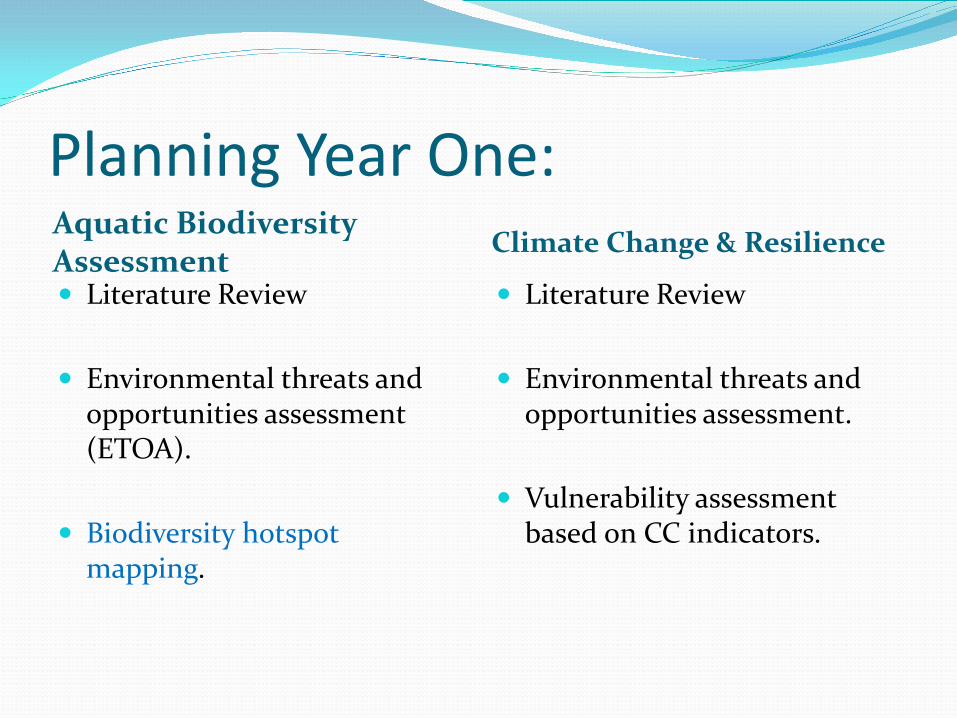
Planning Year One: Aquatic Biodiversity Assessment Climate Change & Resilience
Literature Review
Environmental threats and opportunities assessment (ETOA).
Biodiversity hotspot mapping.
Literature Review
Environmental threats and opportunities assessment.
Vulnerability assessment based on CC indicators.

The Study Area
http://wwwnc.cdc.gov/travel/images/map-malawi.png

Jumping in: Meeting the team!
Creating a system

Methodology
Team
• Gather Data • Consolidate into paper
maps
Me • Digitize paper maps • Processing
Experts • Verify local expertise • Corrections
Me • Edits • Processing
Team • Secondary field
validation
Me • Edits • Processing
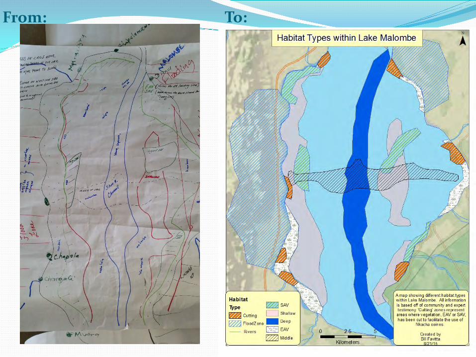
From: To:
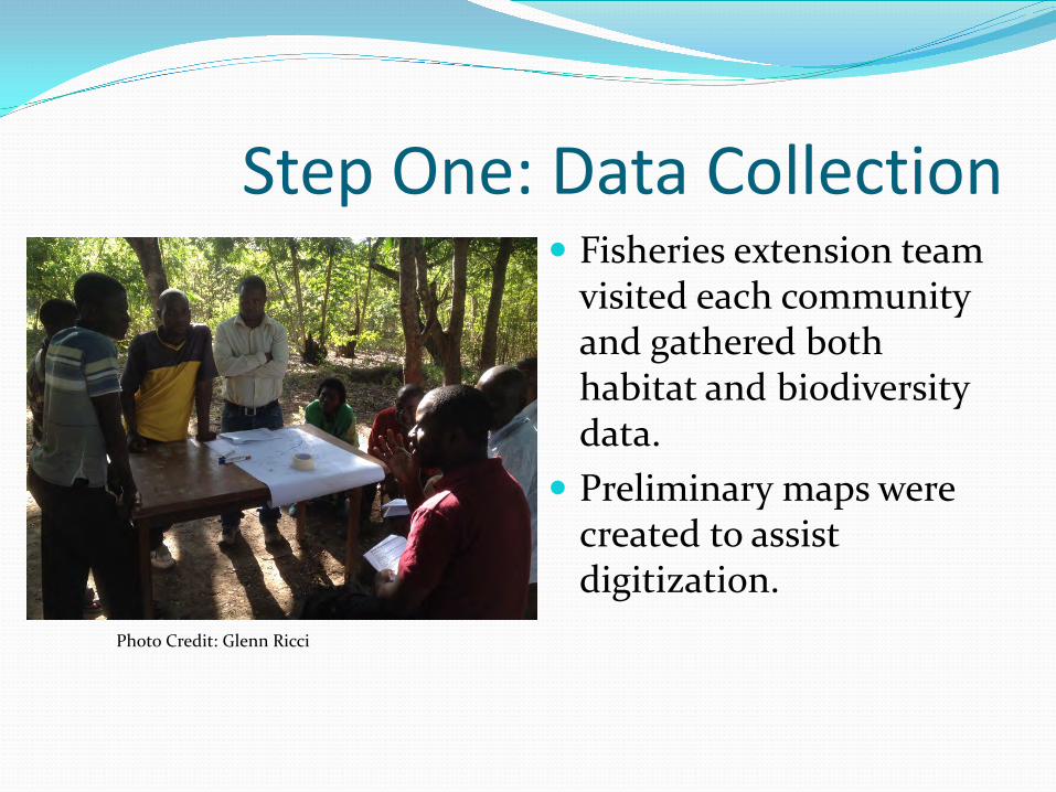
Step One: Data Collection Fisheries extension team
visited each community and gathered both habitat and biodiversity data.
Preliminary maps were created to assist digitization.
Photo Credit: Glenn Ricci

Step Two: Habitat Mapping Initial field visit data was
consolidated.
FISH Extension Team transferred habitat data onto blank maps of target areas.

Step Three: Digitizing

Step Four: Adding Fish
Biodiversity data added as an overlay for digitization.
Using habitat as reference points, fish species were added individually by life stage (Breeding, Nursery, Juvenile, Adult).

Steps Five +: Processing Creating raster data.
Using rasters to calculate biodiversity hotspots.
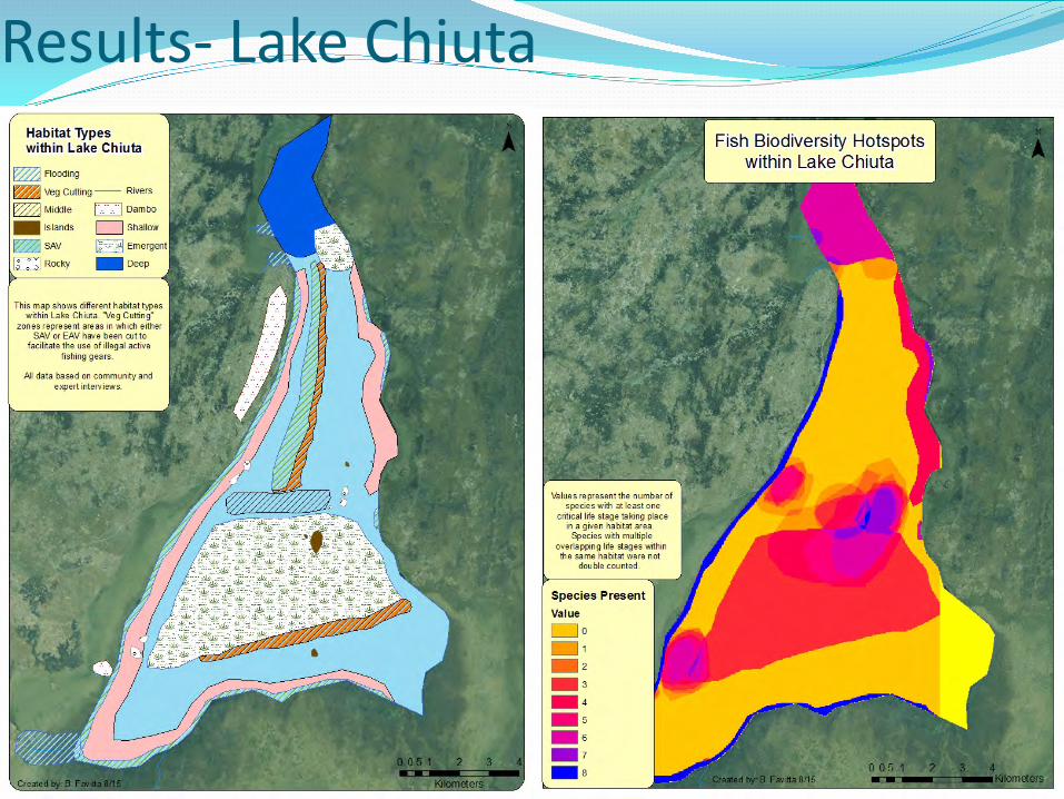
Results- Lake Chiuta

Results – Lake Malawi SEA

How do we use what we found? Identify target sites
Monitoring & Evaluation
Update environmental
policy to reflect reality
Report back to communities involved
Photo Credit: Glenn Ricci

The Efficacy of Social Science Local Expertise
Tacit Knowledge
Interactional Expertise Learning through
exposure
Redundancy/Consistency
Validation
Photo Credit: Glenn Ricci
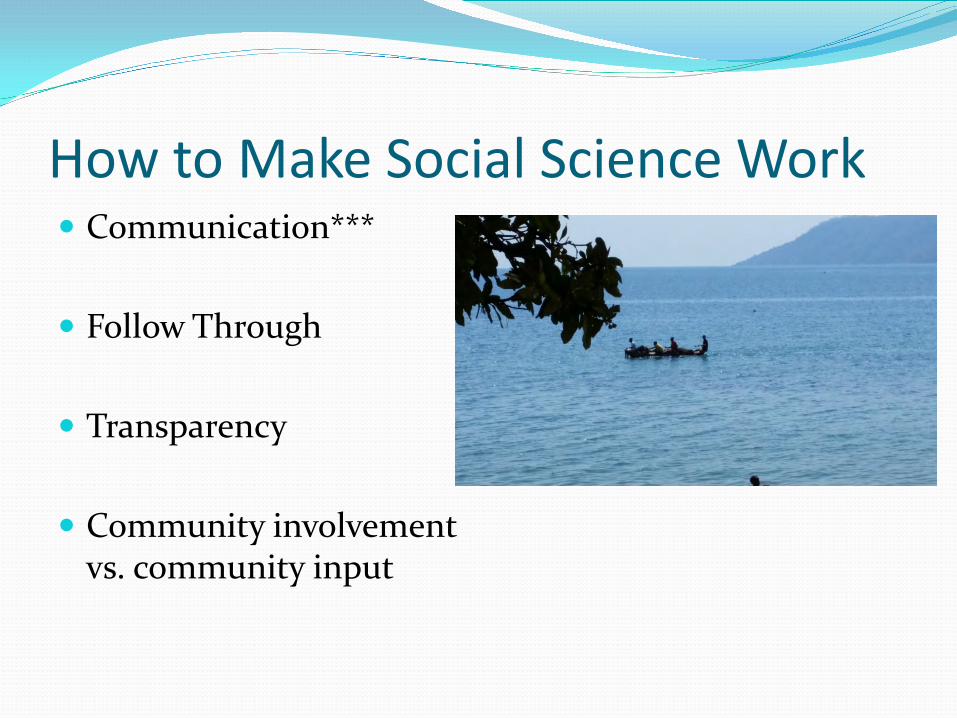
How to Make Social Science Work Communication***
Follow Through
Transparency
Community involvement
vs. community input

Questions?