part 7 - badu island - local plan code 7 - badu island - local plan code.pdfcentre, community...
TRANSCRIPT

Torres Strait Island Regional Council
Planning SchemePage 215
Part 7: Local Plans
Badu Island
Badu Island

Torres Strait Island Regional Council
Planning SchemePage 216

Torres Strait Island Regional Council
Planning SchemePage 217
Part 7: Local Plans
Badu Island
Papua New GuineaPP
Mainland Australiarr
Sue Islandddd
DauanBoigu
Saibai
IamaYam IslandYY
ErubDarnley Island
MasigMaMaaMaaMaasYorkeekk Island Islals ns nsIs ns ndssee
PorumammaamCoconut Island
WarraberSt PPaulssKubin
MMMMMMerereMuuurrrray IslandIsl I dd
UgarUStephen Island
Mabuyag
KerriiriHammond Islandon
MoauBadu
Mainland AustraliaMainland AusustraliaM
Torres Strait Island Regional Council
Planning SchemePage 218
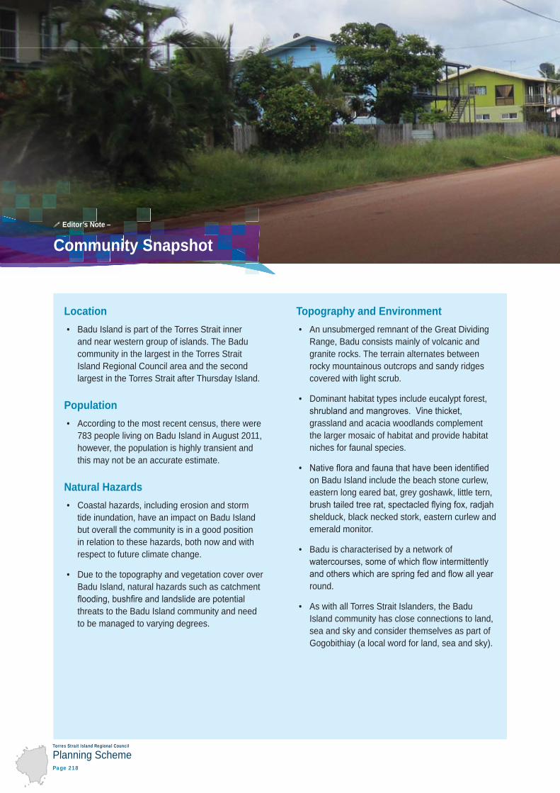
Location • Badu Island is part of the Torres Strait inner
and near western group of islands. The Badu community in the largest in the Torres Strait Island Regional Council area and the second largest in the Torres Strait after Thursday Island.
Population • According to the most recent census, there were
783 people living on Badu Island in August 2011, however, the population is highly transient and this may not be an accurate estimate.
Natural Hazards • Coastal hazards, including erosion and storm
tide inundation, have an impact on Badu Island but overall the community is in a good position in relation to these hazards, both now and with respect to future climate change.
• Due to the topography and vegetation cover over Badu Island, natural hazards such as catchment
threats to the Badu Island community and need to be managed to varying degrees.
Topography and Environment • An unsubmerged remnant of the Great Dividing
Range, Badu consists mainly of volcanic and granite rocks. The terrain alternates between rocky mountainous outcrops and sandy ridges covered with light scrub.
• Dominant habitat types include eucalypt forest,
grassland and acacia woodlands complement the larger mosaic of habitat and provide habitat niches for faunal species.
• on Badu Island include the beach stone curlew, eastern long eared bat, grey goshawk, little tern,
shelduck, black necked stork, eastern curlew and emerald monitor.
• Badu is characterised by a network of
round.
• As with all Torres Strait Islanders, the Badu Island community has close connections to land, sea and sky and consider themselves as part of Gogobithiay (a local word for land, sea and sky).
Community Snapshot Editor’s Note –

Torres Strait Island Regional Council
Planning SchemePage 219
Part 7: Local Plans
Badu Island
Township • Due to Badu Island’s land area, population
size and proximity to Horn Island and Thursday Island, Badu functions as the key population and activity hub for the Torres Strait Island Regional Council area.
Community Aspirations 1 • Aspirations for built community and sporting
facilities include the establishment of a youth centre, community garden, various sport and recreation facilities (such as a swimming pool, cricket pitch and soccer nets), a cultural / arts centre, multi-purpose community hall, playgrounds and parks with picnic areas and toilets.
• Possible enterprise opportunities include a saw mill, an inter-island tourist venture and tourist
ponds.
1. Many of the community aspirations listed here are taken from
priorities relating to the National Indigenous Reform Agreement (NIRA) building blocks of early childhood, schooling, health, economic participation, healthy homes, safe communities, governance and leadership. Priorities that have a development implication are summarised here to provide an indication of the needs of the community. This is supplemented with information gained from community members during community consultation.
Other Planning Matters •
games each year.

Torres Strait Island Regional Council
Planning SchemePage 220
Local StoryLong ago at Wakaid there was a man who had four beautiful daughters, Madainab, Mainab, Damanab, and Kotinab.
One day he told them that they would be going that night to hunt for turtle by torchlight. In the evening they made their way by canoe to Kubin, and from there, south to the big reef a short distance away, where
gapul). They did not know that they were being watched by a sorcerer who was using evil magic against them.
itself to a turtle. Madainab, the eldest daughter, jumped into the water to catch the turtle and was taken down deep by it. She never came up. “Madainab, my beautiful daughter,” said the father after he had set sail for the return journey to Badu, “the spot at which you died shall be named for you.”
By the time the canoe reached Zigini Ngur, the second daughter, Mainab, was so ill that the father decided to take her ashore at the small beach nearby. She died there. The father and his remaining two daughters built a sara (platform) and placed her body on it. They then returned to their canoe.
“We cannot return to Wakaid,” said the father. “We shall go to Argan.” And as they sailed for the west coast of Badu, he said to the girl who lay on the sara: “Mainab, my beautiful daughter, men will call the beach where you died by your name.”
When the father and Damanab and Kotinab reached a certain small bay between Barabaras and Argan they landed, to be greeted by the young men who were camped close by.
That night the young men danced, and Damanab fell in love with one of them. She did not sail with her father and her sister when they left in the morning, instead remaining with the young man whom she had chosen for her husband from among the dancers. From a distance the father looked back at her and said: “Damanab, my beautiful daughter, your home shall be called by your name.”
Editor’s Note –

Torres Strait Island Regional Council
Planning SchemePage 221
Part 7: Local Plans
Badu Island
The father and his youngest daughter went ashore for the last time at Koteid. After they had been there for a while, news of the beautiful girl spread to a nearby village. “Let us go and dance for her,” said the young men. “Let us see if she will choose one of us to be her husband.”
So the young men decorated their bodies and set out with their drums to dance for Kotinab. Presently she chose one of them.
“Kotinab, my beautiful daughter,” the father said at parting from his youngest child, “your name will live on, for the place to which you are going will henceforth be known as Kotinab. Later, I shall come and make my home within sight of you.”
This he did, turning to stone on the reef, not far from the southern end of the beach called Kotinab.
Source:
Myths & Legends of Torres Strait, Lawrie, 1970
[Told by Yopelli Panuel at Badu, 25 October 1967]

Torres Strait Island Regional Council
Planning SchemePage 222
7.2.1Badu Island - local plan code7.2.1.1 Application
of this planning scheme.
When using this code, reference should be made to section 5.3.
7.2.1.2 Purpose
(1) The purpose of the Badu Island local plan code is to guide development on Badu Island in a way that best meets the needs of the community.
(2) The purpose of the Badu Island local plan code will be achieved through the overall outcomes listed on the following pages under the headings of:
(a) Gogobithiay (land, sea and sky)
(b) Natural hazards
(c) Torres Strait people and townships
(d) Ailan kastom and cultural heritage
(e) Getting around
(f) Town infrastructure.
Note – For the purposes of this local plan code, the strategic framework maps in schedule 2 form part of the local plan maps. They contain information referred to in this code.
Editor’s note – To identify where the zones and precincts apply across the local plan area, refer to the maps in schedule 2.

Torres Strait Island Regional Council
Planning SchemePage 223
Part 7: Local Plans
Badu Island
(1) Development minimises and mitigates impacts on areas of high and moderate environmental value within the environmental management and conservation zone.
(2) All development within the environmental management and conservation zone:
(a)
(b) where areas of high and moderate environmental value can not be avoided, is located, designed and operated in a way that minimises and mitigates impacts to areas of environment value.
(3) Within the township zone, development is designed to avoid or minimise impacts on environmental values, including existing vegetation, waterways, natural drainage lines and fauna movement corridors, wherever practical. Development should not occur within waterways.
(4) The habitat values, water quality and natural ecological and hydrological processes of waterways and wetlands,
within the marine environment surrounding Badu Island.
Editor’s note – To identify areas of high environmental value and moderate environmental value or subject to natural hazards, refer to the maps in schedule 2.
Gogobithiay (Land, Sea and Sky)

Torres Strait Island Regional Council
Planning SchemePage 224
(1) Risks to people and property caused by coastal hazards, including erosion, storm tide inundation and the impacts of projected sea level rise, are minimised to the greatest extent possible by:
(a) Avoiding –
(i) Coastal hazard areas are kept free of essential community infrastructure, community facilities
(ii) New lots are not created within a coastal hazard area unless the purpose of the subdivision is to
(iii) Development does not worsen the severity or impact to people and property caused by coastal hazards.
(b) Retreating –
(i) When in need of upgrading or replacement, essential community infrastructure, community facilities and accommodation activities within a coastal hazard area are relocated outside of this area, wherever possible.
(c) Accommodating –
(i) Unless coastal dependent or temporary or readily relocatable, development within a coastal hazard area is:
(A)
(B)
(C) designed to minimise susceptibility to erosion and storm tide inundation.
(ii) Essential community infrastructure is able to function effectively during and immediately after a coastal hazard.
(iii) Community facilities, accommodation activities and coastal dependent development provide for an evacuation route that is available at all times.
(iv) Development involving the manufacture or storage of hazardous materials does not increase risk to public safety or the environment caused by erosion and storm tide inundation.
Natural Hazards

Torres Strait Island Regional Council
Planning SchemePage 225
Part 7: Local Plans
Badu Island
(d) Protecting –
(i) To the greatest extent possible, development maintains environmental features and physical characteristics that provide protective functions for existing development against the risk of erosion and storm tide inundation.
(ii) As a last resort, coastal protection works may be considered to protect existing development.
(2) landslide.
(3) landslide.
(4) landslide.
Editor’s Note – It is critical that future development in the Torres Strait takes into account potential risks associated with coastal hazards such as erosion and storm tide inundation, both now and in the future as sea
respond to coastal hazards will take time for local communities to thoroughly consider and decide.
This planning scheme takes coastal hazards into account using the best available data (at the time of writing). It is anticipated that, over time, the communities of the Torres Strait will continue to discuss these issues and develop an agreed position on the most appropriate responses at the local level. The outcome of these decisions will need to be incorporated into future amendments or revisions to this planning scheme.
While the best available data has been used in this planning scheme, projections about climate change may alter over time. In addition, circumstances may change which means that previous projections about coastal hazards are no longer valid (for example, if a sea wall is constructed to protect a township, calculations about where sea levels may extend to as a consequence of storm tide inundation and sea level rise will no longer be accurate). These circumstances will be taken into account either through development application processes or through planning scheme amendments.
Note – For the purpose of section 13 of the Building Regulations 2006:
(1)
(2)
Editor’s Note – Dwelling houses and dual occupancies are not made assessable in the township zone under
hazard areas under the planning scheme trigger various requirements under the Building Codes of Australia.
Editor’s Note – Essential community infrastructure is used in this document to describe infrastructure that is critical during and after an emergency and includes land uses such as emergency services, hospitals, health care services, renewable energy facilities, telecommunications facilities, utility installations, substations and
This is different to the term community facilities, which is used in this document to describe facilities which provide important social services to the community. Land use examples of community facilities include cemeteries, child care centres, clubs, community care centres, community residences, community uses, crematoriums, detention facilities, educational establishments, emergency services, health care services, hospitals, places if worship, retirement facilities, residential care facilities and rooming accommodation (see the
Torres Strait Island Regional Council
Planning SchemePage 226
Note
Note
includes land covered by very high, high and medium hazard areas, as well as the potential impact buffer area category.
Torres Strait Island Regional Council
Planning SchemePage 227
Part 7: Local Plans
Badu Island
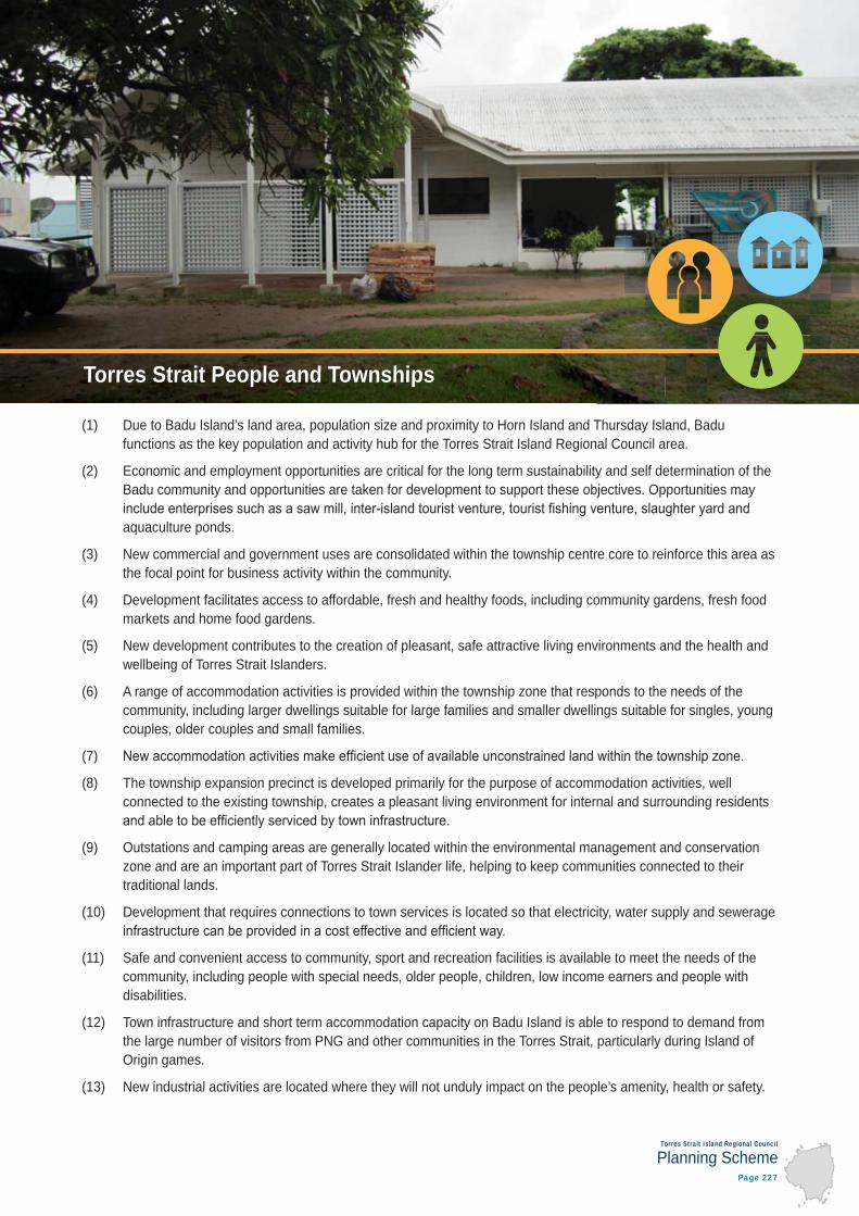
(1) Due to Badu Island’s land area, population size and proximity to Horn Island and Thursday Island, Badu functions as the key population and activity hub for the Torres Strait Island Regional Council area.
(2) Economic and employment opportunities are critical for the long term sustainability and self determination of the Badu community and opportunities are taken for development to support these objectives. Opportunities may
aquaculture ponds.
(3) New commercial and government uses are consolidated within the township centre core to reinforce this area as the focal point for business activity within the community.
(4) Development facilitates access to affordable, fresh and healthy foods, including community gardens, fresh food markets and home food gardens.
(5) New development contributes to the creation of pleasant, safe attractive living environments and the health and wellbeing of Torres Strait Islanders.
(6) A range of accommodation activities is provided within the township zone that responds to the needs of the community, including larger dwellings suitable for large families and smaller dwellings suitable for singles, young couples, older couples and small families.
(7)
(8) The township expansion precinct is developed primarily for the purpose of accommodation activities, well connected to the existing township, creates a pleasant living environment for internal and surrounding residents
(9) Outstations and camping areas are generally located within the environmental management and conservation zone and are an important part of Torres Strait Islander life, helping to keep communities connected to their traditional lands.
(10) Development that requires connections to town services is located so that electricity, water supply and sewerage
(11) Safe and convenient access to community, sport and recreation facilities is available to meet the needs of the community, including people with special needs, older people, children, low income earners and people with disabilities.
(12) Town infrastructure and short term accommodation capacity on Badu Island is able to respond to demand from the large number of visitors from PNG and other communities in the Torres Strait, particularly during Island of Origin games.
(13) New industrial activities are located where they will not unduly impact on the people’s amenity, health or safety.
Torres Strait People and Townships

Torres Strait Island Regional Council
Planning SchemePage 228
Editor’s Notedescribe traditional gardens and home food production, which may be conducted by individuals, households or clan/family groups within a house lot or elsewhere in the community on traditional land. These terms are not

Torres Strait Island Regional Council
Planning SchemePage 229
Part 7: Local Plans
Badu Island
(1) Communities are developed based on Ailan Kastom. In particular, access to the sea and the natural environment is maintained, and important places and events used for traditional practices are protected from any impacts of development.
(2)
Editor’s Note locations of cultural heritage value. Other locations of cultural heritage will exist that are not shown on the
It is important that all land users are aware of their obligations under the Torres Strait Islander Cultural Heritage Act 2003.
The Act recognises that Torres Strait Islander people are the guardians, keepers and knowledge holders of
The most important part of the Act is the Duty of Care provisions that require those conducting activities in
In addition, historical cultural heritage that are not Indigenous in origin are protected under the Queensland Heritage Act 1992. These places are recorded in this planning scheme.
Ailan Kastom and Cultural Heritage
Torres Strait Island Regional Council
Planning SchemePage 230
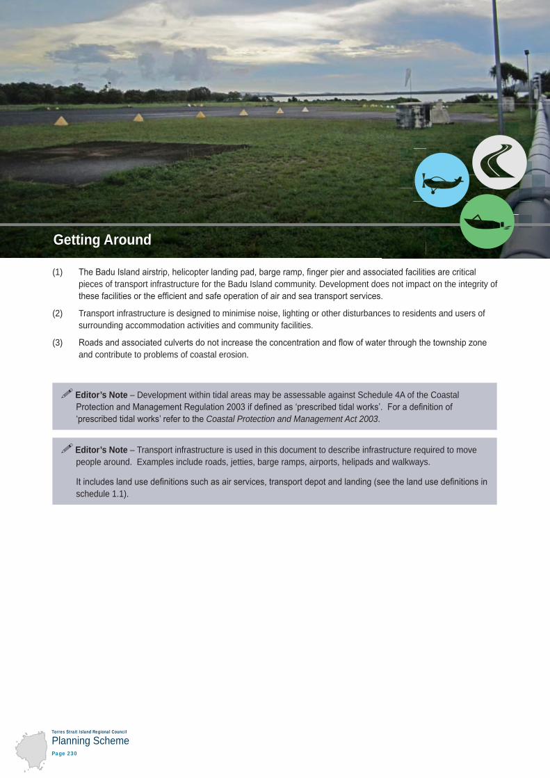
(1) pieces of transport infrastructure for the Badu Island community. Development does not impact on the integrity of
(2) Transport infrastructure is designed to minimise noise, lighting or other disturbances to residents and users of surrounding accommodation activities and community facilities.
(3) and contribute to problems of coastal erosion.
Editor’s Note – Development within tidal areas may be assessable against Schedule 4A of the Coastal
Coastal Protection and Management Act 2003.
Editor’s Note – Transport infrastructure is used in this document to describe infrastructure required to move people around. Examples include roads, jetties, barge ramps, airports, helipads and walkways.
schedule 1.1).
Getting Around
Torres Strait Island Regional Council
Planning SchemePage 231
Part 7: Local Plans
Badu Island
(1) Reliance on local waste facilities for the disposal of construction waste is minimised to the extent possible.
(2) Town infrastructure is located and designed to avoid or minimise negative impacts on the community including negative visual impacts.
Editor’s Note – Town infrastructure is used in this document to describe infrastructure required to provide a basic range of town services. Examples include water supply, sewage treatment, waste collection and disposal, stormwater management, electricity and telecommunications. It includes land uses such as major electricity infrastructure, renewable energy facilities, sub-stations, telecommunication facilities and utility installation
Services provided by town infrastructure may or may not be available within the township zone but typically are not available outside of the township zone. For further information about the existing and planned infrastructure (water supply, sewerage, stormwater, transport, parks and land for community facilities) refer to the local government infrastructure plans (LGIPs) in part 4 of this planning scheme.
due to the way development processes and funding takes place in the region. Therefore, decisions about infrastructure provision are likely to be made on a case by case basis, depending on funding availability and a range of other factors.
Town Infrastructure

Torres Strait Island Regional Council
Planning SchemePage 232
Table 7.2.1.3 — Assessable development
Performance outcomes Acceptable outcomes
Gogobithiay (land, sea and sky)
PO1In limited circumstances, land within the environmental management and conservation zone can be developed for urban purposes provided that the development:
(1) (2) needs to be located in a particular place or near a
(3)
(4) (5) is required to support ailan kastom or traditional
practices.
Editor’s Note – Urban purposes is used in
activity groups other than rural activities in schedule 1.1.1 in this planning scheme. An exception to this is part 4 of the planning scheme
planning scheme.
No acceptable outcome is nominated.
PO2Development does not occur within the environmental management and conservation zone unless it:
(1) minimises and mitigates impacts to areas of high and
(2) maintains connectivity of habitat and fauna
(3) connects tracts of fragmented habitat by vegetating rehabilitation areas where possible.
No acceptable outcome is nominated.

Torres Strait Island Regional Council
Planning SchemePage 233
Part 7: Local Plans
Badu Island
Performance outcomes Acceptable outcomes
PO3 Development is separated from waterways and wetlands to help maintain habitat values, water quality and natural ecological and hydrological processes.
Editor’s Note – The maps provided in schedule 2 show the locations of all known waterways. It should be noted that other waterways may exist that are not shown on these maps.
AO3.1Development:
(1) provides a minimum buffer of 50m to high value waterways, low value waterways, wetlands and
(2) is no closer to these areas than existing buildings on the site.
AO3.2Within these buffer areas, vegetation is retained, no infrastructure is established and no earthworks are carried out.
PO4Development does not introduce or spread known or potential pest or weed species by:
(1) (2) adopting measures to control the introduction of new
pests, such as cane toads, and weeds.
No acceptable outcome is nominated.
PO5 Development does not occur within the water catchment area.
No acceptable outcome is nominated.
PO6All landscaping and revegetation is done using plants native to Badu Island.
No acceptable outcome is nominated.
Natural Hazards – Coastal Hazards
PO7Essential community infrastructure, community facilities and accommodation activities (excluding dwelling houses and dual occupancies) are located outside of the coastal hazard area unless involving:
(1) (2)
or(3) the upgrade or replacement of existing essential
community infrastructure, community facilities or accommodation activities.
Editor’s Note – Dwelling houses and dual occupancies are not made assessable under section 5 of this planning scheme, therefore, the planning scheme provisions do not apply to these land uses. However, building works approval will be required.
No acceptable outcome is nominated.
PO8New lots are not created within a coastal hazard area unless the purpose of the subdivision is to create a lot over a lease area or house site established before the planning scheme was adopted.
AO8.1New lots are not created within the erosion prone area or storm tide inundation area.

Torres Strait Island Regional Council
Planning SchemePage 234
Performance outcomes Acceptable outcomes
PO9Unless development is coastal dependent development, temporary or readily relocatable, development within a coastal hazard area is:
(1) sited to lessen potential risk of erosion and storm tide inundation by locating in a landward position of adjacent buildings or, where there are no adjacent
(2) designed to withstand the erosion and storm tide
(3) designed to minimise susceptibility to storm tide
Editor’s Note – To demonstrate achievement with this PO, a report prepared by a suitably
Engineer of Queensland) with coastal engineering experience may be required.
Editor’s Note – For the purpose of this PO, storage sheds and storage buildings associated with barge ramps, marinas and piers are considered to be coastal dependent development.
No acceptable outcome is nominated.
PO10Essential community infrastructure is able to function effectively during and immediately after a coastal hazard.
No acceptable outcome is nominated.
PO11Community facilities, accommodation activities and coastal dependent development provide for an evacuation route that is available at all times.
No acceptable outcome is nominated.
PO12Development involving hazardous materials manufactured or stored in bulk is not located on land subject to coastal hazard.
AO12.1The manufacture or storage of hazardous materials in bulk does not occur within the erosion prone area or storm tide inundation area.

Torres Strait Island Regional Council
Planning SchemePage 235
Part 7: Local Plans
Badu Island
Performance outcomes Acceptable outcomes
PO13Development:
(1) maintains vegetation on coastal landforms where its removal or damage may: (a) destabilise the area and increase the potential
(b) interrupt natural sediment trapping processes or
(2) maintains the sediment volumes of sand dunes and
(3) maintains physical coastal processes outside the development, including longshore transport of sediment along the coast.
No acceptable outcome is nominated.
PO14Development does not result in a worsening of coastal hazards outside of the development site.
No acceptable outcome is nominated.
Natural Hazards – Flooding
PO15Essential community infrastructure, community facilities and accommodation activities (excluding dwelling houses
hazard area unless involving:
(1) or
(2) the upgrade or replacement of existing essential community infrastructure, community facilities or accommodation activities.
Editor’s Note – Dwelling houses and dual occupancies are not made assessable under section 5 of this planning scheme, therefore, the planning scheme provisions do not apply to these land uses. However, building works approval will be required.
AO15.1Essential community infrastructure and community
hazard area.
PO16
unless the purpose of the subdivision is to create a lot over a lease area or house site established before the planning scheme was adopted, or a suitable building
AO16.1
PO17Essential community infrastructure is able to function
AO17.1Essential community infrastructure and community
hazard area.
Torres Strait Island Regional Council
Planning SchemePage 236
Performance outcomes Acceptable outcomes
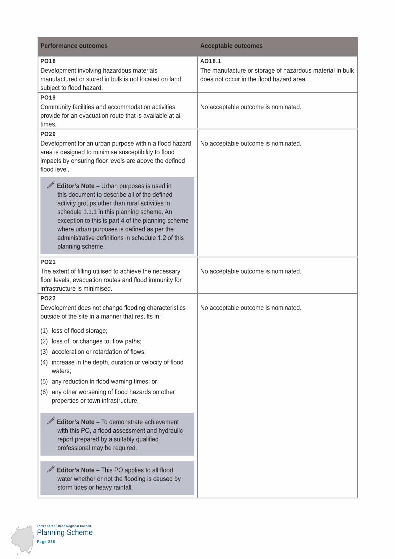
PO18Development involving hazardous materials manufactured or stored in bulk is not located on land
AO18.1The manufacture or storage of hazardous material in bulk
PO19Community facilities and accommodation activities provide for an evacuation route that is available at all times.
No acceptable outcome is nominated.
PO20
Editor’s Note – Urban purposes is used in
activity groups other than rural activities in schedule 1.1.1 in this planning scheme. An exception to this is part 4 of the planning scheme
planning scheme.
No acceptable outcome is nominated.
PO21
infrastructure is minimised.
No acceptable outcome is nominated.
PO22
outside of the site in a manner that results in:
(1) (2) (3) (4)
(5) (6)
properties or town infrastructure.
Editor’s Note – To demonstrate achievement
professional may be required.
Editor’s Note
storm tides or heavy rainfall.
No acceptable outcome is nominated.
Torres Strait Island Regional Council
Planning SchemePage 237
Part 7: Local Plans
Badu Island
Performance outcomes Acceptable outcomes
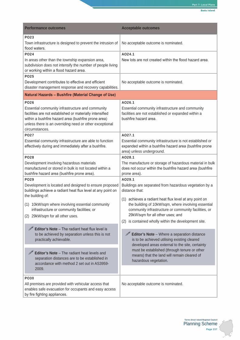
PO23Town infrastructure is designed to prevent the intrusion of No acceptable outcome is nominated.
PO24In areas other than the township expansion area, subdivision does not intensify the number of people living
AO24.1
PO25
disaster management response and recovery capabilities.No acceptable outcome is nominated.
PO26Essential community infrastructure and community
unless there is an overriding need or other exceptional circumstances.
AO26.1Essential community infrastructure and community facilities are not established or expanded within a
PO27Essential community infrastructure are able to function
AO27.1Essential community infrastructure is not established or
area) unless underground.PO28Development involving hazardous materials manufactured or stored in bulk is not located within a
AO28.1The manufacture or storage of hazardous material in bulk
prone area). PO29Development is located and designed to ensure proposed
the building of:
(1) 10kW/sqm where involving essential community
(2) 29kW/sqm for all other uses.
Editor’s Note to be achieved by separation unless this is not practically achievable.
Editor’s Note – The radiant heat levels and separation distances are to be established in accordance with method 2 set out in AS3959-2009.
AO29.1Buildings are separated from hazardous vegetation by a distance that:
(1) the building of 10kW/sqm, where involving essential community infrastructure or community facilities, or
(2) is contained wholly within the development site.
Editor’s Note – Where a separation distance is to be achieved utilising existing cleared developed areas external to the site, certainty must be established (through tenure or other means) that the land will remain cleared of hazardous vegetation.
PO30All premises are provided with vehicular access that enables safe evacuation for occupants and easy access
No acceptable outcome is nominated.

Torres Strait Island Regional Council
Planning SchemePage 238
Performance outcomes Acceptable outcomes
PO31Development outside reticulated water supply areas includes a dedicated static supply that is available solely
AO31.1A water tank is provided within 10m of each building (other than a class 10 building) which:
(1)
(2) has a take off connection at a level that allows the following dedicated, static water supply to be left
(a)
(b)
(c)
(3) ball valve and male camlock coupling and, if underground, an access hole of 200mm (minimum) to accommodate suction lines.
PO32Landscaping uses species that are less likely to
within separation areas.
No acceptable outcome is nominated.
PO33
landscape character of the locality.
No acceptable outcome is nominated.
PO34Where subdivision is being undertaken for an urban purpose or within the township zone, a separation distance from hazardous vegetation is provided to
boundary of the proposed lots.
Editor’s Note – Urban purposes is used in
activity groups other than rural activities in schedule 1.1.1 in this planning scheme. An exception to this is part 4 of the planning scheme
planning scheme.
Editor’s Note – The radiant heat levels and separation distances are to be established in accordance with method 2 set out in AS3959-2009.
AO34.1.1
OR
AO34.1.2Lots are separated from hazardous vegetation by a distance that:
(1)
(2) is contained wholly within the development site.
Editor’s Note – Where a separation distance is to be achieved utilising existing cleared developed areas external to the site, certainty must be established (through tenure or other means) that the land will remain cleared of hazardous vegetation.

Torres Strait Island Regional Council
Planning SchemePage 239
Part 7: Local Plans
Badu Island
Performance outcomes Acceptable outcomes
PO35Where subdivision is undertaken for a purpose other than an urban purpose, a building envelope of reasonable dimensions is provided on each lot which achieves a
No acceptable outcome is nominated.
PO36The development design responds to the potential threat
demonstrate an acceptable or tolerable risk to people, by:
(1) minimising the length of the development perimeter
(2) avoiding the creation of potential bottle-neck points in
(3) establishing direct access to a safe assembly/evacuation area in the event of an approaching
(4)
No acceptable outcome is nominated.
Natural Hazards – Landslide
PO37Development does not result in an increase in risk to people and buildings from landslide hazard.
Editor’s Note – To demonstrate compliance with this PO, a geotechnical engineering report prepared by an experienced geotechnical professional may be required.
No acceptable outcome is nominated.
PO38Access is available to the site during and after a landslide.
No acceptable outcome is nominated.
PO39Landslide control structures or works are contained wholly within the development site.
No acceptable outcome is nominated.
PO40Landslide risk mitigation treatments do not have a
and medium environmental value.
No acceptable outcome is nominated.
PO41Development involving hazardous materials manufactured or stored in bulk is not located on land subject to landslide hazard.
AO41.1The manufacture or storage of hazardous material in bulk does not occur in the landslide hazard area.
PO42Essential community infrastructure and community facilities are able to function effectively during and immediately after a landslide.
AO42.1Essential community infrastructure and community facilities are not established or expanded within a landslide hazard area.

Torres Strait Island Regional Council
Planning SchemePage 240
Performance outcomes Acceptable outcomes
Torres Strait People and Townships
PO43New commercial and government uses, other than home based businesses, industrial activities, community facilities and waterfront activities, are consolidated within the township centre core area.
No acceptable solution is nominated.
PO44Industrial activities minimise any noise, odour or other emissions and do not impact on the community’s ability to enjoy their lifestyle.
No acceptable outcome is nominated.
PO45Multiple dwellings occur within the township zone and are located, designed and oriented to create pleasant, safe and attractive living environments, including through:
(1) interspersing with lower density forms of
(2) provision of generous outdoor open space suited to
(3) (4) provision of an attractive outlook from individual
(5) (6) provision of main building entrances, verandahs and
(7) screening along site boundaries or dwelling openings to obscure any undesirable views.
No acceptable solution is nominated.
PO46Accommodation activities and community facilities are located and sited so that visual, lighting, noise and other impacts do not unduly affect residents and visitors to the site.
AO46.1Accommodation activities and community facilities are separated from:
(1) existing and future substations by a minimum
(2) existing and future sea and air transport infrastructure by a minimum distance of 100m.

Torres Strait Island Regional Council
Planning SchemePage 241
Part 7: Local Plans
Badu Island
Performance outcomes Acceptable outcomes
PO47Development within the township expansion precinct:
(1) is primarily for the purpose of accommodation
(2) connects to surrounding streets and parks to allow easy movement for pedestrians and vehicles
(3) minimises runoff, wastage of water and negative impacts on water quality by retaining natural drainage lines, maximising permeable surfaces and, where
(4) provides for building orientation that maximises
(5) includes a local park in a central location that caters to the needs of future residents of the new development and can be easily seen from residential
(6) upgrades to town infrastructure such as roads,
(7) includes landscaping in streets and public areas.
No acceptable solution is nominated.
PO48Community facilities, particularly those accommodating child care, educational, training and health services are located within the township zone.
No acceptable solution is nominated.
PO49Development that may be incompatible with or compromise the ongoing operation or expansion of community facilities does not occur near these uses.
No acceptable solution is nominated.
PO50Where possible, community facilities are co-located,
changing needs of the community over time.
No acceptable solution is nominated.
Ailan Kastom and Cultural Heritage
PO51The continued practice of Ailan Kastom is facilitated and not impeded by development.
No acceptable solution is nominated.
PO52Development does not cause run off, soil erosion or other
cultural heritage places.
No acceptable solution is nominated.
Getting Around
PO53Development does not impact on Badu Island’s air and sea transport infrastructure, including the airstrip,
services from these facilities.
No acceptable solution is nominated.

Torres Strait Island Regional Council
Planning SchemePage 242
Performance outcomes Acceptable outcomes
PO54Where upgrading existing, or establishing new, barge ramps or piers, development:
(1) is designed to minimise noise, lighting and other disturbances to residents and users of
and(2) provides for nearby set down or storage areas to
avoid congestion around the facility.
Editor’s Note – Only development above high water mark is assessable against this planning scheme.
No acceptable solution is nominated.
PO55Roads and associated culverts do not increase the
zone and contribute to problems of coastal erosion.
No acceptable solution is nominated.
Town Infrastructure
PO56Waste materials generated from construction activities are reused or recycled, wherever possible, to minimise reliance on local waste facilities.
No acceptable solution is nominated.
PO57The visual impact of town infrastructure is minimised.
No acceptable solution is nominated.
PO58Town infrastructure is located and designed to avoid or minimise impacts on the community resulting from noise, odour and other emissions.
No acceptable outcome is nominated.