parcel map review committee staff report - … · parcel map review committee staff report meeting...
TRANSCRIPT

Parcel Map Review Committee Staff Report Meeting Date: December 8, 2016
Post Office Box 11130, Reno, NV 89520-0027 – 1001 E. Ninth St., Reno, NV 89512
Telephone: 775.328.3600 – Fax: 775.328.6133 www.washoecounty.us/comdev
Subject: Parcel Map Case Number WTPM16-0004
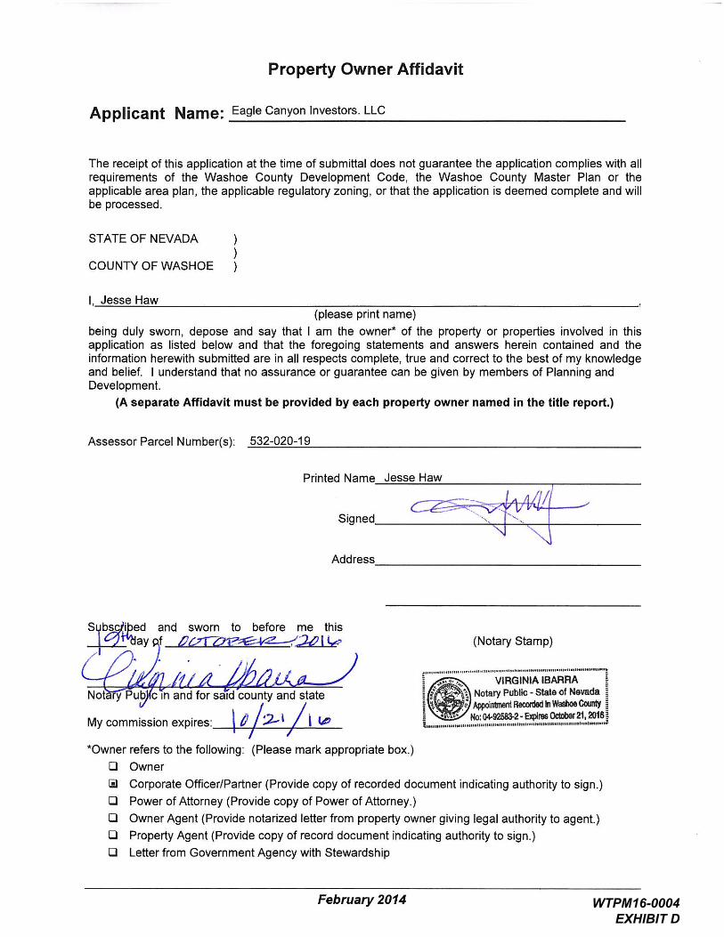
Applicant: Eagle Canyon Investors, LLC
Agenda Item Number: 7B Project Summary: Tentative parcel map to create four parcels to facilitate the sale of
individual phases of the Eagle Canyon Rach subdivision
Recommendation: Approval with Conditions Prepared by: Roger Pelham, MPA, Senior Planner Washoe County Community Services Department
Planning and Development Division Phone: 775.328.3622 E-Mail: [email protected]
Description Tentative Parcel Map Case Number WTPM16-0004 (Eagle Canyon Ranch) – Hearing, discussion, and possible action to approve a tentative parcel map on an existing parcel of ±70.34 acres to create four parcels of ±18.52, ±14.41, ±27.81 and ±9.60 acres to facilitate the sale of individual phases of the Eagle Canyon Rach subdivision (approved as Tentative Subdivision Case Number TM13-002). Each of the parcels proposed with this Tentative Parcel Map correspond to phases of the underlying Tentative Subdivision Map, planned by the applicant. The parcel map is proposed to be subject to all of the terms and conditions of the tentative map already approved for the area (Tentative Subdivision Case Number TM13-002), including the requirement for the creation of CC&Rs that will match the CC&Rs for the rest of the parcels of phases of the remainder of the tentative subdivision map.
• Applicant/Property Owner: Eagle Canyon Investors, LLC Attn: Jesse Haw 550 W. Plumb Lane, Suite B #550 Reno, NV 89509
• Location: Between the terminus of Talon drive on the west and the terminus of Lanstar Drive on the north
• Assessor’s Parcel Number: 532-020-19 • Parcel Size: 70.34 • Master Plan Category: Suburban Residential (SR) • Regulatory Zone: Medium Density Suburban (MDS) • Area Plan: Spanish Springs • Citizen Advisory Board: Spanish Springs • Development Code: Authorized in Article 606, Parcel Maps • Commission District: 4 – Commissioner Hartung • Section/Township/Range: Sections 22, 23, 26 & 27 of T21N, R20E, MDM,
Washoe County, NV
WTPM16-0004 EAGLE CANYON RANCH

Washoe County Parcel Map Review Committee Staff Report Date: November 17, 2016
Parcel Map Case Number: WTPM16-0004 Page 2 of 9
Staff Report Contents Parcel Map ...................................................................................................................... 3 Vicinity Map .................................................................................................................... 4 Site Plan ......................................................................................................................... 5 Tentative Parcel Map Evaluation ..................................................................................... 6 Reviewing Agencies ........................................................................................................ 6 Recommendation ............................................................................................................ 8 Motion ............................................................................................................................. 9 Appeal Process ............................................................................................................... 9
______________________________________________________________________
Exhibits Contents Conditions of Approval ........................................................................................ Exhibit A
Agency Comments .............................................................................................. Exhibit B
Public Notice ....................................................................................................... Exhibit C
Project Application .............................................................................................. Exhibit D
WTPM16-0004 EAGLE CANYON RANCH

Washoe County Parcel Map Review Committee Staff Report Date: November 17, 2016
Parcel Map Case Number: WTPM16-0004 Page 3 of 9
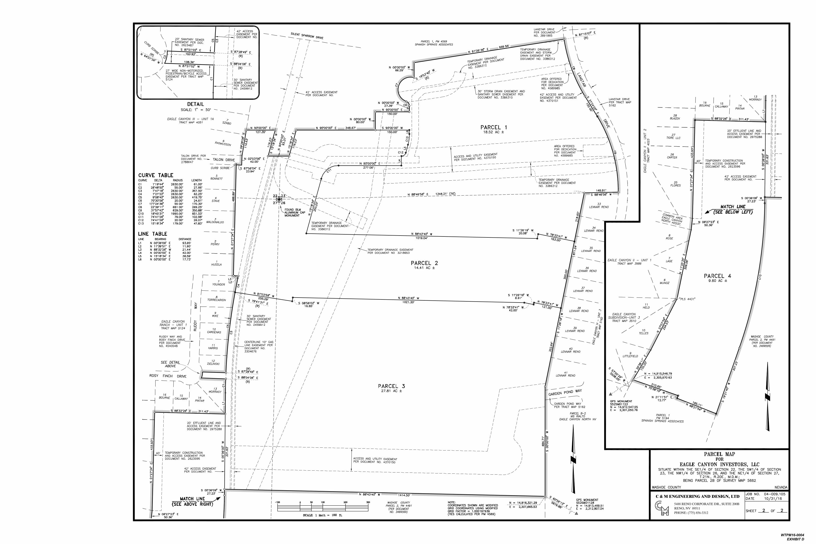
Parcel Map The purpose of a parcel map is to allow for the creation of subdivisions, merger and re-subdivision of existing lots, and common-interest communities consisting of four or fewer parcels pursuant to Article 606, Parcel Maps, of the Washoe County Development Code. A tentative parcel map must be submitted to the Planning and Development Division for the purpose of review prior to or concurrent with the final parcel map. Every tentative parcel map must be prepared by a professional land surveyor. The parcel map process exists to establish reasonable standards of design and procedures for subdividing in order to further the orderly layout and use of land and insure proper legal descriptions and monumenting of subdivided land. Additionally, the process helps to safeguard the public health, safety and general welfare by establishing minimum standards of design and development for any land division platted in the unincorporated area of Washoe County. If the Washoe County Parcel Map Review Committee grants an approval of the tentative parcel map, that approval is subject to Conditions of Approval. Conditions of Approval are requirements that may need to be completed during different stages of the proposed project. Those stages are typically:
• Prior to recordation of a final map.
• Prior to obtaining a final inspection and/or a certificate of occupancy on a structure.
• Prior to the issuance of a business license or other permits/licenses.
• Some Conditions of Approval are referred to as “Operational Conditions.” These conditions must be continually complied with for the life of the project.
• Within 22 months from the date of approval of the tentative parcel map, the applicant must file a final parcel map along with any required supporting materials with the Planning and Development Division and the County Engineer showing that all conditions imposed by the Washoe County Parcel Map Review Committee have been met. Approval or conditional approval of a tentative parcel map imposes no obligation on the part of the Director of Planning and Development Division or the Board of County Commissioners to approve the final parcel map or to accept any public dedication shown on the tentative or final parcel map. Failure to submit a complete final parcel map and pay the required fees within the two year time period shall cease any further action on the map and shall render the tentative parcel map as expired.
The recommended Conditions of Approval for Tentative Parcel Map Case Number WTPM16-0004 are attached to this staff report and include all conditions of approval for the previously-approved underlying tentative subdivision map (Case Number TM13-002) and will be included with the Action Order, if the tentative parcel map is approved by the Parcel Map Review Committee.
WTPM16-0004 EAGLE CANYON RANCH
Washoe County Parcel Map Review Committee Staff Report Date: November 17, 2016
Parcel Map Case Number: WTPM16-0004 Page 4 of 9
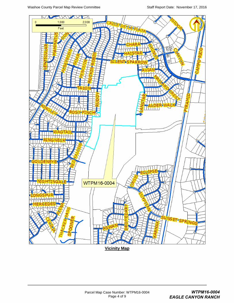
Vicinity Map
WTPM16-0004 EAGLE CANYON RANCH
Washoe County Parcel Map Review Committee Staff Report Date: November 17, 2016
Parcel Map Case Number: WTPM16-0004 Page 5 of 9
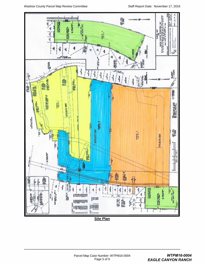
Site Plan
WTPM16-0004 EAGLE CANYON RANCH
Washoe County Parcel Map Review Committee Staff Report Date: November 17, 2016
Parcel Map Case Number: WTPM16-0004 Page 6 of 9
Tentative Parcel Map Evaluation Regulatory Zone: Medium Density Suburban
Master Plan Designation: Suburban Residential
Maximum Lot Potential: 211
Number of Lots on Parcel Map: 4
Minimum Lot Size Required: 12,000 square feet (±0.27 acre)
Minimum Lot Size on Parcel Map: 9.60 acres
Minimum Lot Width Required: 80 feet
Minimum Lot Width on Parcel Map: ±311 feet
The tentative parcel map meets all minimum requirements for the Medium Density Suburban regulatory zone.
Development Suitability Constraints: The Spanish Springs Development Suitability Map, a part of the Spanish Springs Area Plan, identifies the subject parcel as being within the 1% FEMA flood hazard area. However, the subject site is now within flood zone X, as determined from the flood insurance rate map number 32031C2865G dated 3/16/2009 and Letter of Map Revision (LOMR) case number 09-09-0489P issued 3/18/2009. “Zone X” is defined as being outside of the 1% FEMA flood hazard area.
Hydrographic Basin: The subject parcel is within the Spanish Springs Hydrographic Basin.
The subject parcel is within the Truckee Meadows Service Area (TMSA).
Spanish Springs Area Plan Modifiers: There are no Spanish Springs Area Plan Modifiers that are particularly relevant to the proposed parcel map.
Development Information: A tentative subdivision map, case number Case Number TM13-002 has been approved on the subject site. That approval included other adjacent areas that total ± 155 acres and allows the development of a 465-lot residential subdivision with common open space. The minimum lot size in the approved tentative subdivision map is 8,510 square feet; the maximum lot size approved is 37,591 square feet, and the average lot size is 11,125 square feet. The overall density is 3 dwelling units per acre.
The current request is to facilitate the sale of portions of that approved tentative subdivision map to various home builders who will then record final maps in compliance with the approved tentative subdivision map. To ensure that approval of this tentative parcel maps does not conflict in any way with the previously-approved tentative subdivision map staff has included recommended conditions of approval such that the tentative parcel map be subject to all of the terms and conditions of the tentative subdivision map already approved for the area (Tentative Subdivision Case Number TM13-002), including the requirement for the creation of CC&Rs that will match the CC&Rs for the rest of the parcels of phases of the remainder of the tentative subdivision map.
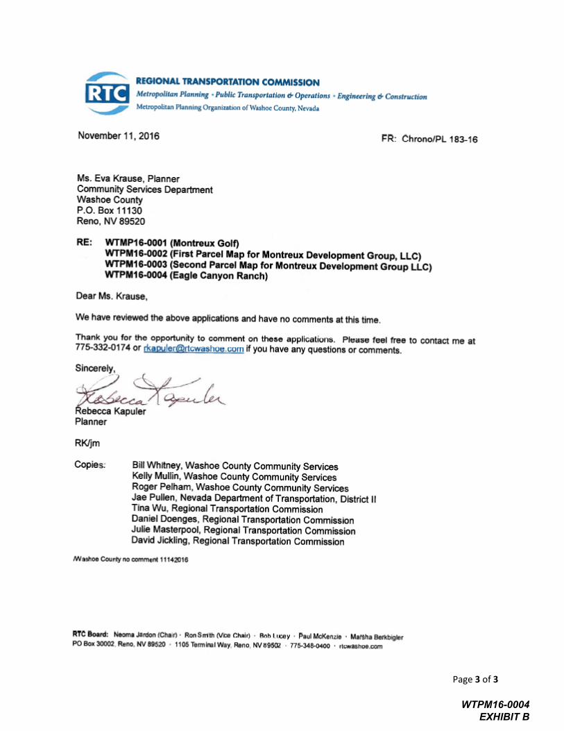
Reviewing Agencies The following agencies received a copy of the project application for review and evaluation.Washoe County Community Services Department
o Planning and Development Division
o Engineering and Capital Projects Division
o Building and Safety Division
o Parks and Open Spaces
WTPM16-0004 EAGLE CANYON RANCH
Washoe County Parcel Map Review Committee Staff Report Date: November 17, 2016
Parcel Map Case Number: WTPM16-0004 Page 7 of 9
o Geographic Information Systems
o Surveyor
o Utilities
• Washoe County Health District
o Air Quality Management Division
o Environmental Health Services
• Truckee Meadows Fire Protection District
• Regional Transportation Commission (RTC)
• Washoe-Storey Conservation District
Two out of the twelve above listed agencies/departments provided substantive comments and/or recommended conditions of approval in response to their evaluation of the project application. A summary of each agency’s comments and/or recommended conditions of approval and their contact information is provided. The Conditions of Approval document is attached to this staff report and will be included with the Action Order if granted approval.Washoe County Planning and Development Division requires the final map be in
substantial compliance with the underlying approved tentative subdivision map, as noted in the staff report.
Contact: Roger Pelham, 328-3622, [email protected]
• Washoe County Engineering and Public Works Division requires that the final map comply with the conditions of the Washoe County technical check for this map.
Contact: Mike Gump, 328-2020, [email protected]
Staff Comment on Required Findings Washoe County Development Code Section 110.606.30 (i) of Article 606, Parcel Maps, requires that all of the following findings be made to the satisfaction of the Washoe County Parcel Map Review Committee before granting approval of the request. Staff has completed an analysis of the application and has determined that the proposal is in compliance with the required findings as follows.
1) General improvement considerations for all parcel maps including, but not limited to:
a) Environmental and health laws and regulations concerning water and air pollution, the disposal of solid waste, facilities to supply water, community or public sewage disposal and, where applicable, individual systems for sewage disposal.
Staff Comment: The underlying tentative subdivision map has been approved. The Health District provided no comments. All development will be served by community water and sewer systems.
b) The availability of water which meets applicable health standards and is sufficient for the reasonably foreseeable needs of the subdivision.
Staff Comment: Water rights will be dedicated in accordance with the underlying tentative subdivision map and will be provided by the Truckee Meadows Water Authority.
c) The availability and accessibility of utilities.
Staff Comment: All utilities will be provided in accordance with all generally applicable requirements of the underlying tentative subdivision map.
WTPM16-0004 EAGLE CANYON RANCH
Washoe County Parcel Map Review Committee Staff Report Date: November 17, 2016
Parcel Map Case Number: WTPM16-0004 Page 8 of 9
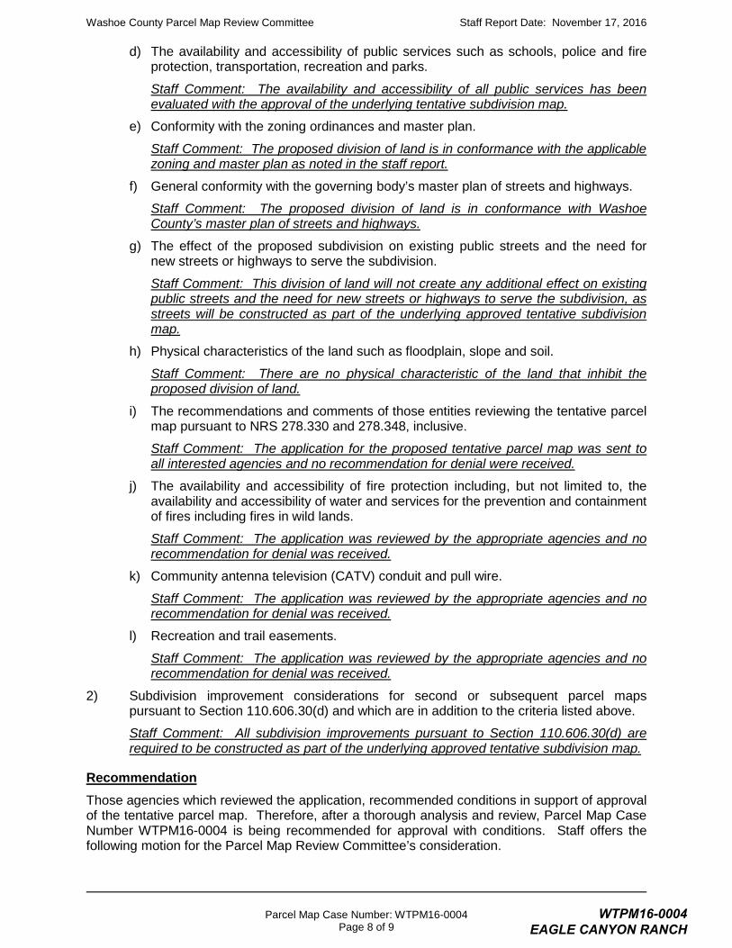
d) The availability and accessibility of public services such as schools, police and fire protection, transportation, recreation and parks.
Staff Comment: The availability and accessibility of all public services has been evaluated with the approval of the underlying tentative subdivision map.
e) Conformity with the zoning ordinances and master plan.
Staff Comment: The proposed division of land is in conformance with the applicable zoning and master plan as noted in the staff report.
f) General conformity with the governing body’s master plan of streets and highways.
Staff Comment: The proposed division of land is in conformance with Washoe County’s master plan of streets and highways.
g) The effect of the proposed subdivision on existing public streets and the need for new streets or highways to serve the subdivision.
Staff Comment: This division of land will not create any additional effect on existing public streets and the need for new streets or highways to serve the subdivision, as streets will be constructed as part of the underlying approved tentative subdivision map.
h) Physical characteristics of the land such as floodplain, slope and soil.
Staff Comment: There are no physical characteristic of the land that inhibit the proposed division of land.
i) The recommendations and comments of those entities reviewing the tentative parcel map pursuant to NRS 278.330 and 278.348, inclusive.
Staff Comment: The application for the proposed tentative parcel map was sent to all interested agencies and no recommendation for denial were received.
j) The availability and accessibility of fire protection including, but not limited to, the availability and accessibility of water and services for the prevention and containment of fires including fires in wild lands.
Staff Comment: The application was reviewed by the appropriate agencies and no recommendation for denial was received.
k) Community antenna television (CATV) conduit and pull wire.
Staff Comment: The application was reviewed by the appropriate agencies and no recommendation for denial was received.
l) Recreation and trail easements.
Staff Comment: The application was reviewed by the appropriate agencies and no recommendation for denial was received.
2) Subdivision improvement considerations for second or subsequent parcel maps pursuant to Section 110.606.30(d) and which are in addition to the criteria listed above.
Staff Comment: All subdivision improvements pursuant to Section 110.606.30(d) are required to be constructed as part of the underlying approved tentative subdivision map.
Recommendation Those agencies which reviewed the application, recommended conditions in support of approval of the tentative parcel map. Therefore, after a thorough analysis and review, Parcel Map Case Number WTPM16-0004 is being recommended for approval with conditions. Staff offers the following motion for the Parcel Map Review Committee’s consideration.
WTPM16-0004 EAGLE CANYON RANCH

Washoe County Parcel Map Review Committee Staff Report Date: November 17, 2016
Parcel Map Case Number: WTPM16-0004 Page 9 of 9
Motion I move that, after giving reasoned consideration to the information contained within the staff report and the information received during the public meeting, that the Washoe County Parcel Map Review Committee approve Tentative Parcel Map Case Number WTPM16-0004 for Eagle Canyon Investors, LLC, subject to the conditions of approval as listed in Exhibit A to the staff report, and make the determination that the following criteria is or will be adequately provided for pursuant to Washoe County Development Code, Section 110.606.30:
1) General improvement considerations for all parcel maps including, but not limited to:
a) Environmental and health laws and regulations concerning water and air pollution, the disposal of solid waste, facilities to supply water, community or public sewage disposal and, where applicable, individual systems for sewage disposal;
b) The availability of water which meets applicable health standards and is sufficient for the reasonably foreseeable needs of the subdivision;
c) The availability and accessibility of utilities;
d) The availability and accessibility of public services such as schools, police and fire protection, transportation, recreation and parks;
e) Conformity with the zoning ordinances and master plan;
f) General conformity with the governing body’s master plan of streets and highways;
g) The effect of the proposed subdivision on existing public streets and the need for new streets or highways to serve the subdivision;
h) Physical characteristics of the land such as floodplain, slope and soil;
i) The recommendations and comments of those entities reviewing the tentative parcel map pursuant to NRS 278.330 and 278.348, inclusive;
j) The availability and accessibility of fire protection including, but not limited to, the availability and accessibility of water and services for the prevention and containment of fires including fires in wild lands;
k) Community antenna television (CATV) conduit and pull wire; and
l) Recreation and trail easements.
2) Subdivision improvement considerations for second or subsequent parcel maps pursuant to Section 110.606.30(d) and which are in addition to the criteria listed above.
Appeal Process Parcel Map Review Committee action will be effective 10 calendar days after the written decision is filed with the Secretary to the Parcel Map Review Committee, unless the action is appealed to the Washoe County Board of County Commissioners, in which case the outcome of the appeal shall be determined by the Board of County Commissioners. Any appeal must be filed in writing within 10 calendar days after the written decision is filed with and signed by the Secretary of the Parcel Map Review Committee and mailed to the applicant. Applicant: Eagle Canyon Investors, LLV Attn: Jesse Haw 550 W. Plumb Lane, Suite B #550 Reno, NV 89509
Representatives: C&M Engineering 5488 Reno Corporate Drive, Suite 200B Reno, NV 89511
WTPM16-0004 EAGLE CANYON RANCH

Post Office Box 11130, Reno, NV 89520-0027 – 1001 E. Ninth St., Reno, NV 89512 Telephone: 775.328.3600 – Fax: 775.328.6133
Conditions of Approval Parcel Map Case Number WTPM16-0004
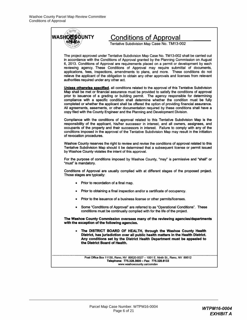
The tentative parcel map approved under Parcel Map Case Number WTPM16-0004 shall be carried out in accordance with the Conditions of Approval granted by the Washoe County Parcel Map Review Committee on December 8, 2016. Conditions of Approval are requirements placed on a permit or development by each reviewing agency. These Conditions of Approval may require submittal of documents, applications, fees, inspections, amendments to plans, and more. These conditions do not relieve the applicant of the obligation to obtain any other approvals and licenses from relevant authorities required under any other act or to abide by all other generally applicable Codes, and neither these conditions nor the approval by the County of this project/use override or negate any other applicable restrictions on uses or development on the property.
Unless otherwise specified, all conditions related to the approval of this tentative parcel map shall be met or financial assurance must be provided to satisfy the conditions of approval prior to the recordation of a final parcel map. The agency responsible for determining compliance with a specific condition shall determine whether the condition must be fully completed or whether the applicant shall be offered the option of providing financial assurance. All agreements, easements, or other documentation required by these conditions shall have a copy filed with the County Engineer and the Planning and Development Division.
Compliance with the conditions of approval related to this tentative parcel map is the responsibility of the applicant, his/her successor in interest, and all owners, assignees, and occupants of the property and their successors in interest. Failure to comply with any of the conditions imposed in the approval of the tentative parcel map may result in the institution of revocation procedures.
Washoe County reserves the right to review and revise the Conditions of Approval related to this tentative parcel map should it be determined that a subsequent license or permit issued by Washoe County violates the intent of this approval.
For the purpose of conditions imposed by Washoe County, “may” is permissive and “shall” or “must” is mandatory.
Conditions of Approval are usually complied with at different stages of the proposed project. Those stages are typically:
• Prior to recordation of a final map.
• Prior to obtaining a final inspection and/or a certificate of occupancy.
• Prior to the issuance of a business license or other permits/licenses.
• Some “Conditions of Approval” are referred to as “Operational Conditions.” These conditions must be continually complied with for the life of the project.
The Washoe County Commission oversees many of the reviewing agencies/departments with the exception of the following agencies.
• The DISTRICT BOARD OF HEALTH, through the Washoe County Health District, has jurisdiction over all public health matters in the Health District. Any conditions set by the Health District must be appealed to the District Board of Health.
• The RENO-TAHOE AIRPORT AUTHORITY is directed and governed by its own Board. Therefore, any conditions set by the Reno-Tahoe Airport Authority must be appealed to their Board of Trustees.
WTPM16-0004 EXHIBIT A
Washoe County Parcel Map Review Committee Conditions of Approval
Parcel Map Case Number. WTPM16-0004 Page 2 of 21
• The REGIONAL TRANSPORTATION COMMISSION (RTC) is directed and governed by its own Board. Conditions recommended by the RTC may be required, at the discretion of Washoe County.
• The NEVADA DEPARTMENT OF TRANSPORTATION (NDOT) is directed and governed by its own board. Therefore, any conditions set by the Nevada Department of Transportation must be appealed to that Board.
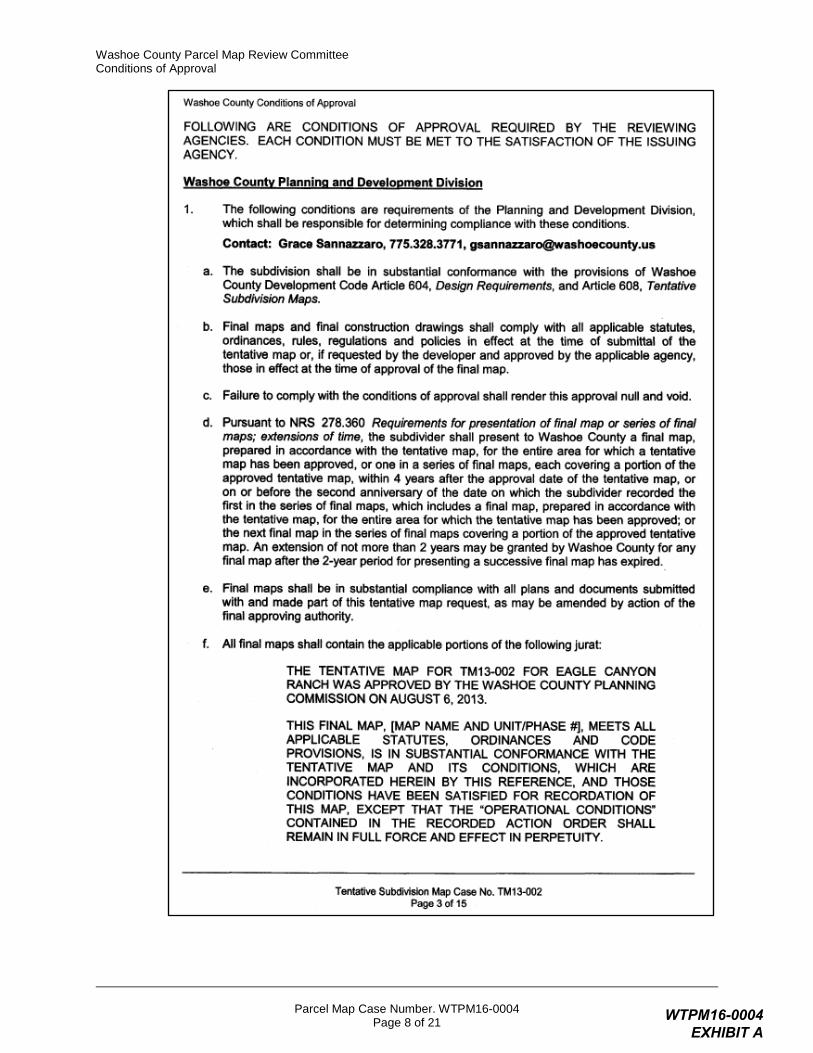
FOLLOWING ARE CONDITIONS OF APPROVAL REQUIRED BY THE REVIEWING AGENCIES. EACH CONDITION MUST BE MET TO THE SATISFACTION OF THE ISSUING AGENCY.
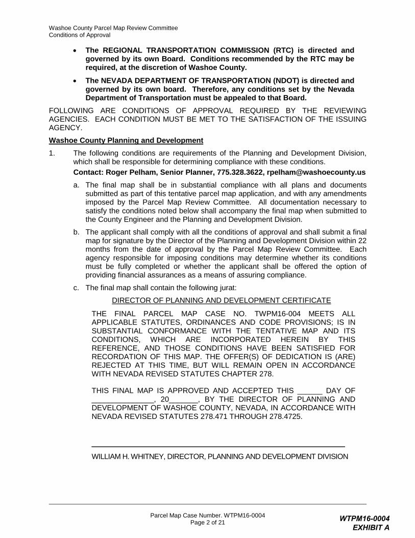
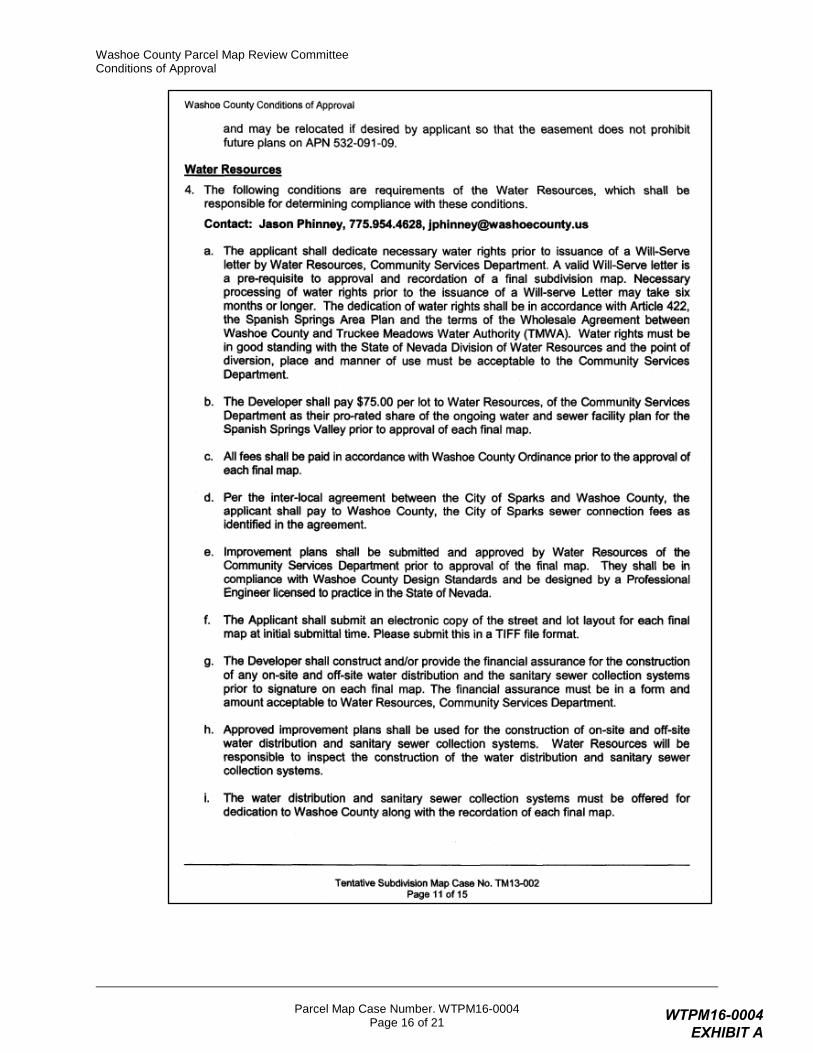
Washoe County Planning and Development 1. The following conditions are requirements of the Planning and Development Division,
which shall be responsible for determining compliance with these conditions. Contact: Roger Pelham, Senior Planner, 775.328.3622, [email protected] a. The final map shall be in substantial compliance with all plans and documents
submitted as part of this tentative parcel map application, and with any amendments imposed by the Parcel Map Review Committee. All documentation necessary to satisfy the conditions noted below shall accompany the final map when submitted to the County Engineer and the Planning and Development Division.
b. The applicant shall comply with all the conditions of approval and shall submit a final map for signature by the Director of the Planning and Development Division within 22 months from the date of approval by the Parcel Map Review Committee. Each agency responsible for imposing conditions may determine whether its conditions must be fully completed or whether the applicant shall be offered the option of providing financial assurances as a means of assuring compliance.
c. The final map shall contain the following jurat:
DIRECTOR OF PLANNING AND DEVELOPMENT CERTIFICATE
THE FINAL PARCEL MAP CASE NO. TWPM16-004 MEETS ALL APPLICABLE STATUTES, ORDINANCES AND CODE PROVISIONS; IS IN SUBSTANTIAL CONFORMANCE WITH THE TENTATIVE MAP AND ITS CONDITIONS, WHICH ARE INCORPORATED HEREIN BY THIS REFERENCE, AND THOSE CONDITIONS HAVE BEEN SATISFIED FOR RECORDATION OF THIS MAP. THE OFFER(S) OF DEDICATION IS (ARE) REJECTED AT THIS TIME, BUT WILL REMAIN OPEN IN ACCORDANCE WITH NEVADA REVISED STATUTES CHAPTER 278.
THIS FINAL MAP IS APPROVED AND ACCEPTED THIS ______ DAY OF _______________, 20_______, BY THE DIRECTOR OF PLANNING AND DEVELOPMENT OF WASHOE COUNTY, NEVADA, IN ACCORDANCE WITH NEVADA REVISED STATUTES 278.471 THROUGH 278.4725.
_____________________________________________________________
WILLIAM H. WHITNEY, DIRECTOR, PLANNING AND DEVELOPMENT DIVISION
WTPM16-0004 EXHIBIT A

Washoe County Parcel Map Review Committee Conditions of Approval
Parcel Map Case Number. WTPM16-0004 Page 3 of 21
d. Any regulations, procedures, and conditions adopted by the Washoe County Health District must be met prior to recordation of a final map.
e. The applicant shall provide verification to the Planning and Development Division that all conditions from the Truckee Meadows Fire Protection District have been satisfied.
f. The applicant shall comply with all conditions of approval imposed upon Tentative Subdivision Map Case Number TM13-002, as follows:
WTPM16-0004 EXHIBIT A

Washoe County Parcel Map Review Committee Conditions of Approval
Parcel Map Case Number. WTPM16-0004 Page 4 of 21
WTPM16-0004 EXHIBIT A

Washoe County Parcel Map Review Committee Conditions of Approval
Parcel Map Case Number. WTPM16-0004 Page 5 of 21
WTPM16-0004 EXHIBIT A
Washoe County Parcel Map Review Committee Conditions of Approval
Parcel Map Case Number. WTPM16-0004 Page 6 of 21
WTPM16-0004 EXHIBIT A

Washoe County Parcel Map Review Committee Conditions of Approval
Parcel Map Case Number. WTPM16-0004 Page 7 of 21
WTPM16-0004 EXHIBIT A
Washoe County Parcel Map Review Committee Conditions of Approval
Parcel Map Case Number. WTPM16-0004 Page 8 of 21
WTPM16-0004 EXHIBIT A
Washoe County Parcel Map Review Committee Conditions of Approval
Parcel Map Case Number. WTPM16-0004 Page 9 of 21
WTPM16-0004 EXHIBIT A
Washoe County Parcel Map Review Committee Conditions of Approval
Parcel Map Case Number. WTPM16-0004 Page 10 of 21
WTPM16-0004 EXHIBIT A
Washoe County Parcel Map Review Committee Conditions of Approval
Parcel Map Case Number. WTPM16-0004 Page 11 of 21
WTPM16-0004 EXHIBIT A

Washoe County Parcel Map Review Committee Conditions of Approval
Parcel Map Case Number. WTPM16-0004 Page 12 of 21
WTPM16-0004 EXHIBIT A

Washoe County Parcel Map Review Committee Conditions of Approval
Parcel Map Case Number. WTPM16-0004 Page 13 of 21
WTPM16-0004 EXHIBIT A
Washoe County Parcel Map Review Committee Conditions of Approval
Parcel Map Case Number. WTPM16-0004 Page 14 of 21
WTPM16-0004 EXHIBIT A

Washoe County Parcel Map Review Committee Conditions of Approval
Parcel Map Case Number. WTPM16-0004 Page 15 of 21
WTPM16-0004 EXHIBIT A
Washoe County Parcel Map Review Committee Conditions of Approval
Parcel Map Case Number. WTPM16-0004 Page 16 of 21
WTPM16-0004 EXHIBIT A

Washoe County Parcel Map Review Committee Conditions of Approval
Parcel Map Case Number. WTPM16-0004 Page 17 of 21
WTPM16-0004 EXHIBIT A

Washoe County Parcel Map Review Committee Conditions of Approval
Parcel Map Case Number. WTPM16-0004 Page 18 of 21
WTPM16-0004 EXHIBIT A

Washoe County Parcel Map Review Committee Conditions of Approval
Parcel Map Case Number. WTPM16-0004 Page 19 of 21
WTPM16-0004 EXHIBIT A
Washoe County Parcel Map Review Committee Conditions of Approval
Parcel Map Case Number. WTPM16-0004 Page 20 of 21
WTPM16-0004 EXHIBIT A
Washoe County Parcel Map Review Committee Conditions of Approval
Parcel Map Case Number. WTPM16-0004 Page 21 of 21
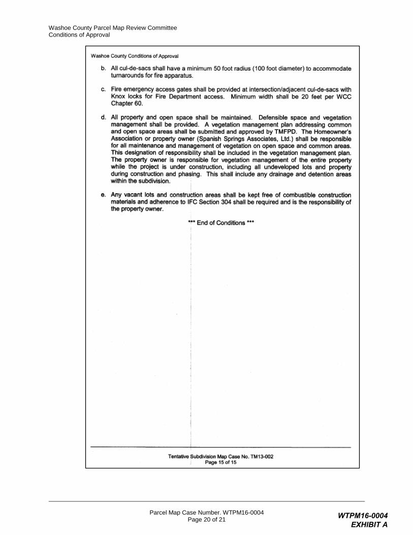
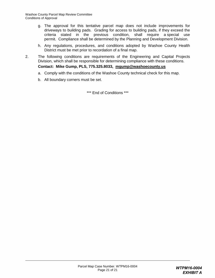
g. The approval for this tentative parcel map does not include improvements for driveways to building pads. Grading for access to building pads, if they exceed the criteria stated in the previous condition, shall require a special use permit. Compliance shall be determined by the Planning and Development Division.
h. Any regulations, procedures, and conditions adopted by Washoe County Health District must be met prior to recordation of a final map.
2. The following conditions are requirements of the Engineering and Capital Projects Division, which shall be responsible for determining compliance with these conditions. Contact: Mike Gump, PLS, 775.325.8033, [email protected] a. Comply with the conditions of the Washoe County technical check for this map.
b. All boundary corners must be set.
*** End of Conditions ***
WTPM16-0004 EXHIBIT A

Page 1 of 3
WTPM16-0004 EXHIBIT B

Page 2 of 3
WTPM16-0004 EXHIBIT B
Page 3 of 3
WTPM16-0004 EXHIBIT B
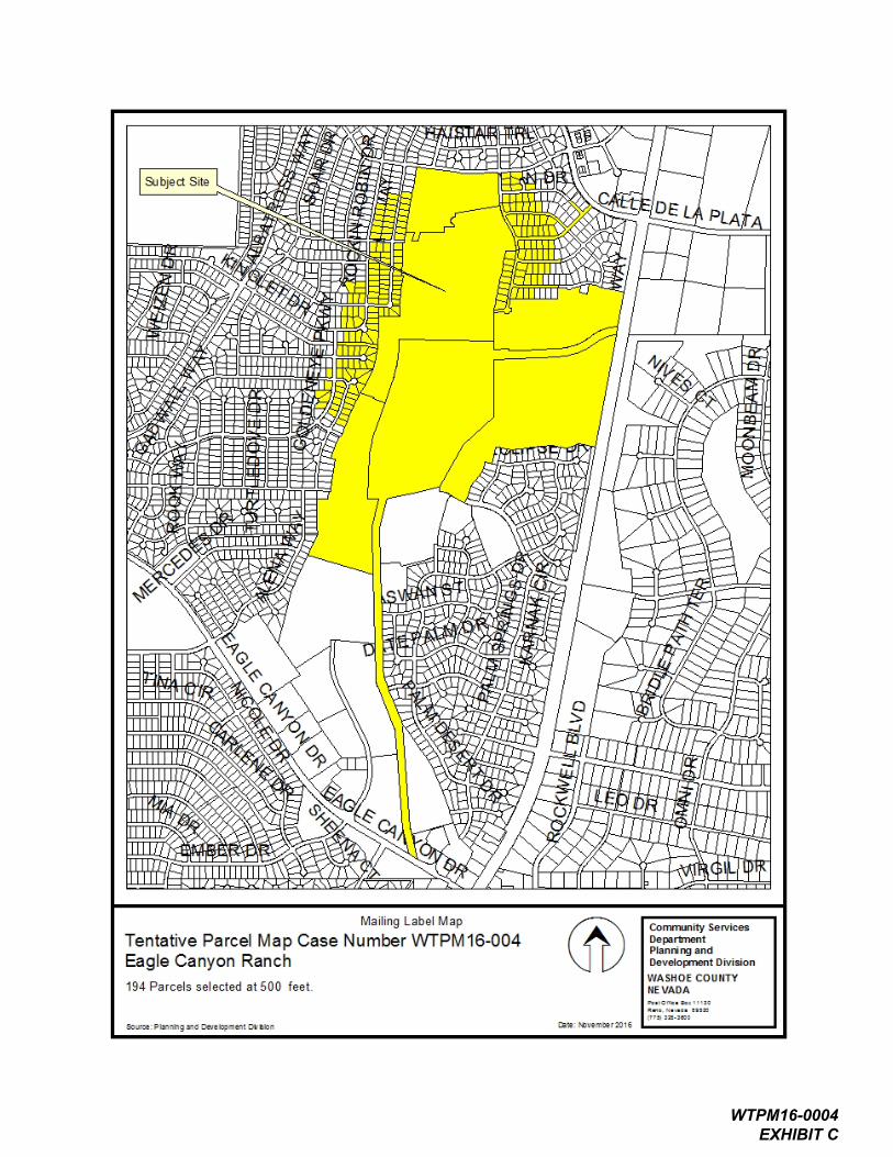
WTPM16-0004 EXHIBIT C

Eagle Canyon Ranch
Pyramid Way
70.34 Ac.
Spanish Springs, west of State Route 445, north of Eagle Canyon Drive, south of West Calle de la Plata
532-020-19 70.34 Ac.
Sections 22, 23, 26 and 27, T21N, R20E
TM13-002, BL15-013
Eagle Canyon Investors, LLC
550 W. Plumb Lane, Suite B, #550
Reno, NV 89509-3686
982-0132 336-0432
Jesse Haw
same as owner
C and M Engineering
5488 Reno Corporate Drive, Suite 200B
Reno, NV 89511
856-3312
George Fong
WTPM16-0004 EXHIBIT D
WTPM16-0004 EXHIBIT D
(All required information may be separately attached)
Chapter 110 of the Washoe County Code is commonly known as the Development Code. Specific references to tentative parcel maps may be found in Article 606, Parcel Maps.
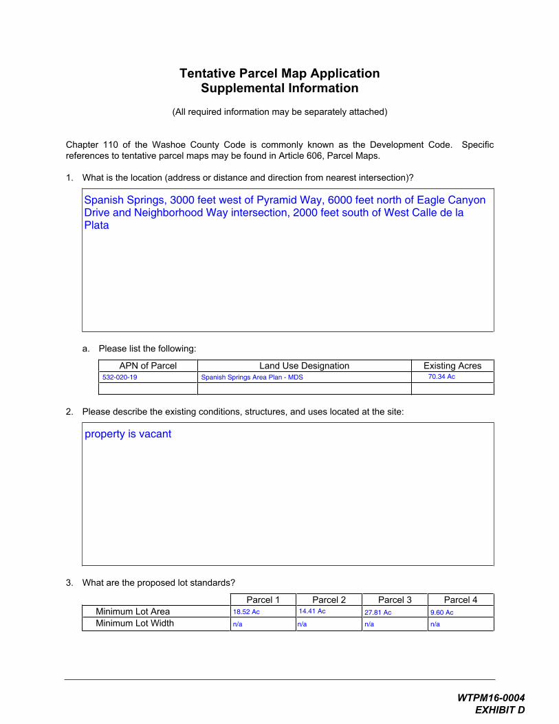
1. What is the location (address or distance and direction from nearest intersection)?
a. Please list the following:
APN of Parcel Land Use Designation Existing Acres
2. Please describe the existing conditions, structures, and uses located at the site:
3. What are the proposed lot standards?
Parcel 1 Parcel 2 Parcel 3 Parcel 4 Minimum Lot AreaMinimum Lot Width
Spanish Springs, 3000 feet west of Pyramid Way, 6000 feet north of Eagle CanyonDrive and Neighborhood Way intersection, 2000 feet south of West Calle de laPlata
property is vacant
532-020-19 Spanish Springs Area Plan - MDS 70.34 Ac
18.52 Ac
n/a
14.41 Ac
n/a
27.81 Ac
n/a
9.60 Ac
n/a
WTPM16-0004 EXHIBIT D
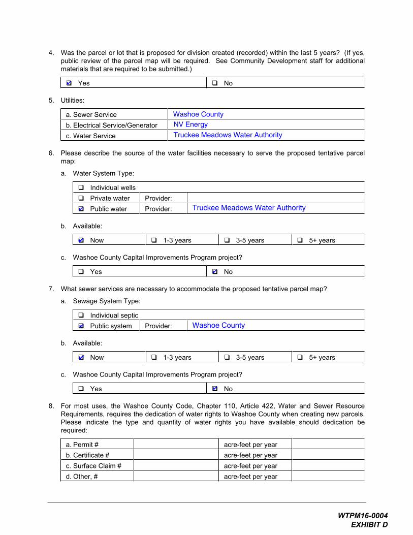
4. Was the parcel or lot that is proposed for division created (recorded) within the last 5 years? (If yes, public review of the parcel map will be required. See Community Development staff for additional materials that are required to be submitted.)
Yes No
5. Utilities:
a. Sewer Service b. Electrical Service/Generator c. Water Service
6. Please describe the source of the water facilities necessary to serve the proposed tentative parcel map:
a. Water System Type:
Individual wells Private water Provider:Public water Provider:
b. Available:
Now 1-3 years 3-5 years 5+ years
c. Washoe County Capital Improvements Program project?
Yes No
7. What sewer services are necessary to accommodate the proposed tentative parcel map?
a. Sewage System Type:
Individual septic Public system Provider:
b. Available:
Now 1-3 years 3-5 years 5+ years
c. Washoe County Capital Improvements Program project?
Yes No
8. For most uses, the Washoe County Code, Chapter 110, Article 422, Water and Sewer Resource Requirements, requires the dedication of water rights to Washoe County when creating new parcels. Please indicate the type and quantity of water rights you have available should dedication be required:
a. Permit # acre-feet per year b. Certificate # acre-feet per year c. Surface Claim # acre-feet per year d. Other, # acre-feet per year
✔
Washoe CountyNV Energy
Truckee Meadows Water Authority
✔ Truckee Meadows Water Authority
✔
✔
✔ Washoe County
✔
✔
WTPM16-0004 EXHIBIT D

July 1, 2008Page 3
e. Title of those rights (as filed with the State Engineer in the Division of Water Resources of the Department of Conservation and Natural Resources):
9. Does the property contain wetlands? (If yes, please attach a preliminary delineation map and describe the impact the proposal will have on the wetlands. Impacts to the wetlands may require a permit issued from the U.S. Army Corps of Engineers.)
Yes No If yes, include a separate set of attachments and maps.
10. Does property contain slopes or hillsides in excess of 15 percent and/or significant ridgelines? (If yes, and this is the second parcel map dividing this property, Article 424, Hillside Development of the Washoe County Development Code will apply.)
Yes No If yes, include a separate set of attachments and maps.
11. Does property contain geologic hazards such as active faults; hillside or mountainous areas; is it subject to avalanches, landslides, or flash floods; is it near a water body, stream, Significant Hydrologic Resource as defined in Article 418, or riparian area such as the Truckee River, and/or an area of groundwater recharge
Yes No If yes, include a separate set of attachments and maps.
12. Does the tentative parcel map involve common open space as defined in Article 408 of the Washoe County Development Code? (If so, please identify all proposed non-residential uses and all the open space parcels.)?
Yes No If yes, include a separate set of attachments and maps.
13. If private roads are proposed, will the community be gated? If so, is a public trail system easement provided through the subdivision?
sufficient rights are held by Truckee Meadows Water Authority to serve thisproject
✔
✔
✔
✔
not applicable
WTPM16-0004 EXHIBIT D

July 1, 2008Page 4
14. Is the subject property located adjacent to an existing residential subdivision? If so, describe how the tentative map complies with each additional adopted policy and code requirement of Article 434, Regional Development Standards within Cooperative Planning Areas and all of Washoe County, in particular, grading within 50 and 200 feet of the adjacent developed properties under 5 acres and parcel matching criteria:
15. Are there any applicable policies of the adopted area plan in which the project is located that require compliance? If so, which policies and how does the project comply
Yes No If yes, include a separate set of attachments and maps.
16. Are there any applicable area plan modifiers in the Development Code in which the project is located that require compliance? If so, which modifiers and how does the project comply?
17. Is the project subject to Article 418, Significant Hydrologic Resources? If yes, please address Special Review Considerations within Section 110.418.30 in a separate attachment.
Yes No If yes, include a separate set of attachments and maps.
parcel map conforms with Spanish Springs Area Plan
✔
no
✔
WTPM16-0004 EXHIBIT D

WTPM16-0004 EXHIBIT D

21. What is the slope (Horizontal:Vertical) of the cut and fill areas proposed to be? What methods will be used to prevent erosion until the revegetation is established?
22. Are you planning any berms and, if so, how tall is the berm at its highest? How will it be stabilized and/or revegetated?
23. Are retaining walls going to be required? If so, how high will the walls be, will there be multiple walls with intervening terracing, and what is the wall construction (i.e. rockery, concrete, timber, manufactured block)? How will the visual impacts be mitigated?
24. Will the grading proposed require removal of any trees? If so, what species, how many, and of what size?
WTPM16-0004 EXHIBIT D
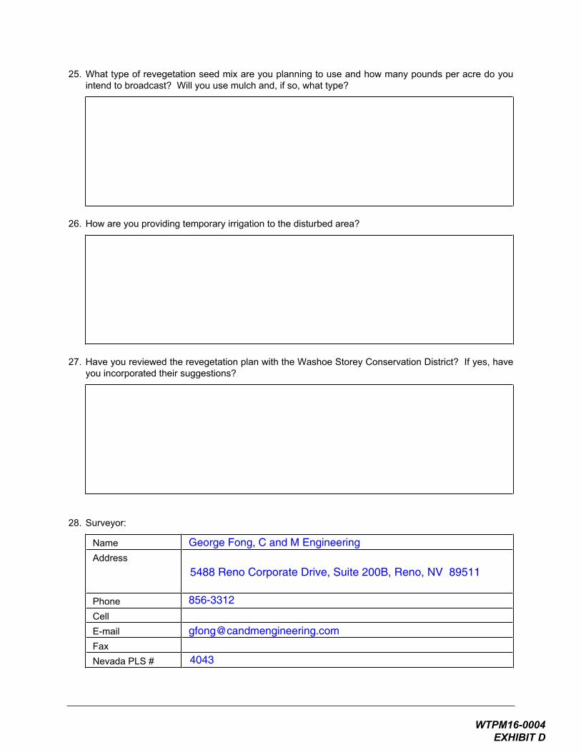
25. What type of revegetation seed mix are you planning to use and how many pounds per acre do you intend to broadcast? Will you use mulch and, if so, what type?
26. How are you providing temporary irrigation to the disturbed area?
27. Have you reviewed the revegetation plan with the Washoe Storey Conservation District? If yes, have you incorporated their suggestions?
28. Surveyor:
NameAddress
PhoneCellE-mailFaxNevada PLS #
George Fong, C and M Engineering
5488 Reno Corporate Drive, Suite 200B, Reno, NV 89511
856-3312
4043
WTPM16-0004 EXHIBIT D

Eagle Canyon Investors, LLC
550 W. Plumb Lane, Suite B, #550
WTPM16-0004 EXHIBIT D
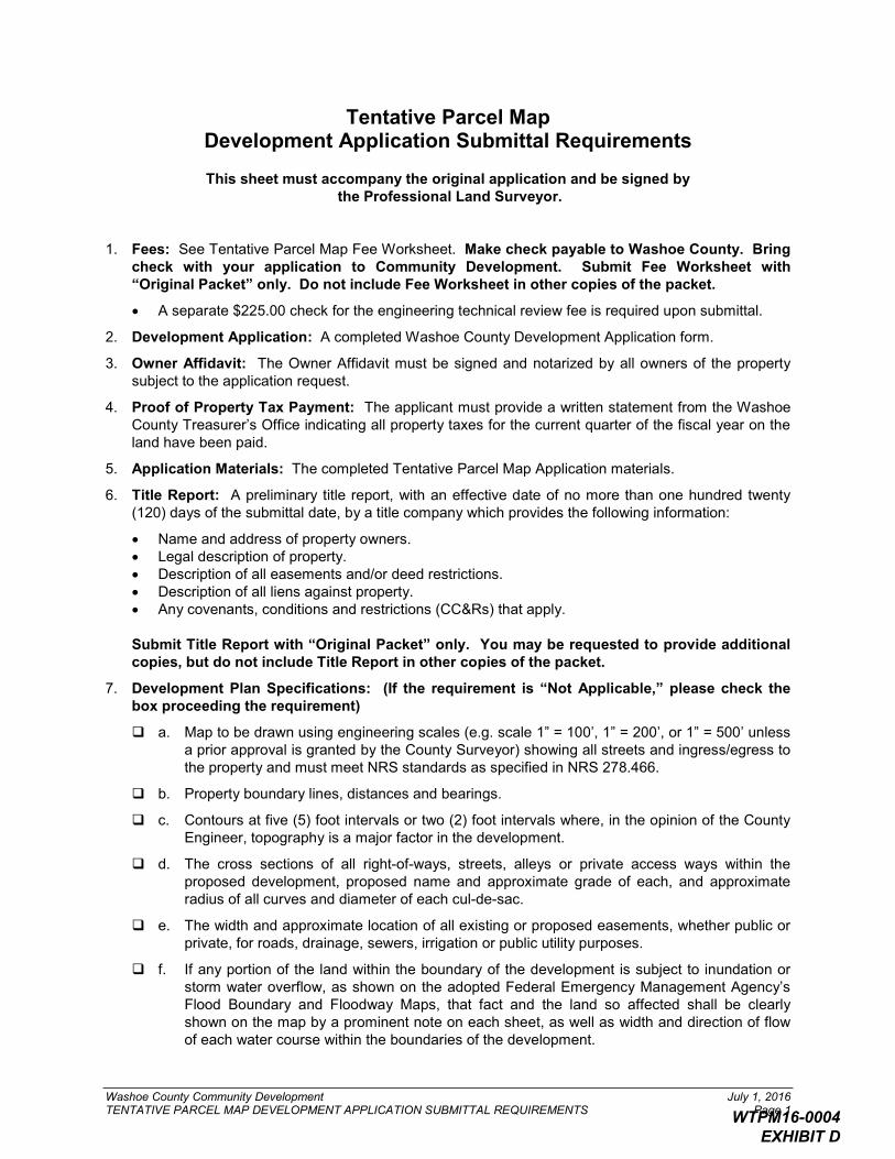
Washoe County Community Development July 1, 2016TENTATIVE PARCEL MAP DEVELOPMENT APPLICATION SUBMITTAL REQUIREMENTS Page 1
Tentative Parcel MapDevelopment Application Submittal Requirements
This sheet must accompany the original application and be signed bythe Professional Land Surveyor.
1. Fees: See Tentative Parcel Map Fee Worksheet. Make check payable to Washoe County. Bring check with your application to Community Development. Submit Fee Worksheet with “Original Packet” only. Do not include Fee Worksheet in other copies of the packet.
A separate $225.00 check for the engineering technical review fee is required upon submittal.
2. Development Application: A completed Washoe County Development Application form.
3. Owner Affidavit: The Owner Affidavit must be signed and notarized by all owners of the property subject to the application request.
4. Proof of Property Tax Payment: The applicant must provide a written statement from the Washoe County Treasurer’s Office indicating all property taxes for the current quarter of the fiscal year on the land have been paid.
5. Application Materials: The completed Tentative Parcel Map Application materials.
6. Title Report: A preliminary title report, with an effective date of no more than one hundred twenty (120) days of the submittal date, by a title company which provides the following information:
Name and address of property owners.Legal description of property.Description of all easements and/or deed restrictions.Description of all liens against property.Any covenants, conditions and restrictions (CC&Rs) that apply.
Submit Title Report with “Original Packet” only. You may be requested to provide additional copies, but do not include Title Report in other copies of the packet.
7. Development Plan Specifications: (If the requirement is “Not Applicable,” please check the box proceeding the requirement)
a. Map to be drawn using engineering scales (e.g. scale 1” = 100’, 1” = 200’, or 1” = 500’ unless a prior approval is granted by the County Surveyor) showing all streets and ingress/egress to the property and must meet NRS standards as specified in NRS 278.466.
b. Property boundary lines, distances and bearings.
c. Contours at five (5) foot intervals or two (2) foot intervals where, in the opinion of the County Engineer, topography is a major factor in the development.
d. The cross sections of all right-of-ways, streets, alleys or private access ways within the proposed development, proposed name and approximate grade of each, and approximate radius of all curves and diameter of each cul-de-sac.
e. The width and approximate location of all existing or proposed easements, whether public or private, for roads, drainage, sewers, irrigation or public utility purposes.
f. If any portion of the land within the boundary of the development is subject to inundation or storm water overflow, as shown on the adopted Federal Emergency Management Agency’s Flood Boundary and Floodway Maps, that fact and the land so affected shall be clearly shown on the map by a prominent note on each sheet, as well as width and direction of flow of each water course within the boundaries of the development.
WTPM16-0004 EXHIBIT D
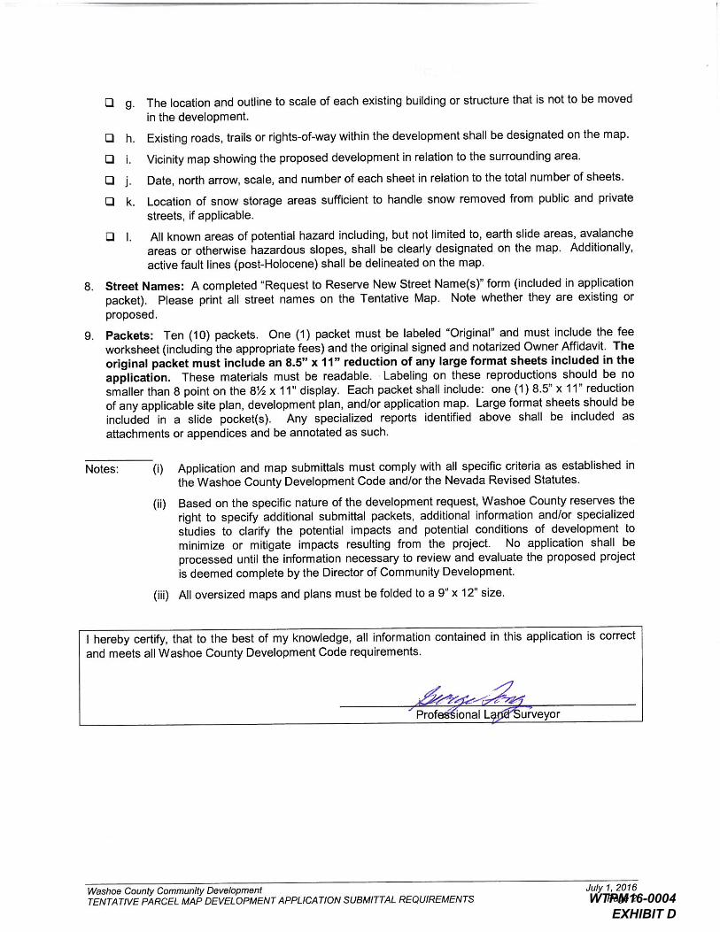
WTPM16-0004 EXHIBIT D

Development Code Master Fee Schedule Page 3 July 6, 2016
PLANNING NOTICING ENGINEERING PARKS UTILITIES ENVIRON. VECTOR TOTAL
$51 - $215 - $26 $115 - $407$51 - $215 - - $115 - $381
$1,162 $200 $65 - $203 $383 $162 $2,175$1,162 $200 $65 - - $383 $162 $1,972$1,162 - - - - - - $1,162
$2,165 $200 $130 - $203 $383 $162 $3,243$2,165 $200 $520 - $203 $383 $162 $3,633$2,165 $200 $130 - - $383 $162 $3,040$2,165 $200 $520 - - $383 $162 $3,430$2,240 - - - - - - $2,240
$803 $200 $345 - $68 $1,208 $303 $2,927$803 $200 $345 - $153 $517 $303 $2,321$803 $200 $345 - $153 $1,208 $303 $3,012$803 $200 $345 - $203 $517 $303 $2,371$803 $200 $345 - - $517 $303 $2,168$803 $200 $345 - $51 $517 $303 $2,219
$2,422 $200 $1,299 $129 - $1,586 $265 $5,901$2,422 $200 $1,299 $129 $2,039 $584 $265 $6,938$2,422 $200 $1,299 $129 $1,019 $1,586 $265 $6,920$2,422 $200 $1,299 $129 $3,059 $584 $265 $7,958$2,422 $200 $1,299 $129 - $584 $265 $4,899$2,422 - - - - - - $2,422$2,422 - - - - - - $2,422$2,422 - - - - - - $2,422
With Significant Hydrologic Resource - ADD With Common Open Space - ADD
REVERSION TO ACREAGE (See Note 5) Not Tahoe
Residential Not Tahoe Tahoe
Tahoe SIGN PERMIT INSPECTION - (Permanent or Temporary)
COMMUNITY SERVICES DEPARTMENT FEES HEALTH FEES
Tahoe (Sewer) Sun Valley (No WC Utilities)
No System 1 System (Sewer) 1 System (No Sewer) 2 Systems Tahoe (Sewer) With Hillside Ordinance - ADD
To Be Determined
APPLICATIONSPlanning Health District
No System 1 System (Sewer)
SPECIAL USE PERMIT
With Environmental Impact Statement Commercial, Industrial, Civic Minor (See Note 7)
TENTATIVE PARCEL MAP/PARCEL MAP WAIVER (See Note 5)
TENTATIVE SUBDIVISION MAP (See Notes 5 & 6)
Major (See Note 7) Tahoe Minor (See Note 7) Tahoe Major (See Note 7)
2 Systems
With Environmental Impact Statement
1 System (Water)
WTPM16-0004 EXHIBIT D

WTPM16-0004 EXHIBIT D
WTPM16-0004 EXHIBIT D
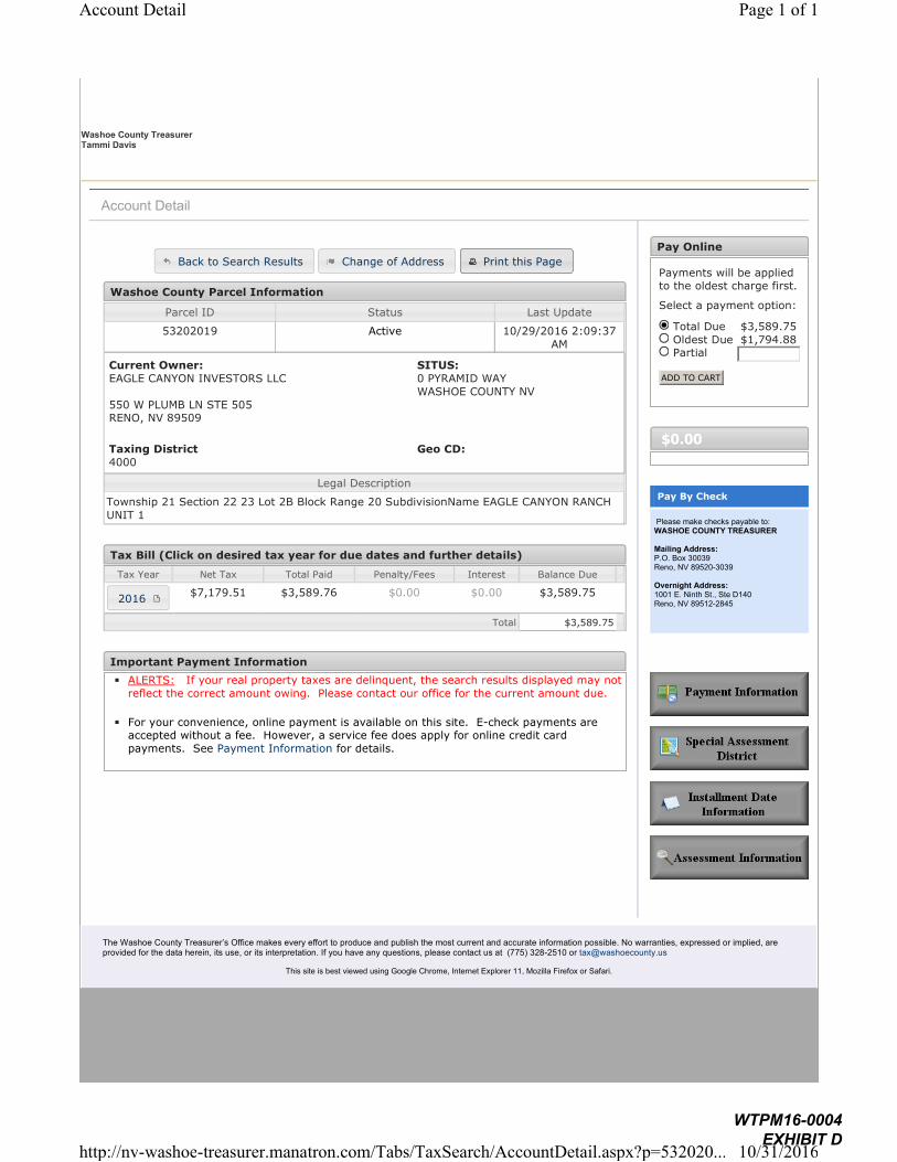
Washoe County Treasurer Tammi Davis
Washoe County TreasurerP.O. Box 30039, Reno, NV 89520-3039ph: (775) 328-2510 fax: (775) 328-2500 Email: [email protected]
The Washoe County Treasurer’s Office makes every effort to produce and publish the most current and accurate information possible. No warranties, expressed or implied, are provided for the data herein, its use, or its interpretation. If you have any questions, please contact us at (775) 328-2510 or [email protected]
This site is best viewed using Google Chrome, Internet Explorer 11, Mozilla Firefox or Safari.
Account Detail
Washoe County Parcel Information
Parcel ID Status Last Update
53202019 Active 10/29/2016 2:09:37
AM
Current Owner:
EAGLE CANYON INVESTORS LLC
550 W PLUMB LN STE 505RENO, NV 89509
SITUS:
0 PYRAMID WAY
WASHOE COUNTY NV
Taxing District
4000
Geo CD:
Legal Description
Township 21 Section 22 23 Lot 2B Block Range 20 SubdivisionName EAGLE CANYON RANCH
UNIT 1
Tax Bill (Click on desired tax year for due dates and further details)
Tax Year Net Tax Total Paid Penalty/Fees Interest Balance Due
$7,179.51 $3,589.76 $0.00 $0.00 $3,589.75
Total $3,589.75
Important Payment Information
◾ ALERTS: If your real property taxes are delinquent, the search results displayed may not
reflect the correct amount owing. Please contact our office for the current amount due.
◾ For your convenience, online payment is available on this site. E-check payments are accepted without a fee. However, a service fee does apply for online credit card
payments. See Payment Information for details.
Pay Online
Payments will be applied to the oldest charge first.
Select a payment option:
Total Due $3,589.75
Oldest Due $1,794.88 Partial
ADD TO CART
$0.00
Pay By Check
Please make checks payable to:WASHOE COUNTY TREASURER
Mailing Address:P.O. Box 30039Reno, NV 89520-3039
Overnight Address:1001 E. Ninth St., Ste D140Reno, NV 89512-2845
Back to Search Results Change of Address Print this Page
2016
Page 1 of 1Account Detail
10/31/2016http://nv-washoe-treasurer.manatron.com/Tabs/TaxSearch/AccountDetail.aspx?p=532020...
WTPM16-0004 EXHIBIT D