pangea and continental drift mr. white 6 th grade earth science
TRANSCRIPT
Pangea and Continental Drift
Mr. White
6th Grade Earth Science
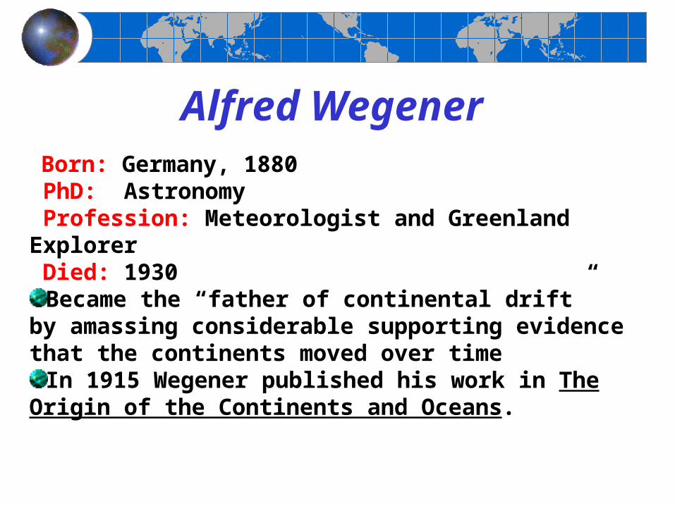
Alfred Wegener Born: Germany, 1880 PhD: Astronomy Profession: Meteorologist and Greenland Explorer Died: 1930
Became the “father of continental drift” by amassing considerable supporting evidence that the continents moved over time
In 1915 Wegener published his work in The Origin of the Continents and Oceans.
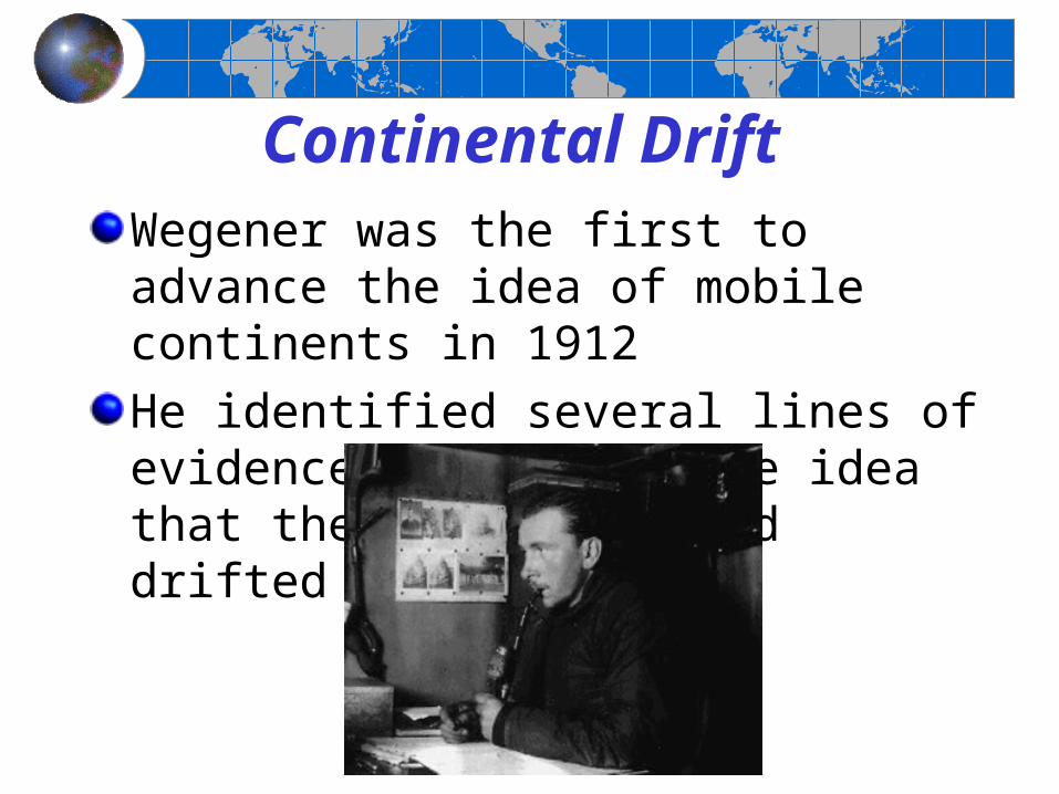
Continental DriftWegener was the first to advance the idea of mobile continents in 1912
He identified several lines of evidence to support the idea that the continents had drifted

What was the evidence and where did it come from?
1- Continental shape
2- Fossil remains3- Sea Floor Depth (Global Bathymetry- SONAR)
4- Magnetic Stripes –A geomagnetic reversal is a change in the Earth's
magnetic field such that the positions of magnetic north and magnetic south are interchanged. The Earth's field has alternated between periods of normal polarity, in which the direction of the field was the same as the present direction, and reverse polarity, in which the field was in the opposite direction.
5- Paleoclimatology
6 - Mountain Soil Comparison
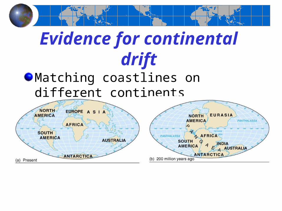
Evidence for continental drift
Matching coastlines on different continents

Evidence for continental drift
Distribution of fossils such as Mesosaurus
Figure 2-6
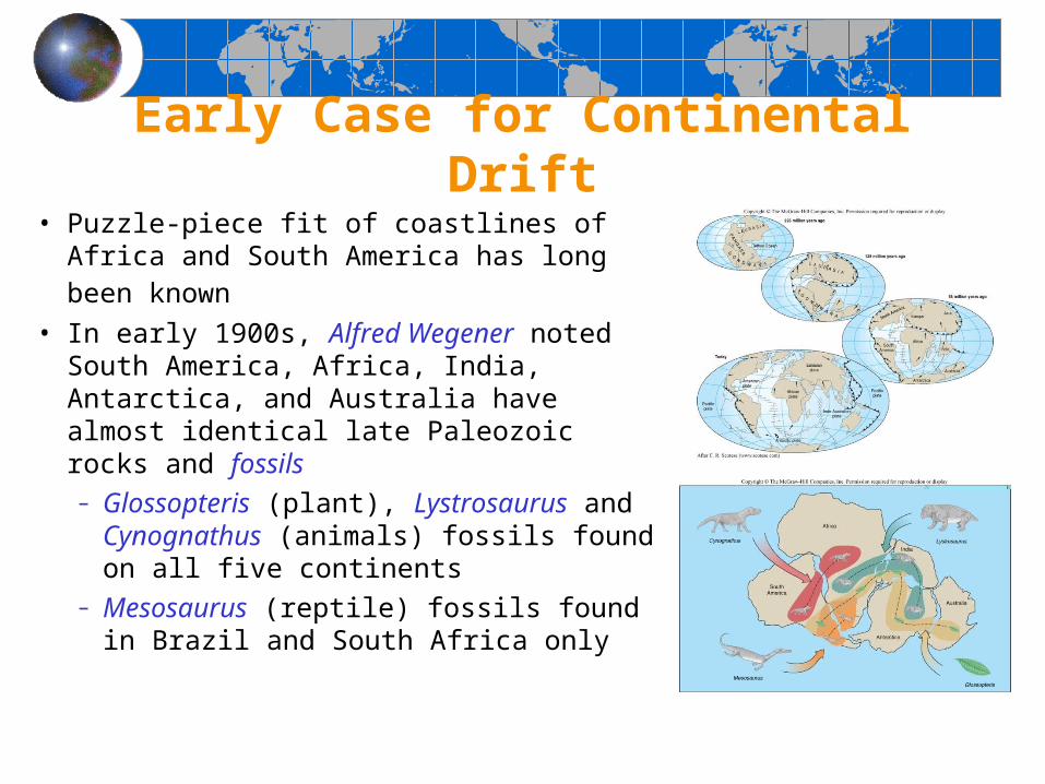
Early Case for Continental Drift• Puzzle-piece fit of coastlines of Africa and
South America has long been known
• In early 1900s, Alfred Wegener noted South America, Africa, India, Antarctica, and Australia have almost identical late Paleozoic rocks and fossils– Glossopteris (plant), Lystrosaurus and
Cynognathus (animals) fossils found on all five continents
– Mesosaurus (reptile) fossils found in Brazil and South Africa only

Early Case for Continental Drift• Wegener reassembled continents into the
supercontinent Pangaea• Pangea initially separated into Laurasia and
Gondwanaland – Laurasia - northern supercontinent containing North
America and Asia (excluding India)– Gondwanaland - southern supercontinent containing South
America, Africa, India, Antarctica, and Australia
• Late Paleozoic glaciation patterns on southern continents best explained by their reconstruction into Gondwanaland
• Coal beds of North America and Europe support reconstruction into Laurasia

The presence of fossils only over small areas of now separate continents (how did they get from continent to continent?).
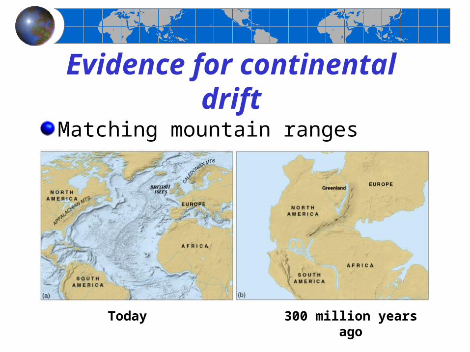
Evidence for continental drift
Matching mountain ranges across oceans
300 million years agoToday
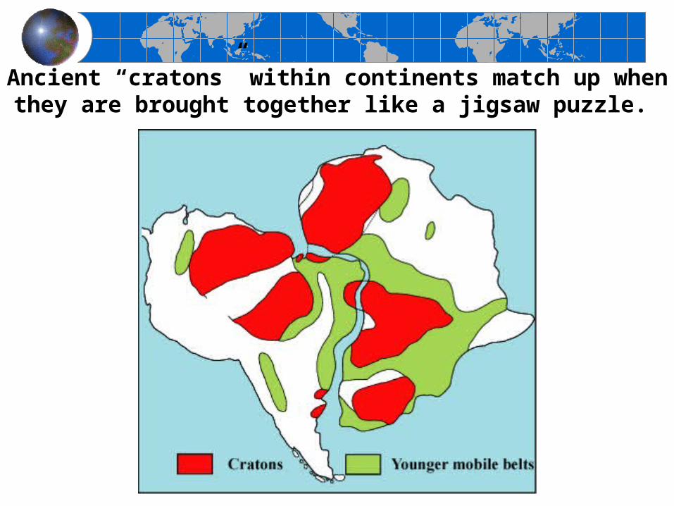
Ancient “cratons” within continents match up when they are brought together like a jigsaw puzzle.

Mountain formations were once connected
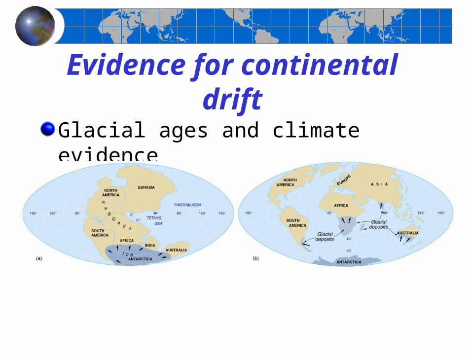
Evidence for continental drift
Glacial ages and climate evidence

Objections to the continental drift model
Wegener envisioned continents plowing through ocean basins
Wegener did not provide a plausible mechanism to explain how the continents could have drifted apart
Most Earth scientists rejected continental drift because it was
Too far-fetched
Contrary to the laws of physics

The theory of plate tectonics
Continental drift was reexamined in the 1960s when new information became available
Sea floor features became better known
A technique was developed that enabled scientists to determine the original positions of rocks on Earth (paleomagnetism)
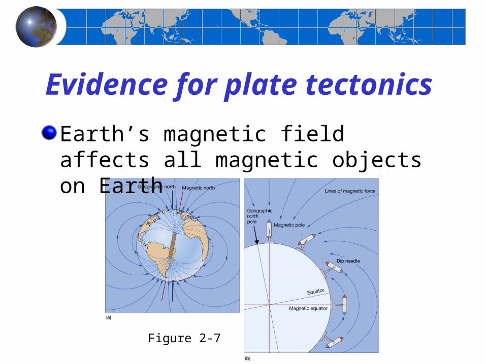
Evidence for plate tectonics
Earth’s magnetic field affects all magnetic objects on Earth
Figure 2-7

Evidence for plate tectonics
When rocks cool at Earth’s surface, they record Earth’s magnetic field (normal or reversed polarity)
Figure 2-9
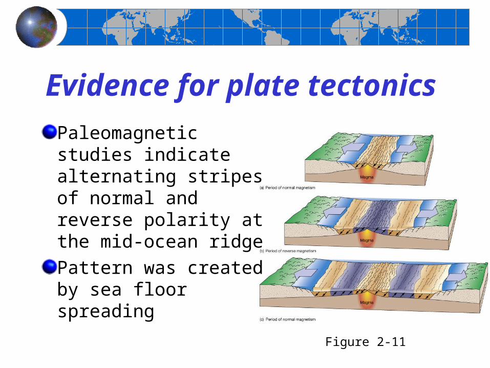
Evidence for plate tectonics
Paleomagnetic studies indicate alternating stripes of normal and reverse polarity at the mid-ocean ridge
Pattern was created by sea floor spreading
Figure 2-11

Evidence for plate tectonics
Harry Hess envisioned new sea floor being created at the mid-ocean ridge and destroyed in deep ocean trenches
Figure 2-10

Evidence for plate tectonics
Age of the sea floor matches pattern predicted by sea floor spreading
Youngest sea floor is at mid-ocean ridgeSea floor is older with increasing distance from mid-ocean ridge
Figure 2-12

Evidence for plate tectonics
Pattern of worldwide earthquakes (left) matches plate boundaries (right)
Figure 2-13

Earth structureChemical composition
CrustMantleCore
Physical propertiesLithosphereAsthenosphereMesosphereOuter coreInner core Figure 2-14

Principles of plate tectonics
The outermost portion of Earth is composed of a mosaic of thin rigid plates (pieces of lithosphere) that move horizontally with respect to one another
Plates interact with each other along their edges (called plate boundaries)
Plate boundaries have a high degree of tectonic activity (mountain building, earthquakes, active volcanoes)
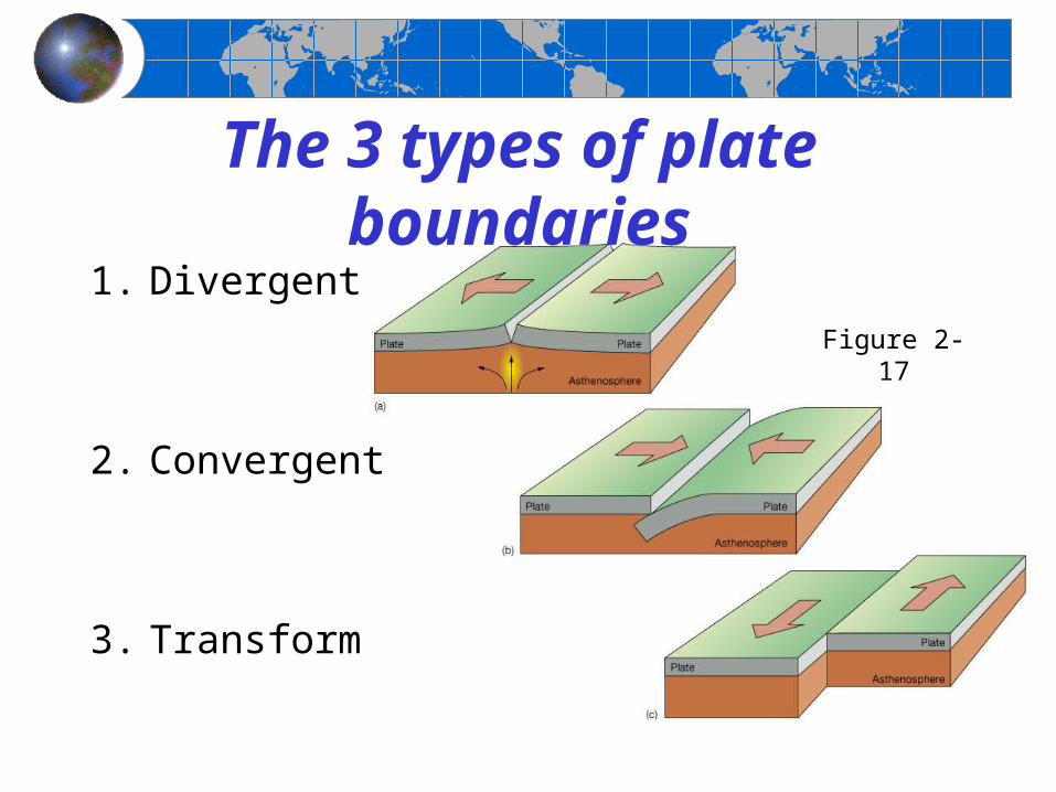
The 3 types of plate boundaries
1. Divergent
2. Convergent
3. Transform
Figure 2-17

Divergent plate boundaries
The Mid-Atlantic Ridge is a divergent plate boundary where sea floor spreading occurs Figure 2-18

Divergent plate boundaries
Iceland sits atop a divergent plate boundary where continental rifting occurs
Figure 2-19
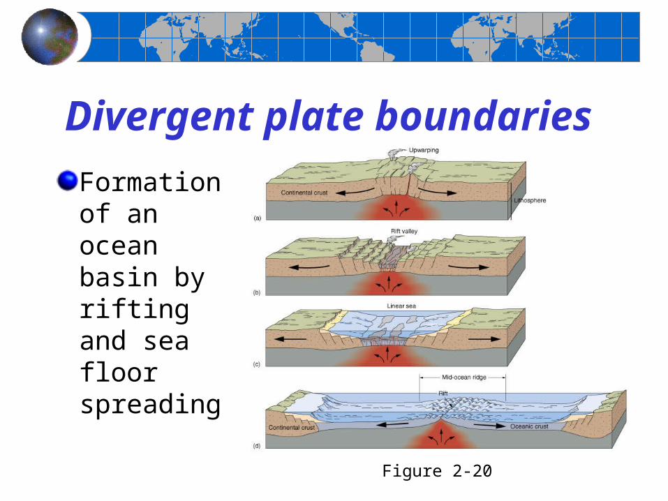
Divergent plate boundaries
Formation of an ocean basin by rifting and sea floor spreading
Figure 2-20

Convergent plate boundaries
Convergent plate boundaries vary depending on the type of crust
Figure 2-23
a. Ocean-continent
b. Ocean-ocean
c. Continent-continent
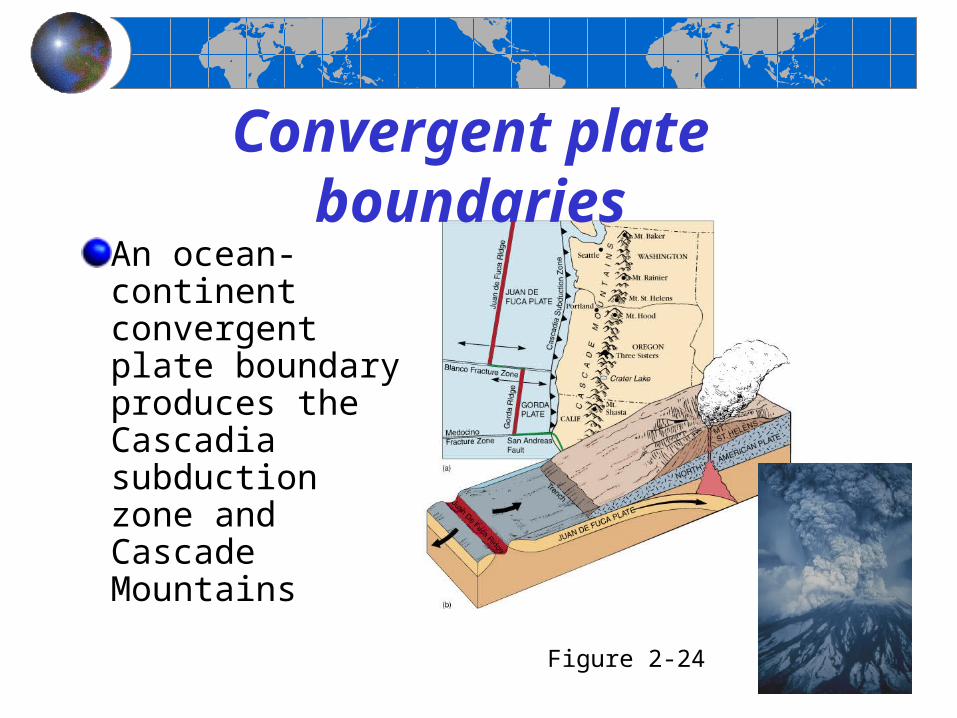
Convergent plate boundaries
An ocean-continent convergent plate boundary produces the Cascadia subduction zone and Cascade Mountains
Figure 2-24

Convergent plate boundaries
A continent-continent convergent plate boundary produces the Himalaya Mountains
Figure 2-25

Transform plate boundaries
Transform plate boundaries occur between segments of the mid-ocean ridgeCan also occur on land (ex: San Andreas Fault)
Figure 2-26

Hotspots and plate tectonics
Hotspots are stationary and have abundant volcanic activityThe lithospheric plate moves over the hotspotCreates a row of volcanoes progressively older toward one end (called a nematath)
Figure 2-28
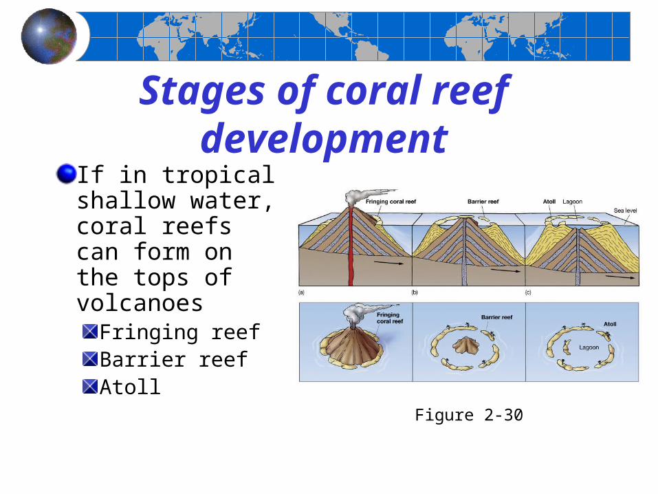
Stages of coral reef development
If in tropical shallow water, coral reefs can form on the tops of volcanoes
Fringing reefBarrier reefAtoll Figure 2-30

Atoll and barrier reefs in the Society Islands
Figure 2-32
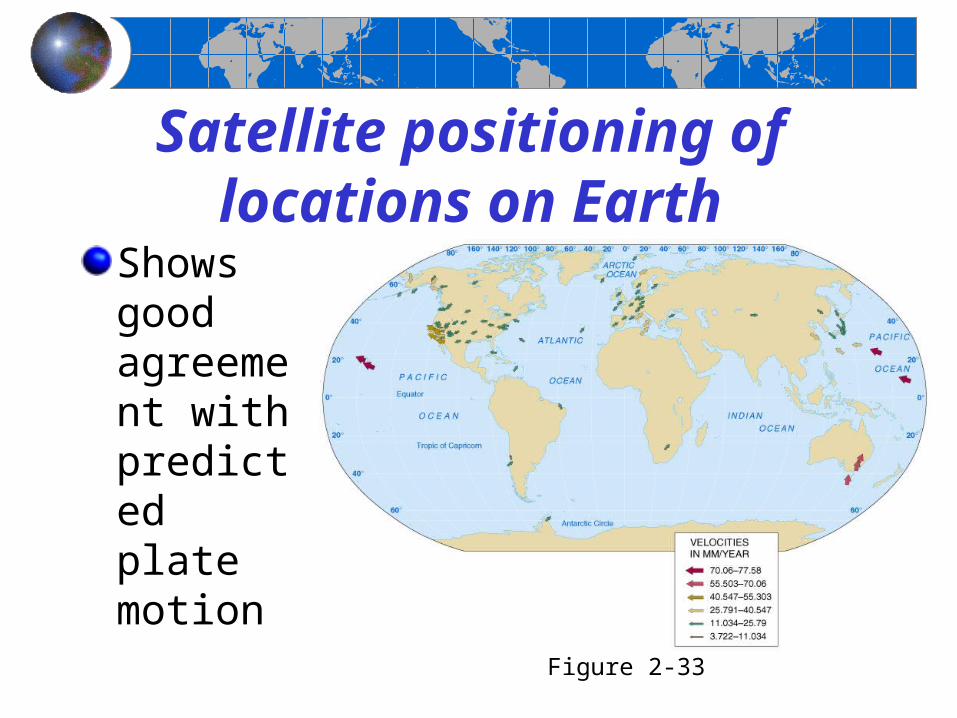
Satellite positioning of locations on Earth
Shows good agreement with predicted plate motion
Figure 2-33

Paleogeography: A look at the past
The positions of continents and oceans have changed in the past
Internet site showing more detailed maps
Figure 2-34
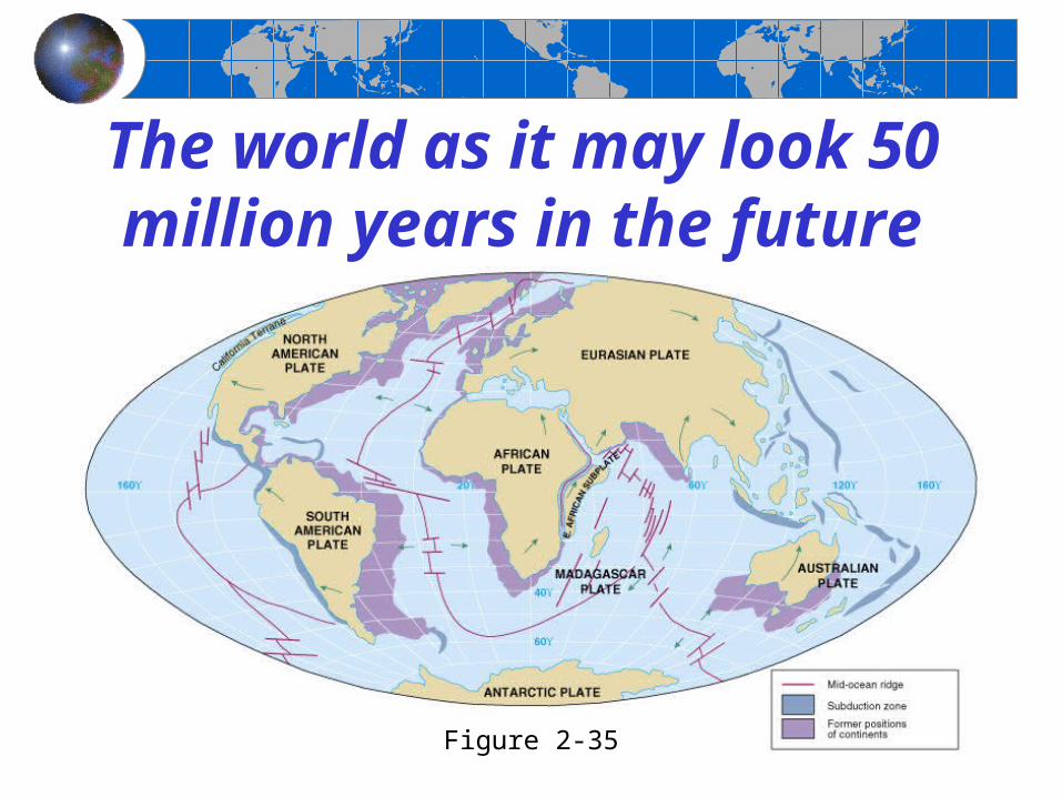
The world as it may look 50 million years in the future
Figure 2-35
End of Chapter 2
Essentials of Oceanography
7th Edition