palm-nipomo parking structure project
TRANSCRIPT

Palm-Nipomo Parking Structure Project
Initial Study
prepared by City of San Luis Obispo
Public Works Department 919 Palm Street
San Luis Obispo, CA 93401
prepared with the assistance of Rincon Consultants
1530 Monterey Street, Suite D San Luis Obispo, California 93401
April 2017

This page left intentionally blank.

Table of Contents
Initial Study i
Table of Contents
Initial Study ..................................................................................................................................................... 3
1 Project Title ....................................................................................................................................... 3
2 Lead Agency Name and Address ...................................................................................................... 3
3 Contact Person and Phone Number ................................................................................................. 3
4 Project Location ................................................................................................................................ 3
5 Project Sponsor’s Name and Address ............................................................................................... 3
6 Existing Setting ................................................................................................................................. 3
7 General Plan Designation ................................................................................................................. 3
8 Zoning ............................................................................................................................................... 6
9 Description of Project ....................................................................................................................... 6
10 Required Approvals .......................................................................................................................... 7
11 Surrounding Land Uses and Setting .................................................................................................. 7
12 Other Public Agencies Whose Approval is Required ........................................................................ 7
Environmental Factors Potentially Affected .................................................................................................. 9
Determination ................................................................................................................................................ 9
Environmental Checklist ................................................................................................................................. 9
1 Aesthetics ....................................................................................................................................... 12
2 Agriculture and Forest Resources ................................................................................................... 14
3 Air Quality ....................................................................................................................................... 16
4 Biological Resources ....................................................................................................................... 23
5 Cultural Resources .......................................................................................................................... 27
6 Geology and Soils ............................................................................................................................ 29
7 Greenhouse Gas Emissions ............................................................................................................. 33
8 Hazards and Hazardous Materials .................................................................................................. 38
9 Hydrology and Water Quality ......................................................................................................... 44
10 Land Use and Planning.................................................................................................................... 48
11 Mineral Resources .......................................................................................................................... 50
12 Noise ............................................................................................................................................... 51
13 Population and Housing.................................................................................................................. 51
14 Public Service .................................................................................................................................. 58
15 Recreation....................................................................................................................................... 61
16 Transportation ................................................................................................................................ 62
17 Utilities and Service Systems .......................................................................................................... 68
18 Mandatory Findings of Significance ................................................................................................ 72
References ............................................................................................................................................. 74
List of Preparers ..................................................................................................................................... 76

City of San Luis Obispo
Palm-Nipomo Parking Structure Project
ii
Tables
Table 1 Issues for Further Analysis in Environmental Impact Report ........................................... 10
Table 2 SLOAPCD Operational Emissions Significance Thresholds ................................................ 17
Table 3 Palm Nipomo Parking Structure Quarterly Construction Emissions................................. 19
Table 4 Palm Nipomo Parking Structure Operational Emissions Comparison .............................. 20
Table 5 Estimated Construction Greenhouse Gas Emissions ........................................................ 35
Table 6 Combined Annual Emissions of Greenhouse Gases ......................................................... 36
Table 7 Maximum Noise Exposure for Noise-Sensitive Uses Due to Transportation Noise Sources .................................................................................................................................... 52
Table 8 Maximum Noise Exposure for Noise-Sensitive Land Use Areas Due to Stationary Noise Sources .......................................................................................................................... 53
Table 9 Exterior Noise Limits (Levels Not To Be Exceeded More Than Thirty Minutes in Any Hour) ....................................................................................................................................... 54
Table 10 Maximum Time Periods for Increased Noise Levels ....................................................... 54
Table 11 Maximum Noise Levels for Nonscheduled, Intermittent, Short-term Operation (Less than Ten Days) of Mobile Equipment ..................................................................................... 54
Table 12 Maximum Noise Levels for Repetitively Scheduled and Relatively Long-Term Operation (Periods of Ten Days or More) of Stationary Equipment ...................................... 55
Table 13 Estimated Project Vehicle Trip Generation (Weekday PM Peak Hour) .......................... 64
Figures
Figure 1 Regional Location ...............................................................................................................4
Figure 2 Project Location ..................................................................................................................5
Figure 3 Site Plan ..............................................................................................................................8
Appendices
Appendix A CalEEmod Air and Greenhouse Gas Emissions Estimates
Appendix B Geotechnical, Geologic, and Hazardous Materials Assessment Report

Initial Study
Initial Study 3
Initial Study
1 Project Title
Palm-Nipomo Parking Structure
2 Lead Agency Name and Address
City of San Luis Obispo 919 Palm Street San Luis Obispo, CA 93401
3 Contact Person and Phone Number
Tim Bochum, Deputy Director, Transportation (805) 781-7203
4 Project Location
The project site is a 1.4-acre property, located south of Palm Street, east of Nipomo Street, and north of Monterey Street. The property includes Assessor’s Parcel Numbers (APN) 002-412-001, 002-412-002, 002-412-003, 002-412-004, 002-412-011, and 002-412-012. Figure 1 shows the regional location of the project, and Figure 2 shows the project site within the local context.
5 Project Sponsor’s Name and Address
City of San Luis Obispo Public Works Department 919 Palm Street San Luis Obispo, CA 93401
6 Existing Setting
The project site is located south of Palm Street, east of Nipomo Street, and north of Monterey Street. The site is currently occupied by a City-owned surface parking lot, one detached garage, and five residential units (three single-family residences and one secondary unit adjacent to Palm Street that has two apartments). The project site is located within the City’s Downtown Historic District.
7 General Plan Designation
Office: APNs 002-412-001, 002-412-002, 002-412-004, 002-412-011, and 002-412-012 Medium-High Density Residential: APN 002-412-003

City of San Luis Obispo
Palm-Nipomo Parking Structure Project
4
Figure 1 Regional Location

Initial Study
Initial Study 5
Figure 2 Project Location

City of San Luis Obispo
Palm-Nipomo Parking Structure Project
6
8 Zoning
Office with Historic Overlay (O-H): APNs 002-412-001, 002-412-002, 002-412-004, 002-412-011, and 002-412-012
Medium-High Density Residential (R-3): APN 002-412-003
9 Description of Project
The project would involve the construction of an above-ground five-level parking structure, non-profit theater, and commercial space. The parking structure would provide 400 to 445 parking spaces. Main vehicular access to the structure would be provided from Palm Street, with secondary access on Nipomo Street. There would be one lane for ingress and one lane for egress at each driveway. Vehicle access would not be provided from Monterey Street; however, a direct pedestrian connection would be provided from the structure to Monterey Street. Pedestrian access would also be provided to public sidewalks from each corner of the structure. The project would also include 5,000 square feet of commercial space on two levels fronting Nipomo Street. The parking structure’s maximum height, excluding elevator towers, would be approximately 50 feet.
In addition, the San Luis Obispo Little Theatre would be relocated to the site, fronting Monterey Street adjacent to the parking structure. The Little Theatre would entail a three-story structure with a gross floor area of 23,841 square feet. The basement level would house a rehearsal area, workshop, and storage. The main level would be comprised of a main theater with 155 seats and a smaller theater with 100 reconfigurable seats, for a total of 255 seats. The third floor would include offices and a conference room. The project would include an entry plaza fronting Monterey Street, and improved landscaping near the sidewalks along Palm Street, Nipomo Street, and Monterey Street. The maximum height of the theater structure would be 43 feet. Figure 3 shows the proposed site plan.
The project would involve the removal of the existing 77 space surface parking lot and demolition or relocation of the existing five residential structures and detached garage. The project would involve a General Plan amendment to amend the General Plan Land Use Map from Office and Medium-High Density Residential to Public and a Zone Change to amend the Zoning Map from Office with a Historic Overlay (O-H) and Medium-High Density Residential (R-3) to Public Facility with a Historic Overlay (PF-H). It would also require the approval of a Use Permit by the Planning Commission to allow the multi-level parking structure and non-profit theater, as well as deviation to otherwise applicable setback requirements and building height limits. Office, retail, and residential uses would be allowed as accessory uses of the parking and theater facilities. In addition, the project would require variances for the floor to area ratio to exceed 1.0 and maximum coverage to exceed 60 percent.
Project alternatives include the following:
Alternative 1: Same as the preferred project described above, except the 5,000 square feet of commercial space would be reduced to 2,500 square feet of commercial space and four residential units would be included
Alternative 2: Same as the preferred project described above, except the Little Theatre would be replaced with 22 two-bedroom residential units

Initial Study
Initial Study 7
10 Required Approvals
The following approvals would be required for the project:
Planning Commission Use Permit approval required for multi-level parking structure, non-profit theater, commercial space, and deviations to otherwise applicable setback requirement
General Plan Amendment to Public Facility Zone Change to PF-H Maximum Coverage Variance to exceed 60 percent Floor to Area Ratio Variance to exceed 1.0 Architectural Review by the Cultural Heritage Committee and the Architectural Review
Commission of the proposed structures and site plan
11 Surrounding Land Uses and Setting
The area surrounding the site is urbanized, consisting of various land uses. Adjacent parcels to the northeast are zoned Medium-High Density Residential (R-3) and have existing residences developed on-site. Across Palm Street to the northwest is the Mission College Preparatory school athletic field, which is zoned Medium-High Density Residential (R-3). Across Nipomo Street to the west is the Reis Family Mortuary & Crematory, which is zoned Office with a Historic district overlay (O-H); residences zoned Medium-High Density Residential (R-3); and mixed commercial and residential suites zoned Downtown Commercial with a Historic District and Planned Development overlay (C-D-H-PD). Across Monterey Street to the south is the San Luis Obispo Children’s Museum, which is zoned Public Facility with a Historic District overlay (PF-H), and residential units zoned Downtown Commercial with a Historic district and Special Considerations overlay (C-D-S-H).
12 Other Public Agencies Whose Approval is Required
Regional Water Quality Control Board – National Pollutant Discharge Elimination System Permit

City of San Luis Obispo
Palm-Nipomo Parking Structure Project
8
Figure 3 Site Plan
Source: Watry Design, Inc. 2017
Nip
om
o S
t
Dana St
Monterey St
Palm St

Initial Study
Initial Study 9
Environmental Factors Potentially Affected
This project would potentially affect the environmental factors checked below, involving at least one impact that is “Potentially Significant” or “Potentially Significant Unless Mitigation Incorporated” as indicated by the checklist on the following pages.
■ Aesthetics □ Agriculture and Forest Resources
■ Air Quality
■ Biological Resources ■ Cultural Resources ■ Geology and Soils
□ Greenhouse Gas Emissions ■ Hazards and Hazardous Materials
□ Hydrology / Water Quality
□ Land Use/ Planning □ Mineral Resources ■ Noise
□ Population / Housing □ Public Services □ Recreation
■ Transportation / Traffic □ Utilities / Service Systems
■ Mandatory Findings of Significance
Determination
Based on this initial evaluation:
□ I find that the preferred project COULD NOT have a significant effect on the environment, and a NEGATIVE DECLARATION will be prepared.
□ I find that although the preferred project could have a significant effect on the environment, there will not be a significant effect in this case because revisions to the project have been made by or agreed to by the project proponent. A MITIGATED NEGATIVE DECLARATION will be prepared.
■ I find that the preferred project MAY have a significant effect on the environment, and an ENVIRONMENTAL IMPACT REPORT is required.
□ I find that the preferred project MAY have a “potentially significant impact” or “potentially significant unless mitigated” impact on the environment, but at least one effect (1) has been adequately analyzed in an earlier document pursuant to applicable legal standards, and (2) has been addressed by mitigation measures based on the earlier analysis as described on attached sheets. An ENVIRONMENTAL IMPACT REPORT is required, but it must analyze only the effects that remain to be addressed.
□ I find that although the preferred project could have a significant effect on the environment, because all potential significant effects (a) have been analyzed adequately in an earlier EIR or NEGATIVE DECLARATION pursuant to applicable standards, and (b) have been avoided or mitigated pursuant to that earlier EIR or NEGATIVE DECLARATION, including revisions or mitigation measures that are imposed upon the preferred project, nothing further is required.
May 1, 2017
Signature Date
Tyler Corey Principal Planner
Printed Name Title

City of San Luis Obispo
Palm-Nipomo Parking Structure Project
10
The following table summarizes the environmental issue areas and work scope items that will be addressed in the Environmental Impact Report for the project.
Table 1 Issues for Further Analysis in Environmental Impact Report
Issue Area Potentially Significant Impact EIR Work Scope Item
Aesthetics Degradation of the existing visual character or quality of the site and its surroundings
The project would increase the size and scale of development on the site, which is located in the historic district. The EIR shall evaluate the potential visual impacts of the project on the existing visual character and quality of the site and its surroundings. Recommendations shall be developed to reduce identified visual impacts. General design guidelines shall be identified to assist the City in terms of design features and elements of the project to assure visual compatibility with the surrounding area.
Create a new source of substantial light or glare which would adversely affect day or nighttime views in the area
The EIR shall evaluate the new sources of light and glare from car headlights and area lighting. General design guidelines shall be identified to assist the City in terms of design and lighting features and elements of the project to assure that lighting and glare associated with the preferred project would be compatible with adjacent and surrounding uses.
Cultural Resources
Cause a substantial adverse change in the significance of a historical, archaeological, or tribal cultural resource
The EIR shall evaluate potential impacts to historic structures and cultural resources, as well as impacts to the historic district. The EIR will analyze impacts to these resources in further detail and recommend mitigation measures.
Noise Exposure of persons to or generation of noise levels in excess of standards; substantial permanent increases in ambient noise levels above levels existing without the project
The project would be surrounded by noise sensitive uses, and the impact of project operations on ambient noise levels at sensitive receptors shall be evaluated in the EIR. Sound level measurements shall be taken on the project site and the level of significance shall be determined using the City’s noise level thresholds. In addition, the project would generate traffic that would contribute to noise levels in the project area that could exceed City thresholds. The EIR shall quantify the increase in vehicle noise levels resulting from project-generated traffic at sensitive receptors along Palm Street, Nipomo Street and Monterey Street and determine the level of significance based on the City’s noise level thresholds. The EIR shall identify any mitigation necessary to reduce significant noise impacts to less than significant levels.
Exposure of persons to or generation of excessive groundborne vibration or groundborne noise levels; result in a substantial temporary or periodic increase in ambient noise levels in the project vicinity above levels existing without the project
The EIR shall quantify the level of construction noise based on anticipated construction equipment. The level of construction noise generated by the project shall be compared to the City’s applicable noise level thresholds to determine the level of significance. The EIR shall identify any mitigation necessary to reduce significant temporary construction noise impacts to the extent feasible.
Transportation/ Traffic
Conflict with an applicable plan, ordinance or policy establishing a measure of effectiveness for the performance of the circulation system, taking into account all modes
A traffic analysis shall be prepared for the EIR. The traffic analysis shall contain an evaluation of project impacts on study area roadway segments and intersections under both existing + project and cumulative + project conditions, as well as impacts related to overall vehicle miles traveled

Initial Study
Initial Study 11
Issue Area Potentially Significant Impact EIR Work Scope Item
of transportation, including mass transit and non-motorized travel and relevant components of the circulation system, including but not limited to intersections, streets, highways, and freeways, pedestrian and bicycle paths, and mass transit; conflict with an applicable congestion management program, including, but not limited to level of service standards and travel demand measures, or other standards established by the county congestion management agency for designated roads or highways; conflict with adopted policies, plans, or programs regarding public transit, bikeways, or pedestrian facilities, or otherwise substantially decrease the performance or safety of such facilities
generated by the project. Impacts, including any potential secondary impacts from required circulation system improvements, will be described and mitigation measures shall be identified as necessary.

City of San Luis Obispo
Palm-Nipomo Parking Structure Project
12
Environmental Checklist
1 Aesthetics
Potentially Significant
Impact
Potentially Significant
Unless Mitigation
Incorporated
Less than Significant
Impact No Impact
Would the project have any of the following impacts?
a. Substantial adverse effect on a scenic vista □ □ ■ □
b. Substantial damage to scenic resources, including but not limited to trees, rock outcroppings, and historic buildings along a state scenic highway □ □ ■ □
c. Substantially degrade the existing visual character or quality of the site and its surroundings ■ □ □ □
d. Create a new source of substantial light or glare that would adversely affect daytime or nighttime views in the area ■ □ □ □
Setting
San Luis Obispo is located on predominantly undulating topography, with low hillsides rising from drainages and creeks. The overall landform of the City and its surroundings is generally defined by the convergence of the Chorro and the Los Osos Valleys. A series of low, visually distinct mountain peaks, such as Bishop Peak and Cerro San Luis, separate the two valleys and provide a scenic focal point for much of the City. The Cuesta Ridge and Santa Lucia Mountains border the Chorro Valley to the north and east, while the Irish Hills border the Los Osos Valley to the southwest. The Santa Lucia Mountains and Irish Hills are the visual limits of this region and are considered the scenic backdrop for much of the City. The visual boundaries to the south and southeast are distant and are defined by low hills rising up from valleys. Development in the region occurs predominantly at the lesser elevations and on the low hills.
The project site is located in the northwestern portion of the downtown planning area. The visual environment surrounding the site is urbanized, consisting of various land uses. These uses include, residential units, commercial and mixed-use development, the Mission College Preparatory school athletic field, and the San Luis Obispo Children’s Museum. The project site and adjacent parcels to the east, west, and south are located within the City’s Historic Overlay. The site currently contains urban development including a surface parking lot, one detached garage, and five residential units (three single-family residences and one secondary unit adjacent to Palm Street that has two apartments). The site is not located within a City General Plan designated scenic vista or along a designated scenic highway; however the site is located near U.S. Highway 101, which is eligible for scenic highway designation.

Environmental Checklist
Aesthetics
Initial Study 13
Discussion
a. Would the project have a substantial adverse effect on a scenic vista?
The site is not located in a City General Plan designated scenic vista. Neither the preferred project nor Alternatives 1 or 2 would have a substantial adverse effect on a scenic vista. Impacts would be less than significant.
b. Would the project substantially damage scenic resources, including, but not limited to, trees, rock outcroppings, and historic buildings in a state scenic highway?
The nearest highway is U.S. Highway 101, designated as an Eligible State Scenic Highway by the California Department of Transportation. Due to the height of the parking structure and theater, the project may be visible from Highway 101; however, this segment has not been designated as a state scenic highway; thus, neither the preferred project nor Alternatives 1 or 2 would damage scenic views. Therefore, impacts would be less than significant.
c. Would the project substantially degrade the existing visual character or quality of the site and its surroundings?
The project site is located in the City’s Downtown Planning area, adjacent to the Downtown Core (City of San Luis Obispo 2014). It is also located in a Historical Overlay district. The site currently contains urban development including a City-owned surface parking lot, one detached garage, and five residential units (three single-family residences and one secondary unit adjacent to Palm Street that has two apartments). The preferred project and alternatives would involve the removal of the existing parking lot, detached garage, and residential structures, and the construction of a five-story parking structure, commercial space, and theater or residential units. Therefore, while the project and project alternatives would be visually compatible with the existing urban environment of the site and the surrounding area, they would increase the size and scale of development and change the uses on the project site. The project would require a General Plan amendment/Zone Change to Public/Public Facility with a Historic Overlay (PF-H). It would also require the approval of a Use Permit by the Planning Commission to allow the multi-level parking structure and non-profit theater, as well as deviation to otherwise applicable setback requirements and building height limits. Office, retail, and residential uses would be allowed as accessory uses of the parking and theater facilities. In addition, the project would require variances for the floor to area ratio to exceed 1.0 and maximum coverage to exceed 60 percent. The increase in size and scale of development on the project site and the sensitivity of the project site within the Downtown Historic District could result in potential impacts to the visual character of the site. The change to the site’s visual character is a potentially significant impact and will be analyzed further in the EIR.
d. Would the project create a new source of substantial light or glare which would adversely affect day or nighttime views in the area?
The preferred project and Alternatives 1 and 2 would introduce new lighting from car headlights and for parking and pedestrian ways and lighting for the commercial space, theater, and/or residential units. Such lighting could create new sources of light or glare. While the project site is located in an urban area where substantial nighttime lighting currently exists, the increased height of the proposed structure and the proximity to residential uses could result in light spillover and additional glare that could result in significant environmental effects. Therefore, the change to the site’s lighting is a potentially significant impact and will be analyzed further in the EIR.

City of San Luis Obispo
Palm-Nipomo Parking Structure Project
14
2 Agriculture and Forest Resources In determining whether impacts to agricultural resources are significant environmental effects, lead agencies may refer to the California Agricultural Land Evaluation and Site Assessment Model (1997) prepared by the California Dept. of Conservation as an optional model to use in assessing impacts on agriculture and farmland. In determining whether impacts to forest resources, including timberland, are significant environmental effects, lead agencies may refer to information compiled by the California Department of Forestry and Fire Protection regarding the state’s inventory of forest land. This includes the Forest and Range Assessment Project and the Forest Legacy Assessment Project, along with the forest carbon measurement methodology provided in Forest Protocols adopted by the California Air Resources Board.
Potentially Significant
Impact
Potentially Significant
Unless Mitigation
Incorporated
Less than Significant
Impact No Impact
Would the project have any of the following impacts?
a. Convert Prime Farmland, Unique Farmland, Farmland of Statewide Importance (Farmland), as shown on maps prepared pursuant to the Farmland Mapping and Monitoring Program of the California Resources Agency, to non-agricultural use □ □ □ ■
b. Conflict with existing zoning for agricultural use or a Williamson Act contract □ □ □ ■
c. Conflict with existing zoning for or cause rezoning of forest land (as defined in Public Resources Code Section 12220(g)); timberland (as defined by Public Resources Code Section 4526); or timberland zoned Timberland Production (as defined by Government Code Section 51104(g)) □ □ □ ■
d. Result in the loss of forest land or conversion of forest land to non-forest use □ □ □ ■
e. Involve other changes in the existing environment which, due to their location or nature, could result in conversion of Farmland to non-agricultural use □ □ □ ■
Setting
The San Luis Obispo Area Plan (County of San Luis Obispo 2014) designates the Agriculture land use category as areas that have existing or potential agricultural production capability. A large portion of the greater San Luis Obispo area is designated for agriculture, which almost entirely surrounds the urbanized area within City limits. Because the project site is located within City limits, the San Luis Obispo Area Plan
Environmental Checklist
Agriculture and Forest Resources
Initial Study 15
does not provide designations for the project site. The project site is not located on an existing or potential agricultural production area as provided for in the City’s zoning code (San Luis Obispo Land Use Element 2014).
Discussion
a. Would the project convert Prime Farmland, Unique Farmland, Farmland of Statewide Importance (Farmland), as shown on the maps prepared pursuant to the Farmland Mapping and Monitoring Program of the California Resources Agency, to non-agricultural use?
b. Would the project conflict with existing zoning for agricultural use, or a Williamson Act contract?
c. Would the project conflict with existing zoning for, or cause rezoning of, forest land (as defined in Public Resources Code Section 12220(g)), timberland (as defined by Public Resources Code Section 4526), or timberland zoned Timberland Production (as defined by Government Code Section 51104(g))?
d. Would the project result in the loss of forest land or conversion of forest land to non-forest use?
e. Would the project involve other changes in the existing environment, which, due to their location or nature, could result in conversion of Farmland to non-agricultural use?
The project site is currently developed with a surface parking lot and residential structures. The project site does not contain any agricultural resources, land identified for potential agricultural production, lands designated as or zoned for agricultural use, or lands under a Williamson Act contract. Furthermore, no timberland land exists on the project site. Therefore, no impact to agricultural resources or forest land would occur as a result of the preferred project or Alternatives 1 or 2.

City of San Luis Obispo
Palm-Nipomo Parking Structure Project
16
3 Air Quality
Potentially Significant
Impact
Potentially Significant
Unless Mitigation
Incorporated
Less than Significant
Impact No Impact
Would the project have any of the following impacts?
a. Conflict with or obstruct implementation of the applicable air quality plan □ □ □ ■
b. Violate any air quality standard or contribute substantially to an existing or projected air quality violation □ ■ □ □
c. Result in a cumulatively considerable net increase of any criteria pollutant for which the project region is non-attainment under an applicable federal or state ambient air quality standard (including releasing emissions which exceed quantitative thresholds for ozone precursors) □ ■ □ □
d. Expose sensitive receptors to substantial pollutant concentrations □ ■ □ □
e. Create objectionable odors affecting a substantial number of people □ □ □ ■
Setting
The City of San Luis Obispo falls within the jurisdiction of the San Luis Obispo County Air Pollution Control District (SLOAPCD) and is located within the South Central Coast Air Basin. SLOAPCD monitors air pollutant levels to assure that air quality standards are met, and if they are not met, to develop strategies to meet the standards. Depending on whether the standards are met or exceeded, the air basin is classified as being in “attainment” or as “non-attainment.” SLOAPCD is in non-attainment for the 24-hour state standard for particulate matter (PM10) and the eight hour state standard for ozone (O3) (SLOAPCD 2015).
The major sources of PM10 in the SCCAB are agricultural operations, vehicle dust, grading, and dust produced by high winds. Additional sources of particulate pollution include diesel exhaust; mineral extraction and production; combustion products from industry and motor vehicles; smoke from open burning; paved and unpaved roads; condensation of gaseous pollutants into liquid or solid particles; and wind-blown dust from soils disturbed by demolition and construction, agricultural operations, off-road vehicle recreation, and other activities. Ozone is a secondary pollutant that is not produced directly by a source, but rather is formed by a reaction between nitrogen oxides (NOx) and reactive organic gases (ROGs) in the presence of sunlight. Reductions in ozone concentrations are dependent on reducing the amount of these precursors. In the SCCAB, the major sources of ROGs are motor vehicles, organic solvents, the petroleum industry, and pesticides. The major sources of NOx are motor vehicles, public utility power generation, and fuel combustion by various industrial sources (SLOAPCD 2015).

Environmental Checklist
Air Quality
Initial Study 17
Construction Emissions Thresholds
The SLOAPCD has developed specific daily and quarterly numeric thresholds that apply to projects within the SCCAB. Daily thresholds are for projects that would be completed in less than one quarter (90 days). The SLOAPCD’s quarterly construction thresholds are applicable to the project because construction would last for more than one quarter. Thresholds are based on guidance in the SLOAPCD’s CEQA Air Quality Handbook (2012). These include:
ROG and NOX Emissions
Quarterly – Tier 1: For construction projects lasting more than one quarter, exceedance of the 2.5 tons per quarter threshold requires Standard Mitigation Measures and Best Available Control Technology (BACT) for construction equipment. If implementation of the Standard Mitigation and BACT measures cannot bring the project below the threshold, off-site mitigation may be necessary; and
Quarterly – Tier 2: For construction projects lasting more than one quarter, exceedance of the 6.3 tons per quarter threshold requires Standard Mitigation Measures, BACT, implementation of a Construction Activity Management Plan (CAMP), and off-site mitigation.
Diesel Particulate Matter (DPM) Emissions
Quarterly – Tier 1: For construction projects lasting more than one quarter, exceedance of the 0.13 tons per quarter threshold requires Standard Mitigation Measures, BACT for construction equipment; and
Quarterly – Tier 2: For construction projects lasting more than one quarter, exceedance of the 0.32 ton per quarter threshold requires Standard Mitigation Measures, BACT, implementation of a CAMP, and off-site mitigation.
Fugitive Particulate Matter (PM10), Dust Emissions
Quarterly: Exceedance of the 2.5 tons per quarter threshold requires Fugitive PM10 Mitigation Measures and may require the implementation of a CAMP.
Operational Emissions Thresholds
SLOAPCD‘s long-term operational emission thresholds are summarized in Table 2.
Table 2 SLOAPCD Operational Emissions Significance Thresholds
Pollutant Daily Threshold Annual Threshold
ROG + NOX (combined)1 25 lbs/day 25 tons/year
Diesel Particulate Matter (DPM)1 1.25 lbs/day ---
Fugitive Particulate Matter (PM10), Dust 25 lbs/day 25 tons/year
CO 550 lbs/day ---
Source: SLOAPCD 2012
1 SLOAPCD specifies that CalEEMod winter emission outputs be compared to operational thresholds for these pollutants.

City of San Luis Obispo
Palm-Nipomo Parking Structure Project
18
Discussion
a. Would the project conflict with or obstruct implementation of the applicable air quality plan?
According to the SLOAPCD CEQA Air Quality Handbook (2012), project-level environmental reviews that may require consistency analysis with the Clean Air Plan and Smart/Strategic Growth Principles adopted by lead agencies include: subdivisions, large residential developments and large commercial/industrial developments. Neither the preferred project nor Alternatives 1 or 2 is a subdivision or large residential project, and would not be considered a large commercial or industrial development according to the screening criteria set forth in the SLOAPCD CEQA Air Quality Handbook. Therefore, neither the preferred project nor Alternatives 1 or 2 has the potential to be inconsistent with the Clean Air Plan or Smart/Strategic Growth Principles.
In addition, the project is considered infill development located within an existing urban area, which are land use strategies supported by the SLOAPCD Clean Air Plan (2001) policies, including:
Cities and unincorporated communities should be developed at higher densities that reduce trips and travel distances and encourage the use of alternative forms of transportation
Urban growth should occur within the urban reserve lines of cities and unincorporated communities (Clean Air Plan L-1 Planning Compact Communities)
The preferred project and Alternatives 1 and 2 would have no impact with respect to a conflict with or obstruction to implementation of the applicable air quality plan.
b. Would the project violate any air quality standard or contribute substantially to an existing or projected air quality violation?
c. Would the project result in a cumulatively considerable net increase of any criteria pollutant for which the project region is non-attainment under an applicable federal or state ambient air quality standard (including releasing emissions which exceed quantitative thresholds for ozone precursors)?
d. Would the project expose sensitive receptors to substantial pollutant concentrations?
As of September 2011, SLOAPCD recommends the use of the most recent version of California Emissions Estimator Model (CalEEMod) (version 2016.3.1) to calculate construction and operational emissions of a project. The CalEEMod results for the preferred project and Alternatives 1 and 2 can be found in Appendix A. The emissions model for the preferred project was based on build out of the proposed 445 parking space structure, 255 seat theater, and 5,000 square feet of commercial space. Alternative 1 was based on build out of the proposed 445 parking space structure, 255 seat theater, 2,500 square feet of commercial space, and four residential units. Alternative 2 was based on build out of the 445 parking space structure, 5,000 square feet of commercial space, and 22 two bedroom residential units. Trip rates for the commercial space, parking structure, and Little Theatre were obtained from the Traffic Study prepared by Central Coast Transportation Consulting (2017). Default trip rates for the residential units were obtained from CalEEMod. The emissions model for the preferred project and Alternatives 1 and 2 assumes a maximum area of disturbance of 1.4 acres (the total size of the project site). In addition, it assumes a net 5,700 cubic yards of soil would be exported from the site.
Construction Impacts
Construction activities would generate fugitive dust particles, ozone precursors, and diesel exhaust that could result in an increase in criteria pollutants and could also contribute to the existing San Luis Obispo County nonattainment status for ozone and PM10. Sensitive receptors near the project site include adjacent residences to the south and east, the Mission College Preparatory School athletic field to the north, residences across Nipomo Street to the west, and residences and the San Luis Obispo Children’s Museum to the south. Table 3 summarizes the estimated project emissions generated from construction

Environmental Checklist
Air Quality
Initial Study 19
activities. Maximum quarterly emissions are shown in Table 3 (see Appendix A for complete CalEEMod results), and compared to the applicable SLOAPCD construction emissions thresholds Table 3 also shows estimated construction emissions associated with Alternatives 1 and 2 to the project.
Table 3 Palm Nipomo Parking Structure Quarterly Construction Emissions
ROG and NOX (combined)1
Fugitive PM10 (dust)
DPM2
Preferred Project Construction Emissions 0.94 tons/quarter 0.03 tons/quarter 0.07 tons/quarter
Alternative 1 Construction Emissions 0.94 tons/quarter 0.03 tons/quarter 0.07 tons/quarter
Alternative 2 Construction Emissions 0.94 tons/quarter 0.03 tons/quarter 0.07 tons/quarter
SLOAPCD Significance Threshold 2.5 tons/quarter (Tier 1) 2.5 tons/quarter (Tier 1) 0.13 tons/quarter (Tier
1)
Threshold Exceeded? No No No
1. The combined ROG and NOX emissions were derived from the rolling maximum quarterly emissions for “ROG + NOX” from CalEEMod.
2. The DPM estimations were derived from the “PM10 Exhaust” and “PM2.5 exhaust” output from CalEEMod as recommended by SLOAPCD. This estimation represents a worst case scenario because it includes other PM10 exhaust other than DPM. See Appendix A for CalEEMod software program output.
Quarterly emissions for Fugitive PM10 and DPM were calculated by dividing maximum annual construction emissions from CalEEMod by 4, since construction activities would extend for a duration exceeding 90 days, as recommended by SLOAPCD.
As shown in Table 3, the preferred project would not exceed SLOAPCD quarterly construction emissions for ROG and NOX, PM10, or DPM. Alternatives 1 and 2 would result in similar construction emissions to the preferred project, and would not exceed applicable SLOAPCD quarterly construction emissions thresholds.
In accordance with the standards of the SLOPACD CEQA Handbook, standard mitigation measures are required because sensitive receptors (Mission College Preparatory Academy, existing residential units and San Luis Obispo Children’s Museum) are located within 1,000 feet of the project site and because the SCCAB is in non-attainment for PM10. Accordingly, Mitigation Measures AQ-1 and AQ-2 would be required to reduce fugitive dust, ozone precursors, and diesel particulate matter emissions from the preferred project and Alternatives 1 and 2. Construction impacts would be potentially significant unless mitigation is incorporated.
Operational Impacts
The project and alternatives would result in an increase in vehicle trips that would generate new criteria pollutant emissions. In addition, operation of the project and alternatives would result in ongoing emissions associated with natural gas use and area sources, such as landscaping, consumption of consumer products, and off gassing from architectural coatings.
Table 4 shows the daily and annual operational emissions associated with the preferred project and Alternatives 1 and 2 (see Appendix A for complete CalEEMod results and assumptions), compared to the applicable SLOAPCD operational emissions thresholds. Operational emissions from the preferred project and Alternatives 1 and 2 would not exceed the applicable SLOAPCD operational emissions thresholds.

City of San Luis Obispo
Palm-Nipomo Parking Structure Project
20
Table 4 Palm Nipomo Parking Structure Operational Emissions Comparison
ROG and NOX (combined)
Fugitive PM10 (dust)
DPM1 CO
Preferred Project Daily Emissions 6.2 lbs/day 2.0 lbs/day 0.1 lbs/day 11.1 lbs/day
Alternative 1 Daily Emissions 6.2 lbs/day 1.9 lbs/day 0.1 lbs/day 11.1 lbs/day
Alternative 2 Daily Emissions 3.4 lbs/day 1.2 lbs/day 0.1 lbs/day 7.2 lbs/day
SLOAPCD Daily Threshold 25 lbs/day 25 lbs/day 1.25 lbs/day 550 lbs/day
Threshold Exceeded? No No No No
Preferred Project Annual Emissions 0.8 tons/year 0.2 tons/year 0.1 tons/year 1.3 tons/year
Alternative 1 Annual Emissions 0.8 tons/year 0.2 tons/year 0.1 tons/year 1.4 tons/year
Alternative 2 Annual Emissions 0.6 tons/year 0.2 tons/year 0.1 tons/year 1.6 tons/year
SLOAPCD Annual Threshold 25 tons/year 25 tons/year n/a n/a
Threshold Exceeded? No No n/a n/a
1 The DPM estimations were derived from the “PM10 Exhaust” and “PM2.5 exhaust” output from CalEEMod as recommended by SLOAPCD. This estimation represents a worst case scenario because it includes other PM10 exhaust other than DPM. CalEEMod – use winter operational emission data to compare to operational thresholds.
As shown in Table 4, area source and operational emissions associated with the preferred project and Alternative 1 and 2 would not exceed SLOAPCD thresholds for ROG, NOX, CO, PM10, or DPM. Therefore, neither the preferred project nor the alternatives exceed applicable SLOAPCD operational air quality standards or contribute to an existing air quality violation. Operational emissions associated with the preferred project and Alternatives 1 and 2 would be less than significant.
Sensitive Receptors
While the estimated construction emissions associated with the preferred project and Alternatives 1 and 2 would be below the SLOAPCD thresholds and would not introduce new hazardous air pollutants to the area, in accordance with the standards of the SLOPACD CEQA Handbook, standard mitigation measures are required because sensitive receptors (Mission College Preparatory Academy, existing residential units and San Luis Obispo Children’s Museum) are located within 1,000 feet of the project site and because the South Central Coast Air Basin is in nonattainment for PM10. Accordingly, Mitigation Measures AQ-1 and AQ-2 would be required for the preferred project and Alternatives 1 and 2 to reduce fugitive dust, ozone precursors, and diesel particulate matter emissions. Therefore, impacts to sensitive receptors in the project vicinity would be potentially significant unless mitigation is incorporated.
Mitigation Measures
The following mitigation measures are required to reduce construction emissions associated with the preferred project or Alternative 1 or 2 and to reduce impacts to sensitive receptors.
AQ -1 Fugitive Dust Control Measures. Construction projects shall implement the following dust control measures so as to reduce PM10 emissions in accordance with SLOAPCD requirements.
Reduce the amount of the disturbed area where possible;
Water trucks or sprinkler systems shall be used during construction in sufficient quantities to prevent airborne dust from leaving the site. Increased watering frequency shall be required whenever wind speeds

Environmental Checklist
Air Quality
Initial Study 21
exceed 15 mph. Reclaimed (non-potable) water shall be used whenever possible;
All dirt stock pile areas shall be sprayed daily as needed;
Permanent dust control measures identified in the approved project revegetation and landscape plans shall be implemented as soon as possible following completion of any soil disturbing activities;
Exposed ground areas that are planned to be reworked at dates greater than one month after initial grading shall be sown with a fast germinating, non-invasive grass seed and watered until vegetation is established;
All disturbed soil areas not subject to revegetation shall be stabilized using approved chemical soil binders, jute netting, or other methods approved in advance by the SLOAPCD;
All roadways, driveways, sidewalks, etc. to be paved shall be completed as soon as possible after grading unless seeding or soil binders are used;
Vehicle speed for all construction vehicles shall not exceed 15 mph on any unpaved surface at the construction site;
All trucks hauling dirt, sand, soil, or other loose materials are to be covered or shall maintain at least two feet of freeboard (minimum vertical distance between top of load and top of trailer) in accordance with California Vehicle Code Section 23114;
Install wheel washers where vehicles enter and exit unpaved roads onto streets, or wash off trucks and equipment leaving the site;
Sweep streets at the end of each day if visible soil material is carried onto adjacent paved roads. Water sweepers with reclaimed water shall be used where feasible;
All of these fugitive dust mitigation measures shall be shown on grading and building plans; and
The contractor or builder shall designate a person or persons to monitor the fugitive dust emissions and enhance the implementation of the measures as necessary to minimize dust complaints, reduce visible emissions below 20 percent opacity, and to prevent transport of dust offsite. Their duties shall include holidays and weekend periods when work may not be in progress. The name and telephone number of such persons shall be provided to the SLOAPCD Compliance Division prior to the start of any grading, earthwork or demolition.
AQ-2(a) Standard Control Measures for Construction Equipment. The following
standard air quality mitigation measures shall be implemented during construction activities at the project site:
Maintain all construction equipment in proper tune according to manufacturer’s specifications;
Fuel all off-road and portable diesel powered equipment with ARB certified motor vehicle diesel fuel (non-taxed version suitable for sue off-road);
Use diesel construction equipment meeting ARB’s Tier 2 certified engines or cleaner off-road heavy-duty diesel engines, and comply with the State Off-Road Regulation;

City of San Luis Obispo
Palm-Nipomo Parking Structure Project
22
Use on-road heavy-duty trucks that meet the ARB’s 2007 or cleaner certification standard for on-road heavy-duty diesel engines, and comply with the State On-Road Regulation;
Construction or trucking companies with fleets that do not have engines in their fleet that meet the engine standards identified in the above two measures (e.g. captive or NOX exempt area fleets) may be eligible by proving alternative compliance;
All on and off-road diesel equipment shall not idle for more than 5 minutes. Signs shall be posted in the designated queuing areas and or job sites to remind drivers and operators of the 5 minute idling limit;
Diesel idling within 1,000 feet of sensitive receptors is not permitted;
Staging and queuing areas shall not be located within 1,000 feet of sensitive receptors;
Electrify equipment when feasible;
Substitute gasoline-powered in place of diesel-powered equipment, where feasible; and
Use alternatively fueled construction equipment on-site where feasible, such as compressed natural gas, liquefied natural gas, propane or biodiesel.
AQ-2(b) Best Available Control Technology (BACT) for Construction Equipment. The
following BACT for diesel-fueled construction equipment shall be implemented during construction activities at the project site, where feasible:
Further reducing emissions by expanding use of Tier 3 and Tier 4 off-road and 2010 on-road compliant engines where feasible;
Repowering equipment with the cleanest engines available; and
Installing California Verified Diesel Emission Control Strategies, such as level 2 diesel particulate filters. These strategies are listed at: www.arb.ca.gov/diesel/verdev/vt/cvt.htm
AQ-2(c) Architectural Coating. To reduce ROG and NOX levels during the architectural
coating phase, low or no VOC-emission paint shall be used with levels of 50 g/L or less.
e. Would the project create objectionable odors affecting a substantial number of people?
The SLOAPCD CEQA Handbook (2012) identifies typical land uses that have the potential to result in increases in odorous emissions and provides recommendations for siting new sensitive land uses in close proximity to these uses. None of the uses proposed under the preferred project or alternatives, including a parking garage, commercial, theater, or residential uses, are listed as uses project that typically create objectionable odors. Therefore, neither the preferred project nor the alternatives would create objectionable odors affecting a substantial number of people. No impact related to objectionable odors from the project or Alternatives 1 or 2 would result.

Environmental Checklist
Biological Resources
Initial Study 23
4 Biological Resources
Potentially Significant
Impact
Potentially Significant
Unless Mitigation
Incorporated
Less than Significant
Impact No Impact
Would the project have any of the following impacts?
a. Have a substantial adverse effect, either directly or through habitat modifications, on any species identified as a candidate, sensitive, or special status species in local or regional plans, policies, or regulations, or by the California Department of Fish and Wildlife or U.S. Fish and Wildlife Service □ □ □ ■
b. Have a substantial adverse effect on any riparian habitat or other sensitive natural community identified in local or regional plans, policies, or regulations, or by the California Department of Fish and Wildlife or U.S. Fish and Wildlife Service □ □ □ ■
c. Have a substantial adverse effect on federally protected wetlands as defined by Section 404 of the Clean Water Act (including, but not limited to, marsh, vernal pool, coastal, etc.) through direct removal, filling, hydrological interruption, or other means □ □ □ ■
d. Interfere substantially with the movement of any native resident or migratory fish or wildlife species or with established native resident or migratory wildlife corridors, or impede the use of native wildlife nursery sites □ ■ □ □
e. Conflict with any local policies or ordinances protecting biological resources, such as a tree preservation policy or ordinance □ □ ■ □
f. Conflict with the provisions of an adopted Habitat Conservation Plan, Natural Community Conservation Plan, or other approved local, regional, or state habitat conservation plan? □ □ □ ■
Setting
This region of San Luis Obispo County falls within the Outer South Coast Ranges geographic subdivision of California. The Outer South Coast Ranges subdivision contains an array of vegetation community types

City of San Luis Obispo
Palm-Nipomo Parking Structure Project
24
that range from southern oak forest, blue-oak/foothill-pine woodland and chaparral to grasslands and agricultural/urbanized areas. The Outer South Coast Ranges subdivision is part of the larger South Coast Ranges geographic sub-region, which is a component of the even larger Central Western California physiographic area. The section of the state that is designated as CW occurs within the cismontane side of California, which is more generally referred to as the California Floristic Province (CA-FP – Hickman 1993).
The federal Migratory Bird Treaty Act (16 United States Code Section 703-711) protects all migratory birds, their nests and eggs against take, possession, or destruction. The MBTA was enacted in 1918 and is enforced by the U.S. Fish and Wildlife Service. Abiding by the MBTA requires that active nests be avoided.
Discussion
a. Would the project have a substantial adverse effect, either directly or through habitat modifications, on any species identified as candidate, sensitive, or special status in local or regional plans, policies, or regulations, or by the California Department of Fish and Wildlife or the U.S. Fish and Wildlife Service?
The project site is currently developed with a surface parking lot, one detached garage, and five residences, and is surrounded by urban land uses. The site does not provide suitable habitat for wildlife or sensitive plant or animal species (City of San Luis Obispo 2006; California Natural Diversity Database 2016). Thus, either directly or through habitat modifications, on any species identified as candidate, sensitive, or special status in local or regional plans, policies, or regulations, or by the California Department of Fish and Wildlife or the U.S. Fish and Wildlife Service, the preferred project and Alternatives 1 and 2 would have no impact.
b. Would the project have a substantial adverse effect on any riparian habitat or other sensitive natural community identified in local or regional plans, policies, or regulations, or by the California Department of Fish and Wildlife or U.S. Fish and Wildlife Service?
The project site is currently developed with a surface parking lot, one detached garage, and five residences, and is surrounded by urban land uses. The site does not contain any riparian habitat or other sensitive natural community identified in local or regional plans, policies, or regulations, or by the California Department of Fish and Wildlife or U.S. Fish and Wildlife Service. There would be no impact to any riparian habitat or other sensitive natural community from the preferred project or Alternatives 1 or 2.
c. Would the project have a substantial adverse effect on federally protected wetlands as defined by Section 404 of the Clean Water Act (including, but not limited to, marsh, vernal pool, coastal, etc.) through direct removal, filling, hydrological interruption, or other means?
The project site is currently developed with a surface parking lot, one detached garage, and five residences, and is surrounded by urban land uses. The site does not contain federally protected wetlands as defined by Section 404 of the Clean Water Act and therefore would not have a substantial adverse effect on such resources. There would be no impact to federally protected wetlands.
d. Would the project interfere substantially with the movement of any native resident or migratory fish or wildlife species or with established native resident or migratory wildlife corridors, or impede the use of native wildlife nursery sites?
The project site is currently developed with a surface parking lot, one detached garage, and five residences, and is surrounded by urban land uses. The site does not provide suitable habitat for wildlife and the surrounding urban uses would act as barriers to wildlife movement. It is not located in any wildlife corridors or potential wildlife corridors identified within the City’s General Plan Conservation and

Environmental Checklist
Biological Resources
Initial Study 25
Open Space Element (City of San Luis Obispo 2006). However, trees on the site may support nesting birds protected under the Migratory Bird Treaty Act. The removal of trees and general construction activity may affect protected nesting birds. Therefore, Mitigation Measure BIO-1 is required for the preferred project and Alternatives 1 and 2 to protect nesting birds. Impacts to migratory bird species would be potentially significant unless mitigation incorporated.
Mitigation Measure
The following mitigation measure, and compliance with Migratory Bird Treaty Act and California Department of Fish and Wildlife requirements, would be required for the preferred project or Alternative 1 or 2 to reduce impacts to nesting birds to a less than significant level.
BIO-1 Nesting Bird Protection. To avoid disturbance of nesting and special-status birds, activities related to the project, including, but not limited to, vegetation removal, ground disturbance, and construction and demolition shall occur outside of the bird breeding season (typically February through August in the project region). If construction must begin within the breeding season, then a pre-construction nesting bird survey shall be conducted no more than 3 days prior to initiation of ground disturbance and vegetation removal activities. The nesting bird pre-construction survey shall be conducted within the Project Boundary, including a 300-foot buffer (500-foot for raptors), on foot, and within inaccessible areas (i.e., private lands) afar using binoculars to the extent practical. The survey shall be conducted by a biologist familiar with the identification of avian species known to occur in the area. If nests are found, an avoidance buffer (which is dependent upon the species, the proposed work activity, and existing disturbances associated with land uses outside of the site) shall be determined and demarcated by the biologist with bright orange construction fencing, flagging, construction lathe, or other means to mark the boundary. All construction personnel shall be notified as to the existence of the buffer zone and to avoid entering the buffer zone during the nesting season. No ground disturbing activities shall occur within this buffer until the avian biologist has confirmed that breeding/nesting is completed and the young have fledged the nest. Encroachment into the buffer shall occur only at the discretion of the qualified biologist.
e. Would the project conflict with any local policies or ordinances protecting biological resources, such as a tree preservation policy or ordinance?
The Conservation and Open Space Element has a policy that pertains to significant trees. Section 7.5.1 states that significant trees that are making substantial contributions to the natural habitat or urban landscape based on their species, size or rarity, shall be protected. The project site currently includes a large oak tree. This tree has the potential to be recognized as a “significant tree” by the City Council Tree Committee because it may potentially be recognized as a native tree and/or because of its size, historical significance, etc. as determined by the City Council’s Tree Committee. Current project design includes the preservation of the identified oak tree on the southeastern edge of the site as well as existing trees on the southern corner where Nipomo Street and Monterey Street converge. If any existing trees on the site were to be identified as a ‘significant tree,’ and the project were to determine the tree would need to be destroyed, removal of the tree would be subject to criteria and mitigation requirements set forth in the City’s Conservation and Open Space Element, Section 8.6.3. With existing city ordinances and preservation of the large oak tree on site, the conflicts with local policies or ordinances would be less than significant for the preferred project and Alternatives 1 and 2.

City of San Luis Obispo
Palm-Nipomo Parking Structure Project
26
f. Would the project conflict with the provisions of an adopted Habitat Conservation Plan, Natural Community Conservation Plan, or other approved local, regional, or state habitat conservation plan?
The project site does not occur within an area covered by an adopted Habitat Conservation Plan, Natural Community Conservation Plan, or other approved local, regional or state Habitat Conservation Plan (California Department of Fish and Game 2016). The project site does not occur within the designated Greenbelt Zone for the City. No impact would occur.

Environmental Checklist
Cultural Resources
Initial Study 27
5 Cultural Resources
Potentially Significant
Impact
Potentially Significant
Unless Mitigation
Incorporated
Less than Significant
Impact No Impact
Would the project have any of the following impacts?
a. Cause a substantial adverse change in the significance of a historical resource as defined in §15064.5 ■ □ □ □
b. Cause a substantial adverse change in the significance of an archaeological resource as defined in §15064.5 ■ □ □ □
c. Directly or indirectly destroy a unique paleontological resource or site or unique geologic feature
d. Disturb any human remains, including those interred outside of dedicated cemeteries ■ □ □ □
e. Cause a substantial adverse change in the significance of a tribal cultural resource as defined in Public Resources Code §21074 ■ □ □ □
Applied Earthworks prepared a Cultural Resources Study in 2011. The 2011 investigation included a records search, archival and historical research, field survey of the property, predictive modeling of archaeological resources, evaluation of any potentially significant historic structures on the property, and assessment of potential impacts to the surrounding Downtown Historic District. This section is based on the information and findings of this report.
Setting
According to the City’s Historic Preservation Program Guidelines (2010), archaeological evidence demonstrates that Native American groups (including Chumash) have inhabited the Central Coast since as early as 10,000 B.C. The City of San Luis Obispo is located within the area historically occupied by the Obispeño Chumash, the northernmost of the Chumash people of California. The earliest evidence of human occupation in the region comes from archaeological sites along the coast.
The area of San Luis Obispo became colonialized by the Spanish Incursion initially in 1542, with the first official settlement on Chumash Territory occurring in 1772, when the Mission San Luis Obispo de Tolosa was established. Late in the 19th Century, San Luis Obispo became a stop on the Southern Pacific Railroad, closing the gap between Los Angeles and San Francisco. The railroad brought industry to the region and accelerated the growth of the community. Cultural and historic resources from each period still shape the setting of San Luis Obispo today.
The project site is located within the Historic Overlay in the downtown region of San Luis Obispo. It is also recognized as a Cultural Facilities Area (Land Use Element 2014).

City of San Luis Obispo
Palm-Nipomo Parking Structure Project
28
Discussion
a. Would the project cause a substantial adverse change in the significance of a historical resource as defined in §15064.5?
The project site is currently developed with a paved parking lot, five residences, and a detached garage. The Cultural Resource Survey determined that residences at 633 and 633 ½ are not located within the Downtown Historic Preservation District nor are the structures considered historic or eligible to be designated as historic. However, the Cultural Resources Inventory determined that the two residences, located at 610 and 614 Monterey Street, are contributors to the Downtown Historic District and provide essential continuity along a historic streetscape. The current project design includes the removal or demolition of these two historically contributing residences. In addition, the detached garage on the 610 Monterey Street property would be demolished as part of the preferred project and alternatives, which is a contributing element to the historic district. Impacts to these historic resources are potentially significant, and will be further analyzed in an EIR.
b. Would the project cause a substantial adverse change in the significance of an archaeological resource as defined in §15064.5?
c. Would the project directly or indirectly destroy a unique paleontological resource or site or unique geologic feature
d. Would the project disturb any human remains, including those interred outside of formal cemeteries?
According to the 2011 Cultural Resources Inventory Report, subsurface archaeological deposits exist throughout the city, including areas adjacent to the project site. Archaeological features in the general area, and overall site integrity is anticipated to be good. Three archeological sites have been identified previously within or immediately adjacent to the current project area. In addition, archaeological investigations for a project approximately 1/8 mile east of the project site found significant Native American deposits present along a long stretch of Palm Street on the side opposite the mission; it is unclear whether that deposit extends into the current project area. The project site is currently developed with a surface parking lot and residential structures. According to the 2011 Cultural Resources Inventory Report, however, because only six structures and the surface lot have ever existed on the project site, it is quite likely that any subsurface cultural remains are intact. Therefore, ground disturbing construction activities have the potential to encounter or disturb undiscovered archaeological resources or human remains. If encountered, such resources could be damaged or destroyed. Adherence to Section 7050.5(b) of the California Health and Safety Code would protect any previously unidentified buried human remains. In addition, the procedures outlined in CEQA Section 15064.5 (d) and (e) would need to be followed if the remains are determined to be Native American. Impacts to such resources from implementation of the project would be potentially significant, and will be analyzed in the EIR.
e. Would the project cause a substantial adverse change in the significance of a tribal cultural resource as defined in Public Resources Code 21074?
The project site is located within an established urban area and is currently developed. Tribal cultural resources can include sites, features, places, cultural landscapes, sacred places and objects with cultural value to a California Native American tribe. Though no known tribal cultural resources have been identified on the project site as described by Public Resources Code Section 21074.a(1), the project may cause substantial adverse change to historic residences along Monterey Street pursuant to Section 21084.1, thus impacts to a tribal cultural resource are potentially significant, and will be further analyzed in the EIR.

Environmental Checklist
Geology and Soils
Initial Study 29
6 Geology and Soils
Potentially Significant
Impact
Potentially Significant
Unless Mitigation
Incorporated
Less than Significant
Impact No Impact
Would the project have any of the following impacts?
a. Expose people or structures to potentially substantial adverse effects, including the risk of loss, injury, or death involving: □ □ ■ □
1. Rupture of a known earthquake fault, as delineated on the most recent Alquist-Priolo Earthquake Fault Zoning Map issued by the State Geologist for the area or based on other substantial evidence of a known fault □ □ ■ □
2. Strong seismic ground shaking □ □ ■ □
3. Seismic-related ground failure, including liquefaction □ □ ■ □
4. Landslides □ □ ■ □
b. Result in substantial soil erosion or the loss of topsoil □ □ ■ □
c. Be located on a geologic unit or soil that is made unstable as a result of the project, and potentially result in on or offsite landslide, lateral spreading, subsidence, liquefaction, or collapse □ ■ □ □
d. Be located on expansive soil, as defined in Table 1-B of the Uniform Building Code, creating substantial risks to life or property □ ■ □ □
e. Have soils incapable of adequately supporting the use of septic tanks or alternative wastewater disposal systems where sewers are not available for the disposal of wastewater □ □ □ ■
A Geotechnical, Geologic, and Hazardous Materials Assessment (Geotechnical Report) was prepared for the project site by Earth Systems Pacific in 2011 (Appendix B). The purpose of this study was to assess the major geotechnical issues that could potentially affect the project by providing information regarding

City of San Luis Obispo
Palm-Nipomo Parking Structure Project
30
general site characteristics and identification of geotechnical characteristics that could represent a conflict to development.
Setting
San Luis Obispo is located within the Coast Range Geomorphic Province, which extends along the coastline from central California to Oregon. This region is characterized by extensive folding, faulting, and fracturing of variable intensity. In general, the folds and faults of this province comprise the pronounced northwest trending ridge-valley system of the central and northern coast of California. There are no known fault lines on the site or in the immediate vicinity.
The Los Osos, Hosgri, and San Andreas faults are considered to be the most significant regionally active faults that could affect the project site during its anticipated lifespan. The closest active fault to the site is the Los Osos Fault which lies approximately 2.5 miles southwest. At this distance, there is only a very low potential for ground rupture to occur on site due to nearby active faults (Earth Systems Pacific 2011). The City is in Seismic Zone 4, a seismically active region of California and strong ground shaking should be expected during the life of proposed structures. Structures must be designed in compliance with seismic design criteria established in the Uniform Building Code and City Codes.
The site is relatively flat with no significant slopes on or immediately adjacent to the site. The site is not subject to geological hazards including landslides and slope instability (Earth Systems Pacific 2011). Based on the Geotechnical Report, the site is generally suitable for development. The soils consist of alluvial sediments overlying bedrock, with a potential for expansion. The soils are comprised of laterally discontinuous zones of sandy clay, clay, and clayey gravel extending to depths of 25 to 40 feet below the surface. The consistency of the clay soils is medium to very hard. The alluvium is underlain by weak to moderately strong shale bedrock of the Franciscan Formation. The subsurface clayey soils contain interbedded layers of sand.
Discussion
a.1. Would the project expose people or structures to potential substantial adverse effects, including the risk of loss, injury, or death involving rupture of a known earthquake fault, as delineated on the most recent Alquist-Priolo Earthquake Fault Zoning Map issued by the State Geologist for the area or based on other substantial evidence of a known fault?
a.2. Would the project expose people or structures to potential substantial adverse effects, including the risk of loss, injury, or death involving strong seismic ground shaking?
Although no faults have been mapped across the project site, seismic events caused by active and potentially active faults in the region could result in seismic ground shaking on-site. The City, along with all of Southern California and the Central Coast, is within Seismic Zone 4 and subject to seismic ground shaking from faults in the region. A seismic hazard cannot be completely avoided in these regions. However, effects can be minimized by implementing requirements specified in the California Building Code (incorporates the Uniform Building Code) and the California Division of Mines and Geology Guidelines for Evaluating and Mitigating Seismic Hazards in California, Special Publication 117 (revised 2008), which includes design and construction requirements related to fire safety, life safety, and structural safety. Compliance with existing building standards would ensure impacts associated with the preferred project and Alternatives 1 and 2 remain less than significant.
a.3. Would the project expose people or structures to potential substantial adverse effects, including the risk of loss, injury, or death involving seismic-related ground failure, including liquefaction?
The Geotechnical Report prepared for the project site determined that the potential for liquefaction on-site is very low to none, due to the density of the clay and granular soils, as well as the discontinuous

Environmental Checklist
Geology and Soils
Initial Study 31
nature of the potentially liquefiable layers (Earth Systems Pacific 2011). Therefore, impacts associated with the preferred project and Alternatives 1 and 2 would be less than significant.
a.4. Would the project expose people or structures to potential substantial adverse effects, including the risk of loss, injury, or death involving landslides?
According to the City’s General Plan Safety Element (2012), the project site is not located in an area that would be subject to high or moderate potential for landslides. Furthermore, the Geotechnical Report found the potential for landslides or slope instability on-site to be very low (Earth Systems Pacific 2011). Therefore, impacts associated with the preferred project and Alternatives 1 and 2 would be less than significant.
b. Would the project result in substantial soil erosion or the loss of topsoil?
The soils on the project site are classified as Los Osos-Diablo complex soils, with 5-9 percent slopes. This soil type is considered well drained and has a low to moderate susceptibility to erosion (Natural Resources Conservation Service 2012). The project site gently slopes toward the northwest and subsurface water was encountered at depths ranging from 23 to 34 feet (Earth Systems Pacific 2011). Both temporary construction impacts and long-term operational impacts are discussed below.
Construction Impacts
The project would require a National Pollution Discharge Elimination System General Permit for Storm Water Discharges associated with construction activities because the project would involve clearing, grading, and disturbances to the ground, such as stockpiling, or excavation that results in soil disturbances of one or more acres of total land area. Under the conditions of the permit, the City would be required to eliminate or reduce non-storm water discharges to waters of the nation, develop and implement a Storm Water Pollution Prevention Plan (SWPPP) for project construction activities, and perform inspections of the storm water pollution prevention measures and control practices to ensure conformance with the SWPPP. Compliance with the National Pollution Discharge Elimination System permit would ensure that construction-related erosion impacts associated with the preferred project and Alternatives 1 and 2 would be less than significant.
Operational Impacts
The soil type on-site (Los Osos-Diablo complex soils) is considered well drained (Natural Resources Conservation Service 2012). Because the majority of the existing project site is currently covered in impervious surfaces, the preferred project and Alternatives 1 and 2 would mimic current drainage patterns. The runoff generated by the proposed parking structure would be collected by a storm drain system and would not result in new on-site erosion issues. No off-site water currently drains onto the site, and there are no existing storm drain facilities on-site. Given the gently sloping topography, the drainage characteristics of on-site soils, and presence of impervious surfaces, neither the preferred project nor the alternatives would result in substantial soil erosion or loss of topsoil. Impacts associated with the preferred project and Alternatives 1 and 2 would be less than significant.
c. Would the project be located on a geologic unit or soil that is unstable as a result of the project, and potentially result in on- or off-site landslide, lateral spreading, subsidence, liquefaction, or collapse?
d. Would the project be located on expansive soil, as defined in Table 1-B of the Uniform Building Code, creating substantial risks to life or property?
According to the Geotechnical Report, expansion index testing on a composite of two soil samples yielded a value of 87. A value of 87 indicates that soils anticipated at proposed excavation depths are moderate to highly expansive. Expansive soils tend to swell with seasonal increases in soil moisture and shrink during the dry season, as soil moisture decreases. The Geotechnical Report determined that the

City of San Luis Obispo
Palm-Nipomo Parking Structure Project
32
existing fill located on-site would not be a suitable foundation for the proposed development. In addition, the Geotechnical Report also determined that soils on-site have the potential for total and differential settlement. Therefore, Mitigation Measure GEO-1(a) would be required to reduce impacts associated with the preferred project or Alternative 1 or 2 to a less than significant level. These impacts are therefore potentially significant unless mitigation incorporated.
Mitigation Measures
The following mitigation measure would reduce impacts associated with the preferred project and Alternatives 1 and 2 to a less than significant level.
GEO-1 Minimization of Expansive Soil Hazards. Once the final maximum loads of the project have been determined, a design-level geotechnical report shall be prepared that identifies the most appropriate geotechnical improvements to on-site soils, the foundation, and parking structure to minimize expansive soil hazards. Recommendations could include, but are not limited to the following:
Use of imported non-expansive materials combined with pre-moistening of the soils to provide protection for slabs and flatwork
A layer of non-expansive material 18 to 24 inches thick
Post-tensioned slabs-on-grade
Shoring methods, such as shotcrete-faced soil nail walls, tangent drilled caissons, whaler-braced retaining walls, and steel I-beam and lagging walls
Overexcavation and recompaction
Utilization of a deep foundation system, such as caissons, driven piles, or rammed aggregate piers
A certified soils engineer shall be retained for monitoring during construction of the project. The certified soils engineer shall also provide any necessary soil testing during construction, to ensure compliance with the design-level geotechnical report, and to provide site specific guidance as subsurface materials are encountered.
e. Would the project have soils incapable of adequately supporting the use of septic tanks or alternative wastewater disposal systems where sewers are not available for the disposal of wastewater?
Neither the preferred project nor Alternatives 1 or 2 would require a septic system or any alternative wastewater disposal system. Therefore, no impacts would occur.

Environmental Checklist
Greenhouse Gas Emissions
Initial Study 33
7 Greenhouse Gas Emissions
Potentially Significant
Impact
Potentially Significant
Unless Mitigation
Incorporated
Less than Significant
Impact No Impact
Would the project have any of the following impacts?
a. Generate greenhouse gas emissions, either directly or indirectly, that may have a significant impact on the environment □ □ ■ □
b. Conflict with any applicable plan, policy, or regulation adopted to reduce the emissions of greenhouse gases □ □ ■ □
Setting
Climate change is the observed increase in the average temperature of the earth’s atmosphere and oceans along with other substantial changes in climate (such as wind patterns, precipitation, and storms) over an extended period. Climate change is the result of numerous, cumulative sources of greenhouse gases (GHG) that contribute to the “greenhouse effect,” a natural occurrence that helps regulate the temperature of the planet. The majority of radiation from the sun hits the earth’s surface and warms it. The surface in turn radiates heat back towards the atmosphere, known as infrared radiation. Gases and clouds in the atmosphere trap and prevent some of this heat from escaping into space and re-radiate it in all directions. This process is essential to support life on Earth because it warms the planet by approximately 60° Fahrenheit. Emissions from human activities since the beginning of the industrial revolution (approximately 250 years ago) are adding to the natural greenhouse effect by increasing the gases in the atmosphere that trap heat and contribute to an average increase in Earth’s temperature.
GHGs occur naturally and from human activities. Human activities that produce GHGs include fossil fuel burning (coal, oil, and natural gas for heating and electricity, gasoline and diesel for transportation); methane generated by landfill wastes and raising livestock; deforestation activities; and some agricultural practices. GHGs produced by human activities include carbon dioxide (CO2), methane (CH4), nitrous oxide (N2O), hydrofluorocarbons (HFC), perfluorocarbons (PFC), and sulfur hexafluoride (SF6). Since 1750, estimated concentrations of CO2, CH4, and N2O in the atmosphere have increased over by 36 percent, 148 percent, and 18 percent respectively, primarily due to human activity. Emissions of GHGs affect the atmosphere directly by changing its chemical composition. Changes to the land surface indirectly affect the atmosphere by changing the way in the Earth absorbs gases from the atmosphere. Potential impacts in California of global warming may include loss of snow pack, sea level rise, more extreme heat days per year, more high ozone days, more large forest fires, and more drought years (California Energy Commission 2009).
CEQA Guidelines provide regulatory direction for the analysis and mitigation of GHG emissions appearing in CEQA documents, while giving lead agencies the discretion to set quantitative or qualitative thresholds for the assessment and mitigation of GHGs and climate change impacts.
The 1,150 metric tons of CO2e per year (MT CO2e/yr) threshold is based on emission target set out by the San Luis Obispo County Air Pollution Control Board. Emissions from projects that exceed the 1,150 MT CO2e/yr. Bright-Line Threshold could still be found less than cumulatively significant if the project as a

City of San Luis Obispo
Palm-Nipomo Parking Structure Project
34
whole would result in a GHG efficiency of 4.9 MT CO2e per service population per year. If projects as proposed exceed both thresholds, they would be required to implement mitigation measures to bring them below the 1,150 MT CO2e/yr. Bright-Line Threshold or within the 4.9 MT CO2e per Service Population Efficiency Threshold. A project’s GHG emissions could also be found less than significant if they comply with a qualified GHG reduction strategy.
Methodology
Calculations of CO2, CH4, and N2O emissions are provided to identify the magnitude of potential project effects. The analysis focuses on CO2, CH4, and N2O because these make up 98.9 percent of all GHG emissions by volume (IPCC 2007) and are the GHG emissions that the project would emit in the largest quantities. Fluorinated gases, such as HFCs, PFCs, CFCs, and SF6, which are primarily associated with industrial processes, were also considered for the analysis. However, because the project is a residential/commercial development, the quantity of fluorinated gases would not be significant. Emissions of all GHGs are converted into their equivalent global warming potential in terms of CO2 (CO2e). Calculations are based on the methodologies discussed in the California Air Pollution Control Officers Association (CAPCOA) CEQA and Climate Change white paper (2008) and included the use of the California Climate Action Registry General Reporting Protocol (2009). GHG emissions associated with the project were calculated using the most recent version of CalEEMod (version 2016.3.1) (Appendix A).
Construction Emissions
Although construction activity is addressed in this analysis, CAPCOA does not discuss whether any of the suggested threshold approaches adequately address impacts from temporary construction activity. As stated in the CEQA and Climate Change white paper, “more study is needed to make this assessment or to develop separate thresholds for construction activity” (CAPCOA 2008). Nevertheless, air districts such as the SLOAPCD (2012) have recommended amortizing construction-related emissions over the life of the project; SLOAPCD suggests the life of a project is typically 50 years for residential projects and 25 years for commercial projects. The project includes commercial uses; therefore, to provide a conservative estimate of construction emissions, emissions were amortized over the shorter project lifetime estimate of 25 years.
Construction of the project would generate temporary GHG emissions primarily as a result of operation of construction equipment on-site, as well as from vehicles transporting construction workers to and from the project site. Site preparation and grading typically generate the greatest amount of emissions due to the use of grading equipment and soil hauling. This analysis assumes 5,700 cubic yards of soil would be exported from the site. CalEEMod provides an estimate of emissions associated with the construction period, based on parameters such as the duration of construction activity, area of disturbance, and anticipated construction.
Operational Emissions
CalEEMod provides operational emissions of CO2, N2O, and CH4. Emissions from energy use include emissions from electricity and natural gas use. The emissions factors for natural gas combustion are based on the U.S. EPA’s AP-42 (Compilation of Air Pollutant Emissions Factors) and California Climate Action Registry. Electricity emissions are calculated by multiplying the energy use by the carbon intensity of the utility district per kilowatt hour (CalEEMod User Guide 2016). The default electricity consumption values in CalEEMod include the California Energy Commission-sponsored California Commercial End Use Survey and Residential Appliance Saturation Survey studies.
Emissions associated with area sources, including consumer products, landscape maintenance, and architectural coating were calculated in CalEEMod and utilize standard emission rates from ARB, U.S. EPA, and emission factor values provided by the local air district (CalEEMod User Guide 2016).

Environmental Checklist
Greenhouse Gas Emissions
Initial Study 35
Emissions from waste generation were also calculated in CalEEMod and are based on the IPCC’s methods for quantifying GHG emissions from solid waste using the degradable organic content of waste (CalEEMod User Guide 2016). Waste disposal rates by land use and overall composition of municipal solid waste in California was primarily based on data provided by the California Department of Resources Recycling and Recovery (CalRecycle).
Emissions from water and wastewater usage calculated in CalEEMod were based on the default electricity intensity from the California Energy Commission’s 2006 Refining Estimates of Water-Related Energy Use in California using the average values for northern and southern California.
For mobile sources, CO2 and CH4 emissions from vehicle trips to and from the project site were quantified using CalEEMod. Because CalEEMod does not calculate N2O emissions from mobile sources, N2O emissions were quantified using the California Climate Action Registry General Reporting Protocol (January 2009) direct emissions factors for mobile combustion (Appendix A provides calculations). Rates for N2O emissions were based on the vehicle fleet mix output generated by CalEEMod and the emission factors found in the California Climate Action Registry General Reporting Protocol.
Discussion
a. Would the project generate GHG emissions, either directly or indirectly, that may have a significant impact on the environment?
Construction activities, energy use, daily operational activities, and mobile sources (traffic) would result in new GHG emissions from the preferred project and Alternatives 1 and 2. CalEEMod was used to calculate emissions resulting from the preferred project (and alternatives) construction and long-term operation. Project-related construction emissions are confined to a relatively short period of time in relation to the overall life of the project. Therefore, construction-related GHG emissions were amortized over a 25-year period to determine the annual construction-related GHG emissions over the life of the project. Table 5 shows construction emissions for the preferred project and Alternatives 1 and 2, which are the same. As shown in Table 5, the construction would result in an annualized average of approximately 16 MT CO2e/yr. Table 6 shows the preferred project’s total annual GHG emissions, including operational emissions and annualized construction emissions. In addition, Table 6 shows the estimated GHG emissions associated with Alternatives 1 and 2.
Table 5 Estimated Construction Greenhouse Gas Emissions
Year
Preferred Project and Alternatives 1 and 2
Construction Emissions (MT CO2e/yr)
Total 399
Total Amortized over 25 Years 16
See Appendix A for CalEEMod worksheets

City of San Luis Obispo
Palm-Nipomo Parking Structure Project
36
Table 6 Combined Annual Emissions of Greenhouse Gases
Emission Source Annual Emissions (MT CO2e/yr)
Construction 16
Operational
Area <1
Energy 474
Solid Waste 2
Water 10
Mobile
CO2 and CH4 258
N2O1 14
Preferred Project Total GHG Emissions 774 MT CO2e/yr
Alternative 1 Total GHG Emissions 765 MT CO2e/yr
Alternative 2 Total GHG Emissions 666 MT CO2e/yr
GHG Emissions Threshold 1,150 MT CO2e/yr
Exceeds Threshold? NO
1. N2O output is not calculated by CalEEMod. See NOx from Mobile Worksheet in Appendix A See Appendix A for CalEEMod worksheets.
As shown in Table 6, the project is estimated to produce approximately 774 metric tons of CO2e per year. The project’s annualized GHG emissions would not exceed the SLOAPCD’s GHG emissions threshold of 1,150 MT CO2e. Therefore, the projects impacts would be less than significant. As shown in Table 6, Alternatives 1 and 2 would result in similar GHG emissions to the project, and similarly would not exceed the SLOAPCD’s GHG emissions threshold. Impacts would be less than significant.
b. Would the project conflict with any applicable plan, policy, or regulation adopted for the purpose of reducing the emissions of greenhouse gases?
City of San Luis Obispo Climate Action Plan
In 2012, the City of San Luis Obispo adopted its Climate Action Plan for reducing greenhouse gas emissions. The plan identifies strategies to guide the development and implementation of GHG reduction measures in the City of San Luis Obispo and quantifies the emissions reductions that result from these strategies. In addition to addressing strategies to reduce GHG emissions, the Climate Action Plan includes adaptation measures to improve the City’s ability to address the potential impacts that climate change may have on the City and its residents. The Climate Action Plan enables the City to maintain local control of implementing state direction (AB 32 – the California Global Warming Solutions Act) to reduce GHG emissions to 1990 levels by 2020. GHG reduction strategies align with existing General Plan policies and Climate Action Plan.
Environmental Checklist
Greenhouse Gas Emissions
Initial Study 37
Senate Bill 32
On September 8, 2016, the governor signed Senate Bill 32 (SB 32) into law, which requires the State to reduce GHGs to 40 percent below 1990 levels by 2030. SB 32 is an extension of AB 32. SB 32 extends AB 32, directing ARB to ensure that GHGs are reduced to 40 percent below the 1990 level by 2030. The other provisions of AB 32 remain unchanged. The project would be in operation before the SB 32 horizon. The California Air Resources Board is currently working to update the Scoping Plan to provide a framework for achieving the 2030 target. The updated Scoping Plan is expected to be completed and adopted by the California Air Resources Board in 2016 (California Air Resources Board 2015).
As part of the analysis in checklist question a, the project would not result in new significant impacts related to greenhouse gas emissions. As the applicable GHG thresholds have been developed by SLOAPCD, and the project would not exceed the adopted GHG thresholds, the preferred project and Alternatives 1 and 2 would not conflict with applicable policies to reduce GHG emissions. Therefore, this impact would be less than significant.

City of San Luis Obispo
Palm-Nipomo Parking Structure Project
38
8 Hazards and Hazardous Materials
Potentially Significant
Impact
Potentially Significant
Unless Mitigation
Incorporated
Less than Significant
Impact No Impact
Would the project have any of the following impacts?
a. Create a significant hazard to the public or the environment through the routine transport, use, or disposal of hazardous materials □ □ ■ □
b. Create a significant hazard to the public or the environment through reasonably foreseeable upset and accident conditions involving the release of hazardous materials into the environment □ □ ■ □
c. Emit hazardous emissions or handle hazardous or acutely hazardous materials, substances, or waste within 0.25 mile of an existing or proposed school □ □ ■ □
d. Be located on a site that is included on a list of hazardous material sites compiled pursuant to Government Code Section 65962.5 and, as a result, would it create a significant hazard to the public or the environment? □ ■ □ □
e. For a project located in an airport land use plan or, where such a plan has not been adopted, within two miles of a public airport or public use airport, would the project result in a safety hazard for people residing or working in the project area □ □ □ ■
f. For a project near a private airstrip, would it result in a safety hazard for people residing or working in the project area □ □ □ ■
g. Impair implementation of or physically interfere with an adopted emergency response plan or emergency evacuation plan □ □ ■ □
h. Expose people or structures to a significant risk of loss, injury, or death involving wildland fires, including where wildlands are adjacent to urbanized areas or where residences are intermixed with wildlands □ □ ■ □

Environmental Checklist
Hazards and Hazardous Materials
Initial Study 39
A hazardous materials assessment for the project site was prepared in April 2011 by Earth Systems Pacific (Appendix B). Additionally, a constraints-level Environmental Assessment report was conducted in 2005. The information contained in the 2005 study was incorporated by reference into the hazardous materials assessment conducted in April 2011.
Setting
Under Title 22 of the California Code of Regulations (CCR), the term “hazardous substance” refers to both hazardous materials and hazardous wastes. Both of these are classified according to four properties: toxicity, ignitability, corrosiveness, and reactivity (CCR Title 22, Chapter 11, Article 3). A hazardous material is defined as a substance or combination of substances that may cause or significantly contribute to an increase in serious, irreversible, or incapacitating illness, or may pose a substantial presence or potential hazard to human health or the environment when improperly treated, stored, transported, disposed of, or otherwise managed. Hazardous wastes are hazardous substances that no longer have practical use, such as materials that have been discarded, discharged, spilled, or contaminated or are being stored until they can be disposed of properly (CCR Title 22, Chapter 11, Article 2, Section 66261.10). Soil that is excavated from a site containing hazardous materials is a hazardous waste if it exceeds specific CCR Title 22 criteria.
Factors that can influence the health effects when human beings are exposed to hazardous materials include the dose the person is exposed to, the frequency of exposure, the duration of exposure, the exposure pathway (route by which a chemical enters a person’s body), and the individual’s unique biological susceptibility.
Federal
Many agencies regulate hazardous substances. These include federal agencies such as the U.S. EPA, the Occupational Safety and Health Administration (OSHA), the Department of Transportation, and the National Institute of Health. The following are federal laws and guidelines governing hazardous substances:
Federal Water Pollution Control Act
Clean Air Act
Occupational Safety and Health Act
Federal Insecticide, Fungicide, and Rodenticide Act
Comprehensive Environmental Response Compensation and Liability Act
Guidelines for Carcinogens and Biohazards
Superfund Amendments and Reauthorization Act Title III
Resource Conservation and Recovery Act
Safe Drinking Water Act
Toxic Substances Control Act
At the federal level, the principal agency regulating the generation, transportation and disposal of hazardous substances is the U.S. EPA, under the authority of the Resource Conservation and Recovery Act (RCRA). The U.S. EPA regulates hazardous substance sites under the Comprehensive Environmental Response Compensation and Liability Act (CERCLA). Applicable federal regulations are contained primarily in Titles 29, 40, and 49 of the Code of Federal Regulations (CFR).
State
The California Environmental Protection Agency (CalEPA) and the Governor’s Office of Emergency Services establish rules governing the use of hazardous substances. The State Water Resources Control Board has primary responsibility to protect water quality and supply.

City of San Luis Obispo
Palm-Nipomo Parking Structure Project
40
Applicable State laws include the following:
Porter Cologne Water Quality Act
Public Safety/Fire Regulations/Building Codes
Hazardous Substance Control Law
Hazardous Substances Information and Training Act
Hazardous Substances Release Response Plans and Inventory Act
Air Toxics Hot Spots and Emissions Inventory Law
Underground Storage of Hazardous Substances Act
Within CalEPA, the Department of Toxic Substances Control, formerly the Department of Health Services, has primary regulatory responsibility, with delegation of enforcement to local jurisdictions that enter into agreements with the state agency, for the generation, transportation and disposal of hazardous substances under the authority of the Hazardous Waste Control Law. State regulations applicable to hazardous substances are indexed in Title 26 of the California Code of Regulations (CCR).
Discussion
a. Would the project create a significant hazard to the public or the environment through the routine transport, use, or disposal of hazardous materials?
b. Would the project create a significant hazard to the public or the environment through reasonably foreseeable upset and accident conditions involving the release of hazardous materials into the environment?
The preferred project includes a parking structure, small commercial space, and theater. Alternative 1 includes a parking structure, small commercial space, four residential units, and theater, while Alternative 2 includes a parking structure, small commercial space, and 22 residential units. Operational activities associated with the preferred project and alternatives would not require the routine storage or transport of hazardous substances. Similarly, neither the preferred project nor alternatives would include any activities that would create a hazard to the public through upset or accident conditions involving the release of hazardous materials. However, the preferred project and either of the alternatives would involve the removal or demolition of five residential units and a detached garage that were constructed between 1927 and 1957. Due to their age, these existing structures may contain asbestos and lead. Demolition and transport of materials from these structures could result in health hazard impacts to workers if the structures are not remediated prior to construction activities.
Asbestos, a naturally occurring fibrous material, was used as a fireproofing and insulating agent in building construction before being banned by the U.S. EPA in the 1970s. Because it was widely used prior to discovery of its negative health effects, asbestos can be found in a variety of building materials and components including sprayed-on acoustic ceiling materials, thermal insulation, wall and ceiling texture, floor tiles, and pipe insulation. The California Occupational Safety and Health Administration (Cal/OSHA) considers asbestos-containing building materials to be hazardous when a sample contains more than 0.1 percent asbestos by weight; Cal/OSHA requires it to be handled by a licensed, qualified contractor.
Lead can be found in paint, water pipes, plumbing solder, and in soils around buildings and structures with lead-based paint. In 1978, the federal government required the reduction of lead in house paint to less than 0.06 percent (600 parts per million [ppm]). However, some paints manufactured after 1978 for industrial uses or marine uses legally contain more than 0.06 percent lead. Exposure to lead can result in bioaccumulation of lead in the blood, soft tissues, and bones. Children are particularly susceptible to potential lead-related health problems because lead is easily absorbed into developing systems and organs.

Environmental Checklist
Hazards and Hazardous Materials
Initial Study 41
Prior to any building demolition, CCR Title 8 Section 5208 requires that a state-certified risk assessor conduct a risk assessment and/or paint inspection of all structures constructed prior to 1978 for the presence of asbestos. If such hazards are determined to exist on site, the risk assessor would prepare a site-specific hazard control plan detailing asbestos-containing building material removal methods and specific instructions for providing protective clothing and gear for abatement personnel. If necessary, the project sponsor would be required to retain a state-certified asbestos-containing building material removal contractor (independent of the risk assessor) to conduct the appropriate abatement measures as required by the plan. Wastes from abatement and demolition activities would be disposed of at a landfill(s) licensed to accept such waste. Once all abatement measures have been implemented, the risk assessor would conduct a clearance examination and provide written documentation to the City that testing and abatement have been completed in accordance with all federal, state, and local laws and regulations.
Several regulations and guidelines pertain to abatement of and protection from exposure to lead-based paint. These include Construction Safety Order 1532.1 from Title 8 of the CCR and lead-based paint exposure guidelines provided by the US Department of Housing and Urban Development. In California, lead-based paint abatement must be performed and monitored by contractors with appropriate certification from the California Department of Health Services. Compliance with existing regulations would ensure impacts related to hazardous materials exposure associated with the preferred project and Alternatives 1 and 2 would be less than significant.
c. Would the project emit hazardous emissions or handle hazardous or acutely hazardous materials, substances, or waste within 0.25 mile of an existing or proposed school?
The project site is located within 0.25 mile of a sensitive use, the existing Mission College Preparatory (Mission Prep) School. However, as discussed under Impacts a and b, neither the preferred project nor Alternatives 1 or 2 includes uses that would result in the routine transport, use, disposal, handling, or emission of any hazardous materials that would create a significant hazard to the public or to the environment, including at the existing school. Therefore, impacts would be less than significant.
d. Would the project be located on a site included on a list of hazardous material sites compiled pursuant to Government Code Section 65962.5 and, as a result, would it create a significant hazard to the public or the environment?
Based on the results of a government database records search, the project site is not included on a list of hazardous material sites compiled pursuant to Government Code Section 65962.5. The Cortese database identified one site located within one-eighth mile from the project site at 748 Pismo Street. This site is listed as a leaking underground storage tank (LUST) site where cleanup has been completed. Due to the closed status of hazardous materials case at this site, it would not affect the project site. In addition, the RWQCB identified one historical LUST site located within one-eighth mile of the project site at 641 Higuera Street. Due to the closed status of hazardous materials case at this site, it would not affect the project site.
However, according to the hazardous materials assessment in the Geotechnical Report, archived documents at the City of San Luis Obispo Fire Department indicate that the previous use of the site as a welding/automobile repair shop contained several areas of oil-stained soil, a dry well, and a hydraulic lift (Earth Systems Pacific 2011). It is unknown whether or not soil sampling was conducted at the time of removal of these features and there is a potential that these or other undocumented buried features would be encountered during excavation. Furthermore, soil samples taken (in 2005) at three and four feet indicate the presence of total petroleum hydrocarbons in quantities that exceed City of San Luis Obispo Fire Department action levels. The presence of nickel and chromium were also detected, although the concentrations were below actionable levels. Because the preferred project, Alternative 1,

City of San Luis Obispo
Palm-Nipomo Parking Structure Project
42
and Alternative 2 would require excavation and removal of existing fill based on the geotechnical analysis, construction activities could result in potential health impacts to workers exposed to on-site soils. Therefore, Mitigation Measure HAZ-1 would be required to reduce impacts associated with the preferred project, Alternative 1, or Alternative 2 to a less than significant level.
Mitigation Measure
The following mitigation measure would reduce impacts associated with the preferred project and Alternatives 1 and 2 to a less than significant level.
HAZ-1 Hazardous Materials Soil Sampling and Remediation. Prior to issuance of grading permits, additional soil samples testing for total petroleum hydrocarbons shall be performed. A work plan shall be completed to address the sampling protocols to be followed, as well as the number of samples to be taken and the chemical analysis required. Upon City of San Luis Obispo approval, the work plan shall be implemented and the results of the soil sampling shall be forwarded to the City of San Luis Obispo. The City should review the data to determine if any additional investigation or remedial activities are deemed necessary. No work shall resume in that area until the lead local regulatory agency has provided written authorization that the area does not warrant any additional action.
If concentrations of contaminants warrant remediation, contaminated materials shall be remediated either prior to or concurrent with construction. Remediation shall generally include a management plan which establishes design and implementation of remediation. Cleanup may include excavation, disposal, bio-remediation, or any other treatment of conditions subject to regulatory action. All necessary reports, regulations and permits shall be followed to achieve cleanup of the site. The contaminated materials shall be remediated under the supervision of an environmental consultant licensed to oversee such remediation and under the direction of the lead oversight agency. The remediation program shall also be approved by the San Luis Obispo Fire Department. All proper waste handling and disposal procedures shall be followed. Upon completion of the remediation, the environmental consultant shall prepare a report summarizing the project, the remediation approach implemented, and the analytical results after completion of the remediation, including all waste disposal or treatment manifests.
e. For a project located within an airport land use plan or, where such a plan has not been adopted, within two miles of a public airport or public use airport, would the project result in a safety hazard for people residing or working in the project area?
f. For a project near a private airstrip, would it result in a safety hazard for people residing or working in the project area?
The project site is not located within an airport land use plan area or in two miles of a public use airport or airstrip. There are no private airstrips in the vicinity of the project site that would result in a safety hazard for people residing or working in the project area. No impact would result.
g. Would the project impair implementation of or physically interfere with an adopted emergency response plan or emergency evacuation plan?
The project would involve the removal of the existing parking lot, detached garage, and residential structures and the construction of a parking structure, commercial space, and theater (and residential units under Alternatives 1 and 2). Construction of neither the preferred project nor Alternative 1 or 2

Environmental Checklist
Hazards and Hazardous Materials
Initial Study 43
would impair implementation of, or physically interfere with, an adopted emergency response plan or emergency evacuation plan. The preferred project and Alternatives 1 and 2 would be required to comply with San Luis Obispo Fire Department specifications and Chapter 5 of the California Fire Code. Impacts would be less than significant.
h. Would the project expose people or structures to a significant risk of loss, injury, or death involving wildland fires, including where wildlands are adjacent to urbanized areas or where residences are intermixed with wildlands?
The project site is surrounded by urban development and no wildlands are in the vicinity of the project site. According to the Safety Element of the City’s General Plan, the project site is not located in an area considered at risk for wildland fires. Therefore, no impacts would occur.

City of San Luis Obispo
Palm-Nipomo Parking Structure Project
44
9 Hydrology and Water Quality
Potentially Significant
Impact
Potentially Significant
Unless Mitigation
Incorporated
Less than Significant
Impact No Impact
Would the project have any of the following impacts?
a. Violate any water quality standards or waste discharge requirements □ □ ■ □
b. Substantially deplete groundwater supplies or interfere substantially with groundwater recharge such that there would be a net deficit in aquifer volume or a lowering or the local groundwater table level (e.g., the production rate of pre-existing nearby wells would drop to a level that would not support existing land uses or planned uses for which permits have been granted) □ □ ■ □
c. Substantially alter the existing drainage pattern of the site or area, including through the alteration of the course of a stream or river, in a manner that would result in substantial erosion or siltation on- or off-site? □ □ ■ □
d. Substantially alter the existing drainage pattern of the site or area, including the course of a stream or river, or substantially increase the rate or amount of surface runoff in a manner that would result in flooding on or offsite □ □ ■ □
e. Create or contribute runoff water that would exceed the capacity of existing or planned stormwater drainage systems or provide substantial additional sources of polluted runoff □ □ ■ □
f. Otherwise substantially degrade water quality □ □ ■ □
g. Place housing in a 100-year flood hazard area as mapped on a federal Flood Hazard Boundary, Flood Insurance Rate Map, or other flood hazard delineation map □ □ ■ □
h. Place structures in a 100-year flood hazard area that would impede or redirect flood flows □ □ ■ □
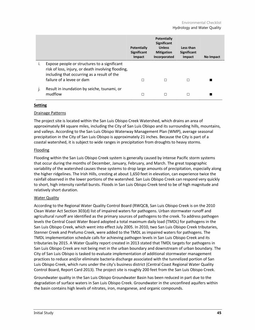
Environmental Checklist
Hydrology and Water Quality
Initial Study 45
Potentially Significant
Impact
Potentially Significant
Unless Mitigation
Incorporated
Less than Significant
Impact No Impact
i. Expose people or structures to a significant risk of loss, injury, or death involving flooding, including that occurring as a result of the failure of a levee or dam □ □ □ ■
j. Result in inundation by seiche, tsunami, or mudflow □ □ □ ■
Setting
Drainage Patterns
The project site is located within the San Luis Obispo Creek Watershed, which drains an area of approximately 84 square miles, including the City of San Luis Obispo and its surrounding hills, mountains, and valleys. According to the San Luis Obispo Waterway Management Plan (WMP), average seasonal precipitation in the City of San Luis Obispo is approximately 21 inches. Because the City is part of a coastal watershed, it is subject to wide ranges in precipitation from droughts to heavy storms.
Flooding
Flooding within the San Luis Obispo Creek system is generally caused by intense Pacific storm systems that occur during the months of December, January, February, and March. The great topographic variability of the watershed causes these systems to drop large amounts of precipitation, especially along the higher ridgelines. The Irish Hills, cresting at about 1,650 feet in elevation, can experience twice the rainfall observed in the lower portions of the watershed. San Luis Obispo Creek can respond very quickly to short, high intensity rainfall bursts. Floods in San Luis Obispo Creek tend to be of high magnitude and relatively short duration.
Water Quality
According to the Regional Water Quality Control Board (RWQCB, San Luis Obispo Creek is on the 2010 Clean Water Act Section 303(d) list of impaired waters for pathogens. Urban stormwater runoff and agricultural runoff are identified as the primary sources of pathogens to the creek. To address pathogen levels the Central Coast Water Board adopted a total maximum daily load (TMDL) for pathogens in the San Luis Obispo Creek, which went into effect July 2005. In 2010, two San Luis Obispo Creek tributaries, Stenner Creek and Prefumo Creek, were added to the TMDL as impaired waters for pathogens. The TMDL implementation schedule calls for achieving pathogen levels in San Luis Obispo Creek and its tributaries by 2015. A Water Quality report created in 2013 stated that TMDL targets for pathogens in San Luis Obispo Creek are not being met in the urban boundary and downstream of urban boundary. The City of San Luis Obispo is tasked to evaluate implementation of additional stormwater management practices to reduce and/or eliminate bacteria discharge associated with the tunnelized portion of San Luis Obispo Creek, which runs under the city’s business district (Central Coast Regional Water Quality Control Board, Report Card 2013). The project site is roughly 200 feet from the San Luis Obispo Creek.
Groundwater quality in the San Luis Obispo Groundwater Basin has been reduced in part due to the degradation of surface waters in San Luis Obispo Creek. Groundwater in the unconfined aquifers within the basin contains high levels of nitrates, iron, manganese, and organic compounds.

City of San Luis Obispo
Palm-Nipomo Parking Structure Project
46
Discussion
a. Would the project violate any water quality standards or waste discharge requirements?
f. Would the project otherwise substantially degrade water quality?
The protection of water quality is under the jurisdiction of the RWQCB, and the preferred project would be required to comply with all state and federal requirements pertaining to the preservation of water quality. As previously discussed, a National Pollution Discharge Elimination System General Permit for Storm Water Discharges Associated with Construction Activities is required when a site involves clearing, grading, disturbances to the ground, such as stockpiling, or excavation that results in soil disturbances of one or more acres of total land area. Coverage under the General Permit must also be obtained prior to construction and the preferred project is subject to these requirements.
Under the conditions of the permit, the City, as the project applicant, would be required to eliminate or reduce non-storm water discharges to waters of the nation, develop and implement a Storm Water Pollution Prevention Plan (SWPPP) for the project construction activities, and perform inspections of the storm water pollution prevention measures and control practices to ensure conformance with the site SWPPP. The state permit prohibits the discharge of materials other than storm water discharges, and prohibits all discharges that contain a hazardous substance in excess of reportable quantities established at 40 CFR 117.3 or 40 CFR 302.4. The state permit also specifies that construction activities must meet all applicable provisions of Sections 30 and 402 of the Clean Water Act. Conformance with Section 402 of the Clean Water Act would ensure that the preferred project does not violate any water quality standards or waste discharge requirements.
In addition, the preferred project and Alternatives 1 and 2 would be required to comply with the City’s and RWQCB’s Post-Construction Stormwater Management Requirements for Development Projects in the Central Coast Region. To demonstrate compliance, a Stormwater Control Plan is required to be submitted for the project. Based on compliance with existing regulations, neither the preferred project nor Alternatives 1 or 2 would violate any water quality standards or waste discharge requirements, or substantially degrade surface or groundwater quality, and potential impacts would be less than significant.
b. Would the project substantially deplete groundwater supplies or interfere substantially with groundwater recharge such that there would be a net deficit in aquifer volume or a lowering or the local groundwater table level (e.g., the production rate of pre-existing nearby wells would drop to a level that would not support existing land uses or planned uses for which permits have been granted)?
The project site is currently developed with an existing City-owned parking lot, five residences, and a detached garage. The preferred project would replace the existing parking lot and buildings with a parking structure, a small commercial space, and theater. Alternative 1 includes a parking structure, small commercial space, four residential units, and theater, while Alternative 2 includes a parking structure, small commercial space, and 22 residential units. Because the current use of the site is developed, the preferred project would not result in additional impervious surface area. The preferred project would also mimic existing on-site drainage patterns. Therefore, the net change in impervious surfaces would not increase and existing drainage patterns would remain the same, the preferred project would not interfere with groundwater recharge.
In addition, the preferred project and alternatives would not interfere with groundwater on-site, due to the depth of groundwater (Earth Systems Pacific 2011), and only two percent of the City’s water supply comes from groundwater sources. Therefore, neither the preferred project nor Alternatives 1 or 2 would substantially deplete groundwater supply, and impacts would be less than significant.

Environmental Checklist
Hydrology and Water Quality
Initial Study 47
c. Would the project substantially alter the existing drainage pattern of the site or area, including by altering the course of a stream or river, in a manner that would result in substantial erosion or siltation on or offsite?
d. Would the project substantially alter the existing drainage pattern of the site or area, including the alteration of the course of a stream or river, or substantially increase the rate or amount of surface runoff in a manner that would result in flooding on or offsite?
e. Would the project create or contribute runoff water that would exceed the capacity of existing or planned stormwater drainage systems or provide substantial additional sources of polluted runoff?
The majority of the project site is covered with impervious surfaces, due to the existing City-owned parking lot, five residences, and detached garage. In addition, the preferred project and Alternatives 1 and 2 would utilize existing drainage infrastructure. As previously mentioned, no net change in impervious surfaces would occur and the existing drainage patterns would remain the same. In addition, neither the preferred project nor alternatives would result in substantial new sources of stormwater runoff. Stormwater runoff rates would be similar to existing conditions and existing stormwater infrastructure would be utilized. Impacts to the existing drainage patterns and drain infrastructure associated with the preferred project and Alternatives 1 and 2 would be less than significant.
g. Would the project place housing in a 100-year flood hazard area as mapped on a federal Flood Hazard Boundary, Flood Insurance Rate Map, or other flood hazard delineation map?
h. Would the project place in a 100-year flood hazard area structures that would impede or redirect flood flows?
The western edge of the project site is within a 100-year flood zone, as designated on the Federal Emergency Management Agency (FEMA) Flood Insurance Rate Map ID 06079C1068F. According to the map, however, the flood elevation is 188 feet, which is two feet below finish floor for the lowest level of the proposed structure (RRM Design 2017). Therefore, neither the preferred project nor Alternatives 1 and 2 would place housing in a 100-year flood hazard or impede or redirect flood flows. No impact associated with the preferred project and Alternatives 1 and 2 would occur.
i. Would the project expose people or structures to a significant risk of loss, injury, or death involving flooding including that occurs as a result of the failure of a levee or dam?
j. Would the project result in inundation by seiche, tsunami, or mudflow?
The project site is located 10 miles from the Pacific Ocean with elevations ranging between 190 and 203 feet above sea level. The project site is not located in a dam inundation area or Tsunami Inundation Zone, as designated by San Luis Obispo County. The potential for a tsunami to affect the site is nil (Earth Systems Pacific 2011). The closest open body of water to the site is Laguna Lake, located approximately 1.63 miles west and separated by Cerro San Luis and associated topography. Given the distance from Laguna Lake and the terrain that exists between the site and the lake, no seiche impact would occur. No impact associated with the preferred project and Alternatives 1 and 2 would occur with respect to flooding as a result of levee or dam failure, or inundation by seiche, tsunami, or mudflow.

City of San Luis Obispo
Palm-Nipomo Parking Structure Project
48
10 Land Use and Planning
Potentially Significant
Impact
Potentially Significant
Unless Mitigation
Incorporated
Less than Significant
Impact No Impact
Would the project have any of the following impacts?
a. Physically divide an established community □ □ □ ■
b. Conflict with any applicable land use plan, policy, or regulation of an agency with jurisdiction over the project (including but not limited to the general plan, specific plan, local coastal program, or zoning ordinance) adopted for the purpose of avoiding or mitigating an environmental effect □ □ ■ □
c. Conflict with an applicable habitat conservation plan or natural community conservation plan □ □ □ ■
Setting
The City has approximately 46,117 residents (California Department of Finance 2016), and covers roughly 13 square miles. Primary land uses include residential development at a low to moderate density, professional services, government facilities, and general retail. The core of the City constitutes a compact urban form, including a downtown area and distinct surrounding neighborhoods. The City is surrounded by a green belt, which defines a separation of urban uses within the City and rural uses outside of the City.
Regulatory Setting
The project site is located within the jurisdiction of the City of San Luis Obispo. The following regulatory framework includes policies identified in the City’s General Plan Land Use Element, Circulation Element, and Conceptual Physical Plan for the City’s Center that apply to the project.
San Luis Obispo City General Plan Land Use Element (2014). The following Land Use Element policies would apply to the preferred project:
4.10 Parking. The city shall ensure there is a diversity of parking opportunities in the Downtown. Any major increments in parking supply should take the form of structures, located at the edges of the commercial core, so people will walk rather than drive between points within the core. Retail uses outside the core, and professional office developments, may have on-site parking for customers and clients.
San Luis Obispo City General Plan Circulation Element (2014). The following Circulation Element policies would apply to the preferred project:
13.2.4 Public Parking Structures. The city shall only approve construction of additional parking structures after considering the findings and results of a parking supply and demand study.

Environmental Checklist
Land Use and Planning
Initial Study 49
The Conceptual Plan for the City’s Center (Downtown Plan 2016). This plan calls for the project area to be developed with cultural facility uses fronting Monterey Street, retail uses fronting Nipomo Street, and a parking structure use fronting Palm Street. The plan also recommends that vehicle congestion in the downtown be minimized by locating parking facilities at the core’s periphery along key streets that enter the City.
Discussion
a. Would the project physically divide an established community?
The project or alternatives would be located on a developed parcel within an urban setting and would not divide an established community. No impact associated with the preferred project or alternatives would occur.
b. Would the project conflict with any applicable land use plan, policy, or regulation of an agency with jurisdiction over the project (including but not limited to the general plan, specific plan, local coastal program, or zoning ordinance) adopted for the purpose of avoiding or mitigating an environmental effect?
The Land Use, Circulation, and Housing Elements of the City’s General Plan, along with the Zoning Ordinance, are the primary land use planning guidance documents for the development pattern of the City. The site’s existing General Plan land use designations are Office and Medium-High Density Residential. Its zoning designation is Office with a Historic Overlay (O-H) and Medium-High Density Residential (R-3). The project would involve a General Plan amendment to amend the General Plan Land Use Map from Office and Medium-High Density Residential to Public and a Zone Change to amend the Zoning Map from Office with a Historic Overlay (O-H) and Medium-High Density Residential (R-3) to Public Facility with a Historic Overlay (PF-H). It would also require the approval of a Use Permit by the Planning Commission to allow the multi-level parking structure and non-profit theater, as well as deviation to otherwise applicable setback requirements and building height limits. Office, retail, and residential uses would be allowed as accessory uses of the parking and theater facilities. In addition, the project would require variances for the floor to area ratio to exceed 1.0 and maximum coverage to exceed 60 percent. Upon approval of the General Plan amendment/Zone Change, Use Permit, and variances, General Plan amendment, and Zone Change, the impacts of which are discussed throughout this document, the project would be consistent with the land use and zoning designations.
The preferred project would be consistent with both Land Use and Circulation Element Policies. Circulation Element Policy 13.2.4 requires completion of a comprehensive parking study prior to development of parking structure projects. Such a study was completed for the proposed structure by an Ad Hoc Parking Review Committee in March 2009; the study determined that a downtown structure will be required to meet the City’s downtown parking needs within the next 5 to 10 years. As such, the preferred project and alternatives would be consistent with the City’s general plan. Impacts associated with the preferred project and Alternatives 1 and 2 would be less than significant.
c. Would the project conflict with an applicable habitat conservation plan or natural community conservation plan?
No habitat conservation or natural community conservation plans that apply to the project site. No impact associated with the preferred project and Alternatives 1 and 2 would occur.

City of San Luis Obispo
Palm-Nipomo Parking Structure Project
50
11 Mineral Resources
Potentially Significant
Impact
Potentially Significant
Unless Mitigation
Incorporated
Less than Significant
Impact No Impact
Would the project have any of the following impacts:
a. Result in the loss of availability of a known mineral resource that would be of value to the region and the residents of the state? □ □ □ ■
b. Result in the loss of availability of a locally important mineral resource recovery site delineated on a local general plan, specific plan, or other land use plan? □ □ □ ■
Setting
According to the City’s Conservation and Open Space Element, quarries and mines in the San Luis Obispo area previously produced basaltic stone, “red rock,” and cinnabar. However, mining is no longer permitted within the City, pursuant to Section 17.08.070 of the Zoning Regulations.
Discussion
a. Would the project result in the loss of availability of a known mineral resource that would be of value to the region and the residents of the state?
b. Would the project result in the loss of availability of a locally important mineral resource recovery site delineated on a local general plan, specific plan, or other land use plan?
The project site is currently developed with an existing City-owned parking lot, four five residential structures, and a detached garage. The preferred project would replace the existing parking lot and buildings with a parking structure, a small commercial space, and theater. Alternative 1 includes a parking structure, small commercial space, four residential units, and theater, while Alternative 2 includes a parking structure, small commercial space, and 22 residential units. As such, neither the preferred project nor Alternatives 1 or 2 would result in the loss of a known mineral resource. Moreover, extraction of mineral resources is not permitted within the City limits. There would be no impact to mineral resources or due to the preferred project or Alternatives 1 or 2.

Environmental Checklist
Noise
Initial Study 51
12 Noise
Potentially Significant
Impact
Potentially Significant
Unless Mitigation
Incorporated
Less than Significant
Impact No Impact
Would the project result in any of the following impacts?
a. Exposure of persons to or generation of noise levels in excess of standards established in the local general plan or noise ordinance, or applicable standards of other agencies ■ □ □ □
b. Exposure of persons to or generation of excessive groundborne vibration or groundborne noise levels ■ □ □ □
c. A substantial permanent increase in ambient noise levels above those existing prior to implementation of the project □ □ ■ □
d. A substantial temporary or periodic increase in ambient noise levels in the project vicinity above those existing prior to implementation of the project ■ □ □ □
e. For a project located in an airport land use plan or, where such a plan has not been adopted, within two miles of a public airport or public use airport, would the project expose people residing or working in the project area to excessive noise levels □ □ □ ■
f. For a project near a private airstrip, would it expose people residing or working in the project area to excessive noise □ □ □ ■
Setting
Sensitive receptors near the project site include adjacent residences to the south and east, the Mission College Preparatory School athletic field to the north, residences across Nipomo Street to the west, and residences and the San Luis Obispo Children’s Museum to the south.
Regulatory Setting
State of California
The State of California has adopted noise standards in areas of regulation not preempted by the federal government. State standards regulate noise levels of motor vehicles, freeway noise affecting classrooms,

City of San Luis Obispo
Palm-Nipomo Parking Structure Project
52
sound transmission control, occupational noise control, and airport noise. The state has also developed land use compatibility guidelines for community noise environments.
The State Office of Noise Control in “Guidelines for the Preparation and Content of Noise Elements of the General Plan,” (November 1988) provided guidance for the acceptability of projects within specific CNEL contours. It diagrammatically identifies “normally acceptable,” “conditionally acceptable,” “normally unacceptable,” and “clearly unacceptable” noise levels for various land use types. For the residential uses, CNEL of up to 60 dBA for low-density residential (65 dBA for multi-family) is normally acceptable. A noise exposure of up to 70 dBA is considered normally acceptable for schools, churches, and libraries.
City of San Luis Obispo
The noise criteria for the City and the State of California for current and projected conditions state that the noise intrusive to interior habitable space of residential units from exterior sources should not exceed 45 decibels (dBA) CNEL. Outdoor living areas are restricted to 60 dB CNEL. Table 7 lists the maximum noise exposure for noise-sensitive uses due to transportation noise sources.
The Noise Element and Noise Guidebook (1996) of the City of San Luis Obispo General Plan uses modified land use compatibility standards recommended by the California Department of Health Services. The City’s maximum noise exposure standards for noise-sensitive land uses (specific to transportation noise sources) are shown in Table 7.
Table 7 Maximum Noise Exposure for Noise-Sensitive Uses Due to Transportation Noise
Sources
Outdoor Activity Areas1 Indoor Spaces
Land Use Ldn or CNEL, in dBA Ldn or CNEL, in dBA Leq in DB2 Lmax in dB3
Residences, hotels, motels, hospitals, nursing homes
60 45 --- 60
Theaters, auditoriums, music halls
--- --- 35 60
Churches, meeting halls, office buildings, mortuaries
60 --- 45 ---
Schools, libraries, museums --- --- 45 60
Neighborhood parks 65 --- --- ---
Playgrounds 70 --- --- ---
Source: City of San Luis Obispo General Plan Noise Element, 1996. 1If the location of the outdoor activity areas is not shown, the outdoor noise standard shall apply at the property line of the
receiving land use. 2As determined for a typical worst-case hour during periods of use. 3Lmax indoor standard applies only to railroad noise at locations south of Orcutt Road.
The City requires that noise generated by new stationary sources be mitigated so as not to exceed the exposure standards shown in Table 8 for noise-sensitive uses, as measured at the property line of the receiver. Table 8 for noise-sensitive uses, as measured at the property line of the receiver.

Environmental Checklist
Noise
Initial Study 53
Table 8 Maximum Noise Exposure for Noise-Sensitive Land Use Areas Due to Stationary
Noise Sources
Daytime (7:00 AM to 10:00 PM)
Nighttime (10:00 PM to 7:00 AM)
Hourly Leq in dB1, 2 50 45
Maximum level in dB1, 2 70 65
Maximum impulsive noise in dB1, 3 65 60 1 As determined at the property line of the receiver. When determining effectiveness of noise mitigation measures, the standards may be applied on the receptor side of noise barriers or other property-line noise mitigation measures. 2 Sound level measurements shall be made with slow meter response. 3 Sound level measurements shall be made with fast meter response. Source: City of San Luis Obispo General Plan Noise Element, 1996.
The City’s Noise Element lists mitigation strategies in a descending order of preference. If preferred strategies are not implemented, it is the responsibility of the project applicant to demonstrate through a detailed noise study that the preferred approaches are either not effective or not practical, before considering other design criteria described in the General Plan. The City considers the following mitigation measures appropriate where existing sound levels significantly impact noise-sensitive land uses, or where cumulative increases in sound levels resulting from new development significantly impact existing noise-sensitive land uses:
1. Rerouting traffic onto streets that can maintain desired levels of service, consistent with the Circulation Element, and which do not adjoin noise-sensitive land uses.
2. Rerouting trucks onto streets that do not adjoin noise-sensitive land uses.
3. Constructing noise barriers.
4. Reducing traffic speeds through street or intersection design methods.
5. Retrofitting buildings with noise-reducing features.
6. Establishing financial programs, such as low-cost loans to owners of a noise-impacted property, or developer fees to fund noise-mitigation or trip-reduction programs.
The following Noise Element policies are applicable to the project and the local noise environment:
Policy 1.4. New Transportation Noise Sources. Noise created by new transportation noise sources, including road, railroad, and airport expansion projects, shall be mitigated to not exceed the levels specified in Table 4.10-3 for outdoor activity areas and indoor spaces of noise-sensitive land uses which were established before the new transportation noise source.
Policy 1.6. New Development and Stationary Noise Sources. New development of noise-sensitive land uses may be permitted only where location or design allow the development to meet the standards of Table 4.10-4, for existing stationary noise sources.
Title 9, Chapter 9.12 (Noise Control) of the City’s Municipal Code specifies noise standards for various categories of land use. These limits, shown in Table 9, would apply to long-term operation of the site, and are not applicable during construction. As shown in Table 10, these noise level standards are not to be exceeded more than 30 minutes in any one hour and noise levels are prohibited from exceeding the noise level standard plus 20 dBA for any period of time.

City of San Luis Obispo
Palm-Nipomo Parking Structure Project
54
Table 9 Exterior Noise Limits (Levels Not To Be Exceeded More Than Thirty Minutes in Any
Hour)
Zoning Category Time Period Noise Level (dBA)
R-1 and R-2 C/OS Low Density Residential 7:00 a.m. – 10:00 p.m. 55
10:00 p.m. – 7:00 a.m. 50
R-3 and R-4 High Density Residential 7:00 a.m. – 10:00 p.m. 55
10:00 p.m. – 7:00 a.m. 50
Office and Public Facility (O and PF) 7:00 a.m. – 10:00 p.m. 60
10:00 p.m. – 7:00 a.m. 55
Neighborhood, Retail, Community, Downtown and Tourist Commercial (C-N, C-R, C-C, C-D, C T)
7:00 a.m. – 10:00 p.m. 65
10:00 p.m. – 7:00 a.m. 60
Source: City of San Luis Obispo Municipal Code.
Table 10 Maximum Time Periods for Increased Noise Levels
Noise Standard for Existing Land Use Maximum Time Period Allowed
+0 dBA 30 minutes/hour
+5 dBA 15 minutes/hour
+10 dBA 5 minutes/hour
+15 dBA 1 minute/hour
+20 dBA Any time
Source: City of San Luis Obispo Municipal Code Section 9.12.060
Table 11 and Table 12 show the City’s maximum allowable noise levels for short-term operation of mobile equipment and long-term operation of stationary equipment at residential properties. Where technically and economically feasible, the City requires that construction activities that use mobile or stationary equipment which may result in noise at residential properties be conducted so that maximum sound levels from mobile equipment at affected properties would not exceed 85 dBA for mixed residential/commercial land uses (Municipal Code 9.12.050). Except for emergency repair of public service utilities, or where an exception is issued by the City Community Development Department, the City prohibits operation of tools or equipment used in construction, drilling, repair, alteration, or demolition work daily between the hours of 7:00 PM and 7:00 AM, or any time on Sundays or holidays, such that the sound creates a noise disturbance across a residential or commercial property line.
Table 11 Maximum Noise Levels for Nonscheduled, Intermittent, Short-term Operation
(Less than Ten Days) of Mobile Equipment
Single-Family Residential
Multi-Family Residential
Mixed Residential/ Commercial
Daily, except Sundays and legal holidays 7:00 a.m. to 7:00 p.m.
75 dBA 80 dBA 85 dBA
Daily, 7:00 p.m. to 7:00 a.m. and all day Sunday and legal holidays
60 dBA 65 dBA 70 dBA

Environmental Checklist
Noise
Initial Study 55
Source: City of San Luis Obispo Municipal Code.
Table 12 Maximum Noise Levels for Repetitively Scheduled and Relatively Long-Term
Operation (Periods of Ten Days or More) of Stationary Equipment
Single-Family Residential
Multi-Family Residential
Mixed Residential/ Commercial
Daily, except Sundays and legal holidays 7:00 a.m. to 7:00 p.m.
60 dBA 65 dBA 70 dBA
Daily, 7:00 p.m. to 7:00 a.m. and all day Sunday and legal holidays
50 dBA 55 dBA 60 dBA
Source: City of San Luis Obispo Municipal Code.
Discussion
a. Exposure of persons to or generation of noise levels in excess of standards established in the local general plan or noise ordinance, or applicable standards of other agencies?
c. A substantial permanent increase in ambient noise levels above levels existing without the project?
The project would introduce new commercial and parking uses on the project site. Existing sensitive uses near the project site and proposed new uses on-site may periodically be subject to noise associated with operation of the project, including stationary equipment, such as heating, ventilation, and air conditioning HVAC systems, trash hauling, parking structure noise, and other general activities associated with commercial and parking activities. However, these on-site sources of operational noise would be similar to those associated with existing nearby commercial uses. Delivery truck and trash hauling trips to the site would be an occasional source of noise, and would be similar in noise level and frequency to existing truck trips associated with other commercial uses located adjacent to the project site. Typical noise sources associated with parking structures include tire squeal, doors slamming, car alarms and horns, and engine start-ups. As a result, impacts would be potentially significant, and this issue will be analyzed in the project EIR.
b. Would the project result in exposure of persons to or generation of excessive groundborne vibration or groundborne noise levels?
Project construction would potentially expose nearby sensitive receptors to a temporary increase in groundborne vibration levels. Groundborne vibration can expose nearby structures to vibration damage or excessive vibration noise. The ground motion caused by vibration is measured as particle velocity in inches per second (in/sec) peak particle velocity (PPV) and is referenced as vibration decibels (VdB). The City of San Luis Obispo considers construction-related vibration significant if construction-related activities create a vibration which is above the vibration perception threshold. The vibration perception threshold is defined in the City of San Luis Obispo Municipal Code (Section 9.12.050) as “The minimum ground or structure-borne vibrational motion necessary to cause a normal person to be aware of the vibration by such direct means as, but not limited to, sensation by touch or visual observation of moving objects. The perception threshold shall be presumed to be a motion velocity of 0.01 in/sec over the range of 1 to 100 Hz.”
In addition, the Federal Transit Administration’s (FTA’s) Transit Noise and Vibration Impact Assessment (2006) guidance is used to determine whether or not groundborne vibration resulting from project-related construction could cause damage to nearby structures. Damage criteria vary depending on the type of building adjacent to the vibration source. For example, for a building that is constructed with reinforced concrete with no plaster, the FTA guidelines state that a continuous vibration level of up to 102 velocity decibels (VdB) (an equivalent to 0.5 in/sec PPV) (FTA May 2006) would not result in any

City of San Luis Obispo
Palm-Nipomo Parking Structure Project
56
construction vibration damage. For older residential structures, the construction vibration damage criterion is 98 VdB (0.3 in/sec PPV). For non-engineered timber and masonry (“fragile”) buildings, the construction vibration damage criterion is 88 VdB (0.1 in/sec PPV).
The FTA guidelines indicate that for fragile structures, such as those located immediately adjacent to the project site, a vibration level in excess of 88 VdB may result in damage. Construction of the proposed parking structure may require the use of driven piles or other construction techniques that would result in vibration levels up to 98 VdB at 50 feet from the source. Therefore, due to the project’s proximity to fragile, historic structures and older residential structures that are sensitive to high levels of groundborne vibration, project construction may result in vibration levels that could cause structural damage to fragile historic structures or older residential structures. As a result, impacts associated with vibration would be potentially significant, and this issue will be analyzed in the project EIR.
d. Would the project result in a substantial temporary or periodic increase in ambient noise levels in the project vicinity above levels existing without the project?
The project would generate temporary noise in the project vicinity during the construction period. The main sources of noise during construction activities would be the heavy machinery used in grading and clearing the site. Average noise levels associated with the use of heavy equipment at construction sites can range from about 76 to 95 dBA at 25 feet from the source, depending upon the types of equipment in operation at any given time and phase of construction (FTA 2006).
In addition, the project would generate construction-related traffic that would occur over the construction period and would vary depending on the stage of construction. Vehicles containing construction materials and equipment would access the site throughout all construction phases. However, construction vehicles would be routed to avoid residential streets. The project would also include the demolition or relocation of the five existing homes and detached garage, which would generate hauling trips to and from the project site. The temporary noise generated by vehicles has the potential to disturb receptors nearby to the project, and along the routes to and from the project site. However, as previously noted, truck trips would be routed to avoid residential streets.
Noise-sensitive uses near the project site include residences to the east, residences immediately adjacent to the project site and across Monterey Street to the south, residential uses across Nipomo Street to the west, and Mission Prep School to the north of Palm Street. These land uses may experience a temporary noise annoyance during construction. Based on current site plans for the project, construction activities may occur within 25 feet or less of the residences to the east of the project site.
The City’s noise standard for short-term construction activities (fewer than ten days) at residential uses is 75 dBA, and the standard for relatively long-term construction activity (10 days or more) at residential uses is 60 dBA. As a result, existing sensitive receptors could be exposed to construction noise that exceeds the City’s applicable standards. Therefore, temporary noise during project construction is a potentially significant impact, and will be analyzed in the project EIR.
e. For a project located in an airport land use plan or, where such a plan has not been adopted, within two miles of a public airport or public use airport, would the project expose people residing or working in the project area to excessive noise levels?
f. For a project within the vicinity of a private airstrip, would the project expose people residing or working in the project area to excessive noise?
The project site is not located within the San Luis Obispo County Regional Airport Land Use Plan or in the vicinity of a private airstrip. Therefore, no impact associated with the preferred project and Alternatives 1 and 2 would result.

Environmental Checklist
Population and Housing
Initial Study 57
13 Population and Housing
Potentially Significant
Impact
Potentially Significant
Unless Mitigation
Incorporated
Less than Significant
Impact No Impact
Would the project result in any of the following impacts?
a. Induce substantial population growth in an area, either directly (e.g., by proposing new homes and businesses) or indirectly (e.g., through extension of roads or other infrastructure) □ □ ■ □
b. Displace substantial amounts of existing housing, necessitating the construction of replacement housing elsewhere □ □ ■ □
c. Displace substantial numbers of people, necessitating the construction of replacement housing elsewhere □ □ ■ □
a. Would the project induce substantial population growth in an area, either directly (for example, by proposing new homes and businesses) or indirectly (for example, through extension of roads or other infrastructure)?
The preferred project does not involve development of residential uses and; therefore, would not induce population growth. However, Alternatives 1 and 2 would include residential units. Alternative 1 would include four units, while Alternative 2 would include 22 residential units. Assuming approximately 2.2 persons per household, Alternatives 1 and 2 would generate a population of 9 and 49 persons, respectively. This number of persons would not represent substantial population growth. In addition, this growth would occur within City limits where it would be served by existing urban services. Moreover, the residential component of Alternatives 1 or 2 would contribute to the housing stock of the City. Impacts associated with the preferred project and Alternatives 1 and 2 would be less than significant.
b. Would the project displace substantial numbers of existing housing, necessitating the construction of replacement housing elsewhere?
c. Would the project displace substantial numbers of people, necessitating the construction of replacement housing elsewhere?
The preferred project would require the demolition of five residences and therefore displace approximately 11 persons. There are an estimated 20,951 housing units and 46,117 people within the City (Department of Finance 2016). While five units and approximately 11 individuals would be displaced, this does not represent a substantial number of people resulting in the need for replacement housing elsewhere. In addition, there are other planned and pending housing projects within the City that would compensate for the loss of housing on the project site. Alternative 1 would include four units, while Alternative 2 would include 22 residential units, which would offset the loss of the existing housing units. Impacts related to the displacement of housing or people associated with the preferred project and Alternatives 1 and 2 would be less than significant.

City of San Luis Obispo
Palm-Nipomo Parking Structure Project
58
14 Public Services
Potentially Significant
Impact
Potentially Significant
Unless Mitigation
Incorporated
Less than Significant
Impact No Impact
Would the project result in any of the following impacts?
a. Would the project result in substantial adverse physical impacts associated with the provision of new or physically altered governmental facilities, or the need for new or physically altered governmental facilities, the construction of which could cause significant environmental impacts, in order to maintain acceptable service ratios, response times or other performance objectives for any of the public services:
1. Fire protection □ □ ■ □
2. Police protection □ □ ■ □
3. Schools □ □ ■ □
4. Parks □ □ ■ □
5. Other public facilities □ □ ■ □
Setting
Fire protection services are provided by the San Luis Obispo City Fire Department (SLOFD). The Fire Administration Department is staffed by four professionals, and the Emergency Response Department which is staffed by 42 firefighters. Services provided by SLOFD include fire response, emergency medical response, hazardous materials response, public assistance, and non-emergency services such as fire and life safety inspections, building inspections, fire code investigations, and public education (SLOFD 2016).
The San Luis Obispo Police Department (SLOPD) provides police protection for the city. The Department has 86.5 employees including 60 sworn police officers. The department is divided into two Bureaus; Operations and Administrative Services. The Operations Bureau includes the Patrol Services Division, the Traffic Safety Unit, Situation Oriented Response Team, and Neighborhood Services. The Administrative Services Bureau includes the Administrative Services Division, Investigative Division, Communications Division, and Records Unit (SLOPD 2016).
The San Luis Coastal Unified School District is the agency primarily responsible for providing school services to the City of San Luis Obispo. The District operates 10 elementary schools, two middle schools, three high schools, and an adult school.
Discussion
a.1. Would the project result in substantial adverse physical impacts associated with the provision of new or physically altered governmental facilities, or the need for new or physically altered governmental facilities, the construction of which could cause significant environmental impacts, in

Environmental Checklist
Public Services
Initial Study 59
order to maintain acceptable service ratios, response times or other performance objectives for fire protection?
Fire protection services for the project would be provided by City Fire Station One, located at 2160 Santa Barbara Avenue, approximately one mile southeast of the project site. The project includes the removal of the existing parking lot, five residential units, and detached garage. Implementation of the preferred project would increase the intensity of use of the site and would marginally increase the demand for fire protection services over existing conditions. The project would be similar to the land uses on surrounding properties, and the site is already served by the City for fire protection. The preferred project does not include residential uses and would not increase the population of San Luis Obispo. Alternative 1 would include up to four residential units, and Alternative 2 would include up to 22 residential units. Neither the preferred project nor the project alternatives would result in substantial new population growth that would require the construction of new fire protection facilities. Therefore, neither the preferred project nor Alternatives 1 or 2 would substantially alter the number of housing units or population in the city or result in the need for new fire protection facilities to serve the site. There would be no physical impacts from the preferred project, Alternative 1, or Alternative 2 related to the construction of new fire protection facilities and impacts related to fire protection would be less than significant.
a.2. Would the project result in substantial adverse physical impacts associated with the provision of new or physically altered governmental facilities, or the need for new or physically altered governmental facilities, the construction of which could cause significant environmental impacts, in order to maintain acceptable service ratios, response times or other performance objectives for police protection?
The project site is within the existing service area of the City of San Luis Obispo Police Department. The project includes the removal of the existing parking lot, five residential units, and detached garage. Implementation of the preferred project would increase the intensity of use of the site and would marginally increase the demand for police protection services over existing conditions. The project would be similar to the land uses on surrounding properties, and the site is already served by the City for police protection. The preferred project does not include residential uses and would not increase the population of San Luis Obispo. Alternative 1 would include up to four residential units, and Alternative 2 would include up to 22 residential units. Neither the preferred project nor the project alternatives would result in substantial new population growth that would require the construction of new police protection facilities. Therefore, neither the preferred project nor Alternatives 1 or 2 would substantially alter the number of housing units or population in the city or result in the need for new police protection facilities to serve the site. There would be no physical impacts related to the construction of new police protection facilities and impacts related to police protection would be less than significant.
a.3. Would the project result in substantial adverse physical impacts associated with the provision of new or physically altered governmental facilities, or the need for new or physically altered governmental facilities, the construction of which could cause significant environmental impacts, in order to maintain acceptable service ratios, response times or other performance objectives for schools?
a.4. Would the project result in substantial adverse physical impacts associated with the provision of new or physically altered governmental facilities, or the need for new or physically altered governmental facilities, the construction of which could cause significant environmental impacts, in order to maintain acceptable service ratios, response times or other performance objectives for parks?
a.5. Would the project result in substantial adverse physical impacts associated with the provision of new or physically altered governmental facilities, or the need for new or physically altered

City of San Luis Obispo
Palm-Nipomo Parking Structure Project
60
governmental facilities, the construction of which could cause significant environmental impacts, in order to maintain acceptable service ratios, response times or other performance objectives for other public facilities?
The project site is located in the existing service area of the City’s schools, parks, and other public facilities. The project includes the removal of the existing parking lot, five residential units, and detached garage. Under the preferred project, the site would be redeveloped with a parking structure, 5,000 square feet of commercial space, and a relocated Little Theatre. The preferred project does not include residential uses and would not increase the population of San Luis Obispo such that it would necessitate the construction of new schools, parks, or other public facilities. However, Alternatives 1 and 2 would include residential units. Alternative 1 would include four units, while Alternative 2 would include 22 residential units. Assuming approximately 2.2 persons per household, Alternatives 1 and 2 would generate a population of 9 and 49 persons, respectively. These alternatives would not substantially alter the number of housing units or population in the city and would not directly result in the need for new park, school, or other government facilities to serve the project; however, the developer would be required to pay a school impact fee as required by Senate Bill 50 (Government Code Section 65970) and a parkland in-lieu fee per the Quimby Act to offset potential impacts on school and park facilities, respectively. Impacts associated with the preferred project and Alternatives 1 and 2 would be less than significant.

Environmental Checklist
Recreation
Initial Study 61
15 Recreation
Potentially Significant
Impact
Potentially Significant
Unless Mitigation
Incorporated
Less than Significant
Impact No Impact
Would the project result in any of the following impacts?
a. Would the project increase the use of existing neighborhood and regional parks or other recreational facilities such that substantial physical deterioration of the facility would occur or be accelerated □ □ ■ □
b. Does the project include recreational facilities or require the construction or expansion of recreational facilities which might have an adverse physical effect on the environment □ □ ■ □
Setting
The City of San Luis Obispo Parks and Recreation Department is responsible for managing and maintaining the City’s eight mini parks, ten neighborhood parks, and eight community parks. Some of the City’s parks are joint-use sites. A wide variety of recreational activities can be conducted at these facilities, including baseball, softball, football, tennis, jogging, swimming, skateboarding, and other passive recreational sports (City of San Luis Obispo 2012).
Discussion
a. Would the project increase the use of existing neighborhood and regional parks or other recreational facilities such that substantial physical deterioration of the facility would occur or be accelerated?
b. Does the project include recreational facilities or require the construction or expansion of recreational facilities which might have an adverse physical effect on the environment?
As discussed under Public Services Impact a.4, the preferred project does not include residential uses and would not increase the population of San Luis Obispo. Therefore, the preferred project would not result in substantial new population growth that would result in physical deterioration of existing recreational facilities or require the construction of new recreational facilities. Alternative 1 would include up to four residential units, and Alternative 2 would include up to 22 residential units, which would generate a population of 9 and 49 persons, respectively; however, the developer would be required to pay a park land in-lieu fee to offset potential impacts on park facilities. Impacts to parks and recreational facilities associated with the preferred project and Alternatives 1 and 2 would be less than significant.

City of San Luis Obispo
Palm-Nipomo Parking Structure Project
62
16 Transportation
Potentially Significant
Impact
Potentially Significant
Unless Mitigation
Incorporated
Less than Significant
Impact No Impact
Would the project result in any of the following impacts?
a. Conflict with an applicable plan, ordinance or policy establishing a measure of effectiveness for the performance of the circulation system, taking into account all modes of transportation, including mass transit and non-motorized travel and relevant components of the circulation system, including but not limited to intersections, streets, highways, and freeways, pedestrian and bicycle paths, and mass transit? ■ □ □ □
b. Conflict with an applicable congestion management program, including, but not limited to level of service standards and travel demand measures, or other standards established by the county congestion management agency for designated roads or highways? ■ □ □ □
c. Result in a change in air traffic patterns, including either an increase in traffic levels or a change in location that results in substantial safety risks? □ □ □ ■
d. Substantially increase hazards due to a design feature (e.g., sharp curves or dangerous intersections) or incompatible use (e.g., farm equipment)? □ ■ □ □
e. Result in inadequate emergency access? □ □ □ ■
f. Conflict with adopted policies, plans, or programs regarding public transit, bikeways, or pedestrian facilities, or otherwise substantially decrease the performance or safety of such facilities? ■ □ □ □
Setting
The city is accessed primarily by roadways including Highway 101, State Route 1, and State Route 227. Routes of regional significance providing access include Los Osos Valley Road, Foothill Road, Broad Street, O’Connor Way, Prefumo Canyon Road, South Higuera Street and Orcutt Road. The local roadway

Environmental Checklist
Transportation
Initial Study 63
system is characterized by a regular street grid in the downtown area and neighborhood street patterns in other parts of the city. According to the Land Use and Circulation Element (LUCE) Update Program EIR (2014), the roadways bounding the project site are classified as local roadways. These facilities are two‐lane streets that provide local access and service. The desired maximum average daily trips for local roadways is 1,500 for local streets that primarily serve residential development and 5,000, for local streets that primarily serve non-residential development.
SLO Transit is the City’s fixed‐route bus program, which serves the public within the city limits, surrounding county areas and the Cal Poly campus. The program operates seven routes throughout the city on weekdays, five routes after‐hours on weekdays during the school year, six routes on Saturdays and four routes on Sundays. In addition to the fixed route system, SLO Transit operates the Downtown Trolley, a shuttle service geared towards visitors that operates Thursdays through Saturdays between the downtown commercial area and hotels located along Monterey Street. The San Luis Obispo Regional Transit Authority (RTA) is a joint powers authority operating fixed‐route bus service in San Luis Obispo County.
Additionally, the incorporated City of San Luis Obispo currently contains:
7.2 miles of Class I Bicycle Paths
29.7 miles of roadway with Class II Bicycle Lanes
24.0 miles of Class III Bicycle Routes
The City maintains sidewalks on almost all City roadways, as well as pedestrian crosswalks throughout the downtown area. Sidewalks are located immediately adjacent to the project boundary along Palm, Nipomo and Monterey Streets.
City Level of Service Standards
The City’s Circulation Element (2014) establishes the following multimodal minimum level of service (LOS) standards:
Bicycle – LOS D (however, bicycle LOS objectives only apply to routes identified in the City’s adopted Bicycle Transportation Plan; as such, this standard is not applicable to this project)
Pedestrian – LOS C
Transit – Baseline LOS or LOS D, whichever is lower (only applies to routes identified in the City’s Short Range Transit Plan; as such, this standard is not applicable to this project)
Vehicle – LOS E or for an intersection or roadway segment in the downtown area
In addition, Table 4 of the Circulation Element identifies maximum average daily trip (ADT) standards for its various roadway classifications. The desired maximum ADT for local roadways is 1,500 for local streets that primarily serve residential development and 5,000 for local streets that primarily serve non-residential development.
The Circulation Element (2014) also establishes priorities of each mode, such that construction, expansion, or alteration for one mode does not degrade the service level of a higher priority mode. In the downtown area, modes are prioritized as follows: 1) pedestrians, 2) bicycles, 3) transit, and 4) vehicle. Exceptions to multimodal priorities may apply when in conflict with safety or regulatory requirements or conflicts with area character, topography, street design, and existing density.
In accordance to the criteria specified in the San Luis Obispo Circulation Element and LUCE Program EIR, a project has a significant impact on the above modes of transportation when it causes an exceedance to one of these LOS standards. For modes already operating below the established LOS standards, any

City of San Luis Obispo
Palm-Nipomo Parking Structure Project
64
further degradation to the LOS score would also be considered a significant impact under CEQA. Impacts are considered significant if the project degrades a higher priority mode.
Discussion
a. Would the project conflict with an applicable plan, ordinance or policy establishing a measure of effectiveness for the performance of the circulation system, taking into account all modes of transportation, including mass transit and non-motorized travel and relevant components of the circulation system, including but not limited to intersections, streets, highways, and freeways, pedestrian and bicycle paths, and mass transit?
b. Would the project conflict with an applicable congestion management program, including, but not limited to level of service standards and travel demand measures, or other standards established by the county congestion management agency for designated roads or highways?
f. Conflict with adopted policies, plans, or programs regarding public transit, bikeways, or pedestrian facilities, or otherwise substantially decrease the performance or safety of such facilities?
The project site is currently developed with an existing City-owned parking lot with 77 parking spaces, five residential structures, and a detached garage. The preferred project would replace the existing parking lot and buildings with an above-ground, five-level parking structure with up to 445 spaces, theater, and 5,000 square feet of commercial space. Alternative 1 would include the parking structure, theater, 2,500 square feet of commercial space, and four residential units. Alternative 2 would include the parking structure, 5,000 square feet of commercial space, and 22 two bedroom residential units.
Table 13 shows the estimated weekday PM peak hour vehicle trips that would be generated by the preferred project. This increase in trips could potentially degrade multi-modal LOS. Impacts are potentially significant and will be further studied in an EIR.
Table 13 Estimated Project Vehicle Trip Generation (Weekday PM Peak Hour)
Land Use In Out Weekday Peak PM Hour
Parking Structure1 118 147 265
Commercial Space 2 1 7 8
SLO Little Theatre3 15 15 30
Total 134 169 303
1 Rates derived from counts at 919 Palm parking structure; average of Tuesday and Wednesday. Estimate reflects 368 net new spaces (445 new minus 77 existing)
2 ITE Trip Generation Manual, Land Use Code 710, General Office Building. Average rate used for Peak Hour trips.
3 Estimated based on information provided by Little Theatre staff.
Source: Central Coast Transportation Consulting (2017)
c. Would the project result in a change in air traffic patterns, including either an increase in traffic levels or a change in location that results in substantial safety risks?
The project site is not located in the San Luis Obispo County Regional Airport Plan Area and would not result in an increase of air traffic levels or a change to air traffic patterns. Therefore, there would be no impact.
d. Would the project substantially increase hazards due to a design feature (e.g., sharp curves or dangerous intersections) or incompatible use (e.g., farm equipment)?
Vehicle Site Access and On-Site Circulation

Environmental Checklist
Transportation
Initial Study 65
Access to the project site would be from Palm Street, with secondary access along Nipomo Street, as shown on Figure 3. There would be one lane for ingress and one lane for egress at each driveway. The service rate of vehicles entering and leaving a parking facility is a function of the entrance approach, driver familiarity, internal circulation, volume of traffic on adjacent streets, and number of pedestrian conflicts.
The type of parking control affects the number of vehicles that can be served in a given hour at a parking garage entry. Typical entrance and exit parking control service rates range from 100 to 400 vehicles per hour, per lane. The project traffic analysis used with an entry service rate of 134 vehicles per hour per lane (see Table 13). The City of San Luis Obispo uses different exit control devices in its parking structures for which the service rates can vary. However, on-site queuing at exit gates is less critical since queuing occurs within the parking structure. The current project site plan shows an entrance that can store up to two vehicles, which means each service gate can serve up to 110 vehicles per hour per lane before queuing onto the street in most conditions. Given two service gates and a peak-hour inbound volume of 134 vehicles, the entrance capacity would be adequate. All estimated approaches and departures are estimated to have a maximum queue of less than 50 feet. With low volumes on Nipomo Street and Dana Street, the number of potential conflicts with vehicles entering and exiting the proposed parking structure is expected to be infrequent. Vehicle site access would be adequate and impacts would be less than significant.
Vehicle-Pedestrian Conflicts
Long curb extensions along the project frontage would prevent architectural elements immediately adjacent to the driveways from hindering the ability of drivers exiting the parking structure to see pedestrians walking along the sidewalk adjacent to the parking structure, or vice-versa.
The community outreach identified concerns related to speeding and vehicle-pedestrian conflicts at the existing offset intersection of Nipomo Street between Dana Street and Monterey Street. The project is not proposing to modify this intersection; therefore, the project is not expected to create a new operational condition at this intersection. The City of San Luis Obispo has an adopted Operating Policy for Pedestrian Crosswalks (January 2000) that establishes guidelines on where pedestrian crosswalks, pedestrian traffic control warning devices and other miscellaneous pedestrian control devices are installed on City streets. Compliance with the San Luis Obispo Municipal Code would ensure that impacts related to vehicle-pedestrian conflicts would be less than significant.
Pedestrian and Bicycle Access
The preferred project is expected to generate some pedestrian and bicycle demand by patrons and employees using the parking structure, as well as employees at and visitors to the Little Theatre and commercial space. Alternatives 1 and 2 would also generate some pedestrian and bicycle demand by residents. Most of the pedestrian destinations would be the existing and planned land uses towards the downtown core along the north and south sides of Palm Street and east side of Nipomo Street. Pedestrian access would be provided at each staircase in three of the four corners of the parking structure, which would provide direct access to the parking structure and adjacent and nearby land uses. Per City requirements, the project will maintain the existing sidewalks on the north and west sides of the project frontage. Thus, the existing and proposed pedestrian facilities can reasonably accommodate the increased demand and the newly constructed pedestrian facilities will not conflict with planned facilities; therefore, impacts to pedestrian facilities are anticipated to be less than significant.
Bicycle parking would be provided on the southern side of the parking structure near the project driveway at Nipomo Street in accordance with the bicycle parking space requirements in the San Luis Obispo Municipal Code (§17.16.060).The existing bicycle facilities can reasonably accommodate the
City of San Luis Obispo
Palm-Nipomo Parking Structure Project
66
increased demand, and implementation of the preferred project and Alternatives 1 and 2 will not conflict with any planned facility; therefore, less than significant bicycle impacts are anticipated.
The project site plan does not identify any modifications or enhancements to existing transit facilities. It does not conflict with the existing transit system or planned transit system. Based on the project impact criteria listed above, the preferred project and Alternatives 1 and 2 will have a less than significant impact on transit facilities.
Project Construction
This construction period of the preferred project would result in short-term construction traffic, construction parking, and modifications to existing pedestrian, bicycle, and transit circulation during the construction period. The traffic associated with the construction of the project could be a potentially significant impact. The preparation of a construction management plan, as described in Mitigation Measure T-1 would reduce construction impacts to less-than-significant levels. Impacts associated with the preferred project and Alternatives 1 and 2 would be less than significant with mitigation.
T-1 Construction Management Plan. Prior to the issuance of each building permit, the construction contractor shall meet with the Public Works department to determine traffic management strategies to reduce, to the maximum extent feasible, traffic congestion and the effects of parking demand by construction workers during construction of this project. The construction contractor will develop a construction management plan for review and approval by the Public Works department. The plan should include at least the following items and requirements:
A set of comprehensive traffic control measures, including scheduling of major truck trips and deliveries to avoid peak traffic and pedestrian hours, detour signs if required, lane closure procedures, sidewalk closure procedures, signs, cones for drivers, and designated construction access routes.
Notification procedures for adjacent property owners and public safety personnel regarding when major deliveries, detours, and lane closures will occur.
Location of construction staging areas for materials, equipment, and vehicles (must be located on the project site).
Identification of haul routes for movement of construction vehicles that would minimize impacts on vehicular and pedestrian traffic, circulation and safety; and provision for monitoring surface streets used for haul routes so that any damage and debris attributable to the haul trucks can be identified and corrected by the project applicant.
Temporary construction fences to contain debris and material and to secure the site.
Provisions for removal of trash generated by project construction activity.
A process for responding to and tracking complaints pertaining to construction activity.
Provisions for monitoring surface streets used for truck routes so that any damage and debris attributable to the trucks can be identified and corrected.
It is anticipated that this Construction Traffic Management Plan would be developed in the context of a larger Construction Management Plan, which would address other issues such as hours of construction on site, limitations on noise and dust emissions, and other applicable items.
e. Would the project result in inadequate emergency access?

Environmental Checklist
Transportation
Initial Study 67
Access to the project site would be from Palm Street, with secondary access along Nipomo Street. Proposed internal roadways and access points would be sized to accommodate emergency vehicles per City of San Luis Obispo Fire Department standards and would therefore provide adequate emergency access. No impact would result.

City of San Luis Obispo
Palm-Nipomo Parking Structure Project
68
17 Utilities and Service Systems
Potentially Significant
Impact
Potentially Significant
Unless Mitigation
Incorporated
Less than Significant
Impact No Impact
Would the project result in any of the following impacts?
a. Exceed wastewater treatment requirements of the applicable Regional Water Quality Control Board □ □ ■ □
b. Require or result in the construction of new water or wastewater treatment facilities or expansion of existing facilities, the construction of which could cause significant environmental effects □ □ ■ □
c. Require or result in the construction of new storm water drainage facilities or expansion of existing facilities, the construction of which could cause significant environmental effects □ □ ■ □
d. Have sufficient water supplies available to serve the project from existing entitlements and resources, or are new or expanded entitlements needed □ □ ■ □
e. Result in a determination by the wastewater treatment provider which serves or may serve the project that it has adequate capacity to serve the project’s projected demand in addition to the provider’s existing commitments □ □ ■ □
f. Be served by a landfill with sufficient permitted capacity to accommodate the project’s solid waste disposal needs □ □ ■ □
g. Comply with federal, state, and local statutes and regulations related to solid waste □ □ ■ □
Setting
Wastewater
The City’s wastewater collection system and Water Resource Recovery Facility (WRRF) is managed by the Utilities Department. The wastewater collection system consists of approximately 136 miles of gravity sewer lines, three miles of force main, and nine sewer lift stations. Wastewater is conveyed to the WRRF, located on Prado Road near U.S. Highway 101. The WRRF removes larger material, treats the waste stream to reduce the amount of nutrients and bacteria, separates sludge, and discharges treated effluent

Environmental Checklist
Utilities and Service Systems
Initial Study 69
into San Luis Obispo Creek near Los Osos Valley Road and is distributed as recycled water for irrigation. The sludge is separated from the wastewater, dried in open ponds at the WRRF, and hauled away for disposal.
The WRRF treats about 4.5 million gallons per day (mgd) during dry weather conditions. The current treatment capacity of the WRRF during dry weather conditions is 5.1 mgd. Therefore, the WRRF currently has excess capacity of 0.6 mgd. Average dry weather treatment flows have been stable over the past several years due to a balance between increased population and improved water conservation. In 2015, average flows to the WRRF were approximately 3.5 mgd.
Water
The City Utilities Department provides water service throughout the City. The City obtains water from five sources: Salinas Reservoir (Santa Margarita Lake), Whale Rock Reservoir, Nacimiento Reservoir, recycled water from the City’s Water Resource Recovery Facility, and a limited amount of groundwater. The water is treated at the City water treatment plant prior to distribution. Total annual water use in the City was 5,541 acre feet in 2012. The 2014 Land Use and Circulation Element Update estimated that water demand will increase to 7,815 acre feet per year upon build-out. The estimated water supply is 9,980 acre feet, including the City’s primary water supply (7,815 acre feet), reliability reserve (1,214 acre feet), and secondary water supply (951 acre feet). Based on the City’s Urban Water Management Plan and 2014 Land Use and Circulation Element Final EIR, the City does not anticipate a need for supplemental water supplies through the year 2035 and build-out of the LUCE. The City’s 2015 Urban Water Management Plan incorporates mandated water conservation targets in response to the severe drought conditions. The City’s 2015 interim target gallons per capita per day (GPCD) was 120, and the actual 2015 GPCD was 92; as noted in the Draft Plan, the City met and surpassed 2015 interim water use reduction targets.
Stormwater
The City’s stormwater drainage system is a separate system that collects surface runoff and conveys it to community retention basins, such as parks, local lakes, and creeks. San Luis Obispo Creek is the main tributary in the City, discharging into the Pacific Ocean at Avila Bay. The City’s stormwater drainage system currently consists of 59 miles of storm sewer with 2,148 drainage inlets and 490 storm drain manholes (City of San Luis Obispo 2010).
Solid Waste
The regional waste collection facility is Cold Canyon Landfill, located approximately six miles south of the City on Highway 227. The San Luis Garbage Company is the sole provider of solid-waste collection services in the City. The San Luis Obispo County Integrated Waste Management Authority estimates that the daily per capita solid waste disposal rate from all sources in the State of California is approximately 4 to 5 pounds. Cold Canyon Landfill is currently (2012) permitted to receive up to 1,620 tons of solid waste per day, with an estimated remaining capacity of 1,830,000 cubic yards (16.8 percent remaining capacity).
Discussion
a. Would the project exceed wastewater treatment requirements of the applicable Regional Water Quality Control Board?
b. Would the project require or result in the construction of new water or wastewater treatment facilities or expansion of existing facilities, the construction of which could cause significant environmental effects?

City of San Luis Obispo
Palm-Nipomo Parking Structure Project
70
e. Would the project result in a determination by the wastewater treatment provider which serves or may serve the project that it has adequate capacity to serve the project’s projected demand in addition to the provider’s existing commitments?
The project site is currently developed with an existing City-owned parking lot, five residential structures, and a detached garage. The preferred project would replace the existing parking lot and buildings with a parking structure, a small commercial space, and theater. Alternative 1 includes a parking structure, small commercial space, four residential units, and theater, while Alternative 2 includes a parking structure, small commercial space, and 22 residential units. The preferred project and alternatives would result in an incremental increase in demand on City infrastructure, including water, wastewater, and storm water facilities. Development of the site would be served by City sewer and water service, which both have adequate capacity to serve the use (LUCE EIR 2014). Currently, storm water facilities exist in the vicinity of the project site, and it is not anticipated the proposed project will result in the need for new facilities or expansion of existing facilities, which could have significant environmental effects. Further, water and wastewater impact fees would be required and are set at a level intended to offset the potential impacts of new development. Impact fees are collected at the time building permits are issued. Impacts from the preferred project and Alternatives 1 and 2 would be less than significant.
d. Would the project have sufficient water supplies available to serve the project from existing entitlements and resources, or are new or expanded entitlements needed?
The project site is currently developed with an existing City-owned parking lot, five residential structures, and a detached garage. The preferred project would replace the existing parking lot and buildings with a parking structure, a small commercial space, and theater. Alternative 1 includes a parking structure, small commercial space, four residential units, and theater, while Alternative 2 includes a parking structure, small commercial space, and 22 residential units. Therefore, Alternative 1 would result in no net increase in residential units and Alternative 2 would result in a net increase of 17 residential units. Assuming approximately 2.2 persons per household, Alternatives 2 would generate a net population approximately 37 persons. Based on a per capita water use of 119 gallons per day, Alternative 2 would have a water demand of approximately 1.4 acre feet per year. Based on this incremental increase in water demand, and adequate capacity, impacts would be less than significant.
c. Would the project require or result in the construction of new storm water drainage facilities or expansion of existing facilities, the construction of which could cause significant environmental effects?
The majority of the project site is covered with impervious surfaces, including an existing City-owned parking lot, five residences, and a detached garage. The net change in impervious surfaces between existing uses and the proposed parking structure would be minimal, and the existing drainage patterns would remain the same. Therefore, the preferred project would utilize the existing drainage infrastructure and no new or expanded facilities would be required. Impacts to storm water drainage facilities associated with the preferred project and alternatives would be less than significant.
f. Would the project be served by a landfill with sufficient permitted capacity to accommodate the project’s solid waste disposal needs?
g. Would the project comply with federal, state, and local statutes and regulations related to solid waste?
Solid waste would be generated during construction and demolition of the existing parking lot and residential structures. Construction waste would be temporary in nature, and in accordance with AB 341, would be required to divert 50 percent of construction waste from landfills, which would minimize potential impacts to the Cold Canyon Landfill. The amount of waste generated from operation of the project or Alternative 1 and 2 would be minimal. San Luis Garbage Company and Cold Canyon Landfill

Environmental Checklist
Utilities and Service Systems
Initial Study 71
have adequate capacity to serve the preferred project and Alternatives 1 and 2. Impacts would be less than significant.

City of San Luis Obispo
Palm-Nipomo Parking Structure Project
72
18 Mandatory Findings of Significance
Potentially Significant
Impact
Potentially Significant
Unless Mitigation
Incorporated
Less than Significant
Impact No Impact
a. Does the project have the potential to substantially reduce the habitat of a fish or wildlife species, cause a fish or wildlife population to drop below self- sustaining levels, eliminate a plant or animal community, reduce the number or restrict the range of a rare or endangered plant or animal or eliminate important examples of the major periods of California history or prehistory? ■ □ □ □
b. Does the project have impacts that are individually limited, but cumulatively considerable? (“Cumulatively considerable” means that the incremental effects of a project are considerable when viewed in connection with the effects of past projects, the effects of other current projects, and the effects of probable future projects)? ■ □ □ □
c. Does the project have environmental effects which will cause substantial adverse effects on human beings, either directly or indirectly? ■ □ □ □
a. Does the project have the potential to substantially reduce the habitat of a fish or wildlife species, cause a fish or wildlife population to drop below self- sustaining levels, eliminate a plant or animal community, reduce the number or restrict the range of a rare or endangered plant or animal or eliminate important examples of the major periods of California history or prehistory?
Based upon the analysis throughout this Initial Study, the preferred project and Alternatives 1 and 2 would not have the potential to substantially reduce the habitat of a fish or wildlife species or cause a fish or wildlife population to drop below self-sustaining levels, eliminate a plant or animal community, or reduce or restrict the range of a rare or endangered plant or animal. However, the project site does contain resources that may be historically or culturally significant. The impacts on these resources will be evaluated in the EIR. These effects towards cultural resources are potentially significant.
b. Does the project have impacts that are individually limited, but cumulatively considerable? (“Cumulatively considerable” means that the incremental effects of a project are considerable when viewed in connection with the effects of past projects, the effects of other current projects, and the effects of probable future projects)?
With the exception of transportation and noise, which will be evaluated in the EIR, the impacts of the preferred project and Alternatives 1 and 2 are individually limited and not considered “cumulatively

Environmental Checklist
Mandatory Findings of Significance
Initial Study 73
considerable.” Although incremental changes in certain issue areas can be expected as a result of the preferred project and Alternatives 1 and 2, all environmental impacts that could occur as a result of the preferred project would be reduced to a less than significant level through compliance with existing regulations discussed in this Initial Study and/or implementation of the mitigation measures recommended in this Initial Study for the following resource areas:, air quality (AQ-1 and 2), biological resources (BIO-1), geology and soils (GEO-1), and hazards and hazardous materials (HAZ-1). The cumulative effects of the preferred project and Alternatives 1 and 2 on noise and traffic are potentially significant and will be evaluated in the EIR.
c. Does the project have environmental effects which will cause substantial adverse effects on human beings, either directly or indirectly?
The preferred project and Alternatives 1 and 2 may result in potential adverse impacts to human beings. Mitigation measures are proposed to reduce impacts related to air quality, geology and soils, and hazards and hazardous materials. However, impacts to aesthetics, noise, and transportation are potentially significant. These impacts will be analyzed further in the EIR.

City of San Luis Obispo
Palm-Nipomo Parking Structure Project
74
References and Preparers
References
Applied EarthWorks, Inc. Cultural Resources Inventory for the Palm-Nipomo Parking Structure. San Luis Obispo, California. June 2011.
California Air Pollution Control Officers Association (CAPCOA). CEQA and Climate Change whitepaper. January 2008. Available at: www.capcoa.org/wp-content/uploads/2012/03/CAPCOA-White-Paper.pdf
California Climate Action Registry. January 2009. General Reporting Protocol. Available at: www.climateregistry.org/tools/protocols/general-reporting-protocol.html
California Department of Conservation, Division of Mines and Geology. Probabilistic Seismic Hazard Assessment for the State of California, DMG Open-file Report 96-08. 1996.
California Department of Conservation, Division of Mines and Geology. Guidelines for Evaluating and Mitigating Seismic Hazards in California, Special Publication 117. Revised 2008.
California Department of Finance. Population and Housing Estimates for Cities, Counties, and the State, 2011-2016. Available at: www.dof.ca.gov/HTML/DEMOGRAP/ReportsPapers/ReportsPapers.php.
California Department of Fish and Game, 2011. Biogeographic Information and Observation System Viewer. Accessed October 18, 2016. Available at: http://bios.dfg.ca.gov/.
California Department of Fish and Wildlife. California Natural Diversity Database: Commercial Version. Accessed October 18, 2016.
California Department of Health Services, Office of Noise Control. Guidelines for the Preparation and Content of Noise Elements of the General Plan. November 1988.
California Department of Transportation. Transportation- and Construction-Induced Vibration Guidance Manual. June 2004.
California Department of Toxic Substances Control, State of. EnviroStor Database. Accessed October 2016. Available at: www.envirostor.dtsc.ca.gov/public/
California Energy Commission (CEC). California Energy Demand 2010-2020 - Commission Adopted Forecast and Demand Forecast. Adopted December 2, 2009. Publication # CEC-100-2009-012-CMF. Available at: www.energy.ca.gov/2009publications/CEC-200-2009-012/index.html
California Water Resources Control Board, State of. GeoTracker Database. Accessed October 2016. Available at: http://geotracker.waterboards.ca.gov/
Central Coast Transportation Consulting. Draft Estimated Project Vehicle Trip Generation (Weekday PM Peak Hour). January 2017.
Earth Systems Pacific. Geotechnical, Geologic, and Hazardous Materials Assessment Report Palm and Nipomo Parking Structure. April 21, 2011.

References and Preparers
Initial Study 75
Hanson, Carl E., Towers, David A., and Meister, Lance D. Transit Noise and Vibration Impact Assessment. Federal Transit Administration, Office of Planning and Environment. May 2006. Available at: www.fta.dot.gov/documents/FTA_Noise_and_Vibration_Manual.pdf
Intergovernmental Panel on Climate Change (IPCC). Climate Change 2007: The Physical Science Basis. Contribution of Working Group I to the Fourth Assessment Report of the Intergovernmental Panel on Climate Change [Solomon, S., D. Qin, M. Manning, Z. Chen, M. Marquis, K.B. Averyt, M.Tignor and H.L. Miller (eds.)]. Cambridge University Press, Cambridge, United Kingdom and New York, NY, USA
Kleinfelder, Inc. June 8, 2005. Constraints Level Environmental and Geotechnical Assessment Proposed Palm-Nipomo Garage Site, San Luis Obispo, California.
Morro Group. Cold Canyon Landfill Expansion Draft Environmental Impact Report. January 15, 2009. Available at: www.slocounty.ca.gov/planning/environmental/EnvironmentalNotices/Environmental_Impact_Reports_2009.htm
RRM Design. E-mail correspondence with Jerry Michael. April 4, 2017.
Regional Water Quality Control Board, Central Coast Region 3. Watershed Management Initiative. January 2002. Available at: www.waterboards.ca.gov/centralcoast/publications_forms/publications/basin_plan/
San Luis Obispo Air Pollution Control District. 2001 Clean Air Plan, San Luis Obispo County. December 2001. Available at: www.slocleanair.org/images/cms/upload/files/business/pdf/CAP.pdf
San Luis Obispo Air Pollution Control District. CEQA Air Quality Handbook. April 2012. Available at: http://www.slocleanair.org/images/cms/upload/files/CEQA_Handbook_2012_v1.pdf
San Luis Obispo Air Pollution Control District. Greenhouse Gas Thresholds and Supporting Evidence March 2012. Available at : www.slocleanair.org/images/cms/upload/files/Greenhouse%20Gas%20Thresholds%20and%20Supporting%20Evidence%204-2-2012.pdf
San Luis Obispo Air Pollution Control District. 2015 Annual Air Quality Report. http://www.slocleanair.org/images/cms/upload/files/2015aqrt-FINAL.pdf
San Luis Obispo, City of. Airport Area Specific Plan. Revised September 2014. Available at: www.slocity.org/home/showdocument?id=4294
San Luis Obispo, City of. Community Design Guidelines. June 2010. Available at: www.slocity.org/communitydevelopment/download/Community%20Design%20Guidelines/CDG%20Update%203.8_final.pdf
San Luis Obispo, City of. Historic Preservation Program Guidelines. November 2010. www.slocity.org/home/showdocument?id=4144
San Luis Obispo, City of. Fire Department. 2016. Available at: www.slocity.org/fire/about.asp
San Luis Obispo, City of. Historic Preservation Program Guidelines. November 2010.
San Luis Obispo, City of. General Plan. Conservation and Open Space. Revised April 4, 2006. Available at: www.slocity.org/communitydevelopment/download/unifiedgeneralplan/Chapter6-COSE.pdf
San Luis Obispo, City of. General Plan. Circulation. December 2014. Available at: www.slocity.org/home/showdocument?id=6637

City of San Luis Obispo
Palm-Nipomo Parking Structure Project
76
San Luis Obispo, City of. General Plan. Housing. 2015. Available at: www.slocity.org/home/showdocument?id=6639
San Luis Obispo, City of. General Plan. Land Use. June 2014. Available at: www.slocity.org/communitydevelopment/download/unifiedgeneralplan/Chapter1-Land%20Use%20June2010.pdf
San Luis Obispo, City of. General Plan. Noise. 1996. Available at: www.slocity.org/home/showdocument?id=6643
San Luis Obispo, City of. Waterway Management Plan. 2003. Available at: www.slocountywater.org/site/Flood%20Control%20and%20Water%20Conservation%20District%20Zones/ZONE%209/pdf/wmp.pdf
San Luis Obispo, City of. General Plan. Safety. March 2014. Available at: www.slocity.org/home/showdocument?id=6645
San Luis Obispo, City of. General Plan. Water and Wastewater. July 2010. Available at: www.slocity.org/home/showdocument?id=6649
San Luis Obispo, City of. Land Use and Circulation Element Update Program EIR. September 2014. Available at: www.slocity.org/home/showdocument?id=6719
San Luis Obispo, City of. Municipal Code. October 2016. Available at: www.codepublishing.com/ca/sanluisobispo/
San Luis Obispo, City of. Parks and Recreation Department. October 2016 Available at: www.slocity.org/parksandrecreation/index.asp
San Luis Obispo, City of. Police Department. 2016. Available at: www.slocity.org/police/about.asp
San Luis Obispo, City of. Water Resources Report. 2015. Available at: www.slocity.org/home/showdocument?id=6371
San Luis Obispo, County of. Land Use and Circulation Elements –The Area Plans (Inland). http://www.slocounty.ca.gov/Assets/PL/Area+Plans/The+Area+Plans+(Inland).pdf
South Coast Air Quality Management District. California Emissions Estimator Model User’s Guide. Version 2016.3.1. September 2016. Available online at: http://www.aqmd.gov/docs/default-source/caleemod/upgrades/2016.3/01_user-39-s-guide2016-3-1.pdf?sfvrsn=2
Southern California Earthquake Center. Seismic Hazards in California: Probable Earthquakes, 1994-2024. 1995.
United States Department of Agriculture. Natural Resources Conservation Service (NRCS). Web Soil Survey. Accessed August 2, 2012. http://websoilsurvey.nrcs.usda.gov/app/.
United States Fish and Wildlife Service. 2011. Critical Habitat Portal. Available online at: http://criticalhabitat.fws.gov. Last accessed on July 26, 2012.
List of Preparers
Rincon Consultants, Inc. prepared this Initial Study under contract to the City of San Luis Obispo. Persons involved in data gathering analysis, project management, and quality control include the following.
RINCON CONSULTANTS
Richard Daulton, Principal

References and Preparers
Initial Study 77
Shauna Callery, Senior Environmental Planner
Chris Bersbach, Senior Environmental Planner
Nikolas Kilpelainen, Associate Environmental Planner
Amanda Ross, Associate Environmental Planner