oregon, the beautiful - oregon historical society and love, oregon, the beautiful this mezzotint by...
TRANSCRIPT

OHQ vol. , no.
Ives Goddard and Thomas Love
Oregon, the Beautiful
© Oregon Historical Society
Generations of scholars have had to confront two con- founding questions in their efforts to resolve the meaning of Oregon, “the most disputed of U.S. names.” The general course of the history of the name can be traced with reason-
able certainty after , when Robert Rogers first referred to “the River called by the Indians Ouragon” in a petition to the king of England. But what is the origin of the word itself? From which Indian language did it come, and what did it mean? And what were Rogers’s reasons for using this name to refer to the goal of his exploration?
Adding fresh historical and linguistic evidence, we build on existing research to answer both questions. The evidence we have uncovered for the origin of Oregon in the Algonquian languages of New England sup-plies the missing link between Rogers and a plausible linguistic source. We construct a scenario grounded in historical fact to explain how Rogers likely learned this term from New England Indians and applied it to the fabled River of the West, whose existence was rumored but whose name was unknown.
To solve the mystery of Oregon, we must investigate the history of exploration by the French and the British, early maps, and long-forgotten Indian dialects. We must supplement the tools of historical research with those of linguistics and delve into details of spelling and pronunciation. The story we will uncover draws together Indians and Europeans, French and British, and West and East and provides a new perspective for under-standing the broader currents of the history of which it forms a part.
An overview of the long-running debate on the meaning of Oregon must begin with the pivotal contributions made in the early s by T.C. Elliott. While previous research had credited the name Oregon to the ex-plorer Jonathan Carver, Elliott showed that Carver’s use of the name was

Goddard and Love, Oregon, the Beautiful
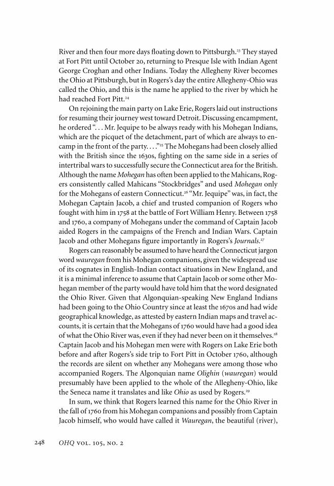
This mezzotint by Thomas Hart, engraved in London in , is the best-known image of Major Robert Rogers; there are no known images of him taken from life.
derived entirely from his associate Robert Rogers, a well-known British American army officer in the French and Indian War. Rogers used the name in the petition he submitted to the Board of Trade and Plantations when he was in London in August .
Any compelling explication of the matter, therefore, must put Rogers at the center of the account and must be directed to the period before .
Courtesy of the Fort Ticonderoga Museum, Ticonderoga, New York

OHQ vol. , no.
None of the solutions offered since Elliott’s work was published do this. Instead, various authors have dwelt on perceived word similarities, the most promising of which seems to have been Vernon Snow’s comparison of Oregon to ouragan — a Canadian French word for a birch-bark dish, borrowed from Algonquian — because it was an attempt to find a word of Indian origin that Rogers could have known.
Most recently, Scott Byram and David Lewis made an ingenious pro-posal that ooligan, a Chinook Jargon term for an oily fish widely traded in coastal British Columbia, found its way across the Rockies to the Great Lakes region. They suggest — though they have no direct evidence for this — that Rogers may have heard the term and connected it with the River of the West. Although theirs is a valuable ethnographic account of the regional grease trade, they do not engage Elliott’s argument or address the central questions: Where did Rogers learn the term, and why would he have used it to name the River of the West? Tantalizing as their sugges-tion may be and while it would not defy the laws of physics, we agree with anthropologist Yvonne Hajda that it is virtually impossible that Chinook Jargon would have been heard in the Great Lakes area by — when Rogers was last in Michigan — even if, against all evidence, it was by then already in existence. We concur with their main point, however: that com-plex trade networks extended across vast reaches of North America before and after European arrival and that Indians sometimes had knowledge of distant places. Rogers clearly drew on Indian geographic knowledge both before and after , as we will show.
One way to approach the question of Rogers’s possible sources of information is to ask whether there was a river with an Indian name that was similar to Ouragon and that he would have known. It has not previously been pointed
out (except by the long-forgotten philologist J. Hammond Trumbull) that there was indeed a river with such a name. The Western Abenaki Indi-ans of northern New England referred to the Ohio River as Olighin (in French spelling, but pronounced as if “Oliguine”), a word meaning “it is good, it is beautiful.” The same word was used by Connecticut Indians in the form wauregan (English spelling; pronounced wau-REE-g’n) as their pidgin word for “good, beautiful,” and Robert Rogers is known to have used Connecticut Indians as auxiliary troops.
The languages of northern and southern New England were closely related members of the eastern branch of the widespread Algonquian family. The appearance of the sound [l] in one language where another

Goddard and Love, Oregon, the Beautiful
has the sound [r] is an example of the slight but regular differences in pronunciation that Algonquian languages show. Roger Williams noted in , for example, that the word for “dog” was pronounced anùm by the Coweset of present-day central Rhode Island, ayím by the Narragansett of southern Rhode Island, arúm by the Indians of western Connecticut (he could have added central Connecticut), and alùm by those of the Con-necticut River valley in central Massachusetts. In , John Eliot added that [n] was also the sound used in Massachusett, the Indian language of eastern Massachusetts, and that [r] was used by the Eastern Abenakis of Maine. In some cases, these sounds shifted after European contact. The [r] prounounced in Eastern Abenaki in the seventeenth and eighteenth centuries shifted to [l] in the nineteenth and twentieth centuries.
The New England Indians’ name for the Ohio River is preserved in the records of one of the most famous events in the history of seventeenth-century North America: René-Robert Cavelier de la Salle’s exploration of the Mississippi River in . It is seldom noted that La Salle’s guides were not midwestern Indians but a group of men from various Algonquian-speaking tribes of New England and vicinity. They had become disen-chanted with life among the English, particularly after King Philip’s War in –, and had moved to the upper Great Lakes within the French sphere of influence. Some had brought wives with them, and some had married local women in the West. La Salle met most of them in January or February when they showed up at the fort he had built at the mouth of the St. Joseph River on Lake Michigan, but some were with him even earlier. Records of the expedition refer to the Indians by various names, but in modern terminology the specific local groups represented were the Minissinks of the upper Delaware River and the Indians of the Manhat-tan area (all speakers of Munsee); the Mahicans of the upper Hudson River; the Mohegans of eastern Connecticut; the Sokokis of western New Hampshire and the upper Connecticut River valley (speakers of Western Abenaki); the Eastern Abenakis of Maine; and other vaguely or obscurely named groups.
In letters and reports preceding and following La Salle’s descent of the Mississippi, he and his notary wrote that the “Ottawa” Indians (“les Outaouacs,” “en outaouac”) called the Ohio River Olighin-sipou. La Salle translated this name as “the beautiful river” (“la Belle Rivière”), report-ing that it was synonymous with the Seneca name Ohio. This name is found on Jean-Baptiste Louis Franquelin’s map, which was based on information from La Salle, as Olighin (see map ). La Salle used “Ottawa” as a linguistic term to refer to the Algonquian family of languages as a

OHQ vol. , no.
whole, in contrast to “Iroquois,” meaning the Iroquoian family, which included Seneca.
In fact, the name Olighin-sipou transparently combines the word for “it is good or beautiful” and the word for “river” in two neighboring central New England languages, called by linguists Western Abenaki and Loup. The Western Abenaki language — which barely survives today in Odanak, Quebec, the old mission village of St. Francis — was spoken in earlier times in New Hampshire, and Loup was spoken in the Connecticut River valley of central Massachusetts. As written by native Western Abenaki grammarians, these words are wligen and sibo. While the phrase wligen sibo could mean “the river is good or beautiful” in Western Abenaki (or Loup), it could be used to mean “beautiful river” only in pidgin Algonquian, which was the kind of language used between Indians and Europeans in the early years of contact in eastern North America and elsewhere.
Cognates (that is, words in related languages that descend from the same word in the ancestral language) of the Western Abenaki word wligen are known to have been used in several local pidgins. In eastern Massachu-setts, the use of the pidgin word is attested in Benjamin Tompson’s poem “New-Englands Crisis” in a line that imitates the mixed language used by an Indian: “This no wunnegin, so big matchit law,” meaning “This no good, very bad law.” The word here is Massachusett wunnegun (also spelled wunnegen), which means “it is good,” with a regular [n] where West-ern Abenaki has an [l]. The eastern Connecticut Mohegans used “wiegon” (phonetically [w eyig en], with [y] for [l]); and in the local languages of central and western Connecticut, which had [r] instead of the [l] found in the languages to the north, the word was wauregan. In fact, wauregan was also used in local English even in eastern Connecticut, where it was not the local word. In the edition of his Dictionary of Americanisms, John Russell Bartlett mentions that wauregan was still heard in the second half of the nineteenth century in the Norwich area, where the Mohegans lived; and Elisha Tracy used it in the epitaph he composed before for the footstone of the Mohegan chief Samuel Uncas:
For Courag Bold For things waureegunHe was the Glory of Moheagon.
A second epitaph has the same word in a different spelling. The word sur-vives today as the name of the village of Wauregan, a district of the town of Plainfield in Windham County in northeastern Connecticut.
The Indians with La Salle who told him that the Ohio was called wligen sibo in a simplified form of their language must have been speakers of West-

Goddard and Love, Oregon, the Beautiful
Courtesy William L. Clements Library, University of Michigan
Map : Jean-Baptiste Louis Franquelin’s “Carte de la Louisiane ou des voyages du Sr de la Salle,” (detail), which includes information about La Salle’s exploration of the Mississippi River in , shows Olighin as one of the names of the Ohio River. The detail at left is from the center of the map shown above.

OHQ vol. , no.
Epitaph on the footstone of the Mohegan chief Samuel Uncas, originally in the Royal Burying Ground in Norwich, Connecticut, and now at Fort Shantok State Park, as it appeared in April . The word wau-reegun (“good, showy”) could be read in but now remains as waur at the damaged right edge (see detail at right).
ern Abenaki. The Western Abenaki language spoken in the mission at St. Francis, Quebec, after was the language of the Sokoki component of the original population; and Sokokis are mentioned specifically as among those who accompanied La Salle. La Salle’s Olighin-sipou is understandable as a spelling of the Western Abenaki words wligen sibo by a French speaker who was more familiar with the phonetics of the Ottawa language.
Among La Salle’s guides were also Mohegans from eastern Connecticut, referred to in the expedition reports as “Moraigane,” an Eastern Abenaki
Courtesy of Moses Goddard and Benjamin Goddard, photographers

Goddard and Love, Oregon, the Beautiful
form of their name. These Mohegans and others among La Salle’s com-panions who spoke Eastern Algonquian languages closely related to West-ern Abenaki would quite certainly have called the Ohio the same thing but with the [l] of Olighin shifted according to their dialectal pronunciation. The Mohegans would have said wiegon or, using the general Connecticut pidgin, wauregan; and, of all New England Indians, it was Mohegans with whom, almost a century later, Rogers had the most prolonged and amicable relations.
The equivalence of La Salle’s Olighin (sipou) “Ohio River,” literally “beautiful river,” and the word wauregan, “good, beautiful” in Connecticut Pidgin Algonquian, is guaranteed by the agreement in meaning and the phonetic resemblance,
which conforms to the known sound correspondences between the lan-guages in question, allowing for the difference of French and English spelling habits. In matching Rogers’s name Ouragon of to these words, we can at first compare only the phonetic shapes, since Rogers never said what the meaning of the name was.
One historical linguistic fact turns out to be, somewhat by accident, quite convenient in this effort. At the beginning of the seventeenth century, many Algonquian languages had the sound [r] but very few had [l], while by the end of the eighteenth century the reverse was the case. It is easy to spot La Salle’s Olighin as Western Abenaki, since it and its contiguous neighbor Loup represent one of the few areas on the Algonquian linguistic map where the sound [l] could have been consistently heard in his day. As time passed, most Algonquian languages with [r] shifted this sound to [l], or in some cases [n], and by the second half of the eighteenth century the sound [r] survived in only a few scattered areas. As a consequence, the presence of [r] in Rogers’s Ouragon severely limits the possible origins of this name. In the s, one of the few plausible sources of the [r] in this word would have been the Connecticut word wauregan.
In his letter of September , , giving instructions to James Tute on how to conduct the search for the Northwest Passage, Rogers used the name five times, spelling it successively Ourigan, Ourgan, Ouregan, and again Ourigan (twice) — all of which are different from the Ouragon of his London petition the previous fall. While the vowels in the spellings vary, the consonants are consistent. The comparison of Rogers’s spellings with the regional word wauregan suggests two possible pronunciations, with the stress on one or the other of the first two syllables.

OHQ vol. , no.
Wauregan is consistently accented on the second syllable, rhyming with Mohegan in the two epitaphs in the Mohegan burying ground. One possibility, then, is that Rogers’s spellings represent a pronunciation with stress on the second syllable but that he spelled the second vowel variably. Two factors could account for such variation in a stressed vowel. In the first place, the Algonquian vowel that sounds roughly like English long e (“ee”) tends to be pronounced with the jaw held slightly lower than for the English vowel, a property that can cause English speakers to perceive it as their next lowest vowel, the long a of day. Thus Rogers’s Ouragon could represent an English pronunciation with a stressed long a in the second syllable (oo-RAY-g’n). The other factor influencing how Rogers and others spelled foreign words was French spelling conventions, as is obvious from his use of “ou” in its French value for something like long oo. The variation between i and e in the second syllable of the name in the instructions to Tute could be a vacillation between French and English spellings of a vowel perceived as an English long e. The spelling Ourgan must simply be a slip of the pen, since it is unlikely that Rogers also had an alternate pronunciation with only two syllables.
On the other hand, the variation in Rogers’s spelling of the second vowel of Ouragon could be taken as evidence that he placed the stress on the first syllable, which would have made the second vowel unstressed and obscure in quality, as in contemporary pronunciations of Oregon (both easterners’ AH-ruh-GON and the OA-ree-g’n favored by modern natives of the state). The explanation for this stress pattern, which differs from that of wauregan, could be either a different perception of the stress in the Algonquian source by some speakers of English or a shift of the stress to the first syllable in its use as an English word. Because stress is more even in Eastern Algonquian than in English and does not correlate auto-matically with raised pitch the way English stress does, misperceptions or conflicting perceptions of the location of Algonquian stress are common. For example, the cognate of wauregan in Eastern Abenaki has stress but low pitch on the first syllable. It seems less likely that the pronunciation of the name would have altered in Rogers’s speech after he learned it, though inconsistencies and shifts of stress are common in English between speakers and over time.
Although we cannot, then, be certain where Rogers placed the stress on the word he first spelled Ouragon, both possible pronunciations are consistent with a borrowing from the Connecticut pidgin word wauregan and with Rogers’s various spellings. In any event, later pronunciations of

Goddard and Love, Oregon, the Beautiful
Oregon derive from written forms by Jonathan Carver and William Cullen Bryant, and we do not propose that they continue a Mohegan oral tradi-tion stemming from Rogers.
Having established that the word wauregan derived from New England Indians and is, in fact, exactly the word that Mohegans of eastern Connecticut would have used in naming the Ohio River in conversation with English-
speaking Europeans and having shown that wauregan and Ouragon could be spellings of the same word, we must now show how, and how likely, it was that Robert Rogers learned this term and its reference to the Ohio River. We assert that Rogers had ample opportunity to pick up the name wauregan during his long and close association with Mohegans over the period from to , when he periodically engaged them alongside his famous Rangers in campaigns of the French and Indian Wars in the Lake Champlain area, especially when he led the British advance inland to the Great Lakes in late after the French surrender at Montreal.
Under orders from Gen. Jeffrey Amherst, Rogers commanded a de-tachment of two hundred Rangers and Indians of at least nine different groups that went up the St. Lawrence River from Montreal to Detroit in fifteen whaleboats. As they passed through Lake Ontario and Lake Erie in September and October , Rogers would have found himself in a secure setting, feeling flush with victory as he conversed with Rangers, British regulars, and loyal Indians about the geography of the suddenly opened western lands they were about to explore. He was a renowned frontiersman, and it is clear both from his Journals and Concise Account and from others’ testimonies that he recognized distinctions among dif-ferent Indian groups and paid close attention to geographic features and local Indian place-names, especially of rivers. He would have taken a keen interest in what his Indian associates were referring to when they used geographical terms.
Rogers and his companions would have been particularly interested in the Ohio, not only because it was the major river of this new territory but also because Rogers was on orders to go to it. On October , he left the main party on the eastern shore of Lake Erie at Presque Isle (present-day Erie, Pennsylvania) and traveled to Pittsburgh to receive orders from Gen. Robert Monckton at Fort Pitt about how to proceed to Detroit. In the Journals Rogers describes how he and five others spent about four days going overland to French Creek and down the creek to the Allegheny
OHQ vol. , no.
River and then four more days floating down to Pittsburgh. They stayed at Fort Pitt until October , returning to Presque Isle with Indian Agent George Croghan and other Indians. Today the Allegheny River becomes the Ohio at Pittsburgh, but in Rogers’s day the entire Allegheny-Ohio was called the Ohio, and this is the name he applied to the river by which he had reached Fort Pitt.
On rejoining the main party on Lake Erie, Rogers laid out instructions for resuming their journey west toward Detroit. Discussing encampment, he ordered “. . . Mr. Jequipe to be always ready with his Mohegan Indians, which are the picquet of the detachment, part of which are always to en-camp in the front of the party. . . .” The Mohegans had been closely allied with the British since the s, fighting on the same side in a series of intertribal wars to successfully secure the Connecticut area for the British. Although the name Mohegan has often been applied to the Mahicans, Rog-ers consistently called Mahicans “Stockbridges” and used Mohegan only for the Mohegans of eastern Connecticut. “Mr. Jequipe” was, in fact, the Mohegan Captain Jacob, a chief and trusted companion of Rogers who fought with him in at the battle of Fort William Henry. Between and , a company of Mohegans under the command of Captain Jacob aided Rogers in the campaigns of the French and Indian Wars. Captain Jacob and other Mohegans figure importantly in Rogers’s Journals.
Rogers can reasonably be assumed to have heard the Connecticut jargon word wauregan from his Mohegan companions, given the widespread use of its cognates in English-Indian contact situations in New England, and it is a minimal inference to assume that Captain Jacob or some other Mo-hegan member of the party would have told him that the word designated the Ohio River. Given that Algonquian-speaking New England Indians had been going to the Ohio Country since at least the s and had wide geographical knowledge, as attested by eastern Indian maps and travel ac-counts, it is certain that the Mohegans of would have had a good idea of what the Ohio River was, even if they had never been on it themselves. Captain Jacob and his Mohegan men were with Rogers on Lake Erie both before and after Rogers’s side trip to Fort Pitt in October , although the records are silent on whether any Mohegans were among those who accompanied Rogers. The Algonquian name Olighin (wauregan) would presumably have been applied to the whole of the Allegheny-Ohio, like the Seneca name it translates and like Ohio as used by Rogers.
In sum, we think that Rogers learned this name for the Ohio River in the fall of from his Mohegan companions and possibly from Captain Jacob himself, who would have called it Wauregan, the beautiful (river),

Goddard and Love, Oregon, the Beautiful
just as men of his grandfather’s generation had. It is easy to imagine conversations along the shores of Lake Erie about the natural and human geography of this new Ohio Country, especially on the resumption of the journey west with George Croghan and even more Indians present.
We have established that well before Robert Rogers had had the opportunity to learn the Connecticut pid- gin word wauregan (beautiful) and, more specifically, had been in an excellent position to have learned that
this was what the Mohegans called the Allegheny-Ohio river. Given the evidence for the use of this word between English and Indians in New England and by La Salle, it is much more likely than not that Rogers would have learned the word and its use as a name. Yet, why would Rogers later apply the name of the Mohegans’ beautiful river to the great River of the West that drained toward the Pacific Ocean?
After returning to New York in February , Rogers was furloughed. He spent the next few months of leave clearing himself of debt and getting married in New Hampshire. He sailed to South Carolina that July, ordered by Gen. Jeffrey Amherst to begin recruiting troops for the southern Indian campaigns. In hopes of securing an appointment as superintendent of the southern Indians, he moved to North Carolina in August and sought patronage from Arthur Dobbs, the governor.
The encounter with Dobbs changed everything for Rogers. Dobbs, whom Rogers met in the fall of , was perhaps the most ardent propo-nent of the long-sought Northwest Passage to the Pacific. Although the nature and extent of their communication cannot be ascertained, there can be no doubt that Dobbs saw Rogers as an ally in his long-running quest for support of an expedition to find the Northwest Passage and that he fired up Rogers’s imagination about the possibilities of discovering it.
Dobbs must have shown Rogers key documents and publications before the end of February , when Rogers announced the planned publica-tion of “some proposals for the Discovery of the North-West-Passage by Land.” This wording, an obvious summary of Dobbs’s views, appeared in a newspaper advertisement soliciting subscriptions for a four-volume set of Rogers’s memoirs and was presumably the basis for Louise Kellogg’s conclusion that Rogers and Dobbs had by then worked out a plan for an overland journey.
In , Rogers traveled to London and spent about six months seek-ing official sanction and funds for an overland expedition in search of the Northwest Passage. In his August petition to the king, which was

OHQ vol. , no.
referred to the Board of Trade and Plantations, Rogers clearly echoed Dobbs’s views when he stated:
The Rout Major Rogers proposes to take, is from the Great Lakes towards the Head of the Mississippi, and from thence to the River called by the Indians Ouragon, which flows into a Bay that projects North-Eastwardly into the (Country?) [mutilated] from the Pacific Ocean, and there to Explore the said Bay and it’s Outletts, and also the Western Margin of the Continent to such a Northern Latitude as shall be thought necessary. . . . he is confident there is, such a Passage in the Latitude of Degrees North, where it communicates with the pacific, but much further where it joins the Atlantic or Northern Ocean. . . .
This petition, a later petition, and Rogers’s letter of instruction to James Tute contain all the extant evidence directly from Rogers for what he had in mind when, as T.C. Elliott established, he was the first to use the name “Ouragon” in writing.
In preparing his Journals and Concise Account as well as the first peti-tion during –, Rogers would have sought out all known maps and journals of interior North America. One map certainly available to him, for example, was John Mitchell’s influential “A Map of the British and French Dominions in North America” (). This map shows an inset of Hudson Bay, with two notations: “If there is a N. West Passage it appears to be through one of these Inlets” and “The Distance from Hudson’s Bay to the South Seas appears from the late Discoveries of the Russians to be about Leagues which makes a North-West Passage that way very improbable.” Cape Dobbs (Rogers’s “Dobsies point” in his instructions to Tute) is shown at what Rogers must have thought was the eastern end of Dobbs’s fabled Northwest Passage.
French maps would have been far more important, however, since the French had already logged more than a century of exploration and trade in the center of North America before the British arrived in those parts in the s. Because of their early presence in the region, they had become the main conduit of Indian knowledge for the English. It is probable that Rogers would have seen maps by Lahontan, La Vérendrye, and others, if not in Dobbs’s library in – then certainly by means of the consid-erable network of influential people he met during the several months he spent in London before submitting his first petition in .
In fact, there is one French map that we think was a key influence on Rogers’s thinking and that led him to bestow the name Ouragon on the unnamed River of the West. Given his interests, his contact with Dobbs, and his later knowledge, Rogers would have to have known about An-toine-Simone Le Page Du Pratz’s Histoire de la Louisiane. Le Page’s Histoire

Goddard and Love, Oregon, the Beautiful
contained a map that showed the “Belle Riv[ière]” running westward beyond the upper reaches of the Missouri (see map ). (This feature appeared as “The Beautiful River” on the English version of the map, published in .)
In his book, Le Page relates the story of Moncacht-apé, a Yazoo Indian (from present-day northwestern Mississippi) who traveled to the Pacific Ocean via a river with beautiful, clear waters that the local Indians (les Loutres, “the Otters”) called the Beautiful River: “nous trouvâmes une Riviere d’une eau belle & claire; aussi la nomment-ils la Belle-Riviere.” Le Page shows this route and the westward course of the upper reaches of the Beautiful River on his map but does not provide the Otters’ name for it.
Two clues — the name of the westward-flowing river and the proposed routes to it — emerge from Rogers’s two petitions and his instructions to Tute. Both directly implicate Le Page’s map and text as a key source for information that Rogers used in planning his exploration.
The first clue is the name of the westward-flowing river. In his petition, Rogers states that the goal of the expedition is to reach “the River called by the Indians Ouragon. . . .” As noted, Le Page reported that the local Otter Indians called the westward-flowing river on whose headwaters they lived “the beautiful river” in their language, which the Yazoo Indian Moncacht-apé reported having learned. Whether or not Moncacht-apé ever traveled to the Pacific Northwest (or whether he even existed), he appealed to the French as a noble, knowledgeable Indian. The veracity of the Yazoo’s account and the ethnographic reality of the Otters are not at issue, however; what matters is that Le Page’s readers (most notably Rog-ers, but also Trumbull) believed his report. Le Page’s map gives a synthesis of some of the information available at the time. It was of direct use to Rogers in developing his plan, and on it he found the putative River of the West, with no Indian name, only Le Page’s “Belle Riviere” () or “Beautiful River” ().
Without documentation we cannot know with certainty why Rogers would have proceeded to name this Beautiful River Ouragon in his petition. Le Page noted on his original French map (map ) that this beautiful river had not previously had a name — “This beautiful river is shown without a name on the map that an Indian gave to Baron Lahontan” — and an unnamed, westward-flowing river does appear on Lahontan’s map. Le Page’s report that the local Indians called this River of the West “the Beautiful River,” without providing the Indian name itself, can-not have failed to recall to Rogers’s mind wauregan, the Indian name he had learned for another “Beautiful River.”

OHQ vol. , no.
Map : Antoine-Simone Le Page Du Pratz’s Histoire de la Louisiane, published in Paris in , includes this map on page (above), which shows a “Belle Riv[ière]” (Beautiful River) running westward (see detail, below). This “Beautiful River” may be the one Robert Rogers said was “called by the Indians Ouragon,” having learned the Algonquian word wauregan as the name of another “Beautiful River,” the Ohio.
Courtesy of the Smithsonian Institution Libraries, Joseph F. Cullman rd Library of Natural History

Goddard and Love, Oregon, the Beautiful
Further research may yet show why Rogers did not reveal more about the source of his name Ouragon. It could be argued that he was reticent to reveal more since he had knowingly stretched the matter by drawing on an authentic but relocated Indian name for the famous River of the West to strengthen his request for funding. Alternatively, it might be that the Mohegans in his company knew the story of Moncacht-apé and had reported to Rogers in that there was another Beautiful River farther west. (Moncacht-apé’s story was in wide circulation prior to .) What-ever the case, Rogers adopted the Mohegans’ pidgin name of the same meaning, wauregan — in his spelling, Ouragon.
The second clue is Rogers’s proposed routes to the Ouragon. While Rogers’s knowledge of Le Page’s work seems clear from the name he bestowed on the great westward-flowing river, the routes to it, which he described three times, indicate, unsurprisingly, that he drew on other information as well. His first description of the route, in the petition — “from the Great Lakes towards the Head of the Mississippi, and from thence to the River called by the Indians Ouragon” — is too vague to determine what he originally had in mind.
The second description of the route to the Ouragon is contained in Rogers’s instructions to Tute a year later. He intended for the party to proceed to the Falls of St. Anthony (present-day Minneapolis–St. Paul), where they were to spend the winter. Then,
early in the Spring endeavour to get some good guides from the Souex’s and proceed with your Party to the Northwest and make what discoveries you can . . . [then] Winter at Fort La Parrie [where you will resupply] to carry on the Expedition, & from Fort La Parrie you will travel West bearing to the Northwest and do you endeavour to fall in with the great River Ourgan which rises in several different branches. . . .
This somewhat fuller description suggests he thought the party could ascend the St. Pierre (Minnesota) River toward the headwaters of the Ouragon but after a period of exploration would have to resupply at Fort des Prairies, the westernmost French post.
The third and last description of the route is contained in Rogers’s second petition of , when he was back in London. Even more desperate for funds and in his final attempt to secure financial support, he penned the most detailed description of the proposed route to the Ouragon. This route can be traced on Le Page’s map: from “the Falls of Saint Antoine,” west along “the River Saint Pierre” (the Minnesota River, replacing Le Page’s Grande Rivière, the fictional Rivière Longue of Baron Lahontan),

OHQ vol. , no.
by portage to “a Branch of the Misouri, and to stem that northwesterly to the Source: To cross thence a Portage of about thirty Miles, into the great River Ourigan.” In this petition Rogers went on to outline an entire plan that remarkably prefigured Lewis and Clark’s expedition three decades later, though it was by comparison rudimentary, speculative, and devoid of their scientific emphasis.
When Rogers named the River of the West Ouragon, he had almost certainly seen a report that Indians living on its headwaters called it “the beautiful River.” He also, again almost certainly, would have known that
New England Indians called the Ohio River by a name that sounded like Ouragon and meant the same thing. The perfect fit of both form and meaning with independently established historical and linguistic facts
Names for the Allegheny-Ohio River and the semi-mythical River of the West, with their equivalents in Algonquian languages of New England
Term Translation Significant Connections Geographic Reference Notes
La Salle () Olighin-sipouOlighin
La Belle Rivière “the Beautiful River”
La Salle’s guides were from various Algonquian-speaking tribes of New England, including Western Abenakis and Mohegans
Allegheny-Ohio River Olighin appears on Franquelin’s map (map ), which was based on information from La Salle. La Salle’s Mohegan guides would have used their own, similar, name.
Western Abenaki [language]
wligen It is good, beautiful Closely related to the language of the Mohegans
Source of La Salle’s name; has the sound [l] where related languages have [r]sibo River
Connecticut Pidgin Algonquian [language]
wauregan(waureegun)
Good, fine, showy Used between Europeans and Indians, including the Mohegans of eastern Connecticut, during early years of contact
This would have been the natural word for the Mohegans to use with Rogers.
Le Page Du Pratz ()
la Belle-Riviere The Beautiful River Rogers was probably shown or told about this map by Dobbs in –
The River of the West (mythic; existence and location of river based on the story of Moncacht-apé)
Used as a label for a river running westward beyond the upper reaches of the Missouri (see map ). Le Page Du Pratz reported that the Otter Indians called this “the beautiful river” but did not provide their name for it.
Rogers () Ouragon Rogers associated with Mohegans from to
The River of the West (mythic) Referred to “the River called by the Indians Ouragon” in a petition to the king of England seeking funding for an expedition to seek out the Northwest Passage

Goddard and Love, Oregon, the Beautiful
gives our explanation of the derivation of the name Oregon the kind of support within a context of time and place that is critical and that other suggestions have lacked.
Oregon has the most complex history of any of the state names with a Native American origin, most of which are taken from the names of tribes, rivers, or other geographical features. It was not a local name but a name that emerged from a complex set of events and circumstances whose unraveling requires delving into details from many fields of knowledge. Oregon first saw light in London, and in America its story stretches from coast to coast and runs through major episodes of the French and British colonial presence in which American Indians played critical roles. The name became synonymous with the Eden at the end of the emigrant trail and the new era toward which a young nation journeyed. It is a name that encapsulates the history of the continent.
Term Translation Significant Connections Geographic Reference Notes
La Salle () Olighin-sipouOlighin
La Belle Rivière “the Beautiful River”
La Salle’s guides were from various Algonquian-speaking tribes of New England, including Western Abenakis and Mohegans
Allegheny-Ohio River Olighin appears on Franquelin’s map (map ), which was based on information from La Salle. La Salle’s Mohegan guides would have used their own, similar, name.
Western Abenaki [language]
wligen It is good, beautiful Closely related to the language of the Mohegans
Source of La Salle’s name; has the sound [l] where related languages have [r]sibo River
Connecticut Pidgin Algonquian [language]
wauregan(waureegun)
Good, fine, showy Used between Europeans and Indians, including the Mohegans of eastern Connecticut, during early years of contact
This would have been the natural word for the Mohegans to use with Rogers.
Le Page Du Pratz ()
la Belle-Riviere The Beautiful River Rogers was probably shown or told about this map by Dobbs in –
The River of the West (mythic; existence and location of river based on the story of Moncacht-apé)
Used as a label for a river running westward beyond the upper reaches of the Missouri (see map ). Le Page Du Pratz reported that the Otter Indians called this “the beautiful river” but did not provide their name for it.
Rogers () Ouragon Rogers associated with Mohegans from to
The River of the West (mythic) Referred to “the River called by the Indians Ouragon” in a petition to the king of England seeking funding for an expedition to seek out the Northwest Passage

OHQ vol. , no.
We are most grateful to members of the Society for Linguistic Anthropology who helped anthro-pologist Love connect with linguist Goddard. OHQ Editor Marianne Keddington-Lang and former Editor Rick Harmon provided enthusiastic encouragement over several years of intermit-tent work on this project. Goddard thanks Leslie Overstreet, Daria Wingreen, and David Steere of the Smithsonian Institution Libraries, who helped make available several key but obscure sources. Love thanks students, colleagues, fam-ily, and friends, among them his parents, Lloyd and Julia Love, Meghan Cherry, Sara Kaip, Jim Peoples, Debbie Olsen, Joel Marrant, and Andy Boeger. Douglas MacGregor, assistant archivist, Historical Society of Western Pennsylvania, helped in following leads on Rogers’s trip to Pittsburgh. Robert Cain of the North Carolina State Depart-ment of Archives was helpful in following leads on the Dobbs-Rogers connections. Philip Cronenwett, Dartmouth College Library, helped navigate the papers of Kenneth Roberts. Brian Leigh Dunnigan and John Harriman of the Clements Library, Uni-versity of Michigan, were extraordinarily helpful in accessing their rich archive of late British colonial materials and in making available the Franquelin map. Above all, we thank Jay Segel for providing evidence that confirmed the Mohegan identity of Captain Jacob.
. George R. Stewart, American Place-Names: A Concise and Selective Dictionary for the Conti-nental United States of America (New York: Oxford University Press, ), .
. Lewis A. McArthur and Lewis L. McAr-thur, Oregon Geographic Names, th ed. (Portland: Oregon Historical Society Press, ), –, provide a capsule overview of the controversy and reviews various proposals. The central body of work on this topic includes: T.C. Elliott, “The Strange Case of Jonathan Carver and the Name Oregon,” Quarterly of the Oregon Historical Society (): –; Elliott, “The Origin of the Name Oregon.” Quarterly of the Oregon Historical Society (): – (which includes Rogers’s and petitions); and Elliott, “Jonathan Carver’s Source for the Name Oregon,” Quarterly of the Oregon Historical Society (): – (which includes Rogers’s instructions to Jonathan Carver, James Stanley Goddard, and James Tute).
. In his Journals, Jonathan Carver has Ou-rigan, one of Rogers’s spellings. Entry for May , , in John Parker, ed. The Journals of Jonathan Carver and Related Documents, – (St. Paul: Minnesota Historical Society Press, ), . Carver’s Travels, which was heavily edited
Notes
and greatly altered by his London publishers, has Oregon twice and Oregan once, and the map that accompanied the edition has Origan. Carver, Travels through the Interior Parts of North-America in the years , , and . . . (London: printed for the author, sold by J. Walter, ), xi, , ; Parker, ed., Journals, . See also McArthur and McArthur, Oregon Geographic Names, –.
. Vernon Snow, “From Ouragan to Oregon,” Oregon Historical Quarterly : (): –. See also Malcolm Clark, “ ‘Oregon’ Revisited,” Oregon Historical Quarterly : (): –. Many commentators have not kept in mind or have dismissed as deceptive Rogers’s explicit statement that the name was Indian in origin.
. Scott Byram and David G. Lewis, “Ourigan: Wealth of the Northwest Coast,” Oregon Historical Quarterly : (): –.
. Yvonne Hajda, letter to the editor, Oregon Historical Quarterly : (): –. In addi-tion, if there had been trade in ooligan in the Mich-ilimackinac area, one would expect there to have been some documentary trace of it in the records of the fort there. Yet, the register of trade during the winter of – at Fort Michilimackinac, made by Rogers in his required report of trade activity at the fort, shows no ooligan or anything like it. “Report by Rogers to Earl of Dartmouth of Board of Trade and Plantations, sent via Carver to Thos. Barton of Lancaster,” Folder #, ms. Notebooks P, Minnesota Historical Center, St. Paul. Trad-ers’ accounts at Fort Michilimackinac from Febru-ary , , to October reveal two things that also militate against the ooligan hypothesis: the Indians trading there were all from nearby groups, and there is no mention of ooligan in any of the accounts of goods given or received from Indians (though the focus was clearly on pelts). Surely at least one of these traders would have remarked on so special an item as packed ooligans from so far away as the Pacific Ocean. Various folders, Oversize +, Minnesota Historical Center, St. Paul.
. J. Hammond Trumbull, “Oregon: The Ori-gin and Meaning of the Word,” The Magazine of American History, with Notes and Queries (): –. Trumbull, whose article we discovered near the very end of our research, reached exactly the same conclusion as we did about the linguistic origin of Oregon, though without the link to Rog-ers that we supply. His article also alerted us to the crucial importance of the Le Page Du Pratz map.
. Ives Goddard, “Eastern Algonquian Lan-guages,” in Northeast, ed. Bruce G. Trigger, vol. of Handbook of North American Indians (Washington, D.C.: Smithsonian Institution, ), –.

Goddard and Love, Oregon, the Beautiful
. Roger Williams, A Key into the Language of America, th ed. (London: printed by Gregory Dexter, ), (Providence: Rhode Island and Providence Plantations Tercentenary Committee, ), . Williams’s accents indicate stress, but their variation is probably not significant. John Eliot, The Indian Grammar Begun (Cambridge, Mass: n.p., ) ; John Eliot, A Grammar of the Massachusetts Indian Language, ed. John Pickering (d ed. of The Indian Grammar Begun) (Boston, Mass: n.p., ), . See also Mary R. Haas, “Roger Williams’s Sound Shift: A Study in Algonkian,” in To Honor Roman Jakobson (The Hague: Mouton, ), –.
. See Pierre Margry, Découvertes et établisse-ments des français dans l’ouest at dans le sud de l’Amérique septentrionale (–), vols. (Paris: D. Jouaust, –), :, , , , , , –, , :–; Claude Charles Le Roy Bacqueville de la Potherie, Histoire de l’Amérique septentrionale (translated extracts), in The Indian Tribes of the Upper Mississippi Valley and the Region of the Great Lakes, ed. Emma Helen Blair, vols. (Cleveland: Arthur H. Clark, ), :–.
. The name appears in these reports as Olighin-cipou, Olighin-sipou, and Olighinsipou. Margry, Découvertes, :, , , respectively. For Seneca ’ohi:yo’ “Allegheny-Ohio River,” see Wal-lace L. Chafe, Seneca Morphology and Dictionary (Washington, D.C.: Smithsonian Institution, ), , , . The apostrophe indicates a glottal stop, and the colon indicates vowel length.
. J.-B.L. Franquelin, “Carte de la Louisiane ou des voyages du Sr de la Salle,” manuscript copy of the lost original, Harvard University, Cambridge, Mass., reproduced in Reuben Gold Thwaites, ed., The Jesuit Relations and Allied Documents, vols. (Cleveland: Burrows Bros., –), :frontispiece.
. The relationship of the Central Algonquian and Eastern Algonquian languages was known to the French at least by . See Ives Goddard, “The Classification of the Native Languages of North America,” in Languages, ed. Ives Goddard, vol. of Handbook of North American Indians (Washington, D.C.: Smithsonian Institution, ), . The use of the tribal name Ottawa as a linguistic term is also found in Thwaites, ed., Jesuit Relations, :–.
. Joseph Laurent, New Familiar Abenakis and English Dialogues (Quebec: printed by L. Brous-seau, ), , ; Henry Lorne Masta, Abenaki Indian Legends, Grammar and Place Names (Vic-toriaville, Quebec: La Voix des boisfrancs, ), , . See also Gordon M. Day, The Mots loups of Father Mathevet, National Museum of Man, Publications in Ethnology (Ottawa: National Museums of Canada, ), , , .
. Algonquian languages do not have ad-jectives as a separate part of speech. Western Abenaki wligen is an inflected verb meaning “(it) is good, beautiful,” and when used to describe a noun it must appear either in its participial form (waligek “[that] which is good, beautiful”) or in an abbreviated compounding form (wli). Names of rivers, however, are typically single words composed of word-forming elements, as in Western Abenaki Kwenitegw “Connecticut River,” which consists of kwen- “long” and -itegw “river,” neither of which is a complete word by itself. Also characteristic of a pidgin is the optional shortening of the full descriptive name wligen sibo to wligen (the “Olighin” on the Franquelin map), omitting the word for “river” altogether. See James Axtell, “Babel of Tongues: Communicating with Indians in Eastern North America,” in The Language En-counter in the Americas, –, ed. Edward G. Gray and Norman Fiering (New York: Berghahn Books, ), –; and Ives Goddard, “The Use of Pidgins and Jargons on the East Coast of North America,” in Gray and Fiering, eds., Language Encounter, –.
. Transcribed from a photograph taken by Stephanie Fielding, April , , except for “waureegun,” which was the reading of Ezra Stiles in . Because of damage to the edge of the stone, only the first part of the word — “waur” — now remains. Ezra Stiles, Extracts from the Itineraries and Other Miscellanies of Ezra Stiles, D.D., LL.D., –, ed. Franklin B. Dexter (New Haven, Conn.: Yale University Press, ), . See also Ives Goddard, “Some Early Examples of American Indian Pidgin English from New England,” Inter-national Journal of American Linguistics :– (): ; Alexander F. Chamberlain, “Wauregan” in Handbook of American Indians North of Mexico, ed. F.W. Hodge, vols. (Washington, D.C.: GPO, –), :; A.F. Chamberlain, “Algonkian Words in American English,” Journal of American Folklore (): –, esp. . The term also appears in a letter dated January , , written in English by Mohegan leaders, spelled “Wiegon,” the same spelling they used in a Mohegan sentence in the same letter. Ms., USPG B. Fol. r, Rhodes House Library, Oxford University, Oxford, Eng-land (citation courtesy of Jay Segel).
. Gordon M. Day, In Search of New England’s Native Past: Selected Essays by Gordon M. Day, ed. Michael K. Foster and William Cowan (Amherst: University of Massachusetts Press, ), esp. , , –; Henri de Tonti in Margry, Décou-vertes, :; Bacqueville de la Potherie, Histoire, :–.
. The Mohegans must be distinguished from the Mahicans of the upper Hudson River (and later the Stockbridge mission in western Massa-

OHQ vol. , no.
chusetts), who spoke a different language. Some Mahicans were also present in the expedition and referred to as “Mahigane.” Neither of these tribal names is synonymous with “Mahingan,” borrowed by the French from Algonquin mahingan (i.e., ma’i:nkan), literally “wolf,” which was used narrowly for the Mahicans and broadly for all the Algonquian-speaking Indians of the Middle Atlantic coast and New England. The French also used “Loups,” the translated form of this name, for the Indians between the Iroquois of upstate New York and the Eastern Abenaki of Maine. La Salle lists the “Mo-raigane” and the “Mahigane” separately. Margry, Découvertes, :. See also Ives Goddard, review of Indian Names in Connecticut, by J.H. Trumbull, International Journal of American Linguistics
(): –; Day, Mots loups of Father Mathevet, –. Tonti used “Mahingans” as a generic term, defined in one place as [Eastern] Abenakis and Sokokis. Margry, Découvertes, :, .
. On Carver’s spellings, see note . . For example, when the pioneer ethnolo-
gist Lewis Henry Morgan wrote down the Munsee (Delaware) kinship terms in , he consistently spelled the pronoun ní: ‘I, my’ (pronounced ap-proximately like English knee) as “Na” or “Nai,” that is, as if like English nay. Morgan, Systems of Consanguinity and Affinity of the Human Family (Washington, D.C.: Smithsonian Institution, ), –, line .
. A parallel would be the spelling of the tribal name Winnebago, which Jonathan Carver rendered as Winebaygoes, with an unambigu-ous stressed long a, and James Goddard has as Whynipicons, perhaps intended as Whynipicous. Parker ed., Journals, , .
. Robert Rogers, Journals of Major Robert Rogers (London: J. Millan, ; reprint, March of America Facsimile Series , Ann Arbor: University Microfilms, ); and Rogers, A Concise Account of North America (East Ardsley, Eng.: S.R. Publishers, ; reprint, New York: Johnson Reprint, ).
. Rogers, Journals, .. Throughout the Journals, in both the
and versions, Rogers refers to the Allegheny-Ohio River only as the Ohio, using the established name in English, which was borrowed from French and ultimately from Seneca. Cf. V.H. Paltsits, “Jour-nal of Robert Rogers the Ranger on His Expedition for Receiving the Capitulation of Western French Posts (October , , to February , ),” Bulletin of the New York Public Library (April ): n.. It is not correct, as Trumbull claimed (see note ), that Allegheny is the same word as Olighin. Allegheny appears in English in as the name of a Delaware Indian village, Alleegaeening, which represents Unami (Delaware) ali:ke:í:nenk, literally “at the place of the Alligewi Indians,” a reference
to the semi-legendary inhabitants of the area in earlier times. Hodge, Handbook, :.
. Rogers, Journals, , .. See note .. Rogers, Journals, , , –, ;
Paltsits, “Journal,” , ; Colin G. Calloway, The American Revolution in Indian Country (Cam-bridge: Cambridge University Press, ), ; John R. Cuneo, Robert Rogers of the Rangers (Oxford: Oxford University Press, ), , . We are indebted to Jay Segel for additional references.
. See Gregory A. Waselkov, “Indian Maps of the Colonial Southeast,” in Powhatan’s Mantle: Indians in the Colonial Southeast, ed. Peter H. Wood, Gregory A. Waselkov, and M. Thomas Hatley (Lincoln: University of Nebraska Press, ), –.
. On his return from Detroit, moving south-east across present-day Ohio from Lake Erie to Fort Pitt in January , Rogers wrote in his Journal: “On the th . . . Cross’d the Maskongom Creek running South about Yards Wide; An Indian Town about Yards on the East Side of the Creek, this is Called the Mohigon Cabbins, there were but two or three Indians in the place, the rest were Hunting, the Indians here had plenty of Cows, Horses & Hogs &ca.” Paltsits, “Journal,” . While this suggests yet another direct association with Mohegans — living on the Ohio River — we think that these “Mohigons” (a name Rogers recorded, not his own description) would have been Mahi-cans, who were numerous in the Ohio country at the time. Wauregan is not in their language.
. We have found no record of contact between Rogers and Mohegans after the fall of . Further research may reveal such contact at other points between late and early , for example, in late , early , or again during most of , when Rogers found himself militarily inactive and engaged in land speculation in New England. See also Allan Nevins, ed. Ponteach or the Savages of America, by Robert Rogers (New York: Burt Franklin, ), , .
. Cuneo, Robert Rogers, –; Glyndwr Wil-liams, The British Search for the Northwest Passage in the Eighteenth Century (London: Longmans, for the Royal Commonwealth Society, ), ff.
. There appears to be no manuscript col-lection containing any correspondence or record of correspondence between Dobbs and Rogers. Robert Cain, Director of Colonial Records Project (retired), North Carolina Department of Cultural Resources, personal communication, August , , and October , . Valuable but still inac-cessible documents may exist in Castle Dobbs near Belfast, Northern Ireland.
. The first two of Rogers’s planned four volumes were the books that appeared in London

Goddard and Love, Oregon, the Beautiful
in early , but neither the third nor the fourth, which was to include the proposal for western exploration, was ever published. Cuneo, Robert Rogers, ; Louise P. Kellogg “The Mission of Jonathan Carver,” Wisconsin Magazine of His-tory : (): ; Clark, “ ‘Oregon’ Revisited,” –, –.
. Rogers’s petition, in Elliott, “Origin,” –.
. The Mitchell map can be found in “To the Western Ocean: Planning the Lewis and Clark Expedition,” part , Lewis and Clark: The Maps of Exploration, –, Special Collections Library, University of Virginia, www.lib.virginia.edu/ speccol/exhibits/lewis_clark/planning.html (ac-cessed March , ).
. Rogers would have seen maps such as “Carte que les Gnacsitares ont dessiné sur des peaux des cerfs,” in Louis Armand de Lom d’Arce de Lahontan, Nouveaux voyages de Mr le baron de Lahontan, dans l’Amerique septentrionale (The Hague: Chez les frères l’Honoré, ). This is the left half of Lahontan’s double map, a later edition of which bears the name Ouaricon:sinz, the engraver’s error for Ouisconsink (Wisconsin River) that George R. Stewart discusses in “The Source of the Name ‘Oregon,’” American Speech : (): –. For a copy of La Vérendrye’s map, see Byram and Lewis, “Ourigan,” . Rogers’s repeated reference to a height of land west of Lake Superior from which the great rivers of interior North America flowed — in his Concise Account, first petition, instructions to Tute, and second petition — clearly reflected Indian and French sources. See Elliott, “Strange Case,” –; Nevins, ed., Ponteach, .
. Antoine-Simon Le Page Du Pratz, Histoire
de la Louisiane (Paris: De Bure, l’aine, ); Le Page Du Pratz, The History of Louisiana, or of the Western Parts of Virginia and Carolina (London: T. Becket and P.A. DeHondt, ).
. “We came upon a river with beautiful, clear water. For that reason they call it the Beautiful River.” Le Page, Histoire, . We have not been able to discover any name for the Columbia or the Fraser that means “beautiful river” nor any Indian group named the Otters.
. Ibid. On another such appealing Indian figure, Ochagac, see Elliott, Strange Case, –.
. The French text reads: “Cette belle Riviere est representée sans nom dans la Carte qui fut don-née par un Sauvage à Mr. de la Hontan.”
. The “Beautiful River” is shown heading northwestwardly off the left side of Le Page’s map at ½º N from uplands west of the Falls of St. Anthony. This would point toward a Pacific Ocean outlet at about º N, as Rogers claimed in the petition. It is easy to see Rogers con-necting this outlet with the southwest end of Dobbs’s Northwest Passage, perhaps having in mind the Strait of Juan de Fuca and even some Indian knowledge (probably secondhand at best) of the Fraser River. By late or into , Rog-ers may well have been in possession of knowl-edge about the Saskatchewan River route of the Western Cree, as proposed in Byram and Lewis, “Ourigan,” –. See also “Report by Rogers to Earl of Dartmouth.”
. See Elliott, “Carver’s Source,” –. “Fort des Prairies [was] the westernmost post the French had held, at the confluence of the north and south branches of the Saskatchewan River near present Prince Albert.” Parker, ed., Journals, .
. See Elliott, “Origin,” –.