oregon mule deer initiative - odfw conservation deer are one of the premier big game species in...
TRANSCRIPT

Oregon Mule Deer Initiative
5 Year Summary 2010 - 2014

1
EXECUTIVE SUMMARY
Mule deer are one of the premier big game species in Oregon and provide significant recreation for both consumptive and non-consumptive users of Oregon’s wildlife. Since the 1960’s mule deer populations have declined throughout their range and Oregon populations are no exception.
In 2009 following a series of public meetings, Oregon Department of Fish and Wildlife Director Roy Elicker tasked staff to develop a process to emphasize management of mule deer and address their declines. As a result, the Oregon Mule Deer Initiative (MDI) was created with the purpose of addressing the problems that are affecting mule deer populations. Rather than attempt to address the problems in all 46 Wildlife Management Units (WMU) with mule deer, the Department selected five units to start the MDI effort. The five WMU’s selected were Heppner, Maury, Warner, Steens Mountain, and Murderer’s Creek. These units have every major vegetation association that provides mule deer habitat in Oregon.
Department biologists, with the help of local action plan committees developed action plans for each MDI unit. Local committees consisted of representatives of hunting associations, landowners, state and federal land management agencies, and county government (ODFW 2011). The action plans outlined factors effecting mule deer populations and prioritized objectives and strategies to help improve conditions for mule deer. For each MDI, six objectives were addressed: 1) Habitat Management, 2) Predator Management, 3) Disturbance and Harassment, 4) Law Enforcement, 5) Disease and Parasites, and 6) Population Management.
Implementation of the individual action plans started in January 2010. Since that time the Department and the various MDI cooperators have spent over $37,892,360 on habitat projects to benefit mule deer on 384,717 acres of the five MDI units. Predator control activities included implementation of cougar target areas in the Steens Mountain and Warner MDI units, and a coyote control project in Heppner. From January 2010 through December 2013, 60 cougar were administratively removed from Steens at a total cost of $65,400 and 28 from Warner at a cost of $12,896. Josephine county OHA assisted with expenses for the Warner target area. Rifle hunter harvest and post season buck ratios indicate that we positively affected mule deer populations in both units. From March 2010 through June 2013, 933 coyotes were removed from the northern half of the Heppner MDI unit at a cost of $114,046. Mule deer monitoring in the control area did not show a noticeable response in mule deer fawn ratios.
Oregon State Police officers developed enforcement action plans for each of the MDI units. When action plans were developed it was generally assumed that there were no substantial enforcement issues in any of the MDI units. Based on 1,796 specific mule deer contacts the average compliance rate was 87%. The only unit with an average compliance rate below the average was Murderer’s Creek at 67% and the reason for this low rate is not clear at this time.
Through the MDI process the Department implemented quadrat sampling to better measure mule deer populations and gather baseline data needed to measure the effect of MDI activities.

2
Management objectives and hunting season structure were reviewed by local committees resulting in implementation of limited entry archery seasons in Maury, Steens, and Warner; and an increase in the post season buck management objective (MO) from 15/100 does to 20/100 does in Maury.
The single most unexpected result of MDI was the support we received from all the cooperators to emphasize mule deer in their planning efforts. Because the Department made mule deer a priority, cooperators were able to use that to leverage funds for projects specifically for mule deer or projects that had side benefits for deer.

3
TABLE OF CONTENTS
EXECUTIVE SUMMARY _____________________________________________________1 TABLE OF CONTENTS _______________________________________________________3 LIST OF TABLES ____________________________________________________________4 LIST OF FIGURES ___________________________________________________________5 INTRODUCTION_____________________________________________________________7 METHODS/ACTIONS _________________________________________________________9
Action Plan Committees ____________________________________________________________ 9
Habitat Management ______________________________________________________________ 9
Predator Management ____________________________________________________________ 10
Disturbance and Harassment _______________________________________________________ 11
Law Enforcement_________________________________________________________________ 11
Disease and Parasites ___________________________________________________________________ 12
Population Management ________________________________________________________________ 12
RESULTS __________________________________________________________________12 Habitat Management _____________________________________________________________ 12
Juniper Treatment_____________________________________________________________ 13 Invasive Weed Treatment_______________________________________________________ 15 Shrub/Grass Seeding___________________________________________________________ 17 Aspen Stand Improvement______________________________________________________ 19 Forest Health Treatment________________________________________________________ 21 Prescribed Burning_____________________________________________________________23 Fence Construction_____________________________________________________________25 Other Habitat Projects__________________________________________________________27
Predator Management ____________________________________________________________ 27 Cougar Target Areas___________________________________________________________ 27
Coyote Control________________________________________________________________ 29
Disturbance and Harassment ______________________________________________________ 30
Law Enforcement ________________________________________________________________ 31
Disease and Parasites ___________________________________________________________________ 32
Population Management ________________________________________________________________ 33
4
Deer Population Inventory_______________________________________________________33
Regulation Changes____________________________________________________________ 36
DISCUSSION _______________________________________________________________38 MDI RECOMMENDATIONS _________________________________________________40 Habitat Management _______________________________________________________40 Predator Management ______________________________________________________41 Cougar Target Areas _______________________________________________________42 Coyote Control ____________________________________________________________43 Disturbance and Harassment ________________________________________________42 Law Enforcement __________________________________________________________43 Disease and Parasites _______________________________________________________43 Population Management ____________________________________________________44 LITERATURE CITED _______________________________________________________46 APPENDICES _______________________________________________________________47
Appendix A. Habitat Treatments/Actions for each MDI WMU and Comparison Area _______ 47 Appendix B. OSP Action Plans _____________________________________________________ 52 Appendix C. Population Data for MDI WMUs and Comparison Areas 2001-2014 __________ 79 Appendix D. Harvest Data for MDI WMUs and Comparison Areas 2001-2014 _____________ 84 Appendix E. Action Plan Committees for All MDI WMUs ______________________________ 89
LIST OF TABLES Table 1. Acres of juniper treated and expenditures in Oregon Mule Deer Initiative WMUs
and comparison areas_________________________________________________13 Table 2. Acres of non-native weeds treated and expenditures in Oregon Mule Deer
Initiative WMUs and comparison areas__________________________________15 Table 3. Acres of juniper treated and expenditures in Oregon Mule Deer Initiative WMUs
and comparison areas_________________________________________________17 Table 4. Acres of aspen stand improvements and expenditures in Oregon Mule Deer
Initiative WMUs and comparison areas__________________________________19 Table 5. Acres of forest health treatments and expenditures in Oregon Mule Deer
Initiative WMUs and comparison areas__________________________________21

5
Table 6. Acres of prescribed burning and expenditures in Oregon Mule Deer Initiative WMUs and comparison areas___________________________________________23
Table 7. Miles of fence constructed and expenditures in Oregon Mule Deer Initiative
WMUs and comparison areas___________________________________________25 Table 8. Cougar Harvest in Steens and Warner Cougar Target Areas in Oregon Mule
Deer Initiative WMUs, 2010-2014_______________________________________28 Table 9. Fall and spring fawn ratios in the coyote control area of the Heppner wildlife
management unit, the total Heppner unit and the Fossil wildlife management unit, Oregon _____________________________________________________________30
Table 10. Road closures and travel management areas implemented in Oregon Mule Deer
Initiative WMUs, 2010 – 2014___________________________________________31 Table 11. Oregon State Police Enforcement Results in Oregon Mule Deer Initiative
Wildlife Management Units ____________________________________________32 Table 12. Mule deer population estimates for Steens Mountain wildlife management unit
(treatment) and Trout Creeks hunt area (comparison) based on quadrat sampling methodology _________________________________________________________33
Table 13. Mule deer population estimates for Warner (treatment) and Interstate
(comparison) wildlife management units based on quadrat sampling methodology_________________________________________________________34
Table 14. Mule deer population estimates for Heppner (treatment) and Fossil
(comparison) wildlife management units based on quadrat sampling methodology_________________________________________________________34
Table 15. Mule deer population estimates for Maury (treatment) and Paulina
(comparison) wildlife management units based on quadrat sampling methodology_________________________________________________________34
Table 16. Mule deer population estimates for Murderer’s Creek (treatment) and Northside
(comparison) wildlife management units based on quadrat sampling methodology_________________________________________________________35
Table 17. Quadrat Sampling Helicopter Hours for Oregon Mule Deer Initiative WMUs
and Comparison Areas, 2010-2014_______________________________________35 Table 18. Quadrat Sampling Expenditures for Oregon Mule Deer Initiative WMUs and
Comparison Areas, 2010-2014__________________________________________ 36

6
LIST OF FIGURES Figure 1. Oregon Mule Deer Initiative Wildlife Management Units 2010 -2014__________8 Figure 2. Juniper Treatment Expenditures by Cooperator in Oregon Mule Deer Initiative
WMUs, 2010 – 2014___________________________________________________14 Figure 3. Juniper Treatment Expenditures by Cooperator in Oregon Mule Deer Initiative
Comparison Areas, 2010 – 2014_________________________________________14 Figure 4. Non-native Invasive Weed Treatment Expenditures by Cooperator in Oregon
Mule Deer Initiative WMUs, 2010 – 2014_________________________________ 16 Figure 5. Non-native Invasive Weed Treatment Expenditures by Cooperator in Oregon
Mule Deer Initiative Comparison Areas, 2010 – 2014_______________________ 16 Figure 6. Shrub and Grass Seeding Expenditures by Cooperator in Oregon Mule Deer
Initiative WMUs, 2010 – 2014___________________________________________18 Figure 7. Shrub and Grass Seeding Expenditures by Cooperator in Oregon Mule Deer
Initiative Comparison Areas, 2010 – 2014_________________________________18 Figure 8. Aspen Stand Improvement Expenditures by Cooperator in Oregon Mule Deer
Initiative WMUs, 2010 – 2014___________________________________________20 Figure 9. Aspen Stand Improvement Expenditures by Cooperator in Oregon Mule Deer
Initiative Comparison Areas, 2010 – 2014_________________________________20 Figure 10. Forest Health Treatment Expenditures by Cooperator in Oregon Mule Deer
Initiative WMUs, 2010 – 2014___________________________________________22 Figure 11. Forest Health Treatment Expenditures by Cooperator in Oregon Mule Deer
Initiative Comparison Areas, 2010 – 2014_________________________________22 Figure 12. Prescribed Burning Expenditures by Cooperator in Oregon Mule Deer Initiative
WMUs, 2010 – 2014___________________________________________________24 Figure 13. Prescribed Burning Expenditures by Cooperator in Oregon Mule Deer Initiative
Comparison Areas, 2010 – 2014_________________________________________24 Figure 14. Fence Construction Expenditures by Cooperator in Oregon Mule Deer Initiative
WMUs, 2010 – 2014___________________________________________________26 Figure 15. Fence Construction Expenditures by Cooperator in Oregon Mule Deer Initiative
Comparison Areas, 2010 – 2014_________________________________________26

7
INTRODUCTION
Mule deer are one of the premier big game species in Oregon and provide significant recreation for both consumptive and non-consumptive users of Oregon’s wildlife. Since the 1960’s mule deer populations have declined throughout their range and Oregon populations are no exception.
In 2009 following a series of public meetings, ODFW Director Roy Elicker directed staff to develop a process to emphasize management of mule and address the declines. As a result, the Oregon Mule Deer Initiative (MDI) was created with the purpose of addressing the problems that are affecting mule deer populations. Rather than attempt to address the problems in all 46 Wildlife Management Units (WMU) with mule deer the Department selected five units to start the MDI effort. Local implementation teams were appointed to develop an action plan for individual MDI units. After five years of implementing these plans the intent was to take what we learned in the MDI units and apply the successful actions to additional mule deer units.
The five WMU’s selected were Heppner, Maury, Warner, Steens Mountain, and Murderer’s Creek (Fig 1.). Each WMU had a comparison area associated with it: Heppner/Fossil, Murderer’s Creek/Northside, Maury/Paulina, Steens Mountain/Trout Creek Mountains, and Warner/Interstate. Comparison areas were selected to be similar in vegetation characteristics and habitat, as well as in close proximity to the MDI unit. Detailed information on mule deer populations in each unit is presented in The Mule Deer Initiative Plan (ODFW 2011).
Heppner is 1,440 mi2 of which 68% is in private ownership and 32% public. Vegetation associations are comprised of forested habitats typical of the Blue Mountains in Oregon and grassland habitats of the Columbia Basin, most of which are used for cattle grazing or have been converted to dry land agriculture and a few irrigated fields. There is 1022 mi2 of winter range in the unit. The comparison unit for Heppner was Fossil. Fossil is 1410 mi2 of which 86% is privately owned and 14% public. Vegetation associations are similar in both units. Winter range makes up 829 mi2 of Fossil.
Murderer’s Creek is 1,550 mi2 of which 36% is in private ownership and 64% public. Vegetation associations in the unit are primarily forested habitats and shrub-steppe that has been heavily impacted by juniper encroachment and annual grass infestation. There is 408 mi2 of winter range in the unit. The comparison area for Murderer’s Creek was the Northside. Northside is 1,116 mi2 of which 53% is privately owned and 47% public. Vegetation associations in the Northside unit were similar to Murderer’s Creek. Winter range makes up 519 mi2 in Northside.
Maury is 1,100 mi2 of which 39% is privately owned and 61% public. Vegetation associations in the unit are primarily sagebrush-steppe, juniper woodlands, and mixed conifer with agricultural lands in lower elevations, the southeastern part of the unit is fairly forested. Winter range makes up 822 mi2 of the unit. For deer population monitoring the comparison area for Maury was the

8
northern portion of the Paulina WMU which had vegetation and human demographics similar to Maury. Paulina is 2,176 mi2 of which 24% is in private ownership and 76% is publicly owned. There are 1,116 mi2 of winter range in the Paulina unit.
Figure 1. Mule Deer Initiative Wildlife Management Units.
Steens Mountain is 1,916 mi2 of which 31% is in private ownership and 69% is publicly owned. Vegetation associations in the unit are shrub-steppe with aspen stands and substantial areas of juniper encroachment. Winter range makes up 672 mi2 of the unit. The Trout Creek Mountains portion of the Whitehorse WMU was the comparison area for Steens. Vegetation associations in the Trout Creeks were similar to Steens. There is 950 mi2 in the comparison area of which 530 mi2 is winter range.
Warner is 960 mi2 of which 39% is in private ownership and 61% public. Vegetation associations in the unit are shrub-steppe plant communities and forested habitat. There are extensive aspen stands throughout the unit. There are 124 mi2 of winter range in the Warner unit. The comparison area for Warner was the Interstate WMU. Interstate is 2,197 mi2 of which 42% is privately owned and 58% public. Vegetation associations in the Interstate were similar to

9
Warner; however, there is substantially more shrub-steppe vegetation in Warner. Winter range makes up 367 mi2 of the Interstate unit.
METHODS/ACTIONS
Action Plan Committees
Department biologists, with the help of local action plan committees developed action plans for each MDI unit. Action plan committees consisted of representatives of hunting associations, landowners, state and federal land management agencies, and county government (ODFW 2011). The action plans outlined the factors effecting mule deer populations and prioritized objectives and strategies to help improve conditions for mule deer. For each MDI unit, six objectives were addressed: 1) Habitat Management, 2) Predator Management, 3) Disturbance and Harassment, 4) Law Enforcement, 5) Disease and Parasites, and 6) Population Management.
Habitat Management
Although mule deer are habitat generalists and can be found in almost all available vegetation associations, their populations are most productive in early to mid-seral vegetation (deVos et al. 2003). The most important habitat component for mule deer is forage quality and quantity. Most shrub and forb species preferred by deer are more productive when growing in open areas with open tree canopy. The four major habitat actions: juniper treatment, timber stand improvement, aspen stand improvement and invasive weed treatments were all designed to improve forage quality by reducing competition on desired forage species.
Western juniper (Juniperus occidentallis) has significantly expanded its range and abundance due to fire suppression and grazing practices of the early 20th century. Juniper is invasive in shrub-steppe and dry forest habitats. As juniper densities increase, shrub, grass, and forb species are out competed resulting in significant decline in deer forage. Removal of post-settlement juniper (Miller et al. 2007) increases the amount of sunlight, moisture, and nutrients available for shrubs and forbs used by mule deer. Aspen (Populus tremuloides) communities play an important role for mule deer from gestation through adulthood. Aspen stands have been described as critical summer range habitat that provide hiding and thermal cover, high diversity forage, fawning and fawn rearing habitat. The Oregon Conservation Strategy (ODFW 2006) has identified aspen communities as one of the eleven strategy habitats on which to focus conservation and restoration efforts. Unfortunately, aspen stands have been declining due to poor grazing management and lack of fire resulting in conifer encroachment. Because of their importance as fawning habitat, MDI projects were designed to improve aspen stands by cutting conifers and fencing areas.

10
Forest vegetation associations make up a significant portion of summer deer habitat in four of the five MDI units. Forest habitats have higher annual precipitation and the potential to produce more mule deer forage per acre than shrub-steppe or grassland vegetation associations. The decline in timber production coupled with fire suppression has resulted in higher conifer densities and increased canopy closure in forest vegetation on public lands. Increased competition from conifers coupled with a reduction in sunlight to the forest floor has resulted in a decline in shrub and forb abundance which are the primary forage species for deer. Forest health and timber stand improvement projects are generally designed to thin (commercial or pre-commercial) timber stands which results in an increase in deer forage.
Because most shrub species in forested habitats are fire tolerant and re-sprout after burning, prescribed fire benefits mule deer by reducing duff on the forest floor and increasing deer forage. This is not true in shrub-steppe and dry ponderosa pine habitats because most shrub species in this habitat type are not fire tolerant, do not re-sprout, and it takes decades or centuries for them to re-establish. Most of the acres treated with prescribed fire were in forested habitats and the fires were designed to consume slash produced from thinning projects or reduce small tree densities and duff in un-thinned stands. Non-native invasive plants often outcompete native vegetation, reduce native plant diversity, cause soil erosion, and increase frequency of wildfires; all leading to a reduction of more desirable forage species. Alterations in mule deer habitats caused by invasive plants can have dramatic impacts to mule deer habitat selection, survival, and sustained population size. Introductions of non-native plant species during early European settlement were escalated by high-intensity grazing in the early 1900s. Invasive weed treatments were designed to improve or maintain mule deer forage quality and quantity. Impacts of invasive species on Oregon’s fish and wildlife resources are one of the six most pressing conservation issues identified in the Oregon Conservation Strategy (ODFW 2006).
Where shrub-steppe habitats were altered by invasive weeds, fire and/or crested wheat seeding, the browse component was increased by applying chemical herbicide using aerial or ground spraying techniques, and returning to the site a year later to plant a mix of native and non-native shrubs, grasses, and forbs,
Other habitat improvement projects identified by the local committees included water development, fencing projects to protect riparian areas used for fawning habitat or improve cattle distribution, and seeding or planting to improve forage.
Predator Management
The five local committees identified predation as either the primary or secondary most important factor affecting mule deer numbers in MDI units. Cougars and coyotes were identified as the main predators. Predation by bears was not considered a significant factor. The goal of predator

11
management actions was to increase either adult or fawn survival and thereby increase the number of deer in the selected units.
Steens and Warner were selected for Cougar Target Areas. The targeted number of cougar to be removed in each unit was based on Oregon’s Cougar Management Plan (ODFW 2006b) and the population model for cougar zone F.
Heppner was selected for implementation of coyote control on the northern third of the unit that consisted primarily of winter and year round range as well as some summer range.
Disturbance and Harassment
In some instances human activity can cause enough disturbance or harassment to mule deer that it has an effect on habitat use or survival. These human caused factors can be direct, such as a project that removes forage plants and converts an area to non-usable vegetation. Factors can also be indirect, as when an increase in human activities causes mule deer to avoid using substantial areas of available habitat. Direct and indirect activities generally have the greatest effect on mule deer survival in winter when animals are already nutritionally stressed.
Historically Department biologists have been involved in various programs to reduce disturbance and harassment to mule deer on both winter and summer ranges. Under MDI some of these programs were continued, such as implementation of pre-existing travel management areas, or working with energy development proponents to minimize impacts of their projects on mule deer; or enhanced such as targeting permanent road closures on USFS lands within MDI units, or removing juniper in rights of ways to reduce vehicle collisions.
Law Enforcement
Each local committee had at least one representative from OSP Fish and Wildlife Division as a member. The troopers identified the prevalence of illegal activities in the unit and their impression of those activities effect on mule deer herds. OSP troopers developed action plans to measure and address illegal activities in the MDI units.
The Department attempted to reduce unlawful take of mule deer by increased presence of OSP and increased compliance with wildlife regulations by hunters through OSP Action Plans for each MDI unit. Better incentives were developed for citizens to notify OSP of game violations by doubling the Turn-In-Poacher reward money within MDI units. OHV enforcement efforts were also escalated in selected WMUs.

12
Disease and Parasites
Certain types of disease or parasites have been implicated in mule deer population declines. During plan development the severity of various diseases in the MDI units was unknown. Local committees identified various actions to monitor or measure disease or parasite prevalence.
Population Management
Population management includes development of hunting seasons as well as inventory and monitoring of mule deer populations.
Local committees reviewed management objectives (MOs) and hunting seasons in their respective MDI units and recommended changes. During this review process the Department agreed to implement any change the committee thought would improve mule deer abundance or herd structure.
In addition to the review of MOs and hunting seasons, Department biologists implemented quadrat sampling (Kuefeld et al.1980) to provide a population estimate with a measure of variance for monitoring mule deer herds within the MDI units and comparison areas.
Local committees reviewed MOs and hunting season structure and made recommendations for changes that would increase deer populations and/or buck ratios.
RESULTS
Habitat Management
All habitat improvement projects were completed in cooperation with other agencies or organizations interested in habitat quality specifically for mule deer or other wildlife and domestic livestock. Cooperating agency personnel used MDI unit designations to secure funding for projects that would improve mule deer habitat as well as meet other resource objectives. Funding for most of the activities reported below would not have been available without the Department’s increased emphasis on mule deer and implementation of MDI.
Several of these projects were accomplished through programs for other target species or habitats. For example the Natural Resource Conservation Service’s (NRCS) Sage-Grouse Initiative targets projects that will benefit sage-grouse on private land. Because sage-grouse and mule deer share similar habitats in the shrub-steppe ecosystem, most efforts intended to improve habitat for sage-grouse also improved conditions for mule deer.

13
Juniper Treatment
With the exception of Heppner, juniper encroachment was identified as a serious factor affecting habitat quality in all MDI units (Table 1). The importance of MDI designation for securing project funding is represented in the difference between juniper treatments in Warner versus Interstate. Post settlement juniper is affecting mule deer habitat on 230,000 acres of mule deer habitat in Warner and over 550,000 acres in Interstate. Although there is concern with the amount of juniper in Interstate and some projects are being funded, during the report period more than twice as many acres were treated in Warner because of the MDI designation.
Figures 2 and 3 present a breakdown of expenditures by cooperating organizations for MDI units and comparison areas, respectively. The type of juniper treatment selected depended on slope, density and size of juniper on the treatment site, and condition of the shrub component. In Phase I stands (Miller et al. 2007) individual junipers were cut and left. Treatment selected in Phase II stands were highly variable and ranged from hand falling followed by jackpot burning individual trees; to mechanical falling and piling followed by burning individual piles. The primary goal of juniper treatment was to retain as much of the shrub component as possible but not less than 50% shrub cover. The various treatment techniques used in Phase II stands were selected to maximize retention of shrubs. In general, Phase III stands were not treated due to the cost and amount of time needed for restoration of these sites. However, in Murderer’s Creek, the Department treated some Phase III stands on Phillip W. Schneider Wildlife Area.
Table 1. Acres of juniper treated and expenditures in Oregon Mule Deer Initiative WMUs and comparison areas.
MDI Juniper Treatments 2010-2014
Unit Total Acres Treated Total Cost
Warner 36,941.6 $3,544,407.40
Interstate 17,714.1 $1,910,213.90
Steens Mountain 36,109.3 $2,644,298.00
Trout Creek Mountains 0.0 $0.00
Maury 48,978.6 $4,420,551.00
Paulina 1,926.1 $116,416.00
Heppner 3,275.0 $370,282.79
Fossil 7,229.9 $853,786.56
Murderer’s Creek 14,742.1 $1,569,424.00
Northside 854.0 $110,800.00
TOTAL 167,770.7 $15,540,179.65

14
Figure 2. Juniper Treatment Expenditures by Cooperator in Oregon Mule Deer Initiative WMUs, 2010 – 2014.
Figure 3. Juniper Treatment Expenditures by Cooperator in Oregon Mule Deer Initiative Comparison Areas, 2010 – 2014.
JUNIPER TREATMENTS IN ALL MDI WMUS
ODFW: 22,181.4acres; $2,068,796.90
NRCS: 35,001.2acres; $4,222,119.10
USFS: 6,069 acres;$968,200
BLM: 49,055 acres;$3,010,000
Other (ODA, SWCD,etc.): 27,740 acres;$2,279,847
JUNIPER TREATMENTS IN ALL COMPARISON AREAS
ODFW: 100acres; $5,000
NRCS:22,616.1 acres;$2,235,061.40
USFS: 5,008acres; $751,155

15
Invasive Weed Treatments
Non-native invasive weeds impact forage quality and quantity primarily on mule deer winter range. The major species of concern on winter ranges in the MDI units included medusa head rye, various species of non-native thistle, white top and knapweed. Chemicals to control weeds were applied both aerially and with various ground based techniques (Table 2). Figures 4 and 5 present a breakdown of invasive weed treatment expenditures by cooperating organizations for MDI and comparison areas respectively.
Table 2. Acres of non-native invasive weeds treated and expenditures in Oregon Mule Deer Initiative WMUs and comparison areas.
MDI Invasive Weed Treatments 2010-2014
Unit Total Acres Treated Total Cost
Warner 6,810 $367,915.00
Interstate 12,372.60 $772,788.67
Steens Mountain 7,830.70 $123,937.00
Trout Creek Mountains 3,300 $52,229.31
Maury 410 $24,124.00
Paulina 0 $0.00
Heppner 8,393.70 $303,053.50
Fossil 234 $1,268.00
Murderer’s Creek 413 $11,939.23
Northside 0 $0.00
TOTAL 39,764.0 $1,605,025.40

16
Figure 4. Non-native Invasive Weed Treatment Expenditures by Cooperator in Oregon Mule Deer Initiative WMUs, 2010 – 2014.
Figure 5. Non-native Invasive Weed Treatment Expenditures by Cooperator in Oregon Mule Deer Initiative Comparison Areas, 2010 – 2014.
INVASIVE WEED TREATMENTS IN ALL MDI WMUS
ODFW: 6,046 acres;$172,491.23NRCS: 5,344.4 acres;$125,991USFS: 6,768 acres;$345,770BLM: 5,390 acres;$170,000Other (ODA, SWCD,etc.): 309 acres; $16,717
INVASIVE WEED TREATMENTS IN ALL MDI COMPARISON AREAS
ODFW: 454 acres;$30,830
NRCS: 2,393.6 acres;$67,736.42
USFS: 3,027 acres;$404,518
BLM: 4,800 acres;$90,000
USFWS: 502 acres;$18,519
Other (ODA, SWCD,etc.): 4,730 acres;$162,453.25

17
In addition to these treatments the Department partnered with Lakeview BLM and Fremont NF to complete weed surveys on 8,500 acres and 1,500 acres in Warner and Interstate respectively. These surveys were for medusa head rye, dyer’s woad, and knapweed, and will be used to plan future treatments. Total cost of the surveys was $68,750, and the Department’s contribution was $10,000.
Shrub/Grass Seeding
Seeding various grass or shrub species was done to establish desirable vegetation in areas that had been disturbed for a variety of reasons (Table 3). These reasons included: areas intensely burned in wildfires which killed all the native vegetation; seeding after juniper treatments to establish desirable herbaceous vegetation or shrubs and to provide competition with weeds; and/or seeding after several years of weed treatments to establish desirable forage species and keep weeds from re-infesting the treatment area. Seed mixes were selected for their forage value, adaptability to precipitation zone and soil type, and competiveness with weeds. Seeding occurred in all seasonal mule deer ranges (Fig. 6 & 7).
Table 3. Acres of shrub and grass seeding and expenditures in Oregon Mule Deer Initiative WMUs and comparison areas.
MDI Shrub/Grass Seeding 2010-2014 Unit Total Acres Treated Total Cost Warner 575 $23,513.00 Interstate 868.7 $64,277.00 Steens Mountain 8,275 $752,500.00 Trout Creek Mountains 10,300 $936,646.51 Maury 847 $21,681.00 Paulina 0 $0.00 Heppner 4,190.30 $351,964.02 Fossil 2,304.80 $227,490.68 Murderer’s Creek 620 $15,891.26 Northside 40 $1,530.00
TOTAL 28,020.8 $1,458,846.96

18
Figure 6. Shrub and Grass Seeding Expenditures by Cooperator in Oregon Mule Deer Initiative WMUs, 2010 – 2014.
Figure 7. Shrub and Grass Seeding Expenditures by Cooperator in Oregon Mule Deer Initiative Comparison Areas, 2010 – 2014.
SHRUB/GRASS SEEDING IN ALL MDI WMUS ODFW: 4,270 acres;$157,409.23
NRCS: 241.3 acres;$27,940.02
USFS: 20 acres;$5,600
BLM: 8,475 acres;$761,500
Other (ODA, SWCD,etc.): 1,501 acres;$213,100
SHRUB/GRASS SEEDING IN ALL MDI COMPARISON AREAS
ODFW: 40 acres;$1,530NRCS: 3,173.5 acres;$291,768BLM: 10,300 acres; $unk

19
Aspen Stand Improvement
Activities to improve aspen stands included removing competing conifers, fencing to protect from grazing, and burning to treat conifer slash (Table 4). Because of the importance of aspen for a wide variety of wildlife species many of the treatments were not specifically targeting mule deer (Fig. 8 & 9); however any aspen improvement has the potential to benefit deer.
Table 4. Acres of aspen stand improvement and expenditures in Oregon Mule Deer Initiative WMUs and comparison areas.
MDI Aspen Stand Improvements 2010-2014
Unit Total Acres Treated Total Cost
Warner 1,714 $466,028.00
Interstate 445 $154,200.00
Steens Mountain 0 $0.00 Trout Creek Mountains 0 $0.00
Maury 147.4 $22,812.00
Paulina 0 $0.00
Heppner 7.9 $36,777.79 Fossil 0 $0.00
Murderer’s Creek 18 $58,000.00
Northside 0 $0.00
TOTAL 2,332.3 $737,817.79

20
Figure 8. Aspen Stand Improvement Expenditures by Cooperator in Oregon Mule Deer Initiative WMUs, 2010 – 2014.
Figure 9. Aspen Stand Improvement Expenditures by Cooperator in Oregon Mule Deer Initiative Comparison Areas, 2010 – 2014.
ASPEN STAND IMPROVEMENTS IN ALL MDI WMUS
ODFW: 571 acres;$134,057.50
NRCS: 21.3 acres;$67,110.29
USFS: 1,189 acres;$361,050
BLM: 50 acres;$8,500
Other (ODA, SWCD,etc.): 56 acres;$12,890
ASPEN STAND IMPROVEMENTS IN ALL MDI COMPARISON AREAS
USFS: 445 acres;$145,200

21
Forest Health Treatment
In Oregon, a majority of mule deer summer range is forested habitat. Over the past 30 years forest maturation has resulted in increasingly closed forest canopies and a buildup of duff, resulting in a decline in shrubs and forbs important for mule deer forage. Forest health treatments generally include both commercial and pre-commercial thinning which opens canopies, decreases competition between trees, and increases sunlight getting to the forest floor which results in a more vigorous understory (Table 5). The majority of the forest health treatments occurred on National Forests, and as with aspen projects, was not always specifically designed to benefit mule deer (Fig. 10 & 11).
Table 5. Acres of forest health treatment and expenditures in Oregon Mule Deer Initiative WMUs and comparison areas.
MDI Timber Stand Improvements 2010-2014
Unit Total Acres Treated Total Cost Warner 6,705 $669,515.00 Interstate 37,711 $3,107,768.00 Steens Mountain 0 $0.00 Trout Creek Mountains 0 $0.00 Maury 1984 $204,656.00 Paulina 0 0
Heppner 423.6 $143,581.27 Fossil 201 $29,525.00 Murderer’s Creek 700 $200,000.00
Northside 0 $0.00
TOTAL 47,724.6 $4,355,045.27

22
Figure 10. Forest Health Treatment Expenditures by Cooperator in Oregon Mule Deer Initiative WMUs, 2010 – 2014.
Figure 11. Forest Health Treatment Expenditures by Cooperator in Oregon Mule Deer Initiative Comparison Areas, 2010 – 2014.
TIMBER STAND IMPROVEMENTS IN ALL MDI WMUS ODFW: 700 acres;
$200,000
NRCS: 423.6 acres;$143,581.27
USFS: 6,505 acres;$635,515
BLM: 200 acres;$34,000
Other (ODA, SWCD,etc.): 1,984 acres;$204,656
TIMBER STAND IMPROVEMENTS IN ALL MDI COMPARISON AREAS
NRCS: 201 acres;$29,525
USFS: 37,711 acres;$3,107,768

23
Prescribed Burning
With the exception of the Steens, most of the acres treated with prescribed fire (Table 6) were in forested habitats and the fires were designed to consume slash produced from thinning projects or reduce small tree densities and duff in un-thinned stands. Most of the prescribed burning was not completed specifically to benefit mule deer (Fig. 12 & 13).
In the Steens unit the BLM has implemented two significant rangeland restoration projects. The foremost objective of each of these projects is to reduce juniper related fuels and restore natural plant communities. The North Steens Ecosystem Restoration Project area encompasses 336,000 acres of public and private lands, and includes approximately 130,000 acres of juniper treatment. The Five Creeks Rangeland Restoration Project calls for an estimated 72,740 acres of juniper treatment. The Department has worked closely with the BLM during the development and implementation of these projects to ensure that significant areas of sagebrush and bitterbrush are maintained while adjacent areas are being treated. Often this requires a variety of juniper removal techniques in addition to burning. The prescribed fires that were conducted were primarily part of the Five Creeks Rangeland Restoration Project and were conducted in large continuous stands of late Phase II juniper where sagebrush was being impacted by juniper. Prescribed fires were conducted at elevations above 5,800 where the shrub component is expected to recover and the risk of annual grass infestation is low.
Table 6. Acres of prescribed burning and expenditures in Oregon Mule Deer Initiative WMUs and comparison areas.
MDI Prescribed Burning 2010-2014 Unit Total Acres Treated Total Cost Warner 13,002 $833,850.00 Interstate 17,701 $766,861.00 Steens Mountain 48,979 $764,000.00 Trout Creek Mountains 0 $0.00 Maury 5,911.60 $133,169.00 Paulina 0 $0.00 Heppner 8,135 $248,820.00 Fossil 5,379 $168,447.00 Murderer’s Creek 0 $0.00 Northside 0 $0.00 TOTAL 99,107.6 $2,915,147.00

24
Figure 12. Prescribed Burning Expenditures by Cooperator in Oregon Mule Deer Initiative WMUs, 2010 – 2014.
Figure 13. Prescribed Burning Expenditures by Cooperator in Oregon Mule Deer Initiative Comparison Areas, 2010 – 2014.
PRESCRIBED BURNING IN ALL MDI COMPARISON AREAS
NRCS: 900.6 acres;$32,294.00
USFS: 12,887acres; $422,670
BLM: 56,937 acres;$1,424,000
Other (ODA,SWCD, etc.): 5,303acres; $100,875
PRESCRIBED BURNING IN ALL MDI COMPARISON AREAS
NRCS: 5,379 acres;$168,447USFS: 17,701 acres;$766,861

25
Fence Construction
Fences were constructed to enhance riparian areas which would then be used by mule deer as fawning habitat; or in upland areas to improve cattle distribution and reduce grazing pressure on important shrubs (Table 7). A total of 53.6 miles of fence construction was completed in four of the MDI units and 2 of the comparison areas. The Department provided partial funding on several of the fence projects because there were benefits to mule deer even though the primary purpose of the project was not specific to deer (Fig. 14 & 15).
Table 7. Miles of fence constructed and expenditures in Oregon Mule Deer Initiative WMUs and comparison areas.
MDI Fence Construction 2010-2014
Unit Total Miles Total Cost
Warner 5.3 $39,572.04
Interstate 0 $0.00
Steens Mountain 4 Data unavailable
Trout Creek Mountains
Maury 24.28 $200,462.00
Paulina 1.45 $17,251.00
Heppner 12.4 $130,830.45
Fossil 6.2 $47,443.56
Murderer’s Creek 0 $0.00
Northside 0 $0.00
TOTAL 53.63 $435,559.05

26
Figure 14. Fence Construction Expenditures by Cooperator in Oregon Mule Deer Initiative WMUs, 2010 – 2014.
Figure 15. Fence Construction Expenditures by Cooperator in Oregon Mule Deer Initiative Comparison Areas, 2010 – 2014.
FENCE CONSTRUCTION IN ALL MDI WMUS
ODFW: 19 miles;$104,744
NRCS: 17.23 miles;$187,412.49
BLM: 4 miles, $ unk
Other (ODA, SWCD,etc.): 5.75 miles;$78,708
FENCE CONSTRUCTION IN ALL MDI COMPARISON AREAS
NRCS: 7.65 miles;$64,694.56

27
Other Habitat Projects
Water developments were completed in Heppner, Fossil, Maury, Paulina, and Murderer’s Creek. In Heppner 28 springs were developed at a cost of $34,853.80, in Fossil development of 44 springs cost $72,962.17, and in Murderer’s Creek development of one spring cost $1,105.40. Fourteen guzzlers were installed in Maury at a cost of $11,827, and four guzzlers were installed in Paulina at a cost of $2,008.
The springs in Heppner and Fossil were developed to improve off stream water for livestock; however the developments also provide benefits to mule deer. In Warner two miles of pipeline was installed. The Department purchased the pipe ($10,000) and the landowner completed installation ($10,400). The purpose of this pipeline was to improve water distribution for cattle and reduce grazing pressure on riparian vegetation on Honey Creek.
Mountain mahogany and bitterbrush seedlings were planted in Steens. Seedlings were planted in appropriate areas that were affected by either wildfire or prescribed burns. Approximately 200 acres of mahogany and 250 acres of bitterbrush were planted for a total of 450 acres. Plants were acquired by the Department and planted by Department and BLM personnel at the cost of $12,000.
Predator Management
All of the local committees identified predation as being either the primary or secondary factor affecting mule deer numbers in the MDI units. The Department adopted Cougar Target Areas in Steens and Warner and implemented a coyote control project in the Heppner. In an effort to measure the effect of these control efforts the Department upgraded mule deer population monitoring by developing population estimates using quadrat sampling methodology.
Cougar Target Areas
The purpose of both target areas was to increase mule deer populations by reducing cougar predation and increasing adult and fawn survival.
Using the Zone F Cougar model and applying the population estimate at the unit level the number of cougar to be removed was set at 20/year in Steens and 14/year in Warner. In Steens cougar removal was completed through a contract with Wildlife Services (WS), on all administrative removal in Warner was completed using Department Volunteer Cougar/Bear Agents. In both units hounds were used as the primary method for taking cougars, with traps or snares being used in appropriate situations. The average cost per cougar removed was $1,090 in the Steens and $460 in Warner. The difference was due to the WS contract in Steens which effectively hired an employee to remove cougars versus using volunteer agents in Warner who were compensated for their mileage but not their time.

28
Targets were not met in either unit (Table 8). In Steens the annual target (20 cougar) was met in year one, almost met in year two (18) and fewer cougar were taken in years three and four (15 & seven respectively). This is consistent with results from previous target areas and although the reasons vary the common themes include: 1.) As the cougar population declines in subsequent years of operation, it becomes harder to catch cougars. 2.) Weather conditions can affect taking cougars, particularly with hounds, and two of the four years of operation had mild winters.
In Warner, the 12 cougars taken in 2012 was closest to meeting the target. There were not enough volunteer agents signed up the first two years of implementation of the target area and, because they were volunteer agents, they were not always available when weather conditions were right.
Table 8. Cougar Harvest in Steens and Warner Cougar Target Areas in Oregon Mule Deer Initiative WMUs, 2010-2014.
PREDATOR CONTROL MDI WMU
Unit Operation Period*
Four- Year
Objective #
Admin #
Sport #
Damage #
Other Cost ($)
Warner Jan 2010 – Dec 2014
56 28 17 6 1
$12,896 (ODFW/OHA)
Steens Mountain
Jan 2010 – Dec 2013
80 60 0 0 0
$65,400 (ODFW)
Variables used to measure deer response to cougar removal included comparison of deer population estimates between target area and comparison units using quadrat sampling methodology (Kuefeld, 1980), POP II (Fossil Creek Software)and deer hunter harvest data. Percent adult female cougars taken and average age of cougars taken were also monitored.
Quadrat population estimates did not show an increase in mule deer numbers during target area implementation (Tables 12 & 13). However, other variables did indicate a positive response in deer numbers. It is likely that there was a positive response in deer numbers as a result of target area implementation and the lack of an increasing trend in quadrat based population estimates was due to our inexperience with the method in 2010 and the effect of highly variable weather conditions and deer distribution between 2011 and 2014. 2011 and 2012 were the only years with consistent weather and deer distribution between years and the population estimate in both units was stable with acceptable variance.
Rifle harvest data is probably the clearest indicator that the target area had a positive impact on the deer population in the Steens. The number of public hunting tags proposed in the Steens (250 tags) and Trout Creeks (50 tags) has remained the same since 2004. Steens hunter success

29
rate from 2004 through 2010 averaged 46%, and the average success rate from 2011-2013 was 53%. In addition, the average percent yearlings in the Steens harvest declined from 37% in 2004-2010 to 25% for 2011-2013. This indicates that not only are hunters having more success, but they are also harvesting more mature bucks. The Trout Creek harvest data remained stable during the same time period. Harvest success in the Trout Creeks was 61% from 2004-2010, and 62% from 2011-2013. Yearling bucks in the harvest from 2004-2010 was 14% and 15% from 2011-2013.
Rifle harvest data in Warner/Interstate was similar to Steens/Trout Creeks but hunter numbers in Warner declined in the second period. Hunter numbers in the north and south Warner hunt areas averaged 88 and 249 respectively from 2004-2010; and 53 and 200 from 2011-2013. Percent hunter success for Warner increased similar to Steens with 51% north and 33% south from 2004-2010; and 67% and 49% respectively from 2011-2013. Percent yearling bucks in the harvest also declined similar to Steens with 37% north and 63% south from 2004-2010; and 18% and 51% respectively from 2011-2013. Interstate harvest data was similar to Trout Creeks during the time period. Average hunter numbers in Interstate was 1,351 from 2004 -2010 and 1,431 from 2011-2013. Average hunter success was 44% and 47% respectively and yearling bucks harvested averaged 54% and 51% respectively.
Coyote Control
The objective of coyote control in the northern portion of the Heppner was to increase spring fawn recruitment to 42 per 100 adults. The average spring fawn ratio from 1991-2000 was 42 fawns per 100 adults.
Coyote control was implemented by Wildlife Services from March 2010 through June 2013. A total of 933 coyotes and 74 dens were taken for a cost of $114,046 (ODFW: $54,000, Wildlife Services: $60,046). Methods used included aerial control and ground trapping. Aerial control occurred primarily from December through May and trapping efforts occurred year round. A helicopter was used for aerial control the first two years and a fixed wing aircraft was used in the third year. Removing coyotes during this time period disrupts the breeding cycle and has been shown to be the most effective in reducing coyote predation impacts on deer populations.
Mule deer monitoring in the control area did not show a noticeable response in mule deer fawn survival from the rest of the Heppner unit or Fossil unit (Table 9).

30
Table 9. Fall and spring fawn ratios in the coyote control area of the Heppner wildlife management unit, the total Heppner unit and the Fossil wildlife management unit, Oregon.
Heppner Coyote Control Area
Heppner WMU Total
Fossil WMU Total
Year Fall Fawns (f/100doe)
Spring Fawns
(f/100adult)
Fall Fawns (f/100doe)
Spring Fawns
(f/100adult)
Fall Fawns
(f/100doe)
Spring Fawns
(f/100adult) 2010 55 - 64 53- 35 - 2011 58 34 46 51 43 44 2012 40 48 49 45 32 49 2013 35 35
2011 was the only year that the fall fawn ratio was substantially higher in the control area as compared to the rest of the Heppner unit and Fossil unit. Fawn ratios improved in the control area as compared to the previous 10 years prior to project implementation, however that improvement was observed in the rest of Heppner and Fossil, and was probably more related to other factors, primarily favorable forage conditions driven by weather and not coyote control.
After considering research performed on coyote control in other areas, it may be that the Heppner coyote control area was too large of an area to be successful. It is possible that more vigorous efforts would have resulted in a more desirable effect on mule deer fawn recruitment.
Disturbance and Harassment
The primary activity under this section was implementation of travel management areas (Table 10) and cooperative project with the USFS to permanently close some roads in Warner unit. Travel management areas in Heppner and Maury were in effect prior to MDI but have been beneficial to mule deer and were continued. The area closure on P.W. Schneider Wildlife Area was implemented as a result of the MDI, and its intent is to protect wintering mule deer from harassment by shed antler hunters.

31
Table 10. Road closures and travel management areas implemented in Oregon Mule Deer Initiative WMUs, 2010 – 2014.
ROAD CLOSURES/TMA’S
WMU Road Closure/TMA Name Square Miles Effective Dates
Heppner West end 93 Year round Heppner Heppner 388 various Maury Maury 9 December 1 – April 15
Murderer’s Creek
Murderer’s Creek – Flagtail TMA
262
Three days prior to archery through the end of buck deer. Did not include archery season prior to MDI.
Murderer’s Creek
Phillip W. Schneider Wildlife Area Closure unknown Feb 1 to April 14
The Heppner closure has been in place since the mid 1990’s but there was a concerted effort to improve signage and enforcement to make the closures more effective.
The closure period of the Murderer’s Creek-Flagtail TMA was changed to include archery season to increase buck escapement and reduce harassment of deer.
The Department signed a cooperative agreement with the Fremont/Winema NF to complete a survey of forest roads planned for permanent closure. The forest committed $60,000 to the project and the Department’s contribution was $5,000. The survey area covered the entire forest and the Department’s contribution covered survey of 77 miles of roads in Warner unit.
Law Enforcement
Table 11 presents contacts made and compliance rates measured by OSP officers while completing patrols or Wildlife Enforcement Decoy (WED) operations while implementing MDI unit OSP action plans. Data shown includes patrols during hunting seasons and for winter range protection.

32
Table 11. Oregon State Police Enforcement Results in Oregon Mule Deer Initiative Wildlife Management Units.
MDI ENFORCEMENT FOR YEARS 2010-2013
Unit Action Plan Initiated*
Mule Deer Contacts
Compliance Rate
Compliance Rate Range
Warner Yes 247 90.2% 82.4 % - 96.2% Steens Mtn. Yes 71 89.4% 70.2% - 100% Maury Yes 206 95.9% 87.5% - 98.3 % Heppner Yes 771 91.7% 88.5% - 98.8% Murderer’s Creek Yes 501 67.2% 75% - 96.7%
TOTAL 1,796 86.90% 70.2% - 100%
When action plans were developed it was generally assumed that there were no substantial enforcement issues in any of the MDI units. With the exception of Murderers Creek, compliance rates measured were generally consistent with other units and other patrol activities in eastern Oregon.
Murderers Creek compliance rates were substantially lower than other MDI units, but the reason is unknown.
During the report period no rewards were paid out through the Oregon Hunters Association TIP program.
Disease and Parasites
All of the MDI local committees identified disease as a low priority factor effecting mule deer populations. During the report period no substantial disease outbreaks were observed in any of the MDI units and the only sampling that occurred was the occasional submission of samples from individual deer that appeared sick. Annual monitoring for the occurrence of Chronic Wasting Disease (CWD) has been completed by collecting samples from hunter harvested deer in all wildlife units. Those collections continued during the report period and there has not been a CWD positive deer detected in Oregon. While completing spring census in Steens a few deer were observed with barbered hair indicative of Hair Loss Syndrome. The first observation was in 2011, but biologists were not able to collect any samples. In February 2013 biologists collected and submitted one deer to the OSU Veterinary Diagnostic Laboratory, and the diagnosis was Hair Loss Syndrome caused by the exotic louse Bovicola tibialis, but was otherwise in excellent physical condition and was carrying

33
twin fawns. Routine sample collection from sick deer in Maury identified an outbreak of adenovirus hemorrhagic disease (AHD). Five cases were confirmed in 2010 and 2011, and a few cases of AHD were suspected in 2012 and 2013 but no samples were collected.
Population Management
Deer Population Inventory
The Department recognized that herd trend surveys were not accurate enough to measure a change in a deer population over the short time period of MDI. The Department adopted quadrat sampling as a statistically based, more rigorous method of measuring mule deer populations in the MDI units and their comparison areas.
The quadrat method is a stratified random sampling technique. All areas that could contain mule deer during the sample period were stratified by deer density (high, medium, low) and then a representative number (~20%) of all one square mile blocks (quadrats) within each strata were randomly selected for deer sampling. Quadrats were gridded using a helicopter with the intent to count every deer within a quadrat. A population estimate was derived for MDI units and their respective comparison unit.
In the units with cougar target areas there was potential to see a change in deer populations during implementation of the control effort, therefore quadrat sampling methodology was started in 2010 (Table12 & 13). In the units without target areas quadrat sampling was started in 2011. Population estimates for the MDI units without cougar target areas and their comparison units are presented in Tables 14 – 16.
Table 12. Mule deer population estimates for Steens Mountain wildlife management unit (treatment) and Trout Creeks hunt area (comparison) based on quadrat sampling methodology.
Steens Trout Creeks Year Population 95% Standard Population 95% Standard
Estimate CI Deviation Estimate CI Deviation 2010 6,379 2,992-9,766 1,728 818 0-1,772 487 2011 4,306 3,156-5,456 587 997 438-1,556 285 2012 4523 3,544-5,502 500 617 320-914 151 2013 6,769 5,100-7,938 851 901 323-1,479 295 2014 4,377 3,227-5,527 586 875 422-1,328 231

34
Table 13. Mule deer population estimates for Warner (treatment) and Interstate (comparison) wildlife management units based on quadrat sampling methodology.
Warner Interstate
Year Population Estimate
95% CI
Standard Deviation
Population Estimate
95% CI
Standard Deviation
2010 3,157 2,247-4,067 464 4,718 3,190-6,247 780 2011 2,468 2,067-2,869 205 4,061 3,430-4,691 321 2012 2,464 1,774-3,155 352 4,104 3,191 466 2013 3,814 2,706-4,921 565 5,538 4,405-6,670 578 2014 1,986 1,424-2,547 286 3,815 2,868-4,762 483
Table 14. Mule deer population estimates for Heppner (treatment) and Fossil (comparison) wildlife management units based on quadrat sampling methodology.
Heppner Fossil
Population 95% Standard
Population 95% Standard
Year Estimate CI Deviation
Estimate CI Deviation 2011 10,289 8,520-12,058 902 9,418 7,453-11,383 1,003 2012 8,914 8,132-9,696 399 8,624 7,041-10,207 807 2013 8,327 7,428-9,226 459 7,914 6,430-9,398 757 2014 10,761 9,810-11,712 485 12,301 10,324-14,278 1,009
Table 15. Mule deer population estimates for Maury (treatment) and northern portion of Paulina (comparison) wildlife management units based on quadrat sampling methodology.
Maury North Paulina Population 95% Standard Population 95% Standard
Year Estimate CI Deviation Estimate CI Deviation 2010 6,399 4,688-8,110 873
2011 5,805 4,636-6,974 596
3,466 2,807 – 4,125 336 2012 4,297 3,194-5,401 563
3,699 2,659 – 4,739 531
2013 5,590 4,378-6,801 618
3,784 2,966 – 4,602 417 2014 3,866 3,373-4,359 251
2,018 1,554 – 2,482 237

35
Table 16. Mule deer population estimates for Murderers Creek (treatment) and Northside (comparison) wildlife management units based on quadrat sampling methodology.
Murderers Creek North Side
Year Population Estimate
95% CI
Standard Deviation
Population Estimate
95% CI
Standard Deviation
2011 9,018 7,730-10,304 657 14,385 12,300-16,470 1,064 2012 7,842 6,921-8,762 470 10,182 8,431-11,932 893 2013 8,790 7,513-10,067 652 13,888 11,565-16,211 1,185 2014 6,846 5,644-8,048 613 11,542 9,888-13,197 844
Table 17 presents flight hours utilized on MDI units and comparison areas and Table 18 presents costs. Although quadrat sampling is more statistically rigorous and provides a population estimate, it costs substantially more due to increased flight hours as compared to trend surveys. Using the Warner unit for comparison, it required an average of 10 helicopter hours to complete spring trend counts for the years 2005 through 2009. The average hours used for quadrat sampling in Warner was 29.5, an increase of approximately three times the flight hours.
Table 17. Quadrat Sampling Helicopter Hours for Oregon Mule Deer Initiative WMUs and Comparison Areas, 2010-2014.
QUADRAT FLYING EFFORT (HOURS)
UNIT 2010 2011 2012 2013 2014
Heppner
47.8 46.7 47.2 34.2
Fossil 58.2 57.3 42.4 41.6
Maury 32 44 32 30 30
North Paulina 24.9 25.6 22.3 25.0
Murderer’s Creek 55.7 57.3 32.4 35.6
Northside 50.4 52.6 29.3 32.2
Steens Mountain 34.1 41 47.2 43.9 40.5
Trout Creek Mountains 19.7 26 17 14.5 16.2
Warner 34 32.6 28.3 20.8 31.7
Interstate 51.6 49.8 43.4 43.8 47.4

36
Table 18. Quadrat Sampling Expenditures for Oregon Mule Deer Initiative WMUs and Comparison Areas, 2010-2014.
QUADRAT FLYING COST
UNIT 2010 2011 2012 2013 2014
Heppner
$30,592 $31,522 $43,188 $20,520
Fossil $37,248 $38,677 $38,796 $24,960
Maury $27,200 $37,400 $26,080 $30,000 $27,000
North Paulina $40,000 $40,000 $40,000 $40,000
Murderer’s Creek $31,415 $32,203 $21,092 $21,360
Northside $28,426 $29,561 $19,074 $19,320
Steens Mt. $22,131 $25,666 $34,172 $30,686 $34,101
Trout Creek Mountains $12,785 $16,276 $12,308 $10,355 $13,640
Warner $26,384 $25,232 $23,461 $17,243 $26,628
Interstate $40,041 $38,545 $35,978 $36,310 $39,816
Fall deer surveys were conducted via helicopter in the Steens and Trout Creeks in 2011 through 2014 in order to attain reliable buck ratio data for those units. Helicopter surveys had been cut previously in those units for cost savings purposes. Ground surveys in those areas produce unreliable/highly variable data because of inadequate sample size and/or inability to access representative populations due to weather.
Regulation Changes
All of the local committees reviewed management objectives and current hunting regulations and suggested changes they thought would benefit mule deer. The only change in MO was in Maury where the post season buck MO was increased from 15 bucks/100 does to 20 bucks/100 does. The committee for Maury believed that by increasing buck escapement a higher proportion of does would be bred in the first estrus cycle and this would result in increased fawn survival. All rifle tags were reduced by 50% and Land Owner Preference (LOP) tags also were restricted. In 2010 buck ratios were 16, and with the tag reduction they increased to 26 in the Maury WMU. In 2012 and 2013 buck ratios were 18 and 16 respectively.
Rifle deer tags were also reduced in the north Warner hunt area. North Warner has a post season buck MO of 25. In the 17 years prior to MDI the buck MO was met only three years. The Warner committee felt it important that the Department do everything it could to meet buck MO, therefore the proposal was to reduce rifle tags 50% of what the biologist thought appropriate until buck MO was met for three consecutive years. LOP tags also were restricted to 50% of what was available in the hunt area. In 2010 public rifle tags were reduced to 30 and LOP tags were restricted to 38, post season buck ratio was 15. Buck ratio increased in 2011-2013 to 27, 28

37
and 29 respectively. For the 2013 and 2014 hunting seasons, public rifle tag numbers were increased to 35.
No changes to hunting regulations were proposed for Heppner and Murderers Creek. Murderers Creek has a post season buck MO of 15, while Heppner’s MO is 12, and both units have been at or above MO. The respective committees believed that the problems revolved around the total number of deer in each unit and not buck escapement. Standard tag modification occurred in both units based on fawn recruitment and the previous year’s buck ratio. The only antlerless seasons in these units are damage related hunts with low tag numbers.
Prior to MDI all archery deer hunting was under general season regulations. Harvest survey data for all general seasons have very wide confidence intervals (+ 200%) and because of that the committees for Maury, Steens and Warner all proposed changing to limited entry regulations for archery hunting. The purpose for limited entry was to be able to measure the amount of archery harvest occurring in each unit and, if necessary, provide the opportunity to control archery harvest similar to rifle harvest. Tag numbers in all three units were initially set at the average number of archers that reported hunting in the unit during the 2006-2008 seasons. All tags were also valid in any other general season unit.
Limited entry archery tags in North Warner were set at 55 and were undersubscribed by first choice applicants in 2011 and 2012 and oversubscribed since. South Warner tags were set at 85 and have been undersubscribed all years. Telephone surveys of hunter success were not completed for the Warner archery hunts until 2012 and by that time the mandatory harvest reporting system was becoming effective. Hunter success for 2012 and 2013 was 28% and 21% respectively for north Warner and 9% and 27% for south Warner. Approximately 75% of the hunters that purchased the limited entry archery tag hunted in the unit.
Limited entry archery tags in Steens Mountain were set at 125 and were undersubscribed by first choice applicants in all years (2010-2013). Hunter success for 2010 was 6%, 2011 was 20%, 2012 was 16%, and 2013 was 17%. Approximately 69% and 63% in 2012 and 2013 respectively of the hunters that purchased the limited entry tag hunted in the unit. Prior to 2012 the data received from the telephone surveys of hunters was not sufficiently detailed to provide this statistic.
In order to meet the new post season buck MO of 20 bucks/100 does, rifle tags in the Maury unit were reduced in 2009 from 821 to 385, limited entry for archery season was implemented in 2010 and set at 90 tags. Rifle and archery tags have stayed consistent since the changes with the goal of meeting buck MO for three consecutive years. The post season buck ratio was over MO in 2011 (26) and 2014 (21). The local committee for Maury believed that having more and older bucks in the population during the rut would increase fawn recruitment. From 2001 through 2010 the average spring fawn ratio in Maury was 38 fawns/100 adults, and from 2011 to 2014 average spring fawn ratio was 41. In Paulina the averages were 38 and 38 respectively.

38
DISCUSSION
The single most unexpected result of MDI was the support we received from all the cooperators to emphasize mule deer in their planning efforts. Because the Department made mule deer a priority, the cooperators were able to use that to leverage funds for projects specifically for mule deer or had side benefits for deer. For example, in 2009 NRCS started focusing some of their Environmental Quality Incentives Program (EQIP) funding on projects that would benefit mule deer. When the Department selected the MDI units and identified those factors which were impacting mule deer habitat, NRCS adopted our MDI units as priority areas for EQIP funding and adopted the habitat factors as scoring criteria for applications within and outside the MDI units. There are numerous other examples of projects which received funding because they were in an MDI unit and would benefit deer.
There was no significant change in the various population parameters as a result of MDI efforts. All of the MDI units showed an increase in buck ratios and some increase in fawn ratios. However this trend was also generally true in the comparison units. The most significant factors affecting fawn recruitment are winter severity and spring precipitation and because of their close proximity these factors would have had similar effects in both the MDI and comparison units.
The lack of substantial change in population parameters also may be due to the time it takes for any wildlife population to respond to habitat change. The benefits of the habitat actions completed may not have been in place long enough to measure a change. Secondarily, the MDI was not implemented under strict research criteria where one variable is changed and all others are held constant. MDI was implemented in a management framework under which the Department attempted to address as many of the factors affecting deer populations as time and money would allow. This was done while still completing standard management actions such as modifying hunting tag numbers to meet buck MOs. Under the management framework it is often difficult to show that any single action had a specific effect.
Although the use of quadrat sampling gave us a better measure of mule deer numbers and a statistically based population estimate, it became very apparent that the technique is highly impacted by variable winter severity. These issues are not unique to quadrat sampling and in fact affect all population monitoring and modeling methodology. The issues observed indicated that we need to improve the techniques used for mule deer population monitoring and the Department has initiated a process to improve the applicability of the technique in the future. However, the observed results during MDI implementation were not conclusive in showing an increase in deer numbers. Some of the items within the future process include identifying mule deer herd ranges across Oregon; testing a population estimation technique which combines quadrat and sightability methodologies which may resolve some of the issues related to variable winter severity; and development of improved population modeling based on herd ranges. Implementation of the two cougar target areas had a positive effect on deer populations in their respective units. This is supported by the rifle harvest data presented and also circumstantially

39
by the comments we have received from the public which are familiar with the units and frequently recreate in them. Since the final years of the target areas we frequently receive comments that people are seeing more deer, more bucks and bigger bucks with a final statement to the effect that the cougar removal is working. A consistent goal in both target areas was to increase adult survival. During and following the target areas we did not measure adult survival. The only way to measure adult survival is to radio mark a representative sample of deer, this was not done due to the cost of marking and monitoring those deer. In the future the Department will collect survival data from the collars planned to be deployed early 2015 for herd range delineation and combine that effort with future target areas to measure the effect on adult survival.
Changing the buck MO, tag numbers, and archery seasons in Maury did not consistently increase post season buck ratios. This could be due to deer from other units migrating into Maury for the winter and effecting observed buck ratios. It is hoped that herd range delineation efforts will answer that question and give the Department a better idea of how hunting seasons affect buck ratios in the unit. Fawn recruitment did appear to increase slightly after the post season buck MO was increased and tags were reduced. It is unlikely that the increase (38 versus 41) was significant, and considering that Maury exceeded the higher buck MO only two years of the four it has been in place it is unlikely the increased buck ratio affected fawn recruitment.
In 2013 the Department appointed a committee to review archery regulations statewide. One of the concerns of this committee was limited entry archery regulations in Maury, Steens and Warner. After reviewing the effectiveness of these regulations it appeared that the Steens regulation was not having an effect and therefore the limited entry regulation will be dropped in 2015. Limited entry regulations were retained in Maury and Warner where they were put in place as part of tag reductions for all hunters.

40
MDI Recommendations
Oregon’s Mule Deer Initiative (MDI) has been very successful. There is significant interest in mule deer and their management in Oregon and that interest is not restricted to just hunters. Land managers, both public and private, view mule deer as an important piece of the lands they manage and have been willing to commit time and money to support all aspects of the MDI effort. Healthy mule deer habitat is also good habitat for other wildlife: it can also benefit domestic livestock and people interested in the outdoors. Through initiation of the MDI process the Department took a leadership role in identifying the problems and needs of mule deer management. The momentum developed during five years of MDI implementation needs to be expanded. There were six main categories of actions undertaken. Following is a list of those six categories, results of actions taken, and recommendations future activities. While setting up the MDI, Department biologists identified these six categories as factors affecting mule deer populations. For each MDI unit the Department set up a local committee of individuals familiar with the unit to prioritize items they felt were impacting mule deer. For example: The Steens Mtn. unit is all shrub steppe vegetation with no forest habitats. Under the habitat management category the Steens Mtn. committee identified juniper encroachment as an important factor affecting mule deer and forest health was not considered. On the other hand the Murderers Creek unit has both shrub steppe and forest habitat and the Murderers Creek committee selected both juniper encroachment and forest health as important factors affecting mule deer. Habitat Management By providing the leadership to prioritize mule deer management the Department developed a substantial amount of momentum with cooperators to leverage funds and implement projects that either directly or indirectly benefitted mule deer habitat. Within the MDI units 266,142 acres of mule deer habitat were treated at a cost of $18,335,690; 87% of those funds were provided by cooperators. There is a significant amount of interest in improving habitat condition to benefit mule deer specifically and other wildlife populations. Additionally, many of the treatments designed to improve forest health or shrub steppe vegetation also improve mule deer habitat by enhancing forage quality and quantity. Many of the cooperators had a primary goal of improving native vegetation associations and wanted to work with the Department because the Department could leverage various funding sources and treat more acres. The Department needs to retain the momentum generated through the first five years of the MDI habitat improvement effort and expand that momentum to other Wildlife Management Units (units). Predator Management As part of the MDI two cougar target areas were implemented and one coyote control area. The purpose of the target areas was to increase adult survival of mule deer and thereby increase deer numbers in the Steens Mtn. and Warner units. The purpose of the Heppner coyote control area was to increase fawn recruitment to 42 fawns/100 adults.

41
Cougar Target Areas Measureable impacts were difficult to document at the end of the removal period. A more comprehensive method of counting and modeling deer populations was implemented within all MDI Units, but as of this time we have not been able to document a significant change in population. It appears that inconsistent winter severity between years effected deer distribution across the sampling areas and consequently affected population estimates. Review of other data indicates there was a change in both age classes of bucks and hunter success rates. Additionally, on the ground observations by landowners, local users and Wildlife District staff indicated more deer and older bucks. In both the Steens Mtn. and Warner units there was data and circumstantial evidence that indicated increased deer numbers. As mentioned in the population management section the Department implemented a more comprehensive method of counting deer with the hope of being able to detect any population level affects based on other actions taken as part of the MDI effort. At this time the new monitoring did not detect any changes. The Department knew this would be a challenge because unlike elk, where 75% of those killed by cougar are calves, cougar more evenly take all age classes of deer so the results of cougar predation on a deer population is more difficult to measure. It appears that to measure a population change in a cougar target area would require more precise before and after survival estimates. Therefore, the analyses below are based on a combination of other factors considered when making management decisions. Based on harvest statistics, implementation of the target areas did increase deer numbers and age class of bucks available. In Steens Mtn. deer tags available were similar prior to and during target area implementation. During implementation there was an increase in hunter success and age of bucks in the harvest, both indicating there were more deer on the landscape. In Warner there was a similar increase in hunter success and age of harvested bucks, but rifle tags available were initially reduced. However that reduced opportunity was not enough to account for the increases observed. Additional circumstantial evidence comes from people that regularly work or recreate in the units. After the first 2 years of target area implementation Department biologists regularly received unsolicited comments that people were seeing more deer and bigger bucks in these units. The biologists did not receive similar comments for other mule deer units they manage. The Department recommends continued use of cougar target areas to increase mule deer populations. Implementation should be considered both in a maintenance mode for areas previously treated and in new units where mule deer numbers are below population management objectives. It is also necessary to continue modifying and strengthening the methods used to monitor mule deer populations to improve the ability to measure population changes in the future.

42
Coyote Control The coyote control efforts did not have a measurable impact on fawn recruitment when compared to the rest of the Heppner unit or the Fossil unit. There are several potential reasons for this. When having fawns, mule deer does disperse across the landscape and select a wide variety of vegetation associations for birthing and rearing sites. Because of this wide dispersal it is difficult to focus coyote control efforts where they might have a substantial impact during the summer fawning/rearing period. Research from Utah indicates that to increase fawn recruitment, more than 50% of the coyotes must be removed from an area. The lack of difference between the control area and comparison areas may also be due to a higher pelt price in the fur market and subsequent increase in recreational coyote harvest during the control years. During the control years coyote pelts were averaging $45-$60. With these prices coyote harvest increased substantially throughout eastern Oregon including the Heppner and Fossil units. Based on the results of the Heppner effort additional coyote control efforts would not be recommended unless sufficient funding were available to remove a substantial portion of the coyote population over a three year period of time. Success of the effort would be measured by increased fawn survival as documented in previous Department research on the Steens. Any removal efforts should be focused on small enough areas to be effective in both reducing the coyote population and measuring a response in the mule deer population. Disturbance and Harassment All of MDI Committees felt disturbance, particularly during the winter and early spring could have a detrimental effect on mule deer populations. Generally actions taken were to increase enforcement of winter range closures and Travel Management Areas (TMAs). In two MDI Units more specific measures were taken in addition to increased enforcement. The Maury MDI Committee was concerned about the disturbance of hunting seasons extending from August to December. Late season hunts have been kept at the level necessary to address property damage. In the Murderers Creek unit the Murderers Creek-Flagtail TMA was lengthened by one month to include the archery season and the Phillip W. Schneider WA was closed to access from February 1-April 14. In all MDI units the Department continued to administer road closures that were already in place and cooperated with the Forest Services in their travel management processes for off road vehicles Based on the results of the South Central Oregon Mule Deer Research Project deer populations could benefit from more emphasis on reducing disturbance. Results of the project showed that of

43
the mule deer mortality for which cause could be determined 22% was due to illegal harvest, the rate for predation was 32% and 19.5% was legal harvest. Numerous studies have shown that as access increases illegal harvest increases. Restricting access through physical or administrative closure of roads would reduce indirect harassment by motorized vehicles and reduce illegal harvest. Enforcement of road closures is very labor intensive and implementation of administrative closures over a large area is often unpopular. The Department should work more aggressively pursuing temporary and permanent road closures as a way to reduce harassment, illegal take and to allow for better utilization of available habitat by mule deer. This includes more aggressively pursuing restrictions on ATV/OHV use on public lands in areas where mule deer populations are below management objective, or habitat use by mule deer is being impacted by the public activity, or in sensitive habitats such as winter range and fawning areas. “Shed hunting” is another activity of concern to biologists because it results in disturbance of wildlife during winter months but may be difficult to address. Disturbance and harassment needs to remain an important category in any future MDI efforts but it may be difficult to make the changes needed on a large enough scale to have a mule deer population level impact. Law Enforcement Enforcement was a high priority for all of the local committees. Oregon State Police developed enforcement action plans for each MDI unit. At the start of the process neither OSP nor the Department thought there were major enforcement issues in any of the MDI units. Enforcement actions focused on compliance with hunting regulations, travel management area compliance and poaching. This proved the case with all units except Murderers Creek. In the case of Murderers Creek, Grant County OSP troopers are trying to identify the reason for the lower compliance rates. Data from the action plans provided baseline information to compare future compliance rates as deer numbers and buck ratios change. Law enforcement must be part of any management strategy for mule deer. Future MDI activities should incorporate enforcement action plans and activities. Disease and Parasites As with disturbance and harassment, this category was viewed as a lower priority by the local committees and as such received less attention. One of the reasons for the lower priority is although disease or parisites may important factors affecting deer populations there is often little that can be done to reduce the problem. In portions of mule deer range, such as central Oregon, there appears to be an increased prevalence of diseases such as Adenovirus and blue tongue. Disease monitoring that did occur in the MDI units did not indicate any significant issues; however that monitoring was not as strategic as it could have been. A disease monitoring protocol should be considered for future MDI efforts because it is important to identify causes of mortality so appropriate actions can be taken.

44
Population Management Hunting season regulations were changed or modified in 3 of the 5 MDI units. In the Maury the post season buck ratio MO was increased from 15 to 20 bucks/100 does and rifle tags were reduced by approximately 50% (from 825 to 385) . In the North Warner hunt area the buck MO of 25/100 had only been met three times out of the 17 years prior to adoption of the MDI. In order to consistently meet that MO rifle tags were reduced by 50% (from 65 to 32). With the restriction of rifle hunting opportunity in Warner and Maury there was a concurrent reduction in LOP tags available. LOP tags were restricted to ~ 50% of the tags registered landowners in the area were eligible for. Controlled archery hunts were adopted in the Maury, Warner and Steens Mtn. units. In Maury and Warner the controlled archery hunts reduced archery hunters to about half of the average number for the prior three years; consistent with reductions to rifle hunter and LOP tags. Controlled archery hunts were intended to contribute to meeting buck MOs as well as providing more dependable harvest data to be used in population modeling. In Steens Mtn. the purpose of the controlled archery hunt was to limit the number of hunters to the average for recent years and provide improved harvest data. Telephone survey harvest data from units with low numbers of hunters in general seasons with multiple units is highly variable unless a large number of hunters are called. Telephone harvest surveys ar more efficient and precise for controlled hunts because the hunters are known and the appropriate number can be surveyed. Regulation changes to meet buck escapement or population objectives will need to be considered in future MDI efforts. In addition to meeting specific biological objectives, hunting regulations are also used to apportion opportunity between the various hunting interests. Through the MDI process landowners, rifle hunters and archers all faced some restrictions to meet the desired biological objectives. Controlled hunts are necessary in some situations to disperse opportunity to the varied groups of hunters. Regulations are developed in an open public process; therefore the public will have the opportunity to review and comment on any changes proposed as part of future MDI activities. Population monitoring is made up of inventory, consisting of fall herd composition counts, and an estimate of population size and fawn survival measured in the spring. These data are then used along with harvest data and an estimate of adult survival to develop a population model used to predict changes in the population and develop allowable harvest levels for the various seasons. In the units with cougar target areas it was recognized that the traditional method of spring trend counts was not accurate enough to measure a short term population change. In 2010 The Department adopted quadrat sampling methodology which is designed to yield a population estimate with a measure of variance for the area surveyed. In 2011 quadrat sampling methodology was expanded to other MDI units in order to develop baseline population estimates. Wildlife management units in Oregon were adopted in 1953 to distribute hunters and monitor hunting pressure and were not primarily developed on herd range boundaries. Results from the South Central Mule Deer Research indicated that none of the WMUs in the study area contained

45
a closed population. As a result of the MDI population monitoring effort the Department has started implementation of improved population estimation techniques across mule deer range. The demands on the Department’s deer data are no longer restricted to development of hunting regulations. The Department is commonly asked to provide data for consideration in all types of land development priorities. At times the data is challenged because the presence of deer or other wildlife can result in modification or mitigation of the development interests. Therefore, the Departments needs to use science based monitoring methods and look for ways to improve those techniques.

46
Literature Cited
deVos, Jr. J.C., M.R. Conover, and N. E. Headrick. 2003. Mule Deer Conservation: Issues and Management Strategies. Berryman Institute Press, Utah State University, Logan. 196p.
Kufeld, R.C., J.H. Olterman, D.C. Bowden. 1980. A helicopter quadrat census for mule deer on Uncompahgre Plateau, Colorado. JWM, 44(3) pp 632-639.
Miller, R.F., Bates, J.D., Svejcar, T.J., Pierson, F.B., and Eddleman, L.E., 2007. Western Juniper Field Guide: Asking the Right Questions to Select Appropriate Management Actions: U.S. Geological Survey Circular 1321, 61p.
ODFW, 2006. Oregon Conservation Strategy. Oregon Department of Fish and Wildlife, Salem, Oregon. 372 p.
ODFW. 2006b. Oregon Cougar Management Plan. Oregon Department of Fish and Wildlife, Salem, Oregon. 146p.
ODFW, 2011. Oregon Mule Deer Initiative. Oregon Department of Fish and Wildlife. Salem, Oregon. 128p.

47
APPENDICIES Appendix A: Habitat Treatments/Actions for each MDI WMU and comparison area.
HEPPNER Action Acres ODFW $ Acres USFS $ Acres NRCS $ Acres Treated BLM $ Acres Treated USFWS $ Acres OTHER $
Juniper Removal 682 $52,514.00 2593 $317,768.79Invasive Weed Treatment 2000 $17,500.00 6300 $283,500.00 93.7 $2,053.50Shrub/Grass Seeding 2800 $119,000.00 20 $5,600.00 170.3 $23,364.02 1200 safe $204,000.00Aspen Stand Improvement 6 $28,489.50 1.9 $8,288.29Timber Stand Improvement 423.6 $143,581.27Prescribed Burning 8135 $248,820.00
Action Quantity ODFW $ Quantity USFS $ Quantity NRCS $ Quantity BLM $ Quantity USFWS $ Quantity OTHER $Spring Development (each) 28 $39,853.80Guzzler Installation (each)Fence Construction (miles) 12.4 $130,830.45Shrub Seed Collection (lbs.)Feral Horse Removal (each)
FOSSIL Action Acres ODFW $ Acres USFS $ Acres NRCS $ Acres Treated BLM $ Acres Treated USFWS $ Acres OTHER $
Juniper Removal 7229.9 $853,786.56Invasive Weed Treatment 234 $1,268.00Shrub/Grass Seeding 2304.8 $227,490.68Aspen Stand ImprovementTimber Stand Improvement 201 $29,525.00Prescribed Burning 5379 $168,447.00
Action Quantity ODFW $ Quantity USFS $ Quantity NRCS $ Quantity BLM $ Quantity USFWS $ Quantity OTHER $Spring Development (each) 44 $72,962.17Guzzler Installation (each)Fence Construction (miles) 6.2 $47,443.56Shrub Seed Collection (lbs.)Feral Horse Removal (each)
USFWS OTHER (SPECIFY)
ODFW USFS NRCS MDI BLM USFWS
ODFW USFS NRCS MDI BLM
OTHER (SPECIFY)
ODFW USFS NRCS BLM USFWS
OTHER (SPECIFY)
OTHER (SPECIFY)
ODFW USFS NRCS BLM USFWS

48
MAURY Action Acres ODFW $ Acres USFS $ Acres NRCS $ Acres NRCS $ Acres BLM $ Acres OTHER $
Juniper Removal 9,882 $957,623.00 2336.5 $197,209.00 9145.1 $962,703.00 1698 $169,989.00 25,917 $2,133,027.00Invasive Weed Treatment 410 $24,124.00Shrub/Grass Seeding 475 $8,005.00 71 $4,576.00 301 $9,100.00Aspen Stand Improvement 90 $9,100.00 1.4 $822.00 56 $12,890.00Timber Stand Improvement 1,984 $204,656.00Prescribed Burning 900.6 $32,294.00 5,011 $100,875.00Juniper Piling/burning 50 $4,723.00 343.4 $58,062.00 1,477 $176,534.00
Action Quantity ODFW $ Quantity USFS $ Quantity NRCS $ Quantity NRCS $ Quantity BLM $ Quantity OTHER $Spring Development (each) 20 $67,713.00 5 $7,210.00 7 $10,094.00 18 $97,795.00Guzzler Installation (each) 5 $4,877.00 9 $6,950.00Fence Construction (miles) 15 $92,246.00 0.85 $8,405.00 2.68 $21,103.00 5.75 $78,708.00Shrub Seed Collection (lbs.)Feral Horse Removal (each)Pipeline Installation (miles) 0.13 $1,148.00 1.5 $13,232.00
PAULINA Action Acres ODFW $ Acres USFS $ Acres NRCS $ Acres NRCS $ Acres BLM $ Acres OTHER $
Juniper Removal 1318.1 $67,259.00 608 $49,157.00Invasive Weed TreatmentShrub/Grass SeedingAspen Stand ImprovementTimber Stand ImprovementPrescribed Burning
Action Quantity ODFW $ Quantity USFS $ Quantity NRCS $ Quantity NRCS $ Quantity BLM $ Quantity OTHER $Spring Development (each)Guzzler Installation (each) 3 $165.00 1 $1,843.00Fence Construction (miles) 1.45 $17,251.00Shrub Seed Collection (lbs.)Feral Horse Removal (each)Pipeline Installation (miles) <1 $62.00
OTHER (SPECIFY)
ODFW NRCS Other NRCS SGI NRCS ASPEN NRCS MDI
ODFW NRCS Other NRCS SGI NRCS ASPEN NRCS MDI
OTHER (SPECIFY)
ODFW NRCS Other NRCS SGI NRCS ASPEN NRCS MDI
OTHER (SPECIFY)
OTHER (SPECIFY)
ODFW NRCS Other NRCS SGI NRCS ASPEN NRCS MDI

49
MURDERER'S CREEK Action Acres ODFW $ Acres USFS $ Acres NRCS MDI $ Acres NGO $ Acres PRIVATE $ Acres OTHER $
Juniper Removal 5988.9 $501,803.90 2854 $485,800.00 4076.2 $435,000.00 194 $16,950.00 150 $11,550.00 1479 $118,320.00Invasive Weed Treatment 413 $6,939.23 $5,000.00Shrub/Grass Seeding 620 $15,891.26Aspen Stand Improvement 18 $58,000.00Timber Stand Improvement 700 $200,000*Prescribed Burning
Action Quantity ODFW $ Quantity USFS $ Quantity NRCS MDI $ Quantity NGO $ Quantity PRIVATE $ Quantity OTHER $Spring Development (each) 1 $1,105.40Guzzler Installation (each)Fence Construction (miles)Shrub Seed Collection (lbs.)Feral Horse Removal (each)
NORTHSIDE Action Acres ODFW $ Acres USFS $ Acres NRCS MDI $ Acres NGO $ Acres PRIVATE $ Acres OTHER $
Juniper Removal 854 $110,800.00Invasive Weed TreatmentShrub/Grass Seeding 40 $1,530.00Aspen Stand ImprovementTimber Stand ImprovementPrescribed Burning
Action Quantity ODFW $ Quantity USFS $ Quantity NRCS MDI $ Quantity NGO $ Quantity PRIVATE $ Quantity OTHER $Spring Development (each)Guzzler Installation (each)Fence Construction (miles)Shrub Seed Collection (lbs.)Feral Horse Removal (each)
NGO PRIVATE OTHER (SPECIFY) SWCD
ODFW USFS NRCS MDI
ODFW USFS NRCS MDI
NGO PRIVATE OTHER (SPECIFY)
ODFW USFS NRCS MDI NGO
OTHER (SPECIFY)
PRIVATE OTHER (SPECIFY)SWCD
ODFW USFS NRCS MDI NGO PRIVATE

50
STEENS MOUNTAIN Action Acres ODFW $ Acres NRCS $ Acres NRCS $ Acres BLM $ Acres OTHER $
Juniper Removal 1,951 $404,056.00 1054.1 $137,977.00 1549.2 $142,265.00 31,555 $1,960,000.00Invasive Weed Treatment 5250.7 $123,937.00 2,580 ??Shrub/Grass Seeding 8,275 $752,500.00Aspen Stand ImprovementTimber Stand ImprovementPrescribed Burning 48,687 $764,000.00 292
Action Quantity ODFW $ Quantity NRCS $ Quantity NRCS $ Quantity BLM $ Quantity OTHER $Spring Development (each)Guzzler Installation (each)Fence Construction (miles) 4 miles ??Shrub Seed Collection (lbs.)Feral Horse Removal (each)
TROUT CREEK MOUNTAINS Action Acres ODFW $ Acres NRCS $ Acres NRCS $ Acres BLM $ Acres OTHER $
Juniper RemovalInvasive Weed Treatment 3300Shrub/Grass Seeding 10300Aspen Stand ImprovementTimber Stand ImprovementPrescribed Burning
Action Quantity ODFW $ Quantity NRCS $ Quantity NRCS $ Quantity BLM $ Quantity OTHER $Spring Development (each)Guzzler Installation (each)Fence Construction (miles) 76Shrub Seed Collection (lbs.)Feral Horse Removal (each)
OTHER (SPECIFY)
OTHER (SPECIFY)
ODFW NRCS SGI NRCS MDI BLM
OTHER (SPECIFY)
ODFW NRCS SGI NRCS MDI BLM
OTHER (DSL)
ODFW NRCS SGI NRCS MDI BLM
ODFW NRCS SGI NRCS MDI BLM

51
WARNER Action Acres ODFW $ Acres USFS $ Acres NRCS $ Acres NRCS $ Acres NRCS $ Acres BLM $ Acres USFWS $ Acres OTHER $
Juniper Removal 3677.5 $152,800.00 3215 $482,400.00 8,664.40 $1,288,511.70 3,884.70 $570,695.71 17500 $1,050,000.00Invasive Weed Treatment 3223 $123,928.00 468 $62,270.00 2810 $170,000.00 309 $11,717.00Shrub/Grass Seeding 375 $14,513.00 200 $9,000.00Aspen Stand Improvement 475 $96,478.00 1189 $361,050.00 50 $8,500.00Timber Stand Improvement 6505 $635,515.00 200 $34,000.00Prescribed Burning 4752 $173,850.00 8250 $660,000.00Weed Inventory 6000 $5,000.00 2500 $10,000.00 $10,000.00Forest Road Survey $5,000.00 $60,000.00
Action Quantity ODFW $ Quantity USFS $ Quantity NRCS $ Quantity NRCS $ Quantity NRCS $ Quantity BLM $ Quantity USFWS $ Quantity OTHER $Spring Development (each)Guzzler Installation (each)Fence Construction (miles) 4 $12,498.00 1.3 $27,074.04Shrub Seed Collection (lbs.)Feral Horse Removal (each)Pipeline Installation (miles) 2 $10,000.00
INTERSTATE Action Acres ODFW $ Acres USFS $ Acres NRCS $ Acres NRCS $ Acres NRCS $ Acres BLM $ Acres USFWS $ Acres OTHER $
Juniper Removal 100 $5,000.00 5008 $751,155.00 6,495.70 $403,814.30 6,110.40 $750,244.60Invasive Weed Treatment 454 $30,830.00 3027 $404,518.00 2,159.60 $66,468.42 1500 $90,000.00 502 $18,519.00 4730 $162,453.25Shrub/Grass Seeding 868.7 $64,277.00Aspen Stand Improvement 445 $145,200.00Timber Stand Improvement 37,711 $3,107,768.00Prescribed Burning 17,701 $766,861.00Weed Inventory 1500 $33,750.00 $10,000.00Forest Road Survey (miles) 77
Action Quantity ODFW $ Quantity USFS $ Quantity NRCS $ Quantity NRCS $ Quantity NRCS $ Quantity BLM $ Quantity USFWS $ Quantity OTHER $Spring Development (each)Guzzler Installation (each)Fence Construction (miles)Shrub Seed Collection (lbs.)Feral Horse Removal (each)
ODFW USFS NRCS SGI NRCS MDI NRCS MH BLM USFWS
ODFW USFS NRCS SGI NRCS MDI NRCS MH
ODFW USFS NRCS SGI NRCS MDI NRCS MH
ODFW USFS NRCS SGI NRCS MDI NRCS MH
OTHER (ODA)
OTHER (SPECIFY)
OTHER (SPECIFY)
OTHER (ODA)BLM USFWS
BLM USFWS
BLM USFWS

52
Appendix B: OSP Action Plan Summaries
OREGON STATE POLICE HEPPNER WORKSITE
HEPPNER MANAGEMENT UNIT (48) MULE DEER ACTION PLAN
2014
SUBMITTED BY TROOPER BRIAN JEWETT OREGON STATE POLICE

53
AREA DESCRIPTION The Heppner Wildlife Unit is composed of 32% public lands with these holdings falling under United States Forest Service, Bureau of Land Management, and State of Oregon Ownership. The remaining 68% of the land is under private land management and is under several different forms of management: timber, grazing, and other private uses.
OVERVIEW The Heppner Wildlife Management Unit has been identified as an area that the Oregon Department of Fish and Wildlife is going to place additional resources in to enhance and restore mule deer populations and habitat. As part of this goal a unit wide enforcement action plan is being developed to enhance these efforts.
In 2010 there were 3,300 tags issued to hunters in the controlled rifle hunt drawing. It is unknown how many archers chose this unit to pursue mule deer during the general archery season. The action plan is going to be broken down into four separate enforcement areas:
1. Habitat protection. 2. Mule Deer hunting season. 3. Winter range protection. 4. Unlawful taking of mule deer during closed seasons.
Some of these areas will overlap but by breaking it down into these areas of enforcement the goals and efforts of the Oregon State Police will be easier to identify and enable us to better track the success of the action plan.
Over the last six years the hours worked, number of contacts, violations, and compliance rates have been recorded using the Oregon State Police Broslund reporting system.
As you can see from these numbers the compliance rates and hours worked during rifle season vary greatly. During rifle season the Trooper with responsibilities in the Heppner Management Unit also has responsibilities in the Columbia Basin, Fossil and Ukiah Management Units.

54
RIFLE SEASON
HEPPNER 2009 2010 2011 2012 2013 Hours 106 14,9.25 15,3.50 95 10,9.50 Contacts 51 122 82 103 172 Violations 6 5 17 15 1 Compliance 88.2% 96% 79% 85% 99%
ARCHERY SEASON HEPPN ER 2009 2010 2011 2012 2013
Hours 43.5 61.50 46.50 21.50 10.50 Contacts 36 20 13 22 4 Violat ions 0 2 0 1 2 Compliance 100% 90% 100% 95% 50% MUZZLELOADER SEASON
HEPPNER 2011 2012 2013 Hours 8 1 11 Contacts 3 2 9 Violations 0 0 0 Compliance 100% 100% 100%
YEARLY TOTALS
HEPPN ER 2011 2012 2013 Hours 423.0
0 283.0
334.00 Contacts 157 176 251
Violations 18 18 3 Compliance 89% 90% 99%

55
RESOURCES AVAILABLE
DEDICATED RESOURCES:
Heppner Worksite- 1 Fish and Wildlife Trooper 1 ATV vehicle
AVAILABLE RESOURCES:
John Day Work Site: 1 Fish and Wildlife Trooper 1 Wildlife Enforcement
Mule Deer Decoy
1 ATV vehicle
Pendleton Patrol Office- 3 Fish and Wildlife Troopers 3 Wildlife Enforcement Mule Deer
Decoys
2 Motorcycles
Hermiston Patrol Office: 1 Fish and Wildlife Trooper Condon Worksite- Vacant
Bend Patrol Office- 1 Fish and Wildlife airplane Baker City Patrol Office- 1 Fish and
Wildlife airplane
Oregon Department Fish and Wildlife Heppner Field Office- 3 employees
3 ODFW ATV's
CONCERNS
There has been a downward trend in the number and quality of the mule deer that are harvested in the Heppner Unit. It is not exactly known what factors are responsible for this trend but the Oregon State Police, Oregon Department of Fish and Wildlife, Private Land Owners, and recreational user groups will all need to work together to try and reverse this downward trend.
Oregon Department of Fish and Wildlife District Biologist Steve Cherry has been consulted in the formation of this action plan to ensure that ODFW and OSP are both partnering to establish the best chance of success of the Mule deer initiative and this action plan.
OPERATIONAL TIME PERIOD AND AREA The entire Heppner Wildlife Unit will be covered by this plan. The action plan with start January 1, 2014 and conclude on December 31, 2014.

56
OPERATIONAL PLAN In January, February, and March winter range patrols will be conducted. This is when the Heppner mule deer are most vulnerable to unlawful take and harassment. Most of the Heppner Unit public ground is open to vehicle travel but is often snowed out and inaccessible to Troopers during the winter months. The winter range is low and easier to access and the deer are more concentrated. Finding shed antlers is increasing in popularity and is often done on ATV. ATV harassment on the winter range when deer are already stressed is harmful to herd health. Flights utilizing the OSP plane will be conducted to locate the largest concentrations of deer. Most ground patrols will be conducted by marked pickup or ATV. Landowner contacts around the winter range will be done to help create the partnership in protecting the mule deer during this vulnerable time. In April, May and June mule deer are transitioning to summer range and beginning to fawn with most of the roads into the summer range just becoming drivable at the same time. This time period would be best utilized by conducting patrols in these areas to minimize harassment to young wildlife. In July and August mule deer are widely distributed on their summer range. Backcountry patrols will be conducted by foot and horse to identify areas of concern that may be potential problems during hunting seasons. Patrols for disturbance by unlawful ATV activity will also be conducted. From late August through mid-October patrols looking for tag compliance will be conducted. If an area of concern is developed the Wildlife Enforcement Decoy will be used. ODFW has demonstrated a willingness to help with decoy operations. Two mule deer decoys are ready for use from the Pendleton area command.
Extra patrols from surrounding offices will be used as the need for manpower dictates. Having patrols from the Pendleton and Hermiston offices working much of the Columbia Basin and Ukiah unit would help free up the Heppner patrol to work the Heppner unit.
During late October through December mule deer bucks move to lower ground to locate does and breed. They are more visible than normal and therefore become vulnerable to unlawful take. Patrols will be conducted around areas of high mule deer activity with added emphasis on areas with large bucks.
Meetings with recreational user groups as well as local landowners will be utilized to inform them of the action plan and to ask for their assistance in reporting violations. ODFW has also offered there assistance where ever needed
The Heppner unit is located within the boundaries of Morrow, Umatilla, Wheeler and Grant County. County Justice courts will be used for all crimes and violations. Citations will be marked with an appearance per their respective county.

57
DATA COLLECTED The following data will be collected; number of patrol hours, hunters contacted, number of animals checked, number of hunters not in compliance, citations and warnings, number of illegal kills and the number of decoy operations conducted.
COMPLETION DATE The evaluation of the action plan will be submitted by January 31, 2015.

58
MEMORANDUM
OREGON STATE POLICE
DATE: January 4, 2009 TO: Sgt. David Pond Fish & Wildlife Division – Bend FROM: Sr. Tpr. Amos Madison Fish & Wildlife Division – Prineville SUBJECT: Action Plan: 2009 Eastern Oregon Mule Deer Initiative – Maury WMU (36) GOAL: To support ODFW’s task in addressing a declining mule deer population in the Maury Unit. OREGON BENCHMARK: Not Applicable HISTORY: The Maury wildlife management unit (WMU 36) covers the South-Central portion of Crook County. It is roughly 1,155 Square miles in size and comprises some 739,200 acres of which approximately 61% is public land, and the remaining 39% private. The area consists of a mosaic of vegetation. This vegetation diversity is comprised primarily of Pine/Juniper trees in the Maury Mountains, with the remaining area being predominantly Juniper and sagebrush. It is classified as a high desert steppe. Many of the private ranches in this unit have alfalfa fields which are the primary attractors to deer in this unit. Elevations range from a high of 6100’ down to a low of 3400’ with the average being 4500’. The majority of all the private property is primarily at the 4500’ elevation, or less. Take into account the alfalfa fields on these ranches and a person will find a significant number of deer on these private holdings.
Presently the Maury WMU is managed for a Mule Deer Herd Management Objective (MO) of 5200 animals. This goal has not been achieved for the last 30 years. Presently the estimated deer population is 42% below the MO. In addition, the minimum buck/doe strategy that is managed for this unit is 15 bucks/100 does. Data from the Prineville ODFW office shows that for the last 3 years, they have met or exceeded their buck MO. However, according to District Wildlife Biologist, Brian Ferry, the 2008 post-season counts revealed an estimated survival of less than 12 bucks/100 does. This is below the management objective and is too early to tell if this was a sampling error or the beginning of a decline in buck numbers.

59
In 2000 the number of rifle deer tags available to hunters was approximately 1500. Those tags were reduced each year after that to the present level of about 825 tags. Interestingly enough there are about 1100+ hunters that apply for the Maury WMU as their first choice. When you add up the remaining number of hunters that indicate they would be willing to hunt the Maury WMU if given a tag, by looking at other choices, this total increases to 3450+. The Maury WMU is also seeing a steady increase in the number of bow hunters that are hunting this unit. This information is coming from ODFW’s phone survey of hunters.
Presently there are not any antlerless deer seasons in the Maury. The last hunts held were in 1988.
There used to be two Oregon State Police game officers assigned to the Prineville office who were able to coordinate and trade off making patrols into the Maury WMU. One of those officers retired in 1996 and that position has been held vacant to date, leaving just one officer to cover the Prineville area. When there used to be two officers, they would also receive additional help from a Bend game officer and a cadet. Since the late 90’s the Prineville area has been fortunate if it received any additional game enforcement assistance. This is primarily due to budgetary constraints. Most recently during the fall 2008 seasons the one seasonal game officer that was working in the Ochoco WMU and Maury WMU was eliminated. This seasonal help was primarily responsible for patrolling the Paulina area and the East end of the Maury WMU. It’s unknown at this time if there will be any additional Fish & Wildlife Enforcement support provided to augment the Prineville Wildlife Officer.
CONCERNS:
ODFW Biologist Brian Ferry was conferred with about the reduced numbers of deer in the Maury WMU. He cites many reason’s for this decline, most of which are biological, such as reduction of habitat, increased predation, and land development, just to name a few. He also feels that a reduction in Fish & Wildlife Enforcement presence is facilitating the poaching of larger bucks out of the unit.
Some other concerns by Biologist Ferry are the increased impact that ATV users are having on the public lands. The Maury WMU has a myriad of roads and open terrain which facilitates ATV’s in getting around. This additional pressure put on deer will push them off public summer/winter ranges and onto private ground. Ultimately many of these deer will remain concentrated on private property.
There have also been some recent poaching incidents where bucks have been found with just the antlers cut off. The Maury WMU used to have some tremendously large bucks back in the 70’s and early 80’s. But through increased pressure from hunters and illegal poaching there are fewer large bucks than ever before. It has also been noted that each year when there are hunting

60
complaints in the Maury WMU it usually involves someone trespassing onto private property where the deer are usually concentrated.
The following information was taken from the Oregon State Police data base. (Fish & Wildlife officers keep track of their activities based on management units, hunters contacted, and those found to be either in compliance or not.)
The Compliance Index information for the Maury WMU is as follows:
Maury WMA (36)
Rifle 2003 2004 2005 2006 2007 Rifle 42.5 48.0 24.5 34.0 78.5 Contacts 27.0 32.0 1.0 17.0 91.0 Violations 12.0 4.0 0.0 10.0 10.0 Compliance 55.6% 87.5% 100.0% 41.2% 89.0%
Archery 2003 2004 2005 2006 2007 Hours 0 0 5 31.5 83 Contacts 0 33.0 131 Violations 0 5. 13 Compliance 100% 84.9% 90.1%
The low hours and contacts reflected in the above table may be due to the demands that other WMU’s place upon the Prineville Wildlife Officer. If a shift in enforcement efforts is made into the Maury WMU without additional man power to cover other WMU’s, then those other units will subsequently see an increase in complaints associated with people violating the wildlife laws. However, since ODFW has identified Law Enforcement as one of their 5 strategies to increase deer numbers in the Maury WMU, then every effort will be made to assist with this management goal.
OPERATIONAL AREA & TIME PERIOD:
The action plan for addressing declining deer herds in the Maury WMU will be implemented for the entire year, having started the 1st of January 2009 and will continue till the 31st of December 2009.
Additional efforts by Fish & Wildlife Enforcement officers will be attempted during the Archery and Rifle seasons.

61
OPERATIONAL PLAN:
Wildlife Enforcement patrols will be done through the months of Jan-Mar to monitor any concentrations or known locations of large bucks. Shed hunters are also starting to increase their presence during this time, which places increased pressure on wintering deer. This sport brings with it an increased amount of ATV traffic in and around wintering deer. Persons will be contacted and educated should their actions be causing unnecessary pressure on deer. Their assistance in detecting any violations of game laws will also be solicited. The use of the Department aircraft will also be made, weather permitting, to locate any vehicles that are operating in areas that have wintering deer.
Through the months of April and August continued patrols in the Maury WMU will be made. Continued ATV pressure will also be monitored. This will also be a time when contacts and relationships with local landowners will be renewed. Many of the ranches in the Maury WMU welcome the deer and have actually been instrumental in this unit being selected for the additional resource monitoring by ODFW.
From September through October the Archery and Rifle deer season will commence. Hunting compliances will be monitored through hunter checks. Efforts will also be made to increase Law Enforcement presence by utilizing Crook County Sheriff Deputies. In the past couple years the sheriff’s Department has increased their presence in the Maury WMU at the request of local ranchers.
November and December are particularly critical to survival of larger bucks during the rutting season. These bucks make themselves more visible and vulnerable during this time period. Increased patrols will be conducted during this time frame and in the areas of concentrated deer numbers.
A deer decoy has recently been provided to the Prineville Worksite for use. While it is difficult to secure a second officer to assist in decoy operations, every effort will be made to utilize this tool when it is deemed necessary.
During the local Prineville-Oregon Hunters Association meeting, they will be advised of the new direction that deer management in the Maury WMU is headed.
DATA TO BE COLLECTED:
The following data will be collected during patrols; number of patrol hours, contacts, any violations found and ultimately the compliance rate calculated. Plus, any complaints in the Maury WMU that are associated with wildlife that may be associated with illegal kills, citations and warnings. Additional information that may be gathered as time dictates is the number of

62
deer seen, and their age classification and any animals harvested legally during the seasons. This will assist ODFW with their data analysis of deer in the Maury WMU.
Additionally, any decoy operations conducted will have its statistics compiled towards the Maury WMU action plan.
COMPLETION DATE:
An action plan critique will be compiled and completed by the end of January 2010.

63
MULE DEER ACTION PLAN
OREGON STATE POLICE MURDERERS CREEK
MANAGEMENT UNIT (46) MULE DEER ACTION PLAN
2014
SUBMITTED BY TROOPER MARV RITTER OREGON STATE POLICE

64
FISH AND WILDLIFE DIVISION JOHN DAY WORK SITE
CONCERNS There has been a downward trend in the number and quality of the mule deer that are harvested in the Murderers Creek Unit. There is not a consensus as to what factors are most responsible for this trend, but those concerned with the issue generally agree that the Oregon State Police, Oregon Department of Fish and Wildlife, Private Land Owners, and recreational user groups need to work together to try and reverse this downward trend.
Oregon Department of Fish and Wildlife (ODFW) District Biologist, Ryan Torland, has been consulted in the formation of this Action Plan to ensure that ODFW and OSP are both partnering to establish the best chance of success of ODFW's Mule Deer Initiative (MDI) Plan and this Action Plan.
AREA DESCRIPTION The Murderers Creek Wildlife Unit is composed of 64% public lands and 36% private land holdings. The public lands include United States Forest Service (USFS), Bureau of Land Management (BLM), and State of Oregon Ownerships. The private lands are utilized for many purposes, including home ownership, recreation, farming, ranching, timber management, etc.
The Phillip W. Schneider Wildlife Area is part of this management unit and is controlled by the Oregon Department of Fish and Wildlife (ODFW). The Wildlife Area contains approximately 50,000 acres, consisting of BLM land, State land, and some Private Land holdings. The Strawberry Mountain Wilderness area is also part of the Murderers Creek Wildlife Unit.
OVERVIEW ODFW identified the Murderers Creek Wildlife Management Unit as a Mule Deer Initiative unit, with the goal of enhancing habitat and restoring mule deer populations, which are currently estimated at approximately 5,700, to the management objective of 9,000. Increasing enforcement efforts was identified in the Murderers Creek MDI plan as one of the means to help achieve that goal.
The first unit-wide mule deer enforcement action plan was developed in 2009 by Troopers from the Oregon State Police (OSP) Fish & Wildlife Division. The plan was followed by an 'After Action Report', which evaluated the implementation and success, or failure, of the 2009 Action Plan. Mule Deer Action Plans for subsequent years were prepared by Senior Trooper Marv Ritter of the OSP Fish & Wildlife Division. This 2014 action plan is a continuation of those efforts.

65
The Murderers Creek Unit is one of the most popular deer hunting units in the State. According to the 2014 Oregon Big Game Regulations, 2,575 hunters listed the Murderers Creek Unit as their first choice on their 2013 controlled rifle hunt applications. In 2013, 990 tags were issued to those first choice rifle applicants. In addition, according to ODFW's harvest survey data, in 2013 approximately 897 mule deer archery hunters chose to hunt the Murderers Creek Unit during the general archery season.
This action plan is broken down into four separate enforcement categories: 1. Habitat protection.
a.) Road closure violations as part of year round closure. 2. Mule Deer hunting seasons. 3. Winter range protection. 4. Unlawful taking of Mule Deer during closed seasons.
While the above enforcement categories are practical from an operational point of view, producing meaningful statistics for some of them is challenging, due, in part, to the fact the Broslund reporting system does not contain some of the categories for reporting purposes and because some of the categories necessarily overlap with one-another. Nonetheless, since the purpose of this action plan is to aid in the goal of enhancing habitat and restoring mule deer populations, the practical operational considerations were deemed, all things considered, more crucial than purely statistical considerations.
Over the last several years the hours worked by OSP Fish & Wildlife Troopers in the Murderers Creek Unit, the number of contacts made, the number of violations found, the hunter compliance rates, and the illegal harvests have been recorded using the Oregon State Police Broslund reporting system. The charts below reflect those statistics for the past 7 years for all OSP F&W enforcement activities, all OSP mule deer enforcement activities, OSP mule deer rifle season activities, and OSP mule deer archery season activities, respectively. (NOTE: Most of the statistics for 2013 are substantially lower than in previous years, because the only OSP F&W Trooper at the John Day work site missed the entire big game hunting seasons in 2013 due to training-related injuries. As a result, many of the numbers for 2013 are not statistically significant or useful)

66
ALL OSP F&W ENFORCEMENT ACTIVITIES
Murderers Creek 2 0 0 7 2 0 0 8 2 0 0 9 2010 2011 2 0 12 2 0 13 Hours 4 5 9 331 4 5 8 5 7 4 573 5 8 6 12 8 Contacts 358 165 257 517 237 296 4 9 Violations 32 37 34 6 3 53 55 9 Compliance 91.1% 77.6%. 86.8% 87.8% 77.6% 81% 82% Illegal Harvest 11 3 8 11 12 3 5
ALL OSP MULE DEER ENFORCEMENT ACTIVITIES
Murderers Creek 2 0 0 7 2 0 0 8 2 0 0 9 2010 2011 2 0 12 2 0 13
Hours 119.5 122.5 205 239.5 311 336 88.5 Contacts 73 65 88 265 100 128 8 Violations 15 12 17 31 25 25 6 Compliance 79.5% 81.5% 80.7% 88.3% 75% 80% 25% Illegal Harvest 6 3 4 5 8 2 5
OSP MULE DEER RIFLE SEASON ACTIVITIES
Murderers Creek 2 0 0 7 2 0 0 8 2 0 0 9 2010 2011 2 0 12 2 0 13 Hours 117.5 98 176.5 98 48 19.5 48.5 Contacts 73 33 68 112 17 11 2 Violations 15 9 16 10 3 2 2 Compliance 79.5% 73% 76.5% 91.1% 82.4% 82% 0% Illegal Harvest 6 2 1 3 3 0 0
OSP MULE DEER ARCHERY SEASON ACTIVITIES
Murderers Creek 2 0 0 7 2 0 0 8 2 0 0 9 2010 2011 2 0 12 2 0 13 Hours 2 24.5 28.5 85.5 47 42 3 Contacts 0 32 20 120 47 76 1 Violations 0 3 1 14 7 6 0 Compliance 100.0% 90.63% 95% 88.3% 85.1% 92% 100% Illegal Harvest 0 1 2 1 0 0 0

67
Beginning in 2008, users of the Brolund reporting system could record generic 'Mule Deer' activities as well as 'Mule Deer - Rifle' and 'Mule Deer - Archery' activities. It was apparent that for 2008 and 2009 users of the Broslund system had recorded some 'Mule Deer Rifle' activities under the generic 'Mule Deer' category. Therefore, for 2008 and 2009 I combined the generic 'Mule Deer' statistics with the 'Mule Deer Rifle' statistics to come up with the numbers that are shown for 2008 and 2009 in the 'Mule Deer Rifle Season Only' chart shown above.
During mule deer rifle and archery hunting seasons, the John Day area Troopers, who have the primary responsibilities in the Murderers Creek Management Unit, also have responsibilities in all, or portions of, the Northside Management Unit, Desolation Management Unit, Beulah Management Unit, Malheur River Management Unit, Silvies Management Unit, Sumpter Management Unit, Heppner Management Unit, Fossil Management Unit, and Ochoco Management Unit.
A couple of significant changes were implemented within the Murderers Creek Management Unit, beginning in 2011. One of those changes involved the annual closure of State Lands within the Philip W. Schneider Wildlife Area from February 01 through April 14, to all entry, including foot traffic, without a permit from ODFW. The yearly closure was implemented in an effort to lessen the stress of human intrusion on animals while they are wintering in the refuge. Beginning in 2012, BLM also implemented an annual closure of its lands within the refuge, to all entry without a permit, from February 01 through April 14.
Another significant change that was first implemented in 2011, extended the period of restriction for vehicular travel within the Murderers Creek - Flagtail Cooperative Travel Management Area to include the general archery deer and elk season, on a yearly basis.
OPERATIONAL TIME PERIOD AND AREA The entire Murderers Creek Wildlife Unit will be covered by this plan. The action plan with start January 1, 2014 and conclude on December 31, 2014.
OPERATIONAL PLAN
In January, February, March, early April, and December, winter range patrols should be conducted. This is when the Murderers Creek mule deer are most vulnerable to unlawful take and harassment. Most of the Murderers Creek unit is open to vehicle travel, but large areas of it are often snowed out and inaccessible during the winter months. The winter range is low and easier to access and the deer are more concentrated.

68
Hunting for shed antlers is increasing in popularity and is often done on foot and/or on ATVs. ATV harassment on the winter range, when deer are already stressed, is harmful to herd health. There have been reports of deer and elk being chased on the winter range by ATV riders. All offenders that are caught violating the motorized vehicle travel restrictions will be charged accordingly. Likewise, all offenders caught violating the Phillip W. Schneider Wildlife Area entry restrictions from February 01, 2014, through April 14, 2014, will be charged accordingly.
Flights utilizing the OSP plane should be conducted to locate the largest concentrations of deer. Most ground patrols will be conducted by marked pickup or ATV. Landowner contacts around the winter range should done to help create the partnership in protecting the mule deer during this vulnerable time.
In April, May and June mule deer are transitioning to summer range and beginning to fawn. Most of the roads into the summer range are just becoming drivable during those months. This time period would generally be best utilized by conducting follow up investigations and fostering private land contacts.
In July and August mule deer are widely distributed on their summer range. Backcountry patrols should be conducted by foot and horse to identify areas of concern that may be potential problems during hunting seasons. Patrols for disturbance by unlawful ATV activity should also be conducted along the wildlife area. From late August through mid-October patrols looking for tag compliance will be conducted. If an area of concern is developed, the Wildlife Enforcement Decoy should be considered. ODFW has demonstrated a willingness to help with decoy operations. One mule deer decoy is ready for use from the John Day worksite.
Extra patrols from surrounding offices should be considered as the need for manpower dictates. Having patrols from the Burns office working the North end of the Silvies and Malheur River unit would help free up the John Day patrol to work the Murderers Creek unit. Some of the hunting activity occurs in the wilderness area and will require Horseback patrols to check hunters in the field. Personal equipment as well as Oregon Department of Fish and Wildlife equipment will be used for these patrols.
During late October through December mule deer bucks move to lower ground to locate does with which to breed. They are more visible than normal and therefore become vulnerable to unlawful take. Patrols should be conducted around areas of high mule deer activity with added emphasis on areas with large bucks.
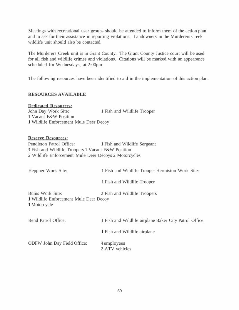
69
Meetings with recreational user groups should be attended to inform them of the action plan and to ask for their assistance in reporting violations. Landowners in the Murderers Creek wildlife unit should also be contacted. The Murderers Creek unit is in Grant County. The Grant County Justice court will be used for all fish and wildlife crimes and violations. Citations will be marked with an appearance scheduled for Wednesdays, at 2:00pm.
The following resources have been identified to aid in the implementation of this action plan:
RESOURCES AVAILABLE Dedicated Resources: John Day Work Site: 1 Fish and Wildlife Trooper 1 Vacant F&W Position 1 Wildlife Enforcement Mule Deer Decoy
Reserve Resources: Pendleton Patrol Office: 1 Fish and Wildlife Sergeant 3 Fish and Wildlife Troopers 1 Vacant F&W Position 2 Wildlife Enforcement Mule Deer Decoys 2 Motorcycles
Heppner Work Site: 1 Fish and Wildlife Trooper Hermiston Work Site:
1 Fish and Wildlife Trooper
Bums Work Site: 2 Fish and Wildlife Troopers 1 Wildlife Enforcement Mule Deer Decoy 1 Motorcycle
Bend Patrol Office: 1 Fish and Wildlife airplane Baker City Patrol Office:
1 Fish and Wildlife airplane
ODFW John Day Field Office: 4 employees 2 ATV vehicles

70
DATA COLLECTED
The following data will be collected: Number of patrol hours, number of contacts made, number of hunters not in compliance, number of illegal kills, number of animals checked, and the number of decoy operations conducted.
AFTER ACTION PLAN
The evaluation of this action plan, in the form of an 'After Action Plan', will be submitted by January 31, 2015.
PROPOSED FUTURE ACTIONS I contacted Ryan Torland, who told me he was unaware of any significant proposed future actions at this time.

71
MEMORANDUM
OREGON STATE POLICE
DATE: January 24, 2013 TO: Isaac Cyr, Sergeant Baker City FROM: Randy Caldwell, Senior Trooper, Burns SUBJECT: ACTION PLAN EVALUATION: Steens Mountain Unit Mule Deer GOAL: Protection of mule deer in the Steens Mountain Unit OREGON BENCHMARK: There is no Oregon Benchmark for this topic SUMMARY:
The Steens Mountain unit, unit number 69, southeast of Burns, Oregon is 1,916 Square miles and is comprised of 69% public land. The Steens Mountain Wilderness area has a total of 170,167 acres and has 89,450 acres in wilderness study area. Both areas have no or limited motor vehicle use allowed. Steens Mountain is predominantly a high elevation fault block that rises gradually from the west and falls off sharply along the east slope. Elevations begin near 4200 feet and rise to 9733 feet at the summit. Mule deer use summer range on the upper slopes and winter on the lower slopes often without leaving the Steens Mountain unit.
In 2008 the Oregon Department of Fish and Wildlife selected five wildlife management units to be part of the Mule Deer Initiative (MDI) plan. The Steens Mountain unit was selected as one of the units in the MDI. The goal is to increase the mule deer population in the unit.
Steens Mountain has historically been regarded as one of Oregon's premier mule deer hunting areas. Oregon Department of Fish and Wildlife records show that the mule deer population peaked in the 1950's. The population had gradually declined until 2007. In 2007 ODFW estimated the mule deer population to be at 35% of their management objective. The estimated population for 2007 was 3,850 mule deer. In 2012 the estimated mule deer population was 4800, which is 44% of management objective.

72
The Oregon State Police action plan to protect mule deer in the Steens Mountain unit was discussed with ODFW district biologist for the area, Rod Klus. Mr. Klus was supportive of the plan and agreed that it would have the greatest chance of success if OSP and ODFW worked closely together on a year round protection plan.
Enforcement presence from 2004 through the 2007 rifle seasons had been limited. Oregon State police records show that an average of 39 hours per rifle season was worked with an average compliance rate of 84.7%. In 2012, 115 hours were worked on mule deer patrols (archery, rifle and winter range) with a 70% compliance rate.
RESULTS FOR 2012:
Patrol Hours-Mule Deer 115 hours Deer Hunter Contacts 37 Hunters in Compliance 26 Compliance Rate 70.3% Warnings 10 Citations 6 Total Patrol Hours-All Species
238
Total Contacts 126 Hunters in Compliance 107 Compliance Rate 85%
During the 2012 hunting seasons the Burns worksite had one full time Fish and Wildlife Trooper and one Patrol Trooper from Bend who helped patrol the Burns area during rifle season. Four criminal citations were issued after completing an investigation into a loaning/borrowing of a landowner preference deer tag that had occurred in 2011. Two citations and several warnings were issued during archery season for equipment violations such as lighted sights and mechanical broadheads. Other warnings were given for other miscellaneous violations.
Patrols concentrating enforcement presence on the mule deer winter range were conducted. Many of the landowner contacts were made during this period. OSP also accompanied ODFW for the fall herd composition flights. This enabled us to be up to date on the location of the bulk of the deer on the winter range.
During other seasons an effort was made to spend time in the Steens Unit. During contacts other hunters and fishermen were made aware of the Steens MDI.

73
DISCUSSION: Wilderness area patrols were not conducted due to manpower and time constraints. ODFW helped monitor the Steens unit during rifle season, conducting many hunter checks, when other calls kept us out of the area. ODFW biologist Rod Klus was contacted regarding the future of the action plan. He is supportive of the plan and would like to see it continue. We discussed expanding our patrol coverage to more of the wilderness area next year.
RECOMMENDATIONS: For 2013 archery season in the Steens Mountain Unit will remain to be a limited entry tag. Archers will need to have a controlled Steens archery deer tag to hunt for buck deer or elk. This is the fourth year of this program and more enforcement presence will be needed to ensure the success of this program.
An additional Fish and Wildlife Trooper is scheduled to be stationed in Burns by the start of the big game seasons. Wilderness patrols will be conducted in the South Steens area and Kiger Gorge to check for tag compliance. The South Steens area has had the most pressure observed during past archery seasons. However in 2012 most of the pressure was concentrated around Fish Lake and Kiger Gorge. Wilderness patrols will again be contingent on manpower and time constraints.
Decoy operations may be conducted if an area of low tag compliance is identified or to address specific problem areas.
A landowner in the Steens Unit has granted OSP access through the ranch to more quickly reach the back edges of the wilderness area in the South Steens. This access will be utilized during the archery and rifle seasons.
I recommend that the action plan be continued in 2013.
RCC Action Plan

74
MEMORANDUM
OREGON STATE POLICE
DATE: January 23, 2014
TO: Isaac Cyr, Sergeant Baker City
FROM: Randy Caldwell, Senior Trooper Burns
SUBJECT: ACTION PLAN EVALUATION: Steens Mountain Unit Mule Deer
GOAL: Protection of mule deer in the Steens Mountain Unit OREGON
BENCHMARK: There is no Oregon Benchmark for this topic SUMMARY:
The Steens Mountain unit, unit number 69, southeast of Burns, Oregon is 1,916 square miles and is comprised of 69% public land. The Steens Mountain Wilderness area has a total of 170,167 acres and has 89,450 acres in wilderness study area. Both areas have no or limited motor vehicle use allowed. Steens Mountain is predominantly a high elevation fault block that rises gradually from the west and falls off sharply along the east slope. Elevations begin near 4200 feet and rise to 9733 feet at the summit. Mule deer use summer range on the upper slopes and winter on the lower slopes often without leaving the Steens Mountain unit.
Steens Mountain has historically been regarded as one of Oregon's premier mule deer hunting areas. Oregon Department of Fish and Wildlife records show that the mule deer population peaked in the 1950's. The population had gradually declined until 2007. In 2007 ODFW estimated the mule deer population to be at 35% of their management objective. The estimated population for 2007 was 3,850 mule deer. In 2012 the estimated mule deer population was 4800, which is 44% of management objective.
In 2008 the Oregon Department of Fish and Wildlife selected five wildlife management units to be part of the Mule Deer Initiative (MDI) plan. The Steens Mountain unit was selected as one of the units in the MDI. The goal is to increase the mule deer population in the unit. The Oregon State Police action plan to protect mule deer in the Steens Mountain unit was discussed with ODFW district biologist for the area, Rod Klus. Mr. Klus was supportive of the plan and agreed that it would have the greatest chance of success if OSP and ODFW worked closely together on a year round protection plan.
Enforcement presence in 2012 totaled 115 hours worked on mule deer patrols (archery, rifle and winter range) with a 70% compliance rate. 238 total hours for all species were worked
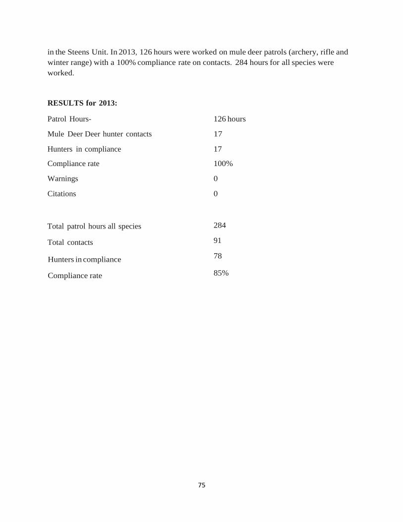
75
in the Steens Unit. In 2013, 126 hours were worked on mule deer patrols (archery, rifle and winter range) with a 100% compliance rate on contacts. 284 hours for all species were worked.
RESULTS for 2013:
Patrol Hours- 126 hours
Mule Deer Deer hunter contacts 17
Hunters in compliance 17
Compliance rate 100%
Warnings 0
Citations 0
Total patrol hours all species
Total contacts
Hunters in compliance
Compliance rate
284
91
78
85%

76
During the 2013 hunting seasons the Burns worksite had two full time Fish and Wildlife Troopers who patrolled the Burns area during hunting seasons. Hunters checked were compliant and many had been contacted in previous seasons. Remains of two mule deer were found after the antelope season; however, no suspects were developed. Citations were issued for ATV violations, bobcat and upland bird violations but none that were directly related to mule deer.
Patrols concentrating enforcement presence on the mule deer winter range were conducted. Many of the landowner contacts were made during this period. OSP also accompanied ODFW for the fall herd composition flights. This enabled us to be up to date on the location of the bulk of the deer on the winter range which remained at higher elevations longer than usual due to the lack of early snowfall and a good fall green-up at mid-elevations.
During other seasons an effort was made to spend time in the Steens Unit. During contacts other hunters and fishermen were made aware of the Steens MDI.
DISCUSSION:
Wilderness area patrols were not conducted due to manpower and time constraints.
ODFW helped monitor the Steens unit during rifle season, conducting many hunter checks, when other calls kept us out of the area.
ODFW biologist Rod Klus was contacted regarding the future of the action plan. He is supportive of the plan and would like to see it continue. We discussed expanding our patrol coverage to more of the wilderness area next year.
RECOMMENDATIONS:
For 2014, archery season in the Steens Mountain Unit will continue to be a limited entry tag. Archers will need to have a controlled Steens archery deer tag to hunt for buck deer or elk. This is the fifth year of this program and more enforcement presence will be needed to ensure the success of this program.
Wilderness patrols will be conducted in the South Steens area and Kiger Gorge to check for tag compliance. The South Steens area has had the most pressure observed during past archery seasons. However in 2012 most of the pressure was concentrated around Fish Lake and Kiger Gorge. Wilderness patrols will again be contingent on manpower and time constraints.
Decoy operations may be conducted if an area of low tag compliance is identified or to address specific problem areas.
I recommend that the action plan be continued in 2014.
RCC Action Plan

77
MEMORANDUM
OREGON STATE POLICE
DATE: February 19, 2009
TO: David Gifford, Lieutenant Southwest Region Headquarters
FROM: Randall G. Hand, Sergeant Klamath Falls Patrol Office
SUBJECT: ACTION PLAN: WARNER UNIT DEER PROTECTION
GOAL: The goal is to provide a measure of the illegal deer take in the
Warner Unit
OREGON BENCHMARK:
The action plan compliments Oregon Benchmark 90, the number of native fish and wildlife species that are healthy.
HISTORY/CONCERN:
The Oregon Department of Fish and Wildlife is charged with management of Oregon’s mule deer. ODFW has implemented a variety of hunter management strategies over the years to deal with the demand for the opportunity to hunt mule deer. Since 1991 hunters have had to draw through a lottery process for all deer tags in eastern Oregon.
After years of declining mule deer populations, Oregon Department of Fish and Wildlife has implemented a Mule Deer Initiative. Five wildlife management units have been selected to implement a variety of strategies to improve mule deer populations. In our patrol area, the Warner Unit has been selected.
The population management objective (MO) for the Warner Unit is 5500 deer. In 1980 the estimated population was 8,120 deer. The most recent population estimate (2008) was 2,958 deer. For the purposes of deer management, the Warner Unit has been split into two sub-units with the dividing boundary being Highway 140. The unit north of Highway 140 is managed for a post-season buck management objective of 25 bucks per hundred does while the unit south of Highway 140 is managed for 15 bucks per hundred does. Since being divided, North Warner has not met the buck management objective in any year. South Warner has consistently met or exceeded buck management objectives during the same time period.
In discussing the Warner Unit mule deer situation, ODFW Biologist Craig Foster states he does not believe that poaching is an issue, but would like to make sure his assumption is correct.
In discussing the Warner Unit mule deer situation with Trooper Curtis Weaver, he also does not believe poaching is an issue. Trooper Weaver stated that most of the illegal deer harvest in his

78
patrol area occurs in the Interstate Unit and even this certainly does not appear to be at the levels seen in North Lake County (Fort Rock and Silver Lake Units).
Several WED operations have been run in the Warner Unit over the past several years. All operations in the North Warner were not successful in locating hunters without valid tags. The hunter density was low and the few vehicles that did manage to drive by did not stop for the WED. Of those operations in the South Warner, none turned up a hunter without a valid tag.
OPERATIONAL AREA/TIME PERIOD:
The operational area shall be the Warner Unit.
This plan is to compliment Oregon Department of Fish and Wildlife’s Mule Deer Initiative. The overall time period for this plan shall be commensurate with their Initiative.
OPERATIONAL PLAN:
In 2009, Trooper Curtis Weaver will do a notebook review to formally document any deer unlawfully killed in the Warner Unit for the time he has been assigned to Lakeview. This shall be reported by year.
Beginning in 2010, the Lakeview Fish and Wildlife Trooper shall monitor and document all deer unlawfully killed in the Warner Unit and submit the results in an Action Plan Evaluation at the end of each year.
As time allows during deer season the Wildlife Enforcement Decoy will be operated in the Warner Unit (north and south) to determine the tag compliance rate.
DATA TO BE COLLECTED:
Numbers of deer unlawfully killed in the Warner Unit.
Number of WED operations
Hunters contacted
Hunters without valid tags
COMPLETION DATE:
Annual reports shall be filed no later than January 31 of each year beginning in 2010. The final evaluation shall be completed upon the full completion of ODFW’s Mule Deer Action Plan.
RGH

79
Appendix C: Population Data for MDI WMU’s and Comparison Areas 2001-2014.
HEPPNER Pop'n MO 12,000; Buck Ratio MO 12
FOSSIL Pop'n MO 10,000; Buck Ratio MO 12
Year Buck Ratio
Fall Fawn:
100 Does
Spring Fawn:
100 Adults
Pop. Est.
Year
Buck Ratio
Fall Fawn:
100 Does
Spring Fawn:
100 Adults
Pop. Est.
2001 11 43 29 12825
2001 11 36 32 11900 2002 9 37 30 11475
2002 10 35 25 10500
2003 16 43 29 10800
2003 10 42 22 9800 2004 10 45 24 9450
2004 12 40 22 9800
2005 9 45 29 6720
2005 15 54 27 3900 2006 14 52 35 7560
2006 14 51 27 5000
2007 10 46 29 6960
2007 15 52 35 5000 2008 15 49 33 7080
2008 12 49 34 5000
2009 15 56 36 7200
2009 21 50 39 5200 2010 12 54 35 7800
2010 13 49 42 5800
2011 13 64 37 8040
2011 13 59 44 6100 2012 17 60 46 8760
2012 19 61 49 7100
2013 17 51 35 8160
2013 15 52 32 7600 2014 15 47 38 9100
2014 17 43 27 8400

80
MAURY Pop'n MO 5,200; Buck Ratio MO 201
PAULINA Pop'n MO 16,500; Buck Ratio MO 15
Year Buck Ratio
Fall Fawn:
100 Does
Spring Fawn:
100 Adults
Pop. Est.
Year
Buck Ratio
Fall Fawn:
100 Does
Spring Fawn:
100 Adults
Pop. Est.
2001 13 56 32
2001 17 63 36 15,400 2002 18 60 37 4,500
2002 16 57 41 15,400
2003 13 56 38 4,700
2003 13 59 33 14,300 2004 12 52 32 4,500
2004 13 57 42 13,800
2005 11 62 48 4,800
2005 16 65 53 13,800 2006 18 64 42 3,800
2006 19 72 49 13,100
2007 21 55 35 3,500
2007 17 59 42 11,600 2008 17 56 32 3,500
2008 18 59 35 10,300
2009 12 58 45 3,000
2009 10 54 37 10,000 2010 16 57 41 3,000
2010 13 57 45 9,800
2011 26 73 47 6,300
2011 17 50 43 9,300 2012 18 52 32 5,600
2012 17 56 38 10,300
2013 16 67 44 5,600
2013 20 57 37 10,700 2014 21 50 54 5,600
2014 18 64 38 7,920
1- Buck Ratio MO changed from 15 to 20 in 2011.

81
MURDERER'S CREEK Pop'n MO 9,000; Buck Ratio MO 15
NORTHSIDE Pop'n MO 15,500; Buck Ratio MO 15
Year Buck Ratio
Fall Fawn:
100 Does
Spring Fawn:
100 Adults
Pop. Est.
Year
Buck Ratio
Fall Fawn:
100 Does
Spring Fawn:
100 Adults
Pop. Est.
2001 11 54 25 6478
2001 17 54 33 9685 2002 11 54 24 6256
2002 17 54 29 8358
2003 16 85 30 5823
2003 17 56 34 8402 2004 11 78 38 5823
2004 11 56 39 7767
2005 12 73 53 6695
2005 12 67 50 7950 2006 16 75 49 6968
2006 20 72 48 7954
2007 16 49 36 6820
2007 17 51 47 8137 2008 12 50 36 5207
2008 11 58 39 7358
2009 12 62 39 5037
2009 15 58 43 7325 2010 14 72 36 5303
2010 16 55 38 7085
2011 16 58 45 5885
2011 20 69 39 7228 2012 16 60 39 5904
2012 14 61 38 7144
2013 13 48 31 5290
2013 13 52 35 6837 2014 17 64 39 5699
2014 11 60 40 6904

82
STEENS MOUNTAIN
TROUT CREEK MOUNTAINS
Year Buck Ratio
Fall Fawn:
100 Does
Spring Fawn:
100 Adults Pop. Est.
Year
Buck Ratio
Fall Fawn:
100 Does
Spring Fawn:
100 Adults Pop. Est.
2001 31 44 33 5,792
2001 40 37 21 1,166 2002 22 65 21 4,935
2002 24 44 13 991
2003 24 55 20 4,317
2003 49 45 13 1,008 2004 34 44 20 4,398
2004 48 55 29 1,111
2005 51 55 32 4,456
2005 47 41 44 1,171 2006 29 69 38 4,296
2006 19 77 44 1,156
2007 47 59 21 3,840
2007 24 41 28 996 2008 29 35 15 3,728
2008 30 14 11 966
2009 28 68 24 3,929
2009 15 50 26 964 2010 37 57 33 4,375
2010 29 65 31 1,069
2011 27 58 43 4,785
2011 37 41 40 1,174 2012 27 66 40 4,957
2012 55 60 37 1,127
2013 35 37 21 5,257
2013 46 38 21 1,157 2014 31 52 29
2014 57 56 27

83
WARNER Pop'n MO 5,500; Buck Ratio MO N-25, S-15
INTERSTATE Pop'n MO 14,800; Buck Ratio MO 15
Year Buck Ratio
Fall Fawn:
100 Does
Spring Fawn:
100 Adults
Pop. Est.
Year
Buck Ratio
Fall Fawn:
100 Does
Spring Fawn:
100 Adults
Pop. Est.
2001 21 49 32
2001 23 59 30 2002 19 66 30 4,250
2002 24 76 35 6,900
2003 22 41 15 3,450
2003 19 49 21 6,800 2004 13 55 24 3,000
2004 15 63 26 6,250
2005 15 56 42 2,600
2005 16 73 43 6,000 2006 18 70 35 1,630
2006 18 113 37 6,685
2007 24 48 24 2,270
2007 20 62 28 6,685 2008 14 37 14 1,036
2008 18 39 15 5,841
2009 15 50 36 2,958
2009 19 66 30 11,004 2010 24 60 23 2,389
2010 15 44 24 10,424
2011 16 56 38 3,157
2011 21 67 34 5,675 2012 23 51 31 2,468
2012 24 52 25 4,061
2013 25 56 28 3,814
2013 21 56 23 5,538 2014 27 59 27 1,986
2014 19 59 26 3,816

84
Appendix D: Harvest Data for MDI WMU’s and Comparison Areas 2001-2014.
Year # HuntersBuck
HarvestDoe
Harvest%
Success # HuntersBuck
HarvestDoe
Harvest%
Success # HuntersBuck
HarvestDoe
Harvest%
Success # HuntersBuck
HarvestDoe
Harvest%
Success # HuntersBuck
HarvestDoe
Harvest%
Success2001 3,700 1211 33 1,027 24 78 10 264 199 75 150 16 46 412002 3,588 1075 30 1,171 130 111 21 177 139 79 137 11 47 422003 3,295 734 22 725 49 7 133 104 78 111 14 32 412004 3,072 621 20 635 46 7 87 8 28 412005 2,495 1008 40 703 130 18 86 11 132006 2,635 924 35 692 66 10 90 28 312007 2,626 995 38 691 71 10 79 18 232008 2,600 905 35 697 86 12 86 30 2 252009 2,658 885 33 873 49 6 78 44 56 91 17 192010 2,667 764 29 790 82 10 72 48 67 106 24 232011 2,600 841 32 821 129 16 63 51 81 105 29 282012 2861 924 32 823 84 10 116 7 70 66 111 28 252013 2884 938 33 893 79 9 122 8 73 66 155 39 25
HEPPNERCombined Rifle (100 Series) General Archery LE Archery Combined Antlerless (600 Series) Muzzleloader
Year # HuntersBuck
HarvestDoe
Harvest%
Success # HuntersBuck
HarvestDoe
Harvest%
Success # HuntersBuck
HarvestDoe
Harvest%
Success # HuntersBuck
HarvestDoe
Harvest%
Success # HuntersBuck
HarvestDoe
Harvest%
Success2001 1,957 869 44 111 16 14 192 160 832002 1,753 732 42 169 0 0 146 126 862003 1,871 770 41 235 37 16 155 127 822004 1,731 578 33 152 33 22 02005 1,660 906 55 216 65 30 02006 1,717 707 41 132 44 33 02007 1,671 740 44 245 47 19 111 86 772008 1,582 763 48 293 86 29 105 81 772009 1,719 663 39 270 74 27 114 87 762010 1,711 594 35 221 24 11 101 74 732011 1,675 954 57 215 70 33 97 77 792012 1846 903 49 206 61 30 92 80 87 42 10 252013 1824 856 47 225 62 3 29 103 78 75.72816 25 10 38
FOSSILCombined Rifle (100 Series) General Archery LE Archery Combined Antlerless (600 Series) Muzzleloader
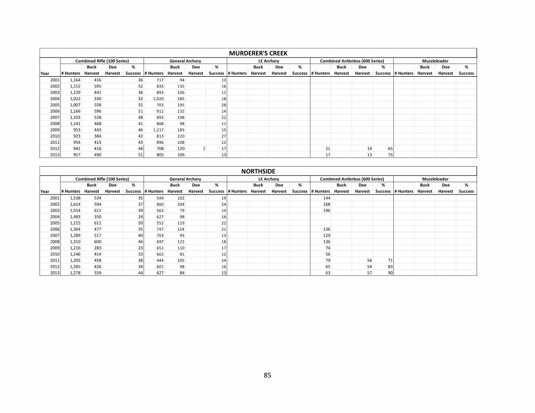
85
Year # HuntersBuck
HarvestDoe
Harvest%
Success # HuntersBuck
HarvestDoe
Harvest%
Success # HuntersBuck
HarvestDoe
Harvest%
Success # HuntersBuck
HarvestDoe
Harvest%
Success # HuntersBuck
HarvestDoe
Harvest%
Success2001 1,164 416 36 717 94 132002 1,152 595 52 833 135 162003 1,229 441 36 893 106 122004 1,022 330 32 1,020 185 182005 1,007 558 55 703 195 282006 1,166 596 51 912 132 142007 1,103 528 48 893 198 222008 1,141 468 41 868 98 112009 953 443 46 1,217 185 152010 923 384 42 813 220 272011 954 413 43 896 108 122012 941 416 44 708 120 1 17 21 14 652013 957 490 51 805 106 13 17 13 75
MURDERER'S CREEKCombined Rifle (100 Series) General Archery LE Archery Combined Antlerless (600 Series) Muzzleloader
Year # HuntersBuck
HarvestDoe
Harvest%
Success # HuntersBuck
HarvestDoe
Harvest%
Success # HuntersBuck
HarvestDoe
Harvest%
Success # HuntersBuck
HarvestDoe
Harvest%
Success # HuntersBuck
HarvestDoe
Harvest%
Success2001 1,538 534 35 549 102 19 1442002 1,614 594 37 860 204 24 1682003 1,554 611 39 563 79 14 1962004 1,483 350 24 627 98 162005 1,215 611 50 552 119 222006 1,364 477 35 747 154 21 1362007 1,289 517 40 703 93 13 1292008 1,310 600 46 697 122 18 1362009 1,216 283 23 651 110 17 742010 1,246 414 33 662 81 12 562011 1,205 458 38 444 105 24 79 56 712012 1,265 426 34 601 98 16 65 54 832013 1,278 559 44 627 84 13 63 57 90
NORTHSIDECombined Rifle (100 Series) General Archery LE Archery Combined Antlerless (600 Series) Muzzleloader

86
Year # HuntersBuck
HarvestDoe
Harvest%
Success # HuntersBuck
HarvestDoe
Harvest%
Success # HuntersBuck
HarvestDoe
Harvest%
Success # HuntersBuck
HarvestDoe
Harvest%
Success # HuntersBuck
HarvestDoe
Harvest%
Success2001 1,119 287 26 62 0 02002 1,089 248 23 93 19 202003 1,110 218 20 92 21 232004 822 199 24 11 11 1002005 662 171 26 108 22 202006 685 189 28 121 33 272007 689 234 34 152 24 162008 724 199 27 183 36 202009 380 120 32 221 37 172010 363 164 45 23 12 522011 348 136 39 77 8 102012 378 144 38 20 2 10 92 26 282013 393 183 47 11 1 9 84 11 13
MAURYCombined Rifle (100 Series) General Archery LE Archery Combined Antlerless (600 Series) Muzzleloader
Year # Hunters Buck
Harvest Doe
Harvest %
Success # Hunters Buck
Harvest Doe
Harvest %
Success # Hunters Buck
Harvest Doe
Harvest %
Success # Hunters Buck
Harvest Doe
Harvest %
Success # Hunters Buck
Harvest Doe
Harvest %
Success 2001 3,262 729 22 714 179 25 24 8 33 195 157 81 2002 3,150 788 25 555 56 10 37 7 19 219 169 77 2003 3,223 594 18 580 106 18 50 5 10 292 152 52 2004 3,061 548 18 483 55 11 46 22 48 264 169 64 2005 2,639 980 37 595 109 18 39 17 44 131 89 68 2006 2,778 534 19 703 176 25 35 6 17 153 80 52 2007 2,748 817 30 641 163 25 33 21 64 122 96 79 2008 2,752 515 19 795 61 8 31 10 32 119 73 61 2009 2,355 470 20 651 147 23 31 9 29 73 48 66 2010 2,187 364 17 581 117 20 18 14 78 33 22 67 2011 1,812 451 25 10 6 60 37 14 38 2012 1925 508 1 26 569 121 21 17 7 41 34 25 73 2013 1908 510 27 553 94 17 14 7 50 27 20 74
PAULINA Combined Rifle (100 Series) General Archery LE Archery Combined Antlerless (600 Series) Muzzleloader

87
Year # HuntersBuck
HarvestDoe
Harvest%
Success # HuntersBuck
HarvestDoe
Harvest%
Success # HuntersBuck
HarvestDoe
Harvest%
Success # HuntersBuck
HarvestDoe
Harvest%
Success # HuntersBuck
HarvestDoe
Harvest%
Success2001 441 234 53 101 8 82002 352 208 59 133 39 292003 378 153 40 85 28 332004 295 138 47 87 11 132005 346 164 47 54 0 02006 340 195 57 88 11 132007 330 146 44 58 12 212008 323 128 40 37 0 02009 314 136 43 111 12 112010 312 137 44 23 0 0 48 3 62011 311 155 50 55 6 112012 305 173 1 57 10 0 0 63 10 16 11 8 732013 304 159 52 12 6 50 60 10 17 8 6 75
STEENS MT.Combined Rifle (100 Series) General Archery LE Archery Combined Antlerless (600 Series) Muzzleloader
Year # Hunters Buck
Harvest Doe
Harvest %
Success # Hunters Buck
Harvest Doe
Harvest %
Success # Hunters Buck
Harvest Doe
Harvest %
Success # Hunters Buck
Harvest Doe
Harvest %
Success # Hunters Buck
Harvest Doe
Harvest %
Success 2001 69 47 68 8 8 100 2002 75 50 67 0 0 2003 78 42 54 33 7 21 2004 84 51 61 13 11 85 2005 83 53 64 11 0 0 2006 80 42 53 0 0 2007 82 55 67 0 0 2008 78 51 65 24 0 0 2009 79 56 71 49 0 0 62 2 3 2010 80 43 54 61 6 10 2011 77 41 53 63 0 0 2012 80 55 69 55 7 13 2013 76 48 63 64 5 8
TROUT CREEK MOUNTAINS Combined Rifle (100 Series) General Archery LE Archery Combined Antlerless (600 Series) Muzzleloader

88
Year # Hunters Buck
Harvest Doe
Harvest %
Success # Hunters Buck
Harvest Doe
Harvest %
Success # Hunters Buck
Harvest Doe
Harvest %
Success # Hunters Buck
Harvest Doe
Harvest %
Success # Hunters Buck
Harvest Doe
Harvest %
Success 2001 215 97 45 150 44 0 29 27 14 7 78 26 12 0 46 2002 219 108 49 192 40 0 20 27 8 9 63 28 13 0 46 2003 174 68 39 186 70 0 38 26 12 6 69 20 5 2 35 2004 121 47 39 109 11 0 10 0 0 26 18 69 2005 99 54 55 151 33 0 22 20 7 5 60 26 18 0 69 2006 99 51 52 121 11 0 9 23 10 4 61 2007 105 60 57 117 24 0 21 21 12 3 71 2008 87 42 48 171 36 0 21 15 2 4 40 2009 55 31 56 86 12 0 14 23 8 8 70 2010 54 24 6 56 37 0 2011 56 35 63 45 20 44 2012 64 43 2 70 47 12 0 2013 35 9 27
*Combined North & South Warner Totals
Year # Hunters Buck
Harvest Doe
Harvest %
Success # Hunters Buck
Harvest Doe
Harvest %
Success # Hunters Buck
Harvest Doe
Harvest %
Success # Hunters Buck
Harvest Doe
Harvest %
Success # Hunters Buck
Harvest Doe
Harvest %
Success 2001 498 163 33 150 44 0 29 26 12 46 2002 481 128 27 192 40 0 20 28 13 46 2003 377 120 32 186 70 0 38 20 5 2 35 2004 282 72 26 109 11 0 10 26 18 69 2005 276 112 41 151 33 0 22 26 18 69 2006 271 89 33 121 11 0 9 2007 283 77 27 117 24 0 21 2008 195 50 26 171 36 0 21 2009 255 93 36 86 12 0 14 2010 205 93 45 17 6 2 47 2011 192 90 49 20 4 20 2012 215 106 1 50 33 6 18 2013 40 8 21
*Combined North & South Warner Totals
NORTH WARNER Combined Rifle (100 Series) General Archery* LE Archery Combined Antlerless (600 Series)* Muzzleloader
SOUTH WARNER Combined Rifle (100 Series) General Archery* LE Archery Combined Antlerless (600 Series)* Muzzleloader*
48 79
223 113 51
61

89
Appendix E: Action Plan Committees for All MDI WMUs
Heppner:
Wayne Elliott Oregon Hunters Association
Jim Jerome Oregon Hunters Association
Ken Hand Mule Deer Foundation
Buster Gibson Wildlife Services
Kevin Hughes Cattlemen’s Association
Dennis Newman SWCD
Randy Scarlett U.S. Forest Service
Dan Tippy Bureau of Land Management
Mike Mayer Oregon State Police
Maury:
Greg Erickson Mule Deer Foundation
Ken Fahlgren Crook County Commissioner
Monty Greg Ochoco National Forest
Steve Hagan Oregon Hunters Association (State Board)
Ken Hand Mule Deer Foundation
Rance Kaster Landowner
Amos Madison Oregon State Police
Kurt McCormack Crook County Stock Growers, Landowner
Ron Powell Rocky Mountain Elk Foundation
Lyle Rilling Oregon Hunters Association (Local Chapter)
Dede Steele Ochoco National Forest
Matt Smith Landowner
Dan Tippy Bureau of Land Management

90
Murderer’s Creek:
Dean Elliott Oregon Hunters Association (local)
Wayne Elliott Oregon Hunters Association (state)
Ken Hand Mule Deer Foundation
Rene Mabe United States Forest Service
Dan Tippy Bureau of Land Management
Linda Brown Warm Springs Tribe
Lorraine Voigt Natural Resource Conservation Service
Roger Ediger Farm Bureau/ Private Landowner
Ken Holliday Private Landowner
J.C. Oliver Private landowner
Steens Mountain:
Randy Caldwell Oregon State Police
Stacey Davies Steens Mountain Advisory Council, Landowner Representative
Steve Grasty Harney County Judge
Ken Hand Mule Deer Foundation
Rich Jenkins Landowner
Dave McDonald Oregon Hunters Association (State Board)
Matt Obradovich Bureau of Land Management
Earl Tiller Oregon Hunters Association (Local Chapter)

91
Warner:
Dave Aikins Oregon Hunters Association
Fred Craig Oregon Hunters Association (State Board)
Lee Fledderjohann Collins Timber
Todd Forbes Bureau of Land Management
Ken Hand Mule Deer Foundation
Roger Linton Lake County Umbrella Watershed Council
Amy Markus Fremont/Winema National Forest
Mike Ramsey Fremont/Winema National Forest
Keith Reed Oregon Hunters Association
Pete Schreder Oregon State University Extension
Sonny Simms Landowner
John Taylor Landowner
Curtis Weaver Oregon State Police
Brad Winters Lake County Commissioner