opengeo presentation to noaa dmit · noaa dmit april 4th, 2012 • supports open source geospatial...
TRANSCRIPT

OpenGeo Presentation to
NOAA DMIT
April 4th, 2012
• Supports open source geospatial worldwide – Community and Enterprise versions – Global support and service – Training – Advanced software development
• Founded 2002 • Global Partner Network
OpenGeo Background
2
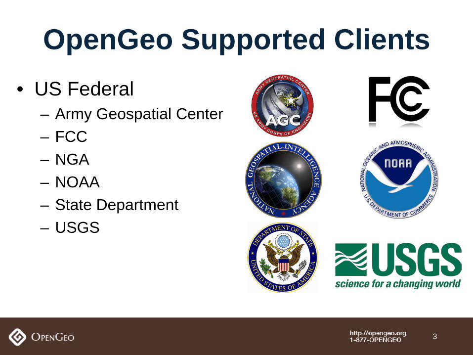
• US Federal – Army Geospatial Center – FCC – NGA – NOAA – State Department – USGS
OpenGeo Supported Clients
3
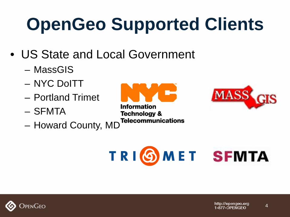
• US State and Local Government – MassGIS – NYC DoITT – Portland Trimet – SFMTA – Howard County, MD
OpenGeo Supported Clients
4
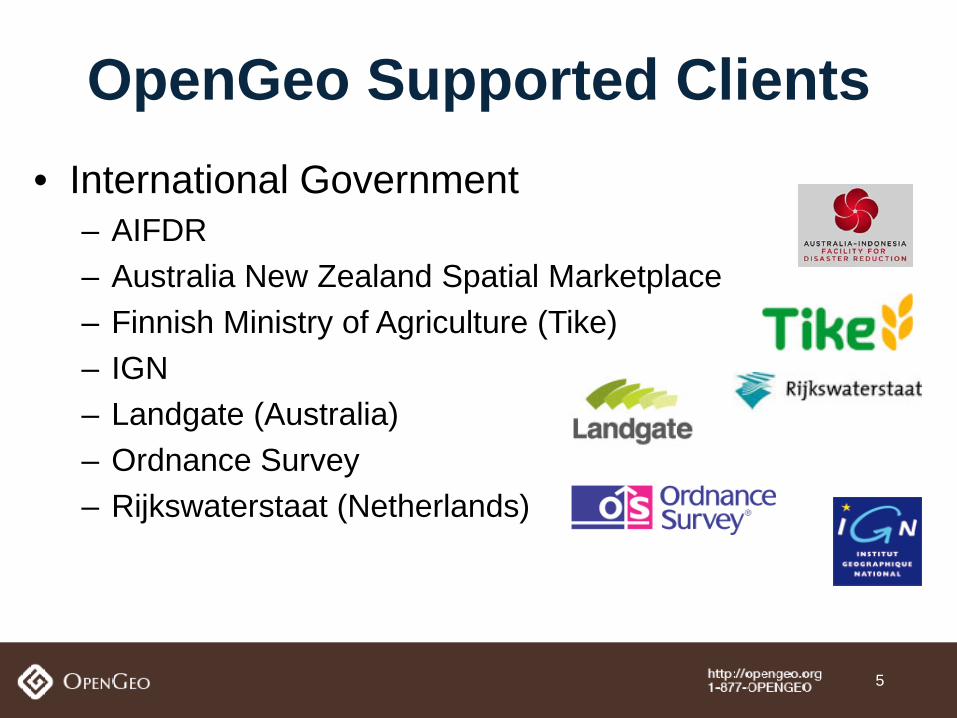
• International Government – AIFDR – Australia New Zealand Spatial Marketplace – Finnish Ministry of Agriculture (Tike) – IGN – Landgate (Australia) – Ordnance Survey – Rijkswaterstaat (Netherlands)
OpenGeo Supported Clients
5
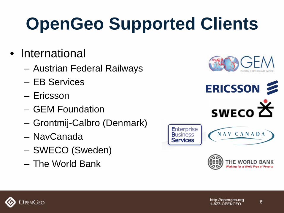
• International – Austrian Federal Railways – EB Services – Ericsson – GEM Foundation – Grontmij-Calbro (Denmark) – NavCanada – SWECO (Sweden) – The World Bank
OpenGeo Supported Clients
6
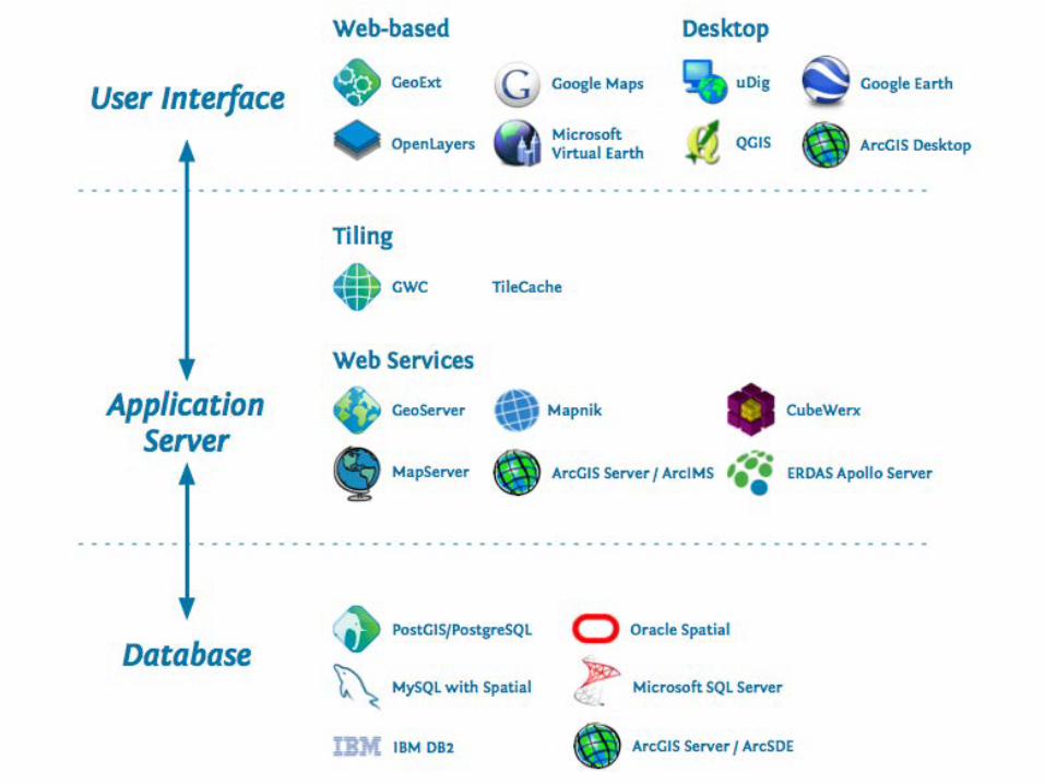
OpenGeo Suite
7
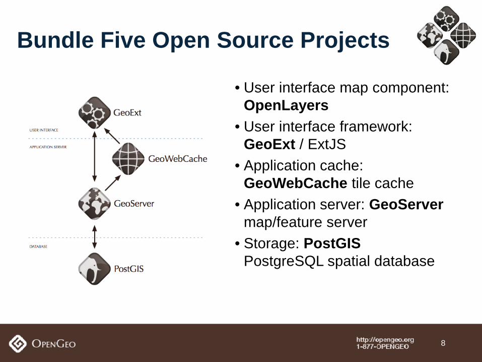
Bundle Five Open Source Projects • User interface map component:
OpenLayers • User interface framework:
GeoExt / ExtJS • Application cache:
GeoWebCache tile cache • Application server: GeoServer
map/feature server • Storage: PostGIS
PostgreSQL spatial database
8
• Publish OGC Web Services • Build high performance web applications through
advanced framework ...all with an entire open source enterprise stack that
scales massively and is easy to administer through an integrated console.
The OpenGeo Suite
9

Leverage your technical and human infrastructure through integration with
existing enterprise architecture
10
11
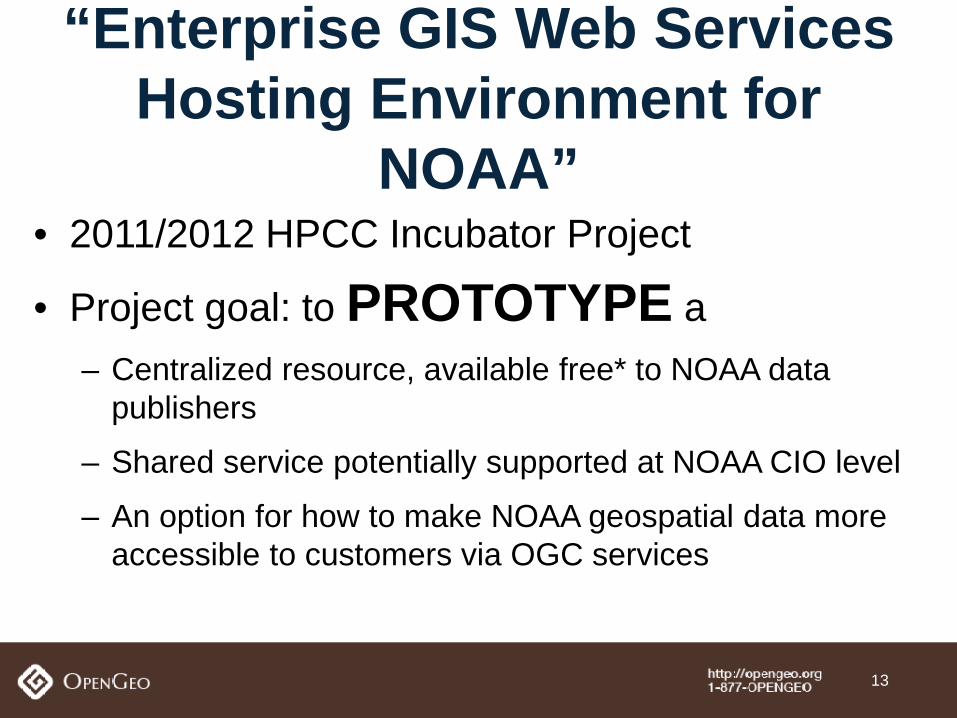
• 2011/2012 HPCC Incubator Project
• Project goal: to PROTOTYPE a – Centralized resource, available free* to NOAA data
publishers
– Shared service potentially supported at NOAA CIO level
– An option for how to make NOAA geospatial data more accessible to customers via OGC services
“Enterprise GIS Web Services Hosting Environment for
NOAA”
13
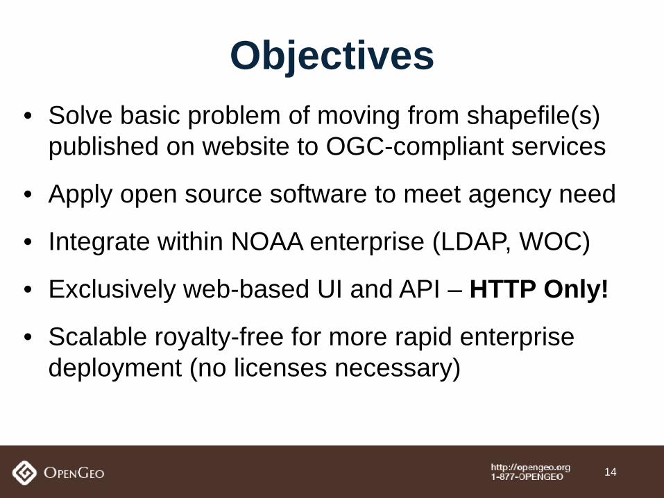
• Solve basic problem of moving from shapefile(s) published on website to OGC-compliant services
• Apply open source software to meet agency need
• Integrate within NOAA enterprise (LDAP, WOC)
• Exclusively web-based UI and API – HTTP Only!
• Scalable royalty-free for more rapid enterprise deployment (no licenses necessary)
Objectives
14
• NOAA requirements provided to OpenGeo – Input from NOAA GIS community, gather common needs
across NOAA line offices
• Collaboration with open source developer community – NOAA requirements folded into core GeoServer product
via ‘GSIP’ process: GSIP #s: 66, 67, 71, 73, 74 – Released in next version of GeoServer – See: http://geoserver.org/display/GEOS/GeoServer+Improvement+Proposals
Implementation
15
• Scriptable data upload capability
– automated workflows supported – NWS short duration warnings, other process-generated data sets
• HTTP-based data publishing – REST API already provided by GeoServer
Data Input
16
• Standards-based. Supported OGC standards: – Web Map Service (WMS) – Web Feature Service (WFS) – Keyhole Markup Language (KML)
• Compatible with proprietary and non-proprietary GIS systems (desktop – ArcMap, QGIS, web – ArcGIS Online, Federal GeoPlatform, GeoNode)
Data Retrieval
17
18
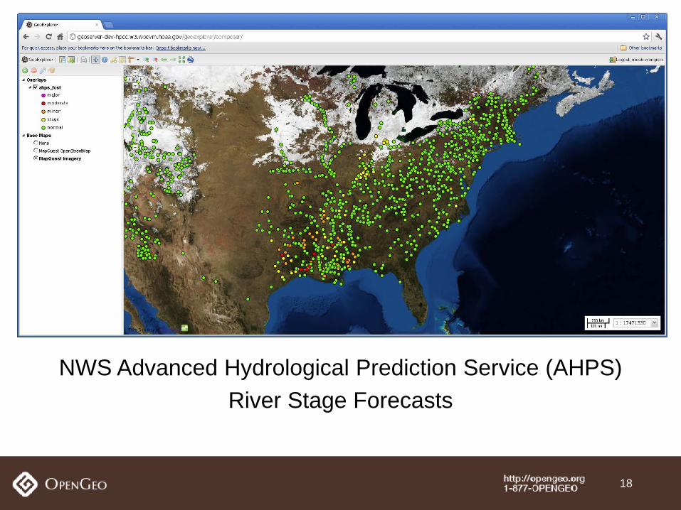
NWS Advanced Hydrological Prediction Service (AHPS) River Stage Forecasts
19
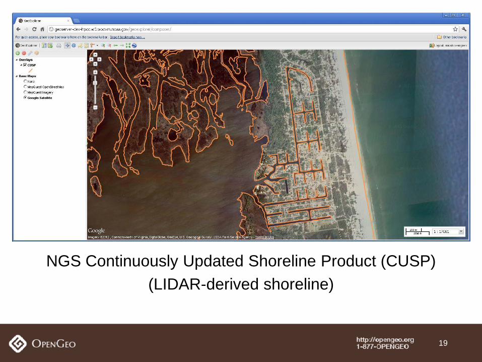
NGS Continuously Updated Shoreline Product (CUSP) (LIDAR-derived shoreline)
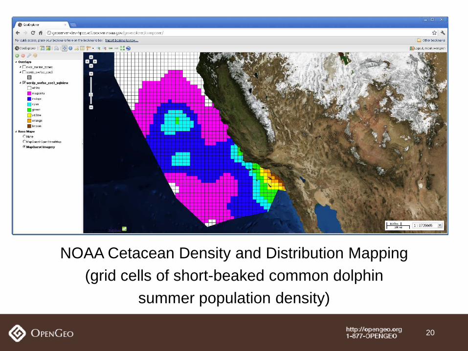
NOAA Cetacean Density and Distribution Mapping (grid cells of short-beaked common dolphin
summer population density)
20
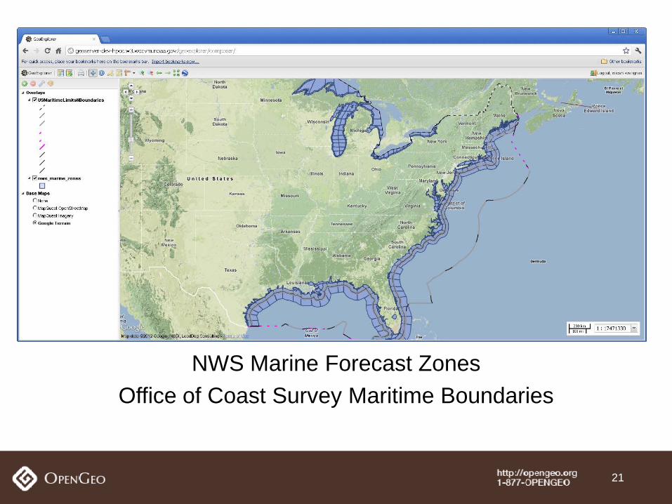
NWS Marine Forecast Zones Office of Coast Survey Maritime Boundaries
21