open house 2013 abstract volume saskatchewan geological survey · discovery of hidden mineral...
TRANSCRIPT
December 2 to 4 2013
Open House 2013
Abstract Volume
SaskatchewanGeological Survey
December 2 to 4 2013
Open House 2013 Abstract Volume Saskatchewan Geological Survey
Printed under the authority of the Government of Saskatchewan
Saskatchewan Geological Survey ii Open House 2013 Abstract Volume
Although the Saskatchewan Ministry of the Economy has exercised all reasonable care in the compilation interpretation and production of this report it is not possible to ensure total accuracy and all persons who rely on the information contained herein do so at their own risk The Ministry of the Economy and the Government of Saskatchewan do not accept liability for any errors omissions or inaccuracies that may be included in or derived from this report
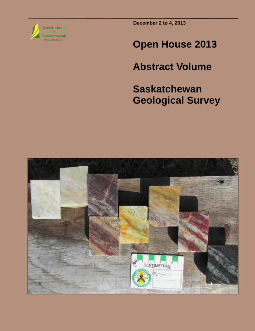
Cover A textural comparison from WR-185 of halved core pieces in migmatitic pelite the base of the core (right) strongly silicified pelite (middle) and pervasively silicified pelite (left) from various places the wide intersection of quartz-rich rock The similarity in melt leucosome texture between the unaltered and strongly silicified pelite is easy to demonstrate however the pervasive silicification in the white-zone rocks on the right have nearly obliterated the melt fabric (see Card this volume)
Additional copies of this volume may be obtained by contacting
Saskatchewan Ministry of the Economy Publications 2101 Scarth Street 3rd Floor Regina SK S4P 2H9 (306) 787-2528 FAX (306) 787-2488 E-mail erpublicationsgovskca
Saskatchewan Geological Survey iii Open House 2013 Abstract Volume
Contents
page
Technical Session 1 Uranium Geoscience
A Update on the CMIC Footprints Project with a Focus on the Uranium and Gold Sites K Ansdell M Gouiza TK Kyser D Brisbin R Linnen G Olivo S Perrouty and the Exploration Footprints Team 2
The Lower Athabasca Group Stratigraphy in the Patterson Lake Region Sean A Bosman and Paul Ramaekers 3
A Rifting and the Generation and Modification of Athabasca Basin Uranium Deposits Paul Ramaekers 4
Are Quartzite Ridges Part of the Wollaston Supergrouprsquos Stratigraphy Colin Card 5
Geological Context of the Beaverlodge Vein-type Uranium Deposits KE Ashton G Chi R Liang and T LeGault 6
A Detecting the Geochemical Signature of Deeply Buried Mineralization of the Phoenix and Millennium Uranium Deposits Athabasca Basin Saskatchewan Keiko Hattori Michael Power Jack Dann Mary Devine Austin Krahenbil Chris (Shishi) Chen Chad Sorba Thomas Kotzer and Eric Potter 7
A An Overview of the Petrography Geochemistry Raman and Fluid Inclusion Analysis of Variably Graphitic and Graphite-depleted Pelitic Schists in the Dufferin Lake Zone Marjolaine Pascal Kevin Ansdell and Irvine Annesley 8
A Unravelling the Alteration History of Basement Rocks along the P2 Fault Zone and in the McArthur River Uranium Deposit E Adlakha K Hattori G Zaluski T Kotzer and E Potter 9
Technical Session 2 Overviews Industrial Minerals and Rare Metals
A Overview of Mineral Exploration and Development Activities in Saskatchewan Gary Delaney and Staff of the Saskatchewan Geological Survey 12
A Proponent Handbook Voluntary Engagement with First Nations and Meacutetis Communities to Inform Governmentrsquos Duty to Consult Karen Bolton 13
A Quantitative Evaluation of Potash Grade and Mineralogy Based on Geophysical Well Log Analysis Preliminary Study of the Prairie Evaporite in Saskatchewan Chao Yang and Guoxiang Chi 14
A Saskatchewanrsquos Geomatics Roadmap John Potter 15
A The Hoidas Lake Vein-type Rare Earth Element Deposit Zonation Alteration Fluid Evolution and Age Constraints Krisztina Pandur Kevin Ansdell John Pearson Charlie Harper Kimberley Halpin Steve Creighton Daniel Kontak and Chris Mcfarlane 16
A Scandium a Little Known REE in Saskatchewan Charles Normand 17
A Pikoo Project from Conception to Discovery ndash Saskatchewanrsquos Newest Kimberlite Field Barbara Kupsch 18
Saskatchewan Geological Survey iv Open House 2013 Abstract Volume
page
Technical Session 3 Gold Base Metals and Generative Mapping
A La Ronge lsquoHorseshoersquo Project Overview of Lithotectonic Assemblages and Their Implications for the Plate Tectonic Architecture and Metallogeny of the Southwestern Reindeer Zone Ralf Maxeiner and Nicole Rayner 20
A Sustained Exploration Success at Seabee in a Gold Market Where Less is mORE Anders Carlson and Brian Skanderbeg 21
A Structural Study of the Auriferous Santoy Shear Zone Northeastern Glennie Domain Saskatchewan Chase Wood Kathryn M Bethune Brian McEwan Anders Carlson Kyle McLintock and Brian Skanderbeg 22
A Comments on the Saskatchewan Mineral Deposit Models with the Sedimentary-hosted Copper + Polymetallic Model as an Example Murray C Rogers 23
Characteristics and Base-metal Potential of the Janice Lake Formation Wollaston Domain J Fetter 24
Quaternary Geological Investigations in the Wollaston Domain Janice and Burbidge Lakes Area Michelle A Hanson 25
Lithological and Lithogeochemical Characterization of the Sub-Phanerozoic Archibald Lake Zn-Cu-Ag Prospect Ryan Morelli and Tim Prokopiuk 26
A VMS Exploration in the Hanson Lake Assemblage Flin Flon Greenstone Belt Eastern Saskatchewan DB Fleming RB March Cliff Stanley and Todd Ballantyne 27
Technical Session 4 Uranium and Exploration Applications
A The Maurice Bay Area The Successful Application of Updated Techniques and Models to an Old Play Ken Wheatley 30
A The Orion 3D DCIPMT System ndash Application and Examples Kevin Killin and Jonathan Rudd 31
A Applications of Automated Mineralogy in Mineral and Oil and Gas Exploration Steve Creighton and Lucy Hunt 32
A How to Carry Out Ground Geophysical Surveys Smartly Safely and Cost Effectively Denis Woods Glenn Chubak Brent Robertson and Anthony Robertson 33
A Optical and Acoustic Televiewer Applications ndash In Situ Structural and Rock Mechanics Understanding Eric Maag and Chris Drielsma 34
A Patterson Lake South High Tech Unconventional and Contrarian Ross McElroy and Ray Ashley 35
Abstracts for Other Papers Appearing in the Summary of Investigations 2013 Volume 2
Characterization of Fluids Associated with Uranium Mineralization in the Beaverlodge Area Northern Saskatchewan Preliminary Field Petrographic Fluid Inclusion and C-O Isotope Studies Rong Liang Guoxiang Chi and Ken Ashton 38
La Ronge lsquoHorseshoersquo Project Bedrock Geology of the Nistowiak-Mountain-Otter Lakes Area Glennie and Kisseynew Domains (Parts of NTS 73P07 08 09 and 10) Ralf O Maxeiner Mark Matthews and Ryan Morelli 39
Saskatchewan Geological Survey v Open House 2013 Abstract Volume
page
U-Pb and Sm-Nd Isotopic Results from the La Ronge lsquoHorseshoersquo Project Area Southwestern Reindeer Zone 184 Ga Felsic-Intermediate Volcanism in the Mullock Lake Assemblage Ralf O Maxeiner Nicole M Rayner and Rob A Creaser 40
A Indicates an Open House 2013 talk abstract only Indicates a report accompanied by a map or maps available separately for purchase They are listed in full on the Ministry of the Economyrsquos website at
wwweconomygovskcasoi All other titles represent papers found in the Summary of Investigations 2013 Volume 2 These papers are also found at wwweconomygovskcasoi
Saskatchewan Geological Survey vi Open House 2013 Abstract Volume
Saskatchewan Geological Survey Open House 2013 Abstract Volume 1
Technical Session 1 Uranium Geoscience
Saskatchewan Geological Survey Open House 2013 Abstract Volume 2
Update on the CMIC Footprints Project with a Focus on the Uranium and Gold Sites
K Ansdell 1 M Gouiza 1 TK Kyser 2 D Brisbin 3 R Linnen 4 G Olivo 2 S Perrouty 4 and the Exploration Footprints Team 5
Abstract Discovery of hidden mineral deposits under cover or at depth is becoming more and more challenging as it is considered that the ldquoeasy-to-findrdquo deposits have for the most part been discovered The Exploration Innovation Consortium of the Canadian Mining Innovation Council (CMIC) have spearheaded an initiative involving 45 researchers from 24 universities across Canada with support from 28 exploration companies and service providers to develop new approaches aimed at improving exploration success Funding for the 5-year project ldquoIntegrated Multi-parameter Footprints of Ore Systemsrdquo is provided by industry and by the federal government through the Natural Sciences and Engineering Research Council of Canada (NSERC) the latter component being approved in April 2013 The project involves multidisciplinary integrative research on three major ore systems the Canadian Malartic gold system in Quebec the McArthur River ndash Millennium uranium systems in Saskatchewan and the Highland Valley copper-molybdenum-gold system in British Columbia The goal is to develop practical applications and approaches to the acquisition management integration and analysis of geological geochemical mineralogical petrophysical and geophysical data that can be used to identify the ore-system footprint at its most distant edge and at depth The research at each site will integrate existing exploration data and in-house company knowledge with new data and research insights to advance our capabilities in remote detection of deposits and in mapping geology under cover
The initial work at the uranium site is focused on the development of a GOCAD 3D geological model of the McArthur River-Millennium trend that will benefit from 30 years of data from over 700 diamond drill holes most with lithogeochemical radiometric and mineral spectroscopy data and from airborne and ground magnetic electromagnetic resistivity gravity and seismic surveys This integrated model will provide the framework for focused research work undertaken by thesis students Their projects will include 1) the petrophysical geochemical and mineralogical characterization of the distal footprint and 2) characterization of the petrophysical and geochemical character of glacial deposits to support removalsuppression of the geophysical signature of these materials and to constrain interpretation of secondary geochemical dispersion signatures in surficial media The geological models and associated projects will provide additional constraints on geophysical inversions and improve the resolution of geophysical imaging of important structures
In contrast to the uranium site the amount of historical data at the gold site is significantly less and so the initial work during summer 2013 was to examine outcrops and drill core on well-chosen sections around the operating open pit The aim was to understand the macroscopic geological structural and alteration characteristics and to obtain representative samples for ongoing petrophysical mineralogical geochemical and isotopic analysis In addition the potential for using pXRF analyses to efficiently map rock-forming and alteration was examined The projects at this site will lead to the generation of a geological and geophysical footprint of these low grade high tonnage gold systems The results of the initial work were highlighted in a field workshop in October 2013 and will be a model for future workshops at the uranium and copper sites
1 University of Saskatchewan Department of Geological Sciences 114 Science Place Saskatoon SK S7N 5E2 2 Queenrsquos University Department Geological Sciences and Engineering 99 University Avenue Kingston ON K7L 3N6 3 Cameco Corporation 2121 - 11th Street West Saskatoon SK S7M 1J3 4 Western University Department of Earth Sciences Biological and Geological Sciences Building Room 1026 1151 Richmond Street North
London ON N6A 5B7 5 Go to URL lthttpcmiclaurentiancagt for other project team members
Saskatchewan Geological Survey Open House 2013 Abstract Volume 3
The Lower Athabasca Group Stratigraphy in the Patterson Lake Region
Sean A Bosman 1 and Paul Ramaekers 2
Abstract The Athabasca lsquoBasinrsquo consists of a stack of several unrelated basins formed at different times and in different tectonic environments The stratigraphy of the lower Athabasca Group in the Patterson Lake region reflects the transition from the Jackfish Basin which is restricted to the western side of the Athabasca lsquoBasinrsquo and host the Fair Point and Smart formations to the Cree Basin whose depocentre lay in the eastern Athabasca lsquoBasinrsquo and was filled by the Read Manitou Falls Lazenby Lake and Wolverine Point formations
In the Patterson Lake area interpretation of the Athabasca Group stratigraphy is difficult because the area is distal to the main source areas and all units have similar grain size ranges complicated by the varying presence of interfingering material from proximal sources
The Fair Point Formation is an overall upward-fining sequence of a coarse-grained diagenetic quartz arenite to granulestone with polymictic pebbles to cobbles deposited as sub-arkose to arkose It was deposited as alluvial fans and high-energy ephemeral streams in the Jackfish Basin The Smart Formation a homogeneous fine- to coarse-grained quartz arenite was deposited unconformably on the Fair Point Formation mainly as eolian dunes in the southeast Jackfish Basin The Read Formation composed of quartz pebblecobble conglomerates quartz arenites and mudstones was deposited initially in a braided fluvial to sheet-flood environment east of the Clearwater Domain directly on the sub-Athabasca unconformity of the Cree Basin with the later stages onlapping the underlying Jackfish Basin The Manitou Falls Formation composed of sheetflood quartz pebble conglomerates and braided fluvial quartz arenites formed the main fill of the Cree Basin and also completely overlapped the preserved parts of the Jackfish Basin
Thinning or absence of the Smart Read and Manitou Falls formations over the Clearwater Domain and Beatty River Fault suggests that during initial deposition of these formations the area had positive relief and may have acted as a divide or watershed in the initial stages of the formation of the Cree Basin This topographic high separated the largely eolian Smart Formation to the west from the predominantly fluvial Read Formation to the east A modern day analog can be found in the Rio Grande Basin where the Sangre de Cristo Mountains act as a watershed with eolian lithofacies on one side and fluvial deposits on the other Cree Basin development eventually buried the topographic highs of the Clearwater Domain and Beatty River Fault and permitted deposition of the Read Formation on top of the Smart Formation in an extended Cree Basin that overlapped the Jackfish Basin A subsequent erosional event was followed by deposition of the Manitou Falls Formation
1 Saskatchewan Ministry of the Economy Saskatchewan Geological Survey 200 - 2101 Scarth Street Regina SK S4P 2H9 2 MF Resources 832 Parkwood Drive SE Calgary AB T2J 3W7
Saskatchewan Geological Survey Open House 2013 Abstract Volume 4
Rifting and the Generation and Modification of Athabasca Basin Uranium Deposits
Paul Ramaekers 1
Abstract Ages of uranium in the Athabasca Basin show a broad range from Proterozoic to sub-Recent with peaks of uranium emplacement and modification around 1500-1300 Ma 1200-1100 Ma 700-500 Ma Devonian to Permian and lower Cretaceous Most of these coincide with continental extension associated with rifting at the margins fewer coincide with continental margin compressional events resulting in Athabasca Basin inversion
The earliest Proterozoic Athabasca Basin U was emplaced during a Mid-Proterozoic basin-deepening event that buried Early Proterozoic Athabasca Group sediments to depths where hydrothermal systems could operate facilitated by mobilization of Athabasca Group evaporites This protracted event may be part of the early stages of the breakup of the Nuna supercontinent
Grenville age reworking (1200-1000 Ma) may reflect events at the Grenville Orogen but also closer to the Athabasca Basin along the western margin of Laurentia
Paleozoic U is widely present in the Athabasca Basin U deposits In the western 23 of the basin it may form the major part of the deposits whether hosted in sub-Athabasca basement or within late Paleoproterozoic Athabasca Group sediments Within the Athabasca Group most of the U is Phanerozoic in age throughout What distinguishes the Athabasca Basin deposits from deposits in other Proterozoic basins is the higher grade and the Paleozoic U metallogenetic event
The Infra-Cambrian breakup of Rodinia is reflected in the Athabasca Basin by coeval U ages in the deposits The major reworking of the basin U occurred during the Devonian and early Carboniferous (Tournaisian) Antler Orogen Northeast trending grabens formed (Montana Trough Peace River Embayment) and disrupted Devonian sediments including the massive Prairie Evaporite that were deposited directly on the Athabasca Group The breaches of the underlying evaporites and massive influx of dense brines into the Athabasca Basin and its basement scavenged U from Paleozoic and Athabasca Group sediments and underlying basement removing some deposits modifying others and creating new ones
Athabasca Basin metallogenesis shows the importance of evaporites and that eroded evaporites may have been as significant as those still present The stratigraphic and tectonic history of overlying basins now removed by erosion may be more important in metallogenesis than the units remaining that host the deposits Understanding this history provides guides to mineralization
1 MF Resources Inc 832 Parkwood Drive SE Calgary AB T2J 3W
Saskatchewan Geological Survey Open House 2013 Abstract Volume 5
Are Quartzite Ridges Part of the Wollaston Supergrouprsquos Stratigraphy
Colin Card 1
Abstract lsquoQuartzite ridgesrsquo are pre-Athabasca group unconformity features associated with uranium exploration plays most commonly between the Phoenix uranium deposits and the McArthur River uranium mine The ridges are associated with north-south- north-northwest- northeast- and east-northeast-trending aeromagnetic lineaments There is up to 200 m relief between the ridges and the surrounding basement rocks Drillholes into the ridges commonly intersect quartz-rich rock that has been interpreted as orthoquartzite of the Wollaston supergroup Orthoquartzite however is not a common constituent of the Wollaston supergroup occurring mainly in the Souter Lake group which is found in the Compulsion River belt along the northwest margin of the Peter Lake Domain and the Hidden Bay assemblage which outcrops on northwest Wollaston Lake In the western part of the Wollaston Domain particularly along its transitional boundary with the Mudjatik Domain rocks of the orthoquartzite-poor basal Daly Lake group are the most common and they sit directly on Archean basement rock
The term quartzite is now used to describe any rock composed of dominantly crystalline quartz regardless of origin Orthoquartzite is derived via metamorphism of quartz arenites Quartzolite originates from a magmatic source although magmatic fluid is likely essential to its formation Secondary or hydrothermal quartzite is precipitated from hydrothermal fluid Drillcore intersections from the vicinity of the unconformity contain rocks that could derive from all three precursors Quartz-rich pegmatites are common Although these could represent quartz-rich igneous rocks textures imply that the quartz is a secondary feature that was introduced preferentially into pegmatites Very quartz-rich foliated rock is thought to represent orthoquartzite It is closely associated with massive quartz that is most certainly fluid deposited suggesting that the foliated rock might represent silicified country rock Textures in the foliated quartz-rich rock are reminiscent of the gneissic fabric contained in nearby unaltered pelitic gneisses suggesting they may have originated as the same rocks Incipient quartz replacement of pelitic rocks also implies that quartz flooding was affecting these rocks Thin sections of the same rocks show ample evidence for quartz replacement textures Therefore the foliated quartz-rich rocks are better interpreted as silicified country rock and not orthoquartzites
The silicified rocks are associated with various other alteration facies that are typically preserved in but not restricted to pelitic gneisses These include graphitisation chloritisation skarnification and garnet blastesis At least some of these facies must predate the Athabasca group The preponderance of alteration variants implies that efficient crustal dewatering conduits played an important role in creating corridors of altered rock that prepared the ground for subsequent post-Athabasca group fluid systems
1 Saskatchewan Ministry of the Economy Saskatchewan Geological Survey 200 - 2101 Scarth Street Regina SK S4P 2H9
Saskatchewan Geological Survey Open House 2013 Abstract Volume 6
Geological Context of the Beaverlodge Vein-type Uranium Deposits
KE Ashton 1 G Chi 2 R Liang 2 and T LeGault 2
Abstract The Beaverlodge deposits are hosted by a variety of rock types and ages including Archean orthogneiss 233 Ga post-collisional Arrowsmith granite quartzites and amphibolites of the 233-193 Ga Murmac Bay group ca 182 Ga Martin group redbeds and mafic volcanic rocks but the majority occur in 193 Ga anatectic leucogranites All of the pre-Martin rocks experienced a complex tectonic history involving at least three phases of ductile deformation (D1-D3) with associated middle to upper amphibolite facies metamorphism ending ca 19 Ga The resulting largely mylonitized terrain underwent significant uplift prior to a fourth phase of deformation (D4) which involved east-west shortening widespread cataclasis and brittle-ductile to brittle re-activation of earlier ductile faults leading to deposition of the Martin group Continued D4 deformation produced upright folding defined by the Martin group and by schistose basement rocks developed during D1-D3 mylonitization Late D4 extension led to further re-activation of the brittle-ductile structures with a normal sense of displacement preserving Martin group in structural basins
Rocks of the Beaverlodge uranium district were affected by several types of alteration during D4 1) retrogression of amphibolite facies metamorphic assemblage to greenschist facies assemblages (chlorite sericite) 2) chloritization resulting in chlorite-lined fractures in cataclastic rocks 3) episodic hematization (microscopic inclusions in feldspar making it salmon pink to red) and some fracture lining (mainly specular hematite) 4) graphitization within fault zones (46 Zone Eagle mine) 5) albitization involving the dissolution of quartz and replacement of K-feldspar plagioclase and chlorite with albite and minor specular hematite rutile and carbonate and 6) silicification and carbonatization resulting in quartz and carbonate veins (quartz Fe-rich and Fe-poor calcite Fe-rich and Fe-poor dolomite) respectively
Mineralization mainly takes the form of pitchblende and occurs as botryoidal encrustations on clasts within secondary and intersecting fault zones and as disseminated grains along fractures and within veins Mineralization postdates ca 182 Ga albitite and is synchronous with the widespread development of steep to vertical quartz and carbonate veins suggesting precipitation took place during late-D4 extension Similarities in the appearance of quartz and carbonate veins in the Martin group to those in the basement-hosted deposits and in their carbon and oxygen isotopic compositions suggest a common origin and age inferring that mineralization was likely coeval with or later than deposition of the Martin group
The source of the uranium is not obvious although it could have been leached from accessory minerals in the slightly fertile leucogranites particularly those affected by mylonitization and cataclasis Several sources for the oxidizing fluid required to transport uranium are still viable but timing and vein relationships suggests a link between mineralization and the Martin group Oxidizing fluids coming from the Martin basin (diagenetic) could have moved into the basement along D4 faults fractures and contacts between rocks of differing competency taking advantage of the oxidized pathways provided by earlier hematization and albitization Mineralization occurred where uraniferous fluids met a reducing agent (eg 2nd fluid coming out of the reduced basement) andor changes in the conditions controlling uranium solubility (eg T P pH)
1 Saskatchewan Ministry of the Economy Saskatchewan Geological Survey 200 - 2101 Scarth Street Regina SK S4P 2H9 2 University of Regina Department of Geology 3737 Wascana Parkway Regina SK S4S 0A2
Saskatchewan Geological Survey Open House 2013 Abstract Volume 7
Detecting the Geochemical Signature of Deeply Buried Mineralization of the Phoenix and Millennium Uranium Deposits
Athabasca Basin Saskatchewan
Keiko Hattori 1 Michael Power 1 Jack Dann 1 Mary Devine 1 Austin Krahenbil 1 Chris (Shishi) Chen 1 Chad Sorba 2 Thomas Kotzer 3 and Eric Potter 4
Abstract We started a project in the summer of 2011 under the Targeted Geoscience Initiative IV program of Natural Resources Canada that was designed to 1) identify alteration along major faults associated with mineralization and to 2) detect the surficial expression of deeply buried uranium deposits Two sites were selected for the project the Wheeler River property of Denison Mines that hosts the Phoenix deposits with Resources of 523 M lb (Indicated) and 76 M lb (Inferred) U3O8 at 400 m depth and Camecorsquos Cree Extension property which hosts the Millennium deposit with Resources of 682 M lb (Indicated) and 223 M lb (Inferred) of U3O8 at a depth of ~750 m Mineralization at the Phoenix deposit focused along northeast-trending parallel shear zones (WS Shear and WS Hanging Wall Shear) close to and along the unconformity between the Athabasca sandstone and basement rocks The Millennium deposit occurs largely along the Marker fault in graphitic cordierite-bearing pelites of the basement ~40 m below the unconformity
This paper presents the results of the second component of our project the surficial geochemical signatures of these two concealed uranium deposits Surficial media examined included humus B-horizon soil C-horizon (till) ground water and gas Considering the narrow shape of the mineralization in both locations the soil media were collected by traverse sampling overlying the mineralization
At Phoenix and Millennium humus and B-horizon soil samples have anomalous concentrations of metals (U Mo W Co Cu Pb) directly above mineralized zones and major shear zones that host uranium ore Anomalies detected in 2011 were repeated in new samples collected in 2012 and 2013 indicating that the geochemical anomalies in soil are reproducible Metals in humus including Cu Pb and U were not easily leached by weak acids Their extraction required digestion with strong acids suggesting that metals are not on the surface but tightly held by organic compounds These results reject contamination by drilling activity in the area as the source of the anomalous concentrations of metals Abundant drill hole data at Phoenix permitted examination of the spatial relationship between chemical compositions of Athabasca sandstones and soil geochemical anomalies The distribution of anomalies in soil broadly coincides with anomalies in the uppermost Athabasca sandstones suggesting the upward movement of metals from sandstones to soil through thick till beds the latter exceeding 20 m in most places To evaluate the transport of metals through the sandstones the metal contents in sandstones over the mineralization were examined Many metals show discontinuous to continuous columns in sandstones above ore zones including U As Mo B Pb Cu Mg Co Y and W The patterns of anomalous metals suggest their upward movement from the mineralized bodies either during or after the mineralizing process
To evaluate the dispersion of gas from uranium mineralization groundwater gas sampling for He and Rn analysis was conducted at the Millennium site Although exploration drill holes were cemented in the lower parts of sandstones anomalously high concentrations of He and Rn gases were detected in many drill holes The ratios of 4He36Ar were up to 720 times that of the ratio in air-saturated water Radon contents were up to 280 Bqlitre compared to less than 1 Bqlitre in the background area
Despite being located in a region of discontinuous permafrost where soil and near-surface water are frozen for much of the year our findings demonstrate that a surficial geochemical survey is a viable and inexpensive method to discriminate concealed uranium ore from other probable targets despite an adverse environment
1 University of Ottawa 75 Laurier Avenue East Ottawa ON K1N 6N5 2 Denison Mines Corp 200 230 - 22nd Street East Saskatoon SK S7K 0E9 3 Cameco Corporation 2121 - 11th Street West Saskatoon SK S7M 1J3 4 Natural Resources Canada Geological Survey of Canada 601 Booth Street Room 679 Ottawa ON K1A 0E8
Saskatchewan Geological Survey Open House 2013 Abstract Volume 8
An Overview of the Petrography Geochemistry Raman and Fluid Inclusion Analysis of Variably Graphitic and Graphite-depleted
Pelitic Schists in the Dufferin Lake Zone
Marjolaine Pascal 1 Kevin Ansdell 1 and Irvine Annesley 1
Abstract Unconformity-type uranium deposits from the Athabasca Basin are considered to be the result of mixing between oxidized basinal brines and basement-derived reduced fluidsgases andor reduced basement rocks The role of graphite andor its breakdown products is also suggested to be responsible for uranium mineralization by acting as a reductant that could trigger deposition of uranium In addition graphite is considered to be indicative of basement structures being often concentrated along structures which can be identified as electromagnetic (EM) conductors Thus exploration for uranium deposits is often focused on the search for EM conductors
Underlying the sedimentary rocks of the basin in the Dufferin Lake zone south central Athabasca Basin are variably graphitic pelitic schists with a steeply dipping fabric Up dip the pelitic schists are replaced by texturally similar rocks within ldquographite-depleted zonesrdquo as the unconformity is approached These zones are characterized petrographically by the absence of graphite (confirmed by Raman analyses) an alteration zone with chlorite and hematite (RedGreen Zone RGZ) and a bleached zone immediately adjacent to the unconformity These zones are geochemically characterized by a lower content of carbon and sulfur species with the bleached zone showing higher uranium content and elevated boron content The latter corresponds to high dravite content The major element composition of the graphite-bearing pelitic schist and altered equivalents are similar Raman analyses indicate that well-ordered carbon species (graphite to semi-graphite) are present in the pelitic schists with both types more common within shear zones In contrast some low-ordered carbon species (carbonaceous matter) were detected in the graphite-depleted samples within the RGZ This variation is interpreted to be the result of graphite consumption (+- later carbon precipitation) by oxidizing fluids migrating downward from the Athabasca Group This graphite consumption may have resulted in the production of a mobile reductant (gas or fluid) which may have played a subsequent role in the deposition of uranium mineralization
Secondary fluid inclusions were examined in different quartz vein generations and provide an indication of the fluids that have interacted with these rocks Monophase vapor are the dominant type of fluid inclusions in the graphitic pelitic schist whereas aqueous two-phase (L+V) and three-phase (L+V+Halite) fluid inclusions occur in the RGZ The microthermometric data provide evidence of two brines in the RGZ a regional basinal fluid and an evolved fluid possibly related to U mineralization similar to other nearby deposits These observations suggest that the basinal brines have circulated in the basement rocks and have been able to evolve by interaction with the basement rocks to become the brine which possibly mobilized and transported uranium In the graphitic pelitic schist all fluid inclusions homogenize into the vapor phase CH4-dominant and N2-dominant fluid inclusions have been identified using Raman These fluid inclusions found deeper in the less altered basement rocks could be the result of fluid(s) interaction with the graphitic lithologies which would have generated the breakdown of graphite to CH4 and associated feldsparsmicas to NH4 and N2 These products represent three possible reductants of uranium-bearing brines
1 University of Saskatchewan Department of Geological Sciences 114 Science Place Saskatoon SK S7N 5E2
Saskatchewan Geological Survey Open House 2013 Abstract Volume 9
Unravelling the Alteration History of Basement Rocks along the P2 Fault Zone and in the McArthur River Uranium Deposit
E Adlakha 1 K Hattori 1 G Zaluski 2 T Kotzer 2 and E Potter 3
Abstract The P2 reverse fault in the basement rocks below the southeastern Athabasca Basin hosts the Zone 2 ore body of the McArthur River uranium deposit the largest high-grade unconformity-type uranium deposit yet discovered This study is to document alteration within and near the P2 deformation zone and the Zone 2 ore body using field observations and petrographic and geochemical data on carefully selected drill core samples in order to evaluate the role of the P2 fault as the conduit for basinal and basement fluids The P2 fault is constrained to chloritized graphitic metapelite and traced seismically as a listric structure down at least 2 km from the unconformity and up to 15 km along the strike Alteration immediately below the unconformity is laterally extensive along strike and consists of a lower Green Zone with sudoite and illite (plusmnFe-Mg chlorite) middle Red Zone with hematite and kaolinite and Bleached Zone of illite and kaolinite right along the unconformity The vertical zonation of alteration from Bleached Red and Green Zones is also observed along the unconformity in the P2 fault zone however the lateral distribution of alteration is not continuous within and in proximity to the fault because the Red and Green Zones are intermittently mingled and sporadically overprinted by illite of Bleached Zone-type alteration It has been previously suggested that the Red Zone represents a pre-Athabascan paleoweathering horizon with lowermost depths delineated by the chloritic Green Zone However we observe at least two generations of hematite in the Red Zone Furthermore along the P2 fault pervasive hematitic and bleaching alteration are observed at depths up to 200 m below the unconformity and the Red and Bleached Zone alteration (plusmnsudoite) is apparent in the immediately overlying sandstone and conglomerates These observations clearly suggest that the alteration is not simply due to weathering
Magnesiofoitite (alkali-deficient Mg-tourmaline) is ubiquitous in rocks along the P2 fault especially those proximal to mineralization and the unconformity Magnesiofoitite is late in the alteration sequence as it crosscuts andor replaces all aforementioned alteration it is likely related to uranium mineralization as it is spatially associated with high grade ore In addition textural evidence and the abundance of REE suggest that magnesiofoitite is coeval with aluminum phosphate sulfate minerals (APS) Alteration surrounding the Zone 2 ore body is dominated by sudoite illite and magnesiofoitite with minor sulfides and late Fe-Mg chlorite veins Minor localized late hematite is restricted to veins (plusmnpitchblende) and fractures Preliminary data indicate that multiple overprinting events from paleo-weathering through diagenetic to late hydrothermal fluids altered the rocks in and proximal to the P2 fault zone We suggest that the paleo-weathering (characterized by hematite I in the Red Zone) made the basement rocks more susceptible to fluid-rock interactions and was overprinted by later alteration (hematite II Green and Bleached Zone-type) To date our observations indicate that the P2 fault allowed for oxidizing fluids related to basinal diagenesis of the Athabasca Group sandstones and later uraniferous hydrothermal fluids to enter deep in the basement and interact with the basement rocks
1 University of Ottawa Department of Earth Science 75 Laurier Avenue East Ottawa ON K1N 6N5 2 Cameco Corporation 2121 - 11th Street West Saskatoon SK S7M 1J3 3 Natural Resources Canada Geological Survey of Canada 601 Booth Street Ottawa ON K1A 0E8
Saskatchewan Geological Survey Open House 2013 Abstract Volume 10
Saskatchewan Geological Survey Open House 2013 Abstract Volume 11
Technical Session 2 Overviews Industrial Minerals and Rare Metals
Saskatchewan Geological Survey Open House 2013 Abstract Volume 12
Overview of Mineral Exploration and Development Activities in Saskatchewan
Gary Delaney 1 and Staff of the Saskatchewan Geological Survey
Abstract Expenditures on mineral exploration and evaluation projects in Saskatchewan in 2012 totalled $324 million (M) exceeding the $293 M spent in 2011 and the $321 M in 2010 Preliminary estimates for 2013 showed companies planned to spend about $297 M in Saskatchewan The bulk of spending will be on potash and uranium projects with significant expenditures on gold base metal diamond coal platinum group metals and rare earth element projects This yearrsquos expenditure estimate is down from 2012 reflecting the difficulty many junior companies continue to have in raising exploration capital Despite the decrease exploration spending in Saskatchewan continues to be well above historic levels In the past decade over $27 billion (B) has been spent on exploration and evaluation programs a dramatic increase when compared to the total $6745 M spent in the 20 years previous The continued interest in Saskatchewanrsquos mining industry is due to Saskatchewanrsquos diverse geology which hosts a variety of metallic and non-metallic mineral deposits
As of September 2012 the amount of land under disposition for mineral exploration pursuant to The Mineral Disposition Regulations 1986 totalled 75 M hectares (ha) 25 per cent higher than the same period last year The increase is attributed mainly to staking around the recent discoveries of uranium at Patterson Lake South and kimberlite north of Deschambault Lake and was facilitated by Saskatchewanrsquos new Mineral Administration Registry (MARS) In addition to mineral dispositions there were also 44 M ha of land under disposition for potash exploration and development pursuant to The Subsurface Mineral Regulations 1960 The total amount of land under disposition in Saskatchewan including mineral potash coal alkali and quarry dispositions was 1212 M ha or about 186 per cent of the Saskatchewan
In 2012 Saskatchewan remained the worldrsquos leading potash-producing jurisdiction and the second-largest producer of uranium accounting for 27 per cent and 154 per cent of world production respectively Coal gold salt sodium sulphate silica sand and bentonite were also mined and there is good potential for development of a variety of other commodities including diamonds base metals and rare earth elements
The value of Saskatchewan mineral sales in 2012 was $74 B down marginally from $81 B in 2011 but up from $686 B in 2010 and $46 B in 2009
1 Saskatchewan Ministry of the Economy Saskatchewan Geological Survey 200 - 2101 Scarth Street Regina SK S4P 2H9
Saskatchewan Geological Survey Open House 2013 Abstract Volume 13
Proponent Handbook Voluntary Engagement with First Nations and Meacutetis Communities to Inform Governmentrsquos Duty to Consult
Karen Bolton 1
Abstract The Government of Saskatchewanrsquos First Nation and Meacutetis Consultation Policy Framework (CPF) June 2010 recognizes the important role of proponents in governmentrsquos duty to consult processes but does not clarify how they can contribute leaving proponents unclear of the opportunity In January 2011 the Deputy Minister of Government Relations with support from the Ministries of Environment Justice and Economy led the development of the Proponent Handbook Voluntary Engagement with First Nations and Meacutetis Communities to Inform Governmentrsquos Duty to Consult that provides clarity to proponents who voluntarily engage with First Nation and Meacutetis communities on what projects have the potential to trigger governmentrsquos duty to consult what information is relevant to governments duty to consult and how to document information in a way that is useful The Handbook encourages proponents to engage early with First Nations and Meacutetis communities to build relationships which will provide opportunities to discuss a full range of interests and provides guidance on building relationships and facilitating productive meetings
1 Ministry of Government Relations Lands and Consultation 710 - 1855 Victoria Avenue Regina SK S4P 3T2
Saskatchewan Geological Survey Open House 2013 Abstract Volume 14
Quantitative Evaluation of Potash Grade and Mineralogy Based on Geophysical Well Log Analysis Preliminary Study of the Prairie
Evaporite in Saskatchewan
Chao Yang 1 and Guoxiang Chi 2
Abstract The potash-bearing beds from the upper part of the Prairie Evaporite in Saskatchewan consist of primarily a mixture of halite (NaCl) sylvite (KCl) carnallite (KClMgCl26H2O) and a small amount of insolubles including clay minerals anhydrite quartz dolomite and red-coloured iron oxides The grades of the potash ores (in K2O) are usually determined by chemical analysis In this paper we have developed a method to estimate the K2O values from geophysical well logs using various combinations of equations relating mineral composition to geophysical log response values This method is based on the unique characteristic of the relative simple mineral composition of potash ore in Saskatchewan
The mathematical method is based on two assumptions Firstly the sum of halite sylvite carnallite and insolubles is 100 (the first equation) Secondly the total log value of an interval is made up of each mineral fraction (halite sylvite carnallite and insolubles) multiplied by its respective logging response value Eight equations are established using geophysical logs including gamma-ray density photoelectrical neutron and sonic Quantitative estimation of the fraction of sylvite halite carnallite and insolubles (four unknowns) are achieved by solving four linear equations the first equation plus a combination of three equations depending on the availability of well logs
The method is tested for two wells (Potash One Findlater 2113-24-19-25W2M 08K302 and Athabasca et al Burr 1101-17-35-22 W2M 07F215) where both chemical analysis data and geophysical well logs are available The two sets of data show generally good agreements for sylvite and halite contents but more discrepancy for insoluble content Carnallite content was not verified due to very small amounts of carnallite in the tested drill holes The correlation between K2O calculated from well logs and from chemical analysis is very good when sample intervals with insolubles gt10 are less than 10 of the potash-rich intervals
The results of this preliminary study suggest that it is possible to obtain quantitative estimation of potash ore grade (K2O) and mineralogy through geophysical log analysis when potash cores are not available This provides a quick method of evaluating the distribution of potash grades over a large area which is helpful for the industry in planning exploration wells
1 Saskatchewan Ministry of the Economy Saskatchewan Geological Survey 201 Dewdney Avenue East Regina SK S4N 4G3 2 University of Regina Department of Geology 3737 Wascana Parkway Regina SK S4S 0A2
Saskatchewan Geological Survey Open House 2013 Abstract Volume 15
Saskatchewanrsquos Geomatics Roadmap
John Potter 1
Abstract The use and evolution of geographic information systems (GIS) continues to rapidly expand worldwide This presentation will outline the provincersquos geomatics strategic plan and related initiatives the province is engaging in and explain how Geomatics and GIS plays a major role in the delivery of programs and services for Saskatchewan and the geological industry
The presentation will highlight geospatial data and airphoto imagery acquisition progress describe distribution policies and access points and identify the importance of geospatial information initiatives such as the results based regulatory framework and mineral and petroleum dispositions management The session will conclude with a look at the importance of maintained geospatial information to support critical government and industry operations and how work flows and services in the future will be impacted
1 Saskatchewan Ministry of Central Services Office of Geomatics Coordination 200 - 2101 Scarth Street Regina SK S4P 2H9
Saskatchewan Geological Survey Open House 2013 Abstract Volume 16
The Hoidas Lake Vein-type Rare Earth Element Deposit Zonation Alteration Fluid Evolution and Age Constraints
Krisztina Pandur 1 Kevin Ansdell 1 John Pearson 2 Charlie Harper 3 Kimberley Halpin 4 Steven Creighton 5 Daniel Kontak 6 and Chris Mcfarlane 7
Abstract The Hoidas Lake vein-type rare earth element (REE) deposit in northern Saskatchewan consists of hyalophane-bearing pegmatites diopside-allanite-(Ce)-hyalophane veins fluorapatite breccia veins and quartz-carbonate veins that all cut the strongly deformed rocks of the Zemlak Domain southern Rae Province The mineralization is younger than peak metamorphism which is interpreted to have occurred at around 19 Ga
Petrographic and electron microprobe analysis of vein minerals and fluid inclusion and laser-ablation ICP-MS analyses were carried out in order to constrain chemical variability and characteristics of the fluids as the system evolved the effects of these fluids on earlier vein minerals and the age and duration of mineralization
In the early stages of mineralization hyalophane-rich pegmatite dikes formed with related Ba-metasomatism The pegmatites underwent sodic alteration adjacent to the REE veins Allanite crystals of the early veins show variations from 7 to 24 wt TREO (total rare earth oxides) and alteration to chlorite and REE-carbonates In the different apatite generations REE contents vary from 1 to 55 wt TREO and late alteration of the apatite breccia resulted in the formation of monazite and hematite The monazite crystals have a negative Eu anomaly (EuEu~059) Euhedral allanite crystals associated with late quartz-carbonate veins show oscillatory zonation variable TREO from 7 to 40 wt and negative Eu anomaly (EuEu~063)
Primary melt inclusions occur in apatite crystals showing a graphic-like texture reminiscent of the graphic textures in granitic pegmatites interpreted to result from rapid non-equilibrium crystal growth These melt inclusions based on SEM-EDS analysis show variable compositions of carbonatitic and silicic affinity Four fluid inclusion generations were observed in quartz apatite and calcite type 1 carbonic (20-40 vol CO2 vapour) type 2 aqueous vapour-rich (90-100 vol vapour) type 3 aqueous liquid-vapour-halite (15 vol vapour) and type 4 aqueous liquid-vapour (15-20 vol vapour) inclusions CO2 homogenization temperature variations of type 1 inclusions (3deg to 32degC) but more restricted ranges within fluid inclusion assemblages indicate transient pressure variations The aqueous inclusions have homogenization temperatures from 90 to 290degC and variable salinities (8 to 40 wt eq NaCl) The type 4 inclusions appear to be cogenetic with the observed hematite alteration Based on evaporate mound SEM-EDS studies the aqueous fluids are Na-dominant but Ca (lt 50) and K (lt15 ) are also abundant with less Mn Ba Mg Fe Sr S and F
The Hoidas Lake mineralization is probably related to a carbonatitic magma source The source of the REEs is likely a pegmatitic melt that evolved through extreme fractionation at depth and transportation along the Hoidas-Nisikkatch Fault system Various generations of allanite and apatite formed possibly due to rapid changes in pressure (05 to 2 kbars) and multiple influxes of REE-bearing but compositionally variable fluidsmelts Emplacement of the mineralization was accompanied by Ba-Na alteration and the related hydrothermal fluids included a carbonic fluid and a mixed Na-Ca-K-(Mn-Fe-Ba-Sr) fluid that was likely responsible for local redistribution of REEs into secondary phases such as monazite Preliminary LA-ICP-MS U-Pb geochronology suggests that the vein system developed between 19 and 178 Ga
1 University of Saskatchewan Department of Geological Sciences 114 Science Place Saskatoon SK S7N 5E2 2 Pearson Exploration Ltd 1418 Fairbrother Crescent Saskatoon SK S7S 1H7 3 Harper Geological Consulting amp Exploration 2411 Cross Place Regina SK S4S 4C8 4 Great Western Minerals Group Ltd 219 Robin Crescent Saskatoon SK S7L 6M8 5 Saskatchewan Research Council 125 - 15 Innovation Boulevard Saskatoon SK S7N 2X8 6 Laurentian University Department of Earth Sciences 935 Ramsey Lake Road Sudbury ON P3E 2C6 7 University of New Brunswick Department of Earth Sciences 2 Bailey Drive Fredericton NB E3B 5A3
Saskatchewan Geological Survey Open House 2013 Abstract Volume 17
Scandium a Little Known REE in Saskatchewan
Charles Normand 1
Abstract Scandium (Sc) a metal used chiefly in the fabrication of specialty aluminum alloys is one of the most valuable rare earth elements (REE) High prices (gt1000-1500 US$kg for gt99 Sc2O3 to ~5900 US$kg for 999995 Sc2O3) and limited availability of this commodity however dictate an annual world production neighbouring 10 tonnes Whereas there are over 300 minerals that contain essential amounts of yttrium and lanthanides only 16 contain essential Sc Unlike other REE Sc tends to be dispersed in rocks through substitution with small cations in six-fold coordination mainly in Fe-Mg-Al-rich minerals Despite similarities in abundances of Sc and niobium and lead (14 12 and 17 ppm respectively) in the upper continental crust Sc is very rarely concentrated by geological processes into economical deposits Under some circumstances the metal is concentrated in residual deposits developed in ultramafic and other rock types The presence of scandium-rich minerals is also well documented in associations with granitic rocks including miarolitic and pegmatitic varieties and some topaz rhyolites and granites and fluorite mineralization Only very small amounts of scandium have been extracted from such deposits in the past however Eudialyte and other minerals are reported to contain significant Sc concentrations at some localities in alkaline plutonic rocks In recent years production of scandium has been reported as a byproduct material from China Kazakhstan Russia and Ukraine Ore tailings at the Bayan Obo REE deposit are reported to contain up to 163 ppm Sc where the metal is contained in iron oxides REE fluorocarbonates ferromagnesian silicates and apatite The only present day mining operation dedicated to the production of scandium is the Zhovti Vody mine in Ukraine which holds 775 tonnes of scandium in V-Sc-rich aegirine-alkali amphibole-bearing ores grading 105 ppm Sc There are no reported analyses of scandium in minerals from any type of deposit in Saskatchewan Elevated concentrations of the metal however were obtained by exploration companies from analysis of uranium-rich diamond drill core during evaluation of numerous unconformity-related uranium deposits of the Athabasca Basin including the West Bear deposit (674 ppm) the McArthur River mine (659 ppm) the Millennium deposit (564 ppm) the Cigar Lake and Cigar East deposits (500 and 189 ppm respectively) the Caribou Lake pod (365 ppm) the Tamarack deposit (346 ppm) and deposits in the Shea Creek area (299 ppm) Elevated scandium concentrations are reported both for samples cored from basement rocks and samples cored from Athabasca Group sediments Statistical analysis of the distributions of U and Sc concentrations in 23014 samples from thirteen deposits in the Athabasca Basin suggest that uranium oxides may carry the bulk of the Sc in concentrations estimated at between 200 and 600 ppm A total Sc content of up to 400-500 tonnes is estimated to be present in the ensemble of the unconformity-related uranium deposits of the Athabasca Basin Scandium concentrations in clay-rich sediments of the Whitemud Formation and in Mn-rich sediments of the Pasquia Hills area should be tested for their Sc (and other REE and metals) contents
1 Saskatchewan Ministry of the Economy Saskatchewan Geological Survey 200 - 2101 Scarth Street Regina SK S4P 2H9
Saskatchewan Geological Survey Open House 2013 Abstract Volume 18
Pikoo Project from Conception to Discovery ndash Saskatchewanrsquos Newest Kimberlite Field
Barbara Kupsch 1
Abstract The Pikoo diamond project is situated in the central eastern portion of Saskatchewan south of the Churchill River near the Manitoba border approximately 110 km east of La Ronge SK and 90 km northwest of Flin Flon MB
The geological setting of the project is in the Precambrian Shield of the Churchill Structural Province underlain by the Sask Craton The project is underlain by rocks of the Glennie Domain of the Trans-Hudson Orogen comprising mainly granite granodiorite and tonalite with some lesser granitic to mafic gneisses and intermediate to basic volcanics Most of the project area is covered by thin till with larger expanses of discontinuous bedrock exposures and lesser glaciolacustrine clays The majority of the area has been burned by a series of forest fires of different ages resulting in good exposures but difficult ground conditions
A regional targeting initiative by Stornoway Diamond Corporation identified the northern Sask Craton as a prospective region in Canada for the discovery of diamond-bearing kimberlites A series of iterative regional to local scale glacial sediment sampling programs resulted in the discovery of a number of anomalous kimberlite indicator mineral (KIM) samples within the Pikoo project area Exploration between 2011 and 2012 consisted of a tightly spaced airborne electromagneticmagnetic geophysical survey over the Property ground truthing geophysical anomalies collection of 427 heavy mineral samples and prospecting of unsourced KIM trains
Heavy mineral sampling has focused on two dominant KIM trains Pikoo North and Pikoo South The mineral trains are dominated by ilmenite and orange and purple garnets Mineral chemistry of the trains was compelling particularly a population of high-chrome sub-calcic pyrope garnets
The airborne geophysical survey helped to delineate and interpret major structural features and lithologies within the project area and identified high priority geophysical anomalies Several geophysical targets were ideally positioned at the head of the North Pikoo and South Pikoo mineral trains
North Arrow Minerals conducted a drilling program in July 2013 resulting in the discovery of kimberlite in nine of ten drill holes at the head of both KIM trains The most significant discovery was the PK150 kimberlite associated with the Pikoo South train PK150 was tested by three drill holes which defined a ~15-20 m wide near vertical body comprised of hypabyssal kimberlite with common indicator minerals and mantle nodules A similar geophysical target was tested 500 m to the east and encountered a narrow hypabyssal kimberlite dyke Five drill holes tested a 11 km strike length of an east-west trending structural target located at the head of the Pikoo North train and encountered between one and six individual hypabyssal kimberlite dykes each having a thickness of less than 1 m
Saskatchewanrsquos newest kimberlite field was discovered using appropriate exploration tools for the region including a review of public government and proprietary databases KIM sampling geophysical surveys diamond drilling and patience
1 North Arrow Minerals Inc Suite 860 - 625 Howe Street Vancouver BC V6C 2T6
Saskatchewan Geological Survey Open House 2013 Abstract Volume 19
Technical Session 3 Gold Base Metals and Generative Mapping
Saskatchewan Geological Survey Open House 2013 Abstract Volume 20
La Ronge lsquoHorseshoersquo Project Overview of Lithotectonic Assemblages and Their Implications for the Plate Tectonic
Architecture and Metallogeny of the Southwestern Reindeer Zone
Ralf Maxeiner 1 and Nicole Rayner 2
Abstract For the last four years the southwestern Reindeer Zone has been the focus of 120 000 scale bedrock mapping north of La Ronge (lsquoHorseshoersquo project) spanning the Rottenstone La Ronge Glennie and Kisseynew domains A number of middle to upper amphibolite facies lithotectonic assemblages and thrust sheets have been identified and can be used as vectors for mineral exploration
Tectonic windows expose Archean rocks in three areas Near the western margins of the project area the Black Bear Island and Rachkewich Lake tectonic windows in the Rottenstone Domain expose 254 Ga granitoids belonging to the Hearne craton or to an independent Archean microcontinent The Black Bear island tectonic window is mantled by and structurally separated from a sequence dominated by quartz-rich psammitic rocks (Sturdy Island assemblage) The assemblage possibly represents a passive margin succession that may equate with basal parts of the Wollaston Supergroup The Nistowiak Lake tectonic window within the Glennie Domain exposes highly strained 292-243 Ga felsic orthogneisses belonging to the Sask craton These orthogneisses in the core of the tectonic window are also mantled by mylonitic supracrustal rocks that may contain structurally interleaved passive margin components (calcic psammite rare marble)
Intervening between these two Archean blocks are a number of refolded in part structurally bound lithotectonic assemblages that record the collisional history of this part of the Trans-Hudson Orogen The widespread Freestone Lake assemblage (190 Ga) dominated by mafic volcanoplutonic rocks is likely a remnant of oceanic crust possibly representing components of the former Manikewan ocean It is prospective for lsquoBesshi-rsquo or lsquoCyprus-typersquo volcanogenic massive sulphide deposits The Hebden Lake assemblage is a hornblende-bearing pelite-psammite succession that is structurally separated from the Freestone Lake assemblage It is juvenile (εNdT = +31) as are crosscutting feldspar porphyry dykes (εNdT = +40) suggesting an oceanic setting proximal to an emerging arc complex and lacking input from Archean sources A muscovite- andor biotite-bearing feldspathic psammite to psammopelite succession (Crew Lake assemblage) predominates throughout the Rottenstone and western Glennie domains Detrital zircon grains from the assemblage give distinct peaks at circa 187 Ga and broader peaks between 23 and 25 Ga similar to results from the northern Rottenstone Domain Together with evolved model Nd ages (εNdT = -037 to -35) this suggests that the Crew Lake assemblage is a very extensive sequence that is lt187 Ga its detritus likely derived from mixed sources including Archean-Siderian-aged sources and the emerging (La Ronge)-Flin FlonndashGlennie Complex The Bell Bay monzodiorite (1838 plusmn6 Ma εNdT = +222) cuts the Crew Lake assemblage and contains older inherited zircon likely derived from the sedimentary rocks The Birch Rapids assemblage an aluminous graphitic psammopelite-pelite succession exposed in a northwest-trending straight belt along the southeastern edge of the Rottenstone Domain structurally overlies the Crew Lake assemblage to the northwest and separates it from the Sturdy Island assemblage Many of these clastic sedimentary assemblages have been intruded by gabbroic to ultramafic dykes and sills that commonly contain disseminated pyrrhotite and minor chalcopyrite These are believed to be prospective for Cu-Ni-(PGE) mineralization
A number of compositionally diverse (diorite to granite) intrusive complexes (eg Frog Narrows complex Nemeiben Lake complex) are equated with ca 187-186 Ga successor arc plutons and provide a minimum age for some of the supracrustal successions A succession of 1846 Ma to 1843 Ma containing conglomerate potassic psammite-psammopelite and felsic to intermediate volcanic and subvolcanic rocks (Mullock Lake assemblage) is believed to have been deposited in a fluvial-alluvial to shallow-marine environment built on top of the (La Ronge)-Flin FlonndashGlennie Complex A felsic volcaniclastic rock belonging to the Mullock assemblage (1846 plusmn3 Ma εNdT = +01) has inherited Neoarchean to Siderian zircon Shear zone hosted mesothermal gold deposits coincide with a drop in metamorphic grade along the boundary between plutonic gneisses and overlying supracrustal rocks of the Mullock Lake assemblage
1 Saskatchewan Ministry of the Economy Saskatchewan Geological Survey 200 - 2101 Scarth Street Regina SK S4P 2H9 2 Natural Resources Canada Geological Survey of Canada 601 Booth Street Ottawa ON K1A 0E8
Saskatchewan Geological Survey Open House 2013 Abstract Volume 21
Sustained Exploration Success at Seabee in a Gold Market Where Less is mORE
Anders Carlson 1 and Brian Skanderbeg 1
Abstract Following the discovery of the L62 and Santoy Gap gold deposits in 2011 Claude Resources was rewarded with three consecutive years of drilling success at its Seabee Property Over the next two years the Company aggressively drilled and began to develop these deposits advancing the L62 to first production in 2012 and looks forward to the same for the Santoy Gap in 2014 With the decline of gold prices the Company chose to reduce its exploration spending by 90 from 2012 to 2013 Despite the adversity faced this year the group was successful in discovering down-plunge extensions to both the Santoy Gap deposit and Santoy 8 orebody with a relatively limited drilling budget of 4300 m Follow-up drilling of these impressive intercepts will comprise the bulk of surface drilling at the Seabee property in 2014 As the Company moves forward in this challenging economic environment the department has strived to maintain a baseline quota for exploration spending focused not only on advancing the best drill targets but also on relatively inexpensive field-mapping and prospecting This initiative has and will continue to serve the long-term positive exploration and production outlook Claude maintains of its Seabee asset
1 Claude Resources Inc 200 224 - 4th Avenue South Saskatoon SK S7K 5M5
Saskatchewan Geological Survey Open House 2013 Abstract Volume 22
Structural Study of the Auriferous Santoy Shear Zone Northeastern Glennie Domain Saskatchewan
Chase Wood 1 Kathryn M Bethune 1 Brian McEwan 2 Anders Carlson 2 Kyle McLintock 2 and Brian Skanderbeg 2
Abstract The study area lies in the northeastern corner of the Glennie domain approximately 125 km north of LaRonge SK This region contains the Seabee gold mine hosted within the 189 Ga Laonil Lake intrusive complex Driven by the success of the Seabee mine exploration in the past 15 years has identified three deposits along an auriferous structural trend within the Pine Lake Greenstone belt known as the Santoy shear zone (SSZ) The SSZ hosts the Santoy 8 deposit the exhausted Santoy 7 deposit and the ldquoSantoy Gaprdquo deposit This shear zone has long been recognized as an important gold-bearing structure however the relationship between shear zone development gold mineralization and deformation has remained enigmatic The recent discovery of the ldquoSantoy Gaprdquo deposit has renewed interest in this system and access to the Santoy 8 gold mine has provided a window into the SSZ which was unavailable to previous researchers Fieldwork indicates that the SSZ is situated along the contact between mafic volcanic rocks and a granodiorite-tonalite pluton within the limb of a regional-scale doubly plunging structure known as the Caruthers Lake synform (CLS) The SSZ is characterized by a NNW-striking E-dipping foliation with stretching mineral and crenulation lineations as well as minor fold axes all sub-parallel and plunging 45 degrees to the N This attitude corresponds closely to the plunge of ore bodies at Santoy 8 and the regional L3 lineation indicating that the shear zone formation and mineralization is intimately related to the development of the F3 CLS Geomagnetic anomaly data also suggest that plutons in the area have acted as rigid bodies that have greatly influenced the orientation of these shear zones and F3 folds Gold mineralization is closely associated with foliation-parallel lsquofelsicrsquo dykes and abundant cm-scale foliation parallel quartz veins and calc-silicate altered wall rock This study is focused on providing new insights into the processes involved with the development of shear-hosted gold deposits within the SSZ and the Pine Lake Greenstone belt Ongoing work will focus on structural and geochronological studies on the timing of gold mineralization and plutonism in the region This approach will provide an updated and coherent structural model for the auriferous Santoy system in order to facilitate future exploration strategies in the area
1 University of Regina Department of Geology 3737 Wascana Parkway Regina SK S4S 0A2 2 Claude Resources Inc 200 224 - 4th Avenue South Saskatoon SK S7K 5M5
Saskatchewan Geological Survey Open House 2013 Abstract Volume 23
Comments on the Saskatchewan Mineral Deposit Models with the Sedimentary-hosted Copper plusmn Polymetallic Model as an Example
Murray C Rogers 1
Abstract The Saskatchewan Geological Survey has produced synoptic descriptive mineral deposit models and posted them as PDF files on the Ministry of the Economy website at wwweconomygovskcadepositmodels The PDF files can be opened printed or downloaded The models are oriented towards Saskatchewan mineral deposits and geology and many are specific to Saskatchewan Most of 42 models that were originally posted in 2011 have been updated and together with seven new models were recently reposted on the website These include 25 metallic 21 industrial one gem and two petroleum deposit types The models document the key characteristics of each deposit type from the literature They range in length from one-and-a-half to four pages averaging about two pages Their purpose is as an initial reference source The primary intended audience is geoscience professionals particularly in the mineral exploration industry and government Members of the general public may also find them useful The intent is to continue updates to the models and develop additional models where warranted by significant new information
The original 42 models together with four summary tables and two reference figures were compiled into a single document and published in PDF format as Open File Report 2011-57 on the website at wwweconomygovskcaOF2011-57 The updates of these 42 models plus the seven new ones and the updated four summary tables will be combined in a new document and published in 2014
As an example the characteristics of the Sedimentary-hosted Copper plusmn Polymetallic model will be sequentially reviewed to illustrate the format of the models Certain characteristics will be emphasized notably the host rock types depositional environment styles of mineralization alteration and examples
1 Saskatchewan Ministry of the Economy Saskatchewan Geological Survey 200 - 2101 Scarth Street Regina SK S4P 2H9
Saskatchewan Geological Survey Open House 2013 Abstract Volume 24
Characteristics and Base-metal Potential of the Janice Lake Formation Wollaston Domain
J Fetter 1
Abstract The Janice-Burbidge Lake area within the east-central Wollaston Domain is underlain by a thick succession of northeast-trending variably deformed and metamorphosed arkose calc-silicate bearing siliciclastic rocks fanglomerate conglomerate and wacke of the Rafuse Lake and Janice Lake formations Higher metamorphic grade rocks on southwestern Burbidge Lake are composed of psammopelite and minor pelite of the Bole Bay Formation A variety of granitoid to pegmatitic dykes have intruded the supracrustal rocks
Five episodes of deformation and have affected the rocks D1 resulted in the development of a foliation (S1) of variable intensity S1 has mostly been transposed parallel to compositional layering and therefore is believed to be a composite foliation D2 formed tight to isoclinal F2 folds D3 which produced the main structural style is characterized by tight to isoclinal northeast-trending doubly plunging F3 folds A pervasive steep dominantly northwest-dipping axial planar S3 foliation commonly has transposed earlier S0S1S2 fabrics D4 formed northwest-trending upright folds expressed as a weak crenulation on S3 D4 was relatively weak and had little effect on the regional structural trends D5 produced widespread brittle faults which mainly trend north- to-northwest and crosscut all of the earlier structures
Two Hudsonian metamorphic events M1 and M2 are distinguished based on textural relationships between the similar metamorphic minerals of different generations M1 began before the peak of D1 deformation and ended during D2 deformation and M2 was broadly coeval with and outlasted D3 deformation Lower amphibolite facies conditions within the arkoses of the Janice Lake and Rafuse Lake Formations occurred during M1 as indicated by the presence of garnet biotite and hornblende Partial melts are found locally possibly associated with M2 suggesting middle to upper amphibolite facies Metamorphic grade reached upper amphibolite facies northwest of Burbidge Lake as indicated by the stability of sillimanite cordierite and K-feldspar relative to the apparent lack of muscovite within the pelitic rocks
Detailed mapping in the summer of 2013 revealed that the prospective Janice Lake Formation extends for at least 15 km northeast of Janice Lake where it has an apparent thickness of 2 km The northeast-trending Burbidge Lake shear zone which has also been traced 15 km northeast of Janice Lake causes repetition of the Janice Lake Formation to the southwest Extension of the Janice Lake Formation further to the north than previously appreciated highlights a prospective area for sediment-hosted Cu mineralization similar to that found in the Janice and Rafuse lakes areas
1 Saskatchewan Ministry of the Economy Saskatchewan Geological Survey 200 - 2101 Scarth Street Regina SK S4P 2H9
Saskatchewan Geological Survey Open House 2013 Abstract Volume 25
Quaternary Geological Investigations in the Wollaston Domain Janice and Burbidge Lakes Area
Michelle A Hanson 1
Abstract In 2013 the Wollaston Domain Surficial Geology project which was designed to provide an assessment of the mineral potential of the Wollaston Domain was initiated around Janice and Burbidge lakes (parts of NTS 74A14 and 15) This yearrsquos project involves 150 000-scale surficial geological mapping measurement of ice-flow indicators and determination of a relative ice-flow chronology and a regional till sampling program
Drift cover is extensive covering more than 90 of the study area Main surficial materials include glaciofluvial sediment till and postglacial organic deposits Two glaciofluvial corridors trend approximately northeast-southwest through the area A glaciofluvial veneer covers much of the landscape adjacent to these corridors Till is present between the glaciofluvial corridors The most common till is a sub- and supraglacial stagnant-ice melt-out till a subglacial till deposited by a combination of lodgement and subglacial melt-out processes is also present The stagnant-ice melt-out till overlies the subglacially deposited till in many locations Both tills are commonly covered by the glaciofluvial veneer and are commonly associated with bouldery surfaces and with boulder fields both of which are attributed to post-depositional meltwater erosion Well-developed glaciofluvial corridors and stagnant-ice melt-out till are features attributed to a slowly retreating ice margin that is dominated by down-wasting of the ice sheet and both are associated with an abundance of meltwater beneath the ice sheet Thick organic deposits are found throughout the study area commonly in low-lying areas
Two hundred and ninety-eight ice-flow indicators were documented ranging from 160deg to 238deg and likely resulting from the Late Wisconsinan glaciation Ice-flow relationships are preliminary as relative ages were difficult to find and only observed at 11 sites The youngest and most pervasive ice-flow direction is to the south-southwest (197deg-210deg) this direction is likely a late deglacial ice-flow direction Cross-cutting relationships indicate that this ice-flow direction is younger than a southward direction (170deg-188deg) and a southwestward direction (232deg-238deg) no age relationships were noted between these two older directions There is possibly an older fourth ice-flow direction to the south-southeast (160deg - 166deg)
Till matrix geochemistry indicator mineral and grain-size analyses are not yet available however some preliminary comments can be made regarding the potential for drift prospecting The ice-flow indicator relationships indicate multiple directional shifts during the Late Wisconsinan ice advance and retreat and these ice-flow directions need to be properly understood in order to determine directions of glacial transport Areas covered in a veneer of the subglacially deposited till are most favourable for drift prospecting this till was likely derived from the last main regional ice-flow event and was not transported great distances This till is commonly however overlain by the stagnant-ice melt-out till or glaciofluvial veneer or has been eroded by meltwater making it difficult to locate and identify Areas where ice-marginal sediments dominate such as stagnant-ice melt-out till or areas where meltwater has potentially eroded the surficial sediment exposing older sediment are less suitable for drift prospecting Areas of extensive organic deposits should be avoided as the underlying sediment is generally inaccessible
1 Saskatchewan Ministry of the Economy Saskatchewan Geological Survey 200 - 2101 Scarth Street Regina SK S4P 2H9
Saskatchewan Geological Survey Open House 2013 Abstract Volume 26
Lithological and Lithogeochemical Characterization of the Sub-Phanerozoic Archibald Lake Zn-Cu-Ag Prospect
Ryan Morelli 1 and Tim Prokopiuk 2
Abstract The Archibald Lake Zn-Cu-Ag prospect is located beneath Phanerozoic cover approximately 30 km south of Amisk Lake The mineralization present in one or more massive to semi-massive sulphide lenses was discovered in 2000 and has yielded drill intersections of up to 822 m of massive sulphide including a 3866 m subzone grading 692 Zn 008 Cu 045 gt Au and 1011 gt Ag A detailed drill core logging project was undertaken this summer to better characterize the host sequence to the mineralization and to aid in establishing its regional geological context The dominant host rock to the mineralization is an aphyric to quartz- and plagioclase-phyric rhyolite interpreted to have been emplaced in a rhyolite dome complex Subordinate mafic volcanic and volcaniclastic rocks are also present This sequence was extensively intruded by gabbroic plutons probably of multiple generations including a suite of mafic dykes and sills A supracrustal sequence presumed to overlie the mineralized sequence ndash termed here the ldquoupper sequencerdquo ndash consists of basalt mafic to heterolithic lapilli tuff sulphidic argillite and thin interlayers of banded iron formation The upper sequence has also been intruded by mafic intrusions though it is currently unclear whether all generations of gabbro cutting the mineralized sequence are also present in the upper sequence The entire sequence (mineralized and upper) has also been intruded by a distinct suite of feldspar porphyry dykes Mineralization-associated sericitic alteration is pervasive throughout the mineralized sequence and the entire sequence has been metamorphosed under upper greenschist facies conditions Preliminary analysis of existing lithogeochemical data from the host sequence suggests that the majority of the rocks were emplaced in a tholeiitic island arc (or back-arc) setting though one unit of texturally distinct gabbro was possibly emplaced in a mid-ocean ridge setting Compared to exposed VMS-hosting volcanic assemblages the sequence hosting the Archibald Lake prospect exhibits lithological and geochemical characteristics most similar to those of the Flin Flon block which hosts the Triple 7 mine and past-producing Flin Flon and Callinan mines This presentation will detail the findings of the Archibald Lake prospect core logging program and the preliminary interpretations of the geochemical data
1 Saskatchewan Ministry of the Economy Saskatchewan Geological Survey 200 - 2101 Scarth Street Regina SK S4P 2H9 2 University of Saskatchewan Department of Geological Sciences 114 Science Place Saskatoon SK S7N 5E2
Saskatchewan Geological Survey Open House 2013 Abstract Volume 27
VMS Exploration in the Hanson Lake Assemblage Flin Flon Greenstone Belt Eastern Saskatchewan
DB Fleming 12 RB March 2 Cliff Stanley 3 and Todd Ballantyne 4
Abstract Foran Mining Corporationrsquos (TSX-V FOM) key asset is the McIlvenna Bay Cu-Zn-Au-Ag volcanic-hosted massive sulphide (VHMS) deposit situated within Paleoproterozoic Hanson Lake Assemblage (HLA) arc volcanics The HLA is a juvenile to evolved arc volcanic assemblage located in eastern Saskatchewan near the western limit of the prolific Flin Flon Greenstone Belt (FFGB) McIlvenna Bay is a blind deposit under shallow Phanerozoic cover that blankets the entire southern half of the project area with reasonable exposure of HLA rocks in the northern project area along shorelines and islands of Hanson Lake An updated mineral resource estimate released in March 2013 consists of 139 million tonnes indicated grading 196 copper equivalent (128 Cu 267 Zn 049 gt Au 17 gt Ag) and 113 million tonnes inferred grading 201 copper equivalent (132 Cu 297 Zn 043 gt Au 17 gt Ag) 5 Since re-activating exploration in January 2011 Foran has advanced the McIlvenna Bay deposit through drilling engineering and environmental studies and now ranks as the third largest VHMS deposit discovered in the Flin Flon Belt to date
In conjunction with deposit-scale work at McIlvenna Bay Foran has initiated regional exploration within the HLA utilizing applied lithogeochemistry airborne magnetic-electromagnetic surveys (VTEM) deep penetrating time domain electromagnetic surveying (DEEP-EM) and diamond drilling Although this work is ongoing early success has been achieved with the discovery of copper-rich VHMS mineralization in the Thunder Zone at Balsam located seven kilometres southeast of the McIlvenna Bay deposit The final drill hole (BA-13-77) of the 2013 program was re-oriented to test a newly identified DEEP-EM conductor intersecting 366 metres of massive sulphide grading 408 Cu at a vertical depth of approximately 300 metres In addition to the Thunder Zone discovery a significant DEEP-EM target has been recognized immediately southeast of the McIlvenna Bay deposit in the form of a group of moderate to strong conductors at depth with similar size geometry and character as at McIlvenna Bay and overall higher calculated conductivity
HLA volcanic and related rocks along the eastern project area host to McIlvenna Bay and Balsam VHMS mineralization are currently thought to be the product of 1860-1875 Ma rifting of a mature arc or continental back-arc Volcanic rocks at McIlvenna Bay and Balsam are bimodal characterized by alkaline rhyolites and within-plate MORB basalt Deposits associated with these eastern belt rocks may represent a bimodal-felsic class of VHMS mineralization with the suggestion of a younger and more evolved tectonic setting relative to 1890 Ma juvenile arc FFGB assemblages at Flin Flon and Snow Lake Limited geochemistry from felsic volcanic rocks in the central and western project area suggest a tholeiitic magmatic origin implying a more juvenile source although more data is required to definitively characterize these rocks As a result Foran in a cooperative effort with Acadia University the Saskatchewan Geological Survey and Copper Reef Mining Corporation has initiated a two-year MSc thesis study on the lithogeochemistry of the HLA and more specifically VHMS alteration and predictive exploration targeting in the belt The historic surface and drill hole lithogeochemical database in the HLA is significant with over 4000 samples Approximately 300 surface samples were collected at Hanson Lake and 460 samples from McIlvenna Bay and Balsam-Thunder Zone drill core in 2012-2013 Initial results are encouraging having determined hydrothermal alteration paths in footwall rhyolites at McIlvenna Bay and separated otherwise visually indistinguishable mafic units above and below the productive VHMS hosting rhyolites at Balsam Lithogeochemical data compilation collection and interpretation will be ongoing through 2014
1 Foranrsquos Qualified Person as defined in NI 43-101 with respect to technical information contained in this abstract 2 Foran Mining Corporation 904 - 409 Granville Street Vancouver BC V6C 1T2 3 Acadia University 15 University Avenue Wolfville NS B4P 2R6 4 in3D Geoscience Inc wwwin3Dgeosciencecom 5 For additional information see the Foran news release dated March 27 2013 at wwwforanminingcom
Saskatchewan Geological Survey Open House 2013 Abstract Volume 28
Saskatchewan Geological Survey Open House 2013 Abstract Volume 29
Technical Session 4 Uranium and Exploration Applications
Saskatchewan Geological Survey Open House 2013 Abstract Volume 30
The Maurice Bay Area The Successful Application of Updated Techniques and Models to an Old Play
Ken Wheatley 1
Abstract The Maurice Bay area was explored by Uranerz in the late 70rsquos to early 80rsquos with moderate success (a small lsquodepositrsquo and 3 showings) and then left idle until Cameco completed a series of geophysical surveys and a ten hole drill program from 2004 to 2008 The project sat idle again until 2011 when Forum Uranium commenced exploration work with partner Mega Uranium (now NexGen Energy) as an earn-in of the Northwest Athabasca project Historic mineralization was discovered by detailed prospecting that delineated fans of uraniferous boulders which were then drilled at the apex EM conductors are very weak in comparison with the strong graphitic conductors found on the east side of the basin Mineralization located in the basement lithologies is not new (Eagle Point Cluff Lake Dawn Lake McArthur River and parts of Shea Creek McClean Lake and HorseshoeRaven) However the relatively recent emergence of unconformity uranium deposits being found wholly in the basement lithologies and surrounded by a wide zone of bleaching and associated boron anomalies such as the P-Patch (1997) Millennium (2000) and Roughrider (2008) has led to a different style of exploration on this old project
Forum started work on the project with a large-scale ground gravity survey by MWH to identify basement alteration in areas of shallow to no sandstone cover The project was conducive to this survey because the sandstone cover is shallow to non-existent allowing for well-defined gravity lows and because previous drilling was mostly stopped at the unconformity contact and not pushed too far into the basement At least 26 gravity lows were identified to date Forum has tested 4 of them 3 of them being mineralized Only one low has returned negative results but it had a low gravity gradient and may be due to a swamp The mineralization located at the unconformity appears to be located at the borders of the gravity lows and the basement mineralization is located at the center
The unconformity mineralization is typically weak (015 U3O8) with local higher grade pods of up to 5 with associated sulphides The basement mineralization occurs as two types high-grade vein type (Zone 1A and Zone 2A both found by Uranerz) and Millennium type (Opie Barney and Otis West) characterized by bleaching with associated boron The vein type (up to 6m at 56) is located within competent hematized basement lithologies and healed breccias The Millennium type lies within a large bleached zone with illite and sudoite clays and associated dravite both in the basement and within the overlying sandstones The presence of boron with grades of up to 1 in the overlying sandstone is the most obvious surface expression of the underlying mineralization Uranium grades are variable ranging from 01 to 287 U3O8 with intersections of up to 40m in width and 100m vertical within a much larger bleached halo The mineralization found to date typically strikes at approximately N110degE and dips moderately to steeply to the south and is locally associated with an unconformity offset
1 Forum Uranium Corp Suite 910 475 Howe Street Vancouver BC V6C 2B3
Saskatchewan Geological Survey Open House 2013 Abstract Volume 31
The Orion 3D DCIPMT System ndash Application and Examples
Kevin Killin 1 and Jonathan Rudd 1
Abstract Quantec Geosciencersquos Orion 3D system has been deployed successfully in different environments across the world The true 3D omni-directional sampling acquired has proven to be an extremely valuable source of information at various stages of exploration programs The Orion 3D system is flexible and can be scaled to suit the needs of exploration programs from porphyry exploration to relatively thin linear bodies A description of the system and four case studies will be presented each from a different geological environment
Nevada Sunrise utilized the Orion 3D system to explore the Hidden Hill gold property in Nevada during September 2011 The goal of the survey was to locate small latite intrusions of approximately 200m diameter which intruded through andesite The intrusions host significant gold grades The survey successfully and accurately located known latite intrusions generated new and successful targets while completely changing the geological knowledge of the area
Blackthorn Resources employed Quantec Geoscience Ltdrsquos Orion 3D system to provide detailed 3D models of their IOCG deposit in Zambia and to aid in focusing their ongoing drill program The Orion 3D system was selected because of its ability to delineate 3D geology at high resolution and to great depth The preliminary results from the Orion 3D survey compelled Blackthornrsquos exploration team to refocus their ongoing 2012 drill program The modified program produced the second largest copper intersection of 2012 of all companies Money was saved in the drill program and resulted in investor confidence
Cerro Grande Mining Corporation contracted Quantec to perform an Orion 3D survey over the Santa Cecilia Deposit in Chile The objectives were to improve targeting while obtaining a 3D image of the known mineralization and to help define the associated alteration The survey area is in rough topography and had several areas that were not to be accessed for land ownership issues This provided a challenge in survey design The program resulted in accurate delineation of the alteration stockwork to a depth of approximately 1km with the Orion DCIP data The MT data defined a significant conductive zone that increased the probable mineralization at depth in the down dip direction
Landore Resources Canada applied the Orion 3D technology to their exploration program on the Junior Lake property in northern Ontario The property has been explored since 1917 and Landore wanted to integrate all known data along with a 3D image of the subsurface The known mineralization varies between 18m width to less than 5m width as a steeply dipping vertical body The Orion 3D survey accurately mapped the known mineralization and has extended the deep exploration potential down plunge of the known mineralization independently confirmed by RPA Landore has contracted Quantec to further explore their property in 2014 with a large survey
1 Quantec Geoscience Ltd 146 Sparks Avenue Toronto ON M2H 2S4
Saskatchewan Geological Survey Open House 2013 Abstract Volume 32
Applications of Automated Mineralogy in Mineral and Oil and Gas Exploration
Steve Creighton 1 and Lucy Hunt 1
Abstract Automated mineralogical analysis using QEMSCAN (quantitative evaluation of mineralogy by scanning electron microscopy) is a common and well-established method in mineral processing and metallurgy The ore characteristics determined using QEMSCAN include quantitative mineral abundances and associations morphology and grain size distribution and mineral liberation These data are invaluable for optimizing extraction processes in order to maximize the profitability of mining operations This same information can be determined from exploration samples prepared as core samples thin sections rock chips and coarsely ground material and can be used to prioritize targets
This presentation will demonstrate how QEMSCAN technology can be used to
1) identify untreated indicator minerals for diverse mineral deposit types (diamonds gold base metals REE etc)
2) determine the modal mineralogy texture and grain size distribution of uranium ore from a core sample
3) quantify potash mineralogy including both the soluble and insoluble fractions from core and crushed samples
4) examine the size and distribution of pore spaces in oil-producing reservoirs (Bakken formation)
5) characterize the suitability of natural sand for use as a hydraulic fracturing proppant (frac sand)
1 Saskatchewan Research Council 125 - 15 Innovation Boulevard Saskatoon SK S7N 2X8
Saskatchewan Geological Survey Open House 2013 Abstract Volume 33
How to Carry Out Ground Geophysical Surveys Smartly Safely and Cost Effectively
Denis Woods 1 Glenn Chubak 2 Brent Robertson 2 and Anthony Robertson 2
Abstract The Athabasca Basin is the worldrsquos most prolific geological terrain for production and reserves of high-grade uranium deposits and geophysics has played a key role in the discovery of these uranium ore bodies The uranium mineralization typically straddles the sandstone basin unconformity with the basement Paleoproterozoic metasedimentary and granitic rocks and can extend up into the sandstones as well as in the underlying metapelites The mineralization typically occurs along or near fault zones in the metapelites and commonly these fault or shear zones have high concentrations of graphite making them good electrical conductors There is almost always intense alteration associated with the mineralization hydrothermal event which results in a zone of lower resistivity in the metasedimentary rocks surrounding the fault zone and extending up into the overlying basin sandstone formations
A wide variety of geophysics is used to explore for these uranium deposits including airborne magnetic electromagnetic and gravity surveys ground electromagnetic DC resistivity radiometric and gravity surveys and limited seismic surveys and various borehole logging surveys The graphitic metapelites in the basement Proterozoics can be detected using electromagnetic techniques and the halo of clay alteration in the overlying basin sandstones can be detected with DC resistivity Faults zones can be inferred from magnetics and gravity and detected using seismics Uranium concentrations can be estimated from radiometric surveys especially down drill holes
Within each of these different geophysical methods there are a wide variety of specific survey methodologies used to collect the geophysical data using different survey equipment and survey parameters Although we cannot claim to have all the definitive answers and ideas about the best way to carry out geophysical surveys in the Athabasca Basin for uranium exploration we have gained enough experience and brought enough innovations to the task that we can confidently share these experiences and innovations with the general exploration community We discuss our experiences and procedures from both a productivity and a safety perspective Our experiences are limited to ground transient electromagnetics (TEM) and DC resistivity along with ground gravity and borehole logging and hence we address only these types of geophysical surveys in this talk
The safety issues associated with these surveys are discussed and procedures and recent technological innovations are presented to make the work as safe as possible This includes labour code regulated procedures for chainsaw usage snowmobile and ATV operation working in cold weather etc But we also discuss safety factors that are not as well documented in the Occupational Health and Safety Regulations of Saskatchewan For instance there is no mention at all in the OHS regulations of the dangers of lightning strikes to outside field workers other than those carrying out blasting Regulations for electrical geophysical workers are lumped in with electrical engineering applications which is less than ideal and misses the special circumstances of electrical geophysics surveying As a result geophysical contractors have traditionally developed their own approaches to electrical safety independent of the labour code Specific guidelines for electrical geophysics are being drafted and along with other specialized aspects of field geophysical surveys such as head protection in rugged terrain we are bound to see more specific and more appropriate regulations in the future In the meantime for both legal and safety reasons it is imperative that geophysical procedures be reviewed with an eye towards compliance with the labour code An overview of the relevant labour code and means of compliance in electrical surveys will be presented
Innovative survey procedures are presented that we feel improve safety OHS compliance survey productivity data quality and cost effectiveness 1) GPS line-cutting instead of line-of sight line-cutting 2) DC resistivity surveying across lakes and rivers in summer instead of over ice in winter 3) lightning detection prediction and avoidance 4) use of SQUID sensors to improve TEM signal-to-noise and reduce transmitter loop sizes 5) new and innovative DCIP equipment and procedures to increase safety of the crews when conducting electrical surveys and 6) current recorders documenting the entire dayrsquos electrical transmissions to improve data quality and to trouble shoot potential safety issues By sharing our innovative techniques procedures and equipment we hope to improve the safety and effectiveness of ground geophysics methods for the entire Athabasca uranium exploration community
1 Discovery International Geophysics 14342 Greencrest Drive Surrey BC V4P 1M1 2 Discovery International Geophysics 147 Robin Crescent Saskatoon SK S7L 6M3
Saskatchewan Geological Survey Open House 2013 Abstract Volume 34
Optical and Acoustic Televiewer Applications ndash In Situ Structural and Rock Mechanics Understanding
Eric Maag 1 and Chris Drielsma 1
Abstract Acoustic and Optical Televiewers provide a unique opportunity to visualize orient and measure true strike and dip of borehole features in situ under naturally occurring pressure temperature and stress conditions Televiewer use is growing rapidly with engineering firms and mining companies interested in the benefits and applications from exploration mine development and active mining Specific applications in various resource types will be presented by Mr Eric Maag Director of Market Development DGI Geoscience The examples of applications will cover structural applications vein type deposits major features definition and measurement geotechnical applications and measurements of break-outs for exploration to active mining operations
1 DGI Geoscience Inc 119 Spadina Ave Suite 405 Toronto ON M5V 2L1
Saskatchewan Geological Survey Open House 2013 Abstract Volume 35
Patterson Lake South High Tech Unconventional and Contrarian
Ross McElroy 1 and Ray Ashley 1
Abstract In the words of well-known analyst Rick Rule of Global Resources yoursquore either a contrarian or a victim Therersquos no doubt about it the worldrsquos most exciting new high-grade uranium discovery at Patterson Lake South is the contrarianrsquos play
The Athabasca Basin Saskatchewan is the worldrsquos largest source of high-grade uranium and is the principle reason that Canada is the second biggest producer of uranium and for many years was number one Average grades in the Athabasca Basin are ten times greater than the world average so if yoursquore serious about uranium you need to be in the Basin Or do you
Patterson Lake South (PLS) project is a major high-grade shallow depth uranium discovery in an under-explored region of the Athabasca Basin Contrarian and innovative thinking led to this discovery and in less than a year PLS has grown into the worldrsquos most prominent new high-grade uranium discovery
PLS was discovered on the west side of the Athabasca Basin when popular theory said you had to be in the east It also lies outside of the Basin margin when people believed you had to be in the Basin As well no one thought there were any more large-scale near-surface discoveries still to be made in the region yet the bulk of high-grade mineralization found at PLS so far is between 55m and 250m
In ten months the discovery grew from a single hole to five mineralized zones on-trend along a strike length of 103km and as of this month a sixth zone has just been discovered on a 530m step out Progress to date has been accomplished with $12m of exploration (two drill programs of 90 holes in total) and has enjoyed a drill hit success rate of 96 While the bulk of assays are pending example grades include Hole 075 545m 908 U3O8 with GT 49486 including 215m 2176 U3O8 with GT 46784 Hole 72 345m 815 U3O8 with GT 2812 including 750m 1928 U3O8 including 2153 U3O8 over 4m
Fission will talk about the evolving models of deposits and how they utilized patent-pending airborne survey technology and methods to identify a high-grade boulder field with pinpoint accuracy which in turn helped the team to track down the discovery Fissionrsquos innovative use of Radon surveys has proved to be of great use in assist drill targeting Fission has shown how this old technology has been made new again and may be a practical aid with the detection of shallow uranium targets
In essence this presentation will show how the lsquoout of the box thinkingrsquo that led to this discovery together with size scope grades shallow depth and drill hit success rate have singlehandedly changed the perspective of the future of Athabasca Basin exploration models
1 Fission Uranium Corp 700 - 1620 Dickson Avenue Kelowna BC V1Y 9Y2
Saskatchewan Geological Survey Open House 2013 Abstract Volume 36
Saskatchewan Geological Survey Open House 2013 Abstract Volume 37
Abstracts for Other Papers Appearing in the Summary of Investigations 2013 Volume 2
Saskatchewan Geological Survey Open House 2013 Abstract Volume 38
Characterization of Fluids Associated with Uranium Mineralization in the Beaverlodge Area Northern Saskatchewan Preliminary Field Petrographic Fluid Inclusion and C-O Isotope Studies
Rong Liang 1 Guoxiang Chi 1 and Ken Ashton 2
Abstract The Beaverlodge area north of Lake Athabasca in northern Saskatchewan is known for vein-type uranium mineralization hosted in pre-Athabasca basin metamorphic and granitoid rocks It is generally agreed that the majority of the uranium deposits in the Beaverlodge area were formed before the Athabasca basin and represent products of pre-Athabasca uranium mineralization events but the actual mineralization ages remain uncertain Most of the Beaverlodge deposits are hosted by leucogranite of inferred ca 193 Ga age (and albitite derived from it by Na metasomatism) and by ca 23 Ga Murmac Bay group amphibolite both of which are unconformably overlain by ca 18 Ga redbeds of the Martin group and by the ca 175-15 Ga Athabasca group Fluids derived from the Martin Lake basin meteoric water and those associated with alteration of the leucogranites have been proposed or implied to have been responsible for mineralization in previous work
The uranium mineralization in the Beaverlodge area is commonly developed in carbonate (with or without quartz) veins The compositions of the vein minerals vary from one deposit (or occurrence) to another including variable amounts of Fe-poor calcite Fe-rich calcite Fe-poor dolomite and Fe-rich dolomite and there are generally multiple episodes of veins at individual localities An Fe-rich dolomite phase characterized by yellowish brown colour on weathered surfaces was recognized in most mineralized localities and appears to be associated with mineralization The oxygen and carbon isotopes of carbonate minerals from various occurrences including those hosted in leucogranite or albitite amphibolite and Martin group sedimentary rocks do not show systematic differences with δ18O ranging from -212 to -93permil (Vienna Pee Dee Belemnite standard or VPDB) and δ13C values from -94 to +11permil (VPDB) Two types of fluid inclusions one with liquid and vapour at room temperatures and the other with only one phase (possible vapour) were recognized in most of the veins Preliminary microthermometric measurements of bi-phase fluid inclusions in calcite-quartz veins from the Bolger open pit yield homogenization temperatures ranging from 97deg to 283degC with most between 150deg to 170degC Some of the bi-phase aqueous inclusions have ice-melting temperatures from -100deg to -455degC with calculated salinities from 139 to 300 weight NaCl equivalent Many bi-phase inclusions however do not appear to be frozen at low temperatures but do show a melting event at temperatures generally ranging between -50deg and +35degC which is interpreted to result from melting of a gas hydrate The compositions of the gases in the aqueous inclusions and those of the mono-phase (vapour) inclusions have yet to be determined The co-existence of the bi-phase and mono-phase inclusions may suggest phase separation (immiscibility) during vein formation and mineralization Using the homogenization temperatures of 150deg ndash 170degC the δ18O values of the parent fluids responsible for the calcite veins are estimated to range from -40 to +97permil (Vienna Standard Mean Ocean Water standard or VSMOW) These preliminary fluid inclusion and stable isotope data are consistent with the hypothesis that the mineralizing fluids were derived from the Martin Lake basin although contributions from other sources (eg metamorphic water recharged meteoric water or fluids evolved from those related to albitization) cannot be ruled out The development of Fe-rich calcite and Fe-rich dolomite suggests that Fe2+ may have been an important reducing agent for uranium mineralization The depleted δ13C values (-94 to -81permil V-PDB) of some carbonate samples may also suggest that organic carbon (eg CH4) was locally involved in the vein formation and acted as a reducing agent in mineralization Based on the preliminary results of this study we propose that the vein-type uranium mineralization in the Beaverlodge area is a syn- to post-Martin group event resulting from the circulation of oxidizing basinal fluids from the Martin Lake basin into the basement Such fluids were likely channelled along high-permeability zones produced by structural deformation and albitization where mixing with fluids from the basement containing Fe2+ and methane together with processes such as fluid phase separation or immiscibility caused precipitation of uraninite
1 University of Regina Department of Geology 3737 Wascana Parkway Regina SK S4S 0A2 2 Saskatchewan Ministry of the Economy Saskatchewan Geological Survey 200 - 2101 Scarth Street Regina SK S4P 2H9
Saskatchewan Geological Survey Open House 2013 Abstract Volume 39
La Ronge lsquoHorseshoersquo Project Bedrock Geology of the Nistowiak-Mountain-Otter Lakes Area Glennie and Kisseynew Domains
(Parts of NTS 73P07 08 09 and 10)
Ralf O Maxeiner 1 Mark Matthews 2 and Ryan Morelli 1
Abstract The bedrock geology of the Nistowiak-Mountain-Otter lakes area has been mapped at 120 000 scale The Nistowiak Lake structural inlier exposes highly strained 292-243 Ga orthogneisses including multicomponent tonalite-quartz diorite-granite gneiss charnockitic augen granite and abundant quartz monzodioritic gneisses The Archean- to early Siderian-aged rocks are mantled by mylonitic ca190-186 Ga supracrustal rocks possibly containing structurally interleaved older continental shelf sedimentary components deposited in a on the margin of the Archean craton The Freestone Lake assemblage (ca 190-187 Ga) including mafic volcanic flows minor tuffs and gabbroic intrusive sills likely is a remnant of oceanic crust representing components of the former Manikewan ocean The Hebden Lake assemblage (ca 187-186 Ga) is a partly calcic psammopelite-pelite dominated succession that was deposited on the Freestone Lake assemblage The 186-185 Ga Frog Narrows complex comprises gabbro to granodiorite and intrudes both the Freestone Lake and Hebden Lake assemblages The ca 184 Ga siliciclastic Mullock Lake assemblage (including the former McLennan group and parts of the lsquoMacLean Lake gneissesrsquo) underlies the Otter Lake area and also includes felsic to intermediate volcanic and subvolcanic rocks
The transect area is subdivided into several structural components (from southeast to northwest Nistowiak Lake tectonic window and Cartier Wapassini and Kyaska thrust sheets) which are separated by discontinuous high strain zones The protracted deformational history includes gt184 Ga migmatization and mylonitization involving early F1 and F2 tight to isoclinal folding events Later F3 folds with steeply northwest-dipping axial planes are responsible for the regional map-scale reorientation of map units Metamorphic grade decreases from upper amphibolite to possibly granulite facies in the centre of the Nistowiak Lake tectonic window to middle amphibolite facies in parts of the Kyaska thrust sheet
The Freestone Lake assemblage is prospective for lsquoBesshi-rsquo or lsquoCyprus-typersquo volcanogenic massive sulphide deposits Psammopelitic to pelitic rocks of the Hebden Lake assemblage which structurally and overlies the Freestone Lake assemblage has been intruded by gabbroic to ultramafic dykes and sills that commonly contain disseminated pyrrhotite and minor chalcopyrite These are believed to be prospective for Cu-Ni-(PGE) mineralization The contact zone between the volcanic Freestone Lake assemblage and the younger sedimentary Hebden Lake assemblage is locally characterized by ferruginous pelite suggesting the presence of a disconformity in a hydrothermally active ocean basin The Elizabeth Lake deposit at Nemeiben Lake 50 km to the west-southwest of the present study area is situated near this stratigraphic break A number of uraniferous pegmatite dykes belonging to the 177 Ga Jan Lake suite have intruded the Archean and Paleoproterozoic Nistowiak Lake gneisses
1 Saskatchewan Ministry of the Economy Saskatchewan Geological Survey 200 - 2101 Scarth Street Regina SK S4P 2H9 2 University of Saskatchewan Department of Geological Sciences 114 Science Place Saskatoon SK S7N 5E2
Saskatchewan Geological Survey Open House 2013 Abstract Volume 40
U-Pb and Sm-Nd Isotopic Results from the La Ronge lsquoHorseshoersquo Project Area Southwestern Reindeer Zone 184 Ga Felsic-Intermediate Volcanism in the Mullock Lake Assemblage
Ralf O Maxeiner 1 Nicole M Rayner 2 and Rob A Creaser 3
Abstract In support of a bedrock mapping project north of La Ronge (La Ronge lsquoHorseshoersquo project) this report adds to a collection of isotopic studies with new U-Pb zircon results from a felsic volcanic rock and three SmNd results from volcanic and sedimentary rocks Hornblende-bearing calcic psammite-psammopelite garnetiferous pelite-psammopelite as well as locally intercalated intermediate to mafic tuffs and possible rare oligomictic pebble conglomerate comprise the Hebden Lake assemblage Feldspar porphyry dykes cutting a succession of polymictic conglomerate and psammite here tentatively equated with a basal portion of the Hebden Lake assemblage are juvenile (εNdT=+40) A calcic psammite believed to be part of the same assemblage but sampled 20 km west of Hebden Lake is also juvenile (εNdT=+31) This suggests that the Hebden Lake assemblage was deposited in a setting proximal to an emerging arc complex an interpretation consistent with its stratigraphic position atop the presumed 189 Ga mafic volcanoplutonic Freestone Lake assemblage
The Mullock Lake assemblage which is dominated by a fluvial-alluvial to shallow-marine succession of polymictic conglomerate and potassic psammite to psammopelite also contains a considerable component of intermediate to felsic volcanic and subvolcanic rocks particularly near its base Previous work indicated deposition between circa 1846 Ma and 1843 Ma A U-Pb zircon crystallization age of a felsic volcaniclastic rock is 1846 plusmn3 Ma and contains inherited zircon ranging between 254 and 188 Ga An εNdT isotopic signature of +01 for the felsic volcanic breccia indicates some interaction with older crust consistent with the inherited zircon The Mullock Lake assemblage is interpreted to have been deposited in a rapidly rising volcanically active environment where subvolcanic intrusions were being unroofed at the same time as new intrusions were being emplaced into slightly older sedimentary rocks of the same assemblage Inherited zircon and evolved Nd signatures in the 1846 Ma felsic volcanic rock suggests that the Flin FlonndashGlennie complex had already begun to amalgamate with Sask craton aged crust at depth
1 Saskatchewan Ministry of the Economy Saskatchewan Geological Survey 200 - 2101 Scarth Street Regina SK S4P 2H9 2 Natural Resources Canada Geological Survey of Canada 601 Booth Street Ottawa ON K1A 0E8 3 University of Alberta Department of Earth and Atmospheric Sciences 126ESB Edmonton AB T6G 2R3
Saskatchewan Geological Survey Open House 2013 Abstract Volume 41
Notes
Saskatchewan Geological Survey Open House 2013 Abstract Volume 42
Notes
December 2 to 4 2013
Open House 2013 Abstract Volume Saskatchewan Geological Survey
Printed under the authority of the Government of Saskatchewan
Saskatchewan Geological Survey ii Open House 2013 Abstract Volume
Although the Saskatchewan Ministry of the Economy has exercised all reasonable care in the compilation interpretation and production of this report it is not possible to ensure total accuracy and all persons who rely on the information contained herein do so at their own risk The Ministry of the Economy and the Government of Saskatchewan do not accept liability for any errors omissions or inaccuracies that may be included in or derived from this report
Cover A textural comparison from WR-185 of halved core pieces in migmatitic pelite the base of the core (right) strongly silicified pelite (middle) and pervasively silicified pelite (left) from various places the wide intersection of quartz-rich rock The similarity in melt leucosome texture between the unaltered and strongly silicified pelite is easy to demonstrate however the pervasive silicification in the white-zone rocks on the right have nearly obliterated the melt fabric (see Card this volume)
Additional copies of this volume may be obtained by contacting
Saskatchewan Ministry of the Economy Publications 2101 Scarth Street 3rd Floor Regina SK S4P 2H9 (306) 787-2528 FAX (306) 787-2488 E-mail erpublicationsgovskca
Saskatchewan Geological Survey iii Open House 2013 Abstract Volume
Contents
page
Technical Session 1 Uranium Geoscience
A Update on the CMIC Footprints Project with a Focus on the Uranium and Gold Sites K Ansdell M Gouiza TK Kyser D Brisbin R Linnen G Olivo S Perrouty and the Exploration Footprints Team 2
The Lower Athabasca Group Stratigraphy in the Patterson Lake Region Sean A Bosman and Paul Ramaekers 3
A Rifting and the Generation and Modification of Athabasca Basin Uranium Deposits Paul Ramaekers 4
Are Quartzite Ridges Part of the Wollaston Supergrouprsquos Stratigraphy Colin Card 5
Geological Context of the Beaverlodge Vein-type Uranium Deposits KE Ashton G Chi R Liang and T LeGault 6
A Detecting the Geochemical Signature of Deeply Buried Mineralization of the Phoenix and Millennium Uranium Deposits Athabasca Basin Saskatchewan Keiko Hattori Michael Power Jack Dann Mary Devine Austin Krahenbil Chris (Shishi) Chen Chad Sorba Thomas Kotzer and Eric Potter 7
A An Overview of the Petrography Geochemistry Raman and Fluid Inclusion Analysis of Variably Graphitic and Graphite-depleted Pelitic Schists in the Dufferin Lake Zone Marjolaine Pascal Kevin Ansdell and Irvine Annesley 8
A Unravelling the Alteration History of Basement Rocks along the P2 Fault Zone and in the McArthur River Uranium Deposit E Adlakha K Hattori G Zaluski T Kotzer and E Potter 9
Technical Session 2 Overviews Industrial Minerals and Rare Metals
A Overview of Mineral Exploration and Development Activities in Saskatchewan Gary Delaney and Staff of the Saskatchewan Geological Survey 12
A Proponent Handbook Voluntary Engagement with First Nations and Meacutetis Communities to Inform Governmentrsquos Duty to Consult Karen Bolton 13
A Quantitative Evaluation of Potash Grade and Mineralogy Based on Geophysical Well Log Analysis Preliminary Study of the Prairie Evaporite in Saskatchewan Chao Yang and Guoxiang Chi 14
A Saskatchewanrsquos Geomatics Roadmap John Potter 15
A The Hoidas Lake Vein-type Rare Earth Element Deposit Zonation Alteration Fluid Evolution and Age Constraints Krisztina Pandur Kevin Ansdell John Pearson Charlie Harper Kimberley Halpin Steve Creighton Daniel Kontak and Chris Mcfarlane 16
A Scandium a Little Known REE in Saskatchewan Charles Normand 17
A Pikoo Project from Conception to Discovery ndash Saskatchewanrsquos Newest Kimberlite Field Barbara Kupsch 18
Saskatchewan Geological Survey iv Open House 2013 Abstract Volume
page
Technical Session 3 Gold Base Metals and Generative Mapping
A La Ronge lsquoHorseshoersquo Project Overview of Lithotectonic Assemblages and Their Implications for the Plate Tectonic Architecture and Metallogeny of the Southwestern Reindeer Zone Ralf Maxeiner and Nicole Rayner 20
A Sustained Exploration Success at Seabee in a Gold Market Where Less is mORE Anders Carlson and Brian Skanderbeg 21
A Structural Study of the Auriferous Santoy Shear Zone Northeastern Glennie Domain Saskatchewan Chase Wood Kathryn M Bethune Brian McEwan Anders Carlson Kyle McLintock and Brian Skanderbeg 22
A Comments on the Saskatchewan Mineral Deposit Models with the Sedimentary-hosted Copper + Polymetallic Model as an Example Murray C Rogers 23
Characteristics and Base-metal Potential of the Janice Lake Formation Wollaston Domain J Fetter 24
Quaternary Geological Investigations in the Wollaston Domain Janice and Burbidge Lakes Area Michelle A Hanson 25
Lithological and Lithogeochemical Characterization of the Sub-Phanerozoic Archibald Lake Zn-Cu-Ag Prospect Ryan Morelli and Tim Prokopiuk 26
A VMS Exploration in the Hanson Lake Assemblage Flin Flon Greenstone Belt Eastern Saskatchewan DB Fleming RB March Cliff Stanley and Todd Ballantyne 27
Technical Session 4 Uranium and Exploration Applications
A The Maurice Bay Area The Successful Application of Updated Techniques and Models to an Old Play Ken Wheatley 30
A The Orion 3D DCIPMT System ndash Application and Examples Kevin Killin and Jonathan Rudd 31
A Applications of Automated Mineralogy in Mineral and Oil and Gas Exploration Steve Creighton and Lucy Hunt 32
A How to Carry Out Ground Geophysical Surveys Smartly Safely and Cost Effectively Denis Woods Glenn Chubak Brent Robertson and Anthony Robertson 33
A Optical and Acoustic Televiewer Applications ndash In Situ Structural and Rock Mechanics Understanding Eric Maag and Chris Drielsma 34
A Patterson Lake South High Tech Unconventional and Contrarian Ross McElroy and Ray Ashley 35
Abstracts for Other Papers Appearing in the Summary of Investigations 2013 Volume 2
Characterization of Fluids Associated with Uranium Mineralization in the Beaverlodge Area Northern Saskatchewan Preliminary Field Petrographic Fluid Inclusion and C-O Isotope Studies Rong Liang Guoxiang Chi and Ken Ashton 38
La Ronge lsquoHorseshoersquo Project Bedrock Geology of the Nistowiak-Mountain-Otter Lakes Area Glennie and Kisseynew Domains (Parts of NTS 73P07 08 09 and 10) Ralf O Maxeiner Mark Matthews and Ryan Morelli 39
Saskatchewan Geological Survey v Open House 2013 Abstract Volume
page
U-Pb and Sm-Nd Isotopic Results from the La Ronge lsquoHorseshoersquo Project Area Southwestern Reindeer Zone 184 Ga Felsic-Intermediate Volcanism in the Mullock Lake Assemblage Ralf O Maxeiner Nicole M Rayner and Rob A Creaser 40
A Indicates an Open House 2013 talk abstract only Indicates a report accompanied by a map or maps available separately for purchase They are listed in full on the Ministry of the Economyrsquos website at
wwweconomygovskcasoi All other titles represent papers found in the Summary of Investigations 2013 Volume 2 These papers are also found at wwweconomygovskcasoi
Saskatchewan Geological Survey vi Open House 2013 Abstract Volume
Saskatchewan Geological Survey Open House 2013 Abstract Volume 1
Technical Session 1 Uranium Geoscience
Saskatchewan Geological Survey Open House 2013 Abstract Volume 2
Update on the CMIC Footprints Project with a Focus on the Uranium and Gold Sites
K Ansdell 1 M Gouiza 1 TK Kyser 2 D Brisbin 3 R Linnen 4 G Olivo 2 S Perrouty 4 and the Exploration Footprints Team 5
Abstract Discovery of hidden mineral deposits under cover or at depth is becoming more and more challenging as it is considered that the ldquoeasy-to-findrdquo deposits have for the most part been discovered The Exploration Innovation Consortium of the Canadian Mining Innovation Council (CMIC) have spearheaded an initiative involving 45 researchers from 24 universities across Canada with support from 28 exploration companies and service providers to develop new approaches aimed at improving exploration success Funding for the 5-year project ldquoIntegrated Multi-parameter Footprints of Ore Systemsrdquo is provided by industry and by the federal government through the Natural Sciences and Engineering Research Council of Canada (NSERC) the latter component being approved in April 2013 The project involves multidisciplinary integrative research on three major ore systems the Canadian Malartic gold system in Quebec the McArthur River ndash Millennium uranium systems in Saskatchewan and the Highland Valley copper-molybdenum-gold system in British Columbia The goal is to develop practical applications and approaches to the acquisition management integration and analysis of geological geochemical mineralogical petrophysical and geophysical data that can be used to identify the ore-system footprint at its most distant edge and at depth The research at each site will integrate existing exploration data and in-house company knowledge with new data and research insights to advance our capabilities in remote detection of deposits and in mapping geology under cover
The initial work at the uranium site is focused on the development of a GOCAD 3D geological model of the McArthur River-Millennium trend that will benefit from 30 years of data from over 700 diamond drill holes most with lithogeochemical radiometric and mineral spectroscopy data and from airborne and ground magnetic electromagnetic resistivity gravity and seismic surveys This integrated model will provide the framework for focused research work undertaken by thesis students Their projects will include 1) the petrophysical geochemical and mineralogical characterization of the distal footprint and 2) characterization of the petrophysical and geochemical character of glacial deposits to support removalsuppression of the geophysical signature of these materials and to constrain interpretation of secondary geochemical dispersion signatures in surficial media The geological models and associated projects will provide additional constraints on geophysical inversions and improve the resolution of geophysical imaging of important structures
In contrast to the uranium site the amount of historical data at the gold site is significantly less and so the initial work during summer 2013 was to examine outcrops and drill core on well-chosen sections around the operating open pit The aim was to understand the macroscopic geological structural and alteration characteristics and to obtain representative samples for ongoing petrophysical mineralogical geochemical and isotopic analysis In addition the potential for using pXRF analyses to efficiently map rock-forming and alteration was examined The projects at this site will lead to the generation of a geological and geophysical footprint of these low grade high tonnage gold systems The results of the initial work were highlighted in a field workshop in October 2013 and will be a model for future workshops at the uranium and copper sites
1 University of Saskatchewan Department of Geological Sciences 114 Science Place Saskatoon SK S7N 5E2 2 Queenrsquos University Department Geological Sciences and Engineering 99 University Avenue Kingston ON K7L 3N6 3 Cameco Corporation 2121 - 11th Street West Saskatoon SK S7M 1J3 4 Western University Department of Earth Sciences Biological and Geological Sciences Building Room 1026 1151 Richmond Street North
London ON N6A 5B7 5 Go to URL lthttpcmiclaurentiancagt for other project team members
Saskatchewan Geological Survey Open House 2013 Abstract Volume 3
The Lower Athabasca Group Stratigraphy in the Patterson Lake Region
Sean A Bosman 1 and Paul Ramaekers 2
Abstract The Athabasca lsquoBasinrsquo consists of a stack of several unrelated basins formed at different times and in different tectonic environments The stratigraphy of the lower Athabasca Group in the Patterson Lake region reflects the transition from the Jackfish Basin which is restricted to the western side of the Athabasca lsquoBasinrsquo and host the Fair Point and Smart formations to the Cree Basin whose depocentre lay in the eastern Athabasca lsquoBasinrsquo and was filled by the Read Manitou Falls Lazenby Lake and Wolverine Point formations
In the Patterson Lake area interpretation of the Athabasca Group stratigraphy is difficult because the area is distal to the main source areas and all units have similar grain size ranges complicated by the varying presence of interfingering material from proximal sources
The Fair Point Formation is an overall upward-fining sequence of a coarse-grained diagenetic quartz arenite to granulestone with polymictic pebbles to cobbles deposited as sub-arkose to arkose It was deposited as alluvial fans and high-energy ephemeral streams in the Jackfish Basin The Smart Formation a homogeneous fine- to coarse-grained quartz arenite was deposited unconformably on the Fair Point Formation mainly as eolian dunes in the southeast Jackfish Basin The Read Formation composed of quartz pebblecobble conglomerates quartz arenites and mudstones was deposited initially in a braided fluvial to sheet-flood environment east of the Clearwater Domain directly on the sub-Athabasca unconformity of the Cree Basin with the later stages onlapping the underlying Jackfish Basin The Manitou Falls Formation composed of sheetflood quartz pebble conglomerates and braided fluvial quartz arenites formed the main fill of the Cree Basin and also completely overlapped the preserved parts of the Jackfish Basin
Thinning or absence of the Smart Read and Manitou Falls formations over the Clearwater Domain and Beatty River Fault suggests that during initial deposition of these formations the area had positive relief and may have acted as a divide or watershed in the initial stages of the formation of the Cree Basin This topographic high separated the largely eolian Smart Formation to the west from the predominantly fluvial Read Formation to the east A modern day analog can be found in the Rio Grande Basin where the Sangre de Cristo Mountains act as a watershed with eolian lithofacies on one side and fluvial deposits on the other Cree Basin development eventually buried the topographic highs of the Clearwater Domain and Beatty River Fault and permitted deposition of the Read Formation on top of the Smart Formation in an extended Cree Basin that overlapped the Jackfish Basin A subsequent erosional event was followed by deposition of the Manitou Falls Formation
1 Saskatchewan Ministry of the Economy Saskatchewan Geological Survey 200 - 2101 Scarth Street Regina SK S4P 2H9 2 MF Resources 832 Parkwood Drive SE Calgary AB T2J 3W7
Saskatchewan Geological Survey Open House 2013 Abstract Volume 4
Rifting and the Generation and Modification of Athabasca Basin Uranium Deposits
Paul Ramaekers 1
Abstract Ages of uranium in the Athabasca Basin show a broad range from Proterozoic to sub-Recent with peaks of uranium emplacement and modification around 1500-1300 Ma 1200-1100 Ma 700-500 Ma Devonian to Permian and lower Cretaceous Most of these coincide with continental extension associated with rifting at the margins fewer coincide with continental margin compressional events resulting in Athabasca Basin inversion
The earliest Proterozoic Athabasca Basin U was emplaced during a Mid-Proterozoic basin-deepening event that buried Early Proterozoic Athabasca Group sediments to depths where hydrothermal systems could operate facilitated by mobilization of Athabasca Group evaporites This protracted event may be part of the early stages of the breakup of the Nuna supercontinent
Grenville age reworking (1200-1000 Ma) may reflect events at the Grenville Orogen but also closer to the Athabasca Basin along the western margin of Laurentia
Paleozoic U is widely present in the Athabasca Basin U deposits In the western 23 of the basin it may form the major part of the deposits whether hosted in sub-Athabasca basement or within late Paleoproterozoic Athabasca Group sediments Within the Athabasca Group most of the U is Phanerozoic in age throughout What distinguishes the Athabasca Basin deposits from deposits in other Proterozoic basins is the higher grade and the Paleozoic U metallogenetic event
The Infra-Cambrian breakup of Rodinia is reflected in the Athabasca Basin by coeval U ages in the deposits The major reworking of the basin U occurred during the Devonian and early Carboniferous (Tournaisian) Antler Orogen Northeast trending grabens formed (Montana Trough Peace River Embayment) and disrupted Devonian sediments including the massive Prairie Evaporite that were deposited directly on the Athabasca Group The breaches of the underlying evaporites and massive influx of dense brines into the Athabasca Basin and its basement scavenged U from Paleozoic and Athabasca Group sediments and underlying basement removing some deposits modifying others and creating new ones
Athabasca Basin metallogenesis shows the importance of evaporites and that eroded evaporites may have been as significant as those still present The stratigraphic and tectonic history of overlying basins now removed by erosion may be more important in metallogenesis than the units remaining that host the deposits Understanding this history provides guides to mineralization
1 MF Resources Inc 832 Parkwood Drive SE Calgary AB T2J 3W
Saskatchewan Geological Survey Open House 2013 Abstract Volume 5
Are Quartzite Ridges Part of the Wollaston Supergrouprsquos Stratigraphy
Colin Card 1
Abstract lsquoQuartzite ridgesrsquo are pre-Athabasca group unconformity features associated with uranium exploration plays most commonly between the Phoenix uranium deposits and the McArthur River uranium mine The ridges are associated with north-south- north-northwest- northeast- and east-northeast-trending aeromagnetic lineaments There is up to 200 m relief between the ridges and the surrounding basement rocks Drillholes into the ridges commonly intersect quartz-rich rock that has been interpreted as orthoquartzite of the Wollaston supergroup Orthoquartzite however is not a common constituent of the Wollaston supergroup occurring mainly in the Souter Lake group which is found in the Compulsion River belt along the northwest margin of the Peter Lake Domain and the Hidden Bay assemblage which outcrops on northwest Wollaston Lake In the western part of the Wollaston Domain particularly along its transitional boundary with the Mudjatik Domain rocks of the orthoquartzite-poor basal Daly Lake group are the most common and they sit directly on Archean basement rock
The term quartzite is now used to describe any rock composed of dominantly crystalline quartz regardless of origin Orthoquartzite is derived via metamorphism of quartz arenites Quartzolite originates from a magmatic source although magmatic fluid is likely essential to its formation Secondary or hydrothermal quartzite is precipitated from hydrothermal fluid Drillcore intersections from the vicinity of the unconformity contain rocks that could derive from all three precursors Quartz-rich pegmatites are common Although these could represent quartz-rich igneous rocks textures imply that the quartz is a secondary feature that was introduced preferentially into pegmatites Very quartz-rich foliated rock is thought to represent orthoquartzite It is closely associated with massive quartz that is most certainly fluid deposited suggesting that the foliated rock might represent silicified country rock Textures in the foliated quartz-rich rock are reminiscent of the gneissic fabric contained in nearby unaltered pelitic gneisses suggesting they may have originated as the same rocks Incipient quartz replacement of pelitic rocks also implies that quartz flooding was affecting these rocks Thin sections of the same rocks show ample evidence for quartz replacement textures Therefore the foliated quartz-rich rocks are better interpreted as silicified country rock and not orthoquartzites
The silicified rocks are associated with various other alteration facies that are typically preserved in but not restricted to pelitic gneisses These include graphitisation chloritisation skarnification and garnet blastesis At least some of these facies must predate the Athabasca group The preponderance of alteration variants implies that efficient crustal dewatering conduits played an important role in creating corridors of altered rock that prepared the ground for subsequent post-Athabasca group fluid systems
1 Saskatchewan Ministry of the Economy Saskatchewan Geological Survey 200 - 2101 Scarth Street Regina SK S4P 2H9
Saskatchewan Geological Survey Open House 2013 Abstract Volume 6
Geological Context of the Beaverlodge Vein-type Uranium Deposits
KE Ashton 1 G Chi 2 R Liang 2 and T LeGault 2
Abstract The Beaverlodge deposits are hosted by a variety of rock types and ages including Archean orthogneiss 233 Ga post-collisional Arrowsmith granite quartzites and amphibolites of the 233-193 Ga Murmac Bay group ca 182 Ga Martin group redbeds and mafic volcanic rocks but the majority occur in 193 Ga anatectic leucogranites All of the pre-Martin rocks experienced a complex tectonic history involving at least three phases of ductile deformation (D1-D3) with associated middle to upper amphibolite facies metamorphism ending ca 19 Ga The resulting largely mylonitized terrain underwent significant uplift prior to a fourth phase of deformation (D4) which involved east-west shortening widespread cataclasis and brittle-ductile to brittle re-activation of earlier ductile faults leading to deposition of the Martin group Continued D4 deformation produced upright folding defined by the Martin group and by schistose basement rocks developed during D1-D3 mylonitization Late D4 extension led to further re-activation of the brittle-ductile structures with a normal sense of displacement preserving Martin group in structural basins
Rocks of the Beaverlodge uranium district were affected by several types of alteration during D4 1) retrogression of amphibolite facies metamorphic assemblage to greenschist facies assemblages (chlorite sericite) 2) chloritization resulting in chlorite-lined fractures in cataclastic rocks 3) episodic hematization (microscopic inclusions in feldspar making it salmon pink to red) and some fracture lining (mainly specular hematite) 4) graphitization within fault zones (46 Zone Eagle mine) 5) albitization involving the dissolution of quartz and replacement of K-feldspar plagioclase and chlorite with albite and minor specular hematite rutile and carbonate and 6) silicification and carbonatization resulting in quartz and carbonate veins (quartz Fe-rich and Fe-poor calcite Fe-rich and Fe-poor dolomite) respectively
Mineralization mainly takes the form of pitchblende and occurs as botryoidal encrustations on clasts within secondary and intersecting fault zones and as disseminated grains along fractures and within veins Mineralization postdates ca 182 Ga albitite and is synchronous with the widespread development of steep to vertical quartz and carbonate veins suggesting precipitation took place during late-D4 extension Similarities in the appearance of quartz and carbonate veins in the Martin group to those in the basement-hosted deposits and in their carbon and oxygen isotopic compositions suggest a common origin and age inferring that mineralization was likely coeval with or later than deposition of the Martin group
The source of the uranium is not obvious although it could have been leached from accessory minerals in the slightly fertile leucogranites particularly those affected by mylonitization and cataclasis Several sources for the oxidizing fluid required to transport uranium are still viable but timing and vein relationships suggests a link between mineralization and the Martin group Oxidizing fluids coming from the Martin basin (diagenetic) could have moved into the basement along D4 faults fractures and contacts between rocks of differing competency taking advantage of the oxidized pathways provided by earlier hematization and albitization Mineralization occurred where uraniferous fluids met a reducing agent (eg 2nd fluid coming out of the reduced basement) andor changes in the conditions controlling uranium solubility (eg T P pH)
1 Saskatchewan Ministry of the Economy Saskatchewan Geological Survey 200 - 2101 Scarth Street Regina SK S4P 2H9 2 University of Regina Department of Geology 3737 Wascana Parkway Regina SK S4S 0A2
Saskatchewan Geological Survey Open House 2013 Abstract Volume 7
Detecting the Geochemical Signature of Deeply Buried Mineralization of the Phoenix and Millennium Uranium Deposits
Athabasca Basin Saskatchewan
Keiko Hattori 1 Michael Power 1 Jack Dann 1 Mary Devine 1 Austin Krahenbil 1 Chris (Shishi) Chen 1 Chad Sorba 2 Thomas Kotzer 3 and Eric Potter 4
Abstract We started a project in the summer of 2011 under the Targeted Geoscience Initiative IV program of Natural Resources Canada that was designed to 1) identify alteration along major faults associated with mineralization and to 2) detect the surficial expression of deeply buried uranium deposits Two sites were selected for the project the Wheeler River property of Denison Mines that hosts the Phoenix deposits with Resources of 523 M lb (Indicated) and 76 M lb (Inferred) U3O8 at 400 m depth and Camecorsquos Cree Extension property which hosts the Millennium deposit with Resources of 682 M lb (Indicated) and 223 M lb (Inferred) of U3O8 at a depth of ~750 m Mineralization at the Phoenix deposit focused along northeast-trending parallel shear zones (WS Shear and WS Hanging Wall Shear) close to and along the unconformity between the Athabasca sandstone and basement rocks The Millennium deposit occurs largely along the Marker fault in graphitic cordierite-bearing pelites of the basement ~40 m below the unconformity
This paper presents the results of the second component of our project the surficial geochemical signatures of these two concealed uranium deposits Surficial media examined included humus B-horizon soil C-horizon (till) ground water and gas Considering the narrow shape of the mineralization in both locations the soil media were collected by traverse sampling overlying the mineralization
At Phoenix and Millennium humus and B-horizon soil samples have anomalous concentrations of metals (U Mo W Co Cu Pb) directly above mineralized zones and major shear zones that host uranium ore Anomalies detected in 2011 were repeated in new samples collected in 2012 and 2013 indicating that the geochemical anomalies in soil are reproducible Metals in humus including Cu Pb and U were not easily leached by weak acids Their extraction required digestion with strong acids suggesting that metals are not on the surface but tightly held by organic compounds These results reject contamination by drilling activity in the area as the source of the anomalous concentrations of metals Abundant drill hole data at Phoenix permitted examination of the spatial relationship between chemical compositions of Athabasca sandstones and soil geochemical anomalies The distribution of anomalies in soil broadly coincides with anomalies in the uppermost Athabasca sandstones suggesting the upward movement of metals from sandstones to soil through thick till beds the latter exceeding 20 m in most places To evaluate the transport of metals through the sandstones the metal contents in sandstones over the mineralization were examined Many metals show discontinuous to continuous columns in sandstones above ore zones including U As Mo B Pb Cu Mg Co Y and W The patterns of anomalous metals suggest their upward movement from the mineralized bodies either during or after the mineralizing process
To evaluate the dispersion of gas from uranium mineralization groundwater gas sampling for He and Rn analysis was conducted at the Millennium site Although exploration drill holes were cemented in the lower parts of sandstones anomalously high concentrations of He and Rn gases were detected in many drill holes The ratios of 4He36Ar were up to 720 times that of the ratio in air-saturated water Radon contents were up to 280 Bqlitre compared to less than 1 Bqlitre in the background area
Despite being located in a region of discontinuous permafrost where soil and near-surface water are frozen for much of the year our findings demonstrate that a surficial geochemical survey is a viable and inexpensive method to discriminate concealed uranium ore from other probable targets despite an adverse environment
1 University of Ottawa 75 Laurier Avenue East Ottawa ON K1N 6N5 2 Denison Mines Corp 200 230 - 22nd Street East Saskatoon SK S7K 0E9 3 Cameco Corporation 2121 - 11th Street West Saskatoon SK S7M 1J3 4 Natural Resources Canada Geological Survey of Canada 601 Booth Street Room 679 Ottawa ON K1A 0E8
Saskatchewan Geological Survey Open House 2013 Abstract Volume 8
An Overview of the Petrography Geochemistry Raman and Fluid Inclusion Analysis of Variably Graphitic and Graphite-depleted
Pelitic Schists in the Dufferin Lake Zone
Marjolaine Pascal 1 Kevin Ansdell 1 and Irvine Annesley 1
Abstract Unconformity-type uranium deposits from the Athabasca Basin are considered to be the result of mixing between oxidized basinal brines and basement-derived reduced fluidsgases andor reduced basement rocks The role of graphite andor its breakdown products is also suggested to be responsible for uranium mineralization by acting as a reductant that could trigger deposition of uranium In addition graphite is considered to be indicative of basement structures being often concentrated along structures which can be identified as electromagnetic (EM) conductors Thus exploration for uranium deposits is often focused on the search for EM conductors
Underlying the sedimentary rocks of the basin in the Dufferin Lake zone south central Athabasca Basin are variably graphitic pelitic schists with a steeply dipping fabric Up dip the pelitic schists are replaced by texturally similar rocks within ldquographite-depleted zonesrdquo as the unconformity is approached These zones are characterized petrographically by the absence of graphite (confirmed by Raman analyses) an alteration zone with chlorite and hematite (RedGreen Zone RGZ) and a bleached zone immediately adjacent to the unconformity These zones are geochemically characterized by a lower content of carbon and sulfur species with the bleached zone showing higher uranium content and elevated boron content The latter corresponds to high dravite content The major element composition of the graphite-bearing pelitic schist and altered equivalents are similar Raman analyses indicate that well-ordered carbon species (graphite to semi-graphite) are present in the pelitic schists with both types more common within shear zones In contrast some low-ordered carbon species (carbonaceous matter) were detected in the graphite-depleted samples within the RGZ This variation is interpreted to be the result of graphite consumption (+- later carbon precipitation) by oxidizing fluids migrating downward from the Athabasca Group This graphite consumption may have resulted in the production of a mobile reductant (gas or fluid) which may have played a subsequent role in the deposition of uranium mineralization
Secondary fluid inclusions were examined in different quartz vein generations and provide an indication of the fluids that have interacted with these rocks Monophase vapor are the dominant type of fluid inclusions in the graphitic pelitic schist whereas aqueous two-phase (L+V) and three-phase (L+V+Halite) fluid inclusions occur in the RGZ The microthermometric data provide evidence of two brines in the RGZ a regional basinal fluid and an evolved fluid possibly related to U mineralization similar to other nearby deposits These observations suggest that the basinal brines have circulated in the basement rocks and have been able to evolve by interaction with the basement rocks to become the brine which possibly mobilized and transported uranium In the graphitic pelitic schist all fluid inclusions homogenize into the vapor phase CH4-dominant and N2-dominant fluid inclusions have been identified using Raman These fluid inclusions found deeper in the less altered basement rocks could be the result of fluid(s) interaction with the graphitic lithologies which would have generated the breakdown of graphite to CH4 and associated feldsparsmicas to NH4 and N2 These products represent three possible reductants of uranium-bearing brines
1 University of Saskatchewan Department of Geological Sciences 114 Science Place Saskatoon SK S7N 5E2
Saskatchewan Geological Survey Open House 2013 Abstract Volume 9
Unravelling the Alteration History of Basement Rocks along the P2 Fault Zone and in the McArthur River Uranium Deposit
E Adlakha 1 K Hattori 1 G Zaluski 2 T Kotzer 2 and E Potter 3
Abstract The P2 reverse fault in the basement rocks below the southeastern Athabasca Basin hosts the Zone 2 ore body of the McArthur River uranium deposit the largest high-grade unconformity-type uranium deposit yet discovered This study is to document alteration within and near the P2 deformation zone and the Zone 2 ore body using field observations and petrographic and geochemical data on carefully selected drill core samples in order to evaluate the role of the P2 fault as the conduit for basinal and basement fluids The P2 fault is constrained to chloritized graphitic metapelite and traced seismically as a listric structure down at least 2 km from the unconformity and up to 15 km along the strike Alteration immediately below the unconformity is laterally extensive along strike and consists of a lower Green Zone with sudoite and illite (plusmnFe-Mg chlorite) middle Red Zone with hematite and kaolinite and Bleached Zone of illite and kaolinite right along the unconformity The vertical zonation of alteration from Bleached Red and Green Zones is also observed along the unconformity in the P2 fault zone however the lateral distribution of alteration is not continuous within and in proximity to the fault because the Red and Green Zones are intermittently mingled and sporadically overprinted by illite of Bleached Zone-type alteration It has been previously suggested that the Red Zone represents a pre-Athabascan paleoweathering horizon with lowermost depths delineated by the chloritic Green Zone However we observe at least two generations of hematite in the Red Zone Furthermore along the P2 fault pervasive hematitic and bleaching alteration are observed at depths up to 200 m below the unconformity and the Red and Bleached Zone alteration (plusmnsudoite) is apparent in the immediately overlying sandstone and conglomerates These observations clearly suggest that the alteration is not simply due to weathering
Magnesiofoitite (alkali-deficient Mg-tourmaline) is ubiquitous in rocks along the P2 fault especially those proximal to mineralization and the unconformity Magnesiofoitite is late in the alteration sequence as it crosscuts andor replaces all aforementioned alteration it is likely related to uranium mineralization as it is spatially associated with high grade ore In addition textural evidence and the abundance of REE suggest that magnesiofoitite is coeval with aluminum phosphate sulfate minerals (APS) Alteration surrounding the Zone 2 ore body is dominated by sudoite illite and magnesiofoitite with minor sulfides and late Fe-Mg chlorite veins Minor localized late hematite is restricted to veins (plusmnpitchblende) and fractures Preliminary data indicate that multiple overprinting events from paleo-weathering through diagenetic to late hydrothermal fluids altered the rocks in and proximal to the P2 fault zone We suggest that the paleo-weathering (characterized by hematite I in the Red Zone) made the basement rocks more susceptible to fluid-rock interactions and was overprinted by later alteration (hematite II Green and Bleached Zone-type) To date our observations indicate that the P2 fault allowed for oxidizing fluids related to basinal diagenesis of the Athabasca Group sandstones and later uraniferous hydrothermal fluids to enter deep in the basement and interact with the basement rocks
1 University of Ottawa Department of Earth Science 75 Laurier Avenue East Ottawa ON K1N 6N5 2 Cameco Corporation 2121 - 11th Street West Saskatoon SK S7M 1J3 3 Natural Resources Canada Geological Survey of Canada 601 Booth Street Ottawa ON K1A 0E8
Saskatchewan Geological Survey Open House 2013 Abstract Volume 10
Saskatchewan Geological Survey Open House 2013 Abstract Volume 11
Technical Session 2 Overviews Industrial Minerals and Rare Metals
Saskatchewan Geological Survey Open House 2013 Abstract Volume 12
Overview of Mineral Exploration and Development Activities in Saskatchewan
Gary Delaney 1 and Staff of the Saskatchewan Geological Survey
Abstract Expenditures on mineral exploration and evaluation projects in Saskatchewan in 2012 totalled $324 million (M) exceeding the $293 M spent in 2011 and the $321 M in 2010 Preliminary estimates for 2013 showed companies planned to spend about $297 M in Saskatchewan The bulk of spending will be on potash and uranium projects with significant expenditures on gold base metal diamond coal platinum group metals and rare earth element projects This yearrsquos expenditure estimate is down from 2012 reflecting the difficulty many junior companies continue to have in raising exploration capital Despite the decrease exploration spending in Saskatchewan continues to be well above historic levels In the past decade over $27 billion (B) has been spent on exploration and evaluation programs a dramatic increase when compared to the total $6745 M spent in the 20 years previous The continued interest in Saskatchewanrsquos mining industry is due to Saskatchewanrsquos diverse geology which hosts a variety of metallic and non-metallic mineral deposits
As of September 2012 the amount of land under disposition for mineral exploration pursuant to The Mineral Disposition Regulations 1986 totalled 75 M hectares (ha) 25 per cent higher than the same period last year The increase is attributed mainly to staking around the recent discoveries of uranium at Patterson Lake South and kimberlite north of Deschambault Lake and was facilitated by Saskatchewanrsquos new Mineral Administration Registry (MARS) In addition to mineral dispositions there were also 44 M ha of land under disposition for potash exploration and development pursuant to The Subsurface Mineral Regulations 1960 The total amount of land under disposition in Saskatchewan including mineral potash coal alkali and quarry dispositions was 1212 M ha or about 186 per cent of the Saskatchewan
In 2012 Saskatchewan remained the worldrsquos leading potash-producing jurisdiction and the second-largest producer of uranium accounting for 27 per cent and 154 per cent of world production respectively Coal gold salt sodium sulphate silica sand and bentonite were also mined and there is good potential for development of a variety of other commodities including diamonds base metals and rare earth elements
The value of Saskatchewan mineral sales in 2012 was $74 B down marginally from $81 B in 2011 but up from $686 B in 2010 and $46 B in 2009
1 Saskatchewan Ministry of the Economy Saskatchewan Geological Survey 200 - 2101 Scarth Street Regina SK S4P 2H9
Saskatchewan Geological Survey Open House 2013 Abstract Volume 13
Proponent Handbook Voluntary Engagement with First Nations and Meacutetis Communities to Inform Governmentrsquos Duty to Consult
Karen Bolton 1
Abstract The Government of Saskatchewanrsquos First Nation and Meacutetis Consultation Policy Framework (CPF) June 2010 recognizes the important role of proponents in governmentrsquos duty to consult processes but does not clarify how they can contribute leaving proponents unclear of the opportunity In January 2011 the Deputy Minister of Government Relations with support from the Ministries of Environment Justice and Economy led the development of the Proponent Handbook Voluntary Engagement with First Nations and Meacutetis Communities to Inform Governmentrsquos Duty to Consult that provides clarity to proponents who voluntarily engage with First Nation and Meacutetis communities on what projects have the potential to trigger governmentrsquos duty to consult what information is relevant to governments duty to consult and how to document information in a way that is useful The Handbook encourages proponents to engage early with First Nations and Meacutetis communities to build relationships which will provide opportunities to discuss a full range of interests and provides guidance on building relationships and facilitating productive meetings
1 Ministry of Government Relations Lands and Consultation 710 - 1855 Victoria Avenue Regina SK S4P 3T2
Saskatchewan Geological Survey Open House 2013 Abstract Volume 14
Quantitative Evaluation of Potash Grade and Mineralogy Based on Geophysical Well Log Analysis Preliminary Study of the Prairie
Evaporite in Saskatchewan
Chao Yang 1 and Guoxiang Chi 2
Abstract The potash-bearing beds from the upper part of the Prairie Evaporite in Saskatchewan consist of primarily a mixture of halite (NaCl) sylvite (KCl) carnallite (KClMgCl26H2O) and a small amount of insolubles including clay minerals anhydrite quartz dolomite and red-coloured iron oxides The grades of the potash ores (in K2O) are usually determined by chemical analysis In this paper we have developed a method to estimate the K2O values from geophysical well logs using various combinations of equations relating mineral composition to geophysical log response values This method is based on the unique characteristic of the relative simple mineral composition of potash ore in Saskatchewan
The mathematical method is based on two assumptions Firstly the sum of halite sylvite carnallite and insolubles is 100 (the first equation) Secondly the total log value of an interval is made up of each mineral fraction (halite sylvite carnallite and insolubles) multiplied by its respective logging response value Eight equations are established using geophysical logs including gamma-ray density photoelectrical neutron and sonic Quantitative estimation of the fraction of sylvite halite carnallite and insolubles (four unknowns) are achieved by solving four linear equations the first equation plus a combination of three equations depending on the availability of well logs
The method is tested for two wells (Potash One Findlater 2113-24-19-25W2M 08K302 and Athabasca et al Burr 1101-17-35-22 W2M 07F215) where both chemical analysis data and geophysical well logs are available The two sets of data show generally good agreements for sylvite and halite contents but more discrepancy for insoluble content Carnallite content was not verified due to very small amounts of carnallite in the tested drill holes The correlation between K2O calculated from well logs and from chemical analysis is very good when sample intervals with insolubles gt10 are less than 10 of the potash-rich intervals
The results of this preliminary study suggest that it is possible to obtain quantitative estimation of potash ore grade (K2O) and mineralogy through geophysical log analysis when potash cores are not available This provides a quick method of evaluating the distribution of potash grades over a large area which is helpful for the industry in planning exploration wells
1 Saskatchewan Ministry of the Economy Saskatchewan Geological Survey 201 Dewdney Avenue East Regina SK S4N 4G3 2 University of Regina Department of Geology 3737 Wascana Parkway Regina SK S4S 0A2
Saskatchewan Geological Survey Open House 2013 Abstract Volume 15
Saskatchewanrsquos Geomatics Roadmap
John Potter 1
Abstract The use and evolution of geographic information systems (GIS) continues to rapidly expand worldwide This presentation will outline the provincersquos geomatics strategic plan and related initiatives the province is engaging in and explain how Geomatics and GIS plays a major role in the delivery of programs and services for Saskatchewan and the geological industry
The presentation will highlight geospatial data and airphoto imagery acquisition progress describe distribution policies and access points and identify the importance of geospatial information initiatives such as the results based regulatory framework and mineral and petroleum dispositions management The session will conclude with a look at the importance of maintained geospatial information to support critical government and industry operations and how work flows and services in the future will be impacted
1 Saskatchewan Ministry of Central Services Office of Geomatics Coordination 200 - 2101 Scarth Street Regina SK S4P 2H9
Saskatchewan Geological Survey Open House 2013 Abstract Volume 16
The Hoidas Lake Vein-type Rare Earth Element Deposit Zonation Alteration Fluid Evolution and Age Constraints
Krisztina Pandur 1 Kevin Ansdell 1 John Pearson 2 Charlie Harper 3 Kimberley Halpin 4 Steven Creighton 5 Daniel Kontak 6 and Chris Mcfarlane 7
Abstract The Hoidas Lake vein-type rare earth element (REE) deposit in northern Saskatchewan consists of hyalophane-bearing pegmatites diopside-allanite-(Ce)-hyalophane veins fluorapatite breccia veins and quartz-carbonate veins that all cut the strongly deformed rocks of the Zemlak Domain southern Rae Province The mineralization is younger than peak metamorphism which is interpreted to have occurred at around 19 Ga
Petrographic and electron microprobe analysis of vein minerals and fluid inclusion and laser-ablation ICP-MS analyses were carried out in order to constrain chemical variability and characteristics of the fluids as the system evolved the effects of these fluids on earlier vein minerals and the age and duration of mineralization
In the early stages of mineralization hyalophane-rich pegmatite dikes formed with related Ba-metasomatism The pegmatites underwent sodic alteration adjacent to the REE veins Allanite crystals of the early veins show variations from 7 to 24 wt TREO (total rare earth oxides) and alteration to chlorite and REE-carbonates In the different apatite generations REE contents vary from 1 to 55 wt TREO and late alteration of the apatite breccia resulted in the formation of monazite and hematite The monazite crystals have a negative Eu anomaly (EuEu~059) Euhedral allanite crystals associated with late quartz-carbonate veins show oscillatory zonation variable TREO from 7 to 40 wt and negative Eu anomaly (EuEu~063)
Primary melt inclusions occur in apatite crystals showing a graphic-like texture reminiscent of the graphic textures in granitic pegmatites interpreted to result from rapid non-equilibrium crystal growth These melt inclusions based on SEM-EDS analysis show variable compositions of carbonatitic and silicic affinity Four fluid inclusion generations were observed in quartz apatite and calcite type 1 carbonic (20-40 vol CO2 vapour) type 2 aqueous vapour-rich (90-100 vol vapour) type 3 aqueous liquid-vapour-halite (15 vol vapour) and type 4 aqueous liquid-vapour (15-20 vol vapour) inclusions CO2 homogenization temperature variations of type 1 inclusions (3deg to 32degC) but more restricted ranges within fluid inclusion assemblages indicate transient pressure variations The aqueous inclusions have homogenization temperatures from 90 to 290degC and variable salinities (8 to 40 wt eq NaCl) The type 4 inclusions appear to be cogenetic with the observed hematite alteration Based on evaporate mound SEM-EDS studies the aqueous fluids are Na-dominant but Ca (lt 50) and K (lt15 ) are also abundant with less Mn Ba Mg Fe Sr S and F
The Hoidas Lake mineralization is probably related to a carbonatitic magma source The source of the REEs is likely a pegmatitic melt that evolved through extreme fractionation at depth and transportation along the Hoidas-Nisikkatch Fault system Various generations of allanite and apatite formed possibly due to rapid changes in pressure (05 to 2 kbars) and multiple influxes of REE-bearing but compositionally variable fluidsmelts Emplacement of the mineralization was accompanied by Ba-Na alteration and the related hydrothermal fluids included a carbonic fluid and a mixed Na-Ca-K-(Mn-Fe-Ba-Sr) fluid that was likely responsible for local redistribution of REEs into secondary phases such as monazite Preliminary LA-ICP-MS U-Pb geochronology suggests that the vein system developed between 19 and 178 Ga
1 University of Saskatchewan Department of Geological Sciences 114 Science Place Saskatoon SK S7N 5E2 2 Pearson Exploration Ltd 1418 Fairbrother Crescent Saskatoon SK S7S 1H7 3 Harper Geological Consulting amp Exploration 2411 Cross Place Regina SK S4S 4C8 4 Great Western Minerals Group Ltd 219 Robin Crescent Saskatoon SK S7L 6M8 5 Saskatchewan Research Council 125 - 15 Innovation Boulevard Saskatoon SK S7N 2X8 6 Laurentian University Department of Earth Sciences 935 Ramsey Lake Road Sudbury ON P3E 2C6 7 University of New Brunswick Department of Earth Sciences 2 Bailey Drive Fredericton NB E3B 5A3
Saskatchewan Geological Survey Open House 2013 Abstract Volume 17
Scandium a Little Known REE in Saskatchewan
Charles Normand 1
Abstract Scandium (Sc) a metal used chiefly in the fabrication of specialty aluminum alloys is one of the most valuable rare earth elements (REE) High prices (gt1000-1500 US$kg for gt99 Sc2O3 to ~5900 US$kg for 999995 Sc2O3) and limited availability of this commodity however dictate an annual world production neighbouring 10 tonnes Whereas there are over 300 minerals that contain essential amounts of yttrium and lanthanides only 16 contain essential Sc Unlike other REE Sc tends to be dispersed in rocks through substitution with small cations in six-fold coordination mainly in Fe-Mg-Al-rich minerals Despite similarities in abundances of Sc and niobium and lead (14 12 and 17 ppm respectively) in the upper continental crust Sc is very rarely concentrated by geological processes into economical deposits Under some circumstances the metal is concentrated in residual deposits developed in ultramafic and other rock types The presence of scandium-rich minerals is also well documented in associations with granitic rocks including miarolitic and pegmatitic varieties and some topaz rhyolites and granites and fluorite mineralization Only very small amounts of scandium have been extracted from such deposits in the past however Eudialyte and other minerals are reported to contain significant Sc concentrations at some localities in alkaline plutonic rocks In recent years production of scandium has been reported as a byproduct material from China Kazakhstan Russia and Ukraine Ore tailings at the Bayan Obo REE deposit are reported to contain up to 163 ppm Sc where the metal is contained in iron oxides REE fluorocarbonates ferromagnesian silicates and apatite The only present day mining operation dedicated to the production of scandium is the Zhovti Vody mine in Ukraine which holds 775 tonnes of scandium in V-Sc-rich aegirine-alkali amphibole-bearing ores grading 105 ppm Sc There are no reported analyses of scandium in minerals from any type of deposit in Saskatchewan Elevated concentrations of the metal however were obtained by exploration companies from analysis of uranium-rich diamond drill core during evaluation of numerous unconformity-related uranium deposits of the Athabasca Basin including the West Bear deposit (674 ppm) the McArthur River mine (659 ppm) the Millennium deposit (564 ppm) the Cigar Lake and Cigar East deposits (500 and 189 ppm respectively) the Caribou Lake pod (365 ppm) the Tamarack deposit (346 ppm) and deposits in the Shea Creek area (299 ppm) Elevated scandium concentrations are reported both for samples cored from basement rocks and samples cored from Athabasca Group sediments Statistical analysis of the distributions of U and Sc concentrations in 23014 samples from thirteen deposits in the Athabasca Basin suggest that uranium oxides may carry the bulk of the Sc in concentrations estimated at between 200 and 600 ppm A total Sc content of up to 400-500 tonnes is estimated to be present in the ensemble of the unconformity-related uranium deposits of the Athabasca Basin Scandium concentrations in clay-rich sediments of the Whitemud Formation and in Mn-rich sediments of the Pasquia Hills area should be tested for their Sc (and other REE and metals) contents
1 Saskatchewan Ministry of the Economy Saskatchewan Geological Survey 200 - 2101 Scarth Street Regina SK S4P 2H9
Saskatchewan Geological Survey Open House 2013 Abstract Volume 18
Pikoo Project from Conception to Discovery ndash Saskatchewanrsquos Newest Kimberlite Field
Barbara Kupsch 1
Abstract The Pikoo diamond project is situated in the central eastern portion of Saskatchewan south of the Churchill River near the Manitoba border approximately 110 km east of La Ronge SK and 90 km northwest of Flin Flon MB
The geological setting of the project is in the Precambrian Shield of the Churchill Structural Province underlain by the Sask Craton The project is underlain by rocks of the Glennie Domain of the Trans-Hudson Orogen comprising mainly granite granodiorite and tonalite with some lesser granitic to mafic gneisses and intermediate to basic volcanics Most of the project area is covered by thin till with larger expanses of discontinuous bedrock exposures and lesser glaciolacustrine clays The majority of the area has been burned by a series of forest fires of different ages resulting in good exposures but difficult ground conditions
A regional targeting initiative by Stornoway Diamond Corporation identified the northern Sask Craton as a prospective region in Canada for the discovery of diamond-bearing kimberlites A series of iterative regional to local scale glacial sediment sampling programs resulted in the discovery of a number of anomalous kimberlite indicator mineral (KIM) samples within the Pikoo project area Exploration between 2011 and 2012 consisted of a tightly spaced airborne electromagneticmagnetic geophysical survey over the Property ground truthing geophysical anomalies collection of 427 heavy mineral samples and prospecting of unsourced KIM trains
Heavy mineral sampling has focused on two dominant KIM trains Pikoo North and Pikoo South The mineral trains are dominated by ilmenite and orange and purple garnets Mineral chemistry of the trains was compelling particularly a population of high-chrome sub-calcic pyrope garnets
The airborne geophysical survey helped to delineate and interpret major structural features and lithologies within the project area and identified high priority geophysical anomalies Several geophysical targets were ideally positioned at the head of the North Pikoo and South Pikoo mineral trains
North Arrow Minerals conducted a drilling program in July 2013 resulting in the discovery of kimberlite in nine of ten drill holes at the head of both KIM trains The most significant discovery was the PK150 kimberlite associated with the Pikoo South train PK150 was tested by three drill holes which defined a ~15-20 m wide near vertical body comprised of hypabyssal kimberlite with common indicator minerals and mantle nodules A similar geophysical target was tested 500 m to the east and encountered a narrow hypabyssal kimberlite dyke Five drill holes tested a 11 km strike length of an east-west trending structural target located at the head of the Pikoo North train and encountered between one and six individual hypabyssal kimberlite dykes each having a thickness of less than 1 m
Saskatchewanrsquos newest kimberlite field was discovered using appropriate exploration tools for the region including a review of public government and proprietary databases KIM sampling geophysical surveys diamond drilling and patience
1 North Arrow Minerals Inc Suite 860 - 625 Howe Street Vancouver BC V6C 2T6
Saskatchewan Geological Survey Open House 2013 Abstract Volume 19
Technical Session 3 Gold Base Metals and Generative Mapping
Saskatchewan Geological Survey Open House 2013 Abstract Volume 20
La Ronge lsquoHorseshoersquo Project Overview of Lithotectonic Assemblages and Their Implications for the Plate Tectonic
Architecture and Metallogeny of the Southwestern Reindeer Zone
Ralf Maxeiner 1 and Nicole Rayner 2
Abstract For the last four years the southwestern Reindeer Zone has been the focus of 120 000 scale bedrock mapping north of La Ronge (lsquoHorseshoersquo project) spanning the Rottenstone La Ronge Glennie and Kisseynew domains A number of middle to upper amphibolite facies lithotectonic assemblages and thrust sheets have been identified and can be used as vectors for mineral exploration
Tectonic windows expose Archean rocks in three areas Near the western margins of the project area the Black Bear Island and Rachkewich Lake tectonic windows in the Rottenstone Domain expose 254 Ga granitoids belonging to the Hearne craton or to an independent Archean microcontinent The Black Bear island tectonic window is mantled by and structurally separated from a sequence dominated by quartz-rich psammitic rocks (Sturdy Island assemblage) The assemblage possibly represents a passive margin succession that may equate with basal parts of the Wollaston Supergroup The Nistowiak Lake tectonic window within the Glennie Domain exposes highly strained 292-243 Ga felsic orthogneisses belonging to the Sask craton These orthogneisses in the core of the tectonic window are also mantled by mylonitic supracrustal rocks that may contain structurally interleaved passive margin components (calcic psammite rare marble)
Intervening between these two Archean blocks are a number of refolded in part structurally bound lithotectonic assemblages that record the collisional history of this part of the Trans-Hudson Orogen The widespread Freestone Lake assemblage (190 Ga) dominated by mafic volcanoplutonic rocks is likely a remnant of oceanic crust possibly representing components of the former Manikewan ocean It is prospective for lsquoBesshi-rsquo or lsquoCyprus-typersquo volcanogenic massive sulphide deposits The Hebden Lake assemblage is a hornblende-bearing pelite-psammite succession that is structurally separated from the Freestone Lake assemblage It is juvenile (εNdT = +31) as are crosscutting feldspar porphyry dykes (εNdT = +40) suggesting an oceanic setting proximal to an emerging arc complex and lacking input from Archean sources A muscovite- andor biotite-bearing feldspathic psammite to psammopelite succession (Crew Lake assemblage) predominates throughout the Rottenstone and western Glennie domains Detrital zircon grains from the assemblage give distinct peaks at circa 187 Ga and broader peaks between 23 and 25 Ga similar to results from the northern Rottenstone Domain Together with evolved model Nd ages (εNdT = -037 to -35) this suggests that the Crew Lake assemblage is a very extensive sequence that is lt187 Ga its detritus likely derived from mixed sources including Archean-Siderian-aged sources and the emerging (La Ronge)-Flin FlonndashGlennie Complex The Bell Bay monzodiorite (1838 plusmn6 Ma εNdT = +222) cuts the Crew Lake assemblage and contains older inherited zircon likely derived from the sedimentary rocks The Birch Rapids assemblage an aluminous graphitic psammopelite-pelite succession exposed in a northwest-trending straight belt along the southeastern edge of the Rottenstone Domain structurally overlies the Crew Lake assemblage to the northwest and separates it from the Sturdy Island assemblage Many of these clastic sedimentary assemblages have been intruded by gabbroic to ultramafic dykes and sills that commonly contain disseminated pyrrhotite and minor chalcopyrite These are believed to be prospective for Cu-Ni-(PGE) mineralization
A number of compositionally diverse (diorite to granite) intrusive complexes (eg Frog Narrows complex Nemeiben Lake complex) are equated with ca 187-186 Ga successor arc plutons and provide a minimum age for some of the supracrustal successions A succession of 1846 Ma to 1843 Ma containing conglomerate potassic psammite-psammopelite and felsic to intermediate volcanic and subvolcanic rocks (Mullock Lake assemblage) is believed to have been deposited in a fluvial-alluvial to shallow-marine environment built on top of the (La Ronge)-Flin FlonndashGlennie Complex A felsic volcaniclastic rock belonging to the Mullock assemblage (1846 plusmn3 Ma εNdT = +01) has inherited Neoarchean to Siderian zircon Shear zone hosted mesothermal gold deposits coincide with a drop in metamorphic grade along the boundary between plutonic gneisses and overlying supracrustal rocks of the Mullock Lake assemblage
1 Saskatchewan Ministry of the Economy Saskatchewan Geological Survey 200 - 2101 Scarth Street Regina SK S4P 2H9 2 Natural Resources Canada Geological Survey of Canada 601 Booth Street Ottawa ON K1A 0E8
Saskatchewan Geological Survey Open House 2013 Abstract Volume 21
Sustained Exploration Success at Seabee in a Gold Market Where Less is mORE
Anders Carlson 1 and Brian Skanderbeg 1
Abstract Following the discovery of the L62 and Santoy Gap gold deposits in 2011 Claude Resources was rewarded with three consecutive years of drilling success at its Seabee Property Over the next two years the Company aggressively drilled and began to develop these deposits advancing the L62 to first production in 2012 and looks forward to the same for the Santoy Gap in 2014 With the decline of gold prices the Company chose to reduce its exploration spending by 90 from 2012 to 2013 Despite the adversity faced this year the group was successful in discovering down-plunge extensions to both the Santoy Gap deposit and Santoy 8 orebody with a relatively limited drilling budget of 4300 m Follow-up drilling of these impressive intercepts will comprise the bulk of surface drilling at the Seabee property in 2014 As the Company moves forward in this challenging economic environment the department has strived to maintain a baseline quota for exploration spending focused not only on advancing the best drill targets but also on relatively inexpensive field-mapping and prospecting This initiative has and will continue to serve the long-term positive exploration and production outlook Claude maintains of its Seabee asset
1 Claude Resources Inc 200 224 - 4th Avenue South Saskatoon SK S7K 5M5
Saskatchewan Geological Survey Open House 2013 Abstract Volume 22
Structural Study of the Auriferous Santoy Shear Zone Northeastern Glennie Domain Saskatchewan
Chase Wood 1 Kathryn M Bethune 1 Brian McEwan 2 Anders Carlson 2 Kyle McLintock 2 and Brian Skanderbeg 2
Abstract The study area lies in the northeastern corner of the Glennie domain approximately 125 km north of LaRonge SK This region contains the Seabee gold mine hosted within the 189 Ga Laonil Lake intrusive complex Driven by the success of the Seabee mine exploration in the past 15 years has identified three deposits along an auriferous structural trend within the Pine Lake Greenstone belt known as the Santoy shear zone (SSZ) The SSZ hosts the Santoy 8 deposit the exhausted Santoy 7 deposit and the ldquoSantoy Gaprdquo deposit This shear zone has long been recognized as an important gold-bearing structure however the relationship between shear zone development gold mineralization and deformation has remained enigmatic The recent discovery of the ldquoSantoy Gaprdquo deposit has renewed interest in this system and access to the Santoy 8 gold mine has provided a window into the SSZ which was unavailable to previous researchers Fieldwork indicates that the SSZ is situated along the contact between mafic volcanic rocks and a granodiorite-tonalite pluton within the limb of a regional-scale doubly plunging structure known as the Caruthers Lake synform (CLS) The SSZ is characterized by a NNW-striking E-dipping foliation with stretching mineral and crenulation lineations as well as minor fold axes all sub-parallel and plunging 45 degrees to the N This attitude corresponds closely to the plunge of ore bodies at Santoy 8 and the regional L3 lineation indicating that the shear zone formation and mineralization is intimately related to the development of the F3 CLS Geomagnetic anomaly data also suggest that plutons in the area have acted as rigid bodies that have greatly influenced the orientation of these shear zones and F3 folds Gold mineralization is closely associated with foliation-parallel lsquofelsicrsquo dykes and abundant cm-scale foliation parallel quartz veins and calc-silicate altered wall rock This study is focused on providing new insights into the processes involved with the development of shear-hosted gold deposits within the SSZ and the Pine Lake Greenstone belt Ongoing work will focus on structural and geochronological studies on the timing of gold mineralization and plutonism in the region This approach will provide an updated and coherent structural model for the auriferous Santoy system in order to facilitate future exploration strategies in the area
1 University of Regina Department of Geology 3737 Wascana Parkway Regina SK S4S 0A2 2 Claude Resources Inc 200 224 - 4th Avenue South Saskatoon SK S7K 5M5
Saskatchewan Geological Survey Open House 2013 Abstract Volume 23
Comments on the Saskatchewan Mineral Deposit Models with the Sedimentary-hosted Copper plusmn Polymetallic Model as an Example
Murray C Rogers 1
Abstract The Saskatchewan Geological Survey has produced synoptic descriptive mineral deposit models and posted them as PDF files on the Ministry of the Economy website at wwweconomygovskcadepositmodels The PDF files can be opened printed or downloaded The models are oriented towards Saskatchewan mineral deposits and geology and many are specific to Saskatchewan Most of 42 models that were originally posted in 2011 have been updated and together with seven new models were recently reposted on the website These include 25 metallic 21 industrial one gem and two petroleum deposit types The models document the key characteristics of each deposit type from the literature They range in length from one-and-a-half to four pages averaging about two pages Their purpose is as an initial reference source The primary intended audience is geoscience professionals particularly in the mineral exploration industry and government Members of the general public may also find them useful The intent is to continue updates to the models and develop additional models where warranted by significant new information
The original 42 models together with four summary tables and two reference figures were compiled into a single document and published in PDF format as Open File Report 2011-57 on the website at wwweconomygovskcaOF2011-57 The updates of these 42 models plus the seven new ones and the updated four summary tables will be combined in a new document and published in 2014
As an example the characteristics of the Sedimentary-hosted Copper plusmn Polymetallic model will be sequentially reviewed to illustrate the format of the models Certain characteristics will be emphasized notably the host rock types depositional environment styles of mineralization alteration and examples
1 Saskatchewan Ministry of the Economy Saskatchewan Geological Survey 200 - 2101 Scarth Street Regina SK S4P 2H9
Saskatchewan Geological Survey Open House 2013 Abstract Volume 24
Characteristics and Base-metal Potential of the Janice Lake Formation Wollaston Domain
J Fetter 1
Abstract The Janice-Burbidge Lake area within the east-central Wollaston Domain is underlain by a thick succession of northeast-trending variably deformed and metamorphosed arkose calc-silicate bearing siliciclastic rocks fanglomerate conglomerate and wacke of the Rafuse Lake and Janice Lake formations Higher metamorphic grade rocks on southwestern Burbidge Lake are composed of psammopelite and minor pelite of the Bole Bay Formation A variety of granitoid to pegmatitic dykes have intruded the supracrustal rocks
Five episodes of deformation and have affected the rocks D1 resulted in the development of a foliation (S1) of variable intensity S1 has mostly been transposed parallel to compositional layering and therefore is believed to be a composite foliation D2 formed tight to isoclinal F2 folds D3 which produced the main structural style is characterized by tight to isoclinal northeast-trending doubly plunging F3 folds A pervasive steep dominantly northwest-dipping axial planar S3 foliation commonly has transposed earlier S0S1S2 fabrics D4 formed northwest-trending upright folds expressed as a weak crenulation on S3 D4 was relatively weak and had little effect on the regional structural trends D5 produced widespread brittle faults which mainly trend north- to-northwest and crosscut all of the earlier structures
Two Hudsonian metamorphic events M1 and M2 are distinguished based on textural relationships between the similar metamorphic minerals of different generations M1 began before the peak of D1 deformation and ended during D2 deformation and M2 was broadly coeval with and outlasted D3 deformation Lower amphibolite facies conditions within the arkoses of the Janice Lake and Rafuse Lake Formations occurred during M1 as indicated by the presence of garnet biotite and hornblende Partial melts are found locally possibly associated with M2 suggesting middle to upper amphibolite facies Metamorphic grade reached upper amphibolite facies northwest of Burbidge Lake as indicated by the stability of sillimanite cordierite and K-feldspar relative to the apparent lack of muscovite within the pelitic rocks
Detailed mapping in the summer of 2013 revealed that the prospective Janice Lake Formation extends for at least 15 km northeast of Janice Lake where it has an apparent thickness of 2 km The northeast-trending Burbidge Lake shear zone which has also been traced 15 km northeast of Janice Lake causes repetition of the Janice Lake Formation to the southwest Extension of the Janice Lake Formation further to the north than previously appreciated highlights a prospective area for sediment-hosted Cu mineralization similar to that found in the Janice and Rafuse lakes areas
1 Saskatchewan Ministry of the Economy Saskatchewan Geological Survey 200 - 2101 Scarth Street Regina SK S4P 2H9
Saskatchewan Geological Survey Open House 2013 Abstract Volume 25
Quaternary Geological Investigations in the Wollaston Domain Janice and Burbidge Lakes Area
Michelle A Hanson 1
Abstract In 2013 the Wollaston Domain Surficial Geology project which was designed to provide an assessment of the mineral potential of the Wollaston Domain was initiated around Janice and Burbidge lakes (parts of NTS 74A14 and 15) This yearrsquos project involves 150 000-scale surficial geological mapping measurement of ice-flow indicators and determination of a relative ice-flow chronology and a regional till sampling program
Drift cover is extensive covering more than 90 of the study area Main surficial materials include glaciofluvial sediment till and postglacial organic deposits Two glaciofluvial corridors trend approximately northeast-southwest through the area A glaciofluvial veneer covers much of the landscape adjacent to these corridors Till is present between the glaciofluvial corridors The most common till is a sub- and supraglacial stagnant-ice melt-out till a subglacial till deposited by a combination of lodgement and subglacial melt-out processes is also present The stagnant-ice melt-out till overlies the subglacially deposited till in many locations Both tills are commonly covered by the glaciofluvial veneer and are commonly associated with bouldery surfaces and with boulder fields both of which are attributed to post-depositional meltwater erosion Well-developed glaciofluvial corridors and stagnant-ice melt-out till are features attributed to a slowly retreating ice margin that is dominated by down-wasting of the ice sheet and both are associated with an abundance of meltwater beneath the ice sheet Thick organic deposits are found throughout the study area commonly in low-lying areas
Two hundred and ninety-eight ice-flow indicators were documented ranging from 160deg to 238deg and likely resulting from the Late Wisconsinan glaciation Ice-flow relationships are preliminary as relative ages were difficult to find and only observed at 11 sites The youngest and most pervasive ice-flow direction is to the south-southwest (197deg-210deg) this direction is likely a late deglacial ice-flow direction Cross-cutting relationships indicate that this ice-flow direction is younger than a southward direction (170deg-188deg) and a southwestward direction (232deg-238deg) no age relationships were noted between these two older directions There is possibly an older fourth ice-flow direction to the south-southeast (160deg - 166deg)
Till matrix geochemistry indicator mineral and grain-size analyses are not yet available however some preliminary comments can be made regarding the potential for drift prospecting The ice-flow indicator relationships indicate multiple directional shifts during the Late Wisconsinan ice advance and retreat and these ice-flow directions need to be properly understood in order to determine directions of glacial transport Areas covered in a veneer of the subglacially deposited till are most favourable for drift prospecting this till was likely derived from the last main regional ice-flow event and was not transported great distances This till is commonly however overlain by the stagnant-ice melt-out till or glaciofluvial veneer or has been eroded by meltwater making it difficult to locate and identify Areas where ice-marginal sediments dominate such as stagnant-ice melt-out till or areas where meltwater has potentially eroded the surficial sediment exposing older sediment are less suitable for drift prospecting Areas of extensive organic deposits should be avoided as the underlying sediment is generally inaccessible
1 Saskatchewan Ministry of the Economy Saskatchewan Geological Survey 200 - 2101 Scarth Street Regina SK S4P 2H9
Saskatchewan Geological Survey Open House 2013 Abstract Volume 26
Lithological and Lithogeochemical Characterization of the Sub-Phanerozoic Archibald Lake Zn-Cu-Ag Prospect
Ryan Morelli 1 and Tim Prokopiuk 2
Abstract The Archibald Lake Zn-Cu-Ag prospect is located beneath Phanerozoic cover approximately 30 km south of Amisk Lake The mineralization present in one or more massive to semi-massive sulphide lenses was discovered in 2000 and has yielded drill intersections of up to 822 m of massive sulphide including a 3866 m subzone grading 692 Zn 008 Cu 045 gt Au and 1011 gt Ag A detailed drill core logging project was undertaken this summer to better characterize the host sequence to the mineralization and to aid in establishing its regional geological context The dominant host rock to the mineralization is an aphyric to quartz- and plagioclase-phyric rhyolite interpreted to have been emplaced in a rhyolite dome complex Subordinate mafic volcanic and volcaniclastic rocks are also present This sequence was extensively intruded by gabbroic plutons probably of multiple generations including a suite of mafic dykes and sills A supracrustal sequence presumed to overlie the mineralized sequence ndash termed here the ldquoupper sequencerdquo ndash consists of basalt mafic to heterolithic lapilli tuff sulphidic argillite and thin interlayers of banded iron formation The upper sequence has also been intruded by mafic intrusions though it is currently unclear whether all generations of gabbro cutting the mineralized sequence are also present in the upper sequence The entire sequence (mineralized and upper) has also been intruded by a distinct suite of feldspar porphyry dykes Mineralization-associated sericitic alteration is pervasive throughout the mineralized sequence and the entire sequence has been metamorphosed under upper greenschist facies conditions Preliminary analysis of existing lithogeochemical data from the host sequence suggests that the majority of the rocks were emplaced in a tholeiitic island arc (or back-arc) setting though one unit of texturally distinct gabbro was possibly emplaced in a mid-ocean ridge setting Compared to exposed VMS-hosting volcanic assemblages the sequence hosting the Archibald Lake prospect exhibits lithological and geochemical characteristics most similar to those of the Flin Flon block which hosts the Triple 7 mine and past-producing Flin Flon and Callinan mines This presentation will detail the findings of the Archibald Lake prospect core logging program and the preliminary interpretations of the geochemical data
1 Saskatchewan Ministry of the Economy Saskatchewan Geological Survey 200 - 2101 Scarth Street Regina SK S4P 2H9 2 University of Saskatchewan Department of Geological Sciences 114 Science Place Saskatoon SK S7N 5E2
Saskatchewan Geological Survey Open House 2013 Abstract Volume 27
VMS Exploration in the Hanson Lake Assemblage Flin Flon Greenstone Belt Eastern Saskatchewan
DB Fleming 12 RB March 2 Cliff Stanley 3 and Todd Ballantyne 4
Abstract Foran Mining Corporationrsquos (TSX-V FOM) key asset is the McIlvenna Bay Cu-Zn-Au-Ag volcanic-hosted massive sulphide (VHMS) deposit situated within Paleoproterozoic Hanson Lake Assemblage (HLA) arc volcanics The HLA is a juvenile to evolved arc volcanic assemblage located in eastern Saskatchewan near the western limit of the prolific Flin Flon Greenstone Belt (FFGB) McIlvenna Bay is a blind deposit under shallow Phanerozoic cover that blankets the entire southern half of the project area with reasonable exposure of HLA rocks in the northern project area along shorelines and islands of Hanson Lake An updated mineral resource estimate released in March 2013 consists of 139 million tonnes indicated grading 196 copper equivalent (128 Cu 267 Zn 049 gt Au 17 gt Ag) and 113 million tonnes inferred grading 201 copper equivalent (132 Cu 297 Zn 043 gt Au 17 gt Ag) 5 Since re-activating exploration in January 2011 Foran has advanced the McIlvenna Bay deposit through drilling engineering and environmental studies and now ranks as the third largest VHMS deposit discovered in the Flin Flon Belt to date
In conjunction with deposit-scale work at McIlvenna Bay Foran has initiated regional exploration within the HLA utilizing applied lithogeochemistry airborne magnetic-electromagnetic surveys (VTEM) deep penetrating time domain electromagnetic surveying (DEEP-EM) and diamond drilling Although this work is ongoing early success has been achieved with the discovery of copper-rich VHMS mineralization in the Thunder Zone at Balsam located seven kilometres southeast of the McIlvenna Bay deposit The final drill hole (BA-13-77) of the 2013 program was re-oriented to test a newly identified DEEP-EM conductor intersecting 366 metres of massive sulphide grading 408 Cu at a vertical depth of approximately 300 metres In addition to the Thunder Zone discovery a significant DEEP-EM target has been recognized immediately southeast of the McIlvenna Bay deposit in the form of a group of moderate to strong conductors at depth with similar size geometry and character as at McIlvenna Bay and overall higher calculated conductivity
HLA volcanic and related rocks along the eastern project area host to McIlvenna Bay and Balsam VHMS mineralization are currently thought to be the product of 1860-1875 Ma rifting of a mature arc or continental back-arc Volcanic rocks at McIlvenna Bay and Balsam are bimodal characterized by alkaline rhyolites and within-plate MORB basalt Deposits associated with these eastern belt rocks may represent a bimodal-felsic class of VHMS mineralization with the suggestion of a younger and more evolved tectonic setting relative to 1890 Ma juvenile arc FFGB assemblages at Flin Flon and Snow Lake Limited geochemistry from felsic volcanic rocks in the central and western project area suggest a tholeiitic magmatic origin implying a more juvenile source although more data is required to definitively characterize these rocks As a result Foran in a cooperative effort with Acadia University the Saskatchewan Geological Survey and Copper Reef Mining Corporation has initiated a two-year MSc thesis study on the lithogeochemistry of the HLA and more specifically VHMS alteration and predictive exploration targeting in the belt The historic surface and drill hole lithogeochemical database in the HLA is significant with over 4000 samples Approximately 300 surface samples were collected at Hanson Lake and 460 samples from McIlvenna Bay and Balsam-Thunder Zone drill core in 2012-2013 Initial results are encouraging having determined hydrothermal alteration paths in footwall rhyolites at McIlvenna Bay and separated otherwise visually indistinguishable mafic units above and below the productive VHMS hosting rhyolites at Balsam Lithogeochemical data compilation collection and interpretation will be ongoing through 2014
1 Foranrsquos Qualified Person as defined in NI 43-101 with respect to technical information contained in this abstract 2 Foran Mining Corporation 904 - 409 Granville Street Vancouver BC V6C 1T2 3 Acadia University 15 University Avenue Wolfville NS B4P 2R6 4 in3D Geoscience Inc wwwin3Dgeosciencecom 5 For additional information see the Foran news release dated March 27 2013 at wwwforanminingcom
Saskatchewan Geological Survey Open House 2013 Abstract Volume 28
Saskatchewan Geological Survey Open House 2013 Abstract Volume 29
Technical Session 4 Uranium and Exploration Applications
Saskatchewan Geological Survey Open House 2013 Abstract Volume 30
The Maurice Bay Area The Successful Application of Updated Techniques and Models to an Old Play
Ken Wheatley 1
Abstract The Maurice Bay area was explored by Uranerz in the late 70rsquos to early 80rsquos with moderate success (a small lsquodepositrsquo and 3 showings) and then left idle until Cameco completed a series of geophysical surveys and a ten hole drill program from 2004 to 2008 The project sat idle again until 2011 when Forum Uranium commenced exploration work with partner Mega Uranium (now NexGen Energy) as an earn-in of the Northwest Athabasca project Historic mineralization was discovered by detailed prospecting that delineated fans of uraniferous boulders which were then drilled at the apex EM conductors are very weak in comparison with the strong graphitic conductors found on the east side of the basin Mineralization located in the basement lithologies is not new (Eagle Point Cluff Lake Dawn Lake McArthur River and parts of Shea Creek McClean Lake and HorseshoeRaven) However the relatively recent emergence of unconformity uranium deposits being found wholly in the basement lithologies and surrounded by a wide zone of bleaching and associated boron anomalies such as the P-Patch (1997) Millennium (2000) and Roughrider (2008) has led to a different style of exploration on this old project
Forum started work on the project with a large-scale ground gravity survey by MWH to identify basement alteration in areas of shallow to no sandstone cover The project was conducive to this survey because the sandstone cover is shallow to non-existent allowing for well-defined gravity lows and because previous drilling was mostly stopped at the unconformity contact and not pushed too far into the basement At least 26 gravity lows were identified to date Forum has tested 4 of them 3 of them being mineralized Only one low has returned negative results but it had a low gravity gradient and may be due to a swamp The mineralization located at the unconformity appears to be located at the borders of the gravity lows and the basement mineralization is located at the center
The unconformity mineralization is typically weak (015 U3O8) with local higher grade pods of up to 5 with associated sulphides The basement mineralization occurs as two types high-grade vein type (Zone 1A and Zone 2A both found by Uranerz) and Millennium type (Opie Barney and Otis West) characterized by bleaching with associated boron The vein type (up to 6m at 56) is located within competent hematized basement lithologies and healed breccias The Millennium type lies within a large bleached zone with illite and sudoite clays and associated dravite both in the basement and within the overlying sandstones The presence of boron with grades of up to 1 in the overlying sandstone is the most obvious surface expression of the underlying mineralization Uranium grades are variable ranging from 01 to 287 U3O8 with intersections of up to 40m in width and 100m vertical within a much larger bleached halo The mineralization found to date typically strikes at approximately N110degE and dips moderately to steeply to the south and is locally associated with an unconformity offset
1 Forum Uranium Corp Suite 910 475 Howe Street Vancouver BC V6C 2B3
Saskatchewan Geological Survey Open House 2013 Abstract Volume 31
The Orion 3D DCIPMT System ndash Application and Examples
Kevin Killin 1 and Jonathan Rudd 1
Abstract Quantec Geosciencersquos Orion 3D system has been deployed successfully in different environments across the world The true 3D omni-directional sampling acquired has proven to be an extremely valuable source of information at various stages of exploration programs The Orion 3D system is flexible and can be scaled to suit the needs of exploration programs from porphyry exploration to relatively thin linear bodies A description of the system and four case studies will be presented each from a different geological environment
Nevada Sunrise utilized the Orion 3D system to explore the Hidden Hill gold property in Nevada during September 2011 The goal of the survey was to locate small latite intrusions of approximately 200m diameter which intruded through andesite The intrusions host significant gold grades The survey successfully and accurately located known latite intrusions generated new and successful targets while completely changing the geological knowledge of the area
Blackthorn Resources employed Quantec Geoscience Ltdrsquos Orion 3D system to provide detailed 3D models of their IOCG deposit in Zambia and to aid in focusing their ongoing drill program The Orion 3D system was selected because of its ability to delineate 3D geology at high resolution and to great depth The preliminary results from the Orion 3D survey compelled Blackthornrsquos exploration team to refocus their ongoing 2012 drill program The modified program produced the second largest copper intersection of 2012 of all companies Money was saved in the drill program and resulted in investor confidence
Cerro Grande Mining Corporation contracted Quantec to perform an Orion 3D survey over the Santa Cecilia Deposit in Chile The objectives were to improve targeting while obtaining a 3D image of the known mineralization and to help define the associated alteration The survey area is in rough topography and had several areas that were not to be accessed for land ownership issues This provided a challenge in survey design The program resulted in accurate delineation of the alteration stockwork to a depth of approximately 1km with the Orion DCIP data The MT data defined a significant conductive zone that increased the probable mineralization at depth in the down dip direction
Landore Resources Canada applied the Orion 3D technology to their exploration program on the Junior Lake property in northern Ontario The property has been explored since 1917 and Landore wanted to integrate all known data along with a 3D image of the subsurface The known mineralization varies between 18m width to less than 5m width as a steeply dipping vertical body The Orion 3D survey accurately mapped the known mineralization and has extended the deep exploration potential down plunge of the known mineralization independently confirmed by RPA Landore has contracted Quantec to further explore their property in 2014 with a large survey
1 Quantec Geoscience Ltd 146 Sparks Avenue Toronto ON M2H 2S4
Saskatchewan Geological Survey Open House 2013 Abstract Volume 32
Applications of Automated Mineralogy in Mineral and Oil and Gas Exploration
Steve Creighton 1 and Lucy Hunt 1
Abstract Automated mineralogical analysis using QEMSCAN (quantitative evaluation of mineralogy by scanning electron microscopy) is a common and well-established method in mineral processing and metallurgy The ore characteristics determined using QEMSCAN include quantitative mineral abundances and associations morphology and grain size distribution and mineral liberation These data are invaluable for optimizing extraction processes in order to maximize the profitability of mining operations This same information can be determined from exploration samples prepared as core samples thin sections rock chips and coarsely ground material and can be used to prioritize targets
This presentation will demonstrate how QEMSCAN technology can be used to
1) identify untreated indicator minerals for diverse mineral deposit types (diamonds gold base metals REE etc)
2) determine the modal mineralogy texture and grain size distribution of uranium ore from a core sample
3) quantify potash mineralogy including both the soluble and insoluble fractions from core and crushed samples
4) examine the size and distribution of pore spaces in oil-producing reservoirs (Bakken formation)
5) characterize the suitability of natural sand for use as a hydraulic fracturing proppant (frac sand)
1 Saskatchewan Research Council 125 - 15 Innovation Boulevard Saskatoon SK S7N 2X8
Saskatchewan Geological Survey Open House 2013 Abstract Volume 33
How to Carry Out Ground Geophysical Surveys Smartly Safely and Cost Effectively
Denis Woods 1 Glenn Chubak 2 Brent Robertson 2 and Anthony Robertson 2
Abstract The Athabasca Basin is the worldrsquos most prolific geological terrain for production and reserves of high-grade uranium deposits and geophysics has played a key role in the discovery of these uranium ore bodies The uranium mineralization typically straddles the sandstone basin unconformity with the basement Paleoproterozoic metasedimentary and granitic rocks and can extend up into the sandstones as well as in the underlying metapelites The mineralization typically occurs along or near fault zones in the metapelites and commonly these fault or shear zones have high concentrations of graphite making them good electrical conductors There is almost always intense alteration associated with the mineralization hydrothermal event which results in a zone of lower resistivity in the metasedimentary rocks surrounding the fault zone and extending up into the overlying basin sandstone formations
A wide variety of geophysics is used to explore for these uranium deposits including airborne magnetic electromagnetic and gravity surveys ground electromagnetic DC resistivity radiometric and gravity surveys and limited seismic surveys and various borehole logging surveys The graphitic metapelites in the basement Proterozoics can be detected using electromagnetic techniques and the halo of clay alteration in the overlying basin sandstones can be detected with DC resistivity Faults zones can be inferred from magnetics and gravity and detected using seismics Uranium concentrations can be estimated from radiometric surveys especially down drill holes
Within each of these different geophysical methods there are a wide variety of specific survey methodologies used to collect the geophysical data using different survey equipment and survey parameters Although we cannot claim to have all the definitive answers and ideas about the best way to carry out geophysical surveys in the Athabasca Basin for uranium exploration we have gained enough experience and brought enough innovations to the task that we can confidently share these experiences and innovations with the general exploration community We discuss our experiences and procedures from both a productivity and a safety perspective Our experiences are limited to ground transient electromagnetics (TEM) and DC resistivity along with ground gravity and borehole logging and hence we address only these types of geophysical surveys in this talk
The safety issues associated with these surveys are discussed and procedures and recent technological innovations are presented to make the work as safe as possible This includes labour code regulated procedures for chainsaw usage snowmobile and ATV operation working in cold weather etc But we also discuss safety factors that are not as well documented in the Occupational Health and Safety Regulations of Saskatchewan For instance there is no mention at all in the OHS regulations of the dangers of lightning strikes to outside field workers other than those carrying out blasting Regulations for electrical geophysical workers are lumped in with electrical engineering applications which is less than ideal and misses the special circumstances of electrical geophysics surveying As a result geophysical contractors have traditionally developed their own approaches to electrical safety independent of the labour code Specific guidelines for electrical geophysics are being drafted and along with other specialized aspects of field geophysical surveys such as head protection in rugged terrain we are bound to see more specific and more appropriate regulations in the future In the meantime for both legal and safety reasons it is imperative that geophysical procedures be reviewed with an eye towards compliance with the labour code An overview of the relevant labour code and means of compliance in electrical surveys will be presented
Innovative survey procedures are presented that we feel improve safety OHS compliance survey productivity data quality and cost effectiveness 1) GPS line-cutting instead of line-of sight line-cutting 2) DC resistivity surveying across lakes and rivers in summer instead of over ice in winter 3) lightning detection prediction and avoidance 4) use of SQUID sensors to improve TEM signal-to-noise and reduce transmitter loop sizes 5) new and innovative DCIP equipment and procedures to increase safety of the crews when conducting electrical surveys and 6) current recorders documenting the entire dayrsquos electrical transmissions to improve data quality and to trouble shoot potential safety issues By sharing our innovative techniques procedures and equipment we hope to improve the safety and effectiveness of ground geophysics methods for the entire Athabasca uranium exploration community
1 Discovery International Geophysics 14342 Greencrest Drive Surrey BC V4P 1M1 2 Discovery International Geophysics 147 Robin Crescent Saskatoon SK S7L 6M3
Saskatchewan Geological Survey Open House 2013 Abstract Volume 34
Optical and Acoustic Televiewer Applications ndash In Situ Structural and Rock Mechanics Understanding
Eric Maag 1 and Chris Drielsma 1
Abstract Acoustic and Optical Televiewers provide a unique opportunity to visualize orient and measure true strike and dip of borehole features in situ under naturally occurring pressure temperature and stress conditions Televiewer use is growing rapidly with engineering firms and mining companies interested in the benefits and applications from exploration mine development and active mining Specific applications in various resource types will be presented by Mr Eric Maag Director of Market Development DGI Geoscience The examples of applications will cover structural applications vein type deposits major features definition and measurement geotechnical applications and measurements of break-outs for exploration to active mining operations
1 DGI Geoscience Inc 119 Spadina Ave Suite 405 Toronto ON M5V 2L1
Saskatchewan Geological Survey Open House 2013 Abstract Volume 35
Patterson Lake South High Tech Unconventional and Contrarian
Ross McElroy 1 and Ray Ashley 1
Abstract In the words of well-known analyst Rick Rule of Global Resources yoursquore either a contrarian or a victim Therersquos no doubt about it the worldrsquos most exciting new high-grade uranium discovery at Patterson Lake South is the contrarianrsquos play
The Athabasca Basin Saskatchewan is the worldrsquos largest source of high-grade uranium and is the principle reason that Canada is the second biggest producer of uranium and for many years was number one Average grades in the Athabasca Basin are ten times greater than the world average so if yoursquore serious about uranium you need to be in the Basin Or do you
Patterson Lake South (PLS) project is a major high-grade shallow depth uranium discovery in an under-explored region of the Athabasca Basin Contrarian and innovative thinking led to this discovery and in less than a year PLS has grown into the worldrsquos most prominent new high-grade uranium discovery
PLS was discovered on the west side of the Athabasca Basin when popular theory said you had to be in the east It also lies outside of the Basin margin when people believed you had to be in the Basin As well no one thought there were any more large-scale near-surface discoveries still to be made in the region yet the bulk of high-grade mineralization found at PLS so far is between 55m and 250m
In ten months the discovery grew from a single hole to five mineralized zones on-trend along a strike length of 103km and as of this month a sixth zone has just been discovered on a 530m step out Progress to date has been accomplished with $12m of exploration (two drill programs of 90 holes in total) and has enjoyed a drill hit success rate of 96 While the bulk of assays are pending example grades include Hole 075 545m 908 U3O8 with GT 49486 including 215m 2176 U3O8 with GT 46784 Hole 72 345m 815 U3O8 with GT 2812 including 750m 1928 U3O8 including 2153 U3O8 over 4m
Fission will talk about the evolving models of deposits and how they utilized patent-pending airborne survey technology and methods to identify a high-grade boulder field with pinpoint accuracy which in turn helped the team to track down the discovery Fissionrsquos innovative use of Radon surveys has proved to be of great use in assist drill targeting Fission has shown how this old technology has been made new again and may be a practical aid with the detection of shallow uranium targets
In essence this presentation will show how the lsquoout of the box thinkingrsquo that led to this discovery together with size scope grades shallow depth and drill hit success rate have singlehandedly changed the perspective of the future of Athabasca Basin exploration models
1 Fission Uranium Corp 700 - 1620 Dickson Avenue Kelowna BC V1Y 9Y2
Saskatchewan Geological Survey Open House 2013 Abstract Volume 36
Saskatchewan Geological Survey Open House 2013 Abstract Volume 37
Abstracts for Other Papers Appearing in the Summary of Investigations 2013 Volume 2
Saskatchewan Geological Survey Open House 2013 Abstract Volume 38
Characterization of Fluids Associated with Uranium Mineralization in the Beaverlodge Area Northern Saskatchewan Preliminary Field Petrographic Fluid Inclusion and C-O Isotope Studies
Rong Liang 1 Guoxiang Chi 1 and Ken Ashton 2
Abstract The Beaverlodge area north of Lake Athabasca in northern Saskatchewan is known for vein-type uranium mineralization hosted in pre-Athabasca basin metamorphic and granitoid rocks It is generally agreed that the majority of the uranium deposits in the Beaverlodge area were formed before the Athabasca basin and represent products of pre-Athabasca uranium mineralization events but the actual mineralization ages remain uncertain Most of the Beaverlodge deposits are hosted by leucogranite of inferred ca 193 Ga age (and albitite derived from it by Na metasomatism) and by ca 23 Ga Murmac Bay group amphibolite both of which are unconformably overlain by ca 18 Ga redbeds of the Martin group and by the ca 175-15 Ga Athabasca group Fluids derived from the Martin Lake basin meteoric water and those associated with alteration of the leucogranites have been proposed or implied to have been responsible for mineralization in previous work
The uranium mineralization in the Beaverlodge area is commonly developed in carbonate (with or without quartz) veins The compositions of the vein minerals vary from one deposit (or occurrence) to another including variable amounts of Fe-poor calcite Fe-rich calcite Fe-poor dolomite and Fe-rich dolomite and there are generally multiple episodes of veins at individual localities An Fe-rich dolomite phase characterized by yellowish brown colour on weathered surfaces was recognized in most mineralized localities and appears to be associated with mineralization The oxygen and carbon isotopes of carbonate minerals from various occurrences including those hosted in leucogranite or albitite amphibolite and Martin group sedimentary rocks do not show systematic differences with δ18O ranging from -212 to -93permil (Vienna Pee Dee Belemnite standard or VPDB) and δ13C values from -94 to +11permil (VPDB) Two types of fluid inclusions one with liquid and vapour at room temperatures and the other with only one phase (possible vapour) were recognized in most of the veins Preliminary microthermometric measurements of bi-phase fluid inclusions in calcite-quartz veins from the Bolger open pit yield homogenization temperatures ranging from 97deg to 283degC with most between 150deg to 170degC Some of the bi-phase aqueous inclusions have ice-melting temperatures from -100deg to -455degC with calculated salinities from 139 to 300 weight NaCl equivalent Many bi-phase inclusions however do not appear to be frozen at low temperatures but do show a melting event at temperatures generally ranging between -50deg and +35degC which is interpreted to result from melting of a gas hydrate The compositions of the gases in the aqueous inclusions and those of the mono-phase (vapour) inclusions have yet to be determined The co-existence of the bi-phase and mono-phase inclusions may suggest phase separation (immiscibility) during vein formation and mineralization Using the homogenization temperatures of 150deg ndash 170degC the δ18O values of the parent fluids responsible for the calcite veins are estimated to range from -40 to +97permil (Vienna Standard Mean Ocean Water standard or VSMOW) These preliminary fluid inclusion and stable isotope data are consistent with the hypothesis that the mineralizing fluids were derived from the Martin Lake basin although contributions from other sources (eg metamorphic water recharged meteoric water or fluids evolved from those related to albitization) cannot be ruled out The development of Fe-rich calcite and Fe-rich dolomite suggests that Fe2+ may have been an important reducing agent for uranium mineralization The depleted δ13C values (-94 to -81permil V-PDB) of some carbonate samples may also suggest that organic carbon (eg CH4) was locally involved in the vein formation and acted as a reducing agent in mineralization Based on the preliminary results of this study we propose that the vein-type uranium mineralization in the Beaverlodge area is a syn- to post-Martin group event resulting from the circulation of oxidizing basinal fluids from the Martin Lake basin into the basement Such fluids were likely channelled along high-permeability zones produced by structural deformation and albitization where mixing with fluids from the basement containing Fe2+ and methane together with processes such as fluid phase separation or immiscibility caused precipitation of uraninite
1 University of Regina Department of Geology 3737 Wascana Parkway Regina SK S4S 0A2 2 Saskatchewan Ministry of the Economy Saskatchewan Geological Survey 200 - 2101 Scarth Street Regina SK S4P 2H9
Saskatchewan Geological Survey Open House 2013 Abstract Volume 39
La Ronge lsquoHorseshoersquo Project Bedrock Geology of the Nistowiak-Mountain-Otter Lakes Area Glennie and Kisseynew Domains
(Parts of NTS 73P07 08 09 and 10)
Ralf O Maxeiner 1 Mark Matthews 2 and Ryan Morelli 1
Abstract The bedrock geology of the Nistowiak-Mountain-Otter lakes area has been mapped at 120 000 scale The Nistowiak Lake structural inlier exposes highly strained 292-243 Ga orthogneisses including multicomponent tonalite-quartz diorite-granite gneiss charnockitic augen granite and abundant quartz monzodioritic gneisses The Archean- to early Siderian-aged rocks are mantled by mylonitic ca190-186 Ga supracrustal rocks possibly containing structurally interleaved older continental shelf sedimentary components deposited in a on the margin of the Archean craton The Freestone Lake assemblage (ca 190-187 Ga) including mafic volcanic flows minor tuffs and gabbroic intrusive sills likely is a remnant of oceanic crust representing components of the former Manikewan ocean The Hebden Lake assemblage (ca 187-186 Ga) is a partly calcic psammopelite-pelite dominated succession that was deposited on the Freestone Lake assemblage The 186-185 Ga Frog Narrows complex comprises gabbro to granodiorite and intrudes both the Freestone Lake and Hebden Lake assemblages The ca 184 Ga siliciclastic Mullock Lake assemblage (including the former McLennan group and parts of the lsquoMacLean Lake gneissesrsquo) underlies the Otter Lake area and also includes felsic to intermediate volcanic and subvolcanic rocks
The transect area is subdivided into several structural components (from southeast to northwest Nistowiak Lake tectonic window and Cartier Wapassini and Kyaska thrust sheets) which are separated by discontinuous high strain zones The protracted deformational history includes gt184 Ga migmatization and mylonitization involving early F1 and F2 tight to isoclinal folding events Later F3 folds with steeply northwest-dipping axial planes are responsible for the regional map-scale reorientation of map units Metamorphic grade decreases from upper amphibolite to possibly granulite facies in the centre of the Nistowiak Lake tectonic window to middle amphibolite facies in parts of the Kyaska thrust sheet
The Freestone Lake assemblage is prospective for lsquoBesshi-rsquo or lsquoCyprus-typersquo volcanogenic massive sulphide deposits Psammopelitic to pelitic rocks of the Hebden Lake assemblage which structurally and overlies the Freestone Lake assemblage has been intruded by gabbroic to ultramafic dykes and sills that commonly contain disseminated pyrrhotite and minor chalcopyrite These are believed to be prospective for Cu-Ni-(PGE) mineralization The contact zone between the volcanic Freestone Lake assemblage and the younger sedimentary Hebden Lake assemblage is locally characterized by ferruginous pelite suggesting the presence of a disconformity in a hydrothermally active ocean basin The Elizabeth Lake deposit at Nemeiben Lake 50 km to the west-southwest of the present study area is situated near this stratigraphic break A number of uraniferous pegmatite dykes belonging to the 177 Ga Jan Lake suite have intruded the Archean and Paleoproterozoic Nistowiak Lake gneisses
1 Saskatchewan Ministry of the Economy Saskatchewan Geological Survey 200 - 2101 Scarth Street Regina SK S4P 2H9 2 University of Saskatchewan Department of Geological Sciences 114 Science Place Saskatoon SK S7N 5E2
Saskatchewan Geological Survey Open House 2013 Abstract Volume 40
U-Pb and Sm-Nd Isotopic Results from the La Ronge lsquoHorseshoersquo Project Area Southwestern Reindeer Zone 184 Ga Felsic-Intermediate Volcanism in the Mullock Lake Assemblage
Ralf O Maxeiner 1 Nicole M Rayner 2 and Rob A Creaser 3
Abstract In support of a bedrock mapping project north of La Ronge (La Ronge lsquoHorseshoersquo project) this report adds to a collection of isotopic studies with new U-Pb zircon results from a felsic volcanic rock and three SmNd results from volcanic and sedimentary rocks Hornblende-bearing calcic psammite-psammopelite garnetiferous pelite-psammopelite as well as locally intercalated intermediate to mafic tuffs and possible rare oligomictic pebble conglomerate comprise the Hebden Lake assemblage Feldspar porphyry dykes cutting a succession of polymictic conglomerate and psammite here tentatively equated with a basal portion of the Hebden Lake assemblage are juvenile (εNdT=+40) A calcic psammite believed to be part of the same assemblage but sampled 20 km west of Hebden Lake is also juvenile (εNdT=+31) This suggests that the Hebden Lake assemblage was deposited in a setting proximal to an emerging arc complex an interpretation consistent with its stratigraphic position atop the presumed 189 Ga mafic volcanoplutonic Freestone Lake assemblage
The Mullock Lake assemblage which is dominated by a fluvial-alluvial to shallow-marine succession of polymictic conglomerate and potassic psammite to psammopelite also contains a considerable component of intermediate to felsic volcanic and subvolcanic rocks particularly near its base Previous work indicated deposition between circa 1846 Ma and 1843 Ma A U-Pb zircon crystallization age of a felsic volcaniclastic rock is 1846 plusmn3 Ma and contains inherited zircon ranging between 254 and 188 Ga An εNdT isotopic signature of +01 for the felsic volcanic breccia indicates some interaction with older crust consistent with the inherited zircon The Mullock Lake assemblage is interpreted to have been deposited in a rapidly rising volcanically active environment where subvolcanic intrusions were being unroofed at the same time as new intrusions were being emplaced into slightly older sedimentary rocks of the same assemblage Inherited zircon and evolved Nd signatures in the 1846 Ma felsic volcanic rock suggests that the Flin FlonndashGlennie complex had already begun to amalgamate with Sask craton aged crust at depth
1 Saskatchewan Ministry of the Economy Saskatchewan Geological Survey 200 - 2101 Scarth Street Regina SK S4P 2H9 2 Natural Resources Canada Geological Survey of Canada 601 Booth Street Ottawa ON K1A 0E8 3 University of Alberta Department of Earth and Atmospheric Sciences 126ESB Edmonton AB T6G 2R3
Saskatchewan Geological Survey Open House 2013 Abstract Volume 41
Notes
Saskatchewan Geological Survey Open House 2013 Abstract Volume 42
Notes

Saskatchewan Geological Survey Open House 2013 Abstract Volume 41
Notes
Saskatchewan Geological Survey Open House 2013 Abstract Volume 42
Notes

Saskatchewan Geological Survey Open House 2013 Abstract Volume 42
Notes