notice of public meeting - california
TRANSCRIPT

Notice of Public Meeting
San Diego River Conservancy
A public meeting of the Governing Board of The San Diego River Conservancy
will be held Friday,
November 21, 2008 9:30 am – 11:30 am
Meeting Location
San Diego City Hall 202 “C” Street
Closed Session Committee Room, 12th Floor San Diego, California 92101
Tele-Conference Location: 1416 Ninth Street
Resources Agency Conference Room 1305 Sacramento, CA 95814 (866) 673-2851 / Pass code 3486949
Contact: Michael Nelson
(619) 645-3183
Meeting Agenda
1. Roll Call
2. Approval of Minutes 3. Public Comment
Any person may address the Governing Board at this time regarding any matter within the Board’s authority. Presentations will be limited to three minutes for individuals and five minutes for representatives of organizations. Submission of information in writing is encouraged.
4. Chairperson’s and Governing Board Members’ Report
5. Executive Officer’s Report
The following topics may be included in the Executive Officers Report. The Board may take action regarding any of them:

Project Updates -Bike Path -Logo Design -SDSU, SDRC, SDRPF / San Diego River Watershed Data Collection and
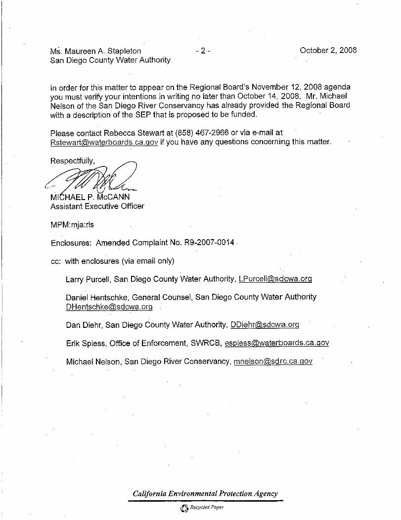
estoration Program R Supplemental Environmental Project (SEP) - San Diego Regional Water Quality Control Board- San Diego Water Authority
Contract & Procurements -Department of Fish & Game Property
Legislative News -SB 1428 -08-09 Budget
2008-2009 Special Session – Governor’s Announcement
6. Deputy Attorney Generals Report
7. San Diego River Trail - Mast Park West-City of Santee (Proposition 40 Grant Application) -Presentation: City of Santee
-Resolution 08-07 8. Trust for Public Lands (TPL) - New Partnership (Grant for TPL’s Conservation Vision Services) -Presentation & Report: Michael Nelson & Caryn Ernst of TPL -Resolution 08-08
9. San Diego River Gorge Trail and Trailhead Improvement Project
(Consideration of Adoption of a Negative Declaration) -Presentation and Report: Michael Nelson, Ann Van Leer
-Resolution 08-09
10. Adjournment
Accessibility In accordance with the Americans with Disabilities Act of 1990, if you require a disability related modification or accommodation to attend or participate in this meeting, including auxiliary aids or services, please call Michael Nelson at 619-645-3183

State of California San Diego River Conservancy EXECUTIVE OFFICER’S SUMMARY REPORT
Meeting of November 21, 2008 ITEM: 1 SUBJECT: ROLL CALL AND INTRODUCTIONS

State of California San Diego River Conservancy EXECUTIVE OFFICER’S SUMMARY REPORT Meeting of November 21, 2008 ITEM: 2 SUBJECT: APPROVAL OF MINUTES The Board will consider adoption of the September 18,
2008 public meeting minutes. PURPOSE: The minutes of the _ September 18, 2008 Board
Meeting are attached for your review. RECOMMENDATION: Approve minutes

SAN DIEGO RIVER CONSERVANCY (SDRC) Minutes of September 18, 2008 Public Meeting
(Draft Minutes for Approval November 21, 2008)
Chairperson Donna Frye called the September 18, 2008 meeting of the San Diego River Conservancy to order at approximately 1:05 p.m.
1. Roll Call
Members Present: Donna Frye, Chair Council Member, City of San Diego Dianne Jacob Supervisor, Second District, County of San Diego Jerry Sanders Mayor, City of San Diego—Arrived at 1:30 p.m. John Donnelly Wildlife Conservation Board—Via Phone Anne Sheehan Department of Finance—Via Phone Anne Haddad Public at Large Ronie Clark Department of Parks and Recreation Ben Clay Public at Large David King San Diego Regional Water Quality Board Toni Atkins Council Member, Public at Large Karen Scarborough Resources Agency Absent: Ruth Hayward Public at Large
Andrew Poat Public at Large Staff Members Present:
Michael Nelson, Executive Officer Hayley Peterson, Deputy Attorney General Flenell Owens, Administrative Services Manager Ann Van Leer, Consultant, San Diego River Conservancy Jim King, Project Development Analyst Others Present:
Janet Redding, Michael Beck, Nicole McGinnis, Jeffery Pasek, Chuck Muse, Sue Richardson, Chet Barfield, Melanie Kush, Brian Albright, Megan Hamilton, Brent Eidson, Stephen Hill, Megan Johnson, Tale Hase, Mark West
2. Approval of Minutes
Ben Clay moved approval of the minutes of the July 18, 2008 public meeting. The motion was seconded by Ann Haddad. The minutes were adopted unanimously.
1

3. Public Comment
Any person may address the Governing Board at this time regarding any matter within the Board’s authority. Presentations will be limited to three minutes for individuals and five minutes for representatives of organizations. Submission of information in writing is encouraged.
Anne Sheehan informed the Board that this meeting would be her last as alternate for the Department of Finance. She stated that she was leaving the Department of Finance to accept a position as Director of Corporate Governance. Tom Sheehy who is presently the Department’s, Legislative Director would be filling in until a permanent replacement is selected.
4. Chairperson’s and Governing Board Members’ Report
(Donna Frye reordered the agenda to move Item 5 to the end.)
6. Deputy Attorney General’s Report (No report)
7. Proposition 40 Allocations: Status Report / Introduction of New Partners
Mike Nelson explained that a critical deadline was approaching for the SDRC’s Proposition 40 funding; that the Resources Agency had established a deadline of May 2009 to have all funds encumbered. He mentioned that at the last meeting he said that he would review the status of all Proposition 40 projects to make certain that projects could meet this deadline and would make recommendations regarding any remaining funds. He asked Ann Van Leer to give a status report of Proposition 40 funds and projects and to introduce SDRC’s new partners to the Board for those projects that would utilize the Proposition 40 funds that remained. Ann Van Leer stated that there was approximately $4.2 million of funds left unencumbered from the original $10 million set aside for SDRC by the Resources Agency. She indicated that Hanson Ponds and the Riverford Road Trail will soon be encumbered and reduce the remaining balance to $2.2million. She stated that today’s agenda included two resolutions for previously approved projects, Invasives Removal and the River Gorge Trail. She added that the Board’s approval of these resolutions would further reduce the balance to approximately $450,000. She also indicated that the Board would receive a presentation from the City of Santee regarding a San Diego River Trail project that would encumber the balance of the Proposition 40 funds; it would appear on SDRC’s next meeting agenda. She introduced representatives of projects that would use the funds approved for the invasives program.
Carlton Oaks Golf Course
Jeff Pasek City of San Diego, Water Department stated that the Water Department owned about 101 acres at the City’s eastern boundaries. Presently, 73 acres is leased to the Carlton Oaks Golf Course. It is a 50-year lease that will expire at the end of this calendar year. He further stated that it was the City of San Diego and the Water Department’s intention to hold on to the land and renegotiate a lease with the golf course operators. He said that 65 acres along the San Diego River would be retained as riparian habitat. He added the Water Department valued the golf course and the
2

undeveloped riparian habitat because they protected ground water resources and other resources along the river.
Cactus Park
Mike Nelson recalled that the Board had encouraged a meeting with all of the property owners in the vicinity of Cactus Park to determine whether these properties could be restored and possibly improved to provide greater public benefits. The Parks and Recreation Department for the County of San Diego took the lead. Brian Albright Assistant Director of the Department of Parks and Recreation indicated that since the attempted child abduction near the park, the County had thinned the vegetation and made improvements to its property. He added that the County had met with neighboring land owners, which have become partners, to look at the larger area and determine what biological resources were present and identify invasives that could be removed to make these properties less attractive as a site for encampments. A biological study was commissioned which indentified infestations of invasive vegetation, both arundo and tamarisk. He said the County would like to proceed with a restoration project and improve a trail which could extend from the Lakeside River Park Conservancy’s trail across Highway 67 and terminate at Cactus Park. He noted that the Department of Parks and Recreation has a multi-year contract with California Conservation Corps which meant that if funding was available his Department could move quickly, do some hand thinning and then dispatch their crew to improve the trail. Ann Van Leer provided an update on the River Gorge Trail Project. She stated that this project has been evolutionary. It started as a trail, then a trailhead and has now been combined into one larger project. She said that the project hadn’t gone as quickly as SDRC would have liked, but Al Colby and Joan Friedlander, the new district ranger, have stepped in and made it a priority for Cleveland National Forest. One of the resolutions before the Board today would obligate additional funds and allow progress to continue. Ann Van Leer introduced Melanie Kush from the City of Santee who gave a presentation on the Mast Park West Trial for which Santee will request funding.
Mast Park West Melanie Kush City Planner for the City of Santee introduced Sue Richardson from the City of Santee, Community Services Department. She said the Mast Park West project is comprised of a trail and trailhead within a 43-acre property adjacent to the San Diego River. The project is estimated to cost $470,000 and would establish a critical segment in the San Diego River Trail. She stated that the project would balance habitat conservation values and public enjoyment in an environmentally responsible way. She explained the City of Santee had been offered the property contingent upon the recordation of a Conservation Agreement and that quitclaim deed is pending approval of the Conservation Agreement by the Wildlife Agencies. The City would like to participate in making this important regional river trail connection. She said they would add a trailhead, a kiosk, nature and regulatory signs and lodge pole fencing. The trail would formalize the non-formalized access over a path that already exists; and, it would widen and create an improved surface for cyclist and equestrians users. The cost of this project is approximately $470,000 and includes a 15% contingency. Ronie Clark asked if the City was planning for parking near the trailhead. Melanie Kush said that Santee was not planning any parking near the trail head, but at Mast
3

Park there is parking directly across the street under the bridge. Dianne Jacob: I am very excited about these projects. She stated that clearing out arundo and inviting bringing the public to these areas will solve other problems like transients in the area. Anne Sheehan questioned if the motion would be to approve both Resolutions 08-05 and 08-06. Chairperson Frye responded affirmatively and said the motion would also allow adjustment of earlier allocations of Prop 40 funds with the approval of the Chair. Dianne Jacob moved the approval of Resolution 08-05 and 08-06 to refine earlier allocations of Proposition 40 funds and to also authorize the executive officer, with the approval of the chair, to modify funding levels for the proposed projects, Invasives, and River Gorge Trail/Trailhead, within the unencumbered balance of $1,918,796.00 and retaining sufficient funding to support the Santee Trail should Governing Board members choose to do so at the meeting of November 21. Ben Clay seconded the motion. The Board voted 9-0-0 to approve the motion.
8. Proposition 84 Allocations: Status Report / Introduction of New Project Manager Mike Nelson mentioned that since the Board had expressed interest in the status of Prop 40 funding, that today’s meeting would also provide an opportunity to review the status of Proposition 84 funds, the only other fund source presently available to SDRC. He reported that SDRC received a $2.9 million set aside of Proposition 84 funding in the Fiscal Year 07/08 budget which had been allocated to the State Coastal Conservancy (SCC). He explained that this “set aside” was accomplished through “budget language” placed within SCC’s budget. The SDRC Board has approved two projects that utilize these funds: the Tributary/Canyon Project and the San Diego River Trail connection beneath SR 163 between Fashion Valley Mall and Hazard Center. He added that in addition to the $2.9 million, another $3 million had been identified in budget language for SDRC projects in the 08/09 budget approved by the Legislature. He stated that he is presently working with SCC to obligate and encumber funds for those projects and has identified SDRC projects that would be candidates for the remaining funds. He introduced Megan Cooper, the project officer for SCC, to review the status of the Proposition 84 funding. Megan Cooper presented the actions SCC had taken to obligate this budget allocation. She focused n three projects: o
Tributary/Canyons Project She reported that SCC had approved a $150,000 planning grant for the Tributary/Canyons Project June 5, 2008. Jim King is SDRC’s manager for this grant. SCC’s approval provides SDRC with funding necessary to prepare a conceptual design before proceeding with implementation. She stated that Jim
g was in the process of hiring contractors to get the design phase underway. Kin The San Diego River Trail (SR 163)
Regarding the San Diego River Trail Project at SR163, she reported that SDRC and she had discussed the project with officials from the City of San Diego and it was agreed that the City would fund all preconstruction costs, including engineering and permitting. After completing the design, permitting and achieving environmental compliance (CEQA), SCC would tentatively agree to fund construction.
4

She also informed the Board that she had arranged a bike ride along the San Diego River Trail with the SCC’s Regional Manager, the Executive Director of the San Diego County Bicycle Coalition and SDRC’s Executive Officer. She stated that the group toured trail segments from Lakeside to Ocean Beach and indicated that it had helped achieve a better understanding of the San Diego River Trail, as well as the gaps that must be addressed. In fact, SCC and SDRC are considering the advisability of doing a “gaps analysis” that would better define, the impediments, the distance of the missing linkages, and preliminary calculation of the construction costs. Mike Nelson emphasized that the “gaps analysis” would establish estimates for the investment that has been made in the Trail. As an example, he suggested that the document would attempt to estimate private and public funding throughout Mission Valley; facts that would hopefully make SDRC and its partners grant applications more attractive.
Watershed Monitoring Project The third project, which this Board had approved at an earlier meeting and has been referred to as, RiverNet, was the subject of a discussion in Oakland with Mike Nelson, officials from San Diego State University and SCC’s Conservancy’s Executive Officer. A decision was made that SCC would consider a planning grant to better define the scope of the project. What the data needs were and how the data would be utilized. She stated that this could be a fairly quick exercise that would make certain the project was eligible for funding by SCC. She noted that she planned to present the proposal to the SCC Board, December 5, 2008. John Donnelly asked if Megan could explain the fiscal relationship between SCC and SDRC and whether the Coastal Conservancy has final say over the allocation or SDRC. Megan Cooper responded that the funding was contained in the SCC’s budget, so SCC has the final say. Though the funding must be spent on projects approved by the SDRC Board, ultimately, SCC remains responsible for the expenditure of funds. John Donnelly also asked whether the allocation was in budget language or bond language. Megan Cooper replied that it was budget language. Mike Nelson stated that SDRC has agreed to pursue projects that are consistent with the goals of SDRC and SCC. Ben Clay asked what the footnote on the Walker/Santee and Hanson Ponds acquisitions meant and quoted “funds budgeted for these acquisitions may decrease if grant applications for them are successful”. Mike Nelson explained that Hanson Ponds was one of the Proposition 40 projects that Ann Van Leer referred to in her overview and that to date; SDRC has approved $1.5 million of Proposition 40 funds for this acquisition. He continued that SDRC’s partner, the Endangered Habitat Conservancy (EHC) has negotiated a $5 million purchase price for the property and had successfully applied to the Resources Agency for $1.5 million in Proposition 50 funds. He said that EHC intended to apply for the additional $2 million from other fund sources. He advised that he had discussions with EHC and SCC and suggested that he would be willing to recommend to the SDRC Board a proposal to consider the approval of an additional one million dollars, if EHC’s applications were unsuccessful, rather than jeopardize this 125-acre land conservation opportunity. Since all of our Prop 40 funds have been obligated he would have proposed using Prop 84 funds. He further stated that he was optimistic EHC will be successful, and that his inclusion of the project in the matrix was intended to serve as a placeholder, not an allocation the
5

SDRC Board had approved. He further stated that the Walker Property was also included on the Proposition 84 matrix as a placeholder. Ben Clay asked if any of SCC’s Proposition 84 funds were at risk. Anne Sheehan advised that she was not aware of an effort to reprogram these funds.
9. New Logo Mike Nelson recalled that the Board requested that he obtain proposals from a graphic designer for an SDRC logo. He said that 4 conceptual designs were developed for their consideration. Dianne Jacob inquired how the logo would be used. Mike Nelson said it would be used on all stationary, business cards, banners, and any marketing or promotional piece. Dianne Jacob asked if it would be used on signs along the river. Mike Nelson replied that it he had not contemplated its usage for signs. Moreover, he advised that the Conceptual Plan for San Diego River Park encouraged unified signage. Ann Haddad asked whether these concepts would compete or be similar to those of our partners or other entities. Mike Nelson responded that California EPA has a logo that is somewhat similar to one of the conceptual designs. Dianne Jacob asked how many different river park logos were there. Chairperson Frye responded that there were probably 50 or more different organizations. Chairperson Frye asked each member which Concept they preferred. John Donnelly selected Concept 3C. Ann Sheehan selected Concept 3C as first choice, Concept 2A as second. Dianne Jacob selected Logo Concept 2. Toni Atkins selected Concept 2B as her first choice and Concept 3C as her second. Mayor Jerry Sanders took no position. Ronie Clark selected the Concept 2 Anne Haddad selected Concept 1A. Ben Clay selected Concept 2. Karen Scarborough selected Concept 1. David King selected Concept 2A. Chairperson Frye selected Concept 2. Chairperson Frye stated that it appears the voting members prefer Concept 2. Ben Clay made a motion to support the selection of Concept 2 as the new logo for the Conservancy. Mayor Jerry Sanders seconded the motion. Chairperson Frye asked if there was any further discussion about the Concept 2 logo. Ann Haddad remarked that Concept 2 was too similar to the San Diego River Park Foundation’s logo. She added that she was aware that as partners we were all interrelated, but felt SDRC’s should be different and believed the Board should look at other designs. Chairperson Frye offered that conceptually, if Concept 2 was narrowed, so it wasn’t so blocky to differentiate it from the San Diego River Park Foundation’s logo. She also observed that the Concept 2
6

could be lengthened to fit Concept1 which Ann Haddad and Karen preferred. Karen Scarborough asked if what she proposed was to meld Concept 1 and 2. Chairperson Frye replied that yes that was the case. Dianne Jacob clarified that the Board was not approving a Concept, but asking the graphic designer to resubmit different approaches to Concepts 1 and 2. Chairperson Frye restated the motion to request the designer to take Concept 1 and 2, elongate Concept 2 and make it more closely resemble Concept 1. The Board voted unanimously by a vote of 9-0-2 to approve the motion.
5. Executive Officer’s Report
2009 Meeting Schedule
Mike Nelson stated that the Board should consider establishing a schedule of meetings for 2009. He asked the Board for guidance as to whether there was a preference for the second or third week of alternating months; or the beginning or end of the week. Alternatively, he said he could conduct a poll of possible dates utilizing software designed for this purpose. Chairperson Frye suggested that we should use the software and encouraged everyone to respond back within two weeks. Karen Scarborough said that conflicts with schedules for SANDAG, Coastal Commission, and Coastal Conservancy should be avoided and asked if the software could eliminate those dates. She added that this year’s calendar was sporadic, but asked how well it worked. Mike Nelson: answered that the program could take the dates of those Boards into consideration. He said that the sporadic calendar did work; a quorum was always achieved Dianne Jacob asked what is wrong with this Thursday at 1 PM on alternating months. Chairperson Frye said she just wanted to accommodate as many members as possible and continue to have a quorum. She asked Mike Nelson to conduct a poll that determined whether the third Thursday of the month in the afternoon would work.
Status of Legislation AB 8 Mike Nelson said there was a Water Bond introduced which specifically referred to the projects of SDRC, but it was no longer receiving serious consideration. SB 1428 Mike Nelson reported that this legislation had been approved by the both the Senate and the Assembly and hopefully would receive a favorable review by the Governor.
7

Ben Clay advised that if there was no agreement on the Budget then some bills would disappear. If there is an agreement put together between all of the parties on the Budget, then he suspects many bills will sail through; but, if there is no agreement, these bills are at risk. Anne Sheehan replied that she agreed with Ben’s assessment. 08-09 Budget Mike Nelson stated that the budget for SDRC had not changed and the operating budget remained at $333,000, he also advised that the SCC’s 08/09 budget included budget language that could provide a $3,000,000 Capital Outlay.
Project Updates
OB Bike Path Mike Nelson said that while the problem with Caltrans and a longitudinal encroachment permit had been solved, similar right-of-way issues existed with MTS and its partner the North County Transit Authority. Ben Clay asked if permits from Caltrans and others could be obtained simultaneously for the San Diego River Trail beneath SR163. Mike Nelson responded that he had discussed this issue with the District Engineer for Caltrans who expressed a willingness to establish a working group to examine encroachment issues along the entire length the San Diego River. SDSU &SDRC Inter Agency Agreement Mike Nelson reported that the partnership with SDSU was progressing. He advised that SDRC had worked with the Resource Agency and the San Diego State University’s Research Foundation to allow the University to be directly involved with the invasives removal program. He spoke of SDRC securing the permits and regulatory approvals, resolving any land tenure issues and then turning the project over to the Research Foundation for implementation and invasives removal throughout the watershed. He reminded the Board that Megan Cooper of the SCC had provide a status report for the RiverNet project. Walker Properties-City of Santee Mike Nelson said that appraisals for the properties were almost complete, that negotiations with the property owners should commence in November and that as he had previously mentioned, The Trust for Public Lands, a national nonprofit, had agreed to assist SDRC with this acquisition and possibly others along the river. Hanson Ponds Mike Nelson advised that SDRC had approved $1.5 million of our Proposition 40 funds for this project and that he had been notified by EHC that a purchase and sale agreement for the property was being prepared and that the property owners were seeking a closing this calendar year. Michael Beck said that the transaction must be reviewed and approved by the Wildlife Conservation
8

9
Board (WCB), and that it would be very difficult to get on WCB’s November agenda. John Donnelly replied that he didn’t believe the contract could make his November agenda. Hydrology Study Mike Nelson stated that the scope of work had been revised for this study which had been approved by the Board sometime ago with the Department of Interior’s, Bureau of Reclamation. The hydrology study will now include the City of San Diego, examine the numerous planning documents that exist, make recommendations consistent with these plans, and indentify projects that will improve the hydrology of the San Diego River Sponsorships Mike Nelson advised the Board that he had prepared a memorandum and policy recommendations for future sponsorships. He said that the memorandum also answered questions raised at SDRC’s last meeting regarding SDRC’s sponsorships, with the Museum of Natural History Museum. He summarized the responses to the Boards questions, listed the sponsorship benefits, and indicated that Janet Redding was in attendance to respond to any questions members of the Board might have.
10. The meeting was adjourned at 2:30 PM.
Accessibility
In accordance with the Americans with Disabilities Act of 1990, if you require a disability related modification or accommodation to attend or participate in this meeting, including auxiliary aids or services, please call Michael Nelson at 619-645-3183.

State of California San Diego River Conservancy EXECUTIVE OFFICER’S SUMMARY REPORT Meeting of November 21, 2008 ITEM: 3 SUBJECT: PUBLIC COMMENT PURPOSE: Any person may address the Governing Board at this
time regarding any matter within the Board’s authority which is not on the agenda. Submission of information in writing is encouraged. Presentations will be limited to three minutes for individuals and five minutes for representatives of organizations. Presentation times may be reduced depending on the number of speakers.

State of California San Diego River Conservancy EXECUTIVE OFFICER’S SUMMARY REPORT Meeting of November 21, 2008 ITEM: 4 SUBJECT: CHAIRPERSON’S AND GOVERNING BOARD
MEMBER’S COMMENTS PURPOSE: These items are for Board discussion only and the Board
will take no formal action.

9:30 AM 1:30 PM 9:30 AM 1:30 PM 9:30 AM 1:30 PM 9:30 AM 1:30 PM 9:30 AM 1:30 PM 9:30 AM 1:30 PM
Ann Haddad OK OK OK OK OK OK OK OK OK OK OK OK
John P. Donnelly OK OK OK OK OK OK
Ruth Hayward OK OK OK OK OK OK OK OK
Andrew Poat OK OK OK OK OK OK OK OK
Alice Re on behalf of Dianne Jacob OK OK OK OK OK OK OK OK OK OK
clay OK OK OK OK OK OK
Lee on behalf of Donna Frye OK OK OK OK OK OK OK OK OK OK OK OK
Count 5 7 4 5 5 6 4 6 5 6 4 5
9:30 AM 1:30 PM 9:30 AM 1:30 PM 9:30 AM 1:30 PM 9:30 AM 1:30 PM 9:30 AM 1:30 PM 9:30 AM 1:30 PM
Ann Haddad OK OK OK OK OK OK OK OK OK OK OK
John P. Donnelly OK OK
May-09
Jul-09 Sep-09 Nov-09
Thu8
Thu15
Thu5
Jan-09 Mar-09
Thu10
Thu12
Thu7
Thu9
Thu16
Thu3
Thu5
Thu12
Thu14
Your nam
Participate
y
Ruth Hayward OK OK OK OK OK OK OK OK OK OK OK OK
Andrew Poat OK OK OK OK OK OK OK OK OK
Alice Re on behalf of Dianne Jacob OK OK OK OK OK OK OK OK OK OK OK OK
clay
Lee on behalf of Donna Frye OK OK OK OK OK OK OK OK OK OK OK OK
Count 6 6 4 5 5 5 4 5 5 5 4 5
Yes votes for 9:30 AM 1:30 PM Comment by toni atkins. (Monday, October 27, 2008 1:02:51 PM PDT)8-Jan 5 7 I don't know what my schedule will be in 2009 but I imagine it will be easier for me to do afternoons.
15-Jan 4 5 I'll remain open to anything.5-Mar 5 6 Comment by Beth for Karen Scarborough. (Wednesday, October 29, 2008 12:17:23 PM PDT)
12-Mar 4 6 Possible conflict with Coastal Commission might occur. Prefer morning meetings over afternoon.7-May 5 6
14-May 4 59-Jul 6 6
16-Jul 4 53-Sep 5 5
10-Sep 4 55-Nov 5 5
12-Nov 4 5
Summary of Availability

State of California San Diego River Conservancy EXECUTIVE OFFICER’S REPORT Meeting of November 21, 2008 ITEM: 5 SUBJECT: EXECUTIVE OFFICER’S REPORT The following topics may be included in the Executive
Officers Report. The Board may take action regarding any of them:
Project Updates -Bike Path -Logo Design -SDSU, SDRC, SDRPF / San Diego River Watershed Data Collection and Restoration Program Supplemental Environmental Project (SEP)
- San Diego Regional Water Quality Control Board- San Diego Water Authority
Contract & Procurements -Department of Fish & Game Property Legislative News -SB 1428 -08-09 Budget 2008-2009 Special Session – Governor’s Announcement

PROJECT NAME
DRAWING TITLE
SCALE
DATE
SHEET NO.
San Diego River Conservancy Logo Design
Logo Concept 1
No scaleC-01-2
31/OCT/08
Concept 1
1.A

PROJECT NAME
DRAWING TITLE
SCALE
DATE
SHEET NO.
San Diego River Conservancy Logo Design
Logo Concept 2
No scaleC-02-2
31/OCT/08
Concept 2
2.A
2.B
2.C


Senate Bill No. 1428
CHAPTER 406
An act to amend Sections 32631, 32634, and 32661 of the PublicResources Code, relating to the San Diego River Conservancy.
[Approved by Governor September 27, 2008. Filed withSecretary of State September 27, 2008.]
legislative counsel’s digest
SB 1428, Kehoe. San Diego River Conservancy.Existing law authorizes the San Diego River Conservancy to acquire and
manage certain public lands in the San Diego River area. These provisionsare repealed on January 1, 2010, unless a later enacted statute, that is enactedbefore January 1, 2010, deletes or extends that date. The governing boardof the conservancy consists of 11 voting members, including the Mayor ofSan Diego, and 2 nonvoting members.
This bill would extend the repeal date until January 1, 2020. The billwould provide that the Mayor of San Diego or his or her designee shall bea voting member.
Existing law states that the conservancy has developed a Five YearStrategic and Infrastructure Plan that is consistent with the San Diego RiverParkway Concept Plan.
This bill would delete this provision.
The people of the State of California do enact as follows:
SECTION 1. Section 32631 of the Public Resources Code is amendedto read:
32631. (a) The San Diego River is a natural, historic, and recreationalresource in the heart of San Diego. From its headwaters near the town ofJulian in east San Diego County, it runs 52 miles through Mission Valleyand the first settlement in California at Old Town San Diego before it emptiesinto the Pacific Ocean at Ocean Beach. The river has been subjected tointense development in some parts; it runs through one of San Diego’s mostpopulated neighborhoods and is in need of restoration, conservation, andenhancement all along its length. The area presents excellent opportunitiesfor recreation, scientific research, historic preservation of the first aqueductin the United States, and educational and cultural activities, of value toCalifornia and the nation. Reestablishing the cultural and historic connectionsbetween the San Diego River, Old Town San Diego State Historic Park, theMilitary Presidio, and the Kumeyaay Nation will provide the public withthe opportunity to appreciate the state’s historic beginnings.
94
(b) Given the opportunities available, the state recognizes the importanceof holding this land in trust to be preserved and enhanced for the enjoymentof present and future generations.
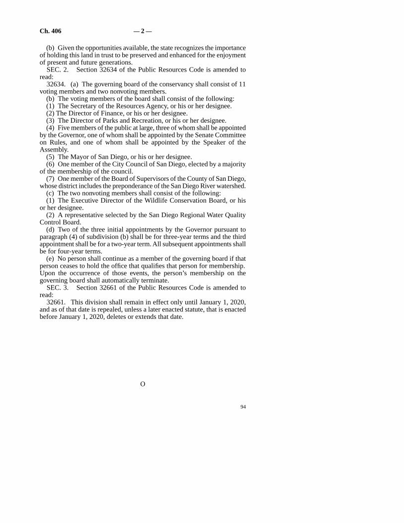
SEC. 2. Section 32634 of the Public Resources Code is amended toread:
32634. (a) The governing board of the conservancy shall consist of 11voting members and two nonvoting members.
(b) The voting members of the board shall consist of the following:(1) The Secretary of the Resources Agency, or his or her designee.(2) The Director of Finance, or his or her designee.(3) The Director of Parks and Recreation, or his or her designee.(4) Five members of the public at large, three of whom shall be appointed
by the Governor, one of whom shall be appointed by the Senate Committeeon Rules, and one of whom shall be appointed by the Speaker of theAssembly.
(5) The Mayor of San Diego, or his or her designee.(6) One member of the City Council of San Diego, elected by a majority
of the membership of the council.(7) One member of the Board of Supervisors of the County of San Diego,
whose district includes the preponderance of the San Diego River watershed.(c) The two nonvoting members shall consist of the following:(1) The Executive Director of the Wildlife Conservation Board, or his
or her designee.(2) A representative selected by the San Diego Regional Water Quality
Control Board.(d) Two of the three initial appointments by the Governor pursuant to
paragraph (4) of subdivision (b) shall be for three-year terms and the thirdappointment shall be for a two-year term. All subsequent appointments shallbe for four-year terms.
(e) No person shall continue as a member of the governing board if thatperson ceases to hold the office that qualifies that person for membership.Upon the occurrence of those events, the person’s membership on thegoverning board shall automatically terminate.
SEC. 3. Section 32661 of the Public Resources Code is amended toread:
32661. This division shall remain in effect only until January 1, 2020,and as of that date is repealed, unless a later enacted statute, that is enactedbefore January 1, 2020, deletes or extends that date.
O
94
— 2 —Ch. 406


River protectors gain time
10-year extension bolsters oversight agency, partners
By Mike Lee STAFF WRITER
October 1, 2008
Supporters of the state agency in charge of protecting the San Diego River are enjoying a new lease on life and projecting big things over the next decade.
The San Diego River Conservancy's charter was extended to 2020 by legislation from state Sen. Christine Kehoe, D-San Diego. Gov. Arnold Schwarzenegger signed the bill over the weekend.
The conservancy, established in 2002, was set to close Jan. 1, 2010. It has been hampered by staff turnover, and some backers have expressed frustration with the agency's slow progress in buying land and cleaning up the waterway.
Yesterday, conservancy leaders said the governor's signature validated their efforts and will give partner organizations confidence to continue working with the conservancy.
“The restoration of the San Diego River is going to gain momentum here, and an additional 10 years will allow us to demonstrate that we are making real progress,” said Michael Nelson, the conservancy's executive director.
The agency runs on about $350,000 annually from the state, plus bond and grant money for specific projects. In fiscal 2009, it has been allocated $3 million through the state's Coastal Conservancy.
In recent years, San Diego River restoration advocates have enjoyed growing support – particularly for their goal of creating a trail that extends some 52 miles from the river's headwaters near Julian to its mouth at Ocean Beach.
Much of the credit for that interest goes to nonprofit groups that have invested heavily in river restoration and celebrations. However, river watchers said the conservancy plays an increasingly important role in attracting money and coordinating the work.
“Projects have been picking up speed, and people are more hopeful about getting them done,” said Jim Peugh, a former conservancy board member and a veteran environmentalist in San Diego. “For a lot of years, there wasn't progress. We had ideas, but it wasn't easy to get them going.”
The conservancy's to-do list includes land conservation, recreation, education and water quality. Its current efforts include connecting trail sections along the lower river; the possible purchase of riverside land in Santee; and trails to provide river access from neighborhoods such as Normal Heights.
In 2006, the agency's board adopted a $164.5 million plan to develop related programs, and most of those projects remain unfinished.
The new legislation deleted a specific reference to that strategy. Deanna Spehn, policy director for Kehoe, said removing that language was an attempt to avoid any implication that the state had committed to funding the entire package.
She said Kehoe wrote the conservancy's extension legislation to give river advocates security about the agency's future. “Extending the deadline to 2020 gives that longevity that allows (the conservancy) to enter into long-term commitments with other agencies,” Spehn said.

There Is No San Diego River
By Bill Manson | Published Wednesday, Oct. 22, 2008
TEXT SIZE: A | A | A
SEND TO A FRIEND | E-MAIL THE EDITOR
PRINTER FRIENDLY
San Diego River? “There is no San Diego River,” says Pete Cuthbert. “What you’re dangling your toes in is
the Colorado River, the Sacramento River, the Feather River — but not the San Diego River.”
“Not the San Diego River…?”
“No. This San Diego river water is basically runoff from the lawns and cisterns and radiators and factories
and gas stations of San Diego, via polluted tributaries like Forester Creek in El Cajon. And we get most of
that water from Northern California. Without runoff there would be no river, period. Not at this time of
year.”
Pete and I are sitting at an idyllic pond above the Old Mission Dam. It’s a June morning. The day is just
warming up. Around us the trees and scrub grow wild and messy, pretty much as they did in Kumeyaay
times, I’m guessing. Ten yards to our left, a blue heron stands statue-still on a spit of sand, looking for fish

movement. Wouldn’t mind tossing in a line myself. This fresh morning, you feel a bit like Huck Finn heading
out for an adventure up the river.
And, actually, that’s what we’re having. We’re setting out to see if this 52-mile-long ribbon of life still has life
in it. Or if it has been dammed and developed and poisoned to death by us — the three million people who’ve
come here to a semi-desert and expect water whenever we turn the taps on.
Because, come on: mentality-wise, San Diego is a beach town, right? Not a river town. We’re not talking
Paris and the Seine (accordions, please), London and the Thames, Baghdad and the Euphrates, Cairo and the
Nile. Why worry about this little local “upside-down river,” as the Kumeyaay called it in summer when the
water disappeared and flowed underground? We have water from the north. The mighty Colorado is just a
couple of hundred miles east. This local river has no spectacular rapids. It’s no Moon River, “wider than a
mile.” It’s just something that floods Fashion Valley every winter, a wasteland where you toss your old
mattress when nobody’s looking. Yard fences back onto it. Heck, it only gives us five percent of the water we
need. It takes up valuable shopping space in beautiful Mission Valley, and it could be piped or sluiced
through unseen concrete pipes to get out to sea. Especially if Pete’s right — that it’s kind of like the Salton
Sea, just a collection point for pesticide/fertilizer/oil-laden runoff that you wouldn’t push your mother-in-
law into. After all, L.A.’s done it, TJ’s done it: laid a concrete bed, got rid of the messy riverbank ecology with
its bushes where homeless hide out and West Nile virus mosquitoes breed, and just turned it into a
pragmatic ditch. Why should you have to deal with the gritty water, the flooding, the bridges…
Guess the problem with that is, well, think Twain: Huck Finn. Think Grahame: The Wind in the Willows; or
Renoir: Luncheon of the Boating Party; or Andy Williams crooning “Moon River”… River culture is so
damned seductive. The feeling that life is born here. This moment. Sitting by a pool of brownish but clear
water, tossing Pooh sticks to see which will drift to the little waterfall first (you have read your Winnie the
Pooh — A.A. Milne’s House at Pooh Corner — haven’t you?), as if we were kids, dragonflies darting,
unknown birds squeaking — least Bell’s vireos? — unseen in the trees, and the rustle of…snakes? No. Cheeky
lizards. This is the other Diego. In the culture of beach, desert, and freeways, this green, cool, slow, secret
world has been left out of the picture.
But now I’m in it, it’s growing on me.
It’s an eerie feeling, here among the trees, contemplating the river. Europeans have been here, what? Two
hundred years. The Kumeyaay, 2000 years. The river, 2,000,000 years. This is not “our” river. We’re
temporary shapers of its way. But it will have its way in the end.
Which is what Mr. Cuthbert is trying to show me too. He has been fighting to save San Diego’s modest river
(its watershed — the area it draws its real waters from — is 400 square miles — compare that with the
Tijuana River’s 1700 square miles) for half a century. He has walked most of its length. He’s compiling a
book on the “Native Plants of the San Diego River Basin.” The man’s a walking watercourse encyclopedia. He

wants to show me why this is worth saving from its abusers, from gravel-pit diggers, garbage dumpers,
recklessly near-the-bank condo developers, levee builders, from a general attitude of disrespect and neglect.
Twenty-five years ago, Cuthbert was the City’s park planner and project manager for a comprehensive
“Preliminary Master Plan” for what was then called the “San Diego River Project.” The plan took years to
work up. It went into all the problems and ended up, of course, on a dusty shelf. Cuthbert has what is
probably the sole remaining copy.
Today, he’s going to show me what went into that report.
The River’s Upside-Down Today
“This is what I wanted to show you first,” Pete says. We’re at the Old 1815 Mission Dam, the earliest-known
big dam in San Diego. “It was the first irrigation/flood-control project on the Pacific Coast,” Pete says. This
was the place where the padres and the Kumeyaay worked together to provide the Mission with water. So the
padres could plant their corn and raise their cattle, using the converted Indians as convenient labor, of
course. Working in the fields for the Lord. Their work, our Lord.
But the dam certainly did get the Mission and the Spanish colonists going agriculturally.
I’m looking at this great, thick, brick and rock and cement wall that stands over 10 feet high, 10 feet thick,
and runs about 245 feet across the river, like a Roman bridge. The water spills through a 12-foot center
section where you can see slots for planks to complete the damming process. We’re about six miles upriver
from the San Diego Mission. The padres needed constant water for their fields and for themselves, and, then
as now, the San Diego River was a stop-start affair. Either flood or drought, it seemed. So in 1813, 195 years
ago, right on this spot, which is now part of the City’s underappreciated Mission Trails Regional Park, their
Kumeyaay converts recommended a place for a dam with a flume to run the water down to the Mission. They
used kilns here to make a mortar of lime and seashells to cement rocks together, a method brought directly
from Rome. Then they built the six-mile cobblestone flume lined with ceramic tile (also shaped and baked
here), placed like upside-down roof tiles.
It was one of those miracles that made the padres realize they could stay and make a go of it here after all.
The water backing up behind the dam formed Kumeyaay (formerly Collins) Lake, 300 yards of potable (at
least then), fishable, irrigation-capable water. In the years following, during the early 19th Century, the
padres were said to have accumulated 20,000 sheep, 10,000 cattle, and 1,200 horses on their lands. All
because back in 1774, they had elbowed aside the Kumeyaay village of Nipaguay and moved their Mission
from Old Town’s Presidio up to near today’s Qualcomm Stadium. It proved a good site: Above the waters
(the 1916 superflood came up to the fifth step of the Mission’s front staircase), yet accessible to fresh water,
thanks to the flume.
Pete and I walk through flat areas that he says were occupied, back in 1774, by a Kumeyaay village. We look
for some of the tiles that lined the flume. We find evidence of sleeping circles, circles of stone where

Kumeyaay men, or women, slept. “Watch for those gopher holes,” Pete says. “Snakes often use them.” He
hadn’t wanted to do this earlier in the day because rattlesnakes and their young often emerge from dens
early to warm up. By now, they’re seeking shade under rocks. But we come around one bend to see a red-
and-cream snake, maybe five feet long, sunning itself on the gravel road. It sees us and sidewinds off into the
bushes. “Red racer,” says Pete. “Not poisonous. But when I was climbing this riverbed on my own, I brought
a snake kit with me, just in case I surprised a rattler.”
What strikes me, as we drive up through Mission Trails Park, is how healthy and pristine the river looks.
“Appearances can be deceiving,” Pete says. “The only reason fish survive in many of these patches of river is
that the fertilizers from lawns promote plant growth, and even though that strangles the river, it provides
oxygen for the fish to breathe in what would otherwise be dead water.” He drives me past admirable
floodplain parks such as El Monte, a green, treed oasis among piles of sand and gravel, then onto a dirt road
and through a valley busy with horse ranchettes. We’re headed for El Capitan, the dam that stops the San
Diego River, and its fish, in their tracks. Finally, we turn right to cross the river — and drive over dry dirt.
“That was the river?” I ask.
“That was the river. Underground today.”
I think of the old Kumeyaay phrase, “upside-down river.” This is what they were talking about.
Rivers Need to Have a Life
And yet, farther up, near the river’s exit from El Capitan Reservoir, here it is gurgling again. We stop beside a
gang of orange-jumpsuited female prisoners hauling beds and mattresses and lamps and garbage up from
the side of the river and onto a truck’s flatbed.
“Would you drink this river water here?” I ask Pete.
He shakes his head.
“Look, the health of the river is directly proportional to the amount of water that flows down it,” he says.
“Today, what we have in the San Diego River below this dam is largely what it gets from Forester Creek,
which drains the El Cajon Valley, meaning runoff from people watering their front yards, draining their
radiators, cleaning their roof gutters, and so on. The quality of Forester Creek is not good at all. And then we
have other little creeks that come into the San Diego River, and they all contribute to its unhealthy state. And
the groundwater is very poor quality. San Diego still has wells in Santee; they have wells in the Grantville
area, but they don’t use them. The quality is bad. Very bad. It’s definitely polluted. If we have a good rainy
season, that helps reduce the salinity in the underground water. It also helps clean up the rivers. But I would
say today that the river’s not very healthy. There are a few reasons why: the bulrushes, the Arundo donax,
cattails, nonnatives. The river can’t sluice them out. The dams are holding back the normal flow of water.

You’d probably have a year-round flow if it wasn’t for the dams. The dams help our water supply. We’re
taking more than half of the river’s water above El Capitan and San Vicente dams. But that’s only five to ten
percent of the water San Diego needs.”
With dams, he says, natural processes grind to a halt. The fish can’t swim up to spawn, the floodwaters are
held back so the river can’t clean itself out, then when there’s a really big flood, the dams spill, and it
becomes very damaging.
“Rivers need to have a life,” he says.
And people get a false sense of security downstream. The sand and gravel companies dig big holes, which
change the dynamics and temperature of the river flow. Developers build nearer to the river bottom (land
right next to the bank). Cities build levees to stop flood waters spreading out. Result? Water, river denizens,
and good fertile silt race out to sea.
So what happened to Cuthbert’s grand 1983 plan for the river…
…which he and the consulting company, Wirth Associates, submitted to the county?
“I prepared [a report] for the approval of the Board of Supervisors,” Cuthbert says. “We were going to hire a
consultant to come up with a plan. A $300,000 plan. What to do with the river, recreationally and
[financially, etc]. It was going to be a river-park plan. So then I came up with a large plan that I presented to
the Board of Supervisors.”
Cuthbert and the consultants advocated habitat restoration and the transformation of much river
bottomland into parks, aiming for riverside walkways “from the ocean to the mountains.”
“I garnered the best talent I could find,” he says. “And we had a pretty good relationship with the Bureau of
Land Management and other agencies, because they’re already acquainted with the project. It can be a
juggling act, especially with 300 property owners, some of whom were irate. We had to convince them that
we were not trying to take their property away, and in reality, we’re probably going to help improve their
property values. I also tried to get funding for lower Mission Valley, and state funding, but it lost by one vote
of a particular committee.”
Maybe that was because the writing was already on the wall: Intensive commercial development for Mission
Valley had long since trumped the river’s health and flooding concerns. When the city allowed the Town and
Country Hotel to come in, they knew they were opening a Pandora’s box.
“[By 1983] Mission Valley was the geographic center of metropolitan San Diego,” Pete says. “Development
came in faster than they expected, and that’s been sort of typical of the City of San Diego. They are always
having to react, rather than plan ahead. They say, ‘Oh, gee, we have this developer who’s coming in with this
beautiful project. What should we do?’ In most cases they say, ‘Okay. We’ll give them the rubber stamp’

because they don’t have any advance planning to know whether that project is a good project or not. That has
historically been a problem for the City of San Diego, in the Planning Department.”
Since 1983, he says, not much has happened. “There was a little activity in the Lakeside area. People there
borrowed my reports and exerted a little bit of pressure. They have done some work in developing park
space. Santee has done some work, but nothing extensive, utilizing river bottomland. As far as I know,
[since] this plan died on the shelf, there have been no efforts to acquire land or set aside land or zone it for
open space or anything like that. In the lower San Diego River, they have. But not in the upper San Diego
River. [In the lower San Diego River area] they have the City of San Diego behind them. Its planning
department is [aiming] for walkways, some greenbelts, green space, but it’s virtually minimal. Adjacent
property owners do not want to give up that land. I mean, it’s worth hundreds of thousands of dollars an
acre. And so they look at it from that pragmatic point of view. They don’t look at it from the aesthetics at all.
“For instance, there are big-mouth bass there, bluegills. They live for the floods, so to speak, and they take
advantage of the ponds around there. There are portions of the San Diego River, like around Grantville, that
are fairly deep, and they hunker down and wait for the rains to come. But that would be the only area that
would have any fish, the Grantville area.”
How do we rate against other river towns?
Cuthbert says most towns just want to squeeze their rivers down as tight as they can. “You’ve got Los
Angeles: all concrete channels. Phoenix, Arizona, has tried to change. They have a pretty good river/flood-
control project. Phoenix is the most forbidding area to try to have a park, in a river bottom. But they have
worked at it. And San Antonio, Sacramento, and Seattle have some river projects, restoring the natural
ecology and making them available for the public. San Diego is very far behind all these people. The property
owners here control the situation, unfortunately. The gravel and sand people were the ones, initially. Over
the past 30 years, they did not want any parks or anything. They’re also the ones who were dumping
construction spoil in the barrow pits where they had mined the sand and gravel. And they’re probably getting
paid to allow [people] to dump in these barrow pits. So they become little ponds. Well, to utilize that land,
the sand and gravel companies would rather have these ponds in-filled and covered over because eventually,
maybe 20, 30, 40 years from now, they can build on them. So they have their own priority. And it’s not
recreation, and it’s not aesthetics.”
Restricting Humans So the River Can Have Life
It’s morning in La Jolla. Here at UCSD’s Thurgood Marshall College, Jim Bell holds forth to undergrads,
mostly engineering students. He has a PowerPoint presentation on the blackboard screen. It shows an
artist’s rendering of a verdant valley, seen from above. A river winds down among woodland and meadow,
with some fields cultivated, and some houses — but only peeking down from the valley rim.

“When I ran for mayor of San Diego in 2004, against Murphy and Roberts and Peter Q. Davis,” says Bell, a
big, fervent, self-styled eco-designer from O.B., “the final debate was on Channel 10. It turned out I was the
last one to speak, and I’d written this little poem: ‘These guys are the old, I’m the new, I’ve got a plan, They
haven’t a clue.’ ”
He looks up at the painting. “This,” he says, “is Mission Valley [as it could be in], say, 2060. It has the best
soil. It has a river that needs its 100-year floodplain. You can either constrict the river or restrict humans.
That’s what we’re doing here. Restricting humans so the river can have life. Remember, every year, pretty
much, Mission Valley floods in winter. The chronic and the catastrophic costs add up. It’s common sense.”
He goes on to explain the logic behind depopulating and “re-naturing” the San Diego River’s 100-year
floodplain. “If you add all the tax revenue being generated by the properties down there [in Mission Valley],
that’s the income. And then you say, ‘Well, what are the chronic costs every year? What are the 10-year
flood-frequency costs? What are the 25-year frequency costs? Hundred-year flood costs?’ We can’t prove it
yet because we haven’t done the work, but I think it would turn out that it would be a net loss.
“And it’s like the developers would get in, and they make money, and then they’re out of it. And then when
the disaster happens, it’s the public who’ll be on the hook.
“So, let’s say I’m elected mayor: I put forward an ordinance to prohibit any further development in the
historic 100-year floodplain. People can still be there, but they won’t be able to add on to whatever they have.
They can repair, but eventually buildings wear out and aren’t worthy of repairing anymore. So then you take
them out of there [or] move them someplace else. And, of course, as soon as you pass a law that says you
can’t develop the floodplain, it’s going to make the land in the floodplain less valuable. So people could
legitimately scream, ‘Hey! What are you doing? You’re changing the rules.’ Assuming they were playing by
an old set of rules, and playing correctly, they shouldn’t be penalized. So the way you work it is that the land
in the floodplains goes down in value — but what’s going to happen to the land just outside the floodplain?
That’s going to go up in value. Because eventually you’re going to be overlooking this beautiful park area,
agrarian, horseback riding, tourists coming from all over the world… And so what happens is, somebody who
already owns land outside of the floodplain (in that same local area) decides to sell their land. And let’s say
that before you prohibited floodplain development, the land was worth a million dollars. OK, after you
prohibit it, [that land] is worth $2 million. But that second million is unearned. Because they didn’t do any
improvement. So you let them have 20 percent of that. They get the million, they get 20 percent more, then
you use the other $800,000 that’s left to compensate the people whose land got devalued. So everybody gets
out whole. No taxes [have been] involved.”
What Jim Bell’s worried about, he says, is the Big Flood coming. Like the one that happened in January 1916,
when 70,200 cubic feet of river water per second gushed through Mission Valley, when it flooded wall-to-
wall up to the fifth step of the San Diego Mission.

Yes, he says, it might take at least 60 years to give the river its floodplain back. “I mean, you’d say, ‘We’d like
to do it as soon as we can because otherwise we’re just keeping our fingers crossed that the big flood doesn’t
happen in the meantime.’ But the more we’ve done when the big flood comes, the less we’re going to lose, the
less the damage is going to cost.
“We in San Diego [city] have done a particularly egregious job, building [recklessly] in the floodplain. But
many cities build in floodplains. Look no further than Del Mar. Its racetrack is squarely on the San Dieguito
floodplain. There you [might] say, ‘Well, maybe that’s not so bad, because you run over a racetrack with a
flood, big deal. You can push the broken buildings into the ocean.’
“But also, here’s the thing. Floodplains are fertile. How crazy is it to pave over your most fertile land?
Especially as ‘think global, act local’ will become more and more necessary. Look at the rising cost of
transporting, say, lettuces 1500 miles. We’re going to need our fertile land. But there are lots of things you
can do in the floodplain, like grow food and make [tourist] money, [things] that are not going to be damaged
very much if there is a big flood. Some Mississippi towns have already backed up beyond their floodplains.
It’s just common sense.”
Bell has an interesting résumé. He has written two books on living harmoniously with Mother Earth
(Achieving Eco-Nomic Security on Spaceship Earth and Creating a Sustainable Economy and Future on
Our Planet) and worked for César Chávez during his Farm Workers’ Union organizing days. “If a flood
happened when El Capitan and San Vicente dams were full or broken, you could expect, where 163 crosses
the river, to have water 30 feet deep. It could go as high as 100 feet. The last so-called 100-year flood was
1916. And now, with global warming, there are fears the hurricane track will edge north toward San Diego.”
“We Decided to Give the River a Voice”
Bell isn’t alone on this. There are at least 68 related groups working to save the San Diego River. Rob Hutsel
tries to coordinate their efforts. More than that, he’s been prepared to get down and do the nitty-gritty things
like pick up trash along the riverbank — in a different league from spotting for least Bell’s vireos here and
elsewhere. And his group is actually making significant progress in a part of the river just east of the 5, across
from Old Town.
I got off the green line trolley at Morena Linda Vista after a beautiful scenic ride crisscrossing the river from
San Diego State. You walk across Friars Road, run down a gravel embankment where a wooden sign says
“Mission Valley Preserve,” and suddenly you’re in a different zone. It’s like putting on a pair of those Bose
noise-dampening earphones. You’re hearing birdsong, kids laughing. A group of YMCA children is sitting on
a wooden bench in a clearing in the bushes, hearing about how to use native plants for medicine and food.
Hutsel’s here, looking the dapper guy he is (he used to work in Mayor Susan Golding’s office and says she
called him her “Officer of Common Sense”), as the director of the San Diego River Park Foundation. He
starts giving me the spiel, which is fine because I know nothing about this place. Never noticed it before. “It’s

the only City park in all of Mission Valley,” he says. “Fifty-two acres. Bounded by 5, 8, and the river runs
through it. It’s a good study for what we’re trying to do.” He’s leading me along a track as he speaks. He stops
at a bush with clusters of cream-colored flowers with little racks of blue berries. He picks a few off. “Try
some,” he says.
I do, and they taste like…blueberries. “Blue elderberry,” he says. “Native. Birds love them too.”
He says he came to this kind of work after the massive (34-million-gallon) sewage spill up around SDSU,
Adobe Falls, that happened back in 2000. Of course, the sewage ended up in the river. “It ran for a week,” he
says. “Nobody cared. There was no public outcry. A dozen of us got together at Donna and Skip Frye’s surf
shop and decided to get organized. We decided to give the river a voice. We needed to create an umbrella
nonprofit.”
But the Mission Valley Preserve actually started off as a police project.
“The Western Division station is right across Friars Road. And they were dealing with a whole lot of petty
crimes, vandalism, misdemeanors. They got together with councilmember Valerie Stallings. I was working
for the mayor. I’d come down and volunteer in a cleanup, and then we had the idea to dedicate it as
parkland. Police brought their Homeless Outreach Team, their HOT team, and they did a survey. It was
amazing. They found that there were over 100 people living down here in this river area. One person had
been living here for longer than 12 years. And you’d go down, and there were literally piles of trash 20–30
feet across, solid paper, human waste, clothes. But they had kitchens set up, car batteries that were probably
stolen — that’s how the police got involved. But they had incredible places. Sometimes the ‘homes’ were two
stories high. They had a mayor; and the community was purposely divided: on one side of the river — the
north side — were the people who did drugs; on the other — the south — were the people who didn’t. So the
River Foundation was born a little after that survey, and one of the big health impacts was the homeless
population. All of that trash. And people were living in the river, bathing in the river, defecating in the river…
Imagine 100 people doing that: it doesn’t sound like a lot, but it is. And the one thing that got us going was
the fires. There used to be a fire a week down here. Some of the wires were being stolen from the
neighborhood [from businesses and homes], and then they’d come down here and melt off the insulation,
and then they’d sell the copper. There were hundreds of needles. So we made a decision that we were going
to try to make a difference. I personally made a decision that it wasn’t okay to leave the status quo here. It
wasn’t good for the people living here, it wasn’t good for the wildlife. So, and slowly and methodically…now,
the fruits of our labor are such that all that trash is gone. We’ve removed it all, over 800,000 pounds of
trash. That’s just our side. The city’s removed a whole bunch as well. And we tried to find alternative places
for the people to live. But our latest survey shows nine camps with one or two people in each. So that’s way
down.”
As we talk, we walk. We’re going down a path that heads underneath the low trolley bridge and then into
taller trees. “But dealing with homeless problems is not my job,” Hutsel says. “My job is to make the river

healthy, and that I will do. The great news is that in the last year to two years, we’ve seen two endangered
bird species, including least Bell’s vireo, come back. They winter down in Baja, and this year we’ve heard two
pairs. Which is incredible. There’s something like 1000 left in the world, and the San Diego River is one of
the places they come to. The other we’ve spotted is the Southwestern willow flycatcher. And we have lots of
willows. Though when we started out it was wasteland. We’ve also seen bobcats in here. The fact that they’re
here means that it’s an inviting-enough place for them. We’ve seen the tracks and the bobcats themselves.”
We pass a kiosk shade-structure that kids from High Tech High designed and built. “We call this ‘the
gathering place,’ ” Hutsel says. “We’ll be having the trolley dancers here this year. Who would have thought
of that?”
We carry on through the trees, looking at areas Hutsel’s teams of volunteers have cleared, nonnative trees,
like palms, that they have rooted out, and pipes that deliver trash-loaded runoff water from gutters as far
away as USD up the hill. “So if you’re up on Linda Vista Road,” Hutsel says, “and you throw your cup out,
this is where it comes out, and we have to pick it up.”
We follow tracks down to the water — yes, past one blue tent hiding in the reeds. It almost seems like a
vernal pool, deep, still, with bubbles that make you think there might be fish down below. I spot a little
island farther out, the perfect Peter Pan pirate hideout. By the time we’re through, I’m sold. These guys’
efforts are going to be worth it. It’s as if they have dug up a beautiful, invaluable, forgotten ancient treasure,
even though, so far, they’ve just cleaned off the first layer.
“What we really want is a 52-mile-long river park,” says Hutsel, “from ocean to mountain source. We’re
planning an October ‘River Blitz’ to document the whole length. Plus, we’ve established a river garden.
Planted 1300 plantings, like sycamore trees and a lot of flowering native plants. The idea is to take over this
space and make it attractive.”
And, yes, he says, they have perch, bass, catfish, and mullet near the coast that are surviving quite well. Fish
often like the winter better because it’s cooler, and more water tumbles more vigorously, capturing more
oxygen.
Still, there are forces out there to deal with, like the trolley people, who pushed through their trolley line —
which travels back and forth across the floodplain — without real consultation. “They effectively stopped the
continuity of the trails because the bridge supports are too low in places,” Hutsel says.
Standing here, with the willows, and the water, and an egret in the water yonder, I suddenly think of Renoir’s
famous river painting, Luncheon of the Boating Party.
“Any chance of river cafés strutting out over the river?” I ask.
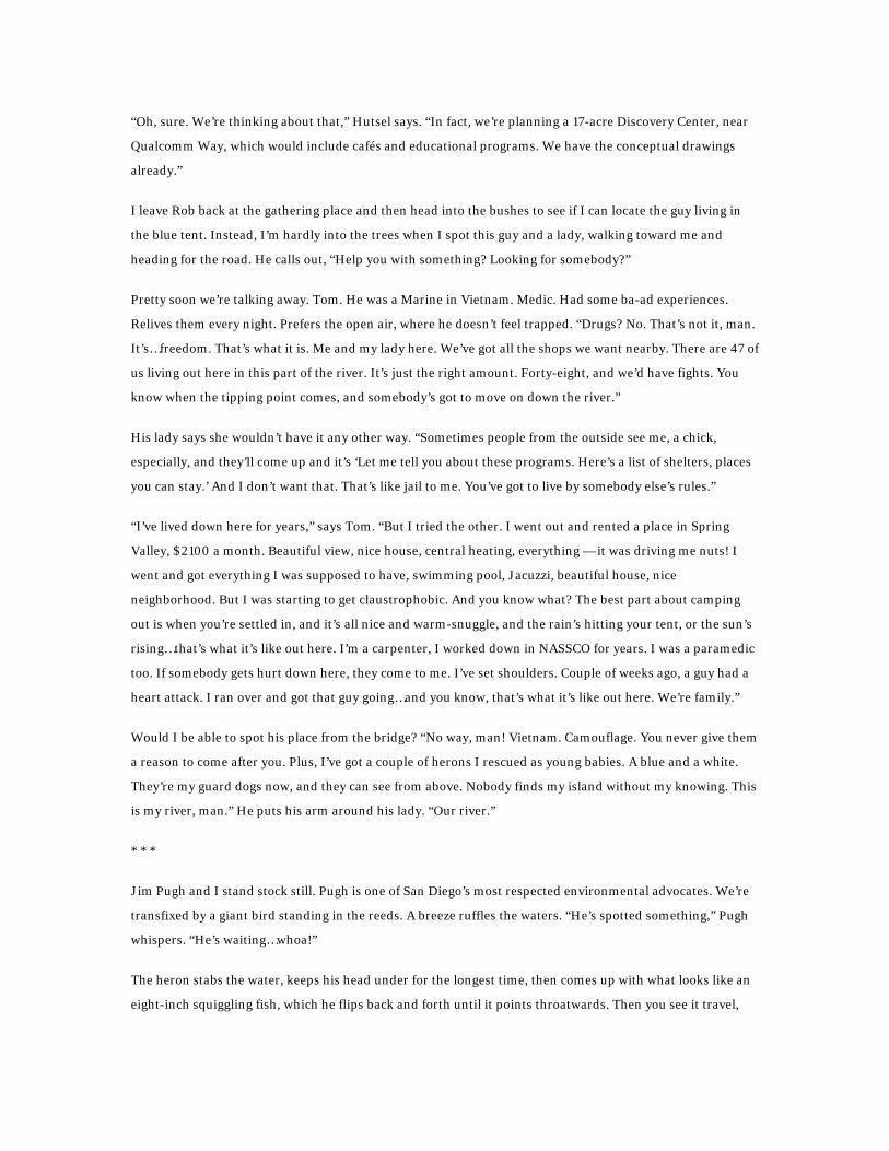
“Oh, sure. We’re thinking about that,” Hutsel says. “In fact, we’re planning a 17-acre Discovery Center, near
Qualcomm Way, which would include cafés and educational programs. We have the conceptual drawings
already.”
I leave Rob back at the gathering place and then head into the bushes to see if I can locate the guy living in
the blue tent. Instead, I’m hardly into the trees when I spot this guy and a lady, walking toward me and
heading for the road. He calls out, “Help you with something? Looking for somebody?”
Pretty soon we’re talking away. Tom. He was a Marine in Vietnam. Medic. Had some ba-ad experiences.
Relives them every night. Prefers the open air, where he doesn’t feel trapped. “Drugs? No. That’s not it, man.
It’s…freedom. That’s what it is. Me and my lady here. We’ve got all the shops we want nearby. There are 47 of
us living out here in this part of the river. It’s just the right amount. Forty-eight, and we’d have fights. You
know when the tipping point comes, and somebody’s got to move on down the river.”
His lady says she wouldn’t have it any other way. “Sometimes people from the outside see me, a chick,
especially, and they’ll come up and it’s ‘Let me tell you about these programs. Here’s a list of shelters, places
you can stay.’ And I don’t want that. That’s like jail to me. You’ve got to live by somebody else’s rules.”
“I’ve lived down here for years,” says Tom. “But I tried the other. I went out and rented a place in Spring
Valley, $2100 a month. Beautiful view, nice house, central heating, everything — it was driving me nuts! I
went and got everything I was supposed to have, swimming pool, Jacuzzi, beautiful house, nice
neighborhood. But I was starting to get claustrophobic. And you know what? The best part about camping
out is when you’re settled in, and it’s all nice and warm-snuggle, and the rain’s hitting your tent, or the sun’s
rising…that’s what it’s like out here. I’m a carpenter, I worked down in NASSCO for years. I was a paramedic
too. If somebody gets hurt down here, they come to me. I’ve set shoulders. Couple of weeks ago, a guy had a
heart attack. I ran over and got that guy going…and you know, that’s what it’s like out here. We’re family.”
Would I be able to spot his place from the bridge? “No way, man! Vietnam. Camouflage. You never give them
a reason to come after you. Plus, I’ve got a couple of herons I rescued as young babies. A blue and a white.
They’re my guard dogs now, and they can see from above. Nobody finds my island without my knowing. This
is my river, man.” He puts his arm around his lady. “Our river.”
* * *
Jim Pugh and I stand stock still. Pugh is one of San Diego’s most respected environmental advocates. We’re
transfixed by a giant bird standing in the reeds. A breeze ruffles the waters. “He’s spotted something,” Pugh
whispers. “He’s waiting…whoa!”
The heron stabs the water, keeps his head under for the longest time, then comes up with what looks like an
eight-inch squiggling fish, which he flips back and forth until it points throatwards. Then you see it travel,

struggling, on its last voyage, down the long, thin gullet. Who knew? Right here in deepest Midway, near the
Sports Arena, at the end of the river’s 52-mile journey to the sea.
It’s a slough, the Famosa Slough, an inlet where the tidal waters of the San Diego River and the Pacific Ocean
mix, and where wildlife unexpectedly thrives. “It’s incredibly healthy,” Pugh says. “And not by chance.” For
sure. The battles over the Famosa Slough are, well, famous. People have been fighting over this little nursing
ground for fish, plants, and birds since the ’30s, but especially since the 1970s, when development
threatened to fill it in. The city bought the 37-acre waterway to preserve it in the early ’90s, but it has been
local neighbors like Pugh — who have fought unremittingly to keep people back, give the wildlife breathing
room, filter the polluted waters of the river channel, plant native plants, and fight invasive exotics — who
have made it the life-sustaining miracle that it is. “Today, we have 180 species of birds, 8 species of fish, and
countless crabs that use this slough,” Pugh says. “It’s an important Pacific Flyway stop and vital for
‘vagrants,’ birds that decide to settle and live here. Even though it’s a shadow of what it was, when the whole
of Mission Bay Park was a slough, it’s something.” He also knows it’s just one small body part of a giant
living organism called the San Diego River, whose larger recovery is not going nearly so well. But he and the
rest of the silent army up and down the river, people who love it, from Hutsel to Cuthbert to Jim Bell to Tom,
aren’t about to give up. “Our motto is ‘Every loss is permanent,’ ” Pugh says, “ ‘and every victory is
temporary.’ ”
• MORE BILL MANSON
• MORE COVER STORY
• SEND TO A FRIEND
• EMAIL THE EDITOR
• PRINTER FRIENDLY
• DIGG
• DEL.ICIO.US
COMMENTS
1. The San Diego River has actually been serving the people San Diego for over 8,000 years, not 2,000
years. What other feature in our lovely region could lay claim to that? Without our river we would not
have had the San Diego that we love today. Our county is named after the river and Old Town grew up
along it's banks. Unfortunately it has become one of the more polluted waterways in the U.S. and it runs
right along our schools, playing fields, homes, churches etc.
How can we continue to let that happen? You can't have a healthy community without a healthy river. It's
truly appalling, we are a first world city with a 3rd world river running right through the middle of it.
The San Diego River is historically, culturally and ecologically significant.
It's referred to as California's first river as dicovered by Europeans. San Diego itself, including the San
Diego River is home to more bio-diversity than any other county on the U.S. mainland. There are more
unique species of flora and fauna here than anywhere else. As such, our region is prone to more extinction
than any other county. That extinction is real and is hapening right now in Mission Valley, in Santee, right

by your house or your favorite shopping center.
Fortunately, there are like minded people out there who are no longer going to sit down and let our river
be abused and neglected. I am thrilled that people are giving a voice to our river and working to make it
healthy again. I urge you to do an internet search on the San Diego River and see how you can get
involved. How exciting that we will soon have a river park and trail where you can walk or ride your bike
from OB to Julian, going through Mission Valley, through Mission Trails Regional Park up to our
beautiful mountains. The river park will be a world class destination and will be a great tourist draw on
par with Balboa Park, the Zoo and other local attractions on which so much of our economy depends.
Parts of the trail and river park exist right now and are waiting for you to explore and discover parts of
our county you may not know exist. It's time to take back our river and return the love it has given to us.
By richard 10:23 a.m., Oct 23, 2008 > Report it
State of California San Diego River Conservancy EXECUTIVE OFFICER’S REPORT Meeting of November 21, 2008 ITEM: 6 SUBJECT: DEPUTY ATTORNEY GENERAL’S REPORT This item is for Board discussion only and the Board will
take no formal action. (Hayley Peterson)

Executive Officer’s Summary Report, 11-21-2008
EXECUTIVE OFFICER’S SUMMARY REPORT Meeting of November 21, 2008 ITEM: Item 7 SUBJECT: Mast Park West Section/San Diego River Trail APPLICATION FOR GRANT FUNDS FROM PROPOSITION 40, RIVER PARKWAYS PROGRAM
UNDER THE CALIFORNIA CLEAN WATER, CLEAN AIR, SAFE NEIGHBORHOOD PARKS, AND COASTAL PROTECTION ACT OF 2002
PURPOSE: The Board may consider adoption of Resolution 08-07 authorizing the City of Santee, to obtain Proposition 40 funds from the Resources Agency to develop the Mast Park West Section of the San Diego River Trail.
STRATEGIC PLAN CONSISTENCY This item will help to implement Program 2, Project 1, Complete the San Diego River Park Trail BACKGROUND: The Conservancy’s enabling statute includes a statement
directing the Conservancy: “to provide recreation opportunities, open space,…and lands for educational uses within the area.” “To provide for the public’s enjoyment and to enhance the recreational and educational experience on public lands in the territory in a manner consistent with the protection of land and natural resources, as well as economic resources, in the area.”
The Conservancy’s Strategic Plan includes in Program 2:
Recreation and Education states; Complete projects that will most expeditiously result in River Park amenities that the public can begin to see and use. Complete or significantly advance at least 32 miles of River Park Trail.
Item 7 San Diego River Trail / Mast Park West

Executive Officer’s Summary Report, 11-21-2008
At the Conservancy Meeting of September 18, 2008, the City of Santee made a presentation entitled Mast Park West, San Diego River Trail and Trailhead which proposed the construction of a project that comprised a trail and trailhead within a 43-acre property adjacent to the San Diego River. The trail’s length would be 2,500 feet. The project includes: regional trail linkage, trailhead off Carlton Hills Boulevard, trailhead kiosk, nature and regulatory signs, and lodge pole fencing. The cost of construction was estimated to be $475,000.
THIS ACTION: The action is for the Governing Board to approve
resolution 08-07 supporting the City of Santee’s application to the Resources Agency for an amount not to exceed $475,000 of Proposition 40 funds set aside for the San Diego River Conservancy to develop the San Diego River Trail at Mast Park West.
SUPPORTING DOCUMENTS: Resolution 08-07 RECOMMENDATION: Adopt Resolutions 08-07
Item 7 San Diego River Trail / Mast Park West

Resolution No: 08-07 RESOLUTION OF THE GOVERNING BOARD OF THE SAN DIEGO RIVER CONSERVANCY
SUPPORTING THE APPLICATION FOR $475,000 OF GRANT FUNDS FROM PROPOSITION 40, RIVER PARKWAYS PROGRAM UNDER THE CALIFORNIA CLEAN WATER, CLEAN AIR, SAFE
NEIGHBORHOOD PARKS, AND COASTAL PROTECTION ACT OF 2002 BY THE CITY OF SANTEE, CALIFORNIA
____________________________________
WHEREAS, the Legislature and Governor of the State of California have provided funds for the program hown above; and s
WHEREAS, the State Resources Agency has been delegated the responsibility for the administration of his grant program, establishing necessary procedures; and t
WHEREAS, said procedures established by the State Resources Agency require a resolution certifying the approval of application by the applicant’s governing board before submission of said application to the
tate; and S WHEREAS, the applicant, if selected, will enter into an agreement with the State of California to carry out he project; and, t
WHEREAS, The project is comprised of a 2,500 feet of trail and trailhead within a 43-acre property adjacent to the San Diego River, which is consistent with the San Diego River Conservancy Act and the
ive-Year Strategic and Infrastructure Plan; and, F WHEREAS, the Governing Board of the San Diego River Conservancy finds the application for an $475,000 Proposition 40, River Parkways Grant to construct the Mast Park West Segment of the San Diego River Trail, consistent with the Conservancy’s Five Year Strategic and Infrastructure Plan, Program 2: Recreation and Education, Project 1. Complete the San Diego River Park Trail. NOW, THEREFORE, BE IT RESOLVED that the San Diego River Conservancy Board of Directors:
1. Approves the filing of an application for the construction of the Mast Park West section of the San
Diego River Trail by the City of Santee; and, 2. Finds that the City of Santee has certified that it has sufficient funds to operate and maintain the
Project(s) consistent with the land tenure requirements; or will secure the resources to do so; and,
3. Finds that City of Santee has reviewed and understands the Special and General Provisions contained in the Sample Project Agreement shown in the Procedural Guide.
Approved and adopted the 21st day of November 2008. I, the undersigned, hereby certify that the
foregoing Resolution Number 08-07 was duly adopted by the San Diego River Conservancy’s Governing oard. B
Following Roll Call Vote: Ayes: ______
Nos: ______ Absent: ______
____________________
____________
Michael J. Nelson, Executive Officer

Executive Officer’s Summary Report, 11-21-2008
EXECUTIVE OFFICER’S SUMMARY REPORT Meeting of November 21, 2008 ITEM: 8 SUBJECT: AUTHORIZING THE PREPARATION OF A GRANT
REQUEST TO DEVELOP AN ADDENDUM TO THE 5-YEAR STRATEGIC & INFRASTRUCTURE PLAN THAT IDENTIFIES AND RECOMMENDS GEOGRAPHICALY SPECFIC PRIORITES FOR THE PROGRAMS AND PROJECTS CONTAINED IN THE
LAN P
PURPOSE: The Board may consider adoption of Resolution 08-08 authorizing
the Conservancy to request approximately $100,000 from the Coastal Conservancy to allow the Trust for Public Land’s, Conservation Visioning Group to develop an addendum to the Conservancy’s Five Year Strategic and Infrastructure Plan 2006-2011, adopted March 2006.
STRATEGIC PLAN CONSISTENCY: This item seeks to refine and provide geographic specificity to the
programmatic objectives established in the 2006-2011 Strategic and Infrastructure Plan and its 4 programs: Land Conservation, Recreation & Education and Program 3, Natural and Cultural Resources Preservation and Restoration, Water Quality and Natural Flood Conveyance.
BACKGROUND:
Project Summary: The 2006 - 2011 Five Year Strategic and Infrastructure Plan (Plan) describes current resource allocations to the Conservancy, public needs served by the Conservancy, policies and principles guiding the Conservancy and the intended and recommended future course of the Conservancy’s efforts. This future course is expressed in terms of four major programs and a number of projects designed to implement each program. The four major programs are:
• Land Conservation • Recreation and Education • Natural and Cultural Resources Preservation and Restoration • Water Quality and Natural Flood Conveyance
Item 8 Trust for Public Land / Conservation Visioning Services

Executive Officer’s Summary Report, 11-21-2008
Many of the projects within this Plan are described within their respective reach of the River. In most cases the program goals are expressed quantatively not geographically (e.g. land conservation, 1500 aces; recreation and education, 32 miles of trail; restoration, 900 acres). Though considerable progress as been made in all four programmatic areas these successes have never been articulated. This exercise would not only demonstrate our accomplishments, it would also develop priorities, create an implementation strategy, and provide geographic specificity to our programmatic goals and projects. The Trust for Public Land (TPL) has extensive conservation, park and trail planning experience around the country, including over 40 active or completed Greenprint projects. This action would enable he TPL to prepare a document that would: t
• Fully utilize the conservation, park, trail and watershed plans that have already been completed such as, the SDRC Strategic Plan and Statute; San Diego River Park Conceptual Plan, The City of San Diego’s Draft Master Plan/ San Diego River Park.;
The San Diego River Watershed Management Plan. • Produce a document plan that is brief, visually appealing and presents a broad implementation strategy for the goals of the Conservancy; a document that can be incorporated as an addendum to the Conservancy’s Strategic Plan an sets forth an action plan for Conservancy’s four programmatic areas.
• Create a strategy which articulates the values associated with a corridor that connects multiple habitat and sub areas plans essential to implementation of the Multiple Species Conservation Program;
• Create a document that could serve as a Conceptual Area Protection Plan, which are used to guide investments by the California Department of Fish and Game and the Wildlife Conservation Board;
• A brochure that is concise, attractive and motivating, that can be used for program development and fundraising.
SUPPORTING DOCUMENTS: Resolution 08-08 Project report
Item 8 Trust for Public Land / Conservation Visioning Services 2

Executive Officer’s Summary Report, 11-21-2008
Resolution No: 08-08 RESOLUTION OF THE GOVERNING BOARD OF THE SAN DIEGO RIVER CONSERVANCY AUTHORIZING THE TRUST FOR PUBLIC LAND, CONSERVATION VISIONING SERVICES,
TO SEEK A GRANT FROM THE STATE COASTAL CONSERVANCY TO FUND DEVELOPMENT OF AN ADDENDUM TO THE SAN DIEGO RIVER CONSERVANCY’S 2006 -
2011 FIVE YEAR STRATEGIC AND INFRASTRUCTURE PLAN ____________________________________
WHEREAS, the San Diego River Conservancy (Conservancy) and the Trust for Public
Land (TPL) have developed a partnership to pursue the conservation of a riparian corridor in antee, California, known as the Walker Properties; S
WHEREAS, TPL is a national nonprofit land conservation and park organization offering
services in Conservation Vision, Conservation Finance, Conservation Transactions, and Research & Education;
WHEREAS, the Conservancy finds that developing an addendum to the Conservancy’s 2006-2011 Five Year Strategic and Infrastructure Plan that illustrates accomplishments and provides geographic specificity to the goals and objectives of the Conservancy’s four programs
ould be beneficial and consistent with the San Diego River Conservancy Act; and w
WHEREAS, TPL, in addition to its real estate expertise, has extensive conservation, park and trail planning experience around the country, including over 40 active or completed projects, and uses a geographic information system (GIS) to identify priorities, which combines the science behind habitat, water quality and other resource protection goals with the art of working with the ocal leaders and stakeholders. l
NOW, THEREFORE, BE IT RESOLVED that the San Diego River Conservancy Board of irectors: D
1. Authorizes TPL, Conservation Visioning Services to seek a grant from the State Coastal
Conservancy to fund the preparation of an addendum to the 2006-2011 Strategic and Infrastructure Plan that provides geographic specificity to the goals and objectives of the Conservancy’s four programs and creates a shared vision for the Conservancy, its participating local governments and its nonprofit partners, such as San Diego River Park Foundation, Lakeside’s River Park Conservancy, Endangered Habitats Conservancy and the San Diego River Coalition; and,
2. Requires the San Diego River Conservancy to negotiate a Scope of Work with TPL to secure the grant from the State Coastal Conservancy, and,
, 3. Appoints the Executive Officer as agent for San Diego River Conservancy to conduct
negotiations, execute and submit all documents which may be necessary for the completion of the aforementioned project.
Approved and adopted the 21st day of November, 2008. I, the undersigned, hereby certify
that the foregoing Resolution Number 08-08 was duly adopted by the San Diego River Con ervancy’s Governing Board. s
Vote: Ayes: ______ Nos: ______ ____________________________ Michael J. Nelson, Executive Officer San Diego River Conservancy
Item 8 Trust for Public Land / Conservation Visioning Services
Executive Officer’s Summary Report, 11-21-2008
EXECUTIVE OFFICER’S SUMMARY REPORT Meeting of November 21, 2008
ITEM 9
SUBJECT San Diego River Gorge Trail and Trailhead Improvement Project (Consideration of Adoption of a Negative Declaration)
PURPOSE The Board may consider adoption of Resolution 08-09, Adopting a Negative Declaration for the U.S. Forest Service’s San Diego River Gorge Trail and Trailhead Improvement Project
STRATEGIC PLAN CONSISTENCY
The Project will improve the San Diego River Gorge Trail and trailhead and will help implement Program 2, Project 1.1 and 1.2 of the Five Year Strategic Plan. The San Diego River Gorge Trail provides access to the San Diego River Trail from the West in Ramona and from the East near Eagle Peak and thus this project also supports Strategic Plan Program 2, Project 1, Complete the San Diego River Park Trail.
PREVIOUS BOARD ACTIONS
The SDRC Board has considered this project at previous meetings, and the Board authorized Conservancy staff to pursue Prop 40 grants for the River Gorge Trail and Trailhead improvements.
BACKGROUND This project is in partnership with the U.S. Forest Service (Forest Service) which manages the Cleveland National Forest on behalf of the American people. This is a high priority project for the Forest Service, primarily because current unsafe conditions have led to repeated rescues including calls to Life Flight to remove hikers suffering from heat exhaustion from the gorge. Additionally, unauthorized trails in the project area have created environmental degradation such as erosion, threatening biological resources in the area.
This is also a high priority for the Conservancy, for the same reasons. The Conservancy is providing Proposition 40 funding to support improvements to the trail and trailhead. Proposition 40 requires a California Environmental Quality Act (CEQA) analysis because state
Item 9 San Diego River Gorge Trail and Trailhead Improvement Project Page 1 of 32 Consideration of Adoption of a Negative Declaration

Executive Officer’s Summary Report, 11-21-2008
funds are being used to implement this project on Forest Service land. The CEQA discloses the environmental impacts from a State decision to provide funding. However, the requirements for CEQA do not apply to decisions the Forest Service makes. State funding, neither authorizes nor directs whether, where and how the trail would be built which is a Forest Service decision subject to NEPA requirements. The Forest Service will oversee construction and maintain the trail and trailhead. It is anticipated that volunteers, such as members of the Ramona Trails Association, will lend support to maintain the improvements. Additionally, the San Diego River Gorge Trail will serve as a portion of the Transcounty Trail and county trail volunteers may also support maintenance of the improvements.
This year marks the 100th anniversary of the Cleveland National Forest. The land encompassing the proposed River Gorge Trail and Trailhead has been a part of the National Forest since the Cleveland National Forest was established in 1908. For decades, forest visitors have accessed the San Diego River and gorge from both the west and east sides; the primary draw is Cedar Creek Falls which is located on land owned by the Helix Water District at the bottom of the gorge. Because of the ease of public access, the West River Gorge Trail, located at the end of Thornbush Road in the Ramona Country Estates, has been historically used. According to the Forest Service, the falls are one of the two most popular attractions on the Palomar Ranger District.
There are no officially recognized Forest trails that access the San Diego River Gorge. Over the decades, Forest visitors have created multiple unauthorized trails from the west side that bisect the hillsides leading down to the falls. Steep, unauthorized trails do not meet Forest Service trail standards making them both unsafe for hikers and an impact to the environment. In some cases trails have caused or exacerbated erosion on the hillsides and affected habitat that supported sensitive species prior to recent fires.
Because the area is unimproved (for example, no water is available for trail users) and often hot, there have been numerous occasions where Life Flight helicopters have been called to rescue hikers out of the gorge. It is for all
Item 9 San Diego River Gorge Trail and Trailhead Improvement Project Page 2 of 32 Consideration of Adoption of a Negative Declaration

Executive Officer’s Summary Report, 11-21-2008
these reasons the Forest Service has proposed improvements to the trail and trailhead to enhance public safety, environmental protection and the recreational experience. Improving the River Gorge Trail and Trailhead enhances public safety and environmental protections in the Gorge and improves access to the San Diego River. It is for all these reasons, the Conservancy is providing Proposition 40 funding to implement improvements to the trail and trailhead.
COMMENTS ON THE INITIAL STUDY AND
NEGATIVE DECLARATION
The Conservancy received seven communications on the Initial Study and Negative Declaration. Four communications were from residents who live near the trailhead on Thornbush Road and expressed opposition to the improvements. One communication was from an individual who expressed support for the project. Another communication was from the Ramona Water District expressing no comments or concerns with the project. The Conservancy also received a letter from the Department of Fish and Game seeking technical clarifications about the project. The communications and responses are included in Attachment A.
ADDITIONAL COMMENTS ON
THE PROJECT
The Conservancy has received other communications concerning the project, including communications in opposition to the project from residents residing near the proposed trailhead on Thornbush Road. Many of those communications suggested the trailhead be located onto another nearby street, Ramona Oaks Road. These communications were directed to the Forest Service and later provided to the Conservancy. The Forest Service has responded to these communications in a letter to Representative Duncan Hunter and a second letter to Supervisor Dianne Jacob; both of those letters are included in Attachment B. In addition, the Conservancy received a letter from the Department of Toxic Substances Control on November 13, after the CEQA comment deadline; its contents have been noted and it is also included in Attachment B.
THIS ACTION The action is for the Governing Board to approve resolution 08-09 adopting a Negative Declaration for the San Diego River Gorge Trail and Trailhead Improvement Project.
Item 9 San Diego River Gorge Trail and Trailhead Improvement Project Page 3 of 32 Consideration of Adoption of a Negative Declaration
Executive Officer’s Summary Report, 11-21-2008
SUPPORTING DOCUMENTS
• Resolution 08-09
• Attachment A - Communications on the River Gorge Trail and Trailhead Project Received by the Conservancy by the Deadline
• Attachment B - Other Communications on the River Gorge Trail and Trailhead Project
• Negative Declaration/Initial Study and an addendum dated November 17, 2008 - (Included in Packet Pouch)
RECOMMENDATION AND MOTION
Staff recommends the Conservancy adopt Resolution 08-09 by the following motion:
I move that the Conservancy find the negative declaration reflects the Board’s independent judgment and there is no substantial evidence in the record before us that the Project will have a significant effect on the environment and therefore move approval of Resolution 08-09.
Item 9 San Diego River Gorge Trail and Trailhead Improvement Project Page 4 of 32 Consideration of Adoption of a Negative Declaration

Executive Officer’s Summary Report, 11-21-2008
ATTACHMENT 1
Communications on the River Gorge Trail and Trailhead Project Received by the Conservancy by the comment Deadline
of November 3, 2008
A1. Communication from Diane Hall (via Carol Wylie)
From: Carole Wylie [[email protected]] Sent: Monday, November 03, 2008 8:42 AM To: [email protected]; Marian Brown; Eileen Castberg; [email protected]; [email protected]; [email protected]; Leo Frisk; Millie Gurzi; Tale Halse; Philip Harding; Michael Harrison; [email protected]; [email protected]; Chuck LeMemager; [email protected]; Robert F Macon; Christine Morgan; Mike Nelson; [email protected]; Flip Rodine; [email protected]; Mario Trejo; Cindy Venolia; Steve Venolia; Edward Wylie Subject: Fwd: San Diego River Gorge Trail and Trailhead Improvement Project
Begin forwarded message: From: Diane Hall <[email protected]> Date: November 2, 2008 2:27:34 M PST PTo: [email protected] vo Cc: [email protected] Subject: Re: San Diego River Gorge Trail and Trailhead Improvement Project Reply-To: [email protected] I am writing to add my concerns regarding the proposed trailhead project in the SD Country Estates. Please add my name to your mail list so that I may be kept up to date on what the County Board of Supervisors is going to do to stop this project from destroying the residential neighborhood that surrounds it. I am very opposed to this project and feel strongly that there are alternatives that would be less invasive. I hope that Ms. Jacob and all the Supervisors will listen to the consitutants/voters regarding this matter. Time and time again the residence in the SD Country Estates area and the Barona Mesa area have had to fight to stop our RESIDENTIAL area from being taken over by motorcyclists, off-roaders and other recreational activities that have no business being placed in or near a residential neighborhood. These kinds of issues don't seem to occur in or near other residential neighborhoods - why this one? We are plagued with motorcylists who come up here from San Diego and ride their bikes on our dirt roads and the horse/hiking/bicycling trails causing noise, scaring horses, ruining our dirt roads/trails with their spinning and circling and going at such a speed as to cause great danger to motorists in vehicles, bicyclists and horseback riders. It's a continual puroblem in my 20 years in this area. Please listen to our concerns. I hope Supervisor Jacob recovers quickly. Sincerely,
Item 9 San Diego River Gorge Trail and Trailhead Improvement Project Page 5 of 32 Consideration of Adoption of a Negative Declaration

Executive Officer’s Summary Report, 11-21-2008
Diane Hall, Ramona resident and concerned voter Response to Communication from Diane Hall: The Conservancy appreciates this communication and concurs with the response from the Forest Service included in the letters to Representative Duncan Hunter and Supervisor Dianne Jacob included in Attachment B.
A2. Communication from Carole Wylie From: Carole Wylie [[email protected]] Sent: Friday, October 10, 2008 3:57 PM To: [email protected] Cc: Eileen; Leo Frisk; Robert F Macon; [email protected]; Millie Gurzi; [email protected]; [email protected]; [email protected]; [email protected]; [email protected]; [email protected]; [email protected]; [email protected]; [email protected]; [email protected]; [email protected]; [email protected]; Philip Harding Subject: San Diego River Gorge Trail and Trailhead Improvement Project Dear Mr. Nelson, We completely oppose this project! This is the third time that I have written to you with our family and neighbors concerns regarding the San Diego River Gorge Trail and Trailhead Improvement Project. We have resided at 15628 Thornbush Rd. for the past 18 years and in that time have been evacuated three times due to wild fires. The first two times, the fires were set by people on the trails in the area that you have planned for this project. We lost many homes in our neighborhood during the Cedar Fire and our home sustained major damage during the fire that occurred on Mothers Day in the year 1993. We are extremely opposed to any development of these trails that would encourage more people to frequent the area and cause greater fire danger than we already face. We also feel that it is completely wrong to propose any such development of public parking and restrooms, etc. on a residential side street where there are children playing and residents backing out of their driveways. Country Estates was designed with major circulation element roads to handle the traffic that would access public facilities, such as parks, equestrian areas, the country club, etc. to keep the traffic off of our residential streets. These roads are free from driveways that take access to single family homes. When any public project such as this is proposed, it should continue to meet those original design standards that made us choose to live in this community and neighborhood to begin with. This project should not be allowed to take access off of Thornbush Road.
Item 9 San Diego River Gorge Trail and Trailhead Improvement Project Page 6 of 32 Consideration of Adoption of a Negative Declaration

Executive Officer’s Summary Report, 11-21-2008
Do not adopt this Negative Declaration. Sincerely, Carole Wylie Resident of Thornbush Rd., Registered Architect and Planner Response to Communication from Carole Wylie: The Conservancy appreciates this communication and concurs with the response from the Forest Service included in the letter to Representative Duncan Hunter and Supervisor Dianne Jacob included in Attachment B. A3. Communication from Geoffrey Smith From: Geoffrey Smith [mailto:[email protected]] Sent: Thursday, October 30, 2008 10:46 PM To: Mike Nelson Cc: Ann Van Leer and Jim Wilkinson; Troy Murphree Subject: San Diego River Gorge Trail Improvements, comments
October 30, 2008 Mr. Mike Nelson, Executive Officer, San Diego River Conservancy [email protected] Subject: Negative Declaration for the San Diego River Gorge Trail and Trailhead Improvement Project Dear Mr. Nelson, I am pleased to support this plan for significant restoration work in connection with trail improvements for the Trans County Trail, from the Thornbush trailhead in San Diego Country Estates, up to Saddleback on Eagle Peak Road. The degraded state of this habitat due to un‐regulated volunteer trail proliferation and down‐hill mountain bike racing is well‐known. This project would rehabilitate habitat damaged by over three acres of out‐of‐control trails, install a public restroom and water fountain, an ADA trail, and establish a much‐needed volunteer host presence. This is a wonderful proposal! By applying much‐needed restoration, and providing continuous presence through volunteer hosts, this beautiful yet highly‐impacted recreation area will
Item 9 San Diego River Gorge Trail and Trailhead Improvement Project Page 7 of 32 Consideration of Adoption of a Negative Declaration

Executive Officer’s Summary Report, 11-21-2008
finally have a chance to recover. As a gateway to the proposed Eagle Peak Wilderness complex, this project is justified, welcomed, and a much‐needed injection of support for a popular recreation area that has been ‘loved to death’ over the years. This trail corridor provides direct access to the San Diego River Gorge Proposed Wilderness, Cedar Creek Proposed Wilderness, and Eagle Peak Proposed Wilderness – all part of a combined total of nearly 25,000 acres of pristine, untrammeled land. The presence of this rehabilitated trail system, ADA overlook, and interpretive components, will provide much‐needed public education for these important public lands resources. I wish your office the best of luck with this project. Please keep Wilderness4All volunteers in mind as you schedule volunteer projects in the future! Geoffrey Smith Response to Communication from Geoffrey Smith: The Conservancy appreciates this communication and has noted the comment. A4. Communication from Eileen Castberg: -----Original Message----- From: Eileen [mailto:[email protected]] Sent: Friday, October 10, 2008 8:01 PM To: [email protected]; Carole Wylie Cc: [email protected]; Leo Frisk; Millie Gurzi; [email protected]; [email protected]; [email protected]; [email protected]; [email protected]; [email protected]; [email protected]; [email protected]; [email protected]; [email protected]; [email protected]; Philip Harding; [email protected]; Robert F Macon Subject: Re: San Diego River Gorge Trail and Trailhead Improvement Project Great letter Carole. I might add - there currently are no trailheads in San Diego County in any residential neighbors--why this one? Eileen Response to Communication from Eileen Castber: The Conservancy appreciates this communication and concurs with the response from the Forest Service included in the letter to Representative Duncan Hunter and Supervisor Dianne Jacob included in Attachment B. A5. Communication from Millie Gurzi:
Item 9 San Diego River Gorge Trail and Trailhead Improvement Project Page 8 of 32 Consideration of Adoption of a Negative Declaration

Executive Officer’s Summary Report, 11-21-2008
-----Original Message----- From: Millie Gurzi [mailto:[email protected]] Sent: Friday, October 10, 2008 9:27 PM To: 'Carole Wylie'; [email protected] Cc: 'Eileen'; 'Leo Frisk'; 'Robert F Macon'; [email protected]; [email protected]; [email protected]; [email protected]; [email protected]; [email protected]; [email protected]; [email protected]; [email protected]; [email protected]; [email protected]; [email protected]; [email protected]; 'Philip Harding' Subject: RE: San Diego River Gorge Trail and Trailhead Improvement Project Great letter, Carole, I hope you didn't mind me asking him to call you. I feel that you make a very good representative for the neighborhood. Are we still planning a meeting for the 22nd? Do we know where? Mr. Nelson expressed an interest in attending the meeting. Not sure if we should have our own meeting first, just to be better organized when he takes the time to come listen to our concerns. Let me know if I can help, like making phone calls to let people know, etc. Millie A. Gurzi Response to Communication from Millie Gurzi: The Conservancy appreciates this communication and concurs with the response from the Forest Service included in the letter to Representative Duncan Hunter and Supervisor Dianne Jacob included in Attachment B.
A6. Communication from Ralph McIntosh, Ramona Municipal Water District: From: Ralph McIntosh [mailto:[email protected]] Sent: Tuesday, October 28, 2008 11:37 AM To: [email protected] Subject: San Diego River Gorge Trail and Trailhead Improvements Importance: High
Mike, Regarding the Negative Declaration for the San Diego River Gorge Trail and Trailhead Improvements, the Ramona Municipal Water District has no comments or concerns regarding the project. Thanks, Ralph McIntosh General Manager Ramona Municipal Water District Response to Communication from the Ramona Water District: The Conservancy appreciates this communication and has noted the comment.
Item 9 San Diego River Gorge Trail and Trailhead Improvement Project Page 9 of 32 Consideration of Adoption of a Negative Declaration
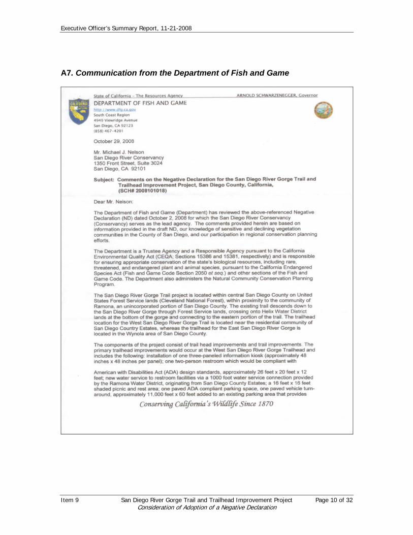
Executive Officer’s Summary Report, 11-21-2008
A7. Communication from the Department of Fish and Game
Item 9 San Diego River Gorge Trail and Trailhead Improvement Project Page 10 of 32 Consideration of Adoption of a Negative Declaration
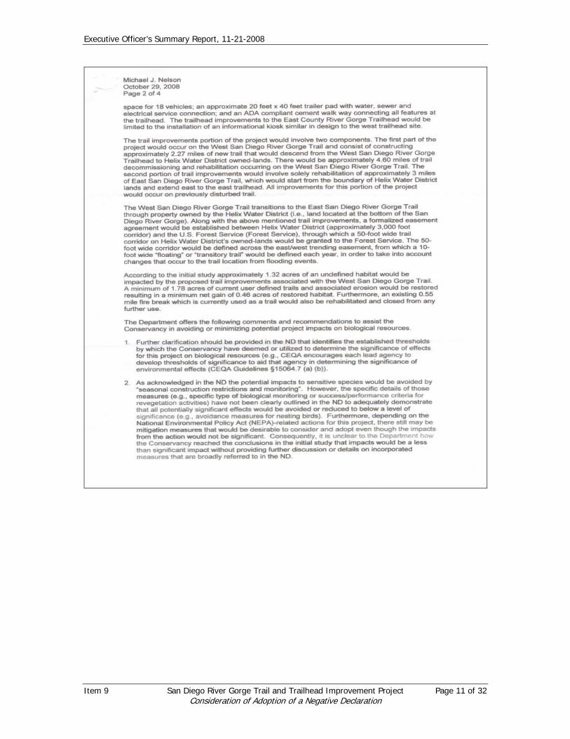
Executive Officer’s Summary Report, 11-21-2008
Item 9 San Diego River Gorge Trail and Trailhead Improvement Project Page 11 of 32 Consideration of Adoption of a Negative Declaration

Executive Officer’s Summary Report, 11-21-2008
Item 9 San Diego River Gorge Trail and Trailhead Improvement Project Page 12 of 32 Consideration of Adoption of a Negative Declaration

Executive Officer’s Summary Report, 11-21-2008
Response to Communication from Department of Fish and Game: The Conservancy appreciates this communication. See replies to DFG comments below.
Item 9 San Diego River Gorge Trail and Trailhead Improvement Project Page 13 of 32 Consideration of Adoption of a Negative Declaration

Executive Officer’s Summary Report, 11-21-2008
The following has been provided by the Forest Service in regards to comments submitted by the California Department of Fish and Game in a letter dated October 29, 2008, and a subsequent meeting held on November 12, 2008.
1. Establishment of thresholds in determination. The Forest Service’s determination of this project having no negative significant effects is based upon several conditions, including both standardized criteria established by federal law (NEPA). Determining the threshold for significance under NEPA regulations (40 CFR 1500-1508), is based on the twin criteria of context and intensity (40 CFR 1508.27). Context means the affected environment in which a proposed action would occur; it can be local, regional, national, or all three, depending upon the circumstances. Intensity means the degree to which the proposed action would involve one or more of the following 10 factors:
• Adverse effects associated with “beneficial projects”; • effects on public health or safety; • unique characteristics of the geographic area (e.g., historic resources,
park lands, prime farmland, wetlands, wild and scenic rivers, ecologically critical areas);
• degree of controversy; • degree of highly uncertain effects or unique or unknown risks; • precedent-setting effects; • cumulative effects; • adverse effects on scientific, cultural or historical resources; • adverse effects on endangered or threatened species or designated
critical habitat (pursuant to the Endangered Species Act); and • Violations of federal, state, or local environmental law.
Based on the Forest’s review of the San Diego River Gorge Trail and Trailhead project, given the small scope of the project in terms of the acres and the beneficial effects from restoring unauthorized trails in the area, it was determined that the effects of the trail and trailhead project are not significant. With regard to the loss of habitat, the total area affected is degraded chamise chaparral. This project does not meet the level of significance. Rationale for this includes:
a) Small scope (size) of project. b) No threatened and endangered species present within project area. c) No proposed ground disturbing activities within riparian habitat. d) Proposed activity will avoid heritage sites that have already been
inventoried. e) Proposed project will improve current conditions by reducing impacts from
unauthorized trails. f) Potential effects will be mitigated through restoration.
Item 9 San Diego River Gorge Trail and Trailhead Improvement Project Page 14 of 32 Consideration of Adoption of a Negative Declaration

Executive Officer’s Summary Report, 11-21-2008
g) Proposed project will not change the current use of area as the focus of this project is to better manage an already existing condition.
2. Project Mitigation Measures.
The level of detail suggested in the DFG letter regarding roles and responsibilities is not appropriate for the State to place in a state decision document as this is a Forest Service determination, and one that we do not typically include in our NEPA documentation. All project conditions and applicable environmental constraints will be presented and discussed with contractor personnel prior to the commencement of work. This is standard USFS procedure and is conducted through a Contracting Officer, Contracting Officer representative, and designated project inspector. In addition, the appropriate USFS staff personnel will also participate (e.g., district biologist, archeologist etc) as needed. Topics covered under this pre-work meeting include identification of work area, unique site conditions, and/or restrictions, safety and fire hazard restrictions, etc. Environmental constraints, including adherence to construction, trail standards and Forest Plan requirements will be a part of the final Forest Service decision and carried forward into the contract as appropriate. Trailhead Construction The proposed trailhead and associated facilities occur within chamise chaparral. This area is unsuitable for California gnatcatchers and has no recorded occupation by this species. Overall condition of the habitat within this area ranges from fair to poor, with varying levels of disturbance due to proximity to existing houses, roads, trails and other infrastructure and human disturbance. No threatened, endangered or Forest sensitive species are documented within the proposed Trailhead area. Specific mitigation measures for the Trailhead construction will include Forest Service standard Best Management Practices (BMPs) for construction and ground disturbance. These include project construction area limitations (marked boundaries), erosion and runoff control measures, parking, storage, and staging area restrictions, etc. Any other site specific environmental mitigation measures identified for this phase of the NEPA project decision and carried forward into the contract as appropriate. Trail Construction The proposed trail is approximately 2.27 miles in length. Standard mitigation measures for trail construction include BMP’s as outlined above. In addition, specific wildlife and botany mitigations will be utilized during the trail construction phase:
a) California Gnatcatcher: Prior to the most recent fires (pre-2003), gnatcatchers were known to be present in the project area. However, much of the habitat has type-converted and there is no record of them using the area since the fires. Since they were previously known to use the area, prior to initiation of work, the Palomar District wildlife biologist will survey the trail route. If gnatcatchers are present within 300’ of the trail
Item 9 San Diego River Gorge Trail and Trailhead Improvement Project Page 15 of 32 Consideration of Adoption of a Negative Declaration

Executive Officer’s Summary Report, 11-21-2008
route, then construction activities will be suspended within that area until monitoring can determine the gnatcatcher’s breeding status, general territory location and nest site location. If gnatcatchers are nesting within 300 feet of the trail route, than construction activities will be suspended until the breeding season is over (August 1) or until monitoring has determined that the pair has successfully fledged young.
b) Least Bell’s vireo and southwestern willow flycatcher: Prior to any construction activities occurring within 300 feet of riparian habitat, the Palomar District biologist will survey for the presence of these species within the project area (300’ of trail route). If either of these species is present, then all construction activities will be suspended within 100’ of riparian habitat until August 15.
c) Coastal sage scrub habitat: Trail construction activities within coastal sage scrub habitat will be restricted to the minimal area of disturbance necessary. Staging and equipment storage activities will be restricted to the trail route pathway. Trail route will be flagged at all times. Staging areas outside of the trail route zone will be pre-defined and marked and be limited to previously disturbed areas where native vegetation is limited or absent.
d) Riparian habitat: No trail construction activities or vegetation disturbance is proposed within riparian habitat. Activities within this habitat type are limited to placing trail marker signs along existing route.
3. Direct and Indirect Impacts to Vegetation
Section 1.4 of the Initial Study describes the impacts to vegetation associated with this project. Impacts will occur to native habitat, largely chamise chaparral but including lesser amounts of coastal sage scrub. All of the impacted chamise chaparral is in a disturbed condition due to proximity to existing roads, trails, homes and other structures, and proximity to existing trail. At least 1/3 of the coastal sage scrub habitat is in disturbed condition due to its proximity and overlap with existing trail. As described in the IS, there is a net gain in habitat from this project of .46 acres due to the proposed restoration of unauthorized trails.
4. Figures and mapping. Figure 2 was mislabeled and has been corrected to “San Diego River Gorge Trail Existing Conditions on USGS 7.5’ Quadrangles.” Final trail location will be located within the red cross hatched project area and constructed to minimize impacts to the resource. Regarding trail rehabilitation near the river, see response to 5, below.
5. Revegetation Plan
Item 9 San Diego River Gorge Trail and Trailhead Improvement Project Page 16 of 32 Consideration of Adoption of a Negative Declaration

Executive Officer’s Summary Report, 11-21-2008
The Forest Service is responsible for decisions regarding revegation, where needed. Prior to seeding, all identified unauthorized routes will be rehabilitated mechanically and/or manually. This work includes returning areas to natural contour, restoring drainage function, eliminating berms and ruts, and pulling back in rock and existing natural material. This technique is a standard method for road and trail obliteration and rehabilitation for the USFS and CDF/Calfire.
Revegetation activities will be performed under a separate revegetation
project in the area for over 200 acres of coastal sage scrub habitat. This effort will utilize a revegetation plan written by restoration ecologist Margot Griswold of Earthworks, Inc. After the routes have been returned to natural condition, the areas will be reseeded with a mixture of native plant seed, including California sage (Artemesia california), deerweed (Lotus scoparius), flat-top buckwheat (Eriogonum fasciculatum), white sage (Salvia apiana), Cleveland sage (Salvia clevelandii), foothill needlegrass (Nassella lepida), and snapdragon penstemon (Keckiella antirrhinoides). Reseeding will be done through a seedball application in which the native seed is encased in a clay and humus ball, which is distributed within the area. Monitoring of seed success will be accomplished through;
a) Sample plots within the coastal sage scrub restoration project area. b) Photo plots within the trail restoration sites in conjunction with user
compliance monitoring of closed trail sections. Minimum of 5 photo plots.
6. Streambed and riparian activities within San Diego River
There are no proposed activities within stream or riparian habitat other than carsonite trail markers on either end to point hikers in the correct direction. Forest Service requirements regarding impacts to riparian areas are governed by best management practices set for in the Cleveland National Forest Plan. An SAA is not required by the Forest Service who will be the responsible party for the easement across Helix land. No Proposition 40 funding will be used on Helix property. Information on the Helix easement was provided as a courtesy to the reader.
7. Equestrian and other use increases. The USFS is not proposing to expand or permit trail use or activities that are not already permitted within the area. In addition, the Forest Service is not creating significantly changed conditions within the area. If the trail is not constructed, the area will still be utilized by the public and current degradation will continue. The proposed trail and trailhead are also not providing a significantly increased benefit to equestrian use which has occurred in this area for decades.
Item 9 San Diego River Gorge Trail and Trailhead Improvement Project Page 17 of 32 Consideration of Adoption of a Negative Declaration

Executive Officer’s Summary Report, 11-21-2008
ATTACHMENT B Other Communications on the River Gorge Trail and Trailhead Project
B1. Communication from Rep. Duncan Hunter to the Forest Service and from the Forest Service to Rep. Duncan Hunter.
Item 9 San Diego River Gorge Trail and Trailhead Improvement Project Page 18 of 32 Consideration of Adoption of a Negative Declaration

Executive Officer’s Summary Report, 11-21-2008
Item 9 San Diego River Gorge Trail and Trailhead Improvement Project Page 19 of 32 Consideration of Adoption of a Negative Declaration

Executive Officer’s Summary Report, 11-21-2008
Item 9 San Diego River Gorge Trail and Trailhead Improvement Project Page 20 of 32 Consideration of Adoption of a Negative Declaration

Executive Officer’s Summary Report, 11-21-2008
Item 9 San Diego River Gorge Trail and Trailhead Improvement Project Page 21 of 32 Consideration of Adoption of a Negative Declaration

Executive Officer’s Summary Report, 11-21-2008
Item 9 San Diego River Gorge Trail and Trailhead Improvement Project Page 22 of 32 Consideration of Adoption of a Negative Declaration

Executive Officer’s Summary Report, 11-21-2008
B2. Communications from Sup. Dianne Jacob to the Forest Service and from the Forest Service to Sup. Dianne Jacob.
Item 9 San Diego River Gorge Trail and Trailhead Improvement Project Page 23 of 32 Consideration of Adoption of a Negative Declaration

Executive Officer’s Summary Report, 11-21-2008
Item 9 San Diego River Gorge Trail and Trailhead Improvement Project Page 24 of 32 Consideration of Adoption of a Negative Declaration

Executive Officer’s Summary Report, 11-21-2008
Item 9 San Diego River Gorge Trail and Trailhead Improvement Project Page 25 of 32 Consideration of Adoption of a Negative Declaration

Executive Officer’s Summary Report, 11-21-2008
Item 9 San Diego River Gorge Trail and Trailhead Improvement Project Page 26 of 32 Consideration of Adoption of a Negative Declaration

Executive Officer’s Summary Report, 11-21-2008
B3. Communication from Todd Barrow: To: Al Colby <[email protected]> From: "Todd A. Barrow" <[email protected]> Date: 10/14/2008 06:02PM Subject: Re: Forest Service River Gorge Project Scoping Documents Attached is my public comment and repeated concern for public safety of our children by having the traffic go through a small neighborhood street without safety measures speed bumps) and limited police and ranger patrols. Thank you. Todd Barrow
PUBLIC COMMENT FORM
SAN DIEGO RIVER GORGE TRAILHEAD AND TRAIL IMPROVEMENT PROJECT
Thank you for your interest in the Forest Service planning processes. Please PRINT your name, address, telephone number, and email address clearly, and write any comments specific to the enclosed proposal in the spaces provided below. Attach additional comments to this form, if needed. Please indicate if you would like to remain on the mailing list for this project.
Yes No I wish to remain on the mailing list for this project. Name and Address: Todd A. Barrow 15546 Thornbush Road Ramona, CA 92065 Affiliation: Telephone Number: 760-789-7126 Email address: [email protected] COMMENTS: The project has left off the main concern for homeowners with children in this neighborhood. SAFETY. The increased traffic will overload a street not designed for increased traffic. Failure to do a traffic impact study would demonstrate negligence for the safety of our children. It will also bring in more People to the neighborhood that has inadequate police and ranger patrol. This Puts our children at risk. Please consider the factor of safety into the equation Since there has not been a park so close to a neighborhood. PLEASE MAIL or EMAIL YOUR COMMENTS TO: Cleveland National Forest [email protected] Palomar Ranger District 1634 Black Canyon Road, Ramona, California 92065 Attn: Al Colby, Recreation and Lands Staff Officer,
SAN DIEGO RIVER GORGE TRAILHEAD AND TRAIL IMPROVEMENT PROJECT
Item 9 San Diego River Gorge Trail and Trailhead Improvement Project Page 27 of 32 Consideration of Adoption of a Negative Declaration

Executive Officer’s Summary Report, 11-21-2008
Response to Communication from Todd Barrow: The Conservancy appreciates this communication and concurs with the response from the Forest Service included in the letters to Representative Duncan Hunter and Supervisor Dianne Jacob included in Attachment B. B4. Communication from Race Paddock:
To: [email protected] From: RACE PADDOCK <[email protected]> Date: 10/13/2008 12:13PM Subject: San Diego River Gorge Trailhead and Trail Improvement Project
I have visited this area since high school with my major interest always being focused on Cedar Creek Falls. This dates back to 1968/69'. I realize the attraction and allure. At the time there were several ways to get in there...... from the west side of Julian down Eagle Peak Road, from Ramona Country Estates on the north side, and from Wildcat Canyon Road turning east at the Painted Rock and travelling down past the old adobe mission and the Helix diversion dam. It is truly a beautiful area. Your intentions are certainly different from what I have seen in the past in watching and dealing directly as well as indirectly with organizations such as "The Nature Conservancy", "Save our Forests and Ranchlands"(Duncan), "The State Water Quality Control Board", Mr. Kimura and "The Sierra Club", and also some folks representing the "State Parks" in the San Diego County area. This is a pleasant surprise and your proposed actions are commendable in concept to relieve the residential street parking, mitigating the trash left by trail users, addressing the unsanitory conditions, and minimzing repeated nuisances of trail users to local residents. Your intent of this plan seems very beneficial to all. Instead of closing off the area, which would be virtually impossible to enforce and very cost prohibitive to try, you are making this public area available to the public with oversight and mitigating efforts.......good luck in your endeavors, my hat is off to you.....Race H. Paddock Please feel free to forward this to whoever you feel needs this input. B5. Communication from Chris Burzo: To: <[email protected]> From: Chris Burzo <[email protected]> Date: 10/13/2008 12:26PM Subject: San Diego River Gorge Trailhead etc
Item 9 San Diego River Gorge Trail and Trailhead Improvement Project Page 28 of 32 Consideration of Adoption of a Negative Declaration

Executive Officer’s Summary Report, 11-21-2008
Dear Sir, I have read the proposal. I believe the proposal ignores a significant population of hikers who don't want four foot wide switchbacks. Those hikers will want to continue to use a more direct path. Since that group is also part of your constituency, you should take their desires into account. The last time the FS sent bulldozers in to muck up the existing trails, new trails were created almost immediately, trails that didn't follow the broad trail. I respectfully submit that you provide some method for more advanced hikers to be able to get down to the San Diego River from the west side. Thanks Chris Burzo
Item 9 San Diego River Gorge Trail and Trailhead Improvement Project Page 29 of 32 Consideration of Adoption of a Negative Declaration

Executive Officer’s Summary Report, 11-21-2008
B6. Letter from the Department of Toxic Substances Control:
Item 9 San Diego River Gorge Trail and Trailhead Improvement Project Page 30 of 32 Consideration of Adoption of a Negative Declaration

Executive Officer’s Summary Report, 11-21-2008
Item 9 San Diego River Gorge Trail and Trailhead Improvement Project Page 31 of 32 Consideration of Adoption of a Negative Declaration
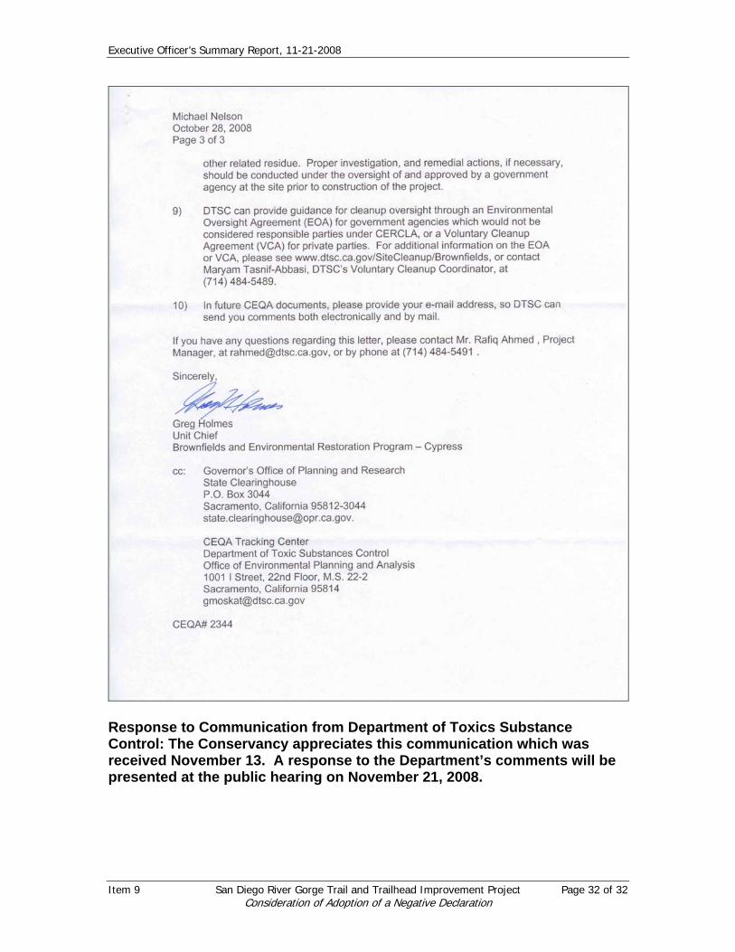
Executive Officer’s Summary Report, 11-21-2008
Response to Communication from Department of Toxics Substance Control: The Conservancy appreciates this communication which was received November 13. A response to the Department’s comments will be presented at the public hearing on November 21, 2008.
Item 9 San Diego River Gorge Trail and Trailhead Improvement Project Page 32 of 32 Consideration of Adoption of a Negative Declaration

Resolution No. 08-09
RESOLUTION OF THE SAN DIEGO RIVER CONSERVANCY ADOPTING A NEGATIVE DECLARATION FOR THE U.S. FOREST SERVICE’S SAN DIEGO RIVER
GORGE TRAIL AND TRAILHEAD IMPROVEMENT PROJECT
WHEREAS, the U.S. Forest Service (“USFS”) is proposing to undertake trail and trailhead improvements and sustainability measures (e.g. restoration of current user defined trails and implementation of erosion control measures) in central San Diego County on lands owned by the Forest Service in the Cleveland National Forest (“San Diego River Gorge Trail and Trailhead Improvement Project” or “Project”) as further described in the Project’s Initial Study;
WHEREAS, USFS is the deciding agency for actions occurring on Forest Service lands and has completed the Forest Service Scoping Letter for the San Diego River Gorge Trailhead and Trail Improvement NEPA Document (USFS 2008) as a preliminary analysis of trail alternatives in the project area;
WHEREAS, the Legislature and Governor of the State of California have provided funds for the California Clean Water, Clean Air, Safe Neighborhood Parks, and Coastal Protection Act of 2002 (“Proposition 40”);
WHEREAS, ten million in Proposition 40 funds have been set aside for use on projects supported by the San Diego River Conservancy (Conservancy);
WHEREAS on Aug 11, 2006 and Nov 9, 2007, the Conservancy approved resolutions 06-06 and 06-14, recommending funding from Proposition 40 be allocated for the San Diego River Gorge Trail and Trailhead Project;
WHEREAS, Proposition 40 provides that CEQA compliance must be completed before grant funds can be distributed;
WHEREAS, the San Diego River Conservancy (Conservancy) is the state lead agency for compliance with the California Environmental Quality Act (CEQA);
WHEREAS, pursuant to the requirements of CEQA, an Initial Study was conducted for the Project which determined that as a result of mitigation measures incorporated into the Project, the Project will not result in a significant adverse impact upon the environment;
WHEREAS, a Draft Negative Declaration was prepared and advertised for public review from October 3, 2008 to November 3, 2008;
WHEREAS, on November 21, 2008, the Conservancy held a public hearing on the Project;
WHEREAS, the Conservancy considered the Staff Report, the Final Negative Declaration, all comments, recommendations from staff, and public testimony; and
WHEREAS, the Governing Board of the San Diego River Conservancy finds the Project consistent with the Five Year Strategic and Infrastructure Plan of the San Diego

Resolution No. 08-09
RESOLUTION OF THE SAN DIEGO RIVER CONSERVANCY ADOPTING A NEGATIVE DECLARATION FOR THE U.S. FOREST SERVICE’S SAN DIEGO RIVER
GORGE TRAIL AND TRAILHEAD IMPROVEMENT PROJECT
River Conservancy, especially Program 2, Projects 1.1 and 1.2 because it will improve the San Diego River Gorge Trail and trailhead and Program 2, Project 1, Complete the San Diego River Park Trail, because the Trail provides access to the San Diego River Trail from the West in Ramona and from the East near Eagle Peak.
NOW, THEREFORE, BE IT RESOLVED by the San Diego River Conservancy, after considering the evidence presented at the public hearing, as follows:
1. The final Negative Declaration reflects the independent judgment of the Board.
2. The Project will not result in a significant adverse impact upon the environment, and the final Negative Declaration, dated November 21, 2008, is approved.
3. The Board directs the Executive Officer or his designee to file a Notice of Determination within five days of the Board’s action on this item.
Approved and adopted the 21st day of November 2008. I, the undersigned, hereby certify that the foregoing Resolution Number 08-09 was duly adopted by the San Diego River Conservancy’s Governing Board.
Following Roll Call Vote: Ayes: ______
Noes: ______
Absent: ______
________________________________ Michael Nelson, Executive Officer San Diego River Conservancy SD2004600910 Document in ProLaw