north amherst’s economic history
TRANSCRIPT

James Avery Smith, Pct 6
NORTH AMHERST’S ECONOMIC HISTORY
300 years of historic Amherst maps demonstrate how
the civic center of North Amherst, with its church,
library and school, was wrapped tightly around what’s
now the Pine Street/Meadow Street/Route 63
intersection. But the commercial center of North
Amherst traveled north early on, with mills, factories,
and businesses up Montague Road, along the Mill
River, and east to Factory Hollow.
Today, only four commercial enterprises, the Fisher
Home Hospice; House of Teriyaki Restaurant;
Kendrick Property Management; and the Black
Walnut Inn remain at the intersection. No non-
residential enterprises are south of the Fisher Home
in North Amherst.
Early North Amherst populations and businesses
were primarily north of and adjacent to the Mill
River, along what are now Sunderland Road,
Montague Road, Summer Street, and Factory
Hollow. This part of Amherst has been referred
to as the Dirty Hands District by long time locals.
On the Cowls Home Farm, onions were boxed,
bagged, processed and shipped from industrial
packaging barns north of Cowls Road. Lumber
was manufactured and sold on Cowls Road’s
south side. For 300 years Cowls Road acres
served as log and lumber concentration and
sales yards.
Corner of North Pleasant and Meadow Streets,
(undated post card)
Post Office and Trolley Line on North Pleasant
Street, (undated post card)
19th century paper mill on the Mill River in North Amherst

James Avery Smith, Pct 6
One major contributor to the 19th century boon
of industry between Sunderland and Montague
Roads, that solidified the Commercial Triangle,
was the North Amherst Branch of the Amherst-
Sunderland Street Railway.
The Amherst-Sunderland Street Railway was
incorporated in 1896 and Walter D. Cowls, who
lived at 134 Montague Road, was the force
behind its creation. W. D. Cowls’ lumber was
the trolley ties and the rocks from his rock
crusher at the Notch were the track bedding.
One hundred years after W.D. Cowls’ glassed-in
front porch was built as a community trolley
stop, the PVTA bus system recognized the
continuing public transportation need and put a
bus stop in the same location in front of 134
Montague Road.
The first tracks of Amherst’s street railway system ran from downtown Amherst to Cowls Road in
North Amherst. As it traveled north from downtown it stopped at “Mass Aggie” where a brick and
stone trolley stop remains today. In North Amherst the trolley went past the church and library,
past Riverside Park (which then was really a park!) up Route 63, took the corner west at 134
Montague Road, and stopped at the depot on the north side of Cowls Road where the trolleys were
kept in Cowls barns at night. The trolley system’s powerhouse was also located north of Cowls
road.
This public transportation system
was very popular and expanded
North Amherst’s reputation as a
business and social center, and as a
destination. In 1897, in its first year
of operation, trolley conductors
collected 2377 fares on
Independence Day alone.
Beyond a hub of transportation for
people, the Cowls Road trolley depot
in North Amherst Village Center was
a significant freight loading area for 116 and 134 Montague Road with trolley tracks and wires
Early map indicating trolley line route and development along
Montague Road north of the Mill River

James Avery Smith, Pct 6
lumber, coal, onions, traprock, and other merchandise. Every morning farmers would meet the
trolleys at the Cowls Road barns to have their milk delivered to the community. Because of the
connection of the street railway to the B&M Railway line, and later when the street railway line
was extended north to Sunderland and South to Holyoke, local agricultural and industrial products
were transported from Cowls Road to points farther away.
The Amherst division of the Holyoke Street Railway Company (post 1907 sold and re-named) ran
cars from Sunderland and Pelham to Amherst every hour, but from North Amherst to Holyoke
twice every hour.
Riverside Park in North Amherst
Village Center was a popular
destination created by the Holyoke
Railway Company to attract weekend
trolley customers. This site remains a
highly popular destination since
Amherst’s largest recreational center
and pool complex is located directly
north of there today.
According to a presentation made by
historian Estelle Rule to the Pelham
Historical Society on May 14, 1991,
Cowls’ original trolley car barns “were
blown down in a heavy wind. The next
barns were built on South Pleasant
Street.” They are now used by Amherst
DPW.
The North Amherst Trolley line was
discontinued in 1928 due to the
popularity of cars and trucks.
After the era when trolley tracks
outlined North Amherst’s Commercial
Triangle, historic Amherst Zoning maps recognized the northern part of North Amherst Village as
its commercial center and encouraged residential density around it. In the 1940s-60s, besides
lumber manufacturing and sales, the Cowls site held a significant dairy industry with milk
processed, packaged and shipped in pint to ten gallon containers. In the mid-1900s the west side
of Montague Road was a significant industrial center of town with Puffer and Cowls/Jones road
construction and real estate development businesses based there.
1916 Sanborn Insurance Map

James Avery Smith, Pct 6
James Avery Smith, former Town of Amherst Engineer and well known historian, researched the
economic history of North Amherst, which was largely north of the Mill River. Mr. Smith found 15
businesses were operating in the area between 1900 and 1925 and the number grew to 30 by the
mid-20th century. Although the types of businesses changed periodically, that number held solid
through the turn of the 21st century with 26 remaining today. These businesses include:
- Street Railway offices, depot and barns - Power Station - Lumber mill/planing mill/offices - Agricultural production, processing packaging and large scale shipping operations - Brown’s Westville Mill, Broom factory - Puffer Grist Mill, then Grist Mill Gift Shop (separate ownership, same location) - Dickinson General Store - E S Puffer Coal and Ice Wood Company - S P Puffer Construction Corp - Dairy / Milk Processing / Distributing - Holden Lumber Company - Ashley Garage - Hobart Dairy - Wood’s Paint and Paper Antiques - Slack Land Surveying - Haskins Carpenter Shop - North Amherst Post Office - Matusezco Trucking - Riverside Park Apartments (48 units) and Shops (8) and - US Post office – with an independent zip code for North Amherst - Auction house - Roosters restaurant - Stan’s Sport Shack - Peter Pan Bus Company Garage - Ainsworth Dodge - Cowls Building Supply - Pro Sensing Engineering - Ernie’s Towing - North Amherst Motors - Potter’s Auto Rental - Amherst Machine Shop - Westcott Packers/Movers - Cowls Building Supply - Staab Ford Auto Sales - Auto repair - Gas station - Paint Shop - Electrical Appliance Shop - Mike’s Westview Café/ The Harp Irish Pub - Vincent’s Liquor Store
James Avery Smith, Pct 6
- Swartz Farm, Market, Processing and Shipping - Survival Center - Watrobas grocery and liquors - Big Guys Liquors - Cumberland Farms - Captain Video/Candy - Pizza Shops - Laundry - North Amherst Farmer’s Market - Head Start - Blacksmith Shop - Amherst Lockworks - Bank Branch and two separate ATMs - E & J Transportation - Aristocrat Hairdressers - Barber Shop - Crossman’s watch and clock repair - Artist studios - Daisy’s Restaurant - Bates General Store
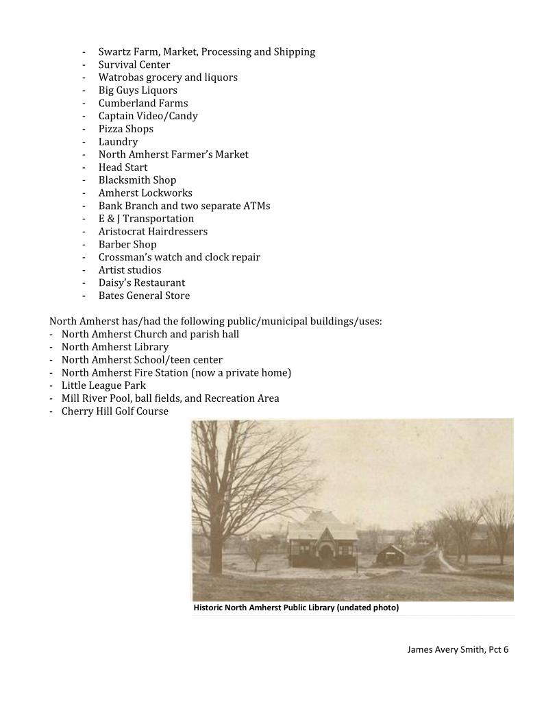
North Amherst has/had the following public/municipal buildings/uses: - North Amherst Church and parish hall - North Amherst Library - North Amherst School/teen center - North Amherst Fire Station (now a private home) - Little League Park - Mill River Pool, ball fields, and Recreation Area - Cherry Hill Golf Course
Historic North Amherst Public Library (undated photo)