new jersey pinelands commission - state
TRANSCRIPT
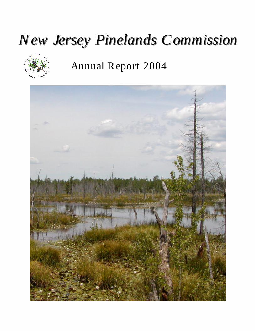
New Jersey Pinelands CommissionNew Jersey Pinelands CommissionAnnual Report 2004
Mission Statement of the
New Jersey Pinelands Commission
The mission of the New Jersey Pinelands Commission is topreserve, protect and enhance the natural and culturalresources of the Pinelands National Reserve, and to
encourage compatible economic and other human activitiesconsistent with that purpose.
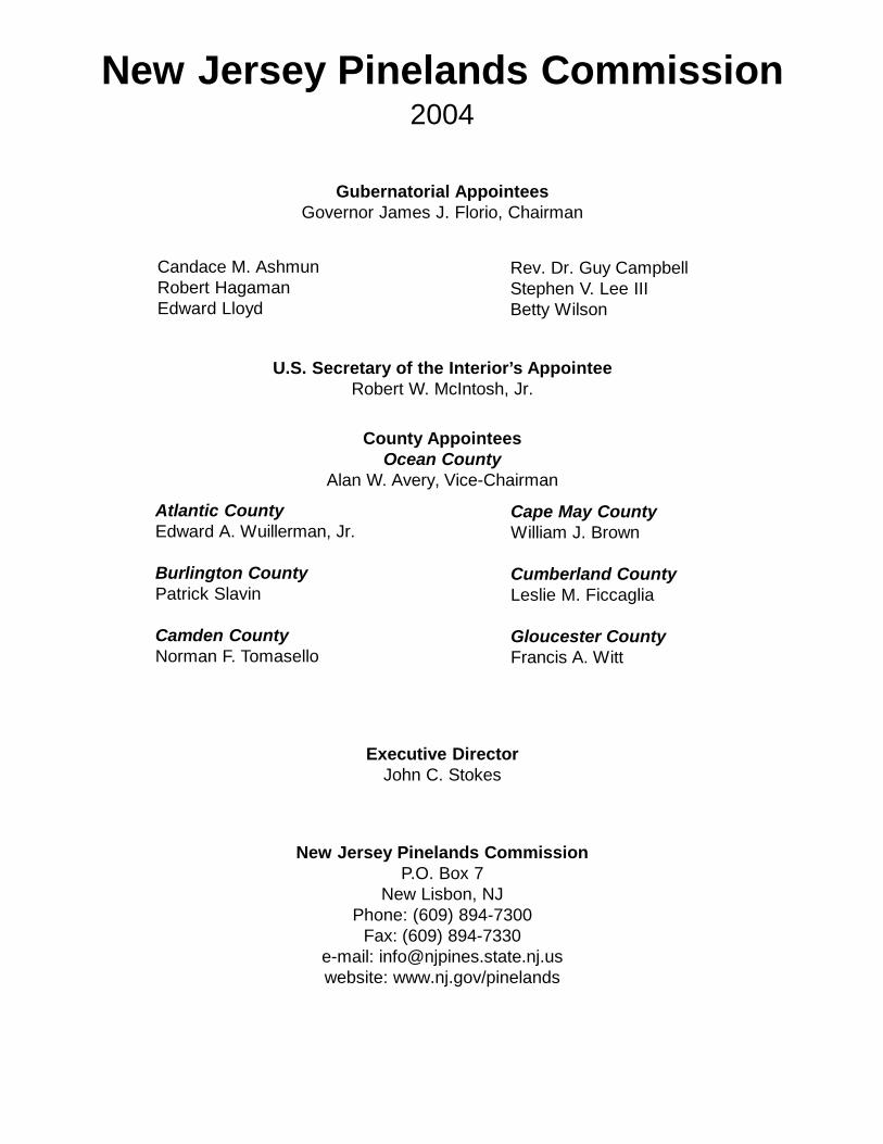
New Jersey Pinelands Commission2004
Gubernatorial AppointeesGovernor James J. Florio, Chairman
Candace M. AshmunRobert HagamanEdward Lloyd
Rev. Dr. Guy CampbellStephen V. Lee IIIBetty Wilson
U.S. Secretary of the Interior’s AppointeeRobert W. McIntosh, Jr.
County AppointeesOcean County
Alan W. Avery, Vice-Chairman
Atlantic CountyEdward A. Wuillerman, Jr.
Burlington CountyPatrick Slavin
Camden CountyNorman F. Tomasello
Cape May CountyWilliam J. Brown
Cumberland CountyLeslie M. Ficcaglia
Gloucester CountyFrancis A. Witt
Executive DirectorJohn C. Stokes
New Jersey Pinelands CommissionP.O. Box 7
New Lisbon, NJPhone: (609) 894-7300
Fax: (609) 894-7330e-mail: [email protected]: www.nj.gov/pinelands

CHAIRMAN’S MESSAGE
When Governor James McGreevey asked me to chair thePinelands Commission, he charged me with addressingmany important challenges. I am pleased to report that, as
my three-year term draws to a close, much has been accomplished. The Pinelands Commission is leading a team of renowned
state, federal and university scientists in a $5.5 million study of theKirkwood-Cohansey aquifer. This unparalleled research project willhelp policy makers determine how much water can be taken from thisunderground source to serve southern New Jersey’s homes andbusinesses without harming the Pinelands environment or our coastalestuaries.
The $13 million “Pinelands Conservation Fund” was established to sustain importantPinelands initiatives in the years to come. Through this fund, land acquisition, applied researchand sound community planning will receive much needed support.
Sub-regional conservation initiatives, undertaken with the support and assistance ofprogressive municipal governments in Jackson, Manchester and Barnegat Townships, have betterprotected thousands of acres of land in the Toms River basin and the Ocean Acres area. Withhelp from a William Penn Foundation grant, we are also partnering with Medford and EveshamTownships to better protect a 14,000-acre region that adjoins one of the Pinelands’ crown jewels,Wharton State Forest.
The Pinelands Commission also approved a 4,100 acre land use classification that affordsfar greater protection to the Oyster Creek basin, an invaluable ecological resource in Ocean andLacey Townships. We have also launched a comprehensive re-examination of land usedesignations throughout the entire Pinelands to ensure that we are adequately protectingimportant natural resources and accommodating growth in the appropriate locations.
Through the generous support of the Geraldine R. Dodge Foundation, the Commissionwas able to hire nationally acclaimed planning and transportation consultants to help Hamilton andWinslow Townships prepare “smart growth” community development plans. With the DodgeFoundation’s continued support, we are now offering this same type of expertise to Egg HarborTownship.
A task force of public and private partners is nearing completion of its future housingprojections for the Pinelands. This work will be indispensable as the Commission determines howbest to adjust the Pinelands zoning program.
These are but a few of the many important steps being taken to protect the Pinelands forfuture generations. Yet, important challenges remain. We must be forward-looking and open tonew ideas that further the goals of the Pinelands Protection Act, particularly those that help tobetter protect our water resources, properly manage our forests and maintain strong,economically sustainable communities. As we look ahead, I am confident that the PinelandsCommission will remain dedicated and vigilant in its continuing efforts to protect this very specialpart of New Jersey.
Sincerely,James J. Florio
PINELANDS COMMISSION HIGHLIGHTS FOR 2004
? Scientific field work began on the ground-breaking Kirkwood-Cohansey Aquifer Study, one ofthe most important Pinelands research efforts ever (page 18).
? Under the Pinelands Excellence Program, smart-growth community action plans werecompleted for two Pinelands growth communities and a grant was secured to begin planning for athird community (page 3).
? The Pinelands Excellence Program earned the Commission a statewide planning award (page4).
? The first-ever sub-regional conservation planning effort in the Toms River Corridor project wascompleted and will result in far better protection of land, water and habitat (page 4).
? The Commission reached an agreement to permit an important electric utility infrastructureproject in a way that enhances the protection of Pinelands resources (page 28).
? The same electric utility project paved the way for creation of the $13 million PinelandsConservation Fund to support natural resource protection efforts (page 22).
? The Commission solved an extremely difficult regulatory problem in the Ocean Acres section ofBarnegat Township and, as a result, protected 450 acres of land (page 26).
? Another complicated development permitting issue – Presidential Lakes – was resolved toinclude the protection of over 650 acres of land (page 27).
? As a result of an ecological re-examination of the Oyster Creek watershed, the Commission hasproposed to re-designate 4,100 acres of land to more protective zoning (page 15).
? The Commission implemented a reasonable application fee program that has run smoothly andgenerated hundreds of thousands of dollars to help underwrite the cost of project reviews (page23).
? The Commission successfully resolved a complex legal dispute over the SanctuaryDevelopment in Evesham Township (page 27) and launched an ambitious conservation planninginitiative in the region (page 6).
? A re-examination of the Pinelands Plan’s housing projections was started, the first study of itskind in 24 years (page 8).
? The design and creation of the Commission’s new comprehensive data information system wasnearly complete at year’s end. The new system will greatly improve efficiency and overall serviceto the Commission’s clients (page 23).
1
? Working with the NJDEP, the Commission secured funding for the preparation of a modelstormwater ordinance to improve the Pinelands stormwater program (page 12).
? The Commission initiated a comprehensive review of Pinelands forestry policies and practiceswith a goal of preserving forestry as a natural and economic resource (page 7).
? Timed-growth programs and clustering were examined to determine how these practices canbest be applied in the Pinelands (pages 8 and 9).
New Pinelands Commissioners in 2004In early 2004, two new members joined the Pinelands Commission: Patrick Slavin, who
represents Burlington County and Francis Witt, who represents Gloucester County. Witt replacedRichard Westergaard, who served since 2000 and Slavin replaced S. Joseph Kowalski, whoserved since 1995. Under the Pinelands Protection Act, the 15-member Commission is structuredto include federal, state and county representation. Each of the seven county governments withinthe million-acre Pinelands reserve appoints one representative to the Commission.
Patrick Slavin presently serves as a lecturer in Biology at Burlington County College. Prior to that, he served for 14 years as manager of agricultural operations for A.R. DeMarcoEnterprises, a then-10,000-acre cranberry farm in Woodland Township. Slavin also served as theDirector of Public Health for Cumberland County, Director of the Cumberland County MosquitoControl Commission, as an entomologist with the Ocean County Mosquito Commission and as aResearch Associate with the USDA Agricultural Research Service. Among other civic andprofessional involvement, Mr. Slavin has served on the American Cranberry GrowersAssociation’s Board of Directors, the New Jersey Blueberry/Cranberry Research Council, NewJersey Pesticide Control Council, Woodland Township Planning Board and the Millville ShadeTree Commission. He also worked on the task force that recommended the Maurice River fornomination to the National Wild and Scenic River System. Slavin holds a Ph.D. in ecology fromRutgers University, a Masters degree in entomology from the University of Maine and a B.S.degree in Biology from Marquette University in Wisconsin.
Francis Witt is a Partner in the firm of Joseph F. McKernan Architects and Associates inCherry Hill, where he also serves as Treasurer and Marketing Principal. A licensed Real EstateAgent for over 30 years, he has represented a host of US and international companies as aconsultant. Witt has a long career in public service. He served for 16 years as Mayor of theBorough of National Park and, prior to that, served eight years on Borough Council. He is pastVice President of the New Jersey League of Municipalities and past President of the GloucesterCounty Mayors’ Association. Witt served 15 years on the Board of the Gloucester CountyUtilities Authority, including stints as Director and Chairman, and on the board of the GloucesterCounty Solid Waste Council. Additionally, he is active in a number of civic, business, church andgovernmental organizations.
In Memoriam: John T. Ross (1944 - 2004)On November 21st, 2004, a champion of Pinelands preservation, John T. “Jack” Ross, died
following a lengthy illness. Ross, a resident of Hamilton Square, had a dedicated andaccomplished career in Pinelands land protection.
From 1980 to 2000, he served with the New Jersey Department of Environmental
2
Protection Green Acres Program, much of that time as a land acquisition supervisor. There, Rossheaded the Pinelands acquisition unit, administering both State and federal Pinelands funding toprotect important ecological land within the Pinelands National Reserve. During his tenure atGreen Acres, Ross facilitated the acquisition of over 100,000 acres, including some 70,000 acresthrough the federally funded Section 502 Pinelands acquisition Program. He lead majorexpansions of several State land units and spearheaded the creation of the 10,000-acre MakepeaceLake Wildlife Management Area in Atlantic County.
In 1987, Ross became the first Executive Director of the newly created PinelandsDevelopment Credit (PDC) Bank while continuing to work at Green Acres. He held theExecutive Director post – which became a full-time position in 2000 – until his retirement in2003. At the PDC Bank, Ross helped to build the program into the most successful regionaltransfer-of- development-rights (TDR) program in existence anywhere. Working cooperativelywith the Pinelands Commission, Ross facilitated the protection of nearly 40,000 acres of privatelyowned forests and farmland and helped advance other Pinelands preservation objectives. Today,the PDC Program is considered a TDR model for smart growth planning and natural resourceprotection. Following his retirement, Ross continued to work as a consultant to the PDC Bank.
Jack Ross will be most remembered for his kindness and positive outlook. His goodnature helped to build consensus and advance preservation of the Pinelands.
LAND-USE & PLANNING ACTIVITIES
Smart Growth & the Pinelands Excellence ProgramThe Pinelands Commission expanded an innovative smart-growth program in 2004 to
include a third municipality. In 2002, the Commission received a $187,000 planning grant fromthe Geraldine R. Dodge Foundation with the goal of fostering the development of "livablecommunities" in the rapidly developing Pinelands Regional Growth Areas. Through a competitiveprocess, the Commission selected two municipalities, Hamilton Township in Atlantic County andWinslow Township in Camden County, to participate in the "Pinelands Excellence Program." Working with the municipalities, the Commission engaged the services of a nationally renownedplanning firm to help each community develop a strategic vision of its future and prepareCommunity Action Plans.
The planning process relies on community participation. The townships form "visioningteams" comprised of representatives from across the community. Team members work with theconsultants to develop a vision statement to guide preparation of the Livable Community ActionPlan. Teams use a community-based observation technique in which they were provided withcameras and asked to document, in pictures and words, what they like and do not like within theircommunities and surrounding areas. Input from this process helped ensure that the resultingvisioning statements are grounded in reality and not just abstractions from a theoretical exercise. Community action plans were then prepared, setting concrete proposals for zoning, subdivision,site planning, and infrastructure improvements to achieve their visions. For example, model ordinances were developed to address community design issues andland clearing. Other measures are designed to preserve small-town character and communityhistoric assets as well as enhancing circulation systems and supporting greater pedestrian andbicycle use.
In early 2004, the Hamilton and Winslow Community Action Plans were completed and
3
endorsed by the governing bodies of the two towns. A series of informational workshops wereheld to share the results with planners and public officials from throughout New Jersey. Bothcommunities began implementation of the Action Plan strategies.
Later in 2004, the Commission was again selected by the Dodge Foundation to receive agrant – this time for $167,000 – to continue the work of the Pinelands Excellence Program. Thenew grant will be used to support a similar smart-growth planning effort with Egg HarborTownship. In the past 10 years, Egg Harbor Township has experienced accelerated residentialgrowth fueled by the rapid expansion of casino gaming in Atlantic City. The town has struggledto keep up with the pace of growth. Egg Harbor Township’s strategies may address criticalissues like open space and recreation, transportation, tree preservation, stormwater managementand the siting of schools and other community facilities.
Smart Growth Planning AwardIn March 2004, the Commission received an "Achievement in Planning" Award for
Regional Planning from the New Jersey Planning Officials organization. The award recognizedthe Pinelands Excellence Program as an innovative approach to address increasing growthpressures on Pinelands municipalities. The Pinelands Excellence program advances manyprinciples of smart growth planning by developing strategies to create vibrant, livablecommunities that maintain essential natural and cultural resources. These strategies includemixed-use development and better community design by utilizing tools such as zoning, planning,and infrastructure improvements.
Conservation Planning & The Toms River Corridor ProjectDuring 2004, the Commission completed the first of several innovative sub-regional
planning projects aimed at enhancing the protection of critical habitat and natural resources. Ayear earlier, the Commission concluded an intensive review of the Pinelands protection program. As part of a five-year strategy plan, the Commission chose to pursue sub-regional conservationplans as a means to better protect Pinelands resources in areas where natural resource values anddevelopment pressures clash. The strategic plan specifically called for one such project in theToms River corridor of Ocean County, an area where potential conflicts exist between zoning anddevelopment objectives and high-value natural resources. Shortly thereafter, the Commissionestablished the Toms River Corridor Task Force to lead this effort. Encompassing a portion ofthe Barnegat Bay watershed within Jackson and Manchester Townships, the project area coversnearly 17,000 acres, or 21 percent of the 124-square-mile Toms River Watershed. Of that landarea, approximately 15,000 acres lie in Jackson, with the remaining acreage in Manchester. Itincludes approximately 7.8 miles of the Toms River main stem and 4.6 miles of the RidgewayBranch, one of its major tributaries. The area contains extensive tracts of ecologically intactPinelands forest and wetlands and habitat for at least a dozen threatened or endangered plant andanimal species. In addition, the Corridor is currently home to several thousand people and isfacing mounting development pressures. The area includes six Pinelands Management Areadistricts ranging from the ecologically critical Preservation District to the Pinelands RegionalGrowth Area and has three designated Pinelands Villages: Cassville, Legler and Vanhiseville.
Twenty individuals representing natural resources, planning, and governmental interestswere invited to serve on the Task Force. In addition to local and county officials, representativesfrom a variety of offices of the NJDEP, including the Endangered and Non-Game Species
4
Program, the Division of Watershed Management, the Office of Policy, Planning and Science, andthe Green Acres Program participated. Also participating were representatives from the NewJersey Audubon Society, New Jersey Conservation Foundation, Pinelands Preservation Alliance,and the Trust for Public Land. The US Naval Air Engineering Station Lakehurst, located on thesouthern edge of the Corridor, also was represented. The task force was supported by staff fromthe Commission. In addition, a group of technical advisors on botany, herpetology, geology,hydrology and other key fields provided ongoing expert guidance to the Task Force.
The Task Force was asked to assess the natural resources of the Corridor, prioritizeprotection areas, and craft a regional land use and protection strategy for the area, which couldthen be reviewed and implemented by the Townships, County, and Pinelands Commission. Inearly 2004, the Task Force finished its analysis and planning efforts and issued a report on itsfindings and recommendations. The report sets forth a comprehensive strategy for protectingthreatened and endangered animal species and other natural resources in the region throughcoordinated zoning, site design and permanent land protection. The Pinelands Commissionendorsed the document at its March 2004 meeting.
In the plan, the Task Force reported several key findings:• Development pressures exist and are growing, with approximately 1,500 residential units
currently proposed for construction within the corridor, and more are expected;• Water resources are threatened, with both water quality and quantity in jeopardy from the
inter-basin transfer of wastewater and proposed development near high-quality waterwaysand groundwater recharge areas; and
• Clusters of threatened and endangered species exist within and around the Corridor inlarge, relatively undisturbed landscapes.
As far as recommendations, the Task Force proposed utilizing a combination of planning,zoning and resource protection tools in the area. A series of Pinelands and municipal re-zoningswere proposed to greater protect water quality and critical wildlife habitat, enhance habitatbuffers, and establish connectors between large areas of undeveloped and protected habitat. These will be supported by reductions in permitted housing densities and by implementingstronger clustering provisions in a number of areas. On-site clustering standards will help tominimize impacts on environmentally sensitive land while allowing for appropriate residentialdevelopment.
The Plan also calls for enhancing the use of conservation easements as well as stepping upefforts to acquire land for permanent protection. The State, County, and Townships are allactively pursuing land acquisitions of up to 2,000 acres that would be consistent with therecommendations of the Task Force. As long-term strategies, the Task Force is also encouragingthe expansion of the Pinelands Density Transfer and Pinelands Development Credit Programs toallow greater use within the Toms River Corridor. Seventy-three percent of the Corridor will beprotected through conservation-oriented zoning measures and 2,600 fewer homes will be built inthe future. Future non-point source pollution of the Toms River and Barnegat Bay will bereduced and clustering will ensure that future development is directed away from the mostenvironmentally sensitive lands.
The Task Force also developed a systematic approach for establishing, up-front, the typeand scope of endangered and threatened species surveys that would be required of potentialdevelopers. This includes a set of criteria that tailors survey procedures based on zoning districts
5
and the type of development being proposed. This approach recognizes the habitat conservationmeasures already set forth in the overall plan and simplifies the survey process to provide greaterpredictability of regulatory requirements.
Subsequent to the Commission’s endorsement of the Report, Commission staff andrepresentatives of Manchester and Jackson worked cooperatively to draft the master plan and landuse ordinances necessary to implement the recommendations of the Report. In late 2004, JacksonTownship adopted a revised zoning plan for the Pinelands Area, including changes in zoningdistrict boundaries and requirements for the clustering of residential development. TheCommission is expected to take action on Jackson’s revised master plan and land use ordinance inthe spring of 2005. The Commission was also working with Jackson officials to develop anordinance creating 600-foot wildlife buffers along certain waterways.
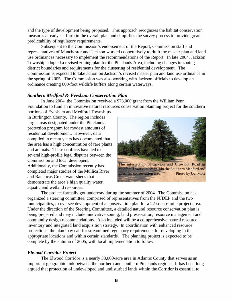
Southern Medford & Evesham Conservation PlanIn June 2004, the Commission received a $73,000 grant from the William Penn
Foundation to fund an innovative natural resources conservation planning project for the southernportions of Evesham and Medford Townshipsin Burlington County. The region includeslarge areas designated under the Pinelandsprotection program for modest amounts ofresidential development. However, datacompiled in recent years has documented thatthe area has a high concentration of rare plantsand animals. These conflicts have led toseveral high-profile legal disputes between theCommission and local developers. Additionally, the Commission recently hascompleted major studies of the Mullica Riverand Rancocas Creek watersheds thatdemonstrate the area’s high quality water,aquatic and wetland resources.
The project formally got underway during the summer of 2004. The Commission hasorganized a steering committee, comprised of representatives from the NJDEP and the twomunicipalities, to oversee development of a conservation plan for a 22-square-mile project area. Under the direction of the Steering Committee, a detailed natural resource conservation plan isbeing prepared and may include innovative zoning, land preservation, resource management andcommunity design recommendations. Also included will be a comprehensive natural resourceinventory and integrated land acquisition strategy. In coordination with enhanced resourceprotections, the plan may call for streamlined regulatory requirements for developing in theappropriate locations and within certain standards. The planning project is expected to becomplete by the autumn of 2005, with local implementation to follow.
Elwood Corridor ProjectThe Elwood Corridor is a nearly 38,000-acre area in Atlantic County that serves as an
important geographic link between the northern and southern Pinelands regions. It has been longargued that protection of undeveloped and undisturbed lands within the Corridor is essential to
6
The intersection of Jackson and Crowfoot Road inMedford Township lies within the Southern Medford andEvesham conservation area. Photo by Joel Mott
preserving genetic biodiversity by providing a natural connection between the plant and animalcommunities of the northern and southern Pinelands. The Corridor covers parts of the MullicaRiver and Great Egg Harbor River watersheds. The region is also home to a number ofthreatened and endangered species, including southern bog lemming, northern pine snake, timberrattlesnake, corn snake, and pine barrens treefrog.
In 2004, the Commission began a conservation planning effort in the Corridor. TheCommission is working closely with Atlantic County, the NJ Green Acres Program, the NJNatural Lands Trust, Mullica Township, Hamilton Township, and the NJ ConservationFoundation to identify conservation opportunities through zoning, planning and land acquisition. To date, several re-zonings have been enacted in Mullica Township and township-owned parcelshave been mapped and their ecological value assessed. Preparations are now underway totransfer some parcels to the State for preservation.
Forestry Policy ReviewWhen done properly, forestry can help to revitalize the forest landscape, but when done
improperly, it can affect the natural biodiversity of the Pinelands. In February 2004, PinelandsCommission Chairman James Florio reconstituted the Pinelands Forestry Advisory Committee, ablue ribbon panel charged with reviewing the forestry provisions of the Pinelands ComprehensiveManagement Plan. The Committee, comprised of eight leading experts in the fields of forestry,forest ecology and conservation biology, is evaluating harvesting, land preparation and re-vegetation practices conducted in the Pinelands to determine if they are consistent with theCommission’s mandate to protect and maintain the Pinelands environment. At the same time,they are working to ensure that forestry remains a viable economic and cultural resource in thePinelands. Based on the Forestry Advisory Committee’s findings and recommendations, expectedlater in 2005, the Commission will determine if amendments to the forestry standards of thePinelands Comprehensive Management Plan are in order.
Stronger Protection of Endangered PlantsIn the fall of 2004, the Pinelands Commission proposed an amendment to the Pinelands
Comprehensive Management Plan (CMP) to bolster protection of rare plant species. The changewill incorporate into the CMP the official State-promulgated list of endangered plants, expandingthe number of protected native Pinelands plants from 54 to approximately 92. The State list ismaintained by the New Jersey Division of Parks and Forestry.
The State list, which now stands at 339 plants, was adopted pursuant to legislation passedin 1989. This was nine years after the adoption of the Pinelands CMP, which since 1980 hasincluded its own list of 54 protected plants. The State list includes only the most vulnerable plants-- globally rare plants and species with five or fewer occurrences statewide. Of the 339 State-listed plants, about 38 occur in the Pinelands Area but are not currently on the CMP list. Another20 are common to both lists.
Among the Pinelands plant species that will gain CMP protection through this measureare:• Barton's St. John's-wort (Hypericum adpressum), a globally rare plant that typically
occurs in vernal ponds. A significant portion of its small remaining worldwide populationis in New Jersey;
• Sessile-leaf tick-trefoil (Desmodium sessilifolium), a Midwestern species with only one
7
known remaining population in New Jersey, which is in the Pinelands; Pine Barrensbellwort (Uvularia puberula), another globally rare species. The only New Jerseypopulations are in Pine Barrens habitat; and
• Lace-lip ladies'-tresses (Spiranthes laciniata) a southern orchid species that reaches itsnorthern limit in the Pinelands.
Ecological Integrity AssessmentPinelands policies to protect threatened and endangered plant and animal species largely
rely on site-by-site surveys to guide decisions on whether and where to permit development. It isdoubtful that site-based policies afford sufficient protection for rare animal species because theirhabitat requirements often extend beyond the boundaries of a particular site. This is especiallytrue of wide-ranging threatened or endangered species, such as the pine snake, timber rattlesnake,and barred owl. Protection of these species requires the preservation of relatively large tracts ofhigh-quality landscapes. A site-by-site-based approach also creates a complicated regulatoryprocess for property owners.
In late 2004, Commission staff began preliminary planning for a comprehensiveassessment of landscape and watershed integrity throughout the Pinelands to better ensure thatimportant natural areas, including those that provide critical habitat for rare plant and animalpopulations, are protected. This effort may result in the modification of site-specific regulatorystandards to reflect a landscape-level approach.
Housing Task Force In 2004, the Commission formed the Pinelands Housing Task Force to review, update and
revise housing capacity projections for Pinelands Growth Areas. This broad-based working groupwill ultimately recommend how future population projections should be factored into housingopportunities. Working with State, county and local officials and representatives from non-governmental organizations, the Task Force is assessing the future housing needs of the greatersouthern New Jersey region to determine what housing share can be apportioned to the Pinelands. At the close of 2004, the group was developing long-term housing demand projections for the 23Pinelands Regional Growth Area communities, while considering factors such as available vacantland, infrastructure and environmental constraints. The Task Force is expected to release theresults of its work in summer 2005. Its report will include recommendations for reapportioninghousing densities within the towns as prescribed by the Pinelands Comprehensive ManagementPlan, while taking into account Pinelands land-use and environmental objectives.
Timed Growth AnalysisSince 1994, the Pinelands Comprehensive Management Plan has provided growth-
oriented communities with a zoning and planning tool to better manage growth. The MunicipalReserve Program allows towns to set aside land as off-limits to major development for five-yearperiods, while other parts of the community are developing. This phased-growth mechanismensures orderly growth, helps prevent piecemeal development and allows efficient infrastructureplanning and development. However, to address more recent concerns over the pace of growth incertain communities, the Commission’s five-year strategic plan called for revising the existingreserve provisions as well as examining alternatives for better timing a community’s growth rate
8
with its ability to accommodate new residents. Further, only one of the 24 Pinelands RegionalGrowth Area communities – Hamilton Township – has employed a Municipal Reserve.
In response, the Pinelands Commission conducted an in-depth timed growth analysis in2004. Directed by the Commission’s Policy and Implementation Committee, staff prepared aWhite Paper on Timed-Growth Options in the Pinelands in October 2004. The report detailedthe need for additional relief in certain Pinelands growth communities, provided a comparativeevaluation of the Municipal Reserve Program and other so-called “rate-of-growth” approaches inuse nationwide, and made recommendations for enhancing the Municipal Reserve program. Moreover, it provided an analysis of eight Pinelands Regional Growth Area municipalities thatcould most benefit from participation in the program.
The Policy Committee has held a series of discussions and directed staff to begin preparingchanges to enhance the Municipal Reserve Program. Additionally, the Commission has begun toexplore the possibility of establishing a broader rate-of-growth program and is consulting withseveral nationally recognized experts in this field.
Clustering AnalysisThe Commission’s 2004 strategic plan directed staff to re-examine the Pinelands CMP in
terms of how it provides for clustering opportunities. Also called conservation subdivisiondesign, clustering can be a useful planning tool for communities that wish to protect valuednatural and scenic assets. While the CMP does promote both on-site and off-site clustering, theCommission wants to enhance the use of clustering in ways that will not promote landscapefragmentation or other undesirable results.
In October 2004, staff issued a comprehensive analysis of clustering, includingassessments of the clustering experience in the Pinelands and throughout the nation. As a resultof its investigation, the Commission has directed staff to prepare an amendment to the CMP toencourage greater clustering in Pinelands Forest Areas and Rural Development Areas undercertain conditions.
Review of Municipal OrdinancesAll municipalities and counties in the Pinelands Area are required to revise their master
plans and land use ordinances in order to implement the objectives and standards of the CMP. Todate, all 7 counties and 52 of the 53 municipalities with land in the state-designated PinelandsArea have had their master plans and land use ordinances certified by the Commission.Amendments to certified county and municipal master plans and land use ordinances must also besubmitted to, and reviewed by, the Commission.
During 2004, the Commission reviewed and certified 130 such ordinances and masterplans from 33 different Pinelands municipalities. Notable among these were master plans andordinances that established a new Special Agricultural Production Area in Bass River Townshipof approximately 3,500 acres and a 40-acre mixed-use district in Wrightstown Boroughencompassing lands formerly owned by the Federal government. The Commission also certified anew zoning plan for a portion of Upper Township that is located in the Pinelands Area. The planin question includes comprehensive standards for golf courses and is designed to address thepotential impacts this land use may have on water use and water quality. Zoning changes withinthe Pinelands Regional Growth Area were also certified, including the addition of age-restricted
9
housing as a conditional use in Galloway Township’s Industrial Zone and the implementation of aconservation plan within the Ocean Acres subdivision in Barnegat Township.
Water Supply Planning The Commission is continually engaged in activities to protect Pinelands surface and
ground water from depletion. Overexploitation of Pinelands water resources could havedevastating effects on the fragile ecological balance of the Pinelands as well as the region’sresidents and agricultural interests. The Commission’s planning office routinely reviews requestsfiled with the NJDEP for new wells and water diversion permits. In 2004, Commission andNJDEP staff continued to collaborate to minimize impacts on the Kirkwood-Cohansey aquifer.
In early 2004, the NJDEP revoked the permit for Berlin Well No. 12, which was drawingdown water levels in a nearby stream. For nearly two years, the Pinelands Commission urged theNJDEP to permanently close the well. The Commission originally recommended, in the early1990s, against installing this municipal water supply well. The well is located just outside of thePinelands but is next to a stream that flows into the Pinelands. Later, the well was temporarilyclosed after adverse impacts to a local wetlands complex resulted, potentially impacting a localpopulation of swamp pink, a federally protected plant.
Commission staff continued to assess the potential impacts that increases in waterwithdrawal have on the Kirkwood-Cohansey aquifer. Applications for water allocations arereviewed to determine if surrounding surface waters will be adversely impacted, particularly as aresult of an interbasin transfer (water drawn from one drainage basin and discharged to another). All requests for diversions exceeding 10 percent of the annual average water that recharges thewatershed are directed to seek alternatives to the Kirkwood-Cohansey aquifer or demonstrate noecological impacts. Such diversions are likely to deplete groundwater supplies, which directlyeffect local streams and wetlands.
As part of the multi-organizational Kirkwood-Cohansey research effort (see page 18),Commission staff began researching current water use and future water demand scenarios forresidential, commercial and agricultural land uses. At the same time, work commenced on thedevelopment of a Pinelands-wide build-out scenario. Data on population, number of housingunits, square footage of commercial space and acres of cropland within the Pinelands has beengathered in order to establish current water demand. Estimates of how much water is used foreach type of development has been compiled to determine the amount of water that is currentlywithdrawn from the aquifer, consumed and discharged to the surface and ground waters. Conservation practices, irrigation techniques and best management practices will be considered topredict future trends. Current zoning, development patterns, lot status data and tax assessmentinformation are inputted and manipulated in a Geographic Information Systems (GIS) to calculatethe amount of existing development and the amount of development that could occur in a build-out scenario. Pinelands staff has already completed draft layers for several municipalities and willsoon implement the same process for the rest of the Pinelands.
Monitoring and Assessing Inter-basin TransfersThe Pinelands Commission continues to work in cooperation with the United States
Geological survey (USGS), Camden County Municipal Utilities Authority (CCMUA) and the
10
Monroe Township Municipal Utilities Authority to monitor and assess inter-basin transfers ofwastewater effluent from Pinelands watersheds to the Delaware River.
During the autumn of 2004, the Pinelands Commission, CCMUA, Chesilhurst Borough,Waterford Township and Winslow Township endorsed a plan to increase the cap on the inter-basin transfer of wastewater from 1.2-million gallons per day to 1.5-million gallons per day insouthern Camden County. The increase was made possible due to downzoning by the townswithin their growth areas, and analysis of monitoring data that demonstrated no present impactsto streamflow levels. Currently, the three towns are pumping water from the Mullica Watershedand exporting approximately 1.0 million gallons per day of wastewater to CCMUA’s DelawareRiver Treatment Plant.
In Monroe Township, the cap on inter-basin transfers to the Gloucester County UtilityAuthority’s Delaware River Plant are set at 3.0 million gallons per day. Effluent is currently at2.1 million gallons per day, an increase of 900,000 gallons per day since monitoring began in1989. Results from the USGS monitoring program indicate that there have not been significantimpacts as a result of these inter-basin transfers on the local stream system.
Mullica Watershed Planning Under a contract with the NJDEP, the Pinelands Commission oversees the development of
management strategies for the Mullica River Watershed, also known as Watershed ManagementArea No. 14. The Mullica Watershed encompasses parts or all of 24 municipalities in fourcounties: Atlantic, Burlington, Camden and Ocean.
During 2004, Pinelands Commission staff assisted Hammonton Town officials andStockton State College researchers with efforts to secure a NJDEP grant to develop a watershedrestoration plan for Hammonton Lake. The plan is proposed to include the implementation ofnonstructural Best Management Practices to reduce phosphorus discharges to Hammonton Lake.
In addition, the following efforts regarding evaluation of storm water infiltration basinsand development of a model stormwater ordinance were outgrowths of the Mullica Watershedplanning program.
Stormwater Infiltration Basin AssessmentDuring 2004, the Pinelands Staff continued to assess the recharge function of stormwater
infiltration basins in the Mullica watershed. In 2003, stormwater basins in Camden and Atlanticcounties were identified and assessed for the presence of standing water 72 hours after a rainfallevent. Several basins were documented under this assessment protocol as failing systems whichmay benefit from reconstruction and retrofit efforts to restoring groundwater recharge functions.
In 2004, a second round of visual assessments and data collection was conducted to betterunderstand the reasons why these basins are unable to infiltrate rainwater as designed. Twostormwater basins, in Winslow Township and Chesilhurst Borough, were selected for furtherinvestigation as part of the NJDEP-funded pilot project. A geotechnical engineering firm workedwith the Pinelands Commission to perform detailed soil analysis and recommend remediationplans for the two basins. The Commission plans to determine the reason for inadequateinfiltration and work with the towns to implement corrective action. Through this project, theCommission and NJDEP hope to identify cost-effective measures to rehabilitate failingstormwater basins throughout the Coastal Plain.
11
A full report containing a catalog of all the basins identified and the results of thegeotechnical analysis will be available in the summer of 2005.
Model Stormwater OrdinanceThe Pinelands Commission teamed up with the NJDEP in 2004 to develop a Joint
Stormwater Control Model Ordinance for Pinelands municipalities. As part of an agreement, theNJDEP is providing the Commission with $25,000 to fund development of the model ordinance. In early 2004, new NJDEP Stormwater management rules became effective, requiringmunicipalities to amend their Stormwater control ordinances. Pinelands municipalities are in theunique position of having to implement stormwater management ordinances that comply withboth NJDEP and Pinelands regulations.
The Commission has long provided Pinelands municipalities with planning assistance indeveloping ordinances that implement Pinelands land-use, development and resource protectionstandards. Through this effort the Commission will assist towns in the development of a modelordinance that integrates both NJDEP and Pinelands regulations to avoid duplication of effortamong municipalities. This collaborative effort will save local governments time and money. Itwill also provide regulatory predictability and ensure consistency among Pinelands municipalitiesthat are charged with protecting shared surface and groundwater resources. Pilot Program for Alternate Design Wastewater Treatment Systems
The Pinelands Commission implemented a pilot program in 2002 to strengthen protectionof water resources from pollution originating from residential septic systems. The programauthorizes the use of residential wastewater systems that are up to three times more effective thanconventional and pressure-dosing septic systems in reducing groundwater pollution. The newsystems are required for new unsewered homes on lots smaller than 3.2 acres in size. Fiveadvanced treatment technologies have been authorized for use subject to a number of stringentoperation and maintenance standards. These technologies were selected by an Ad HocCommittee comprised of representatives from the Commission, the Pinelands Municipal Council,the New Jersey Builders Association and the Pinelands Preservation Alliance, with the support ofengineers and scientists from the NJDEP.
Throughout 2004, Commission staff continued to provide technical and administrativeassistance to Pinelands municipalities and health departments in their cooperative efforts toimplement this important water quality protection program. Commission staff drafted pilotprogram ordinances for each of the 40 municipalities that are affected by the program. To date,33 of the municipalities have adopted these ordinances authorizing the use of the advancedtreatment systems. In 2004, Commission staff continued to meet with municipalities to explainthe water quality benefits of the program and to answer questions posed by municipalrepresentatives and residents.
August 2004 brought an end to the phase-in period and since that date, all new unseweredresidential development on lots smaller than 3.2 acres must use the advanced treatmenttechnologies. Over a dozen of the advanced treatment systems are now in full operation andeffluent monitoring is confirming their effectiveness at attenuating total nitrogen loadings toPinelands groundwater resources. In addition to those systems currently in operation, theCommission staff and Pinelands Area health departments continue to review and approve manynew applications for the advanced treatment technologies.
12
Pinelands Scenic BywayAfter several years of intensive planning, the Pinelands Commission, the formal
nomination for the creation of a State Scenic Byway in the Pinelands National Reserve wassubmitted to the New Jersey Department of Transportation. Scenic byways have been designatedthroughout the nation as a result of the federal Intermodal Surface Transportation Efficiency Actof 1991. The Act provides grant funding and other incentives to entities seeking formalrecognition of public thoroughfares with surpassing natural and/or cultural qualities. New Jerseyadopted a parallel program a few years later and delineated its first byway not long after.
The Commission has been working with 16 municipalities and five counties to develop ascenic byway through the southeastern portion of the Pine Barrens. The approximately 130-mile-long byway stretches from Tuckerton and Batsto in the north to Port Elizabeth and Dennisville inthe south. The Byway meanders through areas of striking natural beauty and rich historicheritage. With a focus on maritime portions of the Pinelands, the route takes particular advantageof the scenic qualities and historic hamlets of the Mullica, Maurice and Tuckahoe River Corridors.
The impetus for the byway designation arose from the Pinelands Rural EconomicDevelopment Program, which examined economic conditions in several Pinelands towns andrecommended measures to stimulate environmentally suitable growth through various planninginitiatives, incentives, public improvements, and redevelopment. One suggestion was for a NewJersey and National Scenic Byway that would bring widespread awareness of, and interest in, thenatural assets of the Pinelands.
During the autumn of 2004, the Commission staff completed a draft Pinelands scenicbyway nomination and circulated it among all of the municipalities along the route as well as thefive-member byway organizing committee. The committee, comprised of municipalrepresentatives, was established in 2002 to oversee completion of the nomination. After receivingfinal comments, the formal nomination was submitted to the New Jersey Department ofTransportation (NJDOT) in December. The NJDOT Byway Committee is scheduled to reviewthe nomination in 2005, after which final approval is expected.
After the byway receives state recognition, the NJDOT will produce directional signs thatwill be placed along the route and the nomination will be forwarded to the US Secretary ofTransportation for federal designation. Listing as a byway enables the sponsors to apply forprogram-affiliated grants and provides access to a variety of promotional and marketingopportunities, including development of visitor centers, wayside exhibits, and self-guided tours. The byway will also be featured in the US Department of the Interior's byway website and in otherstate and national tourism programs.
Fort Dix Computer RecyclingIn March 2003, the Pinelands Commission became aware of an NJDEP-permitted
consumer electronics recycling center operating at the federal prison at Fort Dix, within thePinelands Military and Federal Installation Management Area. At that time, the Commissiondetermined that it would be appropriate to allow for the continued operation of the recyclingcenter in order to determine whether a State decision to
is appropriate for the Pinelands. Following a review, theCommission, in 2004, determined that the most appropriate means of doing so was through theestablishment of a pilot program. The Fort Dix Consumer Electronics Recycling Center PilotProgram was proposed as a means to test whether continued operation of the center, if effectively
13
regulated and monitored, would reduce the waste stream to landfills, reduce illegal dumping, andenhance protection of Pinelands natural resources. A CMP rule amendment establishing the pilotprogram was proposed in October 2004 and is expected to take effect in mid-2005.
Long-Term Economic Monitoring Program A cooperative project administered by the Pinelands Commission and funded by the
National Park Service, the Pinelands Long-Term Economic Monitoring Program monitors,collects, and analyzes data to gauge the economic health of the Pinelands region over time. In2004, the program tracked 19 core variables and four supplemental variables. As part of theannual report, the Municipal Fact Book was upgraded to include data by county in addition to thedata already presented by municipality.
Data collected in 2004 reveals some key findings about the Pinelands economy:
• Supplemental population estimate data demonstrates that the Pinelands municipalitiesgrew more quickly than non-Pinelands municipalities between 2000 and 2002 (Pinelands+5%, non-Pinelands +2%);
• The inflation-adjusted median sales price of Pinelands homes rose 14% in 2003. This isthe largest one-year gain in this category since monitoring began in 1989. In that timeperiod, the Pinelands share of statewide real estate transactions has risen from 8.2% to10.1%;
• Cranberry prices continued their impressive recovery, posting a real gain of 37% from2001-2002. This marks the third straight year the industry posted a double-digitpercentage increase in prices;
• The average inflation-adjusted residential property tax bill in the Pinelands is now $2,000lower than the state average;
• Driven by an increase in the sales price of homes and an increase in property values,equalized property valuation increased 14% in Pinelands municipalities in 2003. Incomparison, the non-Pinelands increased 12.4% and the state as a whole increased 11.2%over the same time period;
• Average effective tax rates for Pinelands municipalities decreased for the second straightyear in 2003. The average effective tax rate in the Pinelands is now $2.30 per $100 ofassessed valuation (in the non-Pinelands: $2.54 and in the state as a whole: $2.27)
Work continued on special studies in 2004. A first draft of the Municipal Finance Studywas completed and is under review. This study is expected to be completed in 2005. All of thedata has now been collected for the Vacant Land Analysis study and a statistical analysis isunderway that will lead to a preliminary report by the end of 2005. In August, the Commissionpublished the Pinelands Population Reference Guide as a supplement to the regular AnnualReport, both of which are available on the Commission’s web site or on CD-ROM by request.
Electric Transmission Right-of-Way Management PlanAs part of a 2004 agreement to authorize the upgrade of electrical transmission lines
through eastern portions of the Pinelands (see page 28), the State Board of Public Utilities (BPU)agreed to work with the Pinelands Commission to develop a ecologically based management plan
1415
for utility rights-of-way (ROWs). Management of electric ROWs has always posed a challenge tomaintain safety and protect natural resources, particularly rare plants and animals. In early 2005,the Pinelands Commission will convene a workgroup of government and industry representativesto develop a “scope of work” to guide the project. The team will also seek input fromenvironmental and other non-governmental organizations. The goal of the plan will be tomaintain early-successional habitats along all ROWs within the Pinelands, while ensuringtransmission safety and reliability.
Oyster Creek Re-ZoningIn late 2004, the Pinelands Commission proposed a significant change to the Pinelands
Comprehensive Management Plan (CMP) Land Capability Map. The change calls for re-designating 4,100 acres of Lacey and Ocean Townships in Ocean County from Pinelands RuralDevelopment Area to the more protective Pinelands Forest Area. The change was prompted by areport issued by the Pinelands Commission Science Office in March 2004. The report showed thatthe Oyster Creek and Waretown Creek watersheds display the essential ecological character ofthe Pinelands. Upon adoption of the CMP in 1980, more than half of the watershed wasdesignated as Rural Development Area due largely to the presence of the Southern Ocean CountyLandfill and its anticipated impacts on water quality. Since that time, significant adverse impactsfrom the landfill have not occurred.
A Pinelands Commission analysis determined the proposed amendment will result in lessland disturbance, nonpoint source pollution and fragmentation of the Oyster Creek landscape. Under the proposal, the maximum permitted housing density in the area would change from oneunit per 3.2 acres of vacant upland to one unit per 15.8 acres. The theoretical maximum zoningcapacity, based on gross vacant acres, will decrease from approximately 374 homes to about 184homes. However, after Commission planners factored in various environmental constraints, suchas wetlands and the lack of accessibility of much of the area to public roads, the effective zoningcapacity decreases from approximately 204 homes to about 92 homes. Following a publiccomment period, the Commission will decide whether to approve the change in early 2005.
Pinelands National Reserve Map AmendmentThe Commission has proposed amending the Land Capability Map by revising Pinelands
management area boundaries in a portion of Manchester Township, Ocean County, which islocated outside the Commission-regulated Pinelands Area but within the federally-designatedPinelands National Reserve. The Commission serves in an advisory capacity to the NJDEP in thisarea as it administrates the Coastal Areas Facility Review Act.
The map revisions were proposed in recognition of a settlement agreement between theDepartment of Environmental Protection, Hovsons, Inc. and the Commission regardingdevelopment of the so-called Heritage Minerals property (see page 25). In support of theagreement, the Commission proposed amending the Land Capability Map so as to re-designatethe proposed 995-acre development area as a growth area and the entirety of the open spacepreservation area in a Pinelands Forest Area. These revised management area boundariesappropriately reflect the permitted future use of lands authorized under the settlement agreementand should serve to prevent future conflicts from arising between a Pinelands management areaand a State planning area.
PERMANENT LAND PROTECTION
Farmland Preservation Working in cooperation with the Pinelands Commission, the State Agricultural
Development Committee (SADC) administers a special Pinelands Direct Easement PurchaseProgram, which permanently protects farmland within those Pinelands Management Areas thatserve as sending areas for Pinelands Development Credits (PDCs).
During 2004, under the Pinelands Direct Easement Purchase Program, developmenteasements were acquired on 13 farms totaling nearly 1,200 acres. In June, the program closed on the nearly 600-acre Joseph J. White Cranberry Farm. The farm straddles Pemberton Township,Burlington County and Manchester Township, Ocean County. Dating back to 1857, the Whitefamily pioneered berry agriculture in the Pinelands. Elizabeth White, eldest daughter of the farm’sfounder, is credited with helping to develop the first cultivated blueberry crops there in 1916.
Through 2004, 34 farms totaling 3,070 acres have been preserved under the PinelandsDirect easement Purchase Program. In addition, 132.5 Pinelands Development Credits associatedwith these farms have been permanently retired. This has reduced potential development inPinelands Regional Growth Area communities – areas where developers can redeem credits toincrease housing densities – by some 530 housing units. The Pinelands Commission has provided$2.1 million to help purchase PDCs on 22 farms.
Cape May County Municipal Utilities Authority Acquisition Fund The Cape May County Municipal Utilities Authority (CMCMUA) fund was established
under an agreement between the Pinelands Commission and the CMCMU whereby theCMCMUA pledged $2.25 million to fund acquisitions throughout the Pinelands National Reserve. In 1999, the Pinelands Commission entered into an agreement with The Nature Conservancy(TNC) of New Jersey to jointly administer the program, with TNC matching acquisition costsdollar-for-dollar.
During 2004, the Pinelands Commission reimbursed TNC $208,634 to help fund theacquisition of 292 acres. Acquisitions include 160 acres in the Oswego River Basin of BarnegatTownship, 35 acres in the Great Cedar Swamp of Upper Township and 97 acres in the East PlainsFireshed of Bass River Township. This brings the total amount of land acquired under theCMCMUA Fund to 1,177 acres in five counties. Pinelands Limited Practical Use Program
The Limited Practical Use (LPU) Program offers owners of small properties in thePinelands (less than 50 acres), whose application for a Waiver of Strict Compliance (a variancefrom normal Pinelands zoning or environmental standards) has been denied by the Commission,the opportunity to sell their land to the State of New Jersey. In 2004, 17 land parcels, totaling 65acres, were declared eligible for this acquisition program by the Commission, bringing the totalnumber of parcels declared eligible since the inception of the program in 1995 to 444, totaling1,517 acres.
In 2004, the NJDEP Green Acres program purchased 13 LPU-approved propertiestotaling 18 acres at a cost of $43,500. To date, more than $1.5 million has been spent to buy andpermanently protect 370 of these parcels totaling 1,053 acres, using a combination of GreenAcres funds and federal reimbursements.
16
Pinelands Development Credit Program The Pinelands Development Credit program is a regional transfer-of-development-rights
program that preserves important agricultural and ecological land. Pinelands DevelopmentCredits (PDCs) are allocated to landowners in the Preservation, Agricultural and SpecialAgricultural Production Areas (known as sending areas). These credits can then be purchased byproperty owners and developers interested in developing land in Regional Growth Areas (knownas receiving areas) and used to increase the densities at which they can build. Once credits are"severed" from a sending area property, the property is permanently protected by a conservationdeed restriction and the credits on the property can then be sold. Credits are bought and sold inone-quarter-credit units called "rights." During 2004, 129 rights were severed, protecting 1,374acres. This brings the total land area protected through the severance of PDCs since 1982 to39,348 acres.
NJDEP Green Acres Pinelands Acquisition Program The Pinelands Commission continued to work cooperatively in 2004 with the NJDEP
Green Acres Program to identify and permanently protect sites of important ecological value inthe Pinelands. Green Acres oversees an ambitious land protection program in the Pinelands thatincludes acquiring land under the Pinelands Limited Practical Use Program and the federallyfunded Section 502 Pinelands land acquisition program.
During 2004, Green Acres acquired 1,577 acres of new State land throughout thePinelands at a cost of nearly $2.9 million. In addition to the State land acquisition program,Green Acres assisted county and local governments and non-profit organizations with theacquisition of 1,054 Pinelands acres at a cost of about $2.4 million.
Pinelands License Plates In 1998, Pinelands specialty license plates became available to New Jersey motorists who
want to demonstrate their support for the Pinelands while helping to protect open space in theregion. After reimbursement to the Motor Vehicle Commission for expenses associated with theplates, proceeds from application and renewal fees are deposited in the Pinelands PreservationFund for acquisition of ecologically sensitive land in the Pinelands. The fund is managed by theNJ Department of the Treasury, with land acquisitions administered by the NJDEP Green AcresProgram.
During Fiscal Year 2004 (July 1, 2003 to June 30, 2004), 673 new sets of Pinelandslicense plates were issued and 3,937 sets were renewed. Receipts for fiscal year totaled $68,638and the total fund balance at the close of Fiscal 2004 stood at $360,123.
NJCF Franklin Parker Preserve Although it isn’t a Pinelands Commission initiative, one of the great Pinelands success
stories of 2004 was the September dedication of the 9,400-acre Franklin Parker Preserve by thenon-profit New Jersey Conservation Foundation (NJCF). The NJCF acquired the formercranberry farm from A.R. DeMarco Enterprises for $12 million. The property is a Pinelandstreasure trove, containing 1,500 acres of reservoirs, 600 acres of Atlantic White Cedar swamps,14 streams and numerous rare plant and animal communities.
17
The preserve was named after Franklin Parker, who served as the first Chairman of thePinelands Commission from 1979 to 1988. Parker is one of New Jersey’s foremost leaders innatural resource protection and serves on the Pinelands Preservation Alliance’s Board ofTrustees, among other civic activities.
The September 24th dedication ceremony included remarks by Pinelands Chairman JamesFlorio, who authored the federal legislation creating the Pinelands National Reserve in the late1970s and Pinelands Commissioner Candace Ashmun, who has served on the Commission sinceits inception in 1979.
SCIENCE & RESEARCH ACTIVITIES
Kirkwood-Cohansey Study 2004 marked the first year of what is likely the most extensive research project ever
undertaken by the Pinelands Commission. The Commission is leading a major study to gain betterunderstanding of the relationship between the 18-trillion-gallon Kirkwood-Cohansey Aquifer andthe unique Pinelands environment that it supports. Legislation passed in 2001 appropriated $5.5million from the State Water Supply Fund to the Commission to determine how the current andfuture water-supply needs within the Pinelands area can be met while protecting the Kirkwood-Cohansey system and avoiding adverse ecological impacts in the Pinelands. The study is beingimplemented in cooperation with the NJDEP, Rutgers University, the United States Fish andWildlife Service (USFWS) and the United States Geological Survey (USGS).
Scientists from the cooperating agencies are conducting a series of component studies thatcharacterize the relationships between key hydrologic and ecological attributes. Among otherindicators, they are looking at stream flows, wetland water levels, wetland forest communities,soils, evapotranspiration, intermittent pond vegetation, fish, frogs, macro invertebrates and swamppink, a federally endangered plant species. The study addresses two major research questions. First, what are the probable hydrologic effects of groundwater diversions from the Kirkwood-Cohansey Aquifer on stream flows and wetland water levels? Second, what are the probableecological effects of these changes on aquatic and wetland communities? Models will then bedeveloped to predict the ecological effects of different water-diversion scenarios within any givengeographic location.
In 2004, inter-agency agreements were executed and the Commission and its cooperatingpartners began implementing work plans that were developed in 2003. By the close of 2004,significant progress had been made in field work for all of the components of the study and theKirkwood-Cohansey research project was in full swing. The study is expected to takeapproximately five years to complete.
Timber Rattlesnake Study In 2004, the Pinelands Commission concluded an intensive three-year study of Eastern
Timber Rattlesnakes in the Pinelands with the release of its final report on the project. In late2000, the Commission reached a settlement agreement with a real estate development firm overlitigation involving construction of an Evesham Township housing development. Under terms ofthe agreement, the developer funded a two-part study. The NJDEP conducted a Pinelands-widestudy, while the Pinelands Commission conducted research on the behavior of rattlesnakes in thevicinity of the Evesham housing development.
18
Nine snakes were radio-tracked by the Pinelands Commission during the study. Thepurpose of the Commission’s study component was to assess the movements of snakes relative tothe constructed portion of a development and to evaluate the effectiveness of fences and culvertsintended to direct snakes away from the developed areas. Field work began in early 2001 andconcluded in late 2003. Progress reports describing the study methodology and results of the firstand second years of snake monitoring were released in 2002 and 2003.
The final report concluded that the rattlesnakes, particularly males, have far-reachingactivity ranges. One snake had a range of nearly 2.8 square miles. However, core activity areasfor several snakes, including a rookery used by gravid (pregnant) snakes, were located in areasthat may be developed in the future. It is also apparent that the fences and culverts have met withvery limited success in redirecting snakes away from developed areas. Fences did not prevent anyof the radio-tracked snakes from entering developed portions of the subdivision. Although only inuse during the last year of the study, there was greater success with the culverts beneathroadways. Two snakes used the culverts to travel to forested lands east of the development.
The report also documents the death of two of the monitored snakes. One was discovereddead and mutilated during the study period, while another was apparently killed by a motorvehicle shortly after the study concluded. On the positive side, two of the snakes gave birth to atleast twelve neonates during the study. Researchers lost track of another gravid female beforegiving birth and yet another female rattlesnake was determined to be gravid when transmitterswere removed at the conclusion of the study.
Mullica River & Rancocas Creek Basin Studies Two recent Pinelands Commission research studies continued to benefit the agency’s
science and planning efforts in 2004. Data presented in the Mullica River Basin report (2001) andthe Rancocas Creek Basin report (2003) clearly demonstrated a relationship between the health ofaquatic and wetland resources and land-use related watershed disturbances. In both studies,surface water quality and biological communities found in forested stream basins contrasted withthose attributes found in basins with a higher percentage of altered land, including developmentand agriculture. Acid waters and typical Pinelands biological communities characterized forest-dominated stream basins. Elevated pH and specific conductance and non-native plant and animalspecies were associated with disturbed stream basins.
The results of the Mullica River study have provided a sound scientific foundation for theCommission’s watershed planning efforts. In 2004, the Commission planning staff used the datato characterize the current and future condition of water resources in the basin. The results of theMullica River Basin study also established the protocols for evaluating the status of otherPinelands streams.
Data from both the Mullica River and Rancocas Basin studies were invaluable in revisingthe NJDEP’s Integrated List of Water bodies. The list rates streams and lakes throughout thestate. Commission staff ranked Mullica River and Rancocas Creek water bodies based on thecomposition of biological communities, and the NJDEP used these ranks to classify Pinelandsstreams.
Great Egg Harbor River Watershed Management Area Study
19
During 2004, significant progress was made toward the completion of the third majorwatershed assessment, this one in the Great Egg Harbor River Basin. This watershed study alsoincludes the Tuckahoe River, Absecon Creek and Patcong Creek. Water-quality sampling at 61sites in the Great Egg Harbor River Watershed was completed in 2003. During 2002, fish weresurveyed at 33 stream sites and 11 stream impoundments, frog-vocalization surveys werecompleted at 44 stream impoundments, and stream vegetation was sampled at 40 stream sites. In2004, fish were sampled a second time at several sites and data analysis was completed. A finalreport is being prepared and will be released in 2005.
Mullica River & Great Egg Harbor River Stream-Discharge Monitoring The Commission and the United States Geological Survey (USGS) continued to
implement two cooperative stream-gaging programs in 2004. Funded by the Camden CountyMunicipal Utilities Authority (CCMUA), the first project is designed to determine whether waste-water transfers from the lower Camden County area are affecting stream flows in portions of theMullica River basin. An initial trend analysis of streams in the study area revealed no changes instreamflow during the period 1991-1998. After Commission staff completed a second trendanalysis for the period April 1991 through September 2002, decreases in streamflows weredetected within the study area and the changes appeared to coincide with an increase inwastewater flows to the Delaware River. However, for most of the study sites that showed amaterial decrease in flow, the annual percentage decreases estimated through the analysis farexceeded the amount of water withdrawn. In 2004, the agreement between the PinelandsCommission and the CCMUA was amended to continue the stream-flow monitoring programthrough March 2008.
The Commission and the USGS are conducting a similar stream-gaging project at fivestream stations in the Upper Great Egg Harbor River basin in cooperation with the MonroeTownship Utilities Authority. In 2004, staff completed an analysis of stream-flow trends in thisstudy area for the period of 1991-2003. The results will be released in 2005.
Toms River Basin Study Following data collection in the Toms River and other Barnegat Bay drainage systems, the
Commission science office began its analysis in preparation of issuing a report, likely in 2005.Monthly pH and specific conductance measurements were completed at 65 stream stations. Fishwere surveyed at 42 stream sites and 17 stream impoundments, frog-vocalization surveys werecompleted at 46 stream impoundments, and stream vegetation was sampled at 49 stream sites.
Cranberry Agriculture and Wetlands In 2000, the Commission initiated a USEPA-funded study of the potential effect of past
and present cranberry agriculture on selected landscape features and aquatic communities in theMullica River and Rancocas Creek basins. From 2001 to 2002, water-quality sampling, stream-habitat characterizations and fish, macro invertebrate, and vegetation surveys were completed anddiatoms (algae) were sampled at 17 streams on two occasions. In 2003, a second round ofdiatom sampling was conducted and streamflow monitoring was concluded. In 2004, an analysisof stream patterns was completed. In late 2004, draft reports were submitted to USEPA
20
describing the preliminary results of the macro invertebrate, diatom and stream and landscapepattern studies. Littoral Communities
Another USEPA-funded study, begun in 2001, is examining the ecological integrity ofPinelands wetlands. Specifically, the Commission is looking at the effect of watersheddisturbance on the littoral, or near shore, communities of stream impoundments. To date,growing season water quality has been measured at 47 sites. Fish, vegetation, and selectedenvironmental features were surveyed at 20 impoundments. The results of this study of littoralbiota will allow the existing baseline inventory of Pinelands vegetation, fish, and anurancommunities to be expanded to include impoundments and help to refine previously developedland-use/ecological relationship models.
Water-level Monitoring: Forested Wetlands and Coastal Plain Ponds Monitoring of growing-season water levels at five pitch pine lowland reference sites
continued for the 16th year. With the exception of one year, these sites have been monitoredcontinuously since 1987. Growing-season water levels were monitored at 14 coastal plain pondsfor the ninth consecutive year (1996-2004). The results of these monitoring programs have beenapplied directly toward development of the Kirkwood-Cohansey Project Work Plan (see page18).
Coastal Plain Streams & Ponds The Pinelands Commission participated in a study, concluded in 2004, of coastal plain
ponds conducted by the NJDEP Office of Natural Lands Management. The study, which wasfunded by the USEPA, builds upon the Commission’s ongoing coastal plain ponds investigationsand will contribute to the Commission’s long-term environmental-monitoring program and theKirkwood-Cohansey Project. The NJDEP is preparing a report for submission to the ISAPI in2005.
A scientific paper, titled “Using multiple indicators to evaluate the ecological integrity ofcoastal plain streams,” was submitted by Commission staff in 2004 to the journal EnvironmentalMonitoring for review and publication. The paper demonstrates the use of multiple indicators tocharacterize the ecological integrity of Pinelands streams in relation to human-induced watershedalterations. The individual indicators include pH, specific conductance, stream vegetation, as wellas stream-fish, impoundment-fish and anuran assemblages.
Remotely Sensed Indices of Land-use Intensity In 2004, a final report was issued on the results of a study conducted by scientists from
the Pinelands Commission and Rutgers University’s Center for Remote Sensing and SpatialAnalysis. The objective of the study, titled “Remotely Sensed Indices of Land-Use Intensity forWatershed-level Monitoring,” was to monitor land use and habitat changes in the Mullica Riverbasin and to relate changes in land use to surface water quality. The water-quality component ofthe project was built upon the results of the Commission’s long-term environmental-monitoringefforts in the Mullica River basin. Funding for the study was provided by the National Oceanic
21
and Atmospheric Agency’s Cooperative Institute for Coastal and Estuarine EnvironmentalTechnology Program.
Science Advisory CommitteeThe Pinelands Science Advisory Committee, established in 2000, advises the Pinelands
Commission and its Science Office on the role of science in achieving the goals of theComprehensive Management Plan. The Committee is Chaired by Dr. Richard Lathrop of RutgersUniversity. The Science Advisory Committee met in March 2004 and discussed studies regardingthe Kirkwood-Cohansey aquifer, timber rattlesnakes, cranberry agriculture and wetlands, theGreat Egg Harbor River Watershed Area and the Toms River Basin.
FACILITIES & OPERATIONS
Pinelands Conservation FundAs part of a 2004 agreement with the State Board of Public Utilities to authorize the
upgrade and construction of electric transmission lines in the Pinelands (see page 28), the utilitycompany constructing the lines agreed to provide $13 million to establish the PinelandsConservation Fund. As specified in the agreement, the Fund shall be used to further the Pinelandsprotection program and ensure a greater level of protection of Pinelands resources.
In late 2004, the Pinelands Commission developed a set of preliminary recommendationsto spark discussion on how to administer the Fund. These included proposals in three separateareas: land acquisition; conservation planning/research; and smart growth/community planninginitiatives. At year’s end, the Commission circulated the preliminary recommendations to dozensof governmental and non-governmental organizations for comment. In early 2005, theCommission will review all written and verbal comments and direct Commission staff to prepare aformal plan for using the Fund.
Fiscal & Budget The Pinelands Commission's operating budget for fiscal year 2005 is $4.4 million. Of this,$3.4 million, or 77 percent, is budgeted for personnel expenses. The 2005 fiscal year budgetanticipates revenues of $4.22 million and projects expenditures of $4.4 million, with the differenceof $180,000 to be financed from the Commission's reserves. Revenue sources include $370,950in federal grants, a $2.95 million State appropriation, $133,350 in State grants and other Statefunding, and $600,000 in application fees.
In addition to the operating budget, the fiscal year 2005 budget for the PinelandsDevelopment Credit Special Purchase Program is $1.9 million, and $700,000 is budgeted for theCommission's commitment to the special land acquisition program funded through the Cape MayCounty Municipal Utilities Authority. The 2005 budget for the Kirkwood-Cohansey AquiferStudy, funded through legislation passed in 2001, is $1.93 million. The balance of the KathleenM. Lynch-Van de Sande Fund for the reforestation of the New Jersey Pinelands totaled $13,653at the end of 2004. The fund is maintained by private contributions.
Pinelands Application Fees
22

On April 5th, 2004, the Pinelands Commission implemented the first application fees sincethe enactment of the Pinelands protection program. The fees were established to partiallyunderwrite the direct personnel costs associated with reviewing development applications.
Fees are required only for certain development activities. The majority of applicationstypically received by the Commission will not require application fees. Fees will not be chargedfor:• applications for residential developments consisting of only one dwelling unit; • requests for Letters of Interpretation for the allocation of Pinelands Development Credits;• development applications from public agencies; and• Waivers of Strict Compliance.
During 2004, with the program in effect for less than nine months, application feerevenues totaled $474,653.
International GIS Technology AwardIn 2004, the Pinelands Commission was honored for its groundbreaking efforts to merge
all of the agency's permitting, zoning, violation and geographic data into one central database. The Environmental Systems Research Institute (ESRI), likely the world's foremost computermapping software development firm, announced at its International User Conference in SanDiego, California that the Commission was selected to receive a Special Achievement in GISAward.
The Pinelands Commission Information System (PCIS) is being developed cooperativelyby the Commission's Geographic Information Systems Office and the Management InformationSystems Office with the help of Applied GIS, a geographic information system development firmlocated in Schenectady, New York. At present, the PCIS is in the final stages of development.The new system will integrate four existing, stand-alone systems: • the development review database, which tracks and records all aspects of the land
development application and approval process; • the zoning database, which manages all municipal land use designations; • the violations database, which tracks violations of Pinelands protection and development
standards; and • the Geographic Information System database, which is used to create maps, conduct land
use analyses and manage spatial data.
Annually, the Commission reviews thousands of development applications and scores ofzoning and land-use ordinances for consistency with Pinelands environmental standards.Traditionally, querying and displaying data across four separate systems was extremely difficultand inefficient, requiring hours of data export and manipulation. As a result, many analyses hadsignificant limitations and often remained very basic in nature. These limitations led theCommission to develop the PCIS as a comprehensive solution for its data connectivity problem. The PCIS will enable Commission staff conducting development application reviews to displayand visually analyze zoning and environmental information as well as the development history of subject properties and surrounding properties. This will dramatically increase efficiency andaccuracy of application reviews.
23
The ESRI Special Achievement in GIS Award is presented to organizations that embraceGIS technology and set new precedents in GIS application to better serve the world.
Fenwick Manor Restoration In 2004, construction work began on the long-awaited restoration of Fenwick Manor, the
Pinelands Commission's historic office complex. Dating back to the 1820s, Fenwick Manor is a4.5-acre remnant of a farmstead with special historical significance to the Pinelands. The propertycontains a main building, a carriage house, a barn and an outbuilding, in addition to the newRichard J Sullivan Center. The property and the historic buildings, included on both the State andNational Registers of Historic Places, were in an advanced state of deterioration and neededmajor improvements, many of which are essential to the continued use and occupation of thebuildings.
Prior to beginning work, staff were relocated from all buildings to be renovated totemporary work stations in the Richard J. Sullivan Center. The total amount authorized for theproject by the State Legislature is $1.8 million.
Following a competitive bidding process, the New Jersey Building Authority, which ismanaging the project, awarded a construction contract for nearly $1.7 million to MasonryPreservation Group, Inc. in July 2004. Soon thereafter, demolition and construction activitiesbegan, and by the close of 2004, much of the carpentry, electrical and plumbing work wascompleted. Roofing, furnace installation and window restoration work was underway. TheFenwick Manor restoration project is expected to be completed by the end of 2005.
REGULATORY ACTIVITIES
PermittingCommission staff reviews municipal and county permitting decisions and development
approvals to determine potential impacts on Pinelands natural resources. In cases where the localapproval may be inconsistent with Pinelands standards, the Commission’s Executive Director hasthe authority to refer the approval to the Commission, which may modify or overturn it. During2004, the Project Review office received 1,372 new applications and had active files on 3,090applications. This compares with 1,239 applications received and 3,068 active files in 2003. In2004, Atlantic County led in new applications with 486 received, followed by: Burlington County(369); Ocean County (259); Camden County (119); Gloucester County (85), Cape May County(34), and Cumberland County (20).
Of the 1,956 local permits that were reviewed by the Pinelands Commission in 2004,1,313 (67%) were processed through the faxed permit procedure. Under the faxed permitprocedure, a local code or health official can telefax a construction or septic application to theCommission prior to issuing the permit. The file is then reviewed and the municipality or county isnotified within two days as to whether the issuance of a permit will raise any regulatory issueswith the Commission. The permit can then be issued or the applicant advised of a problem to beaddressed or corrected. This process dramatically reduces the 15-day review period providedunder the Pinelands Protection Act.
Commission staff work with other public agencies to authorize certain activities that areimportant to the public, with proper safeguards that facilitate a streamlined process while ensuringthat there will be no adverse impacts to the environment. In a continuing effort to improve its
24
coordination with Pinelands Area municipalities, the Pinelands Commission enters intoMemoranda of Agreement with municipalities to streamline the Commission's application processfor certain minor development activities. These activities generally involve development thatdisturbs less than 5,000 square feet. Another streamlined procedure is the Local Review OfficerProgram, which allows participating municipalities to process applications for single-familydwellings on conforming lots with no substantial issues. Of the 769 private and public applicationsfor development that were completed with the Commission in 2004, 221, or 29 percent, werethrough the MOA or LRO streamlined procedures.
Atlantic City International Airport PlanIn early 2004, the Pinelands Commission entered into a Memorandum of Agreement
(MOA) with the South Jersey Transportation Authority (SJTA) to facilitate six short-termdevelopment projects at the Atlantic City International Airport. The projects, part of a broadermanagement plan for the airport, include new and expanded terminal area facilities, runwayupgrades, development of new holding aprons and construction of a hotel and conference center.
The agreement sets forth 30 environmental commitments on the part of the SJTA tosafeguard natural resources at the airport and provide enhancements to wildlife habitat.
Measures include the creation of a 290-acre grassland conservation area and managementplan to provide habitat for neo-tropical grassland bird species. In addition, the SJTA willdesignate over 400 acres of forest preservation area for long-term protection of a forestedwetlands ecosystem along the North Branch of Absecon Creek. Other commitments includevarious management practices, activities and restrictions aimed at maintaining quality habitat andminimizing disturbance of key plant and animal species. The SJTA will also perform surveys tomonitor the success of the measures and ensure the proper balances are maintained.
The Atlantic City International Airport covers approximately 2,100 acres in Egg Harbor,Galloway and Hamilton Townships in Atlantic County. The property is home to a number ofthreatened and endangered animal species, including the grasshopper sparrow, upland sandpiper,barred owl, Coopers hawk and Pine Barrens treefrog. Some of the species are attracted to theproperty by man-made grassland habitat that surrounds the airport runways, approaches, andtaxiways. Absent this agreement, SJTA’s development options would have been limited, but thelong-term protection of 700 acres of important natural resource lands would not have beenensured.
Heritage Minerals SettlementThe Pinelands Commission entered into a three-party settlement agreement in 2004 that
resolves a federal lawsuit over plans to develop nearly 7,200 acres in Ocean County. The otherparties to the agreement are the developer, Hovsons, Inc., Homeland Corporation, and theNJDEP.
A lawsuit was filed by Hovsons in the US District Court of New Jersey in 2000 followingthe developer's unsuccessful attempts over an 11-year period to develop the 7,175-acre HeritageMinerals property located in Manchester Township, Berkeley Township and Lakehurst Borough.
Under the development agreement, the entire 3,088-acre Pinelands Area portion of theproperty will be permanently protected. Some 3,025 acres in the Pinelands National Reserve, thearea where development activities are regulated by the NJDEP under the Coastal Area FacilityReview Act (CAFRA), will also be preserved. In addition, the developer has agreed to preserve
25
362 off-site Pinelands Area acres, comprising the last remaining unprotected parcel in theecologically critical Berkeley Triangle in Berkeley Township.
The conceptual development plan allows clustered development of up to 2,450 housingunits on 995 acres, which are part of a previously disturbed mining area. Commercial space andcommunity recreational facilities may also be constructed, but may not include a golf course. Buffer Areas within the development area, including lakeside buffers, will also be permanentlyprotected. The plan sets additional conditions regarding wastewater and stormwatermanagement, impervious coverage and remediation of the mining site that contains elevated levelsof naturally occurring radionuclides.
In addition, special habitat enhancement and conservation measures are required to protectthree threatened and endangered species: Grasshopper Sparrow; Sickle-leaved Golden Aster; andNorthern Pine Snake. As a result of comments received at a public hearing in December 2003,the terms of the settlement require that market rate housing units shall be age-restricted tominimize the impact on local schools. The development is subject to municipal approval, anddetailed plans will be reviewed to ensure consistency with CAFRA and Pinelands developmentand environmental standards.
Ocean Acres Settlement and Conservation PlanIn 2004, the Pinelands Commission resolved a complex regulatory challenge regarding a
Barnegat Township, Ocean County subdivision. The 2,015 lots in the Barnegat portion of OceanAcres project were sub-divided prior to the Pinelands protection program and is in a PinelandsRegional Growth Area, a zone designated for moderate-density residential development. When areal estate developer recently proposed to undertake the first major development activities withinthe sub-division, the Pinelands Commission became aware that the subdivision is home tothreatened northern pine snakes and a number of other rare plant and animal species.
At the request of the Pinelands Commission, the developer agreed to conduct an extensivesurvey to determine the extent of the pine snake habitat. Five snakes were trapped and radio-tracked over several months to determine their habitat and ranges. Litigation ensued and,following a settlement agreement, the Commission developed an innovative plan to permitdevelopment in appropriate locations while protecting important habitat.
This pine snake data was combined with information on other natural resources, includingthe location of other rare species and wetlands, to delineate a conservation area within OceanAcres that will be off-limits to future development. The Commission then proposed and certifiedan amendment to the Barnegat Township Land Use ordinance to re-zone portions of Ocean Acresfor conservation.
The plan permanently protects about 350 acres of critical habitat in the roughly 810-acresubdivision through a combination of conservation and zoning measures. The zoning planprovides some relief to people whose lots are in the critical habitat areas and cannot be developedby setting options that allow owners of non-conforming lots in the development area to protectland in the conservation area in exchange for building approvals. This also provides dispensationfor property owners who will not be able to build because of the presence of wetlands andthreatened and endangered plants and animals. Under the plan, approximately 730 vacant buildinglots in the subdivision will be located within the protected conservation area.
Sanctuary Settlement
26
In late 2004, the Pinelands Commission authorized a settlement agreement to resolvelitigation between the Pinelands Commission and an owner of property in the Sanctuarysubdivision in Evesham Township, Burlington County. The developer sued the PinelandsCommission in the US District Court of New Jersey in December 2003 after the Commissionadvised Evesham Township that it would not allow certain subdivision and construction approvalsto take effect until measures are implemented to protect threatened pine snakes discovered in thedevelopment.
Development at the Sanctuary had been largely delayed for more than two years due tothe presence of northern pine snakes, including the discovery of a pine snake nest within thesubdivision in June 2002. The Sanctuary was the subject of a previous court settlement in 2000over endangered eastern timber rattlesnakes that also inhabit areas within and around thesubdivision.
The proposed agreement will allow the completion of the unfinished portion of GeorgiaO'Keefe Way, a road that will connect two main areas of development that are separated by alarge deed restricted conservation area. The agreement directs the road to be built over 12-foot-wide box-type culverts that will allow pine snakes and other animals to pass beneath the road tominimize mortalities by motor vehicles.
Under this and a previous agreement reached with another Sanctuary developer in April2004, two building lots where pine snake are known to nest will be permanently protectedthrough a deed restriction. These lots are contiguous to a 350-acre conservation area that servesas a wildlife corridor to areas of protected forests to the east of the subdivision. The developeralso agreed to contribute $75,000 to the Pinelands Commission for natural resource monitoringand planning activities.
Presidential Lakes ResolutionThe Pinelands Commission also resolved a complicated issue regarding the construction of
additional homes in the Presidential Lakes subdivision, a 780-home development in PembertonTownship. Almost 90 percent of the homes in Presidential Lakes were built between 1940 and1979, prior to the implementation of the Pinelands protection program. In 1982, followingimplementation of the Pinelands CMP, a developer received a waiver of strict compliance to buildover 103 additional homes, approximately half of which were built before 1994. In the years thatensued, a dispute arose over whether the Commission’s waiver had expired and whether theTownship could issue construction permits. Further, the Township entered into litigation with anumber of builders over the completion of roads and site improvements.
In 1996, the Pinelands Commission entered into discussions with Pemberton Townshipand a developer regarding plans to construct 45 homes. At that time, a resolution was notreached, but renewed discussions began in 2002. The Commission raised concerns about theenvironmental impacts, particularly on groundwater, and in April 2004, a resolution was reachedthat addressed the Commission’s concerns. Under the approved development plan, 39 homes willbe constructed as the final phase of the development, thereby completing Presidential Lakes. Thehomes will include Commission-approved advanced technology wastewater treatment systems(see page 12), and the developer has agreed to permanently deed restrict over 650 acres ofadjacent land for conservation.
Conectiv Electric Transmission Lines
27
In 2004, the Pinelands Commission faced a complex challenge associated with balancingthe need for critical electrical infrastructure and protecting the Pinelands. In August, followingmonths of negotiations and planning, the Commission entered into a Memorandum of Agreement(MOA) with the NJ Board of Public Utilities (BPU) to permit the construction of an electricaltransmission line improvement project between the Cedar Substation in Stafford Township, OceanCounty and the Cardiff Substation in Egg Harbor Township, Atlantic County.
The proposal was not in strict accord with certain land-use and environmental standards ofthe Pinelands CMP. Specifically, 17.5 miles of the project is located in the Pinelands PreservationArea and Forest Area Districts, two highly protective Pinelands management zones. However,under terms of the MOA, 34 percent of that portion will be constructed within existingtransmission line rights-of-way. The balance of the project in these areas, with one minorexception, is being constructed within the right-of-way of the Garden State Parkway. Theagreement also addresses Pinelands wetlands standards and takes steps to minimize impacts atwetlands crossings. For example, the minor deviation from the Parkway right-of-way wasdesigned to avoid disturbance of a significant wetlands system in the vicinity of Stafford Forge.
Because the route was not in accord with Pinelands requirements, the MOA was requiredto allow the project to proceed. In accordance with CMP requirements, the MOA providesmeasures that afford, at a minimum, an equivalent level of protection of Pinelands resources thanwould be provided through strict application of the CMP's standards.
The agreement sets forth environmental commitments that must be met, including apayment of $13 million by the utility to further Pinelands protection efforts. The funding will beused by the Pinelands Commission for activities that are directly related to the preservation ofPinelands resources. Additionally, the BPU, the public utility and the Pinelands Commission willwork cooperatively to develop a Comprehensive, Ecologically Based Right-of-Way MaintenancePlan for use in all electric transmission rights-of- way located within the Pinelands. Theagreement also establishes 30 environmental conditions that must be met during construction ofthe Cedar-to-Cardiff line, including measures to protect wetlands, vegetation, threatened andendangered species, as well as historic and cultural resources.
A northern segment of this project, running from Lacey Township. to Stafford, receivedCommission approval in April 2004. That application did not raise any significant Pinelandsregulatory issues.
South Jersey Gas Pipeline The Pinelands Commission issued a Certificate of Filing in 2004 to South Jersey Gas
Company of Folsom for an application filed by the company to construct a seven-mile natural gasmain through portions of Camden and Burlington Counties. The Certificate of Filing formallydeemed the firm’s development application as complete and authorized it to proceed withapplications for local permits and any other necessary government agency approvals. The 12-inchdiameter, high-pressure gas main will supplement gas pressure in the Medford area. The routebegins at an existing gas main at Elwood Road and 5th Street in Waterford Township and extendsthrough Evesham Township to a supply line located at the intersection of Hopewell and TauntonRoads in Medford Township.
An earlier application, filed by South Jersey Gas in 1998, proposed to construct the linethrough five Pinelands management areas, including the Preservation Area District, AgriculturalProduction Area and Special Agricultural Production Area – three areas where development is
28
greatly restricted to protect lands of significant ecological and agricultural value. TheCommission denied that application in 2000. South Jersey Gas subsequently appealed the denial,and in 2002, an Administrative Law Judge upheld the Commission’s decision.
The Commission approved a plan in 2004 that re-routed the gas main away fromagricultural and preservation areas to ensure compliance with Pinelands land-use standards. Allapproved construction must occur either in the paved portions of roadways or in the disturbedand filled portions of roadway shoulders to avoid adverse impacts on wetlands and threatened andendangered species.
Southern Ocean Landfill Closure 2004 saw a major environmental milestone when the environmentally sound closure andcapping of the Southern Ocean County Landfill in Ocean Township was completed. The landfill,which operated for decades, was ordered shut down by the NJDEP in 1988. Closure of the 50-acre landfill was led by Ocean County and was facilitated by a Memorandum of Agreementexecuted in 2000 between the NJDEP and the Pinelands Commission. The MOA was needed toaddress concerns regarding capping material that did not strictly meet Pinelands standards. However, the risk that the unclosed landfill posed to the area’s water quality far outweighed thecapping material issue. Following several years of work, the project was completed during the fallof 2004, greatly reducing the threat to the Pinelands environment. With hundreds of old landfillsstill not properly closed statewide, this is a significant victory for Ocean County, the Pinelandsand the environment as a whole.
Forestry ApplicationsThe Pinelands Commission jointly reviews most private forestry applications in the
Pinelands Area in partnership with the NJDEP Forest Service under the auspices of the NewJersey Forest Stewardship Program. In 2004, the Pinelands Commission reviewed and approved13 private forestry applications. In addition to private forestry applications, the Commission alsoreviews forestry applications that are submitted by public agencies. Four public forestryapplications were received in 2004 and, at year’s end, one was approved.
Wetlands Permits The Pinelands Commission has also been delegated the authority to issue NJDEP
Freshwater Wetlands General Permits in the Pinelands Area. In 2004, the Commission issued 10such permits on behalf of the NJDEP.
ViolationsThe Pinelands Commission continues its efforts to provide assistance to municipalities in
pursuing and resolving violations of the local land use ordinances and the Pinelands regulations. Reflective of those efforts, during 2004, Commission staff participated in site inspections withmunicipal officials, provided support and expert testimony in municipal court proceedings andpursued multiple violations of local land use ordinances and the CMP. Staff also worked closelywith the State Attorney General's Office on a number of violations. Of the 88 violations reported
29
to the Commission in 2004, the largest categories of violations were illegal uses (41), vegetativeclearing (16) and wetlands filling (16).
Southern Pine Beetle AgreementFollowing an outbreak of Southern Pine Beetle infestations in 2002 and 2003, the
Commission entered into an agreement with the NJDEP to implement a streamlined permittingprocedure to facilitate a program to suppress a widespread infestation. Some 264 outbreaks ofthe harmful forest pest had impacted nearly 1,300 Pinelands acres. The MOA allowed the NJDEPForest Service to cut, chip, burn or remove pine trees from eleven infested sites without securingindividual development approval from the Pinelands Commission. The Forest Servicesubsequently advised the Commission that it was proceeding with suppression activities at nine ofthe sites and later applied to the Pinelands Commission for reforestation activities at eight ofthose.
A preliminary evaluation, released in early 2004, shows that suppression activities appearto have stopped or significantly slowed the spread of the Southern Pine Beetle. However, during2004, the Forest Service began work on a more detailed evaluation to conclusively determine theeffectiveness of the program. The Forest Service also conducted a Pinelands-wide aerial surveyto determine the full extent of Southern Pine Beetle outbreaks in the Pinelands. The NJDEPForest Service is expected to report the results of its work in 2005.
PUBLIC INFORMATION, PARTICIPATION & EDUCATION
Pinelands Educational Advisory Council The Pinelands Educational Advisory Council (PEAC) is an advisory body to the Pinelands
Commission, consisting of educational professionals. Led by Council Chair Walter B. Freas, Jr.,the PEAC advises the Commission on ways to improve, expand and better coordinate Pinelandseducational and interpretive programs. The Council met twice in 2004, assisting Commissionstaff in planning for future outreach programs and organizing the 15th annual Pinelands ShortCourse. Also in 2004, the PEAC reviewed potential candidates to fill several vacancies on theCouncil. The group plans to make recommendations for PEAC appointments to the Commission’sPublic and Governmental Programs Committee in early 2005.
Pinelands Short Course In 2004, the Pinelands Commission formed a new partnership with Burlington County
College and the Pinelands Institute for Natural and Environmental Studies to build upon thesuccess of the annual Pinelands Short Course. The Pinelands Short Course is a day-longeducational opportunity for the public at large that has been held on the first Saturday in March
30
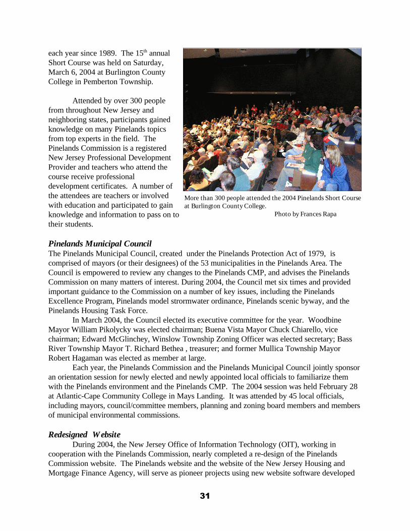
each year since 1989. The 15th annualShort Course was held on Saturday,March 6, 2004 at Burlington CountyCollege in Pemberton Township.
Attended by over 300 peoplefrom throughout New Jersey andneighboring states, participants gainedknowledge on many Pinelands topicsfrom top experts in the field. ThePinelands Commission is a registeredNew Jersey Professional DevelopmentProvider and teachers who attend thecourse receive professionaldevelopment certificates. A number ofthe attendees are teachers or involvedwith education and participated to gainknowledge and information to pass on totheir students.
Pinelands Municipal CouncilThe Pinelands Municipal Council, created under the Pinelands Protection Act of 1979, iscomprised of mayors (or their designees) of the 53 municipalities in the Pinelands Area. TheCouncil is empowered to review any changes to the Pinelands CMP, and advises the PinelandsCommission on many matters of interest. During 2004, the Council met six times and providedimportant guidance to the Commission on a number of key issues, including the PinelandsExcellence Program, Pinelands model strormwater ordinance, Pinelands scenic byway, and thePinelands Housing Task Force.
In March 2004, the Council elected its executive committee for the year. WoodbineMayor William Pikolycky was elected chairman; Buena Vista Mayor Chuck Chiarello, vicechairman; Edward McGlinchey, Winslow Township Zoning Officer was elected secretary; BassRiver Township Mayor T. Richard Bethea , treasurer; and former Mullica Township MayorRobert Hagaman was elected as member at large.
Each year, the Pinelands Commission and the Pinelands Municipal Council jointly sponsoran orientation session for newly elected and newly appointed local officials to familiarize themwith the Pinelands environment and the Pinelands CMP. The 2004 session was held February 28at Atlantic-Cape Community College in Mays Landing. It was attended by 45 local officials,including mayors, council/committee members, planning and zoning board members and membersof municipal environmental commissions.
Redesigned WebsiteDuring 2004, the New Jersey Office of Information Technology (OIT), working in
cooperation with the Pinelands Commission, nearly completed a re-design of the PinelandsCommission website. The Pinelands website and the website of the New Jersey Housing andMortgage Finance Agency, will serve as pioneer projects using new website software developed
31
More than 300 people attended the 2004 Pinelands Short Courseat Burlington County College. Photo by Frances Rapa
by OIT. The new site will expand upon existing content and functions and will help enhance theCommission’s efforts to provide greater information about the Pinelands protection program tothe public. At year’s end, the graphic and architectural design of the website was completed andwork began on creating and loading content onto the new site. The Commission plans to have thenew website online by July 2005.
NJ Open Public Records ActThe Pinelands Commission continued to respond to requests for public records under the
statutory requirements of the New Jersey Open Public Records Act (OPRA) and to ensure theagency’s full compliance with the provisions of the law. During 2004, the Commission’s RecordsCustodian received and processed 23 formal OPRA requests. However, the Commissionprocessed many more information requests, including several legal subpoenas for Commissionrecords, in the same manner as formal OPRA requests.
Of the 23 formal OPRA requests, 17 were made by legal, environmental consulting,development, engineering or other professional service firms. Only three OPRA requests werereceived by private citizens, two from non-profit organizations and one from a governmentagency.
Outreach & Education In October, the Commission co-sponsored the New Jersey World Water Monitoring Day
Celebration along with the NJDEP and the US Geological Survey. Staff from the threeenvironmental agencies hosted about 150 school children at Batsto Village in Wharton StateForest. The students tested water from Batsto Lake for pH (a measure of acidity), dissolvedoxygen, temperature and turbidity. The results were recorded and later entered into the WorldWater Monitoring Day database. The findings were also compared to other examples of waterresources collected throughout the Pinelands.
In May, Commission staff helped plan and execute a traveling faculty seminar sponsoredby Rutgers University. The Commission helped plan the Pinelands segment of the statewidemulti-day educational bus tour, which included a stop at a cranberry farm. The tour was attendedby nearly 40 University faculty. Commission staff also met with representatives of YMCA CampOckanickon to explore future opportunities to partner on Pinelands educational programs.
In October, Commission staff hosted a delegation of planners and university researchersfrom the Republic of Korea (South Korea). The group was on an eight-day tour of the US togain insight into many land-use and planning issues that South Korea is now facing. In April,Commission staff delivered an educational presentation to a delegation of Rotarians from Brazil atWhitesbog Village. That group was hosted by the Pemberton Rotary Club. The Commission routinely participates in public meetings and events to enhance the publicawareness of the uniqueness and importance of Pinelands resources and to increase publicunderstanding of the Pinelands protection policies and programs. In 2004, Commission staff hadinformational exhibits at the Fort Dix Family Funfest celebration, the Pinelands Jamboree inWaretown, Batsto Country Living Days fair, as well as the Pinelands Celebration held atWhitesbog by the Pinelands Preservation Alliance.
In November 2004, the Communications and Public Programs Office organized a publicinformation session to inform residents of Evesham Township of the terms of a proposedsettlement agreement in the Sanctuary development litigation matter. The meeting was attended
32
by over 50 local residents, Township officials, news reporters and members of the environmentalcommunity.
Pinelands Commission Chairman James Florio addressed many public assemblies during2004, including delivering the keynote address at the Environmental Congress of the Associationof New Jersey Environmental Commissions in October, where he discussed the importance ofregional planning to promote smart growth and protect natural resources. Florio authored anarticle on Pinelands smart-growth planning which appeared in the April issue of New JerseyMunicipalities magazine. In August 2004, Pinelands Commission Executive Director John Stokesgave a televised presentation to the Buena Vista Township Committee on various Pinelandstopics. The update was broadcast on cable television to 10 Pinelands municipalities.
One of the most prevalent New Jersey environmental issues of 2004 was the legislativedebate over the creation of a protection program for the New Jersey Highlands. The PinelandsCommission was active during much of the year providing information about the successes andchallenges of the Pinelands program to legislators, news reporters and local officials from theHighlands region. In addition to providing information to support the policy decisions, theCommission also had to dispel misinformation that was being disseminated by some. ExecutiveDirector Stokes testified before a Senate Committee and Chairman Florio wrote op-ed columns tonewspapers and appeared at press conferences.
The Commission’s Communications and Public Programs Office continued to provideinformational support to the media and general public. Staff handled 173 press inquiries from theprint, broadcast and electronic media during 2004. They issued 20 press releases regardingactivities and policy directions of the Pinelands Commission. They also published two issues ofThe Pinelander, the Commission’s official newsletter, both of which were mailed to over 2,300subscribers. The office responded to nearly 700 general public inquiries received by telephone, e-mail, postal mail and office visits.
Public Notification & ParticipationIn mid-2004, Commission staff conducted a detailed review of the agency’s policies and
procedures for informing the public of all Commission-sponsored meetings, hearings and otherpublic events. The review recommended a few additional measures but concluded that theCommission’s decision-making process is a very open and transparent and one that providesabundant opportunities for public participation. Many of the agency’s established procedures gowell beyond the requirements of the NJ Open Public Meetings Act and the notificationrequirements of the Pinelands Protection Act and CMP regulations.
Pinelands Interpretation & TourismIn 2004, the Pinelands Commission continued to work closely with the National Park
Service on the Pinelands Interpretation Program, located at the New Jersey Coastal Heritage Trail(NJCHT) Office in Cumberland County. In April, the NJCHT legislative authorization expiredand, at the close of 2004, had not been re-authorized by the US Congress. During this period, theNJCHT staff and funds were temporarily re-assigned to the Pinelands Interpretive Program. TheCommission and National Park Service worked to advance several Pinelands interpretive projects. These include the design of new Pinelands National Reserve highway signs, development of awayside exhibit for the soon-to-be-restored historic Fenwick Manor (see page 24) and the updateof the Pinelands interpretive kiosk displays that are featured at State Parks and Foreststhroughout the Pinelands.
33
In addition to planning for the Pinelands Scenic Byway (see page 13), Commission staffworked with a number of local governmental and non-profit organizations to help develop andpromote interpretive and tourism opportunities in the Pinelands. The Commission participated in,and provided support to, a newly formed Pinelands Tourism Group in Burlington County as wellas the newly established South Jersey Tourism Corporation. In June 2004, Pinelands Staffparticipated in a regional eco-tourism meeting and a conference on heritage- and ecological-basedtourism sponsored by the Ocean County Cultural and Heritage Commission. At anotherconference in October, Commission staff discussed interpretation of Pinelands Revolutionary Warsites in Ocean County. The Commission also provided input into a proposed Pinelands scenicdriving tour under development by the Woodford Cedar Run Wildlife Refuge in Medford. APinelands Tourism Summit, co-sponsored by the Pinelands Commission, South Jersey TourismCorporation, NJ Division of Travel and Tourism and Burlington County is planned for January2005.
34