nebraska natural resources commission · pdf filea description of any necessary water and land...
TRANSCRIPT
Page 1 of 29
NEBRASKA NATURAL RESOURCES COMMISSION
Water Sustainability Fund
Application for Funding
Section A.
ADMINISTRATIVE
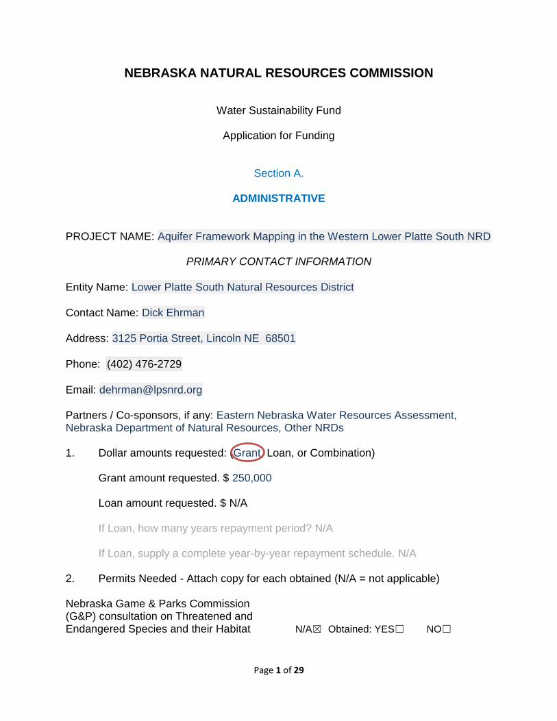
PROJECT NAME: Aquifer Framework Mapping in the Western Lower Platte South NRD
PRIMARY CONTACT INFORMATION
Entity Name: Lower Platte South Natural Resources District
Contact Name: Dick Ehrman
Address: 3125 Portia Street, Lincoln NE 68501
Phone: (402) 476-2729
Email: [email protected] Partners / Co-sponsors, if any: Eastern Nebraska Water Resources Assessment, Nebraska Department of Natural Resources, Other NRDs 1. Dollar amounts requested: (Grant, Loan, or Combination)
Grant amount requested. $ 250,000
Loan amount requested. $ N/A
If Loan, how many years repayment period? N/A
If Loan, supply a complete year-by-year repayment schedule. N/A 2. Permits Needed - Attach copy for each obtained (N/A = not applicable) Nebraska Game & Parks Commission (G&P) consultation on Threatened and Endangered Species and their Habitat N/A☒ Obtained: YES☐ NO☐
Page 2 of 29
Surface Water Right N/A☒ Obtained: YES☐ NO☐
USACE (e.g., 404 Permit) N/A☒ Obtained: YES☐ NO☐
Cultural Resources Evaluation N/A☒ Obtained: YES☐ NO☐
Other (provide explanation below) N/A☒ Obtained: YES☐ NO☐
Click here to enter text. 3. Are you applying for funding for a combined sewer over-flow project?
YES☐ NO☒
If yes, do you have a Long Term Control Plan that is currently approved by the Nebraska Department of Environmental Quality? N/A
YES☐ NO☐ N/A☒
If yes attach a copy to your application. N/A
If yes what is the population served by your project? N/A
If yes provide a demonstration of need. N/A
If yes and you were approved for funding in the most recent funding cycle, then resubmit the above information updated annually but you need not complete the remainder of the application.
4. If you are or are representing an NRD, do you have an Integrated Management
Plan in place, or have you initiated one?
N/A☐ YES☒ NO☐
5. Has this application previously been submitted for funding assistance from the
Water Sustainability Fund and not been funded? YES☐ NO☒
If yes, have any changes been made to the application in comparison to the previously submitted application? N/A
If yes, describe the changes that have been made since the last application. N/A
No, I certify the application is a true and exact copy of the previously submitted and scored application. (Signature required) N/A
Page 3 of 29
6. Complete the following if your project has or will commence prior to next July 1st.
LPSNRD does not intend to request any reimbursement for this project prior to July 1, 2017. As of the date of submittal of this application, what is the Total Net Local Share of Expenses incurred for which you are asking cost share assistance from this fund? $XX,XXX
Attach all substantiating documentation such as invoices, cancelled checks etc. along with an itemized statement for these expenses. Attachment 1 – Total Net Local Share of Expenses Incurred
Estimate the Total Net Local Share of Expenses and a description of each you will incur between the date of submittal of this application and next July 1st for which you are asking cost share assistance from this fund. $xx,xxx Attachment 2 – Total Net Local Share of Expenses Pending
Page 4 of 29
Section B.
DNR DIRECTOR’S FINDINGS
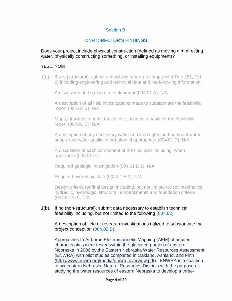
Does your project include physical construction (defined as moving dirt, directing water, physically constructing something, or installing equipment)?
YES☐ NO☒
1(a). If yes (structural), submit a feasibility report (to comply with Title 261, CH
2) including engineering and technical data and the following information:
A discussion of the plan of development (004.01 A); N/A A description of all field investigations made to substantiate the feasibility report (004.01 B); N/A Maps, drawings, charts, tables, etc., used as a basis for the feasibility report (004.01 C); N/A A description of any necessary water and land rights and pertinent water supply and water quality information, if appropriate (004.01 D); N/A A discussion of each component of the final plan including, when applicable (004.01 E);
Required geologic investigation (004.01 E 1); N/A
Required hydrologic data (004.01 E 2); N/A
Design criteria for final design including, but not limited to, soil mechanics, hydraulic, hydrologic, structural, embankments and foundation criteria (004.01 E 3). N/A
1(b). If no (non-structural), submit data necessary to establish technical
feasibility including, but not limited to the following (004.02):
A description of field or research investigations utilized to substantiate the project conception (004.02 B); Approaches to Airborne Electromagnetic Mapping (AEM) of aquifer characteristics were tested within the glaciated portion of eastern Nebraska in 2006 by the Eastern Nebraska Water Resources Assessment (ENWRA) with pilot studies completed in Oakland, Ashland, and Firth (http://www.enwra.org/media/enwra_overview.pdf). ENWRA is a coalition of six eastern Nebraska Natural Resources Districts with the purpose of studying the water resources of eastern Nebraska to develop a three-
Page 5 of 29
dimensional geologic framework and water budget. AEM utilizes helicopter or fixed wing aircraft to carry transmitting and receiving equipment along a predetermined flight path. The ENWRA pilot studies and additional follow up work tested multiple types of AEM techniques in geologically diverse settings. In all types of AEM, the equipment remotely senses the electrical characteristics of the subsurface materials which can be used to infer the type of subsurface materials that are in place such as clay, silt, sand, or gravel. The pilot studies conducted by ENWRA determined the effectiveness of the various AEM approaches for measuring aquifer characteristics (http://www.enwra.org/media/sir2011-5228.pdf). Due to the aquifer depths and variability of overlying material, Time-Domain Electromagnetic (TDEM) AEM has become the standard for large scale remote sensing of aquifer characteristics in eastern Nebraska. TDEM has been successfully implemented in much of Nebraska with extensive flights in 2013 and 2014 across the eastern portion of the state. ENWRA, the Nebraska Department of Natural Resources (NDNR), and the University of Nebraska Conservation and Survey Division (CSD) assisted the local NRDs with the funding, data collection, and interpretation as well as the test hole drilling to ground truth the interpretations. These interpreted datasets have been incorporated into the existing hydrogeologic information and utilized by the LPSNRD to make water management decisions. The proposed Project is an extension of the recent AEM work done by ENWRA. The Lower Platte South NRD has utilized AEM in two priority areas, the Crete-Princeton-Adams Ground Water Reservoir (CPA GWR) and the Dwight-Valparaiso-Brainard Special Management Area (DVB SMA). In CPA, the technology was used primarily to further delineate the boundaries of the paleovalley aquifer in that area as well as to understand the geometry of upper and lower aquifer units. In DVB, the primary objective was to better understand the nature and degree of confinement of much of the area, which is directly related to in-season water level declines. In addition, the AEM study there gave more accurate estimates of aquifer volume as well as identifying the location and extent of recharge areas in the more unconfined portions of the area. Also, in DVB, the data was put into a publicly-accessible Google Earth format in which the user can simply click on a given location to obtain estimates of aquifer thickness, likelihood of recharge, depth to bedrock, and other basic aquifer parameters. This approach is underway for the older data obtained for CPA. LPSNRD will use a similar approach for a WSF-funded project in 2016 for the eastern portion of the District. This project will 1) provide additional delineation of the Lower Salt Creek aquifer system to help further evaluate the degree and extent of ground water/surface water connection; 2) provide closely-spaced transects in blocks covering several Wellhead Protection Areas (WHPAs) in the eastern District where aquifer units are thin, isolated, and somewhat limited; and 3) fly additional longer-
Page 6 of 29
transects providing reconnaissance information for the regions between the Lower Salt Creek aquifer and these WHPAs. Finally, LPSNRD has cooperated with the other ENWRA NRDs to fly several longer transects across much of the District to provide additional focus for future, more detailed block flights. A discussion of the plan of development (004.02 A); Benefitting from the work done by ENWRA and its partners, this Project will utilize TDEM to map the subsurface materials of the Project area. The overall steps of the proposed Project include finalization of the anticipated flight lines, collection of AEM data, analysis and interpretation of the data, and incorporation of the interpretation into the existing understanding and overall framework of the hydrogeology of the area. Preliminary flight lines are included in Attachment 1– Project Area. Additional refinement of the flight lines will be needed to ensure efficient data collection and minimal interference from artificial sources such as pipelines. Additionally, an overall plan for mobilization and collection sequencing will be developed based upon the approvals of similar WSF grant applications. The collected data will be processed by the consultant to determine the electrical resistivity of the subsurface materials from the raw TDEM data. Electrical resistivity is a measure of well or how poorly the subsurface materials resist the flow of an electrical current. Electrical resistivity can be correlated with the subsurface materials such as gravels, sands, silts, and clays. Highly resistive materials are typically sand and gravels with a high quartz content where less resistive materials typically are silts and clays. The processed data will be provided to the LPSNRD, ENWRA, and CSD for further interpretation. The resistivity data and estimates of the types of subsurface materials will be incorporated into existing datasets and interpretations made of geologic units represented in the datasets. These interpretations will be made utilizing the existing understanding of the hydrogeologic units from traditional sampling techniques and previous AEM work. These interpretations comprise the overall framework necessary for understanding the location, extents, recharge, ground water flow, and discharge characteristics of the aquifer systems. Such information is particularly vital in the western portion of the LPSNRD, where aquifer units are often thin and discontinuous, and ground water supplies can be extremely limited. A final report will be provided by the consultant describing the data collection, processing, and interpretation of the AEM.
Page 7 of 29
In addition, this data will be submitted to NDNR for consideration in Fully Appropriated Basin (FAB) delineations and/or modifications (see #9 below).
A description of the necessary water and/or land rights, if applicable (004.02 C); Remote sensing of aquifer materials requires ground truthing of the aquifer characteristics through traditional drilling and sampling techniques. The existing set of CSD test-holes can be utilized as ground truth locations. Flight lines for this Project will be developed to make use of the existing test-holes where possible. Where test-holes are not available but the need for data collection is critical, additional test holes will be drilled. LPSNRD typically includes funds for test-hole drilling in its annual budget process and will continue to do so as needed for verification of data obtained through this project.
A discussion of the anticipated effects, if any, of the project upon the development and/or operation of existing or envisioned structural measures including a brief description of any such measure (004.02 D). N/A
2. Provide evidence that there are no known means of accomplishing the
same purpose or purposes more economically, by describing the next best alternative.
Traditional methods of collecting hydrogeologic information are through the drilling of test-holes and logging of the geologic materials found. Individual test-holes provide a single point of information about the areas hydrogeology, and the materials between test-holes are inferred. The aquifer materials and their properties may change dramatically in as little as a few tens of feet from the individual test-hole. Individual points of information, like test-holes, provide limited information about the broader aquifer characteristics. While limited, test holes have been the best available method for assessing aquifer characteristics until the recent improvement of airborne electromagnetic sensing (AEM). AEM essentially provides thousands of virtual test-holes along the flight path thereby collecting a nearly seamless cross-section of the aquifer materials. The AEM survey method can remotely cover large areas of the subsurface in a short amount of time with great detail. This type of seamless cross-section cannot be collected through any other known method. All methods of AEM collection require approximately the same level of planning, acquisition, and processing costs. The primary reasons for selecting one method over the other are the type of materials being sensed, the depth of the materials, and the water quality within the aquifer. TDEM has been shown,
Page 8 of 29
through the work of ENWRA and the local NRDs, to be the most effective method for the proposed Project area, and will help enhance the limited data available for this area.
3. Document all sources and report all costs and benefit data using current
data, (commodity prices, recreation benefit prices, and wildlife prices as prescribed by the Director) using both dollar values and other units of measurement when appropriate (environmental, social, cultural, data improvement, etc.). The period of analysis for economic feasibility studies shall be fifty (50) years or with prior approval of the Director, up to one hundred (100) years [T261 CH 2 (005)].
Describe any relevant cost information including, but not limited to the engineering and inspection costs, capital construction costs, annual operation and maintenance costs, and replacement costs. Cost information shall also include the estimated construction period as well as the estimated project life (005.01). N/A
Only primary tangible benefits may be counted in providing the monetary benefit information and shall be displayed by year for the project life. In a multi-purpose project, estimate benefits for each purpose, by year, for the life of the project. Describe any intangible or secondary benefits separately. In a case where there is no generally accepted method for calculation of primary tangible benefits describe how the project will increase water sustainability, such that the economic feasibility of the project can be approved by the Director and the Commission (005.02). N/A
All benefit and cost data shall be presented in a table form to indicate the annual cash flow for the life of the proposal, not to exceed 100 years (005.03). N/A
In the case of projects for which there is no generally accepted method for calculation of primary tangible benefits and if the project will increase water sustainability, the economic feasibility of such proposal shall be demonstrated by such method as the Director and the Commission deem appropriate (005.04).
4. Provide evidence that sufficient funds are available to complete the
proposal.
The LPSNRD Board of Directors has included $400,000 for additional AEM data collection in FY2018 in the NRD’s Long Range Implementation Plan (see Attachment 3-Evidence of Available Funds).
5. Provide evidence that sufficient annual revenue is available to repay the
reimbursable costs and to cover OM&R (operate, maintain, and replace). N/A
Page 9 of 29
6. If a loan is involved, provide sufficient documentation to prove that the loan can be repaid during the repayment life of the proposal. N/A
7. Describe how the plan of development minimizes impacts on the natural
environment. N/A
8. Explain how you are qualified, responsible and legally capable of carrying out the project for which you are seeking funds.
The Nebraska Ground Water Management and Protection Act, passed in 1975, established the Natural Resources Districts (NRD) as the preferred local entities for ground water regulation and protection. NRDs work cooperatively with cities, counties, state, and federal agencies to accomplish ground water resource protection through programs, projects, and regulations. Each NRD is required to have in place a Ground Water Management Plan (GWMP), based upon the best available information, and approved by the Director of the Nebraska Department of Natural Resources. The LPSNRD also has in place an Integrated Management Plan for the hydrologically connected surface water and ground water (IMP adopted May 5, 2014)). The District voluntarily entered into the IMP development process to take a proactive approach to the protection of the water resources. The staff, management, and Board of Directors (Board) of the LPSNRD devote significant time and resources toward their duties to understand and manage the ground water resources. The District’s existing, previously collected ground water data will be combined with the information collected during this Project by the staff and management of the LPSNRD and utilized by the Board to inform future decisions regarding the management and protection of ground water resources.
9. Explain how your project considers plans and programs of the state and
resources development plans of the political subdivisions of the state.
The data collected by the Project will be submitted to the NDNR as the “best available” information for use in the Annual Evaluation of Availability of Hydrologically Connected Water Supplies (FAB Report). The FAB Report is a statutory requirement of the NDNR which evaluates the long-term availability of the hydrologically connected water supplies of the State. The previous collection of AEM data done by ENWRA was partially funded by the NDNR for use in modeling efforts to determine the impacts of ground water use on surface waters in hydrologically connected reaches. The results of those modeling efforts were incorporated into the FAB Report which determines if a basin is fully appropriated or not. The Project will update the overall hydrogeologic framework and improve upon the previous modeling updates that supported the FAB Report. The Project will also provide hydrogeologic data necessary for more effective implementation of the LPSNRD’s existing Ground Water Management
Page 10 of 29
Plan (GWMP). All Natural Resources Districts are statutorily required to have a completed GWMP which includes information about the aquifers of the NRD, supplemental supplies, integrated and coordinated use, and the boundaries of management areas. The current GWMP was utilized to determine the area selected for data collection and existing ground water management areas were considered the highest priority. The LPSNRD also has a voluntary Integrated Management Plan (IMP) in place for the entire District (adopted May 5, 2014), and additional AEM data will provide valuable information as that plan continues to be implemented. Also, the proposed AEM flight lines in LPSNRD are focused on designated Community Water System Protection Areas (CWSPAs) in the western portion of the District. CWSPAs are essentially the same as the Wellhead Protection Areas (WHPAs), which are delineated by the Nebraska Department of Environmental Quality (NDEQ), based upon estimated 20-year time-of-travel zones. Several of the CWSPAs in the District are designated as Phase II Ground Water Management Areas (GWMAs) for ground water quality due to elevated nitrate levels (including the Davey and Pleasant Dale CWSPAs included in this project). In these areas, the NRD is promoting various agricultural best management practices and requiring educational certification of individuals applying nitrate fertilizers. It is likely that some of these areas have elevated nitrate levels due at least in part to the very limited thickness of aquifer materials present; in such areas, even modest amounts of nitrate leaching from the land surface can cause elevated ground water nitrate levels. In addition, some of these systems are prone to difficulty in maintaining adequate supplies of ground water, especially under drought conditions. Therefore, the additional, more detailed aquifer delineations provided by AEM data collection will help manage both ground water quality and quantity for these vulnerable systems, as well as helping individual well owners who may be dealing with similar problems. This is particularly important as no current rural water districts exist in the western portion of the NRD—individual wells are currently the only source of domestic supply for rural residents. Finally, the AEM data will also be collected in the remainder of the project area utilizing north-south and east –west transects on an approximate two-mile grid spacing. This will provide additional detail as to the occurrence and extent of aquifer units in the western portion of the District, where the geologic setting is highly variable and, as mentioned above, some aquifer units are quite limited. Such data will be highly valuable for landowners and others considering building homes, developing agricultural land or businesses, etc.
10. Are land rights necessary to complete your project?
YES☐ NO☒
Page 11 of 29
If yes, provide a complete listing of all lands involved in the project. N/A
If yes, attach proof of ownership for each easements, rights-of-way and fee title currently held. N/A
If yes, provide assurance that you can hold or can acquire title to all lands not currently held. N/A
11. Identify how you possess all necessary authority to undertake or
participate in the project.
The LPSNRD is a political subdivision of the State of Nebraska with authority to levy property taxes and enter into contracts and Inter-local Cooperation Act agreements. The contract for professional services to collect the AEM data will require approval from the Board of Directors and be signed on behalf of the LPSNRD by the General Manager. LPSNRD intends to use $400,000 in general funds as match for this application, and has included that in its Long Range Implementation Plan for FY 2018 (see Attachment 3).
12. Identify the probable environmental and ecological consequences that
may result as the result of the project.
Remote sensing projects such as AEM do not have a physical impact on the environment or ecologic communities. There are no environmental or ecological consequences from AEM data collection. This lack of direct physical impact is one of the great advantages of AEM data collection.
Page 12 of 29
Section C.
NRC SCORING In the NRC’s scoring process, points will be given to each project in ranking the projects, with the total number of points determining the final project ranking list. The following 15 criteria constitute the items for which points will be assigned. Point assignments will be 0, 2, 4, or 6 for items 1 through 8; and 0, 1, 2, or 3 for items 9 through 15. Two additional points will be awarded to projects which address issues determined by the NRC to be the result of a federal mandate. Notes:
The responses to one criterion will not be considered in the scoring of other criteria. Repeat references as needed to support documentation in each criterion as appropriate. The 15 categories are specified by statute and will be used to create scoring matrixes which will ultimately determine which projects receive funding.
There is a total of 69 possible points, plus two bonus points. The potential number of points awarded for each criteria are noted in parenthesis. Once points are assigned, they will be added to determine a final score. The scores will determine ranking.
The Commission recommends providing the requested information and the requests are not intended to limit the information an applicant may provide. An applicant should include additional information that is believed will assist the Commission in understanding a proposal so that it can be awarded the points to which it is entitled.
Complete any of the following (15) criteria which apply to your project. Your response will be reviewed and scored by the NRC. Place an N/A (not applicable) in any that do not apply, an N/A will automatically be placed in any response fields left blank.
1. Remediates or mitigates threats to drinking water;
Describe the specific threats to drinking water the project will address.
Identify whose drinking water, how many people are affected, how will project remediate or mitigate.
Provide a history of issues and tried solutions.
Provide detail regarding long range impacts if issues are not resolved.
Detailed information collected from AEM combined with traditional hydrogeologic information that is incorporated into an aquifer framework provides a far more complete understanding of the physical extents and potential interactions of the
Page 13 of 29
local and regional aquifers and surface waters. This framework includes not only the depth to the top of the aquifer and extents of the aquifer materials but also the depth to the bottom aquifer. Beyond the information collected about the aquifer, information about the materials that overlay the aquifer area are also important in providing greater understanding of how the recharging water migrates to the aquifer system. Water quality problems in aquifer systems that can impact drinking water are related to activities at or near the land surface. A particular aquifer’s susceptibility to surface contaminants is partially determined by the type of overlying materials. An understanding of the overlying materials, whether the materials readily allow percolating water to recharge the aquifer or not, determines the rate at which surface contaminants can reach the aquifer. Sandier materials above an aquifer with limited clay content allow more rapid recharge, whereas thick sections of clay reduce the rate of downward migration. Greater understanding of the extents of materials that limit or transmit percolating water can provide LPSNRD with the ability to tailor regulations on activities that potentially impact drinking water quality, such as fertilizer application rates and timing. Typically, contamination from the land surface tends to remain in the uppermost portion of the aquifer system versus mixing more deeply in the aquifer. Mapping the depth to the bottom of the aquifer provides LPSNRD the ability to assist domestic well users and municipalities with guidance on the depth for new drinking water well construction. Typical domestic well construction occurs in the uppermost portion of the aquifer as, once the driller has encountered enough water bearing sands, the drilling is stopped and the well is completed. Additional drilling is considered an unnecessary expense as increases to the capacity of the domestic well are not needed once a sufficient quantity of water bearing sands are encountered. The additional drilling can however provide a domestic well with greater longevity and reduced impact from surface contaminants. Through an understanding of the full depth of the aquifer, LPSNRD can establish best management practices to be used by well drillers and domestic well users during the construction of new drinking water wells. Where sufficient depth of aquifer materials are available, recommendations for drilling to a deeper portion of the aquifer for well completion could be made. Completing the drinking water well in the deeper portion of the aquifer and sealing off the upper portion of the aquifer is an effective way to limit the wells susceptibility to contaminants and reduce the potential for interference from nearby wells. The Project area includes an estimated 1,500-2,000 registered, active domestic wells and encompasses eight wellhead protection areas for the communities of Ceresco, Davey, Denton, Emerald, Garland, Malcolm, Pleasant Dale, and Raymond (Attachment 1 – Project Area). The current population of the communities noted above is approximately 2,500 people; assuming that each registered domestic well serves three people on average, those wells would serve an additional 4,500-6,000 people. In addition, there are undoubtedly some
Page 14 of 29
unregistered domestic wells serving an unknown number of people in the project area, and it’s likely that these wells serve an additional few thousand people. Therefore, LPSNRD estimates that approximately 8,000-10,000 people rely on the combination of domestic wells and small municipal supplies in the Project area for their primary drinking water source. It should be noted that the City of Lincoln occupies a good portion of the project area, but AEM flights are precluded over such a heavily-populated area. Thus, the population estimate provide above only includes people living within one of the eight small communities and in the rural portion of the project area—that is, the City of Lincoln and the population supplied by its water system are not included in these population estimates. Water quality sampling in the project area has indicated that there are elevated levels of nitrate-nitrogen, and LPSNRD has designated Phase II management areas in the Davey and Pleasant Dale WHPAs to help address those concerns. Part of this effort is initiation of vadose zone sampling to document the vertical distribution and movement of nitrate from the land surface down to ground water. In most cases, this sampling occurs at depths up to about 75’ below the land surface. It is anticipated that the AEM survey will provide additional detail on the stratigraphy and composition of the vadose zone in some of these areas. Finally, it’s long been known that the geology of this part of LPSNRD is typical of the glaciated eastern portion of Nebraska, and as such the available water-bearing sediments are highly variable in terms of composition, thickness, and geometry. Such isolated and variable aquifer units are highly susceptible to both ground water quantity and quality concerns, and the most detailed AEM data that can be obtained will be extremely useful to both public water suppliers and individual domestic well owners. This illustrates the importance of additional AEM data to LPSNRD’s ground water quality management efforts.
2. Meets the goals and objectives of an approved integrated management plan or ground water management plan;
Identify the specific plan that is being referenced including date, who issued it and whether it is an IMP or GW management plan.
Provide the history of work completed to achieve the goals of this plan.
List which goals and objectives of the management plan the project provides benefits for and how the project provides those benefits.
This project will directly meet goals and objectives of both the LPSNRD’s Ground Water Management Plan (approved by NDWR in 1995 and the NRD’s voluntary Integrated Management Plan (adopted May 5, 2014). For the GWMP, the data provided by AEM flights will provide a more detailed and defensible understanding of the highly variable aquifer units in the western portion of the District. In addition, it will provide a much improved geologic framework for the designated WHPAs in that part of LPSNRD; these WHPAs (referred to as CWSPAs in the NRD’s GWMP) are designated areas of ground water quality and
Page 15 of 29
quantity management. As of this writing, two WHPAs (Davey and Pleasant Dale) are Phase II management areas for nitrate-nitrogen. The voluntary IMP identifies three major Goal Areas: Water Inventory, Water Supply Management, and Water Use Management. The project directly addresses the Water Inventory area by providing a much more detailed picture of the limited and variable aquifer units in the western portion of the NRD. This information will feed directly into the District’s efforts at Water Supply Management, specifically including proper location of new water supply wells and evaluation of additions and improvements to the regional water systems in the area. Finally, the data provided by this project will greatly enhance LPSNRD’s efforts at water use management, specifically helping identify priority areas for water use techniques as well as evaluation of new water uses and their effects on existing ground water supplies.
3. Contributes to water sustainability goals by increasing aquifer recharge, reducing
aquifer depletion, or increasing streamflow;
List the following information that is applicable:
The location, area and amount of recharge;
The location, area and amount that aquifer depletion will be reduced;
The reach, amount and timing of increased streamflow. Describe how the project will meet these objectives and what the source of the water is;
Provide a detailed listing of cross basin benefits, if any.
The collection of hydrogeologic data and assembly of that data into an overall aquifer framework provides the information necessary to help determine area recharge characteristics, aquifer extents, volume of available ground water, interconnection with other aquifers, and stream-aquifer interactions. AEM, along with interpretation of the collected data, provides highly detailed information about the materials within the aquifer as well as the materials above, below, and adjacent to the aquifer. Aquifer recharge is determined by the water available from precipitation for deep percolation after taking into account runoff, evapotranspiration, soil characteristics, and other factors. Recharge also is impacted by the materials that overlay the aquifer which influence the way in which the deeply percolating water reach the aquifer. Generally speaking, the sandier the materials that overlay the aquifer, the faster the recharge will be. While more clay rich materials will tend to slow the recharge. AEM can be utilized to improve the District’s understanding of recharge potential by delineating the layers of material types overlying an aquifer. Recharge potential can then be utilized by the District to better assess projects designed to increase recharge as well as inform the District’s management of preferred development zones in areas where recharge is higher.
Page 16 of 29
Preferred development areas can be used to tailor development of additional uses of ground water to those areas where recharge more readily replenishes withdrawals, where aquifer thickness is greatest, where effects from aquifer extents are reduced, or where well impacts to streams are minimized. Management decisions for Ground Water Management Areas (GWMA) would seek to balance the needs for ground water development with the existing uses of ground water in and area. A more complete framework of the hydrogeology will improve the District’s ability to make those management decisions and improve the sustainability of the overall water resources. Potential management decisions to utilize allocations, rotation, limits on development, or other ground water controls as part of a GWMP or IMP can be better tailored to protect existing users and promote sustainable use of the water resources. LPSNRD has already seen the benefit of AEM technology in identifying recharge areas. In both the CPA GWR and DVB SMA, the airborne survey identified areas and thicknesses of coarser-grained sediments (mostly sand) close to or at the land surface. In some cases, these areas were already known, but in other areas the AEM data indicated the presence of recharge areas that were not previously identified. Further work will be necessary to quantify the amount and timing of recharge in these areas, but now the geographic location of that work will be much more precise. In addition, these recharge areas are currently priority areas for implementation of agricultural and other best management practices, especially to reduce or prevent the contamination of ground water by nitrate.
4. Contributes to multiple water supply goals, including, but not limited to, flood
control, agricultural use, municipal and industrial uses, recreational benefits, wildlife habitat, conservation of water resources, and preservation of water resources;
List the goals the project provides benefits.
Describe how the project will provide these benefits
Provide a long range forecast of the expected benefits this project could have versus continuing on current path.
Conservation and preservation of water resources for the beneficial use of the residents of the state requires detailed information about the aquifer characteristics and interactions of the ground water and surface water resources. Sound strategies for conservation and preservation, whether management actions, programs, or projects, depend on that detailed information. This is especially true in complex geologic areas such as the glaciated western portion of the LPSNRD, as the aquifer units there are highly variable in terms of extent and thickness. The data gained by additional AEM flights will provide much greater detail and resolution of the characteristics of these aquifers, and will allow public water suppliers, individual well owners, and commercial water users to be more confident in evaluation of existing water sources as well as the potential for
Page 17 of 29
additional sources. This will be especially important for management of ground water nitrate concerns as the limited aquifer units in this area provide much less natural dilution of contaminants. Likewise, in periods of drought, ground water wells completed in these limited aquifers are highly susceptible to limitations in amount of ground water to be pumped. More detailed delineation of aquifer characteristics and volumes will be critical in managing ground water use in these areas in times of limited supply.
5. Maximizes the beneficial use of Nebraska’s water resources for the benefit of the
state’s residents;
Describe how the project will maximize the increased beneficial use of Nebraska’s water resources.
Describe the beneficial uses that will be reduced, if any.
Describe how the project provides a beneficial impact to the state's residents.
The beneficial use of Nebraska’s water resources is established and prioritized in the Nebraska constitution with domestic use being the highest priority and agricultural use and industrial use following from there. Water is considered a natural want and a shared resource of the State. The LPSNRD has long worked with other area NRDs and the State to best manage the water resources for beneficial use. The aquifer framework developed through this AEM collection project will further the District’s understanding of the aquifer systems and their interaction with the land surface and area streams. This understanding will be shared with other NRDs as well as state agencies including NDNR and CSD. The shared understanding of the water resources will allow the agencies tasked with managing Nebraska’s water resources the best available information to make the best possible decisions regarding the beneficial use of the water resources.
6. Is cost-effective;
List the estimated construction costs, O/M costs, land and water acquisition costs, alternative options, value of benefits gained.
Compare these costs to other methods of achieving the same benefits.
List the costs of the project.
Describe how it is a cost effective project or alternative.
As already noted, there are no costs for construction, O/M, etc. for this project. However, it’s important to note that, even though AEM surveys are not inexpensive, the technology provides the equivalent of a detailed geologic cross section for every aerial line flown. Such a result can be obtained in rough form within a few hours, and after data analysis, inversion, etc., the detailed result is produced (along with three-dimensional versions, derived characteristics, etc.) within several months. If such an undertaking were to be attempted using only traditional investigation methods like test-hole drilling, or even with other
Page 18 of 29
electronic techniques like traditional land-based geophysics, the manpower, cost, and timeframe for obtaining similarly detailed information would be many, many times the amount requested for this project.
7. Helps the state meet its obligations under interstate compacts, decrees, or other
state contracts or agreements or federal law;
Identify the interstate compact, decree, state contract or agreement or federal law.
Describe how the project will help the state meet its obligations under compacts, decrees, state contracts or agreements or federal law.
Describe current deficiencies and document how the project will reduce deficiencies.
N/A
8. Reduces threats to property damage or protects critical infrastructure that
consists of the physical assets, systems, and networks vital to the state or the United States such that their incapacitation would have a debilitating effect on public security or public health and safety;
Identify the property that the project is intended to reduce threats to.
Describe and quantify reductions in threats to critical infrastructure provided by the project and how the infrastructure is vital to Nebraska or the United States.
Identify the potential value of cost savings resulting from completion of the project.
Describe the benefits for public security, public health and safety.
A primary benefit of this project will be to obtain more detailed and reliable information regarding the limited aquifer units in the western portion of LPSNRD. This includes all or portion of eight small public water suppliers serving somewhere in the neighborhood of 2,500 people, as well as about 1,500-2,000 private registered and an unknown number of unregistered domestic wells serving several thousand additional residents. Better understanding of this limited resource will help ground water users maximize the use of existing wells, and will provide highly valuable information if and when new sources are needed.
9. Improves water quality;
Describe what quality issue(s) is/are to be improved.
Describe and quantify how the project improves water quality, what is the target area, what is the population or acreage receiving benefits, what is the usage of the water: residential, industrial, agriculture or recreational.
Describe other possible solutions to remedy this issue.
Page 19 of 29
Describe the history of the water quality issue including previous attempts to remedy the problem and the results obtained.
The project would provide information that would improve the understanding of the extent and connectedness of the resource as well as the types of materials overlying the resource. That information could be utilized to improve or create programs or projects that directly impact water quality. As noted several times, the primary threat to ground water quality in this portion of LPSNRD is nitrate-nitrogen, but some communities and private wells have experienced concerns over detection of additional, often naturally-occurring contaminants like arsenic. Of course, this is true in much of Nebraska, but the effect in the western LPSNRD is magnified by the highly variable and in some cases limited extent of aquifer units. Not only does this limited amount of ground water provide less “buffer” due to dilution effects, if ground water does become contaminated it is more difficult to find an alternative source in this area than in other, more ground water rich portions of the District.
10. Has utilized all available funding resources of the local jurisdiction to support the program, project, or activity;
Identify the local jurisdiction that supports the project.
List current property tax levy, valuations, or other sources of revenue for the sponsoring entity.
List other funding sources for the project.
In its FY2018 Long Range Implementation Plan, LPSNRD has allocated $400,000 of local NRD funds for additional AEM mapping (See Attachment 3). The $250,000 request, if granted, would therefore bring the total funding available for this project to approximately $650,000.
11. Has a local jurisdiction with plans in place that support sustainable water use;
List the local jurisdiction and identify specific plans being referenced that are in place to support sustainable water use.
Provide the history of work completed to achieve the goals of these plans.
List which goals and objectives this project will provide benefits for and how this project supports or contributes to those plans.
Describe and quantify how the project supports sustainable water use, what is the target area, what is the population or acreage receiving benefits, what is the usage of the water: residential, industrial, agriculture or recreational.
List all stakeholders involved in project.
Identify who benefits from this project.
LPSNRD’s GWMP delineates two types of areas of management: Ground Water Reservoirs (GWRs), which are those parts of the District where widespread
Page 20 of 29
aquifer units supply considerable amounts of ground water, and Community Water System Protection Areas (CWSPAs), which are the areas around public water system wells (CWSPAs are analogous to the Wellhead Protection Areas (WHPAs) delineated by the Nebraska DEQ). In the project area, the Davey and Pleasant Dale CWSPAs are designated as Phase II management areas for elevated nitrate-nitrogen in ground water. In these areas, individuals who apply nitrogen fertilizer are required to become certified by the NRD in nitrogen management, and LPSNRD promotes additional best management practices (BMPs) to deal with the issue. For all of these areas, LPSNRD convened an Advisory Group consisting of farmers, well owners, businesspeople, and other concerned citizens to help develop effective programs for dealing with the nitrate concerns. In addition, the NRD provides at least annual sampling to the public water systems involved, and provides them with results on an annual basis. Finally, as mentioned, individuals who apply nitrogen fertilizer in these areas are required to attend certification classes every four years, and the NRD shares information on ground water quality as well as BMP implementation with them. As a result, LPSNRD has consistent and effective relationships with public water suppliers and landowners in the area. Availability of additional, more detailed AEM data will help those suppliers and individuals evaluate water supply issues in the area and more effectively respond to concerns.
12. Addresses a statewide problem or issue;
List the issues or problems addressed by the project and why they should be considered statewide.
Describe how the project will address each issue and/or problem.
Describe the total number of people and/or total number of acres that would receive benefits.
Identify the benefit, to the state, this project would provide.
The two primary issues addressed by this project will be limited ground water supplies (especially in drought conditions) and ground water quality degradation due to nitrate-nitrogen and possibly other contaminants. These problems are a statewide occurrence in Nebraska, but are particularly magnified in the project area due to the variable and limited nature of the aquifers occurring in the western LPSNRD. A more detailed understanding of aquifer geometry and composition will help to better evaluate the amount of ground water present, and identification of possible recharge areas will help anticipate future quantity and quality issues. The eight small public water suppliers in the project area serve about 2,500 people, and the estimated 1,500-2,000 registered and an unknown number of unregistered domestic wells likely serve several thousand additional citizens. This project will assist these entities and individuals in maximizing current ground water conservation and management efforts, as well as helping them identify potential new well locations should the need occur.
Page 21 of 29
13. Contributes to the state’s ability to leverage state dollars with local or federal government partners or other partners to maximize the use of its resources;
List other funding sources or other partners, and the amount each will contribute, in a funding matrix.
Describe how each source of funding is made available if the project is funded.
Provide a copy or evidence of each commitment, for each separate source, of match dollars and funding partners.
Describe how you will proceed if other funding sources do not come through.
The primary leverage for this project will be to benefit local public water suppliers. As described, the detailed AEM results will be highly valuable to local suppliers in managing existing limited ground water supplies as well as identifying new well locations should that become necessary. Public water suppliers make use of a variety of funding sources (for example, State Revolving Fund) when upgrading or installing new water or waste water systems. The information on ground water occurrence as well as near surface geology will prove highly valuable when evaluating new facility sites, and the refined aquifer volume estimates will facilitate required aquifer analysis for establishment of new ground water-based drinking water systems.
14. Contributes to watershed health and function;
Describe how the project will contribute to watershed health and function in detail and list all of the watersheds affected.
The information from the Project could be used to inform actions that would promote or improve watershed health. Although the primary benefit of the project will be to an understanding of ground water occurrence, the level of detail provided will undoubtedly help understand surface/ground water interactions and identify a variety of areas where surface runoff may impact ground water quality in the western LPSNRD and portions of both the Lower Platte and Nemaha basins.
15. Uses objectives described in the annual report and plan of work for the state
water planning and review process issued by the department.
Identify the date of the Annual Report utilized.
List any and all objectives of the Annual Report intended to be met by the project
Explain how the project meets each objective.
The Annual Report and Plan of Work for the Nebraska State Water Planning and Review Process – September 2015 lists the following objectives: 1) Maintain
Page 22 of 29
data, information, and analysis capabilities for water planning, including specific programs for collecting, maintaining, and distributing information on streamflows, as well as analyzing water uses and water supplies across the state; 2) Provide staff and resources to support planning and implementation of water resources projects; 3) Support locally developed water management plans for managing hydrologically connected water supplies; 4) Provide resources to map and identify areas vulnerable to flood damage; and 5) Provide coordination of federal agencies, state agencies, local natural resources districts (NRDs), and other water interests for the development of water resources programs and projects. The collection of AEM data and the incorporation of that data into an overall aquifer framework directly supplements Objective 1 through improved data, information, and analysis capabilities. The data collected provides greater understanding of the extents, thickness, and interconnectedness of aquifer systems. That greater understanding directly informs analysis of streamflows in the hydrologically connected water resources of the State. Water uses and supplies are analyzed as part of the FAB Report, done annually by the NDNR, through modeling of those hydrologically connected areas. The AEM data and the resulting interpretation and framework will be submitted to the NDNR as the best available data for use in the FAB Report. The Project directly supplements the staff and resources of the State for planning and management of the water resources of the state. The Project partners will utilize the data collected and the interpretation of that data to further their expertise in the local hydrogeologic framework. That expertise is utilized by the management and Board of the LPSNRD to develop the appropriate plans, programs, and projects for the protection and conservation of the water resources. This project will directly meet goals and objectives of both the LPSNRD’s Ground Water Management Plan (approved by the NE Department of Water Resources in 1995) and the NRD’s voluntary Integrated Management Plan (adopted May 5, 2014). For the GWMP, the data provided by AEM flights will provide a more detailed and defensible understanding of the highly variable aquifer units in the western portion of the District. In addition, it will provide a much improved geologic framework for the designated WHPAs in that part of LPSNRD; these WHPAs (referred to as CWSPAs in the NRD’s GWMP) are designated areas of ground water quality and quantity management. As of this writing, two WHPAs are Phase II management areas for nitrate-nitrogen. The voluntary IMP identifies three major Goal Areas: Water Inventory, Water Supply Management, and Water Use Management. The project directly addresses the Water Inventory area by providing a much more detailed picture of the limited and variable aquifer units in the western portion of the NRD. This information will feed directly into the District’s efforts at Water Supply Management, specifically including proper location of new water supply wells and evaluation of additions and improvements to the regional water systems in the area. Finally, the data
Page 23 of 29
provided by this project will greatly enhance LPSNRD’s efforts at water use management, specifically helping identify priority areas for water use techniques as well as evaluation of new water uses and their effects on existing ground water supplies. The Project partners represent local, regional, and state level interests, cooperatively studying the water resources of the state. Additionally, the data collected is shared with other non-partner agencies and the general public to provide an overall greater understanding of the hydrogeologic framework. That understanding is fundamental to any program and project undertaken to protect and conserve the water resources.
16. Federal Mandate Bonus. If you believe that your project is designed to meet the
requirements of a federal mandate which furthers the goals of the WSF, then:
Describe the federal mandate.
Provide documentary evidence of the federal mandate.
Describe how the project meets the requirements of the federal mandate.
Describe the relationship between the federal mandate and how the project furthers the goals of water sustainability.
As described, a primary function of this project will be to gain greater understanding of the aquifer occurrence and geometry within several WHPAs in the western LPSNRD. Under the federal Safe Drinking Water Act, public water suppliers are required to provide drinking water that meets various federal standards or Maximum Contaminant Levels (MCLs), the most applicable being the 10 parts per million MCL for nitrate-nitrogen. Understanding the limitations of the aquifers in this area as well as possibly identifying recharge areas within those WHPAs will help those systems evaluate and manage possible threats to their ground water supplies. In addition, it will provide LPSNRD with additional information to promote agricultural and fertilizer BMPs in those areas so as to minimize the occurrence and likelihood of nitrate contamination of ground water supplies.
Page 24 of 29
Section D.
PROJECT DESCRIPTION 1. Overview
In 1,000 characters or less, provide a brief description of your project including the nature and purpose of the project and objectives of the project.
The process of proactively identifying and evaluating water availability through the use of both traditional and state of the art techniques is critical to the state’s water planning activities. Equipped with the best available information, state and local agencies are most able to develop the necessary plans to ensure the sustainability and protection of the state’s water supply. Traditional techniques of aquifer characterization rely upon assessments of subsurface materials from numerous individually drilled borehole locations. The remote sensing technique of Airborne Electromagnetics (AEM) has the capability of collecting many thousand virtual boreholes at a fraction of the cost of traditional drilling. AEM is then combined with existing information about aquifer characteristics to provide an overall three dimensional framework of the aquifer extents and interactions. This Project seeks funding to collect AEM data and interpret the results into that three dimensional framework, and will especially emphasize limited aquifers in the Wellhead Protection Areas for eight small public water supplies in the western portion of the Lower Platte South NRD.
2. Project Tasks and Timeline
Identify what activities will be conducted by the project. For multiyear projects please list what activities are to be completed each year.
The Project will map approximately 750 miles of transect lines in a grid pattern across the Project area and an additional estimated 250 miles in eight localized block areas focused on Wellhead Protection Areas (WHPAs) in the western portion of the Lower Platte South Natural Resources District (see Attachment 1 – Project Area). Transect lines will be located, where possible, along existing University of Nebraska-Lincoln Conservation and Survey Division (CSD) test hole locations and the derived cross-sections. The transects will be aligned with associated CSD developed cross sections (published and non-published references) which will tie the resistivity data from the processed results to local geologic interpretations from traditional subsurface mapping. The AEM survey results will be incorporated with this cross section and test-hole data, Geographic Information System (GIS) spatial data, and Nebraska Department of Natural Resources (NDNR) registered well data (select logs of registered wells will be used for general reference and comparisons) to produce hydrogeologic framework segments along the planned transects.
Page 25 of 29
Eight block areas covering the WHPAs are proposed for collection to provide highly detailed ground water information. These block areas are high priority areas targeted for AEM by the LPSNRD where the limited aquifers are most susceptible to water use conflicts in times of drought, and where those limited aquifers are susceptible to ground water nitrate and other types of contamination. Mapping results produced for these blocks through this Project will provide three-dimensional subsurface views of the aquifer materials and estimates of the extents and volumes of the ground water resources available in the block areas. The primary flight lines conducted for the blocks will be spaced on the order of 750-1000 feet apart perpendicular to the estimated trend of the aquifer units. Additionally, regional transects will be flown between the WHPAs to provide more information on regional ground water geology. Finally, additional longer transects will be flown on an approximate two-mile north-south/east-west grid over the remainder of the project area to provide a regional aquifer framework for those areas. Similar approaches have produced successful results previously in eastern Nebraska. (Divine and Korus, 2012, http://www.enwra.org/media/2012ENWRA_Sprague_final.pdf).
YEAR ONE: Refine proposed transect and block areas. Combine all anticipated flight lines into efficient flight plan. Collect data. YEAR TWO: Drill any test holes if needed. Process data. Write reports. Incorporate data into existing datasets and models.
3. Partnerships
Identify the roles and responsibilities of agencies and groups involved in the proposed project regardless of whether each is an additional funding source. List any other sources of funding that have been approached for project support and that have officially turned you down. Attach the rejection letter.
The Project is being done in cooperation with several local and state agencies with coordinated data collection to improve efficiency and gain economy of scale. The LPSNRD is the lead agency for this proposed Project and application to the Water Sustainability Fund (WSF). Additional WSF grant applications are being submitted by other NRDs for similar AEM projects, although each NRD will have a variety of emphases in its project. The planning and coordination of all flights, data collection, test-hole drilling, processing, interpretation, and data products will be done through the use of a single geophysical consulting firm. The use of a single consulting firm allows the NRDs to share the overhead costs of mobilization and de-mobilization of the data collection equipment as well as creating efficiency in data processing and reporting. This shared use reduces the overall costs for all partners with approved WSF grant applications. The Conservation and Survey Division, along with the Eastern Nebraska Water
Page 26 of 29
Resources Assessment, will provide technical support to all of the grant applications. Technical support will include incorporation of the completed data products into the existing datasets that comprise the overall framework of hydrogeology. Additionally, any test-holes necessary for interpretation of the AEM data will be completed by CSD and incorporated into the statewide test-hole database. After the completion of the data collection, interpretation, and framework update, the information about the aquifer characteristics and extents will be provided to the NDNR for incorporation into the existing models as the “best available” information in the FAB Report.
4. Other Sources of Funding
Identify the costs of the entire project, what costs each other source of funding will be applied to, and whether each of these other sources of funding is confirmed. If not, please identify those entities and list the date when confirmation is expected. Explain how you will implement the project if these sources are not obtained.
The total cost of the entire project is estimated at $650,000 (see Attachment 2). LPSNRD is applying for $250,000 of WSF funding, and is budgeting $400,000in matching funds for its FY2018 Long Range Implementation Plan. That plan has been approved as per the normal NRD budget cycle in mid-2016. If WSF funding is not obtained, LPSNRD will continue to pursue additional AEM flights through its annual budgeting process as well as any grant funding opportunities that might arise.
5. Support/Opposition
Discuss both support and opposition to the project, including the group or interest each represents. AEM data collection is supported by the NRDs across the state that have utilized this type of detailed information to make improved management decisions. Over about the last decade that the NRDs have been collecting this type of information, there have been no instances of opposition, and the only concern that LPSNRD has received was from rural property owners concerned about pets, livestock, etc. being affected by the noise of the helicopter. From the earliest collection of AEM data in Nebraska until now, more agencies and organizations have supported the NRD efforts or undertaken their own AEM data collection including the Nebraska Department of Natural Resources and the US Army Corp of Engineers. NDNR was a partner on AEM data collection through ENWRA in 2013 and 2014. The US Army Corps of Engineers collected AEM data to support their efforts at cleanup of the Former Nebraska Ordinance Plant near Mead, Nebraska.
Page 27 of 29
Attachment 1 —Project Area
The target areas and concepts for this project will be block flights in eight designated Wellhead Protection Areas/Community Water System Protection Areas (WHPAs/CWSPAs) in the western portion of the LPSNRD , along with north-south/east-west grid transects on an approximately two-mile spacing as additional reconnaissance lines. The Google Earth image above shows this concept (north-south/east-west grid lines are in red; delineated WHPAs are the red areas; transect/block flight lines being flown in 2016 are in blue; and flight lines already flown in the past are in yellow and white): Rough estimates for these priorities are as follows: 1. WHPAs/CWSPA block flights (assumed approximately 750 ft. spacing): 250 miles 2. North-south/east-west grid flights (assumed approximate two-mile spacing): 550 miles (*NOTE: Actual flight lines will require modification due to the presence of I-80, Highway 6, infrastructure, etc. These lines are to illustrate the concept.)
Page 28 of 29
Attachment 2 – Budget Costs
AEM survey $299,000
Database Development $45,500
Geophysical Analysis $84,500
Hydrogeologic framework and report $221,000
Total $650,000
Page 29 of 29
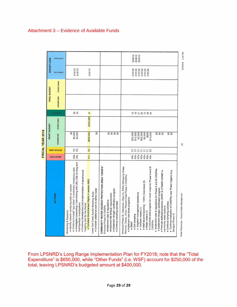
Attachment 3 – Evidence of Available Funds
From LPSNRD’s Long Range Implementation Plan for FY2018; note that the “Total Expenditure” is $650,000, while “Other Funds” (i.e. WSF) account for $250,000 of the total, leaving LPSNRD’s budgeted amount at $400,000.