natural hazard risk assessment in the australasian region
TRANSCRIPT
Natural Hazard Risk Assessment in the Australasian Region: Informing Disaster Risk Reduction and Building Community Resilience
Jane Sexton

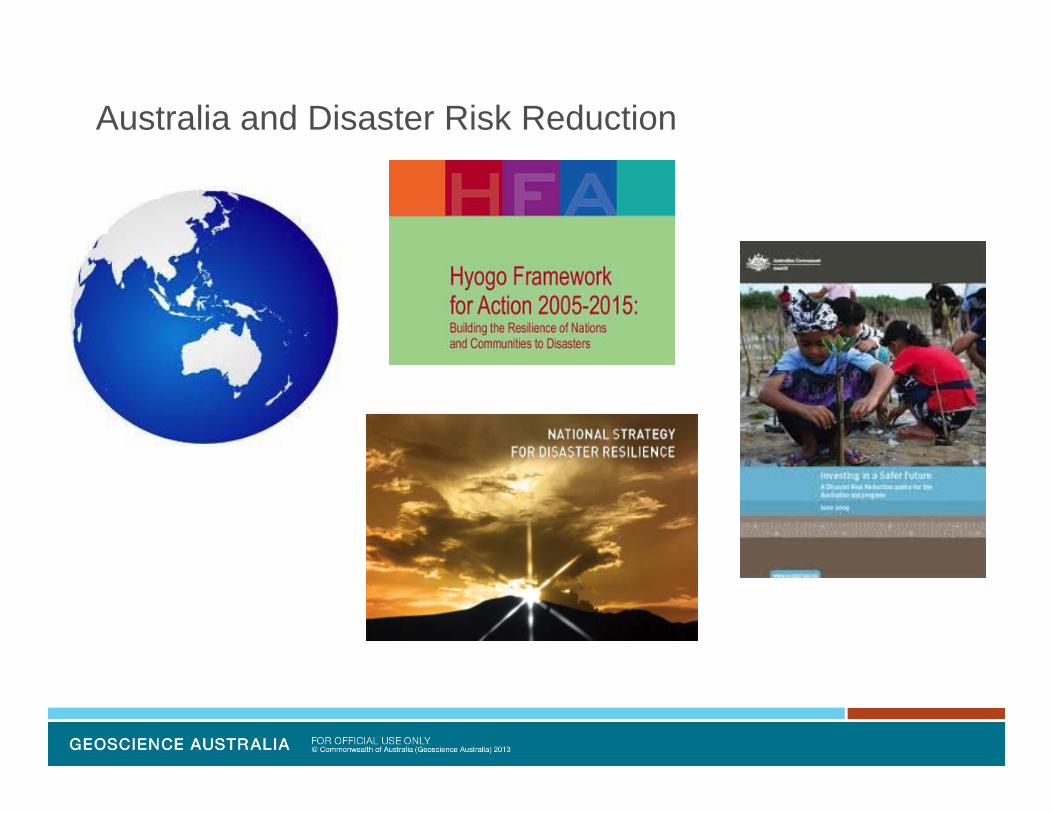
Australia and Disaster Risk Reduction
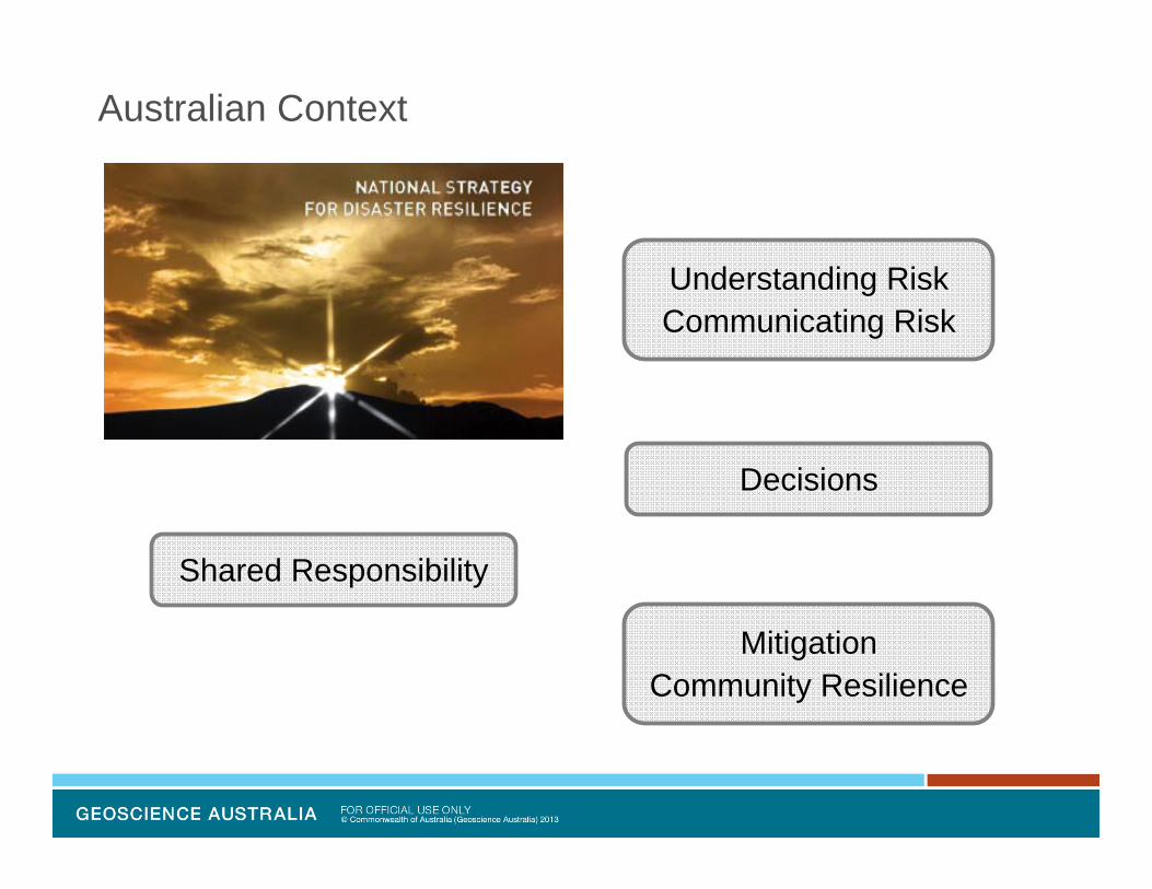
Australian Context
Decisions
MitigationCommunity Resilience
Shared Responsibility
Understanding RiskCommunicating Risk

Australian Context – Risk Governance Framework
Council of Australian Governments
Australia and New Zealand EM Committee
Risk Assessment Measurement & Mitigation Subcommittee
Standing Council for Police and Emergency Management
Land-use Planning and Building Codes Taskforce
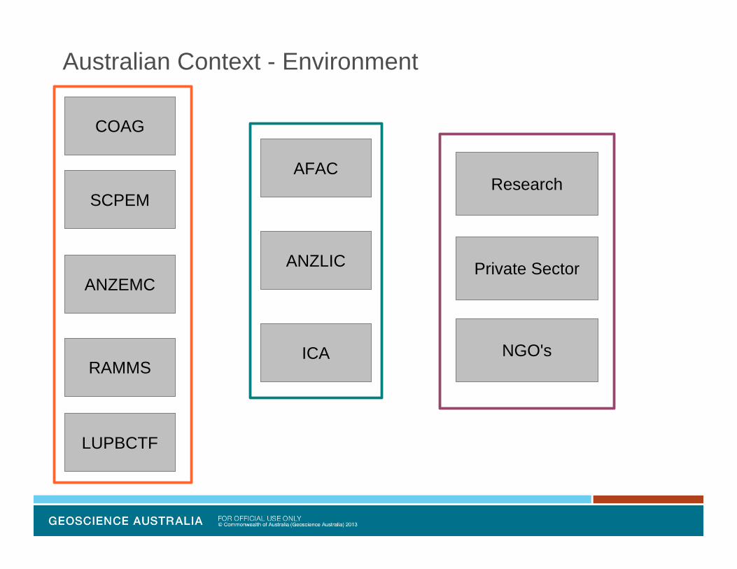
Australian Context - Environment
COAG
ANZEMC
RAMMS
SCPEM
AFAC
ANZLIC
LUPBCTF
ICA
Research
Private Sector
NGO's
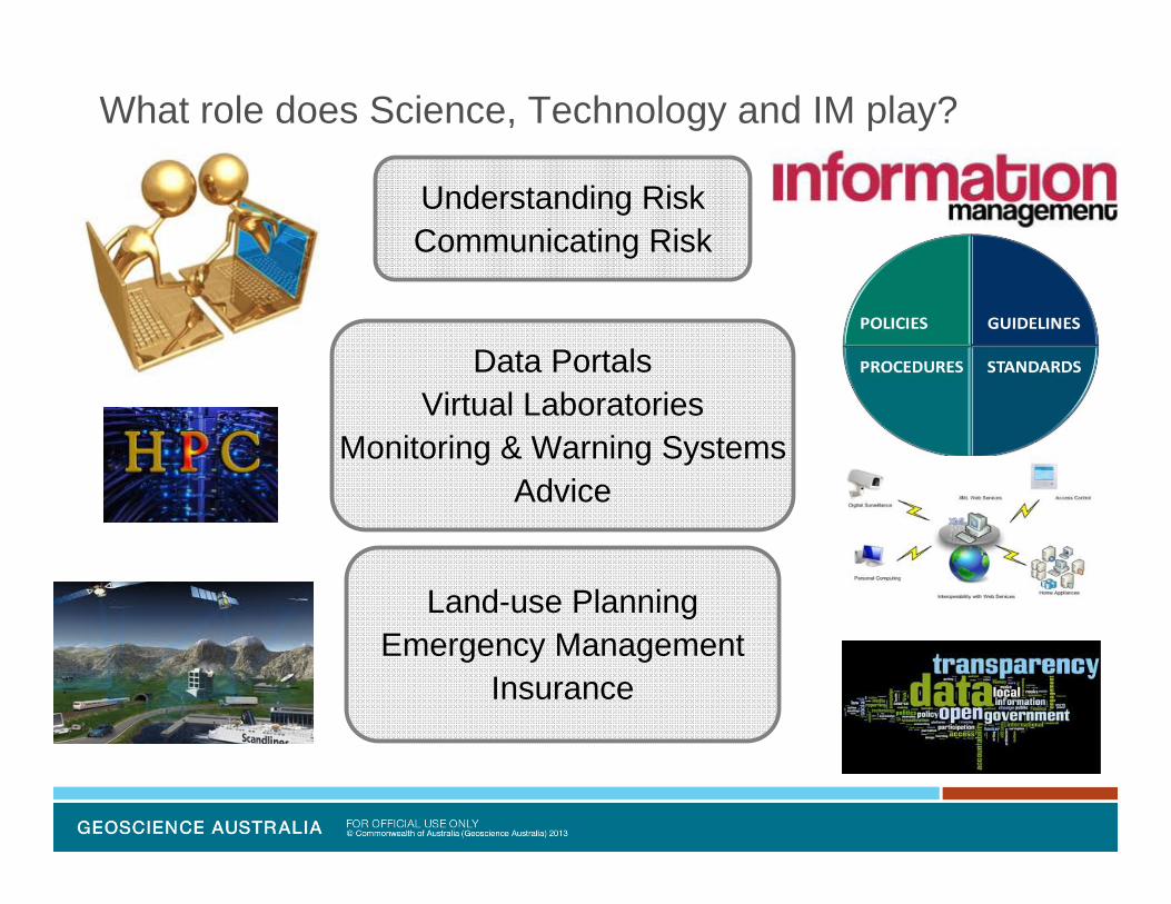
What role does Science, Technology and IM play?
Understanding RiskCommunicating Risk
Land-use PlanningEmergency Management
Insurance
Data PortalsVirtual Laboratories
Monitoring & Warning SystemsAdvice
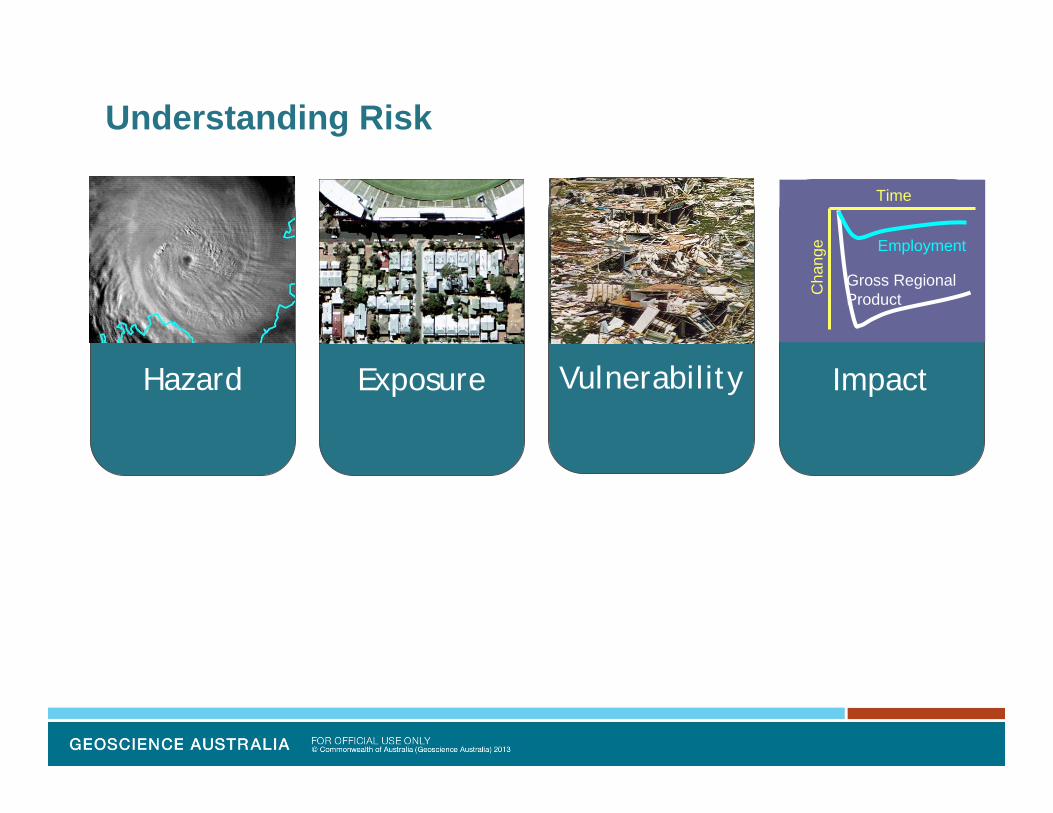
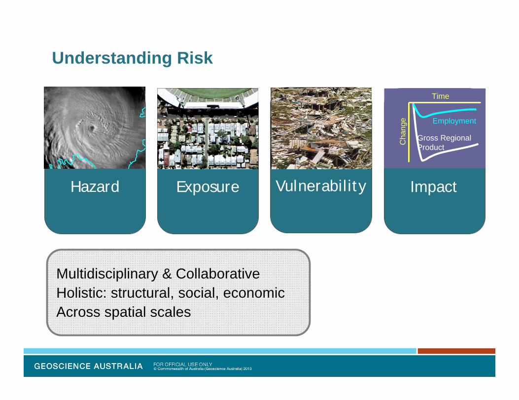
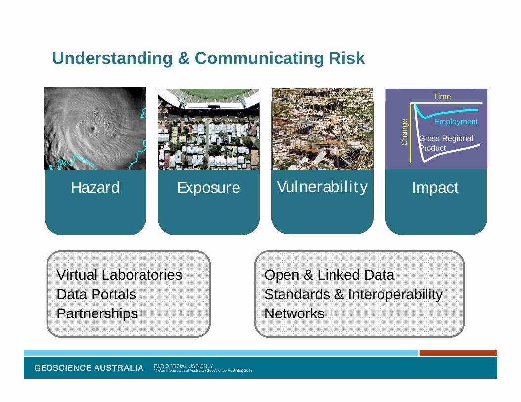
Understanding Risk
Hazard Exposure Vulnerability Impact
$Gross RegionalProduct
Employment
Time
Cha
nge
Understanding Risk
Hazard Exposure Vulnerability Impact
$Gross RegionalProduct
Employment
Time
Cha
nge
Multidisciplinary & CollaborativeHolistic: structural, social, economicAcross spatial scales

Exposure Information
$
1970s 1990s
A B
Physical Location, Size and Shape
Administrative Area
Land Ownership
Land Use
Construction Period
Structural Characteristics
Demographic or Social Characteristics
Economic Characteristics
EXPOSUREDATABASE
Building and maintaining an integrated, centralised and spatially‐enableddatabase is the most effective way to manage exposure information
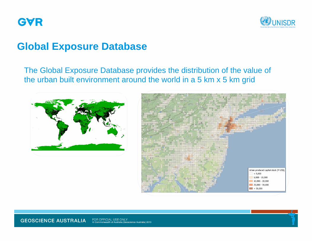
Global Exposure Database
The Global Exposure Database provides the distribution of the value of the urban built environment around the world in a 5 km x 5 km grid

Understanding Risk
Hazard Exposure Vulnerability Impact
$Gross RegionalProduct
Employment
Time
Cha
nge
End-user need:Deterministic or scenario hazard or impact analysisProbabilistic hazard or risk analysis
Understanding & Communicating Risk
Hazard Exposure Vulnerability Impact
$Gross RegionalProduct
Employment
Time
Cha
nge
Virtual LaboratoriesData PortalsPartnerships
Open & Linked DataStandards & Interoperability Networks
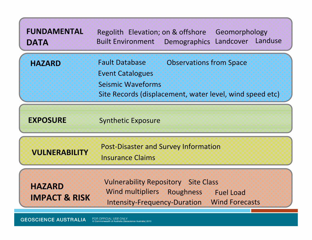
HAZARDIMPACT & RISK
Regolith
Event Catalogues
Post‐Disaster and Survey Information
Elevation; on & offshore
Wind multipliers
Seismic Waveforms
Vulnerability Repository
Synthetic Exposure
Fault Database Observations from Space
Insurance Claims
Site Records (displacement, water level, wind speed etc)
HAZARD
EXPOSURE
VULNERABILITY
FUNDAMENTALDATA Built Environment Demographics
GeomorphologyLandcover
Intensity‐Frequency‐Duration
Landuse
RoughnessSite Class
Wind ForecastsFuel Load

Modelling and Analysis Tools
Hazard
Impact
Risk
PostDisaster
Tropical CycloneRisk Model (TCRM))
Tsunami DataAccess Tool (TsuDAT))
Earthquake RiskModel (EQRM)
ANUGA
Rapid ImageCapture System (RICS)
Field Data Analysis Tool (FiDAT)
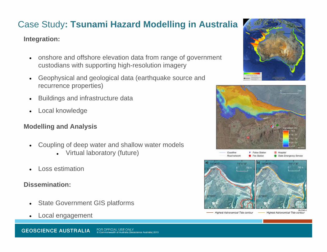
Case Study: Tsunami Hazard Modelling in AustraliaIntegration:
onshore and offshore elevation data from range of government custodians with supporting high-resolution imagery
Geophysical and geological data (earthquake source and recurrence properties)
Buildings and infrastructure data
Local knowledge
Modelling and Analysis
Coupling of deep water and shallow water models Virtual laboratory (future)
Loss estimation
Dissemination:
State Government GIS platforms
Local engagement
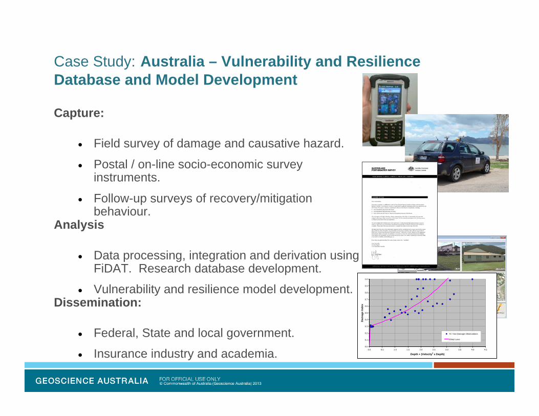
Case Study: Australia – Vulnerability and Resilience Database and Model Development
Capture:
Field survey of damage and causative hazard.
Postal / on-line socio-economic survey instruments.
Follow-up surveys of recovery/mitigation behaviour.
Analysis
Data processing, integration and derivation using FiDAT. Research database development.
Vulnerability and resilience model development.Dissemination:
Federal, State and local government.
Insurance industry and academia.0.0
0.1
0.2
0.3
0.4
0.5
0.6
0.7
0.8
0.9
1.0
0.0 0.5 1.0 1.5 2.0 2.5 3.0 3.5 4.0 4.5
Depth + (Velocity2 x Depth)
Dam
age
Inde
x
TC Yasi Damage Observations
Fitted curve
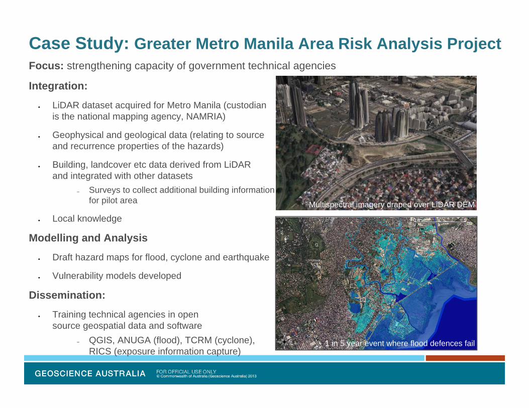
Case Study: Greater Metro Manila Area Risk Analysis Project
Multispectral imagery draped over LiDAR DEM
1 in 5 year event where flood defences fail
Focus: strengthening capacity of government technical agencies
Integration:
LiDAR dataset acquired for Metro Manila (custodianis the national mapping agency, NAMRIA)
Geophysical and geological data (relating to sourceand recurrence properties of the hazards)
Building, landcover etc data derived from LiDAR and integrated with other datasets
– Surveys to collect additional building informationfor pilot area
Local knowledge
Modelling and Analysis
Draft hazard maps for flood, cyclone and earthquake
Vulnerability models developed
Dissemination:
Training technical agencies in open source geospatial data and software
– QGIS, ANUGA (flood), TCRM (cyclone), RICS (exposure information capture)
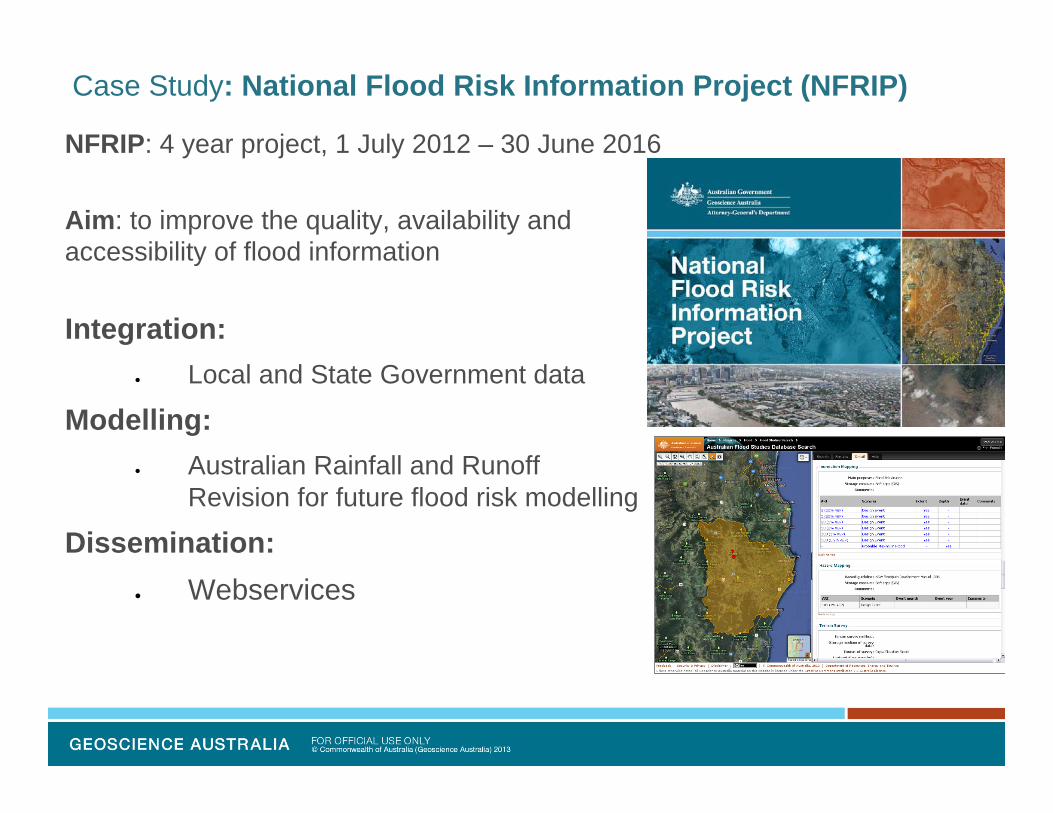
Case Study: National Flood Risk Information Project (NFRIP)
NFRIP: 4 year project, 1 July 2012 – 30 June 2016
Aim: to improve the quality, availability and accessibility of flood information
Integration: Local and State Government data
Modelling: Australian Rainfall and Runoff
Revision for future flood risk modelling
Dissemination: Webservices

Spatial Information Spectrum
Collect data
Derive information
Deliver data and information
Collaborations

Key Messages
Science, technology and information management working with policy for DRR and community resilience
– Integrating, modelling, analysing and disseminating geospatial information
Collaboration– Multi-disciplinary approach– Public and private sector– Multi-lateral
Approach– Modelling: develop and apply FOSS using HPC– Integration and Dissemination: open and linked

Key Messages
Challenges– Exposure information critical to risk information– Maintenance, appropriateness, accuracy
trusted source coverage (area, resolution, accuracy) completeness currency custodians responsibility
– Liability, data security Opportunities
– Benefits across sectors– Leverage existing networks

Phone: +61 2 6249 9841Web: www.ga.gov.auEmail: [email protected]: Corner Jerrabomberra Avenue and Hindmarsh Drive, Symonston ACT 2609Postal Address: GPO Box 378, Canberra ACT 2601
Thank you

Case Study: GA – AIFDR partnership
2009 West Sumatra earthquake, post-disaster survey
Focus: strengthening capacity for national scale earthquake hazard and risk (tsunami for future)
Integration:
onshore and offshore elevation data from range of government custodians with supporting imagery
Geophysical and geological data (earthquake sourceand recurrence properties)
Buildings and essential infrastructure data
Local knowledge
Modelling and Analysis
Draft hazard maps (using FOSS)
Impact analysis (using FOSS)
Dissemination:
Training regional disaster managers in open source geospatial data and software for contingency planning
– OpenStreetMap, QuantumGIS and InaSAFE
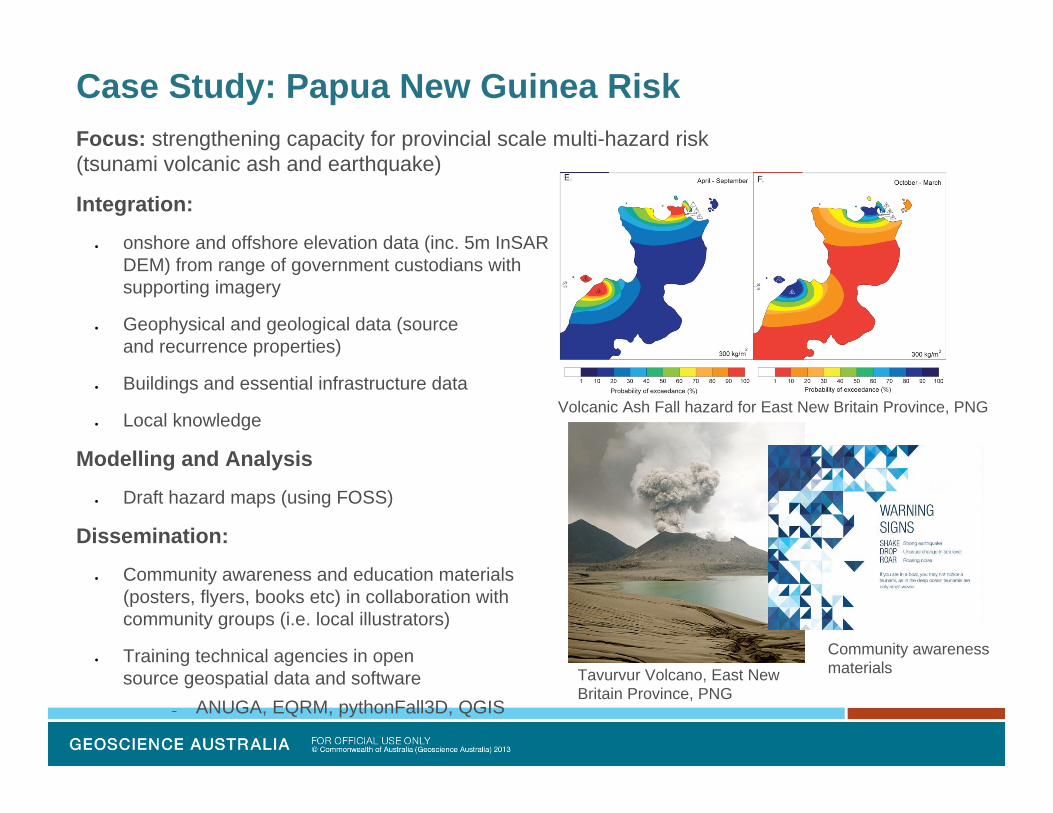
Case Study: Papua New Guinea Risk
Tavurvur Volcano, East New Britain Province, PNG
Community awareness materials
Volcanic Ash Fall hazard for East New Britain Province, PNG
Focus: strengthening capacity for provincial scale multi-hazard risk (tsunami volcanic ash and earthquake)
Integration:
onshore and offshore elevation data (inc. 5m InSAR DEM) from range of government custodians with supporting imagery
Geophysical and geological data (sourceand recurrence properties)
Buildings and essential infrastructure data
Local knowledge
Modelling and Analysis
Draft hazard maps (using FOSS)
Dissemination:
Community awareness and education materials (posters, flyers, books etc) in collaboration with community groups (i.e. local illustrators)
Training technical agencies in open source geospatial data and software
– ANUGA, EQRM, pythonFall3D, QGIS