national park service u.s. department of interior free · camping on the national seashore is...
TRANSCRIPT
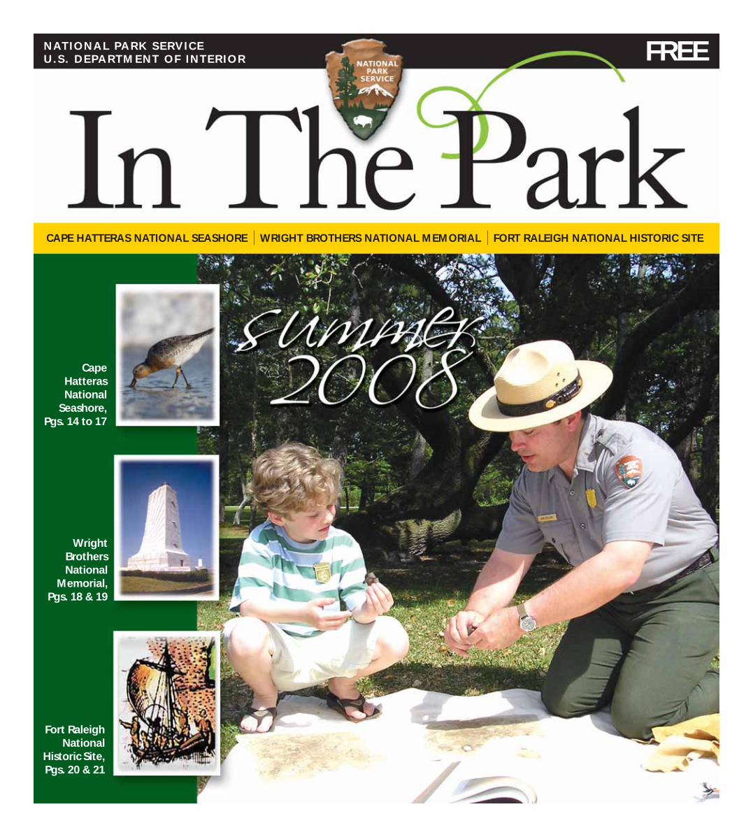
Wright Brothers National
Memorial, Pgs. 18 & 19
Fort Raleigh National
Historic Site,Pgs. 20 & 21
Cape Hatteras National
Seashore, Pgs. 14 to 17
NATIONAL PARK SERVICEU.S . DEPARTMENT OF INTERIOR
CAPE HATTERAS NATIONAL SEASHORE WRIGHT BROTHERS NATIONAL MEMORIAL FORT RALEIGH NATIONAL HISTORIC SITE
FREE
Page 2
Superintendent’s Message
NATIONAL PARK SERVICEU.S . DEPARTMENT OF INTERIOR
territory. . . looking skyward and
wishing you could fl y? Chances are
these childhood dreams and reminis-
cences were made as you explored the
outdoors. Perhaps these experiences
happened while playing in your own
backyard. Or maybe it was during a
family summer vacation to the Outer
Banks – an experience that inspired
you to bring your own children here,
creating generational traditions and
memories.
Today people are becoming sepa-
rated from the natural landscape, and
children seem to play indoors rather
than go outside. There is growing con-
cern that this disconnection between
children and the outdoors will aff ect
the future of the National Park Service.
If our youth do not play outside or visit
the parks, will they want to continue to
Park FeesWright Brothers
National MemorialThe entrance fee is $4 per person.
The National Parks Pass, Wright Brothers
Pass, Golden Eagle, Golden Age, Golden
Access and America the Beautiful Pass
holders enter for free. Children 15 and
younger enter for free.
The Lost Colony & Elizabethan Gardens
Two non-Federal park partners
charge fees at Fort Raleigh National His-
toric Site. The Roanoke Island Historical
Association off ers tickets to the outdoor
drama The Lost Colony; call (252)
473-3414. The Garden Club of North
Carolina charges admission to enter The
Elizabethan Gardens, call (252) 473-3234.
NPS CampgroundsNational Park Service campgrounds
include Oregon Inlet, Cape Point, Frisco
and Ocracoke. Fees for all campgrounds,
except Ocracoke, are $20 per night.
The Ocracoke Campground fee is $23
per night and is the only National Park
Service campground that accepts ad-
vance reservations; call (877) 444-6777.
America the Beautiful Senior and Access
and Golden Age and Access Pass holders
pay half-price at any campground.
Cape Hatteras Lighthouse
The fee to climb the lighthouse is $7
for adults. Children (must be at least 42”
tall) younger than 12 and persons pos-
sessing Golden Age, Golden Access and
America the Beautiful Senior and Access
Passes pay $3.50.
America the Beautiful Passes
America the Beautiful Passes have
replaced the Golden Age, Golden Access,
Golden Eagle and National Park Passes.
America the Beautiful Annual, Senior
and Access Passes are available at Wright
Brothers National Memorial. Senior and
Access Passes are also available at any
campground and at the Cape Hatteras
Lighthouse.
preserve these special places as adults?
Continued stewardship of the natural
and cultural wonders the National Park
Service protects depends upon encour-
aging young people to connect with the
world outside.
You play a crucial role in this eff ort
to cultivate future generations of park
stewards. During your visit to the Outer
Banks, we encourage you to create new,
or perhaps revive old, family traditions
and lasting memories by taking your
children exploring in the parks – either
on your own or with a National Park
Service ranger at the family- and kid-
oriented programs off ered at all three
of our park sites.
We thank you for making our
nation’s heritage a part of your family
tradition and look forward to seeing
you out in the parks!
Welcome to the National Park Service Outer Banks Group!
Do you remember the fancies of
childhood. . . wiggling your toes in the
foam of an ocean wave. . . pretending
you were an explorer in an uncharted
In The Park is produced by the
National Park Service and funded with the support of Eastern National.
Eastern National is a non-profi t organization that provides quality educational products and services to the visitors to America’s na-tional parks and other public trusts. Eastern National operates educational outlets in over 170 national parks and public lands in 30 states. Since 1947, Eastern National has donated over $89 million to the National Park Service. For more information, visit www.easternnational.org. Check out our sales items on the back page, visit our bookstores in the parks or visit us online at www.eparks.com.
Cover PhotoFort Raleigh Junior Ranger Logan Daniels learns more about the native people of Roanoke Island during a
clay pot-making activity with National Park Service Ranger
Rob Bolling. Photo by Jen-nifer Brumfi eld, jennifer@
manteobooksellers.com
Published ByOne Boat GuidesMichael McOwen
Beth P. Storie, EditorNealy B. Hansford, Design
“It is our task in our time and in our generation, to hand down undiminished to those who come after us, as was handed down to us by those who went before, the natural wealth and beauty which is ours.”
– President John F. Kennedy
Phot
o Cr
edit:
Qui
nn C
apps
Page 3
NATIONAL PARK SERVICEU.S . DEPARTMENT OF INTERIOR
ranger programs to become a Junior
Ranger.
At Cape Hatteras National Seashore,
if you attend ranger programs off ered
during the summer and complete the
workbook, you will earn a Seashore
Ranger patch and a Junior Ranger
badge. Get your booklet from any
of the three Seashore visitor centers
located at the Bodie Island Lighthouse,
at the Cape Hatteras Lighthouse and
near the ferry dock in Ocracoke Village.
If you complete only the booklet, you
will earn a Junior Ranger badge.
You will earn a Flight Ranger patch
at Wright Brothers National Memorial
when you complete your booklet and
attend ranger programs that are off ered
through the year.
At Fort Raleigh National Historic
Site, you can earn a Roanoke Ranger
Becoming a Junior Ranger is a
fun way to learn more about
our parks and how you can help
protect them – just like the park rang-
ers that you meet. The Junior Ranger
programs at Cape Hatteras National
Seashore, Fort Raleigh National His-
toric Site and Wright Brothers National
Memorial are for ages 5 to 13.
Along the Outer Banks, you can
actually become three diff erent kinds
of Junior Rangers -- a Seashore Ranger
at Cape Hatteras National Seashore, a
Flight Ranger at Wright Brothers Na-
tional Memorial and a Roanoke Ranger
at Fort Raleigh National Historic Site.
Just go to the visitor centers located
at these national park sites and a staff
person will give you a booklet to get
you started. Generally, you will have
to fi nish the booklet and attend some
Be A Junior Ranger!
In America, we love our national parks. A recent
survey has shown the National Park Service to be the
second-highest rated of all federal agencies in positive
public perception (the Postal Service being fi rst). Last year,
more than 273 million people visited the national parks, and
163,000 volunteers donated more than 5 million hours of service
to help preserve and protect our nation’s valuable natural and cultural resources.
Volunteers come to our national parks because they, like you, care about these
special places and want to make a contribution – sharing their passion and knowl-
edge.
We enthusiastically salute the 150 dedicated volunteers who donated more than
22,000 hours to Cape Hatteras National Seashore, Wright Brothers National Memo-
rial and Fort Raleigh National Historic Site in 2007! Their time and eff ort helped us
meet our mission of protecting resources and providing for the enjoyment, educa-
tion and inspiration of this and future generations.
If you want to do more to care for national parks, you can visit the federal volun-
teer website www.volunteer.gov/gov and check out the latest Outer Banks Group
parks’ volunteer opportunities. Or, if you have specifi c volunteer activities in mind,
call (252) 473-2111.
And if you meet some of our volunteers during your visit, thank them for caring
for the national parks too!
patch when you attend ranger programs
and complete the booklet at any time
of the year. You can also become a Fort
Raleigh Web Ranger and earn a Junior
Ranger badge when you visit the park’s
website at http://www.nps.gov/fora. Just
print out your worksheets, answer the
questions and mail the worksheets to
the park.
Remember to bring your completed
booklets back to the national park site
where you obtained them so you can
get the right type of Junior Ranger
award that you had been working
toward. If you need someone to help
you fi nish the booklet, ask one of your
parents or one of our park rangers.
The North Carolina Beach Buggy
Association, the First Flight Society, and
Eastern National help us in providing
these Junior Ranger programs to you.
Are you a college student who would like a fun and interesting summer job, a
local who would like to share your knowledge or a visitor who would like to further
your experience in this unique area? Then perhaps you’d enjoy working as a Park
Ranger.
If so, visit www.usajobs.opm.gov. This website is where all National Park Service
job openings are posted, and you can apply directly on-line. Summer 2009 jobs for
Cape Hatteras National Seashore, Wright Brothers National Memorial and Fort Ra-
leigh National Historic Site will likely be advertised in October and November 2008.
Or there may be other National Park sites where you might be interested in working
. . . Yosemite . . . Grand Canyon . . . Gettysburg . . . Lincoln Memorial. Check the
website and maybe we’ll be seeing you here next summer as a National Park Service
Outer Banks Group employee.
To learn more about other national park sites, visit www.nps.gov. Working for
the National Park Service could be the experience of a lifetime!
How Would You Look in a Park Ranger Hat?
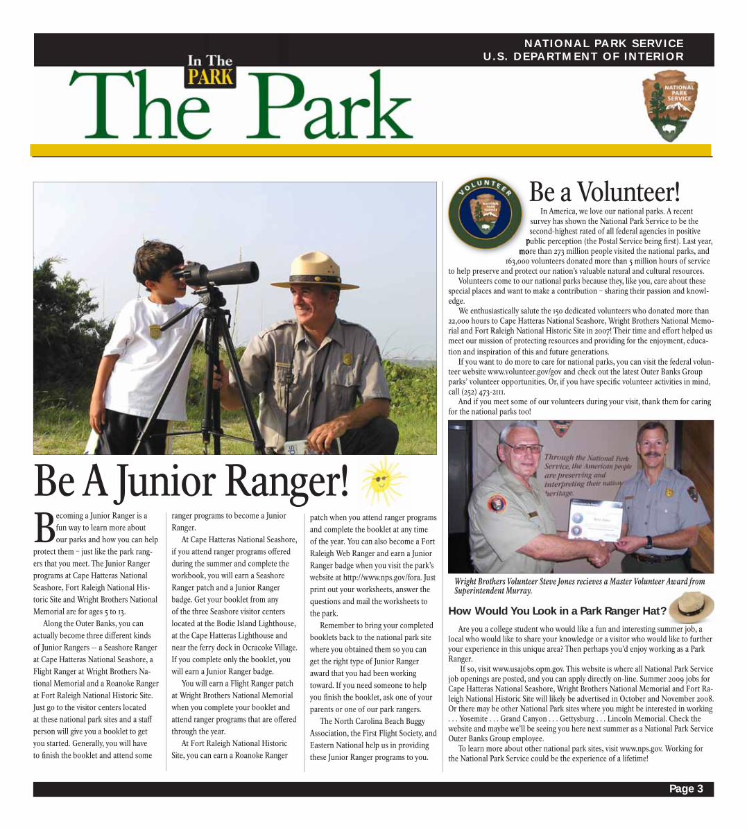
Be a Volunteer!
Wright Brothers Volunteer Steve Jones recieves a Master Volunteer Award from Superintendent Murray.

Page 4
Am I Allowed To Drive On the Beach?
• A four-wheel-drive vehicle is a
must, due to the soft sand.
• Vehicles are not allowed on park
beaches 10 p.m. to 6 a.m. from May 1 to
Sept. 15. Night permit required Sept. 16
to Nov. 15.
• Your vehicle, including ATVs and
dirt bikes, must be street legal to oper-
ate within the park.
• The driver must possess a valid
driver’s license.
• All regulations that apply on the
streets and highways of the state also
apply on the beach.
• The maximum speed limit is 25
m.p.h., unless otherwise posted.
• Driving or parking on the dunes
and/or vegetation is strictly prohibited.
Access the beach only by designated
ramps.
• Please observe all signs, and do
not drive in areas where you see a “No
Vehicles” sign posted. These areas are
closed to protect natural resources such
as turtle and bird nests, developing
dunes and vegetation.
• If violations of protected species
closures results in disturbance or
harassment of wildlife or the vandaliza-
tion of fencing, nests, or plants; the
closure is mandated to be expanded
50 m for the fi rst violation, 100 m for
the second, and 500 m for the third.
Violators are subject up to a $5,000 fi ne
and/or imprisonment up to 6 months.
• Beach areas in front of the villages
of Rodanthe, Avon, Buxton, Frisco and
Hatteras, are closed to vehicles from
May through September to ensure the
safety of the beach goers in these heavy
use area.
Where Can We Camp?
Camping on the National Seashore
is permitted only in designated camp-
grounds at Oregon Inlet, Cape Point,
Frisco and Ocracoke. Availability is on
a fi rst-come, fi rst-served basis except at
Ocracoke, where you may make reserva-
tions by calling Reserve America at
(877) 444-6777. Camping on the beach
overnight, whether in a tent or in your
vehicle, is not permitted.
Is It Okay To Have a Beer On the Beach?
Some alcoholic beverages are
permitted in the Seashore, but consider
the following:
• The laws of North Carolina do not
permit spirituous liquors — distilled
liquors, whiskey, vodka, etc. — or forti-
fi ed wines to be consumed in public.
Ask where you buy your wine if you are
unsure what’s fortifi ed and what’s not.
• The legal drinking age in North
Carolina is 21.
• Open containers of alcohol are
not permitted within any motor vehicle,
including vehicles on the beach.
Please be sure to put all your cans
and bottles in the trash so you’re not
creating a hazard.
Can I Fish at the Seashore?
In a word, yes. But be aware that
fi shing within Cape Hatteras National
Seashore is regulated by state law. It
is a state requirement that all people
fi shing in the National Seashore must
obtain a Coastal Recreational Fishing
License. Regulations regarding size
limits, numbers of fi sh per day, seasons
and licensing requirements are set by
the North Carolina Division of Marine
Fisheries, which may be contacted at
(800) 682-2632. Limit sheets are avail-
able through local tackle shops.
What About Launching My
Personal Watercraft?The trailering, launching or landing
of personal watercraft of any kind
(Jet Skis, Waverunners) is not allowed
within the boundaries of Cape Hatteras
National Seashore.
How About a Beach Campfi re?
Fires are permitted on the park’s
beaches except 11 p.m. to 6 a.m year-
round. The fi res must, however, be at
least 100 feet from any grasses or dunes
and below the high tide line. Please
keep the fi res small. Boards contain-
ing nails and other debris should not
be used in the fi re since they create a
hazard to bare feet. When putting the
fi res out, please use water. Burying
the embers with sand allows the fi re
to smolder, making the sand covering
the fi re very hot — an obvious safety
problem.
What About Handicapped Beach
Access?Handicapped-limited beach access
permits are available from Cape Hat-
teras National Seashore Headquarters
by calling (252) 473-2111. Beach-capable
wheelchairs are available on a fi rst-
come, fi rst-served basis. Inquire at the
park visitor centers.
May We Shoot Fireworks?
No. Fireworks are not allowed in
any National Park Service area. This
includes the beaches in front of the
villages.
Where Can I Fly My Kite?
Kite fl ying and throwing Frisbees
or balls is permitted anywhere in the
Seashore except within or over any bird
closure. These activities can scare birds
off their nests, leaving eggs and chicks
exposed to predators and deadly heat.
What If My Pet Comes On Vacation
Too?Your pets are welcome at Cape Hat-
teras National Seashore. Pet must be on
a 6’ leash at all times and are prohib-
ited within any resource closure. Pets
are not allowed on designated swim
beaches or in buildings. Please, for your
pet’s sake, do not leave them unat-
tended. And, for other visitors’ sake,
clean up after your pet. And, if your
pet is a horse … that’s ok too! You may
ride them anywhere vehicles are permit-
ted to drive except in campgrounds.
Horseback riding is prohibited in NPS
campgrounds. Riders are required to
use ORV ramps when crossing dunes.
May I Hunt For Hidden Treasure With My Metal
Detector?No. Because of the vast wealth of
historic artifacts within National Parks,
metal detectors are prohibited by law
in all areas, including beaches and
campgrounds.
What If I Find Shipwrecks Or Other
Treasures On the Beach?
All items found on the beach, with
the exception of shells and driftwood,
are protected by law and may not be
removed from the beach. Please do not
disturb any shipwrecks that may wash
up or be uncovered by the ocean or
wind.
e want your visit to the Seashore to be safe and enjoyable. By following these guidelines, we can all protect and maintain this spectacular area.
W Remember:
Call 911 to report emergencies.
GOOD QUESTION

Page 5
PARK SAFETY
Watch• Listen regularly to a NOAA
Weather Radio or local radio stations
for updated information. Hurricanes
can change direction, intensity and
speed very suddenly. A storm that was
a minor threat several hours ago can
quickly escalate to a major threat.
• Fill your car’s gas tank. If advised
to evacuate, you may be caught in traf-
fi c, idling for long periods of time. Gas
stations along the route may be closed.
• Listen to the advice of local of-
fi cials and evacuate if they tell you to
do so.
• Others will be concerned about
your safety, so call a loved one or friend
outside of the storm area. Tell them that
you are aware of the storm and advise
them of your plans.
Avoid the “Ouch”
Our seashore is beautiful, but often
on the beach and in the sound you’ll fi nd
dangerous debris. You may come across
sharp objects such as broken seashells,
crabs, cactus and spurs. People add to
that with glass, metal, fi shhooks and
nails. HOT SAND can burn unprotected
feet. Think safety before leaving your
vehicle. Protect your feet from these
hazards.
Warning• Keep posted to local radio sta-
tions for updated information and
offi cial instructions. Local offi cials
will advise leaving only if they truly
believe your location is in danger. It is
important to follow their instructions
as soon as possible. It takes many
hours for an organized evacuation.
Roads may become blocked as the
storm conditions worsen, preventing a
safe escape.
• Call your check-in contact so
someone will know where you will go
in case of an evacuation.
• Pack all of your belongings to
save time if the evacuation is an-
nounced.
• Check before returning to the
Outer Banks. The area may remain
closed to visitors for several days after
a storm passes.
What to Do During a Hurricane
Bugs!!!Mosquitoes and other insects serve
a purpose in the scheme of things.
Nonetheless, they are nuisances and
can make your trip an ordeal. Be
prepared with mosquito repellent and netting for camping and other island-
related activities. After hiking be
sure to check yourself for ticks.
Swimming SafetyThe ocean is a wonderful place to swim — if you are careful. Strong wave energy, rough surf and rip currents can turn a quick dip into a problem.
More Safety TIPS
IF CAUGHT IN A RIP CURRENT...• Don’t fi ght the current.• Swim parallel to the shore to get out of the current.• If you can’t escape, fl oat or tread water.• If you need help, call or wave for assistance.
Phot
o an
d gr
aphi
c cr
edit:
NO
AA a
nd U
.S. L
ifesa
ving
Ass
ocia
tion
Clues for Spotting a Rip Current:• a channel of churning, choppy water
• an area having a notable difference in water color
• a line of foam, seaweed, or debris moving steadily seaward
• a break in the incoming wave pattern
• Due to dangerous currents, never swim in inlets.
• Do not swim alone, at night or near fi shing piers. Children should swim only with adult supervision.
• Know the various types of ocean currents and how to get out of them.
• Watch the weather. Storms and squalls come up quickly.
• Don’t swim during thunder-storms. Lightning is extremely dangerous and does strike the beach.
• Non-swimmers should use Coast Guard-approved fl otation vests, even while wading.
• Be careful at the shore’s edge. The force of crashing waves can pick you up and throw you into the sandy bottom, which may result in fractures, dislocations or possibly fatal neck injuries.
• Watch for jellyfi sh. If stung, seek fi rst aid if needed. Pour on vinegar to stop the stinging, but don’t rub. • Do not swim near surfers. Their surfboard fi n can cut you.
• Always use sunscreen.
Use Lifeguarded
BeachesHOTHOTHOTDangers of Heat
and HumidityA combination of high temper-
ture and high humidity creates an
even higher and possibly dangerous
apparent temperature. With an air
temperature of 90°F and a humidity
of 80%, the apparent temperature is
113°F. Heat cramps, heat exhaustion
and heatstroke are possible during
elevated apparent temperatures. En-
joy the beach, but limit your physical
activity and exposure during days of
high heat and humidity. Drink water
often.
Lifeguarded beaches will be staff ed
9:30 a.m.-6 p.m. daily, May 26-Sept. 1 at
the following locations:
• Cape Hatteras, adjacent to the Old
Lighthouse Location.
• Ocracoke Island, 1½ miles south of the
NPS Campground, or ½-mile north of
Ocracoke Village.
• Coquina Beach Day Use Area, located
across from Bodie Island Lighthouse.
Lifeguards can answer questions on
swimming safety and weather condi-
tions. They’ll be glad to help.

Page 6
PARK PARTNERS
Get ready to be immersed in ship-
wreck stories and lore! 2007 was a big
year for the Graveyard of the Atlantic
Museum. The North Carolina Gen-
eral Assembly authorized the transfer
of the museum from the nonprofi t
board to the state; and the National
Park Service completed an agreement
with the state’s Department of Cul-
tural Resources to allow state use of
park lands for the existing museum.
The concept of the museum start-
ed as a Hatteras Village grassroots
eff ort in the early 1990s. Through a
cooperative agreement, the National
Park Service and National Oceanic
and Atmospheric Association
(NOAA) became partners with the
museum board as they looked to
construct the building on seven acres
The recently restored Hatteras U.S.
Weather Bureau Station, located in
the heart of Hatteras Village, is open to
the public for the its second consecu-
tive season. Under an agreement with
the National Park Service, the Outer
Banks Visitors Bureau operates the
facility as a welcome center for visitors
on the southern end of Hatteras Island,
open daily from 9 a.m. to 5 p.m.
The Hatteras U.S. Weather Bureau
Station, built in 1901, was the fi rst of-
fi cial U.S. Weather Bureau building on
the Outer Banks. From the second fl oor
offi ce and observation room, station
staff delivered daily and hourly checks
to the U.S. Weather Bureau using
specialized equipment. The fi rst fl oor
served as quarters for the supervisor
and his family. The building had been
closed to the public since it was decom-
missioned in the 1940s.
The station was one of 11 such build-
ings constructed by the U.S. Weather
Bureau nationwide – only two others
still remain standing. The bright yellow
building with its beautiful interior pan-
eling is listed on the National Register
of Historic Places and is protected and
preserved by the National Park Service.
As well as being open to the public
daily, a park ranger leads a tour of the
site once a week during the summer
months. For details on times refer to
the program information on page 15.
Now Open to the Public – The Hatteras Weather Station
Graveyard of the Atlantic Museum Now a State Regional History Museum
of Cape Hatteras National Seashore
lands and obtain shipwreck artifacts
from NOAA. The newly constructed
building opened in 2003, but the
board had diffi culty raising the funds
to complete exhibits and provide for
needed staff .
With the transfer of the building
to the Department of Cultural Re-
sources, and state funds authorized
this year for annual operating funds
and continued construction, the
Graveyard of the Atlantic Museum
is well on its way to becoming a top
Outer Banks destination point. With
more than 2,000 shipwrecks off the
Outer Banks, the museum will have
plenty of exciting stories to tell and
artifacts to show. Stay tuned for more
over the next several years!
Join us to Salute National Park Service
Volunteers Every Wednesday
at 8 p.m. Roanoke Island
Festival Park North Carolina
School of the ArtsSummer Performance
Festival June 24 – August 22 p.m. and 8 p.m., Tuesday – Friday
& 8 p.m. Saturday Theater, Music,
Dance, Film Six weeks of
sensational FREE shows by
North Carolina’s premiere arts conservatory
NCSASummerFest.org252.475.1506
2008 season features ragtime, jazz, a family musical, Classics for
Kids and much more!
Teachers In The Parks!The national parks of the Outer Banks Group are fortunate to be seeing an
infl ux of North Carolina teachers . . . thanks to the North Carolina Center for the
Advancement of Teaching (NCCAT). This past October, NCCAT opened the doors
of its new eastern campus, located in Ocracoke Village, to serve as a state-of-the-art
professional development center for North Carolina public school teachers. The
second such center in the state, the NCCAT Ocracoke campus will be providing a
year-round series of fi ve-day seminars for teachers (pre-kindergarten through 12th
grade) to study aspects of the arts, humanities, sciences, technology, health and
fi tness along with associated teaching methodologies.
Having such a center located here is a local boon for the National Park Service,
greatly enhancing the parks’ ability to reach into public schools through this devel-
oping educational partnership. Already, teachers from NCCAT have learned about
fl ight during a trip to Wright Brothers National Memorial, visited Cape Hatteras
National Seashore beaches to learn about climate change impacts and climbed the
Cape Hatteras Lighthouse during a seminar on North Carolina lighthouses. And
this is just a start! Many more seminars are planned for the coming year.
NCCAT is the only model of its kind in the nation and refl ects the high priority
and the great investment that North Carolina is making in its teachers -- instilling
them with renewed energy, ideas and zeal for their craft. By connecting NCCAT
with the parks of the Outer Banks Group, these teachers will also return to the
classroom with a better understanding of our national parks and the legacy they
preserve.
Glenn Eure of the Ghost Fleet Gallery in Nags Head, long-time friend of the National Park Service Outer Banks Group and local artist extraordinaire, had the honor of painting the ornaments representing our local national park sites for last year’s offi cial White House Christmas Tree, themed “Holiday in the National Parks.” Along with many other artists, Eure and his grandsons attended a reception with Laura Bush in the White House Blue Room alongside the 18-foot tall Fraser fi r Christmas tree decked-out with 300 ornaments depicting our country’s most special places – our national parks.

Page 7
EL IZABETHAN GARDENS THE LOST COLONY
The National Park Service is in the
process of developing an off -road ve-
hicle (ORV) management plan for Cape
Hatteras National Seashore. Public in-
put and comments are a key component
in the successful development of the
plan and associated regulation.
The ORV plan will address resource
protection (including protected, threat-
ened and endangered species), visitor
safety and potential confl icts among
various park users. The plan will also
ensure that ORV use is managed within
applicable law, including the park’s
enabling legislation, which provides
Congress’ intent for the management
and use of the park.
This plan will also satisfy Executive
Orders 11644 and 11989, which require
the NPS to develop regulations for
parks that allow ORV use. Rulemaking
is the process used by federal agen-
cies to formulate, amend or repeal a
regulation.
In the traditional agency rulemaking
process, the agency alone produces a
proposed regulation. Negotiated rule-
making is an optional rulemaking pro-
cess that would establish a negotiated
rulemaking committee consisting of the
agency and interest groups involved in
the issue to collaborate on a proposed
solution. At its best, negotiated rule-
making increases citizen participation,
results in more creative solutions, eases
implementation, increases compliance
by the citizens aff ected by the regula-
tion and reduces the prospect of future
confl ict and litigation.
The NPS is using negotiated rule-
making to develop the required ORV
regulation at the Seashore.
The Secretary of the Interior has es-
tablished a negotiated rulemaking com-
mittee of 30 primary members to reach
consensus on ORV management issues
to be the basis for the proposed regula-
tion. Committee meetings are open to
the public. The negotiated rulemaking
process is occuring concurrently with
the required National Environmental
Policy Act (NEPA) analysis.
Off -Road Vehicle Management Planning and Regulation
If you would like to keep updated on the planning process, please access the National Park Service planning and public comment website at http://parkplanning.nps.gov/caha. To join the park’s ORV planning update list-serve, send an email to [email protected].
http://parkplanning.nps.gov OFF ROAD VEHICLES
When taking an ORV on park beaches remember:
• Drive only four-wheel-drive vehicles on the beach. Two-wheel drive or all-wheel drive vehicles do not have adequate traction and are likely to get stuck. Towing is limited and costly.
• Before entering the beach, lower tire air pressure to 20 psi or less. Lowering tire pressure and driving at a slow steady rate of speed are the best ways to provide enough traction for a vehicle to maneuver.
• If stuck, lower tire pressure more. If your wheels start to spin, slowly back up in your tire tracks for several car lengths and then slowly accelerate forward.
• Be aware of tide changes and don’t get trapped -- some sections of beach can be cut off by high tides.
• Any law applicable to vehicle use on a paved road in the State of North Carolina also applies to ORV use.
• Avoid driving or parking on the wrack line. The wrack line is a line of stranded natural debris on the beach left by the previous high tide that can be an important food source for protected birds.
• For a comprehensive listing of ORV use tips and regulations, ask for an ORV site bulletin at any park visitor center.
Accessing Park Beaches With Your
ORVThe National Park Service welcomes visitors to enjoy the beautiful, undevel-
oped ocean beaches of Cape Hatteras National Seashore.
Some sections of ocean beach, such as those in front of the Hatteras Island
villages, receive signifi cant pedestrian use during the summer. These beaches are
open to pedestrian use year-round but are temporarily closed to ORV use during
the summer.
Although extremely narrow beaches stay open for pedestrian use, they may
temporarily close to ORV traffi c due to safety concerns.
Some portions of the beach may be temporarily closed to ORV use due to
mandated protection of wildlife and plant species, such as protected birds and
sea turtles. Closure boundaries may shrink or expand given the specifi c be-
havior or requirements of the protected wildlife. In the event of ORV closures,
alternate routes or bypasses may be established to maintain access.
For current beach access information, visit one of the Seashore visitor
centers.
In October 2007, Defenders of
Wildlife and the National Audubon
Society (plaintiff s) fi led a lawsuit
against the National Park Service
(NPS) alleging inadequacies in man-
agement of protected species and
failure to comply with the require-
ments of ORV executive orders and
NPS regulation at Cape Hatteras
National Seashore. The species
identifi ed for increased protection
included the piping plover (federal-
ly-listed threatened), several species
of colonial waterbirds (state-listed
threatened and species of concern);
the American oystercatcher (state-
listed signifi cantly rare); and several
species of protected sea turtles.
Consent Decree - 2008In April 2008, the U.S. District Court
Judge signed a consent decree on a
settlement agreement reached by the
NPS, the plaintiff s and the intervener-
defendents: Dare and Hyde Counties
and a coalition of local ORV and fi shing
groups (Cape Hatteras Access Preserva-
tion Alliance). This consent decree
gives the settlement agreement the
force of a court order which must be
implemented.
To meet the legal requirements of
the consent decree, the NPS must:
increase the frequency and degree of
monitoring and protection of certain
shorebird and all sea turtle species;
establish and enforce larger buff ers
around nesting areas; mark, monitor
and enforce pedestrian and ORV use
corridors along the shoreline; and
enforce a new prohibition of vehicles
on park beaches between 10 p.m. and
6 a.m., May 1 to Nov. 15, with a permit
system to be established for night
driving Sept. 15 – Nov. 15. Protected
species closure violations that disturb
or harass wildlife, or vandalizes fenc-
ing, nests, or plants are mandated to
expand 50 m for the fi rst violation, 100
m for the second, and 500m or more
for the third. Closure violations may
have up to a $5,000 fi ne and or impris-
onment up to 6 months in jail.

Page 8
Visitors to Wright Brothers National
Memorial will notice a new and im-
proved look to the Wright Monument
this summer. Visible for nearly 5 miles,
the granite pylon towers 60 feet above
the summit of the Big Kill Devil Hill
sand dune in tribute to the two modest
brothers. Although time cannot erase
the Wright brothers’ accomplishments,
time and the elements have taken a
heavy toll on the monument erected in
their honor.
After years of weathering Outer
Banks salt and storms, the historic and
structural integrity of the monument
had deteriorated since its dedication in
1932. Major restoration occurred over a
decade ago, but many of the previ-
ous problems had resurfaced. Earlier
RESOURCE MANAGEMENT
this year, in an eff ort to preserve the
monument, the First Flight Foundation
in partnership with the National Park
Service undertook a restoration project
to prevent further deterioration.
Critical elements in re-establishing
the monument’s structural and histori-
cal integrity have included cleaning the
interior and exterior of the granite
pylon, re-pointing the exterior mortar,
replacing the HVAC and ducts system,
painting the stairs, replacing the exte-
rior lights and renovating the electrical
and mechanical systems. The stainless
steel doors and all fi xtures have been
polished and a polymer coating ap-
plied to prevent future weathering. The
beacon light atop the monument was
removed to prevent damage to it during
Wright Monument Receives a Facelift
Along the Atlantic coast, cats and dogs pose a serious threat to the contin-
ued survival of beach-nesting birds such as piping plovers, least terns and
American oystercatchers. Many people believe that cats and dogs should be
allowed to roam free. People introduced domesticated cats and dogs to this coun-
try, and however much we may appreciate them as part of our lives, those animals
are not native wildlife or part of a naturally functioning ecosystem.When birds
encounter cats and dogs, the birds rarely win.
Two months of living on the edge- Piping plovers are vulnerable to wild and
domestic animals while they guard their nests on sandy beaches for a month before
eggs hatch. Adult plovers will stagger and feign a broken wing to distract predators
from their nests and chicks. Unfortunately, the plover ploy backfi res when they face
predators more nimble than predators in their native environment.
After plover eggs hatch, the tiny chicks spend most of the next month foraging
for the food needed to gain weight and develop fl ight feathers. The fl ightless chicks
face myriad challenges and are simply no match for an agile cat or dog that instinc-
tively sees the chick as something to hunt or chase.
Protecting our environment- We not only have an obligation to protect birds
as an important part of our environment, but that protection is also the law. The
U.S. Fish and Wildlife Service placed Atlantic Coast piping plovers on the List of
Endangered and Threatened Wildlife in 1986 with a “threatened” designation,
meaning that without care the species could face extinction.
Monitoring nests and protecting habitat are only part of the piping plover pro-
tection story. Plovers need everyone’s help, and vigilant pet owners play an essential
role.
What can we do? • Keep cats indoors.
• On beaches where dogs are allowed, keep your pet on a leash.
• Keep dogs away from areas with nesting and young birds.
The fi rst search for the Lost Colony
took place in 1590 after John White
landed on the deserted Roanoke Island
shoreline. The search continues today
through archaeological research at Fort
Raleigh National Historic Site. This year
new technologies are being used to scan
below the surface of the ground with
the hope of uncovering the fate of the
1587 colonists.
The search has been going on for
quite some time. Early archeologi-
cal methodologies used on the park
grounds consisted of test trenches, the
fi rst being conducted in the 1890s. The
test trench method continued in phases
into the 1960s.
In the 1980s, ground penetrating
radar (GPR) surveys, which detect
one-dimensional images from scans of
the ground, were conducted in certain
sections of the park. These surveys
identifi ed some anomalies, or unex-
the restoration project and then it was
cleaned.
Through the monument restoration,
the National Park Service can continue
to protect a fi tting memorial to the
brothers who presented the world with
the gift of fl ight. Newly preserved, it
will continue to serve as inspiration for
those who climb the hill and read the
inscription carved in the base of the
monument that characterize the Wright
brothers’ driving spirit:
In commemoration of the conquest of the air by the brothers Wilbur and Orville Wright. Conceived by genius and achieved by dauntless resolution and unconquerable faith.
plained ground disturbances. One of
these anomalies near the Fort Raleigh
earthworks warranted further study
and the ground was opened, revealing
evidence of the 1585 colony.
During January of this year, a new
technology, radar tomography (RT),
was utilized at Fort Raleigh Na-
tional Historic Site in an archeological
pioneering eff ort. RT unites the radar
surveying capacity of the GPR systems
with precise position control and
advanced signal processing. RT systems
provide high-resolution radar images
of the subsurface, covering thousands
of square meters with a resolution of
centimeters. Such images take on the
quality of satellite radar images.
The Fort Raleigh RT scan, which ran
along the large parking lot and walkway
used for the summer production of
The Lost Colony outdoor drama and
continued toward the Thomas Hariot
Technology Takes Search for the Lost Colony to New Dimensions
Nature Trail, was conducted under the
supervision of Dr. Eric Klingelhofer, an
archeologist with the nonprofi t First
Colony Foundation.
As of the writing of this article, the
scan analysis is not yet complete, and it
remains to be seen if RT proves to be a
viable method in searching for artifacts
or markers of prior human habitation.
The hope is that results from the survey
will help the National Park Service
determine where future archeological
eff orts should take place within the
park and identify areas needing protec-
tion and preservation.
The nonprofi t First Colony Founda-
tion, a park partner, is helping the Na-
tional Park Service fulfi ll its mandate to
conduct continual research of Roanoke
Island’s history and of the Roanoke
colonies.
Cats and Dogs and Birds on the Beach...
A Deadly Combination
©20
08 S
idne
y M
addo
ck

Page 9
RESOURCE MANAGEMENT
Scientists are presenting compel-
ling evidence that the world’s
climate is warming and the rate
of sea level is rising with a high prob-
ability that there will be an increase in
hurricane frequency. Simultaneously,
human development along the coasts
has exploded. A better understanding
of North Carolina’s barrier islands,
including Cape Hatteras National
Seashore, is vital in order to understand
the impacts of potential changes. The
National Park Service is helping to
support an ongoing series of studies led
by experts at East Carolina Univer-
sity, the U. S. Geological Survey and
North Carolina Geological Survey. An
enormous number of samples and data
have been analyzed and researchers are
excited about the information obtained
thus far.
Ancient StreamsGround-penetrating radar, up to
30 feet deep, generates pictures of the
older sediments underlying the barrier
islands. A feature that can be identi-
fi ed from these pictures is various relic
streams that once drained through this
area into the ocean more than 5,000
years ago. Wherever the islands sit on
top of these ancient mud-fi lled chan-
nels, beach erosion is high since mud
erodes more readily than other sedi-
ments. Maps have been generated to
identify areas of varying erosion rates
based on underlying strata.
Sea Level RiseLow-lying barrier islands are born
and die in response to sea level fl uctua-
tions. Sea level has risen more than 300
feet in the past 10,000 years due to the
melting of vast continental glaciers.
There is evidence that today’s barrier
islands were preceded by others. Early
barrier islands formed on the conti-
nental shelf when large sand supplies
were encountered and then migrated
with sea level change. When sea level
rose dramatically, these island chains
disappeared or collapsed only to form
again whenever and wherever sea level
allowed. The present barrier system is
the youngest of the series. Scientists
have found these young barrier islands
have kept up with sea level rise by fol-
lowing a dynamic cycle of change.
It begins with the islands building
width and elevation as beach sand
is redistributed across the island by
successive storm overwash. Higher
islands, no longer prone to overwash,
become vegetated. In time, the now
“stable” land begins to narrow as the
island width recedes in the absence
of new overwash sediments. Inlets
eventually break through narrow
island segments. Subsequent ocean
tides will move massive sand volumes
inward through these inlets each day
and deposit the sand on the sound
side of the inlet. Thus, the island wid-
ens again as a new fl ood-tide delta
shoals merges onto the back side of
the island. Finally, the inlets close as
they become choked with sand, and
the cycle is ready to begin again as
subsequent overwash events rebuild
elevation on low island segments.
Aging the Barrier IslandsStudies have found that large
portions of today’s island chain are
young, having been created a mere
500 years ago. Rolling westward in
front of the rising seas, the islands
sometimes ran into and merged
with older land remnants. All the
Outer Banks village sites sit on such
complex features where younger
sediments are fused onto 3,000- to
5,000-year-old backshore landforms.
Buxton Woods is the most highly
developed of these complex forma-
tions due to an available earlier sand
supply fed from the now submerged
Diamond Shoals. Although the
complex segments of the islands are
relatively stable, many of the younger
parts of the island are showing signs
of collapse.
Future InletsIt is now known that 75% to 80%
of the Outer Banks have been inlets
in the past. Scientists can not say
with absolute certainty where future
inlets will be created, but they can
now make an educated prediction
concerning the likelihood that an
inlet might form at any given location
given specifi c storm types and sizes.
An Inlet Vulnerability Index rates
If 1) sea level continues to rise at either the present rate or greater, 2) the quantity and magnitude of storms that have characterized the 1990s continues or increases, or 3) one or more very large coastal storms (catergory 4 or 5 hurricanes) directly impact the Outer Banks, portions of the barrier islands will collapse. PANEL A. The short-term (i.e., next few decades) and PANEL B. long-term (i.e., next few centuries) future character of the barrier islands and associated estuaries within northeastern North Carolina.
sites as having a high, moderate or low
likelihood of inlet formation. High risk
areas may see inlets after a major storm
or several smaller storms in any given
year. Low risk areas may not see major
changes for several decades. On Pea
Island National Wildlife Refuge alone,
seven potential inlet sites have been
identifi ed.
Shoreline ChangeTo measure how shorelines reacted
to storms and various wave patterns
over a fi ve-year period, numerous
surveys were done at low tide between
Corolla and Cape Point. A customized
beach buggy equipped with Global Po-
sitioning System mapped the shoreline
location and the beach slope. The very
precise sensors were able to produce
accuracies up to 4 centimeters. Also, the
surveys could measure shoreline chang-
es to single storm events. Geologists are
now working on creating models from
this information that will help predict
shoreline changes in response to future
wave patterns and storms.
Human ImpactsSurvey maps generated in the 1850s,
along with aerial photos taken in the
1930s and 1940s, depict natural bar-
rier island systems. These have been
digitized and compared with more
recent aerial photographs taken after
people began to severely modify the
landscape. One such human impact
was the construction and maintenance
of the artifi cial dune ridge in order
to buildings and roadways. The dune
ridges have interrupted the vital role of
storm overwash. Consequently, most
of Cape Hatteras National Seashore’s
sound-side shorelines are eroding with-
out the infl ux of fresh sand supplied by
Study of the Islands’ Past and Present Off ers Insight to the Future
overwash that is essential for building
island width on the estuarine side of
the islands. In addition, preventing the
opening of inlets and artifi cially closing
inlets that do open has eliminated sand
movement into the sounds by another
important method of island widening.
Change is constant. It is a given that
the islands will continue to see more
storms and rising seas will persist to
drown more shoreline. Scientists will
continue to unravel the complex story
of how these barrier islands func-
tion. These insights will allow people
to better live with these ever moving
and sometimes ephemeral landforms.
Knowledge and understanding will help
land managers make informed deci-
sions on where, and more importantly,
where not to build structures, roads and
parking lots. Through understanding,
the public can learn that by protecting
the dynamic coastal processes, we are
ensuring the future of these barrier
island landforms.

Page 10
RESOURCE MANAGEMENT
endangered sea turtle in the world,
the Kemp’s Ridley, also feeds here,
but only nests in parts of the Gulf of
Mexico. The Hawksbill sea turtle, so
named for its hawk-like beak, is a rare
but beautiful sight in these waters.
Loggerheads, greens and the occasional
leatherback are known to nest on the
park’s beaches.
When visiting the park during sum-
mer, you may be treated to one of the
magical experiences that this seashore
has to off er: a sea turtle laying her eggs.
Loggerhead sea turtles can lay about
fi ve nests a season every other year.
When the time is right, these large lum-
bering turtles crawl out of the ocean
onto the beach and dig a hole using
their back fl ippers. They lay their eggs
in the hole and then carefully cover
them up with sand. Slowly, they then
use light cues to fi nd the ocean and
return to the sea once more.
The 100 or so eggs that the female
turtle lays will have to incubate in the
sand for about two months. Dur-
ing that time, the leathery ping pong
ball-sized eggs will be susceptible to
being eaten by predators and washed
out by storms. The temperature of the
sand will determine if the hatchlings
are males or females. If the sand is
colder, most of the baby turtles will
turn out to be males; if it is warmer,
most of them will be females. After the
two months of incubation, the little
turtles will hatch from their shells and
start the long climb to the top of the
nest. When they get there, they will wait
until it is dark and quiet and then pop
up out of the sand. Hatchlings use the
brighter horizon to the east to fi nd their
way to the ocean. Once they get there
they swim for 24 to 36 hours until they
reach the Gulf Stream in the Atlantic,
where fl oating seaweed will protect
them as they get bigger. It is estimated
that sea turtles spend more than 10
years fl oating around in these nursery
areas before they return to the coast.
They will have to survive over a quarter
of a century before they can lay a nest
of their own. Many turtles attempt to
return to the beach they came from in
order to lay their own nests, but after
25 years, many beaches have changed.
Development of beaches, artifi cial
lighting and other human disturbances
can change where and when turtles lay
their nests, sometimes making the nests
unsuccessful.
Unfortunately,
all seven species
of sea turtles in
the world are
either threatened
or endangered.
In many parts
of the world,
sea turtles and
their eggs are still
hunted for food or
traded for money.
In the United
States nesting
beaches have
become extremely
developed, and
the worldwide
commercial fi sh-
ing industry accidentally kills thousands
of turtles a year. It is estimated that
only one in 1,000 hatchlings survives
to maturity, and the actual survival rate
may be even lower.
Cape Hatteras National Seashore is
70 to 2,000 pounds when they are full
grown and have fl ippers rather than
feet. All sea turtles are migratory, and
many travel thousands of miles in a
year, riding the ocean currents.
Of the seven species of sea turtles
in the world, fi ve kinds can be found in
the waters off Cape Hatteras National
Seashore: loggerhead, green, leather-
back, Kemp’s Ridley and Hawksbill.
The loggerhead is the most numerous
and is known for its big head and its
appetite for crabs and whelks. Green
sea turtles can reach about 400 pounds
and are the only ones that are vegetar-
ian, or herbivorous. Leatherback sea
turtles can reach 2,000 pounds and
live primarily on jellyfi sh. The most
Cape Hatteras National
Seashore is a beautiful
and unique place. People
come here from all over
the world to experience
the long beaches, catch fresh seafood
and play in the surf. But did you know
that another kind of animal comes here
for the exact same reasons? Sea turtles,
some of the oldest and largest reptiles
on earth, are found on the Outer Banks
of North Carolina for about seven
months of the year. They come here to
eat, to nest and just to hang out in the
warm waters by the Gulf Stream.
Sea turtles live in the ocean and salt-
water sounds of temperate and tropical
waters. These large animals range from
Turtle Tales
committed to ensuring that sea turtles
have a safe environment in which to
nest and hatch. Park beaches are closed
to vehicle use 10 p.m. to 6 a.m. during
turtle nesting season. Every morn-
ing from May to
September, park
staff use ATVs to
look for sea turtle
tracks and fi nd
nests. All the nests
are then protected
from pedestrians
and off -road
vehicles by closing
the area with four
posts. On day 50
of incubation, the
nest’s closure is
enlarged, going
all the way to the
water line in order
to protect emerg-
ing hatchlings.
After the hatchlings have emerged, the
closure is removed. You can help make
sure that these majestic creatures con-
tinue to visit this Seashore as they have
done for thousands of years.
What Can I Do to Help?
1. Beach Lighting: If you are staying in a beachfront house, turn off all outdoor lights from dusk to dawn and turn off all interior lights when you go to bed to avoid confusing turtles and hatchlings. 2. Beach Furniture: Turtles can become entangled by chairs, tents and umbrellas, so please take everything in at the end of the day.3. Trash: Always dispose of your garbage properly. Turtles have been known to eat things such as plastic bags thinking they were food and die as a result. Balloons look like food to many marine creatures. Avoid releasing balloons into the air at any time.4. Don’t Walk on the Dunes: Walking on the dunes tramples the veg-etation that holds the dunes in place. Eroding dunes can make sea turtle nests unsuccessful. 5. Boating: Stay alert while boating. If you see a turtle, avoid it so that it is not hit by the boat or propeller. 6. Closures: Be aware of turtle closures in your area. Never walk or drive under a closure string or past a closure sign. You could crush a turtle nest or hatchling without even knowing it. 7. Don’t Feed the Wildlife (including feral cats): Increases the popula-tion of animals that prey on sea turtle eggs and hatchlings.8. Playing on the Beach: Deep holes in the sand or tall sandcastles can be a hazard to nesting sea turtles and hatchlings. At the end of each day, please fi ll in your holes and jump on your sandcastles.9. If violations of turtle closures results in disturbance or harass-ment of wildlife or the vandalization of fencing, nests, or plants; the closure is mandated to be expanded 50 m for the fi rst violation, 100 m for the second, and 500 m for the third. Violators are subject up to a $5,000 fi ne and/or imprisonment up to 6 months.10. Beach fi res are prohibited 11 p.m. to 6 a.m. to protect nesting turtles and hatchlings.
What If I See a Sea Turtle?
1Stay Back: Always stay at least 100 feet away from a nesting sea turtle. She needs her space to lay a successful nest.
2Turn Off Lights: Turn off all fl ashlights and headlights from vehicles, and do not use fl ash photography.
3Call the Park: Reporting a nesting turtle means faster protection of that nest site. Report nesting turtles by calling (252) 216-
6892.
4Dead Sea Turtles: If you see a dead sea turtle on the beach or in the sound please call and report the location of the stranding. It
is important to collect samples from strandings to determine how the turtle died and what condition it was in when it was alive. Call and leave a message at (252) 996-6968. A turtle that has orange spray paint on it has already been reported.
Page 11
RESOURCE MANAGEMENT
The National Park Service is the custodian of irreplaceable and price-less museum collections representing important natural and cultural resources in the United States. The Outer Banks group museum collec-tions hold approximately 193,000 items, artifacts and archives related to our parks. Every year we receive new items in our collections that have either been donated to the parks or have been found on park grounds. New to our collections this year are 1800s pottery, pipes and glass from a recent archeology dig at Fort Raleigh National Historic Site in February 2008 and 1500s Spanish coins recovered from a shipwreck on Cape Hat-teras National Seashore in January 2008.
You can get a behind-the-scenes look at our museum collection by going on a guided tour of the museum collections storage facility. Check the Fort Raleigh program schedule on page 20 for information on this fi rst-come, fi rst-served tour. On the tour, you will see such items as ar-chival materials of the Wright brothers’ early aeronautical experiments, an herbarium housing plant specimens collected from Cape Hatteras National Seashore and archeological objects of various periods recov-ered from Fort Raleigh National Historic Site.
If you can’t attend the tour, you can still see many of our fascinating collection items on display at the various park visitor centers.
While on Ocracoke Island, visit
Ocracoke’s pony pasture, located
halfway between the Hatteras Ferry
docks and Ocracoke Village.
Legends and theories abound as to
how the ponies came to these islands.
No one knows for certain, but the
Spanish explorers, such as De Soto,
brought horses to the New World.
Small and powerful, these present-
day animals are full-grown horses
whose ancestors roamed the islands
for hundreds of years. They are often
referred to as Banker Ponies as their
original range included most of the
Outer Banks.
When the early colonists settled
Ocracoke, they used the ponies to help
make life easier on the island by pull-
ing carts to haul freight and fi sh. The
U.S. Lifesaving Service used them to
patrol the beach looking for shipwreck
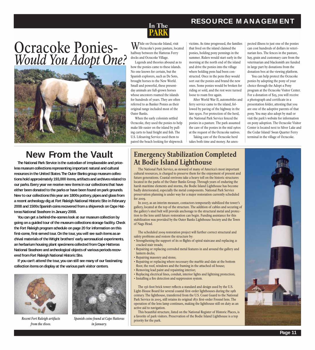
The National Park Service, as steward of many of America’s most important
cultural resources, is charged to preserve them for the enjoyment of present and
future generations. Coastal environs take a heavy toll on the historic structures
located in the parks of the Outer Banks Group. Through years of enduring the
harsh maritime elements and storms, the Bodie Island Lighthouse has become
badly deteriorated, especially the metal components. National Park Service
preservation planning is under way for a major restoration currently scheduled
for 2009.
In 2007, as an interim measure, contactors temporarily stabilized the tower’s
gallery, located at the top of the structure. The addition of cables and securing of
the gallery’s steel belt will provide anchorage to the structural metal and protec-
tion to the lens until future restoration can begin. Funding assistance for this
stabilization was provided by the Outer Banks Lighthouse Society and the Town
of Nags Head.
The scheduled 2009 restoration project will further correct structural and
safety problems and restore the structure by:
• Strengthening the support of its 10 fl ights of spiral staircase and replacing 21
cracked stair treads;
• Repairing or replacing corroded metal features in and around the gallery and
lantern decks;
• Repairing masonry and stone;
• Repairing or replacing where necessary the marble and slate at the bottom
fl oor, the roof, windows and the framing in the attached oil house;
• Removing lead paint and repainting interior;
• Replacing electrical lines, conduit, interior lights and lightning protection;
• Installing a fi re detection and suppression system.
The 156-foot brick tower refl ects a standard and design used by the U.S.
Light-House Board for several coastal fi rst-order lighthouses during the 19th
century. The lighthouse, transferred from the U.S. Coast Guard to the National
Park Service in 2005, still retains its original 1871 fi rst-order Fresnel lens. The
operation of the lens lamp continues, making the lighthouse still on duty as an
active aid to navigation.
This beautiful structure, listed on the National Register of Historic Places, is
a favorite of park visitors. Preservation of the Bodie Island Lighthouse is a top
priority for the park.
Emergency Stabilization CompletedAt Bodie Island Lighthouse
victims. As time progressed, the families
that lived on the island claimed the
ponies, holding pony pennings in the
summer. Riders would start early in the
morning at the north end of the island
and drive the ponies into the village
where holding pens had been con-
structed. Once in the pens they would
sort out the ponies and brand the new
ones. Some ponies would be broken for
riding or sold, and the rest were turned
loose to roam free again.
After World War II, automobiles and
ferry service came to the island, fol-
lowed by paving of the highway in the
late 1950s. For protection of the herd,
the National Park Service fenced the
ponies in a pasture. The park assumed
the care of the ponies in the mid 1960s
at the request of the Ocracoke natives.
Taking care of the Ocracoke herd
takes both time and money. An unex-
pected illness to just one of the ponies
can cost hundreds of dollars in veteri-
narian fees. The fences in the pasture,
hay, grain and customary care from the
veterinarian and blacksmith are funded
in large part by donations from the
donation box at the viewing platform.
You can help protect the Ocracoke
ponies by adopting the pony of your
choice through the Adopt a Pony
program at the Ocracoke Visitor Center.
For a donation of $25, you will receive
a photograph and certifi cate in a
presentation folder, attesting that you
are one of the adoptive parents of that
pony. You may also adopt by mail or
visit the park’s website for information
on pony adoption. The Ocracoke Visitor
Center is located next to Silver Lake and
the Cedar Island/ Swan Quarter Ferry
terminal in the village of Ocracoke.
New From the Vault
Ocracoke Ponies-Would You Adopt One?
Recent Fort Raleigh artifacts from the 1800s.
Spanish coins found at Cape Hatteras in January.

Page 12
12
64
264
158
64 264Wri
ght
Brot
hers
Nat
iona
l Mem
oria
l
Fort
Ral
eigh
Nat
iona
lH
isto
ric
Site
EASHORE
ALLIGATOR RIVER A
LB
EM
AR
LE
S
OU
ND
S O U N D
C U R R I T U C K
C R O A T A N S O U N D
R O A N O K E S O U N D
Ore
gon
Inle
t
Refu
ge V
isit
or C
ente
r
Pea Island National Wildlife Refuge
TO A
LLIG
ATO
R RI
VER
NA
TIO
NA
L W
ILD
LIFE
REF
UG
E
Jock
ey’s
Rid
geSt
ate
Park
Dar
e Co
unty
Regi
onal
Air
port
Bodi
e Is
land
Vis
itor
Cen
ter
Bodi
e Is
land
Lig
htho
use
Coqu
ina
Beac
h
Wha
lebo
ne J
unct
ion
Info
rmat
ion
Stat
ion
Ore
gon
Inle
t
Fish
ing
pier
Sout
hern
Sho
res
Kitt
y H
awk
Kill
Dev
il H
ills
Nag
s H
ead
Man
teo
Man
ns H
arbo
r
Roda
nthe
R o a n o k e I s l a n d
B o d i e I s l a n d
ToEl
izab
eth
City
and
Nor
folk
, Va
ToD
uck
and
Coro
lla
Swim
bea
ch
Bath
hous
e
Boat
laun
ch
Nat
ure
trai
l
Cam
pgro
und
0 0
5 1
Kilo
met
er
51
Mile
No
rth
2
1
3
45
6

Page 13
12
12
Cape
Look
out
Nat
iona
lSe
asho
re
CA
PE
HA
TT
E
RA
S
NATIONAL SE
USS
Mon
itor
Nat
iona
l Mar
ine
Sanc
tuar
y
P
A
M
L
I
C
O
S
OU
ND
Ha
tter
as In
let
Ocr
acok
e In
let
DI A
MO
N
D S
HO
AL S
ATLANTIC OCEAN
Salv
oD
ay u
se a
rea
Hau
love
rD
ay u
se a
rea
Fish
ing
pier
Hat
tera
s Is
land
Vis
itor
Cen
ter
Cape
Hat
tera
s Li
ghth
ouse
Fris
coCa
pePo
int
Sand
y Ba
ySo
unds
ide
Park
ing
Fris
co B
each
Bath
Hou
se
Ocr
acok
e Is
land
Vis
itor
Cen
ter
Ocr
acok
eLi
ghth
ouse
Pony
Pen
&
Park
ing
Lot
Fris
co p
ier
Life
guar
ded
Beac
h
Nat
ure
Trai
l
Ocr
acok
e Ca
mpg
roun
d
Ferr
y Te
rmin
alPa
rkin
g Lo
t
Cape
Hat
tera
s
Wav
es
Salv
o
Frisc
o
Buxt
on
Avo
n
Hat
tera
s
Ocr
acok
e
Hatteras Island
Ocr
aco
ke
Isla
nd
To Ceda
r Is
land
via
toll
ferr
y
To Swan
Qua
rter
via
toll
ferr
y
7
8
9
1011
12
13
14
15
16
17
1819
20 21
22
23
24
25

Page 14
CAPE HATTERAS www.nps.gov/caha
All Visitor Centers areOpen 9 a.m. to 6 p.m. May 23 to Labor Day
9 a.m. to 5 p.m. the rest of the yearProgram Locations: (See Map on Pages 12 & 13) (1) Sandcastle Environmental Education Center (located at north end of Coquina Beach parking lot past bathhouse); (2) Coquina Beach bathhouse; (3) Coquina Beach lifeguard stand; (4) fi rst beach access at Coquina Beach parking lot before bathhouse; (5) Bodie Island Visitor Center; (6) far end of Oregon Inlet Marina charter boat parking area (park by propeller); (7) Salvo Day Use Area; (8) Haulover Day Use Area; (9) Old Lighthouse site parking lot; (10) Buxton Swim Beach parking lot; (11) Buxton Swim Beach; (12) Hatteras Island Visitor Center Pavilion; (13) Museum of the Sea, Double Keepers’ Quarters; (14) Buxton Woods Nature Trail; (15) meet at fi sh cleaning tables near Ramp 44; (16) Sandy Bay soundside parking lot; (17) Hatteras U.S. Weather Bureau Station; (18) oceanside parking lot at north end of Ocracoke Island by Ocracoke-Hatteras Ferry dock; (19) oceanside parking lot 0.7 miles north of the Pony Pasture; (20) Pony Pasture; (21) Hammock Hills Nature Trail parking lot; (22) Ocracoke Campground parking lot; (23) Ocracoke Campground beach; (24) Ocracoke lifeguard stand; (25) Ocracoke Island Visitor Center amphitheatre.
(*) Pre-register at the Bodie Island Visitor Center (#) Pre-register at the Hatteras Island Visitor Center(+) Pre-register at the Ocracoke Island Visitor Center (A) Program is handicapped accessible
Programs listed will be offered from May 23 to Sept. 1, 2008. The program schedule is subject to change without notice. Programs are subject to weather.
Banker Ponies (30 minutes)
The Banker Ponies are defi nitely an
Ocracoke must-see! Learn more about
their mysterious origins, unique physi-
cal attributes, survival skills, and the
circumstances that led the Park Service
to care for them. Sunscreen is recom-
mended.
Barrier Island Nature (30 - 45 minutes)
Sea turtles, shorebirds, seashells and
shoreline migration. Join a ranger for
a talk about the wild side of the Outer
Banks. Topics will vary daily.
Cape Hatteras National Seashore Summer 2008 Program Information
Coast Guard Station Oregon Inlet Tour (1 hour)
The U.S. Lifesaving Service had a
long history on the Outer Banks and
was predecessor of today’s U.S. Coast
Guard. Join us to tour a modern Coast
Guard Station. Program is limited to
20 participants. You must pre-register
in person at the Bodie Island Visitor
Center beginning the Saturday prior to
the program. Program starts May 28.
Crabbing with a Ranger (1 ½ hours)
Learn all about blue crabs, and try
your hand at catching them. Pre-reg-
ister at visitor center. Limited to 25
participants. Bring bait (fi sh or chicken
parts), sunscreen, bug repellant, and
wading shoes.
Especially for Kids (30 - 45 minutes)
Hands-on activities allow kids to
have fun while learning about the
seashore. Check at the Visitor Center to
learn the program of the day.
Evening Campfi re (1 hour)
Spend an evening under the stars
hearing stories of the Outer Banks.
Topics may include shipwrecks, pirates,
sea life, and legends. Bring a beach
chair, a warm blanket, a fl ashlight, and
insect repellent.
Explore the Shore (1 hour)
Join a ranger for a walk along the
beach to explore an ever changing
world. Wear sunscreen and wading
shoes.
Graveyard of the Atlantic (30 minutes)
Countless ships have met their ruin
off the Outer Banks. Learn how storms,
shoals, currents, war, and commerce
have contributed to the wreckage and
about those who risked their lives to
save victims onboard.
Journey of the Loggerhead (30 minute video)
Learn about the lives of Loggerhead
turtles and what people are doing to
help them survive. Programs are limited
to the fi rst 25 people.
Lighthouse Marshes (1 hour)
Experience the sights and sounds of
the island’s fresh water marshes. Birds,
dragonfl ies and butterfl ies are among
those that hunt and gather in this rich
habitat. Binoculars are provided but
bring your own if you have them. Sun-
screen and insect repellant is recom-
mended.
Maritime Forest Walk (1 hour)
Explore one of the oldest sections of
the islands as we venture into maritime
forest habitat. Discover why the mari-
time forest is important to the plants,
animals, and people of the islands.
Morning Bird Walk (1 ½-2 hours)
The Outer Banks is well known for
Program Sun Mon Tue Wed Thur Fri Sat
Morning Bird Walk (2) 8:00
Explore the Shore (2) 9:30
Crabbing with a Ranger (*) 8:30 8:30
Especially for Kids (1) 2:00 9:30 2:00 11:00
Ocean Safety Demo (3) 10:30 Outer Banks History (5) (A) 11:00 3:30 Sentinel of the Shore 11:00 3:00 11:30 11:00 11:00 (5) (A)
Graveyard of the Atlantic 2:00 11:00 10:00 (5) (A)
Soundside Seining (6) 2:30
Pirates! (5) (A) 2:00
Barrier Island Nature 3:30 3:30 3:30 3:00 2:00 2:00(5) (A)
Coast Guard StationOregon Inlet Tour (*) 3:00 4:00
Lighthouse Marshes (5) 4:00
Evening Campfi re (4) 8 p.m.
Night Lights (2) 8:45 p.m.
BODIE ISLAND
Phot
o Cr
edit:
Qui
nn C
apps
Cast Netting (1 hour)
Casting a net from shore is one of
the oldest methods of catching fi sh
still being practiced around the world
today. Try your hand at it with the help
of a coach or just come to observe the
action. You are welcome to bring your
own cast net. Wear wading shoes.
Sunscreen is recommended. Sign up
at the Hatteras Island Visitor Center
beginning the Saturday prior to the
program.
Coast Guard Station Hatteras Inlet Tour (1 hour)
The U.S. Lifesaving Service has a
long history on the Outer Banks and
was predecessor of today’s U.S. Coast
Guard. Sign up for this tour of a mod-
ern Coast Guard Station. This program
is limited to 20 participants and sign-up
is on a fi rst-come, fi rst-served basis.
You must pre-register in person at the
Hatteras Island Visitor Center begin-
ning the Saturday prior to the program.
Phot
o Cr
edit:
Pau
la B
alda
ssin

Page 15
www.nps.gov/caha CAPE HATTERAS
Program Sun Mon Tue Wed Thur Fri Sat
Morning Bird Walk (18) 8:00 Soundside Seining (19) 2:00
Explore the Shore (22) 9:30 9:30 Crabbing with a Ranger (+) 9:30 9:30
Ocean Safety Demo (24) 10:30
Especially for Kids (25) (A) 3:00 4:00 11:00 11:00
Outer Banks History 11:00 3:30 2:00(25) (A) Banker Ponies (20) (A) 3:00 2:00 3:00 Pirates! (25) (A) 2:00 11:00 2:00
Graveyard of the 11:00 3:30Atlantic (25) (A)
Barrier Island Nature 2:00 11:30 3:00 2:00 11:00(25) (A)
Maritime Woods Walk 3:00(21)
Evening Campfi re (23) 8 p.m.
Night Lights (22) 8:45 p.m.
OCRACOKE ISLAND
Program Sun Mon Tue Wed Thur Fri Sat
Morning Bird Walk (15) 8:00
Take Me Fishing (#) 8:00 8:00 Cast Netting (#) 9:00
Soundside Seining 2:30 2:30 2:30(see specifi c day location) (7) (16) (8)
Explore the Shore (10) 10:00 10:00
Sentinel of the Shore 10:00 10:00 10:00 10:00(12) (A)
Outer Banks History 10:00 10:00 10:00(12) (A)
Piping Plover (13) 10:30 10:30 10:30 10:30
Ocean Safety Demo (11) 10:30
Journey of the 10:30 10:30 10:30Loggerhead (13)
Especially for Kids 11:00 11:00 11:00 11:00 11:00 11:00 11:00(12) (/ may vary)
Seashore Arts (#) (A) 11:00
Rip Currents (13) 12:00 12:00 12:00 12:00 12:00 12:00 12:00 Move of the Century (13) 12:30 12:30 12:30 12:30 12:30 12:30 12:30
Barrier Island Nature 2:00 2:00 2:00 2:00 2:00 2:00(12) (/ may vary)
Maritime Forest Walk (14) 2:00
Coast Guard StationHatteras Inlet Tour (#) 3:00
Old Days at the Weather 4:00Station (17)
Soundside Snorkel (#) 2:30 2:30
Pirates! (12) (A) 3:00 3:00
Graveyard of the Atlantic 4:00 4:00 4:00(12) (A)
Evening Campfi re (11) 8 p.m.
Night Lights (9) 8:45 p.m.
HATTERAS ISLAND
its abundant bird life. Come explore
their beach and salt marsh haunts.
Beginner and experienced birders
welcomed. Binoculars are available if
you don’t bring your own. Sunscreen is
recommended.
Move of the Century (1 hour video)
What can you do in 23 days? We
moved a lighthouse. Programs are
limited to the fi rst 25 people.
Night Lights (1 hour)
Take back the night! Leave those ar-
tifi cial lights behind and experience the
natural lights on the beach after dark.
Join a ranger for a short walk to search
Old Days at the Hatteras Weather Station (45 minutes)
Join a ranger for a tour of the
restored Hatteras Weather Station and
hear about villagers who worked there
during both tranquil and stormy times.
Outer Banks History (30 minutes)
Come learn about life along the
Outer Banks. Possible topics include
shipwrecks, early settlers, German
U-Boat activity along the coast during
World War II, and hurricanes. Check at
the Visitor Center to learn the program
of the day.
Piping Plover: Before it’s too late (15 minute video)
Learn about this protected shorebird
living along the beach and what you
can do to help it survive. Limited to the
fi rst 25 people.
Pirates! (30 minutes)
The Outer Banks was a popular
place for pirates during the early 1700’s.
Find out why the area was so attractive
to pirates and how the golden age of
piracy dramatically ended.
Rip Current (7 minute video)
Find out how to identify and avoid
dangerous rip currents. Learn how to
swim and surf our oceans more safely.
Program is limited to the fi rst 25 people.
Seashore Arts (1 hour)
Get in touch with your artistic side
and create a lasting memory of the
Seashore. Bring a T-shirt, pillow case
or scarf to create a seashore-inspired
masterpiece. Program is limited to 16
participants on a fi rst come fi rst serve
basis. Sign up at the Hatteras Island
Visitor Center beginning the Saturday
prior to the program.
Sentinel of the Shore (30 minutes)
Learn about the history, present
status and future plans for the park’s
majestic lighthouses.
Soundside Seining (1 to 1 ½ hours)
Interested in learning about Pamlico
Sound and the creatures found there?
Join a ranger and discover the wonders
of the sound with a seining net. Wear
wading shoes. Sunscreen and insect
repellant are recommended.
Soundside Snorkel (1 ½ hours)
It’s not the Caribbean, but the shal-
low waters of Pamlico Sound are home
to an array of small fi sh, shrimp and
crabs. Program limited to 20 people
on a fi rst-come, fi rst-served basis. You
must pre-register in person at the Hat-
teras Island Visitor Center beginning
the Saturday prior to the program.
Take Me Fishing (2 hours)
Join members of the Cape Hatteras
Anglers Club to learn the art of surf
casting and fi shing. We have poles, but
you MUST bring the bait. This program
is limited to 60 participants and sign
up is on a fi rst come, fi rst served basis.
You must pre-register in person at the
Hatteras Island Visitor Center begin-
ning the Saturday prior to the program.
Phot
o Cr
edit:
Qui
nn C
apps
Phot
o Cr
edit:
Qui
nn C
apps
the tide line for glowing marine plank-
ton and the sky for planets and star
constellations. Find out why protecting
the dark of night is valuable to both
people and wildlife. Insect repellant
and foot protection is recommended.
Ocean Safety Demonstration (1 hour)
Ocean swimming can be hazardous.
Come to one of the three National Park
Service lifeguarded beaches where
guards will demonstrate water rescue
techniques. You will learn how to
protect yourself against rip currents,
pounding waves and more.

Page 16
Cape Hatteras Lighthouse
The Cape Hatteras Lighthouse is the tallest brick lighthouse in the world. It stands 198 feet tall and was constructed in 1870. It was built to help ships navigate around Diamond Shoals off Cape Hatteras, one of the most dangerous sites on the Atlantic Coast. The shoals are a complex of underwater sand bars that constantly move and shift. Ships caught in heavy seas and wind would be washed upon the shoals. Waves breaking on the shoals would simply rip the ships apart. Hundreds and possibly thou-sands of shipwrecks in this area have given it the reputation as the “Graveyard of the Atlantic.”
The lighthouse was moved in 1999 when threat-ened by the encroaching sea.
CAPE HATTERAS www.nps.gov/caha
Cape Hatteras Lighthouse9 a.m. to 5 p.m. daily April18th-June 7th;9 a.m. to 6 p.m. daily June 8th-Sept. 1st;
9 a.m. to 5 p.m. daily Sept. 2nd-Oct. 13th, 2008
$7 for adults and $3.50 for seniors, age 62 and older, the disabled, children under 12 and pass holders. Tickets may
be purchased 20 minutes before closing.
Visit the
If you are planning a day trip to come climb the Cape Hatteras Lighthouse, here
are some helpful tips to make the experience enjoyable.
1Check the weather – The lighthouse can close due to extreme heat, thunder
or lightning, excessive rain or wind and due to medical emergencies.
2 Have a backup plan – If the lighthouse is closed, it’s helpful to have a backup
plan. Here are a few ideas: Attend a ranger program, watch a park movie or
video, hike the Buxton Woods trail, visit the Graveyard of the Atlantic Museum
(Hatteras Village), the Frisco Native American Museum (Frisco) or Chicamacomico
Lifesaving Station (Rodanthe). Those are just a few ideas; be sure to ask any park
staff member for other activities that are available.
3 Bring water – Although bottled water is available on site-food is not. Consider
bringing your own water and other supplies you might need during your visit.
Supplies are available in local stores in nearby communities.
4 Be fl exible and allot more time – The lighthouse tends to be the busiest
from 10 a.m. until 2 or 3 p.m. Sometimes there can be up to an hour wait to
climb the lighthouse during these times. Also, note that in the busy summer season
there is often a long waiting time to get on the ferry to or from Ocracoke as well as
busy traffi c on Highway 12, which can cause delays in your schedule, so please plan
accordingly and allow for extra time.
Tips from a Lighthouse Ranger
Seashore visitors enjoy basking on
the sandy beaches, visiting historic
lighthouses and riding the ferry across
Hatteras Inlet. One memorable experi-
ence that is often overlooked is a peace-
ful stroll in the shade of the maritime
woods, a forest community shaped by
the coastal elements. Two ¾-mile loop
trails, the Ocracoke Island Hammock
Hills Trail located across from the
Ocracoke Campground and the Hat-
teras Island Buxton Woods Nature Trail
located near the Cape Hatteras Light
Station, traverse through some of the
most beautiful sections of maritime
forest on the Outer Banks.
The maritime woods of these trails
developed on the oldest and most
relatively stable sites on the islands,
comprised of ancient dune ridges that
formed 3,000 to 5,000 years ago. The
higher elevation of these ridges protects
the habitat from saltwater tides and
storm-driven overwash, allowing oaks,
cedars, loblolly pines and yaupon holly
to survive.
The increased width of the islands
at these trail locations gives additional
protection to the forest by providing
distance from the ocean’s wind-born
salt spray, which can alter plant growth.
But even with the greater distance, you
will see conspicuously stunted and
twisted branching patterns in some
trees that attest to the fact that no plant
can totally escape the eff ects of salt
spray. This pattern of growth is most
exaggerated at the forest edge where
salt air is more constant. You will fi nd
that the protected trees and shrubs
living in the woods’ sheltered interiors
grow straighter and taller. Maritime
forests become more resistant with age
– these trails will take you under tight
interlocking branches that create a
shield-like canopy of evergreen leaves
that screen out salts and defl ect wind.
These wider areas of the barrier islands
are also often wooded because these
sections can store vital rain-fed ground-
water that is not available to vegetation
on the narrower strips of island.
Other examples of these wood-
land pockets can be seen in the older
sections of any local village where
early Outer Bankers fi rst settled, taking
advantage of the natural protection
provided from the coastal wind and
fl ooding. In a walk through these
maritime woods settlements, one can
easily see aged twisted live oaks and
red cedars lining the roadways and old
home sites.
We invite to you try an alternate bar-
rier island recreational experience. Take
a break from the bright sun and hot
breeze and experience a unique natural
treasure -- the quiet, shady world of the
maritime woods.
Quiet and Shady World of the Maritime Woods
If you want to visit maritime wooded trails, stop by any National Park Service Visitor Center for more information. On Ocracoke, ask for information about Springer’s Point, woodlands protected by the North Carolina Coastal Land Trust. On Hatteras Island, the Buxton Woods Nature Trail is found near the Cape Hat-teras Light Station. For a lengthier experience, ask about the Open Ponds Trail. At Bodie Island, a pond trail leads from the lighthouse. Please be sure to check yourself for ticks after your walk through grasses or shrubbery.
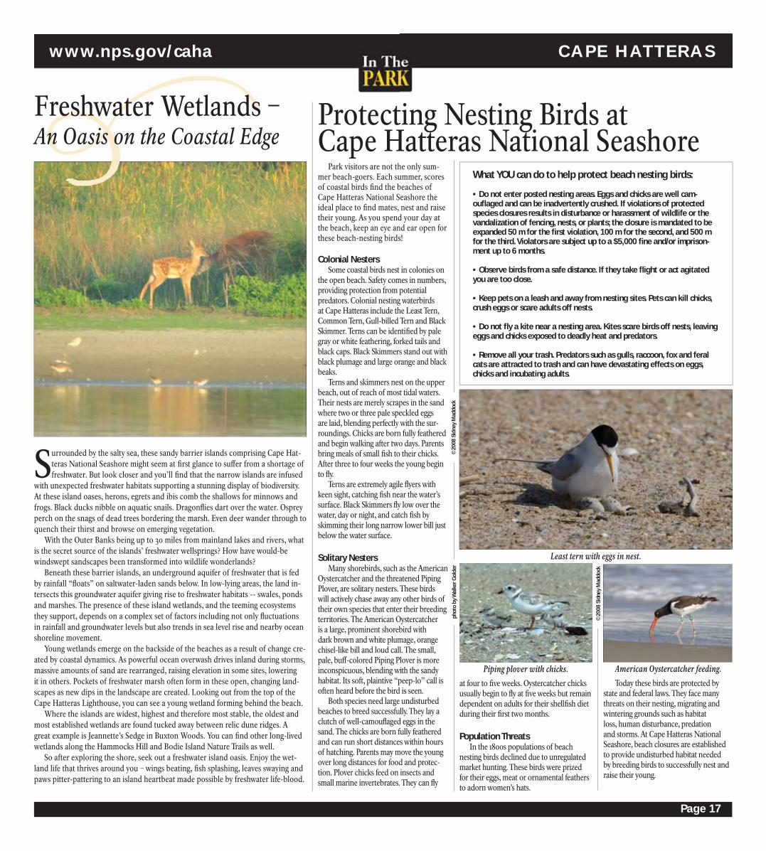
Page 17
Park visitors are not the only sum-
mer beach-goers. Each summer, scores
of coastal birds fi nd the beaches of
Cape Hatteras National Seashore the
ideal place to fi nd mates, nest and raise
their young. As you spend your day at
the beach, keep an eye and ear open for
these beach-nesting birds!
Colonial NestersSome coastal birds nest in colonies on
the open beach. Safety comes in numbers,
providing protection from potential
predators. Colonial nesting waterbirds
at Cape Hatteras include the Least Tern,
Common Tern, Gull-billed Tern and Black
Skimmer. Terns can be identifi ed by pale
gray or white feathering, forked tails and
black caps. Black Skimmers stand out with
black plumage and large orange and black
beaks.
Terns and skimmers nest on the upper
beach, out of reach of most tidal waters.
Their nests are merely scrapes in the sand
where two or three pale speckled eggs
are laid, blending perfectly with the sur-
roundings. Chicks are born fully feathered
and begin walking after two days. Parents
bring meals of small fi sh to their chicks.
After three to four weeks the young begin
to fl y.
Terns are extremely agile fl yers with
keen sight, catching fi sh near the water’s
surface. Black Skimmers fl y low over the
water, day or night, and catch fi sh by
skimming their long narrow lower bill just
below the water surface.
Solitary Nesters Many shorebirds, such as the American
Oystercatcher and the threatened Piping
Plover, are solitary nesters. These birds
will actively chase away any other birds of
their own species that enter their breeding
territories. The American Oystercatcher
is a large, prominent shorebird with
dark brown and white plumage, orange
chisel-like bill and loud call. The small,
pale, buff -colored Piping Plover is more
inconspicuous, blending with the sandy
habitat. Its soft, plaintive “peep-lo” call is
often heard before the bird is seen.
Both species need large undisturbed
beaches to breed successfully. They lay a
clutch of well-camoufl aged eggs in the
sand. The chicks are born fully feathered
and can run short distances within hours
of hatching. Parents may move the young
over long distances for food and protec-
tion. Plover chicks feed on insects and
small marine invertebrates. They can fl y
Protecting Nesting Birds at Cape Hatteras National Seashore
www.nps.gov/caha CAPE HATTERAS
Surrounded by the salty sea, these sandy barrier islands comprising Cape Hat-
teras National Seashore might seem at fi rst glance to suff er from a shortage of
freshwater. But look closer and you’ll fi nd that the narrow islands are infused
with unexpected freshwater habitats supporting a stunning display of biodiversity.
At these island oases, herons, egrets and ibis comb the shallows for minnows and
frogs. Black ducks nibble on aquatic snails. Dragonfl ies dart over the water. Osprey
perch on the snags of dead trees bordering the marsh. Even deer wander through to
quench their thirst and browse on emerging vegetation.
With the Outer Banks being up to 30 miles from mainland lakes and rivers, what
is the secret source of the islands’ freshwater wellsprings? How have would-be
windswept sandscapes been transformed into wildlife wonderlands?
Beneath these barrier islands, an underground aquifer of freshwater that is fed
by rainfall “fl oats” on saltwater-laden sands below. In low-lying areas, the land in-
tersects this groundwater aquifer giving rise to freshwater habitats -- swales, ponds
and marshes. The presence of these island wetlands, and the teeming ecosystems
they support, depends on a complex set of factors including not only fl uctuations
in rainfall and groundwater levels but also trends in sea level rise and nearby ocean
shoreline movement.
Young wetlands emerge on the backside of the beaches as a result of change cre-
ated by coastal dynamics. As powerful ocean overwash drives inland during storms,
massive amounts of sand are rearranged, raising elevation in some sites, lowering
it in others. Pockets of freshwater marsh often form in these open, changing land-
scapes as new dips in the landscape are created. Looking out from the top of the
Cape Hatteras Lighthouse, you can see a young wetland forming behind the beach.
Where the islands are widest, highest and therefore most stable, the oldest and
most established wetlands are found tucked away between relic dune ridges. A
great example is Jeannette’s Sedge in Buxton Woods. You can fi nd other long-lived
wetlands along the Hammocks Hill and Bodie Island Nature Trails as well.
So after exploring the shore, seek out a freshwater island oasis. Enjoy the wet-
land life that thrives around you – wings beating, fi sh splashing, leaves swaying and
paws pitter-pattering to an island heartbeat made possible by freshwater life-blood.
Freshwater Wetlands – An Oasis on the Coastal Edge
©20
08 S
idne
y M
addo
ck
at four to fi ve weeks. Oystercatcher chicks
usually begin to fl y at fi ve weeks but remain
dependent on adults for their shellfi sh diet
during their fi rst two months.
Population ThreatsIn the 1800s populations of beach
nesting birds declined due to unregulated
market hunting. These birds were prized
for their eggs, meat or ornamental feathers
to adorn women’s hats.
Today these birds are protected by
state and federal laws. They face many
threats on their nesting, migrating and
wintering grounds such as habitat
loss, human disturbance, predation
and storms. At Cape Hatteras National
Seashore, beach closures are established
to provide undisturbed habitat needed
by breeding birds to successfully nest and
raise their young.
What YOU can do to help protect beach nesting birds:
• Do not enter posted nesting areas. Eggs and chicks are well cam-oufl aged and can be inadvertently crushed. If violations of protected species closures results in disturbance or harassment of wildlife or the vandalization of fencing, nests, or plants; the closure is mandated to be expanded 50 m for the fi rst violation, 100 m for the second, and 500 m for the third. Violators are subject up to a $5,000 fi ne and/or imprison-ment up to 6 months.
• Observe birds from a safe distance. If they take fl ight or act agitated you are too close.
• Keep pets on a leash and away from nesting sites. Pets can kill chicks, crush eggs or scare adults off nests.
• Do not fl y a kite near a nesting area. Kites scare birds off nests, leaving eggs and chicks exposed to deadly heat and predators.
• Remove all your trash. Predators such as gulls, raccoon, fox and feral cats are attracted to trash and can have devastating effects on eggs, chicks and incubating adults.
©20
08 S
idne
y M
addo
ck
Least tern with eggs in nest.
Piping plover with chicks. American Oystercatcher feeding.
phot
o by
Wal
ker G
olde
r

Page 18
Passenger Flight -- Another First for Wright Brothers National Memorial
Tom D. CrouchNational Air and Space MuseumSmithsonian Institution
Every day two million people board airliners in the United States – some fl ying
to a nearby city, others to the far side of the world. Passenger air travel has become
commonplace in our daily lives. It all began 100 years ago, on May 14, 1908, at
Wright Brothers National Memorial, when Charles Furnas, the Wright brothers’
mechanic, became the world’s fi rst airplane passenger.
The brothers had made the world’s fi rst airplane fl ights on December 17, 1903,
near a low range of dunes known as the Kill Devil Hills, four miles south of the
little fi shing village of Kitty Hawk, North Carolina. On the best of those fl ights,
Wilbur fl ew 852 feet in 59 seconds. With success in hand, the Wrights spent the
next two years continuing their work near their home in Dayton, Ohio, improving
their design and increasing their time in the air. On October 5, 1905, Wilbur Wright
fl ew 30 circles over an Ohio pasture in their third airplane, covering 24.5 miles and
remaining aloft for more than 39 minutes.
The next step was to market their revolutionary fl ying machine. In the spring of
1908, after repeated trips to Europe and protracted negotiations with the U.S. gov-
ernment, the Wrights were at last ready for the fi rst public demonstrations of their
airplane. That summer, Wilbur would travel to France to show the Europeans what
their craft could do, while Orville demonstrated the machine to U.S. Army offi cials
at Ft. Myer, Virginia.
The brothers had not fl own since the fall of 1905. Before they faced the public,
they had to fi ne-tune their fl ying skills, accustom themselves to a new upright
seating arrangement and new controls and try fl ying with a passenger for the fi rst
time, something both their American and French contracts required. They rebuilt
their 1905 airplane with upright seats and the new controls and traveled back to the
North Carolina dunes, where the conditions were ideal to test their craft.
The brothers made the fi rst fl ight from their old campsite near Kitty Hawk on
May 1, 1908. By May 14, they were at last ready to venture aloft with a passenger. At
8 a.m., Wilbur took Charlie Furnas up for a hop that covered only 656 feet. Orville
kept him aloft longer on the second try. The world’s fi rst passenger fl ight lasted just
over four minutes. Not a very impressive performance by modern standards, but it
was enough. The age of air transport was under way.
WRIGHT BROTHERS www.nps.gov/wrbr
By Nags Head Elementary School Teacher Nancy Nance
Over the past eight years, fi fth grad-
ers in Dare County have participated
in a program called “Wright Flight”
that uses the motivational power of
aviation to help students improve their
performance in school.
Wright Flight is a non-profi t
501(c)(3) corporation that was founded
by Colonel Robin Stoddard. Colonel
Stoddard, a former Air Force fi ghter
pilot, noted the profound eff ect that
airplanes have almost universally on
youngsters. He decided to use that in-
terest to motivate children to do better
in school. Colonel Stoddard developed
program materials and organized a
group of volunteers and pilots to teach
the program and provide airplane
fl ights to successful students. In Dare
County, National Park Service staff at
Wright Brothers National Memorial
provide fun, interactive fl ight history
programs for Wright Flight students.
To participate in Wright Flight,
students agree to a contract with three
requirements. First, students must
pass the Wright Flight History of Avia-
tion exam with at least an 85% score.
Second, students pledge to avoid drugs,
alcohol, and tobacco products. Third,
students improve their performance
in some school area as defi ned by the
student and teacher. By meeting these
criteria, students earn the reward of
fl ying with a qualifi ed pilot over the
place where humans fi rst fl ew. To date,
close to 1,200 fi fth graders have earned
this privilege in Dare County. Students
do not just ride in the plane, they take
the controls!
Taking control is the key to this
program. Wright Flight encourages
students to take control of their learn-
ing so that they can be successful in life.
The program emphasizes the principle
that privileges are earned by reward-
ing students’ hard work. What Wright
Flight teaches our children is that with
dedication and determination, the sky
is the limit!
At the turn of the twentieth cen-tury, France - not the United States, was the main center of powered airplane fl ight attempts made by aspiring inventors. The news of the Wright brothers’ fl ights at Kitty Hawk in December 1903 was considered by the French, and the rest of the world, to be a hoax fabricated by two unknown bicycle mechanics and perpetuated by the American press. Thus, in 1908, human fl ight was considered by most to be a standard of impossibility with no forward progress in sight. Little did the world know that the Age of Flight was already here.
In early 1908, the Wright brothers signed two contracts: one with the U.S. Army and the second with a group of French businessmen to form the French Wright Company. It was decided that Orville would conduct the Army tests, and Wilbur would demonstrate in Europe where a Wright Flyer already lay crated, having been sent over to France in July of 1907. Wilbur arrived in France during late May of 1908 and, after various delays, completed the assembly of the 1907-built Flyer in
Le Mans, France. Wilbur was so confi dent in the machine and his ability to fl y that he did not make any secret fl ight tests. Instead, in the face of intense and widespread interest, suspicion and skepticism, Wilbur an-nounced his fi rst fl ight in France and invited the public to attend.
On the late afternoon of August 8, 1908, the most critical and techni-cal of audiences gathered at a race course near Le Mans to witness just another attempt to fl y . . . or so they thought! Little did they know that what they were to witness would change their lives, and the world,
forever. Wilbur Wright shocked the crowd with a series of graceful fl ight maneuvers, exhibiting a mastery of fl ight never before seen in Europe and not, until that day, believed possible. The world changed that afternoon in France as mankind was no longer chained to the earth and men would literally jump into the air. The Wright brothers had taken the world by storm!
This year marks the 100th anni-versary of that historic moment. For more information on the centennial celebration of the Wrights’ fl ights in France visit www.wright2008.com.
WRIGHT BROTHERS NATIONAL MEMORIAL
News correspondents watched the Wrights from a distance near the Kitty Hawk area, hoping to disprove rumors of a manned fl ying machine. To his amazement after seeing the fi rst passenger fl ight of May 14, 1908, one reporter, Bryan Newton
of the New York Herald, wrote in his diary: “Some day Congress will erect a monument here to these Wrights.”
First Flight in Europe - 1908
Using a catapult (foreground), the Wrights take fl ight in France.
Wright Flight!!!!
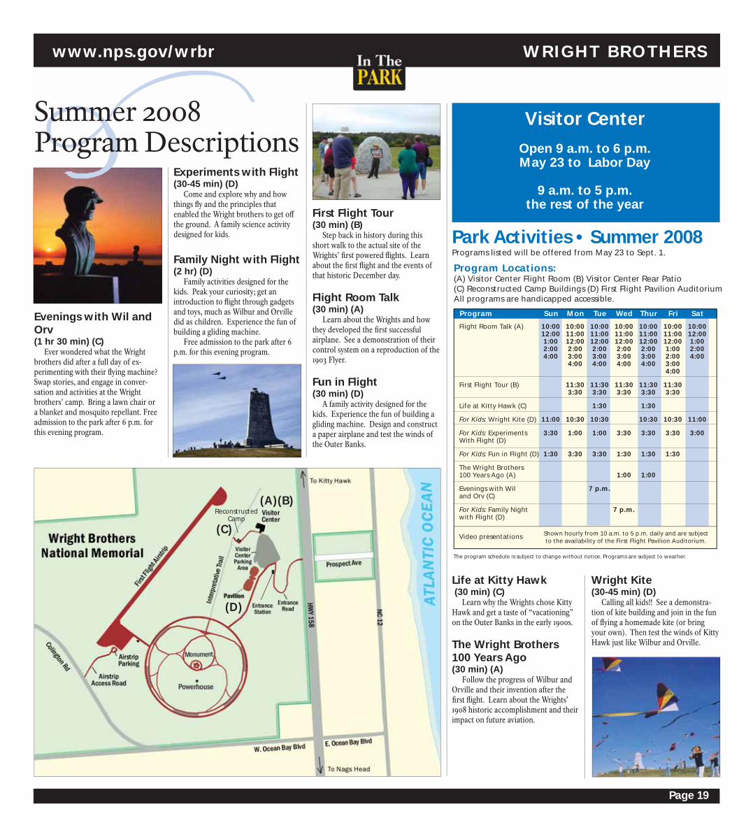
Page 19
Experiments with Flight (30-45 min) (D)
Come and explore why and how
things fl y and the principles that
enabled the Wright brothers to get off
the ground. A family science activity
designed for kids.
Family Night with Flight (2 hr) (D)
Family activities designed for the
kids. Peak your curiosity; get an
introduction to fl ight through gadgets
and toys, much as Wilbur and Orville
did as children. Experience the fun of
building a gliding machine.
Free admission to the park after 6
p.m. for this evening program.
Evenings with Wil and Orv (1 hr 30 min) (C)
Ever wondered what the Wright
brothers did after a full day of ex-
perimenting with their fl ying machine?
Swap stories, and engage in conver-
sation and activities at the Wright
brothers’ camp. Bring a lawn chair or
a blanket and mosquito repellant. Free
admission to the park after 6 p.m. for
this evening program.
Summer 2008Program Descriptions
(C)
(A)Reconstructed
Camp
(D)
(B)
www.nps.gov/wrbr WRIGHT BROTHERS
Visitor Center
Open 9 a.m. to 6 p.m. May 23 to Labor Day
9 a.m. to 5 p.m. the rest of the year
Program Locations: (A) Visitor Center Flight Room (B) Visitor Center Rear Patio(C) Reconstructed Camp Buildings (D) First Flight Pavilion AuditoriumAll programs are handicapped accessible.
Programs listed will be offered from May 23 to Sept. 1.
The program schedule is subject to change without notice. Programs are subject to weather.
Program Sun Mon Tue Wed Thur Fri Sat
Flight Room Talk (A) 10:00 10:00 10:00 10:00 10:00 10:00 10:00 12:00 11:00 11:00 11:00 11:00 11:00 12:00 1:00 12:00 12:00 12:00 12:00 12:00 1:00 2:00 2:00 2:00 2:00 2:00 1:00 2:00 4:00 3:00 3:00 3:00 3:00 2:00 4:00 4:00 4:00 4:00 4:00 3:00 4:00
First Flight Tour (B) 11:30 11:30 11:30 11:30 11:30 3:30 3:30 3:30 3:30 3:30
Life at Kitty Hawk (C) 1:30 1:30
For Kids: Wright Kite (D) 11:00 10:30 10:30 10:30 10:30 11:00
For Kids: Experiments 3:30 1:00 1:00 3:30 3:30 3:30 3:00With Flight (D)
For Kids: Fun in Flight (D) 1:30 3:30 3:30 1:30 1:30 1:30
The Wright Brothers 100 Years Ago (A) 1:00 1:00
Evenings with Wil 7 p.m.and Orv (C)
For Kids: Family Night 7 p.m.with Flight (D)
Video presentations Shown hourly from 10 a.m. to 5 p.m. daily and are subject to the availability of the First Flight Pavilion Auditorium.
Park Activities • Summer 2008First Flight Tour (30 min) (B)
Step back in history during this
short walk to the actual site of the
Wrights’ fi rst powered fl ights. Learn
about the fi rst fl ight and the events of
that historic December day.
Flight Room Talk (30 min) (A)
Learn about the Wrights and how
they developed the fi rst successful
airplane. See a demonstration of their
control system on a reproduction of the
1903 Flyer.
Fun in Flight (30 min) (D)
A family activity designed for the
kids. Experience the fun of building a
gliding machine. Design and construct
a paper airplane and test the winds of
the Outer Banks.
Life at Kitty Hawk (30 min) (C)
Learn why the Wrights chose Kitty
Hawk and get a taste of “vacationing”
on the Outer Banks in the early 1900s.
The Wright Brothers 100 Years Ago (30 min) (A)
Follow the progress of Wilbur and
Orville and their invention after the
fi rst fl ight. Learn about the Wrights’
1908 historic accomplishment and their
impact on future aviation.
Wright Kite (30-45 min) (D)
Calling all kids!! See a demonstra-
tion of kite building and join in the fun
of fl ying a homemade kite (or bring
your own). Then test the winds of Kitty
Hawk just like Wilbur and Orville.

Page 20
We Want to Know What You ThinkThe National Park Service is in the process of developing a general management plan (GMP) for Fort Ra-
leigh National Historic Site that will lay a foundation for the long-term direction of the site. Input from park visitors will help us draft the best possible plan.
A GMP provides a vision for the future of a park and a practical framework for decision making. It rep-resents the broadest level of planning conducted by the National Park Service. The intention of a GMP is to provide guidance for making informed decisions about the future of the park and specify resource conditions and visitor experiences to be achieved. A GMP provides guidance on how to best protect park resources, how to provide for quality visitor experiences and how to manage visitation and visitor use. It involves identifying goals based on the legislative intent of the park, analyzing existing conditions and future possibilities and determining the best course of action to accomplish these goals.
Public involvement is a key component in the preparation of the GMP. To fi nd out how to provide your input, visit the park’s website at www.nps.gov/fora.
FORT RALEIGH www.nps.gov/fora
FORT RALEIGH NATIONAL HISTORIC SITE
In August 1587, Governor John White
departed his newly planted settlers
on Roanoke Island and sailed for
England for more supplies. Unknown
to the fl edgling colony and their gover-
nor, an impending invasion of England
would prevent their relief. The immi-
nent war with Spain would require the
island nation’s every resource to fi ght.
John White was still hopeful that
his colony could be aided even after
learning of this trouble upon his return
to England in November. Meeting with
Sir Walter Raleigh, the sponsor of the
colonizing eff ort, plans proceeded for
a re-supply voyage. By March 1588 Sir
Richard Grenville’s fl eet was ready to
sail, but the Queen’s Government sent
instructions “to forbeare to go his
intended voyage,” ordering his ships
to the English Navy for service against
Spain. White was instead given permis-
sion to use two smaller vessels, the
Brave and the Roe, for the relief eff ort.
In April 1588, Governor White
departed England on the 30-ton Brave
with seven men and four women to join
the colony. The Roe also carried four or
fi ve colonists. The two pinnaces were
small and poorly equipped and provi-
sioned. To worsen matters, the privateer
captain of the Brave, Arthur Facy, was
intent upon prize-taking.
Before leaving European waters,
crews of the two pinnaces boarded
and raided four vessels. But they would
soon be the ones pursued. On May
6, the Brave was overtaken by a large
French ship. Savage fi ghting followed
and the Brave was left half-crippled.
White and three of the colonists were
wounded and their supplies were
seized. White recounted:
“…the fi ght continued without ceasing one hour and a half… they robbed us of all our victuals, powder, weapons, provi-sion, saving a small quantity of biscuit to serve us scarce for England. Our Master and his Mate were deadly wounded, so that they were not able to come forth of their beds. I my self was wounded twice in the head, once with a sword, and an-other time with a pike, and hurt also in the side of the buttock with a shot…Be-ing thus ransacked… we determined to return for England…”
Thus, White’s courageous eff ort to
provision his colonists was thwarted by
circumstances beyond his control.
Meanwhile, eyes were on the
southwest coast of England and the ap-
proaching Spanish Armada. When the
two naval powers met on August 8, 1588,
the English vessels’ maneuverability and
favorable winds won the day for their
nation. It was Queen Elizabeth’s fi nest
hour.
Three thousand miles across the
Atlantic along the wind-swept coast of
the Outer Banks, 116 men, women, and
children never knew of their Governor’s
travails or the English victory. Their
promised supplies never arrived. Sepa-
rated forever from family and friends,
the colonists faced an uncertain future
in a New World, 420 years ago.
John White and the Year of the Armada
Programs listed will be offered from May 23 to Sept.1.
The program schedule is subject to change without notice. Programs subject to weather.
Visitor Center
Open 9 a.m. to 6 p.m.
May 23 to Labor Day
9 a.m. to 5 p.m. the
rest of the year
Program Locations: All programs start at park visitor center: (*) Program has limited attendance capacity; sign up in person at the park visitor center, (A) Program is handicapped accessible.
Program Sun Mon Tue Wed Thur Fri Sat
1584: The Scouting 10:00 10:00Expedition (A)
1585-86: The Exploration 2:00 2:00 2:00 2:00 2:00 2:00 2:00Expedition (A)
1587: The Colony (A) 3:00 3:00 3:00 3:00 3:00 3:00 3:00
Roanoke Island History: 4:00 11:00 4:00The Algonquians (A)
Roanoke Island History: 11:00 11:00The Freedmen (A)
Roanoke Island History: 4:00 4:00The Drama Remembers (A)
Kids’ Activity: Life in the 1:00 10:00 1:00 1:00Roanoke Tribe (A-may vary)
Kids’ Activity: The Power 10:00 10:00of Archeology (A-may vary)
Kids’ Activity: Roanoke 10:00 1:00 1:00 10:00Explorers (A-may vary)
Nature Trail Walk 4:00 4:00
Tour of the Collection (*) (A) 11:00
Video: “Roanoke: The Lost Colony” Shown daily at 30 minutes past the hour in the visitor center auditorium beginning at 9:30 a.m.
Park Activities • Summer 2008
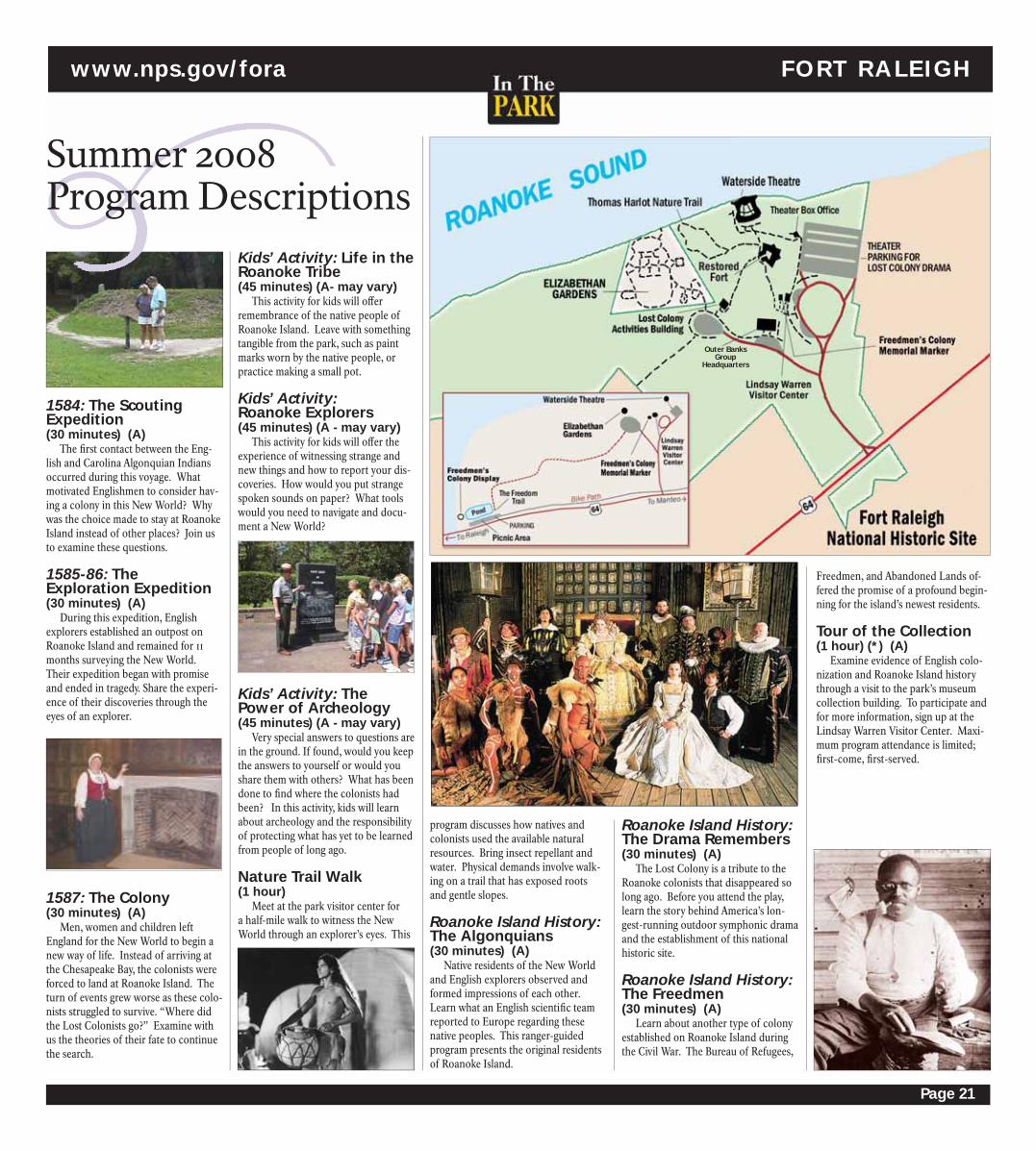
Page 21
Kids’ Activity: Life in the Roanoke Tribe(45 minutes) (A- may vary)
This activity for kids will off er
remembrance of the native people of
Roanoke Island. Leave with something
tangible from the park, such as paint
marks worn by the native people, or
practice making a small pot.
Kids’ Activity: Roanoke Explorers(45 minutes) (A - may vary)
This activity for kids will off er the
experience of witnessing strange and
new things and how to report your dis-
coveries. How would you put strange
spoken sounds on paper? What tools
would you need to navigate and docu-
ment a New World?
Kids’ Activity: The Power of Archeology(45 minutes) (A - may vary)
Very special answers to questions are
in the ground. If found, would you keep
the answers to yourself or would you
share them with others? What has been
done to fi nd where the colonists had
been? In this activity, kids will learn
about archeology and the responsibility
of protecting what has yet to be learned
from people of long ago.
Nature Trail Walk (1 hour)
Meet at the park visitor center for
a half-mile walk to witness the New
World through an explorer’s eyes. This
program discusses how natives and
colonists used the available natural
resources. Bring insect repellant and
water. Physical demands involve walk-
ing on a trail that has exposed roots
and gentle slopes.
Roanoke Island History: The Algonquians (30 minutes) (A)
Native residents of the New World
and English explorers observed and
formed impressions of each other.
Learn what an English scientifi c team
reported to Europe regarding these
native peoples. This ranger-guided
program presents the original residents
of Roanoke Island.
Roanoke Island History: The Drama Remembers(30 minutes) (A)
The Lost Colony is a tribute to the
Roanoke colonists that disappeared so
long ago. Before you attend the play,
learn the story behind America’s lon-
gest-running outdoor symphonic drama
and the establishment of this national
historic site.
Roanoke Island History: The Freedmen (30 minutes) (A)
Learn about another type of colony
established on Roanoke Island during
the Civil War. The Bureau of Refugees,
Summer 2008Program Descriptions
1584: The Scouting Expedition (30 minutes) (A)
The fi rst contact between the Eng-
lish and Carolina Algonquian Indians
occurred during this voyage. What
motivated Englishmen to consider hav-
ing a colony in this New World? Why
was the choice made to stay at Roanoke
Island instead of other places? Join us
to examine these questions.
1585-86: The Exploration Expedition (30 minutes) (A)
During this expedition, English
explorers established an outpost on
Roanoke Island and remained for 11
months surveying the New World.
Their expedition began with promise
and ended in tragedy. Share the experi-
ence of their discoveries through the
eyes of an explorer.
1587: The Colony (30 minutes) (A)
Men, women and children left
England for the New World to begin a
new way of life. Instead of arriving at
the Chesapeake Bay, the colonists were
forced to land at Roanoke Island. The
turn of events grew worse as these colo-
nists struggled to survive. “Where did
the Lost Colonists go?” Examine with
us the theories of their fate to continue
the search.
www.nps.gov/fora FORT RALEIGH
Freedmen, and Abandoned Lands of-
fered the promise of a profound begin-
ning for the island’s newest residents.
Tour of the Collection (1 hour) (*) (A)
Examine evidence of English colo-
nization and Roanoke Island history
through a visit to the park’s museum
collection building. To participate and
for more information, sign up at the
Lindsay Warren Visitor Center. Maxi-
mum program attendance is limited;
fi rst-come, fi rst-served.
Outer BanksGroup
Headquarters

Page 22
Diary of Adam and Eve, are free with
paid admission to The Gardens.
Seasonal kaleidoscopic changes
bring an exciting array of fl owering
plants, shrubs and trees that draw
visitors to return again and again. A
monumental bronze sculpture of Queen
Elizabeth I, ancient marble Italian statu-
ary and the solitary fi gure of Virginia
Dare provide continuity to constantly
changing fl ora. Horticultural collections
are extensive and annual color planted
every season gives The Gardens a dif-
ferent perspective throughout the year.
Special period features are a Sunken
Garden and beautiful 16th century style
gazebo providing breathtaking views of
Roanoke Sound.
Founded and supported by the
Garden Club of North Carolina and
featured in many landscape books and
calendars, The Elizabethan Gardens is
one of the fi nest examples of gardens
of the period. Truly, it stands out as the
crown jewel of Roanoke Island.
Growing Family Traditions For Over Fifty Years:
The Elizabethan Gardens
A 400Year-Old MysteryTheater Under the Stars!
Don’t miss this garden for all
seasons--where history, mystery and
beauty reign all year. Located within
Fort Raleigh National Historic Site next
to The Lost Colony’s Waterside Theater,
The Elizabethan Gardens encompasses
ten acres of botanical and sculptural
delights.
Here, the entire family can explore a
series of garden rooms and naturalized
trails embellished with a wide diversity
of plants well-suited to this unique
coastal environment. Follow your chil-
dren as they play Garden Detective with
a checklist of plants and animals, select
an heirloom plant or gift from The
Gardens’ Nursery and Shop as a lasting
reminder of your visit, or just take the
time to relax and enjoy a garden full of
inspiration.
Our Family Fun Summer Series is
highlighted by The Diary of Adam and Eve, a one act play from the Broadway
Musical The Apple Tree. The perfor-
mances in The Gardens air- condi-
tioned theatre run Tuesdays at 2:30 pm
July 8-August 12. Based on a short story
by Mark Twain and set to words and
music by the team of Harnick and Bock
who created Fiddler on the Roof, this
light comedy is the perfect story for a
garden setting. Younger family mem-
bers can enjoy a concurrent program, A
Snake in the Grass, if they choose not to
see the play. Family Fun continues with
hands-on activities on Wild Wednesday
and Discovery Thursday in the air-
conditioned Theatre June 11-August 14.
All family fun activities, including The
Before Jamestown and Plymouth, a
group of men, women and children settled
on Roanoke Island in 1587—and then
vanished mysteriously. Pulitzer prize-win-
ning playwright Paul Green captured their
haunting story in his play, The Lost Colony,
now performed on the very site they settled
more than 400 years ago.
Witness their hopes and dreams come
to life in a dazzling spectacle of song, dance,
drama, comedy and special eff ects. Rejoice
with the colonists at the birth of Virginia
Dare. Connect with their struggles as they
strive to survive. Delight in the fabulous
costumes fashioned by an award-winning
Broadway designer. Empathize with their
story—an unsolved mystery that captivates
all ages. Experience the splendor and
intrigue that has made The Lost Colony a
family favorite since 1937. The Lost Colony–an American legacy that has been seen by more than 4 million visitors!
The Lost Colony Sun. - Fri. 8:30 p.m. May 30 - Aug. 20
Backstage Tours Sun. - Fri. 6:30 p.m. May 30 - Aug. 20
Sleeping Beauty Tues. & Thur. 9:30 a.m. June 19 - Aug. 14
Tea with the Queen June 26; July 3,10,17, 3 - 5 p.m. 24 & 31; Aug. 7 & 14 Waterside Art Tuesdays 1-2:30 p.m.Tuesday June 10-Aug.12 (Backstage)
Waterside Craft Wednesdays 1-2:30 p.m. Wednesday June 11-Aug. 13 (Backstage) Into the Woods* June 29 & July 13 8:15 p.m.
A Funny Thing... Forum* Aug. 3 & 10 8:15 p.m.
Reaching for the Stars Aug. 16 8:15 p.m. Virginia Dare Faire Aug. 18 All day
Program Date Time
Get Your Ticket to an Enchanting Evening Now!Now, The Lost Colony brings you more! More than just a play, The Lost Colony brings you nine other entertaining
events. See for yourself why millions have made us part of their vacation plans since 1937! For all tickets, call the box
offi ce at 252.473.3414 Tickets are also available online at www.thelostcolony.org (service fees apply).
SPECIAL OFFER! Each child accompanied by a paying adult is admitted FREE on Mondays and for half-
price on Fridays & Sundays (valid for tickets to The Lost Colony production only; not valid with other dis-
counts). Discounts are not available with online purchases.
Program Locations: All programs are located inside of Fort Raleigh National Historic Site at the Waterside Theatre. *Advance purchase ticket discount.
Now celebrating our 71st Anniversary!
Marsha Warren stars in The Diary of Adam and Eve, Tuesday July 8-
August 12.
EL IZABETHAN GARDENS THE LOST COLONY
Phot
o Cr
edit:
Qui
nn C
apps

Page 23
NATIONAL WILDL IFE REFUGES Pea Island & Alligator River
Pea Island National Wildlife Refuge is often called a Birder’s Paradise. But, this tiny barrier is-land refuge is paradise to far more than birds and birders! Nestled in the center of Cape Hatteras National Seashore on the north end of Hatteras Island, Pea Island provides valuable habitat for more than 300 species of migratory birds, several endangered and threatened species and many non-bird species of native wildlife. And, more than a million visitors to the Outer Banks each year seek this refuge to experience wildlife and wildlands...whether birding, fi shing, observing wildlife and shelling or simply fi nding solace on the pristine refuge beaches.
In 1985, a much larger refuge came to be on the mainland portion of Dare County. Alligator River National Wildlife Refuge was established to protect a unique habitat type -- po-cosins, a forested wetland unique to the mid-Atlantic coastal area -- and to provide habitat for the native wildlife species associated with this habitat. Alligator River Refuge wildlife species range from black bear and red wolves to red-cockaded woodpeckers and alligators. Together, the two refuges provide a wide variety of wildlife-related experiences for you to enjoy while vacationing on the Outer Banks. So, while you’re here, take some time to take a walk on the wild side!
Alligator River National Wildlife Refuge
Welcome to Pea Island
and Alligator River
National Wildlife Refuges!
Pea Island 2008Summer Schedule
Bird WalksPea Island is for the birds…literally!
Pea Island National Wildlife Refuge is
home to nearly 400 species of birds.
Come out and meet our summer resi-
dents. We welcome all bird enthusiasts
on our walks. Whether you’re a begin-
ner or an expert, you’ll enjoy this casual
stroll beside North Pond. Field guides,
binoculars, sunscreen and insect repel-
lent are recommended, though some
fi eld guides and binoculars will be
available for participants.
April through October Wed., Thurs. and Fri., 8-9:30 a.m. at Pea Island Visitor Center
Soundside DiscoveryWhat lived in those shells? What’s
that slimy stuff ? What is it like to be a
crab? Kids can discover the answers
to these questions and many more
through hands-on exploration of the
Pamlico Sound. Come pull the seine net
and see what we catch! Wading shoes
are required; sunscreen and hats are
recommended for this wet and wild
activity. Children must be accompanied
by an adult.
June/July/August Thurs. 2:30-3:30 p.m. at New Inlet; 2 miles south of Pea Island Visitor Center
Turtle TalkWhy are sea turtles endangered?
What can you do to save these gentle gi-
ants? Learn more about the lives of sea
turtles and their conservation at this
presentation for all ages.
June/July/August Tues. 2:30-3:30 p.m., Pea Island Visitor Center
Wildlife and Their AdaptationsBirds of prey have special adapta-
tions and behaviors that make them
effi cient hunters. Ducks and other
water birds (and even some mam-
mals) have webbed feet for swimming.
Come and learn about lots of ways that
animals have adapted to survive in their
environments! This is a Show & Tell
program with a hands-on approach!
Insect repellent and sunscreen are
recommended.
June/July/August Wed. 2:30-3:30 p.m., Pea Island Visitor Center
Family Canoe TourDesigned especially for kids, this
tour includes lots of wading and hands-
on exploration. Cost is $25 for adults
and $15 for children 12 and younger.
Children must be accompanied by
an adult. Wading shoes are required.
Hats, sunscreen, insect repellent and
drinking water are recommended.
Reservations are required. Call (252)
475-4266. Co-sponsored by the Coastal
Wildlife Refuge Society.
June/July/August Wed. and Fri., 10 a.m. to noon at New Inlet (2 miles south of Pea Island Visitor Center)
Pea Island Canoe TourVisit the quiet side of Pea Island.
Explore the marshes, islands and
creeks of Pamlico Sound. Look for
birds, crabs, terrapins, skates and
more! Cost is $35 for adults and $20
for children 12 and younger. Wading
shoes are required. Hats, sunscreen
and drinking water are recommended.
Reservations are required. Call (252)
475-4266. Co-sponsored by the Coastal
Wildlife Refuge Society.
May through October Thurs., 9 a.m. to noon at New Inlet (2 miles south of Pea Island Visitor Center)
Alligator River 2008Summer Schedule
Alligator River Canoe TourReally get out into the wild! The
Milltail Creek Canoe Trail system takes
you deep into the heart of the Alliga-
tor River Refuge. Paddle the shady
blackwater canals; watch and listen
for the Refuge’s secretive wildlife. Cost
is $35 for adults and $20 for children
12 and younger. Wading shoes, hats,
sunscreen, bug repellent and drinking
water are recommended. Reservations
are required. Call (252) 475-4266.
Co-sponsored by the Coastal Wildlife
Refuge Society.
May Wed.; June/July/August Wed., Thurs. and Fri., September/October Wed., 9 a.m.-noon south end of Buffalo City Road (off U.S. Hwy. 64 in East Lake)
Bear NecessitiesAlligator River is home to the
largest population of black bears in
eastern North Carolina and one of the
largest in the eastern United States!
Learn more about our largest mammal
and what makes the Refuge such a
good home for these animals. After the
presentation, tour the Wildlife Drive to
look for bears and other wildlife.
June/July/August Wed., 6-7:30 p.m. Creef Cut Wildlife Trail parking lot (Milltail Road)
Purple Martin MadnessThe Outer Banks is home to one
of the largest purple martin roosts in
the eastern US. Although our roost of
100,000 martins is not on the Alligator
River Refuge, the refuge lands and the
water systems surrounding it support
this spectacular collection of migra-
tory birds. Come see the sky fi lled with
martins in fl ight over Croatan Sound and
learn more about the fascinating lives of
these birds and why they roost here.
Visit www.purplemartinroost.com to
learn more. Co-sponsored by Coastal
Carolina Purple Martin Society.
July 24 to August 14 Thurs., 7:30-8:30 p.m. ( July 24 & 31) 7:15- 8:15 p.m. (August 7 & 14) west end parking area of old Mann’s Harbor/Hwy. 64 Bridge (on Mann’s Harbor side). By the purple martin house and kiosk.
Red Wolf Howling SafariRed Wolf Coalition and Refuge staff
off er you the experience of a lifetime!
Come learn about red wolves and par-
ticipate in a howling. The program will
occur except with lightning, heavy wind
or rain, or impassable road conditions.
Decision to cancel will be made no later
than 1.5 hours before program. Howling
Safaris cost $5 per person. Registration is
required. Meet at Creef Cut Wildlife Trail
parking lot (Milltail Road). Visit www.
redwolves.com or call (252) 796-5600 to
register.
June 11 to September 3 Wed., 7:30-9:30 p.m. Creef Cut Wildlife Trail parking lot (Milltail Road)
Red Wolf TrackingSpend an hour on Alligator River
National Wildlife Refuge catching up
on the Red Wolf Recovery Program and
learning how biologists track the move-
ments of these endangered animals.
June/July/August Thurs., 10-11:00 a.m. Creef Cut Wildlife Trail parking lot (Milltail Road)
www.wingsoverwater.org
November 4-9, 2008

Page 24
First Flight By Tom Crouch
Part of the
National Park
Handbook series:
#159. Full of color-
ful illustrations
and packed with
lots of information
about the quest for fl ight, the Wright
brothers and the legacy they left. A
great resource for school projects;
includes information about both the
Wright Brothers National Memorial
and Dayton Aviation Heritage National
Historical Park. $6.00
DVD Kitty Hawk Special
Collector’s
Edition, 115
minutes on two
disks. Features
hundreds
of rare and
unpublished
photographs
plus com-
mentary
from leading
Wright experts. Costumed actors recre-
ate life at Kitty Hawk and the brothers’
experiments. Footage includes replicas
of various Wright Flyers as well as
original footage in Europe and America.
$24.95
Ocracoke Albumby Jack Dudley
A photo-
graphic history
of Ocracoke
Island, from
the 1890s
through
the 1960s.
Detailing the
spectrum of
Ocracoke soci-
ety, including
the fi rst post
offi ce and mail boats, the six-room
school that served as the village’s only
public education building until 1971,
meeting houses, the fi shing industry of
the island and, of course, the famous
Ocracoke lighthouse. Beautifully
designed and easily readable, Ocracoke
Album is a delight not only for fans of
the village but also for fans of photogra-
phy and the old ways of life. $40.00
North Carolina Lighthouses: A Tribute of History and Hopeby Cheryl Shelton-Roberts and Bruce Roberts
For more than 200 years, North
Carolina’s lighthouses warned seamen
of the dangers of our treacherous and
ever-changing coastline. The seven
surviving sentinels are revered as an in-
tegral part of North Carolina’s maritime
history and a symbol of pride for its
residents. This book details with beauti-
ful color photographs and insightful
text each lighthouse, its history, specifi -
cations and keepers. It also details the
move of the Cape Hatteras Lighthouse
in 1999, the U.S. Life-Saving Service,
“Torpedo Junction” and the Graveyard
of the Atlantic. $29.95
Wind and Sand by Lynanne Wescott & Paula Degen
The story of the
Wright Brothers
at Kitty Hawk
as told through
their own words
and photographs.
Cape Hatteras National Seashore Patch & Pin(America’s National Parks
Collector Series)
Cape Hatteras National Sea-
shore was established by Congress as
America’s fi rst national seashore. Mag-
nets and decals also available. $5.95
War Zone: WWII Off North Carolina’s Outer Banks Directed by Kevin DuffusIn 1942, the United
States suff ered one
of its worst defeats
of WWII, not in
Europe or the Pa-
cifi c but along the
nation’s eastern
seaboard. For six months, more than
65 German U-boats hunted Allied ships
Roanoke: Solving the Mystery of the Lost Colonyby Lee G. MillerWhat really happened
to the colonists of
Roanoke Island? There
are many theories of
the fate of the colonists,
due to lack of physical
evidence. Ms. Miller, an
Nature Guide to the Carolina Coast by Peter Meyer
An entertaining, practical,
reader-friendly guide to common
plants, animals
and the physical
environment of the
NC/SC coast. Fully
illustrated – more
than 100 color
photographs,
plus additional
diagrams and
drawings with
in-depth informa-
tion on each subject. A beachcomber’s
handbook, a valuable companion for
seaside explorers of all ages. Scientifi -
cally accurate, yet written in language
beginners can understand. $13.95
Eastern NationalSERVING AMERICA’S NATIONAL PARKS & OTHER PUBLIC TRUSTS
FROM THE BOOKSTORE www.easternnational.org
Contains key historic photographs and
excerpts from the brothers’ journals.
Get a feel for how the brothers thought
and their experiences with life at Kitty
Hawk at the turn of the century as well
as process of experimentation and
invention. $10.95
Mail This Order Form to:Eastern National • P.O. Box 427, Kill Devil Hills, NC 27948Phone: (252) 441-6181 • Fax: (252) 441-9852Name __________________________________________________________________
Address ________________________________________________________________
City ______________________________________ State________ Zip______________
Phone (day) __________________________________
Qty Description Price Ea. Total
Credit Card # ________________________________________ Expiration Date __________
VISA • Mastercard • American Express • DiscoverPlease allow 4 to 6 weeks for delivery
Ordering Information
Postage & Handling: Up to $20: $4.50 — $20-$40: $7.00 — Over $40: $9.00
• All prices subject to change.• Posters shipped separately and
require additional shipping charge.
North Carolina residents please add 7% sales tax
Method of payment: Check - Money Order - Credit Card (Make check or money order payable to Eastern National)
Subtotal
Total
practically unopposed
within view of Outer
Banks communities. In
all, 397 ships were sunk
or damaged, and nearly
5,000 sailors and civil-
ians were killed. Take a
historic journey through
time and explore the
battles on the home
front with award-win-
ning director Kevin
Duff us. $19.98
ethnohistorian and
anthropologist, draws
her own conclu-
sions on the fate of
the famous “lost
colonists.” She paints a
remarkable picture of
betrayal, treachery and
murder. $16.00
Wright Brothers National Sea-shore Pin and Patch(America’s National
Parks Collector Series)
A century ago, wind,
sand, and a dream
of fl ight brought Wilbur and
Orville to the Outer Banks of North
Carolina. Here the fi rst successful
airplane fl ight took place on December
17th, 1903. Magnets and decals also
available. $5.95
The Wright Brothers: How They Invented the Airplane By Russell Freedman
A New-
bery
Honor
Book
loaded
with key
photo-
graphs
and informative text for all ages of
readers. Learn the story of how the
Wrights discovered fl ight and brought
their dreams to life through both
their struggles and the victories that
chronicled their remarkable tale of dis-
covery, experimentation and invention
of powered, controlled fl ight. $14.95