national geographic institute (ign) - united nations conf_103_5... · 1 national geographic...
TRANSCRIPT

1
National Geographic Institute (IGN)National Centre of Geographic Information (CNIG)
National Geographic InstituteAugust 21ST, 2013
Antonio Arozarena Villar
Spanish National Land Observation Program
(PNOT)
Tenth United Nations Regional Cartographic Conference
of the Americas
New York, 19-23 August 2013
2National Geographic Institute
PNOT
August 21ST, 2013
SUMMARY
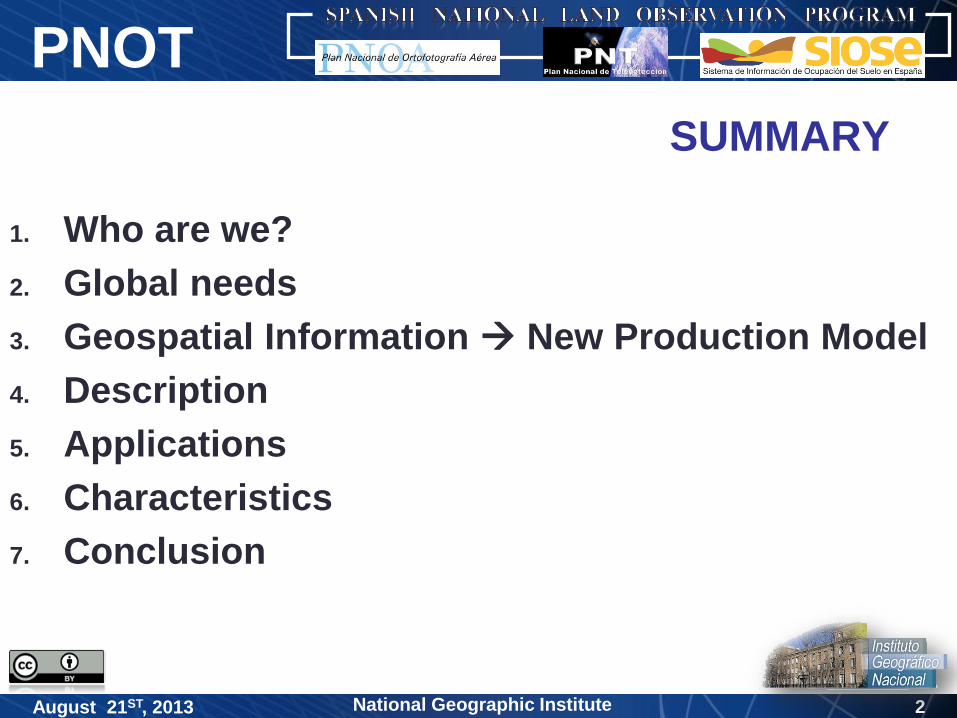
1. Who are we?
2. Global needs
3. Geospatial Information New Production Model
4. Description
5. Applications
6. Characteristics
7. Conclusion
3National Geographic Institute
PNOT
August 21ST, 2013
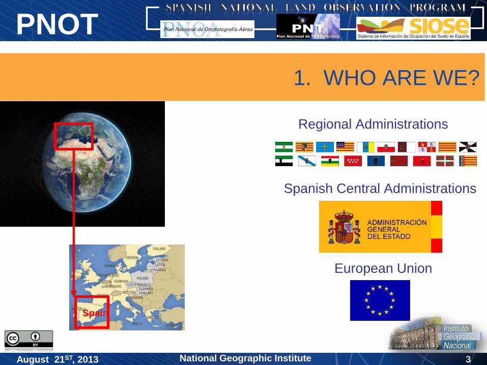
1. WHO ARE WE?
Regional Administrations
Spanish Central Administrations
European Union
Spain

4National Geographic Institute
PNOT
August 21ST, 2013
2. GLOBAL NEEDS
for Geospatial Information (GI) :
Cartography
Emergencies and security
Decision making
Environment
Land Management and Dynamic
SUSTAINABILITY
measurable and comparable in time
Agriculture
…
5National Geographic Institute
PNOT
August 21ST, 2013 5
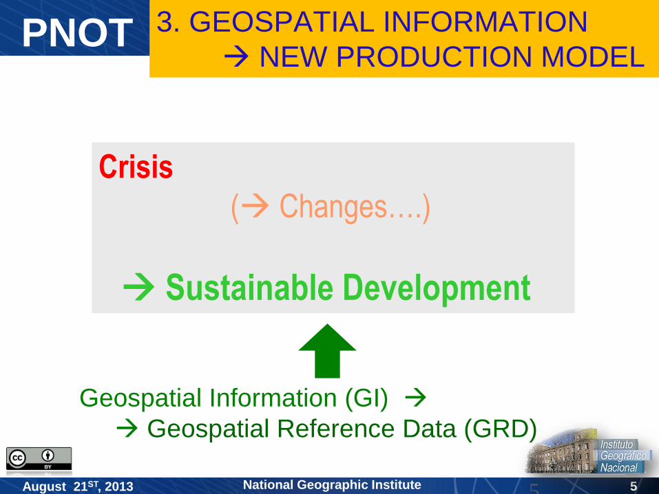
Crisis
( Changes….)
Sustainable Development
Geospatial Information (GI)
Geospatial Reference Data (GRD)
3. GEOSPATIAL INFORMATION
NEW PRODUCTION MODEL
6National Geographic Institute
PNOT
August 21ST, 2013 6
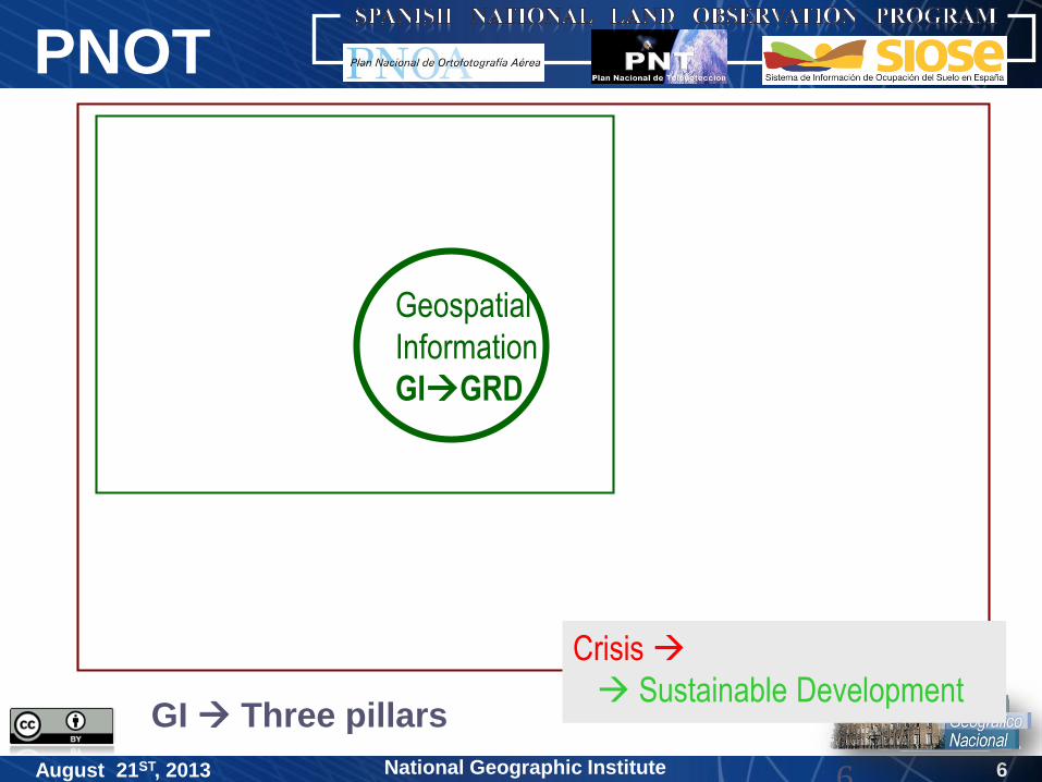
Geospatial
Information
GIGRD
Crisis
Sustainable DevelopmentGI Three pillars

7National Geographic Institute
PNOT
August 21ST, 2013 7
Geospatial
Information
GIGRD
Crisis
Sustainable DevelopmentGI Three pillars
Principles and characteristics GI/UN

8National Geographic Institute
PNOT
August 21ST, 2013 8
Geospatial
Information
GIGRD
Land Observation
Principles and characteristics GI/UN
Crisis
Sustainable Development
GI Three pillars
GI Three pillars

9National Geographic Institute
PNOT
August 21ST, 2013 9
Geospatial
Information
GIGRD
Land Observation
Crisis
Sustainable Development
Participating agents (public/private):
partners, collaborators, users
GI Three pillars
Principles and characteristics GI/UN
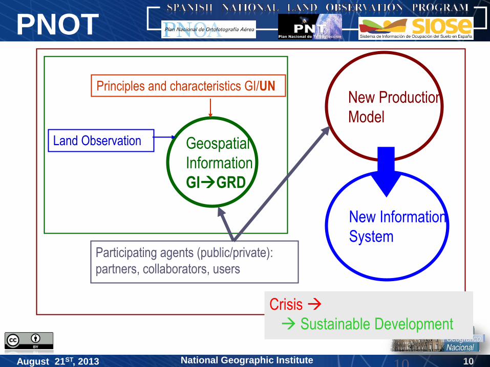
10National Geographic Institute
PNOT
August 21ST, 2013 10
Geospatial
Information
GIGRD
New Production
Model
Land Observation
Participating agents (public/private):
partners, collaborators, users
Crisis
Sustainable Development
New Information
System
Principles and characteristics GI/UN
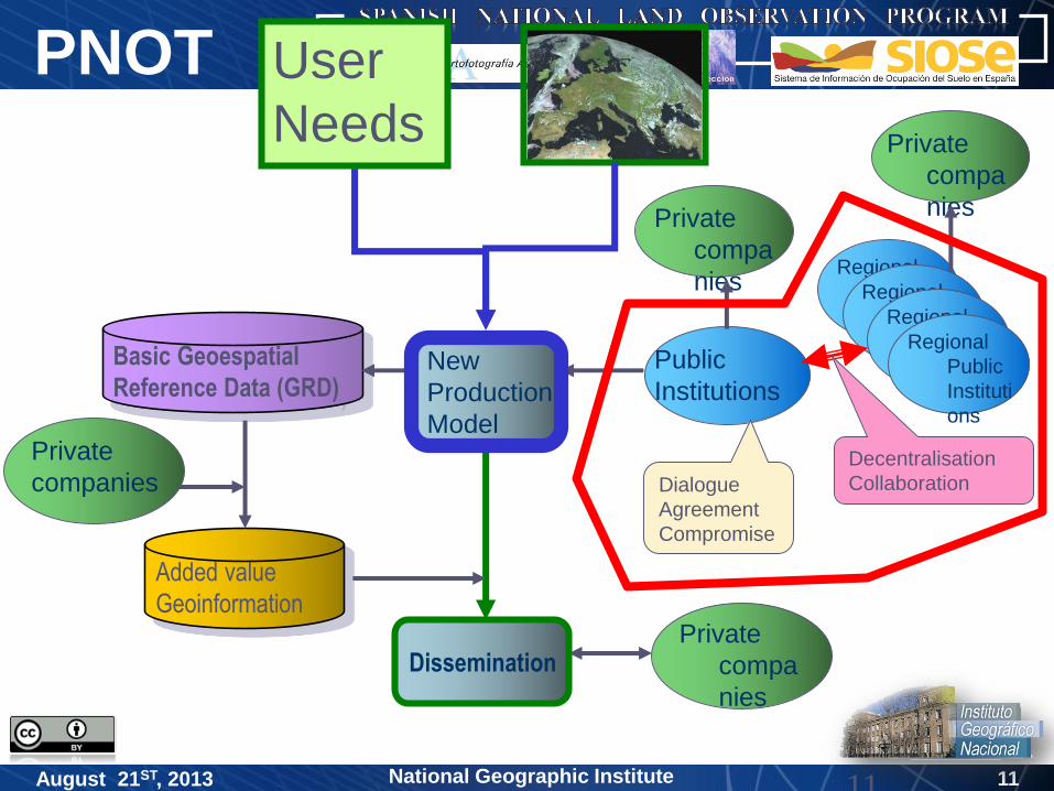
11National Geographic Institute
PNOT
August 21ST, 2013 11
Private
compa
nies
Basic Geoespatial
Reference Data (GRD)
Added value
Geoinformation
Public
Institutions
Private
companies
Regional
Public
Instituti
ons
Regional
Public
Instituti
ons
Regional
Public
Instituti
ons
Regional
Public
Instituti
ons
Private
compa
niesPrivate
compa
nies
Decentralisation
CollaborationDialogue
Agreement
Compromise
New
Production
Model
Dissemination
User
Needs

12National Geographic Institute
PNOT
August 21ST, 2013 12
Land(transmitter)
User/Client(receiver)
Expert Group/Topics
R+D+i
Process
Standarization
EU/ISO
OODMSpatial
Resolution
Quallity
Assurance
Plan
Data Type:
GRD + Them.D
CONTENTS
Production(cod):
Topics/Attributes
1:5.000
1:10.000
1:25.0001:50.000
1:100.000
1:200.000
1:500
1:1.000
1:2.000
Continuously Updated by topics/ attributes
Data
Dissemination
Land Observation
DI(s)Scales
New (integrated) Production Model
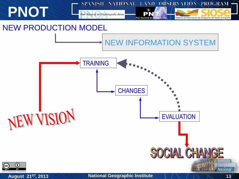
13National Geographic Institute
PNOT
August 21ST, 2013 13
TRAINING
CHANGES
EVALUATION
NEW INFORMATION SYSTEM
NEW PRODUCTION MODEL
14National Geographic Institute
PNOT
August 21ST, 2013
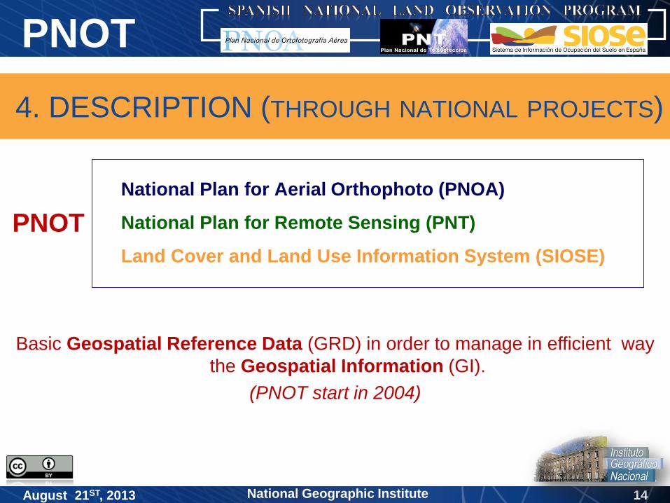
4. DESCRIPTION (THROUGH NATIONAL PROJECTS)
National Plan for Aerial Orthophoto (PNOA)
National Plan for Remote Sensing (PNT)
Land Cover and Land Use Information System (SIOSE)
PNOT
Basic Geospatial Reference Data (GRD) in order to manage in efficient way
the Geospatial Information (GI).
(PNOT start in 2004)

15National Geographic Institute
PNOT
August 21ST, 2013
4. DESCRIPTION (THROUGH NATIONAL PROJECTS)
Coordination and definition the acquisition of high resolution of
aerial images ( 10cm/50cm) and
accuracy digital terrain models ( 30cm)
(every 2/4 years)
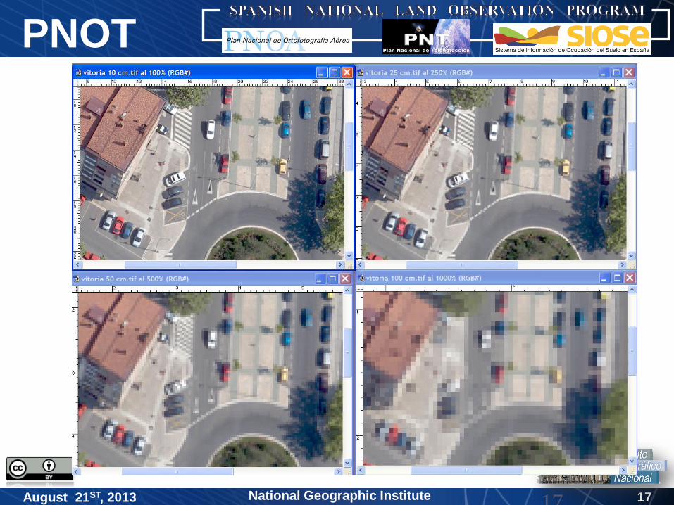
National Plan for Aerial Orthophoto (PNOA)

16National Geographic Institute
PNOT
August 21ST, 2013 16
Scales Resolutions (s)ema= maximum error sv= pixel size for visualisation
sc= pixel size for cartography
Scale ema(m) sv(m) sc(m)
1:25.000 5 2,50 1,25
1:10.000 2 1 0,50
1:5.000 1 0,50 0,25
1:1.000 0,20 0,10 0,05/0,10
17National Geographic Institute
PNOT
August 21ST, 2013 17

18National Geographic Institute
PNOT
August 21ST, 2013
Localization and capture : Dolinas
19National Geographic Institute
PNOT
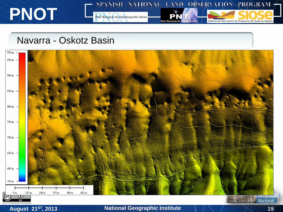
August 21ST, 2013
Navarra - Oskotz Basin
20National Geographic Institute
PNOT
August 21ST, 2013
National Plan for Remote Sensing (PNT)
Coordination in acquiring full coverage of images in Spain from the existing
Earth Observation satellites (high and medium resolution)
(every year)
4. DESCRIPTION (THROUGH NATIONAL PROJECTS)
21National Geographic Institute
PNOT
August 21ST, 2013 21
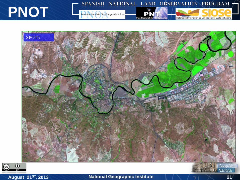
SPOT5

22National Geographic Institute
PNOT
August 21ST, 2013 22
SPOT5 Coverage
Total
scenes: 248
23National Geographic Institute
PNOT
August 21ST, 2013
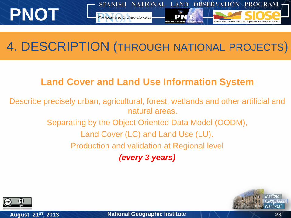
Land Cover and Land Use Information System
Describe precisely urban, agricultural, forest, wetlands and other artificial and
natural areas.
Separating by the Object Oriented Data Model (OODM),
Land Cover (LC) and Land Use (LU).
Production and validation at Regional level
(every 3 years)
4. DESCRIPTION (THROUGH NATIONAL PROJECTS)
24National Geographic Institute
PNOT
August 21ST, 2013
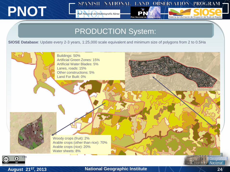
PRODUCTION System:
Mosaico PNOA, píxel de 25
cm
Mosaico SPOT, píxel de 2.5 m
Woody crops (fruit): 2%
Arable crops (other than rice): 70%
Arable crops (rice): 20%
Water sheets: 8%
Buildings: 50%
Artificial Green Zones: 15%
Artificial Water Blades: 5%
Lanes, roads: 15%
Other constructions: 5%
Land For Built: 0%
SIOSE Database: Update every 2-3 years, 1:25,000 scale equivalent and minimum size of polygons from 2 to 0.5Ha
25National Geographic Institute
PNOT
August 21ST, 2013
- Reference Information
- Security and Emergency
- Infrastructure
- Environment
- Land management
- Cadastre
- Geo-location
- Social and economic development
- Territorial policy
- Change detection
- Agriculture
- ….
National Plan for Aerial Orthophoto (PNOA)
National Plan for Remote Sensing (PNT)
Land Cover and Land Use Information System (SIOSE)
PNOT
GRD
5. APPLICATIONS

26National Geographic Institute
PNOT
August 21ST, 2013
Collaborative
Agreed
Coordinated
Coproduced
Cofunded
6. CHARACTERISTICS
Between All Public
Administrations

27National Geographic Institute
PNOT
August 21ST, 2013
Collaborative
Agreed
Coordinated
Coproduced
Cofunded
6. CHARACTERISTICS
Between All Public
Administrations
PNOT USERS
Data policy free and open
Economic savings
Unique data for all
Quality information
Increase the social cohesion

28National Geographic Institute
PNOT
August 21ST, 2013
7. CONCLUSIONS
Exportable model
Sustainable (cofunding)
Data policy (open and free data)
Thinking from the beginning to the users
Efficiency and cost reduction
Quality of Geographical Information services (based in high quality
of GRD)
The GRD produced inside PNOT (PNOA+PNT+SIOSE)
Authoritative and reliable Data Sets
29
National Geographic Institute (IGN)National Centre of Geographic Information (CNIG)
National Geographic InstituteAugust 21ST, 2013
Thanks for your attention
Antonio Arozarena Villar
National Geographic Institute
Madrid, SPAIN
[email protected] NATIONS
PUBLIC SERVICE AWARD 2013