mplnet (micropulse lidar network) - umbc (micropulse lidar network) ... likely choice for the pbl...
TRANSCRIPT
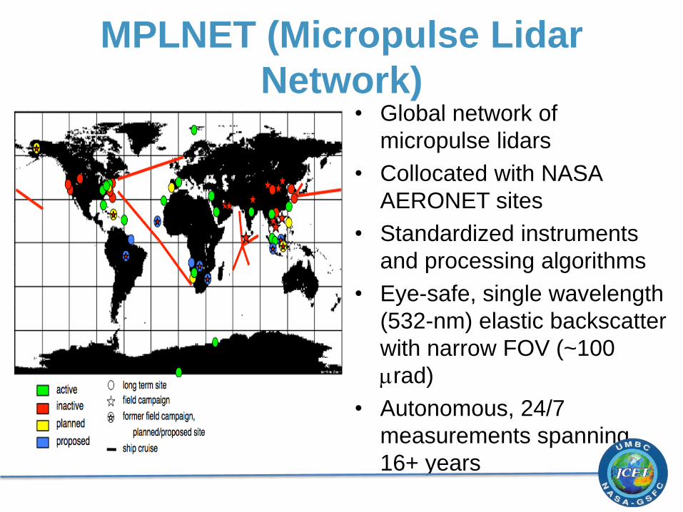
MPLNET (Micropulse Lidar
Network)• Global network of
micropulse lidars
• Collocated with NASA
AERONET sites
• Standardized instruments
and processing algorithms
• Eye-safe, single wavelength
(532-nm) elastic backscatter
with narrow FOV (~100
mrad)
• Autonomous, 24/7
measurements spanning
16+ years
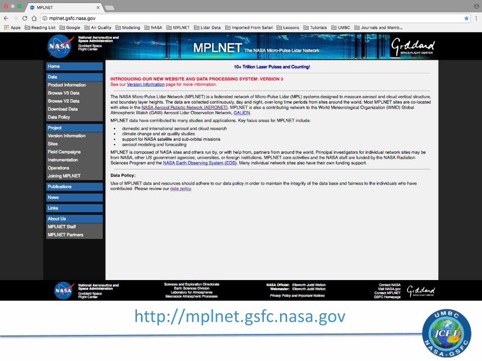
http://mplnet.gsfc.nasa.gov
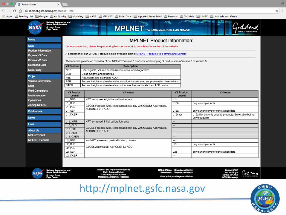
http://mplnet.gsfc.nasa.gov

V3 PBL Height Retrievals
• Wavelet covariance transform utilizes the first derivative of a Gaussian wavelet and a cloud-screened, five-minute average scattering ratio profile
• Canny edge-detection used to detect up to three possible features and fuzzy logic determines the most likely choice for the PBL top height
• A continuity scheme is used to reduce sudden changes in the PBL top height
• Citation: Lewis, J. R., E. J. Welton, A. M. Molod, and E. Joseph (2013), Improved boundary layer depth retrievals from MPLNET, J. Geophys. Res. Atmos., 118, 9870–9879, doi:10.1002/jgrd.50570

V3 PBL Height Retrievals
Issues with collapse and growth periods

Conducting an ongoing three -year study evaluating WRF simulations of the PBL over the Washington DC – Baltimore urban corridor
• Micro Pulse Lidar Network (MPLNET) MPLs and MiniMPLs
• NASA Langley Airborne High Spectral Resolution Lidar (HSRL)
• CALIPSO satellite measurements
• Complimentary ozonesondesand surface measurements
• NASA Award # NNH14CM13C
Simulating Spatiotemporal
Variability in an Urban Mixed Layer
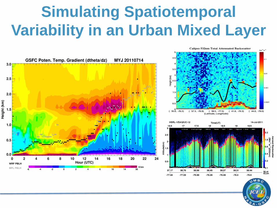
Simulating Spatiotemporal
Variability in an Urban Mixed Layer