mountain flying how not to die…. mountain flying
Post on 20-Dec-2015
238 views
TRANSCRIPT
Mountain FlyingMountain FlyingHow NOT to die…
Mountain FlyingMountain Flying
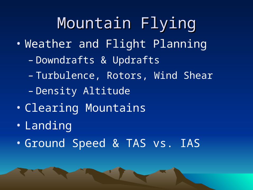
Mountain FlyingMountain Flying• Weather and Flight Planning
– Downdrafts & Updrafts
– Turbulence, Rotors, Wind Shear
– Density Altitude
• Clearing Mountains
• Landing
• Ground Speed & TAS vs. IAS

Mountain FlyingMountain Flying• Takeoff Distance
• Oxygen
• Forced Landings
• Course Reversal
• Emergency Gear
• Controlled Flight into Terrain (CFIT)
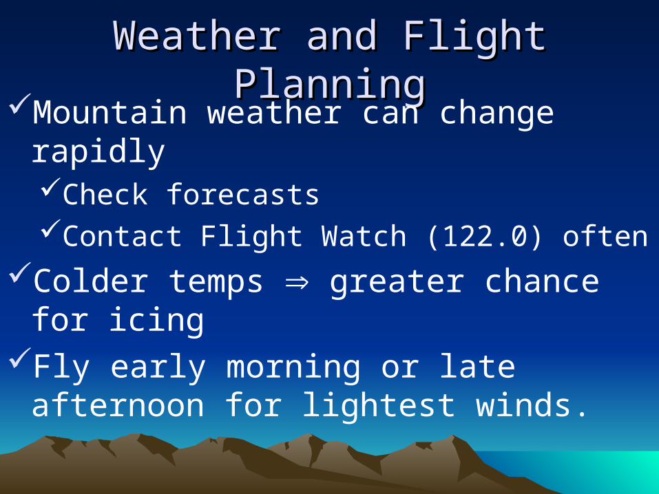
Weather and Flight PlanningWeather and Flight PlanningMountain weather can change rapidly
Check forecasts Contact Flight Watch (122.0) often
Colder temps greater chance for icingFly early morning or late afternoon for
lightest winds.
Weather and Flight PlanningWeather and Flight Planning VFR over high terrain may be impossible
Even though your departure/destination airports are experiencing good weather.
Colorado Pilots Association recommends at least 15 Miles visibility.
Weather and Flight PlanningWeather and Flight PlanningMountain flying is not a guaranteed go.
Check the forecast, and then test the waters.
If you like what you see initially, proceed; If not, turn back. Don't become too attached to completing
your flight.
Don’t go if the weather is doubtful.
Weather and Flight PlanningWeather and Flight PlanningIf stopping at multiple airports, use multiple
flight plans. In general, if you’ll be stopping at multiple airports on a
flight, it’s a good idea to use multiple flight plans. If your plane goes down in between two airports,
search crews will have a much better idea of where to look.
If one leg takes a bit more or less time than planned, the clock is reset when you open your next flight plan.
Weather and Flight PlanningWeather and Flight PlanningMake sure you know the winds aloft and
at your destination airports.Try to plan your route so you are flying on
upwind side of valleys and canyons.Always know where the wind is coming
from.
Weather and Flight PlanningWeather and Flight PlanningRotors/wind shear are basically
guaranteed at 20 kts, Especially on the lee side of a peak/ridge.
Use visualization to determine possible downdraft areas. Air behaves like water. Ask yourself, "What
would water do if it were flowing like the winds aloft?”
Weather and Flight PlanningWeather and Flight PlanningThe venturi effect in mountain passes can
increase wind velocity significantly.This can produce winds in passes that are
much stronger than winds aloft.Expect wind to be much greater velocity over
mountain passes than reported in areas a few miles away.
Weather and Flight PlanningWeather and Flight Planning Winds aloft greater than 30 knots
at cruise altitude usually means the novice pilot should delay or postpone the flight until more favorable conditions prevail.
Weather and Flight PlanningWeather and Flight PlanningWhen approaching a ridge:
Inbound: fly at 45 degree angle when ¼ to ½ mile out
Outbound: fly straight out (90˚ angle)get away as quickly as possible
Downdrafts can be smooth or rapid/joltingMonitor the VSI
A typical downdraft will produce a 1000 to 1500 fpm descent
Weather and Flight PlanningWeather and Flight PlanningIf caught in a downdraft
Apply max power, Lean (for best power)Do not pull up!
It’s very common for people to pull up and then stall or enter a spin.
People will often pull up and try to increase rate of turn by adding rudder.
This is a perfect recipe for entering a spin at high altitudes.
Weather and Flight PlanningWeather and Flight PlanningFly away at VA
This may increase rate of descent, but it will get you out of downdraft as quickly as possible.
The further you are from a ridge, the less turbulence and downdrafts you will experience.

Weather and Flight PlanningWeather and Flight PlanningDowndrafts on lee side of mountain
updrafts on windwardIf you get caught in a downdraft, look for an
area where the wind may be rising.Find rising air and then perform shallow turns
to remain in the updraft.It may be necessary to fly toward a
windward slope or some distance downwind before the aircraft can establish a positive rate of climb.
Weather and Flight PlanningWeather and Flight PlanningMost accidents caused by downdrafts are
due to the pilot's concern about altitude loss.Don’t try to out-climb a downdraft.Instead, try to escape away from the ridge
that is causing the downdraft.
Weather and Flight PlanningWeather and Flight PlanningIf lift (updrafts/downdrafts) is not a factor,
fly on the appropriate side of the valley so that your 180˚ exit turn can be made into the wind.
Weather and Flight PlanningWeather and Flight PlanningEstablish 2000 to 3000' clearance over
mountainsPlan to cross mountains at least 2,000 feet
above the highest point along the route.This altitude should be reached well in
advance, as some terrain will rise faster than the aircraft climb rate.

Weather and Flight PlanningWeather and Flight PlanningLenticular clouds = extreme turbulenceMountain waves can extend for tens or
hundreds of milesIn heavy turbulence, fly an attitude and
accept altitude lossDon't over-stress the airframe
Weather and Flight PlanningWeather and Flight PlanningDon’t rely on cloud shadows for wind
direction Expect the wind to be constantly changing in
direction and velocity because of modification by mountain ridges and canyons.
Don’t fly the middle of a canyon. This places you in a poor position to make a
turnaround and it subjects you to shear turbulence.
Fly on the downwind side of canyons to catch updrafts.
Weather and Flight PlanningWeather and Flight PlanningIf you need to make a tight turn slow
down. Flying slower provides for a more reaction
time and a tighter turning radius.
Weather and Flight PlanningWeather and Flight PlanningThere are three important factors that
affect air density: altitude, temperature, and humidity.
Weather and Flight PlanningWeather and Flight Planning Calculate density altitude before your flight.
Density altitude is the altitude the airplane thinks it is at and performs in accordance with.
High, hot, and humid conditions may raise the effective physical altitude of an airstrip to a performance altitude many thousands of feet higher than its actual elevation.
Be familiar with the performance of your aircraft at altitude: service ceiling, takeoff and landing distance, climb rate. The horsepower output of the engine is decreased because its fuel air mixture
intake is reduced. Normally aspirated engines lose about 3 percent of their horsepower for each
1,000 feet above sea level. For a normally aspirated engine, the maximum power you can generate at 7500’
is 75%. The propeller develops less thrust because the blades are less efficient. The wings develop less lift because the less dense atmosphere exerts less force
on the wings as airfoils. As a result, the takeoff distance is increased and the climb performance reduced.
Weather and Flight PlanningWeather and Flight Planning Know the performance of your airplane:
VY decreases with altitude. As a rule of thumb, subtract 1kt for every 1,000 feet of density altitude.
VG decreases as weight decreases. As a rule of thumb, VG decreases 2kts for every 10% under maximum gross
weight. Weight and density altitude are the two most important factors
when considering the appropriate airspeed to fly for best rate of climb or best glide. Learn to interpolate to figure the proper performance data before you
need it. Don't use short field flap settings for high density altitude
takeoffs (unless the field is truly short.) Short field flap settings offer a better angle, not rate of climb. At the typically long high-elevation airports flaps will be a hindrance to
reaching VY more quickly.
Weather and Flight PlanningWeather and Flight PlanningA good way to compensate for lower
power is to be light. As a rule of thumb, being 10% under
maximum gross weight provides a 20% performance benefit over the POH numbers.
Clearing MountainsClearing MountainsThe visual aspects of mountain flying can
be deceiving. but if you can see more and more of the
terrain on the other side of the ridge you are approaching, you are higher than the ridge and can probably continue.
Plan every ridge crossing as though an engine failure was imminent.
Clearing MountainsClearing MountainsBASIC PREMISE #1
Always remain in a position where you can turn toward lowering terrain.
This axiom also encompasses the idea that you will not enter or fly in a canyon where there is not sufficient room to turn around. Another way of stating this truth is to have an escape route in mind and be in a position to exercise this option.
• Sparky Imeson “The Mountain Flying Bible”
Clearing MountainsClearing MountainsBASIC PREMISE #2
Do not fly beyond the point of no return.This is the position when flying upslope terrain where, if you reduce
the throttle to idle and begin a normal glide, you will have sufficient altitude to turn around without impacting the terrain.
As you near the ridge, when arriving at a position where the power can be reduced to idle and the airplane will glide to the top of the ridgeline, a commitment to cross the ridge can be made.
At this position, the airplane is close enough to the ridgeline not to experience an unexpected downdraft of a nature that will cause a problem.
If a downdraft is encountered, keep the power on, lower the nose to maintain airspeed and the airplane will clear the ridge.
• Sparky Imeson “The Mountain Flying Bible”
Clearing MountainsClearing MountainsRealize that the actual horizon is near the
base of the mountains. This mistake of using the summit of the
peaks as the horizon will result in the aircraft being placed in an attitude of constant climb.
This could inadvertently lead to stall from which a recovery may be impossible.
LandingLandingLanding at a short mountain strip requires
exact airspeed control to eliminate float. A 10% increase in the proper approach
speed results in a 21% increase in landing distance.
LandingLandingMake sure to richen mixture for go-aroundMomentarily increase to full power when close to
pattern altitude, but makes sure you have enough time to loose the airspeed you’ve gained. Richen to 50˚ – 100 ˚ rich of peak EGT.
(50 ˚ is good for small engines, 100 ˚ good for high performance)Depending on your altitude, cruise power at high
elevation is likely to also be maximum power. If this is the case, your fuel-air mixture is already properly set
and requires no adjustment for landing.See your airplane’s POH for the manufacturer’s
recommended leaning procedures.
LandingLanding"The most common problem for
flatlanders is the tendency to fly the approach below the normal indicated airspeed for landing. Thus, an area of heavy emphasis for mountain flying is to fly by the numbers and approach to land at the normal indicated airspeed.“ - Colorado Pilots Association
LandingLandingFor safety from eddies, wind shear, and
gusty conditions, plan your approach using the runway numbers as your aim pointFlare 500 feet down the runway, and try to
touch down on the 1,000 ft. marks. High altitude runways are quite long and this
provides insurance in case of a severe downdraft.
LandingLandingBe certain to use the same indicated
airspeed at high-altitude airports that you use at low-altitude or sea level airports for the takeoff or for the approach to landing.
When flying to remote airports, before landing, first overfly the field to check for wildlife and runway conditions.
If you haven’t landed by ½-way down the runway, you should abort the landing.
LandingLandingRunway Illusions:
You’ll look high due to narrow runwaysYour eyes tend to focus on rising
terrain/ridges.This will cause you to come in high if a hill is
near the runway.
LandingLandingSloping runways are common in
mountainsThis can create illusions of being too high
(upside) or too low (downslope)The slope will also affect takeoff and landing
distance.This can be a very significant important
factor at mountain airports.

Ground Speed & TAS vs. IASGround Speed & TAS vs. IASRoughly, the TAS increases by 2% over IAS
for every thousand feet altitude gain.This implies that at 10,000’ the TAS will be about
20% higher (if calculated accurately it’s actually closer to 15%)
This is a built-in compensator for reduced lift caused by the thin air at higher altitude airports.
Ground speed will be much higher, visual queues will be very different.
Since TAS is higher, you’ll need to fly pattern wider than normal.

Takeoff DistanceTakeoff DistanceBefore landing at a mountain airport, make sure you
can climb back out. One technique you can use is to overfly the field at, say,
1500 feet AGL and apply full power. If you don’t achieve at least 300fpm climb rate, you probably
shouldn’t land.A rule-of-thumb for operating from a short runway is that if
you obtain 71% of the speed necessary for rotation at the ½-way point of the runway, you can take off in the remaining distance.Calculate this speed beforehand and review it as part of your pre-
takeoff briefing.E.g. VR=55kts - need to obtain 39kts at ½-way point.The ½-way point should be treated as a solid abort point.
Takeoff DistanceTakeoff DistanceBefore takeoff, you must lean for max power
For a plane with a direct drive engine and a fixed pitch propeller, before takeoff, hold the brakes, apply full throttle, lean to peak RPM (or 50˚ – 100 ˚ rich of peak EGT). Leave mixture at that position and accomplish the takeoff.
For a plane with a constant speed propeller, leaning is normally done using the EGT. See your POH for the manufacturer’s recommendation.

Takeoff DistanceTakeoff DistanceThe takeoff distance varies with the gross
weight.A 10% increase in gross weight will cause:
5% increase in speed required for takeoff.9% decrease in acceleration (from stop to takeoff
speed).21% increase in takeoff distance.
You may not want full fuel on takeoff from a high-altitude airport.
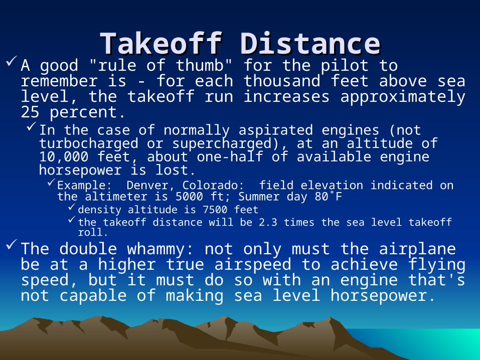
Takeoff DistanceTakeoff DistanceA good "rule of thumb" for the pilot to remember is -
for each thousand feet above sea level, the takeoff run increases approximately 25 percent. In the case of normally aspirated engines (not turbocharged
or supercharged), at an altitude of 10,000 feet, about one-half of available engine horsepower is lost.Example: Denver, Colorado: field elevation indicated on the
altimeter is 5000 ft; Summer day 80˚F density altitude is 7500 feet the takeoff distance will be 2.3 times the sea level takeoff roll.
The double whammy: not only must the airplane be at a higher true airspeed to achieve flying speed, but it must do so with an engine that's not capable of making sea level horsepower.
OxygenOxygenDensity altitude can be much higher than indicated
The effect of altitude on your body depends on the partial pressure of oxygen.
Note that altimeters show pressure altitude (corrected for local altimeter setting).
The U.S. Air Force recommends using oxygen starting at 8000ft.
FAA regulationsNo O2 required until 12500 (although not required, it is
recommended)Between 12500 and 14000, after ½ hourHigher than 14000, continuousHigher than 15000, must be provided for passengers
OxygenOxygen Night vision is inhibited above 5000’ pressure altitude. Cannulas can't be used above 18000'
Manufacturers prohibit use above this altitude. Above this altitude, up to 25,000’ you can use an oxygen mask.
Regulator and flow meters fail, valves freeze, and lines plug up, so always be prepared to descend. It may make sense, because of the increased risk, to plan a flight at, say,
16,000’ vs. 22,000’. The time of useful consciousness at 20,000’ is 30 minutes At 22,000’, the time of useful consciousness is about 10
minutes. Time of useful consciousness is sometimes also referred to as EPT, or
Effective Performance Time.

OxygenOxygenOxygen bottles are normally low pressure
500 PSI, or high pressure
1800 PSI is the most common variety.The 1800 PSI bottles are green.
Oxygen bottles need to be re-certified every 5 years.

OxygenOxygenIt is a good idea to consider oxygen for flights
above 5,000 feet at night and above 8,000 feet during the day.
Use of pulse oximeterhttp://www.flightstat.nonin.com/Hypoxia.pdfhttp://www.radialsolutions.com/
A general rule-of-thumb for using a pulse oximeter is to never let your oxygen saturation level get more than 10 percentage points below your home (ground level) saturation level.
Forced LandingsForced LandingsDon’t choose a route that would prevent a
suitable forced-landing areaIn the event of a forced landing, approach at
best glide, but touch down / impact at stall speed.
Don’t leave the airplane without a compelling reason if you have executed an emergency or precautionary landing.Temporary evacuation may be necessary if a fire
hazard exists.
Forced LandingsForced LandingsIf you have a choice between landing in light
green trees or dark green, head toward the light. Light green trees are more pliable, younger than
dark green trees.Don’t land in water.
You’ll flip upside down and, since the plane won’t be visible, it’s less likely than you’ll be found.
Also, mountain water is cold and you could contract hypothermia.
Forced LandingsForced LandingsFollow roads whenever possible.Avoid flying over open water (Lake Tahoe,
e.g.).Plan your trip along routes that include
populated areas and well-known passes, or over valleys whenever possible.
Forced LandingsForced LandingsFollow roads whenever possible.Avoid flying over open water (Lake Tahoe,
e.g.).Plan your trip along routes that include
populated areas and well-known passes, or over valleys whenever possible.
Swaths cut through trees are usually power lines. It’s usually best to avoid them.

Forced LandingsForced LandingsELT
Learn how to turn it on.The ELT may not turn on automatically in a
forced landing, so you may need to arm it manually.
Course ReversalCourse ReversalEveryone flying in the mountains will encounter
situations when it becomes necessary to make a 180˚ turn. To turn around, slow down. This will decrease the
radius of turn. Pull back on the control wheel to trade airspeed for
altitude if you have extra speed. Then make the steepest turn you can comfortably
make, up to 60 degrees.To execute a course reversal in IMC and end
up over the same spot turn 90˚ followed by 270˚ an 80˚ /260˚ also works

Emergency GearEmergency Gear Warm clothes Blankets or sleeping bags Food Water Flashlights Fire starter Radio Signaling mirror Maps Compass Wear or bring shoes you can use for hiking
Always bring emergency gear when flying in the mountains.
Controlled Flight Into TerrainControlled Flight Into TerrainControlled Flight into Terrain (CFIT)
occurs when an airworthy aircraft under the control of a pilot is inadvertently flown into terrain, water, or an obstacle with inadequate awareness on the part of the pilot of the impending disaster.
Cumulo-granite
Controlled Flight Into TerrainControlled Flight Into TerrainAccidents occur most frequently in GA operations
4.7% of all GA accidents and 32% of GA accidents in IMC.On average there are 1.4 fatalities per CFIT accident, versus
0.33 fatalities per GA accident overall.17% of all GA fatalities are due to CFITCFIT accidents are fatal 58% of the time.CFIT accidents occur 64% of the time in daytime and
36% at night 51% of CFIT accidents occur in IMC, 48% in VMC and
1% unknown. Impacted terrain was flat 45% and mountainous 55%.
Controlled Flight Into TerrainControlled Flight Into Terrain• NTSB Identification: DEN07FA054
14 CFR Part 91: General AviationAccident occurred Wednesday, January 17, 2007 in Centennial, WYAircraft: Piper PA-28-180, registration: N43630Injuries: 3 Fatal.
• This is preliminary information, subject to change, and may contain errors. Any errors in this report will be corrected when the final report has been completed.
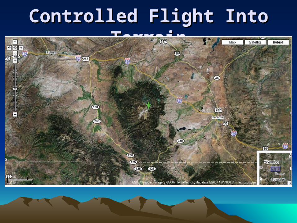
•On January 17, 2007, approximately 2215 mountain standard time, a Piper PA-28-180, N43630, registered to Archer Nevada LLC, and piloted by a private pilot, was destroyed when it impacted mountainous terrain during cruise flight, 6 miles northwest of Centennial, Wyoming. Night visual meteorological conditions prevailed. The personal flight was being conducted under the provisions of Title 14 Code of Federal Regulations Part 91 on a visual flight rules flight plan. The pilot and his two passengers were fatally injured. The cross-country flight departed the Rock Springs-Sweetwater County Airport (RKS) approximately 2115, and was en route to Grand Island, Nebraska (GRI).
Controlled Flight Into TerrainControlled Flight Into Terrain• According to Blue Ridge Aeronautics, a flight school in
Vacaville, California, the flight departed Nut Tree Airport (KVCB) approximately 1100 Pacific standard time. The flight was to travel to Grand Island, Nebraska, on the 17th and continue on to Chicago, Illinois, on the 18th. The pilot reported to the flight school that he intended to follow Interstate 80 for the entire flight.
According to the airport manager in RKS, the airplane arrived approximately 2030 and obtained fuel services. The airplane did not arrive in GRI and an Alert Notification (ALNOT) was issued for the missing airplane. According to National Track Analysis Program (NTAP), the airplane was tracked from RKS to 10 miles west of Centennial. Search and rescue crews located the airplane wreckage approximately 0830 on the morning of January 19th.
Controlled Flight Into TerrainControlled Flight Into Terrain• The National Transportation Safety Board investigator-in-charge arrived on
scene approximately 1300 on January 19, 2007. The accident site was located in mountainous, forested, snow covered terrain. A global positioning system receiver reported the coordinates of the main wreckage as 41 degrees 21 minutes 58.6 seconds north latitude, and 106 degrees 15 minutes 29.6 seconds west longitude. The accident site was at an elevation of 10,710 feet mean sea level and the airplane impacted on a magnetic heading of 260 degrees. The wreckage consisted of the fuselage, empennage, and the left wing. The right wing separated partially and was found adjacent to the belly of the fuselage. The wreckage came to rest inverted in approximately 3 to 5 feet of snow.
The closest official weather observation station was Laramie Regional Airport (KLAR), Laramie, Wyoming, located 27 nautical miles (nm) east of the accident site. The elevation of the weather observation station was 7,278 feet msl. The routine aviation weather report (METAR) for LAR, issued at 0953, reported, winds, 290 degrees at 9 knots, gusting to 18 knots, visibility, 10 statute miles; sky condition, clear; temperature minus 10 degrees Celsius (C); dewpoint, minus 18 degrees C; altimeter, 29.94 inches.
Controlled Flight Into TerrainControlled Flight Into Terrain
Further StudyFurther StudyFor Further Study
http://www.mountainflying.com/Books by Sparky Imeson
“The Mountain Flying Bible”“The Shirt Pocket Mountain Flying Guide”
Order them here: https://secure.airbase1.com/mtnflying/orders.asp
"Hypoxia, Oxygen and Pulse Oximetry," Furgang, Fred, MD.http://www.flightstat.nonin.com/Hypoxia.pdf
Pulse Oximetry and the Oxyhemoglobin Dissociation Curvehttp://www.continuingeducation.com/nursing/pulseox/pulseox.pdf