modern world history maps topic 1: pre-renaissance
TRANSCRIPT

Modern World History Maps
• Topic 1: Pre-Renaissance


First and Third Crusades
This map shows the routes taken by some of the major European armies during the First and Third crusades. The First Crusade began in 1096 and ended in 1099. Key European leaders in the crusade included Robert of Flanders, Raymond of Toulouse, Godfrey of Bouillon, and Bohemond of Taranto. The crusaders traveled from Europe toward Constantinople (now Istanbul, Turkey) and then marched toward Jerusalem. They succeeded in capturing Jerusalem. They also established the crusader states: Edessa, Antioch, Tripoli, and Jerusalem.The Third Crusade began in 1189 and ended in 1192. Important European leaders of the Third Crusade were Frederick I of Germany, Philip II of France, and Richard I of England. The crusaders failed to recapture Jerusalem. But they recovered the Palestinian coastline and won an agreement with the Muslims to permit Christians to visit Jerusalem.
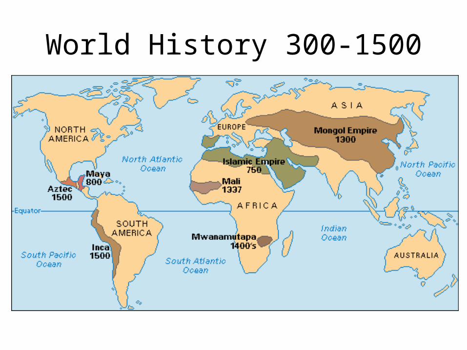
World History 300-1500

Holy Roman Empire c. 1250 C.E.
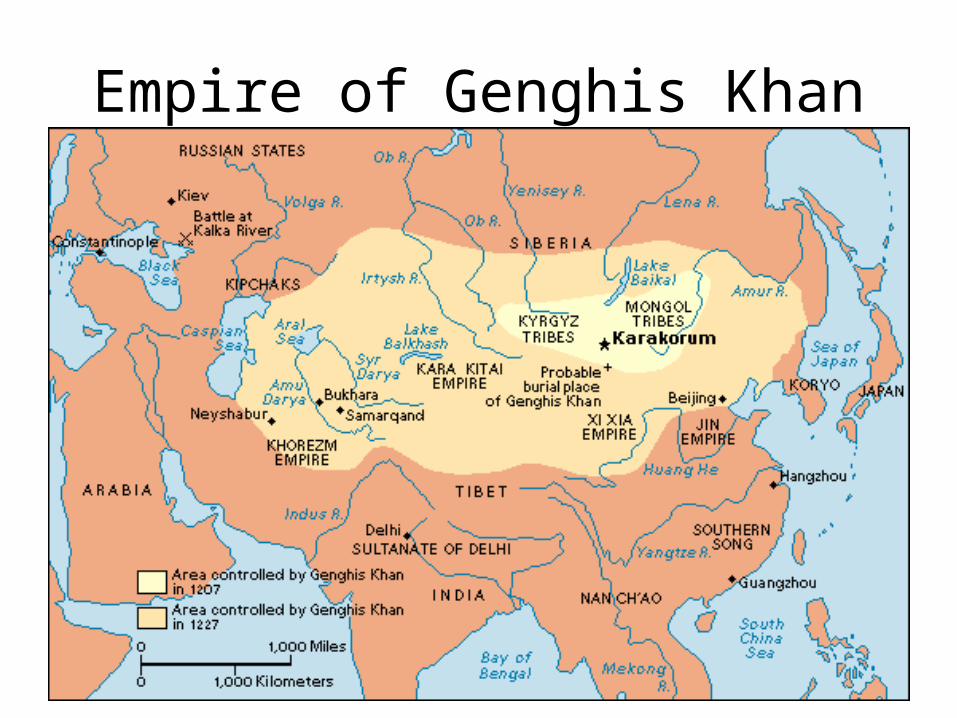
Empire of Genghis Khan

Empire of Kublai Khan

Yuan Dynasty
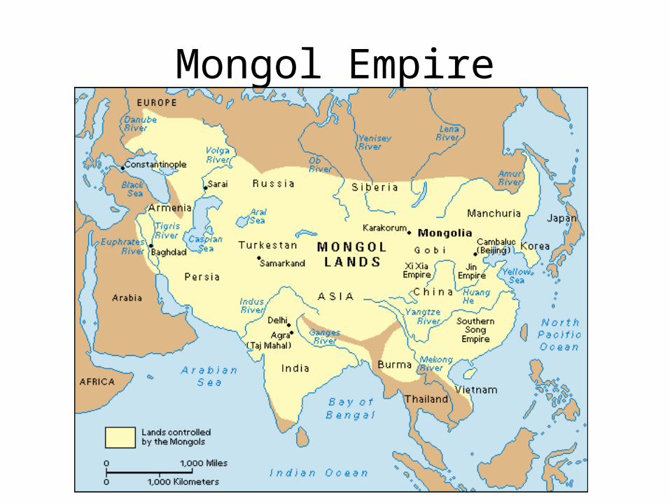
Mongol Empire

World known by Europeans in 1300

Africa in the 1400s

Kingdom of Mali 1337 C.E.

Topic 2: Renaissance & Reformation

Renaissance Italy

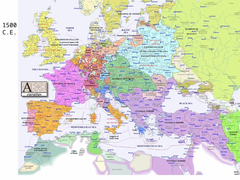
Italy in 1500

Ottoman Empire


Bohemia

Religious Trends in Europe c. 1560

Topic 3: Exploration
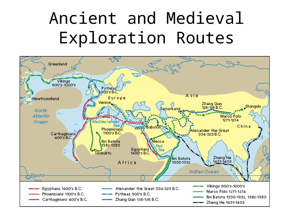
Ancient and Medieval Exploration Routes

Exploration by the Vikings

Marco Polo’s Routes
The map is hyperlinked to the map’s web site. Click it while running the slide show to see Magellan’s route animated.

Silk Road
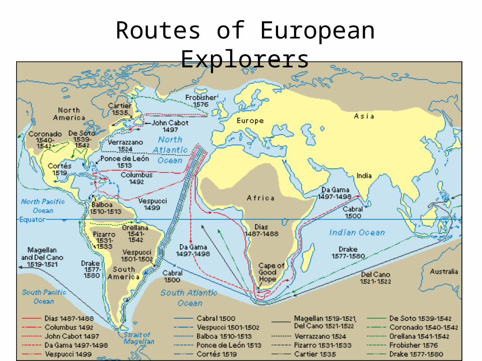
Routes of European Explorers
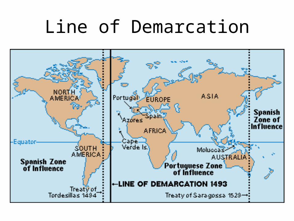
Line of Demarcation

Magellan’s Circumnavigation
The map is hyperlinked to the map’s web site. Click it while running the slide show to see Magellan’s route animated.
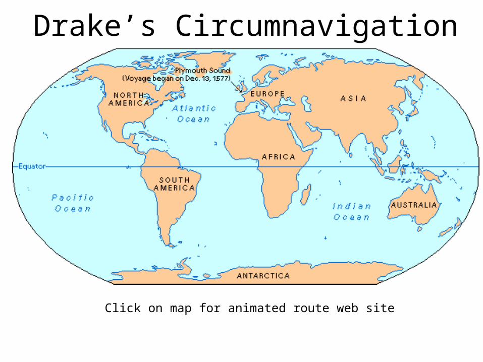
Drake’s Circumnavigation
Click on map for animated route web site

European Exploration of
Africa
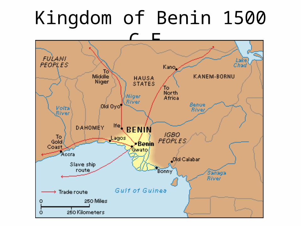
Kingdom of Benin 1500 C.E.

Songhai Empire c.1500

Early Exploration
of Latin America

European Exploration

Voyages of Columbus
Show in slide show mode to display animation of voyages.

Cortes’ Expeditions

Northwest Passage

Land of the Maya

Aztec Empire
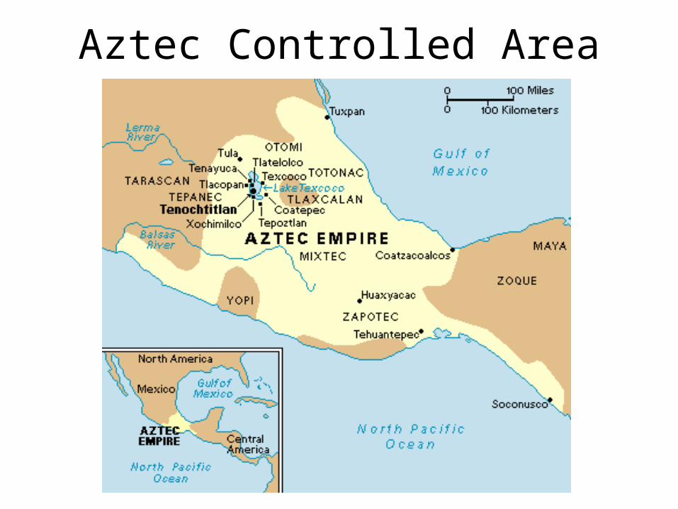
Aztec Controlled Area
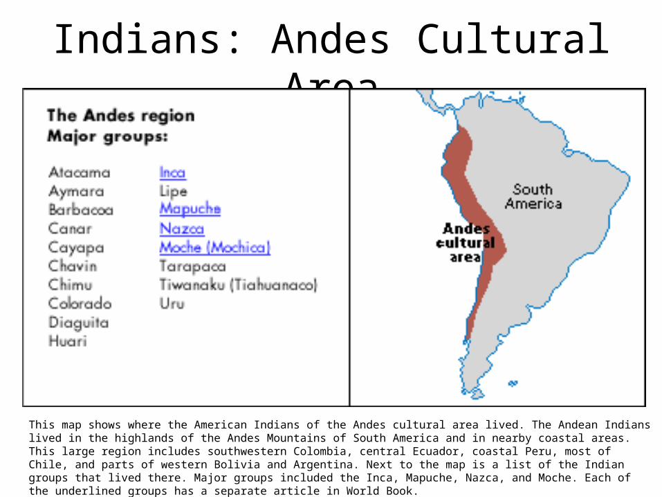
Indians: Andes Cultural Area
This map shows where the American Indians of the Andes cultural area lived. The Andean Indians lived in the highlands of the Andes Mountains of South America and in nearby coastal areas. This large region includes southwestern Colombia, central Ecuador, coastal Peru, most of Chile, and parts of western Bolivia and Argentina. Next to the map is a list of the Indian groups that lived there. Major groups included the Inca, Mapuche, Nazca, and Moche. Each of the underlined groups has a separate article in World Book.
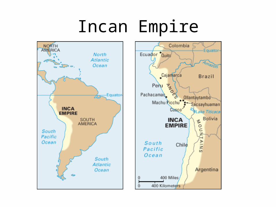
Incan Empire

Ponce De Leon’s Exploration Route

Indians: CaribbeanThis map shows where the American Indians of the Caribbean cultural area lived. The area includes the southern half of Central America, the northern parts of what are now Colombia and Venezuela, and the islands of the Caribbean Sea. Next to the map is a list of the Indian groups that lived there. Major groups included the Arawak, Carib, and Chibcha. Each of the underlined groups has a separate article in World Book.

Champlain’s Exploration

Vespucci’s Exploration
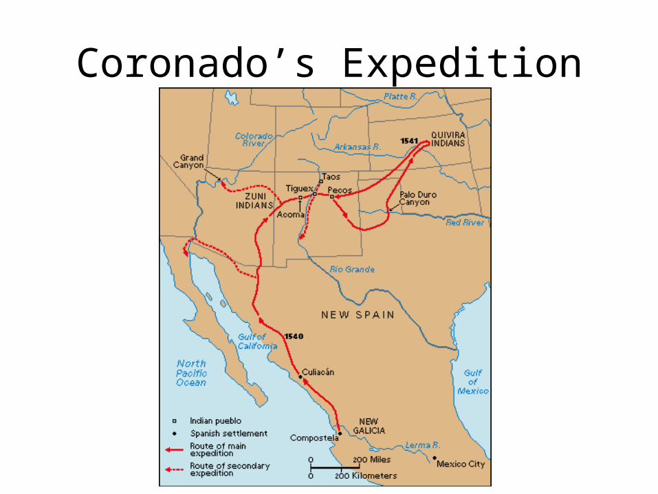
Coronado’s Expedition
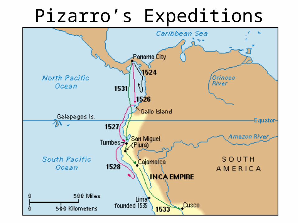
Pizarro’s Expeditions

Exploration of North America

Portugal’s Empire

Spanish Empire 1588

Latin America c.1790
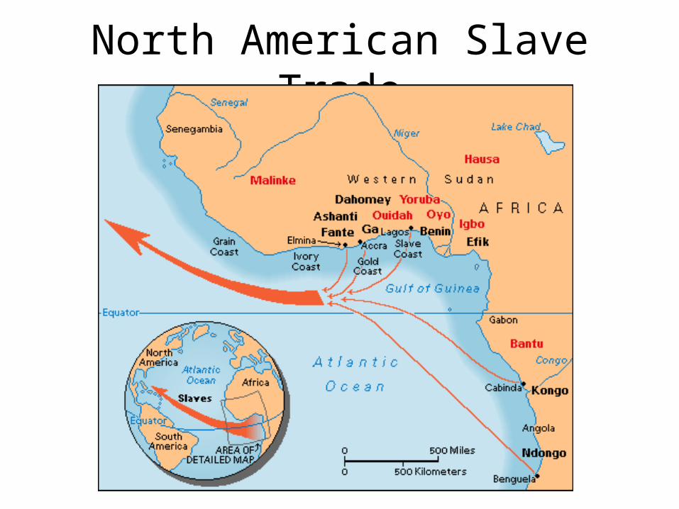
North American Slave Trade

Canary Islands

Trade Winds

Native American Cultural Regions

Indians: California
This map shows where the American Indians of the California cultural area lived. The area includes much of California. The area extends from the southern edges of Oregon in the north to Baja, in Mexico, in the south. It stretches from the Sierra Nevada in the east to the Pacific Ocean in the west. Next to the map is a list of the Indian groups that lived there. Major groups included the Chumash, Miwok, Pomo, and Wintun. Each of the underlined groups has a separate article in World Book.

Indians: Great Basin

Indians: Middle Americas

Indians: Northeast

Indians: Northwest

Indians: Plains

Indians: Plateau

Indians: South America
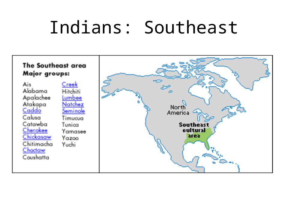
Indians: Southeast

Indians: Southwest

Indians: Subarctic

Inuit Lands

Indians: Tropical Forest
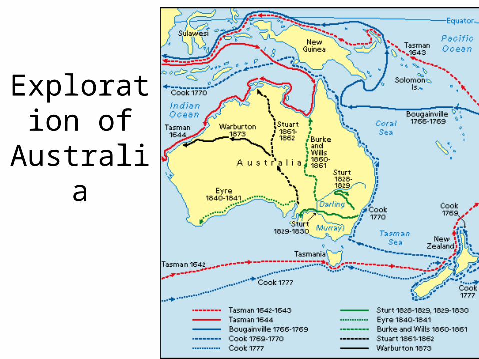
Exploration of Australia

Antarctic Exploration

Indians: Arctic Area

Topic 4: Absolutism Challenged

Hapsburg Lands

Sweden: Wars of the 1500s & 1600s

Swiss Expansion 1291-1815

English Civil War

Low Countries

Dutch Land Reclamation

Prussia

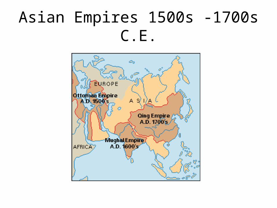
Asian Empires 1500s -1700s C.E.

Ottoman Empire mid 1500s

Ottoman Empire in 1683

Russian Expansion
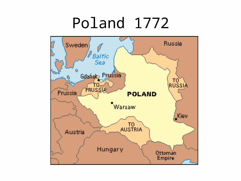
Poland 1772

Poland 1793

Poland 1795

Topic 5: Napoleon and French Revolution

13 British Colonies

Treaty of Paris of 1783
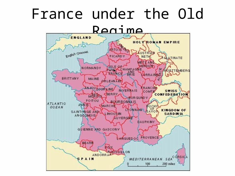
France under the Old Regime

French Revolution

Napoleon’s Empire: 1812

Napoleon’s Empire II

Topic 6: Industrial Revolution

England in 1701 and 1911

Industrial Revolution England: 1800s

Coal Deposits Eastern Hemisphere
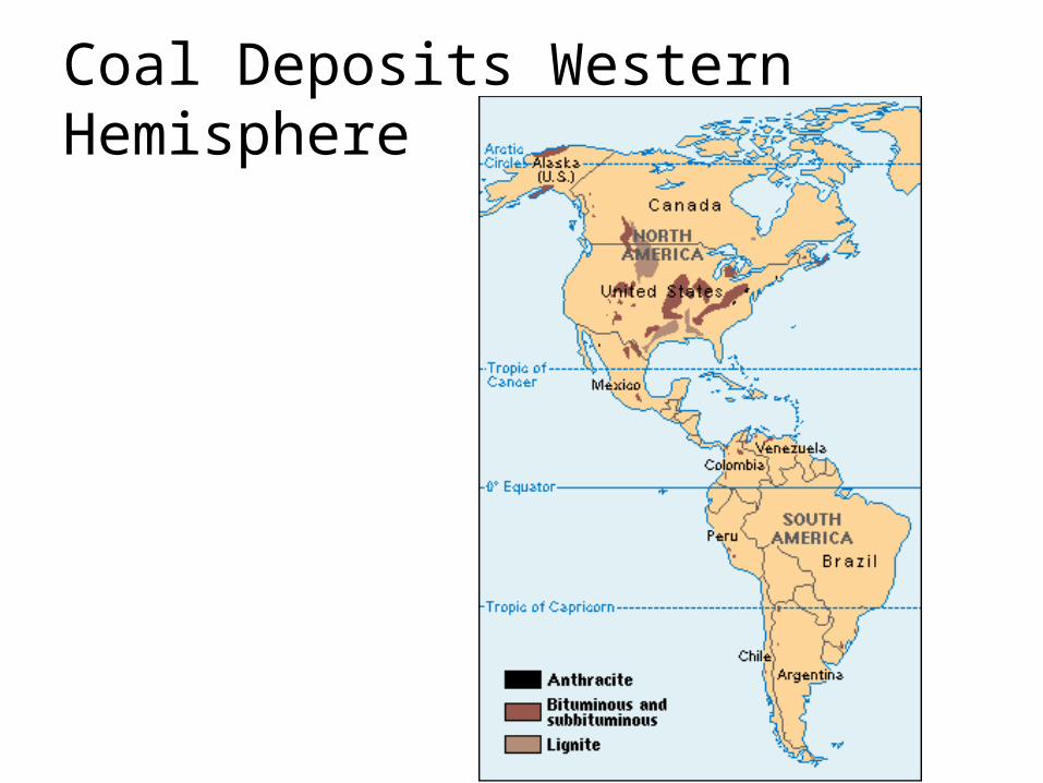
Coal Deposits Western Hemisphere

Iron and Steel: Eastern Hemisphere

Iron and Steel: Western Hemisphere
Topic 7: Nationalism


Unification of Germany
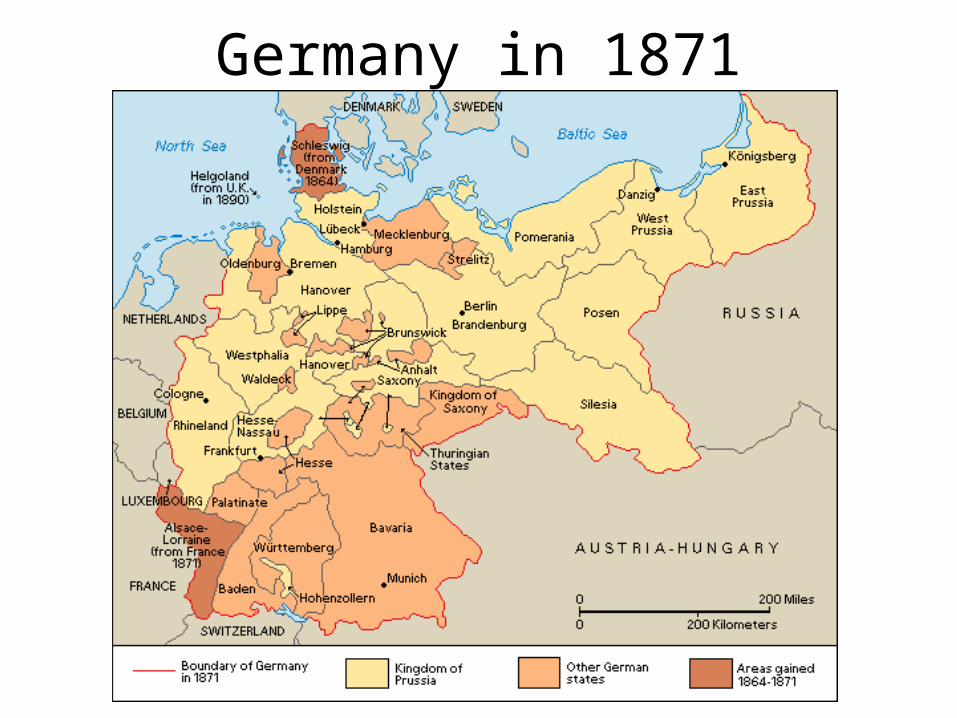
Germany in 1871

Unification of Italy

Unification of Italy II

Latin America c. 1800

Modern Latin America

Romania in 1861


Topic 8: Imperialism

British Empire Under Victoria

Colonial Empires

The British Empire
This map shows territories held by the British colonial empire and those held by the United Kingdom today. England held the American Colonies from the early 1600's until the 1770's. From the mid-1700's to the early 1900's, the British Empire expanded to include Australia, Canada, India, New Zealand, islands in the Pacific Ocean and in the Caribbean Sea, and many territories in Africa.This map also shows those areas that are overseas territories of the United Kingdom today, including the British Antarctic Territory, Bermuda, the Cayman Islands, Gibraltar, and Pitcairn Island.

British Commonwealth

British India

French Colonial Empire

British East India Company

Colonialism in the Americas

Colonialism in Asia

Mughal Empire 1526 C.E.
This map shows the location of the Mughal Empire. Central Asian Muslims established the empire in 1526. By about 1600, the Mughals controlled most of what are now north and central India, Afghanistan, Bangladesh, and Pakistan. The empire lasted until the 1700's.

Expansion of Egypt

Expansion of Greece (1832-1947)

African Imperialism and Exploration

Africa in 1914

African Exploration by Stanley and Livingstone

Great Trek

Suez Canal
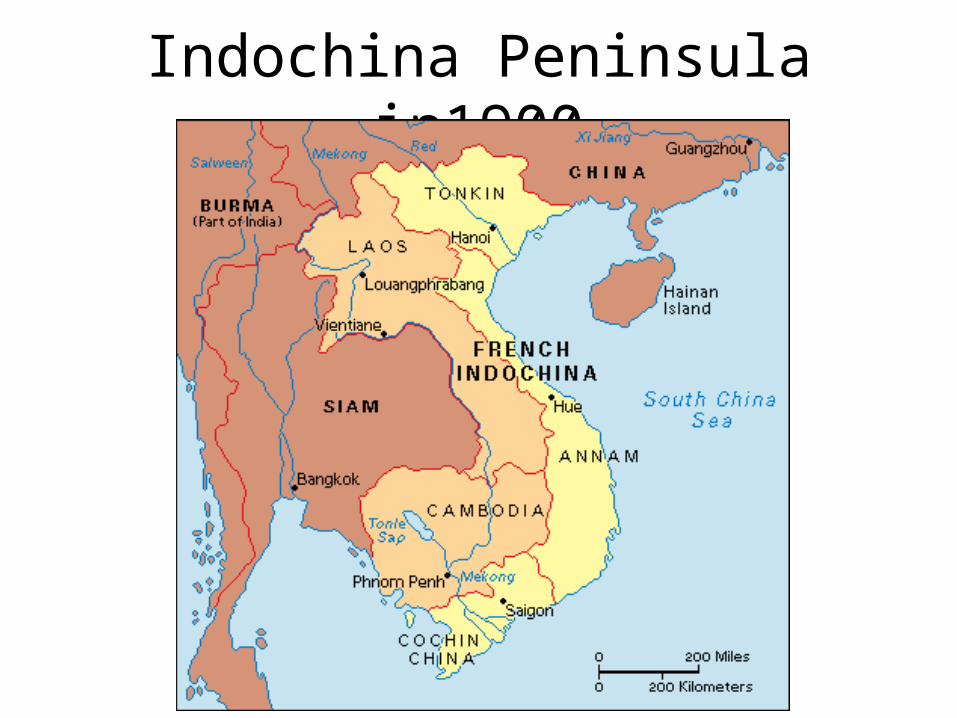
Indochina Peninsula in1900

Crimea

Colonial Migrations
This map shows the paths of global migrations during three time periods: 1500-1814, 1815-1914, and 1915-1960. The vast majority of migrations during these periods were from Europe to areas colonized by European nations.

Foreign influence in Asia 1914

Asian Countries: Independence Dates

Indian Independence

Topic 9: WWI & Russian Rev.
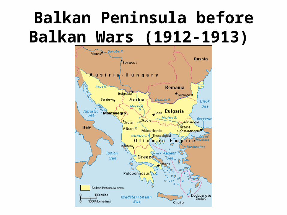
Balkan Peninsula before Balkan Wars (1912-1913)

Europe before World War I

Austria-Hungary 1914

WWI Battlefronts

WWI Eastern Front

WWI Italian Front

WWI Western Front 1914-1917

WWI Western Front 1918

Balkan Peninsula Today
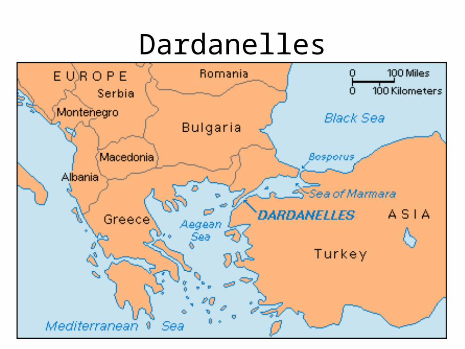
Dardanelles

Bosporus Strait

Gallipoli Peninsula
Topic 10: Interwar Years

Europe After WWI

Soviet Republics
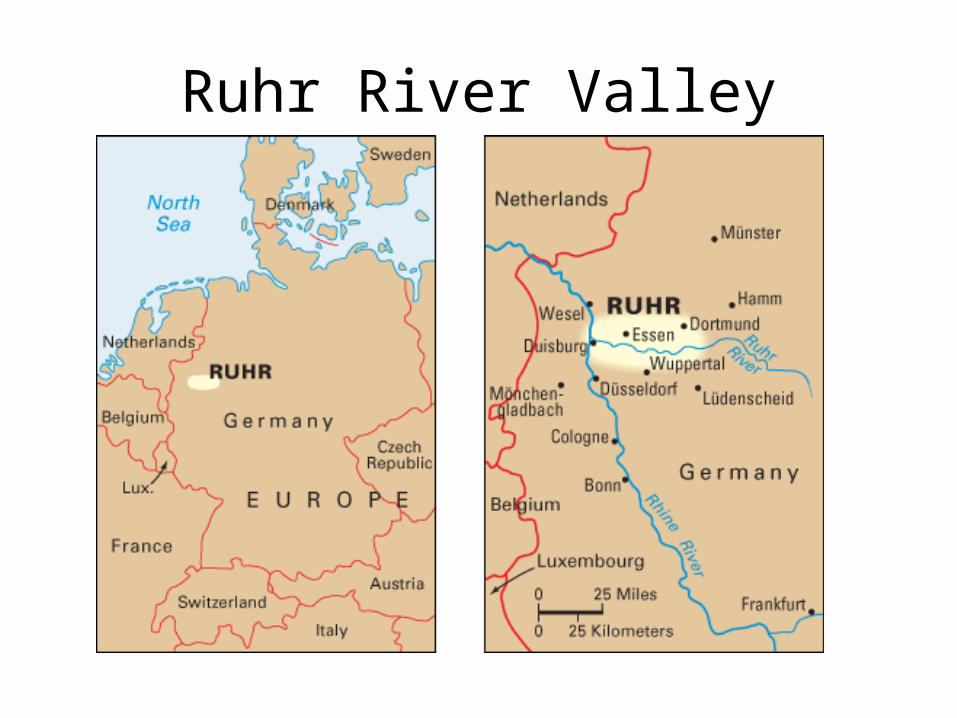
Ruhr River Valley

Alsace-Lorraine

Decline of the Ottoman Empire

British Mandate of Palestine in 1922

Europe After World War I

Germany after World War I

Polish Corridor

Czechoslovakia 1918-1938

Spanish Civil War

China in 1934

Manchuria

Poland 1918

Romania in 1939
Topic 11: WWII

World War II Overview
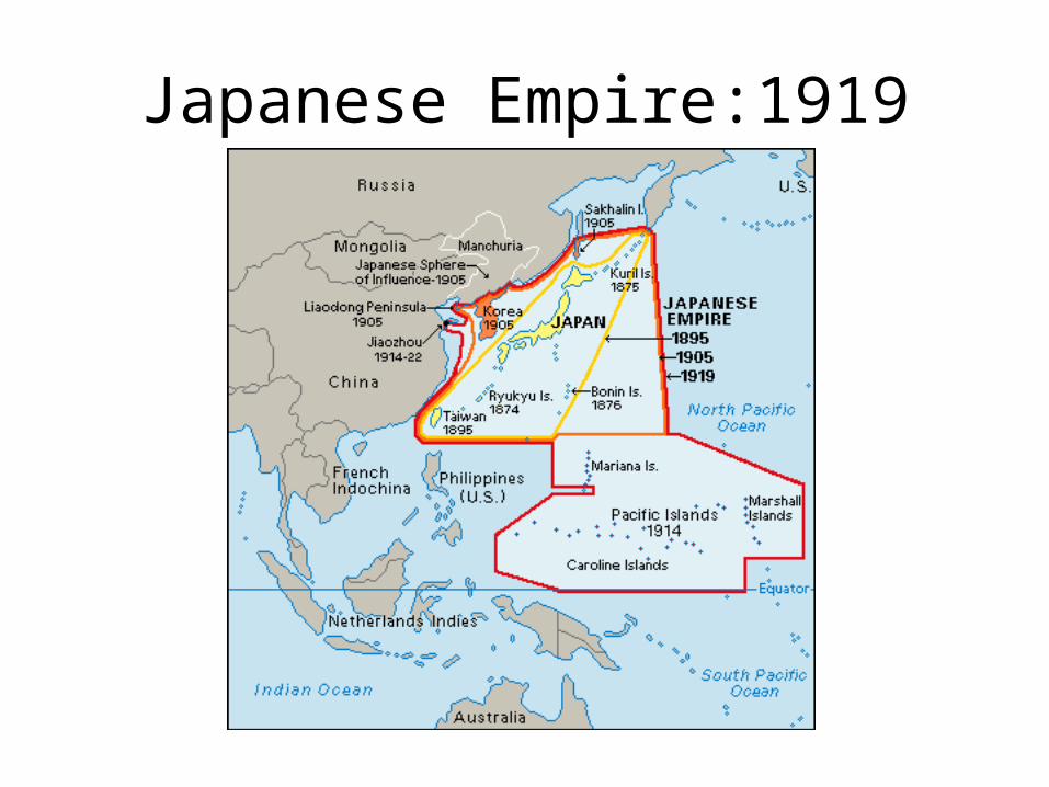
Japanese Empire:1919

World War II in Europe 1939-1942

World War II in Europe 1943-1945

World War II in Pacific 1939-1942

World War II in Pacific 1942-1945
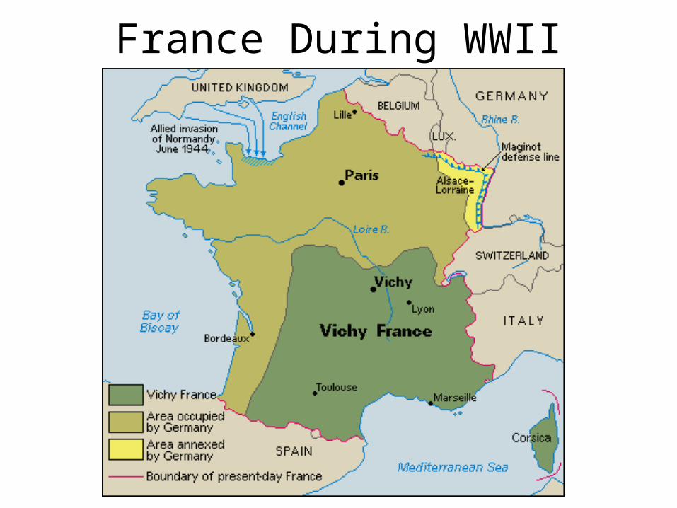
France During WWII

Japanese Empire in 1942

Concentration Camps

Strait of Dover

WWII Normandy Invasion

Normandy Invasion Detail

Czechoslovakia in 1945

Germany After WWII

Berlin Sectors after WWII

Topic 12: Cold War & Modern World

Soviet Influence in
Eastern Europe

Palestine in 1947

Soviet Sphere of Influence in Europe

1948 Arab-Israeli War

Yugoslavia 1946-2003This map shows Yugoslavia as it existed from 1946 to 2003. In 1946, Yugoslavia became a federal state with six republics. From northwest to southeast, these republics were Slovenia, Croatia, Bosnia-Herzegovina, Serbia, Montenegro, and Macedonia. In 1991 and 1992, Croatia, Slovenia, Macedonia, and Bosnia-Herzegovina declared independence. Serbia and Montenegro then formed a new Yugoslavia. In 2003, the country adopted a new constitution and changed its name to Serbia and Montenegro. Serbia and Montenegro split into independent countries in
2006.

Korean War: Chinese Invasion

Korean War: North Korean Offensive

Korean War: U.N. Armistice

Korean War: U.N. Advance
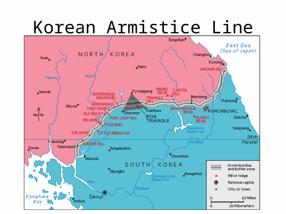
Korean Armistice Line

Vietnam War

Arab World

Israel and its Neighbors

Israel and Palestine Today

Six Day War

Sinai Withdrawal

Persian Gulf War of 1991

Chernobyl Fallout

Persian Gulf War: Troop Movements
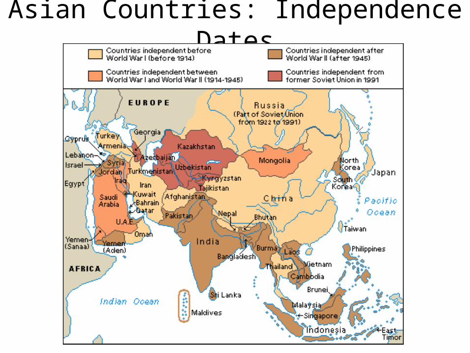
Asian Countries: Independence Dates

September 11

September 11-Ground Zero

Afghanistan Battles


European Union

Second Iraq War
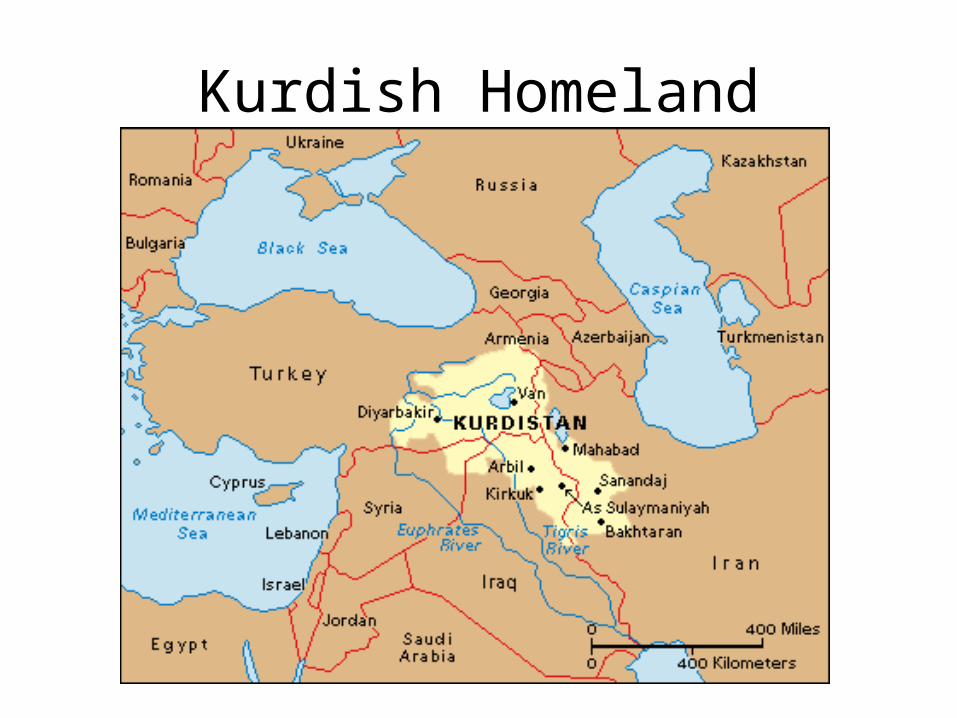
Kurdish Homeland