mobile field force automation (mffa) in the restoration of...
TRANSCRIPT

6th NGIS
PICC, Putrajaya
18th March 2014 (Tuesday)

Introduction
The MFFA overall process flow
How does MFFA helps in restoring power supply in Malaysia?
How does MFFA helps in restoring power supply in Malaysia? (in terms
of utilizing the GIS)
The Benefits
Screen shots
Future plan

Introduction

The MFFA Project was implemented with the intention to improve
supply restoration process with the help of technology.
Focusing to attend low voltage breakdown at sites.
This will improve :
Improve Communication and Coordination
Improve Customers Relationship Management
Improve Business Performance

TNB vehicles that being use to attend breakdowns are also installed
with GPS devices to locate and to identify the nearest field crew to
ensure the response to attend a breakdown is minimized.
It can be viewed on a map that is embedded in MFFA system.

Project started
PDA GPS
To complete
for the whole
Peninsular Malaysia
1046

for supervisors at Pusat Pengurusan Bekalan (PPB)
Job Management
for field crews (installed in the PDA)
TNB SMS
1
2
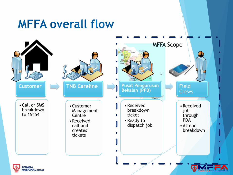
Customer
•Call or SMS breakdown to 15454
TNB Careline
•Customer Management Centre
•Received call and creates tickets
Pusat Pengurusan Bekalan (PPB)
•Received breakdown ticket
•Ready to dispatch job
Field Crews
•Received job through PDA
•Attend breakdown
MFFA Scope

Ticket
number,
Address,
etc.
I’m facing a
blackout at my
house now.
Hello TNB Careline,
How can I help you?
Can I have your
details please……
My name is Mr. Big.
My address……
We will send our
crew to your house
soon.
Thank you.
1. Dispatch ticket to
field crew
2. Field crew receive ticket
via PDA and acknowledge
supervisor by click ‘terima’.
3. Field crew will now go
to customer’s house
4. Reach at customer’s house.
Acknowledge supervisor by click
‘tiba’. Check and repair. Acknowledge
supervisor by click ‘kerja siap’.
5. Acknowledge
completion of job
(via system) to
Careline
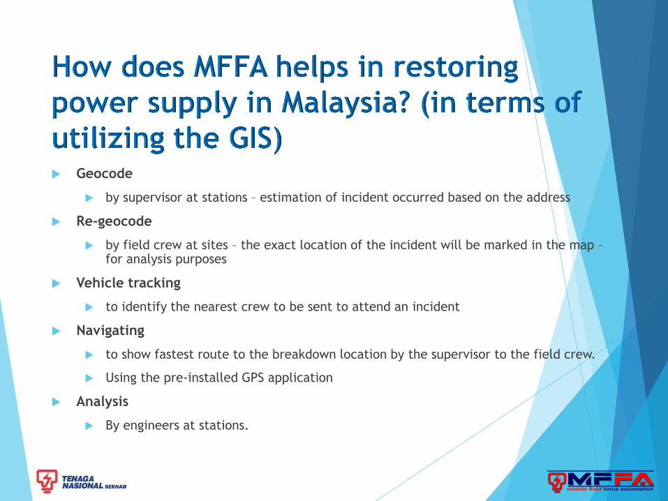
Geocode
by supervisor at stations – estimation of incident occurred based on the address
Re-geocode
by field crew at sites – the exact location of the incident will be marked in the map – for analysis purposes
Vehicle tracking
to identify the nearest crew to be sent to attend an incident
Navigating
to show fastest route to the breakdown location by the supervisor to the field crew.
Using the pre-installed GPS application
Analysis
By engineers at stations.
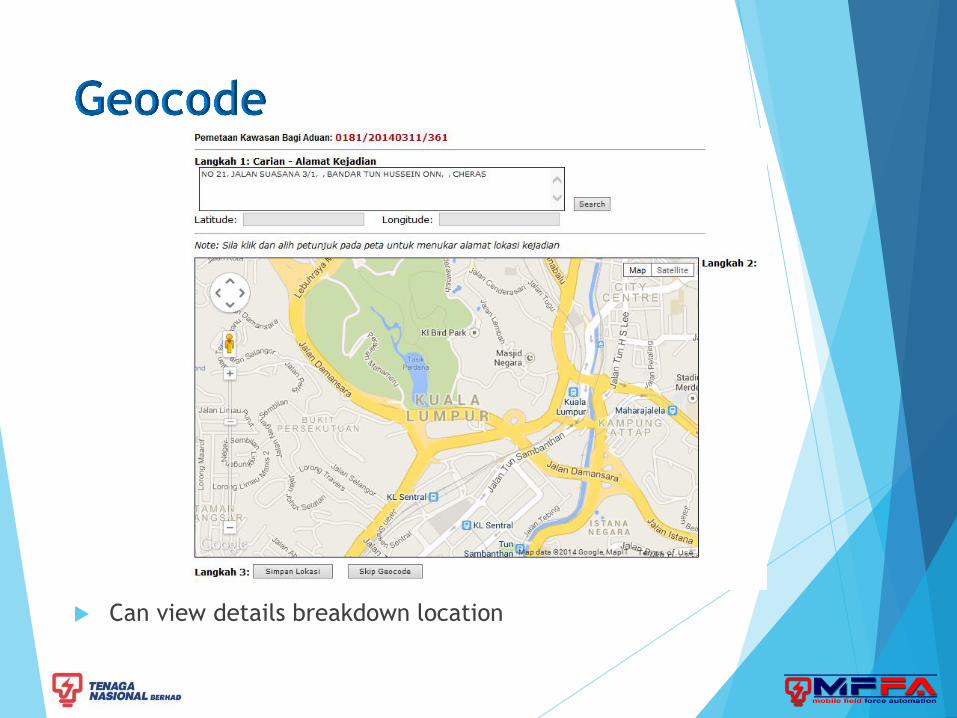
Can view details breakdown location

Latitude and longitude from Map will be dispatch to PDA for
navigation purposes


Can view details breakdown location and engineer can do breakdown
analysis based on frequency of breakdown in map.
Target users : Stations engineers

Job Management
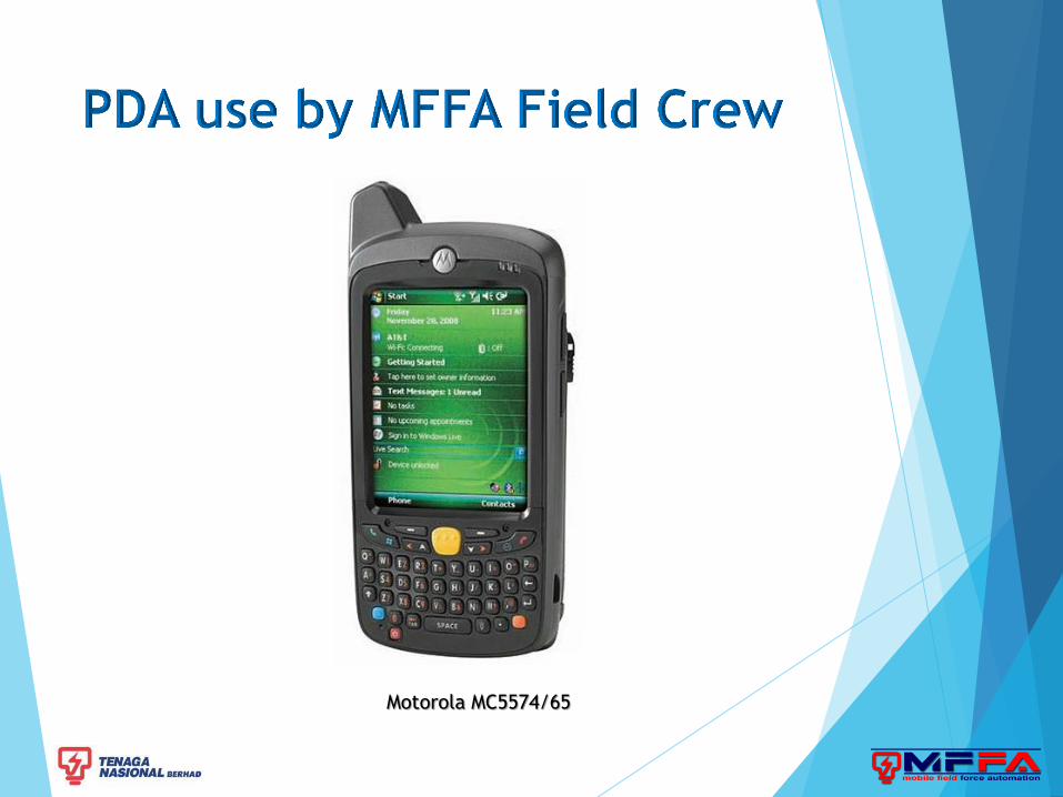
Motorola MC5574/65

SMS
Page 17
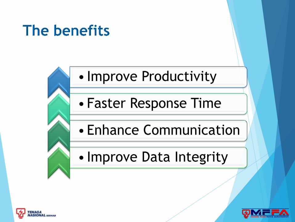
• Improve Productivity
•Faster Response Time
•Enhance Communication
• Improve Data Integrity

To add TNB substations on the map
integrate with TNB Corporate Geospatial Information System (CGIS) on
going project) –
The benefits to TNB – can determine which substation down and affected
customer.
Telemetry functionalities on the vehicle
track historical data and driver behavior.
MFFA is a system that being used by field crews at TNB to help them to
update their current status to the supervisor at the office while
restoring power supply for customers at site.
Faster response
