minutes of the 2016 annual gsics joint working groups meeting€¦ · irradiance dec 2015 to feb...
TRANSCRIPT
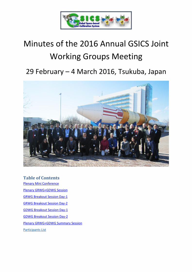
Minutes of the 2016 Annual GSICS Joint
Working Groups Meeting
29 February – 4 March 2016, Tsukuba, Japan
Table of Contents
Plenary Mini Conference
Plenary GRWG+GDWG Session
GRWG Breakout Session Day-1
GRWG Breakout Session Day-2
GDWG Breakout Session Day-1
GDWG Breakout Session Day-2
Plenary GRWG+GDWG Summary Session
Participants List

GSICS Working Groups – 2016 Minutes
2
Action: in red, Recommendation: in green, Decision: in navy
Plenary Mini Conference – 29th February, 2016
Chair AM: Larry Flynn (NOAA), PM: Misako Kachi (JAXA)
Minute Taker Sebastien Wagner (EUMETSAT), Tim Hewison (EUMETSAT)
Attendance AIST: Toru Kouyama, Satoshi Tsuchida CMA: Xiuqing “Scott” Hu, Zhe “Thomas” Xu CNES: Bertrand Fougnie EUMETSAT: Tim Hewison, Rosemary Munro, Rob Roebeling, Sebastien Wagner, Peter Miu, Christopher Hanson Ewha Womans University: Myoung-Hwan Ahn JAXA: Hiroshi MURAKAMI, Misako KACHI, Takeshi Masaki, Takashi Maeda, Kei Shiomi, Takeo Tadono. Takeshi Motooka, Yukio Kurihara, Chu Ishida, Masakatsu Nakajima, Marehito Kasahara, Yousuke Ikehata, Tomomi Nio JMA: Arata Okuyama, Hidehiko Murata, Masaya Takahashi, Tasuku Tabata, Yoshiteru Kitamura, Toshiyuki Kurino, Keita Hosaka, Nobutaka Mori KIOST: Seongick Cho KMA: Dohyeong Kim, Hyesook Lee, Hyunjong Oh, Hayan Shin NASA: Xiaoxiong “Jack” Xiong, David Doelling, Aisheng Wu NIES: Tsuneo Matsunaga NOAA: Xiangqian “Fred” Wu, Fangfang Yu, Ralph Ferraro, Lawrence Flynn, Manik Bali, Yuanzheng “Jordan” Yao, Likun Wang USGS: Thomas Stone
Remote Attendance CMA: Lin Chen, Shengli Wu ISRO: Pradeep Thapliyal
Agenda Item: 1a Introduction to Mini Conference & GSICS – 09:00 (20 minutes)
Presenter Tim Hewison (EUMETSAT)
Discussion point, conclusions, Actions, Recommendations
Tim provided a quick introduction to GSICS and its deliverables, which are now being extended to inter-calibration algorithms and tools.
Agenda Item: 1b Welcome to JAXA– 09:20 (10 minutes)
Presenter Chu Ishida (JAXA)
Discussion point, conclusions, Actions, Recommendations
Mr. Ishida provided a warm welcome to JAXA for the GRWG and GDWG members.
Agenda Item: 1c Welcome address – 09:30 (10 minutes)
Presenter Yoshiteru Kitamura (JMA)
Discussion point, conclusions, Actions, Recommendations
Dr. Kitamura welcomed the groups to Japan and encouraged us in our work.
Agenda Item: 1d CLARREO Pathfinder – 09:40 (20 minutes)

GSICS Working Groups – 2016 Minutes
3
Presenter Dave Doelling (NASA)
Discussion point, conclusions, Actions, Recommendations
Dave presented for Bruce Wielicki the newly funded CLARREO pathfinder mission. It was noted that this is the precursor mission and that a full CLARREO mission, which is designed to detect climate change using absorption bands, will also be funded in the future. The International Space Station will host the sensor from 2019 or 2020 for at least 2 years. It is in a precessionary orbit, making it possible to inter-calibrate all LEO and GEO sensors. We don’t know the level of funding, whether there will be both an IR and Reflected Solar (RS) instruments - this will be known only at end 2016. The target is SI-traceability for reflectance better than 0.5% (k=2) for the Reflected Solar (RS) instrument. This would allow lunar irradiance spectral calibration: 10-20 times as accurate as now (currently 5-10% uncertainty). For the IR: the blackbody has an emissivity = 0.9995 (much better than current instruments) and a large temperature range [210K,330K], whereas current instruments often have 0.99 emissivity and only one temperature. Moon, sun, earth are viewed through the same optical path, which is very important to guarantee a good calibration. The design also includes attenuators and solar views for non-linearity performance verifications. Problem with the ISS = to find the right position to set the instrument in order to optimize the FOV. Initially, one of the aims for GSICS would be to inter-calibrate MODIS, VIIRS and CERES. Q: What about ISS orbit? Important to know which instrument can be calibrated. R: Dave explained that the ISS’ precessionary orbit allows all instruments to be calibrated. The stability/navigation of the platform might be a problem (e.g., flexing and jitter).
Q: How do the instruments deal with orbital variations of ISS? R: A gimbal arrangement overcomes this for VIS/NIR, accurate pointing information needed for IR.
Q: What about the large footprint? R: Looking at scene homogeneity will allow weighting the measurements by scene variance for inter-calibration. Q: How is the navigation of the ISS to be address as it is an issue for such measurements? R: The gimble system is supposed to compensate for the ISS platform stability and navigation
Agenda Item: 1e EUMETSAT FIDUCEO - Defining FCDR uncertainties – 10:00 (20 minutes)
Presenter Rob Roebeling (EUMETSAT)
Overview The project Objective is to will provide Fundamental Climate Data Records (FCDRs) and Thematic Climate Data Records (TCDRs) with traceable uncertainties. Specific aims for Fundamental Climate Data Records (FCDRs) include:
GSICS Working Groups – 2016 Minutes
4
To apply harmonisation techniques to derive FCDRs with uncertainty estimates for Meteosat First Generation MVIRI, Microwave humidity sounder, High-resolution Infra-Red Sounder, and Advanced Very High Resolution Radiometer records. Specific aims for Thematic Climate Data Records (TCDRs) include: To derive, as valuable exemplars, TCDRs using the new FCDRs for four ECVs: upper-tropospheric humidity, sea and lake surface temperature, surface albedo and aerosol optical depth records.
Purpose Introduce FIDUCEO to the GSICS Community
Discussion point, conclusions, Actions, Recommendations
Comment: (Dave Doelling) Meteosat First Generation: there is no filter to constrain the SRF for the VIS band. We see the optical degradation of the instrument. Q: What can be used as reference instruments when going back in time with AVHRR? R: For the IR, HIRS. RSB not covered for AVHRR.
Agenda Item: 1f CMA Progress on ground-based lunar observations – 10:50 (20 minutes)
Presenter Xiuqing "Scott" Hu (CMA)
Overview Overview of Lunar Calibration activities and plans for CMA.
Purpose Introduce the Ground-based Lunar Observation Project
Discussion point, conclusions, Actions, Recommendations
Lunar calibration became a very important calibration method for FY-2 and FY-3 instruments. CMA is hoping to contribute to the international efforts on lunar calibration. Lunar calibration will be used for FY-4. Development of an albedo and radiance model of the Moon. HSFTS: 0.9-2.5 microns hyperspectral instrument 3 periods of measurements. The longest lasted for 3 months, starting in December 2015. The first two were for preparation. Next steps: instrument improvement, long term observation, accurate calibration + data quality control, data processing + validation. Comment (Fangfang): good to see that CMA is also investigating the possibility to derive a radiance model Q (Fangfang): interested to see the hyperspectral resolution and accuracy of the instruments. R: The information is available even though not presented in the present slides. Q: are there plans to release the data to the public? R: yes. but only after data quality control.
GSICS Working Groups – 2016 Minutes
5
GPRCs (especially JMA but NOAA, EUMETSAT, and KMA as well) to provide observed lunar irradiance Dec 2015 to Feb 2016 to CMA for comparison. CMA to provide schedule to release analysis and data.
Agenda Item: 1g Lunar radiance calibration – 11:10 (20 minutes)
Presenter Fred Wu (NOAA)
Overview Introduce lunar radiance calibration – motive, evolution, components.
Purpose Provide an alternative to lunar irradiance calibration such as ROLO/GIRO.
Discussion point, conclusions, Actions, Recommendations
1/f noise and space clamp are part of the sources for uncertainties Looking at the mean count, the curve as a function of the distance to the moon centre is smooth, instead of peaky. MTF were investigated to check potential issues. The difficulties in using an integrated signal (irradiance) for GOES raised the question of using a radiance model instead to have a similar approach to PICS but on the Moon. Determining the BRDF is still an open question: idea is to make use of SELENE/SP, PLEIADES, AHI/ABI and on-ground measurements. Initial goal is trending but absolute calibration (SI-traceable) and inter-calibration is possible. Collaboration with CNES, JAXA and JMA (visiting scientist)
Agenda Item: 1h Lunar calibration based on SELENE/SP data – 11:30 (20 minutes)
Presenter Toru Koyama (AIST)
Overview A hyperspectral lunar reflectance model (SP model) based on SELENE/SP observation data has been developed. Using SP model, any lunar observation can be simulated. Comparing observed radiance and simulated radiance, sensor degradation can be evaluated.
Purpose To introduce SELENE/SP and a lunar reflectance model based on SP’s observation data, and to share the ability of the SP model and its calibration issues for absolute radiometric calibration.
Discussion point, conclusions, Actions, Recommendations
SELENE observed the Moon with many view angles, which can be used to infer a lunar BRDF model. A SP Lunar Reflectance model was developed by Yokota and al. (2011). SP was stable enough between 2007 and 2009 to derive the parameters for the model. The model was validated against ASTER data. Correlations are good but the bias are large for Band 1 (1.27 whereas it is 1.02 and 1.05 for Band 2 and 3). One reason is the SP calibration. A correction was derived from comparisons with the ROLO. For Band 1, the bias was improved from 1.27 to 1.09. Comment (Dave Doelling): The EPIC instrument on the DSCOVR mission sees the other side of the Moon. It would be interesting to compare the data from that mission to the SP model.
GSICS Working Groups – 2016 Minutes
6
Comment (Jack Xiong): As ASTER is flying on the same platform as MODIS and MISR, there are possibility for more comparisons, which could help. Comment (Tim Hewison): The approach of a radiance model is a nice method to complement the current GSICS approach with the ROLO/GIRO to inter-calibrate instruments. AIST to collaborate with NOAA to explore the possibility of lunar BRDF using SELENE/SP.
Agenda Item: 1i Toward a wider use of the moon for in-flight characterization – 13:00 (20 minutes)
Presenter Bertrand Fougnie (CNES)
Purpose Provide an evaluation of the moon as a calibration target for current and future instruments
Discussion point, conclusions, Actions, Recommendations
Bertrand provided a review of potential applications of the Moon to characterize other aspects of instrument performance, in addition to radiometric calibration. These include MTF/PSF, ghosts, optical leaks, cross-talk and band-band registration, which exploit the contrast between bright and dark scenes across the edge of the lunar disc. Also straylight and background characterization can exploit the dark background around the Moon, and response-versus scan angle. In the case of absorption bands, the Moon has the clear advantage of not having an atmosphere, which allows inter-band calibration. He also applied these concepts to the cal/val plans for the MetImage and 3MI instruments, which will be flown on EUMETSAT Polar System - Second Generation (EPS-SG). Sebastien Wagner reminded us of the recommendation from Lunar Calibration Workshop to view Moon during satellite decommissioning. Q: Will Sentinel 3 design allow routine views of the Moon, or via dedicated manoeuvers? A: Design not finalized, but operational requirements motivated by the opportunities this would provide.
Agenda Item: 1j Operation and Calibration of GOCI – 13:20 (20 minutes)
Presenter Seongick Cho (KIOST)
Discussion point, conclusions, Actions, Recommendations
Seongick Cho provided introduction to ocean colour radiometry, emphasizing the calibration requirements, noting only 10% of the signal observed by the instrument comes from the ocean itself. He put this into the context of the GOCI instrument, which operates on the Korean geostationary COMS satellite, which is used to monitor red tides and green algae around the Korean peninsula. He described how clear ocean and the solar diffuser are used to characterize the instrument’s performance and how the varying its integration time can be used to characterize its nonlinearity,

GSICS Working Groups – 2016 Minutes
7
which is performed routinely. He also showed how the gain derived from the solar diffuser was subject to seasonal variations, because of its sensitivity to the solar azimuth angle, which can be corrected empirically. For GOCI-II, will use lunar calibration to monitor the aging of the solar diffuser.
Agenda Item: 1k Himawari-8 Ocean Color and Aerosol – 13:40 (20 minutes)
Presenter Hiroshi Murakami (JAXA)
Discussion point, conclusions, Actions, Recommendations
Hiroshi introduced a range of level 2 products that are routinely generated from Himawari-8 data. He also outlined the vicarious calibration method used for these products. His analysis of the sensitivity of L2 products showed the vicarious calibration had impact on the to L1 calibration. He also highlighted latitudinal stripes in 8-day composite Chla and AOT550 and Angstrom Exponent retrievals, which he attributed to sensor problems. Q: Plan to retrieve surface reflectance simultaneously with AOT? A: Maybe for the future, but currently assumed to be constant over a month. Q: Is the striping caused by detector normalization? A: Probably, and may be corrected be Q: What would be the user requirements for GSICS Corrections in these applications? e.g. absolute accuracy and stability of time series. Recommendation: JAXA to continue to collaborate with JMA to define requirements for GSICS Corrections for AHI ocean colour and aerosol products.
Agenda Item: 1l Impact of GSICS Correction on Himawari-8 SST – 14:00 (20 minutes)
Presenter Yukio Kurihara (JAXA)
Discussion point, conclusions, Actions, Recommendations
Yukio presented an assessment of the quality of the Himawari-8 SST product, based on comparison with buoy data, and compared the results before and after applying the GSICS Correction. These results showed differences ~0.4K, but suggested the inter-calibration against AIRS increased the negative bias, whereas using IASI-A improved the negative biases, but increased the temperature dependence of the bias in long-wave channels. The short-wave channels showed less difference. It seems that there is a relation between bias and sun zenith angle (TBC with presentation). This highlights the need to provide users with clear guidance - with a single GSICS product, based on a single reference for each spectral band. It may also be worth considering performing a comparison of SST retrievals from multiple GEO imagers before/after applying GSICS Corrections (GEO-ring). Comment: validation against MODIS and VIIRS SST products highlight the need for LEO-LEO GSICS corrections. Recommendation: GSICS IR sub-group to develop LEO-LEO GSICS corrections

GSICS Working Groups – 2016 Minutes
8
Agenda Item: 1m Calibration activities of GCOM-C/SGLI – 14:20 (20 minutes)
Presenter Hiroshi Murakami (JAXA)
Discussion point, conclusions, Actions, Recommendations
Hiroshi highlighted the high spatial resolution capabilities of the SGLI instrument and explained how the polarisation changes with view angle. (?) He described the two-stage calibration approach for SGLI IR bands, based on on-board black body and for VN/SWR bands, based on solar diffuser and LED lamp and vicarious calibration against ocean, desert, snow and cloud targets. Moon will be acquired once a month at the same phase angle (7 degrees) during pitch maneuvers for instrument monitoring purposes using the GIRO. It is planned to extract data from ocean targets and PICS in land as done for S-3 and planned cross-calibration with AHI and with other instruments through AHI. Q: Can JAXA share GSLI data extracted over ocean and land sites with GSICS and/or IVOS? e.g. through SADE database. A: Yes - they are interested in sharing the satellite observations, but may not be able to share in situ data obtained by other agencies. Comment: the land site data is not globally available to all GEO imagers, so IVOS may be a more appropriate forum for exchanging this data.
Agenda Item: 1n Calibration activities of GOSAT & GOSAT-2 – 14:40 (20 minutes)
Presenter Kei Shiomi (JAXA)
Discussion point, conclusions, Actions, Recommendations
Kei introduced the Thermal And Near infrared Sensor for carbon Observation (TANSO) and Fourier Transform Spectrometer (FTS) and Cloud and Aerosol Imager (CAI) that have been flown on GOSAT and counterparts that will be flown on GOSAT-2. Comparisons with AIRS by SNO at mid-latitudes. Spectral differences ~0.5K, with 1K difference in CO2 band - although this bias changed in 2014, associated with solar paddle failure. Also monitored quality by comparison of SSTs with buoy data - showed long-term calibration stability. CAI has measured the Moon at 7° phase angle over several years, allowing the monitoring of its degradation. GOSAT-2 will add cross-track scan for pixel calibration for CAI-2… Also working on SONOs (off-nadir) for scan-angle dependency. Q: Can JAXA share lunar observations with community through the GLOD? A: Yes - happily! They also plan to use GIRO. Q: Explanation of spectral calibration change of FTS after solar paddle failure in 2014? A: The spectral calibration is not expected to be affected by this change. High spectral resolution solar spectra...

GSICS Working Groups – 2016 Minutes
9
Agenda Item: 1o Calibration activities of ALOS/AVNIR2 PRISM – 15:30 (20 minutes)
Presenter Takeo Tadono (JAXA)
Discussion point, conclusions, Actions, Recommendations
Takeo presented the various activities on the ALOS mission, which lasted 5.3 years between 2006 and 2011. The geometrical calibration for PRISM was performed using lights spots in the urban areas. This highlighted differences between alignment of different CCD units. This was assessed using a range of innovative techniques, which it could be beneficial to apply to other instruments. This may be possible by considering a programme focusing on geometric aspects, as a counterpart to the radiometric calibration considered by GSICS. He also described inter-band calibration of AVNIR-2 based on analysis of RGB imagery and inter-comparisons with MODIS and PRISM, which is published on the JAXA website.
Agenda Item: 1p Calibration activities of ALOS-2/PALSAR – 15:50 (20 minutes)
Presenter Takeshi Motohka (JAXA)
Discussion point, conclusions, Actions, Recommendations
Takeshi provided a fascinating insight into the world of SAR calibration. For example, PALSAR include multiple beams, which all need to be calibrated. It also needs polarimetric calibration using the Amazon as a homogeneous target and has to deal with RFI rejection, which is becoming increasingly problematic in the L-band. Q: How is SAR calibration coordinated? A: Through a dedicated sub-group of the CEOS WGCV.
Agenda Item: 1q Calibration activities of TRMM & GPM Radars – 16:10 (20 minutes)
Presenter Takeshi Masaki (JAXA)
Discussion point, conclusions, Actions, Recommendations
Takeshi described the Ku- and Ka-band Precipitation Radars operating on TRMM and GPM satellites and provided an overview of the L1, L2, and L3 processing applied to their data. These instruments employ a 2-stage calibration process- first internal calibration, which converts digital counts to power, then external calibration which applies an offset to convert this in absolute power. He also compared the calibration of the radars, which showed a slight offset bias, which will be corrected in a future processing of the data. Q: Is the calibration on the PR done in a similar way to DPR? (Yes) And were similar biases found? A: PR bias was slightly smaller.
Agenda Item: 1r Calibration activities of GCOM-W/AMSR2 – 16:30 (20 minutes)
Presenter Marehito Kasahara (JAXA)
GSICS Working Groups – 2016 Minutes
10
Discussion point, conclusions, Actions, Recommendations
Marehito outlined the calibration and processing approach applied to AMSR2. Contaminations due to RFI (from GEO satellites) and lunar intrusions in space view are first identified and removed by interpolation., then antenna spillover is accounted for, based on a 2-coefficient correction applied to the lowest frequency channels. Then the hot target is corrected for straylight contributions. Then nonlinear correction is applied - largest in low frequency channels (5K), and scan-bias correction applied to the scan edge of the lowest frequency channels, before converting from antenna temperature to brightness temperature. Q: What causes the nonlinearity, and why is it larger in the low frequency channels? A: Not sure Q: What is the uncertainty on the correction terms? Marehito also described the improvements implemented in AMSR-2 wrt AMSR-E to mitigate RFI.
Agenda Item: 1s Intercalibration on ATMS and SAPHIR – 16:50 (20 minutes)
Presenter Ralph Ferraro (NOAA)
Overview Over 3-years of colocated M-T SAPHIR and SNPP ATMS data were compiled and analyzed to intercompare near common 183 GHz water vapor bands. The matchups are restricted to tropical locations where the SAPHIR makes measurements. Very close agreement was found between the two sensors.
Purpose To demonstrate the synergistic use between a research sensor (SAPHIR) and an operational sensor (ATMS) to inter-calibrate the two and monitor the ATMS performance.
Discussion point, conclusions, Actions, Recommendations
Ralph explained how the SAPHIR sensor on the Megha-Tropiques satellite being in a non-polar orbit provides inter-calibration opportunities for polar-orbiting instruments, such as ATMS. He reported an analysis of the impact on collocation time and distance thresholds. Inter-satellite differences changed slowly over time (~0.4K/year), although there was a step change in ATMS in 2014 (but need to check processing versions). He also showed comparisons of satellite observations with forward-modelled radiosondes, which confirm good inter-satellite consistency, if not absolute calibration. Many of these results are routinely updated on the NOAA-STAR webpages. Nicely highlighted different problems we need to provide user guidance on: calibration drifts and jumps. Q: Ralph presented the effect of time and distance collocation thresholds separately. What about combined time and distance collocation thresholds? R: Could be done in the future. [Subsequently, Ralph found out that the plot for time sensitivity was based on collocations within 50 km and the plot for distance sensitivity was based on collocations within 30 minutes] Comment: The slide on the sensitivity to collocation distance shows that collocation criteria affect the bias as well as the amount of collocations. For climate application, the processing should not introduce a systematic bias through the collocation criteria.

GSICS Working Groups – 2016 Minutes
11
Q: Has the dry bias in the radiosondes been resolved? R: Isaac has looked into this, but Ralph does not know the latest.
Agenda Item: 1t Intercalibration on the FY3/MWRI – 17:10 (20 minutes)
Presenter Shengli Wu (CMA)
Discussion point, conclusions, Actions, Recommendations
Having a warm reflector is a specificity of FY-3-MWRI. Usually microwave imagers have only one reflector whereas FY-3-MWRI has two to view the hot and cold views. Shengli has analysed the double differences of MWRI wrt AMSR-E and AMSR-2. The single differences showed good correlation, except in coastal areas and forest (it should be “water body area of land”) due to re-sampling of scenes with water/land mix. Systematic differences in AMSR-E/AMSR-2 may be due to different sampling time, but differences are largest in low frequencies and polar areas. Q: Which version of the SSMIS data was used? A: The source data from (from NSIDC (National Snow Ice Data Center) ftp site) Recommendation: CMA to consider using the SSMIS CDR at Colorado State University and NOAA NCEI that is available and that would be of better quality in their analysis of MWRI data.
Agenda Item: 1u Intercalibration of AMSR2 and PMRs – 17:30 (20 minutes)
Presenter Takashi Maeda (JAXA)
Discussion point, conclusions, Actions, Recommendations
Takashi reported on a series of comparisons of AMSR-2 with other passive microwave radiometers, including the current AMSR-E in slow rotation mode and past data in nominal rotation mode. The latter comparisons were done as double differences against vicarious cold and warm targets (ocean and rainforest, respectively). The latter method was also applied to comparisons with TMI and GMI. From the parabolic shape of the double differences, JAXA now suspect the validity of the AMSR-2 non-linearity parameters.
Agenda Item: 1v New SNO LoS based fast/accurate algorithm – 17:50 (20 minutes)
Presenter Likun Wang (NOAA)
Overview Using VIIRS and CrIS as an example to explore general issues on how to collocate two sensors on the same or different platform
Discussion point, conclusions, Actions, Recommendations
This work was motivated by the user community (incl NWP) wanting to combine VIIRS with CrIS data to provide sub-pixel information. Need a fast and accurate collocation algorithm, suitable for operational use. Need to account for FoV stretching and count all VIIRS pixels within each CrIS footprint. Solution: perform collocation using line-of-sight vectors. This is achieved by converting (Azimuth, Zenith, Range) to (East, North, Up) to (Longitude, Latitude, altitude). A k-dimensional tree algorithm has been implemented. It is a searching algorithm that has the advantage to be extremely fast.

GSICS Working Groups – 2016 Minutes
12
Likun showed that the boxcar average gives results within 2.3mK of the full ellipse matching. He also showed how the method can be extended to assess the instruments’ relative geolocation errors by applying a series of perturbation to the LOS angles and minimozing the resulting differences. e.g. This analysis suggests the VIIRS-CrIS differences are ~4km at the scan extreme (which is small relative to the CrIS FoV here of ~40km). Likun is developing Python based code to share with the GSICS community. The method could be used to collocate CrIS with data from a geostationary imager as soon as the geolocation is provided in the Level 1 data. Q: How fast? 0.2s for one CrIS granule. Q: Any special treatment needed to apply to instruments on GEO platforms with fixed grids? A: just need zenith and azimuth angles. Q: Speed also needed for reprocessing climate data records. Anyone interested to test it out? A: Yes - at NOAA, but also interest for MTG-IRS (?) Q: what about the amount of collocations? The results in terms of collocations are the same with both methods. However the method proposed here is much faster. Highlights need to provide full viewing geometry information to users.
Agenda Item: Discussion – 18:10 (20 minutes)
Presenter All
Discussion point, conclusions, Actions, Recommendations
Discussions took place after each presentation.
GSICS Working Groups – 2016 Minutes
13
Plenary GRWG+GDWG Session – 1st March, 2016
Chair AM: Dohyeong Kim (KMA), PM: Tim Hewison (EUMETSAT)
Minute Taker AM: Hyesook Lee (KMA), PM : Sebastien Wagner (EUMETSAT)
Attendance CMA: Xiuqing “Scott” Hu, Zhe “Thomas” Xu CNES: Bertrand Fougnie EUMETSAT: Tim Hewison, Rosemary Munro, Rob Roebeling, Sebastien Wagner, Peter Miu, Christopher Hanson Ewha Womans University: Myoung-Hwan Ahn JAXA: Hiroshi MURAKAMI, Misako KACHI, Takeshi Masaki, Takashi Maeda, Kei Shiomi, Takeo Tadono. Takeshi Motooka, Yukio Kurihara, Chu Ishida, Masakatsu Nakajima, Marehito Kasahara, Yousuke Ikehata, Tomomi Nio JMA: Arata Okuyama, Hidehiko Murata, Masaya Takahashi, Tasuku Tabata, Toshiyuki Kurino, Keita Hosaka, Nobutaka Mori KIOST: Seongick Cho KMA: Dohyeong Kim, Hyesook Lee, Hyunjong Oh, Hayan Shin NASA: Xiaoxiong “Jack” Xiong, David Doelling, Aisheng Wu NIES: Tsuneo Matsunaga NOAA: Xiangqian “Fred” Wu, Fangfang Yu, Ralph Ferraro, Lawrence Flynn, Manik Bali, Yuanzheng “Jordan” Yao, Likun Wang USGS: Thomas Stone
Remote Attendance ISRO: Pradeep Thapliyal, Munn Vinayak, Ipshita Dey, Shivani Shah
Agenda Item: 2a Agree Agenda & Minute Taking – 09:20 (10 minutes)
Presenter Dohyeong Kim (KMA)
Discussion point, conclusions, Actions, Recommendations
All the participants agreed meeting agenda and minutes takers.
Agenda Item: 2b GCC Report – 09:30 (20 minutes)
Presenter Larry Flynn (NOAA)
Discussion point, conclusions, Actions, Recommendations
Larry introduced GCC activities, which have expanded substantially. GSICS started with a limited number of instruments and activities. But it has grown. GCC provides also support to review FCDRs which could be of interest for GSICS and could become products. The good news are that 4 products are operational, 4 products are pre-operational and 27 products are in demonstration phase. There is a need for new reviewers and users. GCC is working on a GSICS instrument performance summary performing statistics on the current available GSICS products. Review of the GPPA is part of the near-term goals for 2016-2017. Quarterly may be only 3 instead or 4 in order not to rush authors. We need to gather more user requirements. Announced the next GSICS User’s Workshop in NOAA NCWCP in College Park (as part of the JPSS annual science team meeting 8-12 August)

GSICS Working Groups – 2016 Minutes
14
Q: will GCC propose a strawman on the GSICS instrument performance summary? R: yes. But proposal from GPRC are welcome if something is already in place. Will be discussed in the Research Working Group. We may not have the time to discuss it at this meeting. May be the topic of a web meeting Action: GWG.2016.2b.1: GCC to set up GRWG/GDWG web meeting on instrument performance monitoring.
Agenda Item: 2c GDWG Report – 09:50 (20 minutes)
Presenter Masaya Takahashi (JMA)
Discussion point, conclusions, Actions, Recommendations
Masaya summarized GDWG actions. 25 actions closed among 40 (a record!). The terminology on data archiving and preservation defined under GSICS Data Preservation Strategy, which is accepted during last EP meeting. Data mirroring has to be solved in order to ensure data preservation as defined by Pete and Masaya. Collaboration server set-up is one of the most important topic to be addressed this year. EUM will provide support to CMA with their infrastructure. GitHub as Version controlling SW for GSICS SW development is under discussion. GDWG will also discuss the Action Tracking System. The current system for the DWG is not fully satisfactory (spreadsheet through GoogleDoc). The current GSCIS server infrastructures cannot support a restricted access to the GIRO. A solution needs to be found. As GSICS 2016/2017 activity, to adopt DOI for GSICS deliverables is planned. GDWG proposed an action identifier format. Q: What would be the identifier format when a workshop? R: We define a new GsicsId (the presentation proposes already a list of identified GsicsId). Comment: it would be nice to have automatic reminder. Q: What kind of SW is considered for version controlling SW? Re: All Comment: actions are assigned to one coordinator as decided at the 2016 annual meeting. However, actions should be re-assigned automatically when people change roles and responsibilities. Recommendation: GDWG to provide guidance for code sharing in order to avoid problem with

GSICS Working Groups – 2016 Minutes
15
licensing (TBConfirmed).
Agenda Item: 2d GRWG + IR Sub-Group Briefing Report – 10:40 (20 minutes)
Presenter Tim Hewison (EUMETSAT)
Discussion point, conclusions, Actions, Recommendations
GRWG report: Tim reminded us that the GSICS Exec Panel had approved the proposal that we should aim to provide users with the most recent available calibration data at the highest freq and allow user to decide how to apply it for their application. Among the challenges to tackle:
- how to handle multiple references (merging, handling transition, traceability, preparation to CLARREO pathfinder, Moon, etc.).
- expansion: new instruments (new channels, sounders, etc.). - Consistency (between algorithms, spectral, formats, focus on users). Inter-band correlations
and calibrations should be more and more addressed. - GEO ring: it is an opportunity to interact with users.
Tim emphasized the need to coordinate with CEOS WGCV sub-groups. 10 web meetings took place. A few web meetings that were planned did not take place, but may be postponed until 2016. To be discussed on Friday. Tim proposed to actually pursue GRWG_14.15 within the IR and MV subgroup instead of having a dedicated sub-group. Actions associated with CGMS will be transferred to Dohyeong. Wish-list for action tracking tool was presented. Action: GRWG.2016.2d.1: Tim & Dohyeong to review outstanding actions on Tim Hewison and decide which to transfer to GRWG Chair. IR sub-group report:
It is now time to think about version 2 for algorithms in the IR. Other activities such SRF retrievals will be followed up in discussion items on the agenda for Wednesday.
Agenda Item: 2e GRWG VIS-NIR Sub-Group Briefing Report – 11:00 (15 minutes)
Presenter Dave Doelling (NASA)
Discussion point, conclusions, Actions, Recommendations
Dave presented a summary of the main outcome of the VIS/NIR sub-group The selection of a reference instrument is on-going. The assessment of the MODIS and VIIRS calibration accuracy was done. VIIRS is definitely is a good candidate.
GSICS Working Groups – 2016 Minutes
16
A SBAF tool has been established using 3 different sets of hyperspectral instruments. An important aspect to discuss is how to combine methods. Lunar cal:
- GIRO was developed - Initial plan for a second workshop is delayed.
We have now lunar calibration and DCC. A scheme for lunar inter-calibration needs to be defined. DCC:
● A DCC product was submitted to the GPPA. ● Special issue on DCC this year?
VIS/NIR products:
● file product format and update ● bias monitoring tool
Engaging with IVOS is important to get recommendation on solar spectra. We should also apply VIS/NIR calibration strategies to other bands. Development new calibration approach is a topic for discussion for this meeting. Q: the possibility of GEO-ring for VIS? A: GPRC requirements on that will be discussed on Wednesday/Thursday.
Agenda Item: 2f GRWG UV Sub-Group Briefing Report – 11:15 (15 minutes)
Presenter Rosemary Munro (EUMETSAT)
Discussion point, conclusions, Actions, Recommendations
A mini-survey was conducted at the joint GSICS UV sub-group and CEOS WGCV-ASSG meeting in order to define the scope of the UV sub-group. Rose also presented the list of baseline projects agreed at the meeting. Project 1: Reference Solar Spectrum. Main step is to catalog high spectral resolution solar reference spectra and on a common spectrum to use for the project (SOLSTICE, SIM, Kitt Peak) Project 2: White Paper on Ground-based Characterisation White paper in initial drafting stage, scope outline etc This will be discussed further in agenda item 7f. Project 3: Match-ups and Target Sites Main step: Summaries of methods and results for target sites currently in use will be collected. Project 4: cross calibration below 300nm

GSICS Working Groups – 2016 Minutes
17
Agenda Item: 2g GRWG Microwave Sub-Group Briefing Report – 11:30 (15 minutes)
Presenter Ralph Ferraro (NOAA)
Overview The MW subgroup met three times in 2015 and continues to focus on topics related to passive microwave calibration with the ultimate goal of developing GSICS products and algorithms. Expansion to include more organizations, develop common links to CEOS and GPM were two of the group's accomplishments during the past year.
Purpose To provide an update of ongoing activities and future plans of the MW subgroup.
Discussion point, conclusions, Actions, Recommendations
10 space agencies and affiliates are now part of the sub-group. Scope of the sub-group:
● Understanding user’s requirements ● Identifying existing products that could meet requirements ● The group should focus on tools/algos like SNO, double differences, RTM, etc. ● Define standards ● Encourage new products to GPPA
Four web meetings were organized in 2015 and early 2016. Some items of interest: activities in GPM X-CAL, NIST calibration reference and workshop on uncertainties at 183 GHz (Paris, 2015). A mini survey was also conducted to have a quick view of user interests and potential requirements. As a result: mapping time series of similar sensor but from vastly different heritage is low priority. More precise and longer latency is preferred. Focus for 2016:
● Defining clear path for GSICS MW products and algos ● Tying together other groups/opportunities (GPM X-Cal, CEOS MW subgroup, expanding
active participation, etc.) ● Participating by subgroup at upcoming meeting of relevance (GSICS, CEOS, CALCON,
Microrad 2016, AMS, EUMETSAT Conf). Comment: involvement of JAXA is to be pursued.
Agenda Item: 2h JAXA Agency Report – 12:45 (20 minutes)
Presenter Misako Kachi (JAXA)
Discussion point, conclusions, Actions, Recommendations
In 2016, JAXA will launch GCOM-C. GOSAT-2 and EarthCARE will be launched in 2017. End of operation for TRMM (April 2015) and AMSR-E (Dec 2015). Misako mentioned the change in rotation speed for AMSR-2 on EOS Aqua and discussed cross calibration with AMSR-1. Vers 2 of the AMSR-2 dataset was released early 2015. GPM v04 will be released in March 2016, which includes major changes in GMI L1 and small changes
GSICS Working Groups – 2016 Minutes
18
in DPR L1. GMI-TMI correction tables were provided in order to resolve differences between the 2 instruments. Comment related to GMI calibration update: this instrument could be used as a reference instrument within GSICS. Activities on precipitation using AHI data were also summarized. Q: can JAXA put some uncertainties on GMI calibration? R: The instrument is very good (Misako) but values are needed on uncertainties (Tim) Post meeting comment from MW Sub-group - Information on GMI calibration can also be obtained from GPM X-Cal team
Agenda Item: 2i JMA Agency Report – 13:05 (20 minutes)
Presenter Arata Okuyama (JMA)
Overview Introduction of the GSICS members of JMA, actions’ status review , brief report of AHI data quality including calibration and navigation and an application of GEO-GEO comparison.
Purpose To share information about AHI data quality and status.
Discussion point, conclusions, Actions, Recommendations
JMA GSICS member updates: EP - Kotaro Bessho GRWG - Arata Okuyama, Masaya Takahashi, Hidehiko Murata GDWG - Masaya Takahashi Current status for AHI data quality (INR) was presented: current navigation error is less than 0.3 pixel. Band to band registration: less than 0.1-0.2 pixel (stable in the IR but large at midnight in the 3.9 micron). The registration process will be updated soon. Current status of the AHI radiometric calibration: no significant observed in Band 1-4. +/- 5% bias in Band 5 and 6. Ocean targets: method affected by narrow band with + possible polarisation for the VIS/NIR. NIR is too dark. All results are available on JMA satellite centre webpage. HImawari standard data will be updated from 5:00 UTC 9 March. Arata presented also the AHI-AHI comparison tool that allowed detecting some anomalies. Q: how the striping (coherent noise) in Band 4 was corrected? Can the method be shared with the GSICS community? R: the striping was caused by the instrument hardware. Information will be shared as much as possible (not infringing closed information) Q: question by Dave (to be checked) R: The co-registration is done by recognition pattern. Action 14.8 to be closed as already reported in Delhi 2015. (Closed) *Check slides for other closed actions*

GSICS Working Groups – 2016 Minutes
19
GLCWS_14.5, 14-7, 14.10 can be closed for JMA. GDWG_14.2 discussed in Webex 20140605 2015.4c1 discussed by email 2015.4c2 discussed in gsics-dev
Agenda Item: 2j CNES Agency Report – 13:25 (20 minutes)
Presenter Bertrand Fougnie (CNES)
Discussion point, conclusions, Actions, Recommendations
Bertrand reported on Sentinel-2 commissioning activities for which CNES was responsible: geometry + radiometry. For the radiometry, PICS-desert, rayleigh, cloud, in-situ measurements were used on the top of on-board diffuser. Results show good consistency. It applies the diffuser can be used as a reference. Activities on S-3 were also presented, explaining the split between ESA and CNES for the commissioning activities. A strong point: S-3 is a good example for testing method combination. Future activities on the SADE database were presented as the current DB has limitations and needs to be updated to accommodate new missions and new sensor capabilities. Similar some info were given about the POLO DB and the lunar activities at CNES. CNES contributes to the improvement of the ROLO through the use of the POLO DB. Direct IASI-A and -B inter-comparison: a bias is still visible (<0.1K) in 2015 as it was in 2014. Doing the same with CrIS/IASI and AIRS/IASI: no change w.r.t 2014. EUM to perform a reprocessing of IASI-A data in 2016 to make consistent dataset since launch. Investigation on linearities table for both IASI short wave numbers needs to be done. Decommissioning activities for IASI-A: ideas are welcome. Recommendation(2j): EUM to consider pitch-over maneuver of Metop-A as part of End of Life planning, to characterize instruments’ space views and scan angle dependences, and introducing a precessionary orbit to allow the instruments to sample more of the diurnal cycle.
(Post-meeting note: This was raised at the EUMETSAT STG-SWG meeting, where EUMETSAT were requested to consider this, but noted that it is only possible to drift the orbit slowly, given fuel constraints.) Q: non-linearity correction. Is it only for short or also for long wavelength? R: From memory it is applied to all. But impact more in the short waves. To be discussed further in the IR session. Recommendation: CMA to consider coordinating Simultaneous Lunar Observations from ground-based sensors to coincide with satellite observations. Action: GIR.2016.2j.1: Tim to share housekeeping link for IASI monitoring

GSICS Working Groups – 2016 Minutes
20
Agenda Item: 2k CMA Agency Report – 13:45 (20 minutes)
Presenter Xiuqing “Scott” Hu (CMA)
Discussion point, conclusions, Actions, Recommendations
Main achievements for 2015: CMA installed new GISCS server CMA GSICS team has been working actively on FY-3/ FY-4 missions. FY-2D has finished its mission and is replaced by FY-2E. CMA hopes to develop a SI-traceable demo instrument for FY-3 in the 3rd batch for the prep of Chinese CLARREO-like satellite in the future. FY-3 HIRAS is similar to CrIS but with larger FOV. FY-4 FTIR (similar to MTG/IRS) to be launched late 2016 early 2017. FY-2 SRF of WV channel appears to map the WV absorption bands, which may be due to issues with contamination in lab measurements, IASI is used to correct SRFs. Fred confirmed GMS-5 experienced similar problems. This experience provides opportunities for lessons learnt which can provide inputs to the best practices for pre-flight characterisation. FY-3 LEO-LEO IR calib is performing well. FY-3 RSB calib: desert site Dunhuang was used for FY-3B MERSI (Method was validated with MODIS and VIIRS). Dunhuang was established as an automated calibration site in 2015. DNB calibration was done using lamps on ground using VIIRS as a test case. Q: Is there any quality assessment for the on-ground lamp set on ground to calibrate VIIRS DNB? R: Scott could not remember the exact intensity of the lamp. Would need to ask. Q: LEO-LEO MW: is CMA is planning to develop products in this? R: yes Scott presented also some results with combined methods for various instruments. CMA will report at the next annual meeting. Q: Are all SRF (for the various instruments) tested in vacuum chambers? Tests should be done in vacuum as 1m water path would be already critical. R: Scott will check. Action: GWG.2016.2k.1: CMA to report at the 2017 annual meeting about the comparison in the RSB of the various instruments.
Agenda Item: 2l EUMETSAT Agency Report – 14:05 (20 minutes)
Presenter Sébastien Wagner (EUMETSAT)
Overview A summary of the achievements in the last year was given. The report is split between GRWG and GDWG activities. For GRWG activities a further split is made at subgroup level. Similarly, plans for the upcoming year were

GSICS Working Groups – 2016 Minutes
21
provided. Additional activities of interest for GSICS but not strictly run by the GSICS Research or Data working group (climate activities and event log) were presented
Discussion point, conclusions, Actions, Recommendations
Sebastien provided an update on EUMETSAT’s current satellites: 4 Meteosat Second Generation spacecraft are currently on geostationary orbit, Metop-A,-B, Sentinel-3A, JASON-2,-3 are on LEO orbit. Met 8 will be moved to 41.5°E in 2017(?) after approved by Council. Action status :
- For 2015, 17 actions for GDWG (4 closed +13 open) & 25 actions for GRWG(12 close + 13 open)
- long standing actions on GPRC : GWG_13.14+GWG_13.37 (associated with the plotting tool and product monitoring) → expected to change in 2016
Recent EUMETSAT achievement: - Formation of IR subgroup and submission of Prime GSICS Corrections - VIS/NIR product : focused on DCC method
Lunar calibration + inter-calibration using the Moon as transfer - Deploying GSICS DCC of MET-10 VIS0.6 on operational system, but GPPA review still on hold
due to one reviewer mission (from Sep 2015) - UV subgroup : Joint GRWG UV sub-group and CEOS working group on calibration and
validation, Atmospheric composition sub-group meeting NOAA/NCWCP(Oct. 2015) Climate activities at EUMETSAT is introduced.
- Reprocessing + FIDUCEO - SCOPE-CM IOGEO - Recalibrated MVIRI FCDR will be released in 2016 - Set-up FTP site to exchange data with IOGEO project partners (see agenda item 3b)
Tim Hewison asked for any recommendations for End Of Life testing of Meteosat-7 - the last of the Meteosat First Generation satellites. A decontamination has already been requested, but other tests could also be considered.
Agenda Item: 2m IMD Agency Report – 14:55 (20 minutes)
Presenter A.K. Sharma (IMD) given by T. Hewison
Discussion point, conclusions, Actions, Recommendations
IMD are not only GSICS data producers, they are also users. They can help establishing user requirements. The GISAT mission was presented. The CAL/VAL campaign at Jaisalmer and Bhuj was presented. It looks like Jaisalmer site is not suitable for calibration. IMD is now a partner of the IOGEO project and has been also working on INSAT-3D lunar calibration. Comment: Fangfang confirmed that NOAA provided a GEO-LEO to IMD Action: GWG.2016.2m.1: GCC to contact IMD and coordinate interactions re: sharing and

GSICS Working Groups – 2016 Minutes
22
implementing GEO-LEO code.
Agenda Item: 2n ISRO Agency Report – 15:15 (20 minutes)
Presenter Pradeep Thapliyal (ISRO)
Discussion point, conclusions, Actions, Recommendations
INSAT-3DR to be launched this year. Next year GISAT will be launched. ISRO GSICS web site is being developed. Issues:
- Naming convention (need to generate new code for ISRO) - IASI L1C data through EUMETCAST ⇒ large data gaps - Arrangement made with EUM at last meeting in Delhi using the THREDDS server. But issues
in data coverage + latency issues - New procedure in place and is using netCDF -
GDWG_2015.4a1 - will be closed tomorrow GDWG_2015-4l1 - Nitant Dube [email protected] ISRO will provide the ISRO GPRC web page link this week. ISRO focuses currently on GSCIS IR products. Same procedure applied to Kalpana and INSAT-3A. Comment: D. Doelling confirmed that he had good very results with INSAT-3D. ISRO is invited to interact with McIDAS people to insert INSAT-3D into the McIDAS. Q: Is it possible to get Kalpana data? R: ISRO has only data after 2008. For time before, users should ask IMD. Q: Is ISRO planning to work on DCC for RSBs? R: ISRO still waiting for data from NASA. Action GWG.2016.2n.1: Dave to provide MODIS data to ISRO to perform inter-calibration using DCC.
Agenda Item: 2o KMA Agency Report – 15:35 (20 minutes)
Presenter Dohyeong Kim (KMA)
Discussion point, conclusions, Actions, Recommendations
COMS VIS channel is calibrated using a combination of forward modelled ocean, desert, water cloud and DCC targets, but found problems with the use of Simpson desert site. The time series of the slope and intercept are analysed and found to be consistent with that from the Moon (~-5% over 4.5yr). They have also implemented the NASA DCC method, but found inconsistent results, which need further investigation. COMS IR inter-calibration now uses IASI-A, -B, AIRS and CrIS. The latter introduces a large bias in the SWIR channel, due to short spectral coverage. AIRS results show strong seasonal variation due to

GSICS Working Groups – 2016 Minutes
23
midnight effect (reported in more detail tomorrow). IASI-A-B double difference, shows systematic differences in TIR channels (-0.02/3K). The bias in the WV channel has also been investigated and found be be related to a SRF shift by two methods, which gave similar shifts (~3cm-1), which were reported at SPIE. These were validated by examining the relative biases as a function of scene radiance. Seasonal and diurnal variations will be reported tomorrow. KMA are preparing for Demo submission GSICS Corrections are applied to SST and insolation retrievals. For the SST, the mechanism to apply the GSICS correction should be properly investigated as applying those corrections has impact on the processing chain. Q: monthly variation on TB bias. It is recommended to have uncertainty values on the curve. Are there some trend in the IASI-A and IASI-B bias curves? R: to be checked. Recommendation (2o): KMA to investigate effects of the non-linearities in the COMS WV channel.
Agenda Item: 2p NASA Agency Report – 15:55 (20 minutes)
Presenter Jack Xiong (NASA)
Discussion point, conclusions, Actions, Recommendations
Jack presented the status of MODIS, VIIRS and OLI sensors. JPSS-1 will be launched early 2017 (to take over SNPP). Both MODIS and VIIRS use the same on-board calibration scheme (solar diffuser). OLI (Landsat-8) works differently (uses lamps). VIIRS and MODIS have similar patterns for SD degradation, but VIIRS is degrading faster as the diffuser is exposed more often than on MODIS. For OLI, only band with significant trend is 443 nm (~1% over 3 years). Calibration is done in the reflectance space. In the future, an assessment of the OLI calibration in reflectance and radiance will be made. The reason why VIIRS observes the Moon at -51 deg instead of -55 as MODIS is due to the viewing conditions decided for the mission, which added constraint on the design of the SV port. Scatter obtained with lunar calibration is larger than the scatter obtained with SD calibration. However, results are consistent. Collection 6 allows the use of the complete time series (even beyond 2010). For JPSS-1, VIIRS is more sensitive to polarisation. However the characterisation is done better for JPSS than for Suomi-NPP. Q: shortwave MODIS band M7 and VIIRS Band 3, CMA find a large bias with their vicarious calibration system. R: Jack would expect more problem with M5 than M7.

GSICS Working Groups – 2016 Minutes
24
Agenda Item: 2q NOAA Agency Report – 16:15 (20 minutes)
Presenter Fred Wu (NOAA) given by Fangfang Yu
Overview High level summary of NOAA contributions to GDWG, UVSG, &MWSG. Reported the status of ATMS, VIIRS, CrIS, and implications to the discussion of reference sensor. Updated the GEO-LEO operation at NOAA. Reviewed three major research activities.
Purpose Inform GSICS members of NOAA activities and plan.
Discussion point, conclusions, Actions, Recommendations
Fangfang introduced Yuanzheng (Jordan) Yao, NOAA’s new member to GDWG. Fangfang reported the status of several actions: GRWG_15.24: Closed, reported at web meeting 20160204 (Implement Seb’s deseasonalisation). GRWG_15.55 - closed - reported at Calcon 2015 - no radiance-dependence GRWG_15.58 - closed - Tom Pagano invited *check other actions from slides* UV activities: OMPS instrument showed to be stable Activities on VIIRS were presented: for RSB everything is fine as presented previously by Jack. Fangfang showed an assessment of the calibration accuracy when comparing with IASI-A and -B, and CrIS. Some preliminary results on the SNPP calibration campaign in Greenland (2015) were shown. Initial results with AHI to prepare ABI mission were also presented. GSICS corrections are negligible for AHI. The noise on SNPP is extremely stable. A paper is in press regarding on the work done using DCC (Remote Sensing, 2016), and comparing with Ray-matching for AHI. Another contribution is being prepared about band-to-band registration accuracy validation using SNO/ray-matching data from VIIRS and AHI (IGARSS 2016, submitted) There is an on-going collaboration with JMA to develop the lunar radiance model to calibrate AHI/ABI. The lunar radiance model will be made available to the community once it is available.
Agenda Item: 2r USGS Agency Report – 16:35 (20 minutes)
Presenter Tom Stone (USGS)
Discussion point, conclusions, Actions, Recommendations
USGS is responsible for land imaging with the Landsat satellites. Landsat 7 experiences most problems with the ETM instrument. Landsat 8 has an IR instrument (first of the Landsat series to have one). L-7: Radiometric performances: done in reflectance. It is very stable.
GSICS Working Groups – 2016 Minutes
25
L-8: OLI worse case band degrades by about 1% over 2 years. The other bands: ~0.3% over 2 years. TIRS is affected by straylight. The correction is done using a model validated against Moon observations. Comparing on-board calib and lunar calibration (OLI): absolute offsets are large and the root cause is being investigated. For most bands it is over 5% and reaches 15% for shorter wavelengths. USGS is currently expanding the catalog of product to be provided to the users. Tom explained the mechanism that drives the assessment of EO missions in terms of their socio-economic impact areas. Landsat was in #2 satellite mission in 2012 assessment (GPS was #1). Additional activities are on-going, including: collaboration with ESA on Sentinel-2, with ISRO on ResourceSat-2, on Landsat-9 preparation, etc. Near-term activities: recommended solar spectrum for calibration purposes (in coordination with CEOS-WGCV), lunar inter-calibration (uncertainties, coordination with CLARREO). Future collaboration: jointly support CEOS efforts, continue work on cross-calibration and validation, become more involved in GRWG.
Agenda Item: 2s Defining GSICS Products, Deliverables, Maturity – 16:55 (30 minutes)
Presenter Larry Flynn (NOAA)
Discussion point, conclusions, Actions, Recommendations
Q: What does “traceability is a continuum” mean? R: it is about bringing the traceability from labs to space. Difference should be made between traceability to a common community reference and SI-traceability. With the DCC method we can be traceable to MODIS. But we are not SI-traceable. Pete Miu mentioned that if new core products are defined, the GRWG should make sure that those products follow the standards defined by the GDWG. (Dave) SRF product is a very important to have. (Larry) But as such they should follow the GPPA. GSICS should provide dynamic products (Tim) whereas frameworks such as OSCAR are more dedicated to static information. Tim: in the list of documents to be provided, should we include performance reports? Larry: yes, but it should not be additional report that agencies are already producing in order not to increase the load. Some of that can also be covered by the activities on instrument event log. Tim: Best way to deal with Radiative Transfer models? Each sub-group is supposed to make the standards on each spectral band. Larry : Yes, it's best that models and data sets are reviewed and recommended by each sub-group and its associated agencies. Decision: Static instrument information should be provided on Instrument Information landing

GSICS Working Groups – 2016 Minutes
26
pages, linked from OSCAR. GSICS should focus on provided updates on dynamic aspects of performance. There were some discussions on the possibility to have data sets based on vicarious calibration as potential GSICS products. But this is still to be discussed as there are different understanding there.
Agenda Item: 2t Naming convention of GSICS products – 17:25 (20 minutes)
Presenter Dave Doelling (NASA) presented by Tim Hewison
Purpose Propose standard naming convention of GSICS product + seek agreement
Discussion point, conclusions, Actions, Recommendations
It's suggested to give the information about the calibration method used for the products but it's not likely to be efficient and (Manik) suggest to provide the separate guidance on the products (Manik takes the action to prepare the prototype of template). For intermediate product, additional fields could be used such as method name (through the free-formatted fields maybe). But probably not in the final product. This is under discussion. Action: GWG.2016.2t.1: GCC (Manik to coordinate) to develop a prototype template for product landing pages to be linked to the GSICS product catalog. Post-meeting note: Aleksandar started defining a Taxonomy of GSICS Products, which should be finalized.
Agenda Item: 2u GSICS Procedure for Product Acceptance – 17:45 (20 minutes)
Presenter Manik Bali (NOAA)
Discussion point, conclusions, Actions, Recommendations
Following an EP action (EP 16, Action 16.6) a review of GPPA was undertaken to identify the bottlenecks, which require specific adjustments in order to avoid a blocking situation. It is important that the GPPA keeps the approach followeprimd by QA4EO. Not many GPAT reviewers responded to review requests. To prevent this, delegate clause can be applied. An exempt clause can also be applied at any time of the GPPA. Tim raised concerns about the fact that essential steps in the GPPA and in defining the maturity of the product. Manik has written a tool to convert an agency format to GSCIS format (for metadata). Action: GWG.2016.2u.1: GCC to coordinate input from product creators/developers to identify the family of monitored and reference instruments their product is applicable to. Recommendation: the product generator applying the same algo to different instruments should be able to move directly to pre-operational mode subject to reviewing the uncertainty analysis.
GSICS Working Groups – 2016 Minutes
27
Agenda Item: 2v GSICS Websites' Requirements – 18:05 (20 minutes)
Presenter Dave Doelling (NASA)
Discussion point, conclusions, Actions, Recommendations
This was not presented, due to time constraints.
Agenda Item: 2w Recalibration Terminology – 18:25 (20 minutes) presented on Friday
Presenter Rob Roebeling (presented by T. Hewison)
Discussion point, conclusions, Actions, Recommendations
Within FIDUCEO the wording harmonisation and homogenisation is used. The distinction between the two word was explained in the context of FIDUCEO.

GSICS Working Groups – 2016 Minutes
28
Synopsis: GRWG minutes recorded from the discussion of agenda items from the joint meeting.
Date & Time 2nd – 3rd March, 2016 from 09:00 till 18:30
Location Japan
GRWG Breakout Session Day-1 – 2nd March, 2016
Chair AM: Dohyeong Kim (KMA), PM: Tim Hewison (EUMETSAT)
Minute Taker Sebastien Wagner (EUMETSAT), Hyesook Lee (KMA)
Attendance AIST: Toru Kouyama, Kenta Obata CMA: Xiuqing “Scott” Hu CNES: Bertrand Fougnie EUMETSAT: Tim Hewison, Rosemary Munro, Rob Roebeling, Sebastien Wagner, Christopher Hanson Ewha Womans University: Myoung-Hwan Ahn JAXA: Hiroshi Murakami, Misako Kachi, Takashi Maeda JMA: Arata Okuyama, Hidehiko Murata, Tasuku Tabata KIOST: Seongick Cho KMA: Dohyeong Kim, Hyesook Lee, Hayan Shin NASA: Xiaoxiong “Jack” Xiong, David Doelling, Aisheng Wu NOAA: Xiangqian “Fred” Wu, Fangfang Yu, Ralph Ferraro, Lawrence Flynn, Likun Wang USGS: Thomas Stone
Remote Attendance CNES: Denis Jouglet, ISRO Munn V. Shukla
Part Time NOAA: Manik Bali, Yuanzheng “Jordan” Yao
Agenda Item: 3a GRWG GEO-Ring Test Dataset – 09:00 (15 minutes)
Presenter Tim Hewison (EUMETSAT)
Discussion point, conclusions, Actions, Recommendations
Tim made a summary of this activity and its purpose - to generate a dataset of imagers from all operational geostationary imagers, after applying the GSICS Corrections to correct the calibration of their IR channels to be consistent with the reference instrument (IASI-A). This dataset could also be used be beta testers to generate L2 products for case studies. The results of the survey to decide about the case scenario are that the 2 proposed dates (1 and 20 March 2014) are ok in terms of imagery availability for most GEO imagers, but not every 3 hour time slot is available. CMA and KMA still need to provide availability of their GEO imagers’ data. Comment (Fred): for VIS, the geometry and the land characteristics are impacting the inter-calibration between different GOES imagers. Dave pointed out that parallax should be accounted for as it introduces uncertainties - although it these were considered to be primarily random. (Likun) for GOES, at large angles, collocations would have larger uncertainties due to pixel distortion. Tim clarified that limb correction is not considered.

GSICS Working Groups – 2016 Minutes
29
Agenda Item: 3b Discussion: GEO-Ring dataset preparation – 09:15 (15 minutes)
Presenter Rob Roebeling (EUMETSAT)
Discussion point, conclusions, Actions, Recommendations
Rob recalled what SCOPE-CM is about. In particular he described the concept of maturity matrix as put in place within SCOPE-CM, explaining that it is a lengthy effort to achieve a high level of maturity. He went on to explain that the objective of the IOGEO project is to re-calibrate and inter-calibrate geostationary satellite data from 1980s. 2 new members joined IOGEO in 2015: KMA and IMD. A new tool was developed to perform collocations between LEOs and GEOs but also between LEOs and LEOs (STAMP: Space Time Angle Matching Procedure). Recalibration is on-going but not finished yet for some satellites series. For Meteosat satellites, MVIRI and SEVIRI were reprocessed and provided to CM-SAF be tester). Results showed an improvement (bias reduced to 1.2K for IR and 2.2 K for WV). Problems with Met-2 and -3, still to be investigated. For later instruments, results are much better and time series are very clean. 2016-17 : work to be continued on the IR + WV 2017-18 : VIS recalibration to be done 2018-20 : generate gridded FCDR Ends with the question: how good should a FCDR be? (User Requirements) A ftp server has been set for data exchange (ftp.eumetsat.int). Contact point for further info: Viju John (viju.john-at-eumetsat.int) Comment on the resampling: data providers provide at their native resolution. EUM takes care of the resampling. IASI and HIRS reference data will be made available on the ftp server. Q: (Tim) How about separating the directory for the GSICS corrected data? A: GSICS will be able to upload its products on the ftp server in specific directories.
Agenda Item: 3c Discussion: GEO-Ring dataset analysis – 09:30 (15 minutes)
Presenter All
Discussion point, conclusions, Actions, Recommendations
Decision: The best full disk coverage within 30 min time difference should be provided for the GEO-ring demonstration dataset. KMA data availability? KMA can provide data after check on the max time difference (30 min) CMA data availability? CMA will provide the data + correction (FY-2D, E, F) Can they provide already corrected data? Yes The following questions were discussed: Who will provide GSICS corrected GEO IR data?

GSICS Working Groups – 2016 Minutes
30
Who will provide GSICS corrected GEO VIS data? EUM: Can provide for Met-10, and, later for Met-7, but probably not this year. Who will analyse GSICS corrected GEO IR data? Who will analyse GSICS corrected GEO VIS data? Who will provide GSICS corrected GEO-GEO data? Dave Who is interested in analysing ECMWF data? Action: GRWG.2016.3c.1: Rob to consider including an analysis of GEO-ring bias monitoring statistics provided by ECMWF as part of IOGEO. For the VIS channels, Seb mentioned that for Met-10 archive need to be reprocessed to have the GSICS corrections for 2014. For Met-7 it has to be seen. In any case, the reprocessing using SSCC will be done for Met-7 within the context of the FIDUCEO project (which is different than the GSICS corrections). The following points of contact were identified to coordinate the provision of the GEO-ring test dataset: EUM: Rob=POC NOAA: Fangfang = POC for providing the GSICS Correction for GOES Imagers; TBD data JMA: Masaya = POC for providing the data for Himawari imagers KMA: Dohyeong = POC CMA: Xu Na = POC ISRO: Viju John (EUM) to follow up on visit Deadline = before end of summer (1 Sept 2016) GRWG.2016.3c.2: EUMETSAT to coordinate input for GEO-ring test dataset from all geostationary satellite operators by 2016-09-01. Decision: The format of the dataset can be defined in a free choice by provider, but preferably netCDF/HDF. Otherwise, a reader should be provided.
Agenda Item: 3d NASA SBAF Tool - including hyperspectral deserts – 09:45 (30 minutes)
Presenter Dave Doelling (NASA)
Overview Dave presented the current NASA-Langley SBAF tool, which includes both SCIAMACHY and IASI footprint spectra. The tool will be expanded using GOME-2, Hyperion and AIRS hyperspectral data, if the NASA ROSES proposal is funded.
Purpose Dave asked if there is any other hyperspectral datasets existed that can be used in the tool, since the infrastructure already exists.
Discussion point, conclusions, Actions, Recommendations
SBAFs remove the variability that comes from combining more instruments even from a same series such as AVHRR. For example, the comparison between MTSAT-2 and Himawari-8 6 micron band showed strong non-linearities in the SBAF results. Rose mentioned that GOME-2 on Metop-A has seen some degradation and the calibration

GSICS Working Groups – 2016 Minutes
31
coefficients need to be updated. The user can easily apply these coefficients. GOME-2 aboard Metop-B will (probably) move to 40x40km resolution when Metop-A is decommissioned. Q: (Bertrand) how do we handle the SBAFs coming from different instruments, different geometrical conditions? R: Up to the user to decide to best process their data for calibration. EUM to further investigate potential to shift UVN FOV southwards during commissioning and/or winter time – and seek agreement from GRWG whether this would support GSICS activities (SBAF, desert site characterisation). If so, invite WMO to send a letter of support.
Agenda Item: 3e Selecting GSICS References: IR, VIS and MW – 10:35 (30 minutes)
Presenter Manik Bali (NOAA)
Discussion point, conclusions, Actions, Recommendations
The use of the term “primary” is just to define the instrument we are tying to, not to say it is the best reference instrument. The term “anchor” could be used instead. Action: GRWG.2016.3e.1: Tim Hewison to consider revising terminology used in the current “Primary GSICS Corrections”, during demonstration phase.
Agenda Item: 3f GRWG Primary GSICS or Key Comparison References? – 11:05 (20 minutes)
Presenter Tim Hewison (EUMETSAT)
Discussion point, conclusions, Actions, Recommendations
Tim recalled the main points of both approaches that are dealing with multiple reference instruments and how to move from one to another or to make use of more references - either by directly blending them as a weighted average (the Key Comparison Reference Value approached used in the metrology community), or by adjusting them to a common (“primary”) reference first. A concern in the use of KCRVs is the possibility to introduce jumps in the time series when for instance a reference drops out of the blend. Such an approach would be of interest for the CERES project (Dave), as it may help to have stable time series. Decision: It was agreed that there is a need for monitoring the double differences between references instruments during the overlap periods. In the following discussion, it was agreed that different GSICS products could focus on accuracy, precision or stability. Different user applications will have different requirements. e.g. Stability is more of interest for climate applications. This issue will be continue in later agenda items. It was questioned whether the use of single reference (with the definition of a primary reference) may not be the job of GSICS, but more the job of users. Tim expressed the opinion that GSICS has the expertise and the data to decide in the place of the user to prevent mis-use. If we decide to continue to use different references, it would imply the generation of different GSICS products. In the VIS/NIR/SWIR the problem is different w.r.t. the IR as PICSs and PICTs are used for

GSICS Working Groups – 2016 Minutes
32
the transfer (so we do not need contemporaneous observations, which is not the case for the IR). Fred recommends the generation of corrections w.r.t all listed reference instruments. The question then remains which of these products should be recommended to users. It was agreed that further interaction with different user groups is needed to clarify their requirements. This is followed up in the next item on the agenda.
Agenda Item: 3g Do we need to generate Prime GSICS NRTCs? – 11:25 (20 minutes)
Presenter Tim Hewison (EUMETSAT)
Discussion point, conclusions, Actions, Recommendations
Tim continued the previous discussion, raising the question of whether we need to generate Prime GSICS Near Real-time corrections. This developed into a discussion on the user requirements for these and other GSICS products. It became clear that we need to define these before we can decide the details of the products we should aim to generate. Bertrand commented that GSICS is about inter-calibration, this means w.r.t a reference instrument. It is different that achieving the best absolute calibration, which might go beyond the scope of GSICS. In order to answer those ambiguities, we should focus on establishing user requirements. A strawman for user requirement will be presented on Friday. Likun suggested to bring the issue of the user requirement to the executive panel so that they decide what to do about it. This discussion generated actions, which were subsequently transferred to GWG.2016.7b.1.
Agenda Item: 3h Plans for AVHRR inter-calibration – 11:45 (20 minutes)
Presenter Rosemary Munro (EUMETSAT)
Discussion point, conclusions, Actions, Recommendations
Rose reviewed the radiometric calibration and accuracy for GOME-2 (Metop-A/B): Metop-A: lot of noise in the UV wrt Metop-B. There is a large background trend to be removed before making use of the data. For example, over Saharan desert, loss of 2% in reflectance for Metop-A/GOME-2 since launch. It can be removed by linear pieces. She went on to show comparisons of AVHRR with GOME-2 on Metop - There is a clear offset in Ch1 data. The correction of AVHRR against GOME-2 is used within the PMAp processor (aerosol retrieval algo). The corrections could be taken out from the processor to complement the monitoring capabilities for AVHRR. It can also be applied to geostationary. She confirmed that GOME-2 corrections are independent from AVHRR calibration and that EUMETSAT could provide a matrix for corrections so that users do not need to wait for reprocessing. For NOAA, using GOME-2 for RSBs on ABI is a back-up and would be part of the current capabilities. Idem for JMA with AHI. Recommendation: EUMETSAT to liaise with SCIAMACHY team to investigate difference between the 2 instruments (GOME-2 and SCIAMACHY) using SNOs.
GSICS Working Groups – 2016 Minutes
33
Agenda Item: 3i GEO-LEO IR Progress at CMA – 13:05 (15 minutes)
Presenter Na Xu (CMA)
Discussion point, conclusions, Actions, Recommendations
Na was not able to join the meeting.
Agenda Item: 3j GEO-LEO IR Progress at ISRO – 13:20 (15 minutes)
Presenter Muun V. Shukla (ISRO)
Discussion point, conclusions, Actions, Recommendations
ISRO implemented the GEO-LEO IR algorithm operationally only very recently (2-3 month ago). Data gaps in IASI data delivered through EUMETCast was an issue and this reduced number of collocations create difficulties in deriving GSICS corrections. Partially solved using the EUM GSICS data server to relay data. A new alternative is to use NOAA CLASS but finally it was decided to use the EUM EO portal in netCDF format. To filter out spurious data, data are split in granules (of about ~3min). After correction INSAT-3D bias are reduced to +/-1K *to be checked from the slides* Munn also reported ISRO’s progress in conducting an uncertainty analysis, following the same approach as done for SEVIRI. Lon and lat uncertainties are low. Uncertainties in time are much larger as expected. ISRO is seeking guidelines on : Uncertainty analysis frequency: should it be carried out each day? R: It was agreed that this is not needed for GSICS, and may be cumbersome to implement. But it is ISRO’s choice if it wants to include this. Should results of the uncertainty analysis be on the GPRC web site? R: ISRO is encouraged to write a report on the uncertainty analysis and to release it on their website for review by the GPAT when it is ready to apply for promotion to pre-operational status. Muun mentioned that only data before 2:16 GMT are used to avoid the midnight period. Generation of GSICS calibration coefficient files from Metop-B and day time? R: ISRO is encouraged to process Metop-B and also at day time. Recommendation: ISRO to contact Peter Miu to set up a standing order + submit user request through the EUM helpdesk.
Agenda Item: 3k GEO-LEO IR Progress at JMA – 13:35 (15 minutes)
Presenter Arata Okuyama (JMA)
Discussion point, conclusions, Actions, Recommendations
Arata reported the application of the GSICS GEO-LEO IR approach to AHI during its commissioning phase data analysis.

GSICS Working Groups – 2016 Minutes
34
Ground software bug (significant diurnal variation was shown and revealed to be caused by a software bug) was fixed thanks to GSICS approach. (Tim) This is a very good example of GSICS impact on users’ application area. JMA prepare the pre-operational phase for GSICS correction of AHI IR channels after uncertainty analysis and external users’ review.
Comments: (Fred & Larry) Consider the azimuthal angle constraints for the preparation of the collocation dataset for the 6.2 and 9.6 micrometer channels Recommendation: NOAA-JMA to corporate to resolve GEO-LEO IR scan dependency. Recommendation: JMA to share their analysis of AHI’s diurnal variation during commissioning phase to GSICS user workshop or GSICS Quarterly report.
Agenda Item: 3l GEO-LEO IR Progress at KMA – 13:50 (15 minutes)
Presenter Dohyeong Kim (KMA)
Discussion point, conclusions, Actions, Recommendations
Dohyeong presented GEO-LEO IR calibration results. There’s some difference shown in calibration with IASI and AIRS. Correction with AIRS show the larger variation, especially in night time. Results were presented before and after applying the Midnight Black Body Correction, which provide valuable insight to this process, which can be applied to other 3-axis stabilized GEO instruments, which are not fully understood. For example, IR1/2 show the enhancement after MBCC while WV, SWIR not. Dohyeong also showed an analysis suggesting the observed biases in the water vapour channels could be attributed to SRF shifts. Fred has lots of idea of dealing with the diurnal variation due to the MBCC, and can provide to KMA Recommendation: KMA to assess uncertainties in double differences between COMS-1/MI and IASI-A and -B (e.g. as standard error)
Agenda Item: 3m GEO-LEO IR Progress at NOAA – 14:05 (15 minutes)
Presenter Yuanzheng “Jordan” Yao (NOAA)
Discussion point, conclusions, Actions, Recommendations
Jordan provided a status update on the GEO-LEO IR products generated at NOAA: 2 GSICS products (GOES-11,-12) among 6 from NOAA is discontinued. Daily update of GEO-LEO IR was stopped due to system problem but now back online. New GSICS THREDDS server on-line : http://www.star.nesdis.noaa.gov/thredds/gsics/catalog.html NOAA PoC for the movement to the operational mode : Jordan
● Uncertainty analysis is cleared (Fangfang)

GSICS Working Groups – 2016 Minutes
35
Agenda Item: 3n Handling Diurnal Cycle in GEO-LEO IR – 16:20 (15 minutes)
Presenter Fred Wu (NOAA)
Overview Midnight blackbody calibration anomaly has been a risk for instruments on 3-axis stabilized geostationary satellite. The error was characterized and corrected since GOES-8, based on limited evidence at the time. GSICS provides opportunity to further improve the existing correction. Such anomaly should and indeed is much smaller for AHI, however improvement may still be possible.
Purpose Share NOAA calibration experience. Outline a cooperation with KMA on the subject.
Discussion point, conclusions, Actions, Recommendations
Thermal stress is the root cause for the calibration anomaly around satellite midnight for GOES Imager. The results on GOES were presented to remind what were the issues. AHI has different optic design (e.g., two scan mirrors.) and improved cooling. Scan mirror temperature variation is much reduced. Residual midnight effect is well within specifications and approaches GSICS uncertainty, but may be statically significant. Will be investigated further with JMA. The impact on navigation was not discussed but needs to be addressed as it is an important issue (impact on both 2nd and 3rd generation). Dave expressed his interest in testing a new dataset based on a new MBCC method when available. Q: (Tim) Can band 8 + 12 be affected by SRF changes somehow? R: (Fred) Unlikely, but further investigation is welcome. Comment : MH Ahn mentioned there’s AHI ICT design change comparing with MTSAT ICT design so this make AHI thermally stable. Q: (Ahn) There’s likely MBCC impact on INR for GOES. COMS use the landmark for INR process and not Midnight effect on INR. A: GOES use star and there’s midnight effect which cause the misalignment due to the thermal distortion during the midnight. That causes the impact on INR performance. Comment: Arata mentioned that JMA will also further with more data. But they will not look at possible SRF changes. Action(3n): GRWG.2016.3n.1: Fred to report at 2017 meeting on cooperation with KMA on black body calibration correction.
Agenda Item: 3o v2 of GEO-LEO IR - alternative ATBDs – 16:35 (30 minutes)
Presenter Arata Okuyama (JMA)
Discussion point, conclusions, Actions, Recommendations
Arata reviewed 3 aspects of the current ATBD which could be considered for revision in the generation of a new version of the GEO-LEO IR products.
GSICS Working Groups – 2016 Minutes
36
Topic 1: Units for GSICS corrections: For MTSAT-2 there are optional variables: offset + slope to convert GEO DN to LEO radiance in mW.m-2.sr-1.(cm-1)-1 + LUT for GEO DN to LEO Tb [K] For AHI the LUT approach does not work. Many users will adopt the units as proposed in L1b data of the monitored instruments. Arata proposed an alternative to the current units. Likun commented that the IASI on-board processing is not performing well enough in the cold end and noted that AIRS do not have that particular problem. Topic 2: regression Bias in cold end is important for some users. Uncertainties is larger in low end especially in SWIR. It is caused by non-linearities and the current regression may even bring negative radiances. Arata suggested that alternatively, the regression in Tb space - or by dividing the dynamic range into pieces. The question is then how to deal with separate biases in different Tb intervals? Topic 3: Which regression method: least square? major axis? reduced major axis? Tim asked how do we know which one is best? He suggested considering a statistical analysis on the minimum TB to check the stability of the results over the long-time period for 3 regression methods Action GIR.2016.3o.1: Arata to check how the cold end corrections are behaving using AIRS. Action GIR.2016.3o.2: Arata to use the various regression methods for both radiance and brightness temperatures and process the corrections as derived from AIRS and report back. Decision: JMA should include the functions and coefficients need to convert between digital counts and radiance in the netCDF format of their AHI products.
Agenda Item: 3p Hyperspectral IR comparisons - including TANSO-FTS/2 – 17:05 (20 minutes)
Presenter Denis Jouglet (CNES) (remotely)
Discussion point, conclusions, Actions, Recommendations
Metop-A/IASI End of Life Planning Denis provided an update on his analysis of comparison of hyperspectral IR sounders and raised the possibility of having Metop-A/IASI perform special maneuvers during its decommissioning period to better understand its calibration characteristics. He noted there is still one out-of-plane manoeuvres in the plan for 2016. It was agreed that ideally, IASI-A should be put into a precessionary orbit, allowing direct SNOs with other instruments. However, these objectives may be achieved by placing Metop-A in a lower, non-sun-synchronous orbit. It was also agreed that pitch manoeuvres can be very useful to characterise the space view and scan-dependent biases and do not cost much fuel. It would be highly beneficial for future missions. Additional ideas need to be provided quickly *Check deadline with CNES/EUM*.

GSICS Working Groups – 2016 Minutes
37
Action GRWG.2016.3p.1: Rose to communicate the constraints for Metop-A end-of-life activities. Can we accommodate additional manoeuvres? IASI lunar acquisitions Denis also mentioned that IASI has performed acquisition of the Moon. CNES will assess the usefulness of those spectra for inter-calibration in the TIR, in particular to inter-calibrate IASI-A, -B and -C. How does the Moon look like in the IASI FOV? Moon size = 30% of the pixel. But as the Moon is moving across, it is not possible to use only one pixel. CNES has an action to see if they can change the space view set up as part of the end-of-life plan. It should also be established whether IASI saturates over the Moon. Scott confirmed that CMA has observed the Moon in the IR to look at band-to-band registration and that it can be useful for identifying cross-talk but specific to the instruments. So it would help in characterizing IASI itself. But not thought to useful for activities within GSICS. IASI non-linearity table update There is a small bias in IASI Band 1. The LUTs related to the non-linearity should be updated. However, there is no possibility to reprocess the former data as interferograms are not downloaded on-ground. The preferred approach for rolling out these non-linearity corrections was discussed. Q: If we define a correction for past data, what will be the bias in term of absolute cal? R: Not assess yet. Q:Which IASI will be changed with non-linearities correction? R: Both Q: will those corrections improve the bias between IASI and CRiS? R: the bias is thought to be reduced. But to be checked. Tim expressed a preference for just providing an a posteriori correction (with error bar) if possible, but this would not be as accurate as the full interferograms are not downloaded or archived. But for climate data records, we still need to know what are the differences between IASI-A and IASI-B (Larry). GSICS should talk to the users to seek for feedback (Larry). Recommendation: Although there were different opinions, representing different users’ interested, the majority of participants favoured the opinion that there is not really a benefit in changing IASI-A as it is reaching its end of life. Instead, IASI-B should be updated asap to take advantage of the overlap to check the impact and improve IASI-B till its end-of-life, noting that the overlap is crucial to characterize the impact of the change. Of course, changes should be applied to IASI-C. Post-meeting note: it has already been decided to roll out the changes to the non-linearity look up tables as soon as possible to both IASI-A and -B. Comparisons with GOSAT/TANSO-FTS/2 Future inter-comparison with GOSAT/TANSO-FTS/2 were also discussed and it was agreed that it

GSICS Working Groups – 2016 Minutes
38
should be compared with other hyperspectral IR sounders through GSICS.
Action: GIR.2016.3p.2: CrIS team (POC: Likun) to work on the inter-comparison between CrIS and TANSO-FTS and report back to GRWG.
Action: GIR.2016.3p.3: EUM + CNES (POC: Denis Jouglet (CNES) and Dorothee Coppens (EUM)) to work on the inter-comparison between CrIS and TANSO-FTS
Action: GIR.2016.3p.4: JAXA to provide info about TANSO FTS sampling (POC: Kei Shiomi)
Agenda Item: 3q IR Reference Sensor Traceability and Uncertainty – 17:25 (20 minutes)
Presenter Likun Wang (NOAA)
Discussion point, conclusions, Actions, Recommendations
Likun provided an overview of existing and planned hyperspectral infrared sounders that can be used as GSICS references, with emphasis on their radiometric and spectral calibration, as the most important performance parameters for inter-calibration, and reviewed the radiometric uncertainty budget, following the work of Dave Tobin [JGR paper]. He showed the spectral calibration of both CrIS and IASI is sufficiently good that it is a minimal contribution to the inter-calibration uncertainties. He showed 3 types of comparisons between CrIS and IASI:
1. SNOs - where he endorsed the approach that different groups apply different collocation criteria to ensure their results are independent and can be cross-validated.
2. Double-difference with CRTM. 3. Field campaign with SHIS.
All showed CrIS is warmer than IASI-A in the long- and short-wave bands, ~0.1K. He warned that diurnal variations of this order cannot be resolved by combining results from multiple references, until the differences are resolved. Comment: Careful comparing mean Tb differences from different geographic domains! Comment: Care should be taken when comparing SNOs with systematic time differences - it is recommended that these comparisons are limited to ocean areas at night. Action: GIR.2016.3q.1: Likun Wang to coordinate a team to continue to monitor CrIS, IASI and AIRS and report to GSICS. Recommendation: Define common spectral (boxcar) regions for comparisons. Recommendation: Member of AIRS team to be involved in monitoring differences wrt IASI and CrIS.
Agenda Item: 3r SRF Retrievals – 17:45 (20 minutes)
Presenter Manik Bali (NOAA)
Discussion point, conclusions, Actions, Recommendations
Manik has used the results from Likun’s new collocation method for his SRF retrievals, and plans to submit this work for publication. His SRF retrieval is performed after applying a radiance-dependent bias correction. To ensure the matrix is inverted, careful pixel selection is performed. The nominal SRF is used as a priori information. Manik suggested the technique could be applied to non-

GSICS Working Groups – 2016 Minutes
39
hyperspectral references, by careful selection of the reference observations. Q: How many degrees of freedom? Depends on the spectral resolution of the nominal SRF. Q: What information are the Window channel retrievals based on? It was suggested that this must be based on prior information. Q: Are there any constraints to prevent negative SRFs? No - only those applied ad hoc. This could be improved. Comment: Non-linear system - and should repeat the black body calibration process with the new SRF (iteratively). Other examples include Chinese microwave sounders, SEVIRI IR13.4, ... Action GIR.2016.3r.1: Manik to circulate draft manuscript on SRF retrieval method Recommendation: Manik to apply SRF retrieval to CO2 or water vapour channels Recommendation: Manik to check how many singular vectors are greater than 1 in SRF retrieval. Recommendation: Manik to evaluate uncertainties on the SRF retrieval.
Agenda Item: 3s CLARREO preparations – 18:05 (20 minutes)
Presenter Tim Hewison (EUMETSAT)
Discussion point, conclusions, Actions, Recommendations
Tim on behalf of Dave introduced the new infrared intercalibration methodology that minimizes the intercalibration uncertainties and provides uncertainty estimates resulting from the scene variability and instrument noise Simulation study results are provided by 1) using real time and spatial variability from MODIS observations to characterize time and space collocation errors 2) IU as a function of time since mission start 3) 10 K scene temperature intervals.
Tim suggested the possible workshop: preparation for traceable hyperspectral instrument as inter-calibration reference before/after the GRWG/GDWG 2018. Action: GIR.2016.3s.1: Dave Tobin to repeat inter-calibration uncertainty analysis for CLARREO PATHFINDER on ISS and report. Action: GRWG.2016.3s.2: GRWG Chair to check the interest and availability of key representatives for a workshop on hyperspectral instruments as inter-calibration references.
(These include Nigel Fox, Dave Doelling, Bruce Wilwiki, Likun Wang, Dave Tobin, Rose Munro, Kei Shiomi, Masakatsu Nakajima)
Agenda Item: 3t Development of LEO-LEO IR Products – 18:25 (20 minutes)
Presenter Aisheng Wu (NASA)
Discussion point, conclusions, Actions, Recommendations
The LEO-LEO IR comparisons are done between Aqua MODIS and Suomi NPP VIIRS.
GSICS Working Groups – 2016 Minutes
40
SBAFs vary significantly with temperature. Once applied, the relative calibration diff in kelvin is very good for the spectrally matched TEB. For M13-B22 < 0.16 for both CrIS and AIRS. For the other thermal bands it is even less. He concluded that real-time hyperspectral IR measurements (IASI, AIRS and CrIS) can facilitate high quality sensor-to-sensor calibration and inter-comparison. Recommendation: NASA is encouraged to follow the approach adopted for the GEO-LEO IR to derive GSICS products. Recommendation: NASA to investigate the relative calibration of MODIS and VIIRS cold-end.

GSICS Working Groups – 2016 Minutes
41
GRWG Breakout Session Day-2 – 3rd March, 2016
Chair Dave Doelling (NASA) and Sebastien Wagner (EUMETSAT)
Minute Taker Sebastien Wagner (EUMETSAT), Hyesook Lee (KMA), Rosemary Munro (EUMETSAT)
Attendance AIST: Toru Kouyama, Kenta Obata CMA: Xiuqing “Scott” Hu CNES: Bertrand Fougnie EUMETSAT: Tim Hewison, Rosemary Munro, Rob Roebeling, Sebastien Wagner, Christopher Hanson Ewha Womans University: Myoung-Hwan Ahn JAXA: Hiroshi MURAKAMI, Misako KACHI, Takashi Maeda JMA: Arata Okuyama, Hidehiko Murata, Tasuku Tabata KIOST: Seongick Cho KMA: Dohyeong Kim, Hyesook Lee, Hayan Shin NASA: Xiaoxiong “Jack” Xiong, David Doelling, Aisheng Wu NIES: Tsuneo Matsunaga NOAA: Xiangqian “Fred” Wu, Fangfang Yu, Ralph Ferraro, Lawrence Flynn, Likun Wang USGS: Thomas Stone
Remote Attendance Lin Chen (CMA)
Agenda Item: 4a MODIS calibration summary presentation – 09:00 (20 minutes)
Presenter Aisheng Wu (NASA)
Overview Review the MODIS onboard calibration
Discussion point, conclusions, Actions, Recommendations
Solar Diffuser degradation stabilizes in time (almost flat for all channels *check the bands in the slides*). The Aqua-MODIS gain trending for Band 1 is stable from 2002 to 2010, after 2010 the RVS needs to be improved. For NIR changes are within 6% over the whole life time. With RVS improvement the Band 1 is stable within 0.64% desert, 0.5% for Dome-C. This will be available with forward processing and Collection 7 Recent trend show a deviation between the on-board lunar and Earth View gain (at lunar Angle Of Incidence) for Band 1 and Band 2 (already observed on Terra). 2 collections: Coll 6 and Coll 6 EV-based (Coll6+) ⇒ Band 1 Coll6 trend =1.19%, Coll6+ trend = 0.64% Band 3 almost the same Band 2 coll6 trend= 1.71, coll6+ trend = 0.62% Band 1 and Band 2 over Dome-C have a trend. Band 1 and Band 4 have also a small trend over DCC The EV-based RVS approach has been extended to Bands 1-4 of Aqua MODIS Gain changes by 20% over lifetime in Band 8 (0.412 micron) at AOI of SD (50,25 degrees).

GSICS Working Groups – 2016 Minutes
42
Q: has someone looked at the discrepancy between the Lunar results and the EV for Bands 1 and 2? R: Started to be seen in 2012. Still needs to be investigated further. So far, the root cause has not been found. For lunar calibration, the work is done in irradiance. For desert the work is done in reflectance. This raises concerns. The desert trending is very smooth. At the same time the Moon has not changed. So, something must have changed if a discrepancy appears. Tom will look into this issue in March. Q: aging of the SRFs? A change in the SRF can create a gap when observing different targets. Dave commented however that if it is the case, it should be seen at other scan angles. R: the changes were small wrt the specifications. Q: When the RVS correction will be finalized? R: already done for Bands 1 to 4. We can reach the 0.5% stability GVNIR.2016.4a.1: Aisheng and Tom to interact in order to investigate the discrepancy between the lunar calibration results and the Earth View results on both Terra and Aqua MODIS. GVNIR.2016.4a.2: Tom Stone to contact NASA (POC: Jim Butler) about the possibility of extending the USGS analysis of MODIS lunar observation data to study the divergence of sensor responses exhibited by lunar and solar diffuser/vicarious calibration techniques. [Tom] Initial contact done in March 2016, no answer yet from NASA
Agenda Item: 4b VIIRS calibration summary presentation – 09:20 (20 minutes)
Presenter Jack Xiong (NASA)
Overview Review the VIIRS onboard calibration
Discussion point, conclusions, Actions, Recommendations
For VIIRS the lunar port and SD are at the same AOI. For wavelengths <0.5 µm there is a departure, lately, between SD and lunar calibration. I1 has a small trend, M5 does not have trend. The SD and lunar calibration AOI do not view the earth. In 2017 there will be a reprocessing. VIIRS IDBP calibration should have the same calibration as the NASA-LandPEATE. The VIIRS SRF has not been reprocessed. M7 may have an out of band response of up to 0.5% Inter1: 400nm-500nm degradation is more noisy and stronger as expected. Lunar cal show different results for the shortwaves (Inter1) whereas for longer wavelength the results match (Inter2 and 3). Inter3 :1000-2500nm: smoother behaviour Inter2: 500-1000nm: smoother behaviour Similar to MODIS. Trending over desert show a trend but less 0.5% for most of RSB (preliminary SDR products produced by L-SIPS [previously L-PEATES] are available).

GSICS Working Groups – 2016 Minutes
43
The solar diffuser was better characterized than for MODIS. Jack presented some plots about the SDSM response differences between MODIS and VIIRS and its degradation. NOAA reprocessing effort planned for all SNPP data products generated by the IDPS in 2017. Investigation on the differences between lunar cal and SD discrepancies. SWIR calib with correction for SD degradation also needs to be taken care of. Comment: changing from MODIS to VIIRS impact the SBAFs if there is also a trend in the data *check with Bertrand Jack and Dave* Jack advised not to use the first year of the IDBP dataset, after which the IDBP and NASA LandPEATE calibrations are very similar. Fangfang mentioned that there is an option for with and without terrain correction. This is also the case for 3rd generation GEOs. Recommendation: Users should avoid the first year of data from of S-NPP/VIIRS.
Agenda Item: 4c Assessment VIS-NIR calibration of VIIRS and MODIS based on Dunhuang site – 09:40 (20 minutes)
Presenter Lin Chen (CMA) (remote)
Discussion point, conclusions, Actions, Recommendations
Presented the calibration of VIIRS/MODIS VIS/NIR channels with the surface site instrumentation at Dunhung desert site. He showed that most channels are consistent with 3%, except for VIIRS band 7.
Agenda Item: 4d ROLO developments & schedule – 10:30 (20 minutes)
Presenter Tom Stone (USGS)
Overview Update on ROLO model improvements
Discussion point, conclusions, Actions, Recommendations
Improving reference standard for lunar calibration. Residual geometry dependencies - phase angle libration. Point of difference - reference is generated by a model. Must refine or develop model. Reprocess ROLO telescope dataset. Add new reliable observation datasets e.g. PLEIADES - dense phase angle coverage. Support from USGS. Redevelop the lunar model reference - collect new radiometric measurements of the moon. High accuracy - traceability - full spectral coverage and photometric geometry coverage sufficient for high-precision modelling. NIST absolute spectral irradiance measurements from the moon - Mt. Hopkins. Data analysis on-going. C. Cramer et al. J. Res. NIST 118, 396 (2013). ARCSTONE - spaceflight mission - absolute liar irradiance measurements from a small satellite. Presented at GSICS Meeting. 2015 in Delhi. Calibration of Spectral Lunar Reflectance from Space. Accuracy on reflectance (T) 1% - (G) 0.5%; 350 -2300 nm at 4nm spectral sampling. Proposal submission NASA ESTO II Summer 2016. Challenges - need to observe moon and sun for reflectance; requires rapid sampling due to rapid changes in lunar viewing geometry (sun-sync orbit assumed to be flown on cube sat). Ground-based measurements. Needs > 3 years and requires a correction for the atmosphere. NIST measurements should provide SI traceability. Limitation - funding. Solar spectrum - need higher spectral resolution. Tom would like to have a high resolution solar spectra dataset (1/10 nm). He is combining the high
GSICS Working Groups – 2016 Minutes
44
spectral resolution Kurucz and normalizing it to Wherli. There was some discussion on whether CEOS had recommended the Thuillier has the solar spectra:
From an email to Nigel: The GSICS VIS/NIR and UV sub-group would like to use the most accurate solar irradiance spectra for calibration purposes. Has the CEOS group recommended a solar spectra? Is this something that CEOS IVOS would want to engage GSICS with?
Response from Nigel: I have an action to organize a webex of interested parties (GSICS and CEOS WGCV IVOS and AC sub-groups) on that exact topic following up on one we did a year or so ago. So yes we would be keen to come up with a coordinated perspective on what might be a single spectrum or conceptually more than one tailored to specific applications in the near term, probably not viable before your meeting in March but certainly we could look to establish a doodle poll for one in late March/early April. I believe there is also a related topic on fitting and interpolation and convolution of spectra which might be a separate but related issue that we need to discuss also (both of which I need to bring out of minutes from my IVOS meeting in Nov that I need to publish.
Q: Can use be made of current data (from satellite) to provide improvements on a shorter time -scale? R: Yes - all is useful but the issue is the validation of the data before it is used for development of a reference. Tom Stone would like to work with the JMA AHI instrument team and have the GIRO dataset to help improve the ROLO model. Sébastien asked if Tom needed GSICS letter of support. Tom said it would not help. Bertrand - in case of the need to choose is the preference for the ground-based or space-based measurements? Tom - both! Ground-based - long periods of observations possible for phase angle, libration coverage etc. Space-based - get out of the atmosphere. New measurement by NIST: 2 nights in 2012. Cramer et al. J. Res. NIST, 118, 396 (2013) ⇒ up to 1000nm. ARCSTONE: phases thresholds = 0-75%; goal :0-135deg lunar irrad changes ~0.1% in 20s for sun-sync orbit ⇒ need a fast scanning mechanism Action: GVNIR.2016.4d.1: GSICS/WMO to provide a support letter for the ARCSTONE mission. Recommendation: JMA and USGS to work together on AHI data in support of ROLO development. [Tom] This would be a GSICS effort. Maybe try to get support from EUMETSAT, e.g. visiting scientists Tom and Arata at the same time?

GSICS Working Groups – 2016 Minutes
45
Agenda Item: 4e Application of GIRO to NIR bands – 10:50 (20 minutes)
Presenter Arata Okuyama (JMA)
Overview Discuss the AHI lunar observations
Discussion point, conclusions, Actions, Recommendations
GIRO applied to all VIS/NIR bands. More than 5000 images were archived in about 6 months. However “only” 2979 images could be processed by the GIRO. Only Region 5 observe the moon (1000x500 km). That region is also used for landmarks. 2.3micron = 15% dependency In shortwave, variability increased but the phase dependency is reduced 0.3 count variation across the scan for a transit (29/8/2015) across the FOV. Future work:
- improvement of the deep space data handling Comment: Tom congratulated JMA with their lunar calibration activities and the quality of the data they acquired. He also mentioned that the moon is a dark target and that sensor nonlinearity may impact results at low radiances: Between 2 and 92 deg, the intensity of lunar brightness changes by a factor of 10. Non-linearity corrections need to be look at very carefully at the very low end and a linear correction may not be enough to account for non-linearities. Arata found a dependence with phase angle for 1.6 µm and 2.3µm wavelengths Tom commented that the moon changes color as a function of phase angle and the ROLO may not be adequate to remove the complete effect. Tom advised JMA not to spend too much time trying to correct the dependency as it is probably coming from the GIRO. It should be corrected within the ROLO. Q: (Cho) Is stray light correction applied when the moon pass the Earth edge closely? R: No (no stray light effect on Moon detected) Recommendation: JMA is strongly encouraged to keep sharing their data with the lunar calibration community as those data would greatly help in characterozing phase dependency spectrally. It would help the community to achieve intercalibration for sensors with similar bands.
Agenda Item: 4f Status of GIRO policy, infrastructure & inter-cal study – 11:10 (20 minutes)
Presenter Sebastien Wagner (EUMETSAT)
Overview Update on the GLOD policy and inter-calibration of bands using the moon
Discussion point, conclusions, Actions, Recommendations
Status of the GIRO - v1.0.0 released. Dataset policy defined for GIRO usage and GLOD. Want to tighten links with CEOS-WGCV IVOS. USGS takes the lead on further development of ROLO. EUMETSAT to improve the GIRO. Interactions on level of cross-comparison and data provision. GIRO updates. Changes to the source code wrt file naming convention (GSICS standards); modified global attributes; added variable attributes; replaced one SPICE kernel with a high precision one. Update of the GIRO version will happen upon getting the green light for distribution.

GSICS Working Groups – 2016 Minutes
46
GIRO + GLOD Policy - agreed one year ago and presented to the EXEC. panel. EUMETSAT LAD will provide support to update the current data policy to more standard format. GLOD should be available to all Lunar Calibration Community - restricted access (password etc) EUM LAD investigating copyright issues. For distribution of the GLOD - a letter to be prepared by EUMETSAT for formal agreement between Agencies. Problem with licensing e.g. use of Numerical Recipes; Wehrli spectrum and Apollo spectrum. This is currently a blocking point for redistribution. Numerical Recipes may have to be recoded (tbc). For spectra we will contact organisations providing spectra. Timeline - seek feedback from the data/code owner by end March/early April. Would like feedback from DWG on best way to avoid licensing problems in future. GIRO under config. management - svn repository. Need to set up infrastructure. Front-end web pages - GPRC web site? - docs, ATBD, I/O format, links, validation results etc. Provision of tools could be considered. Back-end GSICS data server - restricted access area. GLOD + benchmark for the validation of GIRO updates + traceability to ROLO. DWG took an action to find a way to implement a lock so use of the GIRO can be limited to use for the mission where there is contributing data. Following a discussion with the Data Working Group (Wednesday 2/03 - Pres. 5f), it was suggested that GCC could host the GIRO and GLOD infrastructure as it is a GSICS community effort. It means providing a restricted and secured access to the GIRO and GLOD (following the policy), setting up a wiki web page with the documentation, FAQ, information about lunar calibration activities, etc. The mechanism to provide the restricted access is an action on the Data Working Group (Action GDWG.2016.5f.2). Running a study on validation of SBAF using lunar hyperspectral measurements. KO in December 2015 - completion by end of 2016. Also want to define a list of parameters to make use of GOME-2 data. Two approaches - use actual time and satellite positions as provided by the GLOD and use simulated data-sets for a 3-year period at 6-hour resolution. Question on GIRO policy. Should use assess the modification against the benchmark which traces back to the ROLO. Inter-calibration - a possible scheme was presented. However, because we don’t know what the MODIS phase angle dependence will be, it would be difficult to quantify as an uncertainty. The idea was discussed of using a similar SRF band at the same phase angle to inter-calibrate. However, there is a wavelength dependence with phase angle and this must be known before intercalibration. Cheat and use different instruments? Not realistic because of calibration differences. There will also be a spectral dependence. Only inter-calibrate where there is information available. Several instruments can be used for spectral dependence. A study is needed to compare the phase angle dependence seen in different instruments. Need to be compared before a phase angle dependence correction can be developed. Some preliminary work has been done by Tom but it was not entirely unambiguous. Discussion on possibilities and constraints. MODIS to VIIRS? If this works it could be extended to other instruments. At EUMETSAT level we will make an attempt with MSG. Idea will be forwarded to the CEOS-WGCV IVOS community. On-going work. Top priority currently the license issue. Action: GVNIR.2016.4f.1: Seb to verify that the policy reflects the needs of an Agency implementing a modification to the GIRO to ensure it is assessed against the benchmark.
GSICS Working Groups – 2016 Minutes
47
Agenda Item: 4g Discussion - Way forward on lunar inter-calibration – 11:30 (20 minutes)
Presenter All
Overview Should calibration be reflectance or radiance based?
Discussion point, conclusions, Actions, Recommendations
Discussion on cross-calibration over the moon - radiance or reflectance? Radiance - physical quantity that is close to the measurement; depends on observed target but also depends on illumination of the target. Reflectance or normalized radiance- physical quantity close to the target; depends on target properties but doesn’t depend on the illumination . Some sensors are calibrated in reflectance and others in radiance. What does GSICS want to cross-calibrate? Cross-calibration may simply show the difference in solar irradiance considered by both systems. (e.g. Pleiades vs MODIS/VIIRS). If reference sensor is calibrated in reflectance then we should perform cross-calibration in reflectance and the same for radiance. The GSICS reference MODIS is calibrated in reflectance. After cross-calibration every GPRC can use its own solar irradiance Es to convert radiance -> reflectance. Kernel of the lunar reference if a reflectance model but this is developed from radiometric measurements. So for the basis dataset for the model in terms of reflectance a solar spectrum is required. Need to decide on a reference solar spectrum to create a reflectance from the model and also for the measurement data. Different requirements in terms of solar spectra from different groups will be an issue. Consider use of an SBAF type correction for solar spectra. However traceability of solar spectral is required. Part of Tom’s upcoming work is coding convolution and scaling. Short summary: effect of the solar spectrum has to be removed either by consistency in use of reference or correction factors between spectra. Recommendation: CNES and EUM to resolve any differences in formulation of presented lunar inter-calibration approaches. Note : Tom can support the approach (use of an SBAF type correction for solar spectra). The corrections could be referenced to a SI-traceable solar spectral irradiance, such as acquired from a space-based platform.
Agenda Item: 4h Lunar surface target selections & auto-mapping – 11:50 (20 minutes)
Presenter Fred Wu and Fangfang Yu (NOAA)
Overview Considerations and initial results of site selection for lunar radiance calibration. Site identification using pattern recognition. Three options to derive BRDF. One example.
Purpose Report status of lunar radiance calibration and seek for comments.
Discussion point, conclusions, Actions, Recommendations
It was noted that SELENE does not observe the moon with the same angular geometry that earth orbiting satellites view the moon. Can Pleiades provide data for the lunar targets, since they are the same angular geometry as earth viewing satellites. Select targets: Favorable conditions - spatially uniform; spectrally uniform; sufficiently large; close to

GSICS Working Groups – 2016 Minutes
48
centre; both dark and light; Apollo 16 site for absolute calibration. Use SELENE (KAGUYA) data to select the sites. Selected 15 sites. Different sites have different areas. SP data used to characterize target spectrally and in terms of uniformity. Compute the Angles: Recover the lunar image - needs to be normalized as moon is moving during observation; then needs to be rotated - done by pattern recognition techniques. Mapped in Selenographic coordinates. Not perfectly stable day to day. It was recommended to use SPICE to get the angular geometry on the moon based on ephemeris. Determine the BRDF: Derived empirically from a large number of lunar images at variety of illumination and viewing geometry. SELENE/SP + PLEIADES + H8 AHI. Each have Pros and Cons. Experimental study - lunar radiance vs irradiance for AHI RVS validation. Uncertainties in irradiance calibration - oversampling, classification of pixels; space count. Observations compared to GIRO. Validate E-W spectral uniformity with Earth data. Yu, F. and X. Wu in press 2016. Lunar radiance model - extract three sites manually. Time series of radiances and normalized radiances considered. Experimental study indicates that the lunar radiance calibration model can be applied to all the ABI/AHI bands. Target site selection will be revisited. The BRDF model is critical and accurate data extraction technique is important. Discussion: Ellipsoidal vs spherical - moon is roughly spherical. Not an issue. Selection of targets: What about selection of sites for a satellite in an Earth orbit. Could the analysis be repeated using data from e.g. PLEIADES. Request made to CNES for PLEIADES data (commercial data so difficult to distribute full resolution images). Differences between deep space counts between NOAA and JMA analysis? Is NOAA interacting with JMA. Why is site selection better than full disk irradiance measurements? Helps to remove edge effects, e.g. pixel selection and BRDF. Suggestion to use dark and bright targets for calibration applicability - it is confirmed that this is done - both dark and bright targets. Computation of Angles Is this possible directly from orbit parameters considering that we know he lunar orbit very well. Recommendation to use SPICE tools. Developed at JPL to pinpoint landing sites on solar system bodies such as Titan, moon, Mars, asteroids, etc. Determination of BRDF Lots of work has also been done on the BRDF. It was recommended to use several datasets to perform BRDF analysis of the moon. The lunar oversampling and deep space count methods between NOAA and JMA are different. Tom foresees great difficulties using this method - the main one being consistency of ground sampling on the moon. He believes the variability will be higher than acceptable for radiometric calibration. Could we test using the HRV? Characterization of BRDF is needed. How could this

GSICS Working Groups – 2016 Minutes
49
approach be extended to instruments like MODIS or VIIRS. Only possible for high spatial resolution instruments. Large pixels require the use of large targets on the moon and then there may be geometric registration problems. Is it applicable to a moderate spatial resolution instrument and is the effort to make it applicable reasonable Fred Wu did not consider that this is a replacement for full disk irradiance analysis. Can this be made available to the community when mature? Action: GVNIR.2016.4h.1: Bertrand to investigate if this is possible for CNES to provide NOAA with Pleiades Moon data in order to support the characterization of uniform target sites. Action: GVNIR.2016.4h.2: (1) NOAA and EUMETSAT to liaise for comparison with time series of MSG full disk Moon irradiance measurements over same time period (29/08/2015). (2) NOAA to report back in one year time. Recommendation: NOAA to interact with JMA to understand the root cause of the differences between analyses (in particular w.r.t. deep space counts).
Agenda Item: 4i Discussion- Future of Lunar radiance modelling – 12:10 (20 minutes)
Presenter All
Discussion point, conclusions, Actions, Recommendations
This discussion took place under the previous agenda item.
Agenda Item: 4j Format for GSICS VIS/NIR products & Plotting – 13:30 (30 minutes)
Presenter Masaya Takahashi (JMA)
Overview Present the netCDF file and plotting tool for the GSICS VIS/NIR product
Purpose Recall past discussions and current proposal Discuss and get consensus on remaining issues GDWG discussion results will be reported on Friday.
Discussion point, conclusions, Actions, Recommendations
The format for GSICS UV/VIS products & plotting was discussed - with focus on the GEO-LEO-VISNIR products entering Demonstration Phase in 2016. Current Convention for the GEO-LEO-VisNIR (DCC) product. File naming; netCDF convention; variables - see presentation. We have decided on the structure, where the each calibration method is one index in the dimension. Fred said that the blended calibration should be emphasized as the GSICS recommended calibration in the netCDF file. The Bias monitoring would be from day 1 based on the calibration method, the bias would be a percentage departure from the first day. Note: All plotting parameters need to be in netCDF file. Make sure that the MODIS or VIIRS collection or version number is stated in the netCDF file. Also state the VIIRS or MODIS channels used as the reference for each band in the monitored instrument. Dave highlighted the need to include the MODIS processing collection number in the netCDF

GSICS Working Groups – 2016 Minutes
50
metadata. Discussion on products updating frequency. Current convention works if calibration updating frequency is the same amongst inter-calibration methods (e.g. DCC, Moon, Rayleigh). Product Updating Frequency - this is distinct from the window period. Preferred approach to issue frequent updates together with uncertainties. AIm - to avoid step functions or discontinuities in the GSICS calibrations. A consistent update frequency is preferred. Possible but depends on blending method. Solution 1: Use grouping function - not the GDWG recommendation but if GRWG really need GDWG would resume the discussion. What is interesting for monitoring and what is really relevant for the user. D.D. Two data files? one internal and one external with internal for each Agency. L.F How to track maturity in a blended product? As we don’t have that many products, instruments etc is it necessary to blend? What do we want to record - a combined product made up of different methods to to group separate methods. Plotting - proposal that VIS-NIR has it’s own web site and is not combined with the IR. GDWG_2015.6a5: The GEOLEOVNIR or LEOLEOVNIR shall include an optional global attribute referencing the location of the SRF netCDF file was closed in 6g.
Agenda Item: 4k Progress toward DCC Demo product – 14:00 (10 minutes)
Presenter Lin Chen (CMA)
Discussion point, conclusions, Actions, Recommendations
Dunhang 2015 field experiment campaign. (item [4c]) One group responsible for atmospheric parameters - aerosol optical depth, water vapour content, total ozone column, temperature, pressure, humidity, cloud amount and so on. Second group responsible for surface reflectance measurements by the spectroradiometer. Surface reflectance - 10 x 10 km area divided into 11 measurement points. Previous BRDF data available from2008 and 2013 campaigns. Spectroradiometer 350 - 2500nm - VNIR + SWIR1 + SWIR2. Atmosphere - sun photometer, sun-irradiance, portable sun-photometer, portable meteorological instrument, fisheye camera, radiosonde. Assessment of VIS/NIR calibration for Aqua/Modis. Uncertainty of all bands less than 2.5% Bias within 1.7% Assessment of VIS/NIR for VIIRS/NP the biases for all bands are within 3% except M6 and M9 which are absorption bands as well as DNB. Uncertainties are under 1.8%. DCC Status Presentation. Progress towards DCC demo products. Completed the operational software for FY2D/E/F/G based on the NASA DCC ATBD. Reference instruments if AQUA/MODIS B1. The software has automatic abstract, counting and plotting results. When product format is decided a DCC demo product can be decided . DCC Seasonal Cycle Analysis: Comparison with MSG DCC Model. He noted that the seasonal cycle can be estimated from the MODIS data and that the GEO seasonal

GSICS Working Groups – 2016 Minutes
51
cycle should not be greater than the MODIS seasonal cycle, otherwise there could be coding bugs. DCC seasonal cycle is built based on 6-years of MODIS/AQUA B1 data (2002-2009). The model oscillation amplitude is about 0.5% for global data and 1% for MSG area data with max in summer and min in winter. The mode method gives less of a seasonal cycle than the mean statistic method. How can we bring forward to GPPA - VIS-NIR group a user of the IR correction. Generally supported. Interannual variability of DCC within 1% over a very variable domain - the MSG domain. Intercalibration with MODIS - constant value often used for the reference radiance. We would like to use what Lin is using to reduce the noise. It was mentioned that we could consider the VIS/NIR sub-group as a user for IR products, as it could be used in part of the ATBD to identify DCC pixels, based on a threshold of the IR radiances.
Agenda Item: 4l Progress toward DCC Demo product – 14:10 (10 minutes)
Presenter Sebastien Wagner (EUMETSAT)
Overview The current status of the EUMETSAT implementation of the GSICS DCC method was presented. In particular the modular structure of the system, which provide a high level of flexibility for reprocessing and adding new methods, was described. Finally the potential for collecting user requirements from EUMETSAT internal users was discussed.
Discussion point, conclusions, Actions, Recommendations
Currently under deployment on the EUM operational monitoring system for instrument monitoring. Concept = modular approach so that new products can be plugged in by adjusting the blending method only. System will automatically transfer products to GSICS data server when deployed. Submitted GSICS procedure for Product Acceptance in September 2015 to enter the demonstration phase - still on hold (one reviewer missing). Deseasonalization - seasonal factors for Meteosat-9 are given as seasonal factors for Meteosat-10. In the present version seasonal factors are not updated in time. Algorithm applies to images between 11:00 and 13:00 UTC, not during 12:30-14:30 coincident with the Aqua-MODIS overpass time. General Concept for GSICS VIS/NIR products. Data input -> DCC and Moon intermediate data -> GSICS DCC product and GSICS Lunar product -> GSICS VIS/NIR product. Can reprocess independently (DCC and/or moon) and can update the blender to adapt weights or modify. Makes the system more flexible. Lunar calibration system planned for 2016. Correction of the VIS0.6 wrt MODIS in agreement with the feedback from the cloud community. Future developments - collection of user requirements - beta tester marine application group however there is a complication that they use multiple channels; continuation study - opportunities to include an assessment of the GSICS correction + sensitivity analysis on the correction noise ; validation of the approach for estimation of seasonality a number of alternatives are under consideration; uncertainty analysis; reprocessing SEVIRI data with SSCC is on-going. Revisit uncertainty of the drift estimate for the DCC, Moon and Desert target methods.

GSICS Working Groups – 2016 Minutes
52
Top priority - finalisation of the algorithm on the operational chain. Continue steps of the GPPA, preprocess data from SEVIRI instruments, use VIIRS as a new reference, support EUM activities on climate to apply DCC algorithm, algorithm for intercalibration using the Moon as a transfer target. Use seasonal cycle of the reference data may help a lot. Also an aspect related to the threshold we are using for the geometry. EUMETSAT GSICS product is now ready to be reviewed in the GCC to promote to demonstration product. Manik suggested that we each review each other’s products to promote to demonstration mode. He also confirmed that the uncertainty analysis is not required for demonstration phase.
Agenda Item: 4m Progress toward DCC Demo product – 14:20 (10 minutes)
Presenter Arata Okuyama (JMA)
Purpose Presented the JMA DCC progress on both MTSAT-2 and AHI.
Discussion point, conclusions, Actions, Recommendations
Progress towards DCC demo product. MTSAT-2 calibration coefficients are available for the entire operational period 2010 - 2015 based on standard DCC approach. Himawari 8 - feasibility study performed on AHI data based on ray-matching and standard DCC approach. Mode and mean radiance of DCC pixels are picked up from MTSAT2/IMAGER and AQUA/MODIS data. MODIS data are well calibrated and stable. MTSAT-2 had not changed. DCC data used in the AHI study - see presentation. Both DCC modes show similar trend/variation. Most collocations are over the ocean. Day to day variation for DCC PDF statistics. Data quality check needs to be improved. Time series of Ray-matching approaches show consistent trends with other approaches. AHI solar diffuser calibration. Vicarious calibration on DCC - not implemented yet but in preparation. Vicarious calibration over DCC is not yet implemented but in preparation. Water cloud and clear sky ocean targets are applied in current AHI calibration monitoring. How close are they to a product with MTSAT-2? At end of operation but calibration is in place. Need to put in place an operational system for AHI. System for AHI may be slightly different from MTSAT-2. It is not expected to have something in place within one year - resources are an issue. Seb mentioned that similarly to JMA EUMETSAT is also pursuing the idea of including DCCs in the vicarious calibration system currently in place for the calibration of the Meteosat imagers.

GSICS Working Groups – 2016 Minutes
53
Agenda Item: 4n Progress toward DCC Demo product – 14:30 (10 minutes)
Presenter Hyesook Lee (KMA)
Discussion point, conclusions, Actions, Recommendations
COMS MI visible channel calibration. Results from DCC target is consistent with other target data - linear correlation with high correlation. THe degradation is about 5.8% (1.23% per year) from the moon and 5.47% (1.17%) from the DCC from April 2011 until December 2015. Algorithm from Sohn 2009. RTM input data for COMS calibration using DCC target. Made comparison with other DCC methods e.g. Doelling et al 2013. Comparison with both DCC and Lunar calibration - need more investigation on the DCC NASA method. larger deviations than other two methods. Implement NASA DCC method to COMS MI - good agreement with ATBD. Need to investigate to interpret the large standard deviation. Want to investigate the impact of the BRDF and SBAF on the calibration result. More tests required to compare the results using Sohn’s and NASA method for evaluating the uncertainty. Action: GVNIR.2016.4n.1: Dave will work with KMA to implement the GSICS DCC process to promote KMA to demonstration product.
Agenda Item: 4o Progress toward DCC Demo product – 14:40 (10 minutes)
Presenter Fangfang Yu (NOAA)
Discussion point, conclusions, Actions, Recommendations
NOAA ready to have a demonstration product this year. Data Analysis and Product Status. Uncertainty analysis and deseasonalization not available yet - may need NASA assistance. Issues to be solved before submitting the demo. Server is down since July 2015 - need to work with NOAA GDWG to revive the GOES-13/15 Imager DCC pixel selections. It was clarified that the uncertainty analysis is not required for Demo status. Need to outline the specificities of each and every product with respect to the baseline ATBD. Where do we find five experts to review five flavours of DCC’s - this is an issue. Discussion on change tracking of ATBD’s to identify changes from the basis ATBD. Action: GVNIR.2016.4o.1: Dave to provide information on Aqua MODIS for GOES instruments.

GSICS Working Groups – 2016 Minutes
54
Agenda Item: 4p Discussion Outstanding issues on DCC algorithm, Demo products & GPPA, Journal article – 14:50 (40 minutes)
Presenter All (+DD)
Discussion point, conclusions, Actions, Recommendations
Presented consistent GSICS DCC calibration and DCC ray-matching calibration results, which were within 0.3%. This validates the claim, that the reference and GEO sensor DCC angular corrected mode radiance is very similar if taken over the same GEO domain and reference instrument sampling time. D.Doelling showed results on Verifying the DCC calibration Transfer methodology. Want to work on the uncertainty of the calibration transfer. Comparison of Gridded, DCC (10km), DCC (30km) and DCC (Reg) are very similar within 0.25% in mean gain. This is for MET-9. For MTSAT-2 this is within 0.29%. For GOES-15 it is within 0.21%. Proposing a paper with Agency participation - contacts requested. Dave will write a GSICS DCC algorithm paper with input from all GPRCs. Dave requested contact names from each GPRC to contribute to the GSICS DCC paper., the following names were given during the meeting. KMA Dohyeong Kim CMA Chen Lin JMA Masaya Takahashi NOAA FangFang Yu EUMETSAT Sebastien Wagner Action: GVNIR.2016.4p.1: Dave to coordinate the writing of a paper on the GSICS DCC GEO-LEO algorithm.
Agenda Item: 4q Combining Method – 15:50 (20 minutes)
Presenter Bertrand Fougnie (CNES)
Discussion point, conclusions, Actions, Recommendations
Bertrand presented slides about the combining of methods. The combination of methods is evaluated as a function of trends, absolute calibration, stray light issues, etc. He emphasized that each sensor, each channel will have its own weighting depending on the methods. The weights will not be equivalent across GPRCs. Bertrand raised the following question: What is the definition of consistent for GSICS needs? What do we mean by calibration? What is the best alternative for GSCIS needs? Bertrand presented his concept of synergy matrix that describing the concept of blending methods and how the uncertainty analysis is affected by the blend approach. The purpose of the blend may lead to different mixes. For instance trend analysis allow the use of lunar calibration where absolute calibration does not allow it yet.

GSICS Working Groups – 2016 Minutes
55
Examples were presented with Parasol The last slide raises a series of questions: Should each GPRC have its own weighting parameters ? Yes. The weights are based on the uncertainty. Will GSICS try to understand what radiometric artefacts could be? Job of each instrument team. What to do if:
● Results from various methods are consistent? ● Results are NOT consistent?
What to do with discrepancies? Q : (Larry) Re-analysis as instrument aged (for example, Rayleigh and clouds are getting diverse)? R : Yes… will be re-analyzed at EOL of the mission. One of the main conclusion: unclear info towards users may endanger the future of calib correction proposed by GSICS. The first GSICS product is the correction on the sensor to achieve the best calibration. Then everything else will follow (such as trending). Fred stated that each method should be independent of other methods, this way they each contribute. Fred stated that methods with large uncertainty or noise may still be accurate and contribute to the final blended analysis. This topic needs to have further discussion.
Agenda Item: 4r Discussion: Update freq, weighting – 16:10 (20 minutes)
Presenter All (+SW)
Discussion point, conclusions, Actions, Recommendations
Started the discussion regarding the update frequency of the GSICS VIS/NIR product. Sebastien suggested if the calibration gain exceeded a threshold then it should be updated. Larry stated the user expects regular interval updates, so that they download the file on a schedule. This does not mean that the calibration gain needs to change. Most were in agreement that the calibration coefficients should be updated using an analytical equation, and not the use the individual measurements points. Fred: We should only update the calibration coefficients when the trend exceeds the noise. This topic needs to have further discussion. Tim Hewison later reminded the group of the decision made at the 2015 GRWG meeting was to provide users with the most recent available information on an instruments’ calibration and allow the users to decide how or whether to update its calibration coefficients for their applications. He encourage the VIS/NIR sub-group to adopt this approach, as it was subsequently endorsed by the Exec Panel and communicated to the User Workshop. Product update function

GSICS Working Groups – 2016 Minutes
56
The initial idea was to follow the I approach - one value per day using a sliding window. Frequency depends on the degradation rate and is instrument dependent. There is an assumption that the time series has been cleaned e.g. there is no seasonal cycle. If the variability is too large what should be done ? We need user requirements on the stability of the time series. (Tom recommend to provide the analytic trend) Larry Flynn noted that once a product is provided you must commit to continue to provide it. (Jack) For VIIRS and MODIS, the update is applied when there’s some change observed in the data, which is exceeding the threshold (like 5%). Could provide a file at regular intervals and after a threshold has been exceeded update the calibration coefficients. The drift would need to exceed the noise. Seb emphasized the fact that Re-Analysis and Near-Real-Time corrections do not have the same functions. Clean time series is only possible when long time series has been acquired. He also mentioned that the variability of a product might well be acceptable for users if their algorithms are not sensitive to the noise level, which implies the need to collect and formalize user requirements. How to handle time differences between single methods What does one do when there are non-coincident times between the DCC and Moon for example. Tom mentions the temporal function to model is accounted by the degradation of the sensor and the variability in the moon is accounted by the ROLO/GIRO model. Dave believes an analytical function is required. Seb pointed to the possibility of using similar methods used by the IR products when changing from a reference to another but there was no agreement.
Agenda Item: 4s Discussion: Migration of reference instrument – 16:30 (20 minutes)
Presenter All (+XX?)
Overview Jack Xiong led the discussion of which should be the reference instrument in the VIS/NIR.
Discussion point, conclusions, Actions, Recommendations
The debate centered around a prime reference from which the calibration is traced from one reference instrument to another and eventually to a SI traceable source. There should be an overlap of reference instruments in order transfer the calibration between reference sensors using invariant targets, such as the moon, and SNOs. This is different from what some users want, who are trying to achieve retrieval consistency between various sensors. For this application the users want the most contemporaneous reference. Seb: Reference sensor channel availability will also be used as criteria to select the reference sensor. Migration of RS calibration reference from MODIS to VIIRS
- MODIS: from mid 2002 to ? - VIIRS : starting from ? to ?

GSICS Working Groups – 2016 Minutes
57
Issues that need to be considered or addressed: what data collection is to be used for each sensor; calibration offsets between instruments (as calibrated independently) - considerations RSR, BRDF and lunar model for consistent calibration; intercomparison via reflectance or radiance; reference to closely matched spectral bands; independent studies, multiple approaches and rigorous reviews. ABI were designed to match VIIRS bands. So Fred supports the use of VIIRS as a new reference. Saturation of MODIS in band 2 - 0.8 channel Saturates over DCC so it can’t be used for that method. How would we handle this. Go directly to VIIRS? It was suggested that users may prefer contemporaneity to spectral consistency. Seb objected that the spectral consistency between reference and monitored instrument is required in order to inter-calibrate more bands for instance (at the moment with MODIS we cannot inter-calibrate the VIS0.8 band and NIR1.6 may have problems). Initially a recommendation on the contemporaneity of reference instr and monitored inst was the most important to achieve. It is still subject to debate and the recommendation has not been agreed. However, moving to VIIRS ensure the contemporaneity and the spectral consistency and so everybody is happy :)
Agenda Item: 4t Reference Solar Irradiance Spectra – 16:50 (20 minutes)
Presenter Larry Flynn (NOAA)
Overview Verification of solar spectra in the UV using certain absorption lines
Discussion point, conclusions, Actions, Recommendations
There seems to be high and low resolution solar spectra. Tom will be combining the high resolution Kurucz with the low resolution Wherli model. Need to work with the CEOS community to come up with a common solar spectrum. It was mentioned that these solar spectra have many versions. The temporal variability of the solar spectra outside of the UV should be in the uncertainty range of 0.1-0.2%. Solar activity is really only of a concern for shortwave < 300nm. Longward, only Fraunhofer lines show variations exceeding ~0.5% (magnitude depends on the spectrum resolution). Results from Marchenko S.V. and M.T. Deland [2014] were shown on the solar variation in the UV and visible. MG II index scaling factor: the value of the scaling at any wv depends on instrument resolution for both instrument and proxy. We should have a long term solar spectrum with less than 0.1% variability in time What spectrum would use Tom for lunar calibration? Note[Tom] : For further development of ROLO, I will make the combination of Kurucz and Wehrli. For future lunar calibration development, the lunar reference should be disk-integrated reflectance. This was also discussed in Agenda item 4g. What do the UV subgroup see as a prospect?

GSICS Working Groups – 2016 Minutes
58
Some spectra may have a lower resolution with a higher calibration accuracy and some other spectra will be not as well calibrated but with a much higher resolution. So it looks a blend may be the way to go.
Agenda Item: 4u Discussion: Next method - Rayleigh v Ray-matching – 17:10 (20 minutes)
Presenter All (+BF+FY)
Discussion point, conclusions, Actions, Recommendations
There was no discussion on the next methods for the VIS/NIR over the coming year. There was not enough time.
Agenda Item: 4v Wrap-up: Plan activities for 2016/2017 – 17:30 (20 minutes)
Presenter All
Discussion point, conclusions, Actions, Recommendations
There was not enough time.

GSICS Working Groups – 2016 Minutes
59
Synopsis: GDWG minutes recorded from the discussion of agenda items from the joint meeting.
Date & Time 2nd – 3rd March, 2016 from 09:00 till 18:30
Location Japan
GDWG Breakout Session Day-1 – 2nd March, 2016
Chair Peter Miu (EUMETSAT) and Masaya Takahashi (JMA)
Minute Taker Peter Miu (EUMETSAT) and Masaya Takahashi (JMA)
Attendance Hyunjong Oh (KMA), Zhe Xu (CMA - Thomas), Yuanzheng Yao (NOAA - Jordan)
Part Time Sebastien Wagner (EUMETSAT), Tom Stone (USGS), Bertrand Fougnie (CNES), Manik Bali (GCC), Tomomi Nio (JAXA), Yousuke Ikehata (JAXA)
Agenda Item: 5a GDWG Baseline Reviews – Websites – 09:00 (20 minutes)
Presenter Peter Miu (EUMETSAT)
Overview To review the current GPRC GSICS websites
Purpose To identify updates needed in the website & minimum requirement updates.
Discussion point, conclusions, Actions, Recommendations
Quick introduction of the members in the group was made. Peter have proposed the updates needed in all existing websites in the presentation, all GRPC shall review their websites based on their slide in the presentation. ISRO has provided their initial “internal” GSICS website, this has been evaluated by Peter in the presentation. All GPRC website links are available from the Wiki except ISRO since this is under development. Action: GDWG.2016.5a.1: GPRCs to take this presentation review pages as the instruction for their updates. KMA to lead this action. (KMA - 2016-09-30) Recommendation: EP to provide guidance for GSICS product upload locations - currently there is no decision on where new products are to be uploaded.
Agenda Item: 5b GDWG Baseline Reviews – products meta-data and structures – 09:20 (20 minutes)
Presenter Masaya Takahashi (JMA)
Overview To inform group of agreed updates, to discuss new product meta-data and structures.
Purpose To update the current GDWG agreements for this item.
Discussion point, conclusions, Actions, Recommendations
Overview of achievements for 2015 (see updates on the Wiki): > New reference/instrument names for the WMO filenames > New meta-data names - e.g. DOIs, window period. > New server configuration; directory structure - to be implemented

GSICS Working Groups – 2016 Minutes
60
Manik suggested we should consider possible future updates to the collaboration servers as there might be more GSICS entities in the future. Peter confirmed directory structure updates is not a problem, we just need to agree amongst the GDWG what the guideline, convention and standard should be for these new product types. Configuration of the THREDDS server is relatively simple for THREDDS administrators. Discussion on attributes (for netCDF variables) specification, for new attributes, the general guideline is if machine readable it is required to define the attribute with a unit that follows a convention (e.g. ISO 8601 for time). If it is for information only to the user, then a “comment” attributes for netCDF variables can be used. Proposed invalid_hours attribute to identify when the contents of a variable (e.g. slope) is not valid, this is accepted as optional attribute and recommended to be included in the GSICS meta-data conventions. Actions: GDWG.2016.5b.1: JMA to include invalid_hours in the agreed conventions once the time format has been checked that it follows ISO 8601 format (JMA - 2016-07-31). GDWG.2016.5b.2: EUMETSAT to specify when attribute or comments are to be used on the Wiki (EUM - 2016-05-31).
Agenda Item: 5c New GSICS Wiki – 09:40 (20 minutes)
Presenter Yuanzheng Yao (NOAA - Jordan)
Overview Existing Wiki on NOAA server port to new UMD server
Purpose To provided information on the work; new security, and agree when to make operational.
Discussion point, conclusions, Actions, Recommendations
Overview of the porting of the NOAA Wiki to the server in University MaryLand (UMD). The system is ready and the GDWG was asked to provide the procedure for how and when to switch over. There is more security risk on this server as it is not under NOAA security policy. Since there is a higher risk, the group requests the review of the user registration form and user information such that the minimum amount of information is kept for the Wiki users. The new server will have the following Backup schedule: > Everyday (overwrite - copy of the last day) > Everyday Sunday (overwrite - weekly backup - data lost from the day of the backup if recovered from this image) > First day each month (keep - monthly backup - data is lost from the day of backup if recovered from this image) Regarding the switch over, the old server will be still running in parallel but not accessible for a period to ensure all data has been copied and to test the new system meets expectations. It will be decommissioned after a reasonable period. NOAA will inform users a week before the switch

GSICS Working Groups – 2016 Minutes
61
and perform the switchover. Proposed date of switch is some time in April or May. NOAA commented that it would take a few days in the switch over. After the switch over, new URL will be shown on the current NOAA Wiki URL(s) for a certain period of time (this is a static page, not a redirection to the new Wiki). CMA confirmed that the new server can be accessed from China. Actions: GDWG.2016.5c.1: NOAA to inform the groups of the new security of the new server, and the backups (via Wiki) (NOAA - 2016-05-31). GDWG.2016.5c.2: NOAA to inform workgroup members a week in advance and to switch to the new server (UMD), and decommission the NOAA server (NOAA - 2016-04-30). GDWG.2016.5c.3: NOAA to check how long the URL of new Wiki would be shown on the current Wiki at NOAA (NOAA - 2016-04-30).
Agenda Item: 5d Mirroring GSICS Products at NOAA– (20 minutes)
Presenter Manik Bali (NOAA)
Overview To show the script for downloading the products from GSICS collaboration servers
Purpose To investigate synchronozing GSICS products across the collaboration servers.
Discussion point, conclusions, Actions, Recommendations
Manik presented the product catalogue, accessing to the data via the collaboration servers. A mirroring method; copying of the products between the servers was proposed by using a Wget script, and demonstrated to the group. No one outside of CMA can upload the data to CMA THREDDS server, so CMA needs to get the products from the NOAA and EUMETSAT THREDDs. NOAA also has similar issue. Thomas confirmed CMA has also such a script and there is no problem to put other GSICS products onto the CMA GSICS server using this get method. Actions: GDWG.2016.5d.1: NOAA to upload their download scripts on Wiki for review. GDWG.2016.5d.2: CMA to upload their download scripts on Wiki for review. GDWG.2016.5d.3: NOAA to check if their scripts can be installed and used from the NOAA THREDDS server to mirroring the CMA and EUMETSAT GSICS servers. GDWG.2016.5d.4: CMA to check if these scripts can be installed and used from the CMA THREDDS server to mirroring the NOAA and EUMETSAT GSICS servers.

GSICS Working Groups – 2016 Minutes
62
Agenda Item: 5e Collaboration GSICS servers (e.g. Proposed sync tool for collaboration servers) – (90 minutes)
Presenter Peter Miu (EUMETSAT), Manik Bali (NOAA), Zhe “Thomas“ Xu (CMA)
Overview To discuss the collaboration updates required
Purpose To bring the collaboration server network up to date.
Discussion point, conclusions, Actions, Recommendations
Overview of the collaboration server network and its services are presented. Use of Git was
proposed for the purpose of mirroring the servers.
CMA and NOAA servers need work and EUMETSAT will support the directory and THREDDS updates.
No progress can be made in other areas as there are organizational security constraints that require
support from the EP members.
Actions: GDWG.2016.5e.1: GDWD chair (Peter) to present constraints to EP meeting to get decision if we need GSICS product preservation. If yes, then they need to support their GDWG member based on the security constraints identified (GDWG co-chair 2016-06-30) GDWG.2016.5e.2: KMA to send their GSICS collocation and products (when available) to the EUMETSAT GSICS server. This will support the validation of the product using the bias plotting tool (KMA 2016-12-31).
Agenda Item: 5f Technical aspects of the GIRO work: inputs from GRWG –13:00 (30 minutes)
Presenter Sebastien Wagner (EUMETSAT), Bertrand (CNES), Tom Stone (USGS)
Overview The presentation recalls the current collaborative framework to implement the GSICS Implementation of the ROLO model (GIRO) and develop the GSICS Lunar Observation Dataset (GLOD). The main decisions taken during the Lunar Calibration Workshop in December 2014 are also listed. Finally a draft concept for setting up a service to distribute the GIRO and the GLOD is presented before defining the GRWG needs that could be addressed by the GDWG.
Purpose GRWG needs the support from the GDWG to establish the infrastructure required to distribute the GIRO and GLOD to the Lunar Calibration Community. The presentation addresses the basic requirements on this infrastructure.
Discussion point, conclusions, Actions, Recommendations
Sebastien introduced the current status of the lunar calibration. The latest version of GIRO codes would be only shared within the lunar calibration community. Licensing issues for the GIRO software as this was developed by EUMETSAT so this belongs to EUMETSAT and its use required clarification. Synthetic observation data would be included in GLOD for the benchmark to check the GIRO validity. Support was requested from the GDWG for user management and secure distribution of the software and the data model (the deliverables).

GSICS Working Groups – 2016 Minutes
63
The group discussed the following: > How many users there are? Users are known and there are 10 to 30 users. If users are fixed and do not expect to grow significantly, the deliverables can be sent to the users directly (security FTP or DVD media) after manual registration. No need to expend resources to create a user registration and a deliverables restricted download system. > Should GPRCs expend their resources to support this collaboration activity in terms of user registration & support, deliverables exposure to the user community, and deliverable distribution? No as this task is defined in the Terms of Reference (ToR) of the GCC, and the GCC shall support this activity. For User support, this can be done through the Wiki using a Forum or a Frequently Asked Questions (FAQ) page updated by the project experts who receive these enquiries from an expert group email address. Actions: GDWG.2016.5f.1: EUMETSAT to request the GCC to support lunar calibration activity; webpage content for information and user support. Set up of the Wiki for FAQ or similar (Seb - 2016-09-30). GDWG.2016.5f.2: EUMETSAT to define how to efficiently support the registration and distribution of the GIRO and GLOD deliverables (EUM - 2016-09-30).
Agenda Item: 5g Repository for GSICS Work - use of gitHub for codes etc –13:30 (50 minutes)
Presenter Hyunjong Oh (KMA)
Overview To discuss the use of GitHub in the GSICS context
Purpose To agree on how to use the system.
Discussion point, conclusions, Actions, Recommendations
Discussed overview of software hosting service. Hyunjong identified that the action GCC.15.3 for GCC to investigate whether they can administer a GitHub repository - still open, Jordan will check with GCC directors. GitHub has been evaluated by various group members, it is available in all countries in the attending members, and currently there is no alternative for collaboration in GSICS tool developments. Actions: GDWG.2016.5g.1: GDWG chairs to update Wiki and ask for EP endorsement for using GitHub for collaboration (EUM - 2016-06-30). GDWG.2016.5g.2: GCC to create GitHub repositories for existing GSICS tools, and provide all contributing member with a user guide on how to support tool development (GCC - 2016-09-30).

GSICS Working Groups – 2016 Minutes
64
Agenda Item: 5h Introduction to JAXA Data Distribution Service - G-Portal/DPSS –16:20 (30 minutes)
Presenter Yousuke Ikehata (JAXA)
Overview To introduce Jaxa G-Portal and Data Distribution System
Purpose Introduction to Jaxa Ground distribution systems - for information only
Discussion point, conclusions, Actions, Recommendations
Yousuke made an information presentation about 3 JAXA data distribution services - AUIG2, DPSS and G-Portal. Search Products search online and download/order by internet using 10Gbps line are available on the data dissemination systems. DPSS has a data conversion function. DPSS and G-Portal provide instrument event logging such as maneuvers and data outages. G-Portal will integrate GCOM-W Data Providing Service in FY2016. GCOM-C, EarthCARE will also be provided after products released. Q: How long does it take for the data delivery after the order? - Depends on products (e.g. ~a few days in GCOM-W Data Providing Service). Q: Which way of data delivery is frequently used, HTTPS or SFTP? - SFTP. Q: Are data stored in the tape? or disk? - Disk is used for G-Portal. Backuping on the tape is also used.
Agenda Item: 5i GDWG ToR - Fixed Tasks that each GDWG member commits to Regular “automated” progress, alert Emails requesting status of actions/tasks, Visual reporting of task and efforts for presentation in plenary/GDWG/EP meetings –16:50 (120 minutes)
Presenter Peter Miu (EUMETSAT)
Overview To Inform members of GDWG ToR.
Purpose To identify concerns and possible solutions for endorsement.
Discussion point, conclusions, Actions, Recommendations
Peter informed GDWG members of the GDWG Terms of Reference (ToR). Required GPRC resource commitments to the GSICS collaboration effort is 20 man day per year - this is the decision at GSICS Executive Panel in 2015. Peter presented current collaboration problems - regular changes in members, working in a foreign language, use of foreign technologies, and so on. To solve the them, several solutions were proposed (e.g. visiting scientist / training for language and technologies issues). An action tracking process was also proposed to solve the problem of “Out of sight, out of mind”. Action: GDWG.2016.5i.1: GDWG chair (Peter) to present the action tracking process to the working groups to come to a consensus and ask for EP endorsement (GDWG co-chair 2016-06-30)

GSICS Working Groups – 2016 Minutes
65

GSICS Working Groups – 2016 Minutes
66
GDWG Breakout Session Day-2 – 3rd March, 2016
Chair Peter Miu (EUMETSAT) and Masaya Takahashi (JMA)
Minute Taker Peter Miu (EUMETSAT) and Masaya Takahashi (JMA)
Attendance Hyunjong Oh (KMA), Zhe Xu (CMA - Thomas), Tomomi Nio (JAXA), Yuanzheng Yao (NOAA - Jordan)
Part Time Manik Bali (NOAA)
Agenda Item: 6a Updating Action Tracking way – 09:00 (30 minutes)
Presenter Masaya Takahashi (JMA)
Overview Current action tracking way has some issues to be improved.
Purpose To improve action tracking and discuss resources
Discussion point, conclusions, Actions, Recommendations
Action GDWG_2015.9b3, Alternatives to the current action tracking tool should be discussed at further stage (web meeting), was discussed. Masaya identified current problems of the action tracking on the GSICS wiki - long page, no sorting, no automatic alert, user-unfriendly interface to add/modify actions. Toodledo was looked at, its free but some limitations - max number of action and users, no history. Action tracking plug-in for existing Wiki is available. By adding a command in the generation of the Wiki page, sorted actions page would be generated. Alerting plug-in (actionnotify) can be called from crontab to send Emails to leads of the actions. This means Emails must be registered correctly in the Action list. This needs the server admin to add commands to the server crontab. These plug-ins are required to be checked on the ported version of the Wiki (UMD). The group discussed whether we should continue using the Wiki to track actions or to use resources to find a new method. The group concluded to investigate the use of the plug-ins to achieve the functionality specified in user requirements. Action: GDWG.2016.6a.1 Based on user requirements from Tim’s presentation and GDWG members, GCC to investigate the how to address these requirement using the Wiki and plug-ins (GCC - 2016-07-31). Recommendation: GDWG members are encouraged to look at alternatives to alert tracking (see example presented in agenda item 5i).
Agenda Item: 6b Data versioning updates, Document Management System , MW standards – 09:30 (1 hour)
Presenter Manik Bali (NOAA)
Overview To present the updates to last years presentations
Purpose To provide information
Discussion point, conclusions, Actions, Recommendations

GSICS Working Groups – 2016 Minutes
67
Manik firstly reminded the discussion on the GSICS products and deliverables discussed at the plenary session. Classic products are the products currently listed on the GSICS product catalogue. Core products was also mentioned, it is still ambiguous. Peter commented that GSICS product types presented in 2s should be clarified in the Wiki for discussion and endorsement. Versioning has been discussed in a gsics-dev thread. This needs to be endorsed and should be presented in the Wiki. GCC is not so easy to find a place for all GSICS document, so GDWD co-chairs will propose document types and where they should be located. Actions: GDWG.2016.6b.1: GCC to update the Wiki with the proposed GSICS product types (agenda item 2s) for EP endorsement (GCC - 2016-05-30). GDWG.2016.6b.2: NOAA to update the Wiki with the proposed versioning for proposed GSICS product types for EP endorsement (NOAA - 2016-05-30). GDWG.2016.6b.3: GCC to discuss with MW sub group chair on the use of the proposed MW standards, for EP endorsement (GCC - 2016-05-30). GDWG.2016.6b.4: GDWG chairs to propose on the Wiki where document types are to be located and ask for EP endorsement (GDWG chair - 2016-05-30).
Agenda Item: 6c Calibration Event Logging - Landing page, Standards and nomenclature – 11:00 (90 minutes)
Presenter Rob Roebeling (EUMETSAT)
Overview Overview of events
Purpose Information and request GDWG supports
Discussion point, conclusions, Actions, Recommendations
Coordinate standardization in the following areas. The first step for the calibration event logging project is to establish standardized Landing Pages (context: stable nothing to do with DOIs) which to be linked from WMO-OSCAR. EUMETSAT and JMA Landing Pages have been implemented in the WMO-OSCAR in 2015. Other agencies pages are also in progress. Common Nomenclature and standards (CGMS White Paper) is the next step for the project, with proposed action to start a pilot implementation. Rob drafter the white paper in December 2015 and now the paper is under reviewing within the calibration events task team. Instrument specification for future mission is political. Proposed way forward is: > Working group to specify baseline instrument specification. > Present these in CGMS for endorsement. > All participating agencies shall contractual enforce for industry to provide the baseline instrument specification to be made available future programme contracts to industry.

GSICS Working Groups – 2016 Minutes
68
There are concerns to provide all instrument landing page for all satellites as this is very heavy especially for past satellites. Actions: GDWG.2016.6c.1: KMA to create landing pages for the COMS satellite for linking to the OSCAR database. Provide these URLs to Rob Roebeling at EUMETSAT to link to OSCAR (KMA - 2016-05-31). GDWG.2016.6c.2: CMA to check the current status of their satellites’ landing pages and provide this to Rob Roebeling at EUMETSAT (CMA - 2016-05-31). GDWG.2016.6c.3: NOAA to investigate a clear policy to provide landing pages in the standardised format as described in this presentation for reference in the OSCAR database. Note, this is a CGMS action (GCC - 2016-12-31). GDWG.2016.6c.4: JMA to provide on Wiki example landing pages; current and past satellites (JMA - 2016-04-30).
Agenda Item: 6d A Unit testing suite for GSICS SNO – 12:30 (30 minutes)
Presenter Manik Bali (NOAA)
Overview Presentation of a tool to testing calibration data.
Purpose For information, may be useful for use in GRWG.
Discussion point, conclusions, Actions, Recommendations
Manik introduced his experience on developments of the SNO (Simultaneous Nadir Overpass) algorithm, which is the heart of the Classical GSICS product generation. To detect and remove logical and programmatically errors, a unit testing suite for the algorithm, which consists of two steps, was introduced. This suite has been used at NOAA for SNO code of GEO-LEO and LEO-LEO algorithm and it helped to detect and remove key errors. GDWG members agreed to highlight the tool in the GDWG report on day-5. Recommendation: This tool will be highlighted in the results summary for GRWG to contact Manik for more information.
Agenda Item: 6e GDWG Baseline Reviews - tools e.g. product plotting tool – 14:00 (30 minutes)
Presenter Masaya Takahashi (JMA)
Overview Present existing GSICS tools
Purpose Resources needed to maintain and update the existing tools
Discussion point, conclusions, Actions, Recommendations
Masaya introduced 4 main tools which have been developed by GDWG and GRWG - GSICS Bias Plotting tool, SRF netCDF converter, netCDF metadata checker (GDWG) and GIRO (by GRWG). Bias plotting tool; updates are needed for this tool for the new products such as forthcoming GEO-LEO-VNIR.

GSICS Working Groups – 2016 Minutes
69
SRF netCDF converter and netCDF metadata checking were proposed to be incorporated into the netCDF generation tools, which was discussed in 6f (actions were discussed in 6f).
Agenda Item: 6f New GSICS tools - netCDF generation tool and file checker – 14:30 (60 minutes)
Presenter Peter Miu (EUMETSAT)
Overview To show current tools and efforts needed to
Purpose To manage expectations and provide information to the EP on what resources are available.
Discussion point, conclusions, Actions, Recommendations
Current tools and proposed lead for the future were shown by Peter. GSICS collaboration servers would be lead by CMA/JMA/NOAA. Supports on updating commercial off-the-shelf (COTs) versions/configurations are required - estimated resource: 10 days / year. Plotting tool and catalogue need updates to support current and future GSCIS products - estimated resources are 20 days / year and 10 days / year, respectively. GSICS Wiki should be maintained by administrator. This includes Wiki enhancements - estimated resource: 10 days / year. Developing GSICS Product netCDF generator is underway in collaboration with EUMETSAT and CMA. Peter introduced its schematic design to GDWG members. This tool would integrate functions of SRF converter and netCDF format checker. Documentation is also required - totally 40 days / year resource is estimated. GDWG agreed to share these role within agencies. Action: GDWG.2016.6f.1: EUMETSAT to provide THREDDS configuration template on Wiki for collaboration servers’ administrator for updating their servers. Recommendation: Information is to be presented to working groups and EP.
Agenda Item: 6g Format for GSICS VIS/NIR products/plotting - Requirements from GRWG – 16:00 (60 minutes)
Presenter Masaya Takahashi (JMA)
Overview Present the new products requirement proposals
Purpose To come to GDWG consensus for the proposals.
Discussion point, conclusions, Actions, Recommendations
Masaya showed current conventions for new GSICS product - GEO-LEO-VNIR. New algorithm types for file naming (i.e. GEOLEOVNIR and LEOLEOVNIR) and a new (optional) global attributes to contain instrument SRF file (GDWG_2015.6a5) were approved. Requirements for GSICS Bias Plotting Tool would be prepared by GRWG. Then, GDWG would start updating the tool.

GSICS Working Groups – 2016 Minutes
70
Enhanced data model usage for GEO-LEO-VNIR is currently unknown. Many dimensions arrays are not recommended by GDWG but GRWG would want to use this for blended products in future. Actions: GDWG.2016.6g.1: GDWG chair (Masaya) to update wiki with the new product template (GDWG chair - 2016-04-30) GDWG.2016.6g.2: To investigate the impact enhancement data mode, use of grouping (create an example - available in java or other in C/Fortran). What tools are available to read this? (JMA - 2016-12-31).
Agenda Item: 6h DOIs - Information presentation to inform other GPRCs how EUMETSAT is using DOIs for GSICS products and documentation – 17:00 (30 minutes)
Presenter Peter Miu (EUMETSAT)
Overview DOI
Purpose To see if contributing members would like to use DOIs
Discussion point, conclusions, Actions, Recommendations
After a brief introduction of Digital Object Identifiers (DOIs), Peter showed the usage of DOIs for GSICS relevant data (ATBD and products) at EUMETSAT. He pointed that DOI prefix is provided by a DOI management agency. This means each agency must be responsible for them. He also noted DOIs and their existing objects must be maintained for a minimum agreed period- 10 years. Masaya commented that it may not be easy to have DOIs if the agency has yet to manage DOIs. Recommendation: To provide information in joint summary meeting if DOI for the GSICS group should be discussed further by the GDWG.
Agenda Item: 6i Wrap-up: Plan activities for 2016/2017 – 17:30 (60 minutes)
Presenter Masaya Takahashi (JMA)
Purpose To review the 2016 GDWG actions and discuss work plans in 2016
Discussion point, conclusions, Actions, Recommendations
All the actions were reviewed with GDWG members. GDWG web meeting plans were also discussed - web meetings on netCDF generation framework in Sep 2016 and on action tracking in Nov 2016.

GSICS Working Groups – 2016 Minutes
71
Plenary GRWG+GDWG Summary Session – 4th March, 2016
Chair AM: Ralph Ferraro (NOAA) and PM: Doheyong Kim (KMA)
Minute Taker Sebastien Wagner (EUMETSAT)
Attendance CMA: Xiuqing “Scott” Hu, Zhe “Thomas” Xu CNES: Bertrand Fougnie EUMETSAT: Tim Hewison, Rosemary Munro, Sebastien Wagner, Peter Miu, Christopher Hanson JAXA: Hiroshi MURAKAMI, Misako KACHI, Takashi Maeda JMA: Arata Okuyama, Hidehiko Murata, Masaya Takahashi, Tasuku Tabata KMA: Dohyeong Kim, Hyesook Lee, Hyunjong Oh NASA: Xiaoxiong “Jack” Xiong, David Doelling NIES: Tsuneo Matsunaga NOAA: Xiangqian “Fred” Wu, Fangfang Yu, Ralph Ferraro, Lawrence Flynn, Manik Bali, Yuanzheng “Jordan” Yao, Likun Wang USGS: Thomas Stone
Agenda Item: 7a Event Logging Update – 09:00 (20 minutes)
Presenter Rob Roebeling (EUMETSAT), presented by Peter Miu
Discussion point, conclusions, Actions, Recommendations
Peter reminded about the 2 actions from CGMS regarding event logging. JMA and EUM adapted now their stable landing pages to the standardized concept presented in CGMS-43 EUM-WP-55 Categories covered: instrument specifications / instrument events/ instrument monitoring/ data outages A definition of the items covered by those categories was given. Answer to that action:
● WMO, JMA, EUM: completed ● CMA KMA NOAA: in preparation ● ESA, IMD, NASA: unknown
White paper about establishing a common nomenclature and standards (CGMS-43). This document is being prepared with a task group between agencies. WMO made a recommendation to establish the list of the most relevant instrument specifications of future mission about 3-4 years prior to launch. A mechanism to make the information available from industry should be established. Q: (Larry): should adjustments in the processing chain impacting instrument performances be in included in the event log DB? R: (Seb) yes, as soon as it impacts the data. The purpose of the white paper will be to get the proposal for event endorsed by CGMS. The GRWG and GDWG recognized Rob’s hard work in this area as important to provide users with information on the GPRCs instruments and their performance.

GSICS Working Groups – 2016 Minutes
72
Agenda Item: 7b Strawman User Requirements’ document – 09:20 (20 minutes)
Presenter Manik Bali (NOAA) – GCC deputy director
Discussion point, conclusions, Actions, Recommendations
EP-16: GSICS user requirements should be more precise and traceable to identified resources. 2 critical requirements:
● to monitor instrument measurements in NRT ● re-calibrate past measurements
Who are the users?
● producers of cross calibration data ● L2 producers
Manik presented a list of basic user requirements regarding documentation, benefits of using correction, uncorrected/corrected radiances, etc. However there are some application specific requirements. For example, for the climate community, there’s requirement for the bias monitoring at diurnal and temporal scales over decade and beyond. EP stressed that GSICS should contribute to the architecture for Climate Monitoring from Space We need to find a clear plan to communicate with users, collect and document the user requirements. Comment: (Tom) a proper document about the product such as a user guide should be provided in order to avoid confusion when using corrections. Preferably this doc should be concise (Ralph). Seb commented that providing a concise doc at an early stage of the product life cycle allows the data producer to improve the quality and correctness of the info through iterations with beta-testers. So that the documentation is ok when the product is operational. Rob’s review of climate user requirements for (re)calibration - agenda item 2w Q: What is meant by a requirement to provide “Uncorrected/Corrected radiances”? R : Uncorrected - original data from each agency? Action: GWG.2016.7b.1: GCC to coordinate input from GPRCs to attempt to identify at least one user for NRT, RAC and climate applications and interact with users to establish draft user requirements. (note: this will provide input to Action EP_GRWG_16.10). Action: GIR.2016.7b.2: Tim Hewison to resolve use of GSICS products for Meteosat IR with FIDUCEO.
Agenda Item: 7c GCC User Survey – 09:40 (20 minutes)
Presenter Manik Bali (NOAA) – GCC deputy director
Discussion point, conclusions, Actions, Recommendations
GSICS Working Groups – 2016 Minutes
73
Manik presented the results of the mini-surveys conducted last year in preparation of the GSICS user workshop. The requirements of the NWP community were discussed, as they were underrepresented in the survey. It was proposed that GSICS Corrections could be beneficial, even if they apply their own corrections to the observations, as it would reduce the magnitude of these corrections and make them more linear, to allow more observations to be used. It was again emphasized that GSICS product development should focus on meeting user requirements, rather than continuing to seek the “perfect” calibration. Tim commented that the User Survey is a good start to formulating user requirements, but suggested that analysis of the survey on statistical basis may not be most appropriate - it would be better to take input into defining User Requirements. There is a need for GSICS to get more visibility in the user community. As a result it would help establishing more robust requirements. Comment: Tim commented that the survey approach should be revisited to get more info than only statistics which are a bit difficult to transfer into requirements on GSICS.
Agenda Item: 7d GRWG Summary and Agree Actions – 10:30 (40 minutes)
Presenter Dohyeong Kim – KMA and Chair GRWG
Discussion point, conclusions, Actions, Recommendations
For mini-conference : no action but 3 recommendations New actions: Action: GVNIR.2016.7d.1: NASA(Dave) to work with KMA for KMA to enter DCC demo-phase. All Due dates - 1 March 2017, unless otherwise stated. Additional discussion on the form of corrections for VIS/NIR - GDWG encourage product developers to include correction coefficients for NRTC/RAC products following the example of the GEO-LEO IR products, with optional additional Look Up Tables LUT. The addition of an analytic function of time can be considered as a future enhancement to meet the needs of the climate community to develop FCDRs. Add Decision: GPRCs to decide update frequency for GSICS products, aiming to provide users with most frequent updates with uncertainty meeting their own requirements. New action: GRWG.2016.7d.2: Dave to contact IVOS Chair and ACC to coordinate a recommended update to reference solar spectrum to convert from radiance to reflectance by setting up web meeting.
GSICS Working Groups – 2016 Minutes
74
Agenda Item: 7e GDWG Summary and Agree Actions – 11:10 (40 minutes)
Presenter Peter Miu – EUMETSAT and co-chair GDWG
Discussion point, conclusions, Actions, Recommendations
8 out of 14 contributing members represented. Recommendation: GSICS decisions should be represented to EP for information or endorsement if needed. AND DOCUMENTED.
- A couple of approaches have been discussed and will be investigated in order to address Data Preservation.
- A GSICS Product Generator is in development. - Wiki migration to a new server in 2016Q2 - Jordan will inform the wiki users at the relevant
time for the migration as it will imply a freeze. The mechanism to contribute to the wiki will also be much lighter.
GSICS action tracking process: Peter proposed a model taking the EUM system as an example, which will be proposed to the EP for approval. Meanwhile, Jordan will investigate modifications to the Wiki to issue reminders. The need to include the outcomes of actions needs to be included in any tracking tool, as mentioned in the wish list of requirements presented under item 2d. Resources are needed. It is important to get involved into the discussion and decision making process as moving to operational services implies constraints on the infrastructures and provided services. If members do not attend the meeting or do not contribute, decisions will be made without their agreement at GSICS level.
Agenda Item: 7f Workshop on best practices on pre-flight and onboard calibration – 13:00 (20 minutes)
Presenter Tim Hewison – EUMETSAT
Discussion point, conclusions, Actions, Recommendations
This discussion aimed to draft a proposal for which instrument characteristics affecting its calibration and sampling should be published 2-3 years before launch, and at what level of detail. If a parameter is important for the user while instrument is in orbit, it is important also to have a good guess of this parameter for pre-launch preparation. These could be specified both as a minimum recommended level, and full, detailed level. Item to put on the list of parameters to be provided :
● channel names/purpose ● SRF (and inter-detector variability), or at least channel central frequency/wavelength and
bandwidth ● FOV-pixel size or full PSF/MTF, ● FOR/swath coverage, repeat cycle /orbit configuration, ● pixel sampling distance/time intervals, ● radiometric noise, calibration accuracy, ● geometric accuracy and band to band calibration/registration (geometric performances), ● polarization sensitivity ● radiometric resolution, dynamic range, quantization,

GSICS Working Groups – 2016 Minutes
75
● expected lifetime ● uncertainties on all of the above if available ● All the above should indicate the maturity of the parameter estimate, according to whether
they are specified/expected/modelled/measured values. Workshop planned in 2017. Who will be interested to attend? ⇒ all instrument teams normally. NOAA also interested in participation. WGCV is coordinating the organization of the workshop. Action: GWG.2016.7f.1: Tim/Rob (EUM) to forward draft requirements for pre-launch characterization to WMO - Closed by email 2016-03-09
Agenda Item: 7g GSICS Quarterly Special Issues/Editors – 13:20 (20 minutes)
Presenter Manik Bali – GCC
Discussion point, conclusions, Actions, Recommendations
When using published work for the GQNL, avoid using copy of text/figures as much as possible. Manik encouraged GSICS members to consider acting as guest editors for special issues of the newsletter. He clarified the copyright situation, whereby the publisher of a journal article should be asked for permission to reproduce a figure in a newsletter article. Many open access journals allow this, providing credit is given. Article contributors should contact GCC for further advice. Q (Fred): There is not enough resources to make the GQNL a proper journal? R: No. The possibility to have copyrights is to protect authors from copy by third parties of results presented in the GQNL.
Agenda Item: 7h Interaction & 2016 Users Workshop – 13:40 (20 minutes)
Presenter Manik Bali – GCC
Discussion point, conclusions, Actions, Recommendations
GCC will focus on User survey and user requirements. Next Users’ Workshop = in College Park at NOAA as part of the JPSS annual science team meeting, 8-12 Aug 2016. The JPSS meeting is open to external attendees. However external presentations are not possible. Some items for the WS require clarification, such as “Level 2 product requirements”. Q: who is attending the meeting? What is the audience? R: team from operational services using L1 for data assimilation + L2 production. Comment: (Tim) it would Representatives of GDWG, GRWG + sub-groups? Dave for VIS/NIR, Actions:

GSICS Working Groups – 2016 Minutes
76
GVNIR.2016.7h.1: Seb to provide supporting slides to Dave Doelling as chair of the VIR/NIR sub-group to be presented at the Users’ WS (upon availability of the feedback from Marine Application). GWG.2016.7h.2: Larry to coordinate with the JPSS meeting organisers to organize a dedicated time-slot for the GSICS Users’ WS optimizing attendance and promote through meeting agenda. GWG.2016.7h.3: GCC to check the possibility to have remote access through WebEx
Agenda Item: 7i Topics & Chairing next Web Meetings – 14:00 (20 minutes)
Presenter All
Discussion point, conclusions, Actions, Recommendations
Proposed web meetings: GRWG+GDWG: Instrument Performance Monitoring and Reporting. Chair? Date? GRWG+GDWG: GDWG: 2 meetings - action tracking way and netCDF generation checker GRWG: ? meetings - topics TBD IR Sub-Group: 2 meetings - topics TBD MW Sub-Group: 2 meetings - topics TBD UV Sub-Group: 2 meetings - topics TBD VIS/NIR Sub-Group: 2 meetings - topics TBD Dave to contact IVOS Chair and ACC to coordinate a recommended update to reference solar spectrum to convert from radiance to reflectance by setting up web meeting. Actions: GVNIR.2016.7i.1: Dave to contact Nigel about joint web meeting GVNIR.2016.7i.2: Seb to rescope the web meeting on lunar calibration. GIR.2016.7i.3: Tim to contact Sasha Ignatov regarding the opportunities using NWP bias monitoring statistics. GCC.2016.7i.4: GCC to add a webex meeting for a user feedback (? probably not needed). Or organize one on changing reference and ensure traceability (to be organized by Dave) . GVNIR.2016.7i.5: Dave to provide EUMETSAT with VIIRS data to generate inter-calibration of all SEVIRI warm channels using the DCC method. GVNIR.2016.7i.6: Dave to organize a web meeting about the publication on DCCs.
Agenda Item: 7j Date & Place of Next WG Meetings – 14:20 (20 minutes)
Presenter All
Discussion point, conclusions, Actions, Recommendations
The need for having or not a mini-conference was discussed. It was agreed that there is a need for keeping it. However, the format may be revisited and requires more discussion, with the majority of respondents in favour of reducing it to a half-day session on the first day, and combining it with the Agency Reports.

GSICS Working Groups – 2016 Minutes
77
Fred recommended having a template for GPRC reports in order to optimize the time spend on each presentation. Consensus is to go to North America, with WMO as a backup solution in case no host can be found. Actions: GWG.2016.7j.1: Peter to set-up a template for the agency report, which would help focusing on GSICS activities. GWG.2016.7j.2: GCC (Larry) to contact NIST to organize the next GRWG/GDWG annual meeting. GWG.2016.7j.3: Dave to contact D. Tobin (CLARREO group) to check the possibility to organize the meeting in NOAA, Madison.
- Closed 2016-03-08
Agenda Item: 7k Any Other Business – 14:40 (20 minutes)
Presenter All
Discussion point, conclusions, Actions, Recommendations
Presenters should provide a short overview + purpose as indicated. The minutes are expected to be finalized within 1-2 months. Presenters and attendees are invited to review the document and provide comments.
GSICS Working Groups – 2016 Minutes
78
Participants list - 2016 GRWG/GDWG Annual Meeting
AIST Toru Kouyama Observer
AIST Satoshi Tsuchida Observer
AIST Kenta Obata Observer
CMA Xiuqing "Scott" Hu GRWG
CMA Lin Chen GRWG (remotely)
CMA Zhe "Thomas" Xu GDWG
CMA Shengli Wu Observer (remotely)
CNES Bertrand Fougnie GRWG
CNES Denis Jouglet GRWG (remotely)
EUMETSAT Tim Hewison GRWG
EUMETSAT Rosemary Munro GRWG
EUMETSAT Rob Roebeling GRWG
EUMETSAT Sebastien Wagner GRWG
EUMETSAT Peter Miu GDWG
EUMETSAT Christopher Hanson Observer
Ewha Womans University Myoung-Hwan Ahn Observer
ISRO Pradeep Thapliyal GRWG (remotely)
ISRO Munn V. Shukla Observer (remotely)
JAXA Hiroshi Murakami GRWG
JAXA Misako Kachi GRWG
JAXA Takeshi Masaki Observer
JAXA Takashi Maeda Observer
JAXA Kei Shiomi Observer
JAXA Takeo Tadono Observer
JAXA Takeshi Motooka Observer
JAXA Yukio Kurihara Observer
JAXA Marehito Kasahara Observer
JAXA Masakatsu Nakajima Observer
JAXA Yousuke Ikehata Observer
JAXA Tomomi Nio Observer
JAXA Chu Ishida Observer
JMA Arata Okuyama GRWG
JMA Hidehiko Murata GRWG
JMA Masaya Takahashi GDWG
JMA Tasuku Tabata Observer
GSICS Working Groups – 2016 Minutes
79
JMA Keita Hosaka Observer
JMA Toshiyuki Kurino Observer
JMA Nobutaka Mori Observer
JMA Yoshiteru Kitamura Observer
KIOST Seongick Cho Observer
KMA Dohyeong Kim GRWG
KMA Hyesook Lee GRWG
KMA Hyunjong Oh Observer
KMA Hayan Shin Observer
NASA Xiaoxiong "Jack" Xiong GRWG
NASA David Doelling GRWG
NASA Aisheng Wu Observer
NIES Tsuneo Matsunaga Observer
NOAA Xiangqian "Fred" Wu GRWG
NOAA Fangfang Yu Observer
NOAA Ralph Ferraro GRWG
NOAA Lawrence Flynn GCC
NOAA Manik Bali GCC
NOAA Yuanzheng "Jordan" Yao GDWG
NOAA/UMD Likun Wang Observer
USGS Thomas Stone Observer