minutes of the 16th meeting of the national space-based ...national space-based positioning,...
TRANSCRIPT
NATIONAL SPACE-BASED POSITIONING,
NAVIGATION, AND TIMING (PNT) ADVISORY BOARD
Sixteenth Meeting
October 30-31, 2015
University Corporation for Atmospheric Research (UCAR)
Center Green Conference Center (CG1)
3080 Center Green Drive, Boulder, Colorado 80301
John Paul Stenbit James J. Miller
Chair Executive Director
2
National Space-Based Positioning, Navigation, and Timing Advisory Board
Sixteenth Meeting October 30-31, 2015
University Corporation for Atmospheric Research (UCAR) Center Green
Conference Center (CG1)
3080 Center Green Drive, Boulder, Colorado 80301
http://www2.ucar.edu/campus/center-green-campus
Agenda Friday, October 30, 2015
9:00 - 9:05
BOARD CONVENES
Call to Order & Announcements
Mr. James J. Miller, Executive Director, PNT Advisory Board, NASA Headquarters
9:05 - 9:20
Welcome Members to the 16th Meeting!
Mr. John Stenbit, Chair; Dr. Bradford Parkinson, 1st Vice-Chair; Gov. Jim Geringer, 2nd Vice-Chair
Mr. Badri Younes, Deputy Associate Administrator, Space Communications & Navigation, NASA Headquarters 9:20 - 9:50
Opening Remarks & Introduction of Issue Areas
Outcome from Sep. 3 PNT Executive Committee (EXCOM) & Current Objectives
Mr. John Stenbit, Chair; Dr. Bradford Parkinson, 1st Vice-Chair; Gov. Jim Geringer, 2nd Vice-Chair
9:50 - 10:10
PNT National Coordination Office (NCO) Policy Update
PNT EXCOM Focus Areas VIEW PDF (1 MB) Mr. Harold "Stormy" Martin, Director, National Coordination Office for Space-Based PNT
3
10:10 - 10:40
Global Positioning System (GPS) Status & Modernization Progress
Service, Satellites, Control Segment, and Military User Equipment
· GPS 2F-11 - Launch: 10:17 a.m. MDT (1617 GMT)
Col. Shawn Brennan, GPS Transition Director, GPS Directorate, U.S. Air Force
10:40 - 11:10
U.S. Department of Transportation (DOT) Civil GPS/PNT Update
GPS Adjacent Band Compatibility, NDGPS, & Complementary PNT (CPNT)
VIEW PDF (1 MB)
Ms. Karen Van Dyke, Director for PNT, DOT Office of the Secretary, Research and Technology
11:10 - 11:30
Update on GPS Modernization for Space Operations & Science Missions
Ensuring a Robust Space Service Volume (SSV) to Maximize Societal Benefits
VIEW PDF (1 MB)
Mr. Frank Bauer, FBauer Aerospace Consulting
11:30 - 12:00
The Economic Impact of GPS
Furthering the Analysis
VIEW PDF (629 KB)
Dr. Irving Leveson, Founder, Leveson Consulting
12:00 - 1:00 LUNCH
1:00 - 1:30
GPS Interference Detection & Geolocation Technology
Identify & Detect as First Steps towards Mitigation
VIEW PDF (3 MB)
Mr. Joe Rolli, Business Development Manager for Space and Intelligence Systems, Harris Corp.
1:30 - 2:00
Resilient PNT - An Outsider's View
Some Key Developments from Across the Pond
VIEW PDF (2 MB)
Prof. David Last, Strategic Adviser, Lighthouse Authorities of the United Kingdom and Ireland
2:00 - 2:30
TimeLoc: A New Ultra-Precise Synchronization Technology
Results from World-First Urban Trials in Washington DC
VIEW PDF (5 MB)
Mr. Nunzio Gambale, Chief Executive Officer, Locata & Dr. Jimmy LaMance, Locata Engineer
2:30 - 3:00
Multi-constellation Air and Sea Navigation
Advanced Receiver Autonomous Integrity Monitoring (ARAIM)
VIEW PDF (1 MB)
Dr. Per Enge, Stanford University, PNT Board
3:15 – 3:30
Introduction of Youth for GNSS (YGNSS)
Results from the Space Generation Congress (SGC)
VIEW PDF (1 MB)
Mr. Juan Duran, Co-Lead of Youth for GNSS, Space Generation Advisory Council (SGAC)
4
3:30 - 4:00
Reflections on the Ten Year Anniversary – Lessons Learned
Perspective from an Previous PNT National Coordination Office (NCO) Director
VIEW PDF (395 KB)
Mr. Tony Russo, Chief Engineer, Space Communications & Navigation, NASA HQ
4:00 - 5:00
PNT Board Member Roundtable Observations & Afternoon Recap/All PNT Board Members
5:00 ADJOURNMENT
* * *
Saturday, October 31, 2015AY, OCTOBER 31, 2015
9:00 - 9:05
BOARD CONVENES
Call to Order
Mr. James J. Miller, PNT Advisory Board Executive Director, NASA Headquarters
9:05 - 9:30
Announcements & Agenda
Quick Thoughts & Member Feedback from October 30 Deliberations
Mr. John Stenbit, Chair; Dr. Bradford Parkinson, 1st Vice-Chair; Gov. Jim Geringer, 2nd Vice-Chair
9:30 - 11:00
Representative PNT Board Member Updates & Perspectives (at member's discretion)
Mr. Matt Higgins, International GNSS Society, Australia
Dr. Refaat Rashad, Arab Institute of Navigation, Egypt VIEW PDF (537 KB)
Dr. Sergio Camacho-Lara, UN Center of Science and Space Technology, Mexico VIEW PDF (610 KB) UPDATED
Mr. Arve Dimmen, Norwegian Coastal Administration, Norway VIEW PDF (2 MB)
Dr. Gerhard Beutler, International Association of Geodesy, Switzerland VIEW PDF (781 KB)
Ms. Ann Ciganer, GPS Innovation Alliance, United States VIEW PDF (155 KB)
Mr. Dana Goward, Resilient Navigation and Timing Foundation, United States VIEW PDF (427 KB)
11:15 - 12:00
PNT Board Member Roundtable Observations & Morning Recap/All PNT Board Members
12:00 - 1:00 LUNCH
1:00 - 1:30
Overcoming Obstacles in Creating a Harmonious Multi-GNSS World
Making the Most out of Bilaterals & International Committee on GNSS (ICG)
VIEW PDF (1 MB)
Mr. Dave Turner, Deputy Director, Office of Space & Advanced Technology, U.S. Department of State
1:30 - 1:55
International Committee on Global Navigation Satellite Systems (ICG)
The Way Forward to Provide Positioning, Navigation and Timing Globally
VIEW PDF (1 MB)
Ms. Sharafat Gadimova, Executive Secretariat, ICG, UN Office for Outer Space Affairs
5
1:55 - 2:20
International Update from Canada
Technology Implementation & Governance
VIEW PDF (761 KB)
Ms. Jina MacEachern, Head, GNSS Coordination Office, Industry Canada / Government of Canada
2:20 - 2:45
International Update from Australia
Australian Government PNT Activities
VIEW PDF (2 MB)
Dr. Grant Hausler, Coordinator, National Positioning Infrastructure, Geoscience Australia
2:45 - 3:15
Benefits of Using Multi-GNSS for Mobile/Cellular Platforms
Pros & Cons of Performance to the User and Market Access
VIEW PDF (185 KB)
Mr. Greg Turetzky, Director of Strategic Business Development, Intel
3:30 - 4:00
European Union Activities on GNSS Spectrum Protection
Protect, Toughen, Augment (PTA) Initiatives
VIEW PDF (1 MB)
Mr. Pieter De Smet, Senior Policy Officer, European Commission
4:00 - 4:30
On the Challenge to PNT from the Perspective of Global Common Security
Addressing Mutual Interests
VIEW PDF (2 MB)
Professor WU Haitao, Academy of Opto-Electronics, Chinese Academy of Sciences
4:30 - 5:00
PNT Board Member Roundtable Observations & Afternoon Recap
Work Plan, Schedule & Organizational Structure for 2015-2017 Charter Period
All PNT Board Members
5:00 ADJOURNMENT
Dates and times shown above are as originally scheduled and do not reflect actual presentation times. The
Advisory Board also heard the following presentation that was not on the agenda:
Project Overview of The Quasi-Zenith Satellite System Mr. Yoshiyuki Murai, QZS System Services Inc. (QSS) VIEW PDF (2 MB)
Some links on this page lead to content in the Portable Document Format (PDF) and may require you to install PDF
software. GET SOFTWARE
6
Table of Contents
Friday, October 30, 2015:
Board Convenes / James J. Miller 9
Welcome to members of 16th PNT meeting / Badri Younes 9
Opening Remarks and Introduction of Interest Area / John Stenbit, Chair,
Dr. Bradford Parkinson, 1st Co-Chair; Gov. Jim Geringer, 2nd Co-Chair 9
PNT National Coordination Office (NCO) Policy Update/Mr. Harold Martin III 11
Global Positioning System (GPS) Status and Modernization Process / Col Shawn Brennan 12
U.S. Department of Transportation Civil GPS/PNT Update/Ms. Karen Van Dyke 13
Update on GPS Modernization for Space Operations and Science Missions /
Mr. Frank Bauer 14
The Economic Impact of GPS / Dr. Irving Leveson 15
GPS Interference Detections & Geolocation Technology / Mr. Joe Rolli 16
Resilient PNT: An Outsider’s View / Dr. David Last 17
TimeLoc: A New Ultraprecise Synchronization Technology / Mr. Nunzio Gambale;
Dr. Jimmy LaMance 18
Multi-Constellation Air & Sea Navigation / Dr. Per Enge 18
Introduction of Youth for GNSS / Mr. Juan Duran 19
Reflections on the Ten-Year Anniversary – Lessons Learned/Mr. Tony Russo 20
PNT Board Members Roundtable Observations 21
Saturday, October 31, 2015
Call to Order/Mr. James J. Miller 23
Announcements and Agenda/Mr. John Stenbit, Chair; Dr. Bradford Parkinson, 1st Co-Chair;
Gov. Jim Geringer, 2nd Co-Chair 23
Resilient Navigation and Timing/Mr. Dana Goward 23
Representative PNT Board Member Updates and Perspectives
Dr. Refaat Rashad 25
Mr. Arve Dimmen 25
Dr. Gerhard Beutler 25
7
Dr. Sergio Camacho-Lara 26
Mr. Ron Hatch; Ms. Ann Ciganer 27
Mr. Dana Goward 28
Advisory Board Discussion of PNTAB Recommendation 28
International Committee on Global Navigation Satellite Systems/Ms. Sharafat Gadimova 30
International Update from Canada/Ms. Jina MacEachern 31
International Update from Australia/Dr. Grant Hausler 31
Overcoming Obstacles in Creating a Harmonious Multi-GNSS World/Mr. David Turner 32
Advisory Board Discussion of PNTAB Recommendation / All 34
Benefit of Using Multi-GNSS for Mobile/Cellular Platforms / Mr. Greg Turetzky 35
European Union Activities on GNSS Spectrum Protection / Pieter De Smet 36
On the Challenges of PNT from the Perspective of Common Security / Prof. Haitao Wu 37
Project Overview of the Quasi-Zenith Satellite System / Mr. Yoshiyuki Murai 38
Appendix A: PNT Advisory Board Members 40
Appendix B: Presentations 42
Appendix C: Sign-In List 43
Appendix D: Acronyms and Definitions 47
Appendix E: Documentation 49

8
16th PNT ADVISORY BOARD SESSION
HIGH-LEVEL ACTION ITEMS
Mr. John Stenbit, Chair, directed Mr. Harold Martin to obtain and distribute copies of the Tiger Team report that had been
submitted to the EXCOM on September 3, 2015 to PNT Advisory Board (PNTAB) members. For details, see page 11.
Mr. Stenbit assigned all Advisory Board members the task of listing their top three concerns in each of the five areas --
military, transportation, critical infrastructure, commercial concerns, and science – with the caveat that no concern listed as
first or second in one category could be listed that high in another. Mr. Stenbit allotted two weeks for the completion of this
task. For details, see page 22.
Mr. Stenbit requested Mr. James J. Miller, PNT Executive Secretary, to compile a list of all Advisory Board actions and
recommendations since the Board's reception. For details, see page 30.
The Advisory Board adopted, by consensus and as amended, the first recommendation on PNTAB, presented by Dr.
Camacho-Lara. The final wording is: “Members States of the United Nations that are users of Global Navigation
Satellite Systems (GNSS) should evaluate existing and emerging capabilities for detection, localization,
characterization, and prevention of Radio Navigation Satellite Service (RNSS) interference. Further, they should
consider developing, testing, and implementing these or similar capabilities at the national level.” For details, see page
34.
OTHER ACTION ITEMS
Col Shawn Brennan said he would publish all charts not used in his presentation. For details, see page 12.
Dr. Gerhard Beutler agreed to draft a statement of endorsement by the PNTAB of the International GNSS Service (IGS).
For details, see page 26.
Ms. Jina MacEachern said she would report to the PNTAB on the Canadian risk assessment undertaking once it was
completed. For details, see page 31.
Mr. Stenbit said he would talk with various officials about spectrum issues and the possible commercialization of eLoran.
For details, see page 39.

9
Friday, October 30, 2015 Session of the 16th Meeting of the Space-Based Positioning, Navigation & Timing Advisory Board
Board Convenes
Call to Order and Announcements
Mr. James J. Miller, PNT Advisory Board Executive Director
NASA Headquarters
Mr. James J. Miller welcomed the board members to the 16th meeting of the PNTAB, and expressed a special welcome to the
international participants. Mr. Miller noted that at the International Committee on GNSS 9th Meeting (ICG-9) meeting in Prague,
Czech Republic, Dr. Bradford Parkinson urged other GNSS operating nations to create bodies similar to the PNT Advisory Board
to aid collaboration and partnership. Also, having the 16th PNTAB meeting in Boulder, Colorado, has facilitated the attendance
of Major General Dave Thompson, the current Vice Commander of the U.S. Air Force Space Command (AFSPC). This is
beneficial for the PNTAB as AFSPC is the champion and steward of U.S. space-based PNT. The Advisory Board has achieved
much since its inception in 2007. It recently had its charter renewed, and a new Chair, Mr. John Stenbit, has been appointed. In
addition, the PNTAB consists of both individuals and subject matter experts, who are by statute to collectively represent a fair
balance of viewpoints and interests. All members have been nominated by bodies represented in the PNT EXCOM and
confirmed by the National Aeronautics and Astronautics (NASA) Administrator Hon. Charles Bolden. All members are
volunteers. The Advisory Board operates under the Federal Advisory Committee Act (FACA) of 1973. In consequence, conflicts
of interest (COIs) must be avoided. Generally, the discussion focuses on high national policy questions rather than narrower or
proprietary matters that could pose such conflict. If, however, any member feels there is a potential conflict with a particular
issue, then he or she should recuse themselves from that particular discussion. All presentations made at the session will be
posted on www.gps.gov within 24 hours, and the formal meeting minutes will be posted within 90 days. Mr. Miller noted that
the agenda is rather full and requested presenters to respect time constraints. Also, the Chair has the right to alter the agenda.
The ultimate goal of today’s session is to develop a workplan for the 2015-2017 charter period.
* * *
Welcome Members to the 16th Meeting
Mr. Badri Younes, Deputy Associate Administrator
Space Communications and Navigation, NASA Headquarters
Mr. Younes, Deputy Associate Administrator for the NASA Space Communications and Navigation (SCaN) program, welcomed
everyone on behalf of the NASA Administrator, and thanked the attendees for volunteering their time, energy, and expertise.
The Advisory Board protects the taxpayers’ interest through independent analyses and the recommendations it makes to the PNT
EXCOM. A particular concern to NASA, and key activity for SCaN, is to protect the Global Positioning System (GPS) spectrum
and be prepared to address spectrum issues wherever they arise. In addition, GPS-based radionavigation is essential to many
NASA activities and a host of public and private bodies. The Advisory Board has furthered NASA’s fundamental technical
work. Mr. Younes then introduced the new Chair, Mr. John Stenbit, who, he said, has extensive experience with both the
technical and policy aspects of the subject.
* * *
Opening Remarks and Introduction of Interest Areas
Outcome of September 3, 2015 EXCOM meeting and Current Objectives
Mr. John Stenbit, Chair
Dr. Bradford Parkinson, 1st Vice-Chair
Gov. Jim Geringer, 2nd Vice-Chair
Mr. Stenbit welcomed everyone, including the audience. While he observed a “pretty healthy” series of discussions the previous
day, today was his first day as the Advisory Board’s Chair.
Mr. Stenbit noted he attended the Sep. 3, 2015, PNT EXCOM meeting in Washington D.C. In his view, the Advisory Board
needs to become “more crisp” in its dealings with a mixed group such as the PNT EXCOM. For example, one of the slides
presented to the EXCOM included a double integral, which may have been the first double integral some members had ever seen.
The meeting included considerable discussion of augmentation and complementary systems for GPS, and while it has been
enthusiastic about creating a test bed to demonstrate potential liability for commercial users, a person from the Office of
Management and Budget (OMB) asked embarrassing questions on how all this (and other ideas) are going to be funded. In
10
summary, while the EXCOM has a good understanding of the need for a GPS backup system it remains to be seen how far that
enthusiasm can carry.
Gov. Geringer also addressed EXCOM on the Department of Commerce (DOC) review of the value of GPS, and spoke
eloquently in contrasting the real attributes of GPS with the presumed attributes of alternate approaches.
A briefing was also presented at the EXCOM on the downsizing of the Nationwide Differential GPS (NDGPS) system, where a
number of reference stations have been or are about to be decommissioned. This pleased the EXCOM as it will save some
funding.
In watching the EXCOM members it was apparent that much of the data presented was new to them, and this makes it difficult
for the EXCOM to translate these presentations into concrete actions. The Advisory Board could potentially be more effective
with the EXCOM if, rather than presenting data and seeking a decision, it presents a short “ballot” of options for the EXCOM to
choose from. Also, at the meeting the EXCOM said it wanted to know whether commercial entities would use Enhanced Loran
(eLoran) if the system is established. While the Advisory Board has not been tasked with this question, perhaps it should present
a definite opinion to the EXCOM on the subject.
Dr. Parkinson, 1st Vice-Chair, noted that in providing assured PNT, system integrity is the hardest thing to accomplish.
This is often overlooked. The Federal Aviation Administration (FAA) has invested significant funding and resources
to create a very high integrity level with Wide Area Augmentation System (WAAS). In the coming multi-GNSS world
integrity will be more difficult to achieve than availability and accuracy. Integrity is needed for all GNSS systems, not
just for GPS. All GNSS systems must be transparent and forthcoming about any difficulties encountered. “Safety-of-
life” operations should not use signals from GNSS operators that are not forthcoming.
Ms. Ruth Neilan, noting the absence of other GNSS providers in the room, asked if Mr. Parkinson would repeat this
statement at the ICG-10 conference.
Dr. Parkinson said this would be his central message.
Mr. Younes said that due to proprietary and military concerns it is unlikely that other systems will divulge
“everything.”
Dr. Parkinson said that if the U.S. wishes to use all the world’s systems, doing so requires system transparency.
“Undetected lies” is what undermines system integrity.
Gov. Jim Geringer, 2nd Vice-Chair, noted that in terms of ‘getting things done’ his background is both technical and
policy-oriented. He was on the launch team of the first GPS satellite, and as a former elected official he is aware of the
need to get things done. In his view the Advisory Board’s principal task is not just to give advice, but also to assure
that the actions it takes are meaningful to others. Also, the Advisory Board can express and advocate on any matter it
deemed pertinent. Gov. Geringer seconded Dr. Parkinson’s emphasis on the importance of integrity, which is
increasingly vital as GPS becomes embedded in a broader range of activities. Furthermore, he also seconded Mr.
Stenbit’s urging for the Advisory Board to be “more crisp” in its recommendations.
Mr. Stenbit sought additional comments.
Mr. Dana Goward added that the EXCOM meeting received a Tiger Team report on a range of issues. It may be useful
to the Advisory Board to have this report.
Mr. Stenbit noted the report properly describes the benefits of eLoran while, at the same time, it points to potential
problems. He agreed that the report should be made available and asked Mr. Harold Martin, the National Coordination
Office (NCO) Director, to investigate.
Mr. Martin said the report was pre-decisional and, characteristically, such reports typically are not released. However,
the EXCOM had agreed that public outreach is a much needed step.
Mr. Stenbit designated an Action Item for Mr. Martin try to obtain the Tiger Team report for the Advisory Board to review.
* * *

11
PNT National Coordination Office Policy Update
PNT EXCOM Focus Areas
Mr. Harold “Stormy” Martin, Director
National Coordination Office for Space-Based PNT
Mr. Martin noted that GPS is “the best performing GNSS on the planet and it keeps getting better”, but there is low awareness of
the many applications for GPS, including its uses ranging from surveying, to transit operations, to trucking and many others. For
example, most people do not know their credit card transactions are dependent on GPS timing. It is vital that the Advisory Board
members educate the public on these manifold uses. While use of GPS signals is free of user charges, the launch and operation
costs are borne by the U.S. Government.
Mr. Martin summarized the basic U.S. PNT Policy, stressing that GPS must continue to be the most accurate, capable and
reliable GNSS. U.S. PNT Policy created the PNT EXCOM to coordinate and facilitate space-based PNT issues across federal
agencies. The NCO reports to the EXCOM, and the EXCOM’s charge extends beyond GPS to also include federally-provided
augmentation and supporting systems and technologies. It is likely that the EXCOM will, in the near-term, focus on system
resilience; spectrum protection; and effective operation in a multi-GNSS world. This is important as many commercial users, and
virtually all recent Smart Phones, carry multi-GNSS chips. Other possible EXCOM subjects include the prospective downsizing
of NDGPS, and the assessment of GPS-related benefits. Resilience is critical to GPS, and what is not needed, he said, was not a
backup system of “candles and flashlights that you hope to locate in an emergency” but, rather a complementary system to which
navigation and timing operators can transfer quickly, smoothly, and with confidence.
The EXCOM is investigating complementary systems and published a Federal Register Notice (FRN) inviting comments. Over
200 comments have been received. These are generally supportive of eLoran but “somewhat hazy as to specifics.” We need to
remember the EXCOM is a consensus body and, therefore, the co-chairs cannot “issue orders.” The Sep. 3, 2015 EXCOM
discussed system backup in detail and it was agreed it is a high priority. Additional information is available at www.GPS.gov
and the “GPS Bulletin” published by the NCO.
Ms. Neilan noted that Mr. Stenbit stressed the Advisory Board needs not only to define issues, but to make the case for
particular outcomes. She asked Mr. Martin how he believes such process would work.
Mr. Martin said that accomplishing tasks in government is difficult. A consensus body is more likely to take positive
steps when supplied with a short list of options to choose from.
Gov. Geringer noted that the task of the Advisory Board is not just to update the EXCOM, but to recommend with
some specificity what should be done; why it should be done, and who should do it.
Dr. Parkinson said he believes the Advisory Board has presented a substantial number of concrete suggestions.
Unfortunately, it is not clear how to prompt the federal government to respond and noted that “the cruelest form of
torture was delay.” He agreed on the proposal to present a “voting sheet” to the EXCOM.
Mr. Younes noted that many individual EXCOM agencies lack strong opinion on many issues. Action occurs because
several agencies champion something in a way that draws the tacit support from others. The EXCOM is driven by its
Executive Steering Group (ESG), which sets up the meeting agenda. In his view NASA has worked well with the
EXCOM, and as the official sponsor of the Advisory Board it has acted to ensure that issues receive the necessary
visibility. Mr. Younes seconded the view that GNSS integrity is likely to become a key issue, particularly as it relates
to “safety of life” concerns. Mr. Younes said he will “accept the task” to further review the issues around GPS and
GNSS integrity.
Dr. Parkinson observed that the FAA has a relatively formalized process of assessing integrity. While that process at
times can be painful, he has become appreciative of the value the FAA brings to the table.
Dr. Beutler commented that while GPS is currently the best performing system, it is important to also specify for which
applications this is the case. For some science applications the newer GNSS systems are quite rapidly developing
capability to support specific uses. Today there are two fully operational systems, but in just two years there will be
“three-and-a-half” fully operational systems.
Mr. Higgins added that there are many applications -- machine guidance, precision agriculture and others – for which
eLoran would not be a suitable backup. He asked Mr. Martin for his thoughts.
Mr. Martin said he is aware that not all systems using GPS can use eLoran as a backup in case GPS is not available.
* * *

12
Global Positioning System Status and Modernization Process:
Service, Satellites, Control Segment, and Military User Equipment
Col Shawn Brennan, GPS Transition Director
GPS-Directorate (GPS-D), U.S. Air Force
Mr. Stenbit invited Maj Gen. Dave Thompson, Vice-Commander, Air Force Space Command (AFSPC), to introduce the next
speaker, along with any comments he may wish to make.
Maj Gen Thompson offered two statements. First, while he had hoped to be able to present a live report of the launch of the next
GPS satellite, minor problems have forced a 24-hour launch delay. This launch, and the production of the GPS-III satellite
vehicles are tangible evidence of AFSPC’s current commitment to GPS. Second, his presence at this session is tangible
evidence that his superior, Gen John Hyten, is strongly committed to the Advisory Board. Maj Gen Thompson then turned the
subject over to Col Shawn Brennan.
Col Brennan said he will take an Action Item to publish the charts not used in his presentation. The Air Force is proud to operate
the system for dual use: military and civilian, including public, private and international. Historically speaking, the first
navigation structure created was the lighthouse. Lighthouses became military targets during the U.S. Civil War, which
demonstrates how warfare can affect infrastructure used by civilians.
Col Brennan reported there are currently 31 GPS operational satellites even though the commitment is for a GPS constellation of
24 satellites. In 2015, the signal-in-space (SIS) User Range Error (URE) accuracy is 0.7 meters, against a requirement of 4.0
meters. The single worst day’s performance was 0.76 meters. The L2C signal is now virtually continuously visible to users, and
the L5 safety-of-life signal is nearly providing daily global coverage. Attention is now shifting to the GPS III. Ten GPS III
satellite vehicles are under contract, with the first one currently undergoing thermal vacuum testing. Having a robust GPS
constellation means we do not cut corners and take very seriously any matters to assure the long-term usability of satellites in
orbit. The modernized Operational Control Segment (OCS), also known as OCX, is also moving forward.
Mr. Lewis said it is widely assumed GPS will always be available. The Air Force has a “terrific track record” in
surpassing user expectations GPS continues to improve its metrics. While at times there have been “bumps in the
road,” the Air Force as the system provider has never “wavered” in any way that could cause real concerns.
Mr. Younes asked whether on-going efforts are looking strategically 15-20 years down the round, in particular, on how
to leverage technology. In early 2015 NASA organized a Navigation Workshop to look down the road. The Advisory
Board should undertake something similar. The future will include space-based ‘internet’ capability for
communications, laser communications, and many other technologies that can be leveraged to improve PNT
capabilities for space users.
Col Brennan said the GPS Directorate, among other things, is looking at how new space-based atomic clocks could
support future operations and is also investigating improvements in the common filter algorithms.
Maj Gen Thompson said AFSPC has a 30-year focus on technology, not just limited to GPS but also including all
federal space-based activities. Some referred to this effort as “Space 2.0,” a different way to think about architectures
and to meet requirements at lower cost.
Dr. Parkinson noted that while satellite costs are a concern for the Air Force, launch costs are a significant factor. Dr.
Parkinson said he hopes AFSPC is considering dual launch as a cost saving measure.
Col Brennan said dual launch is not being looked at for the GPS-III satellites currently under contract; however, it still
remains as an option in the long term.
Mr. Stenbit noted that any system of 24+ satellites quickly becomes “a Christmas tree” – that is, something to which
others can attach payloads and services they wished to launch. Anyone adding something to a GPS satellite should
have to pay the extra launch costs. The GPS Directorate needs to protect itself because there were “100,000 people in
Washington who look at you as a Christmas tree.”
Col Brennan said he is aware of the phenomenon.
Mr. Younes said he hopes any “ornaments of this Christmas tree” that benefit NASA, and other space users, will
remain on GPS.
Mr. Matt Higgins suggested the Advisory Board may want to play a formal role in the development of NextGen,
including consideration of additional services that could be added.
Mr. Stenbit supported that, assuming that it does not end up adding “ornaments” to the tree.
* * *

13
U.S. Department of Transportation (DOT]) Civil GPS/PNT Update:
GPS Adjacent Band Compatibility, NDGPS, & CPNT
Ms. Karen Van Dyke, Director for PNT
DOT Office of the Secretary, Research and Technology
Note: Five board members notified the Chair that they would recuse themselves from the forthcoming discussion due to potential
COI issues: Mr. Scott Burgett; Captain Joseph Burns; Mr. Timothy Murphy; Ms. Ann Ciganer, and Dr. Per Enge.
Ms. Van Dyke said she would address the GPS Adjacent Band Compatibility Assessment; NDGPS, and Complementary PNT
(CPNT).
On January 11, 2012 EXCOM letter stating that the intent to make 500 MHz of spectrum available for broadband use should be
achieved “without affecting existing and evolving use of space-based PNT services vital to economic, public safety, scientific,
and national security needs.” As result, a testing regimen that is being established for the GPS adjacent band compatibility
assessment. A FRN was published in September 2015. It is not practical to test every single receiver model, so emphasis is being
placed on selecting a representative sampling of receivers. Government and commercial groups are engaged in this activity. The
next steps are to review comments; design the test plans, and identify the test centers. These steps cannot not go forward without
involvement from GPS receiver manufacturers. The testing schedule is a “somewhat aggressive” as it calls for receiver testing to
be completed by March 2016.
Mr. Dimmen asked whether the testing could include foreign-made receivers.
Ms. VanDyke said yes.
Dr. Betz asked when the test results will be available.
Ms. Van Dyke said no date had been set. Testing must first be completed and the results analyzed. Initial testing will
focus on the L1 frequency band.
In response to a question on who is financing the testing, Ms. Van Dyke said the “line item” is carried in the
Department of Defense (DoD) budget.
NDGPS consists of 84 broadcast sites currently providing differential corrections that enable 1-3 meter accuracy to 92% of the
continental United States. The demand for this systems’ capabilities has declined. Given the response to the 2013 FRN, the
DOT found it difficult to justify continued operation of a nationwide broadcast system given the few remaining users. The
current plan is to maintain 21 sites operated by the U.S. Coast Guard; one site operated by the Army Corps of Engineers, and to
decommission the remaining 62 sites. Decommissioning is scheduled to begin on January 15, 2016. The FRN remains open. In
the unlikely event there is a groundswell of support for NDGPS, then the matter could be reconsidered.
Gov. Geringer asked if the agricultural sector could be an alternative user of these sites.
Ms. Van Dyke reported that no commercial precision agriculture company has expressed such interest.
Gov. Geringer asked if any commercial entity has expressed interest.
Ms. Van Dyke said “probably not,” but is not 100% certain.
Finally, on the issue of CPNT, a PNT Architecture with 19 recommendations has been created. In her view such
recommendations support the Advisory Board’s goal of “toughening” the system. While alternatives cannot meet as many user
needs as GPS does, it remains true that “one size does not fit all.”
Gov. Geringer asked whether eLoran is perceived as a possible backup, or at least as the leading potential backup.
Ms. Van Dyke said that when the “threat space” was assessed, DOT saw that while other GNSS systems will have a
key role to play, they do not mitigate the principal concerns. In the March 23, 2015 FRN, the principal technology
cited was eLoran.
Gov. Geringer asked if Ms. Van Dyke believes a “market-based” eLoran system should be pursued, with a private
sector body operating the system and selling the capability to interested users.
Ms. Van Dyke responded that the central question regarding complementary PNT is whether it is true that “if we build
it, will they come.” Over 200 comments to the FRN have been received. For example, the maritime sector has
expressed very positive support for eLoran, while the aviation community tends to believe that various ground-based
aides currently in use provide sufficient backups and, also, that such new complementary PNT systems are likely to be
expensive and time consuming to install on aircraft. Also, given the continued improvement in GPS’ capabilities, it is
likely eLoran may never be a fully adequate substitute in the event of a GPS outage.
* * *

14
Update on GPS Modernization for Space Operations and Science Missions:
Ensuring a Robust Space Service Volume (SSV) to Maximize Societal Benefits
Mr. Frank Bauer
F. Bauer Aerospace Consulting
Mr. Bauer said he would provide an update on on-going efforts to ensure a robust space surface volume (SSV) to continue
supporting space users between Low Earth Orbit (LEO) and Geosynchronous (GEO) / High Earth Orbits (HEO). NASA plays a
lead role in using GPS to support space operations and space-based science applications. Part of NASA’s vision is to benefit
society by revolutionizing future space missions. However, while NASA is leading this effort, the civil space community and
DoD provide important support.
Providing real-time navigation solutions is crucial to carrying out activities in low, medium, and high earth orbit – and even
through Cis-lunar space. GPS-based navigation enables increased satellite on-board autonomy, thereby lowering operational
costs and increasing navigation performance. In higher earth orbits, this is currently achieved by using the GPS main and side-
lobe signals, and this in turn provides HEO and GEO users with improved weather prediction, lunar navigation support, a denser
satellite navigation arc (more ‘visible’ GPS signals), and many other benefits. In HEO and GEO, the signals in the GPS side-
lobes are particularly useful because they are providing most of the coverage since the GPS main-lobe is often masked by the
Earth itself.
NASA’s Magnetospheric Multi-Scale (MMS) was launched in March 2015. It consists of four spacecraft flying in formation in
highly eccentric orbits. MMS obtained space weather measurements at 76,000 kilometers altitude, the highest point yet of GPS
reception. MMS has demonstrated that when side lobes are considered, four or more satellites were in view 99% percent of time,
whereas at no time were four main lobes in view.
Dr. Parkinson asked whether this analysis make use of the 31 operational satellites in the GPS constellation.
Mr. Bauer said it is based on 24 + 3 satellites. In any case, when tracking the GPS side-lobes well over four signals are
visible at any time.
The “bottom line” is what can be seen in space today is significantly better than what we anticipated ten years ago. The GPS
specifications are currently based only on the main-lobe signal. The side-lobe signals are not in the specifications and, thus, are
not ‘guaranteed’ to remain in future GPS satellite vehicle builds. Since the previous Advisory Board meeting, there has been
significant interagency coordination had been accomplished; a NASA-led team has been working to submit requirements into the
GPS IFOR (Interagency Forum for Operational Requirements); the critical coordination phase with SMC/GP had been entered,
and work is proceeding toward a final IFOR deadline of March 1, 2016.
In summary, both civil and military space users rely on GPS as a critical space navigation utility. However, missions using GPS
in HEO/GEO orbit are vulnerable to changes in the structure of the GPS signal. Several approaches are being followed on how
to update the GPS specifications protect the capabilities available thanks to the side-lobes. Finally, GNSS interoperability for
space users would improve if Galileo and others were to adopt similar enhancements.
Dr. Parkinson asked about the ranging error in the side lobes.
Mr. Bauer said it is under study. Main-lobe accuracy is specified at 0.8 meters. Side-lobe accuracy is probably in the
“several meter class.” At an altitude of 70,000 km, the ranging error was about 5 meters.
In response to a question from Dr. Betz, Mr. Bauer said that the five meter ranging error is mostly in cross-track and
height.
Dr. Betz asked that if the satellites were to carry multi-GNSS receivers, how many signals would be received?
Mr. Bauer said it is under study, but he believes that if all GNSS systems were operating, then using only the main
lobes would create a 91% probability of having four satellites in view at GEO.
Dr. Betz asked if using all GNSS systems could relax the specifications on any given system.
Mr. Bauer said he is not able to answer at present.
Mr. Younes noted that NASA presently has approximately 70 spacecraft in the near-earth environment, a number he
expects to increase.
Mr. Bauer said he believes it is urgent to specify the side-lobes. NASA is, through the ICG and the Interagency
Operations Advisory Group (IOAG), soliciting information on space-borne receivers on all the world’s systems and
performance characteristics.
Dr. Betz noted that a new requirement – such as the one urged for side lobes – is “always a scary thing.” How would it
be validated?
Mr. Bauer said it is essential to run antenna tests on the ground. Once the antenna performance is better known, then it
is likely that much of the validation can be done at ground level.

15
An audience member, noting that he had worked on GPS, recalled receiving inquiries from users who were trying to
use the side lobes. He noted that the designs he has seen coming out of that effort were not conventional and he did not
know if it would have the ability to provide space volume. He would like information gathered on space users that
might employ a backside GPS antenna.
Mr. Bauer said a number of alternatives are under consideration.
Mr. Miller commented that NASA builds multi-GNSS receivers, thereby acquiring access to other systems. If,
however, side-lobes are made a formal part of the requirements process, the U.S. would be self-sustaining for its space
users. In his view, this is important.
* * *
The Economic Impact of GPS: Furthering the Analysis
Dr. Irving Leveson, Founder
Leveson Consulting
Mr. Stenbit, noted that an earlier version of this report has been presented to the EXCOM.
Dr. Leveson explained that the Advisory Board has sought an empirical basis for determining the economic and societal impact
of GPS for some time. Further, the EXCOM has charged the Department of Commerce (DOC) with undertaking such an
analysis. An early study was conducted from December 2014 to June 2015 and primarily consisted of a review of available
literature, and was presented to the PNTAB in June 2015. The study team included economists, engineers, and policy experts.
The interim report is not yet public, so this presentation is based on an article appearing in the September 2015 issue of GPS
World.
The preliminary assessment looked at precision agriculture; construction (only earth moving equipment with machine guidance);
surveying; timing; air, rail, maritime and fleet transportation; and certain consumer uses, all from 2013. It did not include non-
economic benefits such as safety-of-life; the environment; benefits to suppliers; international benefits; future benefits, or costs
that could follow from a GPS interruption. The sectors study show a mid-range GPS value of $55.7 billion for 2013. There are,
however, a number of difficulties with this finding. First, many studies lack precision or were undertaken prior to the
introduction of new and beneficial technologies. Second, information on market segments came from market research firms, and
lacked common definitions or methodologies. Third, systematic research is needed to get reliable data on market size, extent of
GPS adoption, productivity and cost savings. At present, no data is available on the value of the GPS timing function; open pit
mining; education and health, and many other areas. An extensive list of areas requires further research, including the impact
GPS had on tax revenues and jobs; safety-of-life benefits; international benefits, and many others.
Looking ahead, Dr. Leveson foresees a consolidated technical report for the informed audience and a showcase report for a more
general audience. Adding the thus far excluded sectors will probably increase the annual value by $10-20 billion; indirect and
induced benefits should add between $20-50 billion a year; and safety-of-life applications will probably add $20-30 billion a
year. This results in an average total of $75 billion, which in itself is greater than the overall value assigned to GPS in the
preliminary study. The global benefits of GNSS might be four to five times that of benefits to the U.S. alone. At this time, there
are no figures on the cost of GPS service interruption, but it should be noted that between 2003 and 2012, weather-related
electrical outages cost consumers over $25 billion. The follow-on steps for the report include: assembling recommendations of
the PNT Advisory Board; convening a study team for further in-depth research, and developing a plan for updating and extending
existing data.
Mr. Stenbit asked if the figures Dr. Leveson cited are annual or cumulative.
Dr. Leveson said they are annual.
Mr. Russell Shields suggested that as vehicle-to-vehicle communications become mandated, they will yield a higher
value than Mr. Leveson has suggested.
Dr. Leveson noted this is one of the reasons why he wants to look at future benefits, including automotive travel and air
transportation NextGen.
Mr. Jason Kim, NCO, identified three study phases: first, establish a baseline of readily available benefits; second,
undertake original data collection; and, third, flesh out the baseline and extrapolate into the future. The cost of being
without GPS depends greatly on whether the outage is five minutes, five hours, or five days. That cost, however,
cannot be determined until the system’s value is established. The 2013 figures do not include vehicle-to-vehicle
communication, or future critical use of the timing function by the financial community. The power industry will also
have greater timing needs in the future. Many questions still exist. Further, those engaged in the study have questions
and opinions of their own.

16
Gov. Geringer asked what role the Advisory Board will play.
Mr. Kim said that role is not well defined; the study is to occur in concert with the Board and welcomes any
perspectives the Board has to offer.
Mr. Murphy reported that, earlier, airlines had undertaken advanced studies of what it would cost not to include GPS
capability. However, if one looks at 2020, when Automatic Dependence Surveillance Broadcast (ADS-B) becomes a
mandate, it appears that without GPS the entire aviation industry would cease to operate. How dioes Dr. Leveson
propose to examine this issue question?
Dr. Leveson said this is the most vexing problem: how does one measure the impact of service denial? Such denial
would be catastrophic. This has to be weighed against the question of the cost of creating alternatives. What might
have been developed if GPS had never been created? One cannot simply compare what the costs would be if you had
adopted some other system at the time you adopted GPS. Had you not adopted GPS, that “other system” would
presumably have improved over time. If one compares the operation of a current technology with the capability of a
second technology as it existed at the time the first technology was adopted, it greatly overestimates the value of the
adopted technology.
Mr. Younes expressed great admiration for those undertaking this study. The problem, is that there are so many
unknowns, intangibles and ambiguities. Also, it is intrinsically difficult to place an economic value on a human life.
An important issue is determining the cost of creating an alternative safety-of-life capability. GPS is valuable because
it provides such a range of user capabilities that one is not faced with the prospects of building a redundant system for
every user class.
Mr. Stenbit, closed the discussion, noting that it is a topic upon which “the number of ambiguities exceeds the number
of facts.”
* * *
GPS Interference Detection & Geolocation Technology
Identify & Detect as First Steps to Mitigation
Mr. Joe Rolli, Business Development Manner for
Space and Intelligence Systems, Harris Corporation
Mr. Rolli reviewed the range of GPS spoofers/jammers available today; some cost as little as $30. The November 2009 incident
at the Newark Airport involved a truck with a “cigarette lighter” device that interfered with the airport’s Ground Based
Augmentation System (GBAS) system. This led to the first PNT Advisory Board notice on the hazards posed by GPS jammers.
Since then, circumstances have worsened. In February 2016, two trucks carrying high-end pharmaceuticals had jammers wired
to their batteries with the intent to facilitate vehicle theft. Forty-six luxury cars being exported from Los Angeles to South Korea
had jammers attached to batteries in order to facilitate repossession. In March 2015, a port that handles $1 billion in commerce
daily was brought to a halt for six hours due to jamming of GPS signals.
The Harris Corporation has designed a system that can detect and locate jamming. Field trials have been held in three locations:
the 2014 Super Bowl; the British port of Southampton; and the Newark office of the Department of Homeland Security (DHS).
The system detects, locates, and maps jamming in real-time thus permitting a quick response. Harris has also collaborated with
the police in Newark aimed at developing a system where “you don’t need an engineering degree” to use it. Seven sensors have
been installed in Newark, and on October 14, 2014, the system has detected a 2.5 hour jamming incident. The site was identified
as the Essex County College, and a sheriff’s investigation revealed that a group of students were conducting an experiment. Mr.
Rolli also listed 14 jamming events of five minutes or longer in the first six months of 2015, where the system provided the time
and location of the event, although no single event has been long enough to allow for a sheriff’s investigation.
Key lessons learned include: possession of a jammer is not, in itself, illegal so there should be legislation enacted to make such
possession illegal; most police officers cannot recognize a jamming device so better training is needed; and testing the technology
in a real environment is challenging as there were limited opportunities to use live GPS jammers.
Mr. Younes asked if the system can identify multiple jammers.
Mr. Rolli said not at present.
Mr. Younes said that criminals might “fire up” jammers at multiple locations to create confusion. He asked how many
officers are required to operate this system.
Mr. Rolli responded three.

17
Mr. Rolli was also asked why a five-minute standard has been set. He replied that one can produce data for any length
of time, but five minutes reflects the preference of law enforcement people. The system could be set to zero; however,
this produces a lot of false positives that are not related to jamming. Mr. Rolli said he has data on how many 15-second
interruptions occurred.
Mr. Scott Burgett asked how large an area three officers could cover.
Mr. Rolli said that depends on the threat level and the environment with which one is concerned.
* * *
Resilient PNT: An Outsider’s View
Some Key Developments from Across the Pond
Dr. David Last, Strategic Advisor,
Lighthouse Authorities of the United Kingdom and Ireland
Dr. Last described himself as “one of those strange people” who closely follow the deliberations of the Advisory Board and the
EXCOM, and who observe other nations struggle with similar issues. For 40 years, the U.S. has taken the lead in GNSS
development. The U.S. was also the first country to recognize the vulnerabilities of the system, a recognition that prompted a
policy debate. Life was once quite simple: “All navigators had uniforms and wore beards” – i.e., they were ship’s captains. This
simplicity was “ruined” by the development of space-based PNT. By stages, PNT became the basis for maritime navigation, of
many commercial uses, and more recently of mass consumer use. Currently, every economic sector employs PNT in essential
ways. This is a circumstance for which all national governments are completely unprepared. No requisite authority exists to set
national or international PNT policy. No plan exists for “navigating the navigators.” Over time, GPS inspired GLONASS,
which led to Galileo, and regional space-based augmentation systems such as WAAS, the European Geostationary Navigation
Overlay System (EGNOS). While U.S. policy no longer assumes PNT will meet every navigation need of land, sea and air, such
view remains strongly held in Europe; particularly by Galileo. The U.S. is the only nation to undertake serious study of the risks
faced by space-based services. However, the “culture of invulnerability is alive and well and living in Europe.”
U.S. concern about risks led to investigation of eLoran and other systems as potential backups to GPS. The independent review
headed by Dr. Bradford Parkinson has concluded that eLoran is the most cost-effective substitute. Further, DHS announced the
eLoran will be the backup system but this has not been implemented. This inaction sends the world the message that, perhaps, no
backup system to GNSS is needed. This message is welcomed by nations who wish to avoid the costs associated with
implementing a backup system.
As others develop GNSS systems, these become invested with considerable national pride – in part, to justify the cost. Because
GPS is “decades ahead” of any competitor, all other systems strongly resembled it. This statement is obvious to navigators, but
not to politicians. The United Kingdom has created a Loran-based infrastructure that achieves initial operation and 10-meter
accuracy in the Dover Straits, the world’s densest body of water. However, it is uncertain whether this system will ever achieve
full operation. Western Europe does not have a response plan for GNSS system failure. The maritime sector no longer wishes to
use Loran-C and the remaining broadcast centers are due to cease operation nine weeks from today. Commercial parties are
interested in taking over system operation with the objective to sell navigational services. This initiative will only succeed in
Europe if there is support from the U.S., the Advisory Board and the EXCOM. Incidentally, Russia is expanding and
modernizing its low-frequency option.
In summary, “our immensely capable” system of satellite navigation has outstripped the capability of governments to regulate
and protect it. While the U.S. “to its credit” has long recognized the challenges PNT faces, European and other governments
lacked appreciation of how essential resilient PNT is to their national self-interest. Complicating matters, individual nations
believe that GNSS consists of a number of vertically-integrated systems instead of an interoperable whole. The European Union
may end up mandating use of Galileo. Such a step reflects the political perspective common to governments and diplomats. The
“nonpolitical” view, meaning the perspective of the two billion individual users of the system, is one of indifference as the source
of navigation signals. The difference between the individual GNSS constellations is of “great interest to geeks and governments”
but of little interest to users. In his view any government that denies its citizens use of any GNSS system is denying its citizens
the right to use receivers they already own. The “government” view of separate vertically-integrated systems ignores the fact that
jammers cross political boundaries and eliminates the signals of all GNSS constellations. Thus, GNSS “live together or they die
together.”
Dr. Last closed with two questions for the Advisory Board. First, does the U.S. see a role for eLoran as a complement to GPS in
delivering resilient PNT? Given that the U.S. is the world’s “thought leader,” a “signal” of some sort from the U.S. is absolutely
urgent to the survival of eLoran worldwide. Such a signal would trigger action worldwide and strengthen markets for U.S.
manufacturers. Second, does the U.S. actually support the move to receivers capable of tracking multiple GNSS signals?

18
An Advisory Board member noted as “an unhappy coincidence” that a decision on eLoran happens to be needed during
a U.S. presidential election season, when, characteristically, decisions are deferred. It was during the previous election
cycle that the decision to proceed with eLoran was sidetracked.
Dr. Last concluded that he hopes to witness “a little less conversation; a little more action.”
* * *
TimeLoc: A New Ultraprecise Synchronization Technology
Results from World-First Urban Trials in Washington DC
Mr. Nunzio Gambale, Chief Executive officer, Locata
Dr. Jimmy LaMance, Locata Engineer
Mr. Gambale explained he represents 20 years of effort in a “Skunk Works” team. Locata, has invented TimeLoc, which
represents a fundamental advance in wireless transmission. Its development was prompted by the desire to use GPS indoors.
LocataNets, which consist of TimeLoc technology, have been sold to NASA, Leica Geosystems, and others. Locata is trying to
improve GPS, not replace it, and is to GPS what Wi-Fi is to smartphones. Transmitter synchronization is essential to this
augmentation. Locata is a transceiver about the size of a videocassette. While 700 man years have so far been invested in the
device, the current model is just the beginning. In six years, the unit will be smaller and, perhaps with a cost around $100.
Eighteen months ago a project review was initiated at the University of New South Wales. Three units were used, with two at 50
kilometers distance from each other, and the third one at 23 kilometers from these, providing nanosecond timing accuracy
coverage over a 6,500 km2 (about 2,500 square miles). This technology is “riveting,” and could evolve to deliver pico-second
timing accuracy and centimeter-level position accuracy to aircraft at ranges of up to 50-60 kilometers.
Dr. LaMance provided a technical explanation of how the TimeLoc technology works, including performance data as measured
from external sources. Hopefully TimeLoc will eventually be integrated with GPS receivers. Dr. LaMance presented a
schematic of the Locata and described the function of its components. The October 2015 issue of GPS World includes an article
of an experiment where the United States Naval Observatory (USNO) was the source of a timing measurement of 51 picosecond
accuracy, and a number of nodes were added and measurements were made at 50 feet, 3.6 miles, and the distance from USNO to
the National Cathedral. The experiment demonstrated TimeLoc’s relative picosecond-level synchronization of independent
Locata networks, and suggest that distance between nodes is not a significant factor (provided that sufficient signal quality is
maintained) and, thus, there are no theoretical or technical problems with scaling LocataNets to very large areas.
Mr. Gambale continued explaining that Locata can operate in the absence of all other clocks. As long as Locata’s lights are on,
the system continues to provide nanosecond range accuracy. This technology could provide an excellent backup for all types of
critical infrastructure, including in urban canyon environments such as Manhattan.
* * *
Multi-Constellation Air & Sea Navigation
Advanced Receiver Autonomous Integrity Monitoring
Dr. Per Enge, Stanford University
PNT Advisory Board
Dr. Enge said he would address multi-constellation navigation for air and sea, a concept that has been largely captured by
Advanced Receiver Autonomous Integrity Monitoring (ARAIM) technology. This longstanding effort is frequently discussed at
U.S.-EU bilateral meetings. Hopefully dialogue can also be established with other GNSS provider nations. The GPS Directorate
has provided great support to this effort. Also while the FAA has funded the work, the views expressed today are his own.
A central question is how to make effective use of the capabilities offered by Galileo, GLONASS, and BeiDou. GNSS receivers
can stay in operation for decades. In the specifications for WAAS and SBAS, the word “shall” appears 600 times, all just for the
management of one signal. Hopefully we can find a way forward that is simpler.
Receiver Autonomous Integrity Monitoring (RAIM) supported lateral navigation for many aircrafts. The system is entirely based
on the GPS L1 C/A signal. Typically at least four GPS satellites are in view, and each additional satellite allows to create a
residual signal that is used to determine integrity. One of the challenges with ARAIM is how to “feather in” the additional GNSS
constellations without putting users at risk.
WAAS, an SBAS system, is directed at continental areas. The Ground Based Augmentation System (GBAS) supports both
lateral and vertical navigation locally. In time, GBAS will support automatic landing of aircraft. We have already “spanned the
continent” with such systems and providing navigation “down below the clouds.”

19
The objective of ARAIM is to use the new GNSS constellations to improve system integrity. The idea is to have an independent
GNSS time segment, but it has not yet determined how it will be done. One proposal is to re-use the WAAS reference stations or
even the NDGPS system. Off-line monitoring would determine whether the GNSS providers are keeping their commitments,
thus preventing such systems from making unrealistic claims. The intention is to provide a reasonable path in avionics that is
attractive to equipment manufacturers. Horizontal ARAIM is possible with one frequency. Also, ARAIM can support Arctic
navigation with high integrity and vertical ARAIM worldwide without GEOs.
Dr. Enge presented the concept of the “Bathtub Challenge.” This was a way of presenting the experience of systems that, when
young, have a high failure rate with declines over time. GPS has experienced such a declining failure rate, with an aggregate
failure of “zero seconds” over three of the past four years. GLONASS is taking a similar path, and hopefully Galileo and BeiDou
will do likewise. When navigating over the Arctic, if a ship can locate an existing crack in the ice then it can proceed at twice the
speed. However, currently there are no systems providing adequate coverage over the Arctic, but this could be addressed by dual
frequency SBAS and ARAIM.
Finally, the term “toughening” argument is only applicable to aircraft. Within an aircraft fuselage, any “bad actor” wave hitting
from below will diffract around the fuselage, and when it gets to the antenna it will have converted itself into a vertically
polarized wave. Antennas have been built that detect the polarization of the incoming wave. They detect spoofers and attenuate
jammers coming from below by about 15 dB.
Summarizing, ARAIM:
1. Seeks orderly adoption of new constellations for aviation
2. Vertical guidance worldwide with 99.5% availability
3. Resilient to space weather
4. Manages fragilities of new constellation
5. Tough against RFI (still requires quiet background)
Mr. Murphy asked who Dr. Enge envisions will actually approve the ISM services.
Dr. Enge said considerable thought has gone into this. There is a single global ISM. If any air navigation service
provider is uncomfortable with that ISM, they can delete the use of a particular constellation, and/or they can opt not to
approve the use of ARAIM within their airspace.
Mr. Murphy speculated that approval might come from the International Civil Aviation Organization (ICAO).
Dr. Enge said he believes ICAO wants it done, but they do not want to be the ones setting this up. It is not clear why.
* * *
Introduction of Youth for GNSS
Results from the Space Generation Congress (SGC)
Mr. Juan Duran, Co-Lead of Youth for GNSS
Space Generation Advisory Council
Mr. Duran explained that the Space Generation Advisory Council (SGAC) was conceived at the Third UN Conference on the
Exploration and Peaceful Uses of Outer Space (COPUOS) held in Vienna in 1999. Approximately 160 students contributed to
this effort, which led to the Vienna Declaration resolving “to create… a consultative mechanism to facilitate the continued
participation of young people from all over the world, especially young people from developing countries and women, in
cooperative space-related activities.” SGAC offers a networking opportunity persons under 35 years to connect with
professionals in the field and give the next generation of space leadership a voice in space policy. SGAC currently includes
4,000+ members that come from over 100 countries.
SGAC has sponsored conferences; organized year-round projects; supported over 70 scholarships in 2014; and undertaken many
other activities. The 14th Space Generation Congress was held in Jerusalem, Israel in October 8-10, 2015. About 130
representatives attended, of which consisted of approximately 30% women. Amongst the delegates, 75% had a Master’s degree
or better, and 40% were young professionals. The trend over recent years is towards more qualified participants.
Within SGAC, Mr. Duran leads the Youth for GNSS (YGNSS) project. YGNSS’ priority is education and public outreach to the
youth about the importance of GNSS. Further, YGNSS hopes to connect future space policy actors with each other. The
YGNSS governing body has 12 members, including persons from Nigeria, Iran, China, Belgium, Poland, France and elsewhere.
These individuals have backgrounds in satellite navigation, electrical engineering, meteorology, and aerospace engineering. He
emphasized that all are volunteers and the group’s strength is in its national and educational diversity.
20
Two workshops have been sponsored: a 2013 session on GNSS and Earth Observation for Disaster Management, and a 2015
session on GNSS Interoperability and International Cooperation. Current projects focus on international cooperation, outreach,
use of GNSS, and member development. Pending projects include a flood warning app for use in Nigeria, a farming survey to
find ways of applying GNSS-aided farming in developing countries, and a GPS-Galileo interoperability tutorial.
Mr. Stenbit said the Advisory Board is proud of the work undertaken by YGNSS.
Mr. Younes asked what the Advisory Board can do to further the efforts of the YGNSS.
Mr. Duran said it is important for the Advisory Board to place an emphasis on engaging in organizations like SGAC.
Furthermore, schools could perhaps make GNSS part of their educational programs.
Dr. Camacho-Lara said the United Nation, through the COPUOS, has granted observer status to the SGAC which
allows them to bring forward recommendations and proposals. Further, NASA Administrator Charles Bolden regularly
attends YGNSS events which, in turn, draws attendance from other NASA participants.
Mr. Younes asked if more can be done.
Dr. Camacho-Lara, noting that many YGNSS members have doctorates, suggested they could perhaps be engaged in
NASA activities as lecturers or participants.
* * *
Reflections on the Ten-Year Anniversary – Lessons Learned
Perspective from a Previous PNT NCO Director
Mr. Tony Russo, Chief Engineer
Space Communications & Navigation, NASA HQ
Mr. Russo began by explaining that the opinions expressed are entirely his own. His five-year experience with NCO fell in the
middle of its ten-year history. This briefing will address why “we came to be’; what targets were originally established, and the
extent to which they have been reached. He noted that the discontinuation of Selective Availability (S/A) in 2000 prompted a
rush of new GPS applications. Almost every week some “new and mind-boggling” use of GPS emerged. As applications grew
in economic significance, it became clear that “more and more eggs were being put in the GPS basket.” Three things were
recognized. First, the GPS “basket” was not entirely secure. Second, GPS was evolving into a global utility. Third, other nations
were also pursuing GNSS capabilities. This prompted the creation of a body like the EXCOM, which decided to pursue
interoperability with other GNSS systems. This led, in turn, to the creation of the NCO and the PNT Advisory Board. The
EXCOM had two sets of customers. First, it included the Office of Management and Budget, Office of Science Technology and
Policy, and the National Security Administration. Second, it included the cabinet departments represented in the EXCOM.
The EXCOM had three original charges. First, to make recommendations to the President and federal agencies. Second, to
coordinate activities related to policies, architectures, requirements, and resource allocation. Third, to promote U.S. space-based
PNT services. The EXCOM was directed to address issues of interagency transparency and the resolution of interdepartmental
issues. GPS service was offered for free, and as such there was unlimited interest what could be achieved with it. Also, there
was a tendency to “Hang Christmas tree ornaments” onto GPS satellite vehicles. Further, the EXCOM became responsible for
spectrum protection, international cooperation, and system modernization.
Reflecting on his five-year association, the EXCOM has been partially successful. It had been very good at addressing
transparency, working with international partners, resolving inter-departmental disputes, and informing and advising senior
leadership. However, the EXCOM was not entirely effective in promoting modernization to implement new capabilities and at
addressing resource-allocation issues.
The EXCOM has been largely successful in spectrum protection. One such positive example was the LightSquared challenge
when in just a few days all nine federal agencies that comprise of the EXCOM took a firm stance and issued a position paper.
This would not have happened without the EXCOM.
However, the EXCOM was not successful in getting multiple agencies to fund proposals that affected multiple departments. The
reason is that the EXCOM cannot impose costs on its constituents. It had been hoped that elevating EXCOM representation to
the Deputy Secretary level would change this, but it was not so as additional funding still needs approval from the pertinent
departments, OMB, and Congress.
Unawareness of system vulnerability remains a major problem. During his tenure, he spent several years (legally) jamming
people to demonstrate it could be done, and yet some system operators insisted they had no vulnerabilities even though they were
jammed in just four minutes.

21
Mr. Russo suggested the following topics for Advisory Board discussion:
1. Requirements Development: the best way to get something funded is to tie it to a requirement. In the past, if someone
announced a requirement they were immediately handed a bill. This reduces initiative. Inter-agency requirements need
more honest discussions. The existing requirements process is so complex that few seek to undertake it.
2. Budget and Authority: If there is a national requirement that “fits into multiple job jars,” how can it be accomplished?
3. Relationship between PNT and Cybersecurity: A better database is required. Some cybersecurity documents include PNT
and others don’t. Cybersecurity has become a growing issue to NASA.
4. There are a great many other things involved in PNT than just the ‘space-based’ component. Space-based PNT systems
and terrestrial PNT systems are not separate subjects.
5. It has been commented that some GPS satellites are “old enough to buy a beer.” While this demonstrates dependability,
no one boasts having a 21-year old cell phone. Long satellite service life slows efforts to modernize the system.
6. What does “leadership” mean? Does the U.S. have to be ‘THE’ leader, or does it suffice to just be ‘A’ leader? The
current policy is that GPS must be THE leader, and yet are we really building such leadership into the next generation of
GPS? The Advisory Board should discuss what leadership means and how it can be achieved.
Discussion:
Dr. Parkinson expressed thanks, and noted that while Mr. Russo came under great pressure late in his tenure he
nevertheless handled it extremely well.
Gov. Geringer noted the EXCOM looks at requirements between agencies, then makes recommendations in areas of
cross-cutting responsibilities. How does the Advisory Board fit into this?
Mr. Russo said he is not pressing for Advisory Board involvement. However, the process as described by Gov.
Geringer does not frequently occur. Often different departments fail to share information. The central problem is that
whoever identifies a requirement is asked to fund it. Originally the expectation was that most requirements would
relate to a single department. In practice, almost everything is multi-departmental and, thus, the issue becomes on who
has to pay, and how much, for these requirements.
Mr. Younes commented that there is no existing authority empowered to reconcile agency requirements. Agencies
avoid seeking new capabilities for fear of being asked to fund them. This is really why eLoran was lost. Mr. Younes
also asked Mr. Russo if turnover in government personnel had posed a problem during his tenure at the NCO.
Mr. Russo said that, generally, not. Early on, he had face-to-face meetings with people who, while not well informed
on PNT, were very intelligent. However, toward the end of his tenure some departments were not adequately replacing
people who had left.
Adm Allen suggested that it might be time to review the EXCOM charter. For the record, while some GPS satellites
‘can buy beer’, the U.S. Coast Guard has ships old enough to qualify for Medicare.
* * *
PNT Board Members Roundtable Observations & Afternoon Recap
All PNT Board Members
Mr. Stenbit, Chair, noted there are three agendas.
First, Advisory Board members have the opportunity to comment on topics presented thus far.
Second, considerable time has been spent discussing how to make the Advisory Board’s working groups more focused in their
recommendations. There are five areas for discussion: the military, transportation, critical infrastructure, commercial concerns,
and science. Mr. Stenbit said he intends to present a task to each Advisory Board member. Each member is to identify the
constituents they considered important in each of the five groups, along with threats and opportunities. Each member can list
three topics in each box. However, any item listed first or second in one box cannot be listed as the top two in any other box.
Third, Advisory Board members have the opportunity to raise any other matters.
Dr. Brad Parkinson, 1st Co-Chair, presented a draft of “Threatened Value Categories,” which reflect his own thoughts and the
suggestions of others:
FAA’s NextGen
22
Public Surface Transportation (Busses, School Busses, Trains)
Precision Agriculture, Construction and Mining
Robotic Cars and Commercial Trucks
Google, etc., personal locaters
Emergency First Responders
Maritime Shipping
Timing for Telecom and Banking
Dr. Parkinson asked which other applications should be regarded as threatened. The responses were:
Gen. Dave Thompson: Radio science and, related to that, weather science
Mr. Timothy Murphy: Occultation
Dr. Penina Axelrad: Unmanned Air Vehicles (UAVs)
Gov. Jim Geringer: Public health
Energy infrastructure
Mr. Scott Burgett: Timing for critical infrastructure
Dr. Parkinson said each should decide what to include. The items listed are intended to provide a starting point for further
reflection.
Mr. Higgins said people are defensive about threats and responding to threats. He suggested that “future services” be added as an
item.
Mr. Stenbit noted the discussion is about both threats and opportunities.
Gov. Geringer said there is a question of whether the Protect, Toughen, Augment (PTA) initiative is a sufficient “threat.” He
noted that not only should one wish to prevent, toughen and augment; one also should wish to improve.
Mr. Stenbit, asked that responses be submitted to him within two weeks so he can develop a document from which the Advisory
Board can start working before the next meeting.
Mr. Younes said in his view the Advisory Board has been responsive to requests from the EXCOM. Thus, it would be
advantageous for the Board to be more active in attempting to steer the EXCOM.
Mr. Stenbit, said he hopes the Advisory Board can do more than just respond to the “panic of the day.” Additionally, it should
proceed on a longer-term agenda. The assignment is not intended as a “completeness test” but, rather to ascertain what the board
feels should be emphasized.
Mr. Stenbit adjourned the Friday, October 30, 2015 session at 4:35 p.m.
* * *

23
BOARD CONVENES
Call to Order
Mr. James J. Miller, Executive Director
PNT Advisory Board, NASA Headquarters
Mr. James J. Miller called the Saturday, October 31, 2015 session to order at 9:00 a.m.
Announcements & Agenda: Quick Thoughts & Member Feedback from October 30, 2015 Deliberations
Mr. John Stenbit, Chair
Dr. Bradford Parkinson, 1st Vice-Chair
Gov. Jim Geringer, 2nd Vice-Chair
Mr. Stenbit noted he had overlooked the topic of possible commercial interest in operating eLoran as a for-profit function.
Although the Advisory Board has not been tasked with this question, it is appropriate to present its views on potential
commercial demand for eLoran services. At the Sep. 3, 2015 EXCOM meeting, it was made clear that no government funds
would be forthcoming. Mr. Stenbit added that he does not know the required magnitude of funding nor whether potential private
interests are waiting for some signal from the government before giving this possibility serious consideration. As such, he has
asked Mr. Dana Goward, President, Resilient Navigation and Timing (RNT) Foundation to lead conversation.
* * *
Discussion on eLoran Mr. Dana Goward, President
Resilient Navigation and Timing Foundation
Note: Mr Goward’s presentation was in response to the chair’s request for a discussion of the EXCOM request on advice about a
complementary and backup system for GPS.
Mr. Goward said the EXCOM is seeking three things:
1. First, an assessment of whether the public will adopt a terrestrial-based PNT complementary systems. – Mr. Goward pointed
out that the Department of Transportation (DOT) solicitation over the summer provided considerable information. Mr.
Goward’s organization submitted ten papers on the subject on behalf of industry sectors and organizations that were
reluctant to publicly admit their vulnerabilities. It should be noted that individuals are reluctant to reveal industry-wide PNT
vulnerabilities but, on the whole, the government has a fairly strong information base from which to proceed.
2. Second, the EXCOM is continuing with its debate on the best way to ensure PNT. Here again the government has
considerable information. The December 2014 Tiger Team report submitted to the EXCOM stated that the pre-eminent
system “to minimize our maximum regret” is eLoran, and that no single system meets all requirements of all users.
Therefore, given the Tiger Team report and other documents, the government could make a statement that eLoran is the best
complementary system. In his view the Advisory Board should get access to this report if the EXCOM wants its advice on
this topic.
3. Third, the EXCOM has entertained the possibility of creating a public/private consortium to develop a terrestrial-based PNT
system at lower cost to the government. Multiple commercial partners in the U.S. and abroad are eager to address this issue.
In support of this position, Mr. Goward provided two documents (see Appendix E, pp 49-57) drawn from the statement Mr.
Martin Faga, Advisory Board member, made to the House Subcommittee on Coast Guard and Martin Transportation on July
28, 2015. The first document describes Mr. Faga’s testimony addressing the characteristics of a contract or agreement with
the government that the commercial sector might want in order to help ensure a successful project. The second document
was Mr. Faga’s answer to Congressman John Garamendi (D-California), who had sought information on possible customers,
market surveys, or other information on eLoran as a business opportunity. These revenue streams include “early adopters”
as 750,000 telecommunications subscribers; 50,000 financial services; 10,000 energy organizations, and 5 million
transportation users.
Mr. Goward said he believes public/private partnership could work if the government wants it to. The government could either
simply provide infrastructure, or finance the full venture. The goal of the RNT Foundation is to make America safe. While a
government owned and financed system would be preferred, it is not expected that will happen. However, prospective outcomes
should improve system resilience by providing a second timing source. Just as the government can decide how much it wants to
fund the system under an agreement with a private partner, the government can also decide how much it wants to support PNT
resiliency as a matter of policy. For example, it might (1) remain silent on resilient timing backup; (2) establish having a
backup independent of space that works on its own for 30 days or more as a best practice for critical infrastructure and systems,
or (3) enact regulations requiring critical infrastructure and systems use a specific backup system.; The amount the government
24
decides to lead and require resiliency will determine how much of a commercial market is created and how quickly, and could
influence the amount of money the government would need or want to invest in order to ensure the effort is successful.
The initial infrastructure cost is estimated at $40 million, with continuing costs of $4 million a year.
Potential revenue streams could include, for example, a customer leasing the needed equipment and pay for some level of tiered
services. Also, early adopters would achieve lower costs, continuity of operations, improved data services, and a competitive
economic advantage. The next step should be for the government to discuss these options with persons who might not wish to
discuss potential arrangements in a public forum.
Discussion:
Mr. Stenbit said Mr. Goward has established a “high bar” for further discussion.
Ms. Ciganer said she assumes the service would be available to receivers equipped with eLoran.
Mr. Goward noted that, in terms of funding, if every cell phone paid an eight cent monthly surcharge for one year, that
sum would create an endowment to build and fund this system in perpetuity. The government could also impose a fee
on all navigation receivers. Mr. Goward noted he does not necessarily endorse either approach, but the point is that
many alternatives exist. Also, if a company has two sources for the timing function, but is offered this as a third, it
could decide where its cost advantage lay.
Mr. Russell suggested that a performance standard may be needed against which to judge the proposed alternatives.
Mr. Goward noted that under the proposed recommendation the government provides the infrastructure, with the
private sector paying off the $40 million needed to get the system up and running. If the towers are operable the
government could improve everything for $4 million a year.
Mr. Stenbit noted that the important thing is to get started. Incremental decisions are easier than initial ones. If the
operations cost is lower, would any commercial intermediary wish to capitalize the system and seek to recoup its
investment by selling the service? Such approach would require the government to set a performance standard, a task it
is doubtful it would undertake.
Mr. Goward said a major problem is that no single federal agency holds the necessary full authority.
Dr. Betz asked if a draft performance standard exists and, if so, who would be responsible for meeting it?
Mr. Goward said a standard has been drafted, but withdrawn. The UK has a performance standard. The government
should provide a minimum performance standard and insist it be met.
Dr. Betz said the standard would be based on the number of transmitters. Is such information available?
Mr. Goward said performance would be specified in the agreement. If, say, the U.S. wants the entire country to receive
timing data at a microsecond level, that would need to be part of the performance requirement.
Mr. Stenbit said one question is whether the government wants to recoup the $40 million necessary to get the system up
and running. He has no desire to get involved in negotiating contracts.
Dr. Parkinson observed there may be a private market for eLoran.
Mr. Stenbit said the EXCOM has discussed the subject, but no one argued for a private-public partnership. In his view
it is appropriate for the Advisory Board to explore this area.
Dr. Betz said his question is simple: What is the standard and who enforces it?
Mr. Goward said the government has not clarified what it wants, adding that it “drives the private sector crazy when the
government declines to say what it wants.”
Mr. Shields asked how good penetration is indoors.
Mr. Goward said it does penetrate indoors. However, the question remains as to how far.
Mr. Stenbit said he would seek clarification as to the Advisory Board’s tasking in this area. He will take no action
without first circulating it to the Board.
* * *

25
Representative PNT Board Member Updates & Perspectives:
(at member’s discretion)
Mr. Matt Higgins (Australia) ceded his time to Dr. Sergio Camacho-Lara (Mexico).
* * *
Remarks on the PNT Resilient and Protection
Dr. Refaat Rashad (Egypt)
Arab Institute of Navigation
Dr. Refaat Rashad said there is a general understanding that GNSS is vulnerable, but there a need to clarify the level of
vulnerability. First, how does it vary from place to place or application to application? Once this is known, the necessary
protection may be determined. Second, while backup systems exist, no one system can replace what GPS would does. Enhanced
Loran, while not a replacement, is the best available backup. Third, some believe that jamming and spoofing, if they occur, can
be contained to small areas and their cost impact covered by insurance. Fourth, while a smart receiver could prevent damage,
few manufacturers wish to expend the necessary funds. Finally, while governments enjoy the benefits of GPS, they are unwilling
to view it as vulnerable. The Amoco Cadiz and the Exxon Valdez incidents prompted international standards for pollution
control. Similarly, the sinking of the Titanic led to the International Convention for the Safety of Life at Sea (SOLAS). GPS, so
far, has not resulted in a calamity that would prompt action, but there are rogue groups with the capability trying to interfere GPS.
GNSS compatibility, interoperability, interchangeability and transparency are all undergoing slow resolution. Interchangeability
involves receiver manufacturers, users, and governments. The ICG has been a useful forum to discuss this, but the creation of
fair market access requires forums of service providers, receiver manufacturers, and end users -- with back-and-forth talk among
these groups. All those involved with GNSS have an important mission to inform the public of the needs and requirements of
these systems.
* * *
Ny-Alesund Geodetic Observatory
Arve Dimmen, Director, Maritime Safety
Norwegian Coastal Administration
Mr. Dimmen called attention to a U.N. Resolution of February 26, 2015, which urged the wider sharing of GNSS capability.
Norway was participating by extending capability further north through the Ny-Alesund Geodetic Observatory, at 79 degrees
latitude, much further north than any other station. Mr. Dimmen reviewed the creation of this facility, noting that two new Very
Large Baseline Interferometry (VLBI) antennas would be mounted in spring 2016. Full operation was planned in 2018. The
important point, Mr. Dimmen said, was that progress remained on schedule. He noted that many in the room had helped make the
facility possible.
* * *
The IGS, the IAG, and the ICG
Dr. Gerhard Beutler (Switzerland)
International Association of Geodesy (IAG)
Dr. Beutler said he addressed the following topics: International Association of Geodesy (IAG), Global Geodetic Observing
System (GGOS), GGOS Inter-Agency Committee (GIAC), IGS, International Earth Rotation and Reference System Service
(IERS), and the ICG.
The U.N. Resolution on Reference Frames, adopted on Feb. 26, 2015, is the first resolution of such type. Ten years ago such
U.N. action would have been deemed impossible. The resolution is an “astonishing example” of the science-driven community
and political decision-makers working in concert to benefit society. As a result of this agreement, all Earth measurements must
be done in concert with the terrestrial reference frame.
The IGS is a member of the IAG. It provides satellite ephemerides and receiver clock corrections. These allow positioning on
the Earth to be done with “centimeter accuracy.” In addition, IGS supplies data on polar motion, length of the day, atmospheric
information, satellite clock corrections, and other data. For example, IGS information of the Earth’s rotation since 1995 has been

26
determined daily within an accuracy of 1 to 2 millimeters. GNSS has the highest impact on the final products and continuously
works to improve their quality. The IGS’s 20th anniversary workshop was held in 2014 at the Jet Propulsion Laboratory.
Dr. Beutler touched briefly on the Multi-GNSS Experiment (MGEX) and listed the IGS-MGEX products. In closing, he stated
that it remains his wish that all GNSS satellites be equipped with laser retro-reflectors, and that the IGS be acknowledged as the
provider of the highest accuracy GNSS products.
Dr. Parkinson said Dr. Beutler is an “absolutely marvelous” purveyor of technical information and, also, supports the
Advisory Board’s endorsement of IGS as the provider of the highest accuracy GNSS products.
Mr. Stenbit said this is a reasonable process and urged Dr. Beutler to draft a statement for the Advisory Board’s
consideration.
The following draft statement was provided by Dr. Beutler on Feb. 18, 2016 for the Advisory’s Board Consideration:
“The PNT Advisory Board acknowledges the vital role of the International GNSS Service (IGS) as the provider
of highest accuracy GNSS products (such as satellite ephemerides and satellite clock corrections for GPS and
other GNSS, coordinates and velocities of its dense global tracking network, Earth rotation parameters) to
science and society, and as a unique source of information about all GNSS, gathered in the frame of its IGS
Multi-GNSS Experiment (MGEX), which tracks, collocates and analyzes all available GNSS signals.”
* * *
NOTE: At 10:09 a.m., the Advisory Board recessed in order to view the live launch of the GPS II-F satellite, projected on a
“NASA Hyperwall”, a large networked viewing screen in the rear of the meeting room. To the satisfaction of all present, the
10:15 a.m. launch was a success. The meeting reconvened at 10:23 a.m.
* * *
Global Navigation Satellite System Spectrum Protection
Dr. Sergio Camacho-Lara (Mexico)
U.N. Center of Science and Space Technology
Dr. Camacho-Lara said he will propose a recommendation supporting spectrum protection, an issue of prime importance.
Spectrum faces many hazards. He has been working with Dr. Scott Pace on how to address them. The central question is to get
the international community to act in concert. There are two key aspects to U.S. PNT policy: first, compatibility and
interoperability with GPS; and, second, protection of the spectrum from disruption and interference. The International
Telecommunication Union (ITU) bears responsibility for spectrum protection. Dr. Camacho-Lara described the U.N. Convention
for the Suppression of Unlawful Acts against the Safety of Civil Aviation, adopted in 1971 and now supported by 188
signatories. Several U.S. laws related to jamming and spoofing have been adopted in accordance with this convention. Other
nations have acted similarly.
Dr. Camacho-Lara focused next on jamming. No one country acting alone can assure spectrum protection as the spectrum is
international. Countries must act together. Any Advisory Board action must be congruent with the draft guidelines on the Long-
Term Sustainability of Outer Space Activities. At issue, is the mechanics by which the matter can be brought to the U.N.
COPUOS and become part of a resolution that 193 countries will support. The Advisory Board should make a recommendation
to the ICG and, in turn, the ICG would adopt the text. Once adopted the text will go to the U.N. scientific and technical
subcommittee and, if accepted, would then be put in a report to the Office for Outer Space Affairs for distribution to member
states. While the subcommittee is a consensus body, its actions are rarely altered by the full committee. Following further
review, the resolution would then be forwarded to the General Assembly. All this could be achieved in one year.
Dr. Camacho-Lara presented for review and comment the proposed “Potential PNTAB Recommendation.” The statement is
similar to statements adopted by the ICG; however, the difficulty with the ICG is that it “preaches to the choir.” The six current
GNSS providers have formally supported similar statements. The recommendation’s second paragraph urges the ICG to continue
organizing workshops so that all U.N. member states better understand the benefit of GNSS and their shared interest in building
interference, detection, and mitigation capability.
Mr. Miller noted that the Advisory Board is not a member of the ICG and, thus, what would be its great value in
endorsing this recommendation?

27
Dr. Scott Pace believes an endorsement would be useful in that it would inform the U. S. delegation that support exists.
Also, a U.N.-endorsed position vetted through the Scientific and Technical Committee is advantageous to countries
with less involvement in GNSS.
Mr. Miller noted that the ICG is an international body and, therefore, it is not merely stating a U.S. position. Therefore,
he is not clear on who would introduce this measure.
Dr. Scott Pace said its introduction as a joint resolution would be desirable.
Dr. Camacho-Lara noted that the Advisory Board includes members who will be speaking to the ICG, and who could
state their support for this measure. The ICG, in turn, could include the recommendation in its final report.
Mr. Stenbit said leverage would be greater if the EXCOM is involved. The Advisory Board does not represent the U.S.
government. However, the recommendation is a valid matter for the Advisory Board to raise with the EXCOM. The
EXCOM does not have time to act before the ICG meetings next week. However, since this is a public meeting, if the
Advisory Board adopts the recommendation, then Dr. Camacho-Lara could state that the Advisory Board has acted to
forward the recommendation to the EXCOM with a favorable endorsement.
Mr. James M. Miller, in his role as the Advisory Board’s Executive Secretary, said he sees nothing wrong with this.
Mr. Stenbit said he wished to table the discussion about the exact wording of the recommendation, and that he also
wished to hear the forthcoming State Department position on the subject.
Dr. Parkinson asked Dr. Pace if an endorsement from the Advisory Board would be helpful.
Dr. Pace said it would.
Mr. Jeff Auerbach, Department of State, noted that within Working Group A, an intercessional meeting has been held
to develop recommendations prior to the ICG meeting. One recommendation is to urge at the February 2016 Security
Council meeting that: “the working group should prepare a recommendation on its working group for the February
2016 UN session.” Such a recommendation would initiate the process to which others are referring. This is a draft
recommendation within Working Group A and, as such, could be revised prior to being presented to the full ICG.
Mr. Stenbit asked if a specific recommendation from the Advisory Board would be advantageous.
Mr. Auerbach said it might be.
Mr. Higgins suggested the Advisory Board could simply endorse the process, but not the details.
Dr. Pace said that would be fine. He noted that he has been involved in long-term sustainability guidelines. Developing
countries have strong interest in earth environment sensing capability. He foresees a confluence of interest among
providers that says something more specific. The present effort is an attempt to “cross knit” what is already proceeding
within the U.N. system. Sometimes the left hand and right hand do not realize they’re discussing the same subject.
Mr. Higgins said he is concerned with, potentially, creating a parallel mandate from the EXCOM.
Mr. Stenbit said he appreciates that concern. Telling the EXCOM that it should support a process underway at the
United Nations lacks specificity. It may be better to approach the EXCOM with a statement of what it should do,
rather than what it should consider. Therefore, the group should determine if it endorses the wording in the
recommendation that Dr. Camacho-Lara has put forth.
* * *
Advisory Board Working Group 1 (WG-1)
Mr. Ron Hatch
Ms. Ann Ciganer
GPS Innovation Alliance
Mr. Ron Hatch noted that his first slide covers the just-discussed subject. Perhaps, given the discussion, it should be revised.
First, Working Group 1 supports no change in the ITU Radio Regulations for current RNSS allocations. Second, “WG1 opposes
regulatory authorizations of commercial pseudolite (PL) operations in RNSS bands, particularly 1559-1610 MHz…”
Mr. Stenbit requested background on the subject.
Ms. Ciganer said it follows from the June 2014 discussions related to European pseudolite use indoors and, possibly,
outdoors. Historically, pseudolites were used as augmentations. The proposed use of commercial in-band pseudolites,
however, would not augment; it would preclude. Working Group 1 will encourage a statement from the ICG that it

28
make a public recommendation to “harmonize national regulations worldwide” to allow commercial pseudolites to
operate outside the RNSS bands on a frequency neutral basis.
Dr. Parkinson said the EXCOM has already written a letter on pseudolites. Given that the EXCOM is already on
record, he does not wish to repeat that “the horse has already been ridden out of the barn.”
Mr. Stenbit noted that the Advisory Board is concerned with both in-band interference and out-of-band interference.
Dr. Parkinson noted that the Europeans have been seriously considering in-band pseudolites, which would jam GNSS
signals, including those near airports. Some commercial interests are trying to “backdoor” the proposal. Ms. Ciganer
and others have taken the lead in opposing it.
* * *
Discussion on Assured Access Mr. Dana Goward, President
Resilient Navigation and Timing Foundation
Mr. Goward noted there are official statements that the EXCOM exists to achieve transparency, resolve interagency conflicts,
support modernization, and work on assured access. The EXCOM has done well on everything but assured access. There are
matters one must continuingly raise, and assured access is one such matter.
Mr. Goward referred to the Jan. 13, 2012 letter signed by the EXCOM co-chairs, Mr. Ashton Carton, Deputy Secretary of
Defense, and Mr. John Porcari, Deputy Secretary of Transportation, and directed to Mr. Lawrence Strickling, Assistant Secretary,
Department of Commerce, and highlighted the following statement: “Draft new ‘GPS Spectrum interference standards’ to ensure
that the new spectrum proposals are implemented ‘without affecting existing and evolving uses of space-based PNT services.’”
Dr. Parkinson called attention to a portion of that letter which reads, “We propose to draft new GPS Spectrum
interference standards that will help inform future proposals for non-space commercial uses in the bands adjacent to the
GPS signals and ensure that any such proposals are implemented without affecting existing and evolving uses of space-
based PNT services.” Thus, the EXCOM is already on record supporting the recommendation made by Ms. Ciganer.
Mr. Stenbit noted that this letter was sent to the Assistant Secretary of Commerce.
Dr. Parkinson noted that Ms. Ciganer’s recommendation is completely consistent with this statement.
Mr. Stenbit noted it is advantageous to remind people that something is consistent with a position they have already
taken.
Mr. Goward noted that as not all EXCOM members might recall the earlier action, there is value to reminding them of
it.
Dr. Parkinson asked Mr. Miller to review the specific recommendation that was given to the EXCOM.
Mr. Stenbit said he had intended to follow up about eLoran and remind the Secretary of Defense of the Advisory
Board’s concerns about spectrum access and see if such concerns can be placed on the agenda for the December 2015
EXCOM meeting. He noted that he was not going to represent the group’s position.
Mr. Stenbit recessed the meeting until 11:30 a.m., with the intention of then undertaking a roundtable of board member concerns
and perspectives.
* * *
Discussion on the PNTAB Recommendations put forward by Dr. Camacho-Lara
(First recommendation)
“Members States of the United Nations that are users of GNSS, in particular the GNSS providers, should evaluate existing and
emerging capabilities for RNSS interference detection, localization, and characterization and consider developing, testing, and
implementing these or similar capabilities at the national level.”
Mr. Stenbit said the effect of the proposal is that the EXCOM will reinforce international processes by endorsing the
resolution.
29
Dr. Betz said that if the first bullet is adopted, the word ‘mitigation’ should be added following ‘characterization.’
Mr. Stenbit had no objection.
Dr. Betz noted that if the U.S. advances this proposal, it would be forced to “look in the mirror” and not everything it
may see would be flattering.
Mr. Stenbit asked if anyone objected to the first item, as altered. What is the worst possible consequence of the first
item?
Dr. Axelrad said the original wording does not say there should be no interference. “Mitigation” could mean making
use of filters. This appears to place the emphasis on finding interference, as opposed to “stopping it in its tracks.”
Mr. Stenbit proposed altering the wording to: “detection, localization, characterization, mitigation and prevention of
RNSS interference.”
Dr. Parkinson suggested asking Dr. Betz to return to the group with a succinct rewording.
Mr. Stenbit agreed. The statement could be redundant as ICG Working Group A is already working on this issue, with
outreach planned to governments worldwide. Also, some nations – including Canada and Australia -- have acted to
mitigate interference simply by establishing “horrendously” large fines. This creates not only a technical solution but a
financial one. Mr. Stenbit said he respects this alternative.
Dr. Camacho-Lara said the Advisory Board’s contribution is to invite the ICG position to be put into the UN system.
Also, even though adoption of this recommendation by the Advisory Board may be marginally redundant, it still helps
add incremental weight.
(Second recommendation)
“The ICG Executive Secretariat should continue to organize workshops for Member States of the United Nations to provide
education on the importance of RNSS spectrum protection and of building capacity in Interference Detection & Mitigation (IDM)
in order to provide worldwide access to the benefits of GNSS.”
Mr. Stenbit said he doubts the Advisory Board is authorized to speak directly to the ICG.
Mr. Burgett said that while it states this is being addressed, given the recent pseudolite situation in Europe further
emphasis is worthwhile.
Dr. Pace noted he is not empowered to tell the Advisory Board what to do, nonetheless, the Board could state it would
“welcome such-and-such” an activity by the ICG.
Mr. Stenbit said he is not familiar with the procedure for getting something before the U.N. That being the case, he
believes the first recommendation provides some leverage. He urges no action on the second recommendation, but has
no objection for Dr. Pace bringing back a rewording.
Dr. Parkinson suggested that the Advisory Board to go on record as being aware of this ICG activity and encouraging it
to go forward.
Mr. Stenbit said this should receive additional thought, and urged Dr. Camacho-Lara to reword the second
recommendation given the Advisory Board’s constraints.
Dr. Camacho-Lara said the phrase “ICG Executive Secretariat” could be replaced by “United Nations Office for Space
Affairs.”
Mr. Stenbit had no objection, but since this U.N. body is not meeting in the near future, there is no pressure for action
at the moment.
For the record, Mr. Stenbit stated that the Advisory Board will continue considering what action, if any, is likely to be
effective.
Mr. Higgins confirmed that Advisory Board members are free to alert ICG members to any Advisory Board action.
(Third Recommendation)
“Member States of the United Nations, in particular ICG members, are encouraged to actively participate in the ITU-R Regional
and World Radiocommunication Conferences on new International Mobile Telecommunications (IMT) spectrum allocations to
ensure IMT-GNSS compatibility for existing and future GNSS operations.”
Mr. Stenbit considered this a useful recommendation both to external bodies and U.S. ones, although some rephrasing
is needed and suggested Ms. Ciganer for the task.
Ms. Ciganer accepted.

30
Mr. Higgins expressed concern that UN member states are involved, but not necessarily the right GNSS persons.
Mr. Stenbit said a strategy is needed. There are useful aspects to what Ms. Ciganer mentioned.
Mr. Higgins noted that Australia has been separating spectrum issues. Further, he asked if the Advisory Board wishes
to think about the sequence of the three points.
Mr. Stenbit suggested deferring that question until agreement, if any, is reached on the second two recommendations.
Mr. Stenbit asked if the Advisory Board agrees to act on the first recommendation and discuss the latter two more
thoroughly.
No objections were noted.
Mr. Miller, following up on an earlier discussion on pseudolites, said he has obtained the August 14, 2014 letter to the
EXCOM. That letter made four recommendations: first, that GPS be designated as a critical national infrastructure;
second, that a national threat model be created; third, that the proliferation of licensed transmitters be prevented; and
fourth, a nationwide GPS backup system be established. Pseudolites have been an issue of great importance to the
Advisory Board, which has stated so on the public record. This letter had been appended to the minutes of the 15th
PNT session in Annapolis, MD, and can be viewed online at www.gps.gov.
Mr. Stenbit said it would be useful to the Advisory Board to undertake a literature search of past actions.
Mr. Miller said he will undertake that task.
Mr. Stenbit asked Dr. Camacho-Lara if he feels his requests has been accommodated within bounds.
Dr. Camacho-Lara said he does.
* * *
International Committee on GNSS (ICG)
ICG: The Way Forward to Provide Positioning, Navigation, and Timing Globally
Ms. Sharafat Gadimova, Executive Secretariat
ICG, U.N. Office for Outer Space Affairs
Ms. Gadimova said she would address international aspects of GNSS. She explained the mandate of the United Nations Office
for Outer Space Affairs and presented the mission statement of the ICG. Regarding the latter, she called attention to the ICG’s
role in encouraging “coordination among GNSS providers to ensure greater compatibility, interoperability, and transparency.”
The ICG was established ten years ago and received U.N. recognition the following year. In 2006, the ICG established four
working groups: compatibility and interoperability; enhancement of GNSS service performance; information dissemination and
capacity building; and reference frames, timing and applications. In 2007 at the first ICG meeting in India, the Provider’s Forum
was established. The ICG’s 2008 meeting established terms of reference and the workplan. Ms. Gadimova presented
recommendations from the ICG’s 9th meeting in Prague in 2014. The first related to IDM. The second is International Multi-
GNSS monitoring, which urges that existing civil service sectors establish a link to the ICG information portal so users can easily
monitor GNSS services and products.
The ICG sponsored U.N. regional workshops on the use and applications of GNSS drew significant participation from
developing nations. The ICG Experts Meeting GNSS Services, in Vienna, December 14-18, 2015 session is focusing identifying
user needs related to interoperability and compatibility of global and regional systems. The ICG is also cooperating on small-
scale technical seminar topics such as promoting GNSS technologies as tools for scientific applications. The next such session
will be in New Zealand in 2016. Additional activities include the United Nations/Italy Long-Term Fellowship Program: Master
in Navigation and Related Applications, held in Turin, Italy, as well as the ICG Information Centers, which spread understanding
of GNSS and related subjects in countries/regions such as Morocco, Jordan, Nigeria, Latin America and the Caribbean, and Asia
and the Pacific. For additional information see the following website: www.UNOOSA.org/oosa/en/ourwork/icg/icg.html.
In conclusion, the ICG has made significant progress–including promotion of new partnerships, particularly with developing
nations. Nations commonly find their best economic opportunities in outer space, and the ICG is an important vehicle for
promoting genuine international cooperation.
Mr. Stenbit expressed concern about the absence of references to mitigation in Ms. Gadimova’s introduction, but noted
it had been added later. One must both prevent negative events and create cooperative ventures.
Ms. Gadimova agreed. Ms. Gadimova was asked if the multi-GNSS monitoring service is currently running. If so, how
can it be accessed?
Ms. Gadimova said the particular task force are the ones that should answer that question.

31
Mr. Higgins suggested that Ms. Ruth Neilan, temporarily absent from the meeting, could provide useful information.
Mr. Higgins also referred to Dr. Parkinson’s suggestion that other GNSS providers create bodies similar to the
Advisory Board.
Ms. Gadimova said this would be on the next meeting’s agenda.
* * *
International Update from Canada
Technology Implementation and Governance
Ms. Jina MacEachern, Head
GNSS Coordination Office
Industry Canada / Government of Canada
Ms. MacEachern said Canada shares pervasive dependence on GPS. GNSS faces risks – jammers, solar activity, and others –
that threaten safety-of-life and Canada’s ten critical infrastructures. The governance structure for Canadian GPS activities
includes the Federal GPS Coordination Board (FGBC), with formal sponsorship from six government departments, and the
GNSS Coordination Office (GCO). The latter has working groups on interference, disruptions reporting, infrastructure working
group, and vulnerabilities working group. The FGBC’s role is to advise the Canadian government, coordinate interdepartmental
GNSS concerns, and work with international bodies. The GCO is the federal point of contact for GNSS.
Ms. MacEachern identified the critical infrastructures, noting the risks each faces and describing on-going mitigation efforts. One
such mitigation is a recommendation to strengthen laws and to increase penalties for interference. Also, GNSS users need to be
informed of the risks they face and the need for backup. There are a number of technological efforts to improve jammer
identification, and a lengthy list of recommendations where progress is steadily being made. For example, in 2014, the definition
of jammers has been broadened, the sale of jammers criminalized, and civil penalties raised to C$10 million for companies and
C$50,000 for an individual. Also, the first educational workshop on GNSS was in February 2014 and the second in April 2015.
Ms. MacEachern thanked Dr. Parkinson for attending the U.S.-Canadian meeting in Ottawa in 2015. Next steps include
improving communications with users on GNSS; development of a risk assessment model; monitoring GNSS backup efforts; and
developing a plan for advising users of GNSS vulnerabilities.
Dr. Betz asked if GPS difficulties within Canada are reported internationally.
Ms. MacEachern said they are.
Dr. Betz invited Ms. MacEachern to brief the Advisory Board on the risk assessment effort upon its completion.
Ms. MacEachern agreed. Hopefully the assessment plans will be completed in December 2015.
Mr. Stenbit noted the significant cooperation between the U.S. and Canadian militaries. Could she explain how the
Canadian military participates in these efforts?
Ms. MacEachern said the Department of National Defense provides advice.
Dr. Parkinson commended the presentation, saying Canada has accomplished a great deal.
Ms. MacEachern said she hopes to achieve more.
* * *
International Update from Australia
Australian Government PNT Activities
Dr. Grant Hausler, Coordinator
National Positioning Infrastructure, Geoscience Australia
Dr. Hausler said he would address two points. First, examine coordination efforts in Australia, where the goal is to promote
cross-sector understanding of the functioning and importance of GPS. Second, address the opportunity Australia gains from
having a large number of satellites in view. As GNSS develops, so does the dependency on it. The current space coordination
framework includes seven areas, such as space weather and space science, grouped around a central coordinating “table.” This
Space Coordination Committee brings all government bodies together to allow cross-cutting issues to be identified and
addressed. This is a civilian body; a parallel national security body exists.
A Satellite Utilization Policy was adopted in 2013, with three key areas: PNT; Earth Observation from space, and satellite
communications (including broadband). The Space Community of Interest is a cross-sector group within the Attorney General’s

32
Trusted Information Sharing Network (TISN) and is mapping vulnerabilities in the seven key critical infrastructures. The
National Positioning Infrastructure Advisory Board is composed of ten members from user groups across New Zealand and
Australia. The key themes are improved governance, ground infrastructure development, GNSS analysis capability, and data and
service delivery. One issue is addressing the limited terrestrial capabilities in the Australian “Outback.”
There is also considerable interest in spectrum management. In September 2015, the Australia Communications and Media
Authority (ACMA) created a new class of license, the Radionavigation Satellite Service Class License, to better facilitate use of
GNSS frequencies. There has also been collaboration on site hosting with Japan, China, and Australian-Pacific, which is a result
of decades of collaboration with the US. Finally, between 1994 and 2020 the National Coordinate Framework is expected to
move 1.8 meters, generally to the northeast, and Australia is modernizing its data with the Global Geodetic Reference Frame
(GGRF).
In conclusion, Australia is undertaking national coordination, using multi-GNSS to drive upstream and downstream capabilities,
and undertaking capability assessments and data modernization. Sydney will host the international IGS workshop in February
2016.
Gov. Geringer asked if the Australian ACMA is equivalent to the American Federal Communications Commission
(FCC); that is, an independent agency.
Dr. Hausler said it is.
Gov. Geringer noted that the U.S. needs something similar to the new Australian license, and asked Dr. Hausler if he
knows how many devices in Australia have multi-GNSS receiving capabilities?
Dr. Hausler said such systems are most commonly used in agriculture and mining. Further, all new smart phones are
multi-GNSS.
Dr. Parkinson asked whether Australia faces any issues related to allowing multi-GNSS receiving.
Dr. Hausler noted that the previous licensing regime consisted of three tiers of licenses. The new blanket license
recognizes that all signals are being received and, thus, in Australia receivers do not require licenses.
* * *
Overcoming Obstacles in Creating a Harmonious Multi-GNSS World
Making the Most out of Bilaterals & International Committee on GNSS
Mr. David Turner, Deputy Director, Office of Space & Advanced Technology
U.S. Department of State
Mr. Turner said he would discuss national policy as it relates to space-based activities, bilateral and multilateral cooperation, and
challenges and opportunities. Current U.S. National Space Policy support efforts to ensure compatibility, achieve
interoperability, and promote fair competition in the global marketplace.
In terms of bilateral discussions, the GPS-Galileo cooperation agreement was signed in 2004. The most recent bilateral session
with China was in June 2015. Regular plenary and technical sessions are held with Japan. Discussions are occurring with India
on the Indian Regional Navigation Satellite System (IRNSS) as well as emerging spectrum issues. The ICG’s Provider’s Forum
has reached consensus on principles of compatibility, interoperability and transparency. Mr. Turner noted he is co-chair of the
ICG working group on compatibility and interoperability. Also, U.S. FCC Rule 25 requires waivers of non-federal receivers
operating with non-user licensed satellites. The rule, established in 1997, was set up to allow foreign systems to gain access to the
U.S. In March 2011, the National Telecommunications and Information Agency (NTIA) outlined the required waiver criteria,
although the FCC has not as of yet approved any waivers. The waiver criterion are:
It is in the public interest;
The system complies with the U.N. Space Debris Mitigation guidelines;
Consistent with U.S. international trade and other treaty obligations;
Limited to receive-only RNSS;
Operation of the foreign RNSS system is compatible with U.S. systems
The FCC will issue a public notice providing opportunity for comment on any waiver request.
ICG-9 Recommendation 9A.2.1, adopted at ICG-9, focuses on the need for worldwide spectrum protection. Also, ICG-9
Recommendations 9A.3.1 and 9A.3.2 received full committee adoption in 2014. The first one urges providers and users to
evaluate interference issues and develop responses in their own nations, and the second one urges investigating the use of “crowd

33
sourcing” as an interference detection technique. Crowd sourcing may present a greater challenge than originally thought and
should be driven by industry, perhaps under government standards. There are on-going efforts regarding the legal status of
jammers in the U.S., Russia, China and the European Union. Also, the three ICG-9 recommendations cited earlier have led to a
recommendation to be put forward at ICG-10 recommending that individual nation’s status on legal aspects of jammers should be
determined. There is also a recommendation on the provision of GNSS open service information, although simply because a
provider has not yet released a performance standard is not cause for criticism, as several systems do not yet have enough
satellites in service to know what their system will ultimately be.
In summary,
U.S. policy encourages worldwide GPS/GNSS use
International cooperation to ensure compatibility, interoperability, and transparency is a priority
The ICG, with strong U.S. participation, is pursuing a Global Navigation Satellite System-of-Systems
Challenges to realizing the full benefits of multi-GNSS service exist, but so do opportunities that align well with U.S. goals
and objectives
Mr. Turner said he believes all of the above represent both challenges and opportunities.
Mr. Stenbit said the Advisory Board is concerned that GPS, while essential, is poorly understood. Why have no
waivers had been sought from the FCC?
Mr. Turner said that, in a public setting, he cannot say whether waivers have been sought.
Mr. Goward asked if any other nation has set such requirements.
Mr. Turner said he is not certain, but believes not.
Mr. Goward asked why a nation would seek a waiver when it does not require such waivers itself.
Mr. Turner said that is a “good point.”
Dr. Parkinson said the policy is fundamentally flawed because it has not anticipated multi-capability systems. The
existing policy might prevent the U.S. from using GNSS safety-of-life signals. Australia has recognized the issue and
adopted a different licensing policy. Does Mr. Turner see any evidence the U.S. would do likewise?
Mr. Turner said, based on information in the public domain, that the FCC has made it clear that it will not alter this
rule.
Dr. Parkinson said the policy, as it currently stands, invites other nations to apply restrictions to GPS. Thus, the FCC is
risking that the U.S. could be held hostage in its efforts to pursue interoperability with other systems.
Mr. Stenbit noted that the FCC, as an independent regulatory body, is difficult to influence.
Mr. Turner clarified that FCC policy does not apply to federal use. Therefore, if the FAA chooses to adopt multi-
GNSS capable WAAS receivers, it can use them to monitor all signals.
Dr. Axelrad asked if the Advisory Board makes a recommendation to the EXCOM, would it not be better to urge use of
all signals or state that receivers should be allowed to track all signals?
Mr. Turner said the Executive Branch has recommended a case-by-case waiver for a GNSS system. The entirety of a
foreign GNSS signal would not necessarily be waived at a given time. What he has proposed as a waiver process is
closer to the Australian approach that does not require individual receivers to seek authorization.
Dr. Betz noted that under the fourth FCC criteria – “receive-only RNSS”, since Search and Rescue (SAR) beacons are
not receive-only would they still need to be licensed?
Mr. Turner said that is was a good question. As two-way communications, SAR beacons fall under Rule 25 but they do
not fall under existing waiver policy.
Turning to a new issue, Mr. Stenbit asked if Mr. Turner is concerned whether boundary conditions prevented him from
addressing in-band jammers.
Mr. Turner said anything that emits energy into the GNSS band concerns him. In Europe, frequency management is
rather complicated. Europe operates through the European Conference of Postal and Telecommunications
Administrations (CEPT) which, like the FCC, is an independent body not subject to central authority. Ultimately, the
question must be addressed at each national level. This circumstance ties to the survey his group is recommending so
the exceptions for emission into the GNSS band are known for each country.
34
Ms. Ciganer said she believes the subject is in part addressed under the bullet -- “Regulations regarding non-licensed
emissions limits from RF emitters and non-emitters.” This is part of the draft recommendation for the ICG-10.
Mr. Stenbit invited Mr. Turner and Dr. Camacho-Lara to discuss an issue raised earlier whether a recommendation
from the Advisory Board would lend weight to the ICG recommendations.
Dr. Camacho-Lara said the proposal is part of an effort to gain UN COPUOS support for spectrum protection. The
recommendations were drafted without knowing that Mr. Turner already intends to present the issue to the scientific
and technical subcommittee.
Mr. Turner said many Advisory Board members could be helpful “behind the scenes.” While he welcomes statements
of support, he also doubts there would be difficulty in obtaining ICG approval of the recommendation. Where such
effort is really needed is with individual nations that decide for themselves the level of effort they wish to expend.
Mr. Stenbit said that while Advisory Board cannot make recommendations to the ICG, it can publicly state its plans to
make a recommendation to the EXCOM. People would then be free to say the Advisory Board agrees with the ICG
recommendation.
Mr. Turner said he will be happy to work with Mr. Miller and Mr. Martin on how to implement the recommendation.
Dr. Betz noted that “words are important.” Specifically, the word “prevention” has been added to “mitigation.”
Mr. Turner noted that “mitigation” may have a different meaning in other countries. The only receiver responsibility
his group advocates is making the receiver an active part of the interference identification effort.
Mr. Stenbit said it appears Mr. Turner’s position is that Advisory Board passage of this recommendation “would not
bother him.”
Mr. Turner agreed.
Mr. Stenbit announced the Advisory Board will consider the two changes Dr. Betz had suggested to the proposed
Advisory Board’s recommendation.
* * *
Board Discussion of Proposed PNTAB Recommendations
Standing Recommendation: “Members States of the United Nations that are users of GNSS, in particular the GNSS providers,
should evaluate existing and emerging capabilities for detection, localization, characterization, mitigation, and prevention of
RNSS interference. Further, they should consider developing, testing, and implementing these or similar capabilities at the
national level.”
Mr. Stenbit entered a motion to first remove the phrase “in particular the GNSS providers”; second, remove the word
“mitigation”; and third, that the Advisory Board should make this paragraph, as amended, a consensus recommendation
to the EXCOM. The paragraph will be offered as support of efforts at the pending ICG-10 session.
Absent objections, the motion was approved. Mr. Stenbit said that as the action occurs in public session, all persons are
now free to make reference as they see fit.
* * *

35
Benefits of Using Multi-GNSS for Mobile/Cellular Platforms
Protect, Toughen & Augment Initiatives (PTA)
Mr. Greg Turetzky, Director of Strategic Business Development, Intel
Mr. Turetzky said that, while not an official industry representative, he would provide an overview of events on the industry side
including: first, a brief history of GLONASS in cellphones; second, sample results of multi-constellation impact; and third, the
pros and cons of multi-GNSS use.
GPS for cell phones first appeared in 2002. Nokia, the dominant manufacturer in 2005, pushed within the standards organization
for inclusion of GLONASS to provide improved coverage at higher orbital inclination. As the GLONASS constellation was
replenished, RF costs dropped and performance improvements became evident and the GLONASS capability is now part of
nearly every phone sold in the world. The largest benefit is within urban canyons. GLONASS has helped immensely and
allowed advanced receiver manufacturers to differentiate themselves. Further, use of GLONASS facilitates the elimination of
“outlier” reports. All Intel chipsets shipped since 2011 include GLONASS as standard, and the newest chipsets supported all
four GNSS systems. This is the trend in the handset world. The “urban canyon” issues are not likely to be solved by any single
system. Intel has an interest in “harmonizing” the characteristics of the various GNSS systems to simplify manufacturing
requirements.
Intel uses a single omnidirectional antenna for receiving both GPS and GLONASS. More problems are caused by unintentional
interference within the phone than from nearby transmitters. The easiest way to deal with “false” signals is to increase the
number of good signals. This is done without the user’s knowledge who rarely knows, or cares, which GNSS systems it is
drawing on. Because Intel receivers draw ephemeris data from the network, they are more difficult to spoof. Comparing the pros
and cons of using a single vs multi-GNSS receiver, in his view the improvement in urban canyon performance is the central
benefit.
In conclusion, the current plan is: first, to continue to support multi-GNSS in all products; and, second, to work to harmonize
global certifications. There are three requirement for high user service: users receiving all satellite signals, software for real-time
optimal searching/tracking strategy, and network connectivity providing assistance and integrity.
Gov. Geringer asked, given that all new receivers receive four systems, would it make a difference if the FCC blocked
use of any GNSS signals?
Mr. Turetzky said there were commercial requirements, such as the technical requirements for running Google maps,
and E911 requirements which are more under direct FCC control. If the FCC alters the requirements for an E911
solution, then Intel would need to be able to meet them.
Gov. Geringer wondered if the FCC could become so protective of its Rule 25 authority that it would monitor who is
capable of receiving all four signals.
Mr. Turetzky said he has never heard that individual receivers required certification.
Gov. Geringer said all receivers should be capable of receiving all four GNSS signals. If the FCC declared that tens of
millions of people cannot do this then that action would be contrary to the spirit and intent of E911.
Mr. Higgins asked if Mr. Turetzky’s performance statistics are based solely on GPS and GLONASS.
Mr. Turetzky said they are.
Mr. Higgins asked if Intel operates its own reference network.
Mr. Turetzky said it does not. It relies on systems operated by others.
Dr. Parkinson asked if Mr. Turetzky has gotten any traction by arguing that failure to use all constellations would be a
safety-of-life issue.
Mr. Turetzky said the argument carries weight, although more recently questions have been raised about other systems’
reliability.
Responding to the “bad data” objection, Dr. Parkinson asked Mr. Turetzky whether he has a strong method for
eliminating bad data.
Mr. Turetzky said he does and has so argued.
Mr. Parkinson asked if there is any traction on this issue, no matter how small?
Mr. Turetzky said that, alas, there is indeed some motion but backwards.
Mr. McGurn asked whether, during the April 2014 GLONASS incident, Mr. Turetzky’s system used data from that
source.
Mr. Turetzky said most individual receivers “kicked out” that data.

36
Mr. McGurn said that, in his view, this should reassure many people.
Mr. Stenbit asked Mr. Turetzky what he wishes the Advisory Board to do.
Mr. Turetzky urged the Board to endorse the view that receiver manufacturers be allowed to use the best combination
of signals available at any time.
Mr. Stenbit said that is the Advisory Board’s standing position.
* * *
European Union Activities on GNSS Spectrum Protection
Protect, Toughen, & Augment (PTA) Initiatives
Mr. Pieter DeSmet, Senior Policy Officer
European Commission
Mr. DeSmet thanked the Advisory Board for inviting the European Commission (EC) to this session. The EC participates in ITU
and ICG, and plays a policymaking role within the European Union (EU); for example, in advancing legislation against GNSS
jamming. Currently, it is illegal to sell, buy or use jamming equipment in all 28 EU member nations. Punishments vary from
nation to nation. The EU cooperates with European GNSS Agency to help develop and coordinate knowledge on jamming. The
EC efforts are supported by its in-house technical arm, the Joint Research Centre (JRC).
Anti-jamming steps have also been taken at the UN ITU-R through EC participation in Working Party 4C. This ranges from
addressing satellite navigation issues to improving working links with all GNSS operators. Cooperation has been excellent,
including with GPS. Regarding possible use of in-band pseudolites, Mr. DeSmet reassured the Advisory Board that the EU
commission shares the concern. The EU is examining the issue both internally and with the U.S.
Jamming trials were held in Aachen, Germany, in September 2015. The event involved detection technologies from Switzerland,
the United Kingdom, Poland, and Sweden. The “Detector” project is a system that creates “fingerprints” of GNSS interferers
detected along roadways. To date, a database of 60,000 jammers and interferers has been created. The Detector system can
distinguish between deliberate and nonintentional jamming. In one case, a single jammer detected in the north of France was
again detected later that same day in Paris. In general, jammers are becoming more sophisticated, jamming wider bandwidths,
and having effects beyond just GPS. The next step for Detector is to involve more countries in the effort and densify Detector
locations along roadways.
In summary, the EU is active at many levels of IDM, including legislative steps, interference detection and interference
mitigation. As of yet “no magic formula” exists to solve the problem. Mr. DeSmet agreed with Dr. Camacho-Lara that much
more needs to be done in educating the public about the hazards of jamming.
Mr. Goward complimented the Detector program. He has heard of a proposal to convert the Loran system into a
Galileo-earth system in order to provide Galileo signals on a separate frequency, thus improving resiliency and
jamming resistance.
Mr. DeSmet said he is aware of those discussions, but does not have specific information.
Ms. Ciganer said the GNSS User Equipment Alliance has been working very closely with the EU, Galileo and others,
and wishes to thank them for their wonderful spirit of cooperation.
Mr. Dimmen encouraged Mr. DeSmet to extend the cooperation on the “Detector” project to include relevant entities in
his government.
* * *

37
On the Challenges to PNT from the Perspective of Global Common Security
Addressing Mutual Interests
Prof. Haitao Wu, Vice Director
Academy of Opto-Electronics, Chinese Academy of Sciences
Prof. Wu introduced his co-authors and said he would brief on the reasons for worldwide concern and participation in PNT, PNT
global common security, and challenges and suggestions. Prof. Wu noted that GNSS is the cornerstone of PNT. Having a service
that is secure and reliable requires attention be paid to compatibility, interoperability, PTA, and IDM. Often, GNSS is employed
with other navigation techniques to meet specific requirements. Therefore, GNSS cannot just pay attention to itself. The end
user expects everyone engaged in PNT to share responsibility for service security.
Prof. Wu listed GNSS global providers, regional providers, and augmentation systems. He also noted other existing and emerging
technologies, such as eLoran, MicroPNT and others. There is an extensive range of participants in PNT, including governments,
universities, manufacturers, research institutions, individuals and others. PNT services are effective, assured and traceable. By
effective, he means they meet functional requirements. By assured, he means they are reliable and secure. By traceable, he
means their functioning can be verified and traced. There are five levels for reliable PNT which, from lowest to highest, are:
feasibility, maturity, effectiveness, assurance and traceability.
Providing effective, assured and traceable PNT requires that all PNT participants undertake common security activities. These
activities might include enacting laws and regulations, maintaining collaborative mechanisms, sharing resources, creating
standard compliance measures and technical skills, and producing provable and traceable evidence. As for security in the
business and nongovernment sector, there are five goals:
Make available the national navigation techniques and related information
Encourage and promote green business navigation
Investigate complementary national and commercial navigation techniques
Supervise business navigation duty fulfillment, and
Evaluate mutual capability of nation and business navigation
Global common security includes: compatibility and interoperability, PTA and IDM. Also, attention also needs to be paid to the
C-Band (5010-5030 MHz) and S-Band (2483.5 – 2500 MHz) as restricted to RNSS use. Such protection comes from legislation
to prevent interference with GNSS signals. Spectrum protection is needed to protect GNSS services and, at the same time,
stringent legislation was needed to protect GNSS against jamming.
Regarding IDM, in September 2013, the Chinese State Council issued a “National mid-long development plan of the satellite-
based navigation industry.” This plan states that China’s IDM system should be completed by 2020.
Additional issues include the interface of GNSS and Non-GNSS techniques, such as eLoran, wireless optical navigation, micro
PNT and mobile base navigation. There is also a relationship between PNT techniques and PNT-related techniques, such as
electronic maps, communications, and measurement techniques. More attention should be paid to the direct and indirect
beneficiaries.
There are five challenges faced by the PNT world:
Coordinating and defining common security responsibility
Forming and yielding the PNT system benefit
Weighing the cost of service security
Settling the service commitment and related law and regulation issues
Dealing with the emergence of advanced and mature techniques, systems and techniques that cannot guarantee personal or
social security are going to be gradually rejected
Three recommendations to address these issues include:
First, PNT Global Common Security should be discussed, and based more strongly on broader international cooperation
and the construction of coordinating mechanism
Second, high attention needs to be paid to business navigation and emerging technology that may affect future PNT,
especially for the security factors for business
Third, common obligations and responsibilities of GNSS in credible global PNT applications should be identified and
evaluated
38
In summary, global security requires global cooperation – not just from the GNSS providers, but from all nations.
Mr. John Stenbit, Chair, thanked Prof. Wu for his “excellent overview” and noted that what makes the dialogue
interesting is that the solution undertaken by China and the United States face different constraints.
* * *
Project Overview of the Quasi-Zenith Satellite System (QZSS)
Mr. Yoshiyuki Murai, QZS System Services, Inc.
Mr. Murai said he would present an overview on the QZSS system, discuss the system’s mission, and provide system
demonstration results. Currently one satellite has been launched and is operating. QZS System Service, Inc., became the
operating company in late 2012. At present, work is proceeding on a full system design. When completed in 2018 there will be
four satellites in operation. An important aspect of QZSS is that it is fully complementary with GPS, GNSS augmentations, and
messaging services. This will greatly improve service over the Asia and Pacific region. Space-based Augmentation Service
(SBAS) signals will be added in 2020. An additional disaster management and national security component is under
consideration. Early in 2015, the Japanese government decided on the eventual expansion of QZSS to seven satellites by 2023.
In terms of the organizational structure of QZSS, QZS System Service, Inc. oversees both NEC and the Mitsubishi Electric
Corporation. The SBAS project is under the authority of the Ministry of Land, Infrastructure, Transport and Tourism. When
fully implemented more than two QZSS satellites will be visible in Japan over 20° in elevation. In Tokyo three QZSS satellites
will be visible above 70° in elevation. QZSS is the only GPS-compatible navigation satellite and will, therefore, create greater
stability in Asia and elsewhere through its integration with GPS.
U.S.-Japanese cooperation on QZSS has been excellent, including the September 22, 1998 “Joint statement regarding cooperation
in the use of the GPS,” and the January 18, 2012, the “Joint Announcement on U.S.-Japan GPS Cooperation” welcoming Japan’s
decision to expand QZSS. Both nations reaffirmed their close cooperation on in the July 24, 2013 “Joint Announcement on US-
Japan GPS cooperation.”
QZSS’s mission is to:
First, provide positioning and related messaging services. The satellite positioning service would provide more than 10°
elevation to the QZSS constellation. All of Asia and Australia will be included in this service scope. Because of its high
compatibility with GPS, QZSS will reduce positioning error.
Second, the sub-meter level augmentation signal (SLAS) will support public and private transportation and disaster/crisis
management. This service will begin in 2018 in and around Japan.
Third, the centimeter-level augmentation service (CLAS), which is in the L6 signal frequency (and not transmitted by
GPS) is of particular value to users requiring high precision positioning, such as construction, surveying, precision
agriculture and automatic driving. At present, CLAS coverage is provided only to Japan. However, the service is essential
to other areas of Asia.
Fourth, the system will be able to transmit information on earthquakes, tsunamis, terrorist acts, and other hazards.
Since June 2011, QZSS has continuously satisfied its performance requirements. In downtown Tokyo, positioning availability –
which was 39.5% with GPS alone – had been raised to 69.1% by adding QZSS.
In summary, the deployment of operational QZSS is in progress with four satellites planned to be in operation by 2018. The
necessary equipment is under development. The Japanese government has decided to expand the system to seven satellites in the
2020s. The verification of the system had been conducted. SBAS will be provided by QZSS in the 2020s. Additional
information is available at: http://qzss.go.jp/en/.
Mr. Stenbit, commended the presentation and said it is clear that the Japanese government has decided to “get going”
on GNSS.
Mr. Murphy asked if there are signals for aviation other than SBAS.
Mr. Murai said that multiple possibilities are under consideration.
Mr. Murphy suggested the Japanese attend ICAO, because the process can take up to ten years.
Mr. Dimmen asked if consideration had been given to broadcasting SBAS on the L5 frequency.
Mr. Murai said he is not certain.
Mr. Dimmen said that, in his view, broadcasts on L1 and L5 could be very useful.

39
Mr. Murai said additional satellites are needed to permit L5 signal use.
Dr. Pace noted that as more people put signals into the L1 frequency band, the possibility of interference increases.
Regarding aviation and the “noise floor,” current agreements are in effect for up to four QZSS satellites. Further
technical discussions continue on the spectrum coordination that seven satellites will require.
Mr. Higgins asked if services will be provided on a commercial basis. Mr. Murai noted that at present all services are
free of charge. The company is totally owned by Japanese government.
Mr. Murphy noted that QZSS satellites have highly elliptical orbits. Would their power be self-modulated so that when
the satellites are at perigee (i.e. over Australia), they do not raise the noise floor?
Dr. Betz said that bilateral negotiations will establish agreements on maximum and minimum noise levels. The result
for QZSS will closely match GPS.
* * *
Wrap-Up
Mr. Stenbit thanked all the speakers and contributors. In his view the session has not only been informative, but progress has
been made on how the Advisory Board should conduct itself. Possibly, some sort of interim workshop may be held to do further
work on the “threat” assignment he has given to Advisory Board members. Mr. Stenbit noted that he will talk with various
officials on spectrum issues and the possible commercialization of eLoran.
Gen Thompson reported that separation of the GPS II-F launch vehicle has been successful. This constitutes the first successful
command of the spacecraft.
This announcement was met with general applause.
Gov. Geringer reminded members to fill out the matrix in the next two weeks and forward their contribution to Mr. Miller.
Mr. Higgins asked about the schedule for the next meeting. Mr. Miller said April-May 2016 timeframe is most likely. He will
send out an email to see what dates were most convenient.
Mr. Stenbit adjourned the session of Saturday, October 31, 2015 at 5:03 p.m.
40
Appendix A: Space-Based PNT Advisory Board members
Special Government Employees
SGE's are experts from industry or academia who temporarily receive federal employee status during Advisory Board meetings.
John Stenbit (Chair), MITRE
Bradford Parkinson (Vice Chair), Stanford University
James E. Geringer (Second Vice Chair), ESRI
Thad Allen, Booz Allen Hamilton
Penina Axelrad, University of Colorado
John Betz, MITRE
Dean Brenner, Qualcomm
Scott Burgett, Garmin International
Joseph D. Burns, Sensurion Aerospace
Per K. Enge, Stanford University
Martin C. Faga, MITRE
Ronald R. Hatch, consultant to John Deere
Larry James, Jet Propulsion Laboratory
Peter Marquez, Planetary Resources
Terence J. McGurn, private consultant (retired CIA)
Timothy A. Murphy, The Boeing Company
Ruth Neilan, Jet Propulsion Laboratory
T. Russell Shields, Ygomi
Representatives
Representatives are individuals designated to speak on behalf of particular interest groups.
Gerhard Beutler, International Association of Geodesy (Switzerland)
Sergio Camacho-Lara, United Nations Regional Education Center of Science and Space Technology - Latin America and
Caribbean (CRECTEALC) (Mexico)
Ann Ciganer, GPS Innovation Alliance
Arve Dimmen, Norwegian Coastal Administration (Norway)
Dana Goward, Resilient Navigation and Timing Foundation
Matt Higgins, International GNSS Society (Australia)
Refaat M. Rashad, Arab Institute of Navigation (Egypt)
Executive Director
The membership of the Advisory Board is administered by a designated federal officer appointed by the NASA Administrator:
James J. Miller, Executive Director

41
Special Counselors
Mr. Kirk Lewis, Institute for Defense Analyses (IDA)
Dr. Scott Pace, The George Washington University (GWU)
Dr. Tom Powell, Aerospace

42
Appendix B – Presentations
U.S. Space-Based Positioning, Navigation, and Timing [PNT] Policy Update/Harold W. Martin III
DOT GPS/Civil PNT Update:
GPS Adjacent Band Compatibility Assessment, NDGPS, and Complementary PNT [CPNT]/Karen Van Dyke
Update on GPS Modernization for Space Operations and Science Missions/Frank H. Bauer
Value of GPS: Furthering the Analysis/Irving Leveson
GPS Interference Detection & Geolocation Technology/Joe Rolli
Resilient PNT – An Outsider’s View/David Last
TimeLoc: A New Ultra-Precise Synchronization Technology/Nunzio Gambale and Jimmy LaMance
Multi-Constellation Navigation for Air & Sea: Advanced Receiver Autonomous Integrity Monitoring/Per Enge
Space Generation Advisory Council: Introduction of YGNSS and Results from the Space Generation Congress/Juan Duran
Reflections on the Ten Year Anniversary/Anthony Russo
Remarks on the PNT Resilience and Protection/Refaat Rashad
Global Navigation Satellite System [GNSS] Spectrum Protection/Scott Pace and Sergio Camacho
Ny-Alesund Geodetic Observatory: PNT Advisory Group 16/Arve Dimmen
The IGS, the IAG, and the ICG/Dr. Gerhard Beutler
Working Group 1: Protect/Ron Hatch, Ann Ciganer
Resilient Navigation and Timing Foundation/Dana Goward
Overcoming Obstacles in Creating a Harmonious Multi-GNSS World/David Turner
Canadian GNSS Activities/Jina MacEachern
Australian Government PNT Activities/Grant Hausler
Some European Union Activities on GNSS Spectrum Protection/Pieter De Smet
The Challenges of PNT from the Perspective of Global Common Security/WU Haitao, WANG Li, LU Xiaochun
Project Overview of the Quasi-Zenith Satellite System/NAME Murai

43
Appendix C – Sign-In List
Friday, October 30, 2015
Members, PNT Advisory Board:
Penina Axelrad, Colorado University/Boulder
Thad Allen, Booz, Allen, Hamilton
John Betz, MITRE Corporation
Gerhard Beutler, International Association of Geodesy
Scott Burgett, Garmin
Joe Burns
Sergio Camacho, CRECTEALC
Ann Ciganer, GPS Innovation Alliance
Arve Dimmen, Norwegian Coastal Authority
Per Enge, Stanford University
Matt Higgins, IGNSS
James Geringer, ESRI
Ronald Hatch, consultant, Deere
Kirk Lewis, Institute for Defense Analysis
Terry McGurn, consultant
Tim Murphy, Boeing
Ruth Neilan, NASA Jet Propulsion Laboratory
Bradford Parkinson, Stanford University
Refaat Rashad, Arab Institute of Navigation
Russell Shields, Ygomi
John Stenbit, consultant
NASA personnel:
Barbara Adde, NASA
Frank H. Bauer, NASA
Lindsay Hill, NASA
John LaBrecque, NASA/Overlook
James Miller, NASA
Badri Younes, NASA
Stephanie Wan, NASA/Overlook
Other:
Ken Alexander, Department of Transportation
Seiji Amdi, Japan GPS Council
Jeff Auerbach, Department of State
Jean-Luc Bald, European Union
Mark Bernstein, ARSC
Shawn Brennan, SMC
Jim Burton, National Coordination Office
Marion Carter, U.S. Air Force Space Command
Ran Chengqi, China Satellite Navigation Office
Lu Xiao Chum, NTSC, CAS
Francine Coloma, National Oceanographic and Atmospheric Administration
Krzyszivf Czaplewolu [?], RNT Foundation
John Dragseth, Department of Homeland Security
44
Juan Duran YGNSS/SGAC
Werner Enderle, ESA/ESOC
Jonathan Freeman, researcher
Pamela Frumhertz, National Oceanographic and Atmospheric Administration
Nunzio Gambale, Locata
Dana Goward, RNT Foundation
Glen Gibbons, Inside GNSS
Wu Haitao, AOE, CAS
Grant Hausler, Geoscience Australia
Torrey Jacobsen, United States Coast Guard
Robert Jackson, Lockheed Martin
Don Jewell, IDA
Yang Jiang, CSNO
Jason Kim, National Coordination Office
Jimmy LaMance, Locata Corporation
David Last, Lighthouse Authorities of the United Kingdom and Ireland
Deborah Lawrence, Federal Aviation Administration
Rich Lee, iPosi Inc.
Irving Leveson, Leveson Consulting
Wang Li, ZCC, CSNO
Mikael Lilje, GET/3
Jina MacEachern, IC/GNSS Coordination Office
Harold Martin, National Coordination Office
Jeff Menezes, GPS Directorate
Tian Miao, ZCC, CSNO
Jade Morton, Colorado State University
Yoshiyuki Murai, NEC Corporation
Mitch Navins, Federal Aviation Administration
Eric Nelson, GPS
Tom Powell, Aerospace
Chris Rizas, University of New South Wales/IAG
Ernie Robson,
Joe Rolli, Harris Corporation
Jon Schnabel, Harris Corporation
Thomas Schwendtner, Aerospace
Logan Scott, LSC
Hank Skalski, Air Force Space Command
Tom Stansell, Stansell Consulting
Geoff Stearn, LightSquared
Ave Thompson, U.S. Air Force, Air Force Space Command
A. J. Van Dierendonk, supporting the Federal Aviation Administration
Karen Van Dyke, Department of Transportation
Michaek Vilaboy, Harris Corporation
Wang Jin, NISC, CAS
Xingqun [?] Zhan, Shanghai STU
Saturday, October 31, 2015
Members, PNT Advisory Board
Penina Axelrad, University of Colorado/Boulder
John Betz, MITRE
Gerhard Beutler, International Association of Geodesy
Scott Burgett, Garmin
Joe Burns
Ann Ciganer, GPS Innovation Alliance
Arve Dimmen, Norwegian Coastal Authority
45
Per Enge, Stanford University
Matt Higgins, International Global Navigation Satellite Systems
L. Kirk Lewis, Institute for Defense Analysis
Terry McGurn, consultant
Tim Murphy, Boeing
Bradford Parkinson, Stanford University
Refaat Rashad, Arab Institute of Navigation
Russell Shields, Ygomi
John Stenbit, consultant
Other NASA personnel:
Barbara Adde, NASA
Jim Miller, NASA
Tony Russo, NASA
Stephanie Wan, NASA/Overlook
Other:
Ken Alexander, Department of Transportation/FAA
Khalel Al Hashmi, UAE Space Agency
M. Al Mahmoud, UAE Space Agency
Seiji Anai, Japan GPS Council
Jeff Auerbach, Department of State
Jean-Luc Bald, European Union
Frank Bauer, FBauer Associates
Shawn Brennan, SMC
Jim Burton, National Coordination Office
Marion Carter, AFSPC
Ran Chengqi, CSNO, China
Frank Cropek, Microcosm
Krzysztof Czaplewolu [?], RNT Foundation
Pieter De Smet, European Commission
John Dragseth, Department of Homeland Security
Werner Enderle, European Space Agency
Jonathan Freeman, researcher
Nunzio Gambale, Locata
Dana Goward, RNT Foundation
Torrey Jacobson, United States Coast Guard
Donald Jewell, Institute for Defense Analysis
Jason Y. Kim, National Coordination Office
Deborah Lawrence
Irving Leveson, Leveson Consulting
Mikael Lilje, Lantmatenet, Sweden
Xiaochun Lu, NTSC, CAS
Jina MacEachern, Canada
Harold Martin, National Coordination Office
Jeff Menezes, SMC/GP
Yoskiyuki Murai, NEC
Mitch Narins, Federal Aviation Administration
Eric Nelson, GPS
Scott Pace, George Washington University
K. S. Parikh, ISRO
Sergei Revnivykh, ISS – Reshetnev Co.
Chris Rizos, University of New South Wales/IAG
Ernie Robson
46
Joe Rolli, Harris Corporation
Logan Scott, LSC
Jun Shen, CSNO
Hank Skalski, AFSPC/Department of Transportation
Tom Stansell, Stansell Consulting
Dave Thompson, U.S. Air Force
Greg Turetzky, Intel
A.J. Van Dierendonck, AJ Systems
Karen Van Dyke, Department of Transportation
Jin Wang, NTSC, CAS
Haitao Wu, AOE, CAS
Tran Yang, CSNO
Xingqun Zhan, SJTU

47
Appendix D: Acronyms/Definitions
ADS-B Automatic Dependent Surveillance Broadcast
ACMA Australia Communications and Media Authority
AFSPC Air Force Space Command
ARAIM Advanced Receiver Autonomous Integrity Monitoring
BeiDou China’s GNSS
C$ Canadian Dollar
CEPT European Conference of Postal and Telecommunications Administrations
CLAS QZSS Centimeter-Level Augmentation Service
COI Conflicts of Interest
COPUOS Committee on the Peaceful Users of Outer Space
CPNT Complementary PNT
DHS Department of Homeland Security
DOC Department of Commerce
DoD Department of Defense
DOT Department of Transportation
E911 Enhanced 911. A system in the U.S. that links emergency callers with the appropriate public resources.
EC European Commission
EGNOS European Geostationary Navigation Overlay Services
eLoran Enhanced Loran
ESG PNT EXCOM’s Executive Steering Group
EU European Union
EXCOM PNT Executive Committee
FAA Federal Aviation Administration
FACA Federal Advisory Committee Act
FCC Federal Communications Commission
FGBC Canadian Federal GPS Coordination Board
Galileo European GNSS
GBAS Ground-Based Augmentation System
GCO Canadian GNSS Coordination Office
GGOS Global Geodetic Observing System
GGRF Global Geodetic Reference Frame
GLAC GGOS Inter-Agency Committee
GLONASS Russian GNSS
GNSS Global Navigation Satellite System
GPS Global Positioning System
GPS-D GPS Directorate
GEO Geosynchronous Orbit
HEO High Earth Orbit
IAG International Association of Geodesy
ICAO International Civil Aviation Organization
ICG United Nations International Committee on GNSS
IDM Interference Detection and Mitigation
IERS International Earth Rotation and Reference System Service
IFOR GPS Interagency Forum for Operational Requirements
IGS International GNSS Service
IGS-MGEX International GNSS Service Multi-GNSS Experiment
IMT International Mobile Telecommunications
IOAG Interagency Operations Advisory Group
IRNSS Indian Regional Navigation Satellite System
ITU International Telecommunications Union
JRC European Joint Research Center
L1 C/A GPS L1 Coarse Acquisition (C/A) Signal
L1C GPS 4th civilian signal
L2C GPS 2nd civilian signal
L5 GPS 3rd civilian signal
LEO Low Earth Orbit
Loran-C Long Range Navigation
MGEX Multi-GNSS Experiment
MMS NASA’s Magnetospheric Multiscale Mission
NASA National Aeronautics and Space Administration

48
NDGPS Nationwide Differential GPS
NCO National Coordination Office
NextGen Next Generation Air Traffic Control
NTIA National Telecommunications and Information Agency
OCS GPS Operational Control Segment
OCX GPS Next Generation Operational Control System
OMB Office of Management and Budget
PL Pseudolite
PNT Positioning, Navigation, and Timing
PNTAB PNT Advisory Board
PTA Protect, Toughen, Augment Program
QZS Quasi-Zenith Satellite
QZSS Japan’s Quasi-Zenith Satellite System
RAIM Receiver Autonomous Integrity Monitoring
RNSS Radio Navigation Satellite Service
RNT Resilient Navigation and Timing
S/A Selective Availability
SAR Search and Rescue
SBAS Space-based Augmentation System
SCAN NASA’s Space Communications and Navigation Office
SGAC Space Generation Advisory Council
SGC Space Generation Congress
SIS Signal-in-Space
SLAS QZSS Sub-meter Level Augmentation Signal
SOLAS International Convention for the Safety of Life at Sea
SSV Space Service Volume (volume of space between 3000 km and Geosynchronous Orbit altitudes)
TISN Australian Trusted Information Sharing Network
UAV Unmanned Air Vehicle
UCAR University Corporation for Atmospheric Research
UN United Nations
URE User Range Error
USNO US Naval Observatory
VLBI Very Long Baseline Interferometry
WAAS FAA’s Wide Area Augmentation System
YGNSS Youth for GNSS

49
Appendix E: Documentation

50
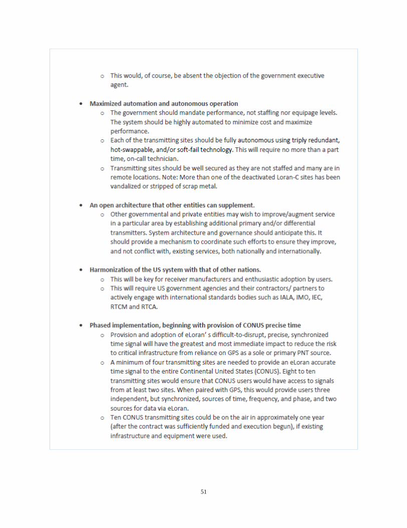
51
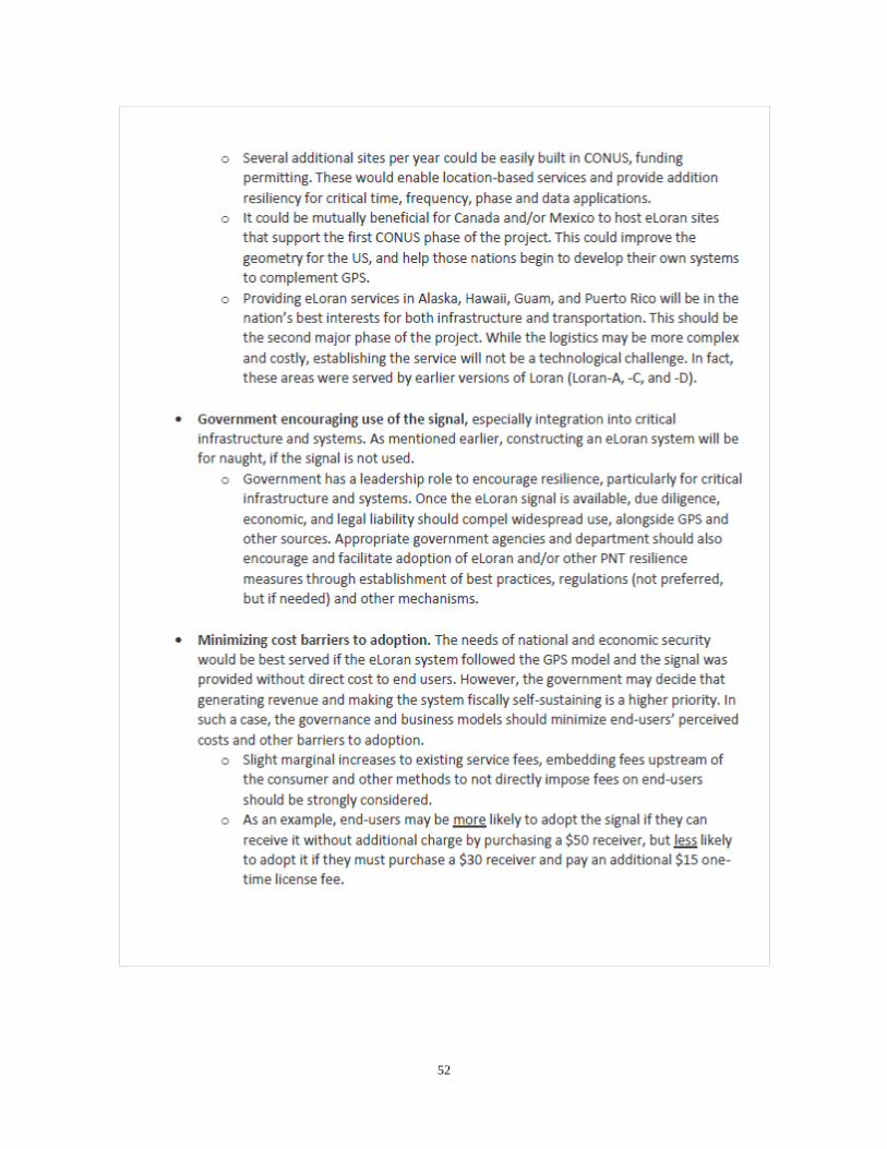
52

53

54

55

56

57