milwaukeeaoc dec09 nl single pages
TRANSCRIPT

8/2/2019 MilwaukeeAOC Dec09 NL Single Pages
http://slidepdf.com/reader/full/milwaukeeaoc-dec09-nl-single-pages 1/12
“ 2
Spawning Reef 7
Emmber Lane Restoration Project
8
Citizen-Based Monitoring Update
9
Milwaukee River Fish Passage
10
Wisconsin DNR and UW-Extension
On July 18, 2008, the EPAformally expanded the geo-graphic boundaries for theMilwaukee Area of Concern(AOC). Evidence showing contributions of toxic sub-
stances from upstreamsources has accumulatedsince the boundaries wereoriginally drawn in 1980.This change more accuratelyreflects ecosystem impactsconnected with the beneficialuse degradation described inthe Milwaukee Remedial Ac-tion Plan and subsequentdocuments. Specific expan-
sions include:
~Cedar Creek downstream
from Bridge Road to conflu-
ence with Milwaukee River.This addition encompassesthe entire Cedar Creek Super-fund Site, which contributessediments contaminated with
PCB’s to the Milwaukee River.
~Milwaukee River and Lincoln
Creek from confluence with
Cedar Creek to North Avenue
Dam. This addition includesthe portion of the MilwaukeeRiver influenced by contami-
nated sediments from LincolnCreek and Cedar Creek. Thisalso includes a large depositof contaminated sedimentslocated upstream from the
Estabrook Park Dam.
~ Little Menomonee River
from Brown Deer Road to
confluence with Menomonee
December 2009
AR E A OF CONC ERN BOUNDARIES EX TENDED
Page 1
I N S I D E T H I S I S S U E : AOC Extended 1
KK Sediment Removal 1-2
“We All Live on the Water” Signage Campaign
2
Delisting Report Update 3
SWWT Initiative 3-4
Ephemeral Ponds Project 5
Rain Garden Challenge 6
M ILWAUKEE AOC UPDATE
D R E D G I N G O N K I N N I C K I N N I C R I V E R C O M P L E T E B Y M A T T A H O A N D B E N U V A A S , W D N R
The final phase of theKinnickinnic River contami-nated sediment removal isfinally complete. After com-pletion of a special cell forKinnickinnic River sedimentand construction of shorelinestabilization features withinthe project area in the Fall of
2008, dredging began in the
Spring of 2009.
The project removed about170,000 cubic yards of sedi-ment contaminated with poly-chlorinated biphenyls (PCBs)and polyaromatic hydrocar-bons (PAHs). There were an
estimated 1,200 lbs of PCBsand 13,000 lbs PAHs in thesediment that was removed,according to the EPA. Theremoval was conducted be-tween Becher Street andKinnickinnic Avenue
(continued on page 2)
River, and Menomonee River
downstream from confluence
with Little Menomonee River
to 35th Street. The LittleMenomonee River containsthe Moss American SuperfundSite, which potentially contrib-utes contaminated sediments
to the Menomonee River.
$475M to Restore the 11
Sturgeon Release 12
8/2/2019 MilwaukeeAOC Dec09 NL Single Pages
http://slidepdf.com/reader/full/milwaukeeaoc-dec09-nl-single-pages 2/12
D R E D G I N G O N K K R I V E R ( C O N T I N U E D F R O M P . 1 )
course of the project a part-nership has been establishedamong federal and local gov-ernment agencies and ripar-ian property owners adjacentto the area. The WDNR, with
tremendous support fromUSEPA-Great Lakes NationalProgram Office, USACE, Portof Milwaukee, MilwaukeeMetropolitan Sewerage Dis-trict, and the KinnickinnicRiver Business ImprovementDistrict worked on the finalengineering design to furtherdefine the restoration specifi-
cations.
Resulting is approximatelyand 80’ navigational channel,
about 20-24’ deep with sidessloped 11’ below the Lake
Michigan Chart Datum.
Sediment removal near the1st street bridge was com-
pleted in October 2009.
For more information, visit::http://dnr.wi.gov/org/water/
wm/sms/kkriver/
Abandoned vessel (E Gillan) mired in
KK sediment. Source: WI DNR
Commercial fishing vessel leaves KK
pier. Source: WI DNR
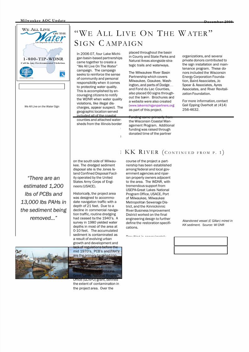
In 2006-07, four Lake Michi-gan basin-based partnerships
came together to create a―We All Live On The Water‖
campaign. The campaignseeks to reinforce the senseof community and personalresponsibility when it comesto protecting water quality.This is accomplished by en-couraging citizens to notifythe WDNR when water qualityviolations, like illegal dis-charges, appear suspect. Thegeographic location servedincluded all of the coastalcounties and attached water-
sheds from the Illinois borderto the top of Door County. Ineach of the four organiza-tion’s territory, 60 signs were
placed throughout the basinin County and State Parks and
Natural Areas alongside stra-tegic trails and waterways.
The Milwaukee River BasinPartnership which coversMilwaukee, Ozaukee, Wash-ington, and parts of Dodgeand Fond du Lac Counties,also placed 60 signs through-out the basin. Brochures anda website were also created(www.lakemichiganpartners.org )
as part of this project.
Funding came primarily fromthe Wisconsin Coastal Man-agement Program. Additionalfunding was raised throughdonated time of the partner
organizations, and several
private donors contributed tothe sign installation and main-tenance program. These do-nors included the WisconsinEnergy Corporation Founda-tion, Baird Associates, JoSpear & Associates, AyresAssociates, and River Revitali-
zation Foundation.
For more information, contactGail Epping Overholt at (414)
256-4632.
Milwaukee AOC Update
“W E AL L L I VE ON THE W ATER ”
S I GN C AMPAIGN
on the south side of Milwau-kee. The dredged sedimentdisposal site is the Jones Is-land Confined Disposal Facil-ity operated by the UnitedStates Army Corps of Engi-
neers (USACE).
Historically, the project areawas designed to accommo-date navigation traffic with adepth of 21 feet. Due to adecline in commercial naviga-tion traffic, routine dredging had ceased by the 1940’s. A
survey in 1980 yielded waterdepths in most of the area at0-10 feet. The accumulatedsediment is contaminated asa result of evolving urbangrowth and development and
lack of regulations before themid 1970’s. PCB’s and PAH’s
are the primary targeted con-
taminants.
A 2002 sediment assess-ment, funded by an USEPA-Great Lakes National ProgramOffice (GLNPO) grant, definedthe extent of contamination in
the project area. Over the
“There are an
estimated 1,200
lbs of PCBs and
13,000 lbs PAHs in
the sediment being
removed…”
December 2009
We All Live on the Water Sign
8/2/2019 MilwaukeeAOC Dec09 NL Single Pages
http://slidepdf.com/reader/full/milwaukeeaoc-dec09-nl-single-pages 3/12
“...to achieve healthy
and sustainable
water resourcesthroughout the
Greater Milwaukee
Watersheds”
The Final Milwaukee Reme-dial Action Plan Delisting Re-port has been submitted tothe EPA. Official commentsare forthcoming. This reportis the second of the five Wis-consin AOC delisting reportsto be submitted. Though la-beled as ―final‖, the report is
intended to be a starting pointto generate further study and
discussion.
Great Lakes wide, three areasof concern have been de-listed, only one of which is
located in the United States.
Milwaukee AOC Update
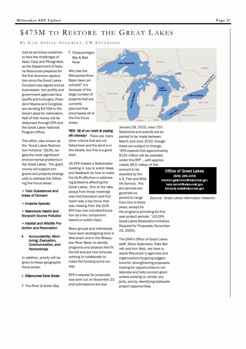
Congress is expected to provide$475 million to help bolster the
remediation effort in what theObama administration is calling the Great Lakes Restoration
Initiative ( GLRI). Major spend-ing includes $147 million desig-nated for cleaning up contami-nated sediments and $105million for habitat restoration.Also notable, $65 million will gotowards monitoring and ac-countability of the projects.Specific goals for the programinclude removing 1 million cu-bic yards of contaminated sedi-ment and restoring 23,000
acres of coastal, wetland,shoreline, and upland habitat.
See page 11 for more informa-tion about the GLRI.
Page 3
S O U T H E A S T W I S C O N S I N W A T E R S H E D S T R U S T “ S W E E T W ATER T R U S T ”
DE L I S T I N G R E P O R T AND GR E A T L AKES R E S T O R A T I O N I N I T A T I V E UPDATE
Committee, in conjunctionwith the newly formed habitatsub-committee, was put intoplace to ensure that SWWTrestoration plans are consis-tent with good science andthat habitat is not overlookedduring the watershed restora-tion process. The Policy andLegal Committee looks atemerging permitting andenforcement policies that
may improve water quality.
Present work groups includepollutant trading and water-shed based Wisconsin Pollut-ant Discharge EliminationSystem (WPDES) permitting.Lastly, two watershed actionteams (WATs) have beencreated for the Kinnickinnicand Menomonee River Water-
sheds to provide review andinput on watershed restora-tion plans that are expectedto be finalized in February2010. The plans are being developed by a team of con-
sultants hired by MMSD.
The Habitat Sub-committeewas created by request of theWATs in their review of the
plans.
The WATs are also charged to
be the on-the-ground imple-menters of the watershedrestoration plans. Both WATsare recruiting communitygroups, individuals, municipali-ties, and businesses to be-come members of the WATs.For more information aboutthe Watershed Action Teamscontact Gail Epping Overholt,UW-Extension at (414) 256-
4632.
Five Primary Purposes
Achieve water resource
goals and objectives
through innovative and
sustainable practices
Improve water quality in
the Greater Milwaukee
Watersheds, supporting a
healthy regional economy
and improving quality of
life
Test and then implement
innovative approaches
and practices that will
achieve improvements in
water resources in a cost-
effective way
(continued on page 4)
The Southeastern WisconsinWatersheds Trust (SWWT), alsoknown as the ―Sweet Water
Trust‖ is a non-profit umbrellaagency uniting independentunits of government, non-profits, agencies, organizationsand members of the generalpublic in a common effort toachieve healthy and sustain-able water resources through-out the Greater Milwaukee
Watersheds.
Origin
In autumn of 2007 a WaterPolicy advisory group assem-bled and facilitated by Dr.Nancy Frank, UWM Departmentof Urban Planning developed amission, primary purposes, andgoals for the Trust. On May 7,2008 at the first meeting of
SWWT’s Executive Steering Council the goals were ap-proved. The Brico Fund sup-ported this effort.
Organization
The Sweet Water Trust is organ-ized under four committeesand their subcommittees. TheExecutive Steering Counciloversees the business plan andsecures funds for the entireorganization. The Science

8/2/2019 MilwaukeeAOC Dec09 NL Single Pages
http://slidepdf.com/reader/full/milwaukeeaoc-dec09-nl-single-pages 4/12
The “Watershed
Restoration Plans”
represent the first
step in the
implementation of
truly science-basedwatershed
improvement efforts.
Watersheds of immediate interest toSWWT (source: Milwaukee Journal
Sentinel)
Build partnerships and
enhance collaborative
decision-making and joint project implementa-
tion, engaging govern-
ment, business, the
building industry, agricul-
ture, environmental, and
other stakeholder organi-
zations to obtain broad
agreement and recom-
mend where to invest
funds to get the greatest
benefit
Increase the region’s
success in attracting new funding and lever-
age existing funding for
water quality and water
resource improvements
Mini Grant Program
The Southeast WisconsinWatersheds Trust (SWWT)and the Milwaukee RiverBasin Partnership announcethe recipients of a Mini GrantProgram. Twenty one appli-
cants applied for funding with a total of nearly$33,000 requested. Thirteenrecipients whose proposalswere chosen to receive fund-ing will be awarded a total of $17,224.00. Awards rangedfrom $400 to $2,000.Successful proposals demon-strated an ability to imple-ment the goals and objectivesof the sponsoring organiza-tions. The goal of the MiniGrant Program is to supportlocal activities that will teach
citizens about water qualityissues, enhance conservation,and improve water quality inthe Milwaukee River Water-shed. Common grant awardsinclude rain garden plantingson school grounds with astrong educational compo-
nent.
Joyce Foundation Grant
The Sweet Water Trust (SWWT)received a major boost in itscampaign to improve waterquality in the Milwaukee RiverBasin with a three year $1.9 Mgrant from the Joyce Founda-tion. The grant supports sevenstate and local environmentalgroups and the SWWT to de-velop projects that will producemeasurable improvements inwater quality and habitat start-ing with the Menomonee and
Kinnickinnic River Watersheds.
State of the
Watershed Restoration Plans
The ―Watershed Restoration
Plans‖ represent the first step
in the implementation of trulyscience-based watershed im-provement efforts. The Trust iscurrently supporting the devel-opment of watershed restora-tion plans for the KinnickinnicRiver and the MenomoneeRiver, but hopes to developplans for each of the GreaterMilwaukee Watersheds in thefuture. The draft plans will beposted on the SWWT website
December 7 for review. Allinterested stakeholders are
invited to review the plans.Comments are due to thetechnical team January 8,2010. (See the website fordetails on how to submit your
comments.)
This work effort will produceadaptive, phased watershedrestoration plans for theKinnickinnic River Watershedand the Menomonee RiverWatershed, which will contain
the following:
An implementation plan focusedon activities that should take
place in the near term to meet long -term water quality goals;
A collaborative stakeholder in- volvement effort that will be basedupon SWWT policy and proce-dures;
Potential additional targetedefforts on green infrastructure,
pollutant trading, and socialscience measures;
Consideration of sustainability inthe development of the Plans.
This effort builds upon the soundscience, extensive data and alter-natives analysis of the MilwaukeeMetropolitan Sewerage District
2020 Facilities Plan and theSoutheastern Wisconsin Regional
Planning Commission’s RegionalWater Quality Management PlanUpdate – the combined effortknown as the Water QualityInitiative (WQI) which ended in
2007.
Contact SWWT More informa-tion about upcoming eventsand how you can get involvedwith SWWT can be found at
www.swwtwater.org .
Milwaukee AOC Update
S W W T T R U S T ( C O N T I N U E D F R O M P . 3 )
December 2009
The scenic Milwaukee River

8/2/2019 MilwaukeeAOC Dec09 NL Single Pages
http://slidepdf.com/reader/full/milwaukeeaoc-dec09-nl-single-pages 5/12
Milwaukee AOC Update
Nature centers, universities,and county staff as well as
local organizations like theFriends of the Cedarburg Bog entered into an exciting ven-ture in the spring of 2008when they joined with theUniversity of Wisconsin Exten-sion and the Wisconsin De-partment of Natural Re-sources (WDNR) in a newCitizen Science Monitoring initiative – the WisconsinEphemeral Pond Project, orWEPP. Ephemeral ponds aresmall wetlands that dry peri-odically and support many
species not found elsewhere.They’re among the least un-
derstood, and the most at
risk, wetland types.
WEPP’s main goals are to
improve methods for mapping ephemeral ponds and to in-ventory mapped ephemeralponds in Wisconsin to in-crease understanding of theirecological importance and tosupport their conservation.―The first step in protecting
and conserving these wet-lands is knowing where theyare,‖ says Joanne Kline, an
Environmental Analysis andReview Specialist with WDNR.―Citizen monitors play a cru-
cial role allowing us to expandthe number of ponds we canfield check.‖ This will aid the
WDNR in identification andmanagement of these uniquewetlands. With the help of agrant from the WisconsinCoastal Management Pro-gram, WEPP had its start inthe Wisconsin counties along
southern Lake Michigan.
Joining more than 72 citizensfrom Kenosha to SheboyganCounties, volunteers partici-pated in a 2-day training pro-gram in ephemeral pond ecol-ogy and inventory methods.Some of the volunteers exam-ined physical features likewater depth and pond size as
the season progresses. Oth-
ers recorded observations of key ephemeral pond indicatorspecies like fairy shrimp andwood frogs. This informationis helping to understand thedifferent types of ephemeralponds and their significance
in the landscape.
Knowledge about these sys-tems in Wisconsin is limitedand this effort broadens theknowledge base leading to adeeper understanding andeventual protection of thesespecial places. Due to theirephemeral nature, theseponds often go unappreciatedas the extremely diverse andecologically vital places theyare. The ponds are to theforest what a coral reef is tothe ocean. Unfortunately,they sometimes are drainedor filled in and built upon.Some ponds will be dug deeper and converted to per-manent fish ponds – not so
great for amphibians!
The volunteers who dedicatedtheir efforts and time during the spring and summer of 2008 and 2009 monitoring ephemeral ponds reap therewards by honing their skillsand expanding their worldview to include fairy shrimp,skunk cabbage and maybeeven an elusive Blanding’s
turtle.
Just a snapshot of the results
of the first year’s efforts: Byworking together, committedcitizens, non-profit partners,and staff from local and stateagencies field checked a totalof 422 sites mapped as po-tential ephemeral ponds. Of the 368 sites with enoughinformation to evaluate mapaccuracy, 245, or 67%, wereverified as correctly mappedephemeral ponds, and 14%
detected mapping errors. The
results show that the mapping is feasible and finding theerrors will improve the map-ping method. Data analysis isbeing completed for the 2009
season.
Another WEPP goal is to builda self-sustaining network of local Partners to recruit, trainand support citizen scientiststo participate in this program.If you or your organizationenjoy exploring wetlands andwant to learn about and con-tribute to ephemeral pondconservation, contact GailEpping Overholt, UW-ExtensionBasin Educator at (608) 256-4632 or email her at
Page 5
W I SCONSI N EPH EMERA L POND PROJECT B Y G A I L E P P I N G O V E R H O L T , U W E X T E N S I O N
“Ephemeral ponds are small wetlands that dry
periodically and support many species not found elsewhere. They’re among the least understood, and the most at risk, wetland types”
Ephemeral Pond. Source:
Joanne Kline - WDNR

8/2/2019 MilwaukeeAOC Dec09 NL Single Pages
http://slidepdf.com/reader/full/milwaukeeaoc-dec09-nl-single-pages 6/12
Students and Professors construct-
ing the UW-Milwaukee Rain Garden.
Source: Jim Wasley
Stormwater and the pollut-ants associated with it have
been recognized through theMilwaukee Estuary Remedial
Action Plan process as majorcontributors to ―beneficial use
impairments‖ throughout the
Milwaukee River Basin. Pol-luted storm water runoff isthe greatest threat to ourregion’s water resources.
Rain gardens are one attrac-tive option to curbing this typeof pollution. Rain gardens arelandscaped depressionsadapted to treat storm waterrunoff from a developed site
such as a parking lot or roof.Rain gardens use the samepollutant removal mecha-nisms that operate in wetlandor wooded ecosystems. Inaddition to improving thewater quality of storm water,rain gardens retain stormwater that would otherwiseenter municipal storm sewersystems, thus dealing withquantity issues as well. TheMilwaukee River Revitaliza-tion Council (Council) and theMilwaukee River Basin Part-
nership (Partnership), withfunding from the Great LakesNational Program Office, dem-onstrated the merits of raingardens with a number of pilot projects throughout the
Milwaukee Metro area.
The Council and Partnershippresented Milwaukee areauniversities with the challenge
of applying good stormwatermanagement practices to
their campuses. Targeting local universities provideseducational opportunities tostudents and encouragesenvironmental stewardship inthe neighborhoods in whichthe universities are situated.Primary goals of the―Collegiate Challenge‖ in-
cluded:
~ Reduce stormwater runoff quantities to public stormsewer systems and improvewater quality;
~ Provide educational op-portunities for students,faculty, staff, & residentsabout innovative stormwa-
ter management techniques;
~ Highly-visible examples of good environmental steward-ship willincreasecommunityawarenessand inspiredecision-
makers topromotesimilarprojects
Five uni-versities agreedto the friendlychallenge: Mar-quette University, Mount MaryCollege, Alverno College, Wis-consin Lutheran College, andthe University of Wisconsin-Milwaukee (through supportfrom WDNR’s environmental
damage compensation fund).Each school incorporatedstudents into all phases of theproject, from initial site selec-tion, implementation, andfinal monitoring.
In August 2007, the final raingarden was constructed.These innovative designs areplaced in strategic areas,capturing runoff from roofs
and paved areas that wouldnormally enter already bur-
dened systems.
Many of thegardens were designed, im-plemented, and maintainedby students and have actedas a catalyst for new student
environmental organizations.
Educators are using the gar-dens as a hands-on learning tool within their curriculum,and each garden design incor-porates educational signage.Most gardens are located inhighly visible areas to pro-
mote public interaction.
These gardens are a pro-active approach to addressing water quality issues in ourregion through establishing partnerships, promoting envi-ronmental stewardship, andeducating both young profes-
sionalsand the
public.
Milwaukee AOC Update
COLLEGIATE R AIN G ARDEN CH ALLENGE
“The Milwaukee River Revitalization Council
and the Milwaukee River Basin
Partnership, with funding from the Great
Lakes National
Program Office,demonstrated the merits of rain gardens with a number of pilot projects
throughout the Milwaukee Metro
area.”
December 2009
Rain Gardens at Alverno College.
Source: Matt Aho
Signage at Mount Mary College.
Source: Matt Aho

8/2/2019 MilwaukeeAOC Dec09 NL Single Pages
http://slidepdf.com/reader/full/milwaukeeaoc-dec09-nl-single-pages 7/12
Milwaukee AOC Update
Water quality along the lowerMilwaukee River and Milwau-
kee River Estuary has steadilyimproved since 1997. Two of the most notable and visiblewater resource managementprojects responsible for theseimprovements include theMilwaukee Metropolitan Sew-erage District’s Combined
Sewer Overflow AbatementProgram and the City of Mil-waukee’s abandonment of
the 150-year old North Ave-nue dam. Although waterquality is now capable of sup-porting a more diverse fish
and aquatic life community,critical fish spawning habitatin the estuary is limited.
Beginning in the early 1900's,river and corridor fish andother aquatic life habitat wasseverely modified by dredging and filling to accommodatecommercial shipping. Prior todredging, a large riffle com-plex was located at the up-stream limits of the estuaryand coincidentally, the loca-tion of the former North Ave-
nue Dam. The goal of theproject was to re-create aportion of the MilwaukeeRiver Estuary’s historic native
potadromous fish spawning habitat
After a detailed design andreview process, the project
was designed as one largereef totaling approximately26,050 SF (0.6 acre); using 1,675 tons of 3-in to 10-inalluvial stone; placed at anaverage thickness of 1-ft.Short-term Lake Michiganseiche events result in por-tions (typically less than 20%of the constructed reef) un-dergoing short-term (hourlyand daily) periods of waterloss and reef exposure to theair. In recognition of thesehydrologic variations, it was
decided early on in the plan-ning stages to construct thereef to accommodate as nearto possible the long-term―average‖ lake and estuary
water elevations as opposedto short-term variations.
The reef design was basedaround the spawning prefer-ences of walleye fish species.Walleye was selected for itshistoric importance to theMilwaukee estuary fishery,and the similarities between
it’s spawning preferences andthat of many other nativeWisconsin fishes.
In-stream construction com-menced on October 9, 2006
and was completed on Octo-ber 19, 2006.
Funding sources and budgetsources included USEPA 319Grant $30,000; USEPA
GLNPO Grant via NationalFish and Wildlife Foundation$60,000; USFWS Grant$15,000; Walleyes for Tomor-row (gift) $15,000 or Total of $114,460.
To date, no walleye reproduc-tion has been documented onthe reef. Eggs have been laidin the reef, but have not beenidentified. In addition to wall-eye, other Wisconsin nativesthat might use the spawning
reef include white suckersand redhorse. In October,sampling for ―young -of-year‖
walleye continued again, andhopefully continued monitor-ing will indicate spawning useby walleye.
Page 7
M ILWAUKEE R I V E R F I S H SPAWNING H ABITAT R EHABILITATION PROJECT
“To date, no walleye reproduction has been
documented on the reef.”
“...hopefully continued monitoring will indicate
spawning use by
walleye.”
Newly reconstructed North Avenue Dam prior to dredg-
ing for commercial navigation (circa. 1876). Note riffle
and coarse bed material. Source: Will Wawrzyn, WDNR
Exposed as-built reef during outflow of Milwaukee
River. Source: Will Wawrzyn, WDNR

8/2/2019 MilwaukeeAOC Dec09 NL Single Pages
http://slidepdf.com/reader/full/milwaukeeaoc-dec09-nl-single-pages 8/12
The Emmber Lane River Ac-cess and Restoration Demon-
stration Project provides aunique urban restoration op-portunity for the Menomonee
River to im-prove waterquality, aes-thetic beauty,and aquaticwildlife habitatwhile providing recreational,educational,and culturalopportunitiesfor Milwaukee
residents.
The upstream side of theEmmber Lane Bridge in theCity of Milwaukee forms asharp angle with the Meno-monee River’s northern bank
creating a corner that accu-mulates with garbage andsediment and creates littlevalue for wildlife or human
communities alike.
This portion of the Meno-
monee River is within theMilwaukee Estuary Area of Concern, which has beneficialuse impairments for―degradation of aesthetics‖
and ―loss of fish and wildlife
habitat‖. Past efforts to clean
-up and restore this area have
been unsuccessful.
A partnership of MilwaukeeRiverkeeper, the City of Mil-waukee, Wisconsin DNR, theHarbor Commission, Meno-monee Valley Partners, theMenomonee Valley BusinessImprovement District, andMenomonee Valley busi-nesses such as Cargill andSigma Environmental willdesign a permanent solutionto minimize accumulation of garbage and debris in thiscorner, improve fish and wild-life habitat, improve waterquality, provide river access,and create educational oppor-
tunities.
With the help of MarquetteUniversity students, a prelimi-nary design alternative wasdeveloped, which has beensubsequently amended toinclude a stationary riverwalkor boardwalk (cantilevered off the Emmber Lane Bridge) witha viewing platform, as well asan attached floating pier and
ramp for the purposes of launching canoes/kayaks aswell as for fishing and educa-tional purposes. There is aseparate trash barrier thatwas installed in Spring 2009,which consists of a floating pipe to minimize garbage
accumulation in the corner.
The project also consists of building a transition betweenthe riverwalk/floating pier andthe land through creation of a
small upland park. This parkwill include a trail to accom-modate ADA access to theviewing platform, a transitionbetween the park and the pierthat does not put any loadonto an aging seawall, andalso upland native plantings.The public will be able to parkat the adjacent Keep GreaterMilwaukee Beautiful parking lot to access the park andpier, and bikers can accessthe area via the Hank Aaron
State Trail. Construction of thesecond phase of this project,
which includes the riverwalk,pier, and path systems, shouldbe complete by the end of 2009. Planting of the uplandpark will continue through
spring 2010.
This project will complementother work being done in thewest end of the MenomoneeValley, as well as tie into thenew Hank Aaron State Trail andMilwaukee Urban Water Trail.The project serves as a demon-stration project for how to re-store ecological function, man-age floatable trash, and pro-vide community assets in simi-lar engineered, modified por-tions of our urban waterways in
Milwaukee and beyond.
The project budget was
$275,000. The City of Milwau-
kee received a $100,000 Wis-
consin Coastal Management
Grant for this project, and
matched that amount in their
2008 budget at $100,000.Milwaukee Riverkeeper re-
ceived financial support from
the Potawatomi Community
Foundation for $7,500, from
the We Energies Foundation for
$10,000 and $5,000 was pro-
vided by both Cargill and the
Menomonee Valley Business
Improvement District. WDNR
dedicated $5,000 from their
Environmental Damage Com-
pensation fund toward this
project as well. In-kind supportwas provided by several part-
ners as well the City of Milwau-
kee, Marquette University,
Sigma Environmental, Milwau-
kee Riverkeeper, Menomonee
Valley Partners, the Depart-
ment of Natural Resources, the
Harbor Commission and the
city’s consultants—Sigma Envi-
ronmental and Engberg Ander-
son.
Milwaukee AOC Update
E M M B E R L ANE A C C E S S AND R I V E R R E S T O R A T I O N D E M O N S T R A T I O N P R O J E C T B Y C H E R Y L N E N N , M I L W A U K E E R I V E R K E E P E R
“This project will serve as a
demonstration project for
how to restore ecological
function, manage floatable
trash, and provide
community assets in
similar engineered,
modified portions of our
urban waterways in
Milwaukee and beyond.”
December 2009
(Source: Cheryl Nenn)

8/2/2019 MilwaukeeAOC Dec09 NL Single Pages
http://slidepdf.com/reader/full/milwaukeeaoc-dec09-nl-single-pages 9/12
Milwaukee AOC Update
assessments). Volunteersmonitor on at least a monthly
basis, and data is enteredinto either the DNR ―SWIMS‖
or WAV databases.
Milwaukee Riverkeeper hopesto continue expanding citizenbased water quality monitor-ing in the Milwaukee RiverBasin. They also hope to iden-tify areas where water qualitydata gaps or needs exist, andto place citizen volunteers inthe field to fill these needs.They expect to start citizenmonitoring for bacteria andother water quality parame-ters in targeted areas, and tocontinue to use citizen volun-teers to help recognize ques-tionable practices, erosioncontrol violations, illicit dis-charges, etc. Ultimately, thegoal is to build on the DNR’s
efforts to improve the qualityand quantity of citizen-collected data that is used tomonitor the health of our wa-
terways.
SUMMARY
•Since 2006, 40 Level II vol-
unteers monitoring 50 sites
•Since 2006, 93 WAV volun-
teers monitoring 60 sites (not
all currently active)
•30 thermistors deployed in
2009 to measure streamtemperature in hourly incre-
ments.
Page 9
C I T I Z E N B ASE D M O N I T O R I N G I N THE M I L W A U K E E R I V E R B A S I N B Y C H E R Y L N E N N , M I L W A U K E E R I V E R K E E P E R
Milwaukee Riverkeeper(formerly Friends of Milwau-
kee’s Rivers) is working toward a goal of establish-ing a watershed-wide net-work of trained citizen vol-unteers who are monitoring streams and rivers, andwho collect the informationin a consistent and useableformat. In 2005, they as-sessed the status of pastcitizen monitoring activitieswithin the watershed, andstructured their citizenmonitoring program in linewith DNR’s overall citizen
monitoring strategy.Riverkeeper’s Level I pro-
gram (or Water Action Vol-unteers program) is de-signed for beginning moni-tors with little to no experi-ence in water quality moni-toring, while the Level IIprogram is for volunteerswho have monitored atLevel I for at least one yearor have some prior experi-ence. In 2006 12 advancedwater quality monitors (DNRLevel II) and 33 Level I or
Water Action Volunteers(WAV) were trained. In 20078 additional advanced vol-unteers and 14 WAV volun-teers received training. In2008 six Level II volunteersand 21 WAV volunteersreceived training. In 200914 Level II volunteers and25 WAV volunteers receivedtraining. Since 2006 over40 Level II and 93 Level I orWAV volunteers receivedtraining through the Milwau-
kee Riverkeeper Program.
Level II volunteers monitorwater quality using DNRequipment and protocols,and monitor pH, dissolvedoxygen (DO), turbidity, andtemperature (using auto-mated thermistors). Level Ivolunteers measure DO,temperature, turbidity, flow,and macroinvertebrates(and do periodic stream
•Rough temperaturedata suggests severalpotential streams forcoldwater trout intro-ductions that arebeing monitored(Mole Creek, River-edge Creek, Nichols
Creek, Pigeon Creek).

8/2/2019 MilwaukeeAOC Dec09 NL Single Pages
http://slidepdf.com/reader/full/milwaukeeaoc-dec09-nl-single-pages 10/12
Reviving our Waterways-Connecting Communities
Native fish have limited swim-ming and jumping capabilitiesto negotiate barriers and un-naturally magnified river cur-rents. This prompted Ozau-kee County to apply for andreceive $4.7M from the Na-tional Oceanic and Atmos-pheric Administration to re-store fish passage in the Mil-
waukee River Watershed.
One of the Program’s next
steps is bringing together
different Non-GovernmentalOrganizations (NGOs),schools, and universities todiscuss how different groupsand agencies can assist theprogram and work together toensure its success in the next
year and beyond.
Please come:
December 9, 2009
10 a.m. to Noon
Ozaukee County Administrative
Building - Port Washington
The meeting goals are to dis-cuss program details andestablish working groups.
Organizational events andwork days that all interestedparties can participate in areanticipated to follow. Forthose of you who are not asfamiliar with the MilwaukeeRiver Fish Passage Programvisit the County website at:http://www.co.ozaukee.wi.us/PlanningParks/PlanningParks_Fish_
Passage.htm.
Barriers to fish passage aregenerally classified into threecategories: ―Conservation
Corps‖ projects such as de-bris, ―public works‖ projects
such as perched or ineffectiveculverts and crossing, anddams. These barriers make if difficult if not impossible forsome fish to migrate up-stream or move fully withintheir resident stream. Suchpassage is often critical forspawning, rearing, and/or
survival.
According to Will Wawrzyn,Fisheries Biologist with the WIDNR, ―The Department is
trying to manage for sustain-
able fish communities and
removing or modifying barri-
ers such as these will provide
many species access to his-
torical spawning and rearing
habitats. The goal is to enableresident river fish and Lake
Michigan fish to have access
to these critical habitats. Ena-
bling fish passage is an im-
portant element to restoring
Walleye and Lake Sturgeon to
the Milwaukee River and near
shore waters of Lake Michi-
gan.”
The Fish Passage Programplans to remove more than100 barriers before Decem-
ber 2010.
If you or a representative of your NGO, university, agency,organization or school is un-able to attend the meeting, orwould like to learn more andget involved, check the web-site or contact Katherine Dis-terhaft at [email protected] formore information about theprogram, the upcoming meet-
ing, and other opportunities.
Milwaukee AOC Update
M I L W A U K E E R I V E R W A T E R S H E D F I S H P A S S A G E –
B Y K A T H E R I N E D I S T E R H A F T , O Z A U K E E C O U N T Y
December 2009
(Source: Ozaukee County)
8/2/2019 MilwaukeeAOC Dec09 NL Single Pages
http://slidepdf.com/reader/full/milwaukeeaoc-dec09-nl-single-pages 11/12
Milwaukee AOC Update
Chequamegon
Bay & Bad
River
Why has the
Milwaukee River
Basin been pri-
oritized? It’s
because of the
large number of
projects that are
currently
planned that
encompass all of
the five focus
areas.
YES! All of our work is paying
off—literally! There are many
other criteria that are not
listed here and the devil is in
the details, but this is a good
start.
US EPA hosted a Stakeholder
meeting in July to solicit ideas
and feedback on how to make
the GLRI effective in address-
ing problems affecting theGreat Lakes. One of the take-
aways from those meetings
was that Education and Out-
reach was a key focus that
was missing from the GLRI.
EPA has now included Educa-
tion as a key component
based on public input.
Many groups and individuals
have been strategizing here in
Wisconsin and in the Milwau-
kee River Basin to identify
programs and projects that fit
the bill and are now furiously
working to collaborate to
make the funding come our
way.
EPA’s request for proposals
was sent out on November 23
and submissions are due
Page 11
$475M T O R E S T O R E THE G RE A T L AKES
Just as we brace ourselves
to face the challenges of
Asian Carp and Phragmites,as the Department of Natu-
ral Resources prepares for
the first diversion applica-
tion since the Great Lakes
Compact was signed and as
businesses, non-profits and
government agencies face
layoffs and furloughs, Presi-
dent Obama and Congress
are sending $475M to the
Great Lakes for restoration.
Half of that money will be
disbursed through EPA andthe Great Lakes National
Program Office.
This effort, also known as
the ―Great Lakes Restora-
tion Initiative‖ (GLRI), tar-
gets the most significant
environmental problems in
the Great Lakes. The grant
money will support pro-
grams and projects strategi-
cally to address the follow-
ing five focus areas:
• Toxic Substances and
Areas of Concern
• Invasive Species
• Nearshore Health and
Nonpoint Source Pollution
• Habitat and Wildlife Pro-
tection and Restoration
Accountability, Moni-
toring, Evaluation,
Communication, andPartnerships
In addition, priority will be
given to these geographic
focus areas:
Milwaukee River Basin
Fox River & Green Bay
January 29, 2010, noon CST.
Selections and awards are ex-
pected to be made between
March and June 2010, though
these are subject to change.
―EPA expects that approximately
$120 million will be awarded
under this RFP ...with approxi-
mately $6.5 million of this
amount to be
awarded by the
U.S. Fish and Wild-
life Service. Pro- ject periods are
generally ex-
pected to range
from one to three
years, except for
the programs providing for five-
year project periods.‖ (US EPA
Great Lakes Restoration Initiative
Request for Proposals, November
23, 2009).
The DNR’s Office of Great Lakes
staff, Steve Galarneau, Kate Bar-rett and Kim Walz, are here to
assist Wisconsin’s agencies and
organizations by giving sugges-
tions for strengthening proposals,
looking for opportunities to col-
laborate and help connect grant
writers working on similar pro-
jects, and by identifying statewide
project opportunities.
(Source: Great Lakes Information Network)
Office of Great Lakes(608) 266-1956
B Y G A I L E P P I N G O V E H R O L T , U W - E X T E N S I O N
8/2/2019 MilwaukeeAOC Dec09 NL Single Pages
http://slidepdf.com/reader/full/milwaukeeaoc-dec09-nl-single-pages 12/12
4 T H ANNUAL S TURGEON R E L E A S E AT R I V E R E DGE N ATURE CE N T E R
Wisconsin Department of Natural Resources
2300 N Dr ML King Jr. Dr.
Milwaukee, WI 53212
Wisconsin DNR
Phone: (414) 263-8625E-mail: [email protected]
All graphics from www.riveredge.us Photo of young sturgeon
by Brian J. Torreano 2009
October 3rd marked the fourthrelease of juvenile sturgeon intothe waters of the MilwaukeeRiver. The event took place atRiveredge Nature Center starting
at 1:00pm. Events of the dayincluded a live reptile and am-phibian presentation, T-shirtdecoration, and activities for chil-dren, all in addition to the stur-
geon release at 2:30pm.
Special for this year, Billy Danielsof the Forest County PotawatomiTribe blessed the sturgeon beforetheir release. In the past, stur-geon have served as an impor-tant food source and spiritualsymbol for many Native AmericanTribes. However, sturgeon num-
“Sturgeon raised at the innovative rear- ing facility imprint on the Milwaukee
river, and will hopefully return in
15-25 years tospawn.”
Milwaukee AOC Update December 2009
UW-Extension
University of Wisconsin Extension
9501 W. Watertown Plank Road
Wauwatosa, WI 53226
Phone: (414) 256-4632
Email: [email protected]
bers have decline dramaticallysince the mid 1800’s. Overfish-
ing, loss of available spawning habitat, and decades of being labeled a ―nuisance‖ fish by
fisherman have all been factorsin the decline.
This years release is part of atwenty-five year program to re-turn sturgeon to Lake Michiganand the Milwaukee River. Stur-geon raised at the innovativerearing facility imprint on theMilwaukee river, and will hope-fully return in 15-25 years to
spawn.
One very popular activity at the
release is sponsoring a stur-geon. With a small donation,individuals are given the opportunity to hand release their owsturgeon into the river. Each
sturgeon is PIT (Passive Inte-grated Transponder) tagged.The PIT tag allows for fisheriesbiologists to track sturgeonmovements, and gives sponsoa chance to learn the fate of th
fish they released.
To request more information oto become a sponsor of nextyear’s event, go to
www.riveredge.us or call 262-
375-2715.