metro greenprintfiles.dnr.state.mn.us/assistance/nrplanning/community/greenways/... · metro...
TRANSCRIPT

METROGREENPRINTPlanning for naturein the face of urban growth
December 1997
Greenways and Natural Areas
Collaborative

Executive summary . . . . . . . . . . . . . . . . . . . . . . . . . . . . . . . . . . . . 7
The need for greenspaces . . . . . . . . . . . . . . . . . . . . . . . . . . . . . . . . 11
Vision for the future . . . . . . . . . . . . . . . . . . . . . . . . . . . . . . . . . . . 13
Building blocks . . . . . . . . . . . . . . . . . . . . . . . . . . . . . . . . . . . . . . 17
Putting the pieces together . . . . . . . . . . . . . . . . . . . . . . . . . . . . . 22
Long-term dividends . . . . . . . . . . . . . . . . . . . . . . . . . . . . . . . . . . 23
Goals and strategies . . . . . . . . . . . . . . . . . . . . . . . . . . . . . . . . . . . 25
Next steps and recommendations . . . . . . . . . . . . . . . . . . . . . . . . 30
Appendix A: Glossary of terms . . . . . . . . . . . . . . . . . . . . . . . . . . . . . 32
Appendix B: County natural resources maps . . . . . . . . . . . . . . . . . . 33
Appendix C: Local greenways and natural areas initiatives . . . . . . . . 41
Appendix D: Toolbox for land protection. . . . . . . . . . . . . . . . . . . . . 44
Bibliography . . . . . . . . . . . . . . . . . . . . . . . . . . . . . . . . . . . . . . . . . . . 47
Tableof
contents

For more information, contact:Metro Region MN-DNR1200 Warner RoadSt. Paul, MN 55106Metro Area: 612-772-7900Toll free: 1-888-MINNDNR
TTY & TDD: 612-296-5484,TDD Toll free: 1-800-657-3929
© Copyright 1997, State of Minnesota,Department of Natural Resources.
Funding for this project approved by theMinnesota Legislature, ML 1996, Chapter 407,Sec. 8, Subd. 4, as recommended by theLegislative Commission on MinnesotaResources from the Minnesota FuturesResources Fund.
Equal opportunity to participate in and benefitfrom programs of the Minnesota Department ofNatural Resources is available to all individualsregardless of race, color, creed, religion, nationalorigin, sex, marital status, status with regard topublic assistance, age, sexual orientation, ordisability. Discrimination inquiries should besent to MN-DNR, 500 Lafayette Road, St. Paul,MN 55155-4031 or the Equal OpportunityOffice, Department of the Interior, Washing-ton, DC 20240.
Printed on recycled paper containing aminimum of 10 percent post-consumer wasteand soy-based ink.
Cover painting by George Pfeifer, cover photosby Carrol Henderson and Lawrence Duke.
This document can be made available in alternative formats by callingvoice: 612-296-6157 or TTY & TDD: 612-296-5484.

DakotaScott
Anoka
Hennepin
Carver
Washington
Ramsey
S
N
EWMajor Roads
Acknowledgments
Special thanks go to John Pauley, formerDNR Metro planner, DNR Metro’sregional managers, and technical staff
who organized the first meetings in 1995 tobrainstorm about the whereabouts of remain-ing patches of green space in the seven-countymetro area. It is as a result of these initialefforts by DNR Metro, in conjunction withoutside natural resource professionals, thata “map” was created with the able assistanceof consultant Liz Anderson to show thelocations of remaining metro green spacesand some generalized greenways to connectthese green spaces together into a regionalnetwork.
The early Greenways and Natural Areas“map” was a strong visual tool and capturedthe imaginations of some key people. Withthe interest and support of Minnesota Rep-resentative Tom Ostoff, the Greenways andNatural Areas Project was recommended to
the Legislative Commission on NaturalResources for funding from the MinnesotaFutures Resources Fund. This funding sup-ported a year long collaborative process toexplore how a regional concept for greenwaysand natural areas might become a reality.
After months of work, this report is the cul-mination of many meetings by the Greenwaysand Natural Areas (GNA) Collaborative,which was organized and facilitated bySharon Pfeifer, DNR Metro, and the Collabo-rative Steering Committee. The Collabora-tive also was aided by additional efforts ofthe Technical Advisory Group. KathleenWallace, Metro Regional Administrator, pro-vided critical support and guidance for thisproject throughout, from the concept stagein 1995 to completion of this report. Greatappreciation goes to all DNR staff, who pro-vided technical and administrative support.
Metro Region

Greenways and NaturalAreas CollaborativeCliff Aichinger, Ramsey-Washington Metro WatershedDistrict
Gina Bonsignore, University ofMinnesota Design Center forAmerican Urban Landscape
Rob Buffler, St. Paul Foundation
Craig Churchward, Barton-Aschman Associates
Whitney Clark, Friends of theMississippi River
Jean Coleman, Biko Associates
Kimberly Shoe-Corrigan,Rosemount
Dave Drealan, Carver County
Robert Engstrom, EngstromCompanies
Eric Evenson, Dakota County
Jane Harper, Washington County
Mary Hauser, Washington County
Barbara Johnson, MetropolitanParks and Open Space Commission
Dean Johnson, Resource StrategiesCorporation
John Kari, Metropolitan Council
Barbara Lukermann, University ofMinnesota, Humphrey Center ofPublic Policy
Peggy Lynch, Friends of the Parksand Trails of St. Paul and RamseyCounty
Greg Mack, Ramsey County
Amy Middleton, Citizens for aBetter Environment
Del Miller, Hennepin Parks
Cordelia Pierson, Trust for PublicLand
Michael Pressman, LandStewardship Project
George Puzak, Minneapolis Parkand Recreation Board
Dan Ray, McKnight Foundation
Shelley Shreffler, St. PaulNeighborhood Energy Consortium
John VonDeLinde, Anoka County
Dorothy Waltz, National AudubonSociety
GNA Steering CommitteeBarbara Lukermann, Chair
Rob Buffler
Whitney Clark
Jean Coleman
Harland Hiemstra
Sharon Pfeifer
Cordelia Pierson
DNR Technical AdvisoryGroupHannah Dunevitz, EcologicalServices
Joan Galli, Nongame Wildlife
Harland Hiemstra, Public Affairs
Lloyd Knudson, Wildlife
Peter Leete, Waters
Sharon Pfeifer, Planning
Bart Richardson, GIS
Peggy Sand, Forestry
Ex OfficiosLiz Anderson, MN House staff
Anne Haines, Friends of theMinnesota Valley
Alice Hausman, MN Representative
Tom Osthoff, MN Representative
Susan Overson, National ParkService
Highest commendations go to all the Collaborative members who took timefrom their very busy schedules to provide input and help shape this effort.
Matt Seltzer, Attorney’s GeneralOffice
Susan Thornton, LegislativeCommission on Natural Resources
Kathleen Wallace, DNR MetroAdministrator
Project ContributorMary Kroll, Kroll Communications
Final Report Design andProductionAmy Beyer, Information andEducation Bureau, DNR
Public Affairs/Communications/Final ReportHarland Hiemstra, DNR Metro
Administrative SupportNancy Flis, DNR Metro
Project Coordinator/Facilitator/Final ReportSharon Pfeifer, DNR Metro
Greenways and natural areas
collaborative

On a recent tour of the Twin Cities Metro Region, I was struck by the phenomenal naturalbeauty of the country’s 15th most populous urban area. From ancient oaks perched on sunnyknolls in the broad Minnesota River valley to the cold clear gurglings of Washington County’strout streams, from Hennepin’s lakes and pockets of shady Big Woods to the sand-duneprairies of Cottage Grove, and from Minnehaha’s frothy tumble to the Father of Waters’slower surge, the Twin Cities region has inherited a wealth of scenic and natural treasures.
It’s an enviable position for an urban area to be in. Our rich natural heritage figures promi-nently in consistently high marks on national quality-of-life surveys. We’re blessed with localopportunities to fish, hunt, hike, bike, boat, birdwatch—to take a deep breath and appreciateour relationship with the natural world around us. This outdoors connection rewards uswith social, economic and environmental benefits that make the Cities a popular place to dobusiness and raise families, and to enjoy what’s precious along the way.
Such popularity could turn into a mixed blessing, though, if we neglect to leave room fornature in the face of ongoing rapid urbanization. The 650,000 new residents expected tomake their homes in the seven-county region over the next 22 years will need housing,offices, shopping centers, schools and roads. They’ll also expect a network of parks, trails andnatural areas to meet their recreational and aesthetic needs. Our challenge is to plan wiselyfor this growth and to work to preserve a key part of what makes the area so appealing in thefirst place.
For the past year a collaborative of nearly three dozen individuals from across the region hasbeen tackling that challenge head-on. This document is a summary of their reasoning andrecommendations. Building upon an existing network of open spaces and conservation ef-forts, it outlines a plan for assuring the continued high quality of our ecological infrastruc-ture. Metro Greenprint: Planning for Nature in the Face of Urban Growth deserves the closeconsideration of anyone committed to maintaining the Twin Cities’ liveability in the yearsahead, policymakers and citizens alike.
Our good fortune in having so many fine natural amenities to enjoy is largely the result offoresight and stewardship on the part of our predecessors. Today we have an opportunity tobuild on their efforts through a renewed vision that draws upon a better understanding ofthe links between natural systems and healthy human communities. To miss this opportunitywould be to leave our children less of a natural legacy than is their right.
Sincerely,
Rodney W. SandoCommissioner, Minnesota Department ofNatural Resources
A letterfrom
the commissioner

7
Executivesummary
The Greenways and NaturalAreas CollaborativeIn January of 1997 a group ofnearly three dozen dedicated in-dividuals from around the TwinCities gathered in St. Paul to de-velop a vision and a frameworkfor preserving and restoring keyecological features and func-
lTwo roads
diverged in awood, and I—I took the oneless traveled by,And that hasmade all thedifference.
—Robert Frost
tions while accommodating growth in themetro region. Representing a diversity of in-terests from county planners and developersto conservationists, the Greenways and Natu-ral Areas Collaborative worked for the next12 months to outline strategies for creating anetwork of natural areas and open spacesconnected via greenways. Their efforts paral-lel similar projects undertaken in a numberof urban areas in other states, including Mary-land, Florida, Oregon, Colorado and Illinois.This trend reflects a growing national aware-ness that communities anticipating growthmust plan not only for traditional systemssuch as roads and utilities; they also need toplan for nature and draft a blueprint for theirecological infrastructure.
Building On Efforts Past and PresentCreating such a network might seem like anoverwhelming task were the seven-countymetro area starting from scratch. But through-out the region’s history, visionary leaders suchas Horace Cleveland and Theodore Wirthhave seen the importance of leaving room fornature. Minneapolis’ widely noted parks andtree-lined boulevards are a testament to thatforesight. And since 1974 the MetropolitanCouncil and local counties have worked to de-velop a regional park system that currently includes45,000 acres of land and 80 miles of public trails.
When early pioneerssettled in what was tobecome the Twin
Cities, a major factor in theirdecision to locate here was theregion’s wealth of naturalresources. Situated at the con-fluence of three major river sys-tems, lavished with lakes and avariety of habitats, the area abounded withtimber, fish and wildlife, fertile prairie soilsand scenic splendor.
That rich natural heritage continues to pro-vide the backbone for a healthy culture andeconomy. Unlike those early settlers, though,we can no longer afford to take for grantedthe natural amenities around us. In the past150 years, the area’s popularity and its con-sequent urban growth have led to a radicalalteration of the landscape. Less than 6 per-cent of the native habitat that greeted pio-neers survives in the seven-county metroregion. With more than 1⁄2 million new resi-dents expected to settle here over the nexttwo decades, much of what’s left could alsodisappear.
Such a loss would compromise the region’squality of life, because natural areas providea wide range of benefits prized by metro resi-dents. These areas enhance property valuesby making communities more attractive.They protect water quality and fuel a multi-billion dollar outdoors recreation industry.They provide habitat for animals and a store-house of biological diversity. In a number ofrecent polls, Twin Citians have made it clearthat such benefits and the natural areas thatyield them are a critical part of what they lookfor in a place to call home.

8
These popular amenities have admirablyserved the purposes they were designed for:To provide outdoor recreation and to offeraesthetic relief in an urban landscape. Whilethey’ve also afforded islands of increasinglyrare habitat for plants and animals, their pri-mary focus has not been on protection andenhancement of biological integrity.
Now we have an opportunity to broadenthose efforts through a better understandingof the interdependent workings of naturalsystems. By promptly acting to protect remain-ing significant natural areas in developingparts of the region, we will be banking re-sources that future generations will value aspart of their outdoor heritage. By connect-ing those areas with each other and existingfacilities, we will create a living web assuringthe region’s ecological health and enhancingthe well-being of humans and wildlife.
Surveys affirming public support for conser-vation indicate that the time is ripe for suchplans. A growing number of grassroots effortsthroughout the region are focusing localefforts on environmental stewardship. Fromthe Phalen Watershed Project’s efforts torestore degraded riparian habitat to Wash-ington and Chisago Counties’ plans for agreen corridor to preserve open space, peopleare working to maintain and enhance thefunctional integrity of the natural worldaround them.
An ongoing metrowide Greenways and Natu-ral Areas program would support these localefforts with financial and technical assistancewhile coordinating individual projects withinthe framework of a regional network of natu-ral systems.
Next StepsThe real groundwork for the Metro region’sgreen infrastructure was laid down centuriesago by hands greater than ours. Throughstewardship and luck we’ve inherited a goodsampling of what opened our ancestors’ eyesin awe. As part of its charge from the Legisla-tive Commission on Minnesota Resources,the Greenways and Natural Areas Collabo-rative has assembled a set of tools, strategiesand recommendations for assuring that wein turn can transmit these amenities to ourheirs.
The recommendations include:
• Create a metro Greenways and NaturalAreas program with an advisory com-mittee appointed by the commissionerof the Department of Natural Resourcesin collaboration with the chair of theMetropolitan Council.
This committee would be charged withcreation of a metro Greenways and Natu-ral Areas network aimed at conservingand restoring native ecosystems and con-necting them with other cultural andoutdoor amenities across the seven-county area. It would be comprised of rep-resentatives of local units of government,nonprofit and neighborhood organiza-tions, and other interests, with supportfrom a technical committee.
Dou
g S
helle
y

9
• Appropriate $20 million as an initialmeasure for the prompt protection andenhancement of high priority naturalareas.
As one of its first tasks, the technical com-mittee would immediately set about rank-ing known natural areas of high biologicaldiversity and regional or statewide signifi-cance. Priority would be given to sitesdemonstrating an urgent need for protec-tion before critical ecological features andfunctions are lost. Concurrently, the ad-visory committee would develop a grantprogram to help individual communitiesidentify and protect locally significantareas.
Appropriated funds would be used toobtain protection for significant naturalareas, greenways providing biological con-nections, and essential buffers to protectnatural areas from adverse impacts. Allprotection efforts would be undertakenin cooperation with willing landownersand local units of government, using tech-niques that could range from conserva-tion easements to acquisition.
• Appropriate $500,000 for a grants pro-gram to encourage communities to de-velop local greenways and natural areasplans and educational projects whichcomplement the regional frameworkestablished by the advisory committee.
• Appropriate $250,000 for operationalsupport to the advisory committee andto coordinate greenways planning andimplementation with other federal,state, regional and local units of govern-ment.
Operational funds would be leveraged bythe commitment of additional staff timeand resources from the Department ofNatural Resources and the MetropolitanCouncil.
A Green LegacyIn a famous poem Robert Frost de-scribes a traveler who arrives at a forkon a forest road. Like that woodlandhiker, the seven-county Twin CitiesMetro Region is at a critical juncture,and the path we take will make all thedifference in terms of the area’s char-acter and quality of life for decades tocome. If we choose wisely, our naturalenvironment will continue to yield anabundance of benefits.
Just as the region has earned a nationalreputation for leadership in education,health care and the arts, we now havean opportunity to put ourselves in thevanguard of ecological stewardship andsustainability. That accomplishmentwould amount to the most enduringand irreplaceable legacy of all.

4
Four years agowhen the city ofSavage received aproposal to buildhousing and of-fices on the banksof Eagle Creek,battle lines werequickly drawn be-tween pro-development interests and con-servationists hoping to save one of theregion’s few remaining trout streams.
Trout need cold, clean water to survive,but urban runoff from pavement androoftops warms and pollutes streams. Asa result, only 15 waterways in the seven-county metro region still remain pristineenough to support this sensitive species.
Today Eagle Creek is an ongoing experi-ment in community-based resource pro-tection. Working together, city officials,builders, conservation interests and theDNR have assembled a management planthat minimizes the impacts of develop-ment on the stream. The plan includesstorm water diversion, restoration of na-tive vegetation, and acquisition of a bufferstrip along the waterway. As a result, fami-
lies moving intothe houses beingbuilt there willhave a nearby placeto fish, go for walksand enjoy nature.
In the aftermathof Eagle Creek, a
group of biologists and anglers issued areport documenting the threatened �sta-tus of other metro trout streams. Now anumber of communities, recognizing thevalue of what’s rare, are working to pre-serve this unique part of their naturalheritage while accommodating urbangrowth. Drawing upon a range of tools,including alternative development de-signs, stormwater diversion, conservationeasements, acquisition of stream corridorsand hydrological research, people in cit-ies such as Stillwater, Lakeville and Ma-rine-On-St. Croix are trying to come upwith local strategies to protect water qual-ity, enhance recreational opportunitiesand assure a healthier environment forhumans and wildlife. Those actions rep-resents a growing awareness that naturalareas help make a community an appeal-ing place to live.
Mar
ty M
elch
ior
Waters Worth Saving

11
In the brief span of time since the TwinCities metro region was settled, 94 per-cent of its original habitat has disap-
peared. The Big Woods, a vast hardwoodforest of towering old trees, once blanketedmuch of Hennepin County; fewer than 1,000acres remain. Less than 1 percent of the area’sprairie is left. Once abundant species havevanished due to habitat loss and fragmenta-tion.
In spite of those losses, the area still boasts awide range of natural amenities. The Minne-sota, Mississippi and St. Croix Rivers mean-der through green valleys. Our landscape issprinkled with wetlands and lakes. Remnantpatches of prairie and woods remind us ofthe region’s natural history and our role inthe masterfully woven tapestry of life.
These natural resources exert a strong pullon people today, just as they did in the past.As a result, the region’s population is ex-pected to continue growing by 650,000 inthe next 22 years. These new residents willneed homes, roads and all the other ameni-ties of modern civilization, amenities thatcould seriously degrade and diminish whatlittle of our natural heritage is left if we’renot careful.
That situation poses a clear and compellingchoice for communities as they plan for thegrowth that’s sure to continue in the metroregion. Will they develop in a fashion thatdestroys the very things people love? Or willthey recognize a fundamental law of econom-ics: that what is rare is precious? If the choiceis the latter, then we need to act now toidentify, inventory and protect remaining re-sources in a way that guides growth to mini-mize environmental impacts.
These two photographsshow the fragmentationof dry oak savanna anddry prairie barrens nearBunker Lake in AnokaCounty between 1953and 1990. With theprogressive loss ofhabitat in the BunkerLake area there hasbeen a significantdecline in plants andanimals as well.
1953
1990
The needfor
greenspaces

12
Metro Area Natural Resources map: Distribution of natural resourcesthroughout the seven-county metro area. Aquatic and terrestrial areas of highbiological importance are shown in bright green. Areas which could be restored tobetter biological quality are in hatched yellow. The parks data layer includes theregional parks system and natural resource management areas, including wildlifemanagement units, scientific and natural areas, and private preserves.
Metro Area Natural Resources (click here for map)

13
Vision Statement
“The Twin Cities Metropolitan area is successful in protecting, restoring,connecting, and managing a metrowide network of regionally and locallysignificant terrestrial and aquatic natural areas and open spaces composed of a widearray of native plant and animal species, interconnected by a system of greenwaycorridors. This regional network of greenspaces, by virtue of its size, quality, andconnectivity , provides wildlife habitat, sustains ecological diversity, and improveswater quality and ecosystem functions. It contributes to the economic well-being ofthe metropolitan area and provides for public enjoyment and education whereappropriate while maintaining high quality natural areas.”
—Greenways and Natural Areas Collaborative 1997
Throughoutmost of 1997a group of
citizens from aroundthe seven-countymetro region metmonthly to explorethe feasibility ofprotecting, restoring,and connecting re-maining natural areas and open spaces as thebackbone of a healthy environment in a rap-idly urbanizing area. Their conclusions: Notonly is that goal feasible, but a future net-work is essential to the region’s continuedhigh quality of life; and, numerous currentopportunities make this the right time to pur-sue a vision of a network of greenspaces.
Starting with a map of the region’s naturalresources and its river valleys, the Greenwaysand Natural Areas Collaborative developeda vision for a network of natural lands andopen spaces interconnected by green corri-dors for the movement of humans and wild-life. Reviewing similar efforts from Portland,Chicago, and Chattanooga, the grouplearned that such a network can provide arange of tangible social, environmental andeconomic benefits. As the collaborativeworked to refine maps of how such a networkmight look on the ground, they also beganidentifying the growing number of locally ori-ented grassroots efforts focused on protect-ing and enhancing natural resources in theTwin Cities region—individual projects thatcould readily be incorporated into a broaderregional effort. And they began assembling atoolbox of conservation techniques aimed atmaximizing local control, respecting propertyrights, and achieving the most protection inthe least costly way.
The Collaborative learned that the conceptthey were exploring was not wholly new tothe metro region. As early as 1888 landscapearchitect Horace Cleveland urged Twin Cit-ies leaders to create an extensive network oflakes, streams, wooded corridors and otheropen spaces for the aesthetic and recreationalbenefit of future residents. Out of thatvision grew the Twin Cities’ existing systemof parks, preserves and trails. What sets theCollaborative’s work apart is its emphasis onthe use of new knowledge to focus on pre-serving and enhancing the ecological integ-rity of natural systems by integrating past andpresent efforts into a regionwide web. Thegroup’s work amounts to a blueprint for theregion’s ecological future—“A MetroGreenprint.”
With the 21st century at our doorstep, theGreenways and Natural Areas Collaborativebelieves metro residents are ready to embracea renewed vision for a network of intercon-nected open spaces and natural areas thatprovide public enjoyment and education,protect wildlife habitat, sustain ecologicaldiversity and improve water quality.
Ultimately, that means a healthier environ-ment for plants, animals and humans alike.
Visionfor the
future
Geo
rge
Pfe
ifer

14
Original Concept Map—1995Potential Greenways and Natural Area (click here for map)
Original Concept Map—1995: A future vision of greenways and natural areasin the metro region. Generated in 1995 by natural resource professionals, thisregional map shows the existing parks system in relation to important habitats withsubstantial natural resource attributes or good wildlife habitat value. Potentialgreenways were drawn to connect the natural areas in to a regional network.

15
Legend definitions:
Potential Natural Areas: Potential Natural Areas: Potential Natural Areas: Potential Natural Areas: Potential Natural Areas: A natural area is asite where native vegetation is distributed innaturally-occurring patterns across the land-scape. This category here includes areas iden-tified by the Minnesota County BiologicalSurvey, and others areas identified by natu-ral resource professionals familiar with theregion. This is not an all-inclusive or precisemap, but a working draft subject to revision.
Greenways:Greenways:Greenways:Greenways:Greenways: Corridors of protected openspace managed for conservation and/or rec-reation purposes. They often follow naturalland or water features, and link natural ar-eas, parks, cultural features, and historic siteswith each other and sometimes with popu-lated areas. The mapped potential greenways,drafted by natural resource professionals, area preliminary draft subject to revision.
“Nature offers us suchadvantages as no othercity could rival…. If we
fail to secure thesenatural features and
suffer them to bedestroyed, no power onearth can restore them.”
—Horace Cleveland, 1888
Scientific and Natural Areas: Scientific and Natural Areas: Scientific and Natural Areas: Scientific and Natural Areas: Scientific and Natural Areas: Public naturepreserves that protect natural features of ex-ceptional biological significance; owned andmanaged by the DNR’s Scientific & NaturalAreas Program.
Parks: Parks: Parks: Parks: Parks: Parks and Recreation Areas is a landuse classification from the MetropolitanCouncil’s land use map. It includes publiclyowned park land and preserves, playgrounds,cemeteries and golf courses.
MUSA: MUSA: MUSA: MUSA: MUSA: The Metropolitan Urban ServiceArea is the area in the metropolitan regionthat has been designated for developmentand where urban services are provided. Thecentral portion of the MUSA area is wherethe most dense development occurs.
k
10
Big Woods, Big City
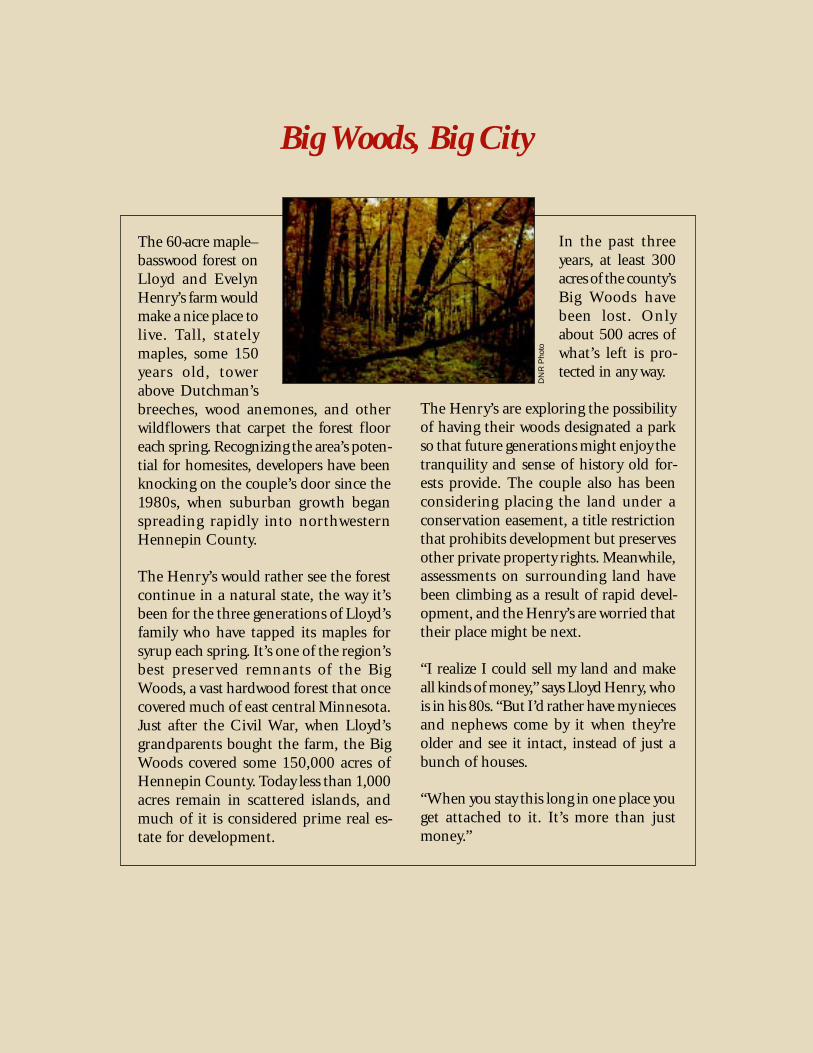
The 60-acre maple–basswood forest onLloyd and EvelynHenry’s farm wouldmake a nice place tolive. Tall, statelymaples, some 150years old, towerabove Dutchman’sbreeches, wood anemones, and otherwildflowers that carpet the forest flooreach spring. Recognizing the area’s poten-tial for homesites, developers have beenknocking on the couple’s door since the1980s, when suburban growth beganspreading rapidly into northwesternHennepin County.
The Henry’s would rather see the forestcontinue in a natural state, the way it’sbeen for the three generations of Lloyd’sfamily who have tapped its maples forsyrup each spring. It’s one of the region’sbest preserved remnants of the BigWoods, a vast hardwood forest that oncecovered much of east central Minnesota.Just after the Civil War, when Lloyd’sgrandparents bought the farm, the BigWoods covered some 150,000 acres ofHennepin County. Today less than 1,000acres remain in scattered islands, andmuch of it is considered prime real es-tate for development.
In the past threeyears, at least 300acres of the county’sBig Woods havebeen lost. Onlyabout 500 acres ofwhat’s left is pro-tected in any way.
The Henry’s are exploring the possibilityof having their woods designated a parkso that future generations might enjoy thetranquility and sense of history old for-ests provide. The couple also has beenconsidering placing the land under aconservation easement, a title restrictionthat prohibits development but preservesother private property rights. Meanwhile,assessments on surrounding land havebeen climbing as a result of rapid devel-opment, and the Henry’s are worried thattheir place might be next.
“I realize I could sell my land and makeall kinds of money,” says Lloyd Henry, whois in his 80s. “But I’d rather have my niecesand nephews come by it when they’reolder and see it intact, instead of just abunch of houses.
“When you stay this long in one place youget attached to it. It’s more than justmoney.”
DN
R P
hoto

17
Across the country, from Maryland inthe east to Oregon and California inthe west, from breadbasket states such
as Illinois and Wisconsin to the southernreaches of Florida, communities are begin-ning to lay the groundwork for networks ofgreenspaces. This national trend reflects agrowing awareness of people’s dependenceon their natural environment, and the ben-efits that arise when the environment existsin a healthy condition.
Compared to many communities, the metroarea is at an advantage when it comes toestablishing such a network. Many high qual-ity natural areas representing rare ecosystemsremain around the region. Open spaces, lakesand parks dot the landscape. Three majorrivers and their tributaries provide naturalcorridors or greenways for the movement ofhumans and wildlife.
These three elements—natural areas, open spaces and greenways—comprise the primary building blocks, along with parks, to create anetwork of greenspaces.
Natural AreasSites that are largely undisturbed by humans. Nativevegetation is distributed in naturally occurring patternsacross the landscape. These patterns change over timeunder the influence of drought, flooding, fires and theinteractions between plants and wildlife.
Open SpacesUndeveloped sites that don’t meet the criteria fornatural areas because of human disturbance, but stillprovide habitat, scenery and other benefits. Openspaces can include areas such as farm land, vacant citylots, high-use parks, golf courses and utility corridors.
GreenwaysContinuous or patchy areas of vegetation that providecorridors for the movement of humans and wildlife.They often follow natural waterways or land features,and they may connect natural areas or other commu-nity resources such as cultural institutions.
Buildingblocks
18
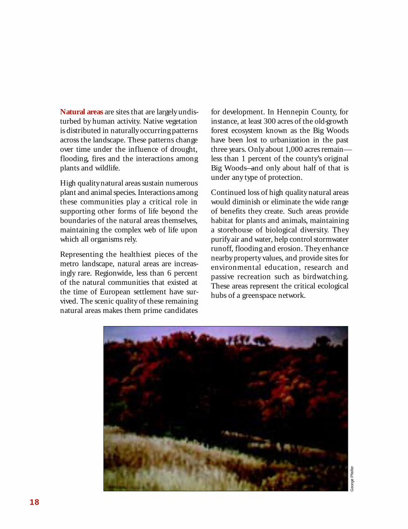
Natural areas are sites that are largely undis-turbed by human activity. Native vegetationis distributed in naturally occurring patternsacross the landscape. These patterns changeover time under the influence of drought,flooding, fires and the interactions amongplants and wildlife.
High quality natural areas sustain numerousplant and animal species. Interactions amongthese communities play a critical role insupporting other forms of life beyond theboundaries of the natural areas themselves,maintaining the complex web of life uponwhich all organisms rely.
Representing the healthiest pieces of themetro landscape, natural areas are increas-ingly rare. Regionwide, less than 6 percentof the natural communities that existed atthe time of European settlement have sur-vived. The scenic quality of these remainingnatural areas makes them prime candidates
for development. In Hennepin County, forinstance, at least 300 acres of the old-growthforest ecosystem known as the Big Woodshave been lost to urbanization in the pastthree years. Only about 1,000 acres remain—less than 1 percent of the county’s originalBig Woods—and only about half of that isunder any type of protection.
Continued loss of high quality natural areaswould diminish or eliminate the wide rangeof benefits they create. Such areas providehabitat for plants and animals, maintaininga storehouse of biological diversity. Theypurify air and water, help control stormwaterrunoff, flooding and erosion. They enhancenearby property values, and provide sites forenvironmental education, research andpassive recreation such as birdwatching.These areas represent the critical ecologicalhubs of a greenspace network.
Geo
rge
Pfe
ifer

19
Open spaces are undeveloped sites that don’tmeet the criteria for natural areas becausethey’ve been altered and disturbed by humanactivities. Open spaces still may provide habi-tat, scenery, recreational opportunities andother benefits. They can serve as a bufferaround higher quality natural areas, and theyoffer potential as sites for habitat restorationand re-establishment of native plants. Openspaces can include areas such as farm land,vacant city lots, high-use parks, golf coursesand utility corridors. Preservation of openspace may be encouraged by local zoningordinances. Greenways are continuous or patchy areas
of vegetation that provide corridors for themovement of humans and wildlife. Gener-ally linear in shape, they often follow water-ways or land features such as steep slopes andravines. They may connect natural areas,parks and other community resources andcultural institutions.
Greenways can take a range of forms, from ahigh-use trail along an urban thoroughfaresuch as Minnehaha Parkway, to a more pris-tine natural corridor along the St. CroixRiver. The highest quality greenways providehabitat and allow for the movement of wild-life, plants and water from one area toanother. Such greenways enhance the valueand ecological function of natural areas andopen space by interconnecting them, therebycounteracting habitat fragmentation as wellas habitat loss.
Greenways also offer numerous opportuni-ties for recreation and alternative forms oftransportation. They can enhance adjacentproperty values and buffer waterways frompollution and erosion caused by runoff. Theyserve as a focus for community identity andpride.
DN
R P
hoto
Joe
Niz
nik

20
Natural areas, greenways, and open space all contribute to a better qualityof life and can provide similar environmental, social, and economicbenefits. Below are a few key benefits that characterize each building block:
Law
renc
e D
uke
Greenways and open spaces can be of par-ticular value in developed urban areas, wherehigh population densities afford opportuni-ties for extending environmental values andthe benefits of nature to a large number ofpeople. Habitat improvements and restora-tion in such areas make these core city neigh-borhoods more attractive, and promoteMetropolitan Council goals for accommodat-ing a good portion of the region’s anticipatedgrowth in already developed locales. Greenenhancement of the urban core wouldcomplement the existing system of parks andtrails, building upon the natural corridor pro-vided by the Mississippi River, which flowsthrough the heart of the central cities.
Natural Areas• Provide a wide range of
“free” ecological servicessuch as efficient nutrientcycling, soil enrichment,flood control
• Contain many species withpotentially useful geneticmaterial
• Provide suitable wildlifehabitat
• Increase environmentalflexibility in the face ofnatural disasters such asfire, drought, and flooding
Open Space• Provides human
sources of food(farms, orchards) andfiber (woodlots)
• Provides areas forrestoration to buffernatural areas
• Creates a sense ofcommunity identity
Greenways• Function as linkages
and increase habitatconnectivity andavailability
• Provide alternativetransportation options
• Stimulate businessdevelopment focusedaround recreation andtourism

15
As MinneapolisParks Commis-sioner GeorgePuzak talks aboutthe MidtownGreenway Coali-tion (MGC), herefers back to thewords of HoraceCleveland.
A 19th century landscape architect, Cleve-land is considered the conceptual grand-father of Minneapolis’ system of parksand boulevards. In 1888 he urged cityleaders to create a parkway down LakeStreet connecting the Minneapolis chainof lakes with the Mississippi River. Fail-ure to attend to such natural amenities,he predicted, would lead to a “hideousscene of desolation”—an early warning ofurban blight.
Puzak finds both prophecy and prospectsin those remarks. He and others with theMGC hope that a modern rendering ofCleveland’s vision might now help revi-talize Lake Street and surrounding neigh-borhoods by creating a greenway oneblock away along an old rail corridor,finally linking Minneapolis’ lakes with theMississippi. Plans call for the 5.5 milestretch to include paths for hiking and
Green to the Core
biking, as well aslandscaping withnative vegetation.
Such attempts tomake the core cit-ies a more appeal-ing place to livethrough greenspaces aren’t re-
stricted to Lake Street or Minneapolis.Across the river, the Greening the GreatRiver Park project has been working forthree years on a goal of planting 30,000native trees and shrubs, 60 acres of prai-ries and thousands of wildflower seed-lings along the Mississippi River valleythrough downtown St. Paul. Drawingupon numerous partnerships with busi-nesses, neighborhood associations andlocal volunteers, the project is well on itsway toward a mission of restoring thearea’s ecological functions by connectingsong bird corridors, reducing chemicalrunoff and increasing the diversity ofriver valley vegetation.
As part of a metrowide network ofgreenways and natural areas, efforts suchas these will help assure the center cities’role as a vital core for an environmen-tally healthy region.
Rob
Buf
fler
22
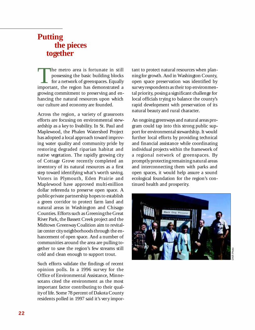
The metro area is fortunate in stillpossessing the basic building blocksfor a network of greenspaces. Equally
important, the region has demonstrated agrowing commitment to preserving and en-hancing the natural resources upon whichour culture and economy are founded.
Across the region, a variety of grassrootsefforts are focusing on environmental stew-ardship as a key to livability. In St. Paul andMaplewood, the Phalen Watershed Projecthas adopted a local approach toward improv-ing water quality and community pride byrestoring degraded riparian habitat andnative vegetation. The rapidly growing cityof Cottage Grove recently completed aninventory of its natural resources as a firststep toward identifying what’s worth saving.Voters in Plymouth, Eden Prairie andMaplewood have approved multi-milliondollar referenda to preserve open space. Apublic-private partnership hopes to establisha green corridor to protect farm land andnatural areas in Washington and ChisagoCounties. Efforts such as Greening the GreatRiver Park, the Bassett Creek project and theMidtown Greenway Coalition aim to revital-ize center city neighborhoods through the en-hancement of open space. And a number ofcommunities around the area are pulling to-gether to save the region’s few streams stillcold and clean enough to support trout.
Such efforts validate the findings of recentopinion polls. In a 1996 survey for theOffice of Environmental Assistance, Minne-sotans cited the environment as the mostimportant factor contributing to their qual-ity of life. Some 78 percent of Dakota Countyresidents polled in 1997 said it’s very impor-
tant to protect natural resources when plan-ning for growth. And in Washington County,open space preservation was identified bysurvey respondents as their top environmen-tal priority, posing a significant challenge forlocal officials trying to balance the county’srapid development with preservation of itsnatural beauty and rural character.
An ongoing greenways and natural areas pro-gram could tap into this strong public sup-port for environmental stewardship. It wouldfurther local efforts by providing technicaland financial assistance while coordinatingindividual projects within the framework ofa regional network of greenspaces. Bypromptly protecting remaining natural areasand interconnecting them with parks andopen spaces, it would help assure a soundecological foundation for the region’s con-tinued health and prosperity.
Puttingthe pieces
together
DN
R P
hoto
23
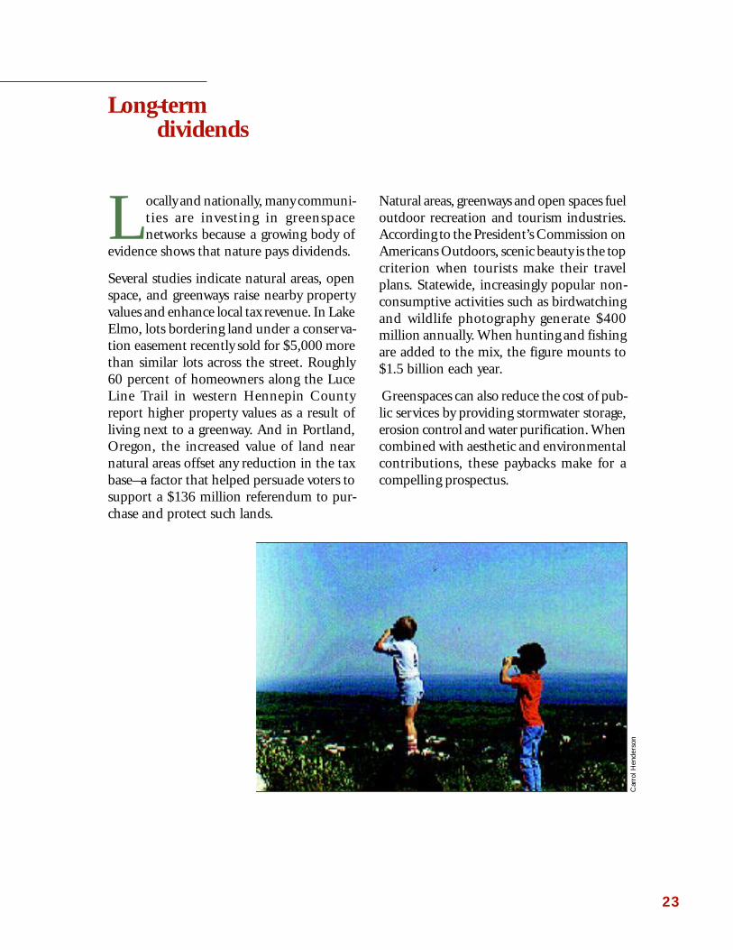
Locally and nationally, many communi-ties are investing in greenspacenetworks because a growing body of
evidence shows that nature pays dividends.
Several studies indicate natural areas, openspace, and greenways raise nearby propertyvalues and enhance local tax revenue. In LakeElmo, lots bordering land under a conserva-tion easement recently sold for $5,000 morethan similar lots across the street. Roughly60 percent of homeowners along the LuceLine Trail in western Hennepin Countyreport higher property values as a result ofliving next to a greenway. And in Portland,Oregon, the increased value of land nearnatural areas offset any reduction in the taxbase—a factor that helped persuade voters tosupport a $136 million referendum to pur-chase and protect such lands.
Natural areas, greenways and open spaces fueloutdoor recreation and tourism industries.According to the President’s Commission onAmericans Outdoors, scenic beauty is the topcriterion when tourists make their travelplans. Statewide, increasingly popular non-consumptive activities such as birdwatchingand wildlife photography generate $400million annually. When hunting and fishingare added to the mix, the figure mounts to$1.5 billion each year.
Greenspaces can also reduce the cost of pub-lic services by providing stormwater storage,erosion control and water purification. Whencombined with aesthetic and environmentalcontributions, these paybacks make for acompelling prospectus.
Long-termdividends
Car
rol H
ende
rson
18
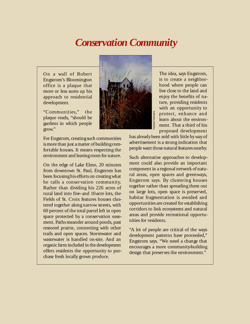
Conservation Community
On a wall of RobertEngstrom’s Bloomingtonoffice is a plaque thatmore or less sums up hisapproach to residentialdevelopment.
“Communities,” theplaque reads, “should begardens in which peoplegrow.”
For Engstrom, creating such communitiesis more than just a matter of building com-fortable houses. It means respecting theenvironment and leaving room for nature.
On the edge of Lake Elmo, 20 minutesfrom downtown St. Paul, Engstrom hasbeen focusing his efforts on creating whathe calls a conservation community.Rather than dividing his 226 acres ofrural land into five- and 10-acre lots, theFields of St. Croix features houses clus-tered together along narrow streets, with60 percent of the total parcel left in openspace protected by a conservation ease-ment. Paths meander around ponds, pastrestored prairie, connecting with othertrails and open spaces. Stormwater andwastewater is handled on-site. And anorganic farm included in the developmentoffers residents the opportunity to pur-chase fresh locally grown produce.
The idea, says Engstrom,is to create a neighbor-hood where people canlive close to the land andenjoy the benefits of na-ture, providing residentswith an opportunity toprotect, enhance andlearn about the environ-ment. That a third of hisproposed development
has already been sold with little by way ofadvertisement is a strong indication thatpeople want those natural features nearby.
Such alternative approaches to develop-ment could also provide an importantcomponent in a regional network of natu-ral areas, open spaces and greenways,Engstrom says. By clustering housestogether rather than spreading them outon large lots, open space is preserved,habitat fragmentation is avoided andopportunities are created for establishingcorridors to link ecosystems and naturalareas and provide recreational opportu-nities for residents.
“A lot of people are critical of the waysdevelopment patterns have proceeded,”Engstrom says. “We need a change thatencourages a more community-buildingdesign that preserves the environment.”
Har
land
Hie
mst
ra

25
The effort to establish a regional net-work of greenways and natural areasbegan with a map. Its first phase con-
cludes with a similar product.
Three years ago resource experts from theDNR, the U.S. Fish and Wildlife Service, theNature Conservancy and other groups gath-ered around maps of the metro region toidentify natural resources not yet lost to ur-ban growth. Their hand-written scribbleswere compiled into a Geographic Informa-tion System database and used to generate aseven-county outline of significant areas andpotential greenways linking them.
That map provided the starting vision for themetro Greenways and Natural Areas Collabo-rative. Over the past year, the group hasrefined its vision, added numerous layers ofdata and produced a preliminary series ofmaps identifying some potential opportuni-ties to begin work on a regional networkof greenspaces. Of equal importance, theCollaborative also drafted a set of goals andstrategies for sustaining our ecological infra-structure.
Goal 1:Create and manage a Greenways and Natural Areas Network by:
• Completing a regional plan to provide guidance and support for local efforts;
• Developing a framework to support “greenways efforts” that cross jurisdictionalboundaries;
• Holding workshops to gather input from citizens and local officials and to rallysupport for the Greenways and Natural Areas Network.
Goalsand
strategies
L. H
uhn
26
Goal 3:Connect and enhance existing open spaces, outdoor recreational amenities, andcultural resources to the regional Greenways and Natural Areas Network by:
• Linking up with existing metropolitan parks, open spaces, outdoor recreationalamenities, and cultural resources;
• Encouraging private land owners with working landscapes to contribute to theregional network through voluntary, incentive-based approaches;
• Identifying key regional outdoor recreational linkages that are missing andincluding them in the regionwide network;
• Coordinating greenways and trail planning efforts among the various entities(local councils, non-profits, neighborhood groups, the Met Council, NationalPark Service, DNR).
Goal 2:Conserve and restore natural areas in the seven-county metropolitan area inorder to maintain a dynamic, functioning natural landscape that providesecological, aesthetic, and economic benefits while allowing for adaptation tofuture environmental changes by:
• Using a variety of voluntary, incentive-based protection tools as well as acquisi-tion to encourage landowners to protect natural areas and important open spaces;
• Involving citizens in the management and restoration of natural areas, greenways,and open space;
• Providing technical assistance to local units of government for the developmentof more environmentally sensitive local comprehensive plans and developmentapproaches;
• Restoring greenspaces, where needed, to improve their ecological health;
• Identifying, protecting, and restoring key regional ecological linkages whereneeded;
• Monitoring the ecological health of components of the network.
27
Goal 4:Ensure that the Greenways and Natural Areas Network serves all metro arearesidents by:
• Encouraging connections between newly created greenways and existing com-munities and transportation corridors;
• Providing a wider range of educational, scientific, and recreational opportuni-ties.
Goal 5:Build public and political support for the Greenways and Natural AreasNetwork by:
• Involving the public in the planning, development, active management, andrestoration of the Greenways and Natural Areas Network;
• Developing and implementing a promotional/marketing strategy to illustratethe ecological, economic, and social benefits of a regional Greenways and NaturalAreas Network;
• Creating awareness of the value and importance of natural areas, greenways,and open spaces through citizen stewardship activities;
• Providing technical assistance and needed information.
Goal 6:Fund the creation and maintenance of the regional Greenways and NaturalAreas Network through public and private sources by:
• Establishing a public information strategy to obtain input for and to create pub-lic awareness of the Greenways and Natural Areas planning and implementa-tion effort;
• Creating a private trust fund to support Greenways and Natural Areas plan-ning, advocacy, education, and outreach.

28
Opportunities for Protection and Restoration: This map represents a preliminaryanalysis of the relationship between the existing regional parks system and high qualitynatural areas, and how they might connect. After additional analysis and application ofecological, social and economic criteria, this map will be refined.
Opportunities for Protection and Restoration (click here for map)

23
A big part of thereason that Wash-ington County isone of the region’sfastest growingareas is its naturalbeauty. Boundedon the east by thescenic St. CroixRiver and to the southwest by the Missis-sippi, the county’s rolling farm fields,wooded hillsides and cool trout streamsmake it an appealing place.
That appeal, however, could lead to de-struction of the very things people love ifthe county’s growth isn’t wisely managed.
Under the banner of the Green Corri-dor Project, a group of area farmers, con-servationists, county officials and otherresidents are now working to prevent thatfrom happening. Spearheaded by theLand Stewardship Project’s 1,000 Friendsof Minnesota, the project is aimed at pro-tecting environmentally sensitive lands,maintaining scenic and rural character,providing wildlife habitat and saving pro-ductive farms by preserving and linkingopen spaces throughout Washington andChisago Counties.
Countryside Connections
Project membersare currently con-ducting an inven-tory of openspaces to identifywhat areas shouldbe protected andhow they might belinked with al-
ready protected lands. Over the next 11⁄2years extensive public input will helpshape the corridors’ design and location.Rather than relying on acquisition as aprimary means of protection, the GreenCorridor Project will emphasize use ofconservation easements and purchase andtransfer of development rights, voluntaryprograms that allow participants to retainownership and control of their propertywhile imposing specific restrictions onfurther subdivision of the land.
“Around the Midwest and throughout thecountry, green corridors have worked tohelp communities keep the landscapethey love while accommodating growth,”says Michael Pressman, Green CorridorProject coordinator. “This is a way to pro-tect important open spaces while improv-ing the appeal of neighborhoods andsupporting their long term tax base.”
Geo
rge
Pfe
ifer
30
Next stepsand
recommendations
DN
R P
hoto
The Greenways and Natural AreasCollaborative believes these measuresare necessary to protect the natural trea-sures that form the basis of the region’shigh quality of life. What was laid downfor us by the creator’s hands can nolonger be taken for granted in a rap-idly growing area that’s already hometo half the state’s population. Theenvironment is a vital part of our com-munities and our infrastructure, andit must be carefully planned for andmanaged if we are to continue enjoy-ing its benefits.
At a time when many decry thenational debt as an unfair burden onfuture generations, we should also takestock of the balance in our ecologicalaccount. Having drawn it down so far,should we take on further debt? Orshould we act decisively to save what’sleft and begin the work of replenish-ing our rich natural endowment?
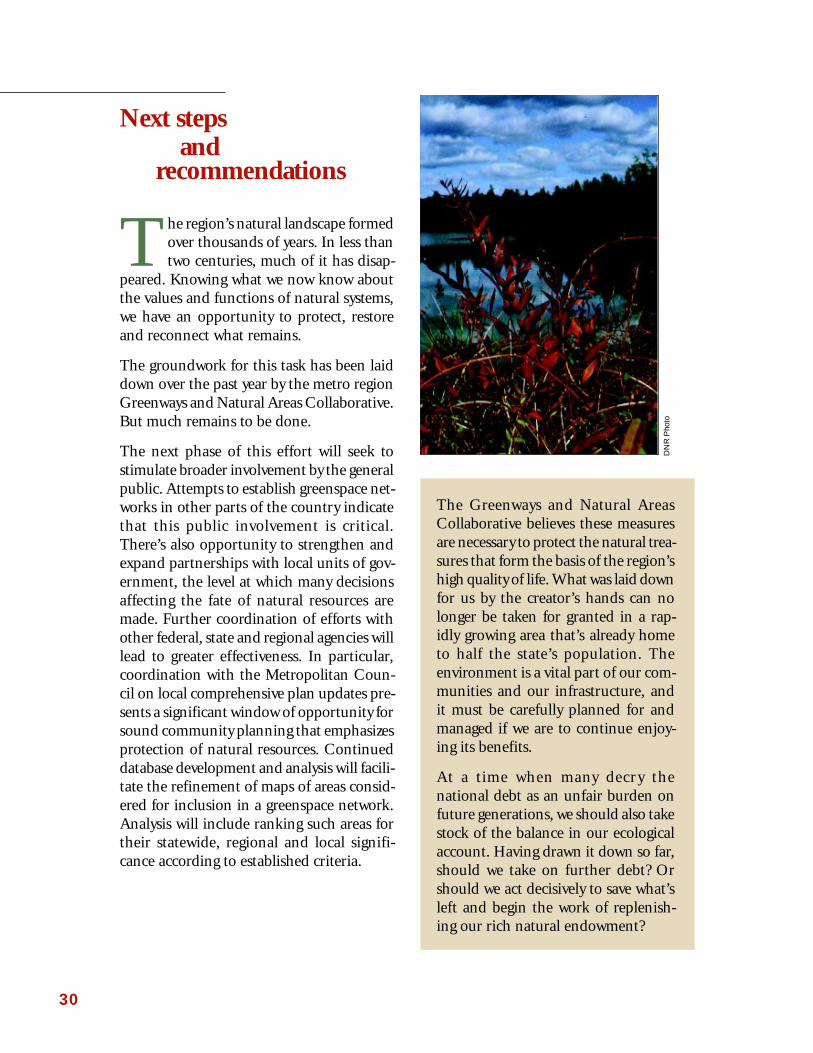
The region’s natural landscape formedover thousands of years. In less thantwo centuries, much of it has disap-
peared. Knowing what we now know aboutthe values and functions of natural systems,we have an opportunity to protect, restoreand reconnect what remains.
The groundwork for this task has been laiddown over the past year by the metro regionGreenways and Natural Areas Collaborative.But much remains to be done.
The next phase of this effort will seek tostimulate broader involvement by the generalpublic. Attempts to establish greenspace net-works in other parts of the country indicatethat this public involvement is critical.There’s also opportunity to strengthen andexpand partnerships with local units of gov-ernment, the level at which many decisionsaffecting the fate of natural resources aremade. Further coordination of efforts withother federal, state and regional agencies willlead to greater effectiveness. In particular,coordination with the Metropolitan Coun-cil on local comprehensive plan updates pre-sents a significant window of opportunity forsound community planning that emphasizesprotection of natural resources. Continueddatabase development and analysis will facili-tate the refinement of maps of areas consid-ered for inclusion in a greenspace network.Analysis will include ranking such areas fortheir statewide, regional and local signifi-cance according to established criteria.

31
• Create a metro Greenways and Natural Areas program with an advisorycommittee appointed by the commissioner of the Department of Natu-ral Resources in collaboration with the chair of the Metropolitan Coun-cil.
This committee would be charged with creation of a metro Greenways andNatural Areas network aimed at conserving and restoring native ecosys-tems and connecting them with other cultural and outdoor amenities acrossthe seven-county area. It would be comprised of representatives of localunits of government, nonprofit and neighborhood organizations, and otherinterests, with support from a technical committee.
• Appropriate $20 million as an initial measure for the prompt protectionand enhancement of high priority natural areas.
As one of its first tasks, the advisory committee would immediately setabout ranking known natural areas of high biological diversity and state-wide or regional significance. Priority would be given to sites demonstrat-ing an urgent need for protection before critical ecological features andfunctions are lost. Concurrently, the committee would develop a grantprogram for individual communities to identify and protect locally signifi-cant areas.
Appropriated funds would be used to obtain protection for these signifi-cant natural areas, greenways providing biological connections among them,and essential buffers to protect sites from adverse impacts. All protectionefforts would be undertaken in cooperation with willing landowners andlocal units of government, using techniques that could range from conser-vation easements to acquisition.
• Appropriate $500,000 for a grants program aimed at encouraging com-munities to develop local greenways and natural areas plans and educa-tional projects to complement the regional framework established bythe advisory committee.
• Appropriate $250,000 for staff to provide operational support to theadvisory committee and to coordinate greenways planning and imple-mentation with other federal, state, regional and local units of govern-ment.
Operational funds would be leveraged by the commitment of additionalstaff time and resources from the Department of Natural Resources andthe Metropolitan Council.
To assure the continued health of our natural world, the Collaborativeaddresses the following recommendations to state, regional and localdecision makers:

32
Park
as defined in this report, lands held in public or private ownership anddesignated for recreation use or natural resource management uses
Permanent agricultural area
permanent agricultural areas are outside the urban reserve and intendedto be kept in agricultural uses indefinitely (as defined by the Met Coun-cil)
Permanent rural area
permanent rural areas are sparsely developed with a mix of farm andnonfarm uses that do/will not require urban levels of service for theforeseeable future (as defined by the Met Council)
Potential natural area
a natural area that retains some features of its original native communi-ties, but has been altered by human activities and requires restoration
Regionally significant natural area
a natural area of importance to the region as a whole for its uniqueecological value
Riparian area or zone
vegetated border along a stream, river, or lake including the flood plain,banks, and upland areas
Scientific and Natural Area
a public nature preserve that protects natural features of exceptionalbiological significance, which is owned and managed by the DNR’sScientific and Natural Areas Program
Urban area
that part of the region bounded by the MUSA line which is activelybecoming urbanized and within which local and regional services arecommitted during specified time periods (as defined by the Met Coun-cil)
Urban core
Twin Cities downtown areas, their immediate neighborhoods, and theUniversity Avenue corridor connecting them (as defined by the MetCouncil)
Urban reserve
the rural-to-urban transition area between the current MUSA line andthe urban reserve boundary line; this area will remain rural until it isincluded in the urban area (as defined by the Met Council)
Biodiversitythe variety of plant and animal life living together in a specific habitat
Bufferan area of preferably native vegetation surrounding a natural area oropen space which provides additional protection from developmentimpacts
Connectivitylinkage of habitats by buffer zones, open space, greenways, and/or trailsthat increases ecological integrity of part of the landscape
Conservation easementa mutually binding contract between a landowner and an individual ororganization that has requested a special right to the land; the land-owner who voluntarily sells an easement gives up some rights to theproperty; the easement defines boundaries, uses, and managementobligations for the land
Fee simple acquisitionacquiring title and all rights to a property without restriction
Greenspacesnatural areas, open spaces, and greenways that function both for peopleand wildlife
GreenwaysContinuous or patchy areas of vegetation that provide corridors forthe movement of humans and wildlife. They often follow natural wa-terways or land features, and they may connect natural areas or othercommunity resources such as cultural institutions.
Landscapea large land area that contains different habitats (land and/or water)arranged in a mosaic
Locally important or locally significant areanatural areas, open spaces, or greenways valued by local communities
MUSAThe Metropolitan Urban Service Area (MUSA) is the area in the met-ropolitan region that has been designated for development and whereurban services are provided; the central portion of the MUSA area iswhere the densest development occurs (as defined by the Met Council)
Natural areaSites that are largely undisturbed by humans. Native vegetation isdistributed in naturally occurring patterns across the landscape.These patterns change over time under the influence of drought,flooding, fires and the interactions between plants and wildlife.
Networksystem of open spaces, natural areas, greenways, trails, parks, wildlifemanagement units, private nature preserves, and scientific and naturalareas which provides social, ecological, and economic benefits
Open spaceUndeveloped sites that don’t meet the criteria for natural areas becauseof human disturbance, but still provide habitat, scenery and other ben-efits. Open spaces can include areas such as farm land, vacant city lots,high-use parks, golf courses and utility corridors.
Appendix A: Glossary of terms
33
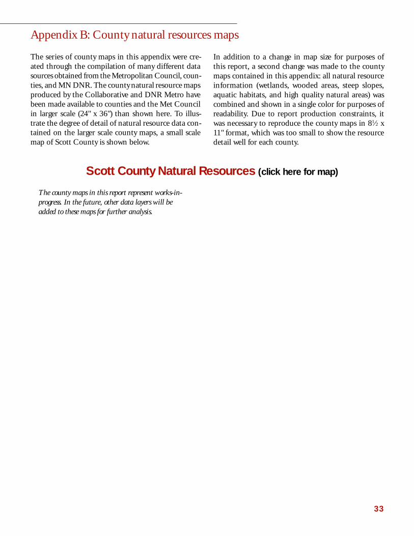
Appendix B: County natural resources maps
The series of county maps in this appendix were cre-ated through the compilation of many different datasources obtained from the Metropolitan Council, coun-ties, and MN DNR. The county natural resource mapsproduced by the Collaborative and DNR Metro havebeen made available to counties and the Met Councilin larger scale (24" x 36") than shown here. To illus-trate the degree of detail of natural resource data con-tained on the larger scale county maps, a small scalemap of Scott County is shown below.
In addition to a change in map size for purposes ofthis report, a second change was made to the countymaps contained in this appendix: all natural resourceinformation (wetlands, wooded areas, steep slopes,aquatic habitats, and high quality natural areas) wascombined and shown in a single color for purposes ofreadability. Due to report production constraints, itwas necessary to reproduce the county maps in 81⁄2 x11" format, which was too small to show the resourcedetail well for each county.
The county maps in this report represent works-in-progress. In the future, other data layers will beadded to these maps for further analysis.
Scott County Natural Resources (click here for map)

34
Anoka County Natural Resources (click here for map)

35
Carver County Natural Resources (click here for map)

36
Dakota County Natural Resources (click here for map)

37
Hennepin County Natural Resources (click here for map)

38
Ramsey County Natural Resources (click here for map)

39
Scott County Natural Resources (click here for map)

40
Washington County Natural Resources (click here for map)

41
The following list represents a sampling of greening projectsin the metro region which focus on the protection,restoration, connection, or better management of naturalareas, open space, parks, trails, and greenways. These areefforts with which the Greenways and Natural Areasinitiative could partner to develop a regional network ofgreenways and natural areas.
Greening the Great River Park ProjectThe goal of this project is to reintroduce native trees,shrubs, and wild flower plantings to the downtownMississippi River Valley in the St. Paul area at a scalewhich creates an urban forest for migratory birds andfor people. The project expects to plant over 30,000trees and shrubs over 5 years and to recreate 60 acresof native prairie. This community-based project relieson volunteers to plant and care for the restored areas.The project spans the river valley between the HighBridge and Holman Field on both sides of the river,bluff to bluff, where the impacts of urbanization andindustrialization have most changed the valley anddegraded its natural vegetation.
Information: Contact Rob Buffler, St. PaulFoundation, 224-5463
Washington-Chisago Green Corridor ProjectThe Land Stewardship Project is working with Wash-ington and Chisago counties to inventory and planfor a permanently protected green corridor of 10,000acres. This effort tests new land protection tools, in-cluding purchase of development rights (PDRs) andtransfer of development rights (TDRs). It also relieson donation, acquisition, and conservation easementsto implement a green corridor plan. Wildlife manage-ment areas, farm lands, Scientific and Natural Areas,environmentally sensitive areas, and other open spacesare proposed to be linked together by this effort.
Information: Contact Michael Pressman, LandStewardship Project, 653-0618
Trout Stream Watershed InitiativeIn an effort to protect 15 metro trout streams threat-ened by the impacts of urbanization, the DNR is col-laborating with local interests to develop local troutstream protection approaches that consider economic,social, and ecological factors.
Information: Contact Annette Drewes, DNR MetroRegional Office, 772-7938
Metro Mississippi Trails and Open SpacePartnership, Mississippi National River andRecreation AreaIn 1988, the federal government declared a 72-milereach of the Mississippi River a National River andRecreation Area because the river is “a nationally sig-nificant historical, recreation, scenic, cultural, natural,economic, and scientific resource.” The MNRRA cor-ridor, from the confluence of the Crow River and theMississippi to just south of Hastings, encompasses54,000 acres of the river and adjacent land, much inprivate ownership. The National Park Service helps tocoordinate the various agencies and governmental unitsthat have on-going management responsibility, butmanages only 5,000 acres of land in the MNRRA cor-ridor. As part of its coordination role, MNRRA stafforganized and facilitated the Trails and Open SpacePartnership, which recently completed an inventory ofthe major recreational trails and parks along or thatconnect to the natural corridors of the Mississippi andMinnesota rivers.
Information: Contact Susan Overson, National ParkService, 290-4160
Appendix C: Local level greenway and natural areasinitiatives to build on

42
Minnesota Valley National Wildlife RefugeFriends of the Minnesota Valley have been workingfor 25 years to protect and preserve the biodiversity ofthe Lower Minnesota River Valley. Through theFriends’ efforts, the Minnesota Valley National Wild-life Refuge was established in 1976 and now stretchesfor 34 miles along the river corridor from Bloomingtonto Jordan. Within its boundaries are marsh, grassland,and forest. Future efforts include expansion of a net-work of valley residents who serve as active stewards ofthe Minnesota valley.
Information: Contact Nelson French, Friends of theMinnesota Valley, 858-0706
Restoring Lower Phalen CreekThis restoration effort focuses on Lower Phalen Creekcorridor between Swede Hollow Park and the Missis-sippi River, an area that includes Phalen Creek’sconfluence with Trout Brook. The residents of threeSt. Paul neighborhoods (Dayton’s Bluff, Railroad Is-land and Lowertown) have adopted a watershed ap-proach to planning with the goal of improving waterquality of the area’s streams by clearing streets of de-bris, minimizing fertilizer and pesticide use, decreas-ing impervious surface area, and restoring PhalenCreek and its wetlands on the Mississippi River flood-plain.
Information: Contact Karin DuPaul, Friends ofSwede Hollow, 771-2659
Redefining a River Corridor as a RiverCommunity, University of Minnesota DesignCenter for American Urban LandscapeThe Design Center for American Urban Landscapehas put together a framework plan and process for de-lineating connections to the Mississippi River in themetropolitan area. The Center’s case study series in-cludes “corridor” connections as a major componentof urban planning and suggests priority projects. Thesix newsletters are available as a resource for commu-nities. Collaborators on the project include the DNR,MNRRA, Metropolitan Council, and 72 metropoli-tan communities that contributed information, at-tended sessions and provided feedback.
Information: Contact Gina Bonsignore, DesignCenter, University of Minnesota, 627-1850
Friends of the Parks and Trails of St. Paul andRamsey CountyThis friends group helps to preserve blufflands inSt. Paul, promotes bikeway and trail connections alongscenic open spaces, and organizes local action to pro-tect natural areas in St. Paul and Ramsey County.
Information: Contact Peggy Lynch, Friends of the Parksand Trails of St. Paul and Ramsey County, 698-4543
Hennepin Community WorksHennepin Community Works is a program that in-corporates infrastructure, transportation, and overallsystem needs into one vision. The program consists ofmembers from Hennepin County, the City of Minne-apolis, the Greater Minneapolis Area Chamber ofCommerce, Minneapolis Park and Recreation Board,and other public/private partners. One effort whichinvolves Hennepin Community Works as a partner isthe Humboldt Greenway Project in Minneapolis. Thisproject aims to expand and extend the Grand RoundParkway along Humboldt Avenue and Shingle Creekin Hennepin County. Residents have provided“groundtruthing” about the neighborhood and refinedthe greenway plans.
Information: Contact Hennepin County Planning,348-3081.
Maplewood Open Space CommitteeThe City of Maplewood was the first city in Minne-sota to pass a referendum for $5 million in 1993 topurchase natural open space and protect it in perpetu-ity. Over 180 acres (11 tracts) of habitat, includingwooded wetlands, some prairie, and oak savanna inneed of restoration, have been purchased for inclusionin the city’s design.
Information: Contact Michael McGuire, City ofMaplewood, 770-4524

43
Scientific and Natural Areas ProgramNatural areas which have exceptional natural featuresand/or rare resources of scientific and educational valuemay be acquired for protection by the DNR as a Scien-tific and Natural Area (SNA). There currently are 10SNAs in the metro area.
Information: Contact Bob Djupstrom, DNR, 297-2357
Neighborhood Revitalization PlansAs part of a long-term commitment by the City of Min-neapolis, School Board, Park Board, Library Board,Hennepin County, and other organizations, neighbor-hoods in Minneapolis have been awarded funds toimprove livability by addressing community concerns.Several communities have identified natural resourcesissues as areas they want to address. For example, theSeward neighborhood is involved in repairing, stabiliz-ing, and preventing erosion along the Winchell Trailas well as planting native plant species and removingweedy, non-native species. This program allows neigh-borhood groups to provide environmental educationand practical assistance to residents to help them greenup their communities and improve the environment.
Information: Contact City of Minneapolis, Neighbor-hood Revitalization Program, 673-5140
Bassett Creek Park Extension, NorthsideCommunity, MinneapolisCollaborators on this project include the MinneapolisPark Board, Friends of Bassett Creek, MinneapolisPublic Housing Authority, and the Design Center forthe American Urban Landscape. As part of a collabo-rative effort, a public housing project will be convertedto Bassett Creek Wetland Park. With the removal ofthe housing, the new wetland and park will becomepart of the neighborhood’s vision to enhance qualityof life and investment potential in the surroundingneighborhoods.
Information: Contact Amy Middleton, Citizens for aBetter Environment, 824-8637
Cottage Grove Community PlanningThe City of Cottage Grove is situated above the bluffterraces of the Mississippi River, mostly within theMUSA boundary. Working under the premise that“people are part of nature,” the city and its citizenscompleted a thorough city inventory of significant natu-ral areas and identified important natural resources forprotection. Natural communities also were rankedaccording to their ecological and local values andrecommendations for management and protection weredeveloped. Alternatives to protect and link naturalareas were also identified.
Information: Contact Tony DeMars, Bonestroo,Rosene, Anderlik & Associates, 636-4600
Crystal Greenway Neighborhood, Crystal,Brooklyn Park, and Brooklyn CenterThe Design Center for the American Urban Landscape,City of Crystal Planning Department, and CitizensEnvironmental Quality Board have developed a usefulblueprint that details the planning process and criticalsite factors to be considered when redeveloping landaround a wetland and other greenway corridors. A casestudy report detailing the planning process is available(Crystal Greenway Neighborhood: A High AmenityMixed Use Development).
Information: Contact Amy Middleton, Citizens for aBetter Environment, 824-8637
Kenny Bicycle Planning Group, Kenny Park,MinneapolisThe goal of the Kenny Neighborhood Task Force is toplan safe greenways and trails that link with other trailsin Hennepin county. Other similar community groupsalso are funded under the Minneapolis NeighborhoodRevitalization Program, including the Bryn MawrNeighborhood Association, Cedar Isles Dean Neigh-borhood, Tangletown Neighborhood Association, andLynnhurst Neighborhood Association. The primarygoal of these neighborhood associations is to protectand enhance the environmental features of their com-munities with projects that address water quality, envi-ronmental education, and parks and trails as priorities.
Information: Contact Carol Frey, Kenny NeighborhoodAssociation, 827-9438

44
Appendix D: Toolbox for land protection(adapted from Allman, 1997)
Tool Applicability for NotesLocal Governments
Transfer of Development Rights (TDR)
In a TDR program, two zones areestablished in a given geographic area; a“sending” (preservation) zone and a“receiving” zone. Landowners withproperty in the sending zone may selltheir (unused) development rights onthe open market to land developers andbrokers, who then use the purchasedrights to increase their allowablebuilding density in the receiving zone.
• To work effectively, TDR programsrequire:
1) a high demand for housing orother development in the receivingzone,
2) capability of the administeringgovernment unit to set up andoversee the program on an ongoingbasis, and
3) residents in receiving zoneamenable to higher density.
• Appropriate for large-scale effortswhere keeping land in privateownership is desirable.
• Minnesota recently passed enablinglegislation which allows for TDRprograms. For information onTDR programs in Minnesota,contact The Land StewardshipProject (LSP) at (612) 653-0618.
Purchase of Development Rights (PDR)
A PDR program typically involves thepurchase of development rights by alocal government unit or nonprofitorganization in order to accomplishprotection of natural features, openspace, or agricultural values. PDRprograms are generally applied as part ofa formal program with specific criteriaused to select acquisitions. A PDRprogram may be viewed as a systematicuse of conservation easements.
• PDR programs require:
1) the capability of the administeringgovernment unit to set up andoversee the program on an ongoingbasis, and
2) a funding mechanism to financethe acquisitions of developmentrights.
• Appropriate for large-scale effortswhere keeping land in privateownership is desirable.
• The Land Stewardship Project isspearheading a conservationproject in Washington-Chisagocounties which employs the use ofPDRs, TDRs, conservationeasements, and acquisition.Contact LSP at (612) 653-0618.
This appendix provides an overview of land protec-tion approaches available to local units of governmentto conserve natural areas and open space in their com-munities. Selection of appropriate tools will dependon quality of the habitat, ownership status, wishes ofthe landowner, and financial considerations.
The tools in this matrix include both regulatory andvoluntary, incentive-based approaches. Each tool pro-vides a different level of land protection, ranging from
temporary to permanent and formal to informal. Thebest tools for land protection are those that protect anarea’s biological structure and ecological functions inperpetuity, and this longer-term goal usually requires acombination of tools.
Selection and implementation of a package of landprotection tools often require cooperation and part-nerships among local officials, private landowners, tech-nical resource professionals, and nonprofits to succeed.

45
Tool Applicability for NotesLocal Governments
Registry Programs
Registry programs are a way toacknowledge and encourage thevoluntary protection of natural featuresby private citizens. Landowners make anon-binding agreement to protect theirland by enrolling in a registry. In turn,they are provided with information andtechnical assistance regarding appropri-ate conservation practices for theirparticular site.
• Local governments may either starttheir own registry program (if theyhave qualified natural resource staff)or may instead educate citizens aboutthe availability of registry programsoffered by other government agenciesor private, non-profit conservationorganizations.
• The MN Chapter of the NatureConservancy administers a registryprogram. Contact Lisa Mueller, LandProtection Specialist, at (612) 331-0733.
• “Friends of the Minnesota Valley”administers a Heritage Registry forlandowners in the Lower MinnesotaRiver Valley. Call (612) 858-0706.
Special Designation
High quality natural areas may qualifyfor special designation under a state orfederal program such as the NationalRegister of Historic Places or the stateScientific and Natural Areas Program,administered by the DNR. Specialdesignation generally requires publicaccess to land.
• Special designation may increaselegal protection and potential forfinancial support for acquisitionsand management of selected sites.
• With sites appropriate for specialdesignation, an outside agency maybe interested in acquiring theproperty and managing it forprotection of its natural features.This allows the local community tobenefit from protection of a sitewithout being obligated for the costof acquisitions or management.
• Appropriate options only for naturalareas with features of state/nationalsignificance.
• If a natural area has historic orcultural significance, call the StateHistorical Preservation Office, (612)296-5434.
• To find out whether a natural areamight qualify for designation as astate Scientific and Natural Area, call(612) 297-2357.
Outright Purchase
Also known as “fee simple acquisition,”the outright purchase of land gives alocal government unit full control overall rights to a property.
• Outright purchase by a unit ofgovernment requires:
1) a determination that the land servesa public purpose. Natural areas canbe said to serve public purposes (e.g.,flood control, enhancement of airand water quality) even when publicaccess to a site is not feasible,desirable, or practical;
2) necessary funding to finance thepurchase. Acquisition may befinanced through general revenuefunds, bond referenda, lend-leaseprograms, special taxation, andgovernment grants, trust funds, andmatching programs. Cost ofacquisitions may be reduced by useof “bargain sale,” in which the selleragrees to sell at below market value(the difference is recognized by theIRS as a charitable contribution forthe seller’s income tax purposes); and
3) financial and staffing resources toprovide for site management andmaintenance.
• Washington County used a lease-purchase arrangement to finance anacquisitions of park land in the St.Croix Valley. For information,contact Dave Engstrom, CountyCommission, at (612) 430-6215.
• The DNR administers a matchinggrant program to assist localgovernments with acquisitions ofnatural and scenic areas.
• The Trust for Public Land (TPL) is anonprofit land conservationorganization that applies its expertisein negotiation, public finance, andlaw to help local governments acquirepublic open space. Contact TPL at(612) 338-8494.

46
Tool Applicability for NotesLocal Governments
Perpetual Conservation Easements
These easements are legally bindingagreements made between a landownerand a qualifying organization, in whichpermanent limits are placed on aproperty’s use and development.
Conservation easements achieve anumber of goals:
1) they protect natural and open spacevalues of public land available forsale;
2) they provide permanent protection ofrequired open space in develop-ments;
3) they promote voluntary conservationby landowners;
4) they provide protection for highlysensitive areas on public land;
5) they ensure private ownership rights.
Easements may be sold or donated by alandowner; a local government mayrequire an easement to protect a naturalor open space area; easements can keepland in private ownership and on the taxroles.
Official Land Use Controls Zoning and subdivision ordinances arethe most common tools used by localgovernments; many land use controlsfail to address the protection of highquality natural areas on public andprivate land; a preservation overlay zoneis a flexible tool which supplementsexisting zoning; open space zoningmandates or encourages protection ofblocks of open space in subdivisions.
St. Cloud is in the process of drafting a“sensitive natural areas overlay zoneordinance” to protect environmentallyimportant areas; developers that employopen space zoning may receive densitybonuses for dedicated open space in asubdivision, which may be managed by ahomeowners organization.

47
Bibliography
Allman, L. 1997. Natural Areas: Protecting a VitalCommunity Asset. MN DNR Natural Heritageand Nongame Research Program.
Brabec, E. and K. Kirby. 1992. The Value of Natureand Scenery. Scenic America Technical InformationSeries 1 (3).
Brabec, E. 1994. The Economics of Preserving OpenSpace. IN Rural by Design: Maintaining Small TownCharacter (R. Arendt, ed.), pp. 280-288.
Decision Resources, Ltd. 1997. Dakota County 1997Residential Study. 96pp.
Fausold, C.J. and R.J. Lilieholm. 1996. The Eco-nomic Value of Open Space: A Review and Synthe-sis. Lincoln Institute of Land Policy Research Paper.
Florida Greenways Commission. 1995. Creating aStatewide Greenways System. 1000 Friends ofFlorida.
Gobster, P.H. 1997. The Other Side: A Survey of theArguments. Restoration and Management Notes15:32-37.
Green, J.C. 1995. Birds and Forests. MN DNR.182 pp.
Harney, K.R. 1995. “Community Living: Look forBike Paths, Not Golf Courses” Washington Post,7 January.
Himle Horner, Inc. 1996. Summary and Report onResearch Conducted on Sustainable Development.16 pp.
Land Stewardship Project Fact Sheet. 1997. WhyMinnesota Needs Community-Based Planning
Mazour, L.P. 1988. Converted Railroad Trails: TheImpact on Adjacent Property. Master’s thesis, KansasState University, Manhattan. KS.
Metro, Portland. 1992. Metropolitan Greenspaces:Master Plan Summary. 22 pp.
Minnesota Public Interest Research Group. 1997.State Parks in Minnesota MPIRG Student OpinionPoll. 13 pp.
National Park Service. 1995. Greenways for theSoutheast Tennessee River Valley.
Nectar, L. 1995. Fast-tracking Culture and Land-scape: Horace William Shaler Cleveland and TheGardens in the Midwest. IN Regional GardenDesign in the United States. (T. O’Malley andM. Treibs eds.) Dumbarton Oaks Research Libraryand Collection, Washington, DC, pp. 69-93.
Rivers and Trails Conservation Assistance. 1995.Economic Impact of Protecting Rivers, Trails, andGreenways Corridors. USDI National Park Service,4th ed., Washington, DC. 150 pp.
Ross, L.M. 1997. The Chicago Wilderness. Restora-tion and Management Notes 15:17-23.
Smith, D.S. and P.C. Hellmund. 1993. Ecology ofGreenways. University of Minnesota Press, Minne-apolis, MN.
Tilman, D. and J.A. Downing. 1994. Biodiversityand Stability in Grasslands. Nature Volume 367:363-365.
University of Michigan. 1997. Greenway Imple-mentation in Metropolitan Regions: A ComparativeCase Study of North American Examples. 39 pp.
Washington County letter dated 14 November 1996re: County Survey.

Growing up in St. PaulPark, Bill Penning used tolove exploring the woodsand prairie hillsides thatstretched south along theMississippi River valleythrough Grey Cloud Is-land into Cottage Grove.It was, he believes, thekind of childhood a boy ismeant to have, full of out-door adventures and healthy fun.
A DNR biologist who now lives in Cot-tage Grove, Penning has seen many ofthose boyhood haunts disappear.
“I’ve slowly watched the areas I played inas a kid either get developed or be boughtup, fenced and posted,” he says. “Kidsneed a place to go, some wild and naturalareas to mess around in. Otherwise, howwill they know what nature is?”
While much has been lost, Penning notesthat there’s much left worth saving. Oneof his favorite local spots is the dry sandprairie in southwestern Cottage Grove.
Perched on a broad slope overlookingpanoramic Mississippi backwaters, theprairie hums with birds and bugs in June.Come October it’s a glowing mix of red-dish browns and grassy gold, a rustlingtweed. A family of eastern bluebirds wingsfrom an oak tree to a clump of shrubs.Ducks glide along a narrow slough.
The 220-acre site, known to some as GreyCloud Dunes, has been identified as a topprospect for protection under the state’s
Of Prairies and Kids
Scientific and NaturalAreas program. Statewide,less than 1 percent of theprairies that existed priorto European settlement re-main today. A rare ecosys-tem not found elsewherein the metro region, it sitson deep layers of fine sanddeposited centuries ago byan ancient river much
broader than today’s Mississippi. Hereand there, bare patches drift in the wind.Tufts of big bluestem and Indian grassmingle with several species of rare andthreatened plants. Protection of thisunique resource could be complicated byits location in an area of high land values.
Identified as a site of statewide signifi-cance, Cottage Grove’s sand dune prai-rie is also gaining local recognition. In a1997 inventory of the city’s naturalresources, the prairie was highlighted asa unique asset in a community that stillretains a fair amount of open space.
That such an inventory was done is apositive sign, Penning says. It’s a first steptoward preserving remaining resources,and it indicates a growing awareness ofthe long-term contributions natural areasmake to a community’s quality of life.
“I didn’t realize how valuable these placeswere until I moved to Detroit for awhile,”Penning says. “Saving these places—sure,it’s not necessarily easy or cheap. But whatkind of a city do we want to live in, andwhat price do we put on a future for ourkids?”
Har
land
Hie
mst
ra