meteorological dissemination [email protected]
DESCRIPTION
Meteorological dissemination [email protected]. HRI A and B Format. Meteosat Image 11 Mai 2001 / Europe. HRI X Format. W_X format (for GOES-W). E_X format (for GOES-E). I_X format (for INDOEX). J_X format (for GMS). WEFAX CnD, D and E Format. - PowerPoint PPT PresentationTRANSCRIPT


HRI A and B FormatHRI A and B Format
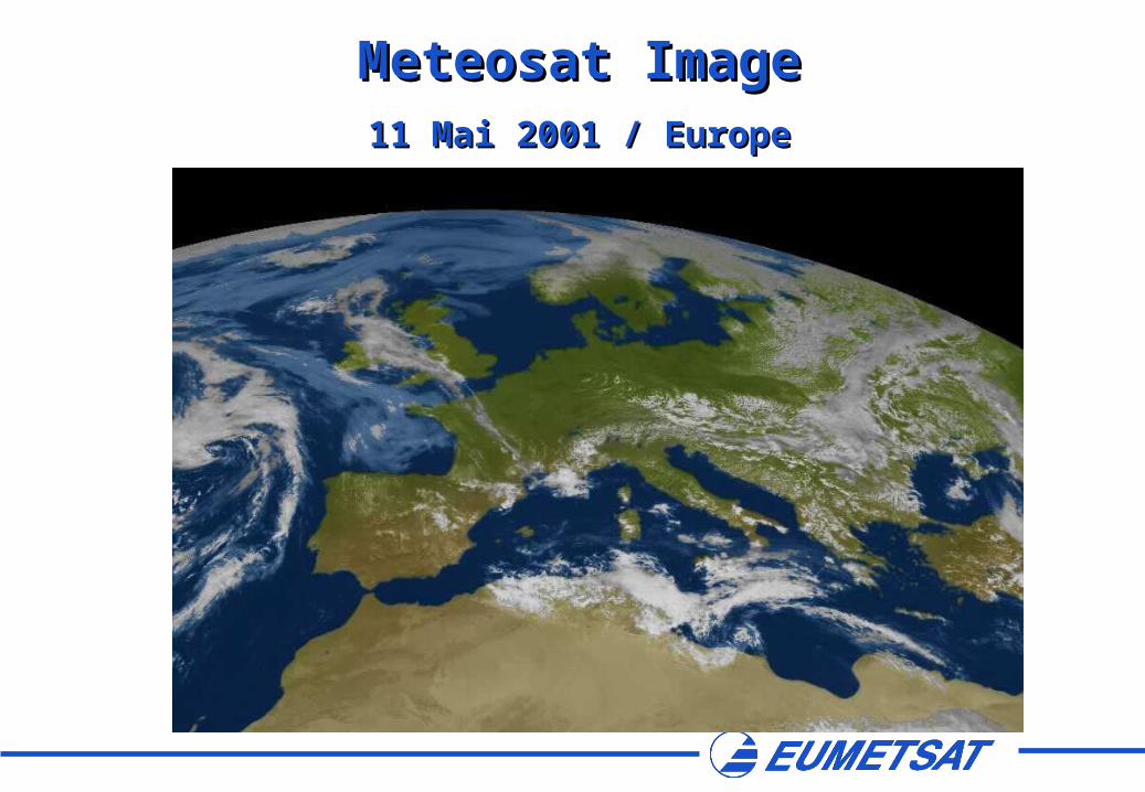
Meteosat ImageMeteosat Image11 Mai 2001 / Europe11 Mai 2001 / Europe
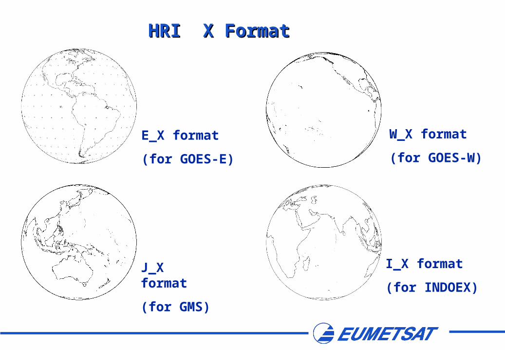
HRI X FormatHRI X Format
E_X format
(for GOES-E)
W_X format
(for GOES-W)
J_X format
(for GMS)
I_X format
(for INDOEX)

WEFAX CnD, D and E FormatWEFAX CnD, D and E Format
Meteorological Products Meteorological Products Extraction FacilityExtraction Facility
(MPEF)(MPEF)
[email protected]@eumetsat.de
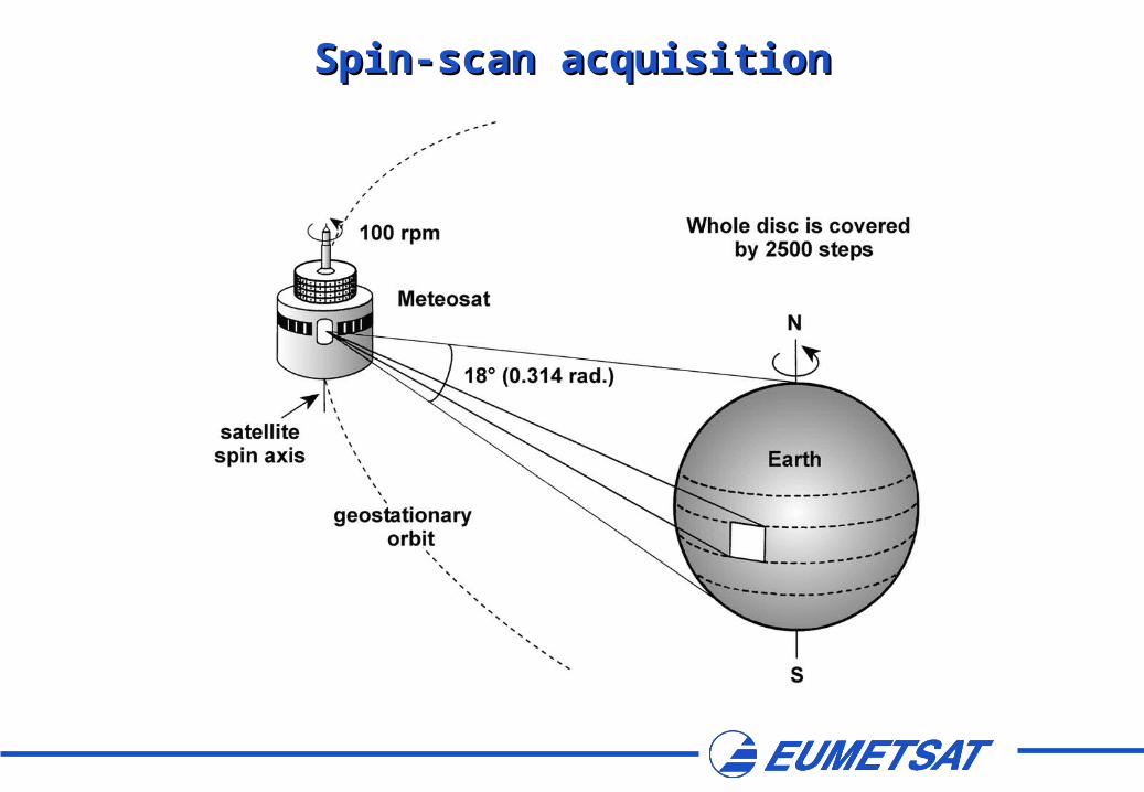
Spin-scan acquisitionSpin-scan acquisition
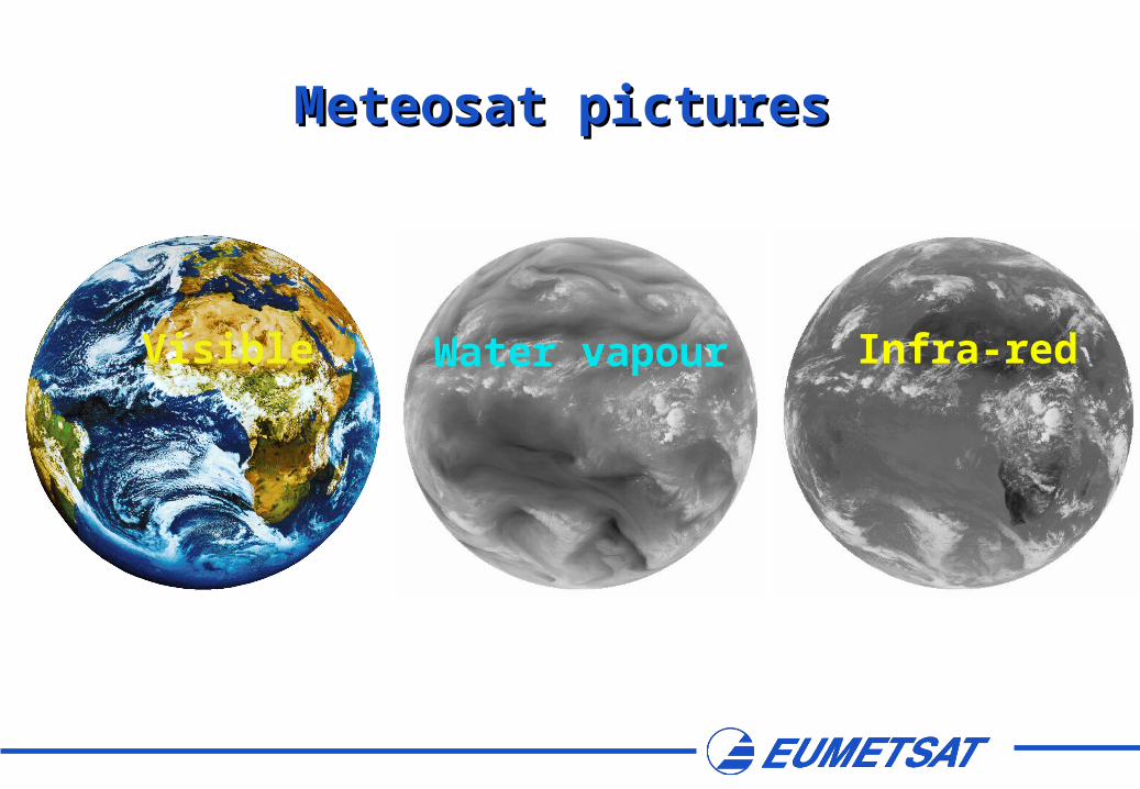
Meteosat picturesMeteosat pictures
Water vapour Infra-redVisible
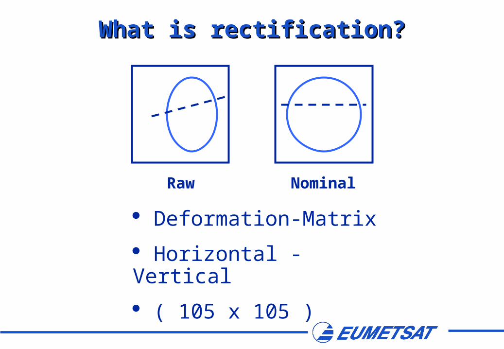
What is rectification?What is rectification?
Deformation-Matrix
Horizontal - Vertical
( 105 x 105 )
Raw Nominal
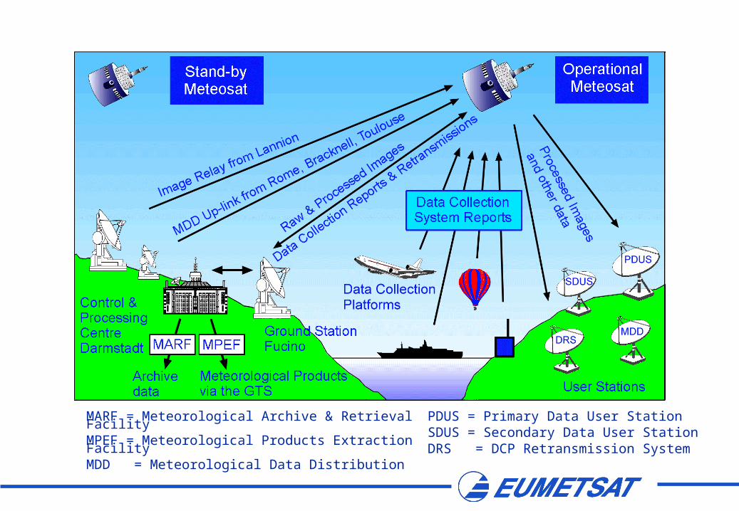
MARF = Meteorological Archive & Retrieval FacilityMPEF = Meteorological Products Extraction FacilityMDD = Meteorological Data Distribution
PDUS = Primary Data User StationSDUS = Secondary Data User StationDRS = DCP Retransmission System
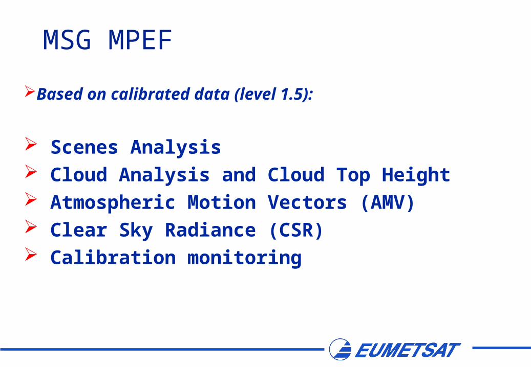
MSG MPEF
Based on calibrated data (level 1.5):
Scenes Analysis Cloud Analysis and Cloud Top Height Atmospheric Motion Vectors (AMV) Clear Sky Radiance (CSR) Calibration monitoring

MSG MPEF Scenes Analysis (SCE)
Derives a pixel cloud maskScene typeRadiances at the top of the atmosphereThreshold testsQuality indices

Algorithm applied to data of the current Meteosat (3 channels)
high, medium, low clouds
Scenes Analysis
MSG SEVIRI Improvement:Scenes identification / cloud heights with higher accuracy
sea land

Cloud mask:Cloud coverage over 100 km * 100 km areas,shown as a colour coded image
Scenes Analysis
MSG SEVIRI Improvement:Clouds coverage will be derived with higher accuracy

IR window channel (10.8 m) Water vapour channel 6.5 m
240 250 260 270 280 290 300 310 320 330 K
215 220 225 230 235 240 245 250 255 260 265 K
Clear Sky Radianceover 100 km * 100 km areas, example of Meteosat-7
MSG SEVIRI Improvement: Clear Sky Radiance in all channels except HRV

Tropospheric Humidityover 100 km * 100 km areas, example for the current Meteosat
Humidity values are representative for an atmospheric layer in ~ 5-7 km height
MSG SEVIRI improvement:A second water vapour channel will additionally provide the humidity field in ~3-5 km height
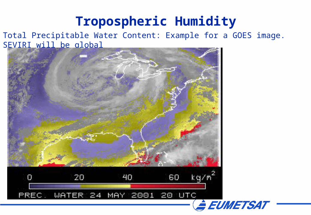
Tropospheric HumidityTotal Precipitable Water Content: Example for a GOES image. SEVIRI will be global

level (3 heights)
phase
fraction
top temperature
10 cloud types. If (clear) surface type
Cloud Analysis

Spatial coherence
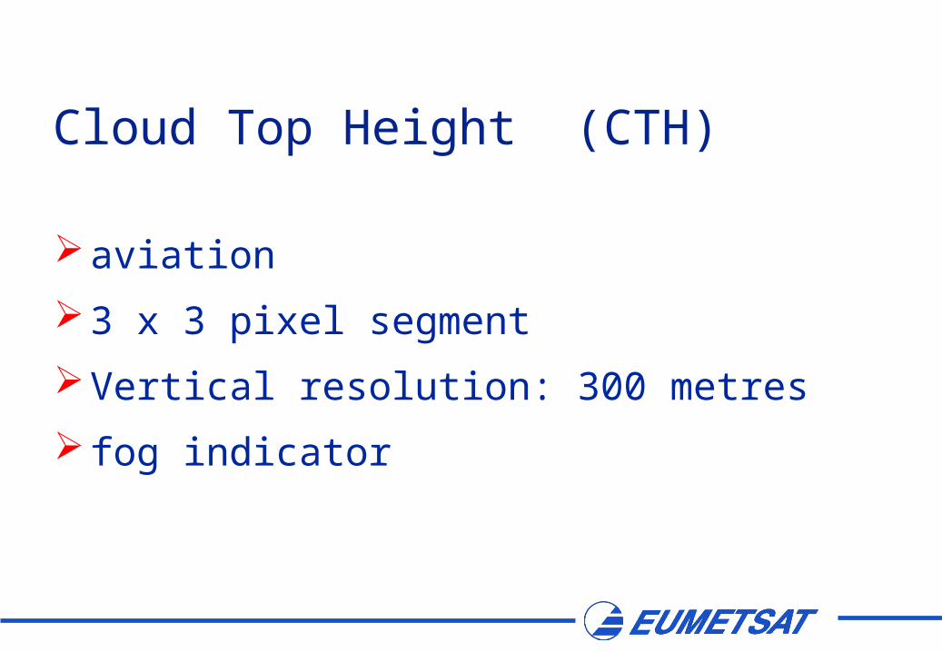
aviation
3 x 3 pixel segment
Vertical resolution: 300 metres
fog indicator
Cloud Top Height (CTH)

Meteosat “winds”
• IR: any level, cloud tracers
• WV: high level (300-600 Hpa), but uncertain
– humidity or cloud tracers, dry zones
• VIS: low level
– cloud/ocean contrast
– not on land (orography, contrast)
– better resolution

-cumulus
-transparent cirrus
-tropical storms at low level
-WV winds: height assignment
Winds: problem areas

Atmospheric Motion Vectors (AMV)
Extracted from the channels: VIS (0.6 or 0.8 µm)
IR (10.8 µm)
WV (6.2 and 7.3 µm)
Ozone (9.7 µm)
IR (8.7 µm)
HRV (0.75 µm)
Speed, direction, position, level (P,T), quality, method
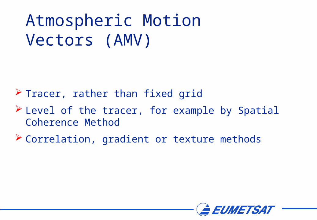
Tracer, rather than fixed grid
Level of the tracer, for example by Spatial Coherence Method
Correlation, gradient or texture methods
Atmospheric Motion Vectors (AMV)
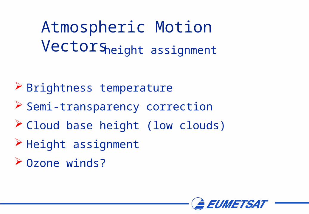
height assignment
Brightness temperature
Semi-transparency correction
Cloud base height (low clouds)
Height assignment
Ozone winds?
Atmospheric Motion Vectors
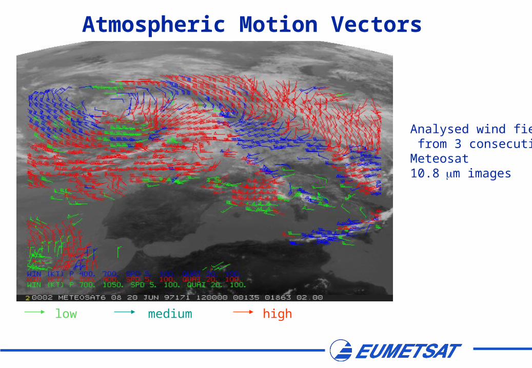
low medium high
Atmospheric Motion Vectors
Analysed wind field from 3 consecutive Meteosat10.8m images

Atmospheric Motion Vectors
Selection of appropriate “targets” for the tracking: These are typically regions of high image contrasts

Example of automatic quality control for a wind field derived from Meteosat VIS data: spatial and temporal consistency determine quality
low quality index
Atmospheric Motion Vectors: Quality Control
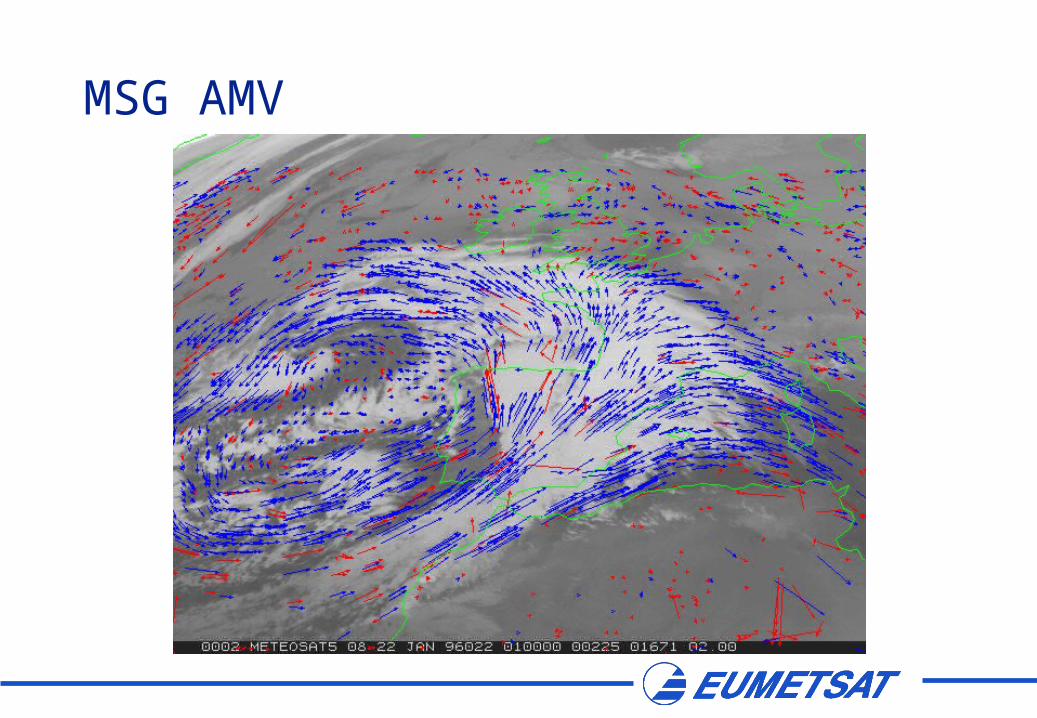
MSG AMV

Meteosat Winds (transition programme)

Atmospheric InstabilityExample of an instability retrieval (over cloudfree areas), data
of GOES satellite (USA)
Instability analysis:red areas mark storm potential
IR image taken 10 hours later shows storm activity
MSG SEVIRI improvement:Instability information retrieved on a global scale
physical and neural network methods
Operational SAF processing method
Little information on atmospheric vertical structure from SEVIRI
Ancillary data from soundings or NWP
Global Instability Index(GII)
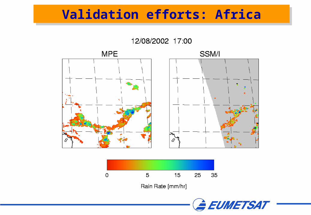
Validation efforts: AfricaValidation efforts: Africa
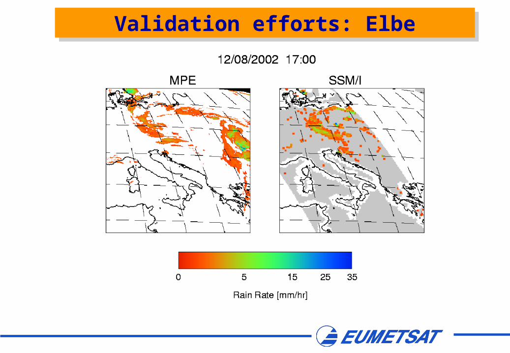
Validation efforts: ElbeValidation efforts: Elbe

solar and IR radiances from radiative transfer models are compared with radiances from level 1.5 images
Monitoring by NWP centres
Satellite cross-calibration
Calibration campaigns, in-situ data
Calibration Monitoring
Satellite Application Facilities(SAFs)
SAF Network EUMETSAT Application Ground Segment
– Services:- up to level 2 products- user software packages - data management and user services- co-ordination of research and development
– Focus: operational meteorology and climate monitoring
Two phases: Development / Operations
– with EUMETSAT financial contribution for travel costs and per diem for visiting scientists
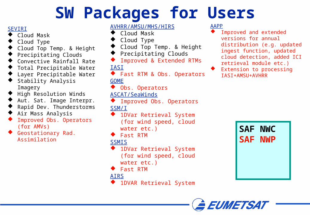
SW Packages for UsersSEVIRI Cloud Mask Cloud Type Cloud Top Temp. & Height Precipitating Clouds Convective Rainfall Rate Total Precipitable Water Layer Precipitable Water Stability Analysis Imagery High Resolution Winds Aut. Sat. Image Interpr. Rapid Dev. Thunderstorms Air Mass Analysis Improved Obs. Operators
(for AMVs) Geostationary Rad. Assimilation
AVHRR/AMSU/MHS/HIRS Cloud Mask Cloud Type Cloud Top Temp. & Height Precipitating Clouds Improved & Extended RTMsIASI Fast RTM & Obs. OperatorsGOME Obs. OperatorsASCAT/SeaWinds Improved Obs. OperatorsSSM/I 1DVar Retrieval System
(for wind speed, cloud water etc.) Fast RTMSSMIS 1DVar Retrieval System
(for wind speed, cloud water etc.) Fast RTMAIRS 1DVAR Retrieval System
AAPP Improved and extended versions for
annual distribution (e.g. updated ingest function, updated cloud detection, added ICI retrieval module etc.)
Extension to processing IASI+AMSU+AVHRR
SAF NWCSAF NWP

Real Time Product ServicesMSG EPS Multi-Mission
Surface Albedo Aerosol Scattered Radiance Field Surface Short-wave Fluxes Land Surface Temperature Surface Emissivity Surface Long-wave Fluxes Soil Moisture Evapotranspiration Rate
Near Surface Wind Vector Regional SST Atlantic High Latitude Rad. Fluxes Total Ozone Ozone Profiles Aerosol Indicator Surface Albedo & Aerosol Scattered Rad. Field Surface Short-wave Fluxes Land Surface Temperature Surface Emissivity Surface Long-wave Fluxes Evapotranspiration Rate N. Europe Snow Cover Refractivity Profiles Temp., Hum. & Pressure Profiles Integrated Water Vapour
Atlantic SST Atlantic Surf. Rad. Fluxes Sea Ice Edge Sea Ice Cover Sea Ice Type Clear-Sky UV Fields Land Surface Temperature Surface Emissivity Surface Long-wave Fluxes S. & C. Europe Snow Cover
SAF OSISAF O3MSAF CLMSAF GRMSAF LSA
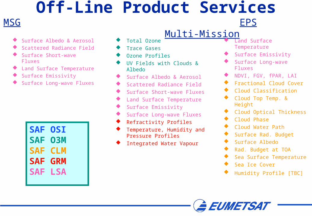
Off-Line Product ServicesMSG EPS Multi-Mission
Surface Albedo & Aerosol Scattered Radiance Field Surface Short-wave Fluxes Land Surface Temperature Surface Emissivity Surface Long-wave Fluxes
Total Ozone Trace Gases Ozone Profiles UV Fields with Clouds & Albedo Surface Albedo & Aerosol Scattered Radiance Field Surface Short-wave Fluxes Land Surface Temperature Surface Emissivity Surface Long-wave Fluxes Refractivity Profiles Temperature, Humidity and Pressure
Profiles Integrated Water Vapour
Land Surface Temperature Surface Emissivity Surface Long-wave Fluxes NDVI, FGV, fPAR, LAI Fractional Cloud Cover Cloud Classification Cloud Top Temp. & Height Cloud Optical Thickness Cloud Phase Cloud Water Path Surface Rad. Budget Surface Albedo Rad. Budget at TOA Sea Surface Temperature Sea Ice Cover
Humidity Profile [TBC]
SAF OSISAF O3MSAF CLMSAF GRMSAF LSA

SAF Visiting Scientists
Objectives• to allow scientists from other
institutes to acquire expertise in the field of the SAF activities/products
• to allow scientists from other institutes to contribute to algorithm development and product verification/validation
Types• VISITING SCIENTISTS,
which participate in the development activities by spending a certain time interval at one of the SAF Institutes
• ASSOCIATED SCIENTISTS, which participate in the development activities but stay “at home”

SAF Visiting Scientists- Examples of topics -
Monthly Arctic sea ice signatures for use in passive microwave algorithms Precipitation analysis from AMSU Evaluation of skin-bulk sea surface temperature difference models Cloud classifications in cold winter situations in Northern Europe Investigations of NOAA AVHRR/3 1.6 m imagery for snow, cloud and sunglint
discrimination Compensating for atmospheric effects on passive radiometry at 85.5 GHz using a
radiative transfer model and NWP model data Tests of the the radiance ratioing method with HIRS data Cloud height determination using GOES water vapour and infrared window
channel imagery Evaluation of applicability of the 3.6 - 4.0 m spectral band data for the SAFNWC
Convective Rainfall Rate product
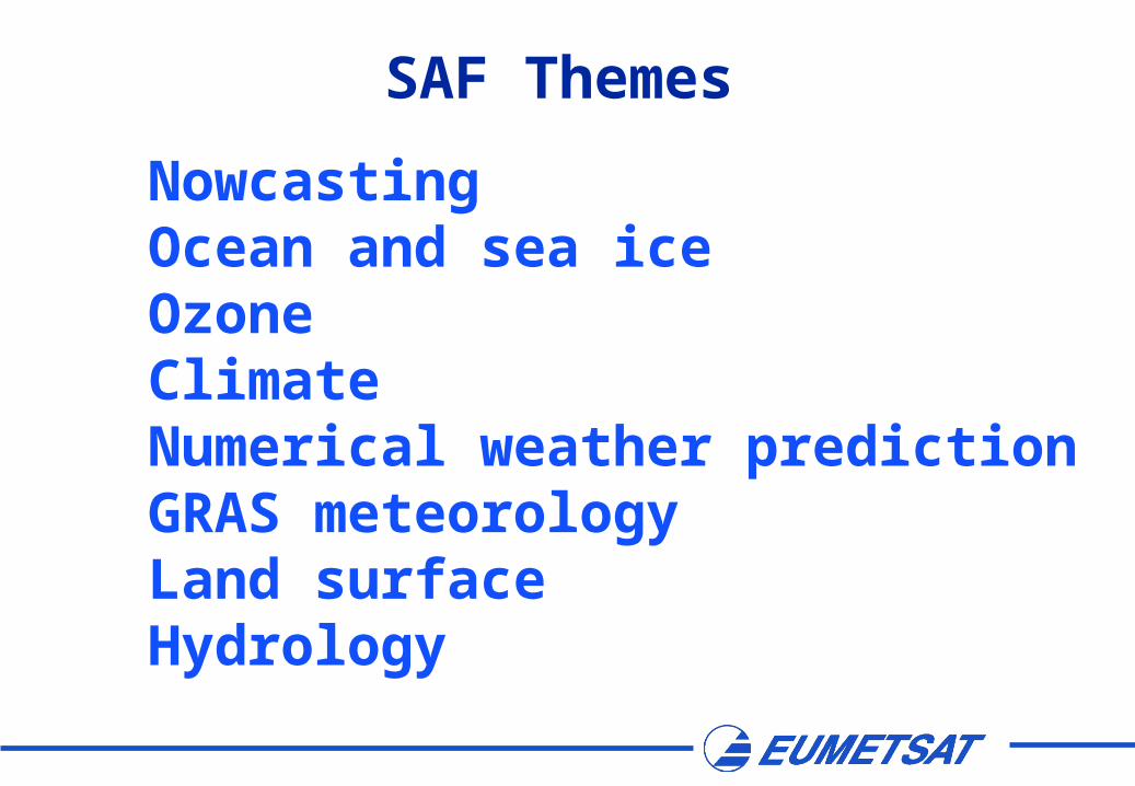
NowcastingOcean and sea iceOzoneClimateNumerical weather predictionGRAS meteorologyLand surfaceHydrology
SAF Themes