mendip hills area of outstanding natural beauty
TRANSCRIPT

MENDIP HILLS AREA OF OUTSTANDING NATURAL BEAUTY
HG-11-01046
SIGNAGE AND INTERPRETATION PLAN FOR THE BURRINGTON COMMONS JULY 2012
Mendip Hills AONB Unit, Charterhouse Centre,
Blagdon, Bristol BS40 7XR 01761 462338 [email protected], www.mendiphillsaonb.org.uk

Discovering Black Down Signing and Interpretation Plan (2012) HG-11-01046
CONTENTS EXECUTIVE SUMMARY .................................................................................4 1. INTRODUCTION AND BACKGROUND .....................................................6
1.1 Purpose of the Study ...........................................................................6 2. AUDIT OF INTERPRETATION, ENTRANCES AND SIGNAGE .................8
2.1 Interpretation ........................................................................................8 2.1.1 Interpretation Panels .....................................................................8 2.1.2 Publications ...................................................................................9 2.1.3 Internet Resources ......................................................................10 2.1.4 Events and Activities...................................................................12
2.2 Site Entrances ....................................................................................13 2.3 Signing ................................................................................................14
2.3.1 Entrance Signs / Boundary Markers ..........................................14 2.3.2 Promoted Routes Signing...........................................................15 2.3.3 Public Right of Way Signage ......................................................15 2.3.4 Public Guidance Notices.............................................................16 2.3.5 Out of Date Signage.....................................................................17 2.3.6 Other signage...............................................................................17 2.3.7 Overview of Current Signage......................................................17
3. AUDIENCE ................................................................................................19 4. INTERPRETIVE RESOURCES .................................................................22
4.1 Interpretative Significance.................................................................22 5. INTERPRETIVE THEMES & OBJECTIVES..............................................25
5.1 The Story of the Burrington Commons ............................................25 5.2 What Are Themes?.............................................................................25 5.3 Core Theme.........................................................................................26 5.4 Discussion of Potential Sub-themes ................................................26 5.5 Recommended Themes .....................................................................28 5.6 Interpretive Objectives.......................................................................34
6. INTERPRETIVE MEDIA RECOMMENDATIONS......................................36 6.1 Communicating the Themes .............................................................36 6.2 Recommendations for Interpretive Media ........................................37
7. PROMOTIONAL / MARKETING TOOLS ..................................................75 8. SIGNING RECOMMENDATIONS .............................................................76
8.1 Signing Objectives .............................................................................76 8.2 Interpretation and Signing for People with Disabilities ..................76 8.3 Design of Outdoor Interpretative Panels..........................................77 8.4 Signing at Primary Entrances ...........................................................77 8.5 Signing at Secondary Entrances ......................................................78 8.6 Public Rights of Way Signage...........................................................78 8.7 Branding..............................................................................................79 8.8 Promoted Routes Signing .................................................................79 8.9 Public Guidance Notices ...................................................................79
9. SUMMARY OF RECOMMENDATIONS ....................................................80 BIBLIOGRAPHY ...........................................................................................82
2

Discovering Black Down Signing and Interpretation Plan (2012) HG-11-01046
APPENDICES Appendix 1: Audit of Signage and Interpretation – Map and
Spreadsheet. Appendix 2: Questionnaire - Analysis of Survey Result Copy of blank questionnaire. Appendix 3: Interpretative Inventory. Appendix 4: Plan of Primary and Secondary Site Entrances.
3

Discovering Black Down Signing and Interpretation Plan (2012) HG-11-01046
EXECUTIVE SUMMARY This report sets out a co-ordinated framework for the signage and interpretation of Black Down, Burrington Ham and Burrington Combe (collectively known as the Burrington Commons). The work has been carried out as part of the development phase of a HLF application for the Discovering Black Down project. The recommendations of the report will be incorporated into the final stage 2 application. An audit of site interpretation, entrances and signage was carried out in March 2012 and this highlighted a number of areas for improvement. An interpretive inventory was also carried out to identify what is special and unique about the Burrington Commons and this was developed in consultation with a focus group meeting of key stakeholders. In addition a questionnaire survey of visitors to the Burrington Commons was undertaken to ascertain how much people already knew about the area, how interested they were in particular interpretive themes and their reaction to different types of interpretative media. This work underpinned the development of interpretive core and sub-themes for the Burrington Commons. The core theme is as follows: -
The Burrington Commons is an ancient landscape with evidence of human activity dating back into prehistory.
Nine sub-themes were also identified for active interpretation in a variety of media. The sub-themes are as follows:
The Burrington Commons has a special character that is shaped by the
underlying sandstone and limestone rocks. There is evidence of people living and dying on the land dating back
over 10,000 years. The treasured landscapes of the Burrington Commons are a result of
its agricultural past and the way that it is farmed today. The Burrington Commons support a rich array of plants and animals
which reflect the underlying rocks and soils. Black Down was used as a bombing decoy site during the Second
World War and is one of only a few remaining in the country. In the past, quarrying and mineral extraction was an important source
of income for local people. This is a fragile landscape that can be easily damaged by overuse and
inappropriate activities. There is a legend that Augustus Montague Toplady was inspired to
write the hymn Rock of Ages while sheltering under a rock in the Combe during a thunderstorm in the late 18th century.
Walkers have the ‘right to roam’ on the Burrington Commons, however only a few local people still enjoy ‘commoners’ rights’.
4

Discovering Black Down Signing and Interpretation Plan (2012) HG-11-01046
Interpretative plans were then developed for each piece of interpretative media and activity that the Discovering Black Down project will deliver. These set the themes that each activity and interpretative media is seeking to convey, along with concise interpretative / activity objectives and a clear definition of the interpretative media to be used and its costs. Recommendations on improving the signing of the site are also included, particularly the need to have signs at 11 primary and secondary entrance points which contain a map of the Burrington Commons showing open access land and public rights of way and clear information on the respective access rights of different recreational users. At the end of this report a summary table of recommendations is presented.
5

Discovering Black Down Signing and Interpretation Plan (2012) HG-11-01046
1. INTRODUCTION AND BACKGROUND The spectacular scenery of the Burrington Commons makes it one of the most treasured areas within the Mendip Hills Area of Outstanding Natural Beauty. The area possesses an open, wild and remote character and this is very attractive to people wishing to experience outdoor activities such as walking, horse riding and off-road cycling. The importance of the areas wildlife and rich history is reflected in its multiple designations, which include three Scheduled Monuments and a Site of Special Scientific Interest. The Burrington Commons consist of three distinct parts:-
Black Down - an area of sandstone geology supporting upland heathland.
Burrington Combe - a dramatic limestone gorge. Burrington Ham - an area of largely calcareous grassland with scrub,
woodland and rocky outcrops. The numbers of visitors wishing to enjoy the Burrington Commons has increased markedly over the last few decades and this has had a damaging impact on this beautiful and remote landscape, particularly with the development of erosion scars. To address this problem the Mendip Hills AONB Unit has developed a project entitled ‘Sustaining Black Down’ which will help conserve the heritage landscapes, biodiversity and archaeological features of the Burrington Commons. There are two main elements of the ‘Sustaining Black Down’ project entitled ‘Discovering Black Down’ and ‘Conserving Black Down’. ‘Conserving Black Down’ will seek to repair and restore heavily eroded paths, landscape scars and habitats whilst ‘Discovering Black Down will work with local communities and user groups to achieve well managed and sustainable access to the Burrington Commons, and discover the areas rich heritage. An application has been made to the Heritage Lottery Fund to provide financial support for the ‘Discovering Black Down’ project, and this Interpretation & Signing Plan is part of the development phase of that application. 1.1 Purpose of the Study
To produce an Interpretation and Signing Plan for the Burrington Commons.
To set out what the interpretation and signing should achieve and
identify the audience, interpretative resources and interpretative themes and objectives for the area.
To identify appropriate interpretative media.
6

Discovering Black Down Signing and Interpretation Plan (2012) HG-11-01046
To provide a coherent and strategic interpretative framework to inform the development of an ‘Activities Plan’.
To set out a comprehensive and co-ordinated plan for the provision of
signing and site information.
7

Discovering Black Down Signing and Interpretation Plan (2012) HG-11-01046
2. AUDIT OF INTERPRETATION, ENTRANCES AND SIGNAGE An audit of interpretation and signage on the Burrington Commons was completed in March 2012. Each item of signing and interpretation was photographed and its condition and location noted. The results of the audit are contained in Appendix 1. 2.1 Interpretation The following interpretive media was identified by the audit: - 2.1.1 Interpretation Panels Mendip Hills AONB Visitor Information Panel – Burrington Combe: This panel is located adjacent the public toilets in Burrington Combe. The panel is mounted within an oak frame mounted as a lectern with oak legs and contains the following information: -
Title – Mendip Hills AONB (logo) Naturally Beautiful, Naturally Protected
A1 size panel, black / blue coloured text on white background. A map of the Mendip Hills AONB area showing area covered by the
AONB designation and 'you are here' locator on the map. Features / areas and sites of interest highlighted on plan of AONB. Images of the Rock of Ages, Burrington ponies and Black Down. List of web links for partner organisations. Smart phone Quick Response code. Key to map and Landscapes for Life logo / text. Branding – Mendip Hills AONB / Landscapes for Life
The panel is new and is in excellent condition. The panel is in a temporary location awaiting decisions regarding the future of the public toilets and this application. The AONB Unit is aware that the panel height is currently too high for wheel chair users to access and there is an uneven surface in front of it. This will be addressed in the early stages of the project. 'The Burrington Combe Story' Panel – Burrington Combe This panel was developed and installed by English Nature and the Mendip Hills AONB Wardens Service. It is a large panel of irregular size between AO/A1, consisting of a full colour panel with perspex cover mounted within a steel frame painted black. The panel is fixed to the wall of the Burrington Inn in Burrington Combe. The panel contains the following information: -
8

Discovering Black Down Signing and Interpretation Plan (2012) HG-11-01046
Title: 'The Burrington Combe Story' Panel depicts how geology and landscape of Burrington Combe formed
through a series of 13 full colour illustrations depicting climate, landscape change, different wildlife that has inhabited the area, and the influence of man. It also includes recent history of the area and the stories of famous people. A small section includes information on how the area is managed today and important landscape / wildlife designations. It also includes information about the Mendip Hills AONB Warden Service that no longer exists.
Contact details for further information – Mendip Hills AONB and English Nature (now Natural England). It does not include a location map.
Logos: Outdated logos for the former Mendip Hills AONB Warden Service / English Nature
The panel has an attractive full colour design and has lasted well despite its age. The panel is fixed at a height that would make access for wheel chair users difficult. The panel is generally in a sound condition. 2.1.2 Publications There are currently a number of leaflets / booklets that provide interpretative information about the wider area, including information about the Burrington Commons.
Mendip Hills AONB Visitor Guide 2012: Folded, full colour leaflet with map providing information on Mendip landscape, places to visit and activities for everyone. New 2012 Visitor Guide published March 2012. Free. http://www.mendiphillsaonb.org.uk/publications/ Wild Walks: (produced by Mendip Hills AONB 2009): Explore the Mendip Hills AONB through 8 themed walks, each with fascinating background information. A5, 40 pages, full colour • Spiral bound for easy use • Walking in safety guide • Countryside Code included • 8 walks using Ordnance Survey extracts • Clear, easy-to-follow route descriptions for each walk • each walk has background information listing wildlife and wild flowers to see. Cost £5 http://www.mendiphillsaonb.org.uk/publications/ Western Mendip: A walker’s guide to the geology and landscape of western Mendip. British Geological Survey (2008). ISBN 978-085272576-4. For those who wish to learn more about the area, this guide gives details of the geology and natural history, and will help you understand how the landscape is formed. The Archaeology of Mendip, 500,000 Years of Continuity and Change Edited by Jodie Lewis, Oxbow Books (2011) ISBN 978-1-
9
Discovering Black Down Signing and Interpretation Plan (2012) HG-11-01046
905223-28-2. Includes a chapter on ‘Mendip Starfish’ with detailed information on Black Down during World War 2. Bad Ass Bikes: www.badassbikes.co.uk The Bad Ass Bikes shop in Burrington Combe has produced a Trail Guide to the Mendip Hills which includes the Black Down project area. Copies are available to down load from their web site at: http://www.funandframes.com/bab/BadAssBikesTrailGuide.pdf Other books / publications: Copies of all Mendip Hills AONB Partnership Documents / Mendip Hills AONB Planning Guidance and other supporting documents are available on the Mendip Hills AONB web site at: http://www.mendiphillsaonb.org.uk/publications
2.1.3 Internet Resources There are a wide range of web sites that contain information about the wider area, including the Burrington Commons. The following list provides a broad summary of web sites currently available: General Sites:
Mendip Hills AONB web site (www.mendiphillsaonb.org.uk) provides a wide variety of downloads, map and documents for people visiting the Mendip Hills, including information on places to go and what to see when visiting, information on local sites, links to food and accommodation providers. Places to visit section makes specific reference to Black Down and Burrington Ham, stating ‘this area is the largest area of open land in the AONB. Black Down trig point is the highest point on Mendip offering terrific views across to Wales. Significant wildlife and archaeology. Excellent for walking, cycling and horse riding’. Web site visitors can also sign up to receive the monthly Mendip Hills AONB eNewsletter. English Heritage www.english-heritage.org.uk Mendip Hills AONB NMP (National Mapping Program) page includes information on the archaeology of the area including detail on World War 2 remains on Black Down. Natural England www.naturalengland.org.uk/ourwork/conservation/geodiversity/englands/sites/local_ID59.aspx Information on the Burrington Combe Site of Special Scientific Interest.
10

Discovering Black Down Signing and Interpretation Plan (2012) HG-11-01046
Information on Mendip Hills National Character Area 141:- http://www.naturalengland.org.uk/Images/141_Mendip_Hills_tcm6-32151.pdf Somerset Wildlife Trust - www.somersetwildlife.org/gb-gruffy : Information provided for the GB Gruffy Nature Reserve to the south of Black Down, includes site description, map and species. Older leaflet also available as pdf. Format providing basic information on The Lots Reserve. British Geological Survey: www.bgs.ac.uk/mendips/localities/blackdown.html Locality areas of their web sites contains section on the Mendip Hills sites including Black Down and Burrington Combe.
Walking / Horse Riding / Mountain Biking Sites: -
The Ramblers Association (Mendip Group): http://www.mendipramblers.co.uk Web site includes local walks program, walking festival, accommodation and how to get involved. The Ramblers Association (Woodspring Group): http://www.somersetramblers.co.uk/GROUPS/Woodspring/Wood.htm Web pages include local walks program, walking festival, accommodation and how to get involved. Long Distance Walkers Association web pages: Limestone Link http://www.ldwa.org.uk/ldp/members/show_path.php?path_name=Limestone+Link+(Cotswolds+to+Mendips) Provides route information and links to Mendip Hills AONB web page. West Mendip Way http://www.ldwa.org.uk/ldp/members/show_path.php?path_name=West+Mendip+Way Provides route information and links to Mendip Hills AONB web page. Black Down Mendip Riding Club: www.blackdownmendiprc.co.uk Black Down Mendip Riding Club: local riding club affiliated to the British Horse Society. Aim to join other likeminded members in a variety of equestrian events. 1 South West www.1sw.org.uk The 1 South West project helps people enjoy off-road cycling across the region. The Adventure Cycle Map grades all off-road cycle routes by their technical difficulty (the AONB Unit is able to revise the map to remove badly eroded routes). The map enables visitors to decide which grade of route is suitable for their cycling ability.
11
Discovering Black Down Signing and Interpretation Plan (2012) HG-11-01046
Bad Ass Bikes Bike shop in Burrington Combe (see entry in 2.2 Publications above) Mendip Mountain Bike Trails Group: www.mendipmountainbiketrails.com. A group of local mountain bikers. Mendip Hills Cycling Club/ Drafting Fairies Cycling Club www.mendiphillscyclingclub.co.uk/ A group of local mountain bikers and road cyclists. Mountain Bike Rider Web Pages: Beacon Batch and Black Down, Mendip Hills (Hard Route) 25KM (15 Miles): Route description and map download. http://www.mbr.co.uk/routes/beacon-batch-and-black-down-mendip-hills-hard-route-25km-15-miles/
2.1.4 Events and Activities A number of public events and activities have taken place over the years.
Mendip Hills AONB Unit: The Mendip Hills AONB Unit organises and supports events to raise awareness and understanding of the Area of Outstanding Natural Beauty. Details can be found on there web site at: www.mendiphillsaonb.org.uk/events Mendip Hills AONB Historic Environment Day Annual event usually including presentations on Black Down and Burrington. http://wellsmuseum.org.uk/archives/399 Mendip Hills Festival of Archaeology organised by Wells and Mendip Museum. http://wellsmuseum.org.uk/archives/459 Mendip Rocks – Annual programme of geology themed events across the Mendip Hills organised by the Somerset Earth Science Centre. http://www.somersetwildlife.org/mendip_rocks.html CLIC24: A charity endurance ride over 24 hours around a 10 mile loop that raises significant funds for children with cancer and leukaemia. The event takes place in May. Around 500 riders take part in the event. It did not be taking place in 2012. The Cheddar Challenge: The Cheddar Challenge is an 80km route that in the past has gone across Black Down. This event now takes place entirely on roads.
Other organised events take place on Black Down and Burrington Ham, including events related to horse riding, walking and running. Many of these are fundraising events and in addition scout groups and other groups supporting young people use the area for Duke of Edinburgh activities.
12

Discovering Black Down Signing and Interpretation Plan (2012) HG-11-01046
2.2 Site Entrances There are a number of site entrances to the Burrington Commons. The audit revealed that a hierarchy of entrances could be identified based on the level of use and links to car parks and the highway network. The entrances are classified as follows and shown on Plan 2, Appendix 4): - Primary Entrances: Entrances demonstrating high levels of use with prominent links to the site from highways and car parking available for visitors:- 1. Burrington Combe Car Park and Toilets. This entrance is used by
people wishing to walk along Burrington Combe, visit the ‘Rock of Ages’, access Black Down on foot via The Link and the Twin Brooks and outdoor activities groups who rock climb and cave in the area. The adjacent Burrington Inn also acts as an entrance point for people that stop for refreshments either before or after exploring the area.
2. Burrington Ham / Ellick House Car Park. The car park at the eastern
end of Burrington Combe provides access to two entrances with access to Burrington Ham and Black Down.
Secondary Site Entrances: Entrances that are used by people who live locally or know the site well, but without limited or no car parking. These entrances are also used by visitors walking, cycling or horse riding in the wider area. 3. Link Lane – bridle path access to Black Down with limited parking and
access by cars not promoted or encouraged. 4. Tynings Farm – bridle path access to southern part of Black Down and
Rowberrow Warren via the West Mendip Way. Very limited parking on a roadside layby.
5. Wireless Station - bridle path access to Black Down with limited parking. 6. Rowberrow Warren - bridle path entrance on western boundary of Black
Down. This is a well used access point to Black Down from Rowberrow Warren. Recent installation of 4x4 barriers to restrict by illegal vehicles.
7. Dolebury Warren / Mendip Lodge Wood – bridle path link to the A368 at
Upper Langford, and via a footpath to Springhead Farm. 8. The Lots Somerset Wildlife Trust Nature Reserve – bridle path link to
south side of Black Down
9. Luvers Lane – public footpath linking Burrington Ham with Blagdon.
13

Discovering Black Down Signing and Interpretation Plan (2012) HG-11-01046
10. Ham Link – public footpath link to Burrington Ham 11. Rickford Rise – bridle path and public footpath links to Burrington Ham,
with limited parking. 2.3 Signing The audit revealed a variety of different types of signage. Some of the signs have been in place for many years, others are more recent additions. Please see Appendix 1 for photographs and descriptions of the signs. The signs are branded in various ways as summarised below (this does not include logos on interpretation panels).
Mendip Hills AONB. Limestone Link. Somerset Wildlife Trust. West Mendip Way. Open Access for Walkers. Landscapes for Life. Forestry Commission. Somerset County Council. Mendip Cave Rescue. Conservators for the Burrington Commons. Pathwatch. Avon County Council. Countryside Watch. Butcombe Brewery - The Mendip Pub Trail. Rotary International (West Mendip Way stickers).
Although the multiplicity of brandings is not particularly confusing for people accessing the area some of it is out of date (for example Avon County Council and Countryside Watch) and requires rationalisation and updating. The audit identified a number of different types of signs that can categorised as follows:- 2.3.1 Entrance Signs / Boundary Markers
Mendip Hills AONB Boundary Marker: Stone cairn constructed using local limestone with large central stone into which the Mendip Hill AONB text and logo are carved / painted black.
Burrington Ham Mendip Hills AONB signs - Two signs consisting of double oak boards mounted on posts. The top board has wording (Burrington Ham and Black Down) routed into timber and painted black; the lower board has five routed symbols and text for: Viewpoint /
14

Discovering Black Down Signing and Interpretation Plan (2012) HG-11-01046
SSSI Mendip Hills AONB / Scheduled Monument / Open Access for Walkers. All symbols routed into board and painted black.
2.3.2 Promoted Routes Signing
Limestone Link: Limestone Link waymarking consists of circular ammonite fossil design. Waymarking primarily consists of Limestone Link stickers placed onto existing public footpath and bridle path waymarker discs.
West Mendip Way: Waymarking of route limited to small number of
route stickers placed on existing public footpath and bridle path waymarker discs.
The Butcombe Trail: Waymarking of route limited to small number of
stickers placed on existing public footpath and bridle path waymarker discs.
. Defunct Mendip Hills AONB Promoted Route – former circular route
with black circular walks waymarkers (with white arrow and red circle). The route is not currently promoted, however their may be an ex AONB ranger who is putting up replacement discs?
2.3.3 Public Right of Way Signage There is a variety of public rights of way signage on the Burrington Commons, including: - Waymarkers
Mendip Hills AONB public footpath waymarker discs with arrow and AONB logo (recently installed)
Mendip Hills AONB bridleway waymarker discs with arrow and AONB logo (recently installed).
Mendip Hills AONB rectangular instruction sign showing image of walker/bicycle/horse/4x4 vehicle with red line striking out activities not permitted (recently installed).
Open Access Land brown and white discs. Yellow circular public right of way waymarkers attached to fence posts
and other structures. Blue circular public bridle path waymarkers attached to fence posts and
other structures. Old blue rectangular public bridle path waymarkers attached to fence
posts and other structures. Old white rectangular public footpath waymarkers attached to fence
posts and other structures.
15
Discovering Black Down Signing and Interpretation Plan (2012) HG-11-01046
Public bridleway waymarker disc – blue arrow on white disc with Somerset County Council web address.
Signposts with green metal public right of way finger (white on green background).
Restricted Byway – No unauthorised vehicles rectangular sign. Restricted Byway disc – brown arrow on white disc with Somerset
County Council web address. No unauthorised vehicles small white rectangular sign attached to
fence posts and other structures. Wooden waymarker posts with plastic Public Bridleway finger on post
(white text on green background). Bridleways - a number of large circular white bridle path waymarkers
with blue directional arrows and black horse shoes. These are augmented by a number of blue arrows roughly painted onto the sides of trees.
Signposts & Waymarker Posts
Metal posts and plastic fingers (white on green background). Old metal footpath finger signs X 2 – green with white lettering. Wooden waymarker posts with standard yellow footpath waymarkers
and permissive path waymarkers attached (green on white background).
Waymarkers attached to fence posts and other structures. A series of low waymarker posts with black and white waymarkers to
mark the route of public footpaths and bridleways on Black Down and Burrington Ham. These have been recently installed by the Mendip Hills AONB Unit.
2.3.4 Public Guidance Notices There is a wide variety of signs providing instructions and warnings to the public; these include: -
Mendip Hills AONB Oak sign board for resting paths with text: ' Path closed for erosion repair. Please use other routes'.
Police beware – thieves operate in this area (car park). Caution Horses. No motorcycles or guns. Please close the gate – square instruction sign fitted to gates. Mendip cave rescue signage – metal signs providing emergency /
rescue information and contact numbers. Burrington Commons Bye laws and regulations in respect of the
Burrington Commons Inclosures Acts 1845 - 1899. Laminated warning sign - Keep dogs on lead. Laminated warning sign - Important Notice: Control of dogs and
animals and nesting birds (AONB sign). Pathwatch signs.
16

Discovering Black Down Signing and Interpretation Plan (2012) HG-11-01046
Avon County Council green disc - please keep dogs on lead. No unauthorised vehicles warning sign. Laminated instruction sign - cycling and horse riding only legal on
bridleways. Countryside Watch Mendip Hills AONB sign - keep dogs on lead. Metal National Trust Dolebury Warren sign. Bridleway - cyclists please give way to horse riders and pedestrians. Forest Commission public bridleway post. Forest Commission board - Rowberrow Warren. Forest Commission laminated notice stating site is privately owned with
agreed permissive access. Public access limited to bridleways. Dated July 2002.
Avon County Council Keep dogs on lead. 2.3.5 Out of Date Signage
Public guidance notices and waymarkers dating back to Avon County Council and Countryside Watch.
Waymarkers for defunct Mendip Hills AONB circular route. Faded and weather beaten laminated signs (i.e. Pathwatch).
2.3.6 Other signage Old inscription in rock face to note where Augustus Toplady took shelter from a thunderstorm and was inspired to write the hymn 'Rock of Ages'. Inscription engraved into rock, painted white on green background. The inscription is high up and people are required to do some rock scrambling to be able to read it. It is also difficult to read in wet weather. 2.3.7 Overview of Current Signage Signage at the Burrington Commons is reasonably comprehensive however there are a number of shortcomings as follows: -
Branding is out of date on some signs and waymarkers with references to authorities that no longer exist and circular routes that are now defunct.
Many waymarkers are damaged or broken. Faded and weather beaten laminated signs convey an atmosphere of
neglect. The newly installed low waymarker posts are difficult to read for some
people, particularly cyclists and horse riders. The consultation work carried out in 2010 to develop the report ‘Proposals for a Black Down and Burrington Ham Access Management and Interpretation
17

Discovering Black Down Signing and Interpretation Plan (2012) HG-11-01046
Project’ April 2010 (copy supplied with Stage 1 application) included a questionnaire to ask people their views on a variety of issues, including signing. The feedback from the questionnaire revealed the following: - Signage and information is widely perceived as being poor. There is a lack
of coherent signing and information to make people aware of where they are entitled to go and their responsibilities.
There is a need for improved way-marking and provision of information, including instructions that are firm and friendly with clear instruction what users can / cannot do. There is a need for information that sets out clearly the respective access rights of different recreational users.
Signage and information provision should be sensitive to the character of the area. Avoid clutter in the countryside.
Since 2010 The Mendip Hills AONB Unit has installed a number of low waymarker posts and waymarkers to in the area. A further survey carried out in 2012 asked people whether signage of footpaths and bridleways in the area was adequate for their purposes. Two thirds of people thought that signing was adequate for their needs whilst one third of people thought that improvements should be made. The increase in the proportion of people who think that signage meets their needs maybe due to the installation of the new waymarker posts. In the 2010 and 2012 questionnaire surveys people were also asked whether a map of the Burrington Commons at the main entrances showing routes for walkers, cyclists and horse riders be useful? There was overwhelming support for this in both surveys, with 87% of people supporting this in the 2012 survey.
18

Discovering Black Down Signing and Interpretation Plan (2012) HG-11-01046
3. AUDIENCE It is important that interpretation and signing for the Burrington Commons is responsive to visitor needs. Before signing and interpretation recommendations can be developed it is important to identify who the audience is and what their needs are. Please see the Discovering Black Down Activities Plan for a full description of how the audience profile for the Burrington Commons has been developed. The profile has been informed by the following:-
Discussions over two years with site managers, volunteer rangers, Burrington Conservators, Black Down Advisory Group members, recreational user groups, local people and people attending an interpretation focus group meeting in April 2012.
The consultation work carried out in 2010 to develop the report ‘Proposals for a Black Down and Burrington Ham Access Management and Interpretation Project’ (April 2010). This included a questionnaire to find out why people visited the area and their views on a number of issues (Details of this are included in ‘Black Down and Burrington Ham Project Consultation: Establishing the Need & Project Development’ (March 2010)). Copies of both documents were supplied with the Stage 1 application.
Consultation work to develop the HLF Stage 1 and Stage 2 Discovering Black Down project proposals.
A questionnaire survey carried out in May / June 2012 to help develop an audience profile for the Burrington Commons, and ask peoples views on interpretation and signage. (A copy of the analysis of results and an example questionnaire are included in Appendix 2).
Who are the audience? The audience is varied; spread across all age ranges and includes local people and visitors from local cities, the wider region and other parts of the UK. Local people tend to visit more regularly and stay for shorter periods of time, visitors from further away stay longer. The audience can be segmented as follows:-
Local people. Walkers - local people visiting regularly including dog walkers and
joggers. Walkers – people from Bristol and the wider region that go on longer
walks and rambles and stay for longer periods of time. Off-road cyclists. Horse riders. Cavers and rock climbers. Visitors to the Burrington Inn, some of which explore the wider area. Outdoor activity groups led by specialist local businesses. School groups and local primary schools.
19
Discovering Black Down Signing and Interpretation Plan (2012) HG-11-01046
People engaged in outdoor activities accreditation e.g. Duke of Edinburgh Award.
Special interest user groups, for example local archaeological and history societies.
Young people involved with organised groups - Scouts, Cubs, Guides, Brownies, Explorers, youth groups.
Volunteer rangers. What are they expecting? Surveys undertaken in 2010 and 2012 indicate that people come to the area for relaxation, peace and quiet, and to keep fit and active. Comments on what visitors enjoyed most about the Burrington Commons can be distilled down to a few key words - views, open space, peace and quiet, natural, beautiful. This is what they are expecting; this is why they visit the Burrington Commons. What do they do? Walking is by far the most popular activity and this is what the majority of visitors go there to do. In the 2012 survey cycling was the next most popular activity (14% of respondents saying they cycle there). Other outdoor activities are horse riding, rock climbing and caving, with between 7 and 9% of respondents having taken part in these pursuits. Over half of the respondents reported that they walked their dogs in the area. Slightly over 10% of respondents have visited the area as part of an organised group or educational activity, reflecting the areas local importance as a venue for organised outdoor activities. What do they already know about the place? The 2012 survey revealed that visitors were generally well informed about the history and special features of the Burrington Commons, particularly how the area has been shaped by underlying rocks, the grazing history, wildlife and Rock of Ages legend. Interestingly, 90% of people knew what was meant by common land and walkers having a right to roam, and a high proportion were aware of erosion problems (which is very evident to people using the popular paths). Fewer people were aware of the stories of the people who have used the area for the last 10,000 years and the reasons why the bracken is cut. What do visitors think about interpretation? The 2012 survey revealed that: -
The majority of people (84%) would like to find out further information from interpretation panels.
People were split on whether they would like to find out more information from a leaflet (Yes 54%: No 46%)
The majority of people (90%) would like to find out more information from a website.
20

Discovering Black Down Signing and Interpretation Plan (2012) HG-11-01046
A significant proportion (41%) of people would like to find out more information from a smartphone or similar device.
A majority of people (64%) would like to find out more information by attending guided walks and events.
A majority of people (87%) would like a map of the Burrington Commons at the main entrances showing routes for walkers, cyclists and horse riders.
Similar findings were also evident in the 2010 survey, although 93% of those who responded supported a leaflet about history, geology, wildlife and outdoor activities. When questioned whether they would like to find out more about the Burrington Commons the majority of people said that they would. The level of interest varied between different themes; however it is clear that the audience is receptive to discovering more about the Burrington Commons from various forms of interpretation and activities.
21

Discovering Black Down Signing and Interpretation Plan (2012) HG-11-01046
4. INTERPRETIVE RESOURCES Before identifying what interpretive resources exist in the Burrington Commons it is worth considering what ‘interpretation’ actually means. There are numerous definitions; however the following seems to capture its essence. “Interpretation enriches our lives through engaging emotions, enhancing experiences and deepening understanding of people, places, events and objects from the past and present.” (Association for Heritage Interpretation 2005). Interpretation focuses on what is special or unique about a place and helps people to appreciate this. It is therefore important to develop a common understanding of what is significant about the Burrington Commons by carrying out an inventory of its features and drawing on the views of local people and professionals. The interpretive inventory in Appendix 3 was complied in consultation with a variety of people and discussed at a focus group meeting on 26th April 2012. The focus group meeting included the following: -
Frances Wilson – Burrington Parish Council Paul Keel – Burrington Conservators Chris Webster – Somerset County Council Archaeologist Nick Croxon – English Heritage John Gower – Langford History Group Alex Columbus – Langford History Group Chris Westcott – Natural England Michelle Bowe – Somerset Wildlife Trust – Living Landscapes Officer David Tranter – Mendip Hills AONB Volunteer Ranger Bill Mckitterick – Trails Trust – representing cyclists and horse riders. Ron Penn - Charterhouse and Environs Research Team (CHERT)
local archaeology group Bob Marley – Charterhouse and Environs Research Team (CHERT)
local archaeology group Vince Russett – North Somerset Council Archaeologist Andy Mallender – Mendip Hills AONB Unit Chris Giles / Richard Aston – Rural Environment Practice.
Woodspring and Mendip Ramblers groups could not attend, but were consulted separately. 4.1 Interpretative Significance The interpretative inventory (Appendix 3) was used to identify the things that are special about the Burrington Commons – general and physical features, built environment, wildlife, geological, people, and folklore and traditions. The
22

Discovering Black Down Signing and Interpretation Plan (2012) HG-11-01046
interpretative inventory enabled the focus group meeting to consider what is unique or special about the place (i.e. what interpretative significance the area has). The following features are the things that are unique or special about the Burrington Commons. They form a long list of features or areas that could be interpreted. Why are the Burrington Commons unique? The contrast between the high land of Black Down and how its character is
shaped by the impermeable sandstone which produces acidic sandy soils, heathland vegetation, boggy areas and surface streams with the impressive limestone gorge of Burrington Combe and its complex system of caves, caverns, pots and passages; all formed by the action of water on limestone.
The human bones found at Aveline’s Hole are the largest assemblage of Mesolithic human remains nationally and one of the most important Earl Mesolithic burial sites in Europe.
Black Down was used as a bombing decoy site during the Second World War, and a number of different elements survive as standing remains, including anti-aircraft landing obstructions known locally as ‘tumps’. It is one of only a few remaining in the country.
The legend that Augustus Montague Toplady was inspired to write the hymn Rock of Ages while sheltering under a rock in the Combe during a thunderstorm in the late 18th century. The rock was subsequently named after the hymn and bears a plaque relating the story.
Why are the Burrington Commons special? It is the largest area of upland hill and moor in the West of England /
former Avon area. It has a special character due to the contrast between the wild, open
landscape of Black Down and the dramatic limestone gorge of the Combe. It includes the highest point in the Mendips with panoramic views for miles
around. It is an ancient landscape and its character has not changed markedly for
at least the last 600 years. It is a large area of open access land that people can visit and enjoy on a
scale that is not replicated nearby. There is visible evidence that people have used the Burrington Commons
for a variety of purposes for thousands of years. There are rich archaeological remains including human bones, barrows, old field systems and hill forts providing evidence of human activity stretching back into prehistory.
The dramatic limestone gorge with its rocks and boulders, exposed limestone strata, cliffs and complex of caves is a draw for many people, from day trippers visiting the pub to walkers, cyclists, cavers and rock climbers seeking a greater challenge.
The open skies and moorland landscapes of Black Down give visitors a feeling of space and escape from the pressures of modern life.
23

Discovering Black Down Signing and Interpretation Plan (2012) HG-11-01046
The grazing Devon red cattle, Exmoor ponies and browsing goats are loved and valued by visitors and provide evidence of how the area is now farmed.
The remnants of former mineral extraction and quarrying demonstrate the economic importance of the area in the past.
The area has remained as common land and local people have retained commoner’s rights, despite the land passing from royal estate to church land to private estate over the centuries.
The limestone outcrops of Burrington Ham and mosaic of grassland habitats.
The rich diversity of plants and animals, how these relate to the soils and geology and have resulted in multiple conservation designations.
The rare birds, bats and insects that the area supports. This list of what is unique or special about the Burrington Commons underpins the development of interpretive themes and messages in the next section.
24

Discovering Black Down Signing and Interpretation Plan (2012) HG-11-01046
5. INTERPRETIVE THEMES & OBJECTIVES Before developing interpretive themes for the Burrington Commons it is necessary to identify its ‘story’. This needs to be expressed in one paragraph if people are going to remember and connect with it. It is proposed that the story of the commons can be expressed as follows: - 5.1 The Story of the Burrington Commons The rocks beneath the Burrington Commons are hundreds of millions of years old and give shape and form to the landscape that we see today. The sandstones beneath Black Down give rise to wet sandy soils where open and windswept moorland landscapes have developed. These upland landscapes provide a compelling contrast to the dramatic gorge that cuts through the limestone rock immediately to the north, with its complex system of caves and caverns, all produced by the action of water dissolving limestone over millions of years. Within these caves, and on the upland moors, there is rich evidence dating back into prehistory of how people have used the land, including farming, burial of their dead and worship. The value of the land for security is evident from the presence of a probable Iron Age hill fort on Burrington Ham, and more recently the construction of anti-aircraft landing obstructions and a World War II decoy site on Black Down. Over the centuries ownership of the land has changed many times, however the rights of ‘common’ of local people survive to this day and the landscape has changed little over the last 600 years. Today the Burrington Commons are visited by increasing numbers of people who come to appreciate its rich wildlife and varied landscape, and to escape the pressures of modern life. 5.2 What Are Themes? A theme is the specific message (or messages) to get across to people about the subject matter (what is unique or special about the place). It is the main idea that people should ideally take away with them after their visit – even if they have forgotten everything else. Themes are statements that unite different strands of information and use an idea or concept as a way of understanding a place – they should be: -
Stated as a complete sentence. Contain one main idea. Reveal what the interpretation is about. Be as interesting as possible. Be as specific as possible.
It has been established that people remember themes but forget the facts. Once themes have been established for the Burrington Commons, they can then help structure the interpretation and help decide what information should be included, and what must inevitably be left out.
25

Discovering Black Down Signing and Interpretation Plan (2012) HG-11-01046
5.3 Core Theme The core theme is as follows: - The Burrington Commons is an ancient landscape with evidence of human activity dating back into prehistory. This core theme should form the common thread for the interpretation of the Burrington Commons and development of all new interpretive media. It is the message that people should remember when they leave the Burrington Commons. 5.4 Discussion of Potential Sub-themes When developing sub-themes it is necessary to keep asking the question - will visitors to the Burrington Commons really find this interesting? Many of the themes described below were tested with site users via a questionnaire survey in May / June 2012 (see Appendix 2) and were discussed by the interpretative inventory focus group meeting on 26th April 2012. The questionnaire was undertaken to ensure that there is evidence that people will be interested in the themes, and this was also tested with the focus group. A draft list of sub-themes is discussed in table 1 below. Table 1: Potential Sub-themes Tested with Site Users & Focus Group
Sub-theme Comments The Burrington Commons has a special character that is shaped by the underlying sandstone and limestone rocks.
There was a high level of interest in this sub-theme with 69% of respondents wishing to know more. It was also supported by the focus group. An understanding of how the rocks have shaped the character of the area is fundamental to fully appreciating what makes the area special.
There is evidence of people living and dying on the land dating back over 10,000 years
There was a high level of interest in this sub-theme with 71% of respondents wishing to know more. It was also supported by the focus group.
In the past, quarrying and mineral extraction was an important source of income for local people.
There was a high level of interest in this sub-theme with 71% of respondents wishing to know more. It was also supported by the focus group.
Black Down was used as a bombing decoy site during the Second World War and is one of only a few remaining in the country.
There was a high level of interest in this sub-theme with 68% of respondents wishing to know more. It was also supported by the focus group.
The Burrington Commons support a rich array of plants and animals which reflect the underlying rocks and soils.
There was a high level of interest in this sub-theme with 71% of respondents wishing to know more. It was also supported by the focus group.
The bracken is cut to help protect the heather and grasses.
This theme was suggested by the focus group. In the survey a majority of people were interested in why
26

Discovering Black Down Signing and Interpretation Plan (2012) HG-11-01046
the bracken is cut (61%), and 56% of people said they already knew why it was cut. However, to prevent too many sub-themes being developed, bracken cutting can be covered under the more general agriculture theme, so it is not thought necessary to retain this as a separate theme.
There is a legend that Augustus Montague Toplady was inspired to write the hymn Rock of Ages while sheltering under a rock in the Combe during a thunderstorm in the late 18th century.
A high proportion of people (77%) were already aware of the legend and only 56% of respondents said that they were interested to find out more. This should be retained as a sub-theme as the rock is an important feature of Burrington Combe; however there is not a great need to actively interpret it as part of Discovering Black Down.
That the area has been grazed for hundreds of years and that today it is grazed by cattle, ponies and goats?
The majority of people (82%) said they knew that the area was grazed and that it had been grazed for hundreds of years, however only 50% said they wished to find out more. Grazing can be covered under the more general agriculture theme, so it is not thought necessary to retain this as a separate sub-theme. The sub-theme was, however, supported by the focus group.
Walkers have the ‘right to roam’ on the Burrington Commons, however only a few local people still enjoy ‘commoners’ rights’.
The overwhelming majority (90%) of people said they already knew about this theme, which perhaps reflected the low level of interest to find out more (47%). Although this sub-theme had the lowest level of interest it should be retained as making people aware of their relative access rights on common land is an important element of Discovering Black Down.
This is a fragile landscape that can be easily damaged by overuse and inappropriate activities.
The majority of people (84%) said they already knew that the area was suffering from erosion and overuse. Interestingly, however only half of respondents said that they wished to find out more. This is probably because people can see the problems with their own eyes when visiting the commons. As creating more sustainable and responsible use of the area is a key element of Discovering Black Down it is vital that this sub-theme is retained.
The Burrington Commons is part of a nationally protected landscape.
This theme was not tested in the user survey. As there is an existing interpretation panel in the Burrington Combe car park with information on this it is not necessary to include this sub-theme as part of Discovering Black Down.
The treasured landscapes of the Burrington Commons are a result of its agricultural past and the way that it is farmed today.
An agricultural theme was suggested by the focus group; however it was not tested directly in the user survey. This sub-theme should be retained as the agricultural history and current management of the land is an important aspect of the ‘story’. It can also incorporate the story of grazing and bracken cutting.
.
27

Discovering Black Down Signing and Interpretation Plan (2012) HG-11-01046
5.5 Recommended Themes If people are to remember the interpretive themes when they leave the Burrington Commons they have to be few in number and simple. The Burrington Commons covers a large area and the character of the landscape; its features and history are varied. There needs to be sufficient sub-themes to reflect its local characteristics but avoid creating a multiplicity of sub-themes where the overall core theme will become lost in the public mind. It is therefore recommended that a core theme and nine sub-themes are actively promoted and interpreted as part of the Discovering Black Down project. These are described below along with a list of information of what might be of interest to support each theme. Core Theme The Burrington Commons is an ancient landscape with evidence of human activity dating back into prehistory. What information might be of interest to support this theme? Settled agriculture probably began in the Bronze Age. That the appearance of the landscape changed little in at least that last
600 years and why this is? What the Mendips used to look like and why has the landscape of the
Burrington Commons survived as a relic? What evidence there is of human activity and how far back in time that this
goes? That from the Roman period onwards it appears that the area was
primarily used for farming, with small-scale mineral extraction and what evidence there is for this?
That the area used to be part of the royal forest of Mendip in the Saxon period (ancient royal forests of unenclosed heath, legal and illegal enclosures of farmed land, copses and woodlands).
Agriculture has been important in shaping the character of the landscape. Sheep grazing and the story of wool are particularly important.
That the land formed part of Glastonbury Abbey Estate throughout the Middle Ages – important for sheep rearing; after dissolution passed into lay hands.
How the land became owned by the Wills Family and who owned the land before them?
What would life have been like here in the Roman period and Middle Ages?
What do we mean by ancient and how is prehistory defined?
28

Discovering Black Down Signing and Interpretation Plan (2012) HG-11-01046
Sub-themes The Burrington Commons has a special character that is shaped by the underlying sandstone and limestone rocks. What information might be of interest to support this theme? How and when the sandstone formed? How and when the limestone formed? The geological processes that shaped the landscape we see today? Whether the rocks contain fossils of the plants and animals that used to
live here? If so, what did the plants and animals look like and what was the climate like when they were alive?
The impermeable properties of sandstone and the impact this has had on the formation of the landscape.
Why there is a change of slope angle and vegetation where the sandstone and limestone rocks meet and why the surface streams disappear underground? What are swallow holes and where can they be seen?
How the dramatic gorge of Burrington Combe formed by water dissolving the limestone rocks.
The area contains many classic ‘karst’ features, including the dramatic gorge of Burrington Combe, and numerous crags, outcrops and fossils. Surface soils are alkaline, and the porous nature of the rock means that there is no surface water.
Below ground is a complex cave system of caverns, pots and passages which formed as a result of the solution of limestone by water percolating along the joints and bedding planes of the rocks.
There are eighteen caves and swallets recorded in Burrington Combe; the most well-known of which are Aveline’s Hole, Goatchurch Cavern and Sidcot Swallet.
The system of caves is a draw to cavers and potholers. The caves were used by people dating back into prehistory. Within the limestone rocks is a ‘subterranean’ landscape that is the
archaeological, geological and recreational equal of anything above ground on the commons.
There is evidence of people living and dying on the land dating back over 10,000 years. What information might be of interest to support this theme? The visible evidence that people have used the Burrington Commons for a
variety of purposes for thousands of years - rich archaeological remains including human bones, barrows, old field systems and hill forts providing evidence of human activity stretching back into prehistory.
The many barrows and other monuments relating to the Neolithic and Bronze Age.
29

Discovering Black Down Signing and Interpretation Plan (2012) HG-11-01046
The monuments that may relate to the Iron Age and Roman periods including a univallate hill fort in the west of Burrington Ham (Possibly Iron Age) and remnants of field systems which may be Iron Age or Romano-British.
The remnants of field systems, enclosures, trackways and linear banks recorded elsewhere that are undated.
What was like life for people in the Neolithic and Bronze Age that lived here?
What are barrows and what did they originally look like? Where can I see them? Why did people bury their dead in barrows?
What was life like for people in the Iron Age – why did they build a hill fort on Burrington Ham? What evidence can I see of its existence? Are we sure that this is a hill fort and not some other kind of structure?
The cave called Aveline’s Hole is where between 50 and 100 skeletons were discovered in 1797 that are over 10,000 years old.
Most of the skeletons were complete and lying on the cave floor. Two main phases of use are evident. The first occurred during the Upper
Palaeolithic, when the cave was possibly used for the dismemberment of horse and red deer, among other activities.
During the Mesolithic it was used as a burial place. Aveline’s Hole is one of the most important Early Mesolithic burial sites in Europe, certainly the largest known Mesolithic cemetery in Britain.
The whereabouts of the skeletons found in 1797 are unknown. Bristol University Speleological Society carried out excavations between
1914 and 1933, during which fragmentary remains of twenty individuals were recovered.
Most of collection and excavation records were lost in a bombing raid that hit the society’s museum in 1940.
The society continues to study the few remaining fragments. What was life like for people in Early Mesolithic times? What did they eat,
what kind of dwellings did they live in? What were their clothes like? Why did they bury so may of their dead in the cave?
What other evidence is there that I can see of people occupying the land in the past?
The treasured landscapes of the Burrington Commons are a result of its agricultural past and the way that it is farmed today. The importance of farming through different time periods? The history of sheep rearing and the story of wool? That the area is common land and how this has influenced how it has
been farmed? How the legacy of farming in the past has shaped the character of the
landscape? Were there crops grown on the land? What kind of ‘wild foods’ did people used to harvest and can you still find
them today? How long have the commons been grazed for?
30

Discovering Black Down Signing and Interpretation Plan (2012) HG-11-01046
What would the area look like if it was not grazed? Who looks after the cattle and ponies and how many graze on the
commons? Do the cattle and ponies stay on the commons all year round? Why are there goats in the Combe and what do they eat? Why are Devon red cattle and Exmoor ponies used to graze the land? Bracken covers a large part of Black Down and Burrington Ham. Bracken is being cut to control its spread and restore heathland and
grassland habitats. Bracken is of low value for wildlife; however grazed bracken does support
some rare species of fritillary butterfly. The bracken is being cut by machinery in late June – just as the leaves are
beginning to open. The Burrington Commons support a rich array of plants and animals which reflect the underlying rocks and soils. What information might be of interest to support this theme? How important is the area for wildlife – are there any designations? Why are the plants and animals found on Black Down different to the
Combe and Ham? What impact do the underlying rock types have on this? What are the important plants and animals found in the healthland areas? What are the important plants and animals found in the limestone areas? What are the rarest plants and animals and how can we make sure they
thrive? What are some of the common plants and animals that can be found? Is bracken a good habitat for animals – which species rely on it? Why are some of the grasslands rare? – What are the important species? What are the interesting animals found there – skylark, dormouse,
nightjar? hen harrier, owls, Dartford warbler, dragonflies, butterflies, bats, newts, lizard? trees and shrubs etc?
Are the plants and animals being affected by climate change? Are they being damaged by the actions of humans? At what times of the year can you see or hear different animals? Why is it important to look after the plants and animals on the Burrington
Commons? (conservation / management message). How can I behave to reduce disturbance to wildlife? What other important habitats are there in the surrounding area? (e.g.
Rowberrow Warren / Dolebury Warren / The Lots and GB Gruffy Reserves).
What wild foods are there in the area, can I go foraging for them? Black Down was used as a bombing decoy site during the Second World War and is one of only a few remaining in the country. What information might be of interest to support this theme?
31

Discovering Black Down Signing and Interpretation Plan (2012) HG-11-01046
What is a bombing decoy site? How many of them were around the country? Why is this one important? How was it constructed? What did it look like? What evidence is there that I can see today? What were the ‘tumps’. What did the site look like to German bomber pilots when flying over? Were any pilots fooled by the decoy? How many bombs were dropped on
it? How were the operators of the decoy protected from bombs? What other evidence is there from WWII (e.g. air raid shelters, footings for
‘Z’ batteries) and where are they located? What is the story of ‘Operation Starfish’? What are the stories of the people who operated the decoy? What other elements from WWII survive today? What did the Home Guard use Plumley’s Den for during the war? In the past, quarrying and mineral extraction was an important source of income for local people. What information might be of interest to support this theme? When did quarrying and the extraction of stone first take place? Why is the stone important and what was it used for? What other minerals were quarried /extracted in the area? What were the
minerals used for? What is the story of stone / mineral extraction? What are the stories of the people (e.g. miners) who worked in the mines
and quarries? What was life like? What were conditions like for the miners? Did any die in accidents? Did any contract illnesses from their work?
Do any of the quarry workings / limekilns survive today? Can these be seen?
What other industries were sited in the area? What did the industrial buildings look like? Can I see any ruins of old
buildings? What were the reasons that these industries developed here? How long did mining take place in the area? What tools did they use? Where did the miners live? Was the stone used in any local or famous buildings? How many quarries were there and how many people worked there? What did the landscape look like when the quarrying / mining was active? When did the quarries and mines close and why? How important were these activities to the local economy and the lives of
local people? How has wildlife / nature reclaimed the quarries and spoil areas today?
32

Discovering Black Down Signing and Interpretation Plan (2012) HG-11-01046
This is a fragile landscape that can be easily damaged by overuse and inappropriate activities. What information might be of interest to support this theme? How and why do landscape scars develop along paths? Why is erosion taking place? How does this damage the wildlife and archaeology? What can I do to minimise damage when I visit the area? Where do horse riders and cyclists have the right to go on the commons? What is the kind of damage that can be caused by illegal 4x4 use? What should I do if I see inappropriate activities and want to report them? There is a legend that Augustus Montague Toplady was inspired to write the hymn Rock of Ages while sheltering under a rock in the Combe during a thunderstorm in the late 18th century. What information might be of interest to support this theme? Who was Augustus Montague Toplady, when did he live. How long was he the curate of Blagdon for? Is it true that he sheltered from a storm in the Combe and got the
inspiration to write Rock of Ages – or is this a legend? Where can I listen to a version of the hymn? Can I see the rock where he sheltered in Burrington Combe? Walkers have the ‘right to roam’ on the Burrington Commons, however only a few local people still enjoy ‘commoners’ rights’. What information might be of interest to support this theme? How long has the area been common land – what is its history? Does this mean I have the right to go anywhere? What was the purpose of the Act of Parliament in 1911? How can the area be privately owned but still be common land? Who are the commoners and what do the Burrington Conservators do? How many people have rights of common? What are ‘stintholders’ and what are they entitled do on the commons? Do any of the commoners exercise their rights today?
33

Discovering Black Down Signing and Interpretation Plan (2012) HG-11-01046
5.6 Interpretive Objectives Now that the interpretive themes for the Burrington Commons have been identified, it is possible to define interpretive objectives. These are concerned with the impact of the interpretation on the visitor and are often divided into emotional, learning and behavioural objectives. The interpretation and signing of the Burrington Commons will need to address the following objectives:- Emotional objectives – what people will feel as a result of the interpretation? People will feel a sense of pride that the Burrington Commons is a unique
and special place with a long and interesting history. People will feel that it is important to conserve the plants and animals in
the Burrington Commons and manage the area to benefit wildlife. People will feel that it is important to conserve the archaeological and
other features that remind us of its past. People will feel that the Burrington Commons is a safe and well managed
place for relaxation, exercise and play. Learning objectives – what people will know or understand as a result of the interpretation? The Burrington Commons has a special character that is shaped by the
underlying sandstone and limestone rocks. There is evidence of people living and dying on the land dating back over
10,000 years. The treasured landscapes of the Burrington Commons are a result of its
agricultural past and the way that it is farmed today. The Burrington Commons support a rich array of plants and animals which
reflect the underlying rocks and soils. Black Down was used as a bombing decoy site during the Second World
War and is one of only a few remaining in the country. In the past, quarrying and mineral extraction was an important source of
income for local people. This is a fragile landscape that can be easily damaged by overuse and
inappropriate activities. There is a legend that Augustus Montague Toplady was inspired to write
the hymn Rock of Ages while sheltering under a rock in the Combe during a thunderstorm in the late 18th century.
Walkers have the ‘right to roam’ on the Burrington Commons, however only a few local people still enjoy ‘commoners’ rights’.
People will know why it is important to conserve the character and features of the Burrington Commons for present and future generations to experience and enjoy.
Behavioural objectives – what people will do as a result of the interpretation?
34

Discovering Black Down Signing and Interpretation Plan (2012) HG-11-01046
People will behave in a positive way to minimise disturbance and damage to plants, animals and historical / archaeological features.
People will not stray from bridleways unless they are walkers. People will report damage and problems to the appropriate organisation. It is important that interpretative objectives are set for each form of interpretative media and activity in the Discovering Black Down project.
35

Discovering Black Down Signing and Interpretation Plan (2012) HG-11-01046
6. INTERPRETIVE MEDIA RECOMMENDATIONS 6.1 Communicating the Themes It is now possible to make recommendations on what interpretive media should be used to communicate the themes for the Burrington Commons. For interpretation to work well it needs to follow the principles of good communication and there has been much research done to establish guidelines on what helps human beings to take an interest in, and remember new information and ideas. James Carter (A Sense of Place – An Interpretive Planning Handbook 2001) established four principles to achieve good communication.
Getting attention – The first thing you need to do is catch people’s attention.
Making it enjoyable – People will pay attention when something pleases them.
Make it relevant to your audience – make it meaningful and make it personal.
Give it structure – Use the themes to give the interpretation structure, also structure the message and layout.
These principles should be adopted in all interpretive media. There are many forms of interpretive media and all have advantages and disadvantages, these are summarised in the table 2 below. Table 2: Forms of Interpretive Media
Media Examples Advantages Disadvantages Person to person
Guided walk Demonstrations Presentations Story telling Performances Re-enacting Shadowing Puppet show Role play
People like people Flexible Responsive Adaptable to the
group Can communicate
complicated information
Allows for a wide range of events and can be creative
Costs are relatively low mainly for hiring performers or staff training.
Requires organisation
Audience numbers can be unpredictable
Requires commitment
On-going programme of events can result in higher long term costs
Outdoor Panels Orientation panel
Historical panel Information
panel
Always there Integration of
pictures and text Highlight points of
interest Durable
Inflexible Can detract from the
atmosphere Limited audience Cannot guide
through a site Cannot be updated Can attract
vandalism
36

Discovering Black Down Signing and Interpretation Plan (2012) HG-11-01046
Costs are variable depending on materials
Publications Promotional material
Leaflets Newsletters
Can include lots of information
Mobile Combine text and
words Visitor can read as
much or as little as they want
Can be taken home Income generation Costs can be kept
minimal
Only appeal to those that enjoy reading
Distribution can be difficult
Storage Costs are low to
moderate. Information can
become out of date quickly and expensive to re-print.
Multi media Web sites Audio Visual Sound/light Interactive PC’s Audio tours Mobile phone
apps.
Exciting Dramatic Hold attention Story telling Multi Lingual Very popular
Maintenance Can become out of
date rapidly Limited audience at
one time High costs
6.2 Recommendations for Interpretive Media One of the main purposes of this document is to provide a coherent and strategic interpretative framework for the Discovering Black Down Activities Plan. This Activities Plan sets out all the learning and participation activities that will be delivered by Discovering Black Down and for each activity it sets out the audience, resources and costs, timetable, targets and measures of success and method of evaluation. However, for each activity to be successful there needs to be a clear vision of the interpretative theme that each activity is seeking to convey, along with concise interpretative / activity objectives and a clear definition of the interpretative media to be used. To achieve this an interpretative activities plan has been drawn up for each of the activities to be included in Discovering Black Down. Taken together, these form the strategic interpretative framework for delivery of the Discovering Black Down project. The interpretation, artwork and learning & participation projects will be undertaken by local community groups, special interest groups, youth groups and schools. This will ensure that the community has a stake in the interpretation and project outcomes and that the process of developing such media is an enjoyable community based learning experience. In this way the process of developing the interpretive media is one of the methods of communicating the themes and messages.
37

Discovering Black Down Signing and Interpretation Plan (2012) HG-11-01046
Interpretative Activity: Volunteer Erosion Monitoring Interpretive theme:
Participants to understand the core theme: The Burrington Commons is an ancient landscape with evidence of human activity dating back into prehistory.
Participants to understand the sub theme: This is a fragile landscape that can be easily damaged by overuse and inappropriate activities.
Interpretative / Activity Objectives:
Participants will know that this is a fragile landscape that can be easily damaged by overuse and inappropriate activities.
Participants will learn about and participate in the management of the heritage.
Participants will develop new skills in learning about how to monitor site erosion, and how this can inform the future management of, and access to the heritage.
People will feel that it is important to conserve the plants and animals of the Burrington Commons and manage the area to benefit wildlife.
People will feel that it is important to conserve the archaeological and other features that remind us of its past.
Interpretive Media:
Person to person: Training programme for volunteers to be led by Discovering Black Down Project Officer.
Audience:
Existing AONB Volunteer Young Rangers. Existing AONB Volunteer Rangers. New volunteers recruited to the project. Students from Bridgwater College.
Cost: £1500 Volunteer support including transport, tools and equipment.
38

Discovering Black Down Signing and Interpretation Plan (2012) HG-11-01046
Interpretative Activity: Volunteer Visitor Monitoring Interpretive theme:
Participants to understand the core theme: The Burrington Commons is an ancient landscape with evidence of human activity dating back into prehistory.
Participants to understand the sub theme: This is a fragile landscape that can be easily damaged by overuse and inappropriate activities.
Interpretative / Activity Objectives:
Participants will know that this is a fragile landscape that can be easily damaged by overuse and inappropriate activities.
Participants will learn about and participate in the management of the heritage.
Participants will develop new skills in learning about how to monitor visitor numbers, operate visitor counters, compile and analyse data and understand how the information can improve management of the heritage.
People will feel that it is important to conserve the plants and animals of the Burrington Commons and manage the area to benefit wildlife.
People will feel that it is important to conserve the archaeological and other features that remind us of its past.
Interpretive Media:
Person to person: Training programme for volunteers to be led by Discovering Black Down Project Officer. Active participation of volunteers to monitor visitor counters, gather and analyse data and understand how this will improve management of the heritage.
Audience:
Existing AONB volunteer Young Rangers. Existing AONB Volunteer Rangers. New volunteers recruited to the project. Students from Bridgwater College.
Cost: £10,709 Field maintenance to check over the existing 6 counters. Supply and install 11 new automated counters, on-site training for project officer, volunteers and students.
39

Discovering Black Down Signing and Interpretation Plan (2012) HG-11-01046
Interpretative Activity: Monitoring of Archaeological Features Interpretive theme:
Participants to understand the core theme: The Burrington Commons is an ancient landscape with evidence of human activity dating back into prehistory.
Participants to understand the sub themes: o This is a fragile landscape that can be easily damaged by
overuse and inappropriate activities. o There is evidence of people living and dying on the land dating
back over 10,000 years. Interpretative / Activity Objectives:
People will know that there is evidence of people living and dying on the land dating back over 10,000 years .
Participants will know that this is a fragile landscape that can be easily damaged by overuse and inappropriate activities.
Participants will learn about and participate in the management of the heritage.
Participants will develop a better understanding of the condition of archaeological features and the impact of visitors on the archaeological interest of the area.
Participants will collect Information and data collected that will allow better decision making to ensure the long-term sustainable management of the archaeological resource.
Participants will develop new skills in learning about how to monitor the condition of archaeological features.
People will feel that it is important to conserve the archaeological and other features that remind us of its past.
Interpretive Media:
Person to person: Training delivered by suitably qualified archaeologist. Active participation of volunteers to monitor condition of the archaeology with co-ordination by project officer.
Audience:
Existing AONB Volunteer Young Rangers Existing AONB Volunteer Rangers New volunteers recruited to the project CHERT members
Cost: £500 Professional archaeologist to deliver training.
40

Discovering Black Down Signing and Interpretation Plan (2012) HG-11-01046
Interpretative Activity: Unlocking the Secrets of Burrington Ham Interpretive theme:
Participants to understand the core theme: The Burrington Commons is an ancient landscape with evidence of human activity dating back into prehistory.
Participants to understand the sub theme: o There is evidence of people living and dying on the land dating
back over 10,000 years. Interpretative / Activity Objectives:
Participants will learn about and participate in the management of the heritage.
People will know that there is evidence of people living and dying on the land dating back over 10,000 years.
People will develop a better understanding of the archaeological interest of Burrington Ham.
Volunteers will develop their archaeological investigative skills and techniques.
Volunteers will learn about bracken control and participate in programmes to control it in the vicinity of the hill fort.
The local community and visitors will learn more about the heritage. People will feel that it is important to conserve the archaeological and
other features that remind us of its past. Interpretive Media:
Person to person: Volunteers led by CHERT (under the guidance of Local Authority Archaeological Officers) will undertake a programme of archaeological investigations of the probable Iron Age hill fort, field systems and other archaeological features on Burrington Ham. The project will endeavour to discover new information and add to the archaeological knowledge base.
Person to person: CHERT will lead an annual guided walk to describe
the archaeology of the area to the local community and visitors.
Artwork: CHERT will work with a reconstruction artist to develop artwork to interpret what the area may have looked like in the Iron Age and what life was like for people that lived there. This will be used on a low key interpretation panels, Discovering Black Down website and other media, along with text and images to tell the story.
Other media: Low-key interpretation panel, mobile phone
archaeological trail, information on website. These elements are costed elsewhere.
41

Discovering Black Down Signing and Interpretation Plan (2012) HG-11-01046
Audience:
All Member of CHERT (local archaeological volunteers group). Volunteers & volunteer rangers. Somerset Rural Youth Project volunteers. Bridgwater college students.
Cost: £2500 £2000 for professional reconstruction artist to work with volunteers to develop artwork, including site visits and liaison. £500 for materials and volunteer support to develop outputs and undertake archaeological investigations.
42
Discovering Black Down Signing and Interpretation Plan (2012) HG-11-01046
Interpretative Activity: Mountain Biking with Respect Sessions Interpretive theme:
Participants to understand the core theme: The Burrington Commons is an ancient landscape with evidence of human activity dating back into prehistory.
Participants to understand the sub theme: This is a fragile landscape that can be easily damaged by overuse and inappropriate activities.
Interpretative / Activity Objectives:
Participants will know that this is a fragile landscape that can be easily damaged by overuse and inappropriate activities.
Participants will learn about the heritage and wildlife and how important it is to ride responsibly in sustainable ways to help conserve these features and minimise erosion and damage.
Participants will learn about their access rights as cyclists, and the need to stick to bridleways.
People will feel that it is important to conserve the archaeological and other features that remind us of its past, and to conserve the plants and animal that live there.
People will behave in a positive way to minimise disturbance and damage to plants, animals and historical / archaeological features.
Interpretive Media:
Person to person: A programme of 5 rides per year, led by a trained mountain bike guide with the project officer, to learn about how to ride sustainably and discover the heritage of the area.
Audience:
Mountain biking groups / individuals who are currently riding in the project area.
Cost: £2630 15 guided cycle rides over three years, led by Life Cycle UK, with support from the project officer, and including pre-planning and risk assessment of routes.
43

Discovering Black Down Signing and Interpretation Plan (2012) HG-11-01046
Interpretative Activity: Horse Riding with Respect Sessions Interpretive theme:
Participants to understand the core theme: The Burrington Commons is an ancient landscape with evidence of human activity dating back into prehistory.
Participants to understand the sub theme: This is a fragile landscape that can be easily damaged by overuse and inappropriate activities.
Interpretative / Activity Objectives:
Participants will know that this is a fragile landscape that can be easily damaged by overuse and inappropriate activities.
Participants will learn about the heritage and wildlife and how important it is to ride responsibly in sustainable ways to help conserve these features and minimise erosion and damage.
Participants will learn about their access rights as horse riders, and the need to stick to bridleways.
People will feel that it is important to conserve the archaeological and other features that remind us of its past, and to conserve the plants and animal that live there.
People will behave in a positive way to minimise disturbance and damage to plants, animals and historical / archaeological features.
Interpretive Media:
Person to person: A programme of 4 rides per year, led by Shipham Riding School, to learn about how to ride sustainably and discover the heritage of the area. .
Audience:
Horse / pony riders who live locally and regularly ride out over the Burrington Commons.
Riders who visit / travel to the Burrington Commons to ride their horse / pony
Cost: £2250 12 guided horse rides over three years, led by Shipham Riding School, with support from the project officer, and including pre-planning and risk assessment of routes.
44

Discovering Black Down Signing and Interpretation Plan (2012) HG-11-01046
Interpretative Activity: Local History Project: Land Tenure and Land Use Through the Ages Interpretive theme:
Participants to understand the core theme: The Burrington Commons is an ancient landscape with evidence of human activity dating back into prehistory.
Participants to understand the sub themes: o This is a fragile landscape that can be easily damaged by
overuse and inappropriate activities. o There is evidence of people living and dying on the land dating
back over 10,000 years. o The treasured landscapes of the Burrington Commons are a
result of its agricultural past and the way that it is farmed today. o In the past, quarrying and mineral extraction was an important
source of income for local people. Interpretative / Activity Objectives:
Participants will know more about how changing land tenure and land use have shaped the history of the area and the heritage / landscape that we see today.
Participants will develop new skills in how to undertake research and record the heritage.
Participants will learn about how to present and share their findings with the wider community through a variety of media.
People will feel that it is important to conserve the archaeological and other features that remind us of its past.
Interpretive Media:
Person to person: Training for participants in historical research methods.
Person to person: Celebration event to share findings with the wider community.
Web information and printed media. Findings to be shared with wider community via the project website and printed media.
Audience:
Langford Local History Group and Blagdon Local History Group. New volunteers recruited to the project from surrounding local
communities. General public who will learn about the findings.
Cost: £3,100
45

Discovering Black Down Signing and Interpretation Plan (2012) HG-11-01046
Cost of qualified historian to run research method training sessions, venue hire, launch event, printed and web media, celebration event.
46

Discovering Black Down Signing and Interpretation Plan (2012) HG-11-01046
Interpretative Activity: Young People - Learning Through Volunteering Interpretive theme:
Participants to understand the core theme: The Burrington Commons is an ancient landscape with evidence of human activity dating back into prehistory.
Participants to understand all sub themes. Interpretative / Activity Objectives:
Young people will engage in an accredited program of practical environmental conservation which will improve employability and employment chances.
Participants will learn about and engage in activities that conserve the heritage and wildlife, whilst developing practical skills.
Young people will feel a sense of pride that the Burrington Commons is a unique and special place with a long and interesting history.
Participants will feel that it is important to conserve the archaeology and plants and animals of the Burrington Commons.
Interpretive Media:
Person to person: Training for participants through a programme of practical environmental and heritage conservation tasks.
Audience:
Somerset Rural Youth Project supporting young people (16 - 25yrs) volunteering from the areas surrounding the Mendips (Weston-Super-Mare, Blagdon, Cheddar, Axbridge, Wells, North Somerset).
Students & staff from Bridgwater College, including volunteer placement student.
Cost: £15,660 (combined) Recruitment and support of volunteer young people by Somerset Rural Youth Project & Bridgwater College Students to engage in a programme of practical environmental and heritage conservation tasks.
47
Discovering Black Down Signing and Interpretation Plan (2012) HG-11-01046
Interpretative Activity: Development of Three Interpretation Panels Interpretive theme:
Panels to interpret the core theme: The Burrington Commons is an ancient landscape with evidence of human activity dating back into prehistory.
Three individual panels to interpret the core theme and following sub themes:
o The Burrington Commons has a special character that is shaped by the underlying sandstone and limestone rocks.
o The Burrington Commons support a rich array of plants and animals which reflect the underlying rocks and soils
o .There is evidence of people living and dying on the land dating back over 10,000 years.
Interpretative / Activity Objectives:
Volunteers will play an active role in developing content and discover more about the heritage and how to interpret it.
People will know the Burrington Commons has a special character that is shaped by the underlying sandstone and limestone rocks.
People will know that there is evidence of people living and dying on the land dating back over 10,000 years.
People will know that the Burrington Commons support a rich array of plants and animals which reflect the underlying rocks and soils.
People will feel that it is important to conserve the plants and animals in the Burrington Commons and manage the area to benefit wildlife.
People will feel that it is important to conserve the archaeological and other features that remind us of its past.
People will behave in a positive way to minimise disturbance and damage to plants, animals and historical / archaeological features.
People will report damage and problems to the appropriate organisation.
Interpretive Media:
Interpretation Panel 1: Replacement of old panel on wall of Burrington Inn. Theme - the Burrington Commons has a special character that is shaped by the underlying sandstone and limestone rocks.
Interpretation Panel 2: Install new panel in Burrington Ham / Ellick Farm entrance car park. Theme - the Burrington Commons support a rich array of plants and animals which reflect the underlying rocks and soils.
Interpretation Panel 3: Install new panel at hill fort site on Burrington Ham. Theme there is evidence of people living and dying on the land dating back over 10,000 years.
Audience:
48

Discovering Black Down Signing and Interpretation Plan (2012) HG-11-01046
General public / visitors who read the panels. Volunteers and groups involved in projects to develop the panels –
local schools, local history groups, CHERT, recreational user groups, volunteer rangers.
Cost: £10,500 Employment of consultant to work with volunteers, schools and groups to develop designs and content. Design work, artwork and mapping. Manufacturing of panels and installation. Celebratory event to mark installation / unveiling of panels.
49

Discovering Black Down Signing and Interpretation Plan (2012) HG-11-01046
Interpretative Activity: Signage at Key Entrance Points Interpretive theme:
Signs to include the core theme: The Burrington Commons is an ancient landscape with evidence of human activity dating back into prehistory.
To interpret the sub-theme: This is a fragile landscape that can be easily damaged by overuse and inappropriate activities.
Interpretative / Activity Objectives:
Recreational user groups will be involved in the conservation of the heritage by helping to decide what information goes onto the signs.
People will know that this is a fragile landscape that can be easily damaged by overuse and inappropriate activities.
People will feel that the Burrington Commons is a safe and well managed place for relaxation, exercise and play.
People will know what the respective access rights are for walkers, cyclists and horse riders.
People will behave in a positive way to minimise disturbance and damage to plants, animals and historical / archaeological features.
People will not stray from bridleways unless they are walkers. People will report damage and problems to the appropriate
organisation. Interpretive Media:
Signs: 12 signs located at primary and secondary entrance points, to include a map of the area and information about access rights and the importance of sustainable use.
Person to person: Project officer to work with recreational user groups to design the signs and appropriate content to interpret the themes.
Audience:
General public / visitors. Recreational user groups – walkers, mountain bikers and horse riders. Volunteer rangers.
Cost: £8,450 12 x times oak monolith entrance signs with polycarbonate information panels @ £600 each. Graphic design of information panels@ £1,000. Installation of signs@ £100 each.
50

Discovering Black Down Signing and Interpretation Plan (2012) HG-11-01046
Interpretative Activity: Burrington Commons Sustainable Access Pack Interpretive theme:
Sustainable Access Pack to include the core theme: The Burrington Commons is an ancient landscape with evidence of human activity dating back into prehistory.
To main purpose of the sustainable access pack is to interpret the sub-theme:
o This is a fragile landscape that can be easily damaged by overuse and inappropriate activities.
It will do this by also providing information that helps to interpret the sub-themes: -
o There is evidence of people living and dying on the land dating back over 10,000 years.
o The treasured landscapes of the Burrington Commons are a result of its agricultural past and the way that it is farmed today.
o The Burrington Commons support a rich array of plants and animals which reflect the underlying rocks and soils.
o Black Down was used as a bombing decoy site during the Second World War and is one of only a few remaining in the country.
o Walkers have the ‘right to roam’ on the Burrington Commons, however only a few local people still enjoy ‘commoners’ rights’.
Interpretative / Activity Objectives:
Recreational user groups will be involved in the conservation and interpretation of the heritage by helping to design and develop content for the access pack.
People will know that this is a fragile landscape that can be easily damaged by overuse and inappropriate activities.
People will know that the treasured landscapes of the Burrington Commons are a result of its agricultural past and the way that it is farmed today.
People will know that the Burrington Commons support a rich array of plants and animals which reflect the underlying rocks and soils.
People will know that Black Down was used as a bombing decoy site during the Second World War and is one of only a few remaining in the country.
People will know that there is evidence of people living and dying on the land dating back over 10,000 years.
People will know that it is common land and what rights they have as walkers, horse riders and cyclists.
People will behave in a positive way to minimise disturbance and damage to plants, animals and historical / archaeological features.
People will not stray from bridleways unless they are walkers.
51
Discovering Black Down Signing and Interpretation Plan (2012) HG-11-01046
People will report damage and problems to the appropriate organisation.
Interpretive Media:
Printed Media: The Sustainable Access Pack will be in the form of a short booklet or other form of printed media that will be made available to recreational user groups and visitors. It will also be downloadable from the project website. It will include sections that interpret the core and sub themes, information on access rights and sustainable use of the area and a map showing bridleways, footpaths and ‘right to roam’ land.
Person to person: Project officer to work with recreational user groups to agree the format of the ‘pack’ and design the content.
Audience:
General public / visitors. Recreational user groups – walkers, mountain bikers and horse riders.
Cost: £3000
52

Discovering Black Down Signing and Interpretation Plan (2012) HG-11-01046
Interpretative Activity: Discovering Black Down Website Interpretive theme:
Web site to include text and images to interpret the core theme on the home page: The Burrington Commons is an ancient landscape with evidence of human activity dating back into prehistory.
Web site to include pages with text and images which interprets each of the 9 sub –themes.
Interpretative / Activity Objectives:
Volunteers will be involved in the conservation and interpretation of the heritage by helping to develop content for the website.
People will know that the Burrington Commons is an ancient landscape with evidence of human activity dating back into prehistory’
People will know that this is a fragile landscape that can be easily damaged by overuse and inappropriate activities.
People will understand each of the 9 sub-themes. People will know that it is common land and what rights they have as
walkers, horse riders and cyclists. People will know about the various projects and activities of
Discovering Black Down, and how they can volunteer to take part. People will be able to access information about current trail conditions,
and whether to avoid trails in wet/muddy conditions. People will behave in a positive way to minimise disturbance and
damage to plants, animals and historical / archaeological features. People will report damage and problems to the appropriate
organisation. People will feel a sense of pride that the Burrington Commons is a
unique and special place with a long and interesting history. People will feel that it is important to conserve the plants and animals
and archaeological features that remind us of the past. People will feel that the Burrington Commons is a safe and well
managed place for relaxation, exercise and play. Interpretive Media: Web Site: Set up Discovering Black Down web site hosted by Mendip Hills
AONB Unit. Professional web design consultant to work with project officer and volunteers to agree design and layout that achieves the interpretative / activity objectives. Structure of the website to include:
o A simple content management system. o Information to interpret core theme and sub-themes. o Updates on projects and activities. o Details of events. o Map of the project area showing open access land, public rights
of way and information on access rights.
53

Discovering Black Down Signing and Interpretation Plan (2012) HG-11-01046
o A section on path conditions updated by recreational user group volunteers.
o A forum / twitter feed page. o Downloadable sustainable access pack, mobile phone
application and other media developed as part of project activities.
Person to person: Web design consultant and project officer to work
with recreational user groups and volunteers to design and develop the website.
Audience:
All - general public / visitors to the web site. Recreational user groups volunteers – walkers, mountain bikers and
horse riders. Volunteer rangers and other community volunteers. Groups and individuals volunteering or participating in Discovering
Black Down activities. Cost: £4,500 Cost of employing web design consultant, hosting and technical support.
54
Discovering Black Down Signing and Interpretation Plan (2012) HG-11-01046
Interpretative Activity: Discovering Black Down Smartphone App Interpretive theme:
Smartphone application to include text and images to interpret the core theme on the home page: The Burrington Commons is an ancient landscape with evidence of human activity dating back into prehistory.
Application to contain four trails with GPS linked ‘stops’ to interpret the following sub-themes:
o The Burrington Commons has a special character that is shaped by the underlying sandstone and limestone rocks.
o There is evidence of people living and dying on the land dating back over 10,000 years.
o The Burrington Commons support a rich array of plants and animals which reflect the underlying rocks and soils.
o This is a fragile landscape that can be easily damaged by overuse and inappropriate activities.
o Black Down was used as a bombing decoy site during the Second World War and is one of only a few remaining in the country.
Interpretative / Activity Objectives:
Volunteers will be involved in the interpretation of the heritage by helping to develop content for the smartphone app and the trails.
People will be able to select from a menu of four GPS linked trails, exploring particular themes.
People will know that the Burrington Commons is an ancient landscape with evidence of human activity dating back into prehistory.
People will know that the Burrington Commons has a special character that is shaped by the underlying sandstone and limestone rocks.
People will know that there is evidence of people living and dying on the land dating back over 10,000 years
People will know that Black Down was used as a bombing decoy site during the Second World War and is one of only a few remaining in the country.
People will know that the Burrington Commons support a rich array of plants and animals which reflect the underlying rocks and soils.
People will know that this is a fragile landscape that can be easily damaged by overuse and inappropriate activities.
People will know that it is common land and what rights they have as walkers, horse riders and cyclists.
People will know about the various projects and activities of Discovering Black Down, and how they can volunteer to take part.
People will be able to access information about current trail conditions, and whether to avoid trails in wet/muddy conditions.
People will behave in a positive way to minimise disturbance and damage to plants, animals and historical / archaeological features.
55

Discovering Black Down Signing and Interpretation Plan (2012) HG-11-01046
People will report damage and problems to the appropriate organisation.
People will feel a sense of pride that the Burrington Commons is a unique and special place with a long and interesting history.
People will feel that it is important to conserve the plants and animals and archaeological features that remind us of the past.
People will feel that the Burrington Commons is a safe and well managed place for relaxation, exercise and play.
Interpretive Media: Smartphone Application: Set up Discovering Black Down Smartphone application with contents management system with an introductory page, events page, select a trail page, and choice of four trails with GPS linked ‘stops’. At each stop GPS triggered information will play to interpret the theme of each trail, with a combination of audio, text and images. A company experienced in developing smartphone applications to be contracted to develop the application in liaison with the project officer and volunteers.
Platform: - iphone and Android. Downloadable from AppStore/google play and from QR codes.
Contents management system - to include contents management
system so that the Discovering Black Down project officer can update an events page.
Introductory Page: This will interpret the main theme – ‘the Burrington
Commons are an ancient landscape with evidence of human activity going back to prehistory’. It will contain links to an events page and sect a trail page.
Events Page: Details of events and activities happening in the area –
content and text and images to be supplied and uploaded by the Discovering Black Down project officer.
Select a Trail Page: Text and images providing an overview of the
trails on offer – content of the trails supplied by the Discovering Black Down project officer, working with volunteers and groups. Links to four trails to be selected from the six trail ideas given below. Each trail to contain an average of 10 ‘stops’.
o Black Down Explorers Trail – Short trail (45mins – 1 hour) interpreting main theme (as above) for audiences who want to explore part of the area, but not go on a long hike (families with younger children, day visitors visiting gorge and pub).
o Geology Trail – theme – ‘the Burrington Commons has a special character that is shaped by the underlying sandstone and limestone rocks’. 3 / 4 mile trail..
o Archaeology Trail – theme – ‘the Burrington Commons have evidence of people living and dying on the land dating back over 10,000 years’. 3/4 mile trail.
56

Discovering Black Down Signing and Interpretation Plan (2012) HG-11-01046
o Wildlife Trail – theme – ‘the Burrington Commons support a rich array of plants and animal which reflect the underlying rocks and soils’. 3 or 4 mile trail with 10 GPS linked stops.
o WW2 Trail – theme – ‘Black Down was used as a bombing decoy site during the second world war and is one of only a few remaining in the country. 1 or 2 mile trail.
o Mountain Bike Trail – ‘the Burrington commons are a fragile landscape that can easily be damaged by overuse and inappropriate activities’. 10 mile trail.
Person to person: The project officer will work with volunteers to develop the routes of the trails and content for the various trail ‘stops’. Information developed by the other Discovering Black Down activities will be adapted and used as content (i.e. unlocking the secrets of Burrington Ham, local history project, artwork and content from interpretation panels and website, schools nature journal project and photographic calendar). Scripts for audio commentaries at the stops will be developed by the project officer and volunteers, audio recordings to be done by the App development company using a professional voice artist. Audience:
Smartphone owners and users. Families and visitors visiting the Combe wishing to go on a shorter
walk. Walkers wishing to go on a choice of trail lengths, exploring the
different themes. Mountain bikers – for mountain bike trail. Volunteers helping to develop content. Groups and individuals volunteering or participating in Discovering
Black Down activities, who will also help to develop content. Special interest user groups, for example local archaeological and
history societies. Young people involved with organised groups - Scouts, Cubs, Guides,
Brownies, Explorers, youth groups. Volunteer rangers.
Cost: £18,665 Cost of employing company for developing application with 4 trail options (£16,700). Extended warranty, CMS support & hosting for 3 Years (£1475). Cost of one iphone, and one Android based phone for project officer to monitor apps, publicise at events and activities and loan out to groups. (Apple iphone 3GS - £280; Android phone – e.g. Samsung Galaxy Ace - £210).
57

Discovering Black Down Signing and Interpretation Plan (2012) HG-11-01046
Interpretative Activity: Discovering Black Down Portable Display Interpretive theme:
Interpret core theme: The Burrington Commons is an ancient landscape with evidence of human activity dating back into prehistory.
Interpret sub-themes: o This is a fragile landscape that can be easily damaged by
overuse and inappropriate activities. o The treasured landscapes of the Burrington Commons are a
result of its agricultural past and the way that it is farmed today. Interpretative / Activity Objectives:
People will know that the Burrington Commons is an ancient landscape with evidence of human activity dating back into prehistory.
People will know that the treasured landscapes of the Burrington Commons are a result of its agricultural past and the way that it is farmed today.
People will know that this is a fragile landscape that can be easily damaged by overuse and inappropriate activities.
People will feel a sense of pride that the Burrington Commons is a unique and special place with a long and interesting history.
People will feel that it is important to conserve the plants and animals and archaeological features that remind us of the past.
People will feel that the Burrington Commons is a safe and well managed place for relaxation, exercise and play.
People will know about the activities of the Discovering Black Down Project.
Interpretive Media: Portable Display: Pop up display to publicise the Discovering Black Down
project and interpret the core theme and sub-themes. Display to circulate around venues such as Burrington Inn, bike shop, local schools, libraries and community venues. Display to be erected at activities as appropriate.
Person to person: Project officer to work with volunteers to design
content of display.. Audience:
All - general public at venues where the display is circulated. Volunteers who help to develop content.
Cost: £800 Design and manufacturing.
58
Discovering Black Down Signing and Interpretation Plan (2012) HG-11-01046
Interpretative Activity: Discovering Black Down Notice Board Interpretive theme:
Interpret core theme: The Burrington Commons is an ancient landscape with evidence of human activity dating back into prehistory.
Interpret sub-theme: This is a fragile landscape that can be easily damaged by overuse and inappropriate activities.
Interpretative / Activity Objectives:
People will know that the Burrington Commons is an ancient landscape with evidence of human activity dating back into prehistory.
People will know that this is a fragile landscape that can be easily damaged by overuse and inappropriate activities.
People will know about the activities of the Discovering Black Down Project.
People will know that it is common land and what rights they have as walkers, horse riders and cyclists.
People will be able to access information about current trail conditions, and whether to avoid trails in wet/muddy conditions.
People will report damage and problems to the appropriate organisation.
Interpretive Media: Notice Board: Permanent display case style notice board to be located in
car park next to the Burrington Inn and to include information to interpret the core theme and sub theme. The notice board will include information about Discovering Black Down activities and how people can take part. It will also include information about trail conditions, access rights and where people can report damage and problems.
Person to person: Project officer to work with volunteers to design
content of display. Volunteers to keep notice board up to date Audience:
All - general public visiting the car park to access the Burrington Commons.
Volunteers rangers who help to keep the notice board up to date. Walkers, mountain bikers and horse riders wishing to find out
information on trail conditions. Cost: £1000 Purchase of notice board display case and installation.
59

Discovering Black Down Signing and Interpretation Plan (2012) HG-11-01046
Interpretative Activity: Black Down Walking and Riding Festival Interpretive theme:
Interpret core theme: The Burrington Commons is an ancient landscape with evidence of human activity dating back into prehistory.
Interpret sub-themes: o this is a fragile landscape that can be easily damaged by
overuse and inappropriate activities. o There is evidence of people living and dying on the land dating
back over 10,000 years. o The treasured landscapes of the Burrington Commons are a
result of its agricultural past and the way that it is farmed today. o The Burrington Commons support a rich array of plants and
animals which reflect the underlying rocks and soils. o Black Down was used as a bombing decoy site during the
Second World War and is one of only a few remaining in the country.
o Walkers have the ‘right to roam’ on the Burrington Commons, however only a few local people still enjoy ‘commoners’ rights’.
Interpretative / Activity Objectives:
People will know that the Burrington Commons is an ancient landscape with evidence of human activity dating back into prehistory.
People will know that this is a fragile landscape that can be easily damaged by overuse and inappropriate activities.
People will know that it is common land and what rights they have as walkers, horse riders and cyclists.
People will know that the treasured landscapes of the Burrington Commons are a result of its agricultural past and the way that it is farmed today.
People will know that the Burrington Commons support a rich array of plants and animals which reflect the underlying rocks and soils.
People will know that Black Down was used as a bombing decoy site during the Second World War and is one of only a few remaining in the country.
People will know that there is evidence of people living and dying on the land dating back over 10,000 years
People will behave in a positive way to minimise disturbance and damage to plants, animals and historical / archaeological features.
People will not stray from bridleways unless they are walkers. Participants will improve their physical and mental well being through
taking part in walks and rides. People will feel a sense of pride that the Burrington Commons is a
unique and special place with a long and interesting history. People will feel that it is important to conserve the plants and animals
and archaeological features that remind us of the past.
60

Discovering Black Down Signing and Interpretation Plan (2012) HG-11-01046
People will feel that the Burrington Commons is a safe and well managed place for relaxation, exercise and play.
Interpretive Media: Person to Person: Annual festival of walking organised by project officer
in partnership with local ramblers groups, Shipham Riding Centre and mountain bikers. Walks and rides to be led by trained walk and ride leaders to interpret the core and sub-themes.
Audience:
All - general public will have the opportunity to join walks and rides. Mendip and Woodspring Ramblers groups. Walkers, mountain bike riders and horse riders.
Cost: £1905 Publicity and cost of employing specialist mountain bike and horse riding guides.
61

Discovering Black Down Signing and Interpretation Plan (2012) HG-11-01046
Interpretative Activity: Schools Nature Journal Project Interpretive theme:
Interpret core theme: The Burrington Commons is an ancient landscape with evidence of human activity dating back into prehistory.
Interpret sub-themes: The Burrington Commons support a rich array of plants and animals which reflect the underlying rocks and soils.
Interpretative / Activity Objectives:
People will know that the Burrington Commons is an ancient landscape with evidence of human activity dating back into prehistory.
People will know that the treasured landscapes of the Burrington Commons are a result of its agricultural past and the way that it is farmed today.
People will know that the Burrington Commons support a rich array of plants and animals which reflect the underlying rocks and soils.
People will know how the landscape changes with the seasons and what kinds of plants and animals they can see at different times of the year.
People will behave in a positive way to minimise disturbance and damage to plants, animals and historical / archaeological features.
People will feel that it is important to conserve the plants and animals in the Burrington Commons and manage the area to benefit wildlife.
Interpretive Media:
Printed Media: Production of nature journal for use by local schools on structured visits to the Burrington Commons. Teacher support material to allow independent use by schools after the project has finished. Materials to be available on Discovering Black Down website.
Person to Person: Environmental consultant to work with primary
school children and teachers to design the nature journal including art work and structured visits to the Burrington Commons in spring, summer, autumn and winter to explore the changing seasons and how this affects the plants and animals.
Audience:
Burrington and Blagdon Primary School children. Teachers and parents. Other local primary schools once the resources have been developed. General public who will be able to access the resources from the
Discovering Black Down website.
62

Discovering Black Down Signing and Interpretation Plan (2012) HG-11-01046
Cost: £10,500 Employment of environmental /educational consultant, design and printing of nature journal and teacher support pack, transport costs for school classes to visit the Burrington Commons.
63

Discovering Black Down Signing and Interpretation Plan (2012) HG-11-01046
Interpretative Activity: What Lies Beneath Interpretive theme:
Interpret core theme: The Burrington Commons is an ancient landscape with evidence of human activity dating back into prehistory.
Interpret sub-themes: o The Burrington Commons has a special character that is shaped
by the underlying sandstone and limestone rocks. o There is evidence of people living and dying on the land dating
back over 10,000 years. .Interpretative / Activity Objectives:
Young people will experience an outdoor activity and improve there physical and mental wellbeing and knowledge of the heritage.
People will know that the Burrington Commons is an ancient landscape with evidence of human activity dating back into prehistory.
People will know that the Burrington Commons has a special character that is shaped by the underlying sandstone and limestone rocks.
People will know that there is evidence of people living and dying on the land dating back over 10,000 years
People will behave in a positive way to minimise disturbance and damage to plants, animals and historical / archaeological features.
People will feel that it is important to conserve the plants and animals in the Burrington Commons and manage the area to benefit wildlife.
Interpretive Media:
Person to Person: Schools and youth groups will take park in ‘caving for novices’ activities to discover and explore the subterranean landscape, including its how the area is shaped by the underlying rocks and the stories of human use of the areas caves dating back into prehistory.
Audience:
Young people from local schools and youth groups. Cost: £3,840 Caving expeditions led by local outdoor activities company, 12 ‘caving for novices’ half day expeditions over 3 years. Project officer to provide support on caving activity to help interpret the themes.
64
Discovering Black Down Signing and Interpretation Plan (2012) HG-11-01046
Interpretative Activity: Uncovering the Secrets of Starfish Interpretive theme:
Interpret core theme: The Burrington Commons is an ancient landscape with evidence of human activity dating back into prehistory.
Interpret sub-theme: Black Down was used as a bombing decoy site during the Second World War and is one of only a few remaining in the country.
. Interpretative / Activity Objectives:
People will know that Black Down was used as a bombing decoy site during the Second World War and is one of only a few remaining in the country.
People will know the story of Operation Starfish and how the decoy on Black Down formed part of this.
People will feel that it is important to conserve the archaeological and other features that remind us of its past.
People will behave in a positive way to minimise disturbance and damage to historical and archaeological features.
Interpretive Media:
Computer animation: Develop computer animation of how the Black Down decoy would have looked from the perspective of Luftwaffe bomber crew flying over the area in WW2, and its relationship to other Starfish Decoys around Bristol. The graphic should be used as a learning tool as part of the wider project, and be available on the Discovering Black Down website.
Person to Person: Educational consultant to work with local schools
and youth groups to interpret the story of the Black Down decoy and Operation Starfish. Local history and archaeology groups to carry out research into the site and record memories of people that remember it along with photographs and artefacts that help to tell the story. Launch event to recruit volunteers and celebration event to share learning. Stories and images to be used to interpret the theme on Discovering Black Down website and other media.
Audience:
Schools. Youth groups. Recreational user groups. Local history groups. Local archaeology groups. General public and local community.
65

Discovering Black Down Signing and Interpretation Plan (2012) HG-11-01046
Cost: £8,000 Venue hire and materials for launch and celebration events, cost of educational consultant to work with local schools and youth groups, employment of historian to work with local history and archaeology groups, development of computer animation.
66
Discovering Black Down Signing and Interpretation Plan (2012) HG-11-01046
Interpretative Activity: Burrington Commons Sustainable Orienteering Interpretive theme:
Interpret core theme: The Burrington Commons is an ancient landscape with evidence of human activity dating back into prehistory.
Interpret sub-theme: This is a fragile landscape that can be easily damaged by overuse and inappropriate activities.
. Interpretative / Activity Objectives:
People will know that the Burrington Commons is an ancient landscape with evidence of human activity dating back into prehistory.
People will behave in a positive way to minimise disturbance and damage to plants, animals and historical / archaeological features.
People will feel that it is important to conserve the plants and animals in the Burrington Commons and manage the area to benefit wildlife.
People will improve their map reading and orienteering skills. Participants will improve their physical and mental wellbeing through
taking part in orienteering. Interpretive Media:
Printed Media: Development of a sustainable orienteering pack with maps and information to interpret the core and sub theme.
Web Resource: Maps and orienteering pack to be downloadable on
Discovering Black Down website.
Person to Person: Bristol Orienteering Klub to lead project with a ‘come and try it’ event in May 2013, and also stage a regional orienteering event in November 2013. Four ‘introduction to orienteering’ events to be stages in 20114/15. There will also be a celebration orienteering event to raise awareness of the on-going sustainable use of Burrington Commons for orienteering.
Audience:
Bristol Orienteering Klub volunteers. Outdoor activity groups. Local Explorer, Guide and Scout Groups. Mendip Hills AONB Young Rangers. General public of all ages wishing to experience orienteering.
Cost: £5,100 Delivery of introductory orienteering session and series of taster events, cost of project launch and celebration events, hire of mapping consultant to
67

Discovering Black Down Signing and Interpretation Plan (2012) HG-11-01046
produce orienteering maps and deliver a mapping training event, cost of printing sustainable orienteering pack.
68

Discovering Black Down Signing and Interpretation Plan (2012) HG-11-01046
Interpretative Activity: ‘A Special Place’ Wildlife Walks Interpretive theme:
Interpret core theme: The Burrington Commons is an ancient landscape with evidence of human activity dating back into prehistory.
Interpret sub-themes: o The Burrington Commons has a special character that is shaped
by the underlying sandstone and limestone rocks. o The Burrington Commons support a rich array of plants and
animals which reflect the underlying rocks and soils. Interpretative / Activity Objectives:
People will know that the Burrington Commons is an ancient landscape with evidence of human activity dating back into prehistory.
People will know that the Burrington Commons has a special character that is shaped by the underlying sandstone and limestone rocks.
People will know that the treasured landscapes of the Burrington Commons are a result of its agricultural past and the way that it is farmed today.
People will know that the Burrington Commons support a rich array of plants and animals which reflect the underlying rocks and soils.
People will feel that it is important to conserve the plants and animals in the Burrington Commons and manage the area to benefit wildlife.
People will behave in a positive way to minimise disturbance and damage to plants, animals and historical / archaeological features
Participants will improve their wildlife I.D. skills. Interpretive Media:
Person to Person: An annual programme of themed wildlife walks and I.D. training events to look at different species and habitats and the areas geology, including owl prowls, bat walks, plant I.D and fungi forays.
Audience:
All – local community and general public wishing to discover wildlife and improve identification skills.
Local residents, youth groups, schools, recreational activity groups. Tourists and day visitors. Volunteer rangers who will help support events.
Cost: £2,700 Employment of specialists and experts to deliver 18 themed geology and wildlife walks over three years, and associated publicity.
69

Discovering Black Down Signing and Interpretation Plan (2012) HG-11-01046
Interpretative Activity: Discovering Black Down e-Newsletter Interpretive theme:
Interpret core theme: The Burrington Commons is an ancient landscape with evidence of human activity dating back into prehistory.
Interpret all sub-themes. Interpretative / Activity Objectives:
People will know about the various projects and activities of Discovering Black Down, and how they can volunteer to take part.
People will know that the Burrington Commons is an ancient landscape with evidence of human activity dating back into prehistory.
People will know that this is a fragile landscape that can be easily damaged by overuse and inappropriate activities.
People will understand each of the 9 sub-themes. People will know that it is common land and what rights they have as
walkers, horse riders and cyclists. People will behave in a positive way to minimise disturbance and
damage to plants, animals and historical / archaeological features. People will feel a sense of pride that the Burrington Commons is a
unique and special place with a long and interesting history. People will feel that it is important to conserve the plants and animals
and archaeological features that remind us of the past. Interpretive Media:
e-Newsletter: Production of a biannual e-newsletter to provide information about the projects and its various activities, with information on how people can take part. This will be emailed to project participants and target audiences and be made available on the Discovering Black Down website. Limited print copies will be made available at specific distribution points (e.g. Burrington Inn).
Audience:
All – local community and general public wishing to discover information about the Discovering Black Down Project.
Local community groups. Parish Councils and local government / central government officers. Schools and youth groups. Recreational user groups. Local history and archaeology groups. Outdoor activity centres and riding schools. Volunteer rangers who will help support events.
Cost: £750
70

Discovering Black Down Signing and Interpretation Plan (2012) HG-11-01046
Cost of £250 per newsletter to allow for design and limited number of printed copies for circulation at local distribution points. Total of 6 e-newsletters to be produced over life of project.
71

Discovering Black Down Signing and Interpretation Plan (2012) HG-11-01046
Interpretative Activity: Discovering Black Photographic Calendar Interpretive theme:
Interpret core theme: The Burrington Commons is an ancient landscape with evidence of human activity dating back into prehistory.
Interpretative / Activity Objectives:
People will know that the Burrington Commons is an ancient landscape with evidence of human activity dating back into prehistory.
People will feel a sense of pride that the Burrington Commons is a unique and special place.
. Interpretive Media:
Printed Media. Production of photographic calendar that celebrates that the Burrington Commons is a unique and special place.
Person to Person: Recruitment of volunteers and participants to take photographs of the Burrington Commons and explore what makes it unique and special in photographic form. Celebration event to launch and publicise calendar and bring together participants in the project.
Audience:
All – local community and general public who have an interest in photography.
Local photographic clubs and societies. Local community groups. Schools and youth groups. Recreational user groups. Local history and archaeology groups.
Cost: £3,000 Appointment of a graphic artist / design consultant to produce calendar layout and cost of printing. Celebration event at local venue to mark launch of calendar.
72
Discovering Black Down Signing and Interpretation Plan (2012) HG-11-01046
Interpretative Activity: Explorers, Scouts and Guides Discovery Programme Interpretive theme:
Interpret core theme: The Burrington Commons is an ancient landscape with evidence of human activity dating back into prehistory.
Interpret sub-themes: o There is evidence of people living and dying on the land dating
back over 10,000 years. o The treasured landscapes of the Burrington Commons are a
result of its agricultural past and the way that it is farmed today. o The Burrington Commons support a rich array of plants and
animals which reflect the underlying rocks and soils. Interpretative / Activity Objectives:
People will know that the Burrington Commons is an ancient landscape with evidence of human activity dating back into prehistory.
People will know that the treasured landscapes of the Burrington Commons are a result of its agricultural past and the way that it is farmed today.
People will know that the Burrington Commons support a rich array of plants and animals which reflect the underlying rocks and soils.
People will know that there is evidence of people living and dying on the land dating back over 10,000 years
Young people will improve their physical and mental wellbeing through taking part in the activities.
People will feel a sense of pride that the Burrington Commons is a unique and special place with a long and interesting history.
People will feel that it is important to conserve the plants and animals and archaeological features that remind us of the past.
. Interpretive Media:
Person to Person: The project will develop a programme of activities with local Explorers, Guides and Scouts that help young people to work towards achieving badges whilst interpreting the core and sub-themes. Events will include such things as caving, map work and orienteering, wildlife discovery walks, wild food walks and bat detecting. Four activities will be delivered per year.
Audience:
Young people and parents from local Explorers, Scouts and Guide Groups.
Cost: £3,600
73

Discovering Black Down Signing and Interpretation Plan (2012) HG-11-01046
Allow £250 per event for specialist activity leaders and transport costs, total of 18 events over life of project, two events per Explorers, Scouts and Guide Group per year.
74

Discovering Black Down Signing and Interpretation Plan (2012) HG-11-01046
7. PROMOTIONAL / MARKETING TOOLS The Discovering Black Down Project should be actively marketed via a co-ordinated programme of press releases and publicity for the various activities. The proposals for a Discovering Black Down website, eNewsletter, portable display and notice board will all contribute to publicity and marketing. The various forms of signing and interpretive media and publicity for activities will form a cohesive package and they should be promoted as part of a planned programme. This programme should include the following: Ensure that all interpretive media have a consistent brand image – use of
consistent design, colours, font types etc in signing, published media and interpretation panels and consider needs of people with disabilities. The consistent brand image should be developed and implemented on a rolling basis as different forms of signing and interpretation are developed.
Write press releases and press articles to promote Discovering Black
Down activities and outputs.
75

Discovering Black Down Signing and Interpretation Plan (2012) HG-11-01046
8. SIGNING RECOMMENDATIONS 8.1 Signing Objectives The following objectives should be used to guide the design of new signing for the Burrington Commons: - Signs at primary and secondary entrances should be of good quality; clear
and easy to read; messages should be friendly and welcoming; materials robust and durable, with consideration given to time and cost of maintenance; and well maintained and kept clear of graffiti. People with disabilities should be able to get close to the signs.
Signage should give people basic information about the site, for example:
who manages it and a telephone number to report problems. 8.2 Interpretation and Signing for People with Disabilities A key element in the design and provision of new signage and interpretation for the Burrington Commons should be the needs of people with disabilities. Many disabled people can find signing and interpretation difficult to understand, particularly if small print and confusing colour contrasts are used. As with most people, they will also find it difficult to understand if it is not written in plain English. The Fieldfare Trust is an organisation that works with people with disabilities and countryside / open spaces managers to improve access to the countryside and open spaces for everyone, providing advice and training services, and research into national standards for accessibility under the BT Countryside for All Project. The Fieldfare Trust has produced ‘Interpretation Guidelines – Providing Accessible Countryside Interpretation’. It is important that the people involved in the detailed design of the signing and interpretation consult these guidelines and test out the designs with disabled people before producing the final product. The guidelines cover a whole range of issues such as making interpretation panels and signs accessible for wheelchair users, using print sizes and colours which people who are partially sighted can see and things to consider when planning person to person interpretation. The Interpretation Guidelines are contained in: Countryside for All Good Practice Guide: A Guide to Disabled People’s Access in the Countryside (The Fieldfare Trust, Extended CD Edition: 2005). Intellectual access should also be an important consideration when developing and designing interpretative media. It is important to avoid technical terms and language that may prevent the understanding of certain sections of the audience, for example younger children.
76

Discovering Black Down Signing and Interpretation Plan (2012) HG-11-01046
8.3 Design of Outdoor Interpretative Panels Visitors will decide in the first couple of seconds whether to read a panel or not. Therefore there is a need to ensure visitors have at least read the parts of the panel that convey the theme and the main message that you want to get across. The following general guidelines for the design of outdoor interpretation panels are presented for guidance. Identify the learning, behavioural and emotional objective for each sign
(see 5.6 above). Remember to provoke the interest of the audience, relate to the everyday
lives of the audience, and reveal the main point through a unique ending or viewpoint.
Remember a picture is worth a thousand words; however don’t use illustrations that simply duplicate what the visitor can already see. Convert words into visual form wherever possible. The theme should be illustrated by the largest, or only, picture.
Don’t use images just to fill up space – e.g. we have all seen panels and leaflets where images of wildflowers are scattered around – leading to a cluttered design.
Good design needs plenty of space – aim for roughly one third each of images, text and space.
Do not use more than 200 words. Avoid technical or unfamiliar terms. Write about what visitors can see. Use active verbs. Add touches of humanity – make reference to people’s common
experiences and write with warmth and emotion. Use colourful language (metaphors, puns, quotes etc). Order information into a text hierarchy -
Title (This has to grab people’s interest) Sub title/heading
Picture caption Introductory text Explanatory text Some people find oblique views easier to understand than conventional
maps. Include addresses, web pages and contact telephone numbers to report
problems. 8.4 Signing at Primary Entrances The signage and interpretation audit identified two primary entrances (please see Plan 3 - Appendix 4).
Burrington Combe Car Park and Toilets Burrington Ham / Ellick House Car Park
77

Discovering Black Down Signing and Interpretation Plan (2012) HG-11-01046
Both car parks are relatively small and there have been fears in the past that enhancement schemes would encourage greater numbers of visitors, exceeding the carrying capacity of the car parks and creating more erosion in the surrounding countryside. These are legitimate concerns and it is recommended that both entrances are kept low key, however car park surfaces should be enhanced to improve accessibility and appearance if resources can be obtained. At the Burrington Combe car park, Burrington Ham car park and Ellick House entrance there should be an A4 sign containing the following information:
A map of the Burrington Commons showing public rights of way and open access land boundaries
Information on the access rights of different users and information about the sustainable use of the area.
Information on who manages the site and a telephone number to report problems.
The signs should conform with the Interpretative Activity Plan on page 50, and be developed in partnership with recreational activity groups and contain no more than fifty words. 8.5 Signing at Secondary Entrances There are nine secondary entrances (see Plan 3 - Appendix 4) to the Burrington Commons. As part of the sustainable use of the area by walkers, horse riders and cyclists it is important that people are aware of their respective access rights, and that horse riders and cyclists stick to bridleways. At all secondary entrances there should be an A4 sign containing the same information as recommended for primary entrances. 8.6 Public Rights of Way Signage The following is recommended to improve PROW signage: -
The audit of signing and interpretation (see Appendix 1) identified that a significant proportion of waymarkers discs were broken or damaged. The audit identifies the location of the broken / damaged discs; these should be replaced and maintained more regularly in future.
Ensure that the signing and waymarking of public rights of way uses a consistent design across the Burrington Commons, with standard colour coding for categories of public rights of way. Remove and replace old waymarkers that do not conform to this standard.
The objective of the recently installed low to the ground waymarker posts is to have minimal impact on the landscape whilst giving clear information about which routes are bridleways or public footpaths, and what access rights different users have. A criticism however, is that the
78

Discovering Black Down Signing and Interpretation Plan (2012) HG-11-01046
waymarker discs are difficult to read, particularly from a horse or mountain bike. The black and white round waymarker discs should be replaced with a design that incorporates standard colour coding for public rights of way.
8.7 Branding Signage on the Burrington Commons contains a variety of different branding related to the Mendip Hills AONB, promoted routes and others. Due to the large size of the Burrington Commons this was not found to be particularly confusing, however the following is recommended:
Remove and replace old signs that refer to Avon County Council. The location of signs to remove / replace can be found in the audit (Appendix 1). 8.8 Promoted Routes Signing
Remove waymarking related to the now defunct Mendip Hills AONB promoted route
The location of signs to remove can be found in the audit (Appendix 1). 8.9 Public Guidance Notices A variety of public guidance notices can be found on the Burrington Commons, however due to the size of the area this is not particularly confusing and does not detract from the character of the area. However the following is recommended:-
Remove or replace old laminated signs that have become faded or illegible.
This is because they create an atmosphere of neglect if they are not regularly replaced as they fade and weather.
79

Discovering Black Down Signing and Interpretation Plan (2012) HG-11-01046
9. SUMMARY OF RECOMMENDATIONS Table 2 summarises the recommendations of this report and the associated costs. TABLE 2: SUMMARY OF RECOMMENDATIONS: SIGNAGE AND INTERPRETATION PLAN FOR THE BURRINGTON COMMONS No. Recommendation Cost INTERPRETATION 1. Adopt the following core theme
The Burrington Commons is an ancient landscape with evidence of human activity dating back into prehistory.
2. Actively promote the following nine sub-themes in interpretive media and activities.
1. The Burrington Commons has a special character that is shaped by the underlying sandstone and limestone rocks.
2. There is evidence of people living and dying on the land dating back over 10,000 years.
3. The treasured landscapes of the Burrington Commons are a result of its agricultural past and the way that it is farmed today.
4. The Burrington Commons support a rich array of plants and animals which reflect the underlying rocks and soils.
5. Black Down was used as a bombing decoy site during the Second World War and is one of only a few remaining in the country.
6. In the past, quarrying and mineral extraction was an important source of income for local people.
7. This is a fragile landscape that can be easily damaged by overuse and inappropriate activities.
8. There is a legend that Augustus Montague Toplady was inspired to write the hymn Rock of Ages while sheltering under a rock in the Combe during a thunderstorm in the late 18th century.
9. Walkers have the ‘right to roam’ on the Burrington Commons, however only a few local people still enjoy ‘commoners’ rights’.
3. Volunteer Erosion Monitoring £1500 Volunteer Visitor Monitoring £10709 4. Monitoring of Archaeological Features £500 5. Unlocking the Secrets of Burrington Ham £2,500 7. Mountain Biking with Respect Sessions £2,630 8. Horse Riding with Respect Sessions £2520 9. Local History Project: Land Tenure and Land Use
Through the Ages. £3,100
10. Young People - Learning Through Volunteering £15,660
80

Discovering Black Down Signing and Interpretation Plan (2012) HG-11-01046
11. Development of Three Interpretation Panels. : £10,500 12. Sustainable Access Pack £3000 13. Discovering Black Down Website £4,500 14. Discovering Black Down Project Portable Display £800 15. Discovering Black Down Smartphone Application £18,665 16. Discovering Black Down Notice Board £1000 17. Black Down Walking and Riding Festival £1905 18. Schools Nature Journal Project £10,500 19. What Lies Beneath £3,840 20. Uncovering the Secrets of Starfish £8,000 21. Burrington Commons Sustainable Orienteering £5,100 22. ‘A Special Place’ Wildlife Walks £2,700 23. Discovering Black Down e-Newsletter £750 24. Discovering Black Photographic Calendar £3,000 25. Explorers, Scouts and Guides Discovery Programme £3,600 SIGNING 26. Signage at 11 primary and secondary entrance points. £8450 27. Replace black and white round waymarker discs on low
waymarker posts with a design that incorporates standard colour coding for public rights of way.
Mendip Hills AONB Unit
28. Remove and replace old signs that refer to Avon County Council and Countryside Watch.
Mendip Hills AONB Unit
29. Remove waymarker related to the now defunct Mendip Hills AONB Promoted Route.
Mendip Hills AONB Unit
30. Remove or replace old laminated signs that have become faded or illegible.
Mendip Hills AONB Unit
Total Costs (Costs do not include inflation) £125,429
81

Discovering Black Down Signing and Interpretation Plan (2012) HG-11-01046
82
BIBLIOGRAPHY A Sense of Place – An Interpretive Planning Handbook. James Carter. 2001. Countryside for All Good Practice Guide: A Guide to Disabled People’s Access in the Countryside (The Fieldfare Trust, Extended CD Edition: 2005). Proposals for a Black Down and Burrington Ham Access Management and Interpretation Project. (April 2010). Black Down and Burrington Ham Project Consultation: Establishing the Need & Project Development. (March 2010)).

Appendix 1: Audit of Signage & Interpretation – Map and Spreadsheet.

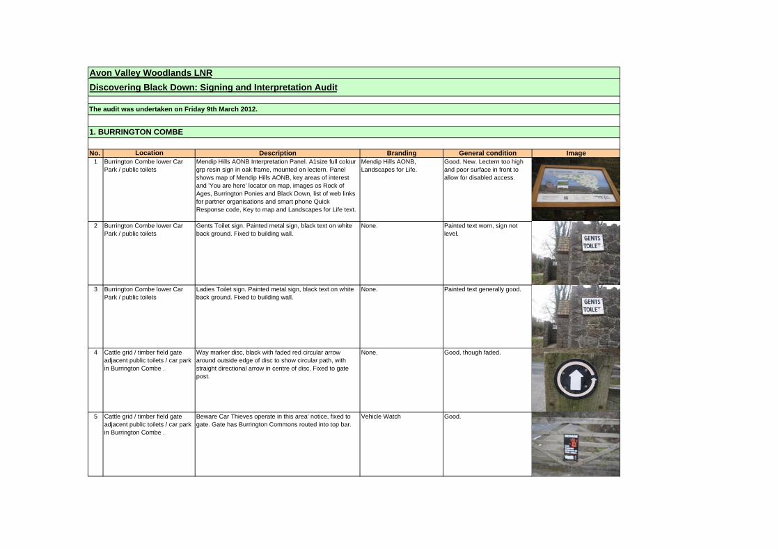
Avon Valley Woodlands LNR
Discovering Black Down: Signing and Interpretation Audit
The audit was undertaken on Friday 9th March 2012.
1. BURRINGTON COMBE
No. Location Description Branding General condition Image1 Burrington Combe lower Car
Park / public toilets Mendip Hills AONB Interpretation Panel. A1size full colour grp resin sign in oak frame, mounted on lectern. Panel shows map of Mendip Hills AONB, key areas of interest and 'You are here' locator on map, images os Rock of Ages, Burrington Ponies and Black Down, list of web links for partner organisations and smart phone Quick Response code, Key to map and Landscapes for Life text.
Mendip Hills AONB, Landscapes for Life.
Good. New. Lectern too high and poor surface in front to allow for disabled access.
2 Burrington Combe lower Car Park / public toilets
Gents Toilet sign. Painted metal sign, black text on white back ground. Fixed to building wall.
None. Painted text worn, sign not level.
3 Burrington Combe lower Car Park / public toilets
Ladies Toilet sign. Painted metal sign, black text on white back ground. Fixed to building wall.
None. Painted text generally good.
4 Cattle grid / timber field gate adjacent public toilets / car park in Burrington Combe .
Way marker disc, black with faded red circular arrow around outside edge of disc to show circular path, with straight directional arrow in centre of disc. Fixed to gate post.
None. Good, though faded.
5 Cattle grid / timber field gate adjacent public toilets / car park in Burrington Combe .
Beware Car Thieves operate in this area' notice, fixed to gate. Gate has Burrington Commons routed into top bar.
Vehicle Watch Good.

6 Cattle grid / timber field gate adjacent public toilets / car park in Burrington Combe .
Square plastic instruction sign on gate - Please Close the Gate - Black circle on yellow square, yellow text.
None. Good.
7 Cattle grid / timber field gate adjacent public toilets / car park in Burrington Combe .
Way marker disc, black with faded red / pink circular arrow around outside edge of disc to show circular path, with straight directional arrow in centre of disc. Fixed to gate post. Red reflector for vehicle safety.
None. Good, though faded.
8 Cattle grid / timber field gate adjacent public toilets / car park in Burrington Combe .
Way marker disc, black with faded red circular arrow around outside edge of disc to show circular path, with straight directional arrow in centre of disc. Fixed to gate post.
None. Good, though faded.
9 Road side verge, Burrington Combe, close to public toilets / car park.
Mendip Hills AONB Boundary Marker, stone cairn using local limestone with large central stone into which the Mendip hill AONB text and logo are carved / painted black.
Mendip Hills AONB. Good condition, repainted.
10 Road side verge, Burrington Combe, close to public toilets / car park.
Chew Valley Explorer bus stop sign. Sign loose and fallen to base of post. Sign faded.
Traveline / Chew Valley Explorer.
Requires removal as no bus service.
11 Rock of Ages, Burrington Combe.
Inscription in rock to note where Augustus Toplady took shelter from thunderstorm and was inspired to write the hymn 'Rock of Ages'. Inscription engraved into rock, painted white on green background. Text now difficult to read.
None. Text faded, required re-painting, difficult to read from road level.

12 Burrington Combe - west side of B3134
Timber post with Open Access way-marking symbol on marker disc.
Open Access symbol. Good.
13 Burrington Combe - west side of B3134
Timber post with way marker disc, black with faded red circular arrow around outside edge of disc to show circular path, with straight directional arrow in centre of disc.
None. Broken disc.
14 Burrington Combe - west side of B3134
Timber post with broken way marker disc on ground. None. Broken disc.
15 Burrington Combe - west side of B3134. Path up to West Twin Brook. Sidcot Swallet Cave entrance.
Mendip cave rescue sign, painted text on metal, provides emergency / rescue information and contact numbers.
Mendip Cave Rescue Good.
16 Path up from Burrington Combe to West Twin Brook where meeting with Limestone Link.
Short square timber post with pointed top, commissioned and installed by Mendip Hills AONB unit to clarify routes that are bridleways and footpaths. 1 x Footpath way marker disc with arrow and AONB logo. 1 x rectangular instruction sign showing footpath only, bikes/horses/vehicles not allowed.
Mendip Hills AONB Good.
17 Entrance to Goatchurch Cavern, adjacent West Twin Brook
Mendip cave rescue sign, painted text on metal, provides emergency / rescue information and contact numbers.
Mendip Cave Rescue Good.

18 Burrington Combe - east side of B3134 in layby.
Bye laws and regulations in respect of the Burrington Commons Inclosures Acts 1845 - 1899 - metal sign with vinyl sign, black text on white background, sign and post painted green.
Conservators fo the Burrington Commons
Good.
19 Timber pedestrian latch gate / path link from public toilets / car park in Burrington Combe down to Burrington Inn.
Gate post with Open Access way-marking symbol on marker disc - disc badly faded. Also please close the gate instruction disc and broken encapsulated sign.
Open Access symbol. Poor.
20 Wall facing the B3134 of the Burrington Inn, within main inn car park.
Large interpretation panel (irregular size between AO/A1), full colour panel with clear perspex cover mounted into black metal frame. Panel is titled 'The Burrington Combe Storey' and depicts processes / how geology and landscape of Burrington Combe formed.
Mendip Hills AONB Warden Service / English Nature.
Good but faded and needs new contact details for AONB and Natural England.

21 Car Park off B3134 at main access point to Burrington Ham.
Oak sign board consisting of two boards mounted into two posts. Top board has wording Burrington ham routed into timber and painted black. Lower board has five symbols and text for Viewpoint, SSSI, Mendip Hills AONB, Scheduled Monument and Open Access for Walkers - all routed into board and painted black.
Mendip Hills AONB / Natural England
Good.
22 Car Park off B3134 at main access point to Burrington Ham.
Short square timber post with pointed top, commissioned and installed by Mendip Hills AONB unit to clarify routes that are bridleways and footpaths. 1 x Bridleway way-marker disc with arrow and AONB logo. 1 x rectangular instruction sign to show type of access allowed / not allowed.
Mendip Hills AONB Good.
23 Gate at access from Burrington Ham (east side) to Luuvers Lane.
Timber / metal kissing gate with multiple way-marker discs on the posts either side of the gate. Discs evident on Burrington Ham side of gate are 1 x yellow plastic waymarker disc with black arrow and Limestone Link sticker, and 1 x rectangular public footpath way marker, black with white text and arrow.
Limestone Link Good, though faded.
24 Gate at access from Burrington Ham (east side) to Luuvers Lane.
Timber / metal kissing gate with multiple way-marker discs on the posts either side of the gate. Discs evident on Luurvers Lane side of the gate are: Open access land disc / Blue plastic Public Bridle Path Disc with black arrow and text (AONB branded) / Blue waymarker disc with Limestone Link sticker and AONB branding / yellow round Public Footpath disc with arrow and text in black.
Mendip Hills AONB / Open Access symbol
Good, though faded.
25 Burrington Ham Short square timber post with pointed top, commissioned and installed by Mendip Hills AONB unit to clarify routes that are bridleways and footpaths. 1 x Bridleway and 1 x rectangular instruction sign on one side / 2 x bridleway and 1 x rectangular instruction sign on alternate sides of post.
Mendip Hills AONB Good.
2. BURRINGTON HAM

26 Burrington Ham - path junction. Short square timber post with pointed top, commissioned and installed by Mendip Hills AONB unit to clarify routes that are bridleways and footpaths. No way markers attached.
None.
27 Burrington Ham - path junction. Short square timber post with pointed top, commissioned and installed by Mendip Hills AONB unit to clarify routes that are bridleways and footpaths. Discs on three sides only. 2 x Bridleway discs on one side / 1 x footpath and 1 x rectangular instruction sign on one side / 1 x bridleway disc on one side / one side of post blank.
Mendip Hills AONB Good.
28 Burrington Ham - path junction. Old timber way marking post. Way marker discs on alternate sides. 2 x older style blue bridlepath waymarker discs on one side with Mendip AONB branding / alternate side has new waymarkers - 2 x bridlepath discs, 1 x footpath disc, and one rectangular instruction sign.
Mendip Hills AONB Good.
29 Burrington Ham - path junction. Short square timber post with pointed top, commissioned
and installed by Mendip Hills AONB unit to clarify routes that are bridleways and footpaths. Discs on three sides only. 2 x Bridleway discs on one side / 1 x bridleway disc on alternate side of post.
Mendip Hills AONB Good.
30 Burrington Ham - path junction. Short square timber post with pointed top, commissioned and installed by Mendip Hills AONB unit to clarify routes that are bridleways and footpaths. Discs on one side only: - 1 x Bridleway disc and 1 x footpath disc.
Mendip Hills AONB Good.

31 Burrington Ham - path junction. Short square timber post with pointed top, commissioned and installed by Mendip Hills AONB unit to clarify routes that are bridleways and footpaths. Discs on one side only. 1 x Bridleway disc and 1 x rectangular instruction sign only.
Mendip Hills AONB Good.
32 Ham Link Bridleway signpost. Plastic finger on wooden post Bridleway Good
33 Ham Link Bridlegate and fencing with proliferation of waymarkers' including white arrow with red outer arrow X 2; Open Access Land disc; No Unauthorised vehicles disc, Path Watch laminated sign, please close the gate disc, public bridleway AONB blue disc, new white AONB rectangular sign (no vehicles); also metal plaque - Burrington Combe Circular Walk waymarked by 100%ers of Nationwide Building Society Sept 2005
Mendip Hills AONB; Path watch
Pathwatch laminated sign faded.
34 Ham Link Bridleway signpost. Plastic finger on wooden post Bridleway Good
35 Corner of Ham Link and Rickford Rise
Bridleway signpost. Double plastic finger on wooden post
Bridleway Good

36 Rickford Rise Bridlegate with waymarker and notice discs. Please close the gate X 2; new white AONB rectangular sign (no vehicles)
Mendip Hills AONB Good
37 Rickford Rise Waymarker post with public bridleway AONB blue disc x 3; new white AONB rectangular sign (no vehicles)
Mendip Hills AONB Good
38 Track across Rickford Rising Public footpath signpost (green plastic finger on wooden post) and proliferation of waymarkers and laminated signs. Waymarkers include public footpath rectangular with yellow arrow, public bridleway AONB blue disc x 3, Mendip Hills AONB white footpath arrow, new white AONB rectangular sign (no horseriding, cycling & vehicles). In addition two laminated signs - Keep dogs on leads; Important Notice - Control of dogs and animals and nesting birds (AONB sign).
Mendip Hills AONB AONB Control of dogs yellow laminated sign covered in algae.
39 Track across Rickford Rising Bridlegate with way markers including please close the gate x 2; public footpath yellow disc, public bridleway AONB blue disc.
Mendip Hills AONB Good
40 Jtn of track across Rickford Rising and drive to house.
Waymarker post with 2 x yellow footpath discs and please keep dogs on lead laminated yellow card.
None Good
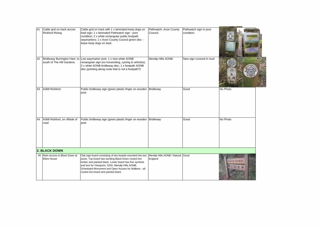
41 Cattle grid on track across Rickford Rising
Cattle grid on track with 1 x laminated keep dogs on lead sign; 1 x laminated Pathwatch sign - poor condition; 2 x white rectangular public footpath waymarkers; 1 x Avon County Council green disc - lease keep dogs on lead.
Pathwatch; Avon County Council.
Pathwatch sign in poor condition.
42 Bridleway Burrington Ham, to south of The Hill Gardens.
Low waymarker post. 1 x new white AONB rectangular sign (no horseriding, cycling & vehicles); 2 x white AONB bridleway disc; 1 x footpath AONB disc (pointing along route that is not a footpath?)
Mendip Hills AONB New sign covered in mud
43 A368 Rickford Public bridleway sign (green plastic finger on wooden post.
Bridleway Good No Photo
44 A368 Rickford, on offside of road
Public bridleway sign (green plastic finger on wooden post.
Bridleway Good No Photo
45 Main access to Black Down at Ellick House
Oak sign board consisting of two boards mounted into two posts. Top board has wording Black Down routed into timber and painted black. Lower board has five symbols and text for Viewpoint, SSSI, Mendip Hills AONB, Scheduled Monument and Open Access for Walkers - all routed into board and painted black.
Mendip Hills AONB / Natural England
Good.
2. BLACK DOWN
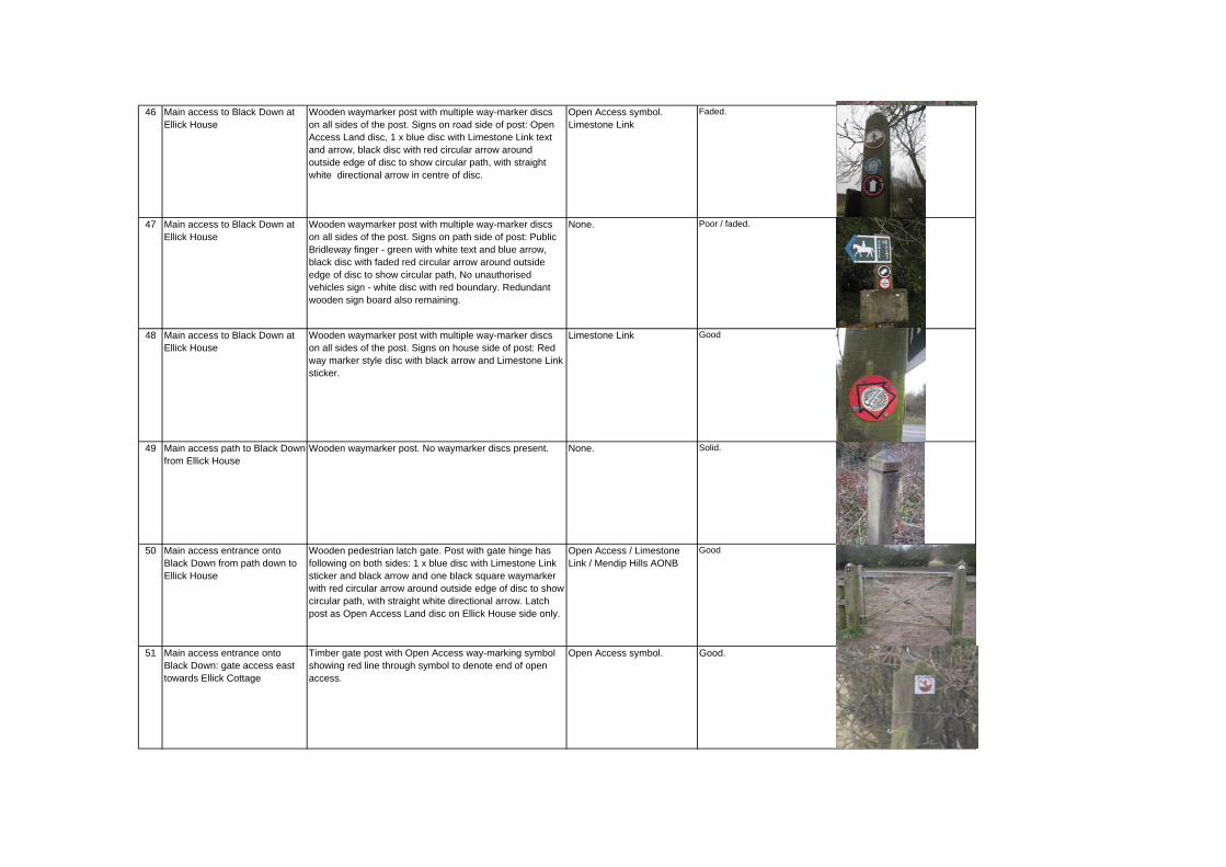
46 Main access to Black Down at Ellick House
Wooden waymarker post with multiple way-marker discs on all sides of the post. Signs on road side of post: Open Access Land disc, 1 x blue disc with Limestone Link text and arrow, black disc with red circular arrow around outside edge of disc to show circular path, with straight white directional arrow in centre of disc.
Open Access symbol. Limestone Link
Faded.
47 Main access to Black Down at Ellick House
Wooden waymarker post with multiple way-marker discs on all sides of the post. Signs on path side of post: Public Bridleway finger - green with white text and blue arrow, black disc with faded red circular arrow around outside edge of disc to show circular path, No unauthorised vehicles sign - white disc with red boundary. Redundant wooden sign board also remaining.
None. Poor / faded.
48 Main access to Black Down at Ellick House
Wooden waymarker post with multiple way-marker discs on all sides of the post. Signs on house side of post: Red way marker style disc with black arrow and Limestone Link sticker.
Limestone Link Good
49 Main access path to Black Down from Ellick House
Wooden waymarker post. No waymarker discs present. None. Solid.
50 Main access entrance onto Black Down from path down to Ellick House
Wooden pedestrian latch gate. Post with gate hinge has following on both sides: 1 x blue disc with Limestone Link sticker and black arrow and one black square waymarker with red circular arrow around outside edge of disc to show circular path, with straight white directional arrow. Latch post as Open Access Land disc on Ellick House side only.
Open Access / Limestone Link / Mendip Hills AONB
Good
51 Main access entrance onto Black Down: gate access east towards Ellick Cottage
Timber gate post with Open Access way-marking symbol showing red line through symbol to denote end of open access.
Open Access symbol. Good.

52 Main access entrance onto Black Down from path down to Ellick House
Wooden waymarker post set back at junction of paths onto Black Down. Multiple way-marker discs on all sides of the post. Side1: blue bridleway disc / blue waymarker disc with Limestone Link sticker /one black waymarker with red circular arrow around outside edge of disc to show circular path, with straight white directional arrow. Side 2 - Old faded public bridleway rectangular sign with Limestone Link sticker over faded arrow.
Limestone Link / Mendip Hills AONB
53 Wooden waymarker post set back at junction of paths onto Black Down. Side 3: Blue public bridleway disc / one black circular waymarker with red circular arrow around outside edge of disc to show circular path, with straight white directional arrow / old faded public bridleway rectangular sign with Limestone Link sticker over faded arrow. Side 4: blue bridleway disc / blue waymarker disc with Limestone Link sticker.
Limestone Link / Mendip Hills AONB
54 Main access entrance onto Black Down from path down to Ellick House
Short square timber post with pointed top, commissioned and installed by Mendip Hills AONB unit to clarify routes that are bridleways and footpaths. 1 x Bridleway way-marker disc with arrow and AONB logo. 1 x rectangular instruction sign to show type of access allowed / not allowed.
Mendip Hills AONB Good.
55 Main access entrance onto Black Down from path down to Ellick House
Short square timber post with pointed top, commissioned and installed by Mendip Hills AONB unit to clarify routes that are bridleways and footpaths. 1 x Footpath way-marker disc with arrow and AONB logo. 1 x rectangular instruction sign to show type of access allowed / not allowed.
Mendip Hills AONB Good.
56 Main access entrance onto Black Down from path down to Ellick House
Short square timber post with pointed top, commissioned and installed by Mendip Hills AONB unit to clarify routes that are bridleways and footpaths. 1 x Bridleway way-marker disc with arrow and AONB logo. 1 x rectangular instruction sign to show type of access allowed / not allowed.
Mendip Hills AONB Good.
57 Main access entrance onto Black Down from path down to Ellick House
Short square timber post with pointed top, commissioned and installed by Mendip Hills AONB unit to clarify routes that are bridleways and footpaths. 2 x Bridleway way-marker disc with arrow and AONB logo on alternate sides of post / 1 x rectangular instruction sign to show type of access allowed / not allowed.
Mendip Hills AONB Good.

58 Black Down - Limestone Link west of West Twin Brook.
Short square timber post with pointed top, commissioned and installed by Mendip Hills AONB unit to clarify routes that are bridleways and footpaths No waymarker discs attached.
Good.
59 Black Down - north west side at junction of limestone link and path up side of West Twin Brook.
Short square timber post with pointed top, commissioned and installed by Mendip Hills AONB unit to clarify routes that are bridleways and footpaths. 5 x Bridleway way-marker discs with arrow and AONB logo on alternate sides of post.
Mendip Hills AONB Good.
60 Black Down - north west side at junction of limestone link and path up over Black Down and down to Link Lane.
Short square timber post with pointed top, commissioned and installed by Mendip Hills AONB unit to clarify routes that are bridleways and footpaths. 2 x Bridleway way-marker discs with arrow and AONB logo.
Mendip Hills AONB Good.
61 Black Down - north west side at junction of limestone link and path up over Black Down and down to Link Lane.
Short square timber post with pointed top, commissioned and installed by Mendip Hills AONB unit to clarify routes that are bridleways and footpaths. 2 x Bridleway way-marker discs with arrow and AONB logo.
Mendip Hills AONB Good.
62 Black Down - north west side at junction of limestone link and path up over Black Down and down to Link Lane.
Redundant timber waymarker post on ground with rectangular public bridlepath sign and limestone link sticker.
Limestone link Poor.
63 Black Down - north west side on limestone link close to Rod's Pot.
Short square timber post with pointed top, commissioned and installed by Mendip Hills AONB unit to clarify routes that are bridleways and footpaths No waymarker discs attached.
None.

64 Black Down - north west side on limestone link close to Rod's Pot.
Yellow waymarker disc, black arrow with Limestone Link logo. Fixed to post and wire fence along side of Limestone link.
Limestone link Clear.
65 Black Down - north west side on limestone link close to Rod's Pot.
Short square timber post with pointed top, commissioned and installed by Mendip Hills AONB unit to clarify routes that are bridleways and footpaths No waymarker discs attached.
None.
66 Link Lane Public bridleway sign on telegraph pole. Bridleway Good
67 Link Lane Open Access Land waymark on gate Open Access Land Good
68 Link Lane, bridlegate to side of cattle grid.
Public bridleway blue waymarks x 2; close the gate x 2; 1 x Open Access Land. Also 1 x laminated sign cycling and horseriding only legal on bridleways.
Open Access Land

69 Link Lane Metal post and sign with laminates Countryside Watch Mendip Hills AONB sign - keep dogs on lead. Includes Mendip Hills Warden telephone number and Police number
Countryside Watch. Mendip Hills AONB.
Poor condition - refers to Mendip warden.
70 Bridleway of Link Lane New low way mark post with white bridleway waymark and white AONB rectangular sign (no vehicles)
Mendip Hills AONB Good
71 Black Down - Field gate on limestone link - access between Rowberrow Warren / Hills farm / Dolebury Warren.
Field gate on limestone link, Somerset CC Bridleway waymarker disc - white with blue arrow, Blue Mendip Hills AONB waymarker disc with Limestone Link sticker in centre.
Mendip Hills AONB / Limestone Link / Somerset CC.
Blue AONB waymarker broken.
72 Black Down - access at Rowberrow Warren / Hills Farm.
Short square timber post with pointed top, commissioned and installed by Mendip Hills AONB unit to clarify routes that are bridleways and footpaths. 3 x Bridleway way-marker discs with arrow and AONB logo on alternate sides / 1 x rectangular instruction sign to show type of access allowed / not allowed.
Mendip Hills AONB Good.
73 Black Down - path junction at Rowberrow Warren / Dolebury Warren.
Timber waymarker post with multiple way-marker discs on two sides: Post side 1: 2 x old public bridleway signs, one with Limestone Link sticker, faded arrows, white waymarker disc with Butcombe Brewery The Mendip Pub Trail waymark. Post side 2: 2 x old public bridleway signs, one with Limestone Link sticker, faded arrows.
Limestone Link, Mendip Pub Trail.
Poor.

74 A368 Langford Green Plastic public footpath finger mounted on telegraph pole.
Public footpath. Sign broken. No Photo
75 A368 Springhead Farm Metal public footpath sign on metal post. Public footpath. Overgrown by leylandi
76 A368 Bath Road Metal signpost - green Bridleway Burrington finger and separate Bridleway - cyclists please give way to horseriders and pedestrians sign.
Bridleway Requires cleaning.
77 A368 Bath Road Metal National Trust Dolebury Warren sign on wooden post
The National Trust Good
78 Rowberrow Warren - adjacent northern boundary with Black Down / Limestone Link.
Timber waymarker post with 2 x faded Somerset County Council public bridleway waymarker discs. Has Somerset CC web address.
Somerset County Council web address.
Faded.
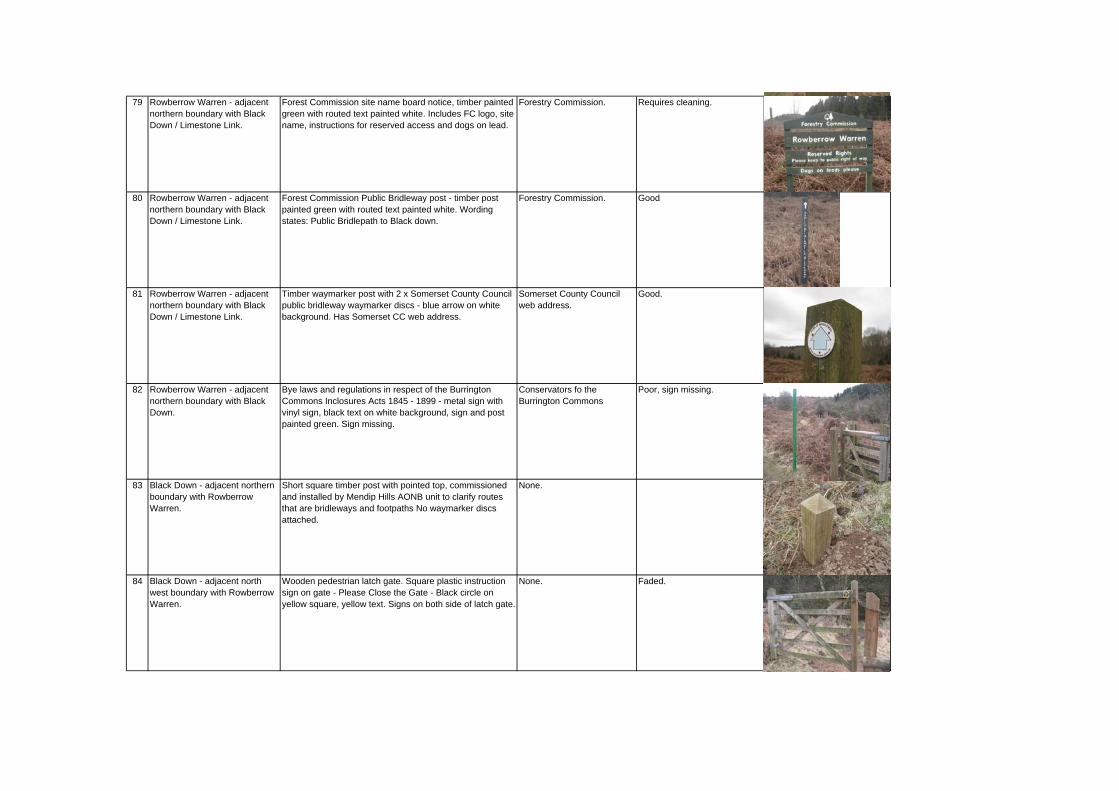
79 Rowberrow Warren - adjacent northern boundary with Black Down / Limestone Link.
Forest Commission site name board notice, timber painted green with routed text painted white. Includes FC logo, site name, instructions for reserved access and dogs on lead.
Forestry Commission. Requires cleaning.
80 Rowberrow Warren - adjacent northern boundary with Black Down / Limestone Link.
Forest Commission Public Bridleway post - timber post painted green with routed text painted white. Wording states: Public Bridlepath to Black down.
Forestry Commission. Good
81 Rowberrow Warren - adjacent northern boundary with Black Down / Limestone Link.
Timber waymarker post with 2 x Somerset County Council public bridleway waymarker discs - blue arrow on white background. Has Somerset CC web address.
Somerset County Council web address.
Good.
82 Rowberrow Warren - adjacent northern boundary with Black Down.
Bye laws and regulations in respect of the Burrington Commons Inclosures Acts 1845 - 1899 - metal sign with vinyl sign, black text on white background, sign and post painted green. Sign missing.
Conservators fo the Burrington Commons
Poor, sign missing.
83 Black Down - adjacent northern boundary with Rowberrow Warren.
Short square timber post with pointed top, commissioned and installed by Mendip Hills AONB unit to clarify routes that are bridleways and footpaths No waymarker discs attached.
None.
84 Black Down - adjacent north west boundary with Rowberrow Warren.
Wooden pedestrian latch gate. Square plastic instruction sign on gate - Please Close the Gate - Black circle on yellow square, yellow text. Signs on both side of latch gate.
None. Faded.

85 Black Down - adjacent north west boundary with Rowberrow Warren.
Bye laws and regulations in respect of the Burrington Commons Inclosures Acts 1845 - 1899 - metal sign with vinyl sign, black text on white background, sign and post painted green.
Conservators fo the Burrington Commons
Good, requires cleaning.
86 Black Down - adjacent north west boundary with Rowberrow Warren.
Forest Commission sign board notice with laminated paper notice stating site is privately owned with agreed permissive access. Public access limited to bridleways. Dated July 2002.
Forestry Commission. Poor, though still legible.
87 Black Down - adjacent north west boundary with Rowberrow Warren.
Forest Commission site name board notice, timber painted green with routed text painted white. Includes FC logo, site name, instructions for reserved access and dogs on lead.
Forestry Commission. Good, requires painting / cleaning.
88 Black Down - adjacent north west boundary with Rowberrow Warren.
Timber waymarker post with 2 x faded Somerset County Council public bridleway waymarker discs. Has Somerset CC web address.
Somerset CC Requires cleaning.
89 Black Down - west boundary with Rowberrow Warren.
Bye laws and regulations in respect of the Burrington Commons Inclosures Acts 1845 - 1899 - metal sign with vinyl sign, black text on white background, sign and post painted green.
Conservators fo the Burrington Commons
Poor. Requires cleaning.
90 Black Down - west boundary / bridlepath from Rowberrow Warren.
Wooden pedestrian latch gate. Way marking discs on Rowberrow side of gate: Square plastic instruction sign on gate post - Please Close the Gate, black circle on yellow square, yellow text / Blue circular bridleway waymarker withAONB branding / Open Access Land disc on post.
Mendip Hills AONB / Open Access Land
Good.

91 Black Down - west boundary / bridlepath from Rowberrow Warren.
Wooden pedestrian latch gate. Way marking discs on Black Down side of gate: Square plastic instruction sign on gate post - Please Close the Gate, black circle on yellow square, yellow text / Blue circular bridleway waymarker withAONB branding / White waymarker disc with Butcombe Brewery The Mendip Pub Trail waymark fixed to side face of latch gate post.
Mendip Hills AONB / Good.
92 Black Down - west boundary / bridlepath from Rowberrow Warren.
Forest Commission site name board notice, timber painted green with routed text painted white. Includes site name, instructions for reserved access and dogs on lead. FC heading board missing.
None. Poor. Requires cleaning, painting and addition of Forestry Commission title.
93 Black Down - west boundary / bridlepath from Rowberrow Warren.
Bye laws and regulations in respect of the Burrington Commons Inclosures Acts 1845 - 1899 - metal sign with vinyl sign, black text on white background, sign and post painted green.
Conservators fo the Burrington Commons
Poor, requires cleaning.
94 Black Down - west boundary / bridlepath from Rowberrow Warren.
Short square timber post with pointed top, commissioned and installed by Mendip Hills AONB unit to clarify routes that are bridleways and footpaths. 2 x bridleway way-marker discs with arrow and AONB logo and 1 x rectangular instruction sign to show type of access allowed / not allowed on one side of post / 3 x bridleway way-marker discs with arrow and AONB logo on alternate side of post.
Mendip Hills AONB Good.
95 Black Down - west boundary / bridlepath from Rowberrow Warren.
Short square timber post with pointed top, commissioned and installed by Mendip Hills AONB unit to clarify routes that are bridleways and footpaths. Bridleway way-marker disc with arrow and AONB logo and 1 x rectangular instruction sign to show type of access allowed / not allowed on one side of post only.
Mendip Hills AONB Good.
96 Black Down - west boundary / bridlepath from Rowberrow Warren.
Short square timber post with pointed top, commissioned and installed by Mendip Hills AONB unit to clarify routes that are bridleways and footpaths. Bridleway way-marker disc with arrow - Butcombe Brewery The Mendip Pub Trail waymark sticker applied over AONB logo. 1 x rectangular instruction sign to show type of access allowed / not allowed on one side of post only.
Mendip Hills AONB / Butcombe Brewery The Mendip Pub Trail
Good.

97 Black Down - west boundary / bridlepath from Rowberrow Warren.
Short square timber post with pointed top, commissioned and installed by Mendip Hills AONB unit to clarify routes that are bridleways and footpaths. 1 x bridleway way-marker discs with arrow and AONB logo and 1 x rectangular instruction sign to show type of access allowed / not allowed on one side of post / 3 x bridleway way-marker discs with arrow and AONB logo on alternate side of post.
Mendip Hills AONB Good.
98 Black Down - south west boundary with Rowberrow Warren.
Bye laws and regulations in respect of the Burrington Commons Inclosures Acts 1845 - 1899 - metal sign with vinyl sign, black text on white background, sign and post painted green.
Conservators fo the Burrington Commons
Requires cleaning.
99 Black Down - south west boundary with Rowberrow Warren.
Wooden pedestrian latch gate allowing access from Black Down to Rowberrow. Square plastic instruction sign on both sides of the gate - Please Close the Gate, black circle on yellow square, yellow text, sign on black down side of gate broken. Also on faded old rectangular bridleway waymarker fixed to gate post.
None. Poor.
100 Black Down - south west boundary with Rowberrow Warren.
Open access land disc signs affixed to Rowberrow side of latch gate posts for when accessing onto Black Down.
Open access land. Requires cleaning.
101 Rowberrow Warren - south west boundary with Black Down.
Timber waymarker post with 2 x Somerset County Council public bridleway waymarker discs - blue arrow on white background. Has Somerset CC web address.
Somerset County Council web address.
Good.
102 Black Down - south west boundary with Rowberrow Warren.
Short square timber post with pointed top, commissioned and installed by Mendip Hills AONB unit to clarify routes that are bridleways and footpaths No waymarker discs attached.
None.
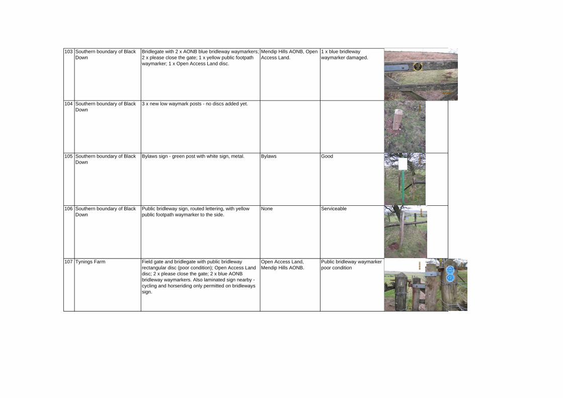
103 Southern boundary of Black Down
Bridlegate with 2 x AONB blue bridleway waymarkers; 2 x please close the gate; 1 x yellow public footpath waymarker; 1 x Open Access Land disc.
Mendip Hills AONB, Open Access Land.
1 x blue bridleway waymarker damaged.
104 Southern boundary of Black Down
3 x new low waymark posts - no discs added yet.
105 Southern boundary of Black Down
Bylaws sign - green post with white sign, metal. Bylaws Good
106 Southern boundary of Black Down
Public bridleway sign, routed lettering, with yellow public footpath waymarker to the side.
None Serviceable
107 Tynings Farm Field gate and bridlegate with public bridleway rectangular disc (poor condition); Open Access Land disc; 2 x please close the gate; 2 x blue AONB bridleway waymarkers. Also laminated sign nearby - cycling and horseriding only permitted on bridleways sign.
Open Access Land, Mendip Hills AONB.
Public bridleway waymarker poor condition

108 Tynings Farm Old wooden waymarker post with routed lettering - Cheddar 4 miles; West Mendip Way, Shipham 2 1/2 miles. Also old faded West Mendip Way waymarker, Restricted Byway x 2 waymarkers and no unauthorised vehicles sign.
Somerset County Council (on restricted byway sign). West Mendip Way
Post in poor condition.
109 West Mendip Way jtn with Rowberrow Warren
2 x posts with old public bridleway rectangular waymarkers and West Mendip Way stickers added. Also 2 x restricted byway waymarks.
Rotary International (West Mendip Way stickers), Somerset County Council.
Old Bridleway waymarkers faded.
110 West Mendip Way jtn with Rowberrow Warren
Forestry Commission Green Sign - Rowberrow Warren. Reserved Rights - please keep top public rights of way, dogs on leads please.
Forestry Commission Good; cut back vegetation.

111 Lane between Charterhouse and Tynings Farm
Plaswood public bridleway sign. Bridleway sign missing on one side. Also waymark white arrow with red circular outer arrow.
Circular walk waymark Bridleway finger needs new sign attaching to one side.
112 Lane between Charterhouse and Tynings Farm
Field gate and bridle gate with several way markers. White public bridleway arrow, Blue AONB bridleway waymarker, white arrow with red circular outer arrow x 2; No Unauthorised vehicles.
Mendip Hills AONB Bridleway and circular walk waymarkers damaged.
113 The Lots Nature Reserve Interpretation Board - sticky back plastic on wooden Frame. Board to interpret the nature reserve
HLF; Natural England; Mendip Society; Grasslands Trust; Somerset Wildlife Trust
Serviceable
114 The Lots Nature Reserve Field gate and gap to side. Public footpath waymarker, Avon County Council keep dogs on lead (poor condition) on old gate post. Aonb blue bridleway waymark on field gate post and 2 x waymark white arrow with red circular outer arrow.
Avon County Council; Mendip Hills AONB.
Avon county Council sign faded, bridleway waymarker damaged.
115 The Lots Nature Reserve (Somerset Wildlife Trust) - Access from south of Black Down
Bridlepath across reserve -gated access between reserve fields: West side of gate - multiple waymarking signs on both sides of gate / gate post including: White broken plastic waymarking arrow, broken blue bridlepath waymarker with AONB branding, black disc with faded red circular arrow around outside edge of disc to show circular path.
Mendip Hills AONB Very poor, most broken / faded.
3. ACCESS FROM THE LOTS NATURE RESERVE TO SOUTH SIDE OF BLACK DOWN

116 The Lots Nature Reserve (Somerset Wildlife Trust) - Access from south of Black Down
Bridlepath across reserve -gated access between reserve fields: East side of gate - multiple waymarking signs on both sides of gate / gate post including: White broken plastic waymarking arrow with public bridle path text, remains of broken blue bridlepath waymarker, square waymarker with faded red circular arrow around outside edge and white arrow to show circular path fixed to gate post.
None. Very poor, most broken / faded.
117 The Lots Nature Reserve (Somerset Wildlife Trust) - Access from south of Black Down
Bridlepath across reserve adjacent gated access between reserve fields: Metal tubular post with remains of cast metal sign, painted green with bare metal finish to wording. Sign broken, remain section indicates probably read 'Please keep on the track'? Sign on east side of the gate.
None. Poor / broken
118 The Lots Nature Reserve (Somerset Wildlife Trust) - Bridlepath access onto Black Down adjacent WWII shelter from the reserve.
Bridlepath access from reserve onto Black Down (south side of gate). Signs on timber latchgate post : 1x blue bridlepath waymarker with AONB branding / Open Access Land circular sign.
Mendip Hills AONB / Open Access Land
Faded broken signs.
119 The Lots Nature Reserve (Somerset Wildlife Trust) - Bridlepath access onto Black Down adjacent WWII shelter from the reserve.
Bridlepath access from reserve onto Black Down (Black Down side of gate). Signs on timber latchgate posts : 1x blue bridlepath waymarker with AONB branding / 1 x black disc with faded red circular arrow around outside edge of disc to show circular path / 1 x Please Close the Gate black circle on yellow square, yellow text.
Mendip Hills AONB Faded / broken.
120 Black Down - southern boundary with The Lots Nature Reserve (Somerset Wildlife Trust) - Bridlepath access onto Black Down adjacent WWII shelter.
Bye laws and regulations in respect of the Burrington Commons Inclosures Acts 1845 - 1899 - metal sign with vinyl sign, black text on white background, sign and post painted green. Sign missing.
Conservators fo the Burrington Commons
Sign missing.
121 Black Down - southern boundary with The Lots Nature Reserve (Somerset Wildlife Trust) - Path running on Black Down side of southern boundary.
Oak sign board mounted on two low level oak posts. Board has wording routed into panel and painted black. Reads ' Path closed for erosion repair Please use other routes'.
None. Good.

122 East boundary of Black Down, junction of bridle path from Wireless station with site boundary.
Bye laws and regulations in respect of the Burrington Commons Inclosures Acts 1845 - 1899 - metal sign with vinyl sign, black text on white background, sign and post painted green. Sign missing.
Conservators fo the Burrington Commons
Sign missing.
123 East boundary of Black Down, junction of bridle path from Wireless station with site boundary.
Timber field gate / latch gate at bridlepath access onto Black Down: Waymarking on Black Down side of gate posts : 1x faded square blue waymarker with bridlepath and arrow in white / 1 x black disc with faded red circular arrow around outside edge of disc to show circular path / 1 x Please Close the Gate black circle on yellow square with yellow text / 1 x white waymarker disc with Butcombe Brewery The Mendip Pub Trail waymark fixed to top of gate post.
Butcombe Brewery The Mendip Pub Trail
Poor - faded / broken
124 East boundary of Black Down, junction of bridle path from Wireless station with site boundary.
Timber field gate / latch gate at bridlepath access onto Black Down: Waymarking on Black Down side of gate posts : 1x faded square blue waymarker with bridlepath and arrow in white / 1 x black square marker with red circular arrow around outside edge of disc to show circular path / 1 x blue bridlepath sign with AONB branding / 1 x Open Access Land disc / 2 x blue circular bridlepath waymarkers with AONB branding.
Mendip Hills AONB / Open Access Land
Some good / some faded or broken.
125 East boundary of Black Down, junction of bridlepaths both from Wireless station and out across/around Black Down including path to Beacon Batch.
Short square timber post with pointed top, commissioned and installed by Mendip Hills AONB unit to clarify routes that are bridleways and footpaths. 2 x bridleway way-marker discs with arrow and AONB logo and 2 x rectangular instruction sign to show type of access allowed / not allowed on alternate sides of the post.
Mendip Hills AONB Good
126 East boundary of Black Down, junction of bridlepaths both from Wireless station and out across/around Black Down including path to Beacon Batch.
Short square timber post with pointed top, commissioned and installed by Mendip Hills AONB unit to clarify routes that are bridleways and footpaths. 1 x bridleway way-marker discs with arrow and AONB logo and 1 x rectangular instruction sign to show type of access allowed / not allowed only.
Mendip Hills AONB Good
127 East boundary of Black Down, junction of bridlepaths both from Wireless station and out across/around Black Down including path to Beacon Batch.
Short square timber post with pointed top, commissioned and installed by Mendip Hills AONB unit to clarify routes that are bridleways and footpaths. 1 x Footpath way-marker disc with arrow and AONB logo and 1 x rectangular instruction sign to show type of access allowed / not allowed on one side of post only. Marks path direction to Beacon Batch.
Mendip Hills AONB Good

128 East boundary of Black Down, junction of bridlepaths both from Wireless station and out across/around Black Down including path to Beacon Batch.
Short square timber post with pointed top, commissioned and installed by Mendip Hills AONB unit to clarify routes that are bridleways and footpaths. 2 x bridleway way-marker discs with arrow and AONB logo and 2 x rectangular instruction sign to show type of access allowed / not allowed - signs on alternate sides of the post.
Mendip Hills AONB Good
129 Bridle Path crossing Black Down from Ellick House over to Tynings Farm. At junction of bridlepath and footpath up to Beacon Batch (located on 305m contour on plan).
Short square timber post with pointed top, commissioned and installed by Mendip Hills AONB unit to clarify routes that are bridleways and footpaths. Bridleway way-marker disc / footpath disc / Rectangular instruction sign to show type of access allowed / not allowed.
Mendip Hills AONB Good No image available.
130 Bridle Path crossing Black Down from Ellick House over to Tynings Farm. At junction with path crossing Black Down from Wire Station entrance on east side, over Beacon Batch, crossing bridle path and over to East Twin Brook. At junction of bridlepath and footpath up to Beacon Batch (located on 320m contour on plan) to north west of Beacon Batch.
2 x short square timber post with pointed top, commissioned and installed by Mendip Hills AONB unit to clarify routes that are bridleways and footpaths. Bridleway way-marker disc / footpath disc / Rectangular instruction sign to show type of access allowed / not allowed.
Mendip Hills AONB Good No image available.
131 Bridle Path crossing Black Down from Ellick House over to Tynings Farm. At junction with desire route/path following line of former WWII bombing decoy to south west side of Beacon Batch. Posts sited at junction of bridlepath located on 315m contour on plan).
2 x short square timber post with pointed top, commissioned and installed by Mendip Hills AONB unit to clarify routes that are bridleways and footpaths. Bridleway way-marker disc / footpath disc / Rectangular instruction sign to show type of access allowed / not allowed.
Mendip Hills AONB Good No image available.
132 Bridle path crossing Black Down from Ellick House over to Tynings Farm. At junction bridle path crossing Black Down from Wireless Station entrance over to Rowberrow Warren. Posts sited at junction of bridlepath paths.
2 x short square timber post with pointed top, commissioned and installed by Mendip Hills AONB unit to clarify routes that are bridleways and footpaths. Bridleway way-marker disc / footpath disc / Rectangular instruction sign to show type of access allowed / not allowed.
Mendip Hills AONB Good No image available.
4. LOCATION OF OTHER NEW WAYMARKER POSTS ON BLACK DOWN (BASED ON MAP SUPPLIED BY MENDIP HILLS AONB)

133 Bridle Path crossing Black Down from Wireless Station entrance on east side, south of Beacon Batch and over to Rowberrow Warren. At junction of bridlepath and unofficial desire line following WWII decoy to south west of Beacon Batch.
2 x short square timber post with pointed top, commissioned and installed by Mendip Hills AONB unit to clarify routes that are bridleways and footpaths. Bridleway way-marker disc / footpath disc / Rectangular instruction sign to show type of access allowed / not allowed.
Mendip Hills AONB Good No image available.

134 Bridle Path crossing Black Down from Tynings Farm over to Ellick House, passing close to East Twin Brook. Posts at junction of bridlepath and unofficial desire line following WWII decoy to south west of Beacon Batch.
2 x short square timber post with pointed top, commissioned and installed by Mendip Hills AONB unit to clarify routes that are bridleways and footpaths. Bridleway way-marker disc / footpath disc / Rectangular instruction sign to show type of access allowed / not allowed.
Mendip Hills AONB Good No image available.
135 Bridle Path crossing Black Down from Wireless Station entrance on east side, south of Beacon Batch and over to Rowberrow Warren. At junction with bridlepath running north adjacent West Twin Brook down to Link Lane.
2 x short square timber post with pointed top, commissioned and installed by Mendip Hills AONB unit to clarify routes that are bridleways and footpaths. Bridleway way-marker disc / footpath disc / Rectangular instruction sign to show type of access allowed / not allowed.
Mendip Hills AONB Good No image available.
136 Bridle Path crossing Black Down from Wireless Station entrance on east side, south of Beacon Batch and over to Rowberrow Warren. At junction with bridlepath running north - south linking Link Lane to Tynings Farm.
2 x short square timber post with pointed top, commissioned and installed by Mendip Hills AONB unit to clarify routes that are bridleways and footpaths. Bridleway way-marker disc / footpath disc / Rectangular instruction sign to show type of access allowed / not allowed.
Mendip Hills AONB Good No image available.
137 Bridle Path crossing Black Down running north - south linking Link Lane to Tynings Farm. At junction with unofficial path following line of WWII decoy up to Beacon Batch.
2 x short square timber post with pointed top, commissioned and installed by Mendip Hills AONB unit to clarify routes that are bridleways and footpaths. Bridleway way-marker disc / footpath disc / rectangular instruction sign to show type of access allowed / not allowed.
Mendip Hills AONB Good No image available.
138 Junction of both bridlepaths crossing Black Down from Ellick House over to Tynings Farm. Junction at south side of Black Down just north of Tynings Farm.
Short square timber post with pointed top, commissioned and installed by Mendip Hills AONB unit to clarify routes that are bridleways and footpaths. Bridleway way-marker disc / footpath disc / Rectangular instruction sign to show type of access allowed / not allowed.
Mendip Hills AONB Good No image available.

139 Mendip Hills AONB Good No image available.

Appendix 2: Questionnaire – Analysis of Survey Results & Blank
Questionnaire

BURRINGTON COMMONS
ANALYSIS OF SIGNING AND INTERPRETATION QUESTIONNAIRE
INTRODUCTION A questionnaire was devised to help develop an audience profile for the Burrington Commons and to ascertain the views of visitors views regarding signing and interpretation. The purpose of the questionnaire was to find out how often they visit, how long they stay, what they do when they get there, where they come from, their age range, how much people already know about the areas special features, how interested they were in a number of themes and their reaction to the potential use of different types of interpretative media. A sample of eighty five (85) people was questioned in total. The majority of the responses came from people who were surveyed on site by Mendip Hills AONB volunteer rangers. Interviews took place over 19 separate days in May, June and July 2012. Questionnaire interviews took place on weekdays and weekends, and at different times of the day. In addition, a number of questionnaires were completed by visitors to Bad Ass Bikes (2), the Burrington Inn (7) and Shipham Riding School (2) and North Somerset Show (5). The on- site interviews were completed at a variety of locations around the Burrington Commons, including Black Down, Burrington Ham car park, Burrington Ham, and Burrington Combe car park. The survey picked up a representative spread on people visiting on weekdays, weekends, different times of day and at different entrance points to the commons. People were asked what category of recreational user they fell into. Results for those that responded to this question were as follows:-
Age Class Number of interviewees %
Walker 78 Cyclist 14
Horse rider 8 Interestingly, information from automatic counters located at two entrances on Black Down by the Mendip Hills AONB Service in 2006, 2007 and 2008 indicated that of total movements, 74% were by walkers, 17% were cyclists, and 9% were horse riders. Compared to this, the categories of recreational user who have responded in the survey is a reasonably representative sample, although cyclists are slightly under-represented.
1

Age Profile The age profile of people who responded to the survey is given in the table below.
Age Class Number of interviewees %
0-15 15 16-25 9 26-40 15 41-65 45 >65 16
This demonstrates that visitors to the Burrington Commons are distributed throughout the age classes and whilst the majority of people are over 41 (61%), there are still a significant proportion of visitors (39%) who fall into the younger age classes. The implication is that activities and interpretation should be able to reach people across the age ranges. We asked people how often they visit the Burrington Commons?
How often do you visit? Number of interviewees %
Daily 10 Once or twice a week 19
Weekly 15 Once or twice a month 33
Once a year 10 Less than once a year 13
From those that responded the figures indicate that there is a mix of people who visit once per week or more (44%), those that visit once or twice a month (33%) and those that visit once a year or less (23%). Where do people come from? Analysis of respondent’s postcodes revealed the following:
Where have you come from? % from area Local – BS40 31 Bristol 21 Wider region (Former Avon area) 37 Swindon 5 Trowbridge 1 Other parts of England – Rugby, St Austell, Bognar Regis, Uxbridge, Uckfield
6
The majority of visitors (89%) come from the former Avon area surrounding the Burrington Commons. Slightly under one third (31%) of visitors live in the local vicinity, one fifth (21%) come from Bristol, whilst a larger proportion (37%) come from
2

the wider former County of Avon region, including Weston Super Mare, the Chew Valley and Bath. There are also visitors travelling from Wiltshire (6%), and from other parts of the country (6%). This data reveals that the Burrington commons are an important resource for people who live locally, however its special character and features draws in significant numbers of visitors from the wider former County of Avon region and even attracts people from further afield, including the Midlands, Cornwall and South East England. We asked people how long they would stay at the Burrington Commons during their visit and recorded the following results: -
Length of Stay Number of interviewees %
< 1 hour 29 1-2 hours 26 2-3 hours 21 > 3 hours 24
There is a relatively even spread over the time categories, however the largest number (29%) spend less than 1 hour. This is probably reflective that many local people regularly walk their dogs on the Burrington Commons, and do not stay for longer periods of time. The Burrington Commons attract visitors wishing to enjoy outdoor pursuits such as walking and off-road cycling, with people travelling from the wider region and beyond. As a result many people spend a significant amount of time in the area, and this is reflected in 45% of people spending over two hours on the commons, with a further quarter of respondents spending over 3 hours. We asked people why they were visiting the Burrington Commons and what they normally did when they visited? We received the following feedback:
Activity? % of respondents identifying as important
Walking 82 Cycling 16 Horse riding 9 Relaxation 38 Peace and quiet 41 Wildlife 28 Keep fit / active 47 With family / children 20 Dog walking 54 Picnic 7 Rock climbing 7 Caving 8 Organised group 13 Education/school 11
3

visit Meet friends 22 Attend events 5 Visit pub 21
The results indicate that the most popular activity by far is walking, with over half of the respondents reporting that they walked their dogs in the area. People come to the area for relaxation and quiet and to keep fit and active. Cycling is the next most popular activity (16% of respondents saying they cycle here). Other outdoor activities are horse riding, rock climbing and caving, with between 7 and 9% of respondents having taken part in these pursuits. Slightly over 10% of respondents have visited the area as part of organised group of educational activity, reflecting the areas local importance as a venue for organised outdoor activities. INTERPRETATION We asked various questions regarding what people already knew about the Burrington Commons and what themes or features they would be interested in learning more about. The results from those that responded were as follows: - Do you know anything about these special features / stories of the Burrington Commons area? Burrington Commons Feature Yes % No % How sandstone and limestone rocks have shaped the special landscape of the area we see today?
76 24
The stories of the people who have used the area for over 10,000 years?
58 42
The history of mining and quarrying in the area? 67 33 The important role of the area in WWII including the use of Black Down as a bombing decoy for Bristol?
69 31
The wildlife (animals and plants) found here? 87 13 Why the bracken is cut? 56 44 The legend behind the hymn ‘Rock of Ages’? 77 23 That the area has been grazed for hundreds of years and that today it is grazed by cattle, ponies and goats?
82 18
What is meant by common land and that walkers have the ‘right to roam’?
90 10
That the area is suffering from erosion due to overuse? 84 16 People were generally well informed about the history and special features of the Burrington Commons, particularly how the area has been shaped by underlying rocks, the grazing history, wildlife and Rock of Ages legend. Interestingly, 90% of people knew what was meant by common land and walkers having a right to roam, and a high proportion were aware of erosion problems (which is very evident to people using the popular paths). Fewer people were aware of the stories of the people who have used the area for the last 10,000 years and the reasons why the bracken is cut.
4

Are you interested in finding out more about these special features / stories of the Burrington Commons area?
Burrington Commons Feature Yes % No % How sandstone and limestone rocks have shaped the special landscape of the area we see today?
69 31
The stories of the people who have used the area for over 10,000 years?
71 29
The history of mining and quarrying in the area? 71 29 The important role of the area in WWII including the use of Black Down as a bombing decoy for Bristol?
68 32
The wildlife (animals and plants) found here? 71 29 Why the bracken is cut? 61 39 The legend behind the hymn ‘Rock of Ages’? 56 44 That the area has been grazed for hundreds of years and that today it is grazed by cattle, ponies and goats?
50 50
What is meant by common land and that walkers have the ‘right to roam’?
47 53
That the area is suffering from erosion due to overuse? 52 48 The most popular themes that people were interested in finding out more about were how the rocks have shaped the land, the people that have used the area for the last 10,000 years, the plants and animals found there, the history of mining and quarrying and the role of the area in WW2. A smaller majority (61%) of people were interested in why the bracken was cut and only 56% of people were interested to find out more about the ,Rock of Ages’ legend. Approximately half the respondents were interested in finding out more about the grazing of the area, what is meant by common land and the right to roam, and that the area is suffering from erosion. This may be a reflection that a high proportion of people (82%, 90% and 84% respectively) already knew about these issues. We asked visitors whether they would like to find out further information from interpretation panels? Yes 86% No 14% The results indicate that a large majority of respondents would wish to find out information from interpretation panels, so further panels in the area would be an effective means of communication the themes. We asked people whether they would like to find out more information from a leaflet? Yes 54% No 46% The results were roughly split, however with slightly more people in favour. We asked people whether they would like to find out more information from a website?
Yes 90% No 10%
5
There was overwhelming support for a website, perhaps reflecting that more and more people now use this medium to obtain information. This suggests, perhaps, that more energy and resources should be put into developing a quality website than developing printed material? We asked people whether they would like to find out more information from a smartphone or similar device?
Yes 41% No 59% Although a majority of people answered no to this question a significant proportion (41%) said they would like to find out more through this media. Given the increasing popularity of this technology and that 61% of respondents were over 41(and perhaps in age classes less likely to adopt new technology quickly) this form of media is very much worth considering to reach certain sections of the audience. We asked people whether they would like to find out more information by attending guided walks and events? Yes 64% No 36% A majority of people would like to find out more information form guided walks and events, so this type of interpretative media should be used. Person to Person interpretation is the most effective means of communicating information and themes. SIGNAGE We asked whether a map of the Burrington Commons at the main entrances showing routes for walkers, cyclists and horse riders be useful? Yes 87% No 13% The vast majority of respondents support the proposal for maps at main entrances. We asked whether signage of footpaths and bridleways in the area is adequate for your purposes? Yes 67% No 33% Whilst two thirds of people think that signing is adequate for their needs whilst one third of people think that improvements should be made. We asked what do you enjoy / value most about your visit? Visitors’ comments on what they enjoyed most about the Burrington Commons are listed below. Perhaps the key words from this list are views, open space, peace, quiet, and natural.
6

Sun / dry paths Weather weather / views / learning. weather / views / wildlife No phone calls Peace and quiet The wildness Beautiful scenery and walking Open air / spectacular scenery Open space / scenery / peace Peace and quiet Wildlife Views Peace and quiet / tranquillity / seeing wildlife / being at one with nature Freedom to roam with dog off lead, beauty and unspoilt countryside with
fantastic views rich in wildlife / seeing great orme goats Access to many different paths , tranquillity, views Views 360deg views, wild animals, open land Views Walking Views, walks are possible for families/children. See children's hitch-hiker
guide. Views, good exercise views, scenery, exercise, bronze Duke of Ed award Views, peace Views Getting out of the city Beauty, open air Peace and quiet Beauty / natural countryside Peace and quiet Views Quality of scenery, not over commercialised, goats Nice are to walk in Fresh air and scenery Not much litter, enjoy returning to area. scenery, long views, drive over from Wells relaxation, walking Great outdoor beauty, landscape beauty Being out, views Being in open countryside Open air, peace and quiet away from road Fantastic views Fresh air and peace Space, countryside and safety Natural beauty of commons, open rock faces for climbing Peace and quiet Scenery, peace and quiet Wildlife, enjoys finding out for self so does not want information provided Countryside
7
No one about Adventure Countryside and caving Peace and quiet away from road Easily accessible natural environment Wildlife, keep fit State of wildlife and trees The hacking Open space / views Scenery Peace and quiet. Natural beauty of the Mendips Live locally. Views Varying terrain and scenery Peace and quiet after crowds have gone Isolation and views Orchids / wildflowers, the views open space / quiet Open space Scenery, peace and quiet, opportunity to avoid traffic, wildlife Lovely views, ice cream man, natural environment, nice to see grazing goats The range of walks and looking at vista Members of ramblers Assoc. Regular walkers. Safety - safe for self and dog. Peaceful. Relaxing quiet elevated area on doorstep. Large enough area not to become
crowded Safe for self and dog On doorstep and views Healthy outdoors, good terrain for walking and cycling. Views. Openness of area Open site, east access to Burrington Ham, no stiles
We asked what do you enjoy least most about your visit? Comments mainly centred on management issues, i.e. Illegal motorbikes, dog mess, litter and damage by cyclists and horse riders.
Ticks at lunch Evidence of vehicles driving across land which is an illegal invasion. Lack of
full time Mendip warden. Bags of stone by the trig point. Puddles Mud / flies Motorbikes on paths Motorbikes on paths onto commons Paving? Drive to get here Illegal motor bikes Litter Cyclists on footpaths / erosion
8

9
Litter Traffic Boggy ground below limestone outcrop, where are Exmoor ponies Lack of butterflies? Weather/wind. The hunt in winter 2011 made a real mess of the paths for a
while. Flies in summer Road and traffic noise Rain, bracken Large noisy groups of walkers Dog poo Need for all walkers/cyclists/riders to get on together. V.Poor state of
TOILETS, VERY POOR considering groups using the site. Dog poo Cyclists damaging paths Cattle fouling footpaths, cyclists damaging paths. Increasing numbers of ticks
on Black Down. Litter, cyclists damage and walkers damage to paths Dog mess Litter Parking difficulties at weekends, need for dog poo bins in car parks Road traffic Flies Lack of trees Cyclists Mud Mountain bikes Harvesting - pathways not re-instated. Lack of trail maintenance Poor state of bridleways, MTBs on footpaths, 4x4/quad bikes on tails. Horses and cyclists illegally on footpaths Bridleways churned up by forestry work are not re-instated afterwards and
tracks are often stony or rocky and difficult for horses to walk on. Forestry works not well signed so difficult to avoid.
Rude horse riders who use footpaths, cyclists cycling furiously of footpaths, both the above eroding historic landscape and features
Overgrowth on many commons of gorse, bracken etc. Inconsiderate dog walkers and dog poo. Would like dog bins in car park. Parking should be increased and easy access would be welcomed by some. Conflict between horse riders, cyclists and dog walkers. Problems caused by
horse riders and cyclists who use footpaths. Inconsiderate dog owners. Suggested dog bins in the car park would reduce
fouling. Would like dog and litter bins in car parks. Road traffic dangerous.

Date: …………… Survey Location ………………..................................................... Walker Mountain Biker Horse Rider
BURRINGTON COMMONS SIGNING AND INTERPRETATION QUESTIONNAIRE
1. How often to you visit the Burrington Commons (Black Down / Burrington Ham / Burrington Combe)?
Daily Once or twice a week Weekly Once or twice a month Once a year Less than once a year 2. How long will you stay at the Burrington Commons today? Less than 1 hour 1 to 2 hours 1 2 to 3 hours Over 3 hours 3. Why are you visiting the Burrington Commons? What do you normally do when you visit? Hand over LAMINATED QUESTION CARD and tick any relevant
Walking Cycling Horse riding Relaxation Peace and quiet Wildlife Keep fit / active With family / children Dog walking Picnic Rock climbing Caving Organised group Education/school visit Meet friends Attend events Visit pub other If other, please state ……………………………………………………………………..…
4. What is your postcode? ……………….............................. First part only - This will help us assess how far people have travelled to the site. 5. What are the numbers of your group in each of the following age groups. 0 – 15 16 – 25 26 – 40 41 – 65 Over 65
1

INTERPRETATION 6. a) Do you know the anything about these special features of the area?
b) Are you interested in finding out more about these features?
Hand over LAMINATED QUESTION CARD and tick any as relevant Burrington Commons Feature 6a. 6b. How sandstone and limestone rocks have shaped the special landscape of the area we see today?
The stories of the people who have used the area for over 10,000 years?
The history of mining and quarrying in the area? The important role of the area in WWII including the use of Black Down as a bombing decoy for Bristol?
The wildlife (animals and plants) found here? Why the bracken is cut? The legend behind the hymn ‘Rock of Ages’? That the area has been grazed for hundreds of years and that today it is grazed by cattle, ponies and goats?
What is meant by common land and that walkers have the ‘right to roam’?
That the area is suffering from erosion due to overuse?
7. Do you know anything else about the special features or history of the Burrington Commons?
…………………………………………………………………………………………………………………………………………………………………………………………………… 8. How would you like to find out more information about the area? Hand over LAMINATED CARD and tick as relevant Yes No On-site interpretation panels/ information boards. Printed leaflet Website(s) Downloads for a Smartphone or similar device. Guided walks and events. SIGNAGE 9. Would a map of the Burrington Commons at the main entrances showing routes for walkers, cyclists and horse riders be useful? Yes No 10. Is signage of footpaths and bridleways in the area adequate for your purposes? Yes No
2

3
And finally 11. What do you enjoy / value most about your visit? Comment ……………………………............................................................................... ....................................................................................................................................... ....................................................................................................................................... 12. What did you enjoy least most about your visit? Comment ……………………………............................................................................... ....................................................................................................................................... ....................................................................................................................................... Please can we take your contact details?
You will be entered in a prize draw to win a £30.00 voucher for a meal at The Plume of Feathers Pub in Rickford
We may contact a random selection of respondents to validate the survey. Name ............................................................................................................................. Email ………………………………………………………………………………………….. Phone ...........................................................................................................................
Thank you for taking the time to respond to this questionnaire

Appendix 3: Interpretative Inventory

APPENDIX 3: INTERPRETIVE INVENTORY The interpretative inventory is split into sections – general and physical features, built environment, wildlife, geological, people, and folklore and traditions. It enables us to consider what is unique or special about the place and underpins the development of interpretive themes and messages. 1. General and Physical Features What are the special or unique features of the Burrington Commons? That it is the largest area of open access land and surviving relic of
unenclosed hill and moorland in the Mendips. That the appearance of the upland commons has changed little over last
600 years. That there are spectacular views across the Mendip Hills, North Somerset,
Bristol, the Severn and Wales from various points in the area. That Black Down includes Beacon Batch, at 325m, the highest point in the
Mendip Hills – views to Welsh mountains and Exmoor on a clear day. The isolated, open, wild and remote character of Black Down. The dramatic carboniferous limestone gorge of Burrington Combe
consisting of calcareous grassland, woodland and scrub with cliffs and areas of exposed rock and scree.
The prominent limestone outcrop on Burrington Ham and surrounding landscape of calcareous grassland, scrub and woodland.
The sacred importance of the area from early history to Iron Age. The rich archaeological remains including human bones, barrows and hill
forts providing evidence of human presence stretching back into prehistory along with more recent remains from World War 2.
Varied and rich diversity of plants and animals, reflected in multiple designations.
A ‘subterranean’ landscape that is the archaeological, geological and recreational equal of anything above ground on the commons.
That the human bones from Aveline’s Hole are the largest assemblage of Mesolithic human remains nationally.
What are the dominant or eye catching features? The rising landform and open skies. Extensive 360 degree view across the surrounding area to distant
landscapes from Beacon Batch. The open and wild character of Black Down. Exmoor ponies and Devon red cattle grazing the land. Eroded paths creating scars across the landscape – providing evidence of
the fragility of the landscape. Views north towards urban area (Bristol) and airport. The dramatic limestone gorge with its rocks and boulders and exposed
limestone strata with tufts of dark yew on one side, contrasting with steep scrub woodland on the other.

Goats browsing in the gorge. Limestone outcrops on Burrington Ham. Stark edge of Rowberrow Warren Plantation contrasting with open
landscape of Black Down. Cliffs faces in the gorge – good for rock climbing. What sensory experiences are offered? Long distance views. Sound of wildlife – birds, e.g. skylarks, pheasants. Sound of wind blowing across elevated and open landscapes. Changing weather in higher locations – wind / rain blowing in / rapidly
changing weather. Sounds of walkers / biking / people Isolation / quiet. Distant sound of roads. - movement and sounds of traffic and people
visiting and moving through the gorge. Slow movement of cattle, ponies and goats. Movement of walkers, cyclists and horseriders. Aircraft – Bristol Airport. Taste – wild foods. Smell – vegetation, animals. 2. Built Environment and Human Activity What people do you know that are connected to the Burrington Commons? The landscape character of the area has evolved through various uses by
people over thousands of years. The changing land uses on the site reflect the sacred and economic importance of the area.
The area has been used by people throughout all periods of history (except the late glacial).
The area was occupied in Palaeolithic (c2m to 10,000BC) and Mesolithic (c10, 000-5,500BC) times evidenced by occupation, animal and human burial deposits in caves.
There are many barrows and other monuments relating to the Neolithic and Bronze Age.
There are monuments that may relate to the Iron Age and Roman periods including a univallate hillfort in the west of Burrington Ham (Possibly Iron Age) and remnants of field systems which may be Iron Age or Romano-British.
There are remnants of field systems, enclosures, trackways and linear banks recorded elsewhere that are undated.
From the Roman period onwards it appears that the area was primarily used for farming, with small-scale mineral extraction.
Ownership of the land has changed from royal forest to church lands to private estate.

The area used to be part of the royal forest of Mendip in the Saxon period (ancient royal forests of unenclosed heath, legal and illegal enclosures of farmed land, copses and woodlands).
Settled agriculture probably began in the Bronze Age. Land formed part of Glastonbury Abbey Estate throughout the Middle
Ages – important for sheep rearing after dissolution passed into lay hands. Agriculture has been important in shaping the character of the landscape.
Sheep grazing and the story of wool is particularly important. Late 18th Century part of Wrington Estate belonging to Dukes of
Cleveland. Then passed via auctions in 1895 and 1909 to Lord Winterstoke and later to the Wills family.
Mineral extraction continued until the 19th century, when limestone quarries were worked to supply two limekilns, one of which still survives.
Surface shale workings on the common provide further evidence of 19th century industrial activity.
There are two extraction sites on Burrington Ham which consist of small scale pits, mines and rakes, with their associated spoil heaps, forming ‘gruffy’ ground. The miners were likely to be extracting lead, ochre or calamine, all of which are to be found within the carboniferous limestone.
In the 19th century, the land was also used for sporting activities (such as rifle shooting) and rabbit warrening. This land use is evidenced in the name of the adjacent land: Rowberrow Warren.
Traditionally, the commons were available to local people to graze their animals and to exercise other commoner’s rights such as the collection of firewood.
Commoners, Stintholders and Conservators – despite changing land ownership commoners rights have remained and were codified by Act of Parliament 1911 – People still have rights of common over the land.
Black Down was used as a bombing decoy site during the Second World War, and a number of different elements survive as standing remains. Stone-built pillars, known locally as ‘Tumps’ survive in a grid formation over a broadly rectangular area 2.2 by 0.75km, these were anti-aircraft landing obstacles.
The Home Guard used Plumley’s Den during the WWII. Burrington Combe was grazed by rabbits until epidemics of myxomatosis
in the 1950s, and much of the scrub growth appears to date from this time. The dominant land use on the commons for the 600 years before 1950
was grazing of livestock, and it is likely that the commons’ appearance changed very little during this time.
Grazing numbers gradually reduced from the 1950s onwards, and the final dairy herd was moved off the common in 1992. Grazing was reintroduced in the late 1990’s and now cattle, ponies and goats roam across the land.
First impetus for tourism discovery in 1797 of 50 skeletons in Aveline’s Hole
In 1909 Burrington Combe described as ‘world famous’ by Bristol Times and Mirror and has continued to attract a steady stream of visitors.
With advent of private vehicle ownership and growth of Bristol the area has become very popular and visitor numbers increased.

One cave known as Plumley’s Den is where John Plumley, The Lord of Locking Manor, hid after the Battle of Sedgemore in 1685, during the Monmouth Rebellion against King James II. Unfortunately for him he was later hanged by forces loyal to the King.
What significant events are associated with the Burrington Commons?
Discovery in 1797 of cave containing 50 skeletons – Aveline’s Hole 1911 Act of Parliament. World War II. Severe and widespread fires in 1976. Are there any interesting buildings or other structures? Neolithic / Bronze Age barrows. Tumps (anti-aircraft landing obstructions) and brick built bunkers
associated with one of the last surviving World War II decoys. Trig point on Black Down. Banks associated with hill fort. Old limestone quarries in the Combe. A number of caves including Goatchurch Cavern, Sidcot Swallet, and
Aveline’s Hole, all of which are popular with cavers. Limestone outcrops on Burrington Ham. The Burrington Inn. 3. Wildlife Value of area for biodiversity reflected by conservation designations –
SSSI, SNCI, CWS. Two Somerset Wildlife Trust Reserves close to southern boundary of
Black Down – The Lots / GB Gruffy. There is a close relationship between geology, soils and the plants and
animals they support. There are four main surface habitats. In order of extent (greatest first) they
are: continuous bracken; acid heathland; woodland/ scrub and unimproved grassland.
There are also valuable subterranean habitats within the limestone cave systems.
Wild foods – opportunities for foraging. Black Down The acidic soils on the sandstone of Black Down support dwarf shrub
heath, comprising ling, purple moor grass, bilberry, western and common gorse, bracken.
A few small mires are also present, providing suitably wet and acidic conditions for sphagnum mosses and a host of other wetland plants.

The northern part of Black Down is covered with continuous bracken, with scrub occurring in the valleys of the East and West Twin Streams. At the head of the West Twin Stream is an area of acid/neutral flush supporting a range of plant species.
Patches of wet heathland provide habitats for a number of rarer species such as bog bean and bog asphodel, as well as invertebrates and newts.
The heathland provides an important habitat for several rare birds, including nightjar, short-eared owl, Dartford warbler and hen harriers. (nightjar and barn owl now absent (1995))
Two small pools on edge of Rowberrow - - reported to contain palmate and pools on Black Down are important for dragonfly (8 species known to have bred).
Last record of viviparous (common) lizards 1983 (any new sightings?) Burrington Ham Burrington Ham is predominantly covered in continuous bracken and
scattered scrub. Bracken is of limited ecological value, although it does support fritillary butterflies. There are also small but important pockets of unimproved calcareous grassland which support a wide variety of wild plants and insects.
Some evidence of dormouse within the common, adjoining established woodland lying outside the boundary/ (NP, p 6).
The lower northern slopes of Burrington Ham are covered in broadleaved semi-natural woodland and dense/continuous scrub. Typical species include ash, hazel, dogwood, yew and whitebeam. The regenerating scrub also includes exotic species such as holm oak, turkey oak and cotoneaster.
Burrington Combe Burrington Combe supports the most extensive areas of calcareous
grassland. The shallow soils on the northern side of the valley support a wide range of rare flowers, grasses and insects, although they are threatened by scrub regeneration.
Occasionally, a thin layer of sandstone occurs over the limestone, and in these areas (particularly at the top of Burrington Combe) a remarkable mosaic of acid and calcareous grassland occurs.
Plateau edge above Combe – remarkable patchwork mosaic of limestone grassland and lowland heath.
The southern side of the valley is more densely wooded. Although Lower Ellick Wood contains some indicator species of ancient woodland (e.g. dog’s mercury), the majority of this woodland / scrub has developed since the 1950s.
Woodland habitats include ash, hazel with calicole shrubs like dogwood, yew and whitebeam on calcareous soils. Hawthorn, rowan, birch, sycamore and less ash on neutral and acidic soils.
Burrington Combe and Black Down pools listed on Invertebrate Site Register. 29 breeding butterfly species including county notables.
Several nationally notable flies and beetles recorded in the Combe – many restricted to calcareous habitats.

Caves are important for bats? – greater and lesser horseshoe? – check that these are present?.
Adjacent land Land adjacent to the project area also contains a rich diversity of habitats,
including woodland and farmland. Conifers on Rowberrow Warren (to the west of Black Down) have recently been cleared and woodland is beginning to regenerate.
On the south side of Black Down, the GB Gruffy Field Nature Reserve contains several different habitats including damp, species-rich neutral-acidic pasture, rocky limestone crags, unimproved limestone pasture and lead-rich spoil heaps, the latter supporting the nationally scarce alpine penny-cress. This gives rise to a wide variety of plant and animal species.
Are there any striking wildlife species?
Bat species in caves? Lesser horseshoe at GB Gruffy – are there any
roosts in Burrington Combe? Dormice? Plants associated with open moorland – heather, bilberry and grasses. Bracken – tall and green in summer, on ground and brown in winter. Nightjar - no longer there? Short-eared owl. Dartford warbler (how often is this seen?) Hen harrier Nationally rare fritillary butterfly noted at Burrington - - grazed bracken
habitat (NP p 5) Which offer the strongest sensory impact? Bird song, particularly skylark / pheasant. Sound and movement of animals on the common (ponies, cattle, goats) Wind moving bracken and trees. Which are the ones that relate most to people’s everyday lives?
Heather, grass and bracken associated with open commons and moors
(this is why people visit – because it is special and no similar landscapes and habitats of this scale exist nearby?).
Woodland and scrub in the Combe. Bird song, particularly skylark. Grazing animals which depend on the land Which ones do most people see? Heather, bracken, on open moors. Scrub and grassland on the Ham. Woodland and scrub in the Combe, along with exposed rock habitats.

4. Geology The geology of the project area is dramatic and varied. The northern part (Burrington Ham and Burrington Combe) comprises a
series of Carboniferous limestone beds which dip almost vertically due to folding of the rocks.
The area contains many classic karst features, including the dramatic gorge of Burrington Combe, and numerous crags, outcrops and fossils. Surface soils are alkaline, and the porous nature of the rock means that there is no surface water.
Below ground is a complex cave system of caverns, pots and passages which formed as a result of the solution of limestone by water percolating along the joints and bedding planes of the rocks.
There are eighteen caves and swallets recorded in Burrington Combe, the most well-known of which are Aveline’s Hole, Goatchurch Cavern and Sidcot Swallet
The geology of Black Down is very different; it consists of Old Red Sandstone, with a smooth outline and sandy, acidic soils on its surface. Sandstone is impermeable to water, resulting in surface streams and patches of boggy ground.
The limestone and sandstone formations meet on the northern side of Black Down. The boundary between them is marked by a change in slope angle and vegetation, and by a series of swallow holes, where streams which flow on the surface over the impermeable sandstone disappear underground on reaching the porous limestone.
The character of the landscape and habitats supported relate directly to the underling geology.
5. Folklore and Traditions There is a legend that Augustus Montague Toplady was inspired to write
the hymn Rock of Ages while sheltering under a rock in the Combe during a thunderstorm in the late 18th century. The rock was subsequently named after the hymn and bears an inscription relating the story.
Early archaeological discoveries, particularly human bones, give rise to speculation about sepulchres and catacombs.
Plumley’s Hole is named after Joseph Plumley, an old quarryman, who broke his neck after volunteering to be lowered into the cave to investigate it; apparently his dog refused to leave the spot until his body was recovered. (check that this is separate to Plumley’s Den -see section 4.2 above).
It is said that the devil is responsible for a dog that went into a cave at Goatchurch and came out at Burrington Combe completely bald (Toulson 1984).

Appendix 4: Plan of Primary & Secondary Site Entrances

Primary Entrances: 1. Burrington Combe Car
Park and Toilets. 2. Burrington Ham / Ellick
House Car Park. Secondary Site Entrances: 3. Link Lane 4. Tynings Farm 5. Wireless Station 6. Rowberrow Warren 7. Dolebury Warren / Mendip
Lodge Wood 8. The Lots Somerset Wildlife
Trust Nature Reserve 9. Luvers Lane 10. Ham Link 11. Rickford Rise
SIGNAGE AND INTERPRETATION PLAN FOR THE BURRINGTON COMMONS LOCATION OF SITE ENTRANCES
11
8
6
5
10
4
7 3
29
1