mccrae lake conservation reserve (c36) statement of conservation...
TRANSCRIPT

McCrae Lake Conservation Reserve (C36)
Statement of Conservation Interest March 2004

i
McCrae Lake Conservation Reserve
(C36)
Statement of Conservation Interest
Ministry of Natural Resources Parry Sound District
Prepared with the assistance of: Meteek & Company Huntsville, Ontario
March 2004

ii
Approval Statement We are pleased to approve this Statement of Conservation Interest for McCrae Lake Conservation Reserve (C36). McCrae Lake Conservation Reserve is a 2,039 hectare area of Crown land in Gibson Ward and northern Baxter Ward of the Area Municipality of the Township of Georgian Bay, in the District Municipality of Muskoka. The site extends from Gibson River Conservation Reserve (C33) at its north boundary, southward approximately 7 kilometres, encompassing McCrae Lake and the Crown lands on the south-western side of Bearshead Lake. It reaches Georgian Bay in several locations. It abuts Highway 400 in the south-eastern part of the conservation reserve. Its southern limits are about 3.8 kilometres due north of Honey Harbour. The adjacent lands to the north-west, west and south-west of the site, including all the dry land areas adjacent to the isolated portion of the conservation reserve in the south-west, are privately owned, and are not part of the conservation reserve. This conservation reserve is within Hills’ ecological Site District 5E-7, and provides ecological representation of the thinly till-covered rolling bedrock landscape of the region. This landscape is characterized by bedrock knolls with red oak, white oak and white pine, containing a number of species at the northern end of their range. The area is scattered with small wetlands and beaver ponds, with several rare plant and animal species. Several of these wetlands have been recently assessed as “High Potential Wetland Complexes” with potential to be identified as provincially significant wetlands. Most of the southern portions of this site have been municipally identified as a Muskoka Heritage Area, and also as 2 regionally significant Area of Natural and Scientific Interest (ANSI). A large area around southern McCrae Lake has been regulated under the Wilderness Areas Act since 1960. The area has been an attractive destination for visits by naturalists. McCrae Lake is a popular canoeing and camping area, and is also used for hiking, angling, hunting, and cross-country skiing. McCrae Lake Conservation Reserve is one of 378 new protected areas approved through Ontario’s Living Legacy Land Use Strategy, aimed, in part, at completing Ontario’s system of parks and protected areas. It is part of the Great Lakes Heritage Coast, a signature site identified through Ontario’s Living Legacy Land Use Strategy. The Great Lakes Heritage Coast is designed to protect the coastal environment and provide for recreational and tourism opportunities associated with the natural environment. During the “Lands for Life” planning process, the public was widely consulted and provided valuable input into what became Ontario’s Living Legacy Land Use Strategy. During consultation related to the formal Public Lands Act regulation of the boundaries of this conservation reserve (in 2000) boundary changes were made to ensure the boundaries reflected areas requiring protection. Comments received during the consultation were generally supportive of the protection of this area. Stakeholders who provided comment during the earlier consultation for this site were subsequently consulted regarding the draft Statement of Conservation Interest and their comments were considered in the finalization of this document. This Statement of Conservation Interest provides interim guidance for the management of the conservation reserve and provides the basis for the ongoing monitoring of activities. Many of the issues associated with the site require further consideration by MNR, and examination with stakeholders and possible future partners. Subject to the availability of resources, consideration will be given to the preparation of a detailed management plan for this site. McCrae Lake Conservation Reserve is managed under the direction of the District Manager and the Parry Sound Area Supervisor of the Ministry of Natural Resources, Parry Sound District. Approved by: R. Griffiths
District Manager Parry Sound District
Approved by: Ron Running
Regional Director Southern Region
iii
Table of Contents
APPROVAL STATEMENT ....................................................................................................................... II
1.0 INTRODUCTION ................................ ................................ ................................ ............................3
1.1 BACKGROUND INFORMATION: ...............................................................................................................4 1.2 REPRESENTATION: .............................................................................................................................4 1.3 SURVEY WORK:.................................................................................................................................5
2.0 VALUES TO BE PROTECTED .......................................................................................................5
2.1 EARTH SCIENCE:................................................................................................................................5 2.2 LIFE SCIENCE: ...................................................................................................................................6 2.3 CULTURAL VALUES: ................................ ................................ ................................ ..........................10 2.4 RECREATIONAL/AESTHETIC VALUES:...................................................................................................10
3.0 MANAGEMENT GUIDELINES ......................................................................................................11
3.1 LAND TENURE: ................................................................................................................................11 3.2 DEVELOPMENT: ...............................................................................................................................12 3.3 RECREATIONAL ACTIVITIES : ...............................................................................................................13 3.4 COMMERCIAL ACTIVITIES: ................................ ................................ ................................ ..................15 3.5 ABORIGINAL INTERESTS: ...................................................................................................................15 3.6 NATURAL RESOURCE STEWARDSHIP: ................................ ................................ ................................ ..16 3.7 CULTURAL RESOURCE STEWARDSHIP: ................................................................................................16 3.8 CLIENT SERVICES: ...........................................................................................................................17 3.9 RESEARCH: .....................................................................................................................................17 3.10 MARKETING: ................................ ................................ ................................ ................................ ..18
4.0 IMPLEMENTATION......................................................................................................................18
5.0 REVIEW AND REVISION OF THE STATEMENT OF CONSERVATION INTEREST ........................19
6.0 REFERENCES .............................................................................................................................20
APPENDICES ........................................................................................................................................22
APPENDIX 1 PROCEDURAL GUIDELINE B – LAND USES – ................................ ................................ ..........22 APPENDIX 2 INDICATOR USES FOR CONSERVATION RESERVES: .................................................................23 APPENDIX 3 PROCEDURAL GUIDELINE C ................................................................................................25
Table of Figures Figure 1: Location of McCrae Lake Conservation Reserve (C36) ................................ ............................1 Figure 2: Site Map – McCrae Lake Conservation Reserve (C36) .............................................................2

1
Figure 1: Location of McCrae Lake Conservation Reserve (C36)

2
Figure 2: Site Map – McCrae Lake Conservation Reserve (C36)

3
1.0 Introduction Ontario’s Living Legacy, the result of an extensive planning process that began in early 1997, culminated in the approval in July 1999 of a Land Use Strategy that identifies the intended strategic direction for Crown land, including the completion of Ontario’s system of parks and protected areas. This process, which included extensive public consultation, resulted in the recommendation for regulation of 378 new protected areas, including McCrae Lake Conservation Reserve (C36). McCrae Lake Conservation Reserve is a 2,039 hectare area of Crown land in Gibson Ward and northern Baxter Ward of the Area Municipality of the Township of Georgian Bay, in the District Municipality of Muskoka. The site includes two parcels of land; the larger of the two (1,888 ha) surrounds the immediate McCrae Lake area, including the large corridor extending north to the Gibson River. The smaller parcel (51 hectare) is located to the west of the south-western corner of the larger parcel, lying west of the western shoreline of Bearshead Lake. Municipal road allowances, which abut or dissect these parcels, are not a part of the conservation reserve. The designation of both areas as a conservation reserve provides protection for: all of 1 Area of Natural and Scientific Interest (ANSI) and part of another ANSI around McCrae Lake and between Bearshead and Buckshoof Lakes (Macdonald 1986). The ANSI around McCrae Lake has been regulated under the Wilderness Areas Act since September 19, 1960.
This conservation reserve is within Hills’ ecological Site District 5E-7. The designation of this area as a conservation reserve allows for the protection of a continuous natural corridor connecting the Gibson River system with the McCrae Lake system. This provides for the protection of the numerous wetland complexes and forest communities that surround McCrae Lake and adjacent lake and river systems. The protection of several shallow bay and interior wetland communities as well as the continuous stretch of land between the Gibson River and the northern shore of McCrae Lake includes relatively undisturbed examples of several wetland communities. These communities provide habitat for several locally and provincially rare plant species, as well as habitat for rare reptile species such as the five-lined skink (Eumeces fasciatus) and eastern massasauga rattlesnake (Sistrurus catenatus catenatus). Many of the wetland complexes in this conservation reserve have been identified as having the potential of being provincially significant wetlands, through the use of satellite imagery and other available wetlands information, in a cooperative study involving Ducks Unlimited, the District Municipality of Muskoka, OMNR, and other interested parties (Ducks Unlimited Canada and OMNR). Two occurrences of the ‘Atlantic Coastal Plain Meadow Marsh’ type, a globally and provincially rare vegetation community, have been documented within McCrae Lake Conservation Reserve. Significant representations of several other provincially and globally rare wetland communities have been documented, including several examples of buttonbush, winterberry and mountain holly thicket swamps. McCrae Lake has been an attractive area for visits by naturalists. The conservation reserve is used for a variety of traditional uses, including canoeing and camping, as well as for angling, hunting, cross-country skiing and hiking. McCrae Lake Conservation Reserve abuts Gibson River Conservation Reserve along its north edge, and lies immediately southeast of Cognashene Lake and Cognashene Point Conservation Reserves. Along with these nearby conservation reserves, McCrae Lake Conservation Reserve may function as an important "gateway" to Georgian Bay and the southern portion of the Great Lakes Heritage Coast. In conjunction with Port Severn and Six Mile Lake Provincial Park, these areas can provide access to the Great Lakes Heritage Coast, recreation, educational and interpretive opportunities in addition to the important role they play in the protection of natural heritage resources. Conservation reserves are established under the authority of the Public Lands Act, Ontario Regulation 805/94. McCrae Lake Conservation Reserve was established by Ontario Regulation 86/01 on April 6, 2001.
4
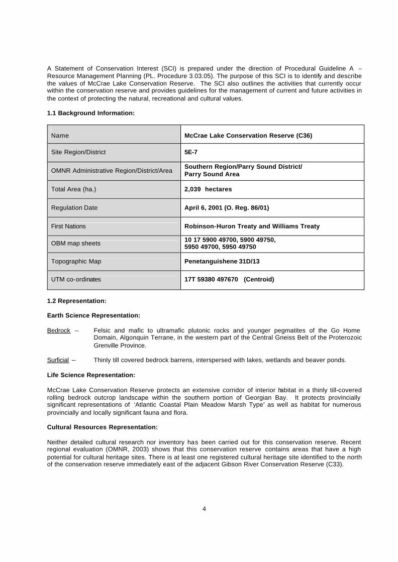
A Statement of Conservation Interest (SCI) is prepared under the direction of Procedural Guideline A – Resource Management Planning (PL. Procedure 3.03.05). The purpose of this SCI is to identify and describe the values of McCrae Lake Conservation Reserve. The SCI also outlines the activities that currently occur within the conservation reserve and provides guidelines for the management of current and future activities in the context of protecting the natural, recreational and cultural values. 1.1 Background Information:
Name
McCrae Lake Conservation Reserve (C36)
Site Region/District 5E-7
OMNR Administrative Region/District/Area Southern Region/Parry Sound District/ Parry Sound Area
Total Area (ha.) 2,039 hectares
Regulation Date April 6, 2001 (O. Reg. 86/01)
First Nations Robinson-Huron Treaty and Williams Treaty
OBM map sheets 10 17 5900 49700, 5900 49750, 5950 49700, 5950 49750
Topographic Map Penetanguishene 31D/13
UTM co-ordinates 17T 59380 497670 (Centroid)
1.2 Representation: Earth Science Representation: Bedrock -- Felsic and mafic to ultramafic plutonic rocks and younger pegmatites of the Go Home
Domain, Algonquin Terrane, in the western part of the Central Gneiss Belt of the Proterozoic Grenville Province.
Surficial -- Thinly till covered bedrock barrens, interspersed with lakes, wetlands and beaver ponds. Life Science Representation: McCrae Lake Conservation Reserve protects an extensive corridor of interior habitat in a thinly till-covered rolling bedrock outcrop landscape within the southern portion of Georgian Bay. It protects provincially significant representations of ‘Atlantic Coastal Plain Meadow Marsh Type’ as well as habitat for numerous provincially and locally significant fauna and flora. Cultural Resources Representation: Neither detailed cultural research nor inventory has been carried out for this conservation reserve. Recent regional evaluation (OMNR, 2003) shows that this conservation reserve contains areas that have a high potential for cultural heritage sites. There is at least one registered cultural heritage site identified to the north of the conservation reserve immediately east of the adjacent Gibson River Conservation Reserve (C33).
5
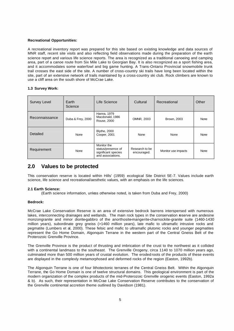
Recreational Opportunities: A recreational inventory report was prepared for this site based on existing knowledge and data sources of MNR staff, recent site visits and also reflecting field observations made during the preparation of the earth science report and various life science reports. The area is recognized as a traditional canoeing and camping area, part of a canoe route from Six Mile Lake to Georgian Bay. It is also recognized as a sport fishing area, and it accommodates some waterfowl and big game hunting. A Trans-Ontario Provincial snowmobile trunk trail crosses the east side of the site. A number of cross-country ski trails have long been located within the site, part of an extensive network of trails maintained by a cross-country ski club. Rock climbers are known to use a cliff area on the south shore of McCrae Lake. 1.3 Survey Work: Survey Level
Earth Science
Life Science
Cultural
Recreational
Other
Reconnaissance Duba & Frey, 2000
Hanna, 1979 Macdonald, 1986 Rouse, 2000
OMNR, 2003 Brown, 2003 None
Detailed None
Blythe, 2000 Cooper, 2001
None None None
Requirement None
Monitor the status/presence of significant species and associations.
Research to be encouraged. Monitor use impacts None
2.0 Values to be protected This conservation reserve is located within Hills’ (1959) ecological Site District 5E-7. Values include earth science, life science and recreational/aesthetic values, with an emphasis on the life sciences. 2.1 Earth Science:
(Earth science information, unless otherwise noted, is taken from Duba and Frey, 2000) Bedrock:
McCrae Lake Conservation Reserve is an area of extensive bedrock barrens interspersed with numerous lakes, interconnecting drainages and wetlands. The main rock types in the conservation reserve are andesine monzongranite and minor diorite-gabbro of the anorthosite-mangerite-charnockite-granite suite (1460-1430 million years), subordinate grey gneiss (>1460 million years), late mafic to ultramafic intrusive rocks and pegmatite (Lumbers et al, 2000). These felsic and mafic to ultramafic plutonic rocks and younger pegmatites represent the Go Home Domain, Algonquin Terrane in the western part of the Central Gneiss Belt of the Proterozoic Grenville Province. The Grenville Province is the product of thrusting and imbrication of the crust to the northwest as it collided with a continental landmass to the southeast. The Grenville Orogeny, circa 1140 to 1070 million years ago, culminated more than 500 million years of crustal evolution. The eroded roots of the products of these events are displayed in the complexly metamorphosed and deformed rocks of the region (Easton, 1992b). The Algonquin Terrane is one of four lithotectonic terranes of the Central Gneiss Belt. Within the Algonquin Terrane, the Go Home Domain is one of twelve structural domains. This geological environment is part of the modern organization of the complex products of the mid-Proterozoic Grenville orogenic events (Easton, 1992a & b). As such, their representation in McCrae Lake Conservation Reserve contributes to the conservation of the Grenville continental accretion theme outlined by Davidson (1981).

6
Within the Ontario Provincial Park system, the felsic and mafic to ultramafic metaplutonic rocks of McCrae Lake Conservation Reserve have regional significance in their representation of a plutonic component of the Go Home Domain, Algonquin Terrane.
Surficial: The thin till covered bedrock barrens, interspersed with lakes, wetlands and beaver ponds is representative of the extensive tract of bedrock plain along the Georgian Bay coastline (Noble 1983). These surficial geological features are not considered significant.
2.2 Life Science: (Life science information, unless otherwise noted, is taken from Cooper, 2001) Representation: McCrae Lake Conservation Reserve protects the immediate land surrounding McCrae Lake and a broad corridor connecting McCrae Lake to the Gibson River. The site comprises two parcels of land; the larger of the two (ca 1,888 ha) surrounds the immediate McCrae Lake area, and includes the wide corridor extending north to the Gibson River. The smaller parcel (51 hectare) is located to the west of the south-western corner of the larger parcel, the area off the western shoreline of Bearshead Lake.
Throughout both parcels, ‘dry-fresh White Pine – Mixed Oak forest’ is the predominant cover, interrupted by upland outcrops of open rock barrens, common juniper (Juniperus communis) rock barrens and less commonly treed rock barrens. Depressions in the bedrock allow for the accumulation of water and in turn the development of numerous wetlands. The smaller depressions support isolated bog and thicket swamp communities while the larger depressions support more extensive wetland complexes, draining into adjac ent water bodies such as open Georgian Bay and McCrae Lake. Water levels within the complexes are controlled by numerous beaver dams, creating narrow inland channels which serve as the main hydrological connection between the wetlands and larger adjacent water bodies. Runoff from adjacent upland forests including eastern hemlock (Tsuga canadensis), red maple (Acer rubrum), ash (Fraxinus spp) and sugar maple (Acer saccharum) forests help to feed these channels. Several different wetland types are represented in these communities, most commonly graminoid meadow marsh mats and shorelines, floating peat mats and open beaver ponds.
Small depressions throughout the area are filled in by isolated thicket swamps and bogs with the occasional beaver pond surrounded by meadow marsh shoreline. The thicket swamps are dominated by mountain holly (Nemopanthus mucronatus) or winterberry (Ilex verticillata) with absent or minimal tree cover of white pine (Pinus strobus ), red maple and less commonly, tamarack (Larix laricina) and white birch (Betula papyrifera). Common species in the understorey of these communities include three-leaved Solomon’s-seal (Maianthemum trifolium), Virginia chain fern (Woodwardia virginica) and cinnamon fern (Osmunda cinnamomea). The dominant cover in bog communities is almost exclusively Virginia chain fern with virtually no tree or shrub cover. Small beaver ponds have limited cover of white water-lily (Nymphaea odorata ssp odorata), bullhead pond-lily (Nuphar variegata) and less commonly, water-shield (Brasenia schreberi) and often include a thin band of meadow marsh vegetation along the shoreline, varying in dominance.
Within the larger depressions, wetland complexes are present, providing representation of numerous wetland types in various sizes. Most of the communities are found in the corridor connecting Gibson River with McCrae Lake; however smaller wetland complexes are also found south and east of McCrae Lake, draining into either McCrae Lake, Bearshead Lake or open Georgian Bay. Some of the more common types represented in these complexes include ‘Leatherleaf / Sweet Gale / graminoid shore fen’, ‘Leatherleaf shrub bog’, ‘Broad-leaved Sedge organic meadow marsh’, ‘Three-way Sedge - Wool-grass / Bur -reed organic meadow marsh’ and ‘Water Lily – Bullhead Lily Floating-leaved Shallow Aquatic’ ponds. Narrow inland streams connecting these wetlands to larger water bodies such as the Gibson River, McCrae Lake and open Georgian Bay are often bordered by rich upland forest communities including variations of sugar maple, aspen and hemlock forests.

7
The smaller separate 51 hectare parcel of this site includes a portion of the Bearshead—Buckshoof Regional ANSI that extends westward from Buckshoof Lake to Bearshead Lake. (NHIC 2001) The area included within the conservation reserve is dominated by ‘dry -fresh White Pine – mixed Oak forest’ interrupted by frequent patches of ‘dry-fresh hemlock coniferous forest’ and ‘common juniper acidic shrub rock barrens’ on ridge tops. Along an upland corridor, stretching the entire length of the parcel from the northern boundary to the southern boundary, a mosaic community of white pine – mixed oak forest and common juniper rock barren is found. In the low-lying areas, the mosaic community of white Pine – mixed oak forest and hemlock forest is more common, generally part of larger patches of land where water accumulation has resulted in wet-very moist conditions. In the hemlock forest, intermediate-mature hemlock makes up more than 90% of the canopy cover with little, if any, sapling or shrub cover. In a few locations, depressions in the white pine – mixed oak forest community mosaic are deep enough to support wetland communities. At the northern boundary, approximately half of a ‘winterberry organic thicket swamp’ is present within the site, the remainder of which is located on the adjacent private land. At the other end of the site, near the southern boundary, a 1-2 hectare mosaic community of ‘winterberry organic thicket swamp’ bordering a ‘virginia chain fern open bog’ has developed.
Shallow bays and drainage areas into Bearshead Lake support additional wetlands. Near the centre of the parcel, just west of Bearshead Lake, there is a small ‘Three-way Sedge – Wool-grass / Bur-reed organic meadow marsh’ dominated by reed-like three-way sedge (Dulichium arundinaceum) and wool-grass (Scirpus cyperinus ).
An additional 165 hectares of the Bearshead—Buckshoof Regional ANSI is represented within the larger parcel of McCrae Lake Conservation Reserve, covering the area south of the private cottage lots along the southern shore of Ganyon Bay. This area includes two additional wetland areas, more of the mosaic community white pine – mixed oak and hemlock forests. In addition, this area supports several patches of open rock barrens, common in areas both between and along the shorelines of the wetlands, providing ideal habitat for several reptile species, including the provincially rare five-lined skink.
Wetland complexes draining into McCrae Lake include two ‘Atlantic Coastal Plain Meadow Marsh’ communities, one of which supports a patch of the provincially rare ridged panic grass (Panicum rigidulum) which was found growing in a rock crevice at the water’s edge.
Smaller wetland communities are found around McDonald Lake including a small ‘Buttonbush Mineral Thicket Swamp’ and a Water Lily – Bullhead Lily pond surrounded by a ‘forb mineral meadow marsh’ community. In the lowland area between McDonald Lake and the eastern bay of McCrae Lake rich deciduous forest communities are present including ‘fresh-moist Red Maple deciduous forest’ and ‘Fresh – Moist Sugar Maple – Hardwood deciduous forest’. This area also supports one of the only examples of an ‘acidic treed cliff ecosite’ documented within McCrae Lake Conservation Reserve during the 2001 inventory.
The largest portion of the site is found in the area connecting the southern shore of Gibson River to the southern shore of McCrae Lake. The northern boundary of McCrae Lake Conservation Reserve is also the southern boundary of the Gibson River Conservation Reserve, allowing for a continuous natural corridor between these two large water systems. Several of the largest wetland complexes within the site are found in this region, as well as a large, continuous tract of white pine – mixed oak forest, serving as habitat for several interior bird species such as red-shouldered hawk (Buteo lineatus). One of these large wetland complexes which runs parallel to the eastern limits of the site, includes a ‘Buttonbush Mineral Thicket Swamp’ community, which opens up into a ‘graminoid organic meadow marsh’ community dominated by Canada rush (Juncus canadensis), soft rush (J. effusus ) and Bebb’s sedge (Carex bebbii).
Along the western boundary of McCrae Lake Conservation Reserve there is an extensive ‘forb mineral meadow marsh shoreline’ dominated by Canada St. John’s-wort (Hypericum canadense), pale St. John’s-wort (H. ellipticum), grass-leaved goldenrod (Euthamia graminifolia) and localized patches of sallow sedge (Carex lurida). Adjacent communities include: a ‘Blue-joint organic meadow marsh’ with swamp loosestrife as an associate and minimal shrub cover dominated by swamp dewberry (Rubus hispidus ) and winterberry; a ridge of open rock barren; a large ‘Leatherleaf shrub bog’, a community which consists of a floating vegetation mat of Virginia chain fern, reed-like three-way sedge, tawny cottongrass (Eriophorum virginicum) and leatherleaf; and, a ‘Three-way Sedge - Wool-grass / Bur-reed Organic Meadow Marsh’ dominated by leatherleaf, eastern buttonbush, reed-like three-way sedge and reed canary grass (Phalaris arundinacea) .

8
The numerous inlets in this area are commonly bordered by several rich upland forest types including: upland ‘fresh-moist Hemlock coniferous forest;’ ‘fresh–moist Sugar Maple –Yellow Birch deciduous forest’; and a ‘Fresh – Moist Sugar Maple – hardwood deciduous forest’. These communities support vegetation poorly represented in forest communities throughout the remainder of the site including species such as sugar maple, basswood (Tilia americana), woolly sweet-cicely (Osmorhiza claytonii) and northern lady fern (Athyrium filix-femina ssp angustum).
Another shoreline area on the western boundary consists of a ‘forb mineral meadow marsh’ community dominated by boneset (Eupatorium perfoliatum) and green-fruited bur-reed (Sparganium emersum ) and a beaver-controlled ‘Rice Cut Grass organic meadow marsh’ dominated by both rice cut grass (Leersia oryzoides ) and reed-like three-way sedge. The rice cut grass meadow marsh changes to a ‘Broad-leaved Sedge organic meadow marsh’ dominated by aquatic sedge (Carex aquatilis) and spotted touch-me-not with wool-grass and swamp loosestrife as associate species. Connecting communities include a large ‘Mountain Holly organic thicket swamp’ and a ‘Three-way Sedge - Wool-grass / Bur-reed organic meadow marsh’.
McCrae Lake includes several communities found along the shoreline and the islands. The majority of the backshore upland areas and interiors of the islands consist of a mosaic community including both ‘dry-fresh White Pine – mixed Oak forest’ and ‘fresh-moist Red Maple deciduous forest’. Shorelines support a variety of wetland communities including: a ‘Twig-rush graminoid open fen shoreline’ community, supporting a dense stand of twig-rush with one localized patch of tall cord grass (Spartina pectinata) and sparse cover of sweet gale; a mosaic community consisting of a ‘Buttonbush mineral thicket swamp’ and a ‘Water-shield – Water Lily Floating-leaved aquatic’, with buttonbush dominant along the shoreline, sharply grading to the shallow aquatic community which consists of a band of heart-leaved pickerel-weed followed by a linear patch of both water-shield and white water-lily; a ‘forb mineral meadow marsh’ grading from a dense stand of twig-rush to a dense stand of aquatic sedge, with a scattering of sweet gale; a ‘graminoid organic meadow marsh’ with a cover of eastern buttonbush and stands of graminoids and cattail surrounded by narrow channels of water containing minimal coverage of bullhead pond-lily.
The majority of the McCrae Lake shoreline is dominated by high cliff face communities, with the warm ledges and crevices supporting populations of rock polypody, maidenhair spleenwort (Asplenium trichomanes) and fireweed (Epilobium angustifolium) (Hanna 1979). The upper ledges of these cliffs have provided nesting habitat for peregrine falcon (Falco peregrinus anatum ) in the past (Hanna 1979). Along the shoreline, shallow embayments support examples of the meadow marsh shorelines that are frequent along the edge of interior wetland communities.
The aquatics of McCrae Lake primarily consist of dense, submerged beds of Eurasian water milfoil (Myriophyllum spicatum) in the deep sandy basins of the lake and a narrow band of emergent slender water milfoil (Myriophyllum tenellum)-pipewort band in the warmer, shallow, sandy portions of the lake (Hanna 1979). Condition:
Forest communities throughout the site are predominantly young to intermediate with occasional patches of older growth forest, including several patches of hemlock most common in the south-western portion of the site. In a few locations, charred stumps are present indicating that some isolated areas have been subject to burning in the past.
The proximity of this site to popular cottage areas and Highway 400 has resulted in heavy recreational use of the area for hiking, camping and hunting. A hiking and cross-country skiing trail system is present along both the eastern and southern shoreline, allowing access to large portions of the site. (Brown, 2003) Generally, the impact of the trail is minimal, with localized trampling of vegetation and limited introduction of non-native species. More severe impact is caused by frequent camping along the shorelines of McCrae Lake. While the impact of campsites on the shoreline of the lake is localized, it does result in small scale soil compaction, introduction of non-native species, garbage, human waste and illegal removal of trees for firewood (Larson, 2003).
Approximately 5% of the plant species recorded for the site are introduced, a low percentage considering the level of human -use this site experiences. The majority of these species are restricted to trails, campsites and picnicking areas as well as wetlands located in close proximity to Highway 400.
9
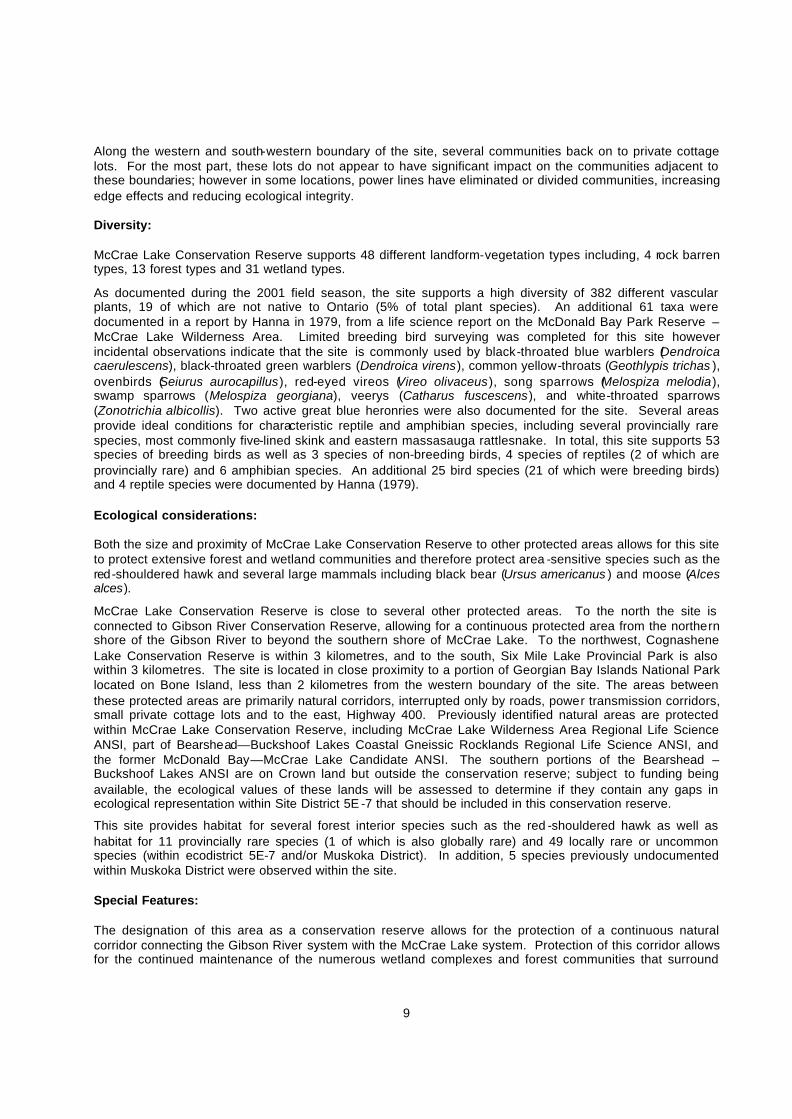
Along the western and south-western boundary of the site, several communities back on to private cottage lots. For the most part, these lots do not appear to have significant impact on the communities adjacent to these boundaries; however in some locations, power lines have eliminated or divided communities, increasing edge effects and reducing ecological integrity. Diversity: McCrae Lake Conservation Reserve supports 48 different landform-vegetation types including, 4 rock barren types, 13 forest types and 31 wetland types.
As documented during the 2001 field season, the site supports a high diversity of 382 different vascular plants, 19 of which are not native to Ontario (5% of total plant species). An additional 61 taxa were documented in a report by Hanna in 1979, from a life science report on the McDonald Bay Park Reserve – McCrae Lake Wilderness Area. Limited breeding bird surveying was completed for this site however incidental observations indicate that the site is commonly used by black-throated blue warblers (Dendroica caerulescens), black-throated green warblers (Dendroica virens), common yellow-throats (Geothlypis trichas ), ovenbirds (Seiurus aurocapillus), red-eyed vireos (Vireo olivaceus), song sparrows (Melospiza melodia), swamp sparrows (Melospiza georgiana), veerys (Catharus fuscescens), and white-throated sparrows (Zonotrichia albicollis). Two active great blue heronries were also documented for the site. Several areas provide ideal conditions for characteristic reptile and amphibian species, including several provincially rare species, most commonly five-lined skink and eastern massasauga rattlesnake. In total, this site supports 53 species of breeding birds as well as 3 species of non-breeding birds, 4 species of reptiles (2 of which are provincially rare) and 6 amphibian species. An additional 25 bird species (21 of which were breeding birds) and 4 reptile species were documented by Hanna (1979). Ecological considerations: Both the size and proximity of McCrae Lake Conservation Reserve to other protected areas allows for this site to protect extensive forest and wetland communities and therefore protect area -sensitive species such as the red-shouldered hawk and several large mammals including black bear (Ursus americanus ) and moose (Alces alces).
McCrae Lake Conservation Reserve is close to several other protected areas. To the north the site is connected to Gibson River Conservation Reserve, allowing for a continuous protected area from the northern shore of the Gibson River to beyond the southern shore of McCrae Lake. To the northwest, Cognashene Lake Conservation Reserve is within 3 kilometres, and to the south, Six Mile Lake Provincial Park is also within 3 kilometres. The site is located in close proximity to a portion of Georgian Bay Islands National Park located on Bone Island, less than 2 kilometres from the western boundary of the site. The areas between these protected areas are primarily natural corridors, interrupted only by roads, power transmission corridors, small private cottage lots and to the east, Highway 400. Previously identified natural areas are protected within McCrae Lake Conservation Reserve, including McCrae Lake Wilderness Area Regional Life Science ANSI, part of Bearshead—Buckshoof Lakes Coastal Gneissic Rocklands Regional Life Science ANSI, and the former McDonald Bay—McCrae Lake Candidate ANSI. The southern portions of the Bearshead – Buckshoof Lakes ANSI are on Crown land but outside the conservation reserve; subject to funding being available, the ecological values of these lands will be assessed to determine if they contain any gaps in ecological representation within Site District 5E -7 that should be included in this conservation reserve.
This site provides habitat for several forest interior species such as the red -shouldered hawk as well as habitat for 11 provincially rare species (1 of which is also globally rare) and 49 locally rare or uncommon species (within ecodistrict 5E-7 and/or Muskoka District). In addition, 5 species previously undocumented within Muskoka District were observed within the site. Special Features: The designation of this area as a conservation reserve allows for the protection of a continuous natural corridor connecting the Gibson River system with the McCrae Lake system. Protection of this corridor allows for the continued maintenance of the numerous wetland complexes and forest communities that surround

10
McCrae Lake and adjacent lake and river systems. The protection of several shallow bay and interior wetland communities as well as the continuous stretch of land between the Gibson River and the northern shore of McCrae Lake includes relatively undisturbed examples of several wetland communities, many of which have not previously been described. These communities provide habitat for several locally and provincially rare plant species, as well as habitat for rare reptile species such as the five-lined skink and eastern massasauga rattlesnake. In addition, several areas support older growth hemlock stands, an uncommon forest community type within protected areas along the Georgian Bay coast. Several of the wetland complexes in this conservation reserve have been identified as having the potential of being provincially significant wetlands, through the use of satellite imagery and other available wetlands information (Ducks Unlimited Canada and OMNR, 2003). Two occurrences of the ‘Atlantic Coastal Plain Meadow Marsh’ type, a globally and provincially rare vegetation community, have been documented within McCrae Lake Conservation Reserve. In addition, significant representations of several other provincially and globally rare wetland communities were documented including several examples of buttonbush, winterberry and mountain holly thicket swamps. 2.3 Cultural Values: No specific cultural studies or inventories have been undertaken within the conservation reserve, and no major cultural resource values have been evaluated or identified to date. However, the proximity of this area to the Gibson River, and its connections to Georgian Bay and Six Mile Lake, suggest that the site may have been part of a larger network of First Nation travel corridors. Recent regional evaluation (OMNR, 2003) shows that this conservation reserve contains areas that have a high potential for cultural heritage sites. There is at least one registered cultural heritage site identified to the north of the conservation reserve to the east of the adjacent Gibson River Conservation Reserve (C33). 2.4 Recreational/Aesthetic Values: (Recreational information, unless otherwise noted, is taken from Brown, 2003) The McCrae Lake area is recognized as a traditional canoeing and camping area, part of a canoe route from Six Mile Lake to Georgian Bay. This route is heavily used, with McCrae Lake being a destination camping area. Consequently, the sites on McCrae Lake show signs of heavy and long term use. The “Friends of McCrae Lake” conduct annual volunteer maintenance on the sites and portages to alleviate problems with garbage and overuse. This canoe route provides access to Georgian Bay, but the portion of the Georgian Bay shoreline within the conservation reserve does not provide much opportunity for campsites. There is potential, however, for protected anchorages along this shoreline, with associated mooring to the shoreline. McCrae and McDonald Lakes are also recognized for their sport fishing potential, and part of the use of these lakes is for this activity. OMNR records indicate that game fish species include smallmouth bass (Micropterus dolomieui), northern pike (Esox lucius), walleye (Stizostedion vitreum ) and cisco (Coregonus artedii). The site also accommodates some waterfowl hunting (McCrae and McDonald Lakes), and big game hunting for white-tailed deer (Odocoileus virginiana), moose, and black bear. There are no authorized recreation camps within the conservation reserve. A cross country ski trail system traverses the conservation reserve, crossing the southern portion, south of McCrae Lake, and then going north/south around the west side of McCrae Lake, almost the full length of the conservation reserve, exiting near its north-east corner. This trail is maintained by the Five Winds Backcountry Touring Club (Hanna 1979), and is also used for hiking. The trail is considered a back-country trail, being relatively rugged.

11
A Trans-Ontario Provincial Trunk snowmobile trail (Trail C) crosses the east side of the site. A snowmobile bridge was constructed in 2001, crossing the narrows between McDonald and McCrae Lakes . Although all-terrain vehicle use was not noted as significant in the earth/life science and recreation checklists, this bridge could provide potential for additional all-terrain vehicle access to the site, as well as for additional access by hikers and cyclists. Rock climbers are known to use a cliff area on the south shore of McCrae Lake. This scenic cliff, known locally as the Eagle’s Nest, once provided nesting habitat for Peregrine Falcons. The distance of this conservation reserve from urban areas has resulted in a relatively pristine night sky, which enhances the sense of remoteness and wilderness of this site. Pristine night skies are considered a significant value, given the increasingly limited areas of southern and central Ontario which are not heavily affected by light pollution.
3.0 Management Guidelines 3.1 Land Tenure: Background: McCrae Lake Conservation Reserve comprises 2,039 hectares of Crown land. The adjacent lands to the north-west, west and south-west of the site, including all the dry land areas adjacent to the isolated portion of the conservation reserve in the south-west, are privately owned, and are not part of the conservation reserve. Neither is the adjacent bed of Georgian Bay a part of the conservation reserve. Road allowances that cross through the conservation reserve remain under the authority of the Area Municipality of The Township of Georgian Bay wherein they lie, and are not included as part of the conservation reserve. This includes the shoreline road allowances around McDonald Lake, McCrae Lake and Georgian Bay. There are two OMNR registered traplines (PS 150, PS 183) that have portions of their harvest areas within the conservation reserve. The southern-most portion, within Baxter Ward, is not covered by a registered trapline. The conservation reserve lies within parts of two commercial Bait Fish Blocks (PS0215 & PS0235). The northern portion of this conservation reserve is located within OMNR Bear Management Area (BMA) (PS-46-17). There is no BMA covering the southern, Baxter Ward portion of this site. There are no recreation camps within the conservation reserve. The conservation reserve is traversed by cross-country ski trails maintained by the Five Winds Backcountry Touring Club, and authorized by land use permit. The conservation reserve is traversed by one snowmobile trail, the Ontario Federation of Snowmobile Clubs (OFSC) Trans Ontario Provincial Trunk Trail C, authorized by land use permit. There is a Bell Canada switching station in the south-western part of Lot 37, Concession 15, Baxter Ward. This is authorized by a licence of occupation, which is currently being considered for upgrade to a Crown lease. Guideline: The sale of Crown lands within the conservation reserve generally is not permitted. Exceptions will only be considered under unusual circumstances, such as where an adjacent privately owned parcel has inadequate area for the installation of a septic system. There are no plans by the MNR to acquire private lands to add to the conservation reserve.

12
The commercial bear hunting service is allowed to continue in the areas associated with the current Bear Management Area. The Baxter Ward portions of this site cannot be incorporated into a Bear Management Area. Fur harvest is permitted to continue in the registered trapline areas. The Bait Fish Blocks that are currently assigned are permitted to continue. New recreation camps are not permitted. While commercial timber harvesting is not allowed within conservation reserves, there are limited situations in which adjacent land owners can harvest firewood for use on their adjacent property. Specifically, property owners who have no road access to their properties can apply for permits to cut limited amounts of firewood in the conservation reserve for their own use. This situation would apply only to water access cottages or recreation camps that are immediately adjacent to conservation reserve boundaries, and that do not have road access. 3.2 Development: Background: There are no Crown owned buildings or other facilities within the conservation reserve. Access to this site is available from a parking lot on Crown land immediately south of the southeast corner of the conservation reserve, which is accessible from Georgian Bay Road west of Highway 400. This parking lot is not maintained by the MNR. Other access to the conservation reserve is generally by canoe with a portage from Georgian Bay to McCrae Lake, and a portage from Six Mile Lake to McDonald Lake. No access roads penetrate the site. One snowmobile trail passes through the conservation reserve. The Ontario Federation of Snowmobile Clubs (OFSC) Trans Ontario Provincial Trunk Trail C crosses the south east corner of the conservation reserve with a bridge, constructed in 2001, over the narrows between McDonald and McCrae Lakes. Guideline: This site contributes to the Great Lakes Heritage Coast initiative by providing important protection to the environment. As well, this site may serve an important "gateway" function to the Great Lakes Heritage Coast. As part of Great Lakes Heritage Coast implementation, future consideration may be given to the upgrading of recreational and interpretive facilities including access, trails, campsites, as well as boating and mooring facilities on Georgian Bay. New facilities will only be considered where either long-term funding is available, or a long-term partnership will provide for long-term management of the facilities. All facility improvements will ensure the protection of natural values of this site, will meet MNR’s Environmental Assessment Act requirements, including requirements for public consultation, and will comply with Procedural Guideline B, Land Uses – Test of Compatibility (see Appendix 1). Major new facility development will involve public consultation. New roads for resource extraction and/or private use will not be permitted, nor will additions to existing roads, or up grading of existing roads be permitted. There is no intention to develop roads outside of the conservation reserve to improve access to this site. However, the MNR will encourage improvement of existing parking and canoe access facilities on Georgian Bay Road, west of Highway 400, through agreements or partnerships with interested parties. In general, existing authorized recreational trails may be permitted to continue in conservation reserves as long as they do not impair the natural features and values for which the area is identified and as long as there are no significant environmental impacts. Accordingly, the authorized cross country ski trail, and the

13
authorized snowmobile trail will continue to be authorized, but their use will be monitored to ensure that conservation reserve values are not being adversely impacted. New recreational trails may be considered on a case by case basis provided that they meet Procedural Guideline B - Land Uses - Test of Compatibility (see Appendix 1) and the MNR's Environmental Assessment Act requirements. Public consultation will generally be required during the consideration of changes to existing trails, and will always be required for new trails. New recreational trails will not be permitted in or within 120 metres of the wetlands that have been assessed as having high potential to be provincially significant wetlands unless it has been demonstrated that there will be no negative impacts on the natural features or the ecological functions of the wetlands. New trails must also ensure protection of the significant ecological values of the 2 regionally significant ANSI’s. New recreational trails for motorized vehicles will not be permitted, unless the following have been demonstrated:
• there is a community need for the trail, as well as community support; • there are no alternative suitable locations outside the conservation reserve; • the trail location would be acceptable and suitable for four-season use; • the trail would meet the requirements applicable to all trails, as identified in the preceding paragraph.
New trails and other development are not permitted in the area of the conservation reserve regulated under the Wilderness Areas Act. The use of unauthorized recreation trails that were existing at the time of regulation of this conservation reserve, and the increase in use of all-terrain vehicles will be monitored to ensure that conservation reserve values are not being adversely impacted. Depending on the results of monitoring, some of the unauthorized trails may need to be redirected from sensitive areas or eliminated completely. Otherwise, there is no intent to mark or upgrade these trails. The snowmobile bridge has the potential of providing access to portions of this site by all-terrain vehicles. The land use permit requires the permittee to provide and maintain appropriate barriers at the bridge across the narrows between McDonald and McCrae Lakes to ensure that this all-terrain vehicle use does not develop. Unauthorized works within the conservation reserve will be handled in accordance with the Public Lands Act and any required removal of improvements will be at the expense of those responsible. No mineral exploration is permitted within this conservation reserve. This policy decision is based on a commitment made by the Ministry of Natural Resources and the Ministry of Northern Development and Mines in March 2002. This policy direction replaces that identified in the 1999 Ontario’s Living Legacy Land Use Strategy, which stated that controlled mineral exploration would be permitted in new conservation reserves which were identified as having provincially significant mineral potential. Any new development must meet MNR’s commitments to protect cultural heritage values (see Section 3.7). While there is no intent at present to provide or permit any new development in this conservation reserve that would require lighting, should this be considered at some point in the future the MNR will not allow unnecessary, undirected light pollution. This commitment recognizes the wilderness values provided by a pristine night sky. 3.3 Recreational Activities: Background: Existing recreational uses include canoeing, camping, sport fishing, hunting, cross-country skiing, hiking, and snowmobiling, and some rock climbing. The southern portion of the site, around McCrae and McDonald lakes, has been a destination for naturalists, who primarily access the area by canoeing, hiking and cross-country
14
skiing. There appears to be pressure for increasing all-terrain vehicle use, by way of access over the snowmobile bridge crossing the narrows between McDonald and McCrae lakes; this would be of concern. Guideline: Canoe tripping, shore access, camping, mooring, and picnicking will continue to be accepted uses of the conservation reserve. These uses will be monitored. Portages and camping areas will be monitored to determine an appropriate level of use and maintenance. Cooperative maintenance of portages, campsites and provision of thunder boxes will continue to be encouraged through volunteer efforts. Overuse of the campsites and the subsequent potential to damage the significant natural environments is a concern, and consideration may be given to establishing number limitations on this type of use. Where overuse develops, or where these uses threaten the values for which this conservation reserve was established, specific uses or areas might be limited, or closed. Sport fishing and hunting are permitted to continue within the conservation reserve. Recreational use such as hiking, wildlife viewing, snowshoeing, and cross-country skiing, will be allowed to occur in the conservation reserve. The use of all-terrain vehicles will be discouraged within the conservation reserve. The existing cross-country ski trails will continue to be authorized. The existing authorized snowmobile trail will continue to be authorized. The land use permit for this trail requires the permittee to provide and maintain appropriate barriers at the bridge across the narrows between McDonald and McCrae Lakes to ensure that all-terrain vehicle use does not develop. Off-trail use of snowmobiles and all -terrain vehicles is only permitted for the direct retrieval of game. Trail and off-trail use will be monitored to ensure that the conservation reserve values are not being adversely impacted. As discussed in Section 3.2 Development, new recreational trails may be considered on a case by case basis provided that they meet Procedural Guideline B – Land Uses – Test of Compatibility (see Appendix 1) and the MNR's Environmental Assessment Act requirements. Public consultation will generally be required during the consideration of changes to existing trails, and will always be required for new trails. New recreational trails will not be permitted in or within 120 metres of the wetlands that have been assessed as having high potential to be provincially significant wetlands unless it has been demonstrated that there will be no negative impacts on the natural features or the ecological functions of the wetlands. Any new trails must meet MNR’s commitments to protect cultural heritage values (see Section 3.7). New trails must also ensure protection of the significant ecological values of the 2 regionally significant ANSI’s. New recreational trails for motorized vehicles will not be permitted, unless the following have been demonstrated:
• there is a community need for the trail, as well as community support; • there are no alternative suitable locations outside the conservation reserve; • the trail location would be acceptable and suitable for four-season use; • the trail would meet the requirements applicable to all trails, as identified in the preceding paragraph.
New trails and other development are not permitted in the area of the conservation reserve previously regulated under the Wilderness Areas Act. Unauthorized recreational trails that were existing at the time of regulation of this conservation reserve, and any increase in the use of all-terrain vehicles, will be monitored to ensure that conservation reserve values are not being adversely impacted. Depending on the results of monitoring, some trails may need to be redirected from sensitive areas or eliminated completely. Otherwise, there is no intent to mark or upgrade these trails.

15
Rock climbing, an activity that has occurred in this site for many years, is not encouraged, and will be monitored to determine its effect on cliff environments, and potential peregrine falcon nesting areas. New recreational activities will be considered on a case by case basis provided they are consistent with maintaining the values of the conservation reserve and comply with Procedural Guideline B – Land Uses – Test of Compatibility (Appendix 1). Emphasis will be placed on activities that have a low impact on the environment of the conservation reserve. Monitoring of existing and permitted activities will be undertaken as required to ensure that the conservation reserve values are not being adversely impacted. 3.4 Commercial Activities: Background: There has been no recent commercial forest harvesting or mining activity within the conservation reserve. Commercial fur harvesting is authorized through registered traplines. The guiding of non -resident bear hunters is authorized through Bear Management Areas, and bait fish harvesting is authorized through Bait Fish Block licences within the conservation reserve. These were discussed under Section 3.1 Land Tenure—Background. Guideline: Fur harvesting, bear hunting services and bait fish harvesting operations will be allowed to continue within the conservation reserve. New trapline cabins are not permitted within conservation reserves. Mineral exploration is not allowed in this conservation reserve, as discussed in Section 3.2. Conservation reserve regulations do not permit mining, commercial forest harvesting, hydroelectric power development, the extraction of aggregate and peat or other industrial uses (Public Lands Act, Ontario Regulation 805/94). Other new commercial activities must meet the requirements of Procedural Guideline B – Land Uses – Test of Compatibility (see Appendix 1). 3.5 Aboriginal Interests: Background: This site is known to be of interest to many First Nation communities. There are 2 treaties associated with the area: the Robinson – Huron Treaty of 1850 and the Williams Treaty. A Supreme Court decision in 1994 (Howard) validated that the Williams Treaty surrendered hunting, fishing and trapping rights of those First Nations affiliated with that treaty. Guideline: The regulation and management of this conservation reserve will not impede the exercise of existing aboriginal or treaty rights. These rights include hunting, fishing, fur harvesting, gathering of plants for a variety of purposes, and the use of ceremonial sites. It is recognized that the manner in which these rights are carried out is not limited to the manner in which they were carried out in the past, but has evolved over time with changes in technology. While there are no existing First Nation land claims that extend to this site, it is recognized that at some point in the future there is a possibility of a land claim in this area. If such a land claim is determined to be valid, the Conservation Reserve designation is not irreversible and does not preclude consideration of these lands in the settlement of a claim. If deregulation of part or all of a conservation reserve occurs as part of the settlement of a claim, this will be carried out at no cost to First Nations.

16
3.6 Natural Resource Stewardship: Background: Vegetation management for specific purposes is not known to have occurred in the past. Wildlife and fisheries management, particularly sport fishing, hunting and fur harvesting, have been occurring according to the prevailing policies and legislation. It is noted that many of the wetlands of this site have been identified as having the potential of being provincially significant wetlands, through the use of satellite imagery and other available wetland information. Guideline – Vegetation: The intent of this site is to allow the existing vegetation communities to evolve naturally. The Ministry will continue to monitor for the status/presence of significant species and associations. Management and protection emphasis will be on ensuring that the wetlands and other natural values of the conservation reserve are not negatively affected by current and future activities. Therefore, applications for new specific uses will be carefully studied and reviewed. Necessary studies may be undertaken by proponents, the Ministry, and/or partner organizations. The OMNR recognizes fire as an essential process fundamental to the ecological integrity of this conservation reserve. In accordance with existing conservation reserve policy and the Forest Management Strategy for Ontario, forest fire protection will endeavour to use “light on the land” techniques, which do not unduly disturb the landscape, in this conservation reserve. Examples of light on the land techniques may include limiting the use of heavy equipment, and limiting the number of trees felled during fire response efforts. Input from the local MNR Area Supervisor would be solicited if a forest fire threatens the area. Opportunities for prescribed burning to achieve resource management objectives may be considered. Plans for any prescribed burning will be developed in accordance with the OMNR Prescribed Burn Planning Manual. Programs may be developed to control forest insects and diseases in the conservation reserve where these threaten significant values in or adjacent to the site. Where insects or disease threaten significant values, in or adjacent to the site, and MNR determines that control is warranted, control within the conservation reserve will be directed by the MNR as narrowly as possible to the specific insect or disease. Biological control will be used wherever possible. In all cases, regard shall be had for Procedural Guideline B – Land Uses – Test of Compatibility (see Appendix 1). Guideline – Wildlife and Fisheries: The relevant Ontario hunting and fishing regulations will guide hunting and fishing within McCrae Lake Conservation Reserve. Fur harvesting and bait fishing will be managed through the maintenance of the current licensing system. The Ministry will monitor the impacts of activities of snowmobiles and all-terrain vehicles on the natural values of the conservation reserve. 3.7 Cultural Resource Stewardship: Background: Recent regional evaluation (OMNR, 2003) shows that this conservation reserve contains areas that have a high potential for cultural heritage sites. The proximity of this area to the Gibson River (where there is at least one registered cultural heritage site), and its connections to Georgian Bay and Six Mile Lake, suggest that the site may have been part of a larger network of First Nation travel corridors. However, no specific studies or
17
inventories have been undertaken within the conservation reserve, and no specific significant cultural resource values have been evaluated or identified to date. Guideline: Should the MNR consider either carrying out or permitting new structural development, significant clearing of vegetation or altering of land within this conservation reserve, the MNR will adhere to the cultural heritage resource screening process as is identified in its Memorandum of Understanding (MOU) with the Ministry of Culture. While the purpose of this MOU is to provide a process to identify and protect cultural heritage resources when the MNR is reviewing work permits or disposing of Crown rights under the authority of the Public Lands Act, the considerations and criteria would also enable the MNR to identify high potential cultural heritage areas for other purposes within conservation reserves. If the screening process indicates that the site of a proposed activity is within an area of high cultural heritage potential, the MNR will consult with the Ministry of Culture to determine the appropriate cultural heritage assessment requirements and will undertake a preliminary archaeological assessment if appropriate. Interested partners will be encouraged to undertake inventories, studies, and research to document the histories of First Nations, settlement, resource harvest/management and recreation in the area. The MNR will discuss the appropriateness of any proposed archaeological assessment with local First Nations and the Ministry of Culture. 3.8 Client Services: Background: Access to the conservation reserve has generally been confined to traditional uses for the current commercial and recreational activities. Other than portages and campsites, and the parking lot just east of the southeast corner of the conservation reserve, there are no Crown facilities or services developed on or adjacent to the conservation reserve. The information fact sheet for this conservation reserve is currently available to the public through the Parry Sound District Office, or via the Internet at www.ontarioslivinglegacy.com. Guideline: Subject to improvements as a result of implementation of the Great Lakes Heritage Coast, the current focus will remain on low key information and self-interpretation of conservation reserve values and features. Consideration will be given to the preparation of an information brochure (with map) to highlight the features for which the area was identified and appropriate uses to ensure the protection of those features. Consideration will be given to the strategic location of identity signs where the authorized cross country ski and snowmobile trails cross the conservation reserve boundary. Consideration will also be given to improvement of existing parking and canoe access facilities on Georgian Bay Road, west of Highway 400. 3.9 Research: Background: Research to date has included the preparation of a number of check sheets to document life science values, earth science values, and recreation potential and values, as well as geological and life science reports associated with the pre viously existing McCrae Lake Wilderness Area, two life science ANSIs that are partially included within the site and the McCrae Lake Muskoka Heritage Area. In addition, there has been recent identification of wetlands in this conservation reserve with the potential of being provincially significant (Ducks Unlimited Canada and OMNR, 2003).

18
Guideline: Research focussing on identifying and protecting the significant life science values will be encouraged, with particular focus on the Atlantic Coastal Plain Meadow Marsh, a globally and provincially rare vegetation community, and a number of provincially significant species of bird, reptile and flora and their habitat. Research will be encouraged on the wetlands of this site, and their significant species and habitats. This will include evaluation of the wetlands using the Ontario Wetland Evaluation System Northern Manual (1993), to confirm their potential as provincially significant wetlands. Research focussing on the assessment of use and activity impacts on sensitive species and habitats will be encouraged. This will include an emphasis on research about rock climbing, and its effects on cliff environments and significant habitats. Research focussing on the prehistoric and historic use of the conservation reserve and its vicinity will be encouraged. All research will be carried out in a non-destructive manner. Research proposals must follow Procedural Guideline C – Research Activities in Conservation Reserves (Appendix 3). 3.10 Marketing: Background: This area received some promotion in the past as a part of a system of canoe routes, including the route from Six Mile Lake to Georgian Bay, through this site, and the adjacent Gibson River canoe route. The area has also received word-of-mouth promotion as a good destination camping area, an area of natural heritage interest, a good sport fishing area, and an area with some opportunity for rock climbing. Otherwise, there has been no marketing of this conservation reserve to date. Recent promotion and information about this site has been primarily through the Ontario’s Living Legacy planning process and recent MNR Parry Sound District public consultation regarding the boundaries of this site. Guideline: Subject to improvements as a result of implementation of the Great Lakes Heritage Coast, the current focus will remain on low key information and self-interpretation of conservation reserve values and features. Consideration will be given to the preparation of an information brochure (with map) to highlight the features for which the area was identified and appropriate uses to ensure the protection of those features. Communication regarding this conservation reserve may address overuse, in an effort to reduce or control the impact of recreational use on significant natural environments and features. This site may be the subject of marketing as part of the Great Lakes Heritage Coast initiative.
4.0 Implementation Administrative responsibility for this conservation reserve belongs to the Parry Sound Area Office of the Parry Sound District of the Ministry of Natural Resources. The Area Office will continue to have the custodial care of McCrae Lake Conservation Reserve. Emphasis will be placed on awareness information highlighting reserve values, and monitoring and managing the current approved uses. Priorities will include:
• Ensure compliance to prescribed management direction of the approved Statement of Conservation Interest;
• GPS location of existing trails, and classify their status and condition;

19
• Require the trail permittee to provide and maintain effective design, barrier or gating solutions to restrict access by all-terrain vehicles over the snowmobile bridge crossing the narrows between McDonald and McCrae Lakes;
• Monitor and evaluate existing and allowed recreational and commercial use levels and impacts as required to ensure that conservation reserve values are not being adversely impacted;
• Encourage improvement of existing parking and canoe access facilities on Georgian Bay Road, west of Highway 400, through agreements or partnerships with interested parties;
• Encourage research and studies focusing on the prehistoric and historic use of the conservation reserve and its vicinity;
• Seek funding to assess the ecological values of the southern portions of the Bearshead – Buckshoof Lakes Coastal Gneissic Rocklands ANSI that are on Crown lands, to determine if these lands contain any gaps in ecological representation within Site District 5E-7. Consideration will be given to revising the boundaries of this conservation reserve to include any missing gaps;
• Encourage research about significant flora and fauna species and communities, and potential impact on these by various recreation activities; this will include evaluation of the wetlands using the Ontario Wetland Evaluation System Northern Manual (1993), to confirm their potential as provincially significant wetlands;
• Encourage research about the role of fire in the creation and maintenance of the major vegetation/landform complexes of this reserve;
• Support cooperative ongoing education of resource users with respect to resource and land stewardship values, in order to maintain the ecological integrity of the site and to provide long term recreational opportunities;
• Provide client services (e.g. brochure or fact sheet) at nearby MNR offices; • Implement future initiatives associated with the Great Lakes Heritage Coast; and • If funding is available, determine whether the Crown land portions of Bearshead-Buckshoof Lakes
Regional ANSI that are outside this conservation reserve (in Lots 30 -31, Con. 14, and Lots 30-32, Con. 15, Baxter Ward) would contribute to any identified gaps in vegetation community/landform representation in ecological Site District 5E-7. If so, consideration will be given to adding these Crown lands to the conservation reserve.
5.0 Review and Revision of the Statement of Conservation Interest This Statement of Conservation Interest presents interim direction for McCrae Lake Conservation Reserve. Many of the issues associated with the site require further consideration by MNR, and examination with stakeholders and possible future partners. Subject to the availability of resources, consideration will be given to the preparation of a detailed management plan for this site. Until such time that a detailed management plan might be prepared, changes to this Statement of Conservation Interest can be undertaken through a standard process of minor and major amendments. • Minor amendments will be processed in a relatively informal manner and will require the approval of the
Area Supervisor. These amendments will deal with uses and activities that do not affect any of the policies in this SCI (e.g. new uses and/or activities that are consistent with existing permitted uses).
• Uses and/or activities that were not anticipated in the approved SCI and which may have an impact on
the values of the conservation reserve will require a major amendment. This will include an opportunity for public comment and input, and will require the approval of the District Manager and Regional Director.

20
6.0 References Blythe, C. 2000. Ecological Inventory and Boundary Review East of the Proposed McCrae Lake (C-36)
Conservation Reserve. Blythe and Associates, Magnetawan, Ontario. Brown, B. 2003 Recreation Resource Inventory Report. McCrae Lake Conservation Reserve. OMNR
Parry Sound. Brunton, D. F. 1993. Life Science Areas of Natural and Scientific Interest in Site District 5E-7: A Review and
Assessment of Significant Natural Areas in Site District 5E-7. Ontario Ministry of Natural Resources, Science and Technology Section, Huntsville, Ontario.
Chapman, L. J. 1975. The Physiography of the Georgian Bay-Ottawa Valley Area of Southern Ontario.
Ontario Division of Mines, GR 128, 35p. Accompanied by Map 2228, scale 1 inch to 4 miles or 1:253,440.
Chapman, L. J. and Putman, D. F. 1966. The Physiography of Southern Ontario (second edition).
University of Toronto, Toronto. ___________ 1984. Ontario Geological Survey, Special Volume 2, The Physiography of Southern
Ontario, Third Edition. OMNR. Cooper, W. L. 2001. McCrae Lake Conservation Reserve (C36) in Georgian Bay Coast Project, Phase I
Summary by J. V. Jalava, W. L. Cooper and R. Ben-Oliel, The Nature Conservancy of Canada. __________ 2003. Natural Heritage Area – Life Science Checksheet McCrae Lake Conservation
Reserve (C36). OMNR, Parry Sound. Crins, B. 1997. Draft Vascular Plan Status list for Ecodistrict 5E-7. Ministry of Natural Resources.
Unpublished. Crins, W. J. and Kor, P. S. G. 1998. Natural Heritage Gap Analysis Methodologies Used by the Ontario
Ministry of Natural Resources. Unpublished Paper. Peterborough: OMNR. Davidson, R. J. 1981. A framework for the conservation of Ontario’s earth science features. Ontario
Ministry of Natural Resources, Toronto, 262 p. Duba, D. and Frey, E. D. 2000. C36 McCrae Lake Conservation Reserve. Earth Science Report,
OMNR Peterborough. Ducks Unlimited Canada and OMNR. 2003. Enhanced Wetland Mapping and Evaluation for Ontario’s
Forested Shield. In Preparation for the District of Muskoka. Easton, R. M. 1992a. The Grenville Province and the Proterozoic history of central and southern Ontario; in
Geology of Ontario, Ontario Geological Survey, Special Volume. 4, Part 2. ______ 1992b. Tectonic evolution of Ontario. Part 3: Mesoproterozoic evolution of the southeast margin of
Laurentia; in Geology of Ontario, Ontario Geological Survey, Special Volume 4, Part 2. Eschman, D. F. and Karrow, P. F. 1985. Huron Basin Glacial Lakes: A review, p. 79-93 in Quaternary
Evolution of the Great Lakes, edited by P. F. Karrow and P. E. Calkin, Geological Association of Canada, Special Paper 30.
Hanna, R. 1979. A Life Science Inventory and Evaluation of McDonald Bay Park Reserve – McCrae Lake
Wilderness Area. Ontario Ministry of Natural Resources, Parks and Recreational Areas Branch, Central Region.

21
Hills, G. A. 1959. A Ready Reference to the Description of the Land of Ontario and its Productivity. Ont. Dept. of Lands and Forests, Division of Research, Maple, Ontario.
Hoffman, D. W., Wicklund R. E. and Richards N. R. 1962. Soil Survey of Parry Sound District. Report
No. 31 of the Ontario Soil Survey. Research Branch, Canadian Department of Agriculture and the Ontario Agricultural College.
Larson, S. 2003. Personal Communication Macdonald, I. D. 1986. Life Science Areas of Natural and Scientific Interest in Site District 5-7, in Huronia
District; A Review and Assessment of Significant Natural Areas in Site District 5-7, in Huronia District. Parks and Recreational Areas Section. Central Region, Richmond Hill. Ministry of Natural Resources.
Natural Heritage Information Centre. 2001a. Natural Area Report – Bearshead Regional Life Science ANSI.
ID 1046. Printed May 7, 2001. _____________________________ 2001b. Natural Area Report – McCrae Lake Life Science Site. ID 6133.
Printed May 7, 2001. ____________________________. 2001c. Natural Area Report – McCrae Lake Wilderness Area Life
Science Site. ID 1411. Printed May 7, 2001. _____________________________ 20 01d. Natural Area Report – McDonald Bay – McCrae Lake Life
Science ANSI. ID 4923. Printed May 7, 2001. Noble, T. W 1983. Biophysiographic Analysis, Site Region 5E, Algonquin Region, Ministry of Natural
Resources. Algonquin Region, Huntsville. Ontario Ministry of Natural Resources. 1999. Ontario’s Living Legacy: Land Use Strategy. Queen’s Printer
for Ontario. ____________________________ 2003. Cultural Heritage Registered Site Reserves and Areas of
High Potential, Parry Sound District, Scale 1:1500 00. Reid, R. and B. Bergsma. 1994. Natural Heritage Evaluation of Muskoka. Muskoka Heritage Areas
Program. Bracebridge, Ontario. Rouse J. D. 2000. Natural Heritage Area – Life Science Checksheet McCrae Lake Conservation
Reserve (C36). OMNR, Parry Sound.

22
APPENDICES Appendix 1 Procedural Guideline B – Land Uses –
Test of Compatibility (PL Procedure 3.03.05) The conservation reserve policy provides broad direction with regard to the permitted uses. The policy provides only an indication of the variety of uses that will be considered acceptable in conservation reserves. The only caution is that “any new uses, and commercial activities associated with them, will be considered on a case by case basis, and, they must pass a test of compatibility to be acceptable.” What does a ‘test of compatibility’ mean? An examination of this must start from the premise of why an area is set aside – specifically, its representative natural heritage values. Criteria are then identified to guide compatibility considerations. These criteria apply to the long-term acceptability of both existing uses and new uses. 1. Conformity to SCI/RMP: SCI describe values for which an area has been set aside and the range of
appropriate uses that will be permitted in the area. SCI may also speak to the acceptability of other ‘new’ uses currently not occurring in the area. The first ‘test’ is: “do proposed new land uses and/or commercial activities conform to the direction of the SCI/RMP for the conservation reserve? Would the new use(s) depart from the spirit of appropriate indicator land uses in the SCI/RMP?”
2. Impact Assessment: If the proposed use(s) pass test 1 it is important to determine their impact on
the area before they are approved. This should include the following: • Impact on natural heritage values: “will the new use(s) impact any natural values in the area? If so how
and to what degree? Is it tolerable?”
• Impact on cultural values: “will the new use(s) impact an historical or archaeological values in the area?”
• Impact on research activities: “will the new use(s) affect research activities in the area?”
• Impact on current uses: “will the new use(s) have any negative impact on the array of current uses?”
• Impact on area administration: “will the new use(s) increase administrative costs and/or
complexity?” (For example, the cost of area monitoring, security and enforcement).
• Impact on accommodating the use outside the conservation reserve: “Could the use(s) be accommodated as well or better outside the conservation reserve?”
• Impact on socio-economics of the area: “will the new use(s) affect the community(ies) surrounding the area in a positive or negative way?” (For example, will the new use make an area less remote thereby affecting a local tourism industry that is dependent on the area’s remoteness for its appeal?”
• Impact on area accessibility: “does the new use(s) give someone exclusive rights to the area or a portion of the area to the exclusion of other existing uses?”
The following table (A ppendix 2) provides a guide of indicator uses for the consideration of uses that may be permitted within conservation reserves. For any specific conservation reserve that test of compatibility should be applied to determine which specific uses are acceptable.

23
Appendix 2 Indicator Uses for Conservation Reserves: Generic and Specific
Generic Policy Permitted? Y = yes, N = no, M = maybe
Activities
Existing New
Specific Application in McCrae Lake Conservation Reserve C36
Recreation Sport fishing Y Y Y Sport hunting Y Y Y Food gathering Y Y YA
Facility infrastructure M M M Off-trail snowmobiling N1 N1 N1
Off-trail all-terrain vehicle use N1 N1 N1 Rock climbing/caving M M M2 Canoeing/kayaking Y Y Y Motorized boating Y Y Y Picnicking Y Y Y Camping Y Y Y Trails: Hiking Y M MB
X country skiing Y M MB Cycling Y M MB
Horse riding Y M MB
Snowmobiling Y M MB All-Terrain Vehicles Y M MB Science, Education & Heritage Appreciation Research Y Y Y General walking Y Y Y Photography & Painting Y Y Y Wildlife viewing Y Y Y Outdoor Education/Interpretation Y Y Y Collecting N M2 M3 Commercial Activities Food harvesting M M N Fishing M M N Baitfish harvesting Y2 M Y Fur Harvesting Y2 M Y Trap cabins Y N MC
Resort – outpost camp Y2 N N Outfitting – bear man agement Y2 N Y Wild rice harvesting Y M M Resource Management
Inventory monitoring Y Y Y Featured species management M M M Natural systems management M M M Insect and disease control M M M
Industrial Activities Timber harvesting N N N Mineral exploration N N N Mining N N N Hydro generation N N N

24
Generic Policy
Permitted? Y = yes, N = no, M = maybe
Activities
Existing New
Specific Application in McCrae Lake Conservation Reserve C36
Energy transmission corridors Y N4 N4 Communications corridors Y N4 N4 Public Transportation corridors Y N4 N4 Resource access roads M N N Private access roads M N N5
Other Activities Land Disposition M6 N6 N6 Recreation Camps YC N3 N
Notes: On generic policy application in conservation reserves: 1. For direct retrieval of game only. 2. Pending further research and monitoring. 3. Only as a part of an approved research project. 4. Existing use is permitted to continue. New transportation corridors, communications lines, and
transmission lines are discouraged in conservation reserves except under unusual circumstances where there are no other viable alternatives.
5. New private roads, including additions to existing roads, will not be permitted except where there are existing commitments.
6. Sale of Crown lands in conservation reserves is not permitted, except for certain minor dispositions (e.g. sale of small parcel of land where adjacent private lot is too small to enable installation of a septic system, or to facilitate legal title to lands where there has been a long-standing encroachment of a dwelling on Crown land) where they do not detrimentally affect the values an area is intended to protect.
On spec ific policy application in McCrae Lake Conservation Reserve: A. Food gathering is permitted for personal consumption only and must be conducted in a sustainable
manner, and such that it does not harm the values of the conservation reserve. B. Existing authorized recreational trails are permitted to continue in conservation reserve as long as
there are no significant environmental impacts and they do not impair the natural features and values for which the area is identified. Additional high impact recreational trails are discouraged, but new trails may be considered on a case by case basis, provided they comply with Procedural Guideline B – Land Uses – Test of Compatibility (Appendix 1) and the MNR’s Environmental Assessment Act requirements.
C. Existing authorized uses can continue. New cabins, outpost camps and private recreation camps are
not permitted. .

25
Appendix 3 Procedural Guideline C Research Activities in Conservation Reserves (PL Procedure 3.03.05) Purpose To encourage contributions to the goal of conservation reserves by: • Providing direction for research activities associated with conservation reserves; and • Establishing a process for the review and approval of proposals by researchers, which could have an
impact on the values protected by the conservation reserve. Definition Research means any investigation or study of the natural, cultural, economic, management or other features or characteristics of conservation reserves. Guidelines Research will be encouraged to provide a better understanding of the natural values protected by a conservation reserve and to advance their protection, planning and management. The Statement of Conservation Interest will define, for each conservation reserve, the key research issues, set out the parameters within which research may occur and identify research needs. Applications and Approvals Researchers must apply in writing to the Area Supervisor for permission to conduct research. The request letter must contain a statement explaining why the proposed research should be undertaken in the particular conservation reserve in preference to another location. Proposals will be reviewed and approved by the Area Supervisor, guided by the SCI prepared for each reserve (see Guideline A – Resource Management Planning) and using Guideline B – Land Uses – Test of Compatibility. Permission must be granted in writing, including any conditions to be met in conducting the research, prior to the undertaking of any research project. Term and Conditions Permission to conduct research under this policy will be valid for a period of 12 consecutive months from the date of issue. Permission to continue a research project for an additional periods of 12 months or less may be granted upon submission of a written request and a progress report. The Ministry may require the posting of collateral to assure that the terms and conditions of granting permission are met. The Area Supervisor may suspend or revoke permission at any time for failure on the part of the researcher to meet: 1. The intent of this policy. 2. The requirements under the Public Lands Act, Ontario Regulation 805/94, including all amendments,
where applicable. 3. The requirements under any other Act or regulations of Ontario or Canada, including those governing
the taking, handling, storing, confining, fur harvesting, excavating and marketing any specimen, artefact, information or action (for example, scientific collector’s permit).
4. The conditions and agreements specified in granting permission. Final Report The researcher will submit copies of reports, publications and theses following the results of the project to the Area Supervisor.

�����������
����� �
�����������
���
�����������
��������� �!�"#�#
$%���!%&%��"#�#
�%���'(!%����
��%&%�%�%�"#�#
&%�%()�����"#�#
$''���*��+��'��!�"#�# &%�!%�$'�%&)��"#�#
*')���"#�#��������
�� ����������� �����
�������� ��
�����
����� ������ ���
��������
������
�� ��
��� ���� �� ����� ��!��
���"#�� ���
� ��� � ���$���� �$�
% #�� �� �������� #��
&�� ��� ��� ����'���(� "��
�������"����
�� ������������ �� �� �����
������������ ���������
�� ��� �����������$$����)����
�� ����� ����������������
� ������� �������
�����#"� ��
��� �� �
���"���������"�
&���������� ����������
���� � �������� ��#�� �����
*����+����� ) �"�
���� �������
���� &����� ����
�
�
�
�
������������ ������ �
������������� ������������������������������������������������������������ ���������������������������������������������������������������������������������������������������������������������� �������!��"##$���������������� ������"##$��%����&�'����������������
(����������������)������'����������������������*�+���������'����������������'",�-�$���� �������.*#!/�*$01$"#-
���������������
,
������-�2##�###
�������������� �
������������� �
��� ���������� �
����������� �
�� ��(,�����(-� ��� �
'�������(� �������(% ���
,������(�� �
� �������(�� �(.(����� ������(&��� ��
��34�����3���3�-#05�������5�� �� �
������������������������������ ������
��������������
������������

��������
�
����������� ���������������
���������������������� ������ �!�"�!�"��#�������$�%&�'�
()��������������������*���$&���������$����������+�,�����#����'�#�������������-���#���������������-���������,��'�����*�,����&
������
���� �
������������������������
�������������������������
������������������
����������� ���������������������������������������������������������� ��!��"�����#����"���
$""����%
&�%��#�����"���"��
��!�%'(�����������������!�����������!����
� ���������� ��(
���#�����"���"��
����.��
!�"
.#!��� �/!���*�����0��*
�12304��
����
�+��#�����������.�$�5-����%
������������� ������� ����������� ����������������
��
���
������
�
�
���
����
�
�
����
��
��
����� ��
�� �
���
���
����
��
�
��
���
����� �
� �
�����������������
��
����
����
����
�
������
��
����
���
�
��
���
�
�� �
�
���
��
����
�
����
���
�
�
��
���
��
��
�
��
���
���
�
�
��
�
������
���
��
�
�
�
�
�
�
��
�
�
�� ��
� ���
�
�
�
�
����
������
���
���
��
��
�
��
��
��
���
�
�
�
�
�
�
�
�
�
�
�
�
�
�
�
�
�
�
�
�
�
�
�
�
�
�
�
�
�
�
�
�
�
�
�
�
�
�
�
�
�
�
�
�
�
�
�
�
�
�
�
�
�
��
�
�
�
�
��
�
�
�
�
��
�
�
�
�
�
�
�
�
�
�
��
�
�
�
�
��
�
�
�
�
��
�
�
�
�
�
�
�
�
�
�
�
�
�
�
�
�
�
�
�
�
�
�
�
�
�
�
�
�
�
�
�
�
�
�
�
�
�
�
�
�
�
�
�
�
�
�
�
�
�
�
�
�
�
� �� �
���
�������
�������
� ���
�
��
�
�
�
�
�
�
�
�
�
�
�
�
�
�
�
�
�
�
�
�
�
�
�
�
�
�
�
�
�
�
�
�
�
�
�
�
�
�
�
�
�
�
�
�
�
�
�
�
�
�
�
�
�
�
�
����
�
���
��
��� ���
���
�
�� ���
�
��
�
���
��
�� �
���
�
�
�
�
���� � ����
��
������ �
��
���
���
����
�� � ��
�
�
�
��
��
� �
�
�
�������
� ���������
�
�
�
�
�
�
�
�
�
�
�
�
�
�
�
�
�
�
�
�
�
�
�
�
�
�
�
�
�
�
�
�
�
�
� �
�
�
�
��
��
�
��
��
�
�
�
�
�
�
�
�
�
�
�
�
�
�
�
�
�
��
�
�
�
�
�
�
�
�
�
�
�
��
�
�
�
��
�
�
�
�
�
�
�
�
��
�
�
�
��
�
�
�
��
�
�
�
��
�
�
�
�
�
�
�
�
�
�
�
�
�
�
�
�
�
�
�
�
�
�
�
�
�
�
�
�
�
�
�
�
�
�
�
�
�
�
�
�
�
�
�
�
�
�
�
�
�
�
�
�
�
�
�
�
�
�
�
�
�
�
�
�
�
�
�
�
�
�
�
�
��
�
�
�
�
��
�
�
�
�
��
�
�
�
�
��
�
�
�
�
��
�
�
�
�
�
�
��
�
�
�
�
�
�
�
�
�
�
�
�
�
�
�
�
�
�
�
�
� �
�
�
�
�
�
�
�
�
�
�
�
� �
�
�
�
�
�
�
�
�
�
�
�
�
�
�
�
�
�
�
�
�
�
�
�
�
�
�
�
�
�
�
�
�
�
�
�
�
�
�
��
��
�
�
�
�
�
�
�
�
�
�
��
�
�
�
�
�
�
�
��
�
�
�
�
�
�
�
�
�
���� �
���
��
��
�����
���
� ��� ��
��������
� ���
�������������� ��
���
����
�
�
��� �
������
�
������ � �
��������
�� �
�
�������
�
�
� �
�
�
�����
�
��
�����
���
����������
�����
������ � ���
��
�
� �����
������
��
��
���� � �
�
��
���
�
�
�
�
�
�� ���
���
��
����
��
����
�
�
��
���� �
��
���
������
��
����
��� ��
���
�� ��
��
��
����
�)
*�
*)
*+
�,�-
*�
*�
*-*,
��
���*
��
�.
��
�,�-
�)
/��
��
$0��
$0�.
$0��
$0�*
$0��
$0��,
$0���
$0��.
12%�����
��
��3�������
�
�4� � �4� �4, 5������%
����������������������������������� ��!"�������#���
����� �
��(%��%�
���������
��� �����
������������
��������������
������%���
1��� ���������4
����%'����"�6�
7� ���"�6�
�3�7��"�6�
�������!����
���
���
��22���%���
��
��/�7�"8�"�58���$9�0 ��"����5
���#�!���4
���6���������4
���
���#�������6�� ��%��#�������%��#�
:�%��0�������������
:������"���7� ����"�6��������%%�����7� ����"�6��������%%�������0��
��;���7$;��5�
�� ���6� �"��
������������������ ��������������������������� ��������������� �� ���� ���������� �� �
��
���!��2��2�� ��
�����������#������ �<�����������%���'�� �,����%'����=����6%'��<�"�6�% ��%���1��%%�����6���%��0��
���6%'��<"�6�
1��������
�
��%������
7������
���� ������!��'� �������
��� ����������
; '!���.���,+
1��� ������
7�������"�6�