maylands gateway hemel hempstead hertfordshire...
TRANSCRIPT
MAYLANDS GATEWAY
HEMEL HEMPSTEAD
HERTFORDSHIRE
ARCHAEOLOGICAL
OBSERVATION AND RECORDING
OF
GEOTECHNICAL TEST PITTING

MAYLANDS GATEWAY
HEMEL HEMPSTEAD
HERTFORDSHIRE
ARCHAEOLOGICAL
OBSERVATION AND RECORDING
OF
GEOTECHNICAL TEST PITTING
Project: MG2847
Document: 2016/43
Version 1.1
29th February 2015
Compiled by Checked by Approved by
Ben Barker Mike Luke Drew Shotliff
Produced for:
CgMs Consulting Ltd
Copyright Albion Archaeology 2016, all rights reserved

Albion Archaeology
Maylands Gateway, Hemel Hempstead, Hertfordshire: Archaeological Observation and Recording of Geotechnical Test Pitting
2
Contents
1. INTRODUCTION 6
1.1 Background 6
1.2 Site Location, Topography and Geology 6
1.3 Archaeological Background 6
1.4 Project Objectives 7
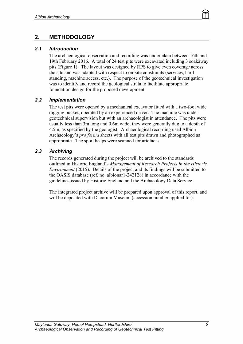
2. METHODOLOGY 8
2.1 Introduction 8
2.2 Implementation 8
2.3 Archiving 8
3. RESULTS 9
3.1 Introduction 9
3.2 Deposit Sequence 9
4. ASSESSMENT OF IMPACT OF PREVIOUS ACTIVITY 12
5. CONCLUSION 14
6. REFERENCES 15

Albion Archaeology
Maylands Gateway, Hemel Hempstead, Hertfordshire: Archaeological Observation and Recording of Geotechnical Test Pitting
3
List of Figures
Figure 1: Site location plan
Figure 2: Representative test pit sections within Area A – paddocks and former Kodak
sports ground
Figure 3: Representative test pit sections within Area B – the former caravan park
Figure 4: Representative test pit sections within Area C – the former Lucas sports
ground (1 of 2)
Figure 5: Representative test pit sections within Area C – the former Lucas sports
ground (2 of 2)
Figure 6: Possible archaeological feature in test pit 12
Figure 7: Location of test pits overlain on LIDAR digital surface map
The figures are bound at the rear of the report.
List of Tables Table 1: Test pit location and depth summary

Albion Archaeology
Maylands Gateway, Hemel Hempstead, Hertfordshire: Archaeological Observation and Recording of Geotechnical Test Pitting
4
Preface Every effort has been made in the preparation of this document to provide as complete a
summary as possible within the terms of the method statement. All statements and
opinions in this document are offered in good faith. Albion Archaeology cannot accept
responsibility for errors of fact or opinion resulting from data supplied by a third party,
or for any loss or other consequence arising from decisions or actions made upon the
basis of facts or opinions expressed in this document.
Acknowledgements The project was commissioned by Simon Mortimer of CgMs Consulting Ltd. This
report has been prepared by Ben Barker (Project Officer), and edited by Mike Luke
(Project Manager). The fieldwork was undertaken by Ben Barker. The project was
managed by Mike Luke of Albion Archaeology. Illustrations were prepared by Joan
Lightning (CAD Technician) and Ben Barker. All Albion projects are under the overall
management of Drew Shotliff.
Version History
Version Issue date Reason for re-issue
1.0 29/02/16 n/a
1.1 02/02/16 Address comments from consultant
Key Terms Throughout this report the following terms or abbreviations are used:
HEA Hertfordshire County Council Historic Environment Advisor
HER Historic Environment Record
NHLE National Heritage List for England
PDA Proposed development area
WSI Written Scheme of Investigation

Albion Archaeology
Maylands Gateway, Hemel Hempstead, Hertfordshire: Archaeological Observation and Recording of Geotechnical Test Pitting
5
Non-Technical Summary
A development is proposed at Maylands Gateway, Hemel Hempstead (centred on NGR
TL 0836 0766). The proposed development area (PDA) is in the vicinity of a number of
heritage assets. CgMs Consulting volunteered to undertake archaeological monitoring
of geotechnical testpits to be undertaken within the PDA during February 2016. In
addition to identifying and recording any archaeological features present, the
monitoring aimed to locate any ground disturbance which might have destroyed
archaeological features and to record the depths of overburden. In essence, the
archaeological attendance was aimed to provide an initial insight into the
archaeological potential of the PDA and to help inform any further archaeological
works that might be required.
Albion Archaeology was commissioned to undertake the observation and recording of
the testpits. This was undertaken between 16th and 19th February 2016, in accordance
with an approved Written Scheme of Investigation. A total of 24 test pits were
excavated. The presence of one undated possible archaeological feature was recorded
towards the centre of the PDA. The archaeological monitoring has also shown that the
depth to the archaeological horizon (undisturbed geology) varies greatly across the
PDA. It has revealed that past usage of the site has undoubtedly had an impact on the
potential for the survival of archaeological remains; in places, the ground has been
truncated, whilst in others it has been preserved under a build-up of ‘made’ ground.
In summary, the eastern part of the PDA, comprising the paddocks, former Kodak
sports ground and former caravan park, exhibited little sign of landscaping, except for
an area of potential terrace build-up in the area of TP03. In contrast, the south-western
part of the PDA, the former Lucas sports ground, appears to have been heavily
landscaped. However, the impact of the terracing is likely to be mixed, with only
slightly more evidence for truncation than ground-raising. The test pits revealed
substantial truncation of the archaeological horizon is likely to be confined to the area
of the western car park/compound and the northern halves of the two terraces.
The fact that only one possible archaeological feature was identified and no artefacts
were recovered from the test pit arisings may be a function of a relatively low density of
archaeological features within the PDA. However, it is also likely to have been
influenced by the restricted area and nature of the test pits, which made the
identification of features within narrow pits at depths in excess of 1.2m very difficult.

Albion Archaeology
Maylands Gateway, Hemel Hempstead, Hertfordshire: Archaeological Observation and Recording of Geotechnical Test Pitting
6
1. INTRODUCTION
1.1 Background
In connection with a proposed development at Maylands Gateway, Hemel
Hempstead, a geotechnical investigation was undertaken during February 2016.
Following discussion with the Historic Environment Advisor (HEA) of
Hertfordshire County Council, CgMs Consulting Ltd volunteered to undertake
archaeological monitoring of the geotechnical test pitting.
The purpose of the monitoring was to record any archaeological features or
deposits that might be present, to locate any ground disturbance which might
have destroyed archaeological features and to record the depths of overburden.
In essence the archaeological attendance aimed to provide an initial insight into
the archaeological potential of the site and help to inform any further
archaeological works that might be required.
Albion Archaeology was commissioned by CgMs Consulting Ltd to undertake
the monitoring. All works were undertaken in line with an agreed Written
Scheme of Investigation (Albion 2016).
1.2 Site Location, Topography and Geology
Maylands Gateway lies on the western outskirts of Hemel Hempstead on the
north side of Breakspear Way (Figure 1). It is bounded by Buncefield Lane to
the east, Wood Lane End to the north and an industrial estate and housing estate
to the west. It is centred on TL 0836 0766.
The underlying solid geology of the area comprises Lambeth Group - Clay, Silt
and Sand, sedimentary bedrock formed approximately 56–66 million years ago.
The superficial geology is Clay-with-flints Formation – Clay, Silt, Sand Gravel.
For the purposes of this report the proposed development area (PDA) has been
divided into three land parcels, reflecting former ownership/usage (Figure 1):
� Area A comprised c. 3ha of land in the north-eastern part of the PDA.
This area is currently occupied by a stable and associated paddocks and
exercise fields. The area was formerly in use as the Kodak Sports
Ground, which included tennis courts, a bowling green and an area of
hard-standing in the north.
� Area B comprised c. 2ha of land to the south-east, formerly used as a
caravan park. Most of the infrastructure for the park had been levelled,
but the circular road and gravelled pitches remain in situ.
� Area C comprised c. 8ha of the former Lucas Aerospace Sports Ground,
located in the western part of the PDA. This was partially overgrown,
but contained an area of hard-standing to the west and two terraced
pitches, the southernmost one encircled by a grass running track.
1.3 Archaeological Background
The archaeological background to the site has been detailed in an archaeological
assessment (AECOM 2015). It is summarised below.

Albion Archaeology
Maylands Gateway, Hemel Hempstead, Hertfordshire: Archaeological Observation and Recording of Geotechnical Test Pitting
7
A number of undesignated prehistoric heritage assets have been recorded within
the environs of the site. These include find-spots of prehistoric flint implements
(HER 540, 1303, 2276, 7315, 10812) and sub-surface remains of occupation
sites (HER 9203, 11824).
The most significant heritage asset in the immediate environs is the Romano-
Celtic temple complex at Wood Lane End (NHLE 1015490), 280m south-west
of Woodwells Farm and c. 30m north of the site. The temple complex is one of
a number of Roman sites in the area, including the villas at Gadebridge and
Boxmoor, which are thought to have been connected by a series of interlinking
roads and trackways. Excavation suggests it was constructed during the early
part of the 2nd century AD, although 1st-century AD pottery hints at some form
of earlier occupation. A number of other undesignated sites in the vicinity have
produced evidence for Roman occupation and agriculture (HER 6823, 6824,
9204).
Evidence for medieval activity in the vicinity of the site is confined to former
ridge and furrow (HER 9205) and the find-spot of a coin of Henry III (HER
11648). Similarly for the post-medieval period, the evidence recorded in the
HER relates largely to rural farmsteads.
1.4 Project Objectives
The immediate objective of the archaeological works was to monitor excavation
of the test pits with the aim of identifying, recording and characterising any
archaeological features that were revealed. A record was also to be made of
more modern deposits of “made ground”, which might have a bearing on the
potential of the site to preserve archaeological remains.
The archaeological background to the site suggested that there was potential for
any surviving archaeological remains within the PDA to contribute to regional
research themes associated with prehistoric and Roman settlement and landscape
(Medlycott 2011).
Albion Archaeology
Maylands Gateway, Hemel Hempstead, Hertfordshire: Archaeological Observation and Recording of Geotechnical Test Pitting
8
2. METHODOLOGY
2.1 Introduction
The archaeological observation and recording was undertaken between 16th and
19th February 2016. A total of 24 test pits were excavated including 3 soakaway
pits (Figure 1). The layout was designed by RPS to give even coverage across
the site and was adapted with respect to on-site constraints (services, hard
standing, machine access, etc.). The purpose of the geotechnical investigation
was to identify and record the geological strata to facilitate appropriate
foundation design for the proposed development.
2.2 Implementation
The test pits were opened by a mechanical excavator fitted with a two-foot wide
digging bucket, operated by an experienced driver. The machine was under
geotechnical supervision but with an archaeologist in attendance. The pits were
usually less than 3m long and 0.6m wide; they were generally dug to a depth of
4.5m, as specified by the geologist. Archaeological recording used Albion
Archaeology’s pro forma sheets with all test pits drawn and photographed as
appropriate. The spoil heaps were scanned for artefacts.
2.3 Archiving
The records generated during the project will be archived to the standards
outlined in Historic England’s Management of Research Projects in the Historic
Environment (2015). Details of the project and its findings will be submitted to
the OASIS database (ref. no. albionar1-242128) in accordance with the
guidelines issued by Historic England and the Archaeology Data Service.
The integrated project archive will be prepared upon approval of this report, and
will be deposited with Dacorum Museum (accession number applied for).

Albion Archaeology
Maylands Gateway, Hemel Hempstead, Hertfordshire: Archaeological Observation and Recording of Geotechnical Test Pitting
9
3. RESULTS
3.1 Introduction
Test pit locations are shown on Figure 1 and detailed in Table 1. The latter
provides their depth, the depth to the top of the original ground surface (buried
topsoil or truncated subsoil), depth to the potential archaeological horizon
(undisturbed geology), and whether archaeological features were present.
Representative sections are shown by area in Figures 2–5.
Test
pit
Area Approximate
location
(OS NGR)
Total
depth
(m)
Depth to
original ground
surface (m)
Estimated depth
to archaeological
horizon (m)
Archaeological
remains
present?
01 A 508396 207831 3.00 0 0.60 No
02 A 508430 207849 4.50 0 0.70 No
03 A 508377 207774 3.60 1.10 1.30 No
04 A 508500 207779 4.45 0 0.65 No
05 C 508175 207729 4.50 0 0.50 No
06 C 508260 207720 4.50 0 0.60 No
07 C 508326 207721 4.5? 0 0.60 No
08 A 508447 207733 4.50 0 0.60 No
09 A 508531 207724 4.50 0 0.75 No
10 C 508166 207662 4.50 Truncated 0.15? No
11 C 508260 207659 4.50 1.70 2.50 No
12 C 508394 207665 4.50 0 0.50 Possible
13 B 508499 207660 4.50 0 0.50 No
14 B 508535 207686 4.50 0 0.50 No
15 B 508565 207665 4.50 0 0.35 No
16 C 508170 207601 4.50 Truncated 0.15? No
17 C 508211 207602 4.50 0 0.50 No
18 C 508313 207618 4.50 Truncated 1.20 No
19 C 508438 207613 4.50 0 0.60 No
20 B 508514 207600 4.50 Truncated 0.20? No
21 C 508252 207537 4.50 0 0.30 No
21a C 508313 207550 3.10 2.60 3.10m+ No
22 C 508382 207538 3.00 0 0.60 No
23 C Not dug - - - -
24 C 508259 207493 4.50 1.20 1.50 No
Table 1: Test pit location and depth summary
3.2 Deposit Sequence
3.2.1 Topsoil and Subsoil
The majority of the test pits were characterised by an average depth of 0.2–0.3m
of topsoil. It was dark grey-brown silty clay with occasional small stones, rich
in organic content. A topsoil layer was absent in TP10, TP16 and TP20 where it
had been replaced by an artificial surface.
The subsoil was more variable but was generally 0.10–0.50m thick. It typically
comprised a mid orange-brown silty clay with moderate small stones. It was

Albion Archaeology
Maylands Gateway, Hemel Hempstead, Hertfordshire: Archaeological Observation and Recording of Geotechnical Test Pitting
10
notably absent from those test pits where there was evidence of disturbance to
the soil profile. The subsoil layer is likely to have been the product of a mixture
of natural weathering and historical ploughing.
3.2.2 Hard standing
Existing hard standing was sampled in the former caravan park and Lucas sports
ground (Areas B and C respectively). The hard standing for the caravan pitches
(TP 20) consisted of 0.20m of grey angular gravel above a geotextile membrane.
The western side of the Lucas sports ground contained an area of hard standing
(TP 10 and 16), presumably a former car park or compound, that consisted of a
0.15m-thick layer of loose asphalt chippings above a geotextile membrane. In
both instances, it is likely that the ground was reduced prior to the construction
of the hard standing.
3.2.3 ‘Made’ ground
A 0.10m-thick layer of dark blue-black coke-like material was identified below
the topsoil within the running track to the south of Lucas sports ground
(TP21A). This is likely to have been deposited to assist drainage of the athletics
track.
More significant thicknesses of ‘made’ ground were identified in five test pits
within the former Kodak and Lucas sports grounds (Areas A and C). It was 0.8–
2.2m thick. Within Area A (TP03) the ‘made’ ground consisted of a mid
orange-brown sandy silt with inclusions of modern brick, concrete and
fragments of metal. The layer is likely to have been deposited as a levelling
layer that was either imported to the site or reworked material incorporating
demolition material from the former sports facilities.
The ‘made’ ground within Area C (TP11, TP18, TP21a and TP24) appeared to
be artificially reworked geological deposits, consisting of mid yellow-brown
silty clay with frequent small stones. It was identifiable by its disturbed
structure, occasional chalk inclusions and clearly defined interface with the
underlying geological strata. The precise nature of the ‘made’ ground will be
detailed in the geotechnical report (RPS, forthcoming) but it is likely to have
originated as fill from levelling activity associated with the construction of the
two sports pitches.
3.2.4 Buried topsoil and subsoil
Buried topsoil and/or subsoil layers were identified in three test pits within the
former Lucas sports ground (TP11, TP21a and TP24) and one in the Kodak
sports ground area (TP03). The topsoil layers were generally comparable with
those on the surface (c. 0.3m thick), although they are likely to have been subject
to compaction. They consisted of dark brown-grey, humic deposits with a
pungent aroma consistent with that of decaying organic material. The buried
subsoils were less easy to detect but were evident as a weathered layer of the
underlying geological deposit.
The buried deposits were identified at a depth of 1.2–2.5m below the existing
ground surface within the former Lucas sports ground (Area C). It is likely that
the original ground surface was, in places, buried during the levelling of the two

Albion Archaeology
Maylands Gateway, Hemel Hempstead, Hertfordshire: Archaeological Observation and Recording of Geotechnical Test Pitting
11
surviving pitches. Within the Kodak sports ground (TP03, Area A), only a
0.2m-thick remnant of buried subsoil existed below the ‘made’ ground (at c.
1.1m below the existing ground level), suggesting that the area had been
partially stripped before being built up.
3.2.5 Undisturbed geology
The undisturbed geology consisted of a mid orange-brown clay with small to
large flints above chalk bedrock. An intervening layer of weathered silty clay,
often grey with orange mottles was present in about a third of the test pits.
Whilst the chalk bedrock was reached in over half of the test pits, this situation
was highly variable, often within a relatively short distance. Further details
should be available in the RPS geotechnical report (forthcoming), which
includes the data from the borehole logging, and is beyond the scope of this
report
3.2.6 Archaeological features
Although the test pits were narrow, if archaeological features had been present
within them they should have been visible at the interface between the subsoil
and the clay-with-flints (the archaeological horizon). An estimate of this depth
is given in Table 1 for reference in any future works. It should be noted that in
areas where potential truncation has been noted, the archaeological horizon may
have been lost completely, or simply reduced, depending on the impact of the
previous groundworks. It is also possible that more recent archaeological
features may be preserved at a higher depth within the subsoil horizon.
Only TP12 contained a possible archaeological feature (see Figure 6). It was
observed as a disturbance to the geological strata at the eastern end of the test
pit. The feature was at least 1m long, 0.6m wide and 0.5m deep, with a concave
profile. Its fill was virtually identical to the mid-orange-brown silty clay subsoil
and did not contain any artefacts or datable material. It is likely to have been a
ditch, or a pit, that has been filled by natural silting. The small size of the test pit
precludes the definite identification of this feature and any further interpretation.

Albion Archaeology
Maylands Gateway, Hemel Hempstead, Hertfordshire: Archaeological Observation and Recording of Geotechnical Test Pitting
12
4. ASSESSMENT OF IMPACT OF PREVIOUS ACTIVITY
This section attempts to assess the likely impact of previous land use on the
potential survival of archaeological remains within the PDA. This assessment is
based on the information available from observation of the geotechnical test pits
and omits potential impacts from services, buildings, roads and sewers in areas
that were not sampled by the test pits. The location of the test pits in relation to
the site topography, and whether they exhibited evidence for truncation or
‘made’ ground, is shown in Figure 7.
4.1.1 Area A – The paddocks and former Kodak sports ground
The majority of the test pits within Area A, comprising the paddocks and former
Kodak sports ground, exhibited profiles that had been minimally affected by
previous land use.
TP1, TP2, TP4, TP8 and TP9 were located in areas currently under pasture and
had consistent soil profiles that do not show any trace of artificial landscaping.
The depth of topsoil and well-developed subsoil may, however, suggest that the
area was previously impacted by medieval and later ploughing.
TP3 exhibited the one anomalous profile from Area A. It indicates that the
ground along the south-western boundary of this area has been artificially built
up to produce a level ground surface. It is possible that this build-up extends to
the west where the Archaeological Assessment notes that the ground is between
two to three metres higher than the ground level of the adjacent housing
(AECOM, 2015, 5). Although the topsoil appears to have been stripped prior to
the build-up, the presence of a residual subsoil suggests that the impact on the
archaeological horizon may have been limited.
4.1.2 Area B – The former caravan park
The profiles of the geological strata within the former caravan park were highly
varied; however, there was no apparent evidence for any substantial
anthropogenic levelling activity. TP20 was the only test pit to be located within
the area of caravan hard-standing. Whilst there was no trace of a surviving
topsoil or subsoil, undisturbed geology was reached at a depth of only 0.20m
below the current ground level. It is therefore likely that the impact of the
caravan pitches has been slight and substantial archaeological features have the
potential to survive in these areas. The impact of the roads and building
foundations (not sampled) are likely to have been more substantial and
detrimental to archaeological survival.
4.1.3 Area C – The former Lucas sports ground
The soil profiles of the test pits within the former Lucas sport ground suggest
that the area has been substantially affected by landscaping activity. Contour
lines shown on historic Ordnance Survey mapping indicate that the field was
previously bisected by a dry valley, or ‘swale’, aligned north to south, with the
land falling to the south. The same area is currently occupied by two level
terraced sports pitches/athletics track, along with an incised parking/compound
along the western boundary. The impact of the landscaping can be clearly seen

Albion Archaeology
Maylands Gateway, Hemel Hempstead, Hertfordshire: Archaeological Observation and Recording of Geotechnical Test Pitting
13
in the LIDAR data (Figure 7). The eastern part of the field appears to have been
unaffected.
TP5, TP6 and TP7 confirm that there has been little impact to what appear to be
typically natural soil profiles along the northern boundary of Area C. TP12,
TP19 and TP22 along the eastern part of the field also appear to be undisturbed.
This conclusion is further supported by the identification of a potential
archaeological feature within TP12.
The most severe impact appears to have been in the car park/compound area
along the western boundary of the PDA, sampled by TP10 and TP16. No trace
of a residual topsoil, or subsoil, was identified in either of the test pits and the
topography of the site suggests that the area has been substantially truncated.
The probable impact on the archaeological horizon suggests that it is unlikely
that any archaeological features, unless very substantial, survive in this area.
The upper terrace was sampled by TP11, TP17 and TP18. The westernmost test
pit, TP17, exhibited a profile that appeared to be unaffected by levelling activity.
Further to the east, the sequence within TP11 suggests that the area of the
depression of the dry valley was built up without removing the existing topsoil
first. TP18 was located in the south-east corner of the terrace. In contrast, this
area appears to have been built up following the removal of both topsoil and
subsoil layers. As such, the impact of the construction of the upper terrace can
be regarded as mixed — with areas of reduction and build-up. On balance, on
the basis of the limited information available, it is likely that the impact of the
landscaping on the archaeological horizon is likely to have been at its greatest to
the north and east of the terrace and is unlikely to have affected more than 50%
of the levelled area.
The lower terrace, containing the athletics track, was sampled by TP21, TP21a
and TP24. These test pits showed a similar mixed pattern to those in the
northern terrace; TP21 contained no subsoil layer and is likely to have been
reduced; whilst TP21a and TP24 contained ‘made’ ground above layers of
buried topsoil. Whilst it is difficult to assess the potential impact of the terracing
without knowledge of the original ground levels, it is clear that the
archaeological horizon has been preserved along the southern and eastern
boundaries of the area of the track.
Albion Archaeology
Maylands Gateway, Hemel Hempstead, Hertfordshire: Archaeological Observation and Recording of Geotechnical Test Pitting
14
5. CONCLUSION
The archaeological observation and recording of 24 geotechnical test pit
recorded the presence of one undated possible archaeological feature towards the
centre of the site (within TP12). It has also shown that the depth to the
archaeological horizon (undisturbed geology) varies greatly across the PDA. It
has revealed that past usage of the site has undoubtedly had an impact on the
potential for the survival of archaeological remains; in places, the ground has
been truncated, whilst in others it has been preserved under a build-up of ‘made’
ground.
In summary, the sampled areas of the eastern part of the PDA, comprising the
paddocks, former Kodak Sports ground and former caravan park, exhibited little
sign of landscaping, except for an area of potential terrace build-up in the area of
TP3. The impact of previous land use in these areas appears to be slight. In
contrast the south-western part of the PDA, the former Lucas sports ground,
appears to have been heavily landscaped. However, the impact of the terracing
is likely to be mixed with only slightly more evidence for truncation than
ground-raising. The test pits suggest that substantial truncation of the
archaeological horizon is likely to be confined to the area of the western car
park/compound and the northern halves of the two terraces (Figure 7).
The fact that only one possible archaeological feature was identified and no
artefacts were recovered from the test pit arisings may be a function of a
relatively low density of archaeological features within the PDA. However, it is
also likely to have been influenced by the restricted area and nature of the test
pits, which made the identification of features within narrow pits at depths in
excess of 1.2m very difficult.

Albion Archaeology
Maylands Gateway, Hemel Hempstead, Hertfordshire: Archaeological Observation and Recording of Geotechnical Test Pitting
15
6. REFERENCES
AECOM, 2015, Archaeological Assessment Maylands Gateway, Hemel
Hempstead
Albion Archaeology, 2016, Maylands Gateway, Hemel Hempstead,
Hertfordshire: Written Scheme of Investigation for Archaeological
Watching Brief on Geotechnical Investigations Report 2016/34
Medlycott, M. (ed), 2011, Research and Archaeology Revisited: A Revised
Framework for the East of England. East Anglian Archaeology
Occasional Paper 24.

Albion Archaeology
Maylands Gateway, Hemel Hempstead, Hertfordshire: Archaeological Observation and Recording of Geotechnical Test Pitting
16
Figure 1: Site location plan This map is based upon Ordnance Survey material with the permission of Ordnance Survey on
behalf of the Controller of Her Majesty's Stationery Office © Crown Copyright.
Unauthorised reproduction infringes Crown Copyright and may lead to prosecution or civil
proceedings. Central Bedfordshire Council. Licence No. 100049029 (2011)
Stevenage
HERTFORDSHIRE
HERTFORD
Hemel
Hempstead
Hemel
Hempstead
TP16 TP17
TP02
TP03
TP09
TP08
TP07 TP06 TP05
TP10 TP11 TP12 TP13
TP14
TP15
TP18 TP19
TP04
TP21 TP22
TP20
TP24
WS18
= Geotechnical test pit
= Geotechnical soakaway test pit
AREA C
AREA A
AREA B
TP21a
508200 508400 508600
207400
207600
207800
100 m
TP01

Albion Archaeology
Maylands Gateway, Hemel Hempstead, Hertfordshire: Archaeological Observation and Recording of Geotechnical Test Pitting
17
Figure 2: Representative test pit sections within Area A – paddocks and former Kodak
sports ground
KEY
= Topsoil = Subsoil = ‘Made’ ground = Geology (clay-with-flints) = Geology (weathered silty clay) = Geology (chalk bedrock)
0m BGL
-1m
-2m
-3m
-4m
TP1 TP2 TP3 TP4
0m BGL
-1m
-2m
-3m
-4m
TP8 TP9

Albion Archaeology
Maylands Gateway, Hemel Hempstead, Hertfordshire: Archaeological Observation and Recording of Geotechnical Test Pitting
18
Figure 3: Representative test pit sections within Area B – the former caravan park
0m BGL
-1m
-2m
-3m
-4m
TP13 TP14 TP15
KEY
= Topsoil = Subsoil = ‘Made’ ground = Geology (clay-with-flints) = Geology (weathered silty clay) = Geology (chalk bedrock)
TP20

Albion Archaeology
Maylands Gateway, Hemel Hempstead, Hertfordshire: Archaeological Observation and Recording of Geotechnical Test Pitting
19
Figure 4: Representative test pit sections within Area C – the former Lucas sports
ground (1 of 2)
TP12 0m BGL
-1m
-2m
-3m
-4m
TP10 TP11
0m BGL
-1m
-2m
-3m
-4m
TP5 TP6 TP7
TP18 0m BGL
-1m
-2m
-3m
-4m
TP16 TP17 TP19
KEY
= Topsoil = Subsoil = ‘Made’ ground = Geology (clay-with-flints) = Geology (weathered silty clay) = Geology (chalk bedrock)
= Possible archaeological feature

Albion Archaeology
Maylands Gateway, Hemel Hempstead, Hertfordshire: Archaeological Observation and Recording of Geotechnical Test Pitting
20
Figure 5: Representative test pit sections within Area C – the former Lucas sports
ground (2 of 2)
0m BGL
-1m
-2m
-3m
-4m
TP24
0m BGL
-1m
-2m
-3m
-4m
TP21 TP21a TP22
KEY
= Topsoil = Subsoil = Drainage = ‘Made’ ground = Geology (clay-with-flints) = Geology (weathered silty clay) = Geology (chalk bedrock)

Albion Archaeology
Maylands Gateway, Hemel Hempstead, Hertfordshire: Archaeological Observation and Recording of Geotechnical Test Pitting
21
geology
N
possible archaeological
feature
topsoil
0.5m
0.5m
geology
subsoil
possible archaeological
feature
geology
subsoil
topsoil
Feature as first seen Plan
(looking west)
S-facing section W-facing section
Possible feature in section
(looking north-west)
Figure 6: Possible archaeological feature in test pit 12

Albion Archaeology
Maylands Gateway, Hemel Hempstead, Hertfordshire: Archaeological Observation and Recording of Geotechnical Test Pitting
22
= ‘made’ ground
= ‘truncated’ ground
= ‘natural’ ground surface
Figure 7: Location of test pits overlain on LIDAR digital surface map LIDAR data from Open Government from Environment Agency (DSM 1m)
Source: https://houseprices.io/lab/lidar/map (accessed 24/2/16)
1 2
3 4
5 6 7
8 9
10 11 12 13
14
15
16 17 18 19 20
21 21a
22
24
Albion Archaeology
Maylands Gateway, Hemel Hempstead, Hertfordshire: Archaeological Observation and Recording of Geotechnical Test Pitting
23