marine management strategy 2003-2010 - parkweb.vic.gov.au · web view1. 1. 6. 6. 10. 10. 12. 12....
TRANSCRIPT

Victoria’s System of Marine National Parks and Marine Sanctuaries
M A N A G E M E N T S T R A T E G Y 2 0 0 3 – 2 0 1 0

A C K N O W L E D G M E N T S A N D D I S C L A I M E R This document was written and prepared by Lawrance Ferns with team contributions from Benjamin Bunting, Fiona Colquhoun, Barry Coombes, Jacqui De Kievit, Franca De Luca, Matt Edmunds, Tom Griffiths, Alex Holt, Colin Leigh, Sonia Lloyd, Peter Mackay, Michael McGoldrick, Joseph Mumford, Benjamin Pye, Kate Riddell, Mark Rodrigue, Elizabeth Strudwick and Ray Supple.
This project was steered by Ian Christie and Rod Gowans as a joint initiative of Parks Victoria and the Department of Sustainability and Environment.
The vision and scope of the document was guided by participants of the Marine National Parks and Marine Sanctuaries Reference Group, comprising representatives of organisations and agencies with significant interest in the ecologically sustainable management of Victoria’s marine environment. Parks Victoria expresses its thanksto all those involved in the development of this document, including those not mentioned here. The Reference Group included:
Australian Marine Sciences Association Tim O’Hara
Boating Industry Association of Victoria John Stav,Lindsey Grenfell
Department of Primary Industries Dallas D’SilvaDepartment of Sustainability Joan Phillips,and Environment Annette Hatten
Environment Australia Peter Taylor
Environment Protection Authority Kelly
O’Shanassy,Vicki Barmby
Marine and Coastal Community Network Tim Allen
Marine Education Society of Australasia Mark Rodrigue
Parks Victoria Sally Troy,Graeme Davis,Amanda Martin, Annie Volkering, Ian Walker
Seafood Industry of Victoria Ross McGowan
South West and Wimmera Cultural Joe ChatfieldHeritage ProgramVictorian Catchment Management Council Bill Sharrock
Victorian Coastal Council Diane James
Victorian Diving Association Peter Fear
Victorian Fisheries Co-Management Council John Sherwood,Bronwyn Burton
Victorian Local Government Association Julie Hanson
Victorian National Parks Association Chris Smyth
VRFish Ray Page
Victorian Tourism Operators Association Simon Von Saldern,Jodie Willmer
The Victorian Government acknowledges relevant Indigenouscommunities of the marine and coastal areas included within thesystem of Marine National Parks and Marine Sanctuaries. The protection of Indigenous cultural values, and the recognition of Indigenous peoples’ cultural rights and interests in the marine and coastal environment is an important component of this Strategy.
Copyright © Parks Victoria 2003Level 10, 535 Bourke Street, Melbourne, Australia.
General disclaimerThis document may be of assistance to you, however Parks Victoria and its employees do not guarantee that the information it contains is without flaw of any kind or is wholly appropriate for your particular purposes and therefore disclaims all liability for any error, loss or other consequence which may arise from you relying on any information in this document.
Further informationVictoriaFor information on Victoria’s Marine National Parks and Marine Sanctuaries, and terrestrial parks system, please refer to the Parks Victoria website at www.parkweb.vic.gov.au
Information can be also be found on the Department of Sustainability and Environment website at www.nre.vic.gov.au (coasts and marine page)
This website provides access to a wide range of reports related to Victoria’s marine biodiversity and the management of the marine environment. Information on geospatial information (mapping) products and data can be accessed at this site using Marine Map – Victoria.
National
Information on the National Representative System of Marine Protected Areas and associated publications are available on the Environment Australia website at www.ea.gov.au/coasts/mpa
InternationalInformation on international marine protected area initiatives and reports by the World Commission on Protected Areas can be found at wcpa.iucn.org/biome/marine/marine.html
Other information and publications on marine protected areas can be found at www.mpa.gov
MPA News is a monthly international newsletter dedicated to providing information on the planning and management of marine protected areas around the world. MPA News can be accessed at http://depts.washington.edu/mpanews
Cover: Weedy sea dragon. (Photography William Boyle).
ISBN 0 7311 8326 6

A U S T R A L I A
T H E V I S I O N
A world-class system of Marine National Parks and Marine
marine environments, protected, and enjoyed by Victorians

Australian fur seal Arctocephalus pusillus. (Photography Mary Malloy). Marine education. (Photography Parks Victoria).
(See page 127 for detailed maps of individual Marine National Parks and Marine Sanctuaries.)
Sanctuaries that conserves the diversity of Victoria's
and visitors, forever.

1
C O N T E N T S
Minister’s Foreword 2
Executive Summary 3
Introduction 8
A Vision for Victoria’s System of Marine National Parks and Marine Sanctuaries 10
Creating a World-Class System of Marine National Parks and Marine Sanctuaries 14
Basis for Management 22
Planning for the Future 28
A Representative System to Protect Victoria’s Unique Biodiversity 32
Protecting Natural Values 48Key Performance Areas
Environmental Management Framework 50Vulnerable Habitats and Threatened Species 52Marine Pests 55Pressures from Coastal and Catchment Activities 58Compliance 60Marine Incident Planning 62
Protecting and Recognising Cultural Values 66Key Performance Areas
Indigenous Partnerships 68Protecting Maritime Heritage 72
Community Engagement 76Key Performance Areas
Education, Interpretation and Communication 78Community Consultation 81Community Participation 84
Recreation, Tourism and Visitor Management 90Key Performance Areas
Management of Visitor Services 93Nature-Based Tourism Opportunities 96
Environmental Research and Monitoring 100Key Performance Areas
Environmental Monitoring Framework 102Marine Habitat Mapping 104Collaborative Environmental Research Partnerships 106Environmental Information Management 108
Performance Assessment and Evaluation 110
References 114
Glossary 118
Appendix 1 122
Appendix 2 126
Marine National Park and Marine Sanctuary Maps 127

2
M I N I S T E R ’ S F O R E W O R D
Victoria’s diverse marine environments are a special part of the State’s natural heritage.
Rocky reefs and sandy seafloors, spectacular underwater canyons and plunging cliffs, intertidal mudflats and tidal channels, ocean beaches and sheltered bays can all be found in Victoria’s marine waters. They provide habitat for more than 12,000 species of marine flora and fauna. Towering kelp forests and seagrass meadows, mangroves and saltmarsh, and an amazing array of fish, sponges and other animals of many colours, shapes and sizes can all be found.
On 16 November 2002 a representative sample of Victoria’s marine environments was included in a highly protected system of 13 Marine National Parks and 11 Marine Sanctuaries.
This was an historic moment for marine conservation because it was the first time in the world that such a representative system had been established by a single jurisdiction. In addition, the new Marine National Parks and Marine Sanctuaries significantly enhance Victoria’s world-class representative parks system.
However, establishing and protecting these special places through legislation is only the first step. Their ongoing protection, and their enjoyment by visitors without compromising their conservation values, also requires good management. Community custodianship is also essential.
This Management Strategy has therefore been prepared to guide the management of the Marine National Parks and Marine Sanctuaries and to ensure that the management plans that are to be developed over the next three years are based on sound strategic directions. Key aspects of the document are strategies for:
• protecting natural and cultural values;
• engaging the community;
• managing recreation, tourism and visitors; and
• environmental research and monitoring.
As the Marine National Parks and Marine Sanctuaries move from the establishment phase to the crucial management phase, I look forward to the community’s continuing involvement in, and support for, these significant parts of our world-class parks system.
HON JOHN THWAITES MP
Minister for Environment

3
E X E C U T I V E S U M M A R Y
The vision for Victoria’s Marine National Parks and Marine Sanctuaries is for a world-class system that conserves the diversity of Victoria’s marine environments, protected and enjoyed by Victorians and visitors, forever.
This Management Strategy has been prepared to guide the management of Victoria’s highly protected system of 13 Marine National Parks and 11 Marine Sanctuaries until 2010. The system makes up 5.3% of Victoria’s marine waters.
The Strategy has been prepared by Parks Victoria, which has the responsibility for day-to-day management of the system. Management plans for individual national parks and sanctuaries will be prepared over the next three years.
The first section of the Strategy provides information about the preparation of the document and future management planning processes, outlining a vision for the system of Marine National Parks and Marine Sanctuaries, and providing the background and the legislative and policy basis for the system.
The Strategy then describes Victoria’s marine environment, and the distinctive flora, fauna and biological communities within the system of Marine National Parks and Marine Sanctuaries.
The body of the Strategy is arranged under five major themes, with key performance areas under each theme outlining the management framework, objectives, desired outcomes, strategies and implementation actions. The five major themes are:
• Protecting Natural Values
• Protecting and Recognising Cultural Values
• Community Engagement
• Recreation, Tourism and Visitor Management
• Environmental Research and Monitoring.
Finally, there is an outline of the way in which management performance will be evaluated and reported upon.
PREPARATION OF THE STRATEGY
The Strategy was prepared by Parks Victoria with the assistance of the Marine National Parks and Marine Sanctuaries Reference Group, comprised of community and industry stakeholders and Commonwealth, State and local government representatives. A draft version of the Strategy was widely circulated for public comment in August2002. The final Strategy has attempted to address and incorporate the suggestions from a wide range of interest
groups and individuals.

4
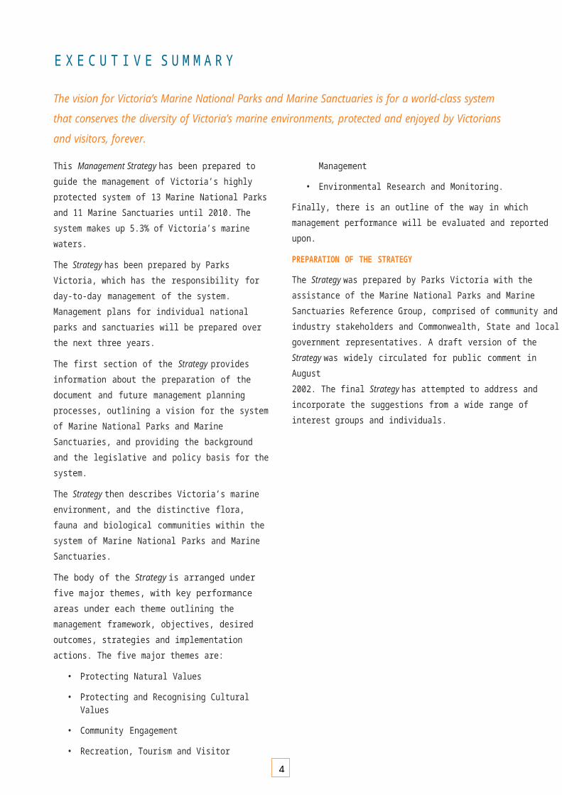
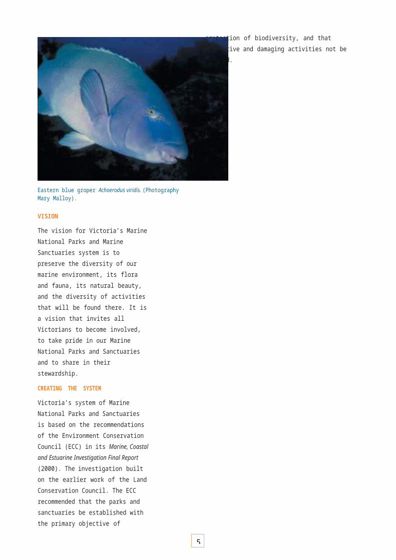
Eastern blue groper Achoerodus viridis. (Photography Mary Malloy).
VISION
The vision for Victoria’s Marine National Parks and Marine Sanctuaries system is to preserve the diversity of our marine environment, its flora and fauna, its natural beauty, and the diversity of activities that will be found there. It is a vision that invites all Victorians to become involved, to take pride in our Marine National Parks and Sanctuaries and to share in their stewardship.
CREATING THE SYSTEM
Victoria’s system of Marine National Parks and Sanctuaries is based on the recommendations of the Environment Conservation Council (ECC) in its Marine, Coastal and Estuarine Investigation Final Report (2000). The investigation built on the earlier work of the Land Conservation Council. The ECC recommended that the parks and sanctuaries be established with the primary objective of protection of biodiversity, and that extractive and damaging activities not be allowed.
5
The planning and management of the system draws on State, national and international strategies and frameworks such as ecologically sustainable development (ESD), integrated coastal zone management (ICZM), and guidelines for the national representative system of marine protected areas (NRSMPA).
BASIS FOR MANAGEMENT
Victoria’s Marine National Parks and Sanctuaries are established under the National Parks Act 1975. Overall arrangements for Parks Victoria’s management responsibilities are set out in a Management Agreement between the Minister for Environment, the Secretary to the Departmentof Sustainability and Environment and Parks Victoria.
The Department of Primary Industries, amongst other things, coordinates and delivers fisheries compliance services across Victorian waters. The Department of Sustainability and Environment is also a significant partner in the management of the Marine National Parks and Sanctuaries. Other legislation, management agenciesand policies also support management of the system.
MANAGEMENT PLANNING
Management plans will be prepared for each of the 13 Marine National Parks and 11 Marine Sanctuaries within three years. Community participation and involvement in the development of these plans is a key focus.
Specialised program plans will also be prepared for individual program areas such as compliance, education, research and monitoring, communication and consultation.
VICTORIA’S MARINE BIODIVERSITY
Australia’s southern waters are unique, with 90% of species found nowhere else on earth. The Marine National Parks and Sanctuaries system has been established to represent the diversity of Victoria’s marine environment, its habitats and associated flora and fauna.
Victoria’s marine environment has been classified into five bioregions according to a nationally agreed scheme based on physical and biological attributes.
PROTECTING NATURAL VALUES
The system of Marine National Parks and Sanctuaries has been established primarily to protect and conserve representative examples of biodiversity, ecological processes and natural features.
Parks Victoria will extend its existing environmental management framework to the Marine National Parks and Sanctuaries, involving an adaptive management approach that includes an assessment of threats and risks, priority setting for management, resource allocation and informed decision making.
Key performance areas include:
• environmental management framework
• vulnerable habitats and threatened species
• marine pests
• pressures from coastal and catchment activities
• compliance
• marine incident planning.
PROTECTING AND RECOGNISING CULTURAL VALUES
Indigenous people have an ongoing relationship with marine and coastal environments. This relationship is based on a long tradition of ownership, stewardship, utilisation and cultural significance.
Mutual recognition and respect will encourage and facilitate the negotiation of Indigenous peoples’ interests in the planning and management of Marine National Parks and Sanctuaries. Both the Department of Natural Resources and Environment and Parks Victoria have developed Indigenous partnership strategies for working with Indigenous communities in land and resource management. Aboriginal Affairs Victoria (AAV) within the Department for Victorian Communities is responsible for advertising the Archeological and Aboriginal Relics Preservation Act 1972 and the Aboriginal and Torres Strait Islander Heritage Protection Act 1984 and providing advice on cultural heritage.
Victoria’s earliest European exploration and settlement was heavily reliant on coastal shipping, and related places and objects are increasingly valued by the community as a link to our history and development.
Key performance areas for this theme are:
• Indigenous partnerships
• protecting maritime heritage (including shipwrecks, lighthouses and marine infrastructure).
6
COMMUNITY ENGAGEMENT
The long-term protection of the Marine National Parks and Sanctuaries will be achieved with engaged, well-informed and aware communities working with managers, and acting as custodians and ambassadors. Fostering community ownership will be an ongoing process, and its extent and success can be measured by rates and levels of awareness, compliance and participation.
Key performance areas include:
• education, interpretation and communication
• community consultation
• community participation.
RECREATION, TOURISM AND VISITOR MANAGEMENT
The marine and coastal environment is highly valued for both passive and active recreation. Appropriate recreation and tourism use contributes to the health and well-being of individuals and the community. Victoria’s Marine National Parks and Sanctuaries are significant additional natural attractions for visitors to the national parks estate. The system provides opportunities for the further growth of recreation and tourism activities. Management of recreation and tourism activities in Marine National Parks and Sanctuaries is guided by the National Parks Act 1975 as well as other legislation, strategies and policies.
Key performance areas include:
• management of visitor services, including visitor use monitoring.
• nature-based tourism opportunities, including management of commercial tourism operations.
ENVIRONMENTAL RESEARCH AND MONITORING
The primary purpose of environmental research and monitoring programs in parks and conservation reserves is to provide information on the status of the natural values and threatening processes, and to determine the nature and magnitude of trends through time. This information is then used in making decisions and implementing management actions to protect ecological integrity and diversity.
The immediate requirement for Victoria’s Marine National Parks and Sanctuaries is to extend existing knowledge and develop understanding of marine biodiversity within and outside the system.
Monitoring programs will demonstrate a clear alignment with management objectives, and be scientifically credible
for their intended purpose. As well as broad-scale, long-term
7
monitoring programs, Parks Victoria will also commission or encourage specific, more localised scientific research that provides clear benefits for learning and management.
Key performance areas are:
• environmental monitoring framework
• marine habitat mapping
• collaborative environmental research partnerships
• environmental information management.
PERFORMANCE ASSESSMENT AND EVALUATION
Performance assessment will ensure that actions contribute effectively to achieving the objectives of the Strategy, and will provide transparency in the way the Marine National Parks and Sanctuaries are managed. Objectives in the Strategy will be assessed and reported across the key performance areas.
Through the management planning process Parks Victoria will be seeking public input into preferred approaches for regular public reporting.
Environmental assessment of Marine National Parks and Sanctuaries will be integrated into future State of the Parks Reports.
Yellow zoanthids Parazoanthus sp. (Photography William Boyle).

6

I N T R O D U C T I O N A N D V I S I O N
7

8
I N T R O D U C T I O N
The Victorian marine and coastal environment is an area recognised for its outstanding natural beauty, unique and diverse marine biota and valuable resources. It offers significant natural, cultural, social and economic values to all Victorians and visitors to this State.
The Victorian Government is committed to ensuring that the values of the marine and coastal environment are protected for future generations through policies that provide for a balance of ecologically sustainable uses.
In June 2002, historic legislation was passed to establish 13 Marine National Parks and 11 Marine Sanctuaries. Victoria is the first jurisdiction in the world to create an entire system of highly protected Marine National Parks at the same time. This Strategy applies to all highly protected Marine National Parks and Sanctuaries in Victoria, and has been preparedto provide clear and consistent direction for planning and management programs over the next eight years. This period allows three years to produce management plans for these areas. The plans will remain in place for at least five years, at which time the need for a review will be considered.
PURPOSE OF THE STRATEGY
The purpose of the Strategy is to provide strategic guidance to managers, planners, researchers and the community about the implementation of the Marine National Parks and Sanctuaries. It draws on State legislation and policy, and national and international best practice principles and guidelines for the management of highly protected Marine National Parks. The Strategy also encourages involvement of the community and integration with existing government programs and initiatives.
Emphasis in the Strategy has been placed on appreciating the diversity of values associated with highly protected Marine National Parks and Sanctuaries, key challenges and how they will be addressed. Key Performance Areas for the Strategy are grouped under the following themes:
• Protecting Natural Values
• Protecting and Recognising Cultural Values
• Community Engagement
• Recreation, Tourism and Visitor Management
• Environmental Research and Monitoring.
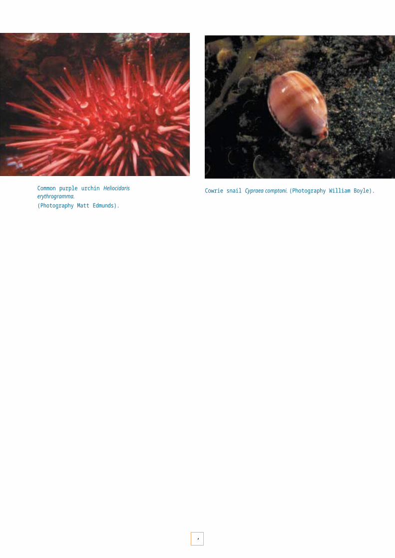
Common purple urchin Heliocidaris erythrogramma.(Photography Matt Edmunds).
Cowrie snail Cypraea comptoni. (Photography William Boyle).

9
Each theme provides an overview of relevant values, key issues and challenges for management. Key Performance Areas under each theme outline the relevant management framework, objectives (including desired outcomes and responsible agencies) and strategies (including implementation actions and targets) for each.
How has the scope of the Strategy been determined?
The scope of this Strategy was determined by Parks Victoria and the Marine National Parks and Marine Sanctuaries Reference Group (see the Acknowledgments page).
In preparing the Strategy, careful consideration was given to:
• the Victorian Government Response to recommendations made by the Environmental Conservation Council in its Marine, Coastal and Estuarine Investigation Final Report (2000);
• Victorian Government principles for ecological sustainability, including the principles of integrated marine, coastal and catchment management; and
• national and international best practice approaches and guidelines for the management of marine protected areas.
CONSULTATION
The draft of this Strategy was widely circulated for public comment throughout Victoria, as well as nationally and internationally. The draft was circulated to over 3000 interested individuals and peak groups, and was also advertised in all main Victorian newspapers and on selected websites.
Through a formal consultation process, the wider community was provided the opportunity to comment on the draft and suggest additional opportunitiesfor community involvement in the future planning, management and research of the Marine National Parks and Sanctuaries system.
This final document has attempted to incorporate the valuable input received from formal submissions to reflect the suggestions of a wide range of interest groups and individuals.
Long-snouted boarfish Pentaceropsis recurvirostris.(Photography John Ariens).

1
A V I S I O N F O R V I C T O R I A ’ S S Y S T E M O F M A R I N E N A T I O N A L P A R K S A N D M A R I N E S A N C T U A R I E S
"A world-class system of Marine National Parks and Marine Sanctuaries that conserves the diversity of Victoria’s marine environments, protected and enjoyed by Victorians and visitors, forever."
This Strategy will guide the management of the system of Marine National Parks and Marine Sanctuaries, and help to ensure that the system meets current and futurecommunity needs, promotes our State as a destination for marine nature-based recreation and tourism, and positions Victoria as a world leader in marine protected area management. The implementation of this Strategy will strive to meet the objectives of this vision, and it is underpinned by the following principles.
PRINCIPLES FOR IMPLEMENTATION
• Conserve, protect and enhance natural and cultural values.
• Ensure excellence and innovation in marine protected area management.
• Foster community engagement and ownership.
• Provide quality information, services and experiences.
• Take a long-term view for planning and management.
• Incorporate and encourage the integration and participation of stakeholders.
• Respect and recognise Indigenous interests and values.
• Underpin all management decisions with environmental, cultural and economical sustainability.
• Ensure management is well-informed, based on sound scientific and social research.
• Display transparency and accountability in planning and management processes.
• Maintain a focus on achieving measurable outcomes.
Leather kelp Ecklonia radiata. (Photography Mary Malloy).
WHAT WILL OUR SYSTEM LOOK LIKE?
Victoria’s vision for its system of Marine National Parks and Marines Sanctuaries is to maintain marine ecosystems in their natural state, enjoyed by visitors and protected from the effects of inappropriate activities. The system will safeguard representative examples of undisturbed natural marine habitats, respect cultural heritage values, and be a place of inspiration, enjoyment and renewal for all people. The system will complement our world-class national parks system on land.
1
These jewels in Victoria’s coastal waters will provide for the conservation, protection and enjoyment of marine environments to international best-practice standards, through targeted scientific and social research. Natural values will be well understood and communicated so that marine park managers, in cooperation with Victorian communities and other agencies, are able to confidently and effectively prevent and manage threats to these areas. Inclusive and integrated management and facilitated research will ensure that the control of marine pests is effective and well informed.
Verco’s nudibranch Tambja verconis. (Photography John Bryan).
Quality marine recreational opportunities will be available for people of all ages and abilities, in a variety of settings, ranging from easily accessible sheltered sites to the more wild and remote protected areas along the open coast. A variety of tourism opportunities will be available, with a broadening of recreational boating choices, from private pleasure boats to tourism craft, being encouraged. Activities undertaken in the parks and sanctuaries will be managed to ensure there is minimal impact on the environment and on the enjoyment and safety of other visitors.
Increasingly, people will experience, enjoy and learn about marine creatures and their environments from both above the water and below the surface. Skilled and professional parks and resource managers and staff will be working to make sure visitors have access to the information they need to keep them safe, and make sure they have the facilities they need, where they need them.
Members of coastal communities will be actively involved in the planning for each Marine National Park and Sanctuary, and will act as custodians for these areas for years to come. The importance of implementing fishing and other restrictions will be well communicated and understood, resulting in voluntary compliance.
Through consultation and involvement, marine heritage and archaeological sites, as well as the sites and values important to Indigenous communities within the parks and sanctuaries, will be provided for in management plans, and their special features will be recognised and interpretedfor the broader community. These sites and values will be protected within planning frameworks that respect the environments within which they exist, and the people to whom they are important.
This vision aims to preserve the diversity of our marine environment, its flora and fauna, its natural beauty, and the diversity of activities that may be enjoyed there. It is a vision that invites all Victorians to become involved, to take pride in our Marine National Parks and Marine Sanctuaries and to share in their stewardship.
1

C R E A T I N G T H E S Y S T E M
13

1
C R E A T I N G A W O R L D - C L A S S S Y S T E M O F M A R I N E N A T I O N A L P A R K S A N D M A R I N E S A N C T U A R I E S
Victoria is the first jurisdiction in the world to establish, all at the one time, a representative system of highly protected Marine National Parks and Marine Sanctuaries. This system was created to conserve and protect the diversity of Victorian marine environments and the flora and fauna within them.
ENVIRONMENT CONSERVATION COUNCIL INVESTIGATION
Victoria’s system of Marine National Parks and Marine Sanctuaries is based on the recommendations of the Environment Conservation Council’s Marine, Coastal and Estuarine Investigation Final Report (2000). This investigation built on the earlier work of the Land Conservation Council, and in total took nine years to complete. The investigation involved detailed assessments of ecological, cultural, social and economic values. The process also encouraged extensive input by the Victorian community, with six formal periods for public comment.
Sites for the new Marine National Parks and Marine Sanctuaries were chosen to ensure that a system representative of Victoria’s diverse marine environments is protected. To achieve this, the parks and sanctuaries have been spread across Victoria’s five marine bioregions (see page 33). More than one park and/or sanctuary was usually selected within each bioregion, to reflect as far as possible the rangeof habitats and biological communities within each, to incorporate the variability within habitats, and to insure against loss due to unforeseen or future catastrophic events.
The Environment Conservation Council adopted the following principles for the selection and management of the parks and sanctuaries. These principles have guided the development of this Strategy :
• There will be a system of protected areas within the marine, coastal and estuarine areas of Victoria which will be comprehensive, adequate and representative (Appendix 1).
• Marine National Parks are established to provide the highest level of protection for biodiversity and to maintain representative examples of natural ecosystems in perpetuity.
• Marine National Parks must be sufficiently large to achieve their objectives.
• Marine Sanctuaries and Marine Special Management Areas will be identified to protect sites of special conservation, recreation or education value and to complement Marine National Parks.
• Marine National Parks and Marine Sanctuaries should provide for a range of non-extractive and non- damaging activities, compatible with the primary aim of conserving biodiversity and ecological processes, and protection of special values.
• Marine protected areas should generally be located to minimise threats, such as pollution and introduced pests, from surrounding areas.
• A system of marine protected areas should include some spectacular areas, and should provide opportunities for recreation, tourism and enjoyment of the natural environment.
• Planning for Victoria’s marine protected areas will take a long-term view, and will provide ongoing protection of the resource.
• Community education and involvement are vital factors in the successful management of marine protected areas.
• Management of marine protected areas must be effective, efficient and accountable.
Southern rock lobster Jasus edwardsii. (Photography William Boyle).

1
ENVIRONMENT CONSERVATION COUNCIL RECOMMENDATIONS
In addressing the terms of reference for the investigation, the Environment Conservation Council also made a range of recommendations related to the protection, use and management of Victoria’s marine environment.
Those recommendations that have been accepted by the Victorian Government and are complementary to the management of Marine National Parks and Marine Sanctuaries have also been carefully applied in preparing this Strategy. These include:
R3 Planning and management relating to traditional interests and uses in coastal marine areas to be based on recognition and respect for the traditionalrelationship of Aboriginal people with the land and sea.
R13 Further research to be undertaken on biological community composition and structure, both within and external to marine protected areas, with an emphasis on assessing the impacts of harvesting marine fauna.
R14 Assessments to be made and strategies developed for protection of vulnerable or threatened marine species and communities, using the provisions of the Flora and Fauna Guarantee Act 1988 (Vic.) as appropriate.
R15 Catchment Management Authorities and boards to ensure that reviews of regional catchment strategies specifically address the impacts of land use and management on the marine and estuarine environment, particularly where important physical or biological features may be affected.
R18 Measures to be implemented by responsible agencies to reduce the risk of marine pest species arriving in Victoria, and to ensure a rapid and effective response in the event of an introduction.
R19 The Department of Natural Resources and Environment (NRE) (now the Department of Sustainability and Environment and Department of Primary Industries) to assess and coordinate management and reporting of risks to the conservation and sustainable use of marine and coastal resources within Victoria’s marine, coastal and estuarine area.
Anthozoa colony, Beware Reef. (Photography John Ariens).
R26 Public land and waters continue to be available for a wide range of tourism and recreational uses. Development should not preclude public access to foreshore and offshore areas, other than to meet safety and security requirements that cannot be achieved in other ways.
R27 Codes of practice be developed with relevant tourism and recreational organisations, to encourage responsible use of vulnerable marine and coastal areas and resources;

1
R28 Consistent with the approach for some National Parks and Reserves on land, where it is appropriate and practicable, and where tourism activity occurs on public land (including waters), a contribution be made by the tourist operator or individual visitor, through appropriate fees or licences, which can be applied to the protection and maintenance of the area or relevant values;
R30 NRE (now DSE/DPI), with local government, catchment management authorities, regional coastal boards and the community, develop an approach to improve coordination between coastal and marine- orientated community programs and catchment- orientated programs;
R31 Compliance strategies should contain provisions to encourage community involvement;
R33 Changes to management regimes and regulations should be well publicised, apply to clearly defined areas, and be accompanied by an appropriate level of education and enforcement;
R34 Priority be given to establishing monitoring programs:
• for Marine National Parks to determine the extent to which these areas are meeting their objectives; and
• for areas of resource use to help assess whether the use is sustainable.
R36 That the Government, in consultation with research, community and industry organisations, establishes a framework for the acquisition of data relating to Victoria’s marine, coastal and estuarine resources, and ensure coordination of a program of integrated data collection.
White mangrove Avicennia marina. (Photography William Boyle).
RECOMMENDED MARINE NATIONAL PARKS AND MARINE SANCTUARIES
The Environment Conservation Council’s terms of reference required it, amongst other things, to recommend a preferred approach and priorities for establishing a representative system of marine protected areas. This Strategy applies principally to the protection and management of the recommended Marine National Parks and Marine Sanctuaries.
The Environment Conservation Council recommended that the 13 Marine National Parks be used to:
1. conserve and protect biodiversity and natural processes;
2. maintain natural ecosystems as a reference against which other areas may be compared;
3. provide opportunities for recreation and education associated with the enjoyment and understanding of natural environments, where consistent with uses 1 and 2;
and the 11 recommended Marine Sanctuaries be used to:
4. conserve and protect the biodiversity and natural processes within the sanctuary;
5. provide opportunities for recreation and education associated with the enjoyment and understanding of natural environments, where consistent with 1.

1
The following activities were recommended to be permitted in Marine National Parks and Marine Sanctuaries:
6. nature observation, scuba-diving, snorkelling, surfing, swimming, boating and wind-surfing;
(Note: boating using motorised craft will be subject to conditions to be determined by the park or sanctuary manager; restrictions on motorised boating would only be appropriate if the activity is in conflict with 1, 2 or 3 above.)
7. research, subject to permit;
8. oil and gas exploration from an aircraft or vessel that does not cause disturbance to the seabed or biota;
(Note: the Government has made a minor qualification to this recommendation: any oil or gas exploration from an aircraft or vessel should not cause detrimental impact to the seafloor or biota);
9. maintenance and replacement of existing structures.
The following activities are not permitted in Marine National Parks and Marine Sanctuaries:
10.the removal or disturbance of marine biota;
11. marine aquaculture;
12.exploratory drilling for oil and gas;
13.oil and gas extraction;
14.exploration and extraction of minerals and stone;
15.other activities that cause disturbance to the seabed or biota (such as blasting, dredging and spoil disposal, seaweed harvesting);
16.point-source waste discharges.
The Environment Conservation Council recommended that, in Marine National Parks:
17.new seafloor cables and pipelines be permitted, subject to:
a. an Environment Effects Statement, and
b. the consent of the Minister responsible for management of the park, and only after the Minister is satisfied that no reasonable alternative outside the park is available.
(Note: the Government made a minor qualification to this recommendation – the form of environmental assessment under the Environmental Effects Act 1978, including whether an Environmental Effects Statement is required, should be determined on a case-by-case basis.)
and that:
18.the Marine National Parks and Marine Sanctuaries be permanently reserved under new or amended legislation and be managed by the Department of Natural Resources and Environment (now the Department of Sustainability and Environment);
19.a management plan be prepared for each Marine Park and Marine Sanctuary by the manager, after public consultation, outlining the strategies to be taken to achieve the objectives of the park or sanctuary, and be in place within three years of the Government’s acceptance of these recommendations;
20.the boundaries of the areas, if they have not been precisely surveyed, be subject to minor modifications and other adjustments that may be deemed necessary.
Note that the Marine National Parks are established to a depth of 200 metres below the seabed.
CREATION OF VICTORIA’S MARINE NATIONAL PARKS AND MARINE SANCTUARIES
In June 2002, historic legislation was passed through the Victorian Parliament, with bipartisan support, to establish 13 Marine National Parks and 11 Marine Sanctuaries.The National Parks (Marine National Parks and Marine Sanctuaries) Act 2002 came into effect on 16 November 2002.
Compound ascidian. (Photography John Ariens).

1
PRINCIPLES
The planning and management of Victoria’s system of Marine National Parks and Marine Sanctuaries draw on state, national and international principles for the management of marine and coastal resources and the environment. These include:
Ecologically sustainable development (ESD)
The Victorian Government has adopted the concept of ESD in its management of ecological, social and economic resources across the State. ESD was established under the National Strategy for Ecologically Sustainable Development (1992), and is defined as "development that improves the total quality of life, both now and in the future, in a way that maintains the ecological processes on which life depends".
Ecologically sustainable development and the use of the marine and coastal environment will require integration and coordination between all spheres of government, and the involvement of the community, stakeholder and industry groups in management decisions and implementation. A framework for the integration and management of ESD within the coastal and marine environment is described below.
Integrated coastal zone management (ICZM)
The ICZM framework has been adopted by the Victorian Government and forms the basis of the Victorian Coastal Strategy (2002). ICZM emphasises the importance of ecologically sustainable development. This means that environmental, social and economic implications are considered in an integrated way, and decisions are made with a long-term view. The hierarchy of principles for decision-making priorities is as follows:
• Provide for the protection of significant natural and environmental features;
• Ensure the sustainable use of natural coastal features;
• Undertake integrated planning and provide direction for the future; and
• Facilitate the sustainable development of the coast when the above principles have been met.
The ecologically sustainable management of our Marine National Parks and Sanctuaries will require recognition by all that the marine environment is connected to the coast and surrounding catchment. In practice this involves:
• horizontal integration of planning and management by the coordination of activities across all government and community organisations; and
• vertical integration of the activities within various tiers of government, including a commitment to community consultation at all tiers.
National guidelines for marine protected areas
The National Guidelines for Establishing the National Representative System of Marine Protected Areas (ANZECC Task Force on Marine Protected Areas 1998) and the Strategic Plan of Action for the National Representative System of Marine Protected Areas (ANZECC Task Force on Marine Protected Areas 1999) outlines specific guidelines and actions to assist Australia’s jurisdictions with their marine protected area planning and management processes.
The Guidelines and Strategic Plan were prepared and endorsed by all State, Territory and Commonwealth governments, and outline ecological, cultural, social and economic criteria for marine protected areas. They aim to ensure that the management of marine protected areas is consistent with best-practice national and international arrangements (Appendix 1).
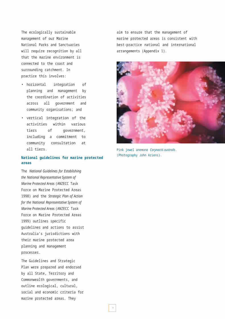
Pink jewel anemone Corynactis australis. (Photography John Ariens).

1
Draughtboard shark Cephaloscyllium laticeps.(Photography John Ariens).
What is Integrated Coastal Zone Management?
The principles of ICZM have been endorsed by all Australian governments. The aim of ICZM is to integrate planning and management within a region across the land and sea interface, so that catchments, coastal lands and adjacent marine waters can be treated as one biophysical entity.
The ICZM framework involves consideration of the following five core components when developing management and planning arrangements within the coastal zone:
• a systems component, which considers the interactions between human uses, natural systems, pressures and assessment of risk;
• a balanced component, which considers social and economic requirements and implications;
• a strategic component, which considers key issues and challenges and how we need to respond;
• a partnership component, which recognises the importance of working together across all levels of government, industry and the community; and
• a jurisdictional component, which recognises the role of management agencies and the coordination of legal and consultative arrangements.
What activities are permitted and not permitted in Marine National Parks and Marine Sanctuaries?
PERMITTED:
Nature observation (including bird, dolphin and whale watching), scuba-diving, surfing, snorkelling, swimming, wind-surfing, all forms of boating, education activities, scientific research (subject to permit), filming and photography (subject to permit if commercial), maintenance and replacement of existing structures, and oil and gas exploration from an aircraft or vessel that does not cause disturbance to the seafloor or biota.
NOT PERMITTED:
Commercial and recreational harvesting or disturbance of fish or any other marine biota*, exploratory drilling or extraction of oil or gas, extraction of minerals, petroleum or other seabed materials**, point source waste and ballast discharge, aquaculture, other activities that cause disturbance to the seabed or marine biota.
* Commercial and recreational fishing will be allowed to continue in four Marine National Parks, and part of one Marine Sanctuary, until 1 April 2004, after which time it will cease. All existing fishing regulations and other regulated activities in these areas will still apply during this period.
The areas where commercial and recreational fishing can continue until 1 April 2004 are:
• Discovery Bay Marine National Park
• Twelve Apostles Marine National Park
• Corner Inlet Marine National Park
• Cape Howe Marine National Park
• Point Cooke Marine Sanctuary (except the area of the former Point Cook Fisheries Reserve that lies between the high water mark and 200 m seaward of the high water mark).
** Although petroleum extraction is not permitted, exploration from an aircraft or from a vessel is permitted provided that it has the consent of the Minister and that it is carried out in a manner which does not detrimentally effect the seabed or biota of the park or sanctuary. Seafloor cables or pipelines are only permitted in Marine National Parks or Marine Sanctuaries with the consent of the Minister, subject to environmental assessment and there being no reasonable alternative outside the park.

2
Definitions
Marine National Parks
Highly protected areas that contribute to a system representing the range of marine environments in Victoria, and in which no fishing, extractive or damaging activities are allowed. There are no restrictions on access, and activities such as recreation, tourism, education and research are encouraged.
Marine Sanctuaries
Marine sanctuaries are smaller highly protected areas designed for the protection of their special natural values, in which no fishing, extractive or damaging activities are allowed. These areas also complement the larger Marine National Parks.
Other Marine Protected Areas
In addition to the newly established Marine National Parks and Sanctuaries, Victoria’s parks system retains all or part of six previously established areas, variously named Marine Park, Marine Reserve, and Marine andCoastal Park, which have existing management regimes, allowing for a range of ecologically sustainable uses, with the primary objective of conservation.
Special Management Areas
The Environment Conservation Council’s Investigation also identified 18 Special Management Areas where lower levels of protection are sufficient to protect their features, and in which fishing and other uses are generally allowed. While there is no single legislative basis for these areas, the Department of Sustainability and Environment, in consultation with other management agencies and local government where appropriate, will develop a separate strategy for the protection and management of these areas.
Spotted pipefish Stigmatopora argus. (Photography Mary Malloy).

M A N A G I N G T H E S Y S T E M A N D P L A N N I N G F O R T H E F U T U R E
21

2
B A S I S F O R M A N A G E M E N T
Victoria’s system of Marine National Parks and Marine Sanctuaries contains our major reservoirs of marine biodiversity. The protection and enhancement of these areas is critical to conserving this biodiversity and ensuring a sustainable future.
LEGISLATIVE AND POLICY CONTEXT
Victoria
Victoria's Marine National Parks and Marine Sanctuaries are established under the National Parks Act 1975 (Schedules 7 and 8 respectively). The Act provides, amongst other things, for the preservation and protection of:
• the natural environment;
• indigenous flora and fauna; and
• features of scenic, archaeological, ecological, geological, historic or other scientific interest.
To ensure the protection and preservation of these areas, the Act also provides for:
• study relating to the conservation of the natural environment;
• the responsible management of the land and/or sea; and
• the use, enjoyment and understanding of these areas by the public.
In highly protected Marine National Parks and Marine Sanctuaries, activities such as commercial and recreational harvesting of fish species, marine plants and invertebrates, and the extraction of minerals, petroleum or other seabed materials are not permitted.
Management is also supported by other management agencies, legislation and policies that reflect the commitment to ensure the ecologically sustainable use of Victoria’s marine and coastal resources (see Table 1 on page 27 for a summary).
Parks Victoria has the responsibility to manage all areas on the schedules of the National Parks Act. Overall arrangements regarding the relationships and responsibilities for the provision of services are set down in a Management Agreement between Parks Victoria, the Minister for Environment, and the Secretary of the Department of Sustainability and Environment.
Other legislative and policy instruments include:
• Archaeological and Aboriginal Relics Preservation Act 1972
• Catchment and Land Protection Act 1994
• Coastal Management Act 1995
• Crown Land (Reserves) Act 1978
• Environmental Effects Act 1978
• Environment Protection Act 1970 (including State Environment Protection Policies (Waters of Victoria) and its schedules, to be finalised in 2003)
• Flora and Fauna Guarantee Act 1988
• Heritage Act 1995
• Historic Shipwrecks Act 1976
• Land Act 1958
• Parks Victoria Act 1998
• Petroleum Act 1998
• Petroleum (Submerged Lands) Act 1982
• Pipelines Act 1967
• Water Act 1989
• Wildlife Act 1975
• Victoria’s Biodiversity Strategy (1997)
• Policy for Sustainable Recreation and Tourism on Public Land (2002)
• Victorian Coastal Strategy (2002)
• Victorian Heritage Strategy – Shipwrecks 2005 (2000)
• Regional Catchment Strategies (to be finalised in 2003).
The Department of Primary Industries coordinates the management of fisheries resources and fisheries compliance across Victorian waters, and licenses and regulates petroleum exploration and pipeline permits. Parks Victoria will work closely with Department of Primary Industries to provide additional surveillance and enforcement resources.

2
Shaw’s cowfish Aracana aurita. (Photography William Boyle).
The Fisheries Act 1995 provides for the ecologically sustainable development of the State’s fisheries resources. The Act facilitates the application of various regulations such as licence limitation, bag limits, quotas, size limits, gear restrictions, seasonal and area closures, imposed to support this primary objective. These management controls aim to avoid fishery collapse, habitat loss, or decreases in the abundance of rare species. A combination of management regimes is often used to achieve sustainable use.
The Environment Protection Authority is responsible for protecting the environment from pollution (including exotic species incursions) and protecting and improving the quality of the environment.
The Environment Protection Act 1970 provides a range of tools to accomplish this, including development of statutory polices, licensing of significant discharge to the environment, enforcement tools and partnership tools, including programs to facilitate community involvementand environment protection, and monitoring and research work to support these activities.
Heritage Victoria is responsible for the identification, protection and management of Victoria’s cultural heritage places and objects, including historic shipwrecks under the Heritage Act 1995, and is also responsible for administering the Historic Shipwrecks Act 1976 on behalf of the Commonwealth.
National
Victoria’s Marine National Parks and Marine Sanctuaries have been established in the context of national and international arrangements and obligations.
At a national level, the Commonwealth, State and Northern Territory governments are cooperatively developing the National Representative System of Marine Protected Areas (NRSMPA) and have agreed on national guidelines and scientific principles for the establishment and management of marine protected areas in Australia (Appendix 1). The primary goal of the NRSMPA is:
To establish and manage a comprehensive, adequate and representative system of marine protected areas to contribute to the long-term ecological viability of marine and estuarine systems, to maintain ecological processesand systems, and to protect Australia’s biological diversity at all levels.
Some key Commonwealth policies and programs relevant to marine protected area establishment and management include the:
• National Strategy for Ecologically Sustainable Development (1992);
• National Strategy for the Conservation of Australia’s Biological Diversity (1996);
• Wetlands Policy of the Commonwealth Government of Australia (1997);
• Australia’s Oceans Policy (1998);
• Environment Protection and Biodiversity Conservation Act 1999.

2
International
The creation of Victoria’s entire system of Marine National Parks and Marine Sanctuaries represents a major contribution to Australia’s international arrangements as a signatory to the United Nations’ Convention on Biological Diversity (1993). The protection and conservation of the world’s biodiversity and ecological sustainability are core objectives of this Convention. A number of other international agreements or conventions are relevant to the management of Marine National Parks and Sanctuaries. These include the:
• Convention on Wetlands of International Importance Especially as Waterfowl Habitat (Ramsar, 1971);
• Convention on the Conservation of Migratory Species of Wild Animals (Bonn Convention) (1979);
• Japan – Australia Migratory Bird Agreement (JAMBA) and the China – Australia Migratory Bird Agreement (CAMBA) (1981 and 1988);
• Jakarta Mandate on Marine and Coastal Biological Diversity (1995);
• UNESCO Biospheres Reserve Program (Seville, 1995);
• Asia–Pacific Migratory Waterbird Conservation Strategy(2001–2005);
HOW WILL THE SYSTEM BE MANAGED?
The day-to-day manager of Victoria’s system of Marine National Parks and Sanctuaries is Parks Victoria under a Management Agreement between the Minister for Environment, the Secretary to the Department of Sustainability and Environment and Parks Victoria.
However, many of the management strategies and actions identified in this Strategy will require coordination and commitment from various agencies, partners and stakeholders who have responsibilities and interests in the sustainable management of the marine environment and its adjacent coast and surrounding catchment.
Relationships and reporting arrangements for relevant State Government agencies, statutory authorities, key advisory bodies and community and business groups witha significant role or interest in the sustainable management of the marine and coastal environment are outlined in Victoria’s Coastal Strategy (2002).
Many of the key performance areas of this Strategy have identified strategies and implementation actions which are part of existing programs, while others are new initiatives required to ensure that the Marine National Parks and Sanctuaries system will be protected and conserved for future generations. The major partners and stakeholders on which this Strategy depends includes the following.
State Government Departments and Agencies,such as the Department of Sustainability and Environment and the Department of Primary Industries (supported by Parks Victoria) and the Environment Protection Authority, which will continue to develop statewide legislation, policy and program strategies to direct natural resource management and planning programs. Other specialist agencies/divisions such as Aboriginal Affairs Victoria and Heritage Victoria will play a leading role in cultural heritage programs and policy coordination. Tourism Victoria will promote Marine National Parks and Sanctuaries as premier natural attractions for the State and work with eco- tourism operators to develop further opportunities.
Pot-bellied seahorse Hippocampus bleekeri.(Photography William Boyle).

2
Victorian Coastal Council and Regional Coastal Boards, which have the responsibility to coordinate the implementation of the Victorian Coastal Strategy (2002) and to work with lead agencies. The Council and Boards will coordinate programs involving environmental planning along the coast, and develop coastal action plans that will complement management planning of Marine National Parks and Sanctuaries.
Catchment Management Authorities which will ensure forthcoming Regional Catchment Strategies (to be finalised 2003) incorporate strategies that address impacts of land use and management on the marine and estuarine environment. Regional Catchment Strategies that span coastal areas also cover the State coastal waters out to three nautical miles, and will include integrated strategies developed in partnership with Regional Coastal Boards and other lead agencies.
Committees of Management for foreshore reserves, which play an important role in managing sensitive coastal sites and will continue to provide a link to the community and opportunities for individuals to be involved in environmental planning and management of Victoria’s coast.
Local government, which will play a major role through partnerships to ensure local planning incorporates appropriate levels of environmental assessment to minimise impacts to adjacent Marine National Parks and Sanctuaries. Programs to inform and involve local government will be communicated through channels such as the Victorian Local Government Association and the Association of Bayside Municipalities.
Red velvetfish Gnathanacanthus goetzeei.(Photography William Boyle).
The community, which is the principal stakeholder. Community ownership and stewardship for the Marine National Parks and Sanctuaries will be encouraged through the development of individual management plans and participation in programs such as Coast Action/Coastcare, Fishcare, Reef Watch and Friends Groups. Opportunities for community involvement and the provision of information on Marine National Parks and Sanctuaries will also be coordinated by the Victorian National Parks Association, the Victorian Branch of the Marine and Coastal Community Network, and the Marine Discovery Centre. Communication avenues for community education, monitoring and research initiatives also include the Australian Marine Conservation Society, Marine Education Society of Australasia and the newsletter Coastline.
Research and academic institutions, which will be encouraged to take a role in developing research and technological opportunities that will provide new knowledge and understanding of our marine environment and the role of highly protected marine areas. Emerging science and research developments will be communicated through professional networks such as the Australian Marine Science Association.

2
Who is the owner? • The people of Victoria• (96% Crown land, 4% private freehold)
Who are the planners? • Victorian Coastal Council• Parks Victoria• Department of Sustainability and Environment
• Department of Primary Industries• Local government
• Environment Protection Authority• Regional Coastal Boards
• Fisheries Co-Management Council• Department of Infrastructure
• Catchment Management Authorities• Committees of Management
Who is the manager? • Parks Victoria• Department of Sustainability and Environment
• Department of Primary Industries• Committees of Management• Melbourne Port Corporation• Private freehold landowners
Who are the regulators? • Department of Sustainability and Environment• Department of Primary Industries
• Parks Victoria• Marine Board of Victoria
• Environment Protection Authority• Local Government
• Department of Infrastructure• Victorian Channels Authority
• VicRoads• Committees of Management
Figure 1 Managers, Planners and Regulators for Victoria’s marine and coastal environment (adapted from Victorian Coastal Strategy 2002).

2
Table 1 Management agencies with responsibilities for Victoria’s marine and coastal environment.
Statewide Regional Role Relevant Legislation
Department of Sustainability and Environment
Strategic direction for park and reserve management; policy advice for the management of marine protected areas; catchment management; coastal and port management; leasing and licensing of public land management; wildlife management.
Provide advice on planning policy and urban design, strategic planning, and information and forecasting on land development.
National Parks Act
1975 Wildlife Act 1988
Flora and Fauna Guarantee Act 1988
Crown Land (Reserves) Act 1978
Planning and EnvironmentAct 1987
Environment Effects Act 1978
Department of Primary Industries Fisheries management and research; regional services; licensing and regulating petroleum exploration and pipelines permits; agricultural services.
Fisheries Act 1988
Petroleum Act 1998 Petroleum
(Submerged Lands)Act 1982
Pipelines Act 1967
Parks Victoria Manage parks and reserves including coastal parks, national parks and the Marine National Parks and Marine Sanctuaries.
National Parks Act 1975
Crown Land (Reserves) Act 1978
Parks Victoria Act 1998
Environment Protection Authority Responsible for coordination of all activities relating to the discharge of waste into the environment and the generation, storage, treatment, transport and disposal of industrial wastes, the emission of noise and the prevention or control of pollution (including exotic species incursion) and protecting and improving the quality of the environment.
Environment Protection Act 1970
Department of Infrastructure (Heritage) Provide advice on heritage management, and administer the Heritage Act 1995.
Heritage Act 1995
Department for Victorian Communities (Aboriginal Affairs Victoria)
Provide policy and other advice regarding Aboriginal affairs; promote knowledge and understanding about Victoria’s Aboriginal people within the wider community; protect Aboriginal cultural heritage.
Archaeological and Aboriginal Relics Preservation Act 1972
Aboriginal and Torres Strait Islander Heritage Protection Act 1984
Marine Safety Victoria Planning and implementation for marine safety initiatives; administration of the Marine Act 1988.
Marine Act 1988
Victorian Coastal Council
Regional Coastal Boards
Provide for long-term strategic planning of the coast; implement the Victorian Coastal Strategy.
Coastal Management Act 1995
Catchment and Land Protection Council
Catchment Management Authorities
Ensure the protection and sustainable development of land, vegetation and water resources within the region.
Catchment and Land Protection Act 1994
Local Government and Shires Association
Local Councils Administer planning schemes for the land adjacent to the coast.
Planning and Environment Act 1987
Committees of Management* Manage, plan and regulate activities on Crown land for a variety of purposes on behalf of the public.
Crown Land (Reserves) Act 1978
* Committees of Management include local community representatives appointed by the Minister, or agencies such as local councils, Parks Victoria or the Department of Sustainability and Environment.

2
P L A N N I N G F O R T H E F U T U R E
In 2001 the Victorian Government accepted the Environment Conservation Council’s recommendation that detailed management plans for each of Victoria’s 13 Marine National Parks and 11 Marine Sanctuaries be completed within three years. Parks Victoria will be developing these plans, with significant community involvement throughout the management planning process.
ROLE OF THE STRATEGY IN MANAGEMENT PLANNING
The Strategy provides a framework to guide and direct the development of the statewide program for the Marine National Parks system. The Strategy interprets Victoria’s legislative and policy context and best practice principles, and provides linkages to existing statewide programsand initiatives. The Strategy does not address local issues, which will be identified during the detailed management planning process.
While detailed management planning is under way, the Strategy will be implemented through an Interim Management Statement that will provide guidance to staff responsible for the management of the Marine National Parks and Sanctuaries in the period between their creation and the release of final management plans.
OPERATIONAL PLANNING
Operational planning will also be developed for individual program areas. These will cover such topics as compliance, education, marine science and research, community consultation and communication in a greater level of detail than either the Strategy or final management plans. The development of these operational plans and strategies will run in parallel with the management planning process, and will similarly follow best practice guidelines.
The way in which legislation and policy, the Strategy, management plans and operational planning interrelate is shown in Figure 2.
THE MANAGEMENT PLANNING PROCESS
Parks Victoria will prepare management plans for each of the Marine National Parks and Marine Sanctuaries over the coming three years. Development of these plans will involve identification of local and/or regional issues and management actions, based on engagement with local communities, stakeholders, government agencies, and interested individuals.
Community participation and involvement in the development of these plans will be encouraged. Over the three-year planning period Parks Victoria will engage with the community in a variety of ways, including meetings, formal submission processes, and consultation and collaboration with interest groups and local advisory groups.
The management planning process will involve the following key steps:
Initiate plan
• Establish the planning team
• Establish community engagement process, including Reference Groups
Collect data and establish vision
• Identify values, resources and uses
• Develop vision with community
Prepare draft plan
• Identify issues through community engagement and resolve issues
Publish draft plan
• Seek public comment (60 days)
Prepare final plan
• Amend plan in response to community comments
• Release approved plan and implement
Government Policy
Best Practice Guideline
Draft Management Plans
Final Management Plans
2
Legislation
M A N A G E M E N T S T R A T E G Y
M A N A G E M E N T P L A N S O P E R A T I O N A L P L A N N I N G
Community Consultation
e.g. Statewide Compliance Strategy
e.g. Risk Assessments
Communication and consultation tools e.g. Research and
Monitoring Framework
Implementation
e.g. Marine Education Plan
e.g. Natural Values Study
Figure 2 Management strategy context.
Table 2 Proposed scheduling of management plans. The development of management plans for each of the 24 Marine National Parks and Marine Sanctuaries is a significant undertaking. The production of these plans will therefore be spread out over the three-year planning period. The proposed scheduling of the management plans is shown below.
Parks Victoria Region Year One Year Two Year Three
East Corner Inlet MNP Wilsons Promontory MNP
Beware Reef MS Cape Howe MNP Point Hicks MNP
Bunurong MNPNinety Mile Beach MNP
West Eagle Rock MS Point Addis MNP Point Danger MS
Merri MSThe Arches MS Twelve Apostles MNP
Discovery Bay MNP Marengo Reefs MS
City and Bays Port Phillip Heads MNP Ricketts Point MS
Barwon Bluff MS Mushroom Reef MS Churchill Island MNP French Island MNP Yaringa MNP
Jawbone MS Point Cooke MS
3

A R E P R E S E N T A T I V E S Y S T E M
31
3
A R E P R E S E N T A T I V E S Y S T E M T O P R O T E C T V I C T O R I A ’ S U N I Q U E B I O D I V E R S I T Y
Victoria’s system of Marine National Parks and Marine Sanctuaries has been established to represent the diversity of the marine environment, its habitats and associated flora and fauna. The system provides refuge for a number of unique flora and fauna communities which are not found anywhere outside Victoria.
WHY IS VICTORIA’S MARINE ENVIRONMENT SO DIVERSE?
The variety of physical processes that form Victoria’s marine environment have a major influence on the diversity of its habitats and flora and fauna.
Victoria is part of southern Australia’s temperate waters. Sea surface temperatures range from 11.5° to 25°C. Waters in the west are cooler, with temperatures increasing onaverage by 2° to 3°C in the east. Victoria’s marine waters are also relatively shallow. Almost 80% of jurisdictional waters are less than 40 m deep, the deepest areas reaching 100 m.
Wave energy along the coast is highest in the west (Discovery Bay to Cape Otway), with waves generated from the large incoming swells of the southern ocean. Wave energy decreases significantly east of Wilsons Promontory, due to these waters being sheltered from the southby Tasmania.
Victoria’s marine environment is influenced by currents generated by tidal movements in Bass Strait. Bass Strait itself is influenced by the Circumpolar Current, which brings cooler water to the western Strait, and the Eastern Australia Current bringing warmer water to the eastern Strait.
Tides in Victoria are mostly diurnal (one low and one high tide per day) along the eastern and western coast. Along the central coast tides are classified as semi-diurnal (two high and two low per day) (Admiralty Tide Tables 2002). Tidal ranges are relatively small (between 0.9 and 2.7 m). They are higher within bays because of the narrow entrances and shallow seafloors (for instance, up to 3.1 m in Western Port).
Victoria’s marine flora and fauna originate from three provinces:
• a western warm-temperate province;
• an eastern warm-temperate province; and
• a southern cool-temperate province.
The western province species are typically abundant on the southern coast of Australia west of Cape Otway, but many
range as far east as Wilsons Promontory. These species include the green seaweed Caulerpa brownii, greenlip
3
Seagrass Zostera muelleri. (Photography Mary Malloy).
abalone Haliotis laevigata and the western blue devil fishParaplesiops meleagris.
The eastern province species are typically abundant along the southeastern coast of Australia east of Wilsons Promontory. Most of these species reach their western limit of distribution at Port Phillip Bay, but a few occasionally extend as far west as Cape Otway. Eastern province species include the long- spined black urchin Centrostephanus rodgersii, eastern hulafish Trachinops taeniatus and white-eared damselfish Parma microlepis. Southern species, typical of the cooler Tasmanian coast, extend into the central and western regions of Victoria. Such species include the string kelp Macrocystis angustifolia, bull kelp Durvillaea potatorum, the seastar Nectria ocellata and the kelpfish Aplodactylus arctidens.
The confluence or overlap of species from the different provinces is a major contributor to Victoria’s diverse range of species and community types.
Victoria is also home to many species that are present throughout southern Australia. These include the common kelp Ecklonia radiata, common purple urchin Heliocidaris erythrogramma and the eleven-armed seastar Coscinasterias muricata.
WHY ARE THERE SO MANY UNIQUE SPECIES?
The high number of endemic (unique) species in this region results from complex
processes involving long periods of isolation between successive glacial and interglacial cycles, and colonisation of tropical species from northern waters and cold-water species from waters to the south.

3
Species in the region are also thought to have evolved to survive waters naturally low in nutrients, and this in turn has promoted specialised adaptations.
A recent analysis of the distribution of southern Australia’s marine invertebrates shows that Victoria has a remarkable mixture of endemic species, species with a western or eastern distribution limit in Victoria, and species found throughout southern Australia.
VICTORIA’S BIOREGIONS
Victoria’s marine environment has been classified into five regions. These regions are termed ‘bioregions’ to reflect how physical processes have influenced the distribution of ecosystems and biodiversity over scales of 100–1000 km.
Victoria’s five bioregions are (Figure 3):
Otway bioregion, from Cape Jaffa in South Australia to Apollo Bay and the western Bass Strait islands such as King Island;
Central Victoria bioregion, between Apollo Bay and Cape Liptrap;
Flinders bioregion, encompassing Wilsons Promontory and the eastern Bass Strait islands of the Furneaux Group;
Twofold bioregion, east of Wilsons Promontory (including the Kent Group islands) to Tathra in southern New South Wales; and
Victorian Embayments bioregion, encompassing the bays, inlets and estuaries, such as Port Phillip, Western Port, Corner Inlet and Gippsland Lakes.
Habitats and communities within the bioregions
Within each bioregion there is a variety of habitats and biological communities, structured by a combination of physical, chemical and biological processes. General habitats include intertidal rocky reefs, shallow rocky reefs, deep rocky reefs, pelagic waters, sandy beaches, subtidal sandy and muddy seabeds, and intertidal mudflats.
Habitats are also formed by certain types of plant and animal species. Biological habitats include kelp forests on shallow rocky reefs, sponge and coral gardens on deep rocky reefs, seagrass on sandy seabeds, and mangrove and saltmarsh on sheltered intertidal sediments.
The flora and fauna is generally quite different between these general habitat types (i.e. the species inhabiting rocky reefs are generally not found in sandy habitats). In addition, the types of species and their abundances in any particular habitat can vary along more subtle environmental gradients, particularly gradients in wave exposure, depth and light availability.
Such gradients often result in distinct changes in community structure over small spatial scales (tens to hundreds of metres). For example, the crayweed Phyllospora comosa often dominates the biota of highly exposed reefs in Victoria. Where a patch of reef is more sheltered, such as under the lee of a headland, the abundance of Phyllospora is reduced and other species become more abundant, such as the large brown seaweeds Ecklonia radiata, Seirococcus axillaris and Acrocarpia paniculata. As the degree of shelter increases, Acrocarpia and Seirococcus become less abundant and other seaweed species such as Sargassum, Cystophora and Caulocystis species may predominate. Patterns in fish and invertebrate assemblages have also been documented along similar environmental gradients.
Consequently, Victoria’s marine flora and fauna is determined by many ecological processes occurring at small, local, regional and continental scales. The combination of these processes has resulted in distinct and unique assemblages within each of the bioregions.
N
Figure 3 Victoria’s marine bioregions.

3
OTWAY BIOREGION
The Otway bioregion is represented by:
• Discovery Bay Marine National Park
• Twelve Apostles Marine National Park
• The Arches Marine Sanctuary
• Merri Marine Sanctuary.
The Otway bioregion is subject to the greatest wave action in Victoria, being nearly continuously subjected to large swells generated in the Southern Ocean. Much of this western Victorian coastline is also directly exposed to the prevailing south-westerly weather. The sea temperature is generally 2–3° lower than in the other Victorian bioregions. The coastline is dominated by cliffs and headlands of limestone. Marine habitats include reef platforms, rocky rubble and steep drop-offs at the base of cliffs. There are extensive reef areas offshore (20–60 m deep), as well as substantial areas of surf beach and nearshore sandy seabeds, particularly in Discovery Bay. The biota of this region consists predominantly of cosmopolitan, southern temperate and western temperate species that are well adapted to the colder, rough water conditions.
Dense canopy of crayweed Phyllospora comosa with six-spined leatherjacket Meuschenia freycineti. (Photography Matt Edmunds).
The extremely exposed shallow rocky reefs of the Otway bioregion, including those in the Twelve Apostles Marine National Park, are dominated by monospecific stands of the bull kelp Durvillaea potatorum. Durvillaea is particularly prevalent in the surge zones immediately below the intertidal zone, to depths of up to 10 metres. Durvillaea is extremely large and robust, with a large leathery bladeup to 4 m long and 1 m wide. Few organisms live beneath the canopy because of scouring by the heavy fronds, and the reef is usually covered in a pink layer of encrusting coralline algae. The periwinkle Turbo undulatus and blacklip abalone Haliotis rubra are often found in or near crevices beneath the fronds.
Where the turbulence is somewhat reduced but the exposure to swell surge is still relatively high, stands of Durvillaea are replaced by the crayweed Phyllospora comosa. Phyllospora has long strap-like fronds up to 3 m long, with short branches and spindle-shaped floats arising from a flat central axis. This species commonly forms a dense canopy over large areas of reef. The fronds are strong and leathery and have a scouring effect on the reef similar to that of Durvillaea. Encrusting coralline algae on the reef surface provide important grazing areas for blacklip abalone and periwinkles.
Pink encrusting coralline algae, shown here between the holdfasts of crayweed Phyllospora comosa, provide important habitat for abalone and periwinkles. (Photography Matt Edmunds).

3
Phyllospora beds provide important habitat for the common sea urchin Heliocidaris erythrogramma, red bait crab Plagusia chabrus and southern rock lobster Jasus edwardsii. Fishes such as purple wrasse Notolabrus fucicola, horseshoe leatherjacket Meuschenia hippocrepis andyellow-striped leatherjacket Meuschenia flavolineataalso characteristically inhabit Phyllospora beds.
On more sheltered shallow reefs, particularly in the lee of headlands, islands and ‘bommies’, the diversity of the seaweed community increases markedly to include many smaller species. These include the brown algae Perithalia cordata, Halopteris sp., Zonaria turneriana, Cystophora moniliformis and Cystophora retroflexa, and patches of the green algae Caulerpa brownii and Caulerpa longifolia. Many species of fleshy and erect coralline algae also become prevalent, including Melanthalia obtusata, Ballia callitricha, Rhodymenia australis, Plocamium mertensii, Haliptilon roseum and Amphiroa anceps. The relatively sheltered reefs also often have turfs of closely cropped seaweeds that are important foraging areas for fishes such as the scalyfin Parma victoriae and the magpie morwong Cheilodactylus nigripes.
Both the Phyllospora-dominated and mixed algal dominated assemblage types can be found within the Twelve Apostles Marine National Park and the Merri Marine Sanctuary.
Importantly, the string kelp Macrocystis angustifolia is also present in small patches on the more sheltered reefs of the Twelve Apostles Marine National Park. Macrocystis has a large root-like holdfast with rope-like stipes connecting fronds with gas-filled floats. The plants often extend from depths of 10 m to the surface to form a floating canopy. The vertical habitat provided by Macrocystis often attracts fish species such as the sea sweep Scorpis aequipinnis and bastard trumpeter Latridopsis forsteri.
With depth, the canopy cover of Phyllospora on the exposed coast thins out and is partially replaced by stands of the common kelp Ecklonia radiata or patches and turfs of smaller algal species. The abundance of sessile invertebrate species such as sponges, bryozoans and ascidians also increases with depth, as the reduced light availability enables them to compete more effectively with the seaweeds for space on the reef. However, patches of some red algal species are common in the deeper waters (20–40 m), including Phacelocarpus peperocarpus and Plocamium angustum.
Mixed algal habitat in more sheltered waters of the Otway bioregion. A magpie morwong Cheilodactylus nigripes is in the foreground. (Photography Matt Edmunds).
The limestone reef structures between Port Campbell and Moonlight Head include deep vertical rock faces, rock steps, ledges and overhangs, as well as caverns, caves and tunnels. There is generally little seaweed growing on the vertical faces and within these overhangs and caverns. Instead, these surfaces support a diverse and colourful array of sponges, corals and bryozoans. Such habitats are present from relatively shallow to deep waters (5–30 m) and are represented in both the Twelve Apostles Marine National Park and the Arches Marine Sanctuary.
Southern rock lobster Jasus edwardsii is an important ecological component of all Victorian reefs. Densities are high in the Otway bioregion. Densities are lower in the central and eastern bioregions, but individuals are much larger and probably have a significant predation effect. (Photography Matt Edmunds).

3
Both the Twelve Apostles and Discovery Bay National Parks have extensive areas of deep reef (30–50 m). Substantial deep reef areas with vertical structure have a very high diversity of bryozoans, sponges and corals, such as the gorgonians Mopsella spp. and Isidid spp. These deepwater reefs also support a high abundance of southern rock lobster Jasus edwardsii. Rocky rubble and low-profile reef in the deep regions generally support low numbers of sessile invertebrates and often have a covering of encrusting coralline algae (particularly near sand patches).
Gorgonian Isidid sp. This coral is common on deep reefs in Victoria. (Photography Matt Edmunds).
The shallower inshore reefs of the Discovery Bay Marine National Park (20 m depth offshore from Cape Duquesne and 7–10 m just south of Whites Beach) do not support dense kelp bed communities because they are heavily scoured by swell surge and sand. These reefs have a high coverage of encrusting coralline algae.
Both the Discovery Bay and Twelve Apostles Marine National Parks have inshore beach and sandy seabed habitats.
The Australian fur seal Arctocephalus pusillus and New Zealand fur seal Arctocephalus forsteri frequent both the Discovery Bay and the Twelve Apostles Marine National Parks. The great white shark Carcharadon carcharias and southern right whale Eubalaena australis are often present in these waters.
Seabirds such as little penguin Eudyptula minor, short- tailed shearwater Puffinus tenuirostris, Australasian gannet Morus serrator and black-browed albatross Diomedea melanophris commonly forage in the Otway bioregion Marine National Parks and Marine Sanctuaries.
CENTRAL VICTORIA BIOREGION
The Central Victoria bioregion is represented by:
• Point Addis Marine National Park
• Port Phillip Heads Marine National Park(outer Point Lonsdale and outer Point Nepean)
• Bunurong Marine National Park
• Marengo Reefs Marine Sanctuary
• Eagle Rock Marine Sanctuary
• Point Danger Marine Sanctuary
• Barwon Bluff Marine Sanctuary
• Mushroom Reef Marine Sanctuary.
The Central Victoria bioregion is relatively exposed to swells and weather from the south-west, but less so than the Otway bioregion. Major habitats between Apollo Bay and Cape Schanck include shallow near-shore reefs and sandy beaches along with large areas of sand and patchy, low- profile reef offshore. Cape Schanck, Phillip Island and Kilcunda have extensive areas of basalt reefs as well as some patches of granite reefs. The Bunurong and Venus Bay region (near Inverloch) has extensive areas of mudstone reefs and sand beds. The dominant biota of this region consists of a diverse mixture of species from all of the adjacent biogeographical provinces – western, eastern and southern temperate species – in addition to cosmopolitan southern Australian species.
The crayweed Phyllospora comosa dominates the relatively shallow exposed reefs of the Central Victoria bioregion. Phyllospora habitats are predominant around Apollo Bay, Port Phillip Heads and from Cape Schanck to Kilcunda, with such habitats represented within the Marengo Marine Sanctuary, Port Phillip Heads Marine National Park andMushroom Reef Marine Sanctuary. While superficially similar to Phyllospora habitats elsewhere, the Central Victoria Phyllospora beds differ in their structure: they are less uniform in distribution (i.e. more patchy) and tend to havea higher predominance of other brown algae in the canopy, such as Acrocarpia paniculata, Perithalia caudata, Ecklonia radiata, Seirococcus axillaris and Cystophora platylobium. Understorey species are also more abundant, and include fleshy red species such as Melanthalia obtusata, Phacelocarpus peperocarpus, Ballia callitricha, Pterocladia lucida, Plocamium angustum and Plocamium dilatum, small green algae such as Caulerpa flexilis, and encrusting and erect coralline species. These understorey species are also

3
abundant in open patches of reef between clumps of Phyllospora.

3
On more sheltered shallow reefs, as well as low profile reefs adjacent to sand, Phyllospora is rapidly displaced by a high diversity of other brown algal species. The larger species include Acrocarpia paniculata, Seirococcus axillaris, Cystophora platylobium, Cystophora retorta and Carpoglossum confluens. These mixed algal assemblages also have an extremely high diversity of green and red algal species. They are present at various locations between Lorne and Port Phillip Heads, at Phillip Island and at Bunurong (Cape Paterson to Inverloch). This community type is particularly well represented within the Bunurong Marine National Park.
Victoria has an exceptionally high diversity of seaweeds, particularly small fleshy red species such as Callophycus laxus (left) and Plocamium dilatum (right). (Photography Matt Edmunds).
The Phyllospora habitats of Central Victoria support exceptionally productive populations of blacklip abalone Haliotis rubra, as well as high densities of periwinkle Turbo undulatus and dogwhelk Dicathais orbita.
The blacklip abalone Haliotis rubra is very abundant on reefs and is an important component of the ecosystem. This species aggregates in rock crevices and forages over encrusting coralline algae habitat, as seen here. (Photography Matt Edmunds).
The small erect coralline alga Haliptilon roseum is particularly abundant on many Central Victorian reefs. It often forms turfs on open areas of exposed reefs, adjacent to clumps of Phyllospora comosa and Acrocarpia paniculata. It is also a common understorey species. (Photography Matt Edmunds).
The seagrass Amphibolis antarctica inhabits shallow(to 7 m depth) moderately exposed reef which has a low profile and is adjacent to sand. Once established, the root- like rhizomes of this species trap a thin layer of sand over the reef, preventing many other species from growing within the Amphibolis stands. Amphibolis is considered important habitat for some fish species, including pike Sphyraena novaehollandiae and King George whiting Sillaginodes punctata. Amphibolis beds are well represented within the Port Phillip Heads National Marine Park (Nepean Bay) and, to a lesser extent, within the Bunurong Marine National Park and Point Addis Marine National Park.
4
In deeper waters, from approximately 12 to 30 m depth, the Central Victorian reefs are dominated by stands of the common kelp Ecklonia radiata, forming a dense canopy interspersed by open patches of reef. These open patches of reef accommodate a diverse range of fleshy red algal species, including Ballia callitricha, Melanthalia obtusata, Phacelocarpus peperocarpus, Plocamium species, Pterocladia lucida and Euptilota articulata. Carpets of the green Caulerpa species are also often present, particularlyC. flexilis and C. cactoides.
This Ecklonia dominated habitat is prevalent on the low profile reefs offshore from the exposed beaches of the Mornington Peninsula as well as offshore from Point Addis, including within the Point Addis Marine National Park. Ecklonia stands are also present on the deeper reefs of Cape Schanck and the Bunurong coast. Sparse Ecklonia stands, interspersed by solitary sponges and ascidians, as well as fleshy red algae, are present on the deep reefs (25–30 m) southwest of Point Lonsdale (Ships Graveyard), off Cape Schanck and in the Bunurong Marine National Park. At 40 m deep, the reefs of Cape Schanck have a high coverage of sponges, ascidians and whip corals and the reefs of Bunurong have a sparse cover of sponges and stalked ascidians Pyura spinifera.
The small green alga Caulerpa flexilis carpets patches of reef in many areas of Victoria, particularly in the Central Victoria bioregion. (Photography Matt Edmunds).
The Central Victoria bioregion has considerable areas of subtidal calcarenite limestone reef, usually offshore from a surf beach. This rock type is derived from consolidated sand dunes that have a high content of shell-grit (the sand dunes developing when sea levels were lower). The calcarenite reefs readily erode to provide a considerable number of cracks, crevices, ledges and overhangs, even in low-profile reefs up to 1 m high. The caverns and crevices of such structures provide important habitat for a diverse array of sessile sponges, bryozoans, corals and ascidians,as well as other crevice dwellers such as the common sea urchin Heliocidaris erythrogramma, featherstar Cenolia trichoptera, southern rock lobster Jasus edwardsii and western blue devilfish Paraplesiops meleagris. Eroded calcarenite reefs are prevalent offshore from the Mornington Peninsula, at Point Lonsdale and in Lonsdale Bay (within the Port Phillip Heads Marine National Park),as well as offshore from Point Addis (within the Point Addis Marine National Park).
Caves and crevices eroded into calcarenite reefs provide habitat for sessile invertebrates, including sponges, bryozoans and ascidians. (Photography Matt Edmunds).
Sessile invertebrate communities cover much of the highly eroded and structured Lonsdale and Nepean Walls. These vertical walls flank the tidal rip channel between Port Phillip Heads and descend to a depth of 90 m. The sessile sponge, coral and bryozoan communities are present from approximately 15 m to at least 35 m deep.
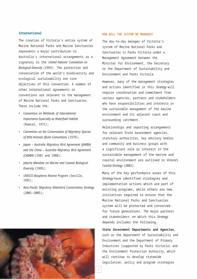
4
There are extensive shallow and deep sandy beds within the Central Victoria bioregion and these are predominantly inhabited by infauna (small crustaceans and worms that burrow into the sand) and bottom-dwelling fishes, such as skates and rays. However, there is also an interesting sponge clump community in the deep waters of the Point Addis Marine National Park. The deep sediments (coarse sand at approximately 50 m deep) are inhabited by clumps of sponges, hydroids, ascidians and bryozoans. These clumps of sessile invertebrates are approximately 0.5 m high and 2 m across, and provide habitat for fishes and other animals. Sponge clumps are not present on the shallower sediments at approximately 40 m depth, where only occasional solitary sponges or ascidians are present.
FLINDERS BIOREGION
The Flinders bioregion is represented by:
• Wilsons Promontory Marine National Park
The Flinders bioregion has less exposure to swells compared with other regions. However, this region is subject to high current flows and high winds. The winds can create substantial surface waves, affect local currents and cause turbidity. The coastal landforms of this region, encompassing Wilsons Promontory, Flinders Island and the other islands of the Furneaux Group, are comprised of granite headlands and outcrops, interspersed with sandy beaches. The granite reefs typically drop steeply to sand within a short distance from the shore (tens to hundreds of metres). The reefs consist of a variety of forms: smooth, featureless reef; deep vertical walls; fissures and pinnacles; boulder fields (with boulders ranging from 1 to 5 m in size) creating extensive overhang and cavern spaces; and rubble beds (0.1–1 m cobble and boulders). There are extensive deepwater and shallow sandy beds within the Flinders bioregion. Although the dominant biota of this region consists of a mixture of species from all of the adjacent biogeographical provinces, the eastern and southern provincial species appear to be more prevalent than the western province species.
The Victorian portion of the Flinders bioregion encompasses Wilsons Promontory and its adjacent islands to the west and east. A dense canopy cover of Phyllospora comosa and Ecklonia radiata dominates most of the shallow reef habitat of Wilsons Promontory coast, particularly south of Tongue Point on the western coast and Cape Wellington on the eastern coast. The canopy cover is predominantly Phyllospora, (50–80% cover), with a lesser abundance of Ecklonia. The understorey consists of a very low cover of smaller algal species such as the erect coralline Haliptilon roseum, small browns Carpomitra costata and Halopteris sp. and fleshy reds such as Callophyllis rangiferinus, Plocamium angustum, Phacelocarpus peperocarpus and Rhodymenia australis. This habitat supports a relatively high species richness of mobile invertebrate species, including seastars such as Nectria ocellata, Nectria macrobrachia, Plectaster decanus, Petricia vernicina and Fromia polypora.
Invertebrates of shallow reef overhangs and deeper channel walls in the Central Victoria bioregion include the gorgonian coral Mopsella klunzingeri and a variety of sponges and bryozoans shown here. (Photography Matt Edmunds).

4
Seastars, including the velvet star Petricia vernicina, are a diverse component of the large, mobile invertebrate reef fauna. (Photography Matt Edmunds).
A large variety of fish species, in high abundances, are also present in the Phyllospora habitat. The fishes include large aggregations of barber perch Caesioperca rasor and silver sweep Scorpis lineolata, in addition to relatively high densities of blue-throated wrasse Notolabrus tetricus, purple wrasse N. fucicola, herring cale Odax cyanomelas, magpie morwong Cheilodactylus nigripes and old wife Enoplosus armatus.
Fish abundances are relatively high at Wilsons Promontory and include large aggregations of sea sweep Scorpis aequipinnis, barber perch Caesioperca rasor and butterfly perch Caesioperca lepidoptera. (Photography Matt Edmunds).
More sheltered reefs, particularly along the northern coasts and on the leeward (northeasterly) coasts of the islands, tend to have a predominance of Ecklonia radiata and Seirococcus axillaris in the canopy, as well as a higher cover (and diversity) of understorey and other small seaweeds. The common sea urchin Heliocidaris erythrogramma and feather star Cenolia trichoptera are also more abundant on the more sheltered reefs.
Much of the shallow reef in the Wilsons Promontory Marine National Park consists of Phyllospora – Ecklonia habitat. However, some of the more sheltered regions,such as within Fenwick Bight and Waterloo Bay on the east coast, have more mixed, Ecklonia–Seirococcus assemblages. Patches of algal turfs and the green Caulerpa obscura are also common in these moderately sheltered bays.
Caves and crevices at the base of large boulders provide habitat for fishes such as bullseye Pempheris multiradiata. (Photography Matt Edmunds).
Most of the reefs in the Wilsons Promontory region consist of massive boulders, fissures, caverns, steep walls and overhangs. The surfaces of these walls and caverns are covered in a diverse array of sponges, bryozoans, ascidians and hard and soft corals. The caves also provide habitat for fishes such as boarfish Pentaceropsis revicurvostris, bullseye Pempheris multiradiata, Port Jackson sharks Heterodontus portusjacksoni and banded morwong Cheilodactylus spectabilis.
In contrast, some reefs consist of smooth, unstructured pavement reef with little or no cracks and crevices. The periwinkle Turbo undulatus is generally the only mobile invertebrate found on these pavement reefs.

4
Typical invertebrate animals covering rocky surfaces under ledges and on deeper vertical walls. Species here include a varietyof encrusting sponges, yellow zoanthid Parazoanthus sp. (left) and jewel anemone Corynactis australis (right).(Photography Matt Edmunds).
The reefs on the northeastern and northwestern coasts of the Promontory drop quickly to sand between 12 and 20 m depth. The reefs of the southern Promontory also drop steeply to sand, but at depths of up to 40 m around the mainland and up to 60 m around the adjacent islands. Ecklonia radiata and smaller seaweeds are more dominant in the intermediate depths (20–30 m) on more gently sloping reefs or tops of boulders, with the cover of sponges, ascidians and bryozoans also being higher. On the deep reef regions from 30 m depth and vertical walls from 20 m depth, massive sponges, whip corals, soft corals and colonial ascidians cover much of the reef. This spectacular community is particularly prevalent on bommies, pinnacles and reefs with high exposure to currents, such as around Skull Rock (Cleft Island) and the Glennie Group. Large aggregations of butterfly perch Caesioperca lepidoptera inhabit these deeper habitats.
Deep reefs at Wilsons Promontory have a variety of massive sponges and are usually inhabited by butterfly perch Caesioperca lepidoptera. (Photography Matt Edmunds).
The Wilsons Promontory Marine National Park encompasses most of the very deep reef habitats in the region. Deep reefs outside the Park are present around the Glennie Group, Norman Island, Shellback Island and Cape Wellington. The Wilsons Promontory Marine National Park also encompasses representative areas of beach, shallow sandy seabed and deep sandy seabed habitats.
The Wilsons Promontory Marine National Park has a large breeding colony of Australian fur seals Arctocephalus pusillus on Kanowna Island, with many other haul-out areas along the coast. Other large animals, such as the great white shark Carcharadon carcharias, common dolphin Delphinus delphis, bottle-nosed dolphin Tursiops truncatus, killer whale Orcinus orca and southern right whale Eubalaena australis also frequent the region. The surrounding coastal waters are also important foraging grounds for seabirds such as the little penguin Eudyptula minor, short-tailed shearwater Puffinus tenuirostris,fairy prion Pachyptila turtur and black-browed albatrossDiomedea melanophris.

4
TWOFOLD BIOREGION
The Twofold bioregion is represented by:
• Ninety Mile Beach Marine National Park
• Point Hicks Marine National Park
• Cape Howe Marine National Park
• Beware Reef Marine Sanctuary
The western portion of the Twofold bioregion consists largely of a long sandy beach (Ninety Mile Beach) with extensive areas of inshore and offshore sandy beds. This regionalso has occasional strips of low-relief calcarenite reef immediately behind the surf zone (7–25 m deep), such as within the Ninety Mile Beach Marine National Park at Seaspray. The sandy habitats of the far eastern coastline are punctuated by rocky headlands and localised outcrops of granite and metamorphic rocks, such as at Cape Conran, Point Hicks, Rame Head, Gabo Island and Iron Prince. Sea temperatures are often much warmer in the Twofold region than elsewhere in Victoria because of the warm East Australia current travelling down the eastern coast of the continent. However, the continental slope is quite close to the far eastern Victorian shore and cold-water upwellings are frequent. These upwellings provide nutrients to the inshore ecosystems, contributing to higher productivity.The biota of this region has a high component of eastern temperate species, in addition to many southern temperate and cosmopolitan species.
The Ninety Mile Beach habitats of the Twofold bioregion consist of extensive areas of surf beach as well as shallow and deep sandy seabeds. The animal community living within the sediment beds of the western Ninety Mile Beach region, including burrowing worms and small crustaceans, has an exceptionally high species richness.
A strip of low-profile calcarenite reef is often present behind the surf break, between 5 and 20 m depth. Various portions of the reef are periodically covered by sand transported by wave action and strong currents. Large seaweeds are not present on this reef habitat. The reef has a high cover of sponges and ascidians, with low cover of small red algae, bryozoans and hydroids. These reefs are important foraging ground for snapper Chrysophrys auratus and juvenile great white shark Carcharadon carcharias, which feed on the snapper. This type of habitat is represented in the Ninety Mile Beach Marine National Park. This Park also contains the unusual soft coral Pseudogorgia godeffroyi, which is found only in the western Ninety Mile Beach region.
The shallow reefs of the eastern Twofold bioregion (Cape Conran to Cape Howe) are inhabited largely by Phyllospora communities. However, the Phyllospora community of the Point Hicks region is quite different to that of the Gabo Island – Cape Howe region. The Point Hicks community has a relatively high abundance and diversity of small thallose red algae (as understorey and on open reef patches). In comparison, the Phyllospora assemblages near Cape Howe are largely depauperate of any understorey algae, with the reef predominantly covered by either encrusting coralline algae or encrusting sponges. These two Phyllospora communities are represented in the Point Hicks andCape Howe Marine National Parks.
Gorgonia Fan Mopsella klunzingeri at Beware Reef. (Photography John Ariens).
The Point Hicks Phyllospora community includes moderate abundances of blacklip abalone Haliotis rubra and relatively high abundances of the predatory whelk Cabestana spengleri and the seastar Patiriella calcar. The Cape Howe Phyllospora community has high abundances of Haliotis and periwinkle Turbo undulatus.
A prominent invertebrate of the eastern Twofold bioregion is the long-spined black sea urchin Centrostephanus rodgersii. Centrostephanus forms large grazing aggregations where it denudes the reef of Phyllospora and other erect algal species, forming ‘sea urchin barrens’. These barrens are present on small patches throughout the region between Cape Conran and Cape Howe. The urchin barrens cover extensive areas around Gabo and Tullaberga Islands, near Mallacoota.

4
The black sea urchin Centrostephanus rodgersii is an important habitat shaper in the Twofold bioregion. The smaller white sea urchin here is Heliocidaris erythrogramma, a common and ecologically important species throughout Victoria. (Photography Matt Edmunds).
The fish assemblages associated with the Twofold Phyllospora communities are quite different to Phyllospora communities elsewhere in Victoria. There are higher abundances of banded morwong Cheilodactylus spectabilis, Neoodax balteatus, maori wrasse Ophthalmolepis lineolata, one-spot puller Chromis hypsilepis and white-ear damselfish Parma microlepis. The eastern blue grouper Achoerodus viridis is also a prominent species, but present in low numbers.
On deeper reefs the abundance of common kelp Ecklonia in the canopy increases substantially, particularly in the Point Hicks region. At Point Hicks Ecklonia is the dominant species at 10 m depth, with Phyllospora still an abundant component. At 15 m depth, Ecklonia is the principal canopy component. On the deeper, Ecklonia-dominated reefs, the assemblages beneath the canopy vary substantially from reef to reef. At Bemm River the reef is predominantly covered in encrusting coralline algae on the reef tops, with high abundances of filter feeders such as the ascidian Herdmania momus, feather star Cenolia trichoptera, feather duster worms Sabellastarte sp and sponges under ledges and on vertical rock faces. At Point Hicks, the reef beneath the canopy has a high cover of encrusting and erect sponges. In contrast, the Ecklonia assemblage at Sensation Reef (also within the Point Hicks Marine National Park) has a diverse and abundant understorey of small fleshy red algae (with many species found only in that area).
Sensation Reef, Pt Hicks, has a canopy of common kelp Ecklonia radiata at 15 m depth, with sponge gardens in deeper waters. The grey colony in the foreground is the soft coral Capnella gaboensis. (Photography Matt Edmunds).
From 15–20 m to approximately 40 m depth, the Ecklonia canopy thins out and is gradually replaced by a ‘garden’ of massive erect sponges, encrusting sponges, gorgonian coral Mopsella zimmeri, sea-whip coral Primnoella australasiae, and basket star Conocladus australis (on the corals). These deep reef habitats are present in both the Point Hicks and Cape Howe Marine National Parks.
Both the Point Hicks and Cape Howe Marine National Parks have extensive sandy beach and shallow sandy seabed areas, in addition to very deep sandy mud habitats(50–90 m deep).
Sea whips Primnoella australasiae are common on deeper reefs. (Photography Matt Edmunds).

4
VICTORIAN EMBAYMENTS BIOREGION
The Victorian Embayments bioregion is represented by:
(Port Phillip)
• Port Phillip Heads Marine National Park
• Point Cooke Marine Sanctuary
• Jawbone Marine Sanctuary
• Ricketts Point Marine Sanctuary
(Western Port)
• Yaringa Marine National Park
• French Island Marine National Park
• Churchill Island Marine National Park
(Corner Inlet)
• Corner Inlet Marine National Park
The Victorian Embayments bioregion consists largely of sheltered waters with extensive areas of subtidal and intertidal sediments. The larger embayments and inlets include Port Phillip, Western Port, Corner Inlet/Nooramunga, Gippsland Lakes and Mallacoota Inlet.
Some shallow reef areas are present in the larger embayments in Port Phillip and Western Port. Variations in salinity and temperature are much higher than on the open coast, and the habitats and biota are also often strongly influenced by the tidal regime. The biota of the Victorian embayments include a mixture of species found in estuarine and open coast environments.
In deeper and highly sheltered regions of embayments, protected from wave action, such as the central region of Port Phillip (20 m deep) and northern regions of Western Port and Corner Inlet, the sediments consist of finer particles that create muddy habitats. Coarser sediments are more prevalent where there is higher exposure to wave action, particularly near the entrances of the embayments.
The sediment beds of the Victorian Embayment bioregion provide important habitat for burrowing animals, including a high diversity of worms, crustaceans, molluscs and heart urchins. Many of these burrowing organisms are important to ecosystem functioning: they cycle nutrients and provide
food for other animals living above the sediment surface. Animals inhabiting open sediment surfaces typically include crabs such as the blue swimmer crab Portunus pelagicus, sand octopus Octopus kaurna, commercial scallop Pecten fumatus, eleven-armed seastar Coscinasterias muricata, smooth stingray Dasyatis brevicaudata and sand flathead Platycephalus bassensis. Sandy areas also provide important habitat for microscopic plants living in athin layer on the sand surface. Open sediment beds are represented within the Port Phillip Heads and Corner Inlet Marine National Parks. Intertidal mudflats are represented in the Yaringa, French Island and Churchill Island Marine National Parks.
Some of the Victorian Embayment bioregion sediments, particularly along the northern and eastern shores of Port Phillip, are covered by a dense layer of drift algae. These algal beds consist of a diverse mixture of red and green algal species that intertwine to form a mat. Thespecies structure varies considerably between seasons and from location to location. The algae do not attach to the sand and are readily moved by waves and currents. The drift algal beds often provide habitat for a variety of fishes, crabs and molluscs, and often support high abundances of the bivalve Electroma georgiana. Drift algal beds often occur near the Point Cooke, Jawbone and Ricketts Point Marine Sanctuaries.
Various locations in the northern and eastern regions of Port Phillip, Western Port and channels within Corner Inlet are inhabited by the sea squirt Pyura stolonifera. Individual animals cement together in clumps of up to 100 animals, up to 0.5 m across, and produce long root-like structures that anchor them in the sand. These clumps occur in aggregations and provide an attachment surface for seaweeds, particularly Caulerpa remotifolia. This Pyura – Caulerpa assemblage provides habitat for many animals, including the blue-ringed octopus Hapalochlaena maculosa and red swimmer crab Nectocarcinus integrifrons, as well as foraging areas for snapper Chrysophrys auratus. Pyura beds are present in channels of the Corner Inlet Marine National Park, and near the Point Cooke, Jawbone and Ricketts Point Marine Sanctuaries.
4
Banjo rays Trygonorrhina fasciata are common on sediments of Victorian embayments. This individual is amongst a sparse stand of the seagrass Halophila ovalis. (Photography Matt Edmunds).
Seagrasses provide habitat structure to large areas of the Victorian Embayment bioregion and are very important providers of primary production – most of Western Port’s primary production is by seagrasses.
Extensive meadows of the seagrass Heterozostera tasmanica are present around the coast of Port Phillip, particularly in Swan Bay and Mud Islands (within the Port Phillip Heads Marine National Park), as well as near Rye on the Mornington Peninsula and Clifton Springs on the Bellarine Peninsula. There are extensive beds of the subtidal seagrass Heterozostera tasmanica and intertidal seagrass Zostera muelleri within Western Port. These communities are represented within the French Island Marine National Park, along the northern coast of French Island, and the Churchill Island Marine National Park on the north-eastern coast of Phillip Island.
A variety of seagrass species inhabit the sediments of Corner Inlet. These include Heterozostera tasmanica, Zostera muelleri, Halophila ovalis and Posidinia australis. The only extensive beds of Posidonia in Victoria are present in Corner Inlet, including within the Corner Inlet Marine National Park.
Saltmarsh and mangrove communities are present on sheltered coasts of most Victorian embayments, between the highest tide level and mid-tide level. Saltmarsh communities are characterised by floristically diverse assemblages of salt-tolerant grasses and shrubs.
The beaded glasswort Sarcocornia quinqueflora is particularly abundant in the seaward regions of saltmarshes, with rush Juncus and tea-tree Melaleuca species occupying landward regions of the saltmarsh. Saltmarsh habitats are represented in the Port Phillip Heads (Mud Islands), Yaringa and French Island Marine National Parks.
Mangrove communities are dominated by the white mangrove Avicennia marina. Mangroves are often present seaward of saltmarshes. Mangroves are present in the northern part of Port Phillip (within the Jawbone Marine Sanctuary) and in fragmented pockets around the Western Port coast, including within the Yaringa, French Island and Churchill Island Marine National Parks.
The sediment channels of the embayments are usually strongly influenced by tidal currents and particulate organic matter, providing important habitat for a range of filter feeding animals. These include the seapen Virgularia mirabilis and lampshell Magellania flavescens in the 10–30 m deep channels of Western Port. Magellania, along with the burrowing molluscs Neotrigonia margaritacea and Anadaria trapezia, are ancient species with a long history in the geological record. These species are represented in or near the French Island and Churchill Island Marine National Parks.
Reef habitats in the Victorian Embayments bioregion are typically limited to areas of greater depth, water turbulence and/or wave exposure, such that the reefs are not inundated by sand.
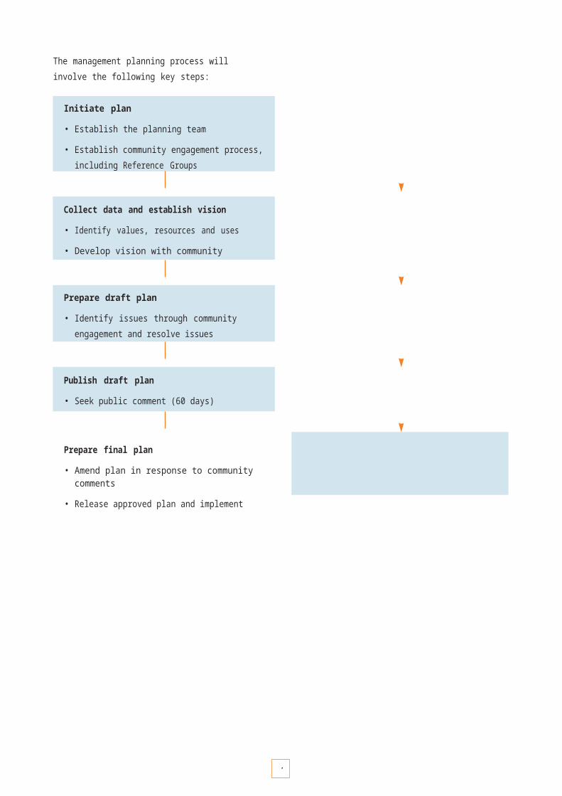
4
Embayment reef habitats are present alsong the shore regions of Port Phillip, the western and south-eastern coasts of Western Port (and northern coast of Phillip Island), and around small islands of Corner Inlet. The biota on embayment reefs is highly determined by environmental conditions, particularly water turbidity, salinity and nutrients. Reefs in the northern part of Port Phillip generally do not have a dominance of large native seaweeds. However, small species of seaweeds do contribute to the habitat structure, along with mussels and ascidians. These reefs are represented in the Point Cooke, Jawbone and Ricketts Point Marine Sanctuaries. Reefs in and near the Point Cooke and Jawbone Marine Sanctuaries also support high abundances and high productivity of blacklip abalone Haliotis rubra.
Reefs in northern Port Phillip are typically inhabited by blue mussels Mytilus edulis and seastars, such as this Uniophora granifera. (Photography Matt Edmunds).
Reefs in the south of Port Phillip are more reflective of sheltered coastal reef communities. There is a high diversity of community types in this location, as the environment grades from sheltered shallow reefs well inside Port Phillip Heads to highly swell-prone and current-affected reefs in the vicinity of the Heads. These community structures include Caulerpa – Ecklonia – Sargassum, Ecklonia, Ecklonia – Seirococcus, Ecklonia – Phyllospora, Phyllospora and mixed brown algal dominated assemblages. Many of these community types are represented within the Port Phillip Heads Marine National Park.
The Pope’s Eye Annulus in southern Port Phillip Bay, part of the Port Phillip Heads Marine National Park, is an important nesting area for the Australasian gannet Morus serrator, as well as being a haul-out site for the Australian fur seal Arctocephalus pusillus. The bottle-nosed dolphin Tursiops truncatus also frequents the Port Phillip Heads region, particularly along the northern shore of Mornington Peninsula (including Nepean Bay).

P R O T E C T I N G N A T U R A L V A L U E S
47

4
P R O T E C T I N G N A T U R A L V A L U E S
Victoria’s system of Marine National Parks and Marine Sanctuaries has been established to protect and conserve representative examples of biodiversity, ecological processes and natural features. This system has many intrinsic values that create a wealth of natural capital for all Victorians. The system is principally valued for the health and integrity of its biodiversity and ecological processes, which must be maintained for future generations.
Intrinsic natural values protected by the system include:
• a rich diversity of marine life and habitats;
• ecological processes that support this diversity of marine life and contribute to the overall health and productivity of the marine environment;
• marine life that is unique to Victoria;
• marine life that is vulnerable or threatened with extinction;
• a diverse array of natural seascapes; and
• geologically and geomorphologically significant natural features.
Diversity and richness
Victoria’s marine life has many more species than most comparable areas in the world. It is estimated that well over 12,000 species of marine plants and animals occur in Victoria’s nearshore waters. The system encompasses a comprehensive range of different habitat types and communities to ensure that a selection of our rich biodiversity is highly protected.
Ecological processes and critical habitats
A highly protected system will help ensure that ecological processes such as species interactions, reproduction and foraging will go on undisturbed as far as possible. Many species depend on particular habitats for their survival, spending all or part of their life cycle in one habitat. Habitats provide shelter, food and a place to breed for a wide range of species.
Uniqueness
The Marine National Parks and Sanctuaries contain species, community assemblages and habitats that are not widely distributed across southern Australia, and many are endemic to this region. Some individual species that have been found in recent years are new to science and are yet to be formally named.
Vulnerable or threatened marine life
A number of marine species and communities either listed or recommended for listing as threatened under the Flora and Fauna Guarantee Act 1988 occur within the system. Other species are considered rare and their conservation status is presently uncertain. Larger migratory species such as marine birds and cetaceans (whales and dolphins) that are nationally or internationally recognised as threatened are known to visit Victoria’s Marine National Parks and Marine Sanctuaries from time to time.
Seascape diversity
The diversity of underwater seascapes across Victoria creates settings for a range of underwater experiences. Geological processes and weathering of different rock types interacting with physical factors such as waves, currents, tides and wind, have formed distinctive seascapes such as rocky outcrops, reef flats and boulders. The diversity of soft sediment seascapes results from processes such as deposition of calcareous materials from the remains of sea animals, the erosion of quartz from rocks, and the deposition of muddy sediments from terrestrial rivers and runoff.
Geomorphologically and geologically significant features
Many geomorphological and geological features are of special scientific and educational value. The visual and aesthetic qualities of the coast are highly valued in Victoria. A Guide to Landscape Setting Types for the Victorian Coast (1998) has been developed as an initiative of the Victorian Coastal Council to describe the variety of structural landscapes and physical processes which underpin the visual and emotional experiences available to all Victorians and visitors to the State, and to outline areas of significant value and sensitivity. A number of areas represented within or directly adjacent to Marine National Parks and Marine Sanctuaries are considered visually significant and unique to Victoria, such as Port Phillip Heads, the Twelve Apostles and Cape Bridgewater.

4
PROTECTING AND MAINTAINING THE SYSTEM
Victorians are fortunate to have marine environments in relatively good health compared with other regions around the world. However, we must recognise that human activities on both sea and land can put pressure on the health and integrity of the marine environment, and cause loss or damage to natural values. Pressures on Victoria’s marine environments include urban, agricultural, industrial and shipping pollution, excessive sedimentation, physical disturbance, over-harvesting and the introduction of exotic organisms.
While some of these pressures originate from and can be managed within the boundaries of Marine National Parks and Sanctuaries, other pressures originate externally. For this reason the management of the system must also involve understanding and working cooperatively with other managers and the community, in order to identify risks and develop strategies for ensuring the protection and improvement of the broader marine and estuarine environment.
Key challenges and issues associated with the protection of the natural values of Marine National Parks and Sanctuaries are:
• preventing and managing incursions of marine exotic species;
• developing enforcement and education strategies to ensure compliance and reduce illegal harvesting of marine species, and to minimise other illegal activities such as dumping of vessel waste;
• planning for the risk of marine incidents such as oil spills, cetacean strandings and new marine exotic pest incursions, and building our capacity to respond to them;
• ensuring that appropriate levels of environmental assessment are undertaken by responsible coastal and catchment managers with respect to existing and future planning, infrastructure and development proposals that may have an impact on Marine National Parks and Sanctuaries;
• increasing our understanding of vulnerable marine habitats such as seagrass beds, mangroves and saltmarshes, and threatened marine species;
• integrating with existing risk management processes and decision support systems to help set priorities to protect Marine National Parks and Sanctuaries; and
• managing for an acceptable range of visitor uses (see Recreation, Tourism and Visitor Management, pages 89–97).
Western blue devilfish Paraplesiops meleagris.(Photography William Boyle).
Sponges and red mullet Upeneichthys vlamingii. (Photography Mary Malloy).

5
ENVIRONMENTAL MANAGEMENT FRAMEWORK
Understanding the range of direct and indirect threats to the natural values of Marine National Parks and Sanctuaries, and setting priorities to minimise their risk of impact,is fundamental to the management of the system. The strategic analysis of risks involves assessing and describing the relationship between threats and their potential to impact on specific values. This type of assessment provides information to managers to facilitate priority setting, resource allocation and informed decision-making.
A key challenge to support the effective management of the Marine National Parks and Sanctuaries will be tointegrate risk assessment approaches and data sets suitable for the marine environment into existing decision support systems for the terrestrial park system. This framework will support decisions on the planning, delivery and assessment of conservation programs.
Definitions
What is a threat?
A threat is a biological, chemical or physical entity or process that has the potential to impact on (harm) natural values. A threat can be a entity such as a marine pest or a process such as increased sediment inputs.
What is risk?
Risk is the consideration of issues such as the likelihood of a threat occurring and impacting on natural values, how severe its impact might be, and also what the consequence(s) might be if the threat is not managed. By considering these issues together, priorities can be set for developing actions to manage the threat.
What is an impact?
An impact is the effect a threat has on natural values. For example, increased sediments (threat) may impact on seagrass by causing turbidity in the water, so that light is reduced and the seagrass is not able to photosynthesise adequately and is reduced in cover and/or density.
Management framework
A key direction for the management of Victoria’s Marine National Parks and Sanctuaries will be to continue to implement the adaptive management framework directed by Victoria’s Biodiversity Strategy (1997). Parks Victoria has adopted this adaptive management framework in the form of an environmental management framework (EMF) based on the International Standard for Environmental Management Systems (ISO 14001). The main elements of the EMF are:
• identifying and describing the significance and condition of natural values;
• identifying and describing the threats to identified natural values;
• assessing which threats pose the greatest risk to natural values;
• setting management objectives;
• developing and implementing management actions to ameliorate threats; and
• measuring the effectiveness or success of those actions in meeting objectives.
The cyclic nature of the EMF (illustrated in Figure 4) provides for ongoing learning by continually assessing the success of past management actions in meeting management objectives, thus allowing refinement(if necessary) to management actions in the future.
The EMF is logical and provides a consistent approach to the development and delivery of environmental management programs. The EMF will apply to all levels of planning and delivery of environmental management programs for Marine National Parks and Sanctuaries.
Following an assessment of threats and their risk to each Marine National Park and Marine Sanctuary, priority management actions will be identified and negotiatedto be implemented by responsible management agencies.
Establishing and improving relationships and partnerships with management agencies and the community will be important in achieving objectives.

1K E Y P E R F O R M A N C E A R E A 1
E n v i r o n m e n t a l m a n a g e m e n t f r a m e w o r k
OBJECTIVE DESIRED OUTCOMES RESPONSIBILITY
1.1 To apply existing environmental management framework to support management programs across all Marine National Parks and Sanctuaries
Informed decision making across all Marine National Parks and Sanctuaries.
Desired management outcomes achieved for protecting natural values.
Parks Victoria with support from DSE/DPI
Strategies Implementation Actions Target
1.1.1 Apply risk assessment and decision support procedures to the marine environment.
• Ensure existing databases, geographic information systems and decision support protocols can be applied effectively to the management of Marine National Parks and Sanctuaries.
By July 2004
1.1.2 Develop marine natural values and risk assessment protocols.
• Complete natural values report for all Marine National Parks and Sanctuaries.
• Complete risk assessment for all Marine National Parks and Sanctuaries.
By July 2005
By July 2005
IDENTIFY AND ASSESS CONDITION OF NATURAL VALUES– What are the most dominant and significant natural values?– Which are the most sensitive to threats?
NATURAL VALUES
IDENTIFY DESIRABLE CONDITION
IDENTIFY AND ASSESS THREATS TO NATURAL VALUES– Which threats pose the greatest risk to natural values?
THREAT MANAGEMENT
EVALUATION– Assess the success of management
actions in managing threats.– Assess the trend in condition to check
that priority threats are being identified.
SET MANAGEMENT OBJECTIVESDEVELOP AND IMPLEMENT MANAGEMENT ACTIONS– Actions developed to ameliorate threats.
Figure 4 Environmental management framework for Victoria’s parks and reserves.
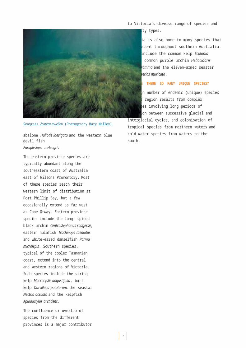
51
5
VULNERABLE HABITATS AND THREATENED SPECIES
Certain marine habitats and species are particularly sensitive to impacts from human activities, either indirectly from coastal and catchment activities or from direct human activities. Habitats and marine species of particular concern represented within the system of Marine National Parks and Sanctuaries include the following.
Intertidal habitats
Intertidal habitats are often highly accessible and are therefore vulnerable to the direct physical disturbance of trampling and removal of biota for collection, bait and food.
Seagrass beds
In some areas of Port Phillip, Western Port and Corner Inlet embayments there is evidence that seagrass communities have fluctuated over the last 20 years. It is believed declines are linked in some areas to catchment activities and draining of coastal wetlands, which have led to increased sediment deposition, turbidity and high ambient nutrient levels.
Saltmarsh communities
Saltmarsh communities have been declining rapidly throughout south eastern Australia since the 1960s. Thereis strong evidence that saltmarsh loss is linked to catchment activities that cause similar impacts to those described for seagrass beds above. With the decline of saltmarsh there is often an associated expansion of mangrove species which intrude into areas normally occupied by saltmarsh, although the mechanics of this relationship are not fully understood. In addition, direct physical disturbance through activities such as the building of causeways and levee banks, and the use of these areas as waste dumps, has further reduced the extent of saltmarsh in Victoria.
Threatened marine species
The majority of larger marine species listed as threatened under State, National or International legislation, such as the southern right whale, are transient in nature and only visit certain parts of the Marine National Parks and Sanctuaries system from time to time. However, a number of marine invertebrates have been identified as suitable for listing as threatened under the Flora and Fauna Guarantee Act 1988 (Table 3) due to their limited distribution and/or dependence on a particular habitat that is considered vulnerable (e.g. seagrass beds). Management of these habitats, rather than attempting to manage threatened species in isolation from their environments, is far more likely to lead to a higher level of success in protecting and enhancing threatened species populations. Whole-of- habitat management may also inadvertently result in the protection of species not yet identified, due to their rarity or cryptic nature.
Management framework
The protection and conservation of vulnerable marine habitats and threatened marine species within the system of Marine National Parks and Sanctuaries is principally dependent on cooperation and integrated planning by management agencies and communities for the adjacent coast and catchments. Successful implementation of the actions developed for the Victorian Coastal Strategy (2002), Victorian Biodiversity Strategy (1997), State Environment Protection Policies (Waters of Victoria) and Regional Catchment Strategies (to be completed in 2003) will lead to a reduction of pollutant inputs and improvement in marine and estuarine water quality.
Within Marine National Parks and Sanctuaries, activities can be regulated to minimise direct human disturbance by visitors and recreational activities. These include controlling access to vulnerable intertidal areas to reduce trampling, and enforcing controls on the illegal taking of plants and animals. Other management controls may be required to minimise the potential impacts of anchor damage, motor- boat propellers and diving activities. Strategies and implementation actions for tourism, recreation and visitor uses are described on pages 89 to 97.
Seagrass Posidonia australis with gastropod Thalotia conica and triangle crab Trigonoplax sp. (Photography Mark Norman).

5
K E Y P E R F O R M A N C E A R E A 22
V u l n e r a b l e h a b i t a t s a n d t h r e a t e n e d s p e c i e s
OBJECTIVE DESIRED OUTCOMES RESPONSIBILITY
2.1 To protect vulnerable marine habitats and threatened species associated with Marine National Parks and Sanctuaries, and adjacent marine areas.
No further significant decline in the area or condition of vulnerable marine habitats. No increase in area of degraded habitats within Marine National Parks and Sanctuaries.
Parks Victoria with DSE/DPI and EPA. All agencies to recognise their responsibilities in relation to habitat recovery.
Strategies Implementation Actions Targets
2.1.1 Lead and assist, where necessary, in restoration and monitoring programs for degraded areas such as intertidal reefs, seagrass and saltmarsh.
• Investigate the feasibility of establishing community restoration programs for degraded marine habitats (such as seagrass) within Port Phillip, Western Port and Corner Inlet.
By June 2004
2.1.2 Monitor long term changes in the area and condition of vulnerable marine habitats such as intertidal reefs, seagrass and saltmarsh.
• Establish monitoring protocols and baseline data sets for vulnerable marine habitats within Marine National Parks and Sanctuaries.
By July 2005
2.1.3 Ensure natural values assessments for Marine National Parks and Sanctuaries include consideration of threats to vulnerable marine habitats and threatened marine species.
• Complete natural values risk assessment reports for all Marine National Parks and Sanctuaries.
• Complete conservation assessment of threatened marine plants.
By July 2005
By July 2006
Table 3 Marine invertebrate species recommended for listing as threatened under the Flora and Fauna Guarantee Act 1988 (O’Hara and Barmby 2000) that have been recorded within a Marine National Park, Marine Sanctuary, or within an adjacent Marine and Coastal Park.
Species Location
Halicarcinus sp.(undescribed crab) Ninety Mile Beach Marine National Park
Athanopsis australis(ghost shrimp) Ricketts Point Marine Sanctuary
Eucalliax tooradin(ghost shrimp) Port Phillip Heads Marine National Park (Swan Bay)
Amphiura trisacantha(brittle-star) Nooramunga Marine and Coastal Park (and possibly Corner Inlet Marine National Park)
Ophiocomina australia(brittle-star) Nooramunga Marine and Coastal Park (and possibly Corner Inlet Marine National Park)
Apsolidium densum(sea-cucumber) Mushroom Reef Marine Sanctuary
Pentocnus bursatus(sea-cucumber) Bunurong Marine National Park
Trochodota shepherdi(sea-cucumber) Corner Inlet Marine National Park and Nooramunga Marine and Coastal Park
Bassethulia glypta
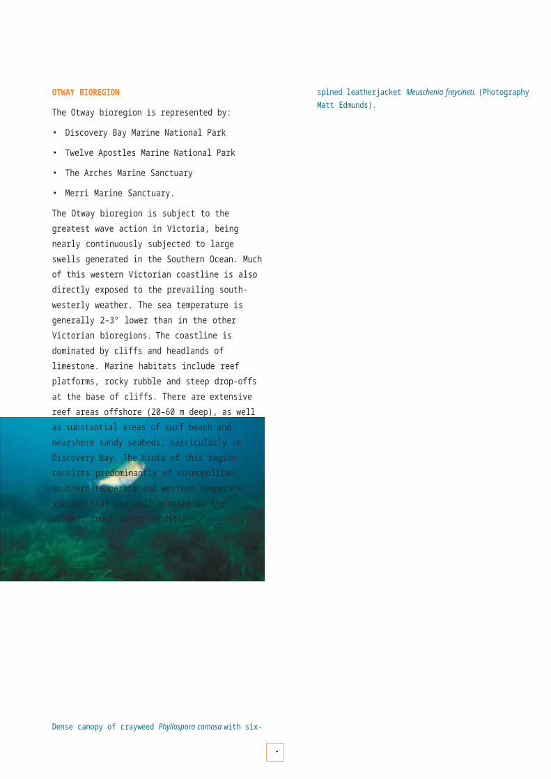
5
(chiton) Port Phillip Heads Marine National Park and Mushroom Reef Sanctuary

5
Volunteers collecting biological information on seagrass. (Photography Environment Protection Authority).
Seagrass Restoration in Western Port
The Western Port Seagrass Restoration Project aims to develop optimum seagrass replanting techniques that form part of the long-term strategy of protecting and improving the Western Port environment. Research into reporting techniques for restoring this important habitat is currently under way at Newhaven and Coronet Bay.
Throughout the project, community volunteers have been working side by side with marine biologists to develop seagrass replanting techniques. The project also serves to educate and empower community groups to become proactive in this and other environmental projects in the region.
The project is supported by the Natural Heritage Trust, Environment Protection Authority and the community- based Western Port Seagrass Partnership.

5
MARINE PESTS
The introduction of marine pests threatens the integrity of marine biodiversity and may reduce the social and economic benefits derived from the marine environment. Most marine pests known from Victorian waters are limited to Port Phillip. Species of particular concern include the northern Pacific seastar (Asterias amurensis), marine fanworm (Sabella spallanzanii), Japanese kelp (Undaria pinnatifida) and broccoli weed (Codium fragile ssp. tomentosoides).
Various human activities can lead to the introduction of marine pests to new areas. They include the discharge of ships’ ballast water and the dislocation of fouling organisms from the hulls of ships, small vessels or aquaculture equipment. Many of these activities require national and international action by industry, government and non- government organisations, along with State-based action.
Prevention is better than cure; therefore the priority is to reduce the risk of new introductions. To date, attempts to eradicate marine pests after they have become established have been successful only in limited circumstances. Some eradication techniques, such as physical removal by hand or machine, need to be carefully considered, as they can make the situation worse. In the case of broccoli weed for example, physical removal can promote the spread of this pest to other areas, because this species can fully regenerate from small fragments of tissue that may be dislodged or left behind on rocks or pylons during removal.
Nothern Pacific seastar Asterias amorensis is a marine pest thought to have invaded Port Phillip in the late 1990s. (Photography Department of Sustainability and Environment).
The marine fanworm Sabella spallanzanii is a marine pest that has invaded many parts of southern Australia. (Photography Department of Sustainability and Environment).

5
Management framework
The Action Statement Introduction of Exotic Marine Organisms into Victorian Marine Waters, prepared under the Flora and Fauna Guarantee Act 1988, outlines Victoria’s management directives for marine exotics. State-based action has included regulations for preventing new incursions through the Waste Management Policy for Ships’ Ballast Water, to be finalised in 2003, and procedures for incursion management, detailed in the Interim Victorian Protocol for Managing Exotic Marine Organism Incursions (1999) and supported through the National Consultative Committee on Introduced Marine Pest Emergencies.
Vessel Cleaning and Maintenance Guidelines to Help Prevent the Spread of Marine Pests (to be finalised in 2003) have been developed through a partnership with skippers of small vessels and local port operators. These guidelines aim to reduce the risk of spreading marine exotics along the coastline, by providing practical solutions for vessel operators and local port managers for cleaning their gear and hulls. Other supporting initiatives include EPA Victoria’s Cleaner Marinas Guidelines (1998).
Preventing introductions to new areas is currently the best management option for protecting the system of Marine National Parks and Sanctuaries, and the marine environment. Responsible Government agencies will provide for ongoing education and promotion of these guidelines to ensure that they are recognised and adopted by industry and local communities. Preventative management will also be supported through increased capacity building, staff training, and the development of marine pest risk assessment and ready response incursion management protocols for each Marine National Park and Marine Sanctuary.
Protecting Western Port from marine exotic organisms
Western Port is designated a wetland of international importance under the Ramsar Convention, and includes Churchill Island, French Island and Yaringa Marine National Parks. Western Port is relatively free of marine exotic organisms. In the absence of management, several high-risk vectors could lead to pest introductions into Western Port, including the discharge of ships’ ballast water and mussel rope transfers from Port Phillip.
The Port of Hastings in Western Port is the location of a National Demonstration Project to determine how both international and domestically sourced ballast water can be best managed. The Project will provide a port model for ballast water management that can be implemented in other Australian ports. It is an important step towards the development of a single national ballast water management regime.
EPA Victoria is managing the project on behalf of a Victorian Government consortium consisting of EPA Victoria, the Department of Sustainability and Environment and Department of Infrastructure. Partners in the project are the Australian Quarantine and Inspection Service and CSIRO’s Centre for Researchon Introduced Marine Pests. The project is supported by the shipping and port industries and Commonwealth Government agencies.
Mussel rope transfers are managed under an innovative cleaning protocol that sterilises the ropes, ridding them of marine pests, prior to their movement. The sterilising methods were developed through a partnership between the mussel industry and the Marine and Freshwater Resources Institute.
The Department of Sustainability and Environment is also working with the Bureau of Rural Science to map the movement of small vessels along the Victorian coast. The aim is to understand how Victoria’s local ports and marine environment, including Western Port, can be best protected from the accidental introduction of marine exotic organisms via this vector. Financial support for these projects has been provided by the Commonwealth Natural Heritage Trust, Coasts and Clean Seas program.
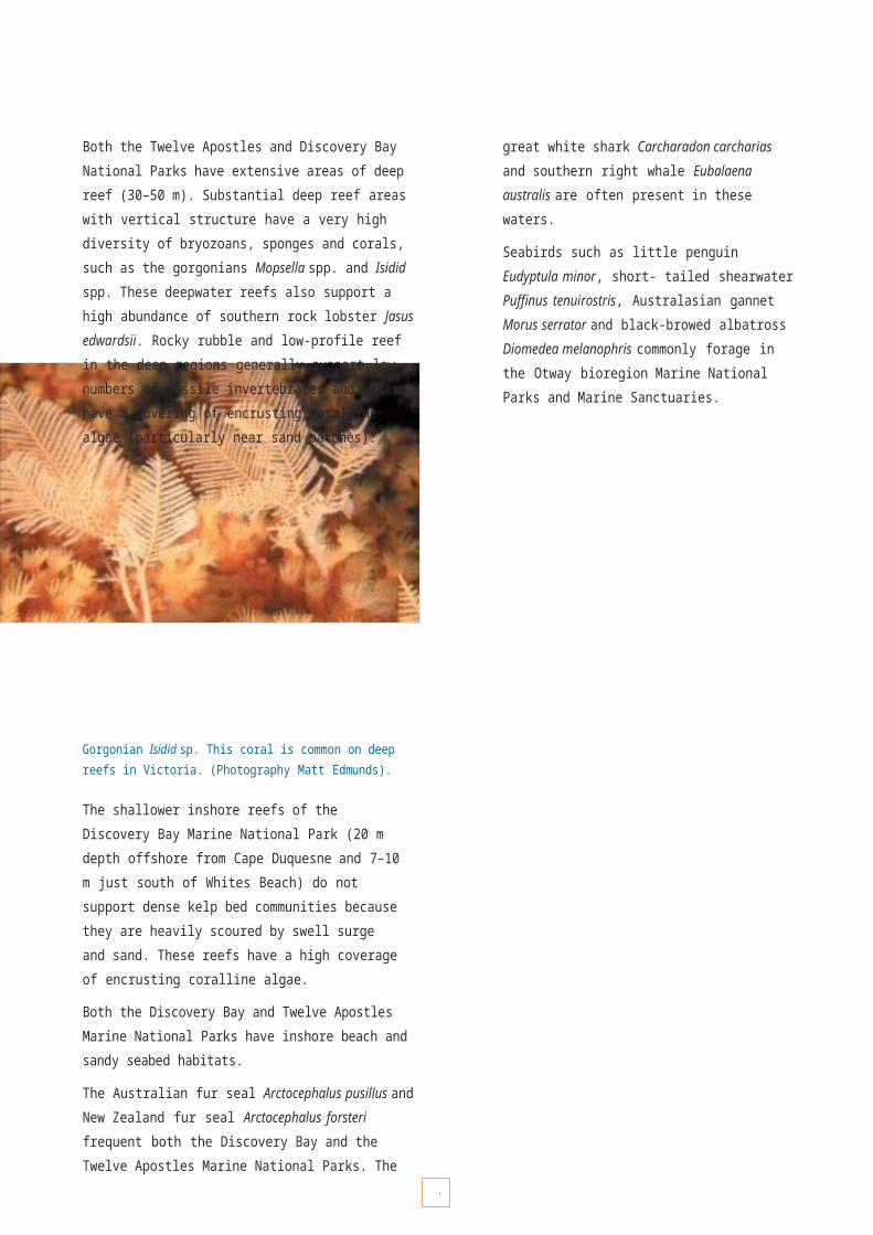
OBJECTIVE DESIRED OUTCOMES RESPONSIBILITY
3.1 To minimise the risks posed by the introduction of marine pests.
No new incursions to the system. Where incursions do occur, no appreciable loss or decline to condition of natural values.
Parks Victoria under policy directives of DSE/DPI and EPA.
Strategies Implementation Actions Targets
3.1.1 Develop a marine pest risk assessment and incident protocol for each Marine National Park and Marine Sanctuary.
• Completion of risk assessment reports and incident protocols for all Marine National Parks and Sanctuaries.
By June 2004, and updated every three years, or as necessary
3.1.2 Ensure that all biological surveys include consideration of the detection and reporting of marine pests.
priority marine pests.
• Detected species to be reported and recorded on National Introduced Marine Pest Information System and other relevant databases.
Ongoing
3.1.3 Ensure that relevant staff are trained in the identification of target marine pests and incident arrangements.
• Relevant field staff to complete specialist training, and be provided with identification kits.
By July 2004, and ongoing
3.1.4 Undertake community extension programs to promote vessel cleaning and maintenance guidelines for minimising the introduction of marine pests.
• Prepare and implement a communication plan for all regions.
By December 2003, and ongoing
3.1.5 Ensure that all management vessels adhere to new cleaning and maintenance guidelines.
• Adopt and comply with best practice vessel cleaning and maintenance standards.
By July 2003 and ongoing
3.1.6 Ensure that all marine infrastructure within Marine National Parks and Sanctuaries is treated to remove marine pests.
• Adopt and comply with best practice vessel cleaning and maintenance standards.
By July 2003 and ongoing
3.1.7 Ensure that all licensed tour operators, researchers, permit holders and contractors operating from vessels within Marine National Parks and Sanctuaries adhere to cleaning and maintenance standards as a condition of their licence agreement contract or permit.
• Adopt and comply with best practice vessel cleaning and maintenance standards.
By July 2003 and ongoing
5
K E Y P E R F O R M A N C E A R E A 3
M a r i n e p e s t s
• Surveys
3to
5
include methods to detect
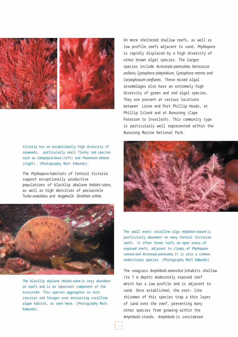
6
PRESSURES FROM COASTAL AND CATCHMENT ACTIVITIES
The nearshore marine environment is directly connected to the adjacent terrestrial environment and the dynamicinterface between them. Forces such as climate and tectonic movement have shaped many unique ecosystems, which are sensitive to changes caused by human activities. Decisions made on the coast and in catchments must consider flow- on effects to the adjacent marine environment.
Much of the coastline is readily accessible and compact. Coastal and catchment activities therefore have a profound influence on the health of the marine environment, particularly in bays, inlets and estuaries. Although 96%of Victoria’s coast is Crown land, with 50% managed under the National Parks Act 1975, approximately 80% of Victorians live in coastal catchments, and populations are increasing.
Urban development and industrial and agricultural activity create both diffuse and point-specific sources of pollution via stormwater drains, sewage outfalls and runoff. Nitrogen loading is a major concern in bays, inlets and estuaries.
Management framework
An integrated approach to planning and using the marine and coastal environment requires coordination of management activities on both land and sea. The Victorian Government is working to ensure that managing the marine and terrestrial environments involves the recognition, acceptance and shared understanding ofthe common goal of ecological sustainability.
The Victorian Coastal Strategy (2002), which is complemented by Victoria’s Biodiversity Strategy (1997), State Environment Protection Policies (Waters of Victoria) and Regional Catchment Strategies (to be completed in 2003), emphasises the importance of ecologically sustainable development, which means that environmental, social and economic implications are considered in an integrated way, and that decisions are made with a long-term view. The hierarchy of principles for decision-making are to:
1. provide for the protection of significant environmental features;
2. ensure the sustainable use of natural coastal features;
3. undertake integrated planning and provide direction for the future; and
4. facilitate the sustainable development of the coast when the above principles have been met.
Port Jackson shark Heterodontus portusjacksoni.(Photography Mark Norman).
Key actions that will be delivered to protect the marine environment from detrimental impacts from coastal and catchment activities include:
• programs to reduce the impacts of effluent, litter and diffuse pollution sources in marine and coastal environments;
• programs to control erosion and other processes that may have an impact on water quality or the overall condition of land and water resources;
• programs to re-establish native vegetation in particular parks and reserves to improve the overall condition of land and water resources;
• best-practice environmental guidelines for dredging activities;
• improved arrangements for the integration of catchment and coastal management;
• increasing community awareness and understanding of catchment, coastal and marine issues; and
• promotion of training opportunities to enhance integrated catchment, coastal and marine management and technical skills.

OBJECTIVE DESIRED OUTCOMES RESPONSIBILITY
4.1 To protect Marine National Parks and Marine Sanctuaries, and the broader marine environment, from pressures originating in the adjacent coastal zone and surrounding catchments.
• Partnerships, effective working relationships and communication established between responsible agencies and the community.
• Measurable decline in pollutant inputs to the marine environment from coastal and catchment activities.
All catchment and coastal managers, includingLocal Government and Committees of Management under policy directives of DSE/DPI and EPA and supported by Parks Victoria.
Strategies Implementation Actions Targets
4.1.1 Develop integrated arrangements for the management and planning of Marine National Parks and Marine Sanctuaries with adjacent coastal parks, Crown land reserves and other land wherever possible.
• Each Marine National Park and Sanctuary management plan to include an assessment of the opportunities for integrating management with adjacent parks, reserves and other land.
By June 2004 and ongoing.
4.1.2 Ensure that programs to improve soil erosion and native vegetation in parks and reserves of the adjacent coastal zone and catchment are prioritised to protect the values of Marine National Parks and Marine Sanctuaries.
• Priorities to be established after completion of issues and risk assessment analyses for each Marine National Park and Marine Sanctuary.
By November 2005 then ongoing.
4.1.3 Identify opportunities for partnership arrangements with Catchment Management Authorities, Regional Coastal Boards, local government, committees of management and community groups to develop strategies and actions which address threatening processes.
• Participate in coastal zone vulnerability assessments, as appropriate, to identify risks to maintaining the integrity of biological and physical processes in the Marine National Parks and Sanctuaries.
• Incorporate Marine National Park and Marine Sanctuary objectives into Regional Catchment Stategies.
• Involve all relevant management agencies in development of future management plans to promote integration and recognition of common issues with related regional coastal plans, regional catchment management strategies and other associated action plans.
• Review participation of Parks Victoria with the work of potential partners anddevelop opportunities to contribute to
Ongoing
Ongoing
Ongoing
Ongoing
4.1.4 Support an information-sharing framework to ensure that coastal and marine data can be accessed across all levels of government, the private sector and the community to improve local integrated planning and management.
• Contribute to the ongoing developmentof Internet- based information systems such as Marine Map – Victoria and the Victorian Node of the Australian Spatial Data Directory.
• Incorporate information on Marine National Parks and Sanctuaries into Parks Victoria’s website (ParkWeb).
Ongoing
Ongoing
K E Y P E R F O R M A N C E A R E A 4
P r e s s u r e s f r o m c o a s t a l a n d c a t c h m e n ta c t i v i t i e s

5
49

6
COMPLIANCE
International experience has clearly demonstrated that protection from illegal fishing and other harmful activities such as dumping of vessel waste is critical to the functioning and effective protection of a Marine National Park or Marine Sanctuary. It takes only a small amount of illegal fishing to remove a large proportion of the most vulnerable or popular species.
Commercially valuable species, such as abalone, are perceived to be subject to high levels of resource theft by an increasingly sophisticated group of poachers. A key challenge associated with the improved surveillance and enforcement required for the ongoing management of Marine National Parks and Sanctuaries is to prevent and address this theft through improved capabilities.
A Fisheries Officer provides information and advice. (Photography Department of Primary Industries).
Management framework
In Victorian coastal waters the principal legislation for the protection and sustainable use of marine resources is the Fisheries Act 1995. This Act provides for the protection and conservation of fisheries resources, habitats and ecosystems, as well as the maintenance of aquatic ecological processes and genetic diversity. Under the Act, the Department of Primary Industries has a major role in enforcing illegal fishing activities and ensuring fisheries compliance in all Victorian waters. Separate to the Fisheries Act, the National Parks Act 1975 establishes highly protected Marine National Parks and Marine Sanctuaries and prohibits extractive activities, including fishing. In these areas the National Parks Act is the principal legislation, complemented by relevant provisions of the Fisheries Act. The National Parks Act includes offences, penalties and powers to deal with illegal fishing activity and encourage a high level of compliance. DPI officers and Park rangers are authorised to undertake law enforcement activities under relevant legislation.
The Department of Primary Industries will work in partnership with Parks Victoria (and in some circumstances, the Victoria Police) to prevent the illegal removal of aquatic biota from Marine National Parks and Sanctuaries. The primary goals of this partnership will be to:
• provide effective enforcement as a deterrent against non-compliance;
• maximise voluntary compliance within the Marine National Parks and Sanctuaries; and
• provide regular and appropriate communication to ensure that the community is aware of all changes to management regimes within Marine National Parks and Sanctuaries.
The extension and education components of compliance programs complement active enforcement, and are aimed at achieving voluntary compliance. The priority will be to maximise the levels of voluntary compliance within the system through community involvement and ownership. The key to maximising voluntary compliance is to fully involve local communities. If the community feels a sense of ownership for a local Marine National Park or Sanctuary, it will be far more likely to help to protect it. Even withouta formal role in enforcement, the community can play a vital role in encouraging voluntary compliance in its local area.
OBJECTIVE DESIRED OUTCOMES RESPONSIBILITY
5.1 To establish and maintain collaborative arrangements for enforcement and compliance of legislation applicable to Marine National Parks and Marine Sanctuaries.
Formal partnership agreements and effective working relationships established between responsible agencies.
DPI (lead agency) / DSE with Parks Victoria supported by Victoria Police when necessary
Strategies Implementation Actions Targets
5.1.1 Develop a statewide management agreement that clearly defines the roles and responsibilities of agencies in fisheries enforcement and compliance, ensuring integrated compliance effort.
• Completion of statewide issues paper and statewide compliance strategy.
• Completion of statewide compliance agreement.
By 16 November 2002 and ongoing
5.1.2 Develop regional compliance plans that define management arrangements and levels of service for each Marine National Park and Marine Sanctuary, and other marine areas.
• Completion of regional compliance plans and regional service agreements with agreed objectives, actions and performance indicators.
By March 2003 and ongoing.
5.1.3 Develop information exchange protocols and procedures to share and provide access to information relevant to fisheries surveillance and law enforcement activities.
agreement with necessary protocols between responsible agencies.
By December 2003, and ongoing
OBJECTIVE DESIRED OUTCOMES RESPONSIBILITY
5.2 To understand the compliance needs and Where previously occurring, measurable decline and DPI (lead agency) / DSEpriorities across all Marine National Parks and maintenance of low levels of illegal harvesting and other with Parks VictoriaSanctuaries and other areas, to effectively illegal activities in all Victorian marine waters. Within supported by Victoriafocus compliance effort for illegal activities. Marine National Parks and Sanctuaries, reductions in levels Police when necessary
of illegal activity maintained.
Strategies Implementation Actions Targets
5.2.1 Develop strategic risk assessment profiles for all Marine National Parks and Sanctuaries.
• Completion of risk assessment profiles, with surveillance and enforcement priorities established.
By December 2003, and reviewed as necessary
5.2.2 Develop coordinated response arrangements across agencies to maximise enforcement.
• Development of measures to assess effectiveness of response arrangements and enforcement effort in deterring non-compliance.
By February 2003, and ongoing
5.2.3 Investigate the use of new technology and information management systems to support the compliance effort.
• Trials completed of technologies as they arise, with assessment of their efficiency and effectiveness.
Ongoing
OBJECTIVE DESIRED OUTCOMES RESPONSIBILITY
5.3 To maximise voluntary compliance with Marine National Parks and Sanctuaries regulations.
Reductions in levels of illegal activity maintained. Parks Victoria (lead agency) with DPI/DSE. DPI/DSE lead for 5.3.2
Strategies Implementation Actions Targets
5.3.1 Develop community awareness strategies and highlight the benefits of encouraging voluntary compliance and reporting of illegal activity.
• Completion and dissemination of compliance park note, outlining permitted / prohibited activities in Marine National Parks and Sanctuaries.
• Installation of shore markers and navigation buoys to identify boundaries in key locations.
• Completion of signage and park notes with clearly identifiable boundaries.
• Develop ongoing liaison arrangements with key boating and fishing organisations to determine information needs with respect to park locations and
From 16 November, and ongoing
5.3.2 Contribute to mechanisms for the general public to be involved in the reporting of illegal activity affecting the marine environment.
• Increased use of public reporting facilities such as telephone hotlines.
From 16 November2002 and ongoing
6
K E Y P E R F O R M A N C E A R E A 5
C o m p l i a n c e
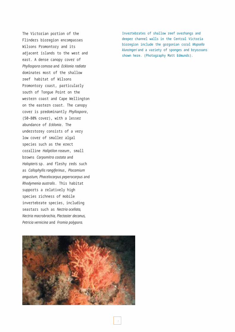
6
• Com

6
pl
5etion of

6
formal information exchange

6
MARINE INCIDENT PLANNING
Ensuring adequate planning and resourcing for appropriate and timely responses to emergencies is recognised as important in Victoria. Current statewide response arrangements and training for emergency incidents are outlined in the Victorian Emergency Management Manual and the draft Victorian Emergency Management Training and Development Management Strategy.
Victoria’s Marine National Parks and Sanctuaries are at risk from a range of marine incidents. Planning will require response arrangements and training protocols for incidents such as:
• spills of oil and other chemicals;
• shipping and boating accidents;
• stranding of cetaceans; and
• the introduction of marine pests (see pages 55–57).
Management framework
A national plan to combat pollution of the sea by oil and other noxious substances has been operational since 1973. The plan represents a combined effort between Commonwealth and State Governments to provide a framework to plan for and respond to marine pollution incidents. Marine Safety Victoria has responsibility under the Marine Act 1988 to ensure that there is an effective response to pollution incidents, guided by the Victorian Marine Pollution Contingency Plan (VICPLAN) (1997).Marine Safety Victoria maintains and stores pollution response equipment across the State, and provides training and exercises for personnel. The Environment Protection Authority Victoria also has powers and enforcement provisions to restrict the pollution of State waters, and works closely with Marine Safety Victoria.
The Department of Sustainability and Environment coordinates incidents associated with wildlife through the Wildlife Response Plan for Oil Spills (1997) and the Victorian Cetacean Contingency Plan (1999). Regulations with respect to human activities with cetaceans are set using the Wildlife (Whale) Regulations 1998 under the Wildlife Act 1975.
Cleaning up after an oil spill. (Photography Marine Safety Victoria).
The Victoria Police, through its Division/District structure and the Police Search and Rescue Squad, has prime responsibility under the Emergency Management Act 1986 for search and rescue and other emergency incidents in Victoria.
Parks Victoria will work with coordinating agencies to ensure that appropriate response arrangements are developed for marine incidents within or in the vicinityof Marine National Parks and Sanctuaries. This may require, for example, the amendment of relevant authority designations, contacts, local plans and response procedures. Provisions relating to response arrangements include:
• responsibilities for management of maritime emergencies;
• responsibilities across tenures;
• designation of the major control agency; and
• provisions for competing emergencies.

M a r i n e i n c i d e n t
6
K E Y P E R F O R M A N C E A R E A 66
OBJECTIVE DESIRED OUTCOMES RESPONSIBILITY
6.1 To ensure that Victorian planning arrangements are in a state of preparedness to respond adequately to marine incidents near and within the vicinity of Marine National Parks and Sanctuaries.
Rapid and effective response to potential marine incidents, and incident impacts minimised as quickly as possible.
Control agencies (as defined in the Victorian Emergency Management Manual) and Parks Victoria
Strategies Implementation Actions Targets
6.1.1 Develop protocols for response procedures and responsibilities for marine incidents.
• Completion of marine incident risk assessment and issues paper.
• Develop regional and/or local marine incident response protocols as necessary.
By July 2005
6.1.2 Define the support roles and operational responsibilities of Parks staff in marine incident responses across Victoria.
• Complete review of operational responsibilities, resources and equipment capacity.
By July 2005
6.1.3 Ensure all relevant staff are trained to fulfil their support role in emergency response arrangements.
• All relevant field staff to complete specialist training.
By July 2006

6
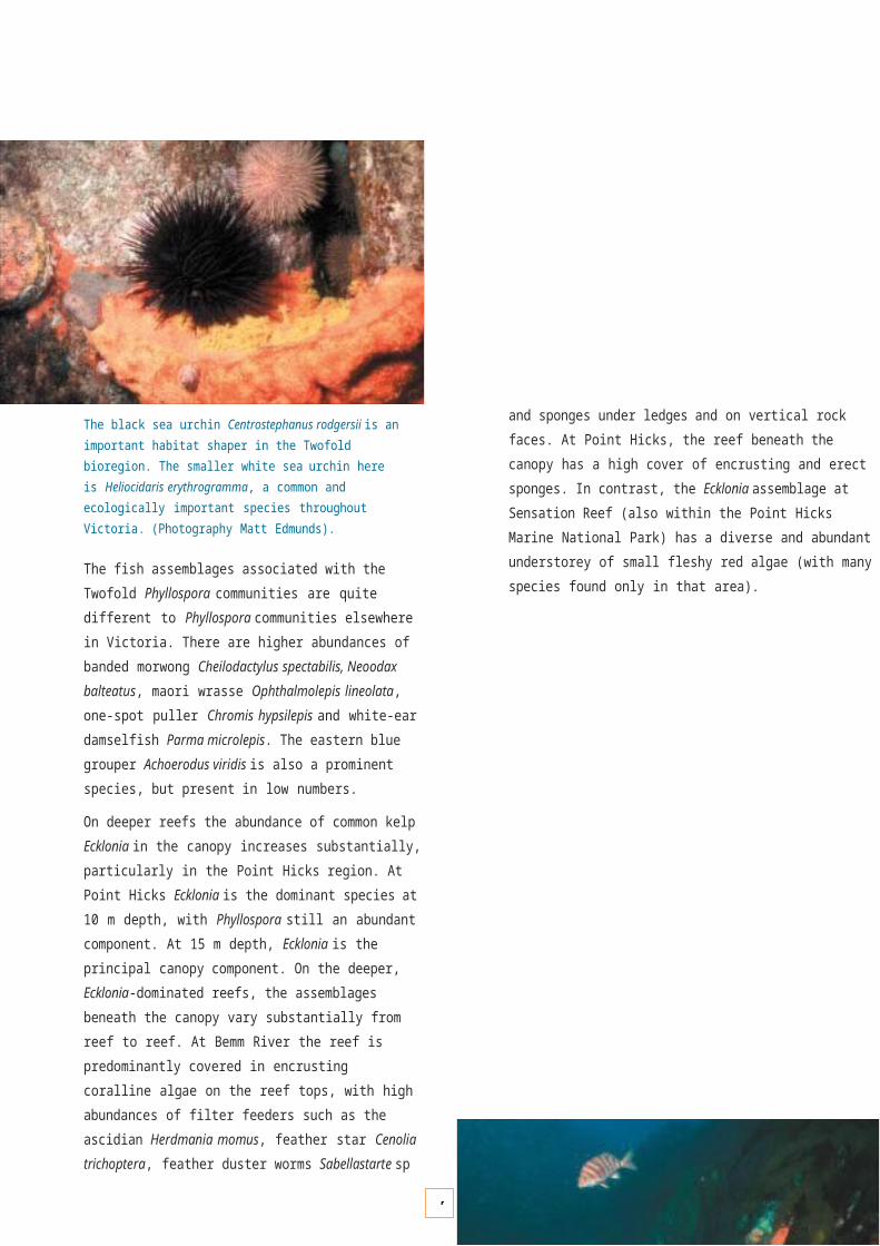
P R O T E C T I N G A N D R E C O G N I S I N G C U L T U R A L V A L U E S
65
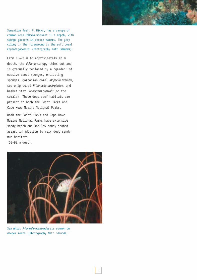
6
P R O T E C T I N G A N D R E C O G N I S I N G C U L T U R A L V A L U E S
INDIGENOUS VALUES AND INTERESTS
Indigenous people have an ongoing and intimate relationship with coastal and marine environments stretching back over thousands of years. This ongoing relationship is reflected in the cultural sites present along Victoria’s coast, many of which are represented in the system of Marine National Parks and Sanctuaries. The relationship is based on a long tradition of ownership, stewardship, utilisation and cultural significance.
For Indigenous people, their cultural values are intertwined around traditional uses, spiritual connection, ancestral ties and respect for the land and sea, and the resources they provide.
Valuing country
Contemporary Indigenous people see the sea as a natural extension of country, and continue to have a cultural affiliation with coastal and marine environments across the state.
This continuing social, spiritual or traditional connection to a place is embodied in the concept of 'country', which embraces all the values, places, resources, stories and cultural obligations associated with a geographical area. The social, cultural, and economic values that Indigenous people place upon home reefs, islands, shoreline or resources such as fish and shellfish give strength to culture and demonstrate an affiliation with traditionand traditional areas.
By recognising this inherited cultural, spiritual, historical and traditional relationship that Indigenous peoples have with the sea, we also ensure that the cultural and heritage values of Victoria's marine and coastal areas are recognised.
The new Marine National Parks and Sanctuaries provide an opportunity to respect and conserve Indigenous cultural values associated with the past occupation, use and ownership of Victoria’s coastline.
Cultural heritage sites
The Indigenous people of Victoria have relied on the Southern Ocean as a source of food for thousands of years, including sustainable harvesting of a wide variety of shellfish, crustaceans, finfish, whales and seals.
Today, evidence of occupation and use may be found along the Victorian coastline, in the form of archaeological sites. These sites, which include shell middens and camping places, date back as far as 12,000 years.
Reconciliation and respect
Recognition of Indigenous peoples’ cultural rights and interests in the coastal and marine environment can achieve mutually acceptable outcomes. Indigenous peoples’ stewardship ethic which already exists should be recognised and nurtured, to the benefit of all Victorians.
Whatever the legal outcomes of Indigenous peoples' Native Title claims over marine areas, their belief in their cultural rights and responsibilities with respect to their ‘sea country’ will continue.
In order to achieve more cooperative partnerships and understanding, it is therefore important that all managers and the community recognise Indigenous peoples' interests and aspirations with respect to marine areas.
With a growing appreciation of the importance of ‘country’ to Indigenous people, many Australians now accept that Indigenous involvement in the management of national parks such as Kakadu National Park and the Garig Gunak Barlu National Park (formerly Gurig National Park and Cobourg Marine Park) in the Northern Territory, is beneficial to those places and to the local Indigenous cultures. Millions of tourists continue to visit such places, which continue to make major contributions to the national and regional economies.

6
TOWARDS IMPROVED RECOGNITION
Future planning and management of Victoria’s system of Marine National Parks and Sanctuaries provides an opportunity for Government agencies and the wider Victorian community to learn about Victoria’s unique Indigenous culture, society and history, and to recognise and respect Indigenous peoples’ perspectives on country.
Mutual recognition and respect will encourage and facilitate the negotiation of Indigenous peoples’ interests in the planning and management of Marine National Parks and Sanctuaries. Key challenges and strategic directions are:
• developing and fostering an understanding of Indigenous peoples’ perspectives on country and associated cultural values;
• ensuring that all relevant Indigenous communities and organisations are adequately informed and involved with respect to the planning and management of Marine National Parks and Sanctuaries;
• providing appropriate information to all managers and users of Marine National Parks and Sanctuaries to assist them to learn about and respect Indigenous cultural, economic and legal rights and interests;
• contributing to ‘whole-of-government’ processes relating to Native Title determination applications, and consulting with and involving Native Title determination applicants;
• ensuring that any Marine National Park and Sanctuary reference groups or advisory committees include appropriate representation by Indigenous people;
• providing training, logistical and other support for Indigenous representatives to enable them to contribute fully to decision-making and advisory processes; and
• continuing a cross-cultural training program for Parks Victoria and other land management agency staff, and increasing the number of Indigenous people employed.
Cultural awareness and education. (Photography Parks Victoria).
String kelp Macrocystis angustifolia. (Photography Matt Edmunds).

6
INDIGENOUS PARTNERSHIPS
The Victorian Government is committed to working with Indigenous communities to protect and manage Indigenous cultural heritage values. As outlined in its Policy for Indigenous Victorians – Reconciliation and Respect, the Government has endorsed recommendations of the Environment Conservation Council’s Marine, Coastal and Estuarine Investigation (2000) which recognises Indigenous land and sea interests, the enhancement of Aboriginal involvement in management, and improved consultation procedures.
Management framework
Indigenous partnerships
The two main coastal management agencies, the former Department of Natural Resources and Environment and Parks Victoria, have developed strategies for working with Indigenous communities. As detailed in the Department of Natural Resources and Environment’s Indigenous Partnerships Strategy, the Government is committed to:
• developing an Indigenous Cultural Awareness Program;
• developing Indigenous partnerships;
• helping Indigenous communities to build capacity;
• promoting Indigenous cultural heritage values as an integral part of land and resource management;
• increasing Indigenous employment opportunities within the department;
• developing a communication strategy to promote theIndigenous Partnerships Strategy; and
• assisting the establishment of a process of community profiling as a resource for Indigenous communities.
The Department for Victorian Communities (DVC), through Aboriginal Affairs Victoria (AAV), now has responsibility for providing policy and other advice relating to Indigenous affairs in Victoria. AAV also promotes knowledge and understanding of Victoria’s Indigenous people and assists in the protection of Indigenous cultural heritage.
Parks Victoria’s Indigenous Partnership Strategy (2003) makes provision for greater involvement of Aboriginal people in the management of land, sea and resources relevant to their heritage. Parks Victoria is committed to continuing and developing further sound working relationships with Indigenous communities throughout Victoria, based on:
• recognition of the interests and values of Indigenous peoples and ensuring ongoing consultation before adopting decisions which may affect those interests; and
• working with Indigenous peoples to promote their participation in the management of Marine National Parks and Sanctuaries.
Cultural site protection
All Indigenous cultural heritage sites and places, whether registered or not, are protected under the Archaeological and Aboriginal Relics Preservation Act 1972 (Vic.) and the Aboriginal and Torres Strait Islander Heritage Protection Act 1984 (Cwlth).
In addition, all State agencies must comply with the Native Title Act 1993 (Cwlth), which provides for the possibility of legal recognition of traditional association, which could include recognition of customary rights to land.
Management agencies will work closely with Indigenous communities to ensure that the integrity of culturally significant areas, values and archaeological sites are protected. This will involve a number of strategies, including:
• undertaking cultural site assessments and surveys with Indigenous communities;
• continuing to refine guidelines and protocols for managing culturally significant sites, which will be reflected in management plans and work programs for Marine National Parks, Marine Sanctuaries and adjoining coastal areas; and
• developing educational and interpretive materials and training courses to build awareness, understanding and respect for cultural values and sensitive sites.

OBJECTIVE DESIRED OUTCOMES RESPONSIBILITY
7.1 To understand, recognise and respect the rights, interests and aspirations of Indigenous people across coastal lands and the sea.
Established consultative and working relationships.
Increased recognition and respect of Indigenous peoples’culture and interests in conservation.
Parks Victoria and DVC
Strategies Implementation Actions Targets
7.1.1 Work with Indigenous groups to build a greater understanding of Indigenous issues and values in the coastal and marine environment.
• Consult regularly with all relevant Indigenous groups.
• Complete cross-cultural training for all parks staff.
Ongoing
By July 2005 then ongoing
7.1.2 Develop consultative procedures and protocols aimed at improving communication between Parks Victoria and Indigenous groups.
• Complete consultation and communication plan.
• Complete protocols or memorandums of understanding with all Indigenous communities who wish to document working arrangements in this manner.
By December 2004
By December 2004
OBJECTIVE DESIRED OUTCOMES RESPONSIBILITY
7.2 build partnerships with Indigenous communities for managing Marine National Parks and Sanctuaries.
with management agencies towards the long term protection and conservation of Marine National Parks and Sanctuaries.
Parks Victoria and DVC
Strategies Implementation Actions Targets
7.2.1 Build partnerships with Indigenous communities in Marine National Park and Sanctuary management.
• Encourage Indigenous membership on the Statewide Reference Group and other local consultation groups.
• Involve Indigenous communities in Marine National Park and Sanctuary management planning from project initiation to completion.
Ongoin
g
Ongoin
g7.2.2 Establish community-based
conservation projects that encourage the participation of Indigenous peoples in the management of Marine National Parks and Sanctuaries.
• Scope options and complete community projects plan following consultation with Indigenous communities.
By July 2005
OBJECTIVE DESIRED OUTCOMES RESPONSIBILITY
7.3 To promote understanding and awareness of Indigenous cultural values, and ensure their protection.
Comprehensive documentation and increased awareness of Indigenous cultural values for all Marine National Parks and Sanctuaries.
Cultural values protected from disturbance or inappropriate behaviour.
Parks Victoria and DVC
Strategies Implementation Actions Targets
7.3.1 Develop a cultural values management program for site protection.
• Complete program plan in consultation with Indigenous communities.
• Review and update existing ‘Guidelines for Working with Aboriginal Communities and Protection of Cultural Sites’.
By July 2004
By July 2004 then ongoing
7.3.2 Develop education and interpretation materials to enhance understanding, sensitivity towards and protection of Indigenous cultural values.
• Complete information and interpretation materials for brochures, visitor centres and other communication materials in partnership with local Indigenous communities.
• Complete education and interpretation training package for parks staff and licensed tour operators.
By December 2004
6
K E Y P E R F O R M A N C E A R E A 7
I n d i g e n o u s p a r t n e r s h i p s
Indigenous
c
7ommunities
actively working in partnership
To
7
MARITIME HERITAGE
Maritime heritage in Victoria has left a rich tapestry of places and objects, which are increasingly valued by the community as a tangible link to the past. These places and objects assist the community in defining and understanding the contemporary cultural expressionof the beliefs, hopes and aspirations of our forebears.
Themes of interest include sealing and whaling, Australian shipbuilding, life at sea, immigration, and exploration. Victoria’s Marine National Parks and Sanctuaries will help protect historic places and objects by promoting appropriate activities at these places and creating opportunities for interpretation and improved understanding.
Shipwrecks
Victoria’s earliest European exploration and settlement was heavily reliant on coastal shipping. From the early 1800s, well before official exploration and settlement, whalers and sealers established stations in Victoria, exporting seal pelts, whalebone and whale oil. In 1834 the Henty family established a settlement at Portland and began shipping goods to and from Tasmania. Melbourne was also established around this time. Throughout the 19th century, as settlement and trade increased, ships were the most reliable means of transport for local produce and passengers.
Butterfly perch Caesioperca lepidoptera swimming on shipwreck at Beware Reef. (Photography John Ariens).
A large number of vessels serviced the State in the 19th and early 20th centuries. During the gold rush era 50 ships per day or 18,250 ships per year passed the Cape Otway Lightstation. While shipwrecks were a regular occurrence, particularly at the entrances to Port Phillip and Bass Strait,the 697 registered shipwrecks are an extremely small sample. These shipwrecks can reveal a great deal about our history and development.
The types of shipwrecks along Victoria's coastline reflect trading patterns and trade routes, often directly related to activities developing in the coastal hinterland. The underwater heritage in these areas includes sailing ships, steamships and even submarines. There are a number of known shipwrecks in Marine National Parks and Sanctuaries, including the Twelve Apostles, Point Addis, Port Phillip Heads, Wilsons Promontory and Point Hicks Marine National Parks, and the Point Cooke and Beware Reef Marine Sanctuaries.

7
Lighthouses
Lighthouses have protected shipping from Victoria’s hazardous coastline since the early days of European settlement. Built by the Colony of Victoria in the 19th century, the lighthouse complexes were the responsibility of the Commonwealth from Federation in 1901. However, key lighthouses were returned from the Commonwealth to Victoria in December 1995.
Advances in navigation technology have largely now superseded their function, and several are now managed by Parks Victoria to protect their heritage values and allow appropriate eco-tourism use. Six lighthouse reserves adjoin national or state parks and can be seen on guided tours.
Marine infrastructure
Many historic places associated with our maritime heritage are present along Victoria's coastline. These places include maritime industries and settlement sites, channel markers, careening beaches, military forts, immigration barracks, piers, jetties, pilotage facilities, lifeboat and rocket sheds and ports. These port facilities catered for the movement of produce and the arrival of immigrants to the State.The historic places within the Marine National Parks and Sanctuaries system will be protected to ensure their preservation for the future, for education and other uses.
Lighthouse at Wilsons Promontory. (Photography Parks Victoria).
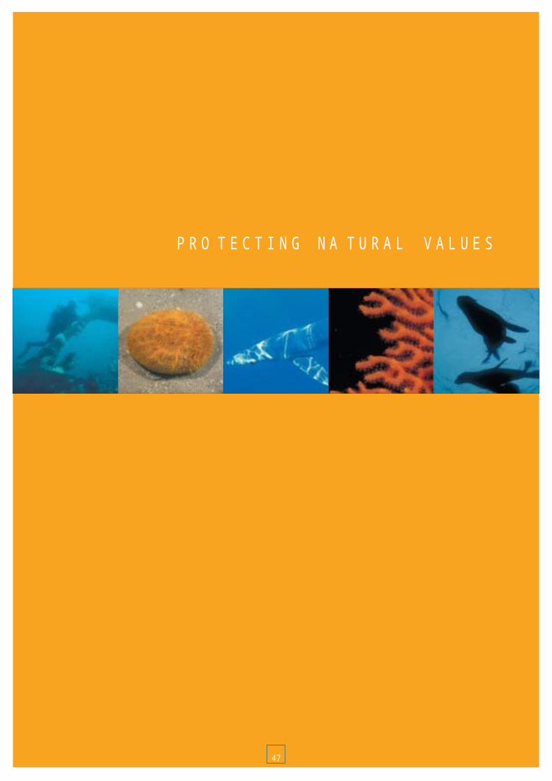
7
PROTECTING MARITIME HERITAGE
Shipping and its associated infrastructure played a fundamental role in the settlement and development of Victoria. Historic places and objects illustrating this aspect of our heritage are extremely rare. The creation of Victoria’s system of Marine National Parks and Sanctuaries provides an opportunity to protect and improve the community’s understanding of this resource. The key issues associated with the protection and management of this resource are:
• ensuring that research activities are compatible with both natural and cultural heritage conservation requirements;
• protecting significant historic places and objects;
• ensuring that the importance of historic places and objects is properly understood;
• establishing cooperative management arrangements with Heritage Victoria; and
• working cooperatively with communities and other agencies in protecting historic places and objects, as well as in providing opportunities for visitor uses which do not adversely impact on park or sanctuary values.
Shipwreck (S.S. Auckland) at Beware Reef. (Photography Heritage Victoria).
Management framework
General directions for the protection and management of non-Indigenous cultural heritage is provided by the Victorian Heritage Strategy (2000). In addition, Victoria’s Shipwrecks 2005 Heritage Strategy provides direction for management of Victoria’s diverse shipwreck maritime heritage from 2000 to 2005.
These strategies set objectives for improved support for managers of heritage places, better clarity on heritage issues and processes, more efficient and effective use of resources, the establishment of partnerships to share responsibilities, and increased awareness and knowledge about heritage in the community. The Heritage Act 1995 (Vic.) and the Historic Shipwrecks Act 1976 (Cwlth) recognise the cultural value of shipwrecks and provide legal protection in the interest of international, national and State heritage. The Australia ICOMOS Burra Charter (1999) provides guidelines for assessing the importance of the management of historic and cultural places, and for making decisions about them.
Parks Victoria has an important role as the protected area manager responsible for the conservation of the largest and most diverse collection of historic places within the State. For non-Indigenous cultural values, the Parks Victoria: Heritage Management Strategy (2002) identifies maritime heritage values under the historic theme of Shipping Along the Coast as one of six priority historic themes for management.
Parks Victoria will develop partnerships with Heritage Victoria and other agencies to assist with the protection and management of heritage values within Marine National Parks and Sanctuaries by promoting and regulating appropriate activities around them. Heritage Victoria will retain responsibility for the management of shipwrecks within Marine National Parks and Sanctuaries.
OBJECTIVE DESIRED OUTCOMES RESPONSIBILITY
8.1 To understand the importance of historic places and objects in or adjacent to Marine National Parks and Sanctuaries.
Complete inventory and research of historic places and objects so that their level of significance, history and educational potential can be realised.
Parks Victoria and Heritage Victoria.
Strategies Implementation Actions Targets
8.1.1 Promote opportunities for research into the significance of historic places and objects associated with Marine National Parks and Sanctuaries.
• Develop a research strategy with Heritage Victoria and identify relevant institutions with which to develop partnerships for completion of this research.
By December 2003.
8.1.2 Train relevant staff in the identification and protection of historic places and objects.Incorporate historic places and objects within management information systems.
• Identify relevant staff and develop training programs.
• Obtain relevant information from Heritage Victoria and include in the Asset Management System.
By July 2005.
By end of
2003.
OBJECTIVE DESIRED OUTCOMES RESPONSIBILITY
8.2 To protect historic places and objects associated with Marine National Parks and Sanctuaries.
Heritage values, risks and condition of places and objects assessed, program of actions agreed and implementation commenced to protect significant places and objects.
Parks Victoria and Heritage Victoria.
Strategies Implementation Actions Targets
8.2.1 Develop a memorandum of understanding with Heritage Victoria, which sets out arrangements for the administration of the National Parks Act and the Heritage Act with respect to the management of historic shipwrecks and associated
• Negotiate, prepare and sign a memorandum of understanding with Heritage Victoria.
• Evaluate the need to authorise relevant parks staff under the provisions of the Heritage Act.
By December 2003.
By July 2004.
8.2.2 Develop operational policies and procedures for the management of historic places and objects associated with Marine National Parks and Sanctuaries.
• Identify and complete operational policies and procedures and prepare policies for inclusion into the Parks Victoria policy manual.
Policies identified by December 2003. Policies prepared by July 2004.
OBJECTIVE DESIRED OUTCOMES RESPONSIBILITY
8.3 To promote the protection of, and provide opportunities for people to appreciate the importance of, heritage values associated with Marine National Parks and Sanctuaries.
• Provide a range of educational and interpretation materials which promote the protection of historic places and objects related to the theme Shipping Along the Coast.
Parks Victoria with the Maritime Museums Association, Heritage Victoria and relevant local communities.
Strategies Implementation Actions Targets
8.3.1 Develop educational and interpretation programs which promote the protection of and explain the importance and relevance of historic places and objects.
• Develop an educational and interpretation program which incorporates material relating to places and objects which illustrate the historic theme Shipping Along the Coast.
By December 2004.
7
K E Y P E R F O R M A N C E A R E A 8
P r o t e c t i n g m a r i t i m e h e r i t a g e

7
8

7

C O M M U N I T Y E N G A G E M E N T
75
7
C O M M U N I T Y E N G A G E M E N T
“Education is critical for promoting sustainable development and improving the capacity of the people to address environment and development issues. It is critical for achieving environmental and ethical awareness, values and attitudes, skills and behaviour consistent with sustainable development and for effective public participation in decision-making." (United Nations Conference on Environment and Development 1992)
In many parts of the world, marine and coastal environments have suffered from the consequencesof a general lack of knowledge and appreciation of these environments, poor understanding of human impacts on the sea, attitudes which do not value marine environments highly, and inaction in addressing issues of habitat loss and consequent loss of biodiversity. The consequences of this are continuing environmental degradation and loss of natural and cultural values.
Victoria has taken a major step towards the sustainable use of our valuable coastal and marine environments through the establishment of the world’s first representative system of Marine National Parks and Marine Sanctuaries. The long- term acceptance, adoption and protection of this system will, however, ultimately depend on an informed community that:
• recognises the values of the Marine National Parks and Sanctuaries;
• has attitudes that support the long-term protection of these environments; and
• has the skills and willingness to take action to protect and maintain the values of these environments.
Although the coast has long been the favourite relaxation and recreation place for Victorians, our knowledge and understanding of the marine environment, and its relationship to the land, remain relatively low. While interest in the marine environment is growing, active programs for community education and engagement will be vital in ensuring the long-term protection of Marine National Parks and Sanctuaries.
The long-term protection of Marine National Parks and Sanctuaries will be achieved with engaged, well-informed and aware communities working with managers and acting as custodians and ambassadors for the marine environment.
PRINCIPLES FOR A WELL-INFORMED AND SUPPORTIVE COMMUNITY
To foster and encourage widespread community support for our system of Marine National Parks and Sanctuaries, it is important to recognise and adopt the following principles:
• Education is central to acquiring knowledge and understanding of the marine environment (or any environment).
• Consultation is a valuable means of communicating ideas, aspirations and concerns.
• Participation directly facilitates working involvement and stewardship.
• Engagement promotes a sense of ownership and an active role in management.
As shown by the widespread community support for the establishment of Marine National Parks and Sanctuaries, many Victorians are seeking opportunities for high levels of involvement in education, consultation and other participatory activities.
Education
Community education about the values, diversity and sensitivity of coastal and marine environments, and the benefits of highly protected Marine National Parks and Sanctuaries, will be crucial to public awareness, acceptance and ongoing support of the system. This will form the basis of the consultation and participation processes, increase compliance with park and sanctuary regulations, and help develop community custodians and ambassadors for marine conservation.
A long-term commitment to effective programs will help create an aware community with the values, attitudes, behaviours and skills necessary for participation in marine protection activities and for encouraging attitudes and behaviours in others that also help protect the marine environment.
7
Consultation
Community consultation is a two-way process that shares and analyses information and gives guidance in the making of decisions. It should not just be seen as ‘local’, and should be used within relevant management agencies as well as with the community to ensure that staff members are well- informed and supportive of policies and programs.
Good consultation processes operate within clearly defined parameters that are understood and accepted by those involved. Consultation should inform, listen and respond, and give consistent feedback to those involved. It should also use a range of techniques to garner public input, e.g. questionnaires, workshops, face-to-face meetings withindividuals and groups, and written submissions, and give the community adequate time to become effectively involved.
Participation
Participation in the management of Marine National Parks and Sanctuaries will be diverse and will bring benefits to management agencies, community groups and individuals.
Aspects of participation may include involvement in research, monitoring, conservation, education and administrative activities, attendance at workshops, or representation on management advisory groups.
Participation activities must be planned and conducted to be meaningful to participants and effective in achieving the objectives of managing our Marine National Parks and Sanctuaries.
Engagement
Local government, community environment groups, business associations, welfare bodies, ethnic associations, tourism bodies, recreation bodies, schools and government agencies are some of the community organisations that potentially have an interest in Marine National Parks and Sanctuaries.
To achieve sound management, the outcomes of education, consultation and participation must empower communities to recognise that they can play, or are playing, important roles in the management of Marine National Parks and Sanctuaries, and that their input is highly valued.
The benefits of community engagement are evident when communities proactively impart knowledge, ideas and active involvement that assist in setting priorities and directions, developing policies and programs, and undertaking conservation projects. Engaged communities are more than just passive participants in managing Marine National Parks and Sanctuaries. They offer quality management advice and outcomes, question management plans and actions where appropriate, act as advocates for management, and add value to the operations of management agencies.
Their engagement through community partnership will also strengthen links within the community, enhance individual personal development and increase support for the protection of Victoria’s marine environment.
Community education. (Photography Parks Victoria).

7
FOSTERING COMMUNITY OWNERSHIP
For many people, community ownership will follow from consultation, participation and engagement. It will be achieved when people no longer see management of the marine environment as someone else’s responsibility, or no- one’s, but as something for which everyone is responsible and in which everyone has a role. As with terrestrial National Parks, or with community programs such as recycling or revegetation, this will be an ongoing process, and its extent and success can be measured by rates of awareness, compliance and participation.
Key means of achieving community ownership of Marine National Parks and Sanctuaries include:
• high-quality and strategically targeted education, interpretation and communication programs;
• transparent, accountable and responsive consultation processes; and
• effective participation programs and networks of supportive organisations and individuals.
Hermit crab Trizopagurus stigimanus. (Photography William Boyle).
EDUCATION, INTERPRETATION AND COMMUNICATION
A highly protected system of Marine National Parks and Sanctuaries increases opportunities for Victorians to learn about the marine environment.
Effective education interpretation and communication activities and programs will address the needs of the wider community as well as those of the formal education system.
Community education
In Victoria there are some existing programs that enable the general community to be involved in learning about the coastal and marine environment. Many people, both adults and children, are involved in field-based experiential learning opportunities using Victoria’s diverse marine and coastal habitats. These are usually undertaken at accessible coastal sites, including intertidal rocky shores, mudflats, mangrove and estuarine environments, but can also take place on the water. Such field-based learning experiences are offered by a range of organisations, including Parks Victoria, at park education centres, the Marine Discovery Centre (Queenscliff), through Coast Action/Coastcare,as well as by commercial operators.
Formal education
Formal education is delivered mainly through schools and universities. These institutions deliver programs to students on marine biology, ecology, marine and coastal issues, and other related studies, at primary, secondary and tertiary levels. Some educational providers also offer vocational or professional development training to teachers, public servants and private sector individuals.

7
Management framework
Community services
The importance of education as a tool for fostering community values and understanding of protected areas is reflected in Victorian legislation under the National Parks Act 1975, which promotes the public use and understanding of parks.
In Australia, a Best Practice Model for Park Interpretation and Education has been developed by the Department of Natural Resources and Environment on behalf of the ANZECC Working Group on National Park and Protected Area Management Benchmarking and Best Practice Program (Department of Natural Resources and Environment and Parks Victoria 1999).
The Model can be used by any organisation to ensure education and interpretation are delivered to high standards. This Model has been adopted by the Interpretation Australia Association to assess Awards for Excellence for outstanding interpretation and education programs.
The Department of Sustainability and Environment will continue to lead policies to ensure that education,interpretation and communication are integrated across all natural resource management programs. For example, over the last five years the implementation of Victoria’s Biodiversity Strategy (1997) has included the development of interpretation and education materials for schools to educate future generations about the importance of protecting and conserving biodiversity.
Parks Victoria will use, at a variety of levels, a range of tools to reach all segments of the community. Programs will be delivered through cooperation with lead management agencies, community organisations and private businesses with responsibilities or interest in marine education.
Services offered will include access to marine specialists, provision of curriculum and support material, information signs and shelters, on-line and phone-based advice and support, visitor centre and other displays, guided andself-guided nature walks, and other similar services and materials. Park staff and teachers at education centres will continue to disseminate the majority of formal education services.
Community interest and understanding of the marine environment is important for the long-term protection of Marine National Parks and Sanctuaries. (Photography Parks Victoria).

OBJECTIVE DESIRED OUTCOMES RESPONSIBILITY
9.1 To increase awareness and understanding of the values of Marine National Parks andSanctuaries through high-quality education services.
An informed and aware community that minimises its impact on, and behaves appropriately in, Marine National Parks and Sanctuaries, as measured by awareness and satisfaction surveys and levels of impact.
Lead agency Parks Victoria with Marine and Coastal Community Network (MCCN), Victorian National Parks Association (VNPA) and other community organisations (supported by DVC, DSE/DPI and Strategies Implementation Actions Targets
9.1.1 Communicate educational information about the Marine National Parks and Marine Sanctuaries to schools.
• Complete the Marine National Parks and Marine Sanctuaries Education Plan.
By December 2003
9.1.2 Deliver appropriate and focused marine education and interpretation services and programs at service centres.
on ParkWeb, with links to related marine education websites.
• Complete Marine National Parks and Marine Sanctuaries educational kits for Victorian schools.
By December 2003 and ongoing
By December 2005
9.1.3 Communicate the benefits and values of Marine National Park and Sanctuary conservation and management to the community.
• Develop active partnerships with existing marine-focused education providers, programs and trainers.
• Develop targeted marine education training courses for
Ongoing
December 2003
9.1.4Develop and promote research opportunities to improve marine conservation education, interpretation and communication methodologyand delivery.
• Contribute regular articles or website information on marine park management to key community information providers such as MCCN, VNPA and Coast Action newsletters.
• Cooperative research projects facilitated by Parks Victoria in partnership with management agencies and education providers.
Ongoing
Begin July 2003
8
K E Y P E R F O R M A N C E A R E A 9
E d u c a t i o n , i n t e r p r e t a t i o n a n d c o m m u n i c a t i o n

8
• Establi
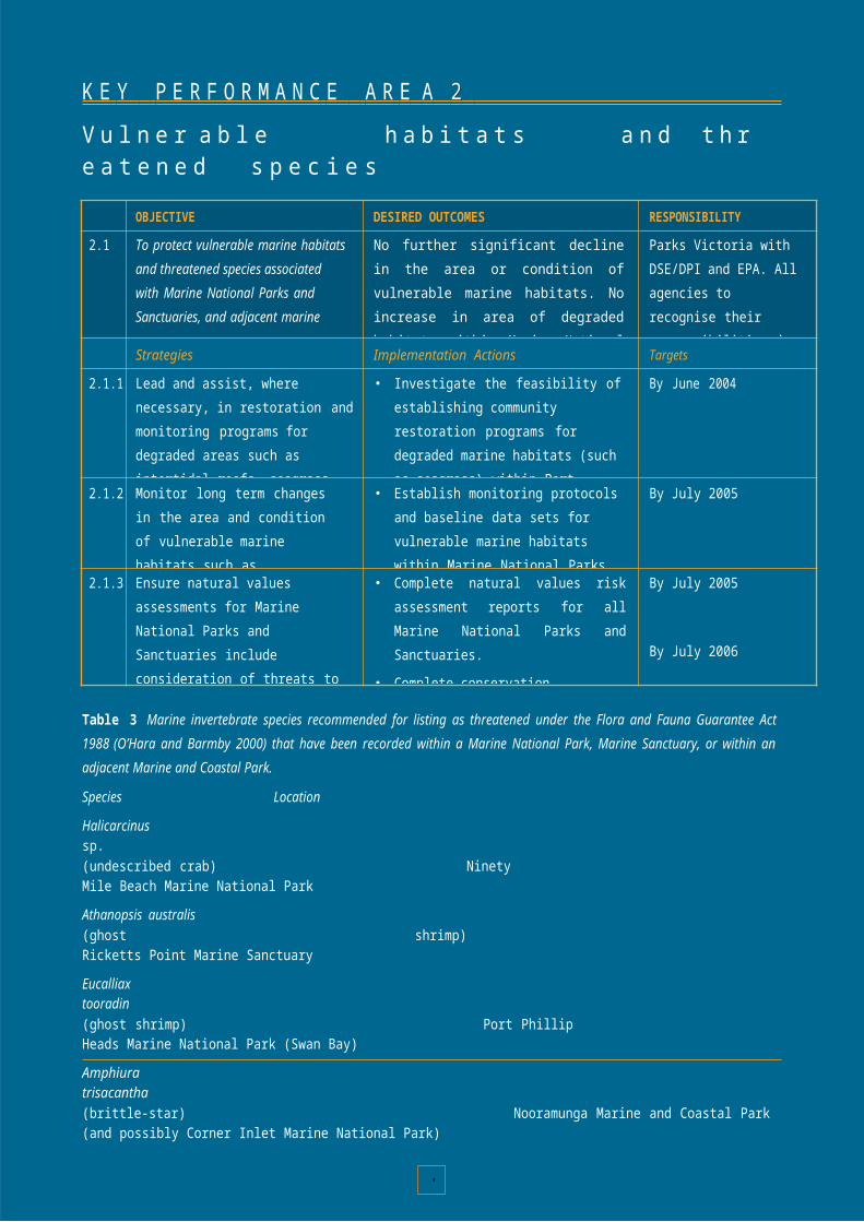
8
sh
9marine

8
education web pages
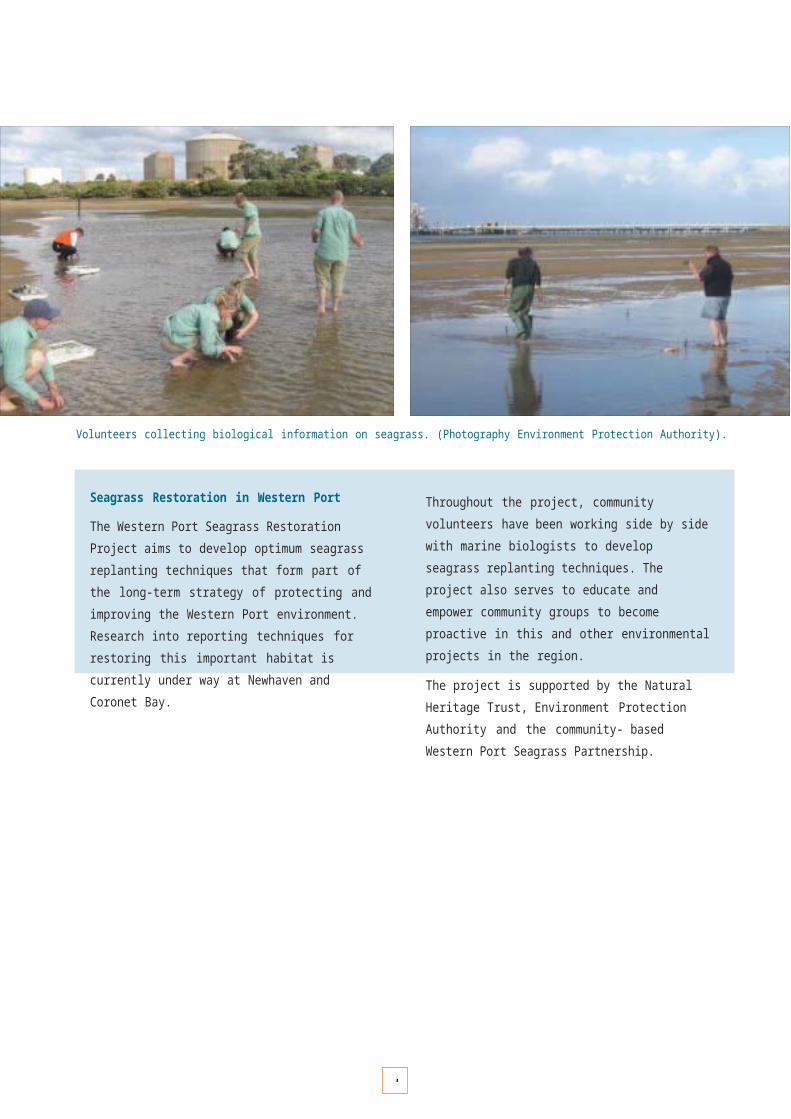
8
Marine education planning
A Marine National Parks and Marine Sanctuaries Education Plan will be developed to increase community understanding and appreciation of the values, diversity and sensitivity of coastal areas and marine environments by leading integrated community outreach and curriculum- driven programs for Marine National Parks and Sanctuaries.
This Plan will be developed by managers, community groups and stakeholders associated with Marine National Parks and Sanctuaries. Highlights of the Plan will include:
• a review of previous successful (and unsuccessful) community education strategies related to the protection and conservation of the marine environment;
• options for specialised training and materials appropriately targeted for park staff, community leaders, peak body representatives, teachers and other reference points for the community;
• understanding community needs for marine education at a regional and local level through consultation; and
• identification of opportunities for innovative research, curriculum development, and integration with related Commonwealth and State marine education programs.
Consultation will be an important process for decision-making and understanding community views and aspirations.
(Photography Parks Victoria).
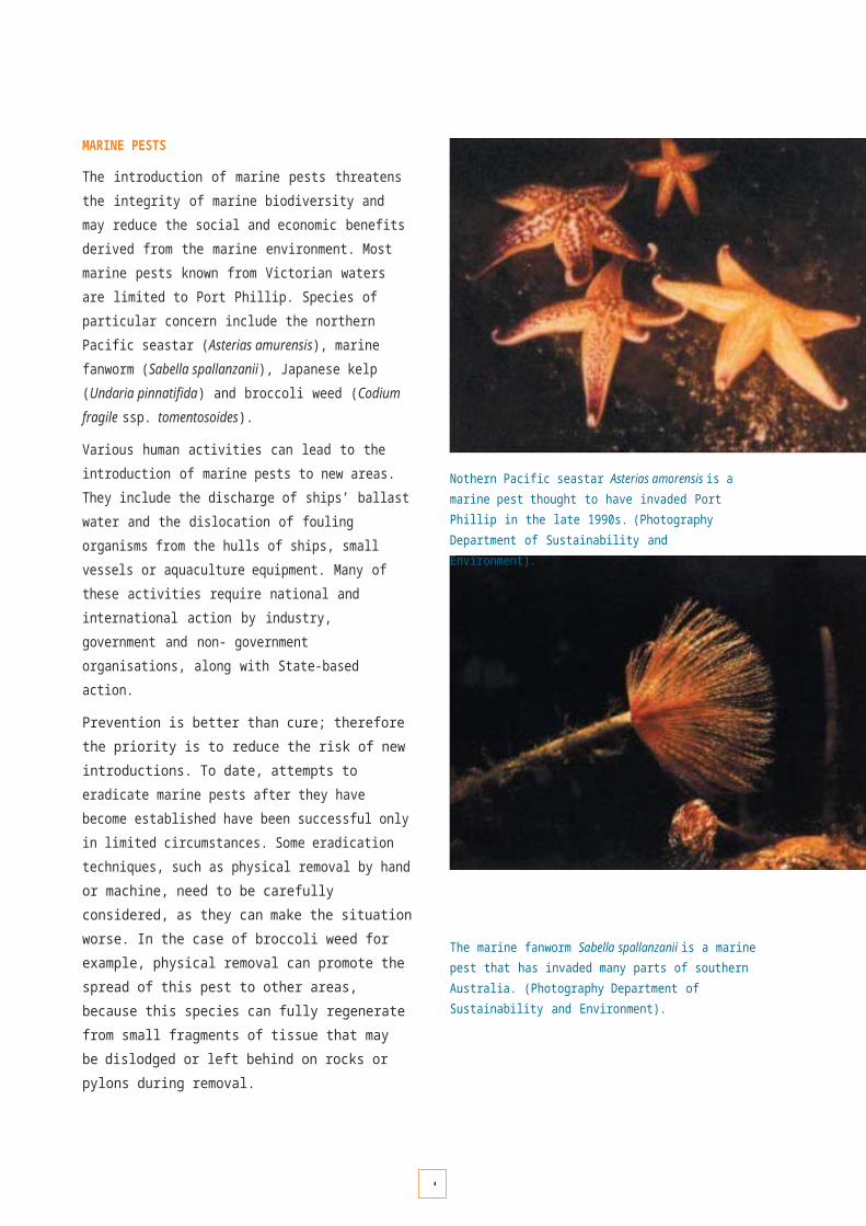
8
COMMUNITY CONSULTATION
Community consultation is a two-way process that shares and analyses information and gives guidance in decision- making. Understanding community attitudes towards and expectations for Victoria’s system of Marine National Parks and Sanctuaries will be vital for the implementation of this strategy. Community consultation directly contributes to the management of the system by:
• giving insights into community expectations for the conservation and use of Marine National Parks and Sanctuaries, for input into management decision- making; and
• assessing the community’s understanding of issues to target education programs better, and where necessary developing new strategies or programs to address community views.
Community consultation is also important in developing performance and satisfaction indicators related to the management of the system, thus ensuring accountability. As people become more informed about marine issues their expectations for marine environmental policy and implementation are likely to change. Marine environmental managers must ensure that management approaches based on community expectations are monitored to ensure that those approaches continue to be relevant.
Opportunities for the community to be actively consulted about decisions that impact on Victoria’s Marine National Parks and Sanctuaries are an important part of their long- term acceptance in local and regional communities. Through these processes, communities will begin to develop a sense of ownership, and will be far more likely to become advocates for, and custodians of, these areas.
Management framework
Management agencies will inform, listen and respond to communities, organisations and individuals involved in the management of Marine National Parks and Sanctuaries. This will be achieved through a range of techniques involving targeted consultation strategies and community surveys.

8
Best practice community consultation
The Best Value Principles of Community Consultation Resource Guide prepared by the Victorian Local Government Association (2000) provides a framework for management agencies to enhance consultation with their community and stakeholders, and is currently being introduced with the participation of all Victorian local governments.
These principles include:
• pre-consultation methods, such as advertising, letters and media;
• traditional methods, such as community meetings, steering groups and focus groups; and
• innovative methods such as electronic bulletins, websites and discussion groups.
Community consultation will be integral to the preparation of management plans for each Marine National Park and Marine Sanctuary. Parks Victoria will actively seek to engage the community in all aspects of management, including stakeholder liaison during preparation of management plans, discussions with interested groups, research studies, education, formal presentations, group meetings and enforcement.
Victorians appreciate and enjoy the marine and coastal environment. (Photography Parks Victoria).
Community surveys
Determining the levels of community satisfaction with the management of the marine environment provides a basis for the assessment of performance. Community satisfaction is increasingly being incorporated as a performance measure to improve the delivery of Government services. Parks Victoria has been undertaking annual visitor satisfaction and community perception surveys for Victoria’s terrestrial parks system for a number of years. This data has been important in planning and developing services and facilities which meet broad community expectations. With the implementation of the Marine National Parks and Sanctuaries system, similar performance measures will be required. Community surveys will help provide data for these measures.
KEY MESSAGES FROM A RECENT COMMUNITY SURVEY REPORT COMMISSIONED BY THE DEPARTMENT OF NATURAL RESOURCES AND ENVIRONMENT (2000)
Victorian coastal and marine environment community attitudes and behaviour:
• 80% of the community visit the Victorian coast for its appeal and experience.
• 67% believe the Victorian coast is well managed.
• 47% want more public consultation on coastal matters.
• 76% of the community feel the marine environment is under threat from pollution, overfishing and marine pests.
• 82% believe the marine environment cannot look after itself.
• 95% regard living things in the marine environment as important.
• 90% believe the marine environment needs more policing.

OBJECTIVE DESIRED OUTCOMES RESPONSIBILITY
Toto provide advice and direction in the planning and management of Marine National Parks and Marine Sanctuaries.
engaged in the development and implementation of management plans for Marine National Parks and Marine Sanctuaries.
Parks Victoria in partnership with other agencies and the community
Strategies Implementation Actions Targets
10.1.1 Build support for Marine National Parks and Sanctuaries within targeted community sectors.
• Identify relevant marine-based industry, recreational and community groups and develop relationships where appropriate.
Ongoing
10.1.2 Develop channels for dialogue with and engagement of communities.
• Complete a review of community expectations and aspirations for Marine National Parks and Sanctuaries management.
• Develop a Marine National Parks and Marine Sanctuaries communications strategy which includes opportunities for accessible and responsive community consultation and participation.
• Develop community information programs that convey the importance and benefits of protecting and managing Marine National Parks and Sanctuaries.
Review completed by July 2003
July 2003
Ongoing
8
K E Y P E R F O R M A N C E A R E A 1 0C o m m u n i t y c o n s u l t a t i o n
10.1
1empower and enable communities
8
Aw are com
0munities that

8
are actively
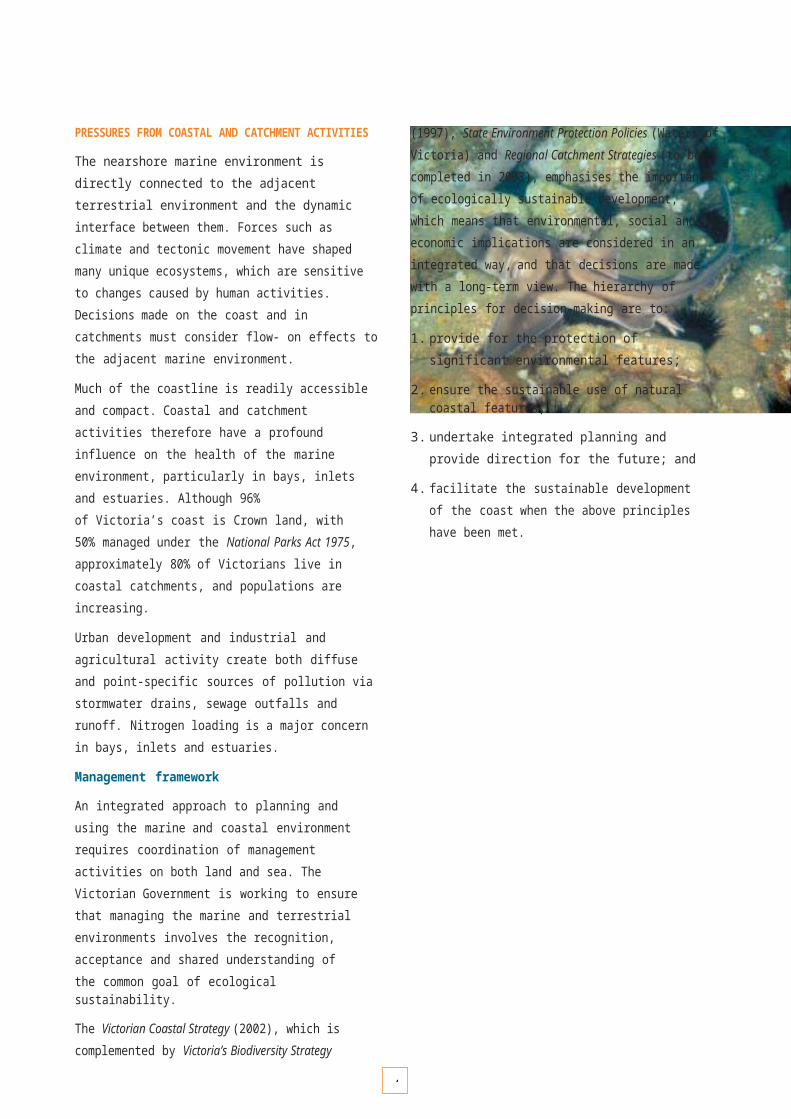
9
COMMUNITY PARTICIPATION
Direct participation in marine and coastal programs will give community members a sense of ownership and ability to contribute directly to the management of Marine National Parks and Marine Sanctuaries. This participation can include on-ground action through volunteering or involvement in a range of research and monitoring, conservation, education and administrative activities.
Local government, community environment groups, business associations, welfare bodies, ethnic associations, tourism bodies, recreation bodies, schools and government agencies are some of the groups and organisations that potentially have an interest in active participation. The involvement of Indigenous groups in management of parks is discussed separately on pages 66 – 69.
Participation in activities and programs must be taken seriously by management and seen as meaningful to those involved, allowing communities and individuals to recognise that that they have an important role in achieving the objectives of Marine National Park and Sanctuary management. This participation will provide direct benefits to the Marine National Parks and Sanctuaries, as well as rewarding the individuals involved. Participatory activities currently recognised and supported by management agencies and the community include the following.
Community participation through volunteer groups provides vital support for managing Marine National Parks and Sanctuaries. (Photography Environment Protection Authority).
Friends Groups and other volunteers
A Friends Group is a group of people with the shared interest of supporting a particular protected area or species of native flora or fauna. Friends derive satisfaction and greater understanding from their involvement, which may be regular or occasional. The range of activities covered by Friends Groups is enormous and includes surveys, research, restoration, litter control, nature rambles, monitoring track works, education, interpretation and fundraising. The general objectives of Friends Groups are to:
• provide support for and foster public awareness of parks (or species);
• assist with special projects selected by Friends in consultation with the appropriate authority;
• bring into contact people with an interest in the park (or species); and
• support the effective management of native flora and fauna in Victoria.
Friends Groups, although independent, operate in partnership with the relevant land manager. The basis is a cooperative, mutually supportive relationship which encourages volunteer participation and recognises the legal responsibilities of the management authority.
Coast Action/Coastcare
The Coast Action/Coastcare Program works with over 350 groups and organisations, including coastal community conservation groups, committees of management, local coastal councils and other community organisations. The majority of these groups consist of the 20,000 coastal volunteers who donate their time, energy, skills and knowledge to take part in activities such as:
• restoration (e.g. coastal vegetation planting);
• access management (e.g. board-walks, viewing platforms, walking tracks);
• monitoring (e.g. birds, water quality, fauna);
• planning (e.g. management plans and strategies); and
• education (e.g. pamphlets, interpretative displays).
The Coast Action/Coastcare Program is about empowering and enabling people to become actively involved. Others prefer to join local community groups or committees of management to actively participate in the planning and on-ground activities needed to manage the Victorian coast better.
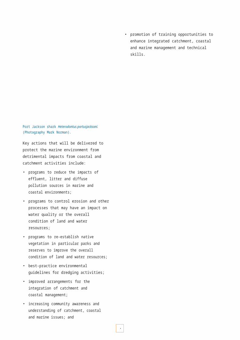
9
Marine and Coastal Community Network
The Marine and Coastal Community Network (MCCN) is a prominent national program that works to increase community involvement in decisions, programs andinitiatives affecting Australia’s marine and coastal areas.
The MCCN brings organisations, government agencies and industry together to develop a more cooperative andcoordinated approach to marine resources management and biodiversity conservation. The Network also provides an accessible link between the community and Commonwealth and other government programs delivering marine and coastal conservation and management initiatives.
The activities of the MCCN focus on seven key areas:
• contacts and network building;
• government policy development and implementation;
• information dissemination;
• public awareness, communication and education;
• media liaison;
• community involvement projects; and
• workshops and training.
Key initiatives of the MCCN include:
• creating an active national and statewide network of marine and coastal interests;
• increased access to information, data, publications and resources via newsletters, email and other material;
• undertaking extensive media work (e.g. ABC, print media, Radio Marinara – RRR FM);
• producing a broad range of community educational materials; and
• facilitating community involvement in national and State level policy development.
Victorian National Parks Association
The Victorian National Parks Association (VNPA) is the principal non-government advocate for nature conservation and biodiversity protection in Victoria. It provides community representation for creating and managing national parks and other protected areas in the State. In addition, it provides professional input to flora and flora issues across all land tenures and runs the largest bushwalking program in Victoria. The VNPA provides community support and representation for:
• strategic input and advice on nature conservation initiatives across Victoria;
• expanding Victoria’s world-class system of parks and reserves;
• protecting, maintaining and improving the existing system; and
• enhancing land and water quality outside parks and reserves.
Reef Watch (Victoria)
Community participation in monitoring underwater habitats and marine life is coordinated by Reef Watch. This is anon-profit project that encourages divers and snorkellers to monitor marine life at their favourite sites. The project has been developed by the Australian Marine ConservationSociety and the Marine and Coastal Community Network to:
• develop local knowledge in the dive community about the significance of cool-water marine habitats and species;
• develop a more highly valued marine environment in the broader community; and
• encourage effective policies and actions to protect and enhance Victoria’s marine environment.
Fishcare
DPI coordinates the Fishcare Volunteer program, which has the aim of fostering stewardship and personal responsibility by Victorian recreational fishers to fish resources and the aquatic environment. Volunteers provide information, educational material and assistance to recreational anglers, and they regularly visit piers, jetties, boat ramps and beaches to disseminate information and talk to anglers.
Other volunteers, both individuals and groups under the auspices of Conservation Volunteers Australia and other organisations, also make valuable contributions to park management.

9
HOW DOES REEF WATCH WORK?
Reef Watch volunteer divers are supplied with a Reef Watch Monitoring Kit to carry out surveys in areas in which they choose to monitor. This resource, and identification courses, help divers and snorkellers to:
• gather information about the distribution and abundance of key species;
• monitor and report seasonal changes in plants and animals;
• report special natural history phenomena or events; and
• serve as a ‘neighbourhood watch’ program, reporting marine pest invasions, illegal fishing practices, dumping and polluting.
Despite its name, Reef Watch is not restricted to reefs. Divers may choose to monitor other marine habitats, including seagrass beds and sandy bottoms.
Surveys will occur along the entire coastline and out to the State limit (5.5 km offshore). Key species monitored include algae, seagrasses, invertebrates and fish. Surveys are taken at any time of the year.
Survey data collected is validated and logged onto the Reef Watch web site database. This information is available to other divers, community groups and individuals, government organisations and education facilities.
Volunteer divers can carry out surveys in Marine National Parks and Sanctuaries to gather important information on plants and animals, and report on unusual sightings.(Photography Parks Victoria).
Management framework
Victoria’s Biodiversity Strategy (1997) recognises that involvement by the community is one of the greatest resources available in managing Victoria’s biodiversity across all land and seascapes. Involving the community in the implementation and management of Marine National Parks and Sanctuaries will be vital to their long-term management and protection.
Community involvement in Marine National Parks and Sanctuaries represents a new and exciting era in community participatory activities. Park staff will actively seek to engage the community in all aspects of management, including stakeholder liaison at several stages of establishing and preparing management plans, discussion with interested parties, baseline studies and monitoring, education, formal presentations and group meetings.
Parks Victoria’s Community Partnership Program recognises that volunteer and community programs are integral to the continuing health of Victoria’s parks and reserves, giving people tangible experiences of parks, and giving volunteers experience, skills, and opportunities for personal development.
The Program distributes annual funding to committed community groups working on public land across the State. Funding is available under five categories:
• Environment
• Recreation
• Heritage
• Community awareness
• Multicultural diversity. *
Coast Action/Coastcare has seven community facilitators in regional locations to ensure widespread support for community participation. The Program is jointly funded by the State and Commonwealth Governments through the Department of Sustainability and Environment. The Community Grants Program provides funds for a range of coastal and marine community projects.
Other opportunities to initiate new partnerships or integrate existing partnerships with the community or other management agencies will be sought.
* Parks Victoria has developed a Community Access Strategy which responds to cultural and linguistic diversity so that the widest possible range of cultures and individuals can enjoy the parks and reserves system.

9
K E Y P E R F O R M A N C E A R E A 1 1
C o m m u n i t y p a r t i c i p a t i o n

OBJECTIVE DESIRED OUTCOMES RESPONSIBILITY
11.1 To promote opportunities for communities to be involved in the management of Marine National Parks and Marine Sanctuaries.
Engaged communities that act as custodians and advocates for Marine National Parks and Sanctuaries.
Parks Victoria in partnership with other agencies and the community.
Strategies Implementation Actions Targets
11.1.1 Develop capacity building initiatives for the community to effectively participate in Marine National Park and Sanctuary management.
• Provide assistance to source funding for community projects of benefit to the Marine National Parks system
• Provide necessary training and education materials to support community projects.
Ongoing
11.1.2community in marine conservation programs and the management of Marine National Parks and Sanctuaries.
Friends and volunteer groups and create opportunities for community involvement.
• Review existing community engagement, and the challenges, training needs and priority areas associated with it.
• Encourage and support community- based projects aimed at communicating the benefits of conservation and protection.
• Provide regional communities with access to resources and expertise in Marine National Park and Sanctuary management and marine sciences.
Ongoing
Review completed by Nov 2003
Ongoing
Ongoing
11.1.3 Develop ways to effectively respond to the needs of a multicultural and linguistically diverse community within Marine National Parks and Sanctuaries.
• Engage diverse cultural groups and individuals through multilingual signage and interpreter liaison.
• Identify and foster multicultural programs in partnership with government and non-government organisations.
• Identify champions within ethnic communities to facilitate involvement.
• Provide cross-cultural training to relevant staff, utilise and encourage use of language skills and knowledge.
• Conduct research into visitor needs from the variety of cultural backgrounds.
By December 2003 and ongoing
Ongoing
Ongoing
By December 2003 and ongoing
By July 2004
9
Develop ways to enga
1ge the
9
• Support the establish
1ment

9
of new

8

R E C R E A T I O N , T O U R I S M A N D V I S I T O R M A N A G E M E N T
89

9
R E C R E A T I O N , T O U R I S M A N D V I S I T O R M A N A G E M E N T
Marine National Parks and Marine Sanctuaries provide quality recreational opportunities which are of great benefit to the health and well-being of our community.
Marine National Parks and Marine Sanctuaries provide quality recreational opportunities which are of great benefit to the health and well-being of our community.
Victoria’s system of Marine National Parks and Marine Sanctuaries provides a significant additional natural attraction for visitors to the parks and reserves estate. The system provides for a broad range of recreation and tourism opportunities for visitors to explore, enjoy, learn about and appreciate the wonders of the marine environment, and complements and enhances existing marine and coastal recreation opportunities.
Appropriate recreation and tourism use contributes to the physical and mental well-being of individuals and the social, economic and environmental well-being of the community.
Recreation and tourism activities
The marine and coastal environment is highly valued for passive and active recreation. Many coastal areas experience huge increases in population during peak holiday periods as millions of visitors flock to the beach and hinterland to participate in land and water-based activities. Recreation and tourism activities often involve a high degree of self-organisation and independence.Tourism activities involve away-from-home visits and often involve the purchase of recreation services, such as those provided by licensed tour operators and other businesses. Popular recreation and tourism activities include:
• boating
• diving
• dolphin swim tours
• guided sightseeing and interpretive tours
• motorised boat tours
• nature observation and sightseeing
• photography
• rock pool rambling
• sea kayaking
• snorkelling
• surfboarding and surf education
• swimming
• wind surfing.
The Twelve Apostles Marine National Park is an international tourism icon. (Photography Parks Victoria).
Sustainable tourism development and promotion associated with Marine National Parks and Sanctuaries can contribute to greater awareness and understanding of marine conservation values and foster community pride.
Tourism activities can be independent or guided but generally reflect a participant's desire for new leisure experiences in different destinations and environments. High levels of tourism services are provided in many coastal areas and contribute significantly to the local and state economy. Product development and marketing are key components supporting tourism activity.
Marketing the attractive and interesting values of Marine National Parks and Sanctuaries will encourage visitation and exploration of the marine world and is likely to lead to increased curiosity and interest in the marine environment.
9
Licensed tour operators
Activity groups, clubs and licensed tour operators play a valuable role in facilitating public recreation and tourism. Over 250 tour operators are licensed to undertake activities on public land and waters in Victoria, and many already provide activities in the marine environment. It is anticipated that this number will increase as operators become licensed to take visitors to our Marine National Parks and Sanctuaries.
Licensed tour operators and organised recreation activity groups play a valuable role in facilitating new experiences and access, providing expert guidance, information and education for visitors. They can also play a key role in resource protection and the promotion of minimal impact behaviour.
Victoria’s Marine National Park system provides opportunities for the further growth of recreation and tourism activities as marketing activities and information about the parks and sanctuaries increases public interest in them.
Access and links to other natural attractions
Many of Victoria’s Marine National Parks and Sanctuaries are adjacent to well-known recreation and tourism destinations and icon parks. For example, the Twelve Apostles Marine National Park is adjacent to Port Campbell National Park and encompasses one of the State’s premier attractions, the
Twelve Apostles. Point Addis Marine National Park is adjacent to Australia's famous Bells Beach. Marine Sanctuaries such as Barwon Bluff, Jawbone and Ricketts Point are easily accessible and in popular urban recreation areas.
Discovery Bay, Point Hicks and Cape Howe Marine National Parks offer more remote experiences.
Community lifestyle and well-being
The near-shore marine environment and its spectacular coastal features are clearly valued by the community as a place of relaxation and psychological renewal. The benefits associated with coastal living are appealing to people all over Australia. This trend is reflected in the population increase in coastal Victoria of more than 10% between 1991 and 2001, considerably greater than Victoria’s overall population growth.
The knowledge that areas of our special marine environment are well protected is an important social value, even if our experience of these areas is to simply view them from favourite places along our popular coastline. Victoria’s system of Marine National Parks and Sanctuaries reflects a need to ensure that people now, and in the future, will continue to be able to enjoy all that the marine and coastal environment has to offer.
Recreational activities such as surfing and snorkelling are popular along Victoria’s coast. (Photography Parks Victoria).
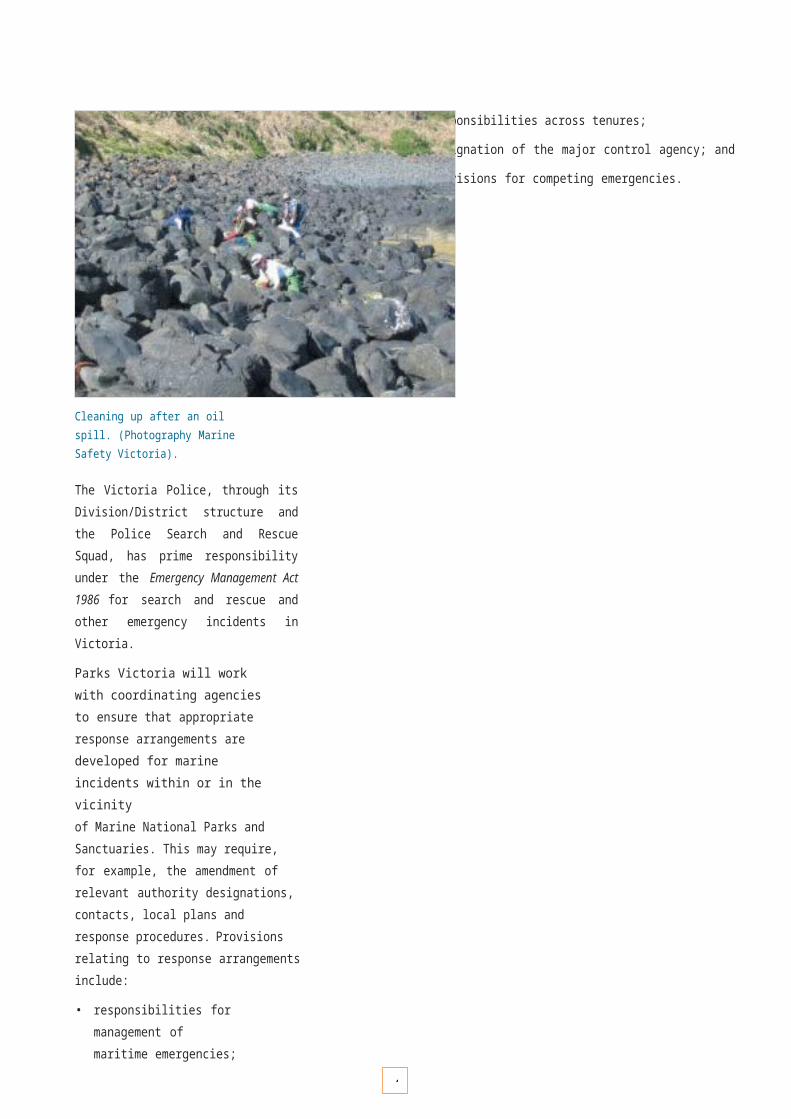
9
SUSTAINABLE RECREATION AND TOURISM
Management of recreation and tourism activities on public land and waters is also guided across Victoria by the National Parks Act 1975 and other Acts. The Policy for Sustainable Recreation and Tourism on Public Land (2002) provides guiding principles for the management of recreation and tourism across all public land, including Marine National Parks and Sanctuaries. It guides the development of local management plans, strategies and other relevant documents. Four key policy principles are identified:
• the provision of equitable access for a diverse range of appropriate recreation and tourism opportunities;
• pro-active management and monitoring of natural and cultural values and visitor access and activities to ensure sustainable use;
• the delivery of appropriate services and facilities to foster visitor enjoyment, education and safe activity practice; and
• the provision of information, interpretation and education for the community and interested parties which encourages appropriate and sustainable use.
These principles have been considered in the development of this Strategy and will underpin the future development of individual management plans.
Other supporting strategies and plans include:
• National Tourism Strategy (1992);
• National Ecotourism Strategy (1994);
• Victoria’s Nature Based Tourism Directions and Opportunities (2000);
• Linking People and Spaces. A Strategy for Melbourne’s Open Space Network (2002);
• Victoria’s Adventure Tourism Action Plan (2002–2005);
• Victorian Coastal Strategy (2002);
• Victorian Trails Strategy (2002–2005).
FINDING A BALANCE
Managing for a balanced range of visitor activities in the marine environment presents a variety of challenges. The key challenges are:
• ensuring a diverse and equitable range of recreation and tourism opportunities is provided for visitors, supported by appropriate facilities and services; and
• ensuring appropriate levels of protection of natural, cultural and social values whilst facilitating recreation and tourism activities with a focus on minimal impact.

9
KEY GOVERNMENT AGENCY ROLES IN NATURE-BASED RECREATION AND TOURISM
Parks Victoria
Mission is to provide ecologically sustainable management services and facilities for recreation and tourism visitors. Also manages tour operator licensing system.
Lead role in day-to-day management of Victoria’s parks and reserves and the activities within them, including managing visitors and tourism operator activities. Recreational management of waterways and bays.
Department of Sustainability and Environment
Mission is to ensure ecologically sustainable recreation and tourism use of Victoria’s natural resources.
Lead role in policy setting and integrated management of Victoria’s natural resource base, including policy setting for parks and reserves management.
Department for Victorian Communities
Mission is to maximise the economic and social benefits provided to all Victorians by the sport and recreation industries. Sport and Recreation Victoria is a division of the Department for Victorian Communities.
Lead role in sports and major event facilitation, facility development and industry development.
Tourism Victoria
Mission is to maximise economic and social benefits to the State by promoting Victoria’s system of terrestrial and marine national parks, reserves and sanctuaries as nature- based attractions.
Lead role in marketing and stimulating tourism growth through development initiatives.
All agencies liaise with industry peak bodies and associations such as the Victorian Tourism Operators Association (VTOA), Victorian National Parks Association (VNPA) and activity- specific groups and stakeholders to maintain and promote industry best practice standards and professionalism.

9
MANAGEMENT OF VISITOR SERVICES
Visitors to Victoria’s coastal and marine environment place a high value on experiencing natural and aesthetic qualities, and expect a range of facilities to be provided to enhance their enjoyment. Service provision will be consistent with the conservation objectives of highly protected Marine National Parks and Sanctuaries, and Victorian Government policies for equal opportunity, access and public safety.
Access and activities
Certain recreational activities and pursuits also have the potential to adversely impact on values, or conflict with the safety and enjoyment of other users. Accessible areas with large numbers of regular visitors may require management prescriptions to minimise impacts. Management concerns include:
• ensuring that a diverse range of activities are undertaken in a safe and sustainable manner;
• promoting minimal impact visitor behaviour through information and education (for example, discouraging the trampling of intertidal biota, shell and pebble collection, littering and illegal harvesting of edible species); and
• protecting natural, cultural and visitor values through enforcement of legislation, regulations and conditions of permits and licenses.
Every effort will be made to make Marine National Parks and Sanctuaries accessible to a range of users. This will include a review of access options for the disabled and the aged. However, it will be neither practical nor desirable to provide uniform levels of access to all areas.
Risks to visitors
Wherever possible and practicable, risks and potential hazards to visitors will be identified, managed and communicated through means such as brochures, signage and parks staff.
Boating and water safety
The provision of boating facilities and boating use will consider all aspects of water safety, potential impacts on natural and cultural values, and the amenity, quality of experience and safety of other users.
Boating is another popular recreational activity. (Photography Parks Victoria).
Facilities
The maintenance and replacement of existing in-water facilities such as moorings will be undertaken to maximise long-term benefits to the marine environment and to visitors. For example, there will be a gradual replacement of existing moorings with environmentally accredited designs. The potential for new moorings will be investigated where it may reduce impacts from the use of anchors.
Future adjacent land-based facilities will be designed to ensure they are complementary, and appropriate both environmentally and visually. Design of infrastructure will have regard to coastal planning guidelines .*
Where practical and appropriate, both in-water and shore- based markers will be used to help identify the boundaries of Marine National Parks and Sanctuaries.
* Relevant guidelines include the Victorian Coastal Council’s ‘Landscape Setting Types for the Victorian Coast’ and ‘Siting and Design Guidelines for Structures on the Victorian Coast’.
9
Management framework
Service levels
The provision of visitor services and facilities for Marine National Parks and Sanctuaries will be guided by a Visitor and Asset Management Framework managed by Parks Victoria. The framework identifies appropriate visitor service and facility levels for individual parks and reserves to assist planning and management decisions. The framework considers facilities and services such as:
• access (e.g. roads, car parks, steps);
• education and information(e.g. signage, interpretation facilities);
• amenities (toilets, camping);
• management services(e.g. risk and hazards, ranger presence); and
• facilities (e.g. berths, moorings).
An important component of the framework is to ensure that services and facilities are appropriately designed. This will be addressed through the management planning and consultation process.
The present framework considers piers and jetties andtheir associated visitors and uses. Some site reassessment will be required which considers Marine National Parks and Sanctuaries and marine environmental assessment protocols.
Visitor numbers are an important component of the framework. Existing visitor number monitoring programs will be revised to encompass Marine National Parks and Sanctuaries.
Vermillion seastar Pentagonaster dubeni.(Photography Mary Malloy).
Promotion of appropriate and responsible visitor behavior will help to protect and maintain the quality of natural, social and cultural values. (Photography Coast Action).
Visitor education
Experience and increased knowledge and understanding of the values associated with the marine environment will be important for its protection and sustainable use.Promotion of responsible and appropriate visitor behaviour through the development of signage and educational material (including multilingual communication tools), licensed tour operators and other management actions will help to protect and maintain the quality of natural, cultural and social values.
Visitor monitoring
Visitor uses will be monitored for planning and management purposes. Survey methods for visitation and uses will be developed and incorporated into Parks Victoria’s existing visitor monitoring program.

9
K E Y P E R F O R M A N C E A R E A 1 2
M a n a g e m e n t o f v i s i t o r s e r v i c e s

OBJECTIVE DESIRED OUTCOMES RESPONSIBILITY
12.1 To collate and provide researchdata to guide decisions about sustainable use.
Collation of quality information to guide decision making. Parks Victoria, DSE/DPI and DVC
Strategies Implementation Actions Targets
12.1.1 Monitor visitor numbers and activities and provide information for management and planning purposes.Develop research programs to assess impacts of human interactions with selected marine species (e.g. dolphins).
• Devise and implement methodologies for the Visitor Monitoring Program.
• Complete research needs assessment on species that are subjected to intense visitor pressure.
By July 2004
July 2004 and ongoing
OBJECTIVE DESIRED OUTCOMES RESPONSIBILITY
12.2 To provide ecologically sustainable and safe visitor services and facilities for Marine National Parks and Sanctuaries.
An appropriate distribution of services and facilities to cater for visitors of all abilities that provide for enjoyment, education and safety.
Parks Victoria with Regional Coastal Boards, local councils, supported by DSE/DPI and DVC.
Strategies Implementation Actions Targets
12.2.1equitable access for visitors of all abilities to safely experience the marine environment.
using the Visitor and Asset Management Framework for each Marine National Park and Sanctuary.
By July 2005
12.2.2 Develop appropriate signage for Marine National Parks and Sanctuaries.
• Establish a consultation process, as necessary, for assessing the impact of upgrades or closures to future services or facilities.
Ongoing
12.2.3 Develop visitor education programs and opportunities to increase knowledge, understanding and awareness of safe and appropriate behaviour in the marine environment.
• Install interpretive signage at boat ramps, visitor centres and other main access points.
• Contribute to Statewide water safety signage audit and implement based on recommendations.
• Complete signage, brochures and other communication materials to promote awareness of risks, hazards, and potential impacts and the skill and competence required to undertake activities in the marine environment as safely as possible.
• Complete visitor education component as part of Marine National Parks and Marine Sanctuaries Education Plan.
By November 16 and
ongoing By July 2006 and
ongoing November 16 and
ongoing
12.3 OBJECTIVE DESIRED OUTCOMES RESPONSIBILITY
12.3.1 To minimise risks to natural, cultural and social values posed by inappropriate visitor uses and behaviour.
No measurable impacts to natural, cultural and social values through visitor uses.
Parks Victoria with community groups, VTOA, supported by DSE/DPI and DVC.
Strategies Implementation Actions Targets
12.3.2 Develop codes of behaviour to promote responsible visitor activity in liaison with the community, user groups and agencies.
• Complete ‘codes of behaviour’ review and integrate with visitor education program.
By July 2004
12.3.3 Ensure appropriate licence conditions are developed and adhered to by licensed tour operators.
• Develop licence conditions in association with relevant industry bodies.
Ongoing
12.3.4 Encourage community and licensed tour operator involvement in monitoring appropriate user behaviour.
• Promote codes of behaviour and policy guidelines as part of visitor education program and supporting communication materials.
Ongoing
12.3.5 Develop visitor use risk assessment procedures for determining potential impacts on natural, cultural and social values.
• Complete visitor use risk assessment report and monitoring protocols.
By July 2005
12.3.6 Investigate the risks and benefits of additional moorings in Marine National Parks and Sanctuaries.
• Identify high-risk locations.
• Assess risks and benefits of moorings at those locations.• Provide additional moorings if and where appropriate.
By December 2003By July 2004 Ongoing
9
Develop s
1ervices and

9
facilities to provide • Complete a

9
statew id
2e review of

1
services and facilities
1
NATURE-BASED TOURISM OPPORTUNITIES
Nature-based tourism opportunities provide significant benefits to regional communities throughout Victoria. The creation of Marine National Parks and Marine Sanctuaries will provide additional long-term opportunities into the future.
Strategic directions
Management agencies (Parks Victoria, the Department of Sustainability and Environment, the Department for Victorian Communities), Tourism Victoria, the Victorian Tourism Operators Association, regional and local tourism associations and groups, and other stakeholders will continue to work cooperatively to develop and promote opportunities for nature-based tourism for Marine National Parks and Sanctuaries. This will include:
• marketing awareness for enhanced visitor opportunities for Marine National Parks and Sanctuaries;
• identifying and promoting links to established nature- based recreation and tourism services in adjacent coastal areas;
• analysing and prioritising new tourism opportunity proposals;
• establishing community and interest group consultation programs related to new tourism opportunities;
• maintaining and encouraging accredited best practice tourism industry standards (such as the Nature and Ecotourism Accreditation Program and the Victorian Better Business Tourism Accreditation Program); and
• supporting ecological sustainable development of nature-based tourism through targeted research programs (such as the Cooperative Research Centre for Sustainable Tourism).
Tourism operators
As public interest and marketing activities increase for Marine National Parks and Sanctuaries, licensed tour operators and organised activity groups will become central to facilitating new experiences and access, providing expert guidance, information and education for visitors.
Parks Victoria will encourage and support the provision of quality tour guiding services through appropriate regulations and professional development opportunities for licensed tour operator, such as:
• ensuring tour operators are managed consistently within the objectives of legislation, policy and management plans;
• improving Victoria’s public land Tour Operator Licensing System; and
• providing training and education workshops and communication material, and contributing to further development of tour operator accreditation standards.
DOLPHIN TOURISM IN PORT PHILLIP – RESEARCH, COOPERATION AND SUSTAINABILITY
A resident population of about 80 inshore bottlenose dolphins inhabits Victoria’s Port Phillip Bay. Since the late 1980s, commercial vessels have run tours to view and swim with dolphins, and private recreational vessels also interact with the population. Concern about the impacts of this activity on the dolphins led to the Sustainable Dolphin Tourism Program. The program consists of four main elements:
• communication with tour operators, tourism industry bodies and research stakeholders;
• assembly of relevant research;
• review of this research to determine the question of whether the current level of tourism and recreation is sustainable; and
• implementation of any required changes through legislation, competitive allocation of permits, and industry education and support.
To date the Sustainable Dolphin Tourism Program has proven the value of an integrated approach involving science, stakeholder involvement, innovative management, education and regulatory enforcement.
Professional filming and photography
A company, institution, group or individual conducting filming or photography as part of a trade or a business requires a permit in all Victorian National Parks and Reserves. These conditions will apply to filming and photography in Marine National Parks and Marine Sanctuaries.

13.1.1 Investigate and develop priorities for potential tourism opportunities related to Marine National Parks and Sanctuaries.
• Analyse and identify potential for enhanced recreation and tourism opportunities.
By July 2004
13.1.2 Promote appropriate marine recreation and tourism opportunities.
• Complete a communications and marketing program to promote Marine National Parks and Sanctuaries.
By July 2004
13.1.3 Developforums to improve industry standards and accreditation.
• Complete training and education plan and supporting materials for licensed tour operators.
• Incorporate Adventure Activity Standards developed by industry into the existing tour operator licensing framework.
By December 2004
By July 2005
13.1.4 Develop targeted research projects for ecologically sustainable recreation
• Complete Statewide research and funding proposal in consultation with industry
By July 2004
and tourism opportunities. stakeholders and the community.
OBJECTIVE DESIRED OUTCOMES RESPONSIBILITY
13.2 To manage commercial tourism operations to ensure environmental
Consistency in tour operator licensing. Integration of specific marine issues.
Parks Victoria and DSE/DPI, DVC with VTOA.
sustainability and commercial viability. A sustainable marine tourism industry.
Strategies Implementation Actions Targets
13.2.1 Integrate marine operators into the existing Government tour operator licensing system.
• Proactively support and monitor marine tourism/recreation business activities through the existing licensing framework.
• Continue to persue industry liaison and development opportunities.
By July 2004
By July 2004 and ongoing
13.2.2 Encourage product diversification to minimise impacts on target species and reduce seasonality.
• Conduct workshops.
• Support the development of codes of conduct in relation to specific species.
By December 2004 and ongoing
1
K E Y P E R F O R M A N C E A R E A 1 3
N a t u r e - b a s e d t o u r i s m o p p o r t u n i t i e s

13.1.1 Investigate and develop priorities for potential tourism opportunities related to Marine National Parks and Sanctuaries.
• Analyse and identify potential for enhanced recreation and tourism opportunities.
By July 2004
13.1.2 Promote appropriate marine recreation and tourism opportunities.
• Complete a communications and marketing program to promote Marine National Parks and Sanctuaries.
By July 2004
13.1.3 Developforums to improve industry standards and accreditation.
• Complete training and education plan and supporting materials for licensed tour operators.
• Incorporate Adventure Activity Standards developed by industry into the existing tour operator licensing framework.
By December 2004
By July 2005
13.1.4 Develop targeted research projects for ecologically sustainable recreation
• Complete Statewide research and funding proposal in consultation with industry
By July 2004
and tourism opportunities. stakeholders and the community.
OBJECTIVE DESIRED OUTCOMES RESPONSIBILITY
13.2 To manage commercial tourism operations to ensure environmental
Consistency in tour operator licensing. Integration of specific marine issues.
Parks Victoria and DSE/DPI, DVC with VTOA.
sustainability and commercial viability. A sustainable marine tourism industry.
Strategies Implementation Actions Targets
13.2.1 Integrate marine operators into the existing Government tour operator licensing system.
• Proactively support and monitor marine tourism/recreation business activities through the existing licensing framework.
• Continue to persue industry liaison and development opportunities.
By July 2004
By July 2004 and ongoing
13.2.2 Encourage product diversification to minimise impacts on target species and reduce seasonality.
• Conduct workshops.
• Support the development of codes of conduct in relation to specific species.
By December 2004 and ongoing
11training packages and

13

9

E N V I R O N M E N T A L R E S E A R C H A N D M O N I T O R I N G
99

1
E N V I R O N M E N T A L R E S E A R C H A N D M O N I T O R I N G
The primary objective of environmental research and monitoring programs related to protected area management is to provide information on the status of natural values and threatening processes, and to determine the nature and magnitude of trends over time. This information is used for assessing and implementing management strategies to protect and sustain ecological integrity and diversity.
Environmental information is required at a range of spatial scales, from unique sites of ecological interest to regional trends in representative communities, such as kelp forests. Other objectives of monitoring include obtaining information on general ecological processes and providing baseline and post-event data to assess unforeseen events, such as marine pest invasions, mass mortality events, oil spills and severe storms. A sound and scientifically based understanding of the natural values will provide the cornerstone for continual improvement in the management of the Marine National Parks and Marine Sanctuaries system.
Victoria’s Marine National Parks and Marine Sanctuaries also provide opportunities for new scientific investigation and learning. This highly protected system offers the community a chance to study the marine environment in areas that are not subject to significant disturbance from human activities.
Research and monitoring spans every aspect of protected area management and is not confined to the natural environment. Other important areas include:
• recreation, such as visitor numbers, patterns of use and demand (pages 90–97);
• education, such as level of involvement in educational programs, level of understanding (pages 78–81);
• community involvement, such as engagement in management planning, public awareness and support (pages 76–87); and
• cultural heritage, such as archaeological site surveys and cultural heritage research (pages 66–73).
PURPOSES
Building knowledge
Studies that map and describe the distribution of biodiversity in the Marine National Parks and Sanctuaries system will provide an invaluable knowledge base. Records of the composition and distribution of habitats and species will build a detailed picture of the natural history of Victoria’s marine environment. By combining this information with technology such as databases and geographical information
systems, scientists and managers will be able to readily access biodiversity data to perform detailed analyses and prepare displays to improve understanding and support management and planning decisions.
Understanding change
The interaction of physical and ecological processes influences natural fluctuations and changes in biodiversity through time and from place to place. Physical variables such as wave energy, temperature and depth, and ecological processes such as competition and recruitment, all play an important role in structuring marine habitats and their associated species. Monitoring long-term trends in the status of marine species, communities and habitats will improve our understanding of change and allow a more informed assessment of the contribution of the Marine National Parks and Sanctuaries system to protecting and conserving biodiversity.
Benchmarking
Highly protected Marine National Parks and Marine Sanctuaries may act as scientific reference sites or benchmarks to compare and assess the impacts of human activities in other areas of the marine environment. For example, scientific studies comparing the status of biodiversity within and outside Marine National Parks will contribute to assessing the sustainable use of Victoria’s marine resources. Benchmarking opportunities include comparing the effects of activities such as fishing (both recreational and commercial), diving and boating.
Vital signs
Data from Marine National Parks and Marine Sanctuaries can provide ‘vital signs’ that trigger further investigation, or that illustrate the health of marine biodiversity and ecological processes. Selecting vital signs requires scientific studies to understand how marine systems work and to develop appropriate monitoring protocols, sampling techniques and analyses. Vital signs may be components of biodiversity (e.g. population dynamics) or variables (e.g. nitrogen levels) that tell us if the marine environment is healthy or stressed. Stressors of the marine environment may be natural (e.g. El Niño events) or the result of human activities (e.g. pollution discharges).

1
STRATEGIC DIRECTIONS FOR ENVIRONMENTAL RESEARCH AND MONITORING
As Victoria’s system of highly protected Marine National Parks and Marine Sanctuaries is new, the immediate requirement is to develop a baseline understanding of marine biodiversity within and outside the system in order to put the status of the system into context. This will provide an informed assessment of the directions for monitoring and evaluation, which will allow managers to review and adapt their programs into the future.
Recommended approaches
Fundamental information requirements for monitoring and reporting on the status or condition of natural values within marine protected areas have been recommended in Australia by the ANZECC Task Force on Marine Protected Areas (1999) as well as internationally, for example, the Committee on the Evaluation, Design and Monitoring of Marine Reserves and Protected Areas in the United States (2001). These information requirements can be summarised as follows:
• establishing a baseline of the types of habitats and the spatial areas they occupy within each marine protected area;
• building knowledge of the structure (i.e. composition and relative abundance) of dominant ecological communities associated with these habitats;
• understanding how marine habitats and communities change through time and eventually how to distinguish natural variation from any human-induced variation; and
• identifying threats that may impact on marine habitats and communities, the potential magnitude of their impacts, and the best approaches for their management. (pages 48–51).
Program design
Environmental research and monitoring of Marine National Parks and Marine Sanctuaries provides a number of challenges involving the design and selection of appropriate approaches to collect and provide meaningful information regarding the dynamics of the system, and identifying management options to respond to adverse change.
Scientific diver performing monitoring survey. (Photography Matt Edmonds).
Key challenges for the program are:
• to define key questions that arise from management objectives concerning natural values and threatening processes;
• to design and implement cost-effective mapping, research and monitoring programs that are:
– clearly linked to priority questions,
– scientifically credible and will collect appropriate information regarding different habitat types and their associated flora and fauna communities, and
– appropriate for working within the operational constraints of the marine environment;
• to build collaborative partnerships and networks between managers, scientists and the community;
• to maintain geographical information systems for data management, analyses and reporting; and
• to provide access to information for scientists, planners, policy-makers, managers and the wider community.

1
ENVIRONMENTAL MONITORING FRAMEWORK
Frameworks for the future development of ecologically based monitoring programs for natural landscapes and seascapes are guided by Victoria’s Biodiversity Strategy (1997), which suggests that monitoring programs should demonstrate a clear alignment with management objectives and be scientifically credible for the purpose they are implemented.
Generic process for monitoring programs
The development of approaches to monitoring in Marine National Parks and Sanctuaries will also be guided by the Best Practice Protected Area Guidelines developed by the World Conservation Union (IUCN) (Hockings et al. 2000). These Guidelines recommend a six-stage generic process for evaluating and reporting on outcomes from monitoring programs as follows:
1. Set the objectives – What achievements are desired, what is the context for monitoring?
2. Select relevant indicators – What indicators(s) are to be measured that best reflect the objectives? What benchmarks are there against which to evaluate the indicators?
3. Establish the data required – What sort of attribute data is required for the selected indicators?
4. Design the monitoring program – How will the data be collected? Will the data be suitable for the analyses required? A pilot study and/or expert review might be necessary to assess suitability of the monitoring program design in obtaining data for the indicators.
5. Establish the process for reporting and publication – How will the data be presented and reported to managers and other audiences?
6. Review the program – Was the monitoring program effective? If so, what has been learned and have outcomes been achieved? Do management or policy objectives require changing?
Where practicable and appropriate, the approaches that are used elsewhere in Australia and internationally will be used to enable findings to be compared with those from other marine programs, thereby providing a better understanding and interpretation of long-term changes in habitats and species. For example, the former Department of Natural Resources and Environment and Parks Victoria have already established survey protocols in Victoria for shallow subtidal reefs, which are the same as those used in Tasmania, Western Australia and New South Wales, and very similar to those used on the Great Barrier Reef and in marine protected areas in New Zealand, South Africa and the United States.
Specific investigations and research
In addition to broad-scale, long-term monitoring programs, Parks Victoria will foster specific, localised scientific research that is non-destructive, and provides clear benefits to scientific learning and management. This may be in the form of direct commissions of specific studies (such as on the status of a particular vulnerable species), as well as the encouragement and support of independent investigations by academics, institutions and community groups to do appropriate research within Marine National Parks and Marine Sanctuaries (see page 84).
All research and monitoring programs in Marine National Parks and Sanctuaries are subject to a research permit under the National Parks Act 1975. The assessment involves application of the criteria outlined in Appendix 2.
Transect monitoring on intertidal platform reefs. (Photography Matt Edmunds).

OBJECTIVE DESIRED OUTCOMES RESPONSIBILITY
14.1 To establish appropriate long-term environmental monitoring programs for the system of Marine National Parks and Marine Sanctuaries.
An improved understanding of long-term changes and trends in marine habitats and associated species.
Parks Victoria and DSE/DPI.
Strategies Implementation Actions Targets
14.1.1 Identify key questions and develop appropriate survey design and monitoring protocols for each major habitat type.
• Identify priorities for environmental monitoring.
• Complete standard operational procedure manuals for monitoring priority habitat types in the system.
By end 2003
By December 2004 and ongoing
14.1.2 Implement standardised monitoring procedures for the system of Marine National Parks and Sanctuaries.
• Continue and, where appropriate, expand the existing subtidal reef monitoring program.
• Commission surveys for selected new habitats at selected sites.
• Oversee implementation (including selection of new sites) and adherence to protocols.
Ongoing
By December 2003
Ongoing
14.1.3 Reporting and review of ecological status.
• Complete and publish regular status reports including exploratory analyses of data for all survey sites.
• Complete and publish independent scientific review of survey data at three to five year intervals or as required.
By July 2004 and ongoing
By December 2004 and ongoing
1
K E Y P E R F O R M A N C E A R E A 1 4
E n v i r o n m e n t a l m o n i t o r i n g f r a m e w o r k
1

1
4

1
MARINE HABITAT MAPPING
Mapping of habitats is important for understanding and communicating the distribution of natural values within Marine National Parks and Sanctuaries, particularly as the marine environment is not as easily visualised as the terrestrial environment. For management purposes, knowledge of the distribution and extent of habitats is required to target management activities, including monitoring and research, effectively.
Habitat mapping of Marine National Parks and Marine Sanctuaries will need to be at scales relevant to their management. The mapping program will require the integration of several techniques to capture information across a depth range of 0 to 100 metres. Affordable technologies that are currently available can be grouped into either remote sensing or direct observation.
All methods require ground truthing to verify that each habitat type is being mapped accurately. This must be done by direct observation of selected sites using divers or semi- submersible vessels (shallow water), and underwater videography (deeper water).
MAPPING FRAMEWORK
Since 1992 the Department of Natural Resources and Environment has been progressively mapping and describing marine ecosystems at various scales as part of the Environmental Inventory of Victoria’s Marine Ecosystems Program (Ferns and Hough 2000).
More recently, higher-resolution techniques were employed to map the area that now includes the Bunurong Marine National Park and adjacent coastal waters (Ferns and Hough 2002). This project provided an opportunity to assess the suitability and limitation of techniques for mapping other Marine National Parks and Marine Sanctuaries.
Parks Victoria will continue to use these techniques where appropriate and will work closely with the marine science community to consider new technologies as they become available and affordable.
Aerial photography is a powerful remote sensing tool for mapping shallow water marine habitats. (Photography Department of Sustainability and Environment).

11
K E Y P E RFORMANCE A R E A 1 55
M a r i n e h a b i t a t m a p p i n g
OBJECTIVE DESIRED OUTCOMES RESPONSIBILITY
15.1 To map habitats within Marine National Parks and Marine Sanctuaries at scales suitable for management purposes.
Provision of maps and other mapping information products for all Marine National Parks and Marine Sanctuaries.
Parks Victoria and DSE/DPI
Strategies Implementation Actions Targets
15.1.1 Develop suitable marine habitat mapping framework for the Marine National Parks and Sanctuaries system.
• Complete cost-benefit analysis of available technologies for mapping intertidal, shallow water and deep water habitats.
• Commission staged implementation of mapping surveys.
By December 2003
By December 2003
15.1.2 Develop mapping information products for reporting, education and interpretation purposes.
• Complete mapping information products. By December 2006
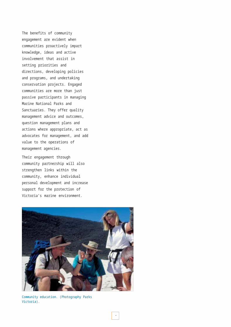
1
COLLABORATIVE ENVIRONMENTAL RESEARCH PARTNERSHIPS
The development of knowledge and understanding of the ecosystems within the system of Marine National Parks and Marine Sanctuaries involves investigations from a variety of perspectives and disciplines. These include studiesby natural and physical scientists such as ecologists, oceanographers, taxonomists and hydrographic surveyors, as well as social scientists.
While many research and monitoring investigations occur independently and collect empirical data, scientists may also review and incorporate information from other studies (secondary research) and disciplines into their own study to facilitate knowledge-building.
Research partnerships
In many cases, particularly large-scale investigations, it is highly advantageous for multi-disciplinary studies to be designed, integrated and implemented together. This can lead to efficiencies through sharing of resources and economies of scale, as well as substantially increased information return through combined research efforts.
Community partnerships
Community participation in the investigation and monitoring of Marine National Parks and Sanctuaries is valuable to management from both an ecological and social perspective.
Neptune's necklace Hormosira banksii is home to a variety of small animals such as the crab, Paragrapsus quadridentatus seen here. (Photography William Boyle).
With appropriate training and support, community-based surveys conducted by volunteers such as Friends Groups and Reef Watch (see pages 85–86) can provide useful information on easily recognised species and habitats, such as large fishes, kelp forests and seagrass beds. Such surveys provide valuable information that complements more detailed scientific surveys.
Community involvement in the monitoring of Marine National Parks and Sanctuaries is also of value in developing awareness and the profile of natural, cultural and social values amongst the general public, as well as building community custodianship. Even casual observations by the public enable Marine National Parks and Sanctuaries to be examined at more frequent intervals. This is likely to lead to a more rapid detection of unexpected or unusual natural events or marine pest introductions.
Involvement of the community in research and monitoring also provides a vehicle for communicating findings back to the community. In addition to formal community-based surveys, anecdotal evidence from community members(e.g. “I remember the days when…”) can also be of value to scientists and managers.
PARTNERSHIP FRAMEWORK
A key objective of the Victorian Coastal Strategy (2002) is to improve Victoria’s marine and estuarine research and scientific capability by strengthening collaborative partnerships between scientists and institutions. Lead agencies such as the Department of Sustainability and Environment, Parks Victoria and the Environment Protection Authority will continue to facilitate and develop research partnerships between scientific institutions with complementary experience and expertise in marine science.
Parks Victoria’s existing Research Partners Program will be expanded to incorporate priorities for marine research, monitoring and information synthesis within Marine National Parks and Sanctuaries. This program is reviewed by an independent Environment Committee, which provides expert scientific advice to Parks Victoria on research priorities.
Community partnerships for research and monitoring will be encouraged through the Community Partnerships Program (see page 76–87).

OBJECTIVE DESIRED OUTCOMES RESPONSIBILITY
16.1implementation of multi-disciplinary marine science studies through collaborative research partnerships.
scientists and institutions.
Value-added science projects and outcomes through efficiencies of integrated projects.
Parks Victoria with DSE/DPI and EPA
Strategies Implementation Actions Targets
16.1.1 Develop the marine science and research component of the Research Partners Program.
• Establish formal research partners for marine science and research initiatives.
• Work with research partners to identify priorities for target primary and secondary research projects.
By December 2003
By July 2004
16.1.2 Develop and foster community-based research and monitoring projects.
• Investigate support and value-adding potential for community-based research and monitoring programs such asReef Watch.
• Provide support through the Community Partnerships
By July 2003
Ongoing
16.1.3 Develop and facilitate targeted research projects.
• Provide support for appropriate research projects within Marine National Parks and Sanctuaries.
• Establish data exchange agreements between research institutions as necessary.
Ongoing
Ongoing
1
K E Y P E R F O R M A N C E A R E A 1 6
C o l l a b o r a t i v e e n v i r o n m e n t a l r e s e a r c h p a r t n e r s h i p s
To f
1acilitate the

1
integration and Cooperative
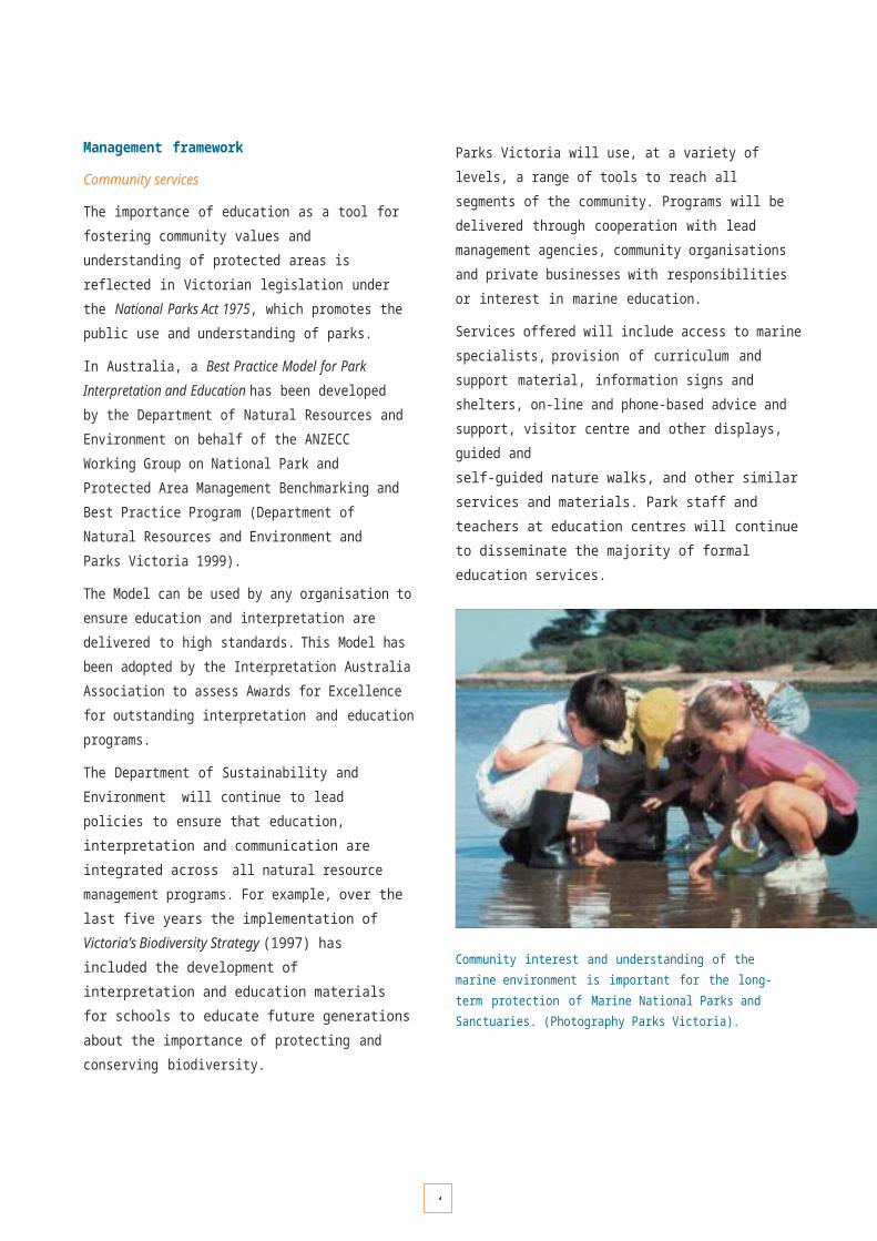
1
w o
6rking

1
arrangements between

1
ENVIRONMENTAL INFORMATION MANAGEMENT
An important component of environmental research and monitoring programs is the storage and retrieval of information for timely and effective data analysis and reporting. This facilitates our understanding of the status of natural values and enables any required management actions to be initiated with minimal delay.
In the context of long-term monitoring programs, information systems will be used to present survey findings and interpret changes and trends.
Another important role of information management systems is to support communication and presentation, and to ensure that information reaches the appropriate levels of management and community audiences in a useable format.
Information management framework
Parks Victoria has developed an Environmental Information Strategy to provide the framework for management of natural values information for all parks and reserves.
Parks Victoria’s Environmental Information System (EIS), which is a geographic information system and supporting databases, provides a single point of access to spatial and textual information concerning natural values, threatening processes, research and management projects as well as base-layer geographic data. The EIS is an important component of the Environmental Management Framework described on page 50, and complements other Victorian information systems such as the Atlas of Victorian Wildlife and Pest Management Information System managed by the Department of Sustainability and Environment.
The EIS will be enhanced to incorporate monitoring and mapping data from survey programs within Marine National Parks and Sanctuaries. These data will be linked and reported through the Internet on ParkWeb (www.parkweb.vic.gov.au) and Marine Map Victoria, which is coordinated by the Department of Sustainability and Environment (www.nre.vic.gov.au).
Diver undertaking a quadrat survey. (Photography Parks Victoria).
Southern dumpling squid Euprymna tasmanica.(Photography Mark Norman).

11
K E Y P E R F O R M A N C E A R E A 1 7
E n v i r o n mental i n f o r m a t i o n m a n a g e m e n t
OBJECTIVE DESIRED OUTCOMES RESPONSIBILITY
17.1 To maintain an environmental information management system for Marine National Parks and Marine Sanctuaries.
Information system capable of storing, analysing and reporting spatial and textual environmental data collected from Marine National Parks and Sanctuaries.
Provision of accessible and timely information products for wide range of uses.
Parks Victoria and DSE/DPI
Strategies Implementation Actions Targets
17.1.1 Upgrade Environmental Information System (EIS) to facilitate storage, analysis and reporting of marine environmental monitoring and mapping data.
• Complete technical scoping paper for EIS upgrade, including an analysis of user needs.
• Complete an agreement with DSE/DPI for exchange of information and appropriate management of intellectual property.
• Upgrade the EIS to hold relevant marine data that is consistent with statewide spatial data held and managed by DSE/DPI.
By December 2003
By December 2003
By July 2004
17.1.2 Provide public access to environmental information about the Marine National Parks and Sanctuaries system.
• Scope and implement a strategy for public access to marine environmental information.
By December 2004

1
P E R F O R M A N C E A S S E S S M E N T A N D E V A L U A T I O N
Performance assessment will play an integral role in the management of Victoria’s system of Marine National Parks and Marine Sanctuaries to ensure that actions contribute effectively to achieving the objectives of this Strategy. Performance assessment will:
• provide information for continuous improvement in the way the system is managed by learning from adaptive management;
• assess the effectiveness of the system in protecting natural, cultural and social values;
• ensure that maximum ecological, social and economic value is received from the use of public resources; and
• provide transparency in the way the system is managed, and whether management outcomes are achieved.
BEST PRACTICE MODEL
To promote a nationally consistent framework for reporting on performance in managing Marine National Parks, the Strategic Plan of Action for the National Representative System of Marine Protected Areas (1999) has endorsed a Best Practice Model developed for the report on Best Practice Performance Reporting in Natural Resource Management (ANZECC Working Group on National Parks and Protected Area Management, 1997).
The model stipulates that the following criteria should be identified:
• a clear link between an agency’s legislative requirements and its strategic objectives for management;
• clearly stated strategies that are derived directly from the strategic objectives;
• a plan of management for programs and activities at both the agency and park level for meeting strategic objectives within a specified time-frame;
• performance indicators and targets against which the achievement of objectives can be assessed, at both the agency and park level; and
• monitoring programs that provide data for assessing performance indicators.
HOW THIS STRATEGY WILL MEET THE BEST PRACTICE MODEL FOR PERFORMANCE REPORTING IN NATURAL RESOURCE MANAGEMENT
• Objectives and strategies have been developed consistent with legislative requirements, State Government policy, and management agency responsibilities.
• Actions developed to implement the Strategy will be monitored and evaluated using performance indicators.
• Performance indicators will be outcome-based, measurable, and directly related to how successful actions will be in meeting the objectives of the Strategy.
STANDARDS
An important aspect of evaluation systems is to ensure that data collection and design of monitoring programs are undertaken to agreed standards and quality assurance levels. In this way the effectiveness of management actions can be evaluated consistently with certainty and confidence.
Parks Victoria will seek to adopt established standards for data collection and monitoring for evaluating management effectiveness, provided that they are cost-effective, achievable and appropriate. Where necessary, new approaches will be developed to the highest possible standards by drawing on expert advice and independent review.
EVALUATION
Evaluation is an important part of performance assessment. It provides a way of reviewing the effectiveness at all levels, from setting of objectives to program design and operational delivery.
Collecting appropriate information is central to the evaluation process. Information is used to continuously improve performance through a process termed adaptive management.
The adaptive management process involves obtaining information on how well actions in the past produced desired outcomes, and then consideration of how these actions might be improved into the future. This type of evaluation allows management actions to adapt through a learning and continuous improvement process.
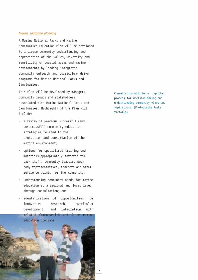
1
REPORTING
Strategic objectives outlined in this Strategy will be assessed and reported across key performance areas under the following themes:
• Protecting Natural Values
• Protecting and Recognising Cultural Values
• Community Engagement
• Recreation, Tourism and Visitor Management
• Environmental Research and Monitoring.
An important aspect of reporting will be to ensure that our assessment process is transparent and open, with results available to local communities, stakeholders and the Victorian Government.
Regular public reporting
Through the management planning consultation process, Parks Victoria will be seeking public input into preferred approaches for transparent public reporting and communication. This will involve:
• identifying the needs and type of performance indicators that different audiences require;
• identifying suitable media for disseminating this information;
• linking results back to education programs, training and development; and
• seeking ongoing feedback on the usefulness of the information that is reported and disseminated.
Progress on implementing the Strategy and related information on the Marine National Parks and Sanctuaries program will be reported through ParkWeb, and through periodic communication bulletins.
Senator wrasse Picitlabrus laticlavius. (Photograph William Boyle). Black-lipped abalone Haliotis rubra. (Photography William Boyle).
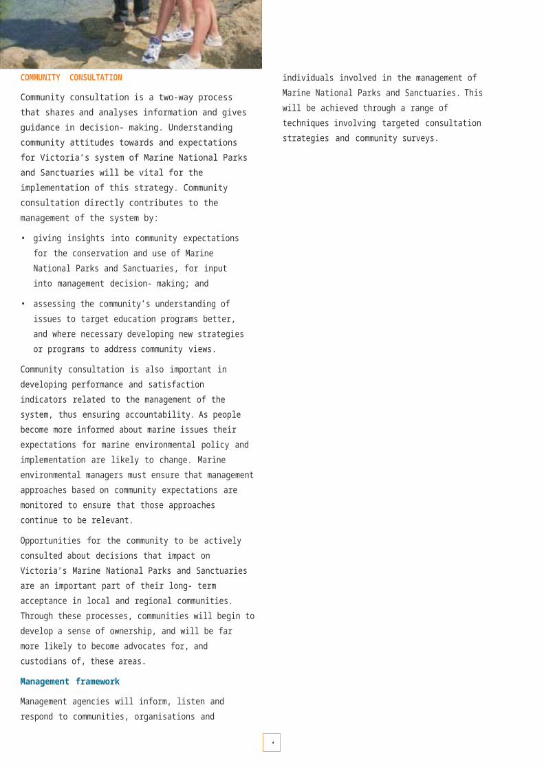
1
State of the Parks Reporting
Environmental assessments of Marine National Parks and Sanctuaries will be integrated in future State of the Parks Reports. These reports provide the community with a comprehensive overview on the condition of Victoria’s parks system, and serve as an historical record. The reports cover various environmental aspects, such as:
• natural values protected in the parks and reserves system;
• key environmental issues faced by the parks system as a whole, and how they vary between parks;
• progress of major environmental programs currently undertaken across the State.
Corporate reporting requirements
The Parks Victoria Act 1998 requires Parks Victoria to develop an annual Corporate Plan. Within the context of the management agreement between the Minister for Environment, the Secretary to the Department of Sustainability and Environment and Parks Victoria, the corporate plan provides the overall framework for the day- to-day management of Victoria’s parks estate. It establishes the long-term vision for Victoria’s parks system and establishes strategic objectives by identifying priority issues and challenges.
The strategic objectives of this Strategy will be integrated into the corporate plan. Parks Victoria’s success in meeting those objectives will measured by performance indicators and will be reported to the Victorian Government through the Department of Sustainability and Environment.
Neptune’s necklace Hormosira banksii. (Photography William Boyle). Diver at the surface. (Photography William Boyle).
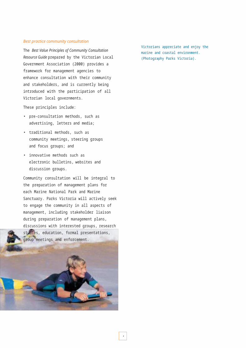
R E F E R E N C E S
113

1
R E F E R E N C E S
ANZECC Task Force on Marine Protected Areas (1998). Guidelines for Establishing the National Representative System of Marine Protected Areas. Australia and New Zealand Environment and Conservation Council, Task Force on Marine Protected Areas. Environment Australia, Canberra.(Available at www.environment.gov.au/marine/marine_protected/nrsmpa/main.html)
ANZECC Task Force on Marine Protected Areas (1999). Strategic Plan of Action for a National Representative System of Marine Protected Areas: A guide for action by Australian Governments Australia and New Zealand Environment and Conservation Council, Task Force on Marine Protected Areas. Environment Australia, Canberra. (Available at www.environment.gov.au/marine/marine_protected/nrsmpa/main.html)
ANZECC Working Group on National Parks and Protected Area Management (1997). Best Practice Performance Reporting in Natural Resource Management.Report by Biosis Research Pty Ltd to the Department of Natural Resources and Environment Victoria (Lead Agency), Melbourne Australia.
ASTEC (Australian Science, Technology and Engineering Council) (1998). National Priciples and Guidelines for the Ethical Conduct of Research in Protected and Environmentally Sensitive Areas. (Available at www.dest.gov.au/archive/science/astec/ethics/ethics.html).
Australia ICOMOS (1999). Burra Charter. (Avalable at www.icomos.org/australia/burra.html)
Committee on the Evaluation, Design and Monitoring of Marine Reserves and Protected Areas in the United States (2001). Marine Protected Areas: Tools for Sustaining Ocean Ecosystems. National Academy Press, Washington DC, USA.
Department of Natural Resources and Environment and Parks Victoria (1997). Victoria’s Biodiversity Strategy: Directions in Management. Department of Natural Resources and Environment, East Melbourne, Victoria, Australia.
Department of Natural Resources and Environment and Parks Victoria (1999). Best Practice Model for Park Interpretation and Education. Report for the ANZECC Working Group on National Park and Protected Area Management Benchmarking and Best Practice Program, Melbourne, Australia.
Department of Natural Resources and Environment (2002). Port Phillip Bay Environmental Management Plan and Critical Programs to 2003.
Environment Conservation Council (2000). Marine, Coastal and Estuarine Investigation: Final Report.Environment Conservation Council, Melbourne, Australia. (Available at www.nre.vic.gov.au/ecc/index.htm)
Ferns, L.W. and Hough, D. (eds) (2000). Environmental Inventory of Victoria’s Marine Ecosystems Stage 3 (Volume 2) – Understanding Biodiversity Representativeness of Victoria’s Rocky Reefs. Parks, Flora and Fauna Division, Department of Natural Resources and Environment, East Melbourne, Australia. (Available at www.nre.vic.gov.au/ coasts and marine)
Ferns, L.W. and Hough, D. (eds) (2002). High Resolution Marine Habitat Mapping of the Bunurong coast (Victoria) – Including the Bunurong Marine and Coastal Park. Parks, Flora and Fauna Division, Department of Natural Resources and Environment, East Melbourne, Australia.(Available at www.nre.vic.gov.au/ coasts and marine)
GBRMPA Research Ethics Advisory Committee (1997). Terms of Reference.(Available at www.gbrmpa.gov.au/corp_site/about_gbrmpa/online_action_plan/detailed_reports/oapreps_42.html)
Hockings, M., Stolton, S. and Dudley, N. (2000). Evaluating Effectiveness. A Framework for Assessing the Management of Protected Areas. World Commission on Protected Areas, Best Practice Protected Area Guidelines Series No. 6. IUCN – The World Conservation Union, Gland, Switzerland.
Interim Marine and Coastal Regionalisation for Australia Technical Group (1998). Interim Marine and Coastal Regionalisation for Australia: An Ecosystem-based Classification for Marine and Coastal Environments. Version 3.3. Environment Australia, Commonwealth Department of the Environment, Canberra, Australia.
O’Hara T. and Barmby V. (2000). Victorian Marine Species of Conservation Concern: Molluscs, Echinoderms and Decapod Crustaceans. Parks, Flora and Fauna Division, Department of Natural Resources and Environment, East Melbourne, Australia.
Simpson, C.J., Colman, J.G and Hill, A.K. (2000). A Strategic Framework for Marine Research and Monitoring in the Shark Bay World Heritage Property. Draft Report by the Department of Conservation and Land Management, Fremantle, Australia.
Victorian Coastal Council (1998). Landscape Setting Types for the Victorian Coast. Victorian Coastal Council, East Melbourne, Australia.(Available at www.vcc.vic.gov.au/landscape/index.htm)
Victorian Coastal Council (1998). Siting and Design Guidelines for Structures on the Victorian Coast. Victorian Coastal Council, East Melbourne, Australia.(Available at www.vcc.vic.gov.au/landscape/index.htm)
Victorian Coastal Council (2002). Victorian Coastal Strategy. Victorian Coastal Council, East Melbourne, Australia. (Available at www.vcc.vic.gov.au)
Victorian Local Government Association (2002). Best Value Victoria Community Consultation Resource Guide. Victorian Local Government Association, Melbourne, Australia. (Available at www.vlga.org.au)
1
READING RELATED TO VICTORIA’S MARINE BIODIVERSITY
Bennett, I. and Pope, E.C. (1953). Intertidal zonation of the exposed rocky shore of Victoria, together with a rearrangement of the biogeographic provinces of temperate Australian shores. Australian Journal of Marine and Freshwater Research 4: 105–159.
Blake, S. and Ball, D. (2001). Seagrass Mapping of Port Phillip Bay. Marine and Freshwater Resources Institute Report No. 39, Department of Natural Resources and Environment, Melbourne, Australia. (Available at www.nre.vic.gov.au/ coasts and marine)
Blake, S. and Ball, D. (2001). Seagrass Mapping of Western Port. Marine and Freshwater Resources Institute Report No. 29, Department of Natural Resources and Environment, Melbourne, Australia. (Available at www.nre.vic.gov.au/ coasts and marine)
Blake, S., Roob, R. and Patterson, E. (2000). Seagrass: Minor Inlets of Victoria. Marine and Freshwater Resources Institute Report No. 10, Department of Natural Resources and Environment, Melbourne, Australia. (Available at www.nre.vic.gov.au/ coasts and marine)
Coleman, N., Gason, A. and Poore, G. (1997). High species richness in the shallow marine waters of south-east Australia. Marine Ecology Progress Series154: 17–26.
Consulting Environmental Engineers (1992). Environmental Inventory of Victoria’s Marine Ecosystems – Stage 1: Review of Information Sources. Report to the Department of Conservation and Environment and Land Conservation Council, Melbourne, Australia (unpublished).
Edmunds, M., Chidgey, S.S. and Wilcox, S.T. (2000). Association between biological communities and physical variables of Victoria’s rocky reefs. In Ferns, L.W. and Hough, D. (eds) (2000). Environmental Inventory of Victoria’s Marine Ecosystems Stage 3 (2nd Edition) – Understanding Biodiversity Representativeness of Victoria’s Rocky Reefs. Parks, Flora and Fauna Division, Department of Natural Resources and Environment, East Melbourne, Australia.(Available at www.nre.vic.gov.au/ coasts and marine)
Edmunds, M., Roob, R. and Ball, D. (2000). Victorian Oil Spill Response Atlas – Biological Resources. Macroalgal Communities in Central Victoria. Report to the Australian Maritime Safety Authority. Australian Marine Ecology Report No. 109, Melbourne, Australia.
Edmunds, M., Roob, R. and Ferns, L.W. (2000). Marine biogeography of Central Victoria and Flinders bioregions– a preliminary analysis of reef flora and fauna. In Ferns, L.W. and Hough, D. (eds) (2000). Environmental Inventory of Victoria’s Marine Ecosystems Stage 3 (2nd edition) – Understanding Biodiversity Representativeness of Victoria’s Rocky Reefs. Parks, Flora and Fauna Division, Department of Natural Resources and Environment, East Melbourne, Australia. (Available at www.nre.vic.gov.au/ coasts and marine)
Ferns. L.W. (ed.). (1999). Environmental Inventory of Victoria’s Marine Ecosystems Stage 4 (Part 1) – Physical Classification of Soft Sediment Ecosystems.Parks, Flora and Fauna Division, Department of Natural Resources and Environment, East Melbourne, Australia. (Available at www.nre.vic.gov.au/ coasts and marine)
Ferns, L.W., Hough, D. and Catlin, J. (2000). Describing marine biodiversity through mapping and quantitative analysis of biological data. A classification system for Victoria’s intertidal and nearshore subtidal marine waters. In Ferns, L.W. and Hough, D. (eds) (2000). Environmental Inventory of Victoria’s Marine Ecosystems Stage 3 (2nd Edition) – Understanding biodiversity representativeness of Victoria’s rocky reefs. Parks, Flora and Fauna Division, Department of Natural Resources and Environment, East Melbourne, Australia. (Available at www.nre.vic.gov.au/ coasts and marine)
Gray, J.S., Poore, G.C.B., Ugland, K.I., Wilson, R.S., Olsgard, F. and Johannessen, Ø. (1998). Coastal and deep-sea benthic diversities compared. Marine Ecology Progress Series 159: 97–103.
Hamilton, N.T.M. (1994). Environmental Inventory of Victoria’s Marine Ecosystems Stage 2. A physical Classification of Bass Strait Waters: Pattern Analysis of Selected Attributes Together with a Review of an Existing Shore-based Classification. Report to the Land Conservation Council and Department of Conservation and Natural Resources, Melbourne, Australia.
Handreck, C.P. and O’Hara, T.D. (1994). Occurrence of Selected Species of Intertidal and Shallow Subtidal Invertebrates at Victorian Locations. A report by the Marine Research Group of Victoria Incorporated to the Land Conservation Council, Melbourne, Australia.
Harty, C. (1997). Mangroves in New South Wales and Victoria. Vista Publications, Melbourne, Australia.
Haynes, D. and Quinn, G.P. (1995). Temporal and spatial variability in community structure of a sandy intertidal beach, Cape Patterson, Victoria, Australia.Marine and Freshwater Research 46: 931–942.
Jenkins, G.P., May, H.M.A., Wheatley, M.J. and Holloway, M.G. (1997). Comparison of fish assemblages associated with seagrass and adjacent unvegetated habitats of Port Phillip Bay and Corner Inlet, Victoria, Australia, with emphasis on commercial species. Estuarine and Coastal Shelf Science 44:569–588.
King, R.J. Hope-Black, J. and Ducker, S.C. (1971). Intertidal ecology of Port Phillip Bay with systematic lists of plants and animals. Memoirs of the Natural Museum of Victoria 32: 93–128.
Land Conservation Council (1993). Marine and Coastal Special Investigation Descriptive Report. Land Conservation Council, Melbourne, Australia.
Menkhorst, P.E. (1995). Mammals of Victoria. Oxford University Press, Melbourne, Australia.

1
O’Hara, T. (2000). Faunal and floral assemblages associated with rocky reefs along the Victorian coast. In Ferns. L.W and Hough, D. (Eds). (2000). Environmental Inventory of Victoria’s Marine Ecosystems Stage 3 (2nd edition) – Understanding Biodiversity Representativeness of Victoria’s Rocky Reefs. Parks, Flora and Fauna Division, Department of Natural Resources and Environment, East Melbourne, Australia.(Available at www.nre.vic.gov.au)
O’Hara, T. (2000). Victorian Province. In: Sheppard, C.R.C. (ed.). Seas at the Millenium: An Environmental Evaluation. Elsevier Science, Oxford.
O’Hara T. (2001). Patterns of diversity for subtidal reef assemblages of Victoria, Australia. PhD Thesis, University of Melbourne, Australia (unpublished).
Parry, G.D., Campbell, S.J. and Hobday, D.K. (1990). Marine Resources off East Gippsland, Southeast Australia. Marine Science Laboratories Technical
ReportNo 72, Melbourne, Australia.
Porter, C. (1997). Subtidal Reef Areas in Victoria’s Central Marine Biophysical Region: Identification, Assessment and Documentation of Significant Sites for Nomination to the Register of the National Estate. A report to the Victorian National Parks Association and the Australian Marine Conservation Society – Victorian Branch, Melbourne, Australia.
Porter, C. and Trail, B. (2001). The conservation status of Victoria’s marine environment. In: Nature Conservation Review Victoria 2001. Victorian National Parks Association Inc., Melbourne Australia. pp. 9–64.
Roob, R. and Currie, D. (1996). Marine and Coastal Special Investigation: Offshore Survey of Selected Areas. Report to the Land Conservation Council by the Victorian Fisheries Research Institute. Department of Natural Resources and Environment, Melbourne, Australia.
Roob, R. and O’Hara, T. (1996). Marine and Coastal Special Investigation: Additional Offshore Survey of Selected Areas. Report to the Land Conservation Council by the Marine and Freshwater Resources Institute. Department of Natural Resources and Environment, Melbourne, Australia.
Roob, R. and Ball, D. (1997). Seagrass: Gippsland Lakes. Marine and Freshwater Resources Institute Report to Fisheries Victoria, Department of Natural Resources and Environment, Melbourne, Australia. (Available at www.nre.vic.gov.au/ coasts and marine)
Roob, R. Blake, S. and Parry, G. (1999). Marine and Coastal Special Investigation: Additional offshore survey of selected areas. Report to the Environment Conservation Council by the Marine and Freshwater Resources Institute. Department of Natural Resources and Environment, Melbourne, Australia.
Roob, R., Morris, P. and Werner, G. (1998). Seagrass: Corner Inlet and Nooramunga. Marine and Freshwater Resources Institute Report No. 10, Department of Natural Resources and Environment, Melbourne, Australia. (Available at www.nre.vic.gov.au/ coasts and marine)
Tsernjavski, N. (1995). Marine and Coastal Sites of significance in Victoria. Nomination form and guidelines for listing marine and coastal areas to the National Estate Register. A report by the Victorian National Parks Association to the Australian Heritage Commission, Melbourne, Australia.
Victorian Institute of Marine Sciences, Consulting Environmental Engineers, Dames and Moore, and Museum of Victoria. (1994). Environmental Inventory of Victoria’s Marine Ecosystems Stage 1: Biophysical classification. Unpublished report to the Land Conservation Council and the Department of Natural Resources and Environment, Melbourne, Australia.
Williams, I. M., and Leach, J. H. J. (1999). The relationship between depth, substrate and ecology: a drop video study from the southeastern Australian coast.Oceanologica Acta, 22: 651–662.
Wilson, R.S., Poore, G.C.B. and Gomon, M.F. (1990). Marine Habitats at Wilsons Promontory and the Bunurong Coast, Victoria: Report on a Survey, 1982.Marine Science Laboratories. Technical Report No 73, Melbourne, Australia.
READING ON THE MANAGEMENT AND PLANNING OF MARINE PROTECTED AREAS
Borrini-Feyerabend, G. (1998). Managing marine protected areas in partnership with communities. In: Partnership for Conservation: Report of the Regional Workshop on Marine Protected Areas, Tourism, and Communities. International Union for Conservation of Nature, Eastern Africa Regional Office, Nairobi, Kenya.
Great Barrier Reef Marine Park Authority (1994). The Great Barrier Reef: A 25 year Strategic Plan for the Great Barrier Reef World Heritage Area.Townsville, Australia.
Gubbay, S. (1995). Marine Protected Areas: Principles and Techniques for Management. Chapman and Hall, London.
Kelleher, G. (1999). Guidelines for Establishing Marine Protected Areas. IUCN, Gland, Switzerland and Cambridge,
UK.
Recksiek, H. and Hinchcliff, G. (2002). Marine Protected Areas Needs Assessment Final Report. NOAA Coastal Services Center in cooperation with the National MPA Protected Areas Center, National Oceanic and Atmospheric Administration.
Salm, R.V., Clark, J.R. and Siirila, E. (2000). Marine and Coastal Protected Areas: A Guide for Planners and Managers. IUCN, Gland, Washington, DC.
Salvat, B. (1975). Guidelines for the planning and management of marine parks and reserves. In Proceedings of an International Conference on Marine Parks and Reserves. May 12–14, 1975, Tokyo, Japan. IUCN Publication No. 37, Gland, Switzerland.

G L O S S A R Y
117

1
G L O S S A R Y
AAV – Aboriginal Affairs Victoria.
Algae – plant like organisms which use light energy to create food. Unlike plants, not differentiated into roots, stems and leaves. Commonly called seaweed.
Aquaculture – cultivation of fish, molluscs or other aquatic organisms in fresh or salt water for human use.
Anti-fouling paint – paint containing chemicals that prevent organisms such as barnacles from attaching to a ship’s hull.
ANZECC – former Australian and New Zealand Environment and Conservation Council. ANZECC was represented by government Ministers and guided national policy and programs related to the management of the environment and its conservation.
Ascidian (sea squirt) – common solitary or colonial marine animal. Closest common invertebrate relative to humans in the ocean.
Ballast water – water carried in a ship’s tanks for stability; normally discharged to the sea when the ship is loaded, and can be contaminated with pollution or exotic organisms.
Biodiversity – the natural diversity of all life: the sum of all our native species of flora and fauna, the genetic variation within them, their habitats and the ecosystems of which they are an integral part.
Bioregion – an area with particular underlying environmental and ecological features.
Bivalve – type of mollusc possessing two shells (e.g. scallop, mussel).
Bommie – small free-standing rocky reef.
Bryozoan (lace coral) – small, common colonial marine animal, flat or upright, many colours.
Canopy – structural overstorey (e.g. of kelp).
CAR – Comprehensive Adequate and Representative.
Catchment – the area of land that drains to a watercourse or estuary.
Coast – in broad terms, the sea and the seabed to the State limit (three nautical miles, or 5.5 km) and the land and inland waters within the coastal catchment.
Coastal action plan – plan that identifies strategic directions and objectives for use and development in the region or part of the region to facilitate recreational use and tourism, and to provide for protection and enhancement of significant features of the coast, including the marine environment.
Coastline – generally, where the land meets the sea.
Committee of Management – a committee appointed under the Crown Land (Reserves) Act 1978 to manage reserved Crown land on behalf of the Minister. For coastal land, committees are either an agency (e.g. the local municipality, Parks Victoria or the Department of Sustainability and Environment) or a committee appointed through an expression of interest process.
Coralline algae – algae which contain calcified components. Can take a variety of forms from encrusting to upright.
CRIMP – Centre for Research on Introduced Marine Pests.
Crown land – public land not vested in a public authority, including land which has been temporarily or permanently reserved under the Crown Land (Reserves) Act 1978.
CSIRO – Commonwealth Scientific and Industrial Research Organisation.
DPI – Department of Primary Industries.
DSE – Department of Sustainability and Environment.
ECC – Environment Conservation Council.
Ecologically sustainable development (ESD) – development that improves the total quality of life both now and in the future, in a way that maintains the ecological processes on which life depends.
Ecologically sustainable use – the use of a species or ecosystem at a level that allows it to naturally renew.
Ecosystem – a dynamic complex of interacting organisms and their associated non-living environment.
Effluent – a liquid, partially or completely treated or in its natural state, flowing from a water or sewage treatment plant.
EMF – Environmental Management Framework.
Endemic – unique to a particular area, and not found naturally anywhere else.
Environmental flow – minimum flows of water (by volume and season) necessary to maintain all aquatic life.
EPA – Environment Protection Authority.
Estuary – an inlet or river mouth that is influenced by tides and freshwater inputs from the catchment.
Exotic marine organism – see pest.
Foreshore – generally, the land between a coastal road and the low water mark.
Freehold land – see private land.
Geomorphology – the scientific study of landforms and geological formations and the processes that shape them.

1
Gorgonian – soft coral fan, generally found in high flow areas. Many colours.
Habitat – the preferred location or ‘home’ of an organism.
Hard Coral – coral with solid calcareous cases for structure. Generally colonial and found on hard surfaces.
Heritage – a, place, activity, cultural way of life, structure or group of structures that have aesthetic, historic, scientific or social value for the past, present or future generations.
HV – Heritage Victoria.
Hydroid – small tentacled animal related to corals and sea-jellies. Common but often overlooked.
ICZM – Integrated Coastal Zone Management.
Indigenous people – people who are descendants of Aboriginal Australians.
Indigenous species – species that occur naturally in a region. See also endemic.
Infrastructure – physical structures that facilitate the use of an area (e.g. roads, paths, toilet blocks).
Integrated coastal zone management (ICZM) – a framework that attempts to integrate planning and management in a region (e.g. Victoria) across the land and sea interface and the private and public land interface, to treat the coastal zone as one biophysical entity.
Intertidal zone – the area between low and high tide levels, which is subject to daily changes in physical and biological conditions from tide movements.
Invertebrate – an animal without a backbone at any stage of development (e.g. worms, sponges).
Marine National Park – in Victoria, highly protected areas that represent the range of marine environments in Victoria, in which no fishing, extractive or damaging activities are allowed.
Marine protected area – term used internationally to describe a marine area that has some form of protection and is managed for conservation objectives.
Marine Sanctuary – in Victoria, a smaller, highly protected area designated to protect special values, in which no fishing, extractive or damaging activities are allowed. These areas complement Marine National Parks.
Mollusc – broad group of animals including snails, sea slugs, squid, octopus, cuttlefish and mussels.
Nature-based tourism – tourism that provides a range of experiences associated with the natural environment, generally related to outdoor activity.
NRE – (Department of) Natural Resources and Environment.
NRSMPA – National Representative System of Marine Protected Areas.
Outfall – the place where sewage is discharged to the ocean.
Pelagic – the surface waters of the marine environment.
Pest – an organism that is, or has the potential to become, a threat to indigenous species or their habitat.
Photosynthesis – the process by which organic molecules are made from carbon dioxide and water, using light energy. This process is essential for the growth and survival of plants and algae.
Private land – land under freehold tenure (privately owned).
Public land –unalienated land of the Crown (see Crown land) or land vested in a public authority.
PV – Parks Victoria.
Remnant vegetation – remaining natural vegetation.
Sediment – insoluble material suspended in water, consisting mainly of particles derived from rock, soil and organic material.
Sessile – an organism that grows attached to any underwater surface (eg. pier, seabed, pile).
Sewage – household and commercial waste water that contains human or trade wastes.
Sewerage – the system that facilitates the collection, transport, treatment and discharge of sewage.
Soft coral – coral without solid calcareous cases for structure. Generally colonial and found on hard surfaces.
Sponge – multicellular, filter-feeding animals which occur in a variety of forms. The simplest form of invertebrate life.
Stakeholders – public users, an individual or group that have a vested interest in, or may be affected by, a project or process.
Stipe – the unbranched middle section of seaweeds.
Stormwater – runoff from land during and following rain. Stormwater removes accumulated material including litter, soil, nutrients, pathogens, chemicals, pesticides, oils and grease.
Thallus – the body of a plant.
Understorey – layer of organisms living beneath a canopy of taller species.
Wetland – land where saturation by water is the dominant factor for soil type and plant and animal communities (e.g. tidal areas, saltmarshes and mangroves).
Whip coral (sea whip) – specialised whip-like form of coral. Commonly lives in deep water on hard and soft surfaces.

1

A P P E N D I C E S
121
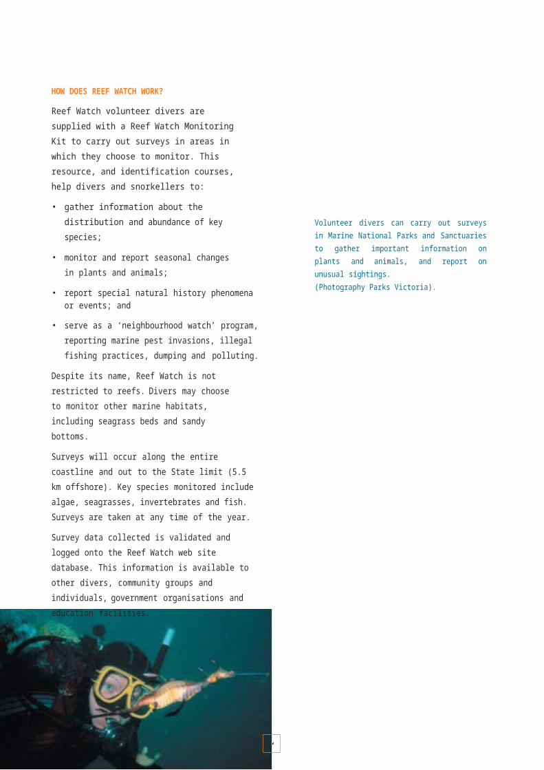
1
A P P E N D I X 1
NATIONAL AND INTERNATIONAL BEST PRACTICE GUIDELINES FOR THE ESTABLISHMENT AND MANAGEMENT OF MARINE PROTECTED AREAS
National arrangements
The ANZECC Task Force on Marine Protected Areas has developed national guidelines and scientific principles for the establishment and management of the NationalRepresentative System of Marine Protected Areas
(NRSMPA). The primary goal of the NRSMPA is:
To establish and manage a comprehensive, adequate and representative system of marine protected areas to contribute to the long-term ecological viability of marine and estuarine systems, to maintain ecological processesand systems, and to protect Australia’s biological diversity at all levels.
The NRSMPA also has the following secondary goals, which are compatible with the primary goal:
• to promote the development of marine protected areas within a framework of integrated ecosystem management;
• to provide a formal management framework for a broad spectrum of human activities, including recreation, tourism and shipping;
• to provide scientific reference sites;
• to provide for the special needs of rare, threatened or depleted species and threatened ecological communities;
• to provide for the conservation of special groups of organisms; for example, species with complex habitat requirements or mobile or migratory species, or species vulnerable to disturbance, and which may depend on reservation for their conservation;
• to protect areas of high conservation value, including those containing high species diversity, natural refugia for flora and fauna and centres of endemism; and
• to provide for recreational and cultural needs of Indigenous and non-Indigenous people.
Interim Marine and Coastal Regionalisation for Australia
Australia’s marine environment has been classified into 60 marine bioregions (see page 33) for the Interim Marine and Coastal Regionalisation for Australia (Interim Marine and Coastal Regionalisation for Australia Technical Group 1998).
The NRSMPA uses these bioregions to identify broad geographic areas within which marine protected areas should be established.
Victoria’s Marine National Parks and Sanctuaries were selected geographically across each of the five bioregions in Victorian waters. This will ensure that a comprehensive selection of marine ecosystems and biodiversity are protected for future generations.
National guidelines
The NRSMPA has been developed under national Guidelines for Establishing the National Representative System of Marine Protected Areas (ANZECC Task Force on Marine Protected Areas 1998). The guidelines outline ecological, cultural, social and economic criteria for identifying marine protected areas and are intended to ensure that their management is consistent with national arrangements.In summary, the guidelines recommend that the following issues be incorporated into the planning and management processes of each jurisdiction:
• Bioregional Framework – the adoption of marine bioregions as the geographical framework for the planning and management of marine protected areas;
• Comprehensive, Adequate and Representative Systems Approach – the establishment and management of marine protected areas according to the principles of comprehensiveness, adequacy andrepresentativeness (see text box opposite for definitions);
• Highly Protected Areas – each marine bioregion to include some areas managed as highly protected according to the categories defined by the IUCN;
• Precautionary Principle – decision-making should proceed in a conservative and cautious manner even if insufficient information is available to assess the magnitude of effects caused by certain activities;
1
• Consultation – establishment and management of marine protected areas will include community and stakeholder consultation to address current and future issues;
• Indigenous Involvement – the interest of Australia’s Indigenous peoples should be recognised and incorporated in management decision-making;
• Decision Making – the decision-making process should integrate both long-term and short-term ecological, cultural, social and economic considerations;
• Values Assessment – each jurisdiction will undertake a relevant assessment of ecological, cultural and social values associated with the selection and management of marine protected areas;
• Threats – potential and existing threats to values, and the integrity of marine protected areas should be assessed and priorities established based on the potential severity of impacts from threatening processes;
• Management objectives and strategies – all marine protected areas should have appropriate management objectives and strategies to address those objectives in place to provide for their ongoing management;
• IUCN protected area management categories –the classification of marine protected areas should adopt the IUCN guidelines for protected area management to ensure their primary objectives are clear.
DEFINITIONS OF COMPREHENSIVENESS, ADEQUACY AND REPRESENTATIVENESS
Comprehensiveness – the NRSMPA will include the full range of ecosystems recognised at an appropriate scale within and across each bioregion.
Adequacy – the NRSMPA will have the required level of reservation to ensure the ecological viability and integrity of populations, species and communities.
Representativeness – those marine areas that are selected for inclusion in marine protected areas should reasonably reflect the biotic diversity of the marine ecosystems from which they derive.
Strategic Plan of Action
The Strategic Plan of Action for the National Representative System of Marine Protected Areas (ANZECC Task Force on Marine Protected Areas 1999) outlines specific actions to assist Australia’s jurisdictions with their marine protected area planning and management processes.
The Strategic Plan of Action identifies 34 priority actions, to be implemented in stages, that reflect both national and jurisdictional priorities. These actions can be grouped under the following categories.
Comprehensive, Adequate and Representative (CAR) System
Actions to ensure that each jurisdiction adopts nationally consistent CAR principles for its planning process. CAR principles allow conservation outcomes required for the NRSMPA, particularly outcomes related to the conservation of marine biodiversity, to be articulated and standardised.A key national action has included understanding CAR principles for strategic planning and management purposes.
Information requirements and information management
Actions that relate to acquiring core information needed to establish, manage and evaluate management performance of the NRSMPA. Key national actions include:
• assessment of biodiversity through marine habitat mapping and surveys of marine communities;
• identification of threatening processes to marine protected areas and their potential impacts; and
• development and maintenance of databases and standardised data sets.
Involvement of stakeholders
Actions to encourage the active participation of stakeholders or individuals in implementing and managing marine protected areas. Key national actions include:
• developing principles for incorporating stakeholder needs through consultation and negotiation; and
• developing approaches for education, training and development.

1
Classifying marine protected areas
Actions to ensure that marine protected areas are classified consistently so that managers and stakeholders have a clear understanding of their management objectives. Key national actions include:
• analysis, application and reporting of IUCN protected area management categories; and
• development of nationally consistent nomenclature for marine protected areas.
Managing the NRSMPA
Actions to examine international and national arrangements for the management of marine protected areas to identify best practice elements and principles. Key national actions include:
• cooperative management arrangements with Indigenous peoples; and
• best practice approaches in marine protected area management planning.
Table A1 IUCN Protected Area Management Categories.
Performance assessment
Actions to develop performance assessment and reporting frameworks for the NRSMPA and individual marine protected areas. Key national actions include:
• frameworks for marine protected area performance assessment; and
• development of outcome-based performance indicators and monitoring programs.
IUCN Protected Area Management Categories
The IUCN has developed Protected Area Management Categories to ensure that the management objectives of protected areas can be consistently communicated across national and international jurisdictions. The categorisation system neither imposes management prescriptions nor sets criteria for assessing management effectiveness. Table 1 below shows the IUCN categories.
In Australia, the former Australian and New Zealand Environment and Conservation Council (ANZECC) endorsed the use of IUCN Protected Area Management Categories for the NRSMPA.
Victoria’s Marine National Parks and Sanctuaries system has been created to ensure the long-term protection and conservation of the marine environment. The system provides for both high levels of protection and uses consistent with the primary objective.
Management Objective IUCN Protected Area Management Category
IA IB II III IV V VI
Scientific research 1 3 2 2 2 2 3
Wilderness protection 1 2 2 3 3 – 2
Preservation of species and genetic diversity 1 2 1 1 1 2 1
Maintenance of environmental services 2 1 1 – 1 2 1
Protection of natural/cultural features – – 2 1 3 1 3
Tourism and recreation – 2 1 1 3 1 3
Education – – 2 2 2 2 3
Sustainable use of resources from natural ecosystems – 3 3 – 2 2 1
Maintenance of cultural/traditional attributes – – – – – 1 2
Key1 Primary objective2 Secondary objective3 Potentially applicable objective– Not applicable

1
IUCN PROTECTED AREA MANAGEMENT CATEGORIES
CATEGORY IStrict Nature Reserve/Wilderness Area: protected area managed mainly for science or wilderness protection
CATEGORY IAStrict Nature Reserve: protected area managed mainly for science
Area of land and/or sea possessing some outstanding or representative ecosystems, geological or physiological features and/or species, available primarily for scientific research and/or environmental monitoring.
CATEGORY 1BWilderness Area: protected area managed mainly for wilderness protection
Large area of unmodified or slightly modified land and/or sea, retaining its natural character and influence, without permanent significant habitation, which is protected and managed so as to preserve its natural condition.
CATEGORY IINational Park: protected area managed mainly for ecosystem protection and recreation
Natural area of land and/or sea, designated to (a) protect the ecological integrity of one or more ecosystems for present and future generations, (b) exclude exploitation or occupation inimical to the purposes of designation of the area and (c) provide a foundation for spiritual, scientific, education, recreational and visitor opportunities, all of which must be environmentally and culturally compatible.
CATEGORY IIINatural Monument: protected area managed mainly for conservation of specific natural features
Area containing, one or more, specific natural or natural/cultural feature which is of outstanding or unique value because of its inherent rarity, representative or aesthetic qualities or cultural significance.
CATEGORY IVHabitat/Species Management Area: protected area managed mainly for conservation through management intervention
Area of land and/or sea subject to active intervention for management purposes so as to ensure the maintenance of habitats and/or to meet the requirements of specific species.
CATEGORY VProtected Landscape/Seascape: protected area managed mainly for landscape/seascape conservation and recreation
Area of land, with coast and sea as appropriate, where the interaction of people and nature over time has produced an area of distinct character with significant aesthetic, ecological and or cultural value, and often with high biological diversity. Safeguarding the integrity of this traditional interaction is vital to the protection, maintenance and evolution of such an area.
CATEGORY VI
Managed Resource Protected Area: protected area managed mainly for the sustainable use of natural ecosystems
Area containing predominantly unmodified natural systems, managed to ensure long-term protection and maintenance of biological diversity, while providing at the same time a sustainable flow of natural products and services to meet community needs.

1
A P P E N D I X 2
CRITERIA USED FOR THE ASSESSMENT OF MONITORING TECHNIQUES
The following set of pragmatic criteria developed for the Shark Bay World Heritage Property (Simpson et al. 2000) are currently used for evaluating the suitability of marine monitoring techniques for Victoria’s marine environment.
MeritThe key criterion for evaluating the merit of all monitoring techniques is whether the data provides appropriate information in meeting specific management objectives. Criteria against which to assess the merit of a proposal include:
EligibilityThe technique must deliver data that report on outcomes that are consistent with defined management objectives. Will the technique provide data that leads to long-term improvements to management?
Scientific / Technical ValidityThe technique must be based on sound scientific principles and methods. Has the technique been reviewed at an appropriate level?
ApplicationIs the technique innovative and does it have a broad application? What is the time-frame for delivery of effective returns to the management process?
CompatibilityIs the technique complementary to supplying data for other existing and/or proposed projects? Is there sufficient integration or is it a duplication of other projects?
Social SignificanceCan the technique and/or the data derived from the technique involve key stakeholders or the community? What is the potential educational significance to the community?
ReportingHow effectively will the results/outcomes of the technique be disseminated? How will data and specimens collected be managed, archived and maintained?
Ethics
The ethical criteria detailed below have been adapted from a number of sources, including terms of reference for the Great Barrier Reef Marine Park Authority Research Ethics Advisory Committee (GBRMPA, 1997) and the Australian Science, Technology and Engineering Council guidelines for the ethical conduct of research in environmentally sensitive areas (ASTEC, 1998).
Best practiceDoes the technique represent best practice? Can data be obtained using alternative and less intrusive or destructive techniques or by using a different sampling design? Does the experimental design address the objectives with minimal disturbance?
ImpactsWill the technique have any direct, indirect or cumulative impacts? What, if any, remediation will be required after the project is complete? Do the potential benefits of the project warrant the extent of likely impacts?
RiskDoes the technique impact on endangered, vulnerable, threatened or commercially important species or communities? Can the technique be carried out in less sensitive areas without compromising management objectives? Does the technique involve the introduction or relocation of any biological material (including genetically modified organisms)? Are toxic/radioactive/cumulative or persistent chemicals likely to be released into the marine environment?
AcceptabilityIs the technique manipulative or intrusive? Is the technique likely to be controversial or sensitive (culturally) or be considered cruel or unnecessary? Will the technique take place in a highly protected area such as a sanctuary zone of a marine park, or a marine nature reserve?
EquityDoes the technique involve the infringement of privacy and property rights? What are the potential benefits of the data collected for resource conflict resolution between different users?
Commercial GainWill the technique, including the availability of data obtained from the technique, be likely to lead to direct or indirect commercial gain which may compromise the objectives?
FeasibilityAchievabilityIs sufficient technical expertise and experience available to undertake the technique? Is the technique likely to achieve the proposed outcomes?
ResourcesWhat resource demands will be required to undertake the technique? Are there sufficient resources to conduct the work?

M A R I N E N A T I O N A L P A R K A N D M A R I N E S A N C T U A R Y M A P S
127

1
Marine National Park Shore based boundarymarker (Triangular Beacon)
Coastal Park and Reserves Boat access point
D I S C O V E R Y B A Y M A R I N E N A T I O N A L P A R K Located 20 km west of Portland at the point where the coastline turns towards the Great Australian Bight, these waters border Victoria’s largest coastal basalt formations and feature low reefs covered in sponges, filmy sea mosses and erect sea fans.
Discovery Bay Coastal Park
Discovery BayBridgewater
Lakes
Blacks Beach
Descartes Bay
Whites Beach
Discovery Bay Marine National Park Portland
Cape Duquesne
Cape Bridgewater
Bridgewater Bay
Blowholes
Cape Bridgewater
Marine National Park Shore based boundary
marker (Triangular Beacon)
Coastal Park and Reserves
Boat access point
0 1.5 3
Kilometres

Marine Sanctuary Shore based boundaryBoat access point
1
M E R R I M A R I N E S A N C T U A R Y Near Warrnambool, at the mouth of the Merri River, a combination of reef, sand and deep canyon environments support a representative variety of marine life. Two small islands provide breeding sites for penguin colonies.
Warrnambool
Lake Pertobe
Point Ritchie
Lady Bay
Thunder Point
Footbridge
Pickering Point
Merri Marine Sanctuary
Merri Island
Middle Island
Breakwater Rock
Marine Sanctuary Shore based boundary
marker (Triangular Beacon)
Coastal ReservesBoat access point
0 0.25 0.5
Kilometres

1
T W E L V E A P O S T L E S M A R I N E N A T I O N A L P A R K With colourful seaweeds, sponge gardens, rich invertebrate life and schools of reef fish, the underwater scenery of this park, 7 km east of Port Campbell, is just as dramatic as the world-famous rock formations above. A park of colour, underwater canyons, arches and sloping reefs.
T H E A R C H E S M A R I N E S A N C T U A R Y Underwater limestone canyons and rocky formations are covered in kelp and seaweed to create important habitat for a rich diversity of marine life.
Port Campbell
Two Mile Bay
Port Campbell Bay
The Arches Marine Sanctuary
Sherbrook Guide Camp
Broken Head
Port Campbell National Park
Mutton Bird
Island
Loch Ard Gorge
The Twelve Apostles
The Twelve Apostles Lookout
Gibsons Steps
Glenample Homestead
Clifton Beach
Twelve Apostles Marine National Park
Bowkers Beach
Princetown
Gellibrand River Picnic Area
Point Ronald
Rivernook
Marine National Park Shore based boundarymarker (Triangular Beacon)
National Parks and Reserves Boat access pointInformation
Pebble Point
Cat Bay
Otway National Park
0 24
Wreck Beach
The Gable
Kilometres
Moonlight Head
Marine Sanctuary Coastal Reserves Boat access pointInformation
1
M A R E N G O R E E F S M A R I N E S A N C T U A R Y Close to the shoreline, two small reefs offer a variety of microhabitats allowing dense stands of bull kelp and other smaller seaweeds to thrive. As well, there is an abundance of soft corals and sponges.
Lorne
Apollo Bay
Apollo Bay
Bunbury Point
Mounts Bay
Marengo Hayley Point
Marengo Reefs Marine Sanctuary
Swell Point
Port Campbell
Cape Marengo
Storm Point
The Blowhole
Marine Sanctuary
Coastal Reserves Boat access point Information
0 0.5 1
Kilometres

1
P O I N T A D D I S M A R I N E N A T I O N A L P A R K The shoreline features wide sandy beaches and the world-famous surfing venue of Bells Beach. Rocky reefs are exciting destinations for diving and nature study and support intriguing marine creatures such as the weedy sea dragon.
P O I N T D A N G E R M A R I N E S A N C T U A R Y Located in one of Victoria’s most popular seaside towns, the reef is an ideal place for snorkelling and at low tide searching for the diverse animals and plants.
E A G L E R O C K M A R I N E S A N C T U A R Y Sandstone and basalt geology and associated shore platforms, pools and fissures support colourful sponges, impressive kelp forests and encrustations of invertebrates.
TorquayZeally Bay
Jan Juc
Rocky Point
Half Moon Bay
Point Danger Marine Sanctuary
Bells Beach
Southside Beach
Point Addis
AngleseaDemons
Bluff
Point Roadknight
Ingoldsby Reef
Point Addis Marine National Park
Urquhart Bluff
Marine National Park Shore based boundary
marker (Triangular Beacon)
Parks and Reserves Boat access point
Eagle Rock Marine Sanctuary
0 2.5 5
Kilometres
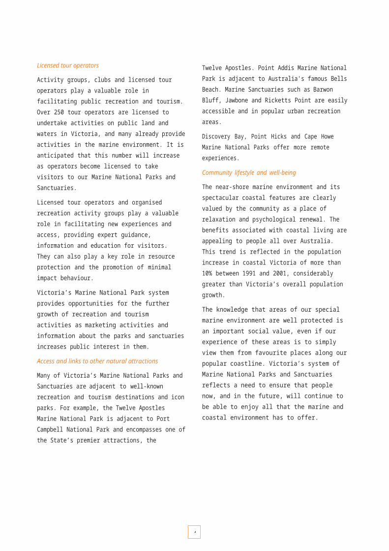
Marine Sanctuary
1
B A R W O N B L U F F M A R I N E S A N C T U A R Y Extensive shore platforms of both basalt and sandstone make this site an ideal place for snorkelling and exploring the rockpools. This site is used extensively for marine education purposes.
Lake Connewarre Wildlife Reserve
Geelong
Guthridge Street Boat
Ramp
Barwon River
Pelican Court Boat Ramp Point Lonsdale
GeelongOcean Grove
Barwon Heads RAAFs Beach
Sandy Point
13th Beach
Barwon Heads Point
Flinders
Barwon Bluff Marine
Sanctuary
Marine Sanctuary Shore based boundary
marker (Triangular Beacon)
Parks and ReservesBoat access point
0 0.5 1
Kilometres
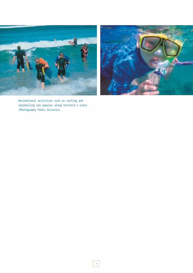
1
P O I N T C O O K E M A R I N E S A N C T U A R Y Extensive reefs parallel to the shoreline create the ideal habitat for a diverse range of molluscs and crustaceans as well as significant fish populations.
Melbourne
Werribee
Point Cooke Marine
Sanctuary
Jawbone Marine Sanctuary
Ricketts Point Marine Sanctuary
Geelong
Port Phillip
Port Phillip Heads Marine National Park
Frankston
Melbourne
Queenscliff
Sorrento
WilliamstownH
obsons Bay
AltonaJaw bone Reserve
Jawbone Marine Sanctuary
Point Gellibrand
Alt ona Bay
Point Cook Coastal Park
Point Cooke Marine
Sanctuary
Campbells Cove
Werribee South
Marine Sanctuary Shore based boundary
marker (Triangular Beacon)
In water boundary
marker (Pile or Buoy)
Coastal Parks and Reserves
Boat access point

1
0 2.5 5
Kilometres

Marine Sanctuary Shore based boundarymarker (Triangular Beacon)
In water boundary marker (Pile or Buoy)
Coastal Parks and Reserves Boat access point
Marine Sanctuary Shore based boundarymarker (Triangular Beacon)
Coastal Parks and Res Boat access point
erves
0 2.5 5
Kilometres
1
J A W B O N E M A R I N E S A N C T U A R Y The closest marine sanctuary to Melbourne, this environment protects some of the last remaining saltmarsh and mangrove communities in Port Phillip. Its water also supports seagrasses and subtidal rocky reefs.
R I C K E T T S P O I N T M A R I N E S A N C T U A R Y Popular for rockpool exploration, this highly accessible marine environment has sandstone platforms that contain not only many invertebrates but evidence of Aboriginal occupation.
Melbourne
Werribee
Point Cooke Marine
Sanctuary
Jawbone Marine Sanctuary
Ricketts Point Marine Sanctuary
Melbourne
Geelong
Port Phillip
Port Phillip Heads Marine National Park
Frankston
Queenscliff
Sorrento
Altona
Williamstown
Jawbone Reserve
Hobsons Bay
Jawbone Marine Sanctuary
Point Gellibrand
St Kilda
Brighton
Brighton Beach
Sandringham
Black Rock
Ricketts Point Marine Sanctuary
Beaumaris Bay
Mordialloc

1
Patterson River

BeaconShort
1
P O R T P H I L L I P H E A D S M A R I N E N A T I O N A L P A R K At the southern reach of Port Phillip, six separate marine environments (Swan Bay, Mud Island, Point Lonsdale, Point Nepean, Popes Eye and Portsea Hole) include intertidal platforms, seagrass meadows, waterbird habitat and popular dive sites.
Melbourne
Werribee
Point Cooke Marine
Sanctuary
Jawbone Marine Sanctuary
Ricketts Point Marine Sanctuary
Point Richards
Portarlington Geelong
Port Phillip Frankston
Port Phillip Heads Marine National Park
Queenscliff
Indented HeadSorrento
St Leonards
Sw an Bay
Duck Island Port Phillip
Heads Marine National Park
M arcus Hill Column
Sw an Island
M ud Islands
QueenscliffClarkes
Bluf f Popes Eye
PointLonsdale
Corsair Rock Beacon
Point Nepean Former
Quarant ine St at ion
Port sea Hole
Sout h Channel
Fort
PortseaMarine National Park Shore based boundarymarker (Triangular Beacon)
In water boundary marker (Pile or Buoy)
National Parks and Reserves Boat access point Information
London Bridge
Sorrento
Mornington Peninsula National
Park
Lighthouse0 2.5 5

1
KilometresRye Frankston
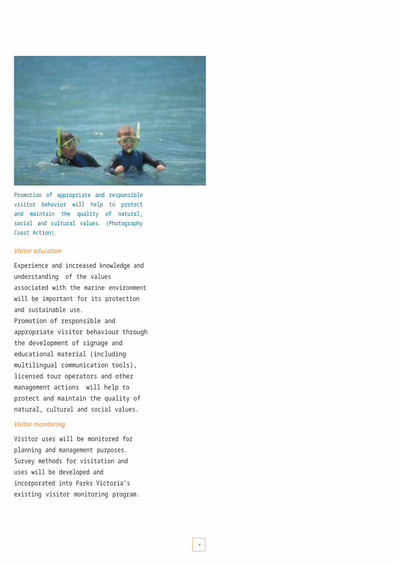
Marine Sanctuary Shore based boundarymarker (Triangular Beacon)
National Parks and
Reserves Boat
access point
1
M U S H R O O M R E E F M A R I N E S A N C T U A R Y Exposed to the wild waters of Bass Strait, this sanctuary has a variety of microhabitats and the most diverse intertidal reef marine communities recorded on the Victorian coastline.
Hastings
Rosebud
Flinders
Flinders Pier
Kennon Cove
a
Ocean Beach
Flinders Golf Course
Flinders Yacht Club
West Head Lookout
West Head
Mushroom Reef Marine Sanctuary
Marine SanctuaryShore basedmarker (Triangular Beac
National Parks and R Boat acces
0 0.25 0.5
Kilometres

1
Frankston
Melbourne
WarneetTooradin
Yaringa Marina
Quail Island
Yaringa
Chinaman Island
French Island
Pelican Point
MarineNational Park
Marine National Park
Scrub Point
Hastings
Western Port
Marina
Long Island
French Island National Park
Palmer Point
Lang
Lang
Crib Poin
t French Island
Sandy Point
Stockyard Point
Stony Point
Tankerton
Balnarring Beach
Grantville
Corinella
Coronet Bay
CowesObservation
Point
Phillip Island
Rhyll
Long Point
Churchill Island Marine National Park
Churchill Island
Kennedy Point
Newhaven
The Nobbies
Pyramid Rock
Woolamai Surf Beach
San Remo
Cape Woolamai
Wonthaggi
Marine National Park Shore based boundarymarker (Triangular Beacon)
In water boundary marker (Pile or Buoy)
National Parks and ReservesBoat access point
0 4 8

1
Kilometres

1
Y A R I N G A M A R I N E N A T I O N A L P A R K Protected well inside Western Port, this small park has significant stretches of mangrove, mudflat and saltmarsh that attract both marine species and waterbirds.
F R E N C H I S L A N D M A R I N E N A T I O N A L P A R K Along the indented northern coastline of French Island are seagrass meadows that serve as fish nurseries. As well, there are stretches of mangrove and saltmarsh and deep-water channels.
C H U R C H I L L I S L A N D M A R I N E N A T I O N A L P A R K Lamp shells are very ancient marine animals that thrive in the mangrove, seagrass and saltmarsh environs of this park, contained in a protected corner between Phillip and Churchill Islands.
B U N U R O N G M A R I N E N A T I O N A L P A R K Sweeping intertidal platforms and rocky reefs within this park, 6 km west of Inverloch, provide habitat for an unusually rich collection of marine plants, fish and invertebrates.
Wonthaggi
Inverloch
Point Norman
Point Smythe
Harmers Haven
Flat Rocks
Wreck Beach
Bunurong Marine Park
Cape Paterson
Cape Paterso
n
Undertow Bay
The Oaks
Twin Reefs
Shack Bay
Eagles Nest
Bunurong Marine Park Venus Bay
Marine National Park Marine and Coastal Park(Fishing is permitted subject to Fisheries and Park regulations)Shore based boundary marker (Triangular Beacon)Parks and Reserves Boat access point
Bunurong Marine National Park
0 1.5 3

1
Kilometres

1
Foster
PortToora
TooraAgnes
Welshpool
Fish Creek
Franklin
Beach
Foster Beach
Corner Inlet Marine and Coastal Park
Barry Beach
Port Welshpool
Nooramunga Marine
and Coastal
Park
Sunday Island
Sandy
Point
Yanakie
Doughboy Island
Duck Point
Granite Island
Corner Inlet Marine National Park
Bennison Island
Mount Singapore
Tin Mine Hill
Snake Island
Shallow Inlet Marine and Coastal Park
Long Island
Barry Hill
Millers Landing
Rabbit Island
Wilsons Promontory Marine Park
Shellback Island
Tongue Point
Darby Beach
Wilsons Promonto
ry National
Park
Wilsons Promontory Marine Park
Five Mile Beach
Norman Island
Whisky Bay Tidal
River
Sealers Cove
Most northerly
point of Great
GlennieIslan
d on HWM
Great Glennie Island
Dannevig Island
Citadel Island
Mc Hugh Island
Pillar Point
Norman Point
Oberon Bay
Mt Oberon
Waterloo Bay
Refuge Cove
Cape Wellington
Marine National Park Marine and Coastal Park(Fishing is permitted subject to Fisheries and Park regulations)
Marine ParkMarine Park Protection Zone (Line fishing only)Shore based boundary marker (Triangular Beacon)
In water boundary marker (Pile or Buoy)
Cleft Is
Anser Island
Kanowna Island
Wattle Island
National Park and Reserves Boat access point Lighthouse
Wilsons Promontory Marine National
Park
Forty Foot Rocks
1
Rodondo Island0
5
Kilometres
1
W I L S O N S P R O M O N T O R Y M A R I N E N A T I O N A L P A R K The small islands off mainland Australia's southernmost point are home to penguins, seabirds and seals. The vast marine park also has dramatic underwater scenery of plunging granite cliffs and deep reefs encrusted by colourful sponge gardens and populated by a diversity of fish species.
C O R N E R I N L E T M A R I N E N A T I O N A L P A R K Part of an internationally significant coastal wetland, this extensive and relatively sheltered environment has the world’s most poleward mangroves, as well as saltmarshes, mudflats and large seagrass meadows.
N I N E T Y M I L E B E A C H M A R I N E N A T I O N A L P A R K The sandy seafloor and intermittent ribbons of rocky reef sustain an environment noted as one of the richest marine habitats in the world. The reefs are covered in resilient red seaweeds and numerous encrusting shellfish.
Sale
Lake Reeve
Gippsland Lakes Coastal Park
The Island
The Honeysuckles
Seaspray
Giffard
Lake Denison
Ninety Mile Beach Marine National Park
Darriman
McGaurans Beach Marine National
Park Shore based boundarymarker (Triangular Beacon)
Coastal Parks and ReservesBoat access point
0 2.5 5Jack Smith
Lake

1
Kilometres
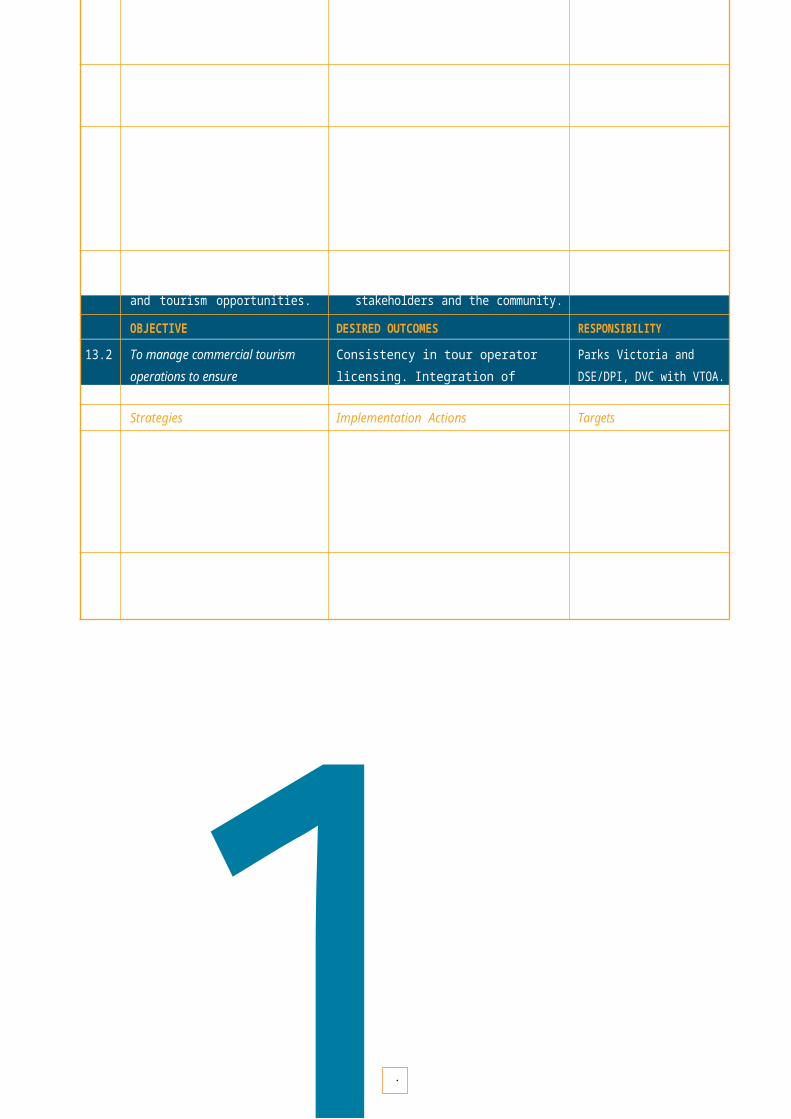
Marine SanctuaryCoastal Parks and Reserves Boat access point Camping
1
B E W A R E R E E F M A R I N E S A N C T U A R Y Several ships have come to grief on this granite reef, which has forests of bull kelp. It is also home to many species of reef fish and a diverse range of invertebrates.
Cann River
Orbost
Cabbage Tree Creek Bemm River
Cape Conran Coastal Park
Yeerung River
Dock Inlet
Pearl Point
East Cape Beach
Point Ricardo West
CapeCape Conran
Beware Reef Marine Sanctuary
Marine SanctuaryCoastal Parks and Reserves Boat access point Camping
0 2.5 5
Kilometres

1
P O I N T H I C K S M A R I N E N A T I O N A L P A R K Snorkelling and scuba diving are popular in this park because in the clear waters and amid massive granite boulders are tall seaweeds and numerous reef fish species not found in cooler Victorian waters.
Cann River
Croajingolong National Park
Tamboon Inlet
Tamboon
Clinton RocksThurra River
Camp
Mueller Inlet Camp
Petrel Point
West Beach
Point Hicks
Marine National Park Shore based boundarymarker (Triangular
Beacon) National Park and Reserves Boat access pointCamping
Point Hicks Marine National Park
+Whaleback
Rock
Lighthouse
0 2.5 5
Kilometres

New South Wales
Croajingolong National ParkCape Howe
Howe Hill+
Lake Wau Wauka
IronPrince
Lake Barracoota
Mallacoota Inlet
Cape Howe Marine National Park
sTullaberga erIsland at
lw taGaboscoas
Island toria'
ofVict
i
mMallacoota lid
r
1
C A P E H O W E M A R I N E N A T I O N A L P A R K At Victoria's easternmost extreme, migrating humpback whales can be seen offshore from May to September. Underwater, thick canopies of seaweed shelter warm and cool water species of sponges, seastars and smaller seaweeds.


-
- - --- -
- -- ---