maps and geography unit revised october 2011. maps & geography jeopardy vocabulary & map...
TRANSCRIPT

Maps and Geography Unit
Revised October 2011
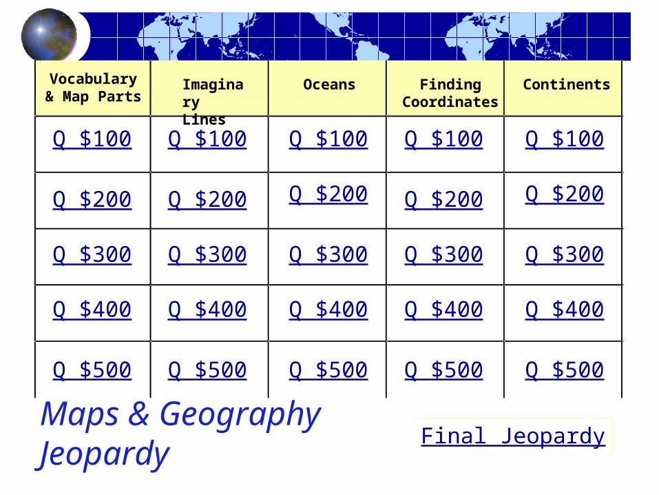
Maps & Geography Jeopardy
Vocabulary & Map Parts
Oceans
Q $100
Q $200
Q $300
Q $400
Q $500
Q $100 Q $100Q $100 Q $100
Q $200 Q $200 Q $200 Q $200
Q $300 Q $300 Q $300 Q $300
Q $400 Q $400 Q $400 Q $400
Q $500 Q $500 Q $500 Q $500
Final Jeopardy
Finding Coordinates
Imaginary Lines
Continents

$100 Question Vocabulary & Map Parts
In which hemispheres is the United States?
a)northernb)southernc) easternd)western

$100 Answer Vocabulary & Map Parts
Northern and western (a and d).
??

$200 Question Vocabulary & Map Parts
A political map:
a) Shows man made boundaries.b) Shows boundaries that can be seen
from outer space.c) Shows land elevations.d) Shows the names of political
leaders.

$200 Answer Vocabulary & Map Parts
??
A political map:
a) Shows man made boundaries.
$300 Question Vocabulary & Map Parts
A topographical or physical map
a)Shows man made boundaries.b)Shows boundaries that can be seen from outer space.c)Shows land elevations.d)Shows the names of political leaders.

$300 Answer Vocabulary & Map Parts
A topographical (physical) map
(c) Shows land elevations.
??

$400 Question Vocabulary & Map Parts
Identify the directions on this compass rose.

$400 Answer Vocabulary & Map Parts
??
N
EW
S
$500 Question Vocabulary & Map Parts
How is a map different from a globe?

$500 Answer Vocabulary & Map Parts
A map is a flat picture of the Earth, and a globe is a model of the Earth.
??
$100 Question Imaginary Lines
The equator is:
a) a place at the north pole.b) an imaginary line running around the middle of the Earth on a map or a globe.c) a longitudinal line.d) also called 0 degrees latitude.

$100 Answer Imaginary Lines
??
The equator is an imaginary line running around the middle of the Earth on a map or a globe (b) and is also called 0° latitude (d).

$200 Question Imaginary Lines
The prime meridian is
a) a place at the south pole.b) an imaginary line running
from the north pole to the south pole.
c) a line of latitude.d) also called 0° (degrees)
longitude.

$200 Answer Imaginary Lines
??
The Prime Meridian is an imaginary line running from the north pole to the south pole and is also called 0° (degrees) longitude (b and d).

$300 Question Imaginary Lines
Which line is the Tropic of Cancer?
A
B
C
D

$300 Answer Imaginary Lines
??
Which line is the Tropic of Cancer?
A
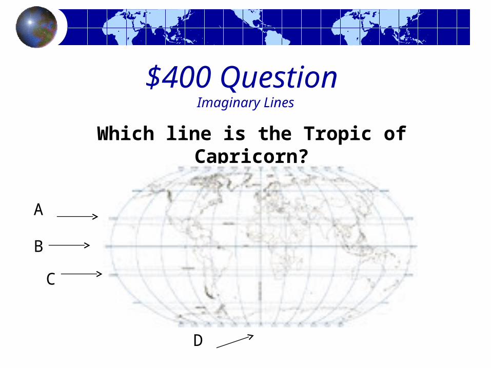
$400 Question Imaginary Lines
Which line is the Tropic of Capricorn?
A
B
C
D
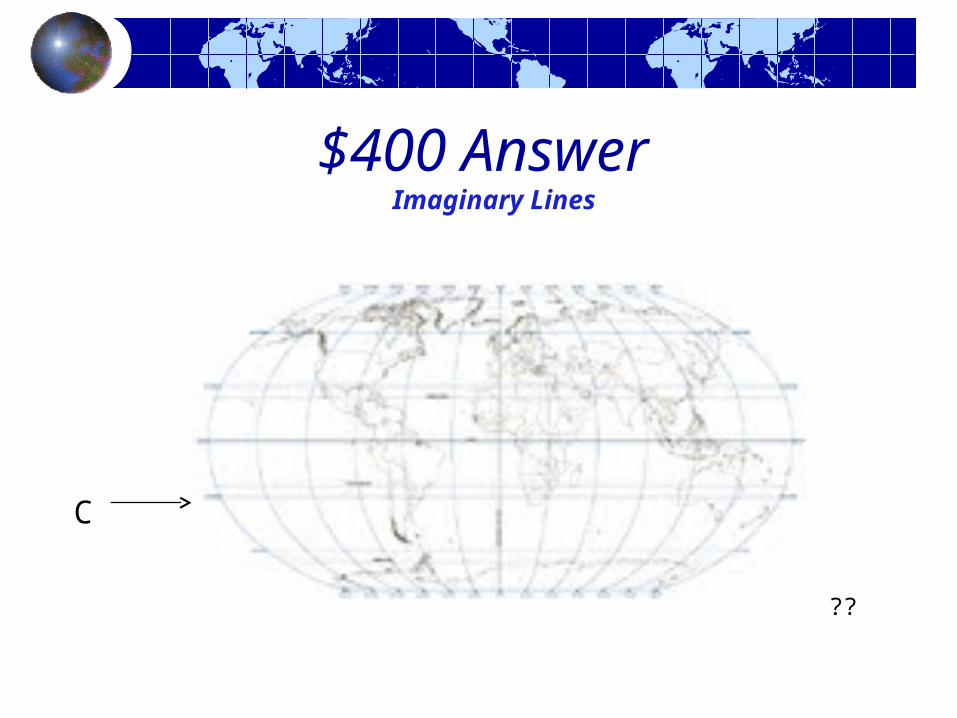
$400 Answer Imaginary Lines
??
C
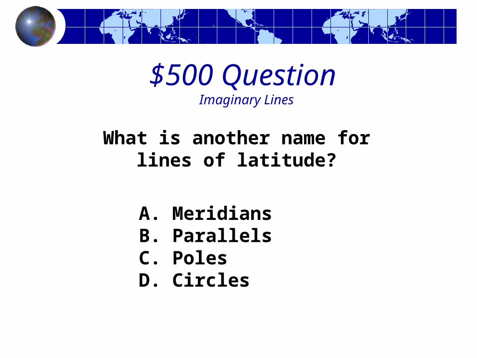
$500 Question Imaginary Lines
A. Meridians B. ParallelsC. PolesD. Circles
What is another name for lines of latitude?

$500 Answer Imaginary Lines
What is another name for lines of
latitude?
b. parallels
??

$100 Question Oceans
Which ocean is shown in blue on this map?

$100 Answer Oceans
Atlantic Ocean ??

$200 Question Oceans
Which ocean is shown in blue on this map?

$200 Answer Oceans
Pacific Ocean ??

$300 Question Oceans
Which ocean is shown in blue on this map?

$300 Answer Oceans
Arctic Ocean ??

$400 Question Oceans
Which ocean is shown in blue on this map?

$400 Answer Oceans
Indian Ocean
??

$500 Question Oceans
The Southern Ocean is located above which continent ?
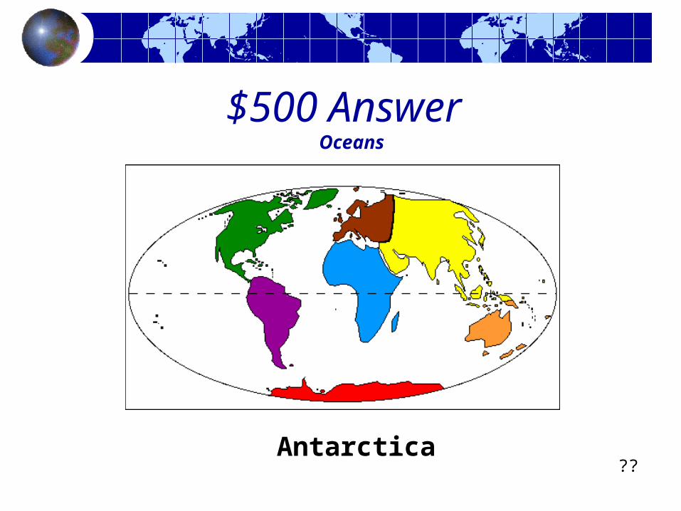
$500 Answer Oceans
Antarctica??

$100 Question Finding Coordinates
Lines of latitude show you how far north or south a location is from the __________?

$100 Answer Finding Coordinates
Lines of latitude show you how far north or south a
location is from the equator.
??

$200 Question Finding Coordinates
Lines of longitude show you how far east or west a
location is from the __________________.
$200 Answer Finding Coordinates
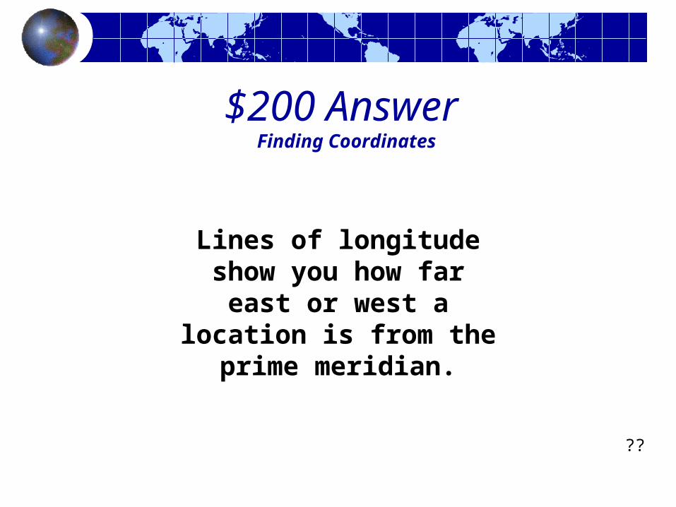
??
Lines of longitude show you how far
east or west a location is from the
prime meridian.

$300 Question Finding Coordinates
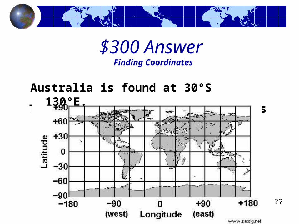
What continent is found at 30°S 130°E ?
$300 Answer Finding Coordinates
The Rio Grande River divides Texas from Mexico (a).
??
Australia is found at 30°S 130°E.

$400 Question Finding Coordinates
What continent is found at 15°N, 0°?

$400 Answer Finding Coordinates
D - Great Lakes Region??
Africa is found at 15°N, 0°?

$500 Question
Finding Coordinates
Give the approximate coordinates for Addis Ababa which is the capital of Ethiopia. (answer must be within 2 degrees)

$500 Answer Finding Coordinates
Addis Ababa, Ethiopia is located at 9°N, 39°E.
??
$100 Question Continents
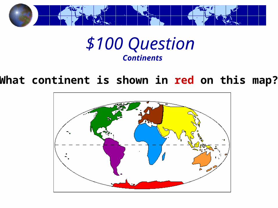
What continent is shown in red on this map?
$100 Answer Continents
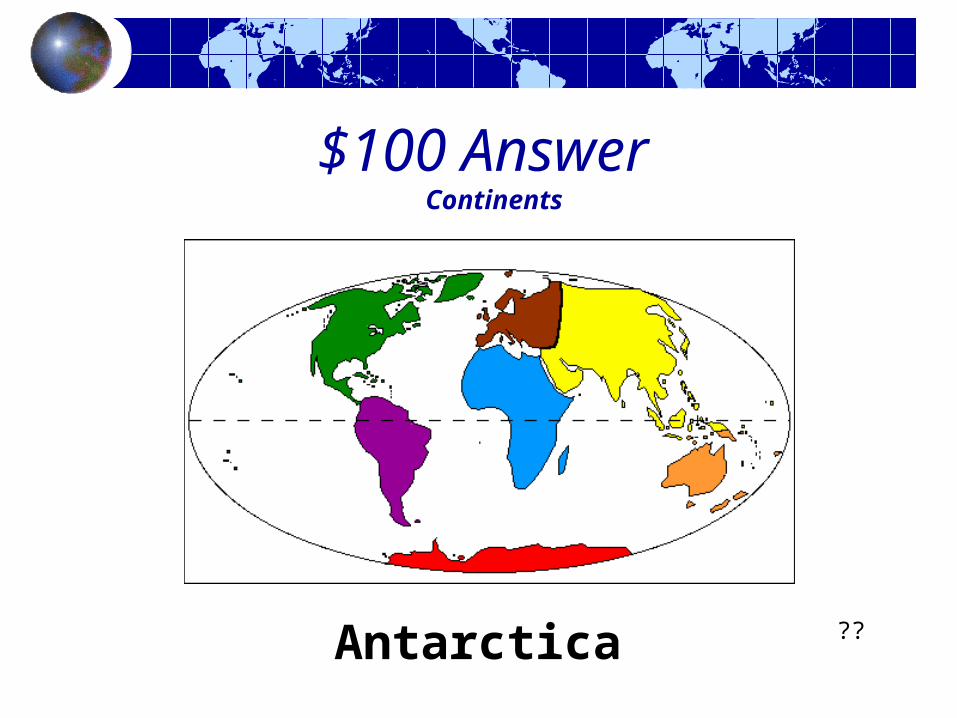
Antarctica ??

$200 Question Continents
What continent is shown in purple on this map?

$200 Answer Continents
South America ??

$300 Question Continents
What continent is shown in orange on this map?
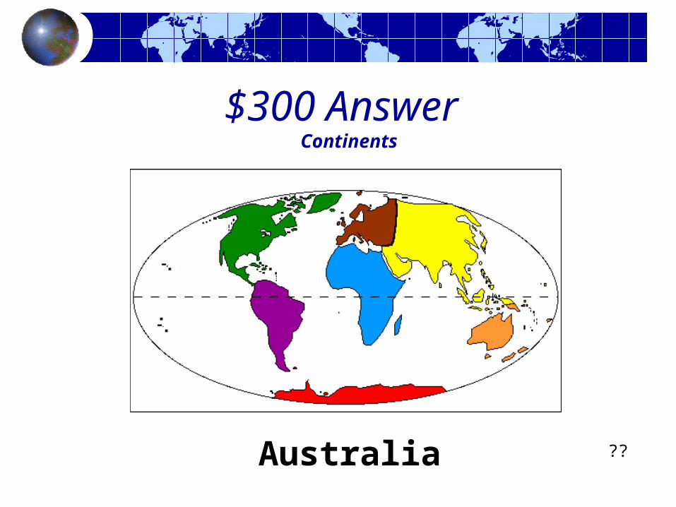
$300 Answer Continents
Australia ??

$400 Question Continents
What continent is shown in blue on this map?

$400 Answer Continents
Africa??

$500 Question Continents
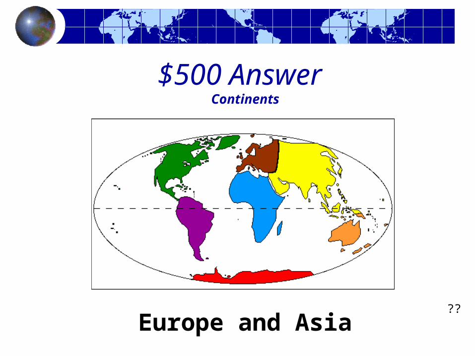
Which 2 continents are mostly connected?
$500 Answer Continents
Europe and Asia??

Why is the Pacific Ocean shown in two different
places on a map of the world?

The Pacific Ocean is shown in two places on a map of the world because the world is round, but a map is flat. In order to make it flat, they had to
divide the ocean in half.