mapping and analyzing watersheds: options for local groups jane frankenberger, ph.d. purdue...
TRANSCRIPT

Mapping and Analyzing Watersheds:
Options for Local Groups
Jane Frankenberger, Ph.D.Purdue University
Extension Agricultural Engineer and Water Quality Specialist

Watershed groups and watershed planning
• Place-based process for restoring water quality, led by local residents
• We know of around 30 to 40 groups in Indiana

Educating leaders through the Indiana Watershed Leadership Academy
(www.purdue.edu/watersheds)
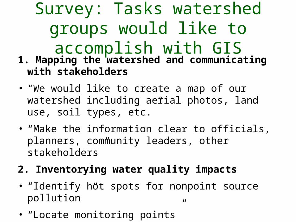
Survey: Tasks watershed groups would like to accomplish with GIS
1. Mapping the watershed and communicating with stakeholders
• “We would like to create a map of our watershed including aerial photos, land use, soil types, etc.”
• “Make the information clear to officials, planners, community leaders, other stakeholders”
2. Inventorying water quality impacts
• “Identify hot spots for nonpoint source pollution ”
• “Locate monitoring points”

3. Watershed planning – “Locate problems within the watershed. – “Identify areas for BMP implementation.– “Calculate total amount of land impacted by
BMPs
4. Tracking progress– “Create layers showing the placement of BMPs
to help track changes and progress in the watershed”
– “Spatial assessment of BMP impacts (Have critical source areas been treated?)”
Tasks watershed groups would like to accomplish with GIS

– “I would like to introduce students to GIS by hands on activities with GPS.”
– “Improve sense of place”
5. Education
Tasks watershed groups would like to accomplish with GIS

So what GIS can watershed leaders use to accomplish these tasks?
Some Requirements • Learn in hours or days, not weeks or
months• Create maps that can be used in public
meetings, in reports, and on the Web• Import and use GPS data• Conduct simple analyses to support
planning
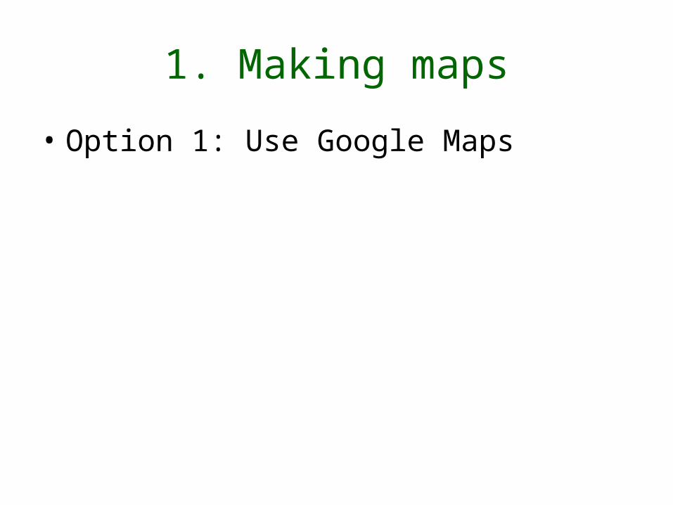
1. Making maps
• Option 1: Use Google Maps

1. Mapping only – Google Maps “Mash-ups”
• Google Maps (maps.google.com) released the Application Programming Interface (API) for their mapping technology, and created the world of Google Maps Mashups.
• With the API, a programmer can create a mash-up by combining Google Maps with other data - like apartment listings, bird sitings, restaurants, etc.
• So why not watershed information?


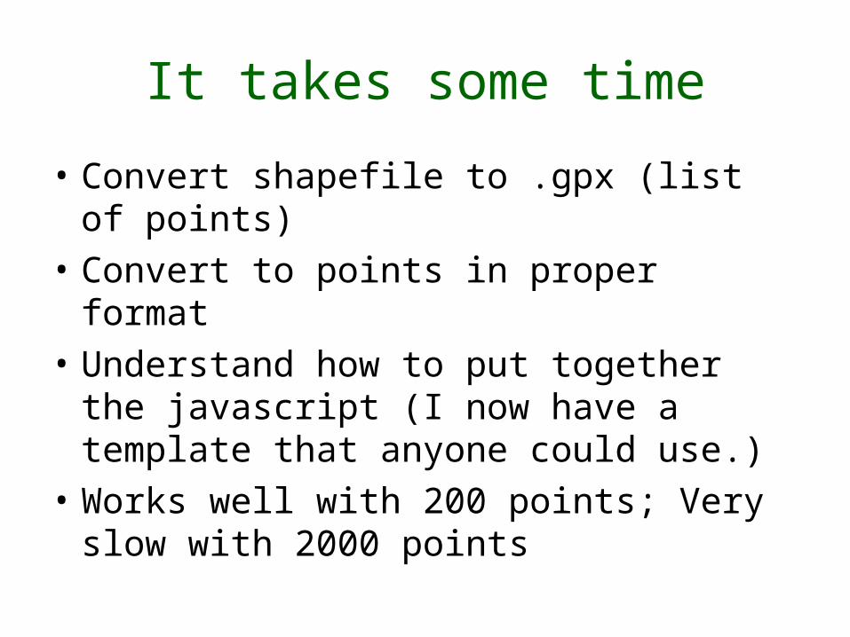
It takes some time
• Convert shapefile to .gpx (list of points)
• Convert to points in proper format
• Understand how to put together the javascript (I now have a template that anyone could use.)
• Works well with 200 points; Very slow with 2000 points


Eagle Creek Reservoir Watershed Above Drinking Water Intake

Advantages
• Anyone, anywhere, can pull up the map on demand.
• Anyone can display at any zoom level.
• Imagery is usually the most current available – Google acquires whatever is available.

Disadvantages
• All of those associated with Google – loss of privacy?
• Some say there may be ads in the future.

Google Maps – If you don’t want to program yourself
• Use a site that eliminates the need for your own API or coding– Can only map single points
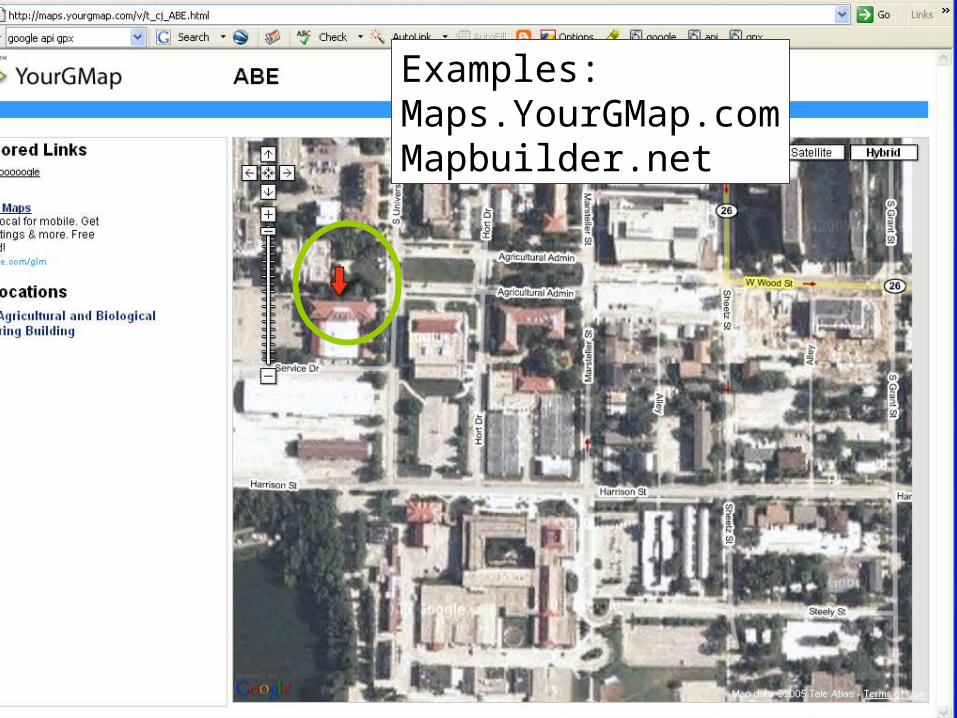
Examples:Maps.YourGMap.comMapbuilder.net

2. Mapping only – Google Earth Place Markers

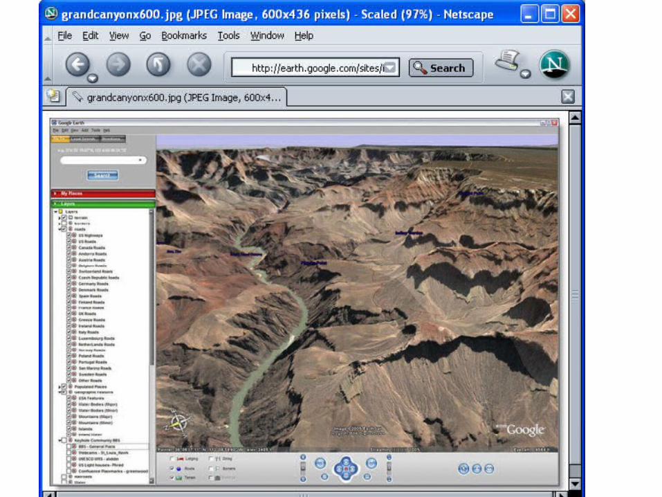


Google Earth• “No need to travel around the US for
vacations .... its all here in Google Earth.” (PC World Techlog)
• “I feel like superman! I can fly anywhere!”
• “Totally awesome... “
• "Google Earth is just the most fantastic thing I have ever seen," says Jack Dangermond, founder and president of ESRI, the world's largest creator of GIS software. (as quoted in Nature)

Generating kml or kmz from shapefiles
1. Add-on to Google Earth Pro ($400 but free for educators): GIS Data Importing Module - $200
• incorporates GIS data in file formats such as .shp, .tab
(Other add-ons):Movie Making Module - $200 Premium Printing Module - $200

Free extensions to convert shapefile to kml: Search for kml at support.esri.com (6 currently)

Arc2earth - $99Released March 1

But real GIS is still needed for analysis and processing
• "Just as the PC democratized computing, so systems like Google Earth will democratize GIS." Michael Goodchild, quote in Nature
• Google Earth can improve spatial literacy and provide a tool for communicating all sorts of findings
• Google Earth cannot do analysis or geoprocessing, so GIS is still needed.

ArcIMS Image Servers provide access to layers for analysis.Example: Indiana GIS Atlas

• Tutorial for GIS Atlas for Indiana
But low resolution printing was a concern for people I asked to test this. (Resolution of screen or lower.)

ArcExplorer Java Edition for Education
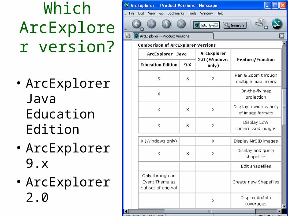
Which ArcExplorer
version?
• ArcExplorer Java Education Edition
• ArcExplorer 9.x
• ArcExplorer 2.0

Query builder
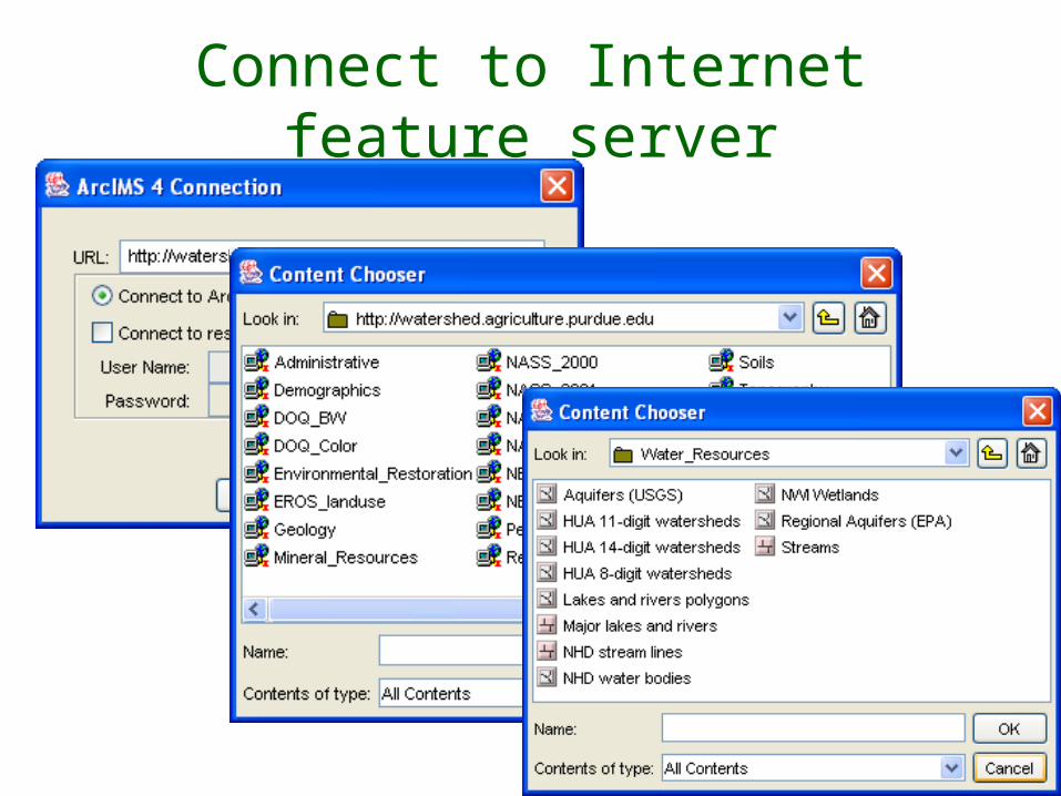
Connect to Internet feature server
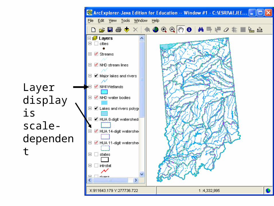
Layer display is scale-dependent


How many underground storageTanks within 1 mile of reservoir?
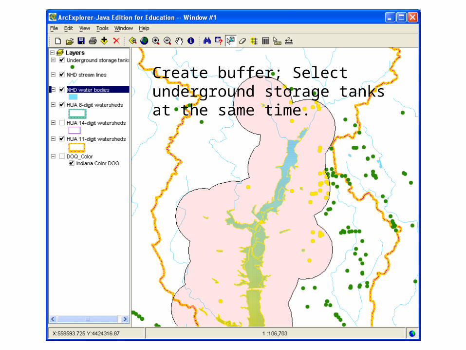
Create buffer; Select underground storage tanks at the same time.

Zooming in allows us to see the tank location a little better, but to really understand where they are…


Printing maps:The “Print” option does not include Text or Legend
Export high-resolution image and make your own map in Word, PowerPoint, or other software

Coming soon: ArcGIS Explorer (Q2 2006)

Conclusion• There is a real audience for easy-to-use GIS
software that can perform a limited number of spatial analysis tasks
• New applications such as Google Maps and Google Earth offer GIS viewing for everyone. Let’s use them!