management system” - its 3c summit - home system ” tech session 3 ... 4 5 “icm is about...
TRANSCRIPT

ITS 3C Summit (2014)
Mobile, Alabama
Presented by:
Steve McDonald, P.E.
1
“San Diego I-15 Integrated Corridor Management System”
Tech Session 3
“We Like to Move it, Move it-Integrated Corridor Management”
September 16, 2014

U.S. Department of Transportation
Presentation Overview
2
• Problem Statement
• San Diego ICMS Background
• ICM System Design
• Expected Outcomes
• Conclusions

U.S. Department of Transportation
Project Partners/Stakeholders
3
National ICM
EvaluatorNational AMS
Contractor

U.S. Department of Transportation
Problem Statement
Tra
nsit
Fre
ew
ays
Arte
rials
Managed
Lanes/T
olls
Em
erg
en
cy
Responders

U.S. Department of Transportation
Problem Statement
Tra
nsit
Fre
ew
ays
Arte
rials
Managed
Lanes/T
olls
Em
erg
en
cy
Responders
Managed independently, limited coordination

U.S. Department of Transportation
Changing the Paradigm

U.S. Department of Transportation
Changing the Paradigm Via ICM

U.S. Department of Transportation
FHWA ICM Program
8
7-Year Federally-sponsored program
supporting development of improved mobility,
safety, and other transportation objectives for
people and goods through integrated
management of transportation networks and
cross-network connections in major
transportation corridors in metropolitan areas.

U.S. Department of Transportation
FHWA ICM Program
• Phase 1: Conducted research into the current state of corridor management
• Phase 2: Develops analytic tools and methods that enable the implementation and evaluation of ICM strategies.
• Phase 3: Corridor Site Development, Analysis and Demonstration - San Diego and Dallas
• Phase 4: ICM Outreach and Knowledge and Technology Transfer
9

U.S. Department of Transportation
Evaluation Hypothesis
10
Hypothesis
The Implementation of ICM will:
Improve Situational Awareness
Enhance Response and Control
Better Inform Travelers
Improve Corridor Performance
The implementation of ICM will have a positive or no effect on:
Air Quality
Safety
Have Benefits Greater than Costs
Decision Support Systems

U.S. Department of Transportation
What is Integrated Corridor Management?
• Intelligent Transportation System (ITS) Concept
• Manages all facilities and modes in a pro-active, coordinated manner
• Involves Active Traffic Management (ATM) and Active Transportation Demand Management (ATDM)
• Optimizes use of all available infrastructure
• Directs travelers to underutilized capacity and modes
• Focuses on motorists shifting their trip departure times, routes, or modal choices
• Allows agencies the ability to dynamically adjust capacity
11

U.S. Department of Transportation
Phase 3 – ICM Demonstration
• Five primary ICM goals in Phase 3 :1. The corridor’s multi-modal and smart-growth approach shall
improve accessibility to travel options and attain an enhanced level of mobility for corridor travelers.
2. The corridor’s safety record shall be enhanced through an integrated multimodal approach.
3. The corridor’s travelers shall have the informational tools to make smart travel choices within the corridor.
4. The corridor’s institutional partners shall employ an integrated approach through a corridor-wide perspective to resolve problems.
5. The corridor’s networks shall be managed holistically under both normal operating and incident/event conditions in a collaborative and coordinated way.
12

U.S. Department of Transportation
Sabre Springs/Penasquitos Transit Center
I-15 Express Lanes
SR 56/Ted Williams Parkway
N
Direct Access Ramp (DAR)
I-15 Main Lanes
Express Lanes
DAR
BRT Stations
Arterial Network
Main Lanes1
2
3
4
5
“ICM is about management of a corridor. Management implies more than monitoring. Management implies planning for, and responding to, what is happening across all networks”
5
1
2
3
4
San Diego ICM: Next Big Step in Transportation System Management

U.S. Department of Transportation
San Diego I-15 Corridor
• 21 mile corridor
• Includes 16 miles of Managed Lanes
• Encompasses three cities: Escondido, Poway, and San Diego
• Interregional goods movement corridor
• 3 segments: South, Mid, North
14
Poway
Santee
Escondido
5252
56
78
67
78
Mira Mesa/
Miramar College
Escondido
Transit CenterNorth Segment
South Segment Sabre Springs/
Peñasquitos
Rancho
Bernardo
Del Lago
Middle Segment

U.S. Department of Transportation
Corridor Infrastructure
8 Caltrans DMS
25 FasTrak DMS
20 Portable CMS (Caltrans)
240 Signalized intersections
42 Ramp Metering Stations
40+ Vehicle Detection Stations
Highway Advisory Radio
Arterial Trailblazers
5 BRT stations
15

U.S. Department of Transportation
Rancho Bernardo Transit Center
BRT
Station
Main Lanes
Managed
LanesDirect Access
Road to Arterial
Park-
and-Ride
Drop
Ramps

U.S. Department of Transportation
ICMS Inputs and Outputs
17

U.S. Department of Transportation
Interfacin
g Systems (C
on
text Diagram
)
System Design
18
ICMS Data Stores (includes Library of a-priori plans)
iNet(User Interface, Response Plans)
Aimsun Online(Real-Time
Simulation and Predictive Analysis)
Learning/Feedback
Enhancements to serve as the corridor performance
management element of DSS
TransModeller
511
IMTMSSystem Services
Off-Line ModelingA-Priori Response Plans
AIS
TransCAD
Background Traffic
Assignment
IMTM
S Servers/Co
mm
un
ication
sPeMSaPeMStPeMS
Delcan/TSS
Delcan
SANDAG
Decision Support System

U.S. Department of Transportation
Aimsun Online Interfaces
19
Detection data filtering
and processing
Aimsun
Micro/Meso
Selected
O/D matrix
Real time raw
detection data
Filtered
detection pattern
Historical
traffic patterndata base
Historical
O/D matrixdata base
Parallel Simulations
Real time
event detection
Traffic mana-
gement strategies
Best strategy
selectionForecast
traffic data
Aimsun Online
O/D Matcher
Pattern recognition module
Real time
control plan data
Quality Manager
module
Traffic Management
Operations
Quality
Indicators
What is the best strategy to respondbased on:
• Rules-Based DSS
• Available Assets
• Current and predicted traffic conditions
• On-line Micro simulation Analysis

U.S. Department of Transportation
Action plans defined within 5 categories
ICMS Action Plans/Response Plans
20
Traveler Information
• No change• Notify operators
of event• Notify public of
event on freeway• Notify public of
event on arterial• Direct traffic to
use alternative routes
• Direct traffic to specific routes or transit usage
Traffic Signal Timing
• No action• Inbound Shoulder• Inbound Peak• Inbound Step Up• Inbound Flush• Outbound
Shoulder• Outbound Peak• Outbound Step
Up• Outbound Flush
Ramp Metering
• No action• Meter Off• Meter Rate 1• Meter Rate 2• Meter Rate 3• Meter Rate 4• Meter Rate 5• Meter Rate 6• Meter Rate 7• Meter Rate 8• Meter Rate 9• Meter Rate 10• Meter Rate 11• Meter Rate 12• Meter Rate 13• Meter Rate 14• Meter Rate 15
Transit
• No change• Notify transit
dispatcher of event• Provide transit
dispatcher w/ recommended transit user message
• Provide dead-head re-routing recommendation
• Provide in-service re-routing recommendation
• Recommend deployment of stand-by transit vehicles
Express Lanes
• No change• Open to all
Vehicles• Northbound 3
Southbound 1• Southbound 3
Northbound 1• Closed to
vehicles (segment)

U.S. Department of Transportation
Response Plan Concept
21
Express Lanes
• Not used
• Action Plan 1
• Action Plan 2
Transit
• Action Plan 1
• Action Plan 2
Traveler Information
• Action Plan 1
• Action Plan 2
• Action Plan 3
• Action Plan 4
Traffic Signal Timing
• Action Plan 1
• Action Plan 2
• Action Plan 3
• Action Plan 4
Ramp Metering
• Action Plan 1
• Action Plan 2
• Action Plan 3
• Action Plan 4
A combination of Action Plans defines an individual Response Plan

U.S. Department of Transportation
Response Postures
22
Conservative Conservative Moderate
Conservative Moderate Aggressive
Moderate Aggressive Aggressive

U.S. Department of Transportation
Event Impact
Response Posture
Demand
Response Postures
23
Conservative• Example – Provide slight
increase to ramp metering rate
Moderate • Example – Provide additional
green-time to favor northbound
traffic while still providing
adequate cross-street timing
Aggressive• Example – Display alternate
route for freeway traffic on
CSM, such as “INCIDENT
AHEAD NB USE POMERADO”
Light• Weekends
• Holidays
Moderate • Off-peak weekday
• Minor weekend special event
Heavy• Peak-hour weekday traffic
Low• Incident closing freeway shoulder or
one lane
• Construction closing one lane of
primary arterial
• Breakdown of transit vehicle
Medium• Incident closing 1 freeway lane
• Closure of Express Lanes
• Construction on Pomerado reducing
NB and SB to one lane each
direction
High• Major incident at intersection of
primary arterials
• Closure of two or more lanes of the
freeway
• Combination of low and medium
incidents

U.S. Department of Transportation
Congestion Detection Rules
• Control Sensitivity to create ICM events
• Detection Rules– Distance Criteria
• Severity criteria • Bridging events• Transition events
– Detection Measures• Free Flow comparison• Historical comparison
– Measures used• Speed• Delay• V/C

U.S. Department of Transportation
Asset Availability Rules
• Discrete control of agency assets
– Diversion Routes
– Signals
– Ramps
– Signs
• Weekly Schedule
• Manual Override

U.S. Department of Transportation
What will San Diego ICMS do?
Implements Active Traffic Management (ATM) strategies to pro-actively manage multiple modes through and along the corridor.• En-route traveler information• Pre-trip traveler information• Automatically detects/predicts congestion events• Dynamic Rerouting• Freeway coordinated adaptive ramp metering• Signal coordination on arterials with freeway ramp metering• Regional arterial management • Real-time multimodal decision support• Network traffic prediction• On-line micro simulation analysis• Real-time response strategy assessment

U.S. Department of Transportation
Network Traffic Prediction
4 different time
intervals (15,
30, 45, 60
minutes) to view
27

U.S. Department of Transportation
Response Plan Evaluation
28

U.S. Department of Transportation
Response Plan Diversions
29

U.S. Department of Transportation
Ramp Meter Responses
30

U.S. Department of Transportation
DMS Responses
31
U.S. Department of Transportation
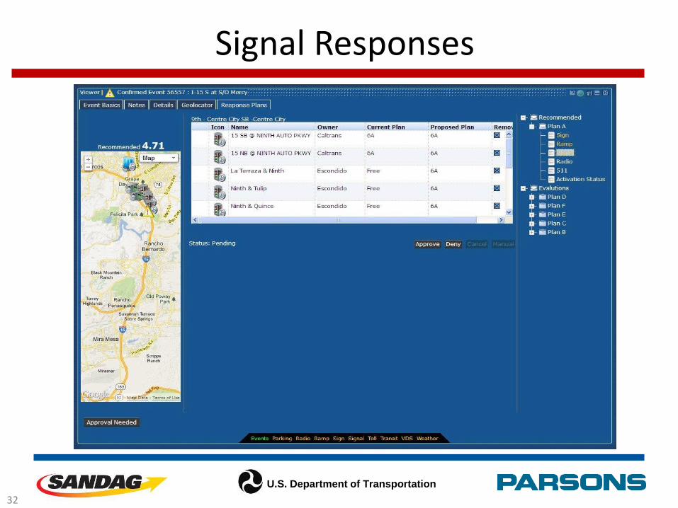
Signal Responses
32

U.S. Department of Transportation
Response Plan Summary
33

U.S. Department of Transportation
What is unique about San Diego ICMS?
• First system to incorporate a Network Prediction Subsystem (NPS) and Real-time Simulation Subsystem (RTSS) into an operational ATMS
• Intelligent Decision Support System that uses rules-based response plans, NPS, RTSS and dynamic route guidance
• It’s a Real-time Multimodal Decision Support System (RTMDSS)
• 2013 Best of ITS America Award -Innovation
34

U.S. Department of Transportation
Conclusions
• Real-time prediction and evaluation engines can be used to influence commuter’s route and mode options
• Use of Network Prediction Subsystem (NPS) and Real Time Simulation Subsystem (RTSS) is an important component for an effective decision support system.
• Micro-Simulated outputs of “Measures of Effectiveness” have been used in planning strategies for years, but now they have moved from planning to operations.
• There are challenges in working with multiple data sets from disparate data sources
35

U.S. Department of Transportation
Thank You
Alex Estrella
Project Manager
SANDAG
Dan Lukasik, P.E.
Technical Manager
Parsons
Peter Thompson
Technical Manager
SANDAG
Richard Chylinski
Project Manager
Parsons
Robert SheehanICM Initiative San Diego Site Team Lead [email protected]