magellan-spark as a geospatial analytics engine by ram sriharsha
TRANSCRIPT

Magellan – Spark as a Geospatial Analytics Engine
Ram SriharshaHortonworks

Who Am I?• Apache Spark PMC Member• Hortonworks Architect, Spark + Data Science• Prior to HWX, Principal Research Scientist @
Yahoo Labs (Large Scale Machine Learning)– Login Risk Detection, Sponsored Search Click
Prediction, Advertising Effectiveness Models, Online Learning, …
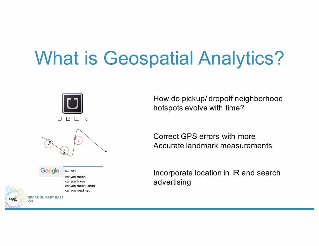
What is Geospatial Analytics?
How do pickup/ dropoff neighborhoodhotspots evolve with time?
Correct GPS errors with moreAccurate landmark measurements
Incorporate location in IR and searchadvertising

Do we need one more library?• Spatial Analytics at scale is challenging
– Simplicity + Scalability = Hard• Ancient Data Formats
– metadata, indexing not handled well, inefficient storage• Geospatial Analytics is not simply BI anymore
– Statistical + Machine Learning being leveraged in geospatial• Now is the time to do it!
– Explosion of mobile data– Finer granularity of data collection for geometries– Analytics stretching the limits of traditional approaches– Spark SQL + Catalyst + Tungsten makes extensible SQL engines easier
than ever before!

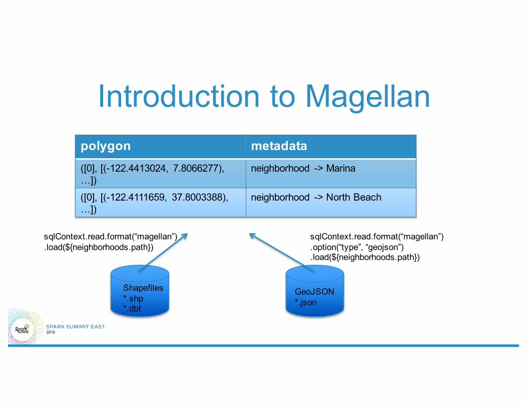
Introduction to Magellan

Introduction to Magellan
Introduction to Magellan
Shapefiles*.shp*.dbf
sqlContext.read.format(“magellan”).load(${neighborhoods.path})
GeoJSON*.json
sqlContext.read.format(“magellan”).option(“type”, “geojson”).load(${neighborhoods.path})
polygon metadata([0], [(-122.4413024, 7.8066277), …])
neighborhood -> Marina
([0], [(-122.4111659, 37.8003388), …])
neighborhood -> North Beach
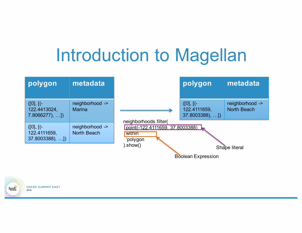
Introduction to Magellanpolygon metadata
([0], [(-122.4413024, 7.8066277), …])
neighborhood -> Marina
([0], [(-122.4111659, 37.8003388), …])
neighborhood -> North Beach
neighborhoods.filter(point(-122.4111659, 37.8003388)within‘polygon
).show()
polygon metadata
([0], [(-122.4111659, 37.8003388), …])
neighborhood -> North Beach
Shape literal
Boolean Expression

Introduction to Magellanpolygon metadata([0], [(-122.4111659, 37.8003388), …])
neighborhood-> North Beach
([0], [(-122.4413024, 7.8066277), …])
neighborhood -> Marina
point(-122.4111659, 37.8003388)
(-122.4343576, 37.8068007)
points.join(neighborhoods).where(‘point within ‘polygon).show()
point polygon metadata
(-122.4343576, 37.8068007)
([0], [(-122.4111659, 37.8003388), …])
neighborhood-> North Beach

Introduction to Magellan
polygon metadata([0], [(-122.4111659, 37.8003388), …])
neighborhood-> North Beach
([0], [(-122.4413024, 7.8066277), …])
neighborhood -> Marina
neighborhoods.filter(point(-122.4111659, 37.8003388).buffer(0.1)intersects‘polygon
).show()
point polygon metadata
(-122.4343576, 37.8068007)
([0], [(-122.4111659, 37.8003388), …])
neighborhood-> North Beach

‘point within ‘polygon

the join• Inherits all join optimizations from Spark
SQL– if neighborhoods table is small, Broadcast
Cartesian Join– else Cartesian Join

Status• Magellan 1.0.3 available as Spark Package. • Scala • Spark 1.4• Spark Package: Magellan• Github: https://github.com/harsha2010/magellan• Blog: http://hortonworks.com/blog/magellan-geospatial-analytics-in-
spark/• Notebook example: http://bit.ly/1GwLyrV• Input Formats: ESRI Shapefile, GeoJSON, OSM-XML• Please try it out and give feedback!
What is next?• Magellan 1.0.4
– Spark 1.6– Python– Spatial Join– Persistent Indices– Better leverage Tungsten via codegen + memory
layout optimizations– More operators: buffer, distance, area etc.

the join revisited• What is the time complexity?
– m points, n polygons (assume average k edges)– l partitions– O(mn/l) computations of ‘point within ‘polygon– O(ml) communication cost– Each ‘point within ‘polygon costs O(k)– Total cost = O(ml) + O(mnk/l)– O(m√n√k) cost, with O(√n√k) partitions

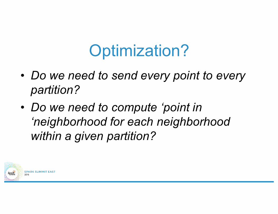
Optimization?• Do we need to send every point to every
partition?• Do we need to compute ‘point in
‘neighborhood for each neighborhood within a given partition?

2d indices• Quad Tree• R Tree• Dimensional Reduction
– Hashing– PCA– Space Filling Curves
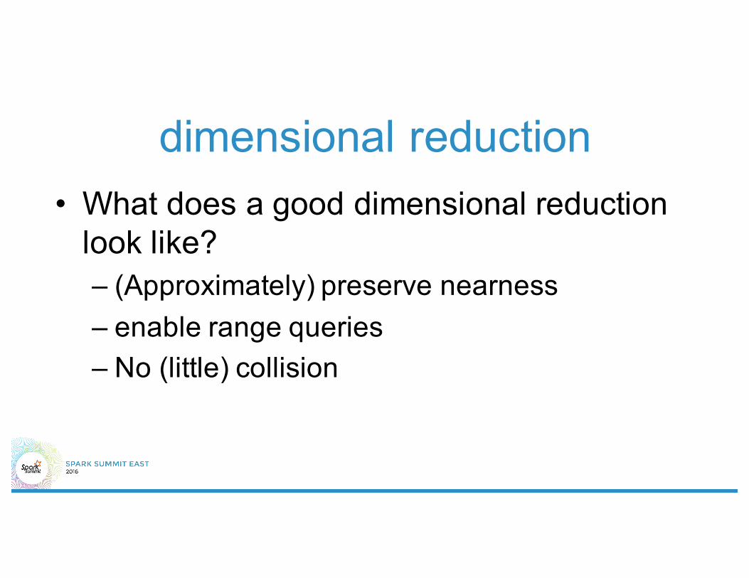
dimensional reduction• What does a good dimensional reduction
look like?– (Approximately) preserve nearness– enable range queries– No (little) collision
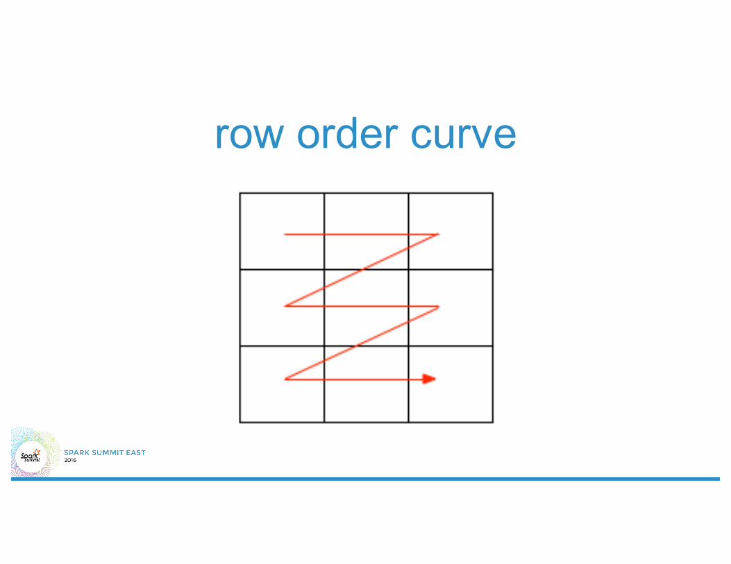
row order curve
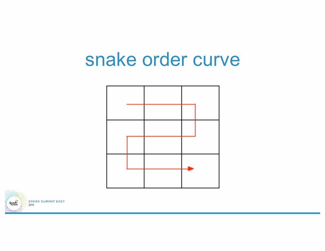
snake order curve
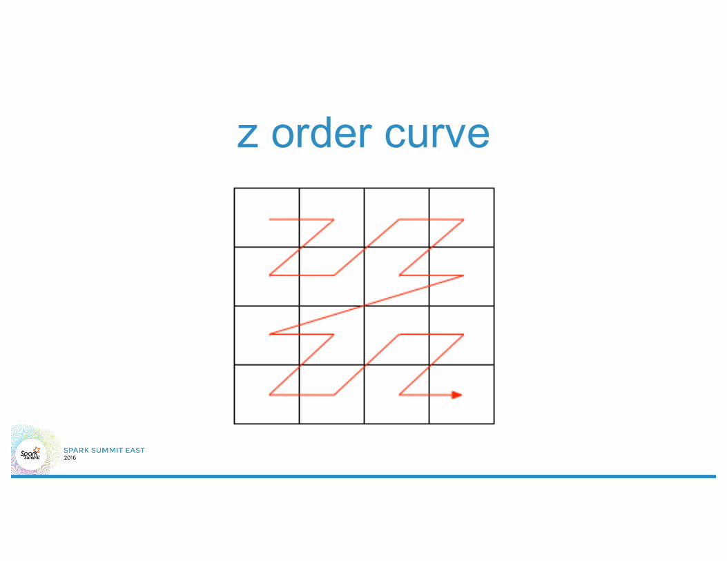
z order curve
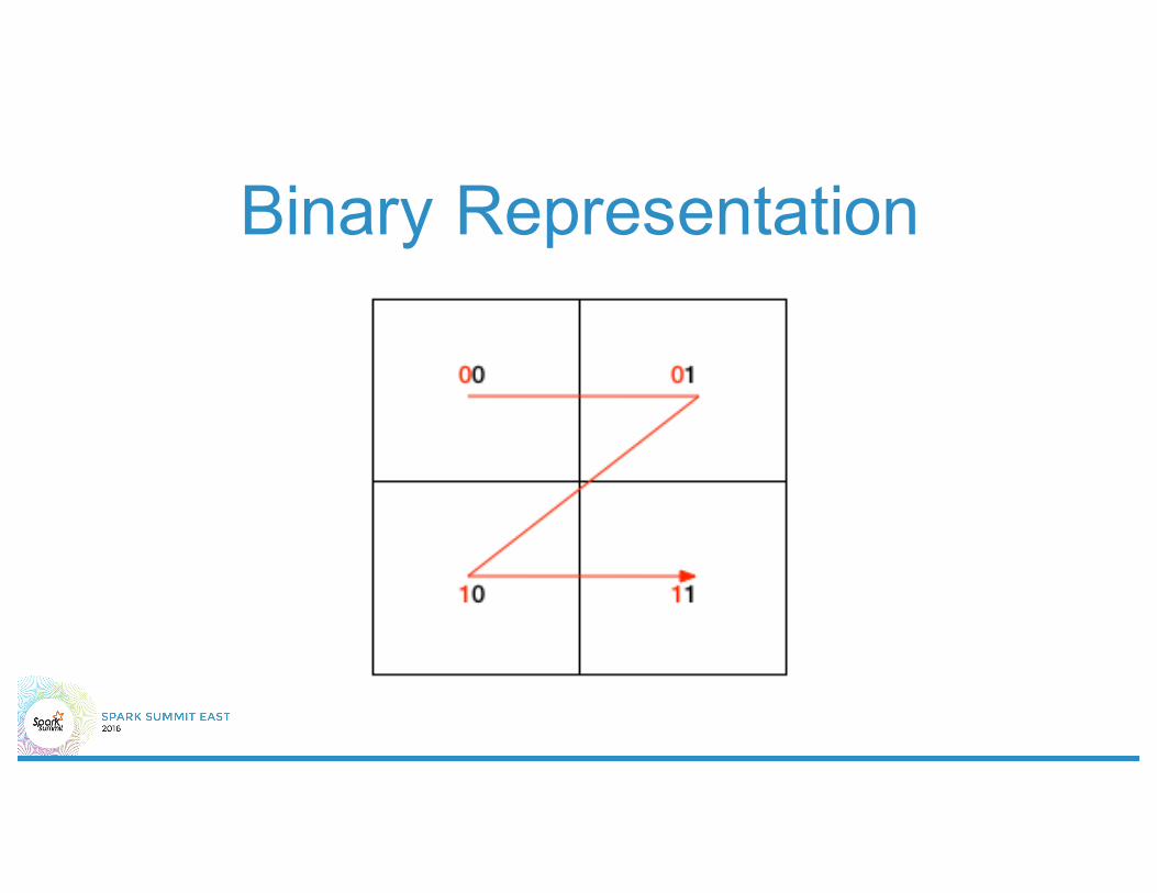
Binary Representation
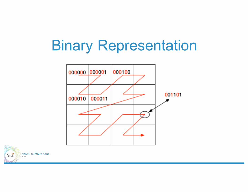
Binary Representation

properties• Locality: Two points differing in a small # of
bits are near each other– converse not necessarily true!
• Containment• Efficient construction• Nice bounds on precision

geohash• Z order curve with base 32 encoding• Start with world boundary (-90,90) X (-180,
180) and recursively subdivide based on precision

encode (-74.009, 40.7401)• 40.7401 is in [0, 90) => first bit = 1• 40.7401 is in [0, 45) => second bit = 0• 40.7401 is in [22.5, 45) => third bit = 1• …• do same for longitude
answer = dr5rgb

decode dr5rgb
• Decode from Base 32 -> Binary– 01100 10111 00101 01111 01010
• lat = 101110001111, long = 0100101111000• Now decode binary -> decimal.
– latitude starts with 1 => between 0 - 90– second bit = 0 => between 0 - 45– third bit = 1 => between 22.5 - 45– ...

An algorithm to scale join?• Preprocess points
– For each point compute geohash of precision p covering point
• Preprocess neighborhoods– For each neighborhood compute geohashes of precision p that
intersect neighborhood.
• Inner join on geohash• Filter out edge cases

Implementation in Spark SQL• Override Strategy to define SpatialJoinStrategy
– Logic to decide when to trigger this join• Only trigger if geospatial queries• Only trigger if join is complex: if n ~ O(1) then broadcast join
is good enough– Override BinaryNode to handle the physical execution
plan ourselves• Override execute(): RDD to execute join and return results
– Stitch it up using Experimental Strategies in SQLContext


Persistent Indices• Often, the geometry dataset does not
change… eg. neighborhoods• Index the dataset once and for all?

Persistent Indices• Use Magellan to generate spatial indices
– Think of geometry as document, list of geohashes as words!
• Persist indices to Elastic Search• Use Magellan Data Source to query indexed ES
data• Pushdown geometric predicates where possible
– Predicate rewritten to IR query
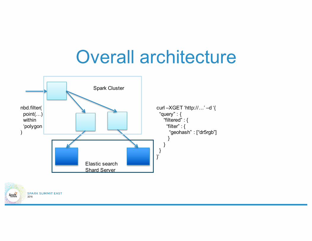
Overall architecture
Elastic search Shard Server
Spark Cluster
nbd.filter(point(…) within ‘polygon
)
curl –XGET ‘http://…’ –d ‘{“query” : {
“filtered” : {“filter” : {“geohash” : [“dr5rgb”]}
}}
}’


THANK YOU.Twitter: @halfabrane, Github: @harsha2010