longitude latitude presentation ms. shappley 4 th grade social studies
TRANSCRIPT
Longitude Latitude Presentation
• Ms. Shappley
• 4th grade Social Studies
Directions
• Students will be able to use the information gained from this PowerPoint to label the important areas of the world based on longitude and latitude. Map will be pasted into their notebooks for future review.
• Students will be able to answer quiz questions accurately.

Latitude and Longitude• The earth is divided into lots of lines
called latitude and longitude.

Singing Longitude
• Longitude:– “It's a LONG, LONG way
from pole to pole, pole to pole, pole to poleIt's a LONG, LONG way from pole to pole, so we call those LONGITUDES.”

Lines
• Longitude lines run north and south.
• Latitude lines run east and west. • The lines measure distances in
degrees.
Latitude
Longitude

Where is 0 degree?
• The equator is 0 degree latitude.
• It is an imaginary belt that runs halfway point between the North Pole and the South Pole.
Equator

Where is 0 degree?
• The prime meridian is 0 degrees longitude. This imaginary line runs through the United Kingdom, France, Spain, western Africa, and Antarctica.
P
R
I
M
E
MERIDIAN

Prime Meridian
• This imaginary line separates the East and the West side of the Earth• zero degree (0°) longitude• All lines west of the Prime Meridian are labeled W for west and all
lines that are east are labeled E.


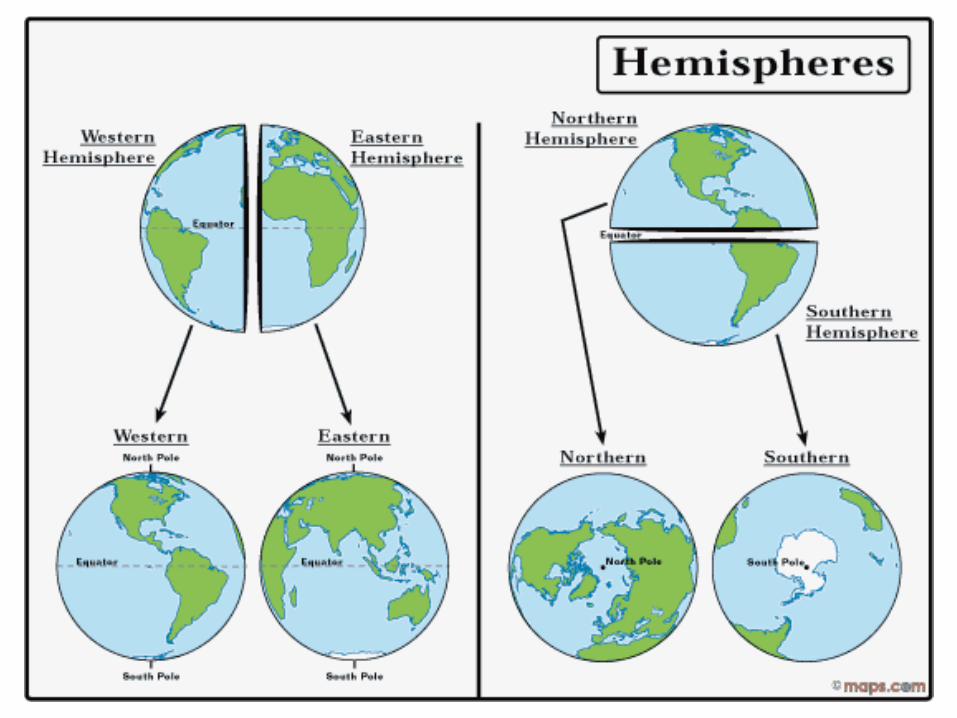
Hemispheres
• By using the equator and prime meridian, we can divide the world into four hemispheres, north, south, east, and west.

Arctic Circle
• The arctic circle is an imaginary line which marks where once a year there is 1 sunlit day. 66.5 degrees North.

Antarctic Circle
• The antarctic circle is an imaginary line which marks where there is one whole day during which the sun does not set, and one whole day in which the sun does not rise. 66.5 Degrees South.

North Pole
• The North Pole• is the northern
point on Earth
• Temperature
at the
North Pole is 0°F
North Pole
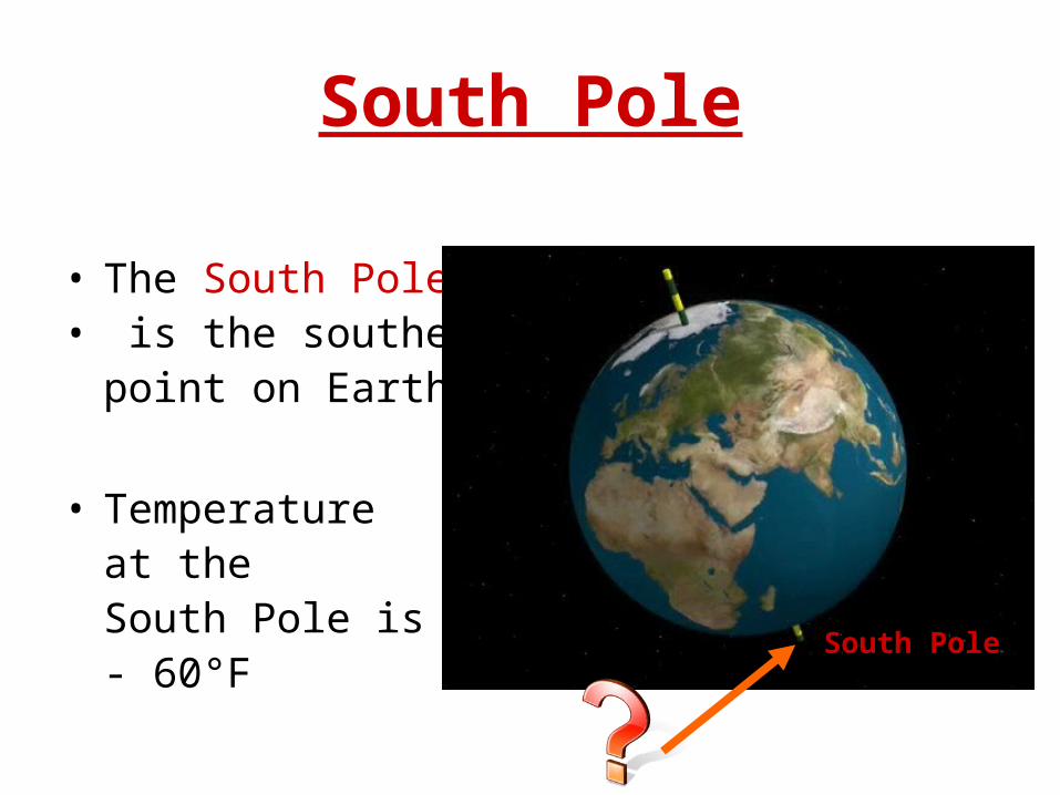
South Pole
• The South Pole• is the southern
point on Earth
• Temperature at theSouth Pole is - 60°F South Pole

Tropic of Cancer
• This parallel line marks the farthest point north at which the sun can be seen directly overhead at noon

Tropic of Capricorn
• This parallel line marks the farthest point south at which the sun can be seen directly overhead at noon

Northern Hemisphere
• The northern hemisphere half of Earth that is above the equator.
• Contains more land and less ocean
Equator
The part of the earth above the equator is
called what?

Southern Hemisphere
• The southern hemisphere is the half of Earth that is below the equator.
• Contains more ocean and less land
• Less pollution
Equator
The part of the earth below the equator is
called what?

Major lines of latitude
• North Pole
• Arctic Circle
• Tropic of Cancer
• Equator
• Tropic of Capricorn
• Antarctic Circle
• South Pole

Globe Says (Simon Says)
Body parts represent the major lines of latitude• Top of head – North Pole• Ears – Arctic Circle• Shoulders – Tropic of Cancer• Waist – Equator• Knees – Tropic of Capricorn• Shins – Antarctic Circle• Toes – South Pole