location - sgs- · pdf filehowever, maintenance and monitoring ... but it is costing us ......
TRANSCRIPT
May 2009
May Luncheon
Thursday
May 14, 2009 11 :00 AM – 1 :00 PM
Location:
Le Pavillon Hotel
833 Poydras Street New Orleans, LA
Sponsor:
Geokinetics Inc.
RSVP Mr. Don Dubose
(504) 592-5105 or
By May 11th, 10:00AM
Inside This Issue
President’s………………….……2 1st Vice President’s ...…...…......3 Auxiliary ……………….……..…3 SEG Recognition.……………….4 Spring Social ..………………….5 Fall Symposium……………….. 5 NOGS Seminar ……………….. 6 Company Representatives…..16
SGS May Luncheon Presentation
Geophysical Characterization of Flood Protection Barriers: West Bank, Louisiana, USA
Presented by Juan M. Lorenzo Louisiana State University Department of Geology and Geophysics To date, construction of flood protection barriers has been achieved with traditional geotechnical characterizations of the subsurface. However, maintenance and monitoring of these same structures requires a novel approach. Whereas subsurface geotechnical data exist, they are only collected at widely spaced intervals, often hundreds of feet apart, far exceeding the scale of the weak links in the levee system. I propose a comprehensive, geo-scientific methodology for the maintenance and evaluation of a coastal flood protection system that integrates seismic, electrical resistivity and engineering log data. I use as a test case, a distressed portion of the V-levee of Marrero,Louisiana, USA. Many mechanisms for failure such as, liquefaction or underseepage, can be attributed to a lack of understanding of the strength and permeability of the embankment and its soil foundation. Inherent uncertainties in the engineering analyses and unexpected variability in the foundation soils can be checked independently through geophysical methods. Based on preliminary field tests across the distressed levee, transmission tomographic analyses display sensitivity to changes in average shear wave velocities. The shear velocity (and hence shear strength) in the material used to build the artificial levee crest is twofold greater (~20 m/s) than the natural soils in the levee foundation. Relatively lower shear strength appears under the visibly distressed portion of the levee, than at two other apparently non-distressed locations along the levee.
Speaker Biography
Dr. Lorenzo received his Licenciatura (1983) from the University of Barcelona, and his M.A. (1986) and Ph.D. (1991) in Marine Seismology from Columbia University, NY.
Southeastern Geophysical Society Reflections May 2009 1

President’s Corner by Tim Maciejewski
Dear SGS members, Another year has passed at the SGS. As I look back over the year our industry went from a high to a low in a short time span. With the continued withdrawal of the industry from the New Orleans area, we are getting thin. We are still working on keeping the society active; mainly with North/South meetings so that no one will need to cross the bridge for the luncheons. We will continue to work that problem over the summer break. All the speakers this year were very good. We also noticed that our trial “breakfast” meeting had a higher turn-out then expected, we may consider another one as we proceed into next year.
Most of last year, the oil industry was riding a high. As you can guess, we do not expect to get the same company support next year so there may be some slight changes to the social events and luncheons next year. Yes, we will still have these events, what is a society that does not meet occasionally to socialize and pass along contacts and ideas. One cost saving idea that I had was the luncheon drink. Do you come to the luncheon for the drink or for the speaker and topic? It is nice because we are one of the last societies that offer this perk, but it is costing us roughly $300 per luncheon. This and other topics will be discussed when the committee members meet to pass along the mantle to the next generation.
“Didja know – Some River History”
Through a series of events that were not fully understood at the time, the Mississippi River could have a drastically different course then its present day path through New Orleans. Until the early 1800’s, the Red River emptied into the meandering Mississippi River. Just down river of their intersection, there was a large, pre-historic log jam that filtered water from the Mississippi river into the Atchafalaya swamp. In 1831, Henry Shreve (founder of Shreveport on the Red River) did not like navigating one of the large meanders on the Mississippi river, so he had a channel dug to by-pass it. The Mississippi river now ran through both the old meander “Old River” and the new pathway created by Henry. Then in 1839, the State of Louisiana decided to make the Red River and Mississippi River more navigable by burning, blasting, and dredging the 30 mile long log jam on the “Old River”. Soon afterwards, the Mississippi started to divert into the Atchafalaya River heading towards the Gulf of Mexico. Since this new pathway to the gulf is only 145 miles, less then half its present course, the flowing water naturally wants to take the path of lease resistance.
In the 1940’s the Atchafalaya captured the Red River, and by the 1950’s almost 1/3 the total volume of the Mississippi River was also flowing into the Atchafalaya. Well, it was obvious that if nothing was done, eventually the Mississippi River would change course to the new pathway through the swamp. In the 1950’s Congress ordered the Army Corps of Engineers to stop the Atchafalaya from capturing any more of the Mississippi. In 1963, the Corps finished its river control structure and the volume is held in check, 70% will go down the Mississippi and 30% will go down the Atchafalaya.
Southeastern Geophysical Society Reflections May 2009 2

President’s Corner, Continued
Presently locks are installed on the river channels to allow boats to pass from the Mississippi to Red/Atchafalaya Rivers. There have been a couple of times when the new control structures were in trouble. During the 1973 flood water diverted around both sides of the dam forming scour holes on both sides. A secondary controls structure was erected in the early 1980’s to ease some of the stress on the original.
Have a good summer and I thank y’all for the continued support of the SGS.
Best Regards, Tim M… SGS President
1st Vice President’s Corner by Eric Zimmerman Turning the Page Looking back on the year, I feel we were able to accomplish many of our goals, with the opportunity to do more in the future. In the past year we have executed a complete and broad range of monthly meetings, entertaining socials, continuing education, joint society meetings, and community outreach. Our meeting sponsorships have allowed us to maintain our lunch schedule, our northshore meetings have allowed us to reach a greater portion of our population, and our golf tournament has allowed us to continue our tradition of awarding scholarships. In the year to come we hope to continue to serve as a catalyst for the local oil industry. The industry has been through a rocky year, and the SGS will continue to serve as a constant source of positive industry interaction. To do this, however, it is important that our members continue to participate in the local society and to renew your membership to the SGS.
The Southeastern Geophysical Auxiliary, New Orleans
On Thursday. April 16th. the SGA took a ride across the lake to have lunch at the Dakota's. Our speaker, Cheryl Blaise, gave us hints on pairing colors and other pieces of clothing to get the best effects. Dixie Jeffries made the cutest tea towels for door prizes, She along with Carol Johansen, Doreen Cole and Darla Boudreaux made up the committee for our get together. Our next meeting and lunch will be held at Glenda Evans home in August and this will begin our 2009-10 year. Thanks to editor Ken Reynolds, for your help this year, you were great.
Happy Summer
Rosemary Austin
Southeastern Geophysical Society Reflections May 2009 3

Dixie Jefferies Carol Johansen
Doreen Cole Darla Boudreaux
Rosemary Austin & Guest Cheryl Blaise, Speaker
SEG Recognitions
We at the SGS would like to recognize those individuals who had received service awards from the SEG.
10 years of continuous service 25 years of continuous service Bronze Certificate Silver Certificate
Simon Baldock Ed Zinni Alfred Berroteran John DeLaughter Marlene Himel Alexander Lavrik Paul Lawless Richard Smith Steve Tsai
These certificates will be placed in the mail to the address SEG has on record. Thank you for you long-term service and work with the SEG and the SGS.
Regards, Tim Maciejewski, SGS President
Southeastern Geophysical Society Reflections May 2009 4

Southeastern Geophysical Society Reflections May 2009 5
Northshore Spring Social & Membership Drive Thursday, June 4, 2009
5:00 – 7:00 P.M.
Columbia Street Tap Room 434 N. Columbia St. Covington, Louisiana
Members (2009-2010) $5.00 New Members Free (with $20.00 membership fee)
For the cost of membership, come join us for food, fun, and drinks. If you have already renewed your 2009-2010 membership, cost to attend is a minimal $5.00. If you have yet to renew your membership, join up, and the party is on us. Come and be part of a great society. RSVP to Don Dubose by Monday, June 1st 504-592-5105.
The Southeastern Geophysical Societypresents
Exploration Offshore USA OCS: Opening the Next Frontier?
•Offshore Virginia has been opened.
•When will the potential lifting of other OCS areas result in drilling?
•What is the potential for hydrocarbon accumulations?
•What will the new President and Congress do?
SGS Technical SymposiumNovember 12, 2009
New Orleans, Louisiana
Call for presenters/sponsors – if you or your company would like to present a lecture or sponsor the symposium – contact Wayne Cook at [email protected] or Eric Zimmermann at [email protected]

Seminar lunch break 11:30 – 1:00 Attend the NOGS seminar at One Shell Square and the SGS luncheon at Le Pavillon
Southeastern Geophysical Society Reflections May 2009 6

PGS Gulf of Mexico Library
Challenging Times Require Imaginative Solutions - PGS Your Creative Business Partner
A Clearer Imagewww.pgs.com
Newly Reprocessed PSDM - Kirchhoff, Beam & WEM
Wide-azimuth - Kirchhoff, Beam & WEM
Narrow azimuth
Proposed Wide Azimuth – Anisotropic Beam and RTM
Contact your local PGS representative for more information
HoustonTel: +1 281 509 8000Fax: +1 281 509 8500
OsloTel: +47 67 52 6400Fax: +47 67 52 6464
LondonTel: +44 1932 37 6000Fax: +44 1932 37 6100
Narrow Azimuth Anisotropic Kirchhoff, Beam and WEM in cooperation with

The latest 3DVSP technology from Baker Atlas and VSFusion focuses on providing you with the best structural image of your reservoir.
The industry’s most experienced experts focus on designing surveys that
deliver the results you must have.
Our DPFASM (Deep Penetrating Focused ArraySM) patented source, tuned specifically
for high-resolution VSP surveys, when combined with the 32+ level digital receiver
produces the best survey data.
In addition, our VS3 processing package optimizes the velocity model while
our 3C-3D Vector Migration focuses precisely on the location of each reflection
point, ensuring you receive the most accurate structural image possible.
Why wouldn’t you want the best structural image available?
…for planning your next well, for greater confidence in your reserve calculations,
for reducing your risk, for the accuracy of your reservoir characterization, for…
T h e B E S T C h o i c e
Bring Your Reservoir Into Focus.F
or m
ore
info
rmat
ion,
vis
it ou
r w
ebsi
te w
ww
.bak
erhu
ghes
.com
© 2
007
Bak
er H
ughe
s In
corp
orat
ed.
A Baker Hughes - CGGVeritas Company
ATL-07-12364 DPFA Ad 1.qxp 3/13/2007 3:05 PM Page 1
Proud to bean American
companyHouston 281/275-7500New Orleans 985/626-1400
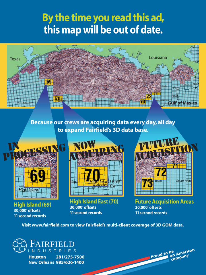
By the time you read this ad,this map will be out of date.
FAIRFIELDI N D U S T R I E S
High Island (69)30,000’ offsets 11 second records
Because our crews are acquiring data every day, all day to expand Fairfield’s 3D data base.
now acquiring
High Island East (70)30,000’ offsets 11 second records
FUTURE acquiSITION In
processing
Future Acquisition Areas30,000’ offsets 11 second records
LouisianaTexas
Gulf of Mexico
Visit www.fairfield.com to view Fairfield’s multi-client coverage of 3D GOM data.

For a superior image just say WAZ!Allow us to widen your perpective with Walker Ridge WAZ data. The WAZ imagingdifference couldn’t be clearer. Final products are now available.
DATA LIBRARY WITH A DIFFERENCE
Contact:
CGGVeritas Marine Data Library
+1 832 351 8501 cggveritas.com
Walker Ridge Wide-Azimuth RTM.
Walker Ridge Narrow-Azimuth WEM.
09A-DM-87-V1_SGS _Newsletter:09A-DM-87-V1_SGS _Newsletter 27/04/09 15:06 Page 1

Southeastern Geophysical Society Reflections May 2009
11
Southeastern Geophysical Society Reflections May 2009 12
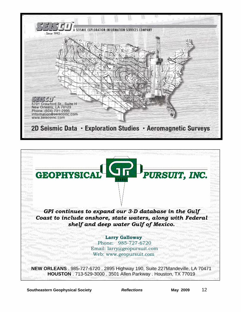
GPI continues to expand our 3-D database in the Gulf Coast to include onshore, state waters, along with Federal
shelf and deep water Gulf of Mexico.
Larry Galloway Phone: 985-727-6720
Email: [email protected] Web: www.geopursuit.com
NEW ORLEANS . 985-727-6720 . 2895 Highway 190, Suite 227Mandeville, LA 70471 HOUSTON . 713-529-3000 . 3501 Allen Parkway . Houston, TX 77019

Southeastern Geophysical Society Reflections May 2009
13
100 NorthPark Blvd Covington, LA 70433
(985) 773-6000
100 NorthPark Blvd Covington, LA 70433
(985) 773-6000

Southeastern Geophysical Society Reflections May 2009
14

Southeastern Geophysical Society Reflections May 2009
15
Southeastern Geophysical Society Reflections May 2009
15

Southeastern Geophysical Society Reflections May 2009
16
Advertiser Index PGS 7 Baker-Hughes 8 Fairfield 9 CGGVeritas 10 TGS 11 Seisco 12 Geophysical Pursuit 12 SEI 13 Chevron 13 emgs 14 Shell 14 Eni 15
S.G.S. Executive Committee SGS Company Representatives: PRESIDENT – Tim Maciejewski
Chevron USA Production Company (985) 773-6148 [email protected]
1st VICE PRESIDENT & UNIV LIAISON – Eric Zimmerman LLOG Exploration (985) 801-4338 [email protected]
2nd VICE PRESIDENT – William Reid WesternGeco (504) 592-5435 [email protected]
SECRETARY – Wayne Cook Seitel Data, Ltd. (504) 582-2290 [email protected] TREASURER – Rod Stafford Chevron USA Production Company (985) 773-6122 [email protected] EDITOR – Ken Reynolds Chevron USA Production Company (985) 773-6288 [email protected] PAST PRESIDENT – Toby Roesler
Eni Petroleum (504) 593-7937 [email protected]
PRIOR PAST PRESIDENT Richard Fossier CGGVeritas (832) 351-8939 [email protected] WEBMASTER Richard Mongan Chevron (832) 854-5725 [email protected] OUTREACH Lisa Dwyer Kennedy Minerals Management Service (504) 736-2794 [email protected] Southeastern Geophysical Auxiliary Officers President- Rosemary Austin …………….……...…..... (504) 737-9697 Vice President – Glenda Evans Secretary - Claudia Marquis Treasurer – Claire LaPointe