llake champlain: our lake, our futureake ... champlain: our lake, our future january 8-9, 2008...
TRANSCRIPT
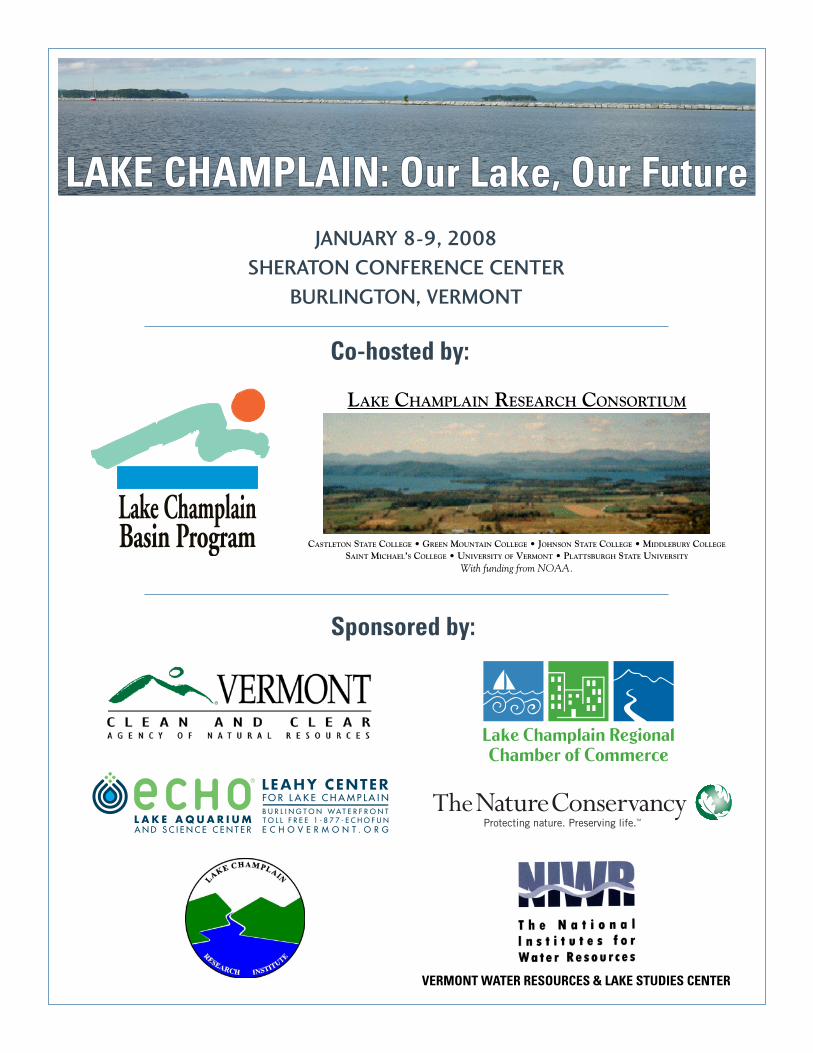
LAKE CHAMPLAIN: Our Lake, Our FutureLAKE CHAMPLAIN: Our Lake, Our FutureJANUARY 8-9, 2008
SHERATON CONFERENCE CENTER BURLINGTON, VERMONT
Sponsored by:
Lake ChamplainBasin Program
Co-hosted by:
LAKE CHAMPLAIN RESEARCH CONSORTIUM
CASTLETON STATE COLLEGE • GREEN MOUNTAIN COLLEGE • JOHNSON STATE COLLEGE • MIDDLEBURY COLLEGE SAINT MICHAEL’S COLLEGE • UNIVERSITY OF VERMONT • PLATTSBURGH STATE UNIVERSITY
With funding from NOAA.
VERMONT WATER RESOURCES & LAKE STUDIES CENTER
Lake Champlain: Our Lake, Our Future January 8-9, 2008 Sheraton Conference Center, Burlington VT
CONFERENCE HOSTS:
The Lake Champlain Research Consortium (LCRC) is composed of seven academic institutions located within the Lake Champlain Basin. Its mission is to coordinate and facilitate research and scholarship of the Lake Champlain ecosystem and related issues; to provide opportunities for training and education of students on lake issues; and to aid in the dissemination of information gathered through lake endeavors. More information is available at http://academics.smcvt.edu/lcrc/. The Lake Champlain Basin Program (LCBP) works in partnership with government agencies from New York, Vermont, and Quebec, private organizations, local communities, and individuals to coordinate and fund efforts which benefit the Lake Champlain Basin's water quality, fisheries, wetlands, wildlife, recreation, and cultural resources. More information is available at http://www.lcbp.org/.
BRIEF CONFERENCE SCHEDULE TUESDAY 8:30 Registration – Promenade 9:00 Welcoming comments – Emerald Ballroom 1&2 9:30 2 concurrent technical sessions – Emerald Ballroom 1&2, Amphitheater 10:45 Break – Promenade 11:00 2 concurrent technical sessions – Emerald Ballroom 1&2, Amphitheater 12:30 Lunch – Emerald Ballroom 3 2:00 2 concurrent technical sessions – Emerald Ballroom 1&2, Amphitheater 3:15 Break – Promenade 3:30 2 concurrent technical sessions – Emerald Ballroom 1&2, Amphitheater 4:45 Poster Session and Reception – Emerald Ballroom 3 6:15 Board buses for buffet dinner and reception at ECHO Lake Aquarium
and Science Center at the Leahy Center for Lake Champlain 8:15 Board buses to return to Sheraton Conference Center Wednesday 7:30 Continental Breakfast and Poster Session – Emerald Ballroom 3 8:30 The Watershed and Inputs panel discussion – Emerald Ballroom 1&2 9:35 Biodiversity and Aquatic Nuisance Species panel discussion – Emerald
Ballroom 1&2 10:35 Break – Promenade 11:00 In-Lake Processes and Water Quality panel discussion – Emerald
Ballroom 1&2 12:00 Lunch – Emerald Ballroom 3 1:00 Society and Culture Related to the Lake panel discussion – Emerald
Ballroom 1&2 2:05 Modeling for the Future panel discussion – Emerald Ballroom 1&2
[2]
Lake Champlain: Our Lake, Our Future January 8-9, 2008 Sheraton Conference Center, Burlington VT
Technical Sessions for Tuesday, January 8
[Abstract found on program page number in brackets]
NUTRIENT RUNOFF- Session 1
9:30 Emerald Ballroom (1&2) Hydrologic, seasonal and management controls on
sediment and phosphorus transfers within experimental watersheds - Aubert Michaud1, Richard Lauzier2, and Jacques Desjardins1 (1IRDA - Institut de recherche et de développement en agroenvironnement, 2Ministère de l’agriculture, des pêcheries et de l’alimentation du Québec, Direction régionale de la Montérégie, secteur Est) [10]
Using SWAT for BMP implementation and
diffuse source phosphorus reductions: Results from Pike River Watershed - Isabelle Beaudin, Julie Deslandes, Aubert Michaud, and Jacques Desjardins (IRDA - Institut de recherche et de développement en agroenvironnement) [11]
Phosphorus losses from agricultural fields under
subsurface and non-subsurface drained conditions: Pike River watershed, Quebec, Canada - Mark Eastman, Apurva Gollamudi, Nicolas Stämpfli, and Chandra Madramootoo (McGill University) [12]
Development and validation of a modified Quebec
phosphorus index to include subsurface drainage - Mohamed Chikhaoui, Chandra Madramootoo, and Apurva Gollamudi (McGill University) [13]
HYDRODYNAMICS AND WIND EFFECTS
9:30 Amphitheater Two simple models of wind-driven lake
circulation - Ken Hunkins (Lamont-Doherty Earth Observatory of Columbia University) [14]
Sub-surface neutrally buoyant drifters and
cross-lake intra-thermocline flow in Lake Champlain, VT - Thomas O. Manley1, Michael J. McCormick 2, and Ken Hunkins3 (1Middlebury College; 2NOAA - Great Lakes Ecological Research Laboratory, 3Lamont-Doherty Earth Observatory of Columbia University) [15]
Use of autonomous underwater vehicles
(AUVs) and their effectiveness in mapping hydrodynamic variability in Lake Champlain - Kristen Poehling (Middlebury College) [16]
Atmospheric forecasting and modeling in the
Lake Champlain Basin - Paul A. Sisson, John M. Goff, and Conor T. Lahiff (NOAA - National Weather Service) [17]
Break from 10:45 to 11:00
[3]
Lake Champlain: Our Lake, Our Future January 8-9, 2008 Sheraton Conference Center, Burlington VT
PLANKTON
11:00 Emerald Ballroom (1&2) Cyanobacteria abundance, cyanobacteria
concentrations, and nutrients and other drivers in Missisquoi Bay - Mary C. Watzin, Meghan K. Rogalus, Susan P. Fuller, Kathryn A. Crawford, and Cynthia May (University of Vermont) [18]
Distribution and molecular analysis of cyanobacteria toxins in Lake Champlain: a 5-year review - Greg Boyer1, Michael Satchwell1, Rachael Damon2, Amber Hotto1, and Xingye Yang1 (1SUNY - College of Environmental Science and Forestry, 2LeMoyne College) [19]
Missisquoi Bay: Community dynamics of
cyanobacteria blooms and the development of a new monitoring method for Lake Champlain - Carrianne E. Pershyn1, Timothy Mihuc1, Jeffry Jones1, Eileen Allen1, Greg Boyer2, Mike Satchwell2, Sean Thomas1, and Meghan Greene1
(1SUNY – Plattsburgh, 2SUNY - College of Environmental Science and Forestry) [20]
Where have all the algae gone in Missisquoi
Bay? - Eric Smeltzer1, Angela Shambaugh1, Pete Stangel1, and Fred Dunlap2 (1Vermont Agency of Natural Resources, 2New York State Department of Environmental Conservation) [21]
Missisquoi Bay zooplankton: the crash of 2007 - Fredric Dunlap1, Timothy Mihuc2, and Carrianne Pershyn2 (1New York State Department of Environmental Conservation, 2SUNY – Plattsburgh) [22]
ATMOSPHERIC DEPOSITION AND MERCURY DYNAMICS
11:00 Amphitheater Episodic and chronic atmospheric mercury
deposition to the Lake Champlain Basin - Eric K. Miller1, Sean Lawson2, Melody Burkins3, Mim Pendleton2,3, Alan VanArsdale4, Gerald Keeler5, and James B. Shanley6 (1Ecosystems Research Group, Ltd., 2Vermont Monitoring Cooperative, 3University of Vermont, 4U.S. Environmental Protection Agency, 5University of Michigan, 6U.S. Geological Survey) [23]
Mercury in Lake Champlain: The Lake
Champlain mass balance project - Neil Kamman1, Ning Gao2, Eric Miller3, Celia Chen4, and James B. Shanley5 (1Vermont Agency of Natural Resources, 2Saint Lawrence University, 3Ecosystems Research Group, Ltd., 4Dartmouth College, 5U.S. Geological Survey) [24]
The dynamics of streamwater inputs of total
mercury and methylmercury to Lake Champlain - James B. Shanley and Ann T. Chalmers (U.S. Geological Survey) [25]
Inter- and intra- basin variability in mercury
bioaccumulation by zooplankton in Lake Champlain - Celia Chen1, Neil Kamman2, Jason Williams1, Vivien Taylor1, and Brian Jackson1 (1Dartmouth College, 2Vermont Department of Environmental Conservation) [26]
Dynamics of mercury cycling and biotic
assimilation in Malletts and Missisquoi Bays - Eric K. Miller1, Celia Chen2, Brian Jackson2, Neil Kamman3, Jamie Shanley4, Ann Chalmers4, Ning Gao5, and Tom Holsen6 (1Ecosystems Research Group, Ltd., 2Dartmouth College, 3Vermont Department of Environmental Conservation, 4U.S. Geological Survey, 5Saint Lawrence University, 6Clarkson University) [27]
12:30 - Break for lunch (provided in Emerald Ballroom 3)
[4]
Lake Champlain: Our Lake, Our Future January 8-9, 2008 Sheraton Conference Center, Burlington VT
NUTRIENT RUNOFF- Session 2 2:00 Emerald Ballroom (1&2)
The role of constructed wetlands in agricultural
watersheds - Anne-Caroline Kroeger and Chandra Madramootoo (McGill University) [28]
Overview of the Lake Champlain Basin wetland
restoration plan - April Moulaert1 and Shelley Gustafson2 (1Vermont Department of Forests, Parks, and Recreation, 2Pioneer Environmental Associates) [29]
Linking soil-landscape factors to phosphorus
levels in Vermont floodplains - Eric Young1, Donald S. Ross1, Caroline Alves2, Thomas Villars2 (1University of Vermont, 2U.S. Department of Agriculture – Natural Resources Conservation Service) [30]
Adoption of low input, no phosphorous grounds
care by commercial/institutional property managers - Jurij Homziak1, Bethany Hanna2, and Jim Flint3, (1Lake Champlain Sea Grant, University of Vermont, 2University of Vermont Extension, 3Friends of Burlington Gardens) [31]
FISH, WILDLIFE AND INVASIVE SPECIES
2:00 Amphitheater
Lake Sturgeon in Vermont, what do we know and where do we go next? - Chet MacKenzie1, Madeleine Lyttle2, and Nick Staats2 (1Vermont Fish and Wildlife Department, 2U.S. Fish and Wildlife Service) [32]
Searching for lake whitefish in Lake
Champlain - J. Ellen Marsden1 and Stephen Smith2, (1University of Vermont, 2U.S. Fish and Wildlife Service) [33]
Nest site management for spiny softshell and
other native species of turtles - Steve Parren (Vermont Fish and Wildlife Department) [34]
Behaviors and knowledge regarding aquatic
invasive species: Lessons from Lake Champlain boaters and tournament anglers - Mark Malchoff1 and Meg Modley2 (1Lake Champlain Sea Grant, SUNY–Plattsburgh, 2Lake Champlain Basin Program) [35]
Break from 3:15 to 3:30
[5]
Lake Champlain: Our Lake, Our Future January 8-9, 2008 Sheraton Conference Center, Burlington VT
WATERSHED PROCESSES AND IMPACTS 3:30 Emerald Ballroom (1&2)
A multiproxy paleolimnological study of Lake
Champlain, USA-Canada - Andrea Lini1, Suzanne Levine1, Elizabeth Collyer1, Milton Ostrofsky2, Daun Dahlen3, Neil Kamman4, Peter Leavitt5, and Lynda Bunting5 (1University of Vermont, 2Allegheny College, 3Paul Smith's College, 4Vermont Department of Environmental Conservation, 5University of Regina) [36]
Ecosystem integrity in Adirondack upland
headwater catchments: a multivariate approach to ecosystem quality indicators - Timothy B. Mihuc1, Thomas Woodcock1, Edwin Romanowicz1, Janet Mihuc2, Eileen Allen1, Chris Cirmo3, Robert Fuller1, David Franzi1, Celia Evans2, and James Allen2 (1SUNY – Plattsburgh, 2Paul Smith’s College, 3SUNY –Cortland) [37]
Evaluation of streambank stability – Jaron Borg,
Mandar Dewoolkar, and Paul Bierman (University of Vermont) [38]
Mapping potential wetlands in the AuSable and
Boquet watersheds - Ariel Diggory1,2 , Donald J. Leopold2, William F. Porter2, and Mark Rooks1 (1New York State Adirondack Park Agency, 2SUNY College of Environmental Science and Forestry) [39]
GEOLOGIC HISTORY, CHEMISTRY, AND CONTAMINANTS
3:30 Amphitheater Seismic and core stratigraphic evidence for
salinity changes in the Champlain Sea ~ 11.4 -11.2 ka. Impact from North American glacial lake drainage - Patricia L. Manley1, T. Cronin2, S. Brachfeld3, T. Manley1, D. A. Willard2, J.-P. Guilbault4, J. A. Rayburn5, and R. Thunell6 (1Middlebury College, 2U.S. Geological Survey, 3Montclair State University, 4BRAQ-Stratigraphie, 5SUNY – New Paltz, 6University of South Carolina) [40]
Pesticide monitoring by the Vermont Agency of
Agriculture; where we’ve been and where we should go from here - Nat Shambaugh (Vermont Agency of Agriculture) [41]
Wastewater treatment effluent, combined sewer
overflows, and urban storm samples as sources of organic compounds in the Lake Champlain Basin, 2006 - Patrick Phillips and Ann Chalmers (U. S. Geological Survey) [42]
Prevalence of microbial pathogens in dairy
manure from three farms in the Vermont Lake Champlain Basin - Donald W. Meals1, David C. Braun1, John P, Hanzas1, and Paul S. Warden2 (1Stone Environmental, Inc, 2Analytical Services, Inc.) [43]
4:45 Poster session and reception in Emerald Ballroom 3
[6]
Lake Champlain: Our Lake, Our Future January 8-9, 2008 Sheraton Conference Center, Burlington VT
POSTER PRESENTATIONS - Emerald Ballroom 3
Poster sessions 4:45 – 6:00 pm on Tuesday, and 7:30 – 8:30 am on Wednesday P-01 Calibration and validation of the SWAT model for BMP implementation and diffuse source
phosphorus reductions - Isabelle Beaudoin, Julie Deslandes, Aubert Michaud, and Jacques Desjardins (IRDA - Institut de recherche et de développement en agroenvironnement) [44]
P-02 Hydropedological segmentation characterization for enhanced water management - Julie Deslandes1, A. Michaud , K. Vézina , I. Saint-Laurent1 2 1, A. Lavoie , M. Nolin , L. Grenon , G. Gagné
2 3 3
1 , and A. Vézina (4 1IRDA - Institut de recherche et de développement en agroenvironnement, 2Centre d’applications et de recherches en télédétection (CARTEL), Sherbrooke University, 3Agriculture and Agri-Food Canada, Pedology and Precision Agriculture Laboratories, 4Institut de Technologie Agricole de La Pocatière) [45]
P-03 Using performance-based incentives for agricultural pollution control - Jonathan Winsten1,2 and Charles Kerchner2 (1Winrock International, 2University of Vermont) [46]
P-04 Soil dynamics in an urban landscape: linking anthropogenic influences to soil processes - Amanda K. Holland and William B. Bowden (University of Vermont) [47]
P-05 Vermont Flow Monitoring Project: comparing runoff from stormwater impaired and
attainment watersheds - Meredith Curling Clayton and William B. Bowden (University of Vermont) [48]
P-06 Assessment of the diversity of ammonia oxidizing bacteria in three distinct forest types within
the Lake Champlain watershed area - Mat Cunningham (University of Vermont) [49] P-07 Historical changes in phytoplankton populations and water quality in Missisquoi Bay - Angela
Shambaugh (Vermont Agency of Natural Resources) [50] P-08 Use of volunteers in blue-green algae monitoring - Mike Winslow1, Mary Watzin2, Meghan
Rogalus2, Susan Fuller2, and Lori Fisher1 (1Lake Champlain Committee, 2University of Vermont) [51]
P-09 Volunteer monitoring in the Basin runs deep - Amy Picotte (Vermont Agency of Natural
Resources) [52] P-10 Using the microcystin mcyA gene to track toxin movement in northern Lake Champlain - Mike
Satchwell, Amber Hotto, and Greg Boyer (SUNY - College of Environmental Science and Forestry) [53]
P-11 Diet overlap between native yellow perch (Perca flavescens) and invasive white perch (Morone
americana) in Missisquoi Bay, Lake Champlain, Vermont - Jeffrey D. White and Douglas E. Facey (Saint Michael’s College) [54]
P-12 Diet overlap between native yellow perch (Perca flavescens) and invasive white perch (Morone
americana) in two major Lake Champlain tributaries, Vermont - Jeffrey D. White and Douglas E. Facey (Saint Michael’s College) [55]
P-13 Larval fish drift in the Poultney River - Melissa Barber and Meriel Brooks (Green Mountain
College) [56]
[7]
Lake Champlain: Our Lake, Our Future January 8-9, 2008 Sheraton Conference Center, Burlington VT
P-14 Zebra mussel colonization of mushroom anchors, chains, and ropes: effects of bottom
substrate, time, and prior algal colonization - Sandra H. Brown1 and Declan McCabe2 (1BFA Fairfax, Vermont Science Initiative, 2Saint Michael’s College) [57]
P-15 Evidence of lacustrine bedforms in Lake Champlain, Vermont - Kathryn Hayo and Patricia L.
Manley (Middlebury College) [58] P-16 Tracking the surface flow in Lake Champlain - Michael J. McCormick1, Thomas O. Manley2,
Dmitry Beletsky3,4, Andrew J. Foley III3,4, Gary L. Fahnenstiel5, and Nathan Hawley1 (1NOAA – Great Lakes Ecological Research Laboratory, 2Middlebury College, 3Cooperative Institute for Limnology and Ecological Research, 4University of Michigan, 5NOAA – Great Lakes Ecological Research Laboratory, Lake Michigan Field Station) [59]
P-17 Mass wasting events in Lake Champlain - Patricia L. Manley and Thomas O. Manley
(Middlebury College) [60] P-18 Hydrodynamic model of Lake Champlain - Dmitry Beletsky1 and Michael J. McCormick2
(1University of Michigan, 2NOAA – Great Lakes Ecological Research Laboratory) [61] P-19 Determination of methyl and inorganic mercury in Lake Champlain waters and particulates -
Vivien Taylor and Brian Jackson (Dartmouth College) [62] P-20 The Vermont Monitoring Cooperative: A Long-Term Forest Health and Air Quality
Monitoring Resource for Vermont - Sean Lawson (Vermont Monitoring Cooperative) [63] P-21 Meteorological Monitoring on Lake Champlain at Diamond Island and Colchester Reef -
Joanna Grossman1,2 and Sean Lawson1 (1Vermont Monitoring Cooperative, 2Vermont Department of Forests, Parks, and Recreation) [64]
[8]
Lake Champlain: Our Lake, Our Future January 8-9, 2008 Sheraton Conference Center, Burlington VT
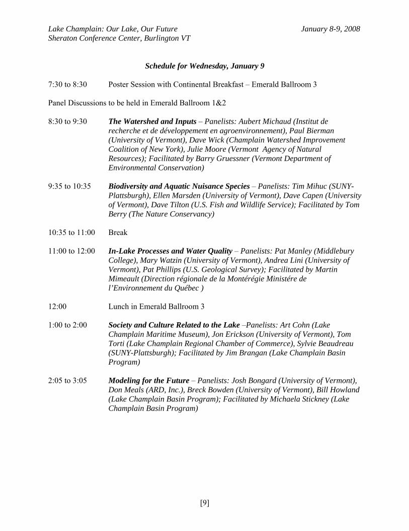
Schedule for Wednesday, January 9
7:30 to 8:30 Poster Session with Continental Breakfast – Emerald Ballroom 3 Panel Discussions to be held in Emerald Ballroom 1&2 8:30 to 9:30 The Watershed and Inputs – Panelists: Aubert Michaud (Institut de
recherche et de développement en agroenvironnement), Paul Bierman (University of Vermont), Dave Wick (Champlain Watershed Improvement Coalition of New York), Julie Moore (Vermont Agency of Natural Resources); Facilitated by Barry Gruessner (Vermont Department of Environmental Conservation)
9:35 to 10:35 Biodiversity and Aquatic Nuisance Species – Panelists: Tim Mihuc (SUNY-
Plattsburgh), Ellen Marsden (University of Vermont), Dave Capen (University of Vermont), Dave Tilton (U.S. Fish and Wildlife Service); Facilitated by Tom Berry (The Nature Conservancy)
10:35 to 11:00 Break 11:00 to 12:00 In-Lake Processes and Water Quality – Panelists: Pat Manley (Middlebury
College), Mary Watzin (University of Vermont), Andrea Lini (University of Vermont), Pat Phillips (U.S. Geological Survey); Facilitated by Martin Mimeault (Direction régionale de la Montérégie Ministére de l’Environnement du Québec )
12:00 Lunch in Emerald Ballroom 3 1:00 to 2:00 Society and Culture Related to the Lake –Panelists: Art Cohn (Lake
Champlain Maritime Museum), Jon Erickson (University of Vermont), Tom Torti (Lake Champlain Regional Chamber of Commerce), Sylvie Beaudreau (SUNY-Plattsburgh); Facilitated by Jim Brangan (Lake Champlain Basin Program)
2:05 to 3:05 Modeling for the Future – Panelists: Josh Bongard (University of Vermont),
Don Meals (ARD, Inc.), Breck Bowden (University of Vermont), Bill Howland (Lake Champlain Basin Program); Facilitated by Michaela Stickney (Lake Champlain Basin Program)
[9]
Lake Champlain: Our Lake, Our Future January 8-9, 2008 Sheraton Conference Center, Burlington VT
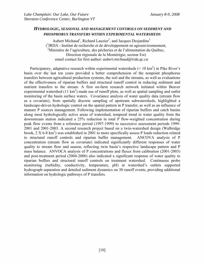
HYDROLOGIC, SEASONAL AND MANAGEMENT CONTROLS ON SEDIMENT AND
PHOSPHORUS TRANSFERS WITHIN EXPERIMENTAL WATERSHEDS
Aubert Michaud1, Richard Lauzier2, and Jacques Desjardins1
(1IRDA - Institut de recherche et de développement en agroenvironnement, 2Ministère de l’agriculture, des pêcheries et de l’alimentation du Québec,
Direction régionale de la Montérégie, secteur Est) email contact for first author: [email protected]
Participatory, adaptative research within experimental watersheds (< 10 km2) in Pike River’s
basin over the last ten years provided a better comprehension of the nonpoint phosphorus transfers between agricultural production systems, the soil and the streams, as well as evaluations of the effectiveness of riparian buffers and structural runoff control in reducing sediment and nutrient transfers to the stream. A first on-farm research network initiated within Beaver experimental watershed (11 km2) made use of runoff plots, as well as spatial sampling and outlet monitoring of the basin surface waters. Covariance analysis of water quality data (stream flow as a covariate), from spatially discrete sampling of upstream subwatersheds, highlighted a landscape-driven hydrologic control on the spatial pattern in P transfer, as well as an influence of manure P sources management. Following implementation of riparian buffers and catch basins along most hydrologically active areas of watershed, temporal trend in water quality from the downstream station indicated a 25% reduction in total P flow-weighted concentration during peak flow events from a reference period (1997-1999) to successive assessment periods 1999-2001 and 2001-2003. A second research project based on a twin-watershed design (Walbridge brook, 2 X 6-8 km2) was established in 2001 to more specifically assess P loads reduction related to structural runoff controls and riparian buffer management. ANCOVA analysis of P concentration (stream flow as covariate) indicated significantly different responses of water quality to stream flow and season, reflecting twin basin’s respective landscape pattern and P mass balance. ANVOCA analysis of P concentrations and fluxes from calibration (2001-2003) and post-treatment period (2004-2006) also indicated a significant response of water quality to riparian buffers and structural runoff controls on treatment watershed. Continuous probe monitoring (turbidity, conductivity, temperature, pH) at watershed’s outlets supported hydrograph separation and detailed sediment dynamics on 30 runoff events, providing additional information on hydrologic pathways of P transfers.
[10]
Lake Champlain: Our Lake, Our Future January 8-9, 2008 Sheraton Conference Center, Burlington VT
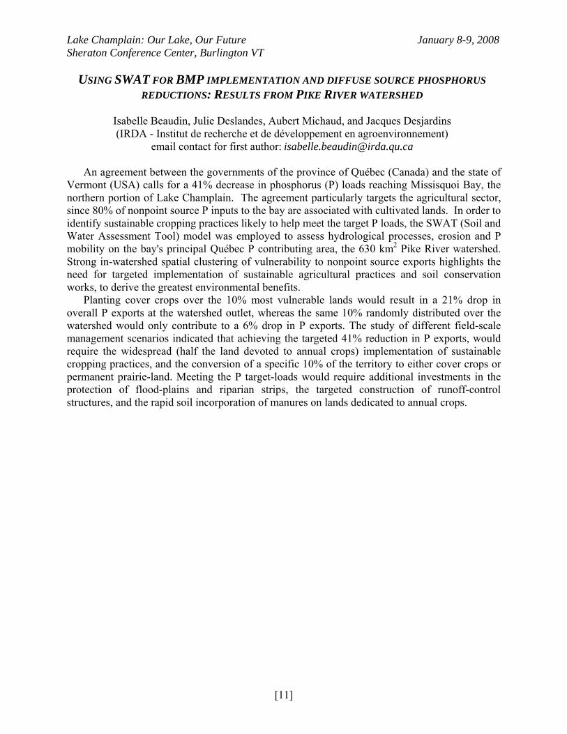
USING SWAT FOR BMP IMPLEMENTATION AND DIFFUSE SOURCE PHOSPHORUS
REDUCTIONS: RESULTS FROM PIKE RIVER WATERSHED
Isabelle Beaudin, Julie Deslandes, Aubert Michaud, and Jacques Desjardins (IRDA - Institut de recherche et de développement en agroenvironnement)
email contact for first author: [email protected]
An agreement between the governments of the province of Québec (Canada) and the state of Vermont (USA) calls for a 41% decrease in phosphorus (P) loads reaching Missisquoi Bay, the northern portion of Lake Champlain. The agreement particularly targets the agricultural sector, since 80% of nonpoint source P inputs to the bay are associated with cultivated lands. In order to identify sustainable cropping practices likely to help meet the target P loads, the SWAT (Soil and Water Assessment Tool) model was employed to assess hydrological processes, erosion and P mobility on the bay's principal Québec P contributing area, the 630 km2 Pike River watershed. Strong in-watershed spatial clustering of vulnerability to nonpoint source exports highlights the need for targeted implementation of sustainable agricultural practices and soil conservation works, to derive the greatest environmental benefits.
Planting cover crops over the 10% most vulnerable lands would result in a 21% drop in overall P exports at the watershed outlet, whereas the same 10% randomly distributed over the watershed would only contribute to a 6% drop in P exports. The study of different field-scale management scenarios indicated that achieving the targeted 41% reduction in P exports, would require the widespread (half the land devoted to annual crops) implementation of sustainable cropping practices, and the conversion of a specific 10% of the territory to either cover crops or permanent prairie-land. Meeting the P target-loads would require additional investments in the protection of flood-plains and riparian strips, the targeted construction of runoff-control structures, and the rapid soil incorporation of manures on lands dedicated to annual crops.
[11]
Lake Champlain: Our Lake, Our Future January 8-9, 2008 Sheraton Conference Center, Burlington VT
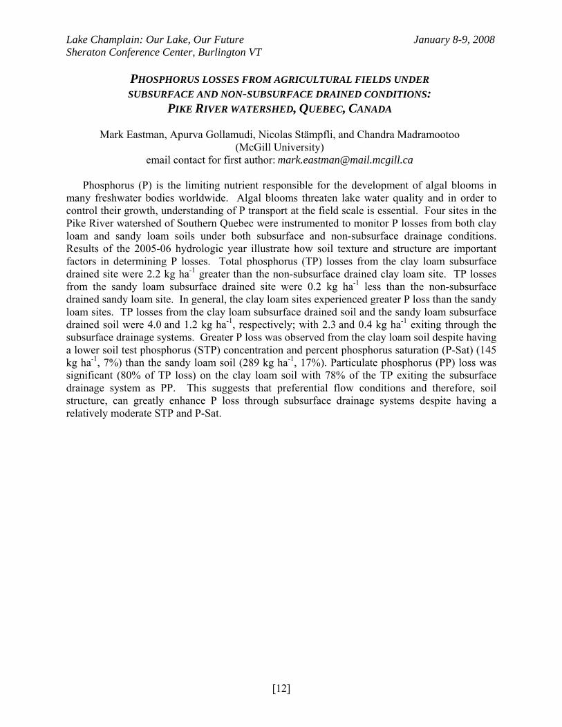
PHOSPHORUS LOSSES FROM AGRICULTURAL FIELDS UNDER SUBSURFACE AND NON-SUBSURFACE DRAINED CONDITIONS:
PIKE RIVER WATERSHED, QUEBEC, CANADA
Mark Eastman, Apurva Gollamudi, Nicolas Stämpfli, and Chandra Madramootoo (McGill University)
email contact for first author: [email protected] Phosphorus (P) is the limiting nutrient responsible for the development of algal blooms in
many freshwater bodies worldwide. Algal blooms threaten lake water quality and in order to control their growth, understanding of P transport at the field scale is essential. Four sites in the Pike River watershed of Southern Quebec were instrumented to monitor P losses from both clay loam and sandy loam soils under both subsurface and non-subsurface drainage conditions. Results of the 2005-06 hydrologic year illustrate how soil texture and structure are important factors in determining P losses. Total phosphorus (TP) losses from the clay loam subsurface drained site were 2.2 kg ha-1 greater than the non-subsurface drained clay loam site. TP losses from the sandy loam subsurface drained site were 0.2 kg ha-1 less than the non-subsurface drained sandy loam site. In general, the clay loam sites experienced greater P loss than the sandy loam sites. TP losses from the clay loam subsurface drained soil and the sandy loam subsurface drained soil were 4.0 and 1.2 kg ha-1, respectively; with 2.3 and 0.4 kg ha-1 exiting through the subsurface drainage systems. Greater P loss was observed from the clay loam soil despite having a lower soil test phosphorus (STP) concentration and percent phosphorus saturation (P-Sat) (145 kg ha-1, 7%) than the sandy loam soil (289 kg ha-1, 17%). Particulate phosphorus (PP) loss was significant (80% of TP loss) on the clay loam soil with 78% of the TP exiting the subsurface drainage system as PP. This suggests that preferential flow conditions and therefore, soil structure, can greatly enhance P loss through subsurface drainage systems despite having a relatively moderate STP and P-Sat.
[12]
Lake Champlain: Our Lake, Our Future January 8-9, 2008 Sheraton Conference Center, Burlington VT
DEVELOPMENT AND VALIDATION OF A MODIFIED QUEBEC PHOSPHORUS INDEX TO INCLUDE SUBSURFACE DRAINAGE
Mohamed Chikhaoui, Chandra Madramootoo, and Apurva Gollamudi
(McGill University) email contact for first author: [email protected]
The current version of the Quebec phosphorus index (PI) has an additive structure which
combines source and transport factors of phosphorus (P). However, many studies have demonstrated that such an algorithm does not consider the interaction between these factors adequately. This study focuses on the development and validation of a modified PI (M_PI) to improve management of P on agricultural lands, by taking the effects of subsurface drainage into account.
Data used in this study were collected at four experimental fields located near Bedford in the Pike River watershed, which drains into Missisquoi Bay. These agricultural sites are characterized by different soil types (sandy loams to clay loams) and crops grown were corn, alfalfa, soybean, or hay. Two sites with tile drainage were established in October 2000, while two other sites (without tile drainage) have been monitored since December 2004. Data collected include surface runoff, subsurface drain flows, sediment, total phosphorus concentrations, and farm management practices.
The analysis and interpretation of the collected data improved the understanding of the mechanism of P transport and the interaction between different factors. This information, together with a literature review, formed the basis of the modified P index, which for the first time includes a subsurface drainage component. There was a very strong correlation (R2=0.82) between measured annual total phosphorus (TP) loads for the four experimental fields and M_PI values. Also, a second correlation was established between M_PI values and management practice simulations using SWAT (Soil and Water Assessment Tool) predicted TP (R2=0.79).
Results indicated that the modified P Index is a suitable tool, which can be used successfully for P risk assessment. The M_PI with a multiplicative structure improves risk assessment for agricultural P losses. Additionally, the M_PI can help decision makers identify sites with high P vulnerability, and select conservation practices in order to improve downstream water quality.
[13]
Lake Champlain: Our Lake, Our Future January 8-9, 2008 Sheraton Conference Center, Burlington VT
TWO SIMPLE MODELS OF WIND-DRIVEN LAKE CIRCULATION
Ken Hunkins
(Lamont-Doherty Earth Observatory of Columbia University) email contact for author: [email protected]
Numerical vorticity models of circulation in rectangular basins illustrate the contrasting roles
of wind shear and bottom topography. In the first model the bottom is flat and the wind velocity is greatest in the center of the lake. Under a symmetrical wind pattern a double gyre results with clockwise rotation on the right when looking downwind and anti-clockwise rotation on the left. In the second model wind velocity is constant but topography takes the shape of a symmetrical channel with greatest depth at the center and shallow water near the shore. Again a double gyre develops but now the sense of rotation is reversed. An anti-clockwise gyre develops on the right and a clockwise gyre forms on the left. These models should aid in understanding features of more complete models and of actual lake circulation.
[14]
Lake Champlain: Our Lake, Our Future January 8-9, 2008 Sheraton Conference Center, Burlington VT
SUB-SURFACE NEUTRALLY BUOYANT DRIFTERS AND CROSS-LAKE INTRA-
THERMOCLINE FLOW IN LAKE CHAMPLAIN, VT
Thomas O. Manley1, Michael J. McCormick 2, and Ken Hunkins3 (1Middlebury College; 2 NOAA - Great Lakes Ecological Research Laboratory,
3Lamont-Doherty Earth Observatory of Columbia University) email contact for first author: [email protected]
Three years of data collected from short-term deployments of acoustically tracked, neutrally-
buoyant drifters within Lake Champlain confirm the presence of three distinct circulation systems existing within the Main Lake. These three systems were stratification-dependent but contrary to the typical boundaries of the epi-, meta- and hypolimnions in that the surface circulation system included the upper portion of the metalimnion. Drifters within this layer showed wind-driven and internal seiche dynamics. Movement ranged from curvilinear to near circular depending on the relative strengths of mean versus internal seiche driven dynamics. The deep (hypolimnic) system was confined below the base of the metalimnion and was laterally restricted by topography. Drift tracks within this layer were elliptical but with little net transport. The largest net transport was found to exist within the mid to bottom portion of the metalimnion. Within this narrow region of the water column, drifters were transported over 40 km away from their deployment site within a short period of time. This anomalous metalimnic transport was comprised of two components. The first was a unique, previously undocumented, cross-lake flow that placed the drifters within a coastal jet (along-axis or 2nd component) that completed the net long-distance transport.
[15]
Lake Champlain: Our Lake, Our Future January 8-9, 2008 Sheraton Conference Center, Burlington VT
USE OF AUTONOMOUS UNDERWATER VEHICLES (AUVS) AND THEIR EFFECTIVENESS
IN MAPPING HYDRODYNAMIC VARIABILITY IN LAKE CHAMPLAIN
Kristen Poehling (Middlebury College)
email contact for author: [email protected]
The evolving technology of autonomous underwater vehicles (AUVs) is an exciting new advancement in the field of marine science. Old methods to study the water column can be labor, equipment and time intensive in order to gain accurate data. Old methods included the use of ROVs (unmanned underwater vehicles controlled from the surface), manned underwater vehicles and shipboard hydrographic surveys typically taken with CTDs (conductivity/temperature/depth) sensors. AUVs, on the other hand, can provide massive amounts of data with minimum user intervention while at the same time surveying spatial and temporal domains that would be dangerous or impossible; e.g. dynamic changes in the water column occur during extreme wind events. Fortunately, the size and cost of these instruments are continually being reduced. Additionally, the software that controls the AUVs, as well as the sensors installed on them, are presently being tested and improved to better map ocean and lacustrine environments. As part of a pilot program with the U.S. Navy, Tom Manley (Middlebury College Geology Department) used two new AUVs (model Iver2 from OceanServer Technology, Inc.) to test the accuracy of these devices in Lake Champlain. As a basis to compare the AUV results to, a two-ship (UVM Melosira and Middlebury College’s R/V Baldwin), 106-station CTD survey was taken each day for 4 days (starting July 29th) in the Thompsons Point – Split Rock Gap region (~4 km²). Concurrently, the AUVs were deployed while CTD survey was underway. AUV and CTD daily data sets were three-dimensionally modeled and characterized using earthVisons4® (Dynamic Graphics, Inc) software. The two objectives of the survey were to determine the accuracy and feasibility of AUVs in a dynamic region, while also producing shipboard real-time mapping as the data were collected, and to analyze the high resolution 106 station CTD data set in various parameters (conductivity, temperature, depth).
[16]
Lake Champlain: Our Lake, Our Future January 8-9, 2008 Sheraton Conference Center, Burlington VT
ATMOSPHERIC FORECASTING AND MODELING IN
THE LAKE CHAMPLAIN BASIN
Paul A. Sisson, John M. Goff, and Conor T. Lahiff (NOAA - National Weather Service)
email contact for first author: [email protected]
The National Weather Service (NWS) in Burlington, VT produces weather forecasts for the Lake Champlain Basin on a daily basis. Text and gridded forecasts include specific marine elements of wind, waves, and sensible weather for the open waters of the lake. Forecasts of temperature, dew points, sky cover, precipitation, wind, and weather are made for the surrounding Adirondack and Green mountains. Real-time automated weather observations and a high resolution model are used to improve forecasts for the region. Observations at Colchester Reef, made available by the Vermont Monitoring Cooperative, provide ground truth data and a climatological basis for Lake Champlain Basin forecasts. Global and regional atmospheric models produced centrally by the NWS typically are not of sufficient horizontal or vertical resolution to identify and forecast local meteorological phenomenon such as wind channeling, that commonly occur in the basin. To improve the forecasts for the complex terrain and water areas that exist in the Lake Champlain Basin, the NWS in Burlington, VT runs a 4 km horizontal resolution version of the Weather Research and Forecast model (WRF) and had made the output available on the World Wide Web. The WRF has proven invaluable to meteorologists in the Burlington office for forecasting winds and other local weather phenomenon in the basin. This paper will describe the strengths and limitations of the WRF modeling system, and its utilization in the forecast process at the National Weather Service.
[17]
Lake Champlain: Our Lake, Our Future January 8-9, 2008 Sheraton Conference Center, Burlington VT
CYANOBACTERIA ABUNDANCE, CYANOBACTERIA CONCENTRATIONS,
AND NUTRIENTS AND OTHER DRIVERS IN MISSISQUOI BAY
Mary C. Watzin, Meghan K. Rogalus, Susan P. Fuller, Kathryn A. Crawford, and Cynthia May
(University of Vermont) email contact for first author: [email protected]
Cyanobacteria have dominated the phytoplankton in Missisquoi Bay in Lake Champlain for
the last 10 years, but were rare prior to that time. Weekly sampling from 2003-2006 documents noxious blooms of Microcystis, Anabaena, and Aphanizomenon from July through September, and microcystin concentrations that range from less than 1 to almost 7000 μg/L in shoreline scums. The reasons for this dominance are not clear, since neither total nitrogen (TN) nor total phosphorus concentrations (TP) in the bay have changed significantly for more than a decade. Competing hypotheses that might explain cyanobacteria dominance include low TN:TP ratios, light limitation associated with high sediment loads to the bay, warming summer water temperatures, and changes in grazing pressures in the bay. Multivariate statistical analyses show that less than 35% of the variance in the abundance of Microcystis spp. and Anabaena spp. in the monitoring data can be explained by total nutrient or TN:TP ratios, and that only cyanobacterial abundance is associated with microcystin concentration. Other experimental data suggest that available nitrogen form and zooplankton grazing pressure can influence cyanobacteria community composition. These results suggest that while phosphorus reductions are necessary, only holistic approaches offer long term hope for managing toxic cyanobacteria blooms.
[18]
Lake Champlain: Our Lake, Our Future January 8-9, 2008 Sheraton Conference Center, Burlington VT
DISTRIBUTION AND MOLECULAR ANALYSIS OF CYANOBACTERIA TOXINS
IN LAKE CHAMPLAIN: A 5-YEAR REVIEW
Greg Boyer1, Michael Satchwell1, Rachael Damon2, Amber Hotto1, and Xingye Yang1 (1SUNY - College of Environmental Science and Forestry, 2LeMoyne College)
email contact for first author: [email protected]
Cyanobacterial toxins have been detected in Lake Champlain for the past 5 years. During the summer field season, water samples were collected lake-wide and analyzed for nutrients, algal abundance and the cyanobacterial peptide toxin microcystin. Microcystin concentrations were determined by the activity based protein phosphatase inhibition assay (PPIA). PCR was used to detect cyanobacterial and Microcystis 16S rRNA genes, and the microcystin biosynthetic genes mcyB, mcyD and mcyA, which indicate potential microcystin production. Cyanobacterial abundance and microcystin concentrations peaked in late summer and showed a distinct north – south gradient. Toxin levels were highest in Missisquoi Bay, the extreme northeast end of the lake, where concentrations routinely reached 5 μg/L in open water and greater than 30 μg/L in surface scums. PCR analysis indicated that both toxic and nontoxic cyanobacteria are common throughout the lake. Presence of the microcystin biosynthetic genes outside Missisquoi Bay indicates potential for toxic blooms to occur in other areas of the lake. In addition to the peptide toxins, distribution of other toxins such as the neurotoxin anatoxin-a will be presented.
[19]
Lake Champlain: Our Lake, Our Future January 8-9, 2008 Sheraton Conference Center, Burlington VT
MISSISQUOI BAY: COMMUNITY DYNAMICS OF CYANOBACTERIA
BLOOMS AND THE DEVELOPMENT OF A NEW MONITORING METHOD FOR LAKE CHAMPLAIN
Carrianne E. Pershyn1, Timothy Mihuc1, Jeffry Jones1, Eileen Allen1, Greg Boyer2,
Mike Satchwell2, Sean Thomas1, and Meghan Greene1
(1SUNY – Plattsburgh, 2SUNY - College of Environmental Science and Forestry) email contact for first author: [email protected]
Phytoplankton communities form the base of the Lake Champlain aquatic food web and are
important indicators of water quality. Cyanobacteria can release neurotoxins when blooms are in high concentrations, and have been a potential health issue for residents of the Lake Champlain Basin (Boyer et al. 2006). The purpose of this study was to develop and test a flow through methodology for spatially explicit mapping of Lake Champlain algal blooms and to describe the phytoplankton community dynamics in bloom areas. We used fluorometers linked to a spatial GPS signal to map chlorophyll a and phycocyanin pigments and blue-green algae, respectively, in Missisquoi Bay. Mapping consisted of continuous data collection using a Turner Designs Cyanowatch fluorometer. In addition to algal pigments, temperature and other selected parameters were mapped in 2006 and 2007. Results indicate that our pigment mapping method is feasible and could be applied at larger scales for first tier monitoring of algal blooms. We were able to detect bloom conditions in Lake Champlain and develop protocols to produce accurate bloom maps. Relationships with other parameters suggest a temperature threshold may exist for blue-green bloom formation in Lake Champlain. Biological samples were taken at selected bloom locations using horizontal surface tows with a 63 micron Wisconsin net. The samples were counted and identified to the lowest possible taxon and data were used to calculate density, species richness, species abundance, and Simpson’s index of diversity. Results show dominant genera in bloom sites were Microcystis spp., Aphanizomenon spp., and Anabaena spp. Furthermore, our community data suggest that there is spatial variation of dominant cyanobacteria throughout the lake with highest densities in Missisquoi Bay.
[20]
Lake Champlain: Our Lake, Our Future January 8-9, 2008 Sheraton Conference Center, Burlington VT
WHERE HAVE ALL THE ALGAE GONE IN MISSISQUOI BAY?
Eric Smeltzer1, Angela Shambaugh1, Pete Stangel1, and Fred Dunlap2
(1Vermont Agency of Natural Resources, 2New York State Department of Environmental Conservation)
email contact for first author: [email protected]
It was apparent to lake users and researchers that Missisquoi Bay was remarkably free from algae blooms during 2007. The severe cyanobacteria blooms that have been common in the bay for many years never materialized during 2007. Long-term monitoring data on total phosphorus, total nitrogen, chlorophyll-a, Secchi disk transparency, phytoplankton, zooplankton, hydrologic inputs, and weather variables will be examined to determine what factors were different in Missisquoi Bay during 2007. The results will be presented in order to suggest possible lines of further research or management actions that could help prevent the occurrence of cyanobacteria blooms in the future.
[21]
Lake Champlain: Our Lake, Our Future January 8-9, 2008 Sheraton Conference Center, Burlington VT
MISSISQUOI BAY ZOOPLANKTON: THE CRASH OF 2007
Fredric Dunlap1, Timothy Mihuc2, and Carrianne Pershyn2
(1New York State Department of Environmental Conservation, 2SUNY – Plattsburgh) email contact for first author: [email protected]
Zooplankton populations in Missisquoi Bay have been highly variable in both species composition and abundance over time. While seasonal and annual variabilities in zooplankton are to be expected, the summer and autumn of 2007 saw a dramatic decline in both crustacean and rotifer zooplankton that had not been documented in the recent past. Sharp drops in species richness, as well as abundance were observed beginning in mid-summer and continuing into the autumn. On August 7, 2007 we recorded the lowest species richness for all zooplankton samples lake-wide since 1993 (n=4). Coincident with the drop in zooplankton, phytoplankton densities also declined in dramatic fashion. The bay did not experience algal blooms that have plagued it in the past. Secchi disc readings were some of the best in recent history. This presentation will explore the zooplankton composition and abundance over time with specific emphasis on findings in 2007. When linked to other parameters being measured in Missisquoi Bay including phytoplankton, water temperatures, phosphorus and nitrogen, chlorophyll-a, Secchi disc, hydrologic inputs and weather variables, a better understanding of the condition of the bay in 2007 might be gained. This may also help to target additional research toward identifying triggering mechanisms for algal blooms, or lack thereof, for the future.
[22]
Lake Champlain: Our Lake, Our Future January 8-9, 2008 Sheraton Conference Center, Burlington VT
EPISODIC AND CHRONIC ATMOSPHERIC MERCURY DEPOSITION
TO THE LAKE CHAMPLAIN BASIN
Eric K. Miller1, Sean Lawson2, Melody Burkins3, Mim Pendleton2, 3, Alan VanArsdale4, Gerald Keeler5, and James B. Shanley6
(1Ecosystems Research Group, Ltd., 2Vermont Monitoring Cooperative, 3University of Vermont, 4U.S. Environmental Protection Agency,
5University of Michigan, 6U.S. Geological Survey) email contact for first author: [email protected]
Chronic, elevated atmospheric deposition of mercury continues to increase the pool of
mercury stored in the Lake Champlain Watershed. A portion of the mercury stored in soils is transferred to the lake by the movement of dissolved and particulate mercury in stream water during snow melt and storm events. However, both wet and dry atmospheric deposition of mercury are also episodic with seasonal patterns. A relatively small number of deposition events are responsible for a large proportion of annual deposition. Episodic, direct loading of aquatic ecosystems may be an important source of mercury accumulated in aquatic food webs if high deposition events coincide with the right conditions for methylation and biotic assimilation. The Lake Champlain Basin has the longest continuous record of event-based mercury wet-deposition in the world. In 2004 continuous measurements of speciated-mercury air concentrations were established in the basin, beginning what is now one of the longest records in North America. In 2005 measurements of methyl-mercury wet-deposition were added. These observations provide the continuing basis for evaluating both chronic and episodic inputs of mercury to both the lake and its watershed. The atmospheric deposition measurement program provides the foundation for understanding mercury cycling and accumulation in biota. The comprehensive suite of atmospheric measurements at Underhill, Vermont provides a unique temporally resolved record of all forms of mercury deposition. This record can be used with meteorological models and adjunct atmospheric chemical measurements to identify the sources of atmospheric mercury deposited to the Lake Champlain Basin.
[23]
Lake Champlain: Our Lake, Our Future January 8-9, 2008 Sheraton Conference Center, Burlington VT
MERCURY IN LAKE CHAMPLAIN: THE LAKE CHAMPLAIN
MASS BALANCE PROJECT
Neil Kamman1, Ning Gao2, Eric Miller3, Celia Chen4, and James B. Shanley5 (1Vermont Agency of Natural Resources, 2Saint Lawrence University,
3Ecosystems Research Group, Ltd., 4Dartmouth College, 5U.S. Geological Survey) email contact for first author: [email protected]
The Lake Champlain Mass Balance for Mercury project is a long-standing project of the
Lake Champlain Research Consortium. In 2005, after two years of field measurement and subsequent analyses, the initiative produced a mechanistic model quantifying several major Hg loadings and losses to the lake: wet and dry atmospheric deposition (+17.8 kg yr-1), watershed tributaries (+26.4 kg yr-1); wastewater input (+2.7 kg yr-1); sedimentation loss (-25.2 kg yr-1); and evasion loss (up to -34.8 kg yr-1). This model was published in 2006 in the journal Environmental Science and Technology.
The initial model had several poorly quantified uncertainties that provided opportunities for enhancement to maximize the management utility of the model. Therefore, in 2005, we augmented the sampling program with three major goals. These were to increase the precision of bidirectional deposition flux estimates at the air-water interface, characterize sediment methylmercury as a source to the littoral zone of the lake, and incorporate biological model compartments as responses. This field initiative started in 2005 and is being carried out in three areas of the lake across a range of trophic conditions: Malletts Bay, Otter Creek Segment, and Missisquoi Bay. In addition to the sediment and biological sampling, considerable method development has been undertaken to facilitate bidirectional atmospheric flux and aqueous methylmercury measurements. Results of these efforts are being provided in companion papers at this meeting.
These data are being combined with other monitoring datasets (water chemistry from LCBP; gamefish mercury from VTANR/NYSDEC) to provide a more comprehensive mercury cycling model in Lake Champlain. In addition to these enhancements, the Project has developed several important collaborations among stakeholders in the Lake Champlain Basin, providing support to several research, public outreach, and legislative policy initiatives.
[24]
Lake Champlain: Our Lake, Our Future January 8-9, 2008 Sheraton Conference Center, Burlington VT
THE DYNAMICS OF STREAMWATER INPUTS OF TOTAL MERCURY
AND METHYLMERCURY TO LAKE CHAMPLAIN
James B. Shanley and Ann T. Chalmers (U.S. Geological Survey)
email contact for first author: [email protected]
From 2000 to 2004, we monitored total mercury (THg) and methylmercury (MeHg) in stream inputs and the outlet of Lake Champlain. We sampled the major inlets to Lake Champlain which ranged from 92% forested to 53% agricultural, as well as some smaller basins with specific land cover, including an urban stream. THg and MeHg dynamics in streamwater were parallel, suggesting a common source, though the MeHg/THg ratio increased in summer. THg and MeHg concentrations both increased with increasing flow, and both were dominated by the particle phase. THg was highly correlated with total suspended solids (TSS) and its flux was dominated by the particulate fraction. The flux of of THg from the watershed to the lake averaged 1.9 mg ha-1 yr-1, or about 10% of atmospheric deposition. THg concentrations were generally less than 1 ng L-1 in the lake outlet, and THg export from the lake represented only 2% of atmospheric input to the system. THg flux and MeHg concentrations correlated positively with percent agricultural land, and MeHg concentrations correlated positively with percent wetlands. Urban land represented only 6% of the basin, but THg flux from urban land was about 5 times the average for the basin. In this mountainous forested basin with a high watershed-to-lake ratio of 18, the terrestrial watershed is the dominant source of Hg to the lake. Though most Hg is retained in the basin, land disturbance, including agriculture and urban settlement, promotes Hg movement to the lake.
[25]
Lake Champlain: Our Lake, Our Future January 8-9, 2008 Sheraton Conference Center, Burlington VT
INTER- AND INTRA- BASIN VARIABILITY IN MERCURY
BIOACCUMULATION BY ZOOPLANKTON IN LAKE CHAMPLAIN
Celia Chen1, Neil Kamman2, Jason Williams1, Vivien Taylor1, and Brian Jackson1 (1Dartmouth College, 2Vermont Department of Environmental Conservation)
email contact for first author: [email protected]
Top-trophic level fish across Lake Champlain have been shown to exhibit mercury concentrations in excess of the USEPA criterion limit of 0.3 µg/g (w.w.), and some fish species exceed concentrations which result in special fish consumption advisories. However, little is known about Hg bioaccumulation and trophic transfer in the lower food web and their relationship to concentrations in higher trophic level fish species. Hg trophic transfer is reduced in eutrophic lakes where high plankton biomass can dilute Hg in the food web which results in lower Hg transfer to primary and secondary consumers. As part of a multi-disciplinary study on Hg fate in Lake Champlain, we compare the Hg bioaccumulation in zooplankton from contrasting basins in Lake Champlain to test the hypothesis that more eutrophic conditions result in lower total Hg and MeHg concentrations in plankton. In 2004-2006, zooplankton samples were taken at the mouth of Otter Creek, and in Malletts Bay and Missisquoi Bay in mid-summer to compare Hg bioaccumulation across basins of contrasting trophic status. In 2007, samples were taken in the oligotrophic and eutrophic basins (Malletts Bay and Missisquoi Bay) over the growing season to determine the seasonal variation in Hg and MeHg bioaccumulation in zooplankton. Zooplankton in the eutrophic basin had lower total Hg and MeHg concentrations than in the more oligotrophic basins suggesting that plankton biodilution of Hg is occurring. Moreover, there is a seasonal pattern of increase in total Hg concentrations in zooplankton in late spring for both sites and a decrease in Malletts Bay in mid-summer. The results of these data from multiple years indicate that despite major year-to-year variability in metal bioaccumulation in zooplankton, there are some consistent patterns between sites across years.
[26]
Lake Champlain: Our Lake, Our Future January 8-9, 2008 Sheraton Conference Center, Burlington VT
DYNAMICS OF MERCURY CYCLING AND BIOTIC ASSIMILATION
IN MALLETTS AND MISSISQUOI BAYS
Eric K. Miller1, Celia Chen2, Brian Jackson2, Neil Kamman3, Jamie Shanley4, Ann Chalmers4, Ning Gao5, and Tom Holsen6
(1Ecosystems Research Group, Ltd., 2Dartmouth College, 3Vermont Department of Environmental Conservation, 4U.S. Geological Survey,
5Saint Lawrence University, 6Clarkson University) email contact for first author: [email protected]
Measurements of dissolved ionic (DHg2+), particulate ionic (PHg2+), dissolved methyl-
(DMHg), and particulate methyl-mercury (PMHg) were made in the epiliminon of Malletts (MAL) and Missisquoi (MIS) Bays on 6 occasions during the summer of 2007. Measurements of the mercury content of zooplankton were made at each water sampling. Measurements of fish mercury content were made on 2 occasions. The temporal patterns of tributary and atmospheric mercury loadings, outflows, sedimentation, and vapor-phase emissions to/from the bays were quantified using a combination of measurements and modeling. Measurements of lake-levels and water chemistry were made by USGS and VTDEC. Mercury loading to both systems was episodic. All epilimnion mercury fractions exhibited significant temporal variation with both increases and decreases between samplings. The PMHg concentration was greater at MIS than MAL at each sampling period. The DMHg concentrations were similar between the bays for most samplings with the concentration at MIS higher at the first and last sampling, and the concentration at MAL higher at the third sampling. Mercury concentrations in zooplankton increased over the summer in both bays, with MAL zooplankton exhibiting higher concentrations than MIS zooplankton. A dynamic model of mercury cycling and food web assimilation was parameterized with the observations and estimates. Model simulations provide insight into the interaction of mercury cycling mechanisms governing biotic mercury accumulation in response to episodic mercury loading in these contrasting ecosystems.
[27]
Lake Champlain: Our Lake, Our Future January 8-9, 2008 Sheraton Conference Center, Burlington VT
THE ROLE OF CONSTRUCTED WETLANDS IN AGRICULTURAL WATERSHEDS
Anne-Caroline Kroeger and Chandra Madramootoo
(McGill University) email contact for first author: [email protected]
Phosphorus contamination of surface waters is a primary water quality concern in the
agricultural watershed of Walbridge River in southern Québec. Surface waters from this creek were diverted into a small constructed wetland consisting of three basins laid out in series to evaluate nutrient (nitrogen and phosphorus) retention within the system. The wetland retained 8.47 kg total phosphorus, which corresponded to 44 % of total phosphorus inputs (19.3 kg) and it also retained 132.5 kg nitrates, which represented 13 % of nitrate inputs (995 kg) to the wetland, over 4 years (2003-06) of seasonal (May-Nov) operation. Annual mean nutrient retention rates (1.7 g total P m-2 year-1 and 27.3 g NO3
- m-2 year-1) were within the range of values reported in the literature for constructed wetlands treating agricultural runoff waters. This study therefore provided additional evidence supporting the use of small constructed wetlands as nutrient traps in agricultural watersheds in a moderate Canadian climate.
[28]
Lake Champlain: Our Lake, Our Future January 8-9, 2008 Sheraton Conference Center, Burlington VT
OVERVIEW OF THE LAKE CHAMPLAIN BASIN WETLAND RESTORATION PLAN
April Moulaert1 and Shelley Gustafson2
(1Vermont Department of Forests, Parks, and Recreation, 2Pioneer Environmental Associates) email contact for first author: [email protected]
One of the most important functions of wetlands is the ability to attenuate nonpoint source
phosphorus (P) and thereby maintain and improve downstream water quality. Because of this capacity, restoration of degraded wetlands could be an important component of overall efforts to reduce nonpoint source P loading to Lake Champlain. This project was conducted to develop a basin-wide wetland restoration plan through the identification and prioritization of wetlands in the Vermont portion of the Lake Champlain Basin with the greatest potential for P removal through restoration.
Potential restoration sites on the 2.9 million acres of the Vermont portion of the Lake Champlain Basin (LCB) were identified using a geographic information system (GIS) model. Non-forested agricultural and urban sites were inventoried according to criteria that included hydric soils, slopes equal to or less than five percent, National Wetlands Inventory data, and size equal to or greater than three acres. The result was a preliminary set of potential agricultural, urban, or suburban sites for wetland restoration. The model identified 4,883 potential restoration sites occupying 86,480 acres (135 square miles) within the Vermont LCB. Sites ranged in size from 3 to 1,490 acres with a mean area of 18 acres. These sites were distributed among the six sub-basins across the LCB, with the greatest number of sites in the Lake Champlain Direct, Otter Creek, and Missisquoi River watersheds.
A quantitative prioritization model was developed to rank the potential of each restoration site to mitigate P loading to Lake Champlain based on 11 variables focusing on site function and upslope drainage. The model results were used to target visits to sites within the top 200 based on the restoration score. The site visit process included pre-screening via photointerpretation, preparation of an individual site map, securing landowner permission for access, and an on-site evaluation. Eighty two of the 200 top-ranked sites were visited in order to: confirm that the site truly is a converted or degraded wetland, determine whether restoration of the site would help meet P mitigation goals, and determine the actual potential for site restoration with respect to technical feasibility and constraints of landowner interest and potential impacts on adjacent land or structures.
Restoration alternatives were identified for each of the 82 sites visited with respect to the target natural community type(s) for the restoration area and the specific hydrologic manipulations recommended for the restoration area.
Lessons for Management: This information can be used to locate sites that would be suitable for wetland restoration that would help reduce phosphorus loading into the lake.
[29]
Lake Champlain: Our Lake, Our Future January 8-9, 2008 Sheraton Conference Center, Burlington VT
LINKING SOIL-LANDSCAPE FACTORS TO PHOSPHORUS LEVELS
IN VERMONT FLOODPLAINS
Eric Young1, Donald S. Ross1, Caroline Alves2, Thomas Villars2 (1University of Vermont, 2 U.S. Department of Agriculture –
Natural Resources Conservation Service) email contact for first author: [email protected]
Riparian zones can significantly influence the fate and transport of P. We investigated the
relationship between soil-landscape factors and P availability at two riparian sites in the Lake Champlain Basin. The soils were remapped at a finer scale (~1:3000) than the original soil survey (1:20,000) and depth-increment samples were collected. Soils were analyzed for total and plant-available P (Modified Morgan solution; the Vermont soil test; MM-P) and major cations. Results from the remapping indicated that the original map unit delineations did not consistently capture map unit variability revealed by the higher intensity mapping. Total P was more strongly correlated with soil-landscape factors than MM-P. Soil series, drainage class, parent material, and sampling depth had significant univariate effects on total P. Average total P concentrations tended to be greater at 0-15 and 15-30 cm depths, whereas MM-P varied less by depth. More imperfectly drained soils tended to have greater total and MM-P concentrations. MM-P was significantly correlated with total P across all samples, but did not accurately predict total P concentrations. Total P was more strongly correlated with individual cations than was MM-P, though correlations among total P and cations tended to be stronger within series. A multiple linear regression model with total calcium, MM-P, and pH as independent variables explained 83% of the total P variation among 0-30 cm samples. Variables influencing total P at deeper depths were less clear. Linear discriminant analysis (with total Ca, MM-P, and pH as discriminating variables) revealed significant separation of 0-30 cm samples when grouped by parent material, drainage, and series. Results suggest that the map unit variability of floodplains may be useful for categorizing total P levels in riparian zone soils.
[30]
Lake Champlain: Our Lake, Our Future January 8-9, 2008 Sheraton Conference Center, Burlington VT
ADOPTION OF LOW INPUT, NO PHOSPHOROUS GROUNDS CARE BY
COMMERCIAL/INSTITUTIONAL PROPERTY MANAGERS
Jurij Homziak1, Bethany Hanna2, and Jim Flint3 (1Lake Champlain Sea Grant, University of Vermont,
2University of Vermont Extension, 3Friends of Burlington Gardens) email contact for first author: [email protected]
Non-residential property is an often overlooked component of urban nonpoint source pollution prevention education. Non-residential lawns in many urban/suburban watersheds may account for up to 50% of the total lawn area.
In 2005, we developed an education program to promote adoption of low input landscape practices for non-residential properties. The initial trial was in Englesby Brook, a small (0.94 sq mi) urban watershed in Burlington, VT. Non-residential properties comprise 23% of the watershed area. We contacted 35 of 42 priority non-residential properties (based on total landscaped area and intensity of landscape maintenance), and 18 (43%) agreed to participate in the educational program. Ten further agreed to implement a low input program, an adoption rate of 29%. These managers were responsible for 20 of the 42 priority parcels, totaling 47.04 acres (59%) of total commercial lawn area in the watershed. Two private lawn care firms also adopted low input practices to increase profitability. Based on information on prior fertilizer use, the total phosphorous savings achieved were between 0.45 and 0.91 metric tons annually. The annual phosphorous reduction target for the entire Lake Champlain watershed is 81 MT.
Cost savings, contributing to improved water quality, and improved customer perceptions were among the reasons given for adopting low input practices. 2006 post program surveys show that all adopting managers continue to use low input practices. Principal reasons include cost savings, acceptable lawn appearance, and contribution to improved water quality.
In 2007 we used this program in the larger Stevens and Rugg Brook watersheds in St. Albans, VT. While many grounds care managers already used some form of low input/no phosphorous grounds care, the program expanded the use and improved effectiveness of grounds care practices.
[31]
Lake Champlain: Our Lake, Our Future January 8-9, 2008 Sheraton Conference Center, Burlington VT
LAKE STURGEON IN VERMONT, WHAT DO WE KNOW AND WHERE DO WE GO NEXT?
Chet MacKenzie1, Madeleine Lyttle2, and Nick Staats2
(1Vermont Fish and Wildlife Department, 2U.S. Fish and Wildlife Service) email contact for first author: [email protected]
Lake sturgeon (Acipenser fulvescens) in Vermont are confined to Lake Champlain and are
currently listed as a Vermont state endangered species. In 1995, a review group of biologists from the Vermont Fish & Wildlife Department, U.S. Fish & Wildlife Service, and the Cooperative Fish & Wildlife Research Unit at the University of Vermont recommended that a survey of the existing adult population be conducted before a restoration plan could be developed. Sampling efforts have been focused on historic spawning sites found in the Lamoille, Winooski, and Missisquoi rivers and Otter Creek.
The total numbers of individual adult sturgeon captured and tagged during the surveys were 17 in the Winooski river and 9 in the Lamoille River. No adult sturgeon were captured in the Missisquoi River. Adult sturgeon captured ranged in total length from 958 to 1762 mm and weighed from 5 to 33 kilograms. All adult sturgeon captured were males except for 2 small sturgeon that could not be sexed.
Sturgeon eggs have been collected in the Winooski, Lamoille and Missisquoi rivers and drifting larvae have been collected in both the Lamoille and Winooski rivers which proves that adult females are entering the rivers and spawning successfully.
Although recent surveys indicate that the numbers of adult sturgeon spawning in tributaries are low, the presence of viable sturgeon eggs and larvae indicates that our adult capture efforts are missing female sturgeon and may be missing males as well. Sturgeon are currently spawning successfully in 3 of the 4 tributaries used historically.
Genetic samples of Lake Champlain sturgeon have been compared with samples from the Great Lakes and elsewhere. Preliminary reports indicate that the Lake Champlain sturgeon are genetically distinct.
[32]
Lake Champlain: Our Lake, Our Future January 8-9, 2008 Sheraton Conference Center, Burlington VT
SEARCHING FOR LAKE WHITEFISH IN LAKE CHAMPLAIN
J. Ellen Marsden1 and Stephen Smith2
(1University of Vermont, 2U.S. Fish and Wildlife Service) email contact for first author: [email protected]
Lake whitefish are a prized, commercially-harvested fish in the Great Lakes, and supported
the largest commercial fishery in Lake Champlain in the late 1800s. Commercial fishing in Quebec waters continued until the 1990s. Whitefish populations in the Great Lakes have undergone severe declines in the past two decades, possibly linked to the invasion of dreissenid mussels. In particular, diets have shifted to incorporate dressenids, and condition factor has declined due to loss of the burrowing amphipod Diporiea. We examined whitefish population characteristics to determine whether similar changes may be occurring in Lake Champlain. Adult whitefish were sampled using gillnets in fall. Egg sampling was conducted using a benthic sled and passive egg bags. Larval whitefish were sampled in spring with an ichthyoplankton net. In the first year, sampling was focused on historic spawning grounds and potential spawning areas identified by substrate. No whitefish adults, eggs, or larvae were found at traditional fall commercial fishing sites in the south end of the lake or Mississquoi Bay. Spawners and larvae were sampled in high densities along the west shoreline of Grand Isle. Preliminary analysis indicates that the age structure is broad, condition factor is good, whitefish are growing well, and they do not consume zebra mussels. Diets are largely composed of gastropods, similar to diets reported in the 1930s. The apparent disappearance of historically important populations is being investigated further.
[33]
Lake Champlain: Our Lake, Our Future January 8-9, 2008 Sheraton Conference Center, Burlington VT
NEST SITE MANAGEMENT FOR SPINY SOFTSHELL AND
OTHER NATIVE SPECIES OF TURTLES
Steve Parren (Vermont Fish and Wildlife Department)
email contact for author: [email protected]
For several years nesting beaches located along the shore of Lake Champlain have been monitored and managed to benefit nesting success of the spiny softshell turtle (Apalone spinifera). Other species benefiting from site management are the Northern map turtle (Graptemys geographica), painted turtle (Chrysemys picta) and snapping turtle (Chelydra serpentina). Challenges to successful nesting include predation, parasitic flies, human disturbance, water level fluctuations, vegetation growing over nest substrate, and annual weather during the short summer. Turtles generally nest during the month of June with activity noted as early as late May and extending into July, depending on weather and individual behavior of turtles. One nesting site has at least 150 nesting females of all species with 40 spiny softshell turtle nests having been located. Management is adaptive with techniques changing based on efficacy, predation, and water level. Monitoring is key to understanding the challenges unfolding. Nesting substrate is cleared and cleaned each year and trees and brush have been cut to enhance solar radiation reaching portions of the beach. Volunteers and students assist with beach management each year. Nest emergence begins in late August and extends through October depending on the weather. Painted and map turtle hatchings have overwintered in the nest, but not spiny softshell turtles.
[34]
Lake Champlain: Our Lake, Our Future January 8-9, 2008 Sheraton Conference Center, Burlington VT
BEHAVIORS AND KNOWLEDGE REGARDING AQUATIC INVASIVE SPECIES: LESSONS
FROM LAKE CHAMPLAIN BOATERS AND TOURNAMENT ANGLERS
Mark Malchoff1 and Meg Modley2 (1Lake Champlain Sea Grant, SUNY – Plattsburgh, 2Lake Champlain Basin Program)
email contact for first author: [email protected]
Numerous aquatic invasive species (AIS) vectors have been implicated in the spread of AIS in North America, including overland transport by recreational boats, gear and boat trailers. While numerous outreach efforts and national campaigns have been directed at this spread prevention issue, little information exists which might document AIS knowledge status, behavior and travel patterns of Lake Champlain boaters and anglers. Two preliminary data sets are now available which might elucidate such behaviors and skills relative to AIS. During the period July-August 2007, part-time boat ramp AIS stewards were deployed at Wilcox Dock, Peru Dock, Mallets Bay, Shelburne Bay, and Winooski boat ramps. Approximately 1300 recreational boater trip interceptions were recorded. In September 2007, we also presented AIS information to, and surveyed approximately 300 professional bass anglers at two Plattsburgh-based tournaments. Boat ramp stewards documented numerous occurrences of plant material transport into/out of Lake Champlain, with no vegetation removal behavior observed. Though the origin and destination of these trips is yet to be summarized, this behavior pattern suggests that large numbers of recreational boaters are still unaware of the threat posed by AIS transport. Similarly, 86 percent of the professional bass anglers indicated that their knowledge of AIS issues had increased following a slide lecture on current/future AIS threats to Lake Champlain. While the results validated the outreach effort, this knowledge increase was unexpected given the expertise of anglers competing for prizes in excess of $100K. In total, 28 different water bodies representing 11 states had been visited by these anglers (and their boats) immediately prior to the tournament. Vessel time out of water ranged from <24 hours to >5days. Mean time out of water equaled 5.4 days. The cumulative level of risk of AIS introduction via this cross-watershed transport activity would seem to warrant greater attention by both educators and regulators.
[35]
Lake Champlain: Our Lake, Our Future January 8-9, 2008 Sheraton Conference Center, Burlington VT
A MULTIPROXY PALEOLIMNOLOGICAL STUDY OF
LAKE CHAMPLAIN, USA-CANADA
Andrea Lini1, Suzanne Levine1, Elizabeth Collyer1, Milton Ostrofsky2, Daun Dahlen3, Neil Kamman4, Peter Leavitt5, and Lynda Bunting5
(1University of Vermont, 2Allegheny College, 3Paul Smith's College, 4Vermont Department of Environmental Conservation, 5University of Regina)
email contact for first author: [email protected]
Changing land use and human population growth in the Lake Champlain Basin from 1760 to present have had significant impacts on the trophic status of the lake. Due to the lake's large size and complex morphometry, however, not all regions of the lake have been equally affected. We collected ten sediment cores from widely spaced locations throughout the lake to assess site-specific trajectories of anthropogenic enrichment and its consequences. The cores were analyzed for a large array of indicators of trophic state, including diatom composition, soft algae microfossils, paleopigments, C and N stable isotopes, organic content, phosphorus fractions, total N, and biogenic silica. All assays suggest that Lake Champlain was borderline oligotrophic-mesotrophic during the 17th century. With land clearing in the 18th century, high inputs of organic matter and sediment occurred in some lake regions, and with them a small amount of eutrophication. Most lake eutrophication has been post-1950, however, and thus probably is related to fertilizer spreading, phosphate detergents and shoreline development. Indicators of eutrophication include rising concentrations of photosynthetic pigments, organic carbon, available and total phosphorus, nitrogen, and biogenic silica; falling concentrations of UV-protective pigments (as water transparency declined); decreasing C:N ratios, and increasingly negative delta 13C values. All major algal groups have been present in the lake throughout its history and have become more abundant as nutrient availability has increased. However, paleopigments indicate that the main algal beneficiaries of eutrophication have been cryptophytes, diatoms and bloom-forming cyanobacteria.
[36]
Lake Champlain: Our Lake, Our Future January 8-9, 2008 Sheraton Conference Center, Burlington VT
ECOSYSTEM INTEGRITY IN ADIRONDACK UPLAND HEADWATER CATCHMENTS:
A MULTIVARIATE APPROACH TO ECOSYSTEM QUALITY INDICATORS
Timothy B. Mihuc1, Thomas Woodcock1, Edwin Romanowicz1, Janet Mihuc2, Eileen Allen1, Chris Cirmo3, Robert Fuller1, David Franzi1, Celia Evans2, and James Allen2
(1SUNY – Plattsburgh, 2Paul Smith’s College, 3SUNY – Cortland) email contact for first author: [email protected]
Catchment scale characteristics and land use practices were used to define and assess
ecosystem integrity in Adirondack upland headwater catchments to compare sytsems managed for timber harvest and reference sites located in the New York State Forest Preserve. A suite of variables describing catchment geomorphology (area, circularity, slope, elevation, aspect, soil depth, surficial geology), water chemistry, surface water hydrology (drainage density, baseflow discharge, ‘flashiness’, groundwater influx, water velocity), and channel habitat (slope, width, depth, substrate particle size, stored and transported organic matter, transported sediment) were determined. These data were compared to biotic data (stream biota and upland plant communities). Watershed geomorphology was similar between land use types. However, Forest Preserve streams tended to have deeper and wider channels (despite steeper channel slopes), while streams in logged watersheds had more stored organic matter and finer substrate. Over 175 macroinvertebrate taxa were recorded in the streams, and taxa richness was significantly reduced in logged watersheds (p=0.006). Fish (brook trout) had higher biomass and density in logged sites. Surface water chemistry, hydrology variables, forest community composition and riparian plant communities also showed differences between logged and reference catchments. A new multivariate method, based on principal components analysis, was developed to compare the array of measured variables and assess biotic, physical and chemical ecosystem integrity between reference and logged systems.
[37]
Lake Champlain: Our Lake, Our Future January 8-9, 2008 Sheraton Conference Center, Burlington VT
EVALUATION OF STREAMBANK STABILITY
Jaron Borg, Mandar Dewoolkar, and Paul Bierman
(University of Vermont) email contact for first author: [email protected]
The erosion of streambanks constitutes a significant nonpoint source of pollution to the
streams and lakes in Vermont. Extensive agriculture has resulted in stripping of riparian vegetation and soil impregnation with nutrients such as nitrogen and phosphorus. With over 7000 miles of waterways in Vermont these nutrient deposits represent a significant source of water pollution. This research examines what makes some banks stable and other banks fail over both time and changing river and groundwater conditions. The goal is to develop a reliable quantitative model of streambank slope stability. To develop such a model, quantitative and semi-quantitative approaches are adopted. The quantitative approach utilizes an in-depth geotechnical analysis incorporating measured soil strength parameters, water levels, bank geometries and failure processes. The semi-quantitative approach is similar; however, the soil strength parameters are empirically correlated to index properties. Since the summer of 2006, reaches of two streams in the Lake Champlain Basin have been selected for the study. Eight cross-sections on each stream reach, some on the verge of failure and some marginally stable, were surveyed and subsurface investigations were performed. Several boreholes were augered at each of these sites to determine the soil profiles and obtain soil samples. In-situ borehole shear tests were performed at these sites to determine soil’s shear strength parameters; laboratory shear strength tests were also performed. One cross-section on each reach was instrumented with several groundwater wells, tilt switches and rain gages. Preliminary analysis of the measurements from this instrumentation indicated that they are working properly. The soil shear strength properties determined in the laboratory compared fairly well with those determined from the borehole shear tests. Methods for evaluating effects of grass roots on soil’s strength and erodibility of soils in the banks are currently being developed. A stream bank stability evaluation model will be developed and validated using the above data.
[38]
Lake Champlain: Our Lake, Our Future January 8-9, 2008 Sheraton Conference Center, Burlington VT
MAPPING POTENTIAL WETLANDS IN THE AUSABLE
AND BOQUET WATERSHEDS
Ariel Diggory1, 2, Donald J. Leopold2, William F. Porter2, and Mark Rooks1 (1New York State Adirondack Park Agency, 2SUNY College of
Environmental Science and Forestry) email contact for first author: [email protected]
The New York State Adirondack Park Agency routinely reviews development applications
for wetland impacts, recommends alternatives, and often requires compensatory mitigation. Appropriate local mitigation sites are often difficult to locate. While most development decisions are made after on-the-ground wetland delineations, maps are an indispensable tool for watershed and landscape scale analyses and planning. Wetland scientists and regulators have developed a variety of methods to map wetlands from remote sensing data (e.g., the National Wetland Inventory). We adapted an Ecological Land Unit (ELU) approach that uses landscape features (e.g., slope, moisture, and soil) in a Geographic Information System (GIS) to predict wetland locations in the AuSable and Boquet watersheds of the Adirondack Park. The ELU model aims to map not just existing wetlands, but potential wetlands, and consequently to identify candidate mitigation sites and focus wetland mitigation efforts. The model can locate historical wetlands because it relies on permanent landscape features, as opposed to more temporary vegetative features. We will explain ELU model development and compare the results of the expert-driven ELU model with a more data-driven regression model. Model validation relies on reference maps of wetlands delineated on air photos and incorporates standard error matrices.
[39]
Lake Champlain: Our Lake, Our Future January 8-9, 2008 Sheraton Conference Center, Burlington VT
SEISMIC AND CORE STRATIGRAPHIC EVIDENCE FOR SALINITY CHANGES IN
THE CHAMPLAIN SEA ~ 11.4 -11.2 KA. IMPACT FROM NORTH AMERICAN GLACIAL LAKE DRAINAGE
Patricia L. Manley1, T. Cronin2, S. Brachfeld3, T. Manley1, D. A. Willard2,
J.-P. Guilbault4, J. A. Rayburn5, and R. Thunell6 (1Middlebury College, 2U.S. Geological Survey, 3Montclair State University,
4BRAQ-Stratigraphie, 5SUNY New Paltz, 6University of South Carolina) email contact for first author: [email protected]
Lithologic, CHIRP sonar, paleomagnetic, stable isotopic, and micropaleontological analyses
of sediment cores from Lake Champlain (New York, Vermont) were used to identify periods of sedimentation characterizing the post-glacial record: pro-glacial Lake Vermont, a marine excursion, the Champlain Sea, and Holocene lacustrine sedimentation of the present-day Lake Champlain. During 2004, 2005 and 2007 high-resolution CHIRP sonar profiles were obtained from several depositional basins with the objective of further defining these stages of the lake’s history and to identify potential long coring sites for high-resolution paleoclimate records. Several short cores strategically sampled key seismic horizons and new 14C dates on shell and plant material allowed us to determine carbon reservoir on shell dates, and to redefine the timing of lacustrine and marine phases of deposition. Calibrated radiocarbon ages on plant material provide an improved post-glacial chronology overcoming problems from shell ages caused by carbon reservoir effects up to 1500 years. Results indicate that the final drainage of glacial Lake Vermont and the inception of marine conditions occurred ~ 13.1-12.8 ka (kiloannum, calendar years) and that a sharp decrease in Champlain Sea salinity from ~25 to 7-8 ppt occurred approximately 11.4 - 11.2 ka. Reduced salinity was most likely caused by rapid freshwater inflow eastward from glacial Lake Algonquin into the Champlain Basin. The timing of inferred freshwater event coincides with the widespread climatic cooling called the Preboreal Oscillation.
[40]
Lake Champlain: Our Lake, Our Future January 8-9, 2008 Sheraton Conference Center, Burlington VT
PESTICIDE MONITORING BY THE VERMONT AGENCY OF AGRICULTURE;
WHERE WE’VE BEEN AND WHERE WE SHOULD GO FROM HERE
Nat Shambaugh (Vermont Agency of Agriculture)
email contact for author: [email protected] The Vermont Agency of Agriculture has been surveying for pesticides in surface water since
2001. Efforts have concentrated on use of pesticides on corn crops, golf courses, and for railroad weed control. This presentation will summarize results to date, discuss the possible ecological implications of these findings and where the Agency of Agriculture should concentrate its monitoring efforts in the future.
[41]
Lake Champlain: Our Lake, Our Future January 8-9, 2008 Sheraton Conference Center, Burlington VT
WASTEWATER TREATMENT EFFLUENT, COMBINED SEWER OVERFLOWS,
AND URBAN STORM SAMPLES AS SOURCES OF ORGANIC COMPOUNDS IN THE LAKE CHAMPLAIN BASIN, 2006
Patrick Phillips and Ann Chalmers
(U. S. Geological Survey) email contact for first author: [email protected]
Samples collected from wastewater treatment plant effluent (WWTP), combined sewer
overflow (CSO) effluent, urban streams, large rivers, an undeveloped stream, and Lake Champlain between April and August 2006 indicate that the highest total concentrations (10 μg/L to 100 μg/L) were found in samples collected from WWTP and CSO effluents. Samples collected from urban streams had total concentrations ranging from 0.1 to 10 μg/L, with urban storm samples having higher concentrations than baseflow samples due to combined sewer overflow and leakage from sewer pipes during storms.
Concentrations in CSO effluent samples for compounds that have a high amount of removal during the wastewater treatment process (including caffeine, Tris (2-buto-oxyethyl) phosphate (TBEP) and cholesterol) are generally higher or similar to those for the WWTP effluents, reflecting the lack of treatment in the CSO samples; concentrations of these compounds in urban storm samples are also elevated. Loads of these three compounds in the CSO effluent discharging to Burlington Bay range from 9.4 kg/yr for caffeine to 4.6 kg/yr for TBEP. Loads for caffeine and TBEP were higher for Potash Brook (0.70 and 1.7 kg/yr), than for the non-CSO WWTP discharges (0 and 0.73 kg/yr, respectively). Cholesterol loads were similar for the CSO effluent, non-CSO WWTP discharges and Potash Brook (5.0, 4.4, and 2.9 kg/yr, respectively). The most important single load source of these three compounds to Burlington Bay is CSO effluent, which ranges from 40 percent of the load for cholesterol to 92 percent for caffeine. The urban streams constitute from 8 percent (for caffeine) to 25 percent (for TBEP).
Conversely, concentrations in CSO samples for compounds that experience little removal during the wastewater treatment (including Galaxolide (HHCB), 4-nonlyphenol diethoxylate (NP2EO) and Tris (dichlorisopropyl)phosphate (TCPP) are generally lower than those found in the WWTP effluent samples; concentrations of these compounds in urban storm samples are not much different from baseflow sample concentrations. Loads for these three compounds are dominated non-CSO WWTP discharges.
[42]
Lake Champlain: Our Lake, Our Future January 8-9, 2008 Sheraton Conference Center, Burlington VT
PREVALENCE OF MICROBIAL PATHOGENS IN DAIRY MANURE FROM THREE
FARMS IN THE VERMONT LAKE CHAMPLAIN BASIN
Donald W. Meals1, David C. Braun1, John P, Hanzas1, and Paul S. Warden2 (1Stone Environmental, Inc, 2Analytical Services, Inc.)
email contact for first author: [email protected]
Contamination by bacteria and other microorganisms is an important cause of water quality impairment in the Lake Champlain Basin. Bacterial indicators are commonly reported in high numbers in runoff from agricultural land, contributing to violations of water quality standards. Agricultural runoff presents a potential risk to public health if microbial pathogens are also present; however, data on the prevalence of microbial pathogens in the Lake Champlain Basin are scarce. As part of a larger study of manure management practices to reduce pathogen losses in runoff from agricultural land, we collected monthly grab samples of stored and fresh manure from three Vermont dairy farms in the Lake Champlain Basin from November 2006 through October 2007. Samples were analyzed for generic E. coli, E. coli O157:H7, and Salmonella bacteria, and for the protozoa Cryptosporidium and Giardia. Levels of generic E. coli (104 to 106 organisms/g) were consistent with values reported elsewhere; some variation was observed among the farms sampled. E. coli numbers in fresh manure consistently exceeded numbers in stored manure by an order of magnitude. Seasonal variation was observed in both fresh and stored manure; lowest E. coli numbers occurred in winter. No E. coli O157:H7 were detected in any of the samples. Salmonella spp. have been detected at low levels (<3 organisms/g) in both fresh and stored manure from one of the farms. Only low numbers of Giardia (<100 organisms/g) or Cryptosporidium (<20 organisms/g) have been observed in occasional samples. Giardia cysts were detected in manure from all three farms on at least one occasion, while Cryptosporidium occurred in the manure of only one of the farms. Based on this limited data set, the prevalence of microbial pathogens in dairy manure sampled in the Lake Champlain Basin is low compared to numbers observed elsewhere in the U.S.
[43]
Lake Champlain: Our Lake, Our Future January 8-9, 2008 Sheraton Conference Center, Burlington VT
CALIBRATION AND VALIDATION OF THE SWAT MODEL FOR BMP
IMPLEMENTATION AND DIFFUSE SOURCE PHOSPHORUS REDUCTIONS
Isabelle Beaudin, Julie Deslandes, Aubert Michaud, and Jacques Desjardins (IRDA - Institut de recherche et de développement en agroenvironnement)
email contact for first author: [email protected] In recent years, cyanobacteria blooms, triggered by an excess of phosphorus (P) have caused
the degradation of the Missisquoi Bay, in Lake Champlain. The cooperative agreement between Quebec and the state of Vermont, signed in 2002, targets a maximum annual P load of 97.2 T-P/year, which represents a reduction of 41% of the actual annual P load. In order to devise cropping systems and land development scenarios that could meet the target loads set by the Quebec-Vermont agreement, the SWAT model (Soil and Water Assessment Tool) (Arnold et al., 1993) was adapted, calibrated and validated to the conditions prevailing in the Pike River watershed, a major tributary of the Missisquoi Bay.
The sensitivity and predictive capacity of SWAT were tested at a large scale, using the Pike River Basin (630 km²) and at a smaller scale, using the Walbridge Brooks (7 km²) sub-basins, which present contrasting landscape attributes. The hydrologic response units and input parameters required by SWAT were derived from digital elevation model, soil maps, remote sensing data as well as spatially referenced farm census information and soil tests data. This poster presents the calibration and validation results. Daily flows, sediment and phosphorus fluxes were adequately predicted by SWAT over the entire watershed and experimental sub-basins for the 2001-2003 period, as indicated by the Nash-Sutcliffe and Pearson correlation coefficients. SWAT model performance offers a solid asset for simulating optimal management scenarios that would meet the target phosphorus loads set for the Missisquoi Bay.
[44]
Lake Champlain: Our Lake, Our Future January 8-9, 2008 Sheraton Conference Center, Burlington VT
HYDROPEDOLOGICAL SEGMENTATION CHARACTERIZATION
FOR ENHANCED WATER MANAGEMENT
Julie Deslandes1, A. Michaud , K. Vézina , I. Saint-Laurent1 2 1, A. Lavoie , M. Nolin , L. Grenon , G. Gagné2 3 3 1, and A. Vézina
(4
1IRDA - Institut de recherche et de développement en agroenvironnement, 2Centre d’applications et de recherches en télédétection (CARTEL), Sherbrooke University,
3Agriculture and Agri-Food Canada, Pedology and Precision Agriculture Laboratories, 4Institut de Technologie Agricole de La Pocatière)
email contact for first author: [email protected]
Given that roughly 10% of a watershed’s agricultural land contributes to more than 50% of total diffuse pollution charge (Michaud et al., 2006), it appears paramount to target the most vulnerable sectors for BMP implementation in order to obtain tangible reductions in pollutant exports. State-of-the-art airborne diagnosis tools now allow the characterization of hydropedological behavior for vast territory at a very fine spatial scale. In particular, airborne multispectral images allow, amongst other things, to derive soil brightness indices that highlight the poorly drained zones often associated to low yield and increased sensitivity to nutrient and sediment exports. Moreover, the characterization of the territory’s topography with a LiDAR survey, reaching an altimetric precision of 5 to 15 cm, now provides a very precise knowledge of the water movements inside the fields. It also helps to identify the zones of high surface runoff concentration that are responsible for the majority of exports, and it can support the design alternative hydro-agricultural management of the fields, riparian zones and rivers.
Parallel to the water management applications, LiDAR data can also be used in development of techniques to derive the spatial soil variability. For over 10 years, the Canadian developers of the LandMapR© software (MacMillan et al., 2000) created procedures to automatically classify the territory according to hydrological, ecological and morphological characteristics. The spatial entities thus derived constitute an ideal basis to describe and analyze the relationships between the soil and landscape properties governing runoff, erosion and contaminants migration processes in the fields. The validation of this approach in Quebec territory remains to be completed. For this purpose, thorough statistical analyses using multiscales pedological prospection (1: 40,000, 1: 20,000 and 1: 7,500) is currently in progress.
[45]
Lake Champlain: Our Lake, Our Future January 8-9, 2008 Sheraton Conference Center, Burlington VT
USING PERFORMANCE-BASED INCENTIVES FOR AGRICULTURAL POLLUTION CONTROL
Jonathan Winsten1,2 and Charles Kerchner2
(1Winrock International, 2University of Vermont) email contact for first author: [email protected]
Current programs for controlling nonpoint source (NPS) pollution in the United States are focused on cost-sharing best management practices and compensating farmers for idling selected tracks of working land. While these programs have been important and valuable tools, they do not often encourage farmers to utilize the most cost-effective actions or inspire new and innovative solutions to reduce NPS pollution from their farming operations. The project titled Pilot-testing Performance-based Incentives for Agricultural Pollution Control1 is providing flexible incentives to participating farmers that are designed to induce the most appropriate and cost-effective solutions for each farm, farmer, and farm business. The project is currently working in six selected small watersheds in the Lake Champlain and Upper Mississippi River Basins.
In the Lake Champlain Basin, incentive payments are being made to participating farmers in Vermont’s Rock River and Hungerford Brook watersheds to reduce the amount of phosphorus (P) lost from each farm, as estimated by the Vermont P Index. After calculating the most cost-effective options for reducing P loss from numerous farms, the project established an initial incentive payment of $25/lb of P loss reduced. Participating farmers have great flexibility in how they choose to accomplish P reductions and are choosing the most appropriate actions for their farm. In this way, performance-based incentives incorporate environmental planning into farm business decision-making. Performance-based incentives may also enhance the probability of successful NPS pollution trading programs and effective TMDL implementation.
Preliminary results from the first year of pilot-testing show participating farmers reducing P loss, on average, by 30 lbs or 0.25 lbs/acre/year. The average cost to the farmer for these changes is $12/lb P reduced. Accounting for the $25/lb incentive payment, an average “profit” of $13/lb accrues to each farm for providing the ecosystem service of reduced P loads to Lake Champlain. A very important general result is that the most appropriate and cost-effective actions differ across farms; approaching pollution control from a business perspective seems to be well-received by farmers.
1 This project is being implemented by Winrock International in conjunction with the University of Vermont and Iowa State University Extension. It is supported by the U.S. Department of Agriculture under Agreement No. 68-3A75-6-184.
[46]
Lake Champlain: Our Lake, Our Future January 8-9, 2008 Sheraton Conference Center, Burlington VT
SOIL DYNAMICS IN AN URBAN LANDSCAPE: LINKING ANTHROPOGENIC INFLUENCES TO SOIL PROCESSES
Amanda K. Holland and William B. Bowden
(University of Vermont) email contact for first author: [email protected]
Conversion of land from agriculture and forest to urban and suburban land use has increased
steadily in recent decades. This development has led to measurable degradation of streams in Vermont and threatens the health of Lake Champlain. However few studies have explored how increasing suburbanization alters ecosystem processes in soils, especially lawns, which are an important component of the suburban landscape. Suburban development alters physical, chemical and biological properties of suburban lawns in ways that may affect runoff to streams and contaminant loading to Lake Champlain. The goal of this research was to quantify how residential development influences soil health. The main objective was to determine if soil quality differed in residential developments as a function of increasing time since development and urban density. Soil quality or health was defined on the basis of easily measured properties and processes. Soil properties included total carbon (TC) and nitrogen (TN) content, and microbial biomass (MB). Soil processes include soil respiration, nitrogen mineralization, and nitrification. These properties and processes are critical characteristics of any ecosystem, including lawns.
Lawns in seven towns were sampled in August and September of 2006. As the management of lawns can vary (e.g., in the amount of fertilizer used), homeowners were surveyed on their lawn care practices to identify the influence management practices had on the soil quality measurements. Preliminary results of the study show that younger soils (<20 years old) had significantly less MB carbon, TC and TN than older soils (> 50 years old) and higher density sites had more TC than rural sites. In addition, lawns that were unfertilized (47%) had significantly higher levels of respiration, TC and TN while fertilized lawns (53%) had higher concentrations of potential N mineralization. Identifying urban variables that influence soil functioning will provide an improved knowledge about how the expansion of urban land use is likely to affect our environment in the future.
[47]
Lake Champlain: Our Lake, Our Future January 8-9, 2008 Sheraton Conference Center, Burlington VT
VERMONT FLOW MONITORING PROJECT: COMPARING RUNOFF FROM STORMWATER IMPAIRED AND ATTAINMENT WATERSHEDS
Meredith Curling Clayton and William B. Bowden
(University of Vermont) email contact for first author: [email protected]
Long-term streamflow records exist for most of Vermont’s larger rivers; however, few
records exist for the smaller streams that are typically impacted by stormwater runoff from urban, suburban, and recreational developments which are becoming more commonplace in the Vermont landscape. An initial effort in 2005 to collect rainfall and runoff data for the stormwater-impaired streams in Vermont (Heindel and Noyes 2006) highlighted the need for multi-season gauged precipitation and streamflow data for both impaired and attainment watersheds, to produce comparable data for analysis of development effects on stormwater runoff. In 2006, we expanded the initial effort to include a set of comparable attainment watersheds, for a total of 26 watersheds throughout the state of Vermont.
In 2006, three of the impaired watersheds (Indian, Morehouse, and Roaring East), and one attainment watershed (Milton Pond), had short-term runoff greater than rainfall, which is impossible to maintain in the long-term. It is likely that these results are due to the presence of impoundments upstream or snowmelt from adjacent ski resorts that distorts the short-term runoff-rainfall ratio. Ignoring these watersheds for which we suspect the hydrologic budget is not in balance, the average area-specific runoff:rainfall percentage in the attainment watersheds was 41%+5% while that of the impaired watersheds was 64%+5% (mean+SE). Thus, across all the watersheds, area-specific runoff from the impaired watersheds was approximately 50% greater than runoff from the attainment watersheds. Data collected during the 2007 season are still being analyzed; however, preliminary analysis suggests that the results will be comparable to those for the 2006 season. The greatest difference observed in 2007 is the lack of precipitation. This difference has made it challenging to obtain a wide range of flows for the development of rating curves; although an increase in precipitation in the fall of 2007 has allowed for necessary improvements in the ratings for all 26 watersheds.
[48]
Lake Champlain: Our Lake, Our Future January 8-9, 2008 Sheraton Conference Center, Burlington VT
ASSESSMENT OF THE DIVERSITY OF AMMONIA OXIDIZING BACTERIA IN THREE
DISTINCT FOREST TYPES WITHIN THE LAKE CHAMPLAIN WATERSHED AREA
Mat Cunningham (University of Vermont)
email contact for first author: [email protected]
Abstract not available at time of printing of conference program
[49]
Lake Champlain: Our Lake, Our Future January 8-9, 2008 Sheraton Conference Center, Burlington VT
HISTORICAL CHANGES IN PHYTOPLANKTON POPULATIONS
AND WATER QUALITY IN MISSISQUOI BAY
Angela Shambaugh (Vermont Agency of Natural Resources)
email contact for author: [email protected]
Missisquoi Bay has long been recognized as one of the Lake Champlain segments most impaired by algae blooms. Utilizing data and archived phytoplankton samples available through the Lake Champlain Long-Term Water Quality and Biological Monitoring Program (LTMP) and data available from the Vermont Department of Environmental Conservation’s Lay Monitoring Program (LMP), phytoplankton and pertinent water quality data were evaluated for the period 1981 through 2003. Limited data available prior to 1991 indicated cyanobacteria have been present in Missisquoi Bay since at least the 1970s, including a dense bloom of the potentially toxic cyanobacteria Aphanizomenon and Microcystis documented in the early 1980s. Cyanobacteria have dominated the phytoplankton since LTMP monitoring began in 1991, with especially high densities occurring in 1992, 1996, 1999 and 2001. The monitoring data suggest that algal density has been increasing, but the trend was not statistically significant. Aphanizomenon dominated the phytoplankton samples prior to 1996. Another potentially toxic alga, Anabaena, was prevalent from 1995 through 1999, and Microcystis was predominant from 1999 through 2003. The more than twenty years of water quality data provided by the LMP and LTMP documented that, since the early 1980s, phosphorus and chlorophyll have increased significantly in the bay while Secchi depths have decreased.
[50]
Lake Champlain: Our Lake, Our Future January 8-9, 2008 Sheraton Conference Center, Burlington VT
USE OF VOLUNTEERS IN BLUE-GREEN ALGAE MONITORING
Mike Winslow1, Mary Watzin2, Meghan Rogalus2, Susan Fuller2, and Lori Fisher1
(1Lake Champlain Committee, 2University of Vermont) email contact for first author: [email protected]
In order to detect and track blue-green algae blooms, a network of volunteers was established
to take weekly grab samples during the summer. The volunteers complemented other monitoring activities by focusing on near-shore areas where blooms accumulate. Sampling began in 2003 in Missisquoi Bay and was expanded in 2005 to targeted areas of the north lake, the south lake, and New York. Targeted areas were places where blooms might be expected or where human contact with blooms should they develop would be high such as drinking water intakes or public beaches. Volunteers were typically retired or able to incorporate sampling into their daily work routine; high turnover occurred when neither criterion was met. The program faced two limitations. First, the geographic scope made sample pick-ups time-consuming. This was addressed by adding visual surveys and as-needed grab samples from publicly accessible areas to the pick-up routes. Second, the analytical capabilities of the laboratory limited the number of samples; additional volunteers were available had capacity been greater. Data collected from volunteers informed a three-tiered alert system for water users. Cell density of potentially toxic algae less than 4,000 cells per liter meant water was “generally clear”. Densities greater than 4,000 cells per liter triggered a low alert - open for recreation, but caution advised near apparent dense algae accumulations. Actual toxin concentrations greater than six micrograms per liter triggered a high alert - water was deemed unsafe for contact recreation. In 2005 the program generated 21 low alerts and three high alerts, in 2006 there were 48 low alerts and three high alerts, in 2007 there were no high alerts and only three low alerts. The north lake and Missisquoi Bay accounted for all but one alert.
[51]
Lake Champlain: Our Lake, Our Future January 8-9, 2008 Sheraton Conference Center, Burlington VT
VOLUNTEER MONITORING IN THE BASIN RUNS DEEP
Amy Picotte
(Vermont Agency of Natural Resources) email contact for author: [email protected]
My poster session has two objectives. First, to give recognition to the volunteer monitors
within the Lake Champlain basin and secondly, to showcase their data and findings. Through the Vermont Lay Monitoring Program, volunteers have been sampling Lake Champlain and its basin lakes since 1979. Additionally, there are several very active, sub-basin watershed groups that are doing their part to pinpoint pollution sources and protect Lake Champlain’s water conditions. Volunteer citizen monitoring is a critical component in understanding and educating Vermonters about water quality issues, and my poster will show the scope of volunteer monitoring in the Lake Champlain Basin.
[52]
Lake Champlain: Our Lake, Our Future January 8-9, 2008 Sheraton Conference Center, Burlington VT
USING THE MICROCYSTIN MCYA GENE TO TRACK TOXIN
MOVEMENT IN NORTHERN LAKE CHAMPLAIN
Mike Satchwell, Amber Hotto, and Greg Boyer (SUNY - College of Environmental Science and Forestry)
email contact for first author: [email protected]
In Missisquoi Bay, the northeastern arm of Lake Champlain, the cyanobacterial toxin microcystin annually reaches levels which exceed the World Health Organization’s guideline value of 1.0 μg L-1 for drinking water. Concentrations of 5 ppb in open water and greater than 30 ppb in surface scums are common. Six years of whole lake monitoring (2000-2005) indicated that this highly eutrophic bay may serve as the source of microcystin to other regions of the lake. Previous work using PCR to detect a suite of microcystin synthesis genes has shown that the number of positive microcystin amplicons decreases with distance from Missisquoi Bay. During the summer of 2006, samples for DNA analysis, microcystin quantification, pigment concentration (chlorophyll and phycocyanin) as well as numerous lake parameters were collected from Missisquoi Bay, south through the Inland Sea (eastern basin of Lake Champlain) and down through the Alburg passage connecting Missisquoi Bay to the northwest section of the lake (Northwest Arm). The phycocyanin to chlorophyll a ratio ranged from 0.03 – 0.22, indicating that cyanobacteria were dominant or co-dominant at all stations. Average water temperature and pH at the sampling stations was 25.1°C and 6.8 respectively. Measurable amounts of microcystin, determined by the activity based protein phosphatase inhibition assay (PPIA), were found at most stations. PCR, performed with primers specific to cyanobacterial and Microcystis 16S rRNA genes, and the microcystin biosynthetic genes (mcyA and mcyD), indicated that Microcystis was present at all stations, as were the 2 toxin biosynthesis genes. The movement of potentially toxin-producing populations was estimated from genotype compositions, determined by sequencing the mcyA amplicons.
[53]
Lake Champlain: Our Lake, Our Future January 8-9, 2008 Sheraton Conference Center, Burlington VT
DIET OVERLAP BETWEEN NATIVE YELLOW PERCH (PERCA FLAVESCENS)
AND INVASIVE WHITE PERCH (MORONE AMERICANA) IN MISSISQUOI BAY, LAKE CHAMPLAIN, VERMONT
Jeffrey D. White and Douglas E. Facey
(Saint Michael’s College) email contact for first author: [email protected]
White perch (Morone americana) are not native to Lake Champlain, but have become
abundant in Missisquoi Bay since the late 1990s. White perch are voracious consumers of zooplankton and efficient opportunists, potentially competing for food with native fishes such as yellow perch (Perca flavescens). Goals of this study were to determine if significant diet overlap between these two fishes exists in Missisquoi Bay, and to observe any shifts in their diets over the course of the summer. Fishes (n=204 yellow perch; n=114 white perch) were angled biweekly from late May through September, euthanized by cranial concussion, and dissected to identify and determine percent diet composition of food items. Niche overlap was quantified using Schoener’s Index. Generally, yellow perch ate benthic invertebrates from late May to mid June, eggs and benthic invertebrates from mid June to mid July, and fish, chironomids, and flatworms in August. White perch consumed mainly zooplankton from mid June to early August, when their diet shifted to fish and chironomids. White perch included juvenile yellow perch in their diets at this time. Overlap ranged from insignificant (< 0.60) in early summer to significant by mid August and September (0.64, 0.73), when both species consumed juvenile fishes.
[54]
Lake Champlain: Our Lake, Our Future January 8-9, 2008 Sheraton Conference Center, Burlington VT
DIET OVERLAP BETWEEN NATIVE YELLOW PERCH (PERCA FLAVESCENS) AND
INVASIVE WHITE PERCH (MORONE AMERICANA) IN TWO MAJOR LAKE CHAMPLAIN TRIBUTARIES, VERMONT
Jeffrey D. White and Douglas E. Facey
(Saint Michael’s College) email contact for first author: [email protected]
White perch (Morone americana) are not native to the Lake Champlain Basin, but have
become established throughout since their introduction in the 1980s. White perch are efficient opportunist feeders, potentially competing for food with native fishes such as yellow perch (Perca flavescens). Goals of this study were to determine if significant diet overlap exists between these two fishes in two major Lake Champlain tributaries: the Winooski and Missisquoi Rivers. Yellow perch (n= 75) and white perch (n= 96) were sampled approximately biweekly from each river from late May through August, euthanized by cranial concussion, and dissected to identify and determine percent diet composition of food items. Diet overlap was quantified using Schoener’s Index.
Diet overlap between species in both rivers was generally not significant or only slightly so. Eggs were common in the diets of both fishes in the late spring, although more so in the Missisquoi River; chironomids and other benthic invertebrates constituted the majority of the diets throughout the summer in both rivers. The mayfly Hexagenia limbata was abundant in July and August in fishes from the Missisquoi River; juvenile fishes were consumed minimally throughout the summer. Specific habitats of the two species appeared to be distinct; yellow perch generally were found in littoral areas among vegetation along the river bank whereas white perch typically were found in deeper portions of the channel. When also considering data we collected on Missisquoi Bay of Lake Champlain in the summer of 2006, we conclude that white perch may have little impact on the diet of adult yellow perch; any significant diet overlap arises from similar temporal diet shifts apparently based on opportunistic feeding strategies. Future studies might investigate the interactions between white perch and juvenile yellow perch, or other species, in the Lake Champlain Basin.
[55]
Lake Champlain: Our Lake, Our Future January 8-9, 2008 Sheraton Conference Center, Burlington VT
LARVAL FISH DRIFT IN THE POULTNEY RIVER
Melissa Barber and Meriel Brooks
(Green Mountain College) email contact for first author: [email protected]
Rivers provide unique challenges to the organisms that inhabit them, primarily because of
their characteristic flow environment. This flow structures most of the physical and chemical parameters in which organisms operate and as a result also shapes the biological communities. Drift, the propensity to "let go" of the bottom sediments and move passively with the current, has been observed in both fish and invertebrates, however few studies beyond basic characterization of drift pattern have been carried out for fishes. Hypotheses about causes of drift include dispersal, predation avoidance, competition, and simple dislodgement. Studies of fish and invertebrates most often describe the drift pattern for taxa, but have not shed much light on causes. It is the more recent invertebrate experimental studies that have begun to link drift to its causes for those organisms. This project, a study of larval drift in the Poultney River, will document the pattern of drift for two sections of the river and begin to address the question of cause. It is part of a larger collaboration between faculty and students at Castleton State College and Green Mountain College on ecology of fish early life history stages. Data to be presented from our project are preliminary results that seem to support the hypothesis of accidental drift. They are part of an ongoing set of studies intended to rule out hypotheses for larval drift and to link the population structure of adults with activities observed in early life history stages. Survival and dispersal of these stages play a critical role in the structure of these fish communities.
[56]
Lake Champlain: Our Lake, Our Future January 8-9, 2008 Sheraton Conference Center, Burlington VT
ZEBRA MUSSEL COLONIZATION OF MUSHROOM ANCHORS, CHAINS, AND ROPES:
EFFECTS OF BOTTOM SUBSTRATE, TIME, AND PRIOR ALGAL COLONIZATION
Sandra H. Brown1 and Declan McCabe2 (1BFA Fairfax, Vermont Science Initiative, 2Saint Michael’s College)
email contact for first author: [email protected]
The majority of Lake Champlain on the borders of New York and Vermont has been infested by zebra mussels. In the summer of 2007 we measured zebra mussel movement onto 8-10 pound rubberized mushroom anchors to evaluate potential zebra mussel transportation to uninfested water bodies on boat anchors. We carried out a time-course experiment to measure typical colonization times. In addition we compared seasoned vs. new anchors and we examined differences between colonization from sandy vs. rocky substrates. The data collected from these tests suggest that zebra mussels colonize and attach to anchors in under twenty-four hours. There was no significant difference in colonization between new anchors and those previously immersed in the lake and therefore covered with algae. More zebra mussels attached to anchors placed on sandy substrates as opposed to those placed on rocky substrates. This work has implications for anchor use by recreational boaters and cleaning between water bodies.
[57]
Lake Champlain: Our Lake, Our Future January 8-9, 2008 Sheraton Conference Center, Burlington VT
EVIDENCE OF LACUSTRINE BEDFORMS IN LAKE CHAMPLAIN, VERMONT
Kathryn Hayo and Patricia L. Manley
(Middlebury College) email contact for first author: [email protected]
High resolution CHIRP seismic profiles reveal the presence of two large lacustrine sediment
drifts (Drifts A and B) located in Lake Champlain’s Juniper Deep. Both drifts are positive features composed of highly laminated sediments overlying trough-filling acoustically-transparent sediment. Both drifts are oriented approximately north-south and are parallel to a steep ridge along the eastern shore of the basin. Drift A, located at the bottom of a structural trough, is classified as a confined, elongate drift that transitions northward to become a system of mudwaves. Drift B is perched atop a structural high to the west of Drift A and is classified as a detached elongate drift. Bottom current depositional control was inferred from the orientations of the bedforms and modern lake circulation patterns. Sediment thicknesses and volume estimates were used to create isopach maps and 3-dimensional images detailing drift evolution. Sediment cores were taken at the crest and at the edges of the drifts. Drift source, deposition, and evolution will be discussed in the context of the regional history of the Lake Champlain Valley.
[58]
Lake Champlain: Our Lake, Our Future January 8-9, 2008 Sheraton Conference Center, Burlington VT
TRACKING THE SURFACE FLOW IN LAKE CHAMPLAIN
Michael J. McCormick1, Thomas O. Manley2, Dmitry Beletsky3,4, Andrew J. Foley III3,4, Gary L. Fahnenstiel5, and Nathan Hawley1
(1NOAA – Great Lakes Ecological Research Laboratory, 2Middlebury College, 3Cooperative Institute for Limnology and Ecological Research, 4University of Michigan,
5NOAA – Great Lakes Ecological Research Laboratory, Lake Michigan Field Station) email contact for first author: [email protected]
Understanding the hydrodynamics of Lake Champlain is a basic requirement for developing
forecasting tools to address most of the lake’s environmental issues. A set of relatively extensive measurements of the subsurface current and thermal structure have been made in the main body of the lake but very limited observations in the southern portion and northeast region of Lake Champlain exist. Even fewer observations of the surface currents exist. Lagrangian observations of the surface currents from 2003 and 2004 were made by satellite-reporting drifting buoys in the main body of the lake. Also, in 2005 drifting buoys tracked the surface flow in the northeast portion of Lake Champlain. The Lagrangian statistics from these data, and drifter trajectory comparisons to a hydrodynamical model of Lake Champlain are presented.
[59]
Lake Champlain: Our Lake, Our Future January 8-9, 2008 Sheraton Conference Center, Burlington VT
MASS WASTING EVENTS IN LAKE CHAMPLAIN
Patricia L. Manley and Thomas O. Manley
(Middlebury College) email contact for first author: [email protected]
High resolution CHIRP seismic profiles revealed the presence of large slumps in several
separate regions within Lake Champlain. Slumped regions were oriented approximately parallel to the shore, show downslope movement and were within Champlain Sea sediments. The Diamond Island slump showed a distinct detachment surface and a downslope rotated intact block. The slump lobe was clearly identified by side-scan sonar. In Whallon Bay, the slump showed downslope transport with several rotated toe blocks. The Basin Harbor and the Willsboro Bay slumps were less well defined but showed a lake bottom surface drop with a thickened and disturbed subbottom sediment package. The cause of these slump features appears to be failure along an acoustically wide spread unit at the base of the Champlain Sea sediments within these regions. The slumping occurred prior to the deposition of modern Lake Champlain sediments as the slumps and slump blocks are over lain by undisturbed Lake Champlain sediment.
[60]
Lake Champlain: Our Lake, Our Future January 8-9, 2008 Sheraton Conference Center, Burlington VT
HYDRODYNAMIC MODEL OF LAKE CHAMPLAIN
Dmitry Beletsky1 and Michael J. McCormick2
(1University of Michigan, 2NOAA – Great Lakes Ecological Research Laboratory) email contact for first author: [email protected]
Like many other large lakes, Lake Champlain faces a variety of environmental problems
ranging from cultural eutrophication and toxic pollution to invasive species problem. In most cases, knowledge of physical processes in the lake is needed for developing comprehensive lake management and restoration plans. All this generates a need for a model capable of predicting 3D circulation and temperature. We adopted the Princeton Ocean Model to study hydrodynamics of Lake Champlain. The grid has a resolution of 200m to assure accurate description of water exchange in narrows. The model is being tested using realistic winds. For that purpose, we obtained July 2004 wind data from the Burlington International Airport (BIA) and generated gridded fields to force the model. Surface currents from a 3D model run were used to drive a 2D particle transport model to predict Lagrangian drifter movements in the lake. Results are being compared with surface drifter movements deployed in the central part of the lake.
[61]
Lake Champlain: Our Lake, Our Future January 8-9, 2008 Sheraton Conference Center, Burlington VT
DETERMINATION OF METHYL AND INORGANIC MERCURY IN
LAKE CHAMPLAIN WATERS AND PARTICULATES
Vivien Taylor and Brian Jackson (Dartmouth College)
email contact for first author: [email protected]
Despite low aqueous concentrations of Hg, high Hg levels have been found in fish living in Lake Champlain, which prompted a study to better understand Hg biogeochemistry in this ecosystem. In order to successfully model mercury dynamics in freshwater lakes it is essential to be able to quantify the ambient methylmercury concentrations in the water column, both in the dissolved and particulate load.
Determination of methyl and inorganic Hg is most commonly achieved by volatilizing Hg with sodium tetraethylborate. The volatile species are then purged from solution, separated by gas chromatography, and detected by atomic fluorescence spectroscopy. Recovery of methyl Hg by this method has been shown to be incomplete (10-65%) in aqueous samples with high concentrations of chloride and dissolved organic matter. Dissociation of methyl Hg from particulate matter and complexing ligands is therefore necessary prior to ethylation, and has been achieved previously by solvent extraction or distillation procedures. However, extraction procedures expose samples to more than one vessel, increasing the risk of contamination, and distillation procedures have been shown to cause transformation of Hg species.
In this work, determination of Hg species was achieved using gas chromatography coupled with magnetic sector inductively coupled plasma mass spectrometry, which gave detection limits of 3 pg L-1, significantly lower than those offered by commercial laboratories (40 pg L-1). Furthermore, this method employed isotope dilution for quantification of Hg species, which precludes the need for dissociation of Hg from ligands or particulates. Investigation of the kinetics of complexation / adsorption of isotopically enriched MeHg to suspended colloidal and organic matter showed that equilibration with natural Hg occurred after 24 hr. Natural Hg that was irreversibly bound was therefore compensated by complexation of the enriched isotope spike. This method was applied to Lake Champlain waters as part of a study of Hg biogeochemistry. Because methyl Hg concentrations in the lake were consistently <0.05 ng L-1, the analytical technique presented here was found crucial to studying this ecosystem.
[62]
Lake Champlain: Our Lake, Our Future January 8-9, 2008 Sheraton Conference Center, Burlington VT
THE VERMONT MONITORING COOPERATIVE: A LONG-TERM FOREST HEALTH
AND AIR QUALITY MONITORING RESOURCE FOR VERMONT
Sean Lawson (Vermont Monitoring Cooperative)
email contact for author: [email protected]
The Vermont Monitoring Cooperative (VMC) is a unique University-State-Federal partnership with over 15 years of continuously-collected forest health and atmospheric data managed and archived for scientific research, natural resource management, and public interest. The VMC mission is to provide the information needed to understand, manage, and protect forested ecosystems in Vermont. VMC supports and coordinates over 130 ecosystem research projects throughout Vermont, but focuses its staff on the management and support of critical long-term forest health and atmospheric monitoring programs at three key study sites in Vermont – Mount Mansfield and Lake Champlain in the north, and Lye Brook Wilderness Area (USFS) in the south. The VMC air-quality “super site” at Underhill, VT is part of numerous national monitoring networks and is recognized as having the world’s longest continuous record of event-based mercury (Hg) deposition in precipitation. Data are available through VMC website at www.uvm.edu/vmc or by calling (802) 879-5687 or by writing the VMC at 111 West Street, Essex Junction, VT 05452. The Vermont Monitoring Cooperative partners are the Vermont Agency of Natural Resources, Department of Forests, Parks, and Recreation; The University of Vermont, Rubenstein School of Environment and Natural Resources; and the USDA National Forest, State and Private Forestry, and the Green Mountain National Forest.
[63]
Lake Champlain: Our Lake, Our Future January 8-9, 2008 Sheraton Conference Center, Burlington VT
METEOROLOGICAL MONITORING ON LAKE CHAMPLAIN AT
DIAMOND ISLAND AND COLCHESTER REEF
Joanna Grossman1,2 and Sean Lawson1 (1Vermont Monitoring Cooperative, 2Vermont Department of Forests, Parks, and Recreation)
email contact for authors: [email protected]
The Vermont Monitoring Cooperative (VMC), a partnership between the State of Vermont, the University of Vermont, and the USDA Forest Service, collects data from all over Vermont. In the Lake Champlain watershed, VMC maintains a total of five meteorological stations - at Mt. Mansfield and on Lake Champlain. These stations power a wide variety of research and modeling by academic, government, and other institutions throughout the country. The weather stations on Lake Champlain are located at Colchester Reef and Diamond Island and provide the only baseline meteorological data of this type for the region. To learn more about VMC and our data services please visit www.uvm.edu/vmc.
[64]