lesson 5 directions. compass is an instrument containing a freely suspended magnetic element which...
TRANSCRIPT
Lesson 5
Directions
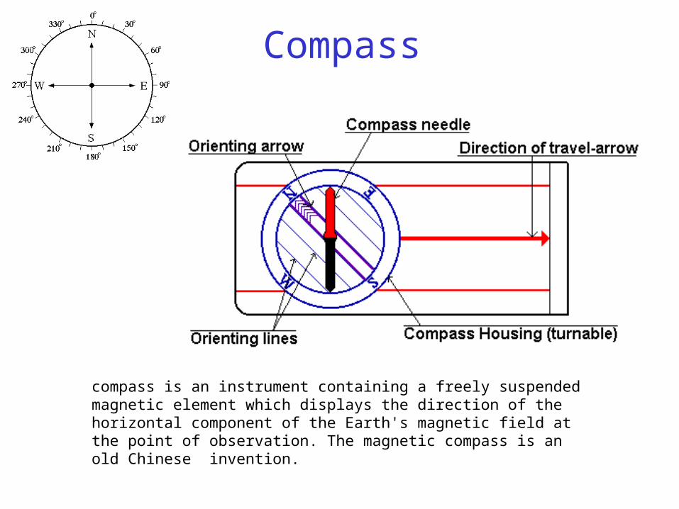
compass is an instrument containing a freely suspended magnetic element which displays the direction of the horizontal component of the Earth's magnetic field at the point of observation. The magnetic compass is an old Chinese invention.
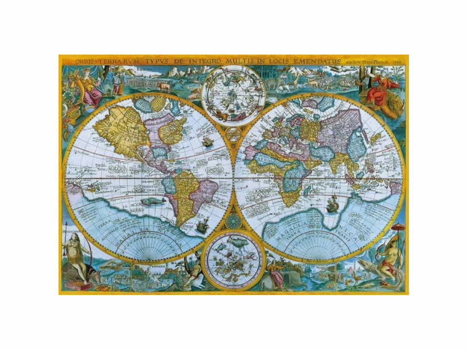
Compass
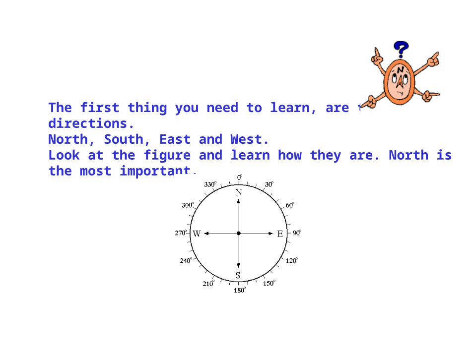
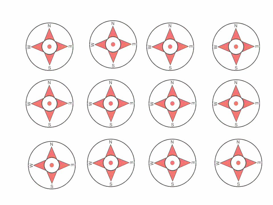
The first thing you need to learn, are the directions.North, South, East and West. Look at the figure and learn how they are. North is the most important.
Is a compass all we need when navigating?
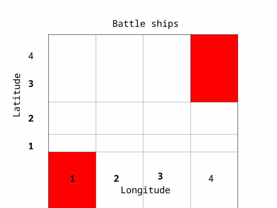
1
2
3
4
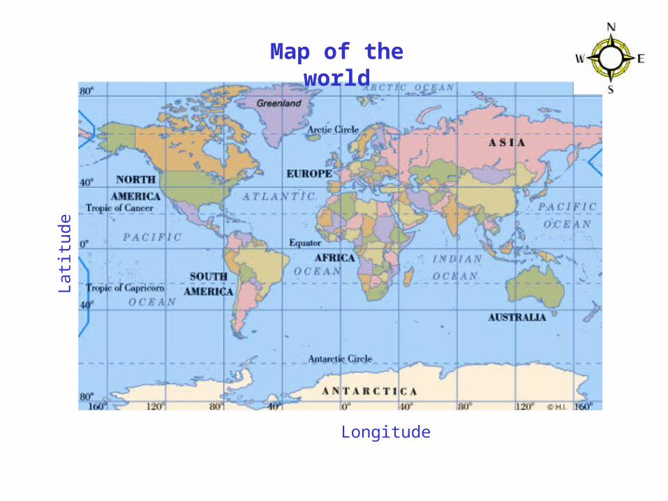
Longitude1 2 3 4
Lat
itud
eBattle ships
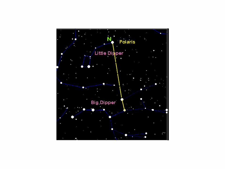
How to find North without a
compass
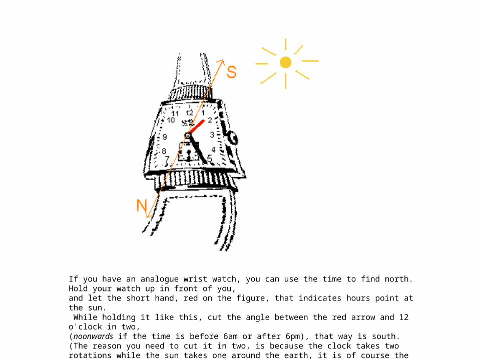
If you have an analogue wrist watch, you can use the time to find north. Hold your watch up in front of you, and let the short hand, red on the figure, that indicates hours point at the sun. While holding it like this, cut the angle between the red arrow and 12 o'clock in two, (noonwards if the time is before 6am or after 6pm), that way is south. (The reason you need to cut it in two, is because the clock takes two rotations while the sun takes one around the earth, it is of course the other way around, but never mind.)
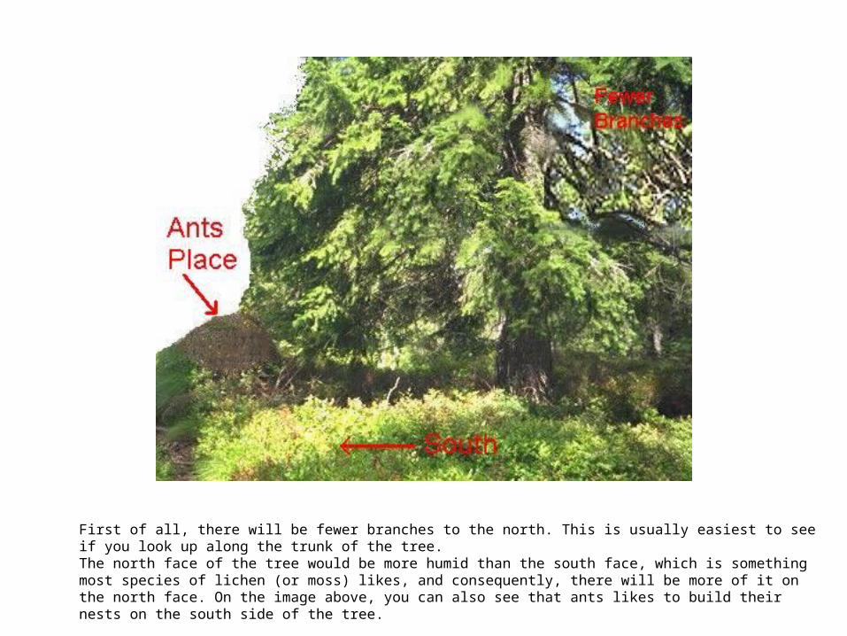
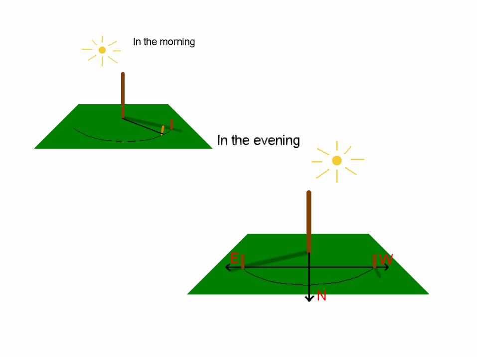
First of all, there will be fewer branches to the north. This is usually easiest to see if you look up along the trunk of the tree. The north face of the tree would be more humid than the south face, which is something most species of lichen (or moss) likes, and consequently, there will be more of it on the north face. On the image above, you can also see that ants likes to build their nests on the south side of the tree.
LESSON NOTES
2 November 2004
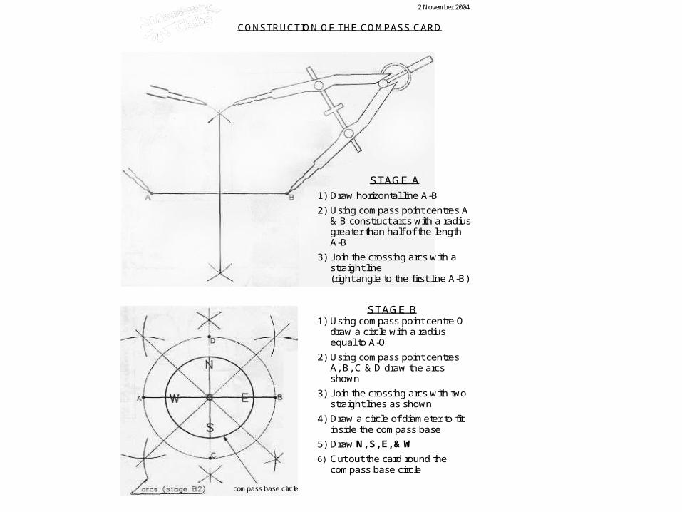
CONSTRUCTION OF THE COMPASS CARD
.
STAGE A
1) Draw horizontal line A-B
2) Using compass point centres A & B construct arcs with a radius greater than half of the length A-B
3) Join the crossing arcs with a straight line (right angle to the first line A-B)
STAGE B 1) Using compass point centre O
draw a circle with a radius equal to A-O
2) Using compass point centres A, B, C & D draw the arcs shown
3) Join the crossing arcs with two straight lines as shown
4) Draw a circle of diameter to fit inside the compass base
5) Draw N, S, E, & W
6) Cut out the card round the compass base circle
compass base circle
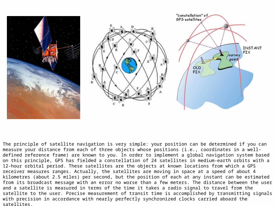
The principle of satellite navigation is very simple: your position can be determined if you can measure your distance from each of three objects whose positions (i.e., coordinates in a well-defined reference frame) are known to you. In order to implement a global navigation system based on this principle, GPS has fielded a constellation of 24 satellites in medium-earth orbits with a 12-hour orbital period. These satellites are the objects at known locations from which a GPS receiver measures ranges. Actually, the satellites are moving in space at a speed of about 4 kilometres (about 2.5 miles) per second, but the position of each at any instant can be estimated from its broadcast message with an error no worse than a few meters. The distance between the user and a satellite is measured in terms of the time it takes a radio signal to travel from the satellite to the user. Precise measurement of transit time is accomplished by transmitting signals with precision in accordance with nearly perfectly synchronized clocks carried aboard the satellites.