lehi’s trail
TRANSCRIPT

26 Volume 15, number 2, 2006
Lehi’s TrailFrom the Valley of Lemuel
to Nephi’s Harbor
Richard Wellington and George Potter
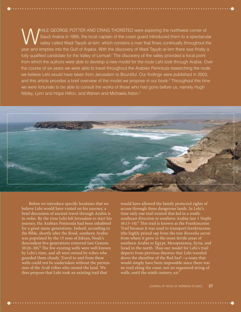
Above: upper valley of Wadi Tayyib al-Ism (near maqna, Saudi Arabia), the authors’ proposed site for the Valley of lemuel. right: The ancient port of Khor rori, a candidate for nephi’s harbor (today the inlet is closed by a sandbar). All photos and maps courtesy George Potter and richard Wellington unless otherwise noted.
Lehi’s Trail
Before we introduce specific locations that we believe Lehi would have visited on his journey, a brief discussion of ancient travel through Arabia is in order. By the time Lehi left Jerusalem to start his journey, the Arabian Peninsula had been inhabited for a great many generations. Indeed, according to the Bible, shortly after the flood, southern Arabia was populated by the 13 sons of Joktan, Noah’s descendant five generations removed (see Genesis 10:26–30).4 The few existing wells were well known by Lehi’s time, and all were owned by tribes who guarded them closely. Travel to and from these wells could not be undertaken without the permis-sion of the Arab tribes who owned the land. We thus propose that Lehi took an existing trail that
would have allowed the family protected rights of access through these dangerous lands. In Lehi’s time only one trail existed that led in a south-southeast direction to southern Arabia (see 1 Nephi 16:13–14).5 This trail is known as the Frankincense Trail because it was used to transport frankincense (the highly prized sap from the tree Boswelia sacra) from where it grew in the more fertile areas of southern Arabia to Egypt, Mesopotamia, Syria, and Israel in the north. Thus our model for Lehi’s trail departs from previous theories that Lehi traveled down the shoreline of the Red Sea6—a route that would simply have been impossible since there was no trail along the coast, nor an organized string of wells, until the ninth century ad.7
While GeorGe Potter and CraiG thorsted were exploring the northwest corner of saudi arabia in 1995, the local captain of the coast guard introduced them to a spectacular valley called Wadi tayyib al-ism, which contains a river that flows continually throughout the
year and empties into the Gulf of aqaba. With the discovery of Wadi tayyib al-ism there was finally a fully qualified candidate for the Valley of lemuel.1 the discovery of the valley provided a focal point from which the authors were able to develop a new model for the route lehi took through arabia. over the course of six years we were able to travel throughout the arabian Peninsula researching the route we believe lehi would have taken from Jerusalem to Bountiful. our findings were published in 2003, and this article provides a brief overview of the model we propose in our book.2 throughout this time we were fortunate to be able to consult the works of those who had gone before us, namely hugh nibley, lynn and hope hilton, and Warren and Michaela aston.3
journAl of booK of mormon STudIeS 27

There are two main reasons why we feel that Lehi’s party would have used the Frankincense Trail (see map on facing page). First, this trail would have protected Lehi and his family from plunder. Jere-miah, a contemporary of Lehi, noted that the Arabs were notorious highway robbers (see Jeremiah 3:2). The tribes that ruled the land through which trade routes passed provided protection at the wells and on the trails. Travel was encouraged and controlled, not prohibited. Arabist Alan Keohane wrote of a period later than Lehi’s: “Traders and cultivators paid them [the local tribes] protection money, called khawah, to keep themselves safe from raids. The desert sheikhs . . . became so powerful that many were given the grander title of emir or prince. They were also fabu-lously wealthy.”8
Second, the trail would have provided Lehi’s party water and provisions. The Roman historian Pliny the Elder (23 bc–ad 79) described the eco-nomics of the frankincense route this way: “Indeed all along the route they keep on paying, at one place for water, at another for fodder, or the charges for lodging at the halts.”9 The course of the Frankin-cense Trail can be explained in one word—water, the most precious commodity of all to the desert traveler. The Hiltons noted: “The history of Arabia is written with water, not ink.”10 The great oases of western Arabia—Tabuk, Hijra (Madain Saleh), Dedan (Ula), Medina, Mecca, and Najran—are all found on the Frankincense Trail or a branch thereof. Indeed, the course of the Frankincense Trail was no coincidence; it was there because it provided a reliable water supply and thus offered the traveler the best chance of surviving a crossing of the great deserts.
While we do not have texts from Lehi’s day that mention the dangers of crossing the Arabian desert (notably marauders and lack of water) or the necessity of taking the Frankincense Trail, scholars assume that the documented historical situation of later date has remained fairly constant over time and thus is an accurate indication of the challenges that Lehi’s party found in Arabia.
Some might argue that the Liahona could have directed Lehi through the desert without a trail. Even so, the party presumably would have needed to rejoin the trail at the wells. In the Ottoman period (14th–20th centuries ad), “fortified kellas or water stations, protected by iron-plated doors and garrisons of soldiers, dotted the route [of the
Frankincense Trail] at long and irregular intervals. Although it might have been two or three days’ march from one to another, at least the water sup-plies were known and plans made accordingly.”11 As the Hiltons succinctly summarized, “Lehi could not have carved out a route for himself without water, and for a city dweller to discover a line of water-holes of which desert-dwellers were ignorant is an unlikely prospect.”12 “The family, therefore, must have traveled and survived as other travelers of their day did in the same area, going from public water-hole to public waterhole.”13 Supporting this view is the fact that, as Pliny pointed out, those who left the official trail were summarily executed by the Arab ruling hegemonies.14
From Jerusalem southward
Nephi tells us that Lehi left Jerusalem and “departed into the wilderness” (1 Nephi 2:4). Was there an ancient route that led from Jerusalem to Wadi Tayyib al-Ism (our candidate for the Valley of Lemuel) and that could have been described as being “in the wilderness”? It turns out that there was such a route. The northern branches of the Frankincense Trail (in Gaza, Damascus, and Baby-lonia) joined together at the town of Dedan15 (situ-ated in modern Saudi Arabia) and from there con-tinued south to Yemen. The Gaza branch of the trail passed within 10 miles of Wadi Tayyib al-Ism, a fact that would certainly not have been lost on Lehi. The trail consisted of halts at wells, usually several days’ journey apart. The nearest halt to Wadi Tayyib al-Ism was the town of Midian (or Madyan—the for-mer abode of Jethro, Moses’s father-in-law, and the modern town of al-BadaĻa). From Midian the Gaza branch wended its way in a roughly south-southeast direction inland through the mountains, eventually joining the other branches at Dedan.16
Space does not allow a long argument explain-ing why we believe that Lehi took this route from Jerusalem south to Aqaba and then on to Wadi Tayyib al-Ism rather than any of the other pos-sibilities. Suffice it to say, however, that to the east of Jerusalem were two major routes that ran in a north–south direction: the King’s Highway and, farther to the east, the Way of the Wilderness, so called because it passed through the desert country to the east of the SeĻir mountain range.17
28 Volume 15, number 2, 2006

There would seem to be a historical precedent for the family escaping to the east toward the Way of the Wilderness and the King’s Highway. That was the preferred exit route from Jerusalem not only for those Israelites who fled when Nebuchadnezzar captured Jerusalem in 587 bc18 but also for King Zedekiah and his family.19 It would seem that if Lehi took the same route taken by most others who escaped from Jerusalem shortly after Lehi’s depar-ture, then it would be perfectly correct to describe that course of travel as departing “into the [Way of] the Wilderness.”
Nephi’s text states that after reaching the Gulf of Aqaba, Lehi’s party traveled “by” and then “in” the “borders” (1 Nephi 2:5), which in Joseph Smith’s translation may well have meant the edge of a mountain range since in the Bible
we read that Moses was commanded, with regard to Mount Sinai, that the people should “go not up into the mount, or touch the border of it” (Exodus 19:12; emphasis added). The name of the mountain range through which the party traveled runs along the eastern side of the gulf and is the called the “Hejaz” (also Hijaz), which means “barriers.” By using Nephi’s text as a guide, one passes directly from Aqaba to the fertile Wadi Tayyib al-Ism, where we found an oasis of hundreds of date palms (see 1 Nephi 8:1), wild grain (see 8:1), a river of continuously flowing water (see 2:9), and a magnif-icent granite canyon (see 2:10).20 This course took us through the entire length of Wadi Bir Marsha, which Jeffrey R. Chadwick, who has not visited the region, argued could be a candidate for the Val-ley of Lemuel. However, unlike the fertile Wadi Tayyib al-Ism, Bir Marsha is only a barren rocky wadi, with no grain, no fruit trees, and certainly no flowing water.21
the Valley of lemuel to nahom
After leaving the Valley of Lemuel, the party traveled four days to a place they called “Shazer,” where they pitched their tents and hunted (see 1 Nephi 16:13–14). Regarding the place-name Shazer, Hugh Nibley wrote: “The name is intrigu-ing. The combination shajer is quite common in Palestinian place names; it is a collective meaning ‘trees,’ and many Arabs (especially in Egypt) pro-nounce it shazher.”22 Nigel Groom uses a number of variations of the same place-name, Shajir being one of them, identical to Nibley’s Shajer. Groom’s defini-tion of Shajir is “a valley or area abounding with trees and shrubs.”23
Lehi’s first camp after the Valley of Lemuel must have been at an authorized halt along the Gaza branch of the Frankincense Trail; otherwise he would not have been allowed to stop for an extended period. And so we began to look for a cara vansary in a val-ley with trees that would have been a four-day jour-ney from the Valley of Lemuel.
In the early 20th century, Alois Musil traveled and made meticulous maps of the Northern Hijaz, the land between Midian and Medina where the next leg of the Gaza branch of the Frankincense Trail passed. He described his journey down Wadi Agharr, also known as Wadi Sharmah, a wadi (mountain valley) about 60 miles southeast of the
east of jerusalem in lehi’s time were two established routes south-ward, with a branch leading to ezion-geber on the Gulf of Aqaba, an arm of the red Sea.
journAl of booK of mormon STudIeS 29

30 Volume 15, number 2, 2006
Valley of Lemuel. Musil recorded: “We . . . crossed the old Pilgrim Road of ar-Rasifijje leading south-ward to the hills of Kos al-Hnane, where spirits abide. Date palms were still growing in parts of the valley, so that the oasis of Sarma could be extended a full twenty-five kilometers to the east.”24 Musil described a fertile valley with an oasis over 15 miles long. This fertile valley is approximately south-southeast from our candidate for the Valley of Lem-uel and was crossed by the old pilgrim route that followed the Gaza arm of the ancient Frankincense Trail. We found Musil’s description of Agharr most interesting because on a prior trip to Midian we had been told by the police general at al-Bada<a that the best hunting in the entire area was in the moun-tains at Agharr. The leading expert on the trail of northwest Arabia is Abdullah al-Wohaibi of King Saud University. Al-Wohaibi noted the names and order of the halts or rest stops on the al-Mu<riqah route, another name for the old ar-Rasifijje road
that Musil had mentioned. He wrote that according to various medieval Arab geographers, the first rest stop after Midian was al-Aghra<.25 Musil had previ-ously noted the similarities in the names al-Aghra< and Wadi Agharr and concluded that the rest stop was in this wadi.
In connection with the Book of Mormon locale Shazer, where Lehi’s party stopped to hunt and whose meaning in Arabic, as noted earlier, was “a valley or area abounding with trees and shrubs,” we now had evidence from independent sources that the first rest stop after Madyan on the ancient Gaza branch of the Frankincense Trail was in a fertile valley with trees, Wadi Agharr, and the surround-ing mountains presented the best hunting opportu-nities along the trail.
Nephi informs us that after leaving Shazer, the party traveled “in the most fertile parts of the wil-derness” (1 Nephi 16:14), yet the famous explorer Richard Burton described the Hijaz in these words:
Wadi Agharr, the authors’ candidate for nephi’s Shazer, is an extensive oasis valley near both the red Sea and the Gaza branch of the frankincense Trail.

journAl of booK of mormon STudIeS 31
“Nowhere had I seen a land in which the earth’s anatomy lies so barren, or one richer in volcanic or primary formations.”26 If Joseph Smith, or anyone else, had made up the Book of Mormon, one has to wonder what could have possessed him to state that there were “fertile parts” in this type of landscape. Here would be an obvious place to show that the Book of Mormon was a fraud. Yet what might at first seem to be a great flaw in Nephi’s text is actu-ally one of the most compelling witnesses for its historical accuracy, for not only were the large oasis towns mostly located on the Frankincense Trail (al-Bada<a, al-Aghra at Wadi Agharr, Shuwaq, Shagbh, Dedan, Medina, etc.), but also each of these oases had a farming community associated with it. Yet there is a second, equally compelling argument sup-porting the veracity of Joseph Smith’s translation.
In pre-Islamic times there was a series of vil-lages along a 215-mile27 section of the Frankincense Trail, incorporating the 12 halt settlements between Dedan and Medina. They were known anciently as the Qura >Arabiyyah, or the “Arab Villages.” These villages with their cultivated lands were linked together by the Frankincense Trail. Surrounded by thousands of square miles of barren terrain, the cultivated lands stood out from the surrounding desert like pearls adorning a chain along the south-southeast course of the trail. The old name for this
area is interesting in light of the fact that Nephi refers to it as “the most fertile parts.”
According to the Saudi Ara-bian Department of Antiquities and Museums, Wadi Ula (Qura) at the northern end of the Qura >Arabiyyah, where the ruins of Dedan were, was called Hijr in antiquity (alternatively spelled Hājir or Mahājir), which accord-ing to Groom means, among other things, “a fertile piece of
land.”28 In his book Tahdhib, the Islamic geogra-pher al-Azhar explains that the Arabs who lived in the Qura >Arabiyyah (the villages along the Frank-incense Trail) were called the Muhājirun, meaning “the fertile pieces of land” (the plural form of Hājir or Mahājir). Thus when Nephi describes that the family traveled in the most “fertile parts,” it is quite probable that he was using a real name for this area. It is interesting that the name Muhājirun, or “fertile parts,” occurs nowhere else in Arabia and is situ-ated only on the Frankincense Trail, after the two locations that would appear to perfectly fit Nephi’s descriptions of both the Valley of Lemuel and Shazer—quite a coincidence!
As we continued south along the Frankincense Trail, we found even more evidence that Nephi’s record is an eyewitness account of one who traveled along it. Three examples of this evidence follow.
First, Nephi’s description of the trail depicts declining fertility, from “the most fertile parts” (1 Nephi 16:14) to “more fertile parts” (16:16) to an area where the party had to pitch their tents and go into the mountains to hunt for food—the camp where Nephi broke his bow (see 16:17, 30)—and finally to an area of presumably no fertility where the family was starving to death (see 16:35). This is exactly what is found along the Gaza branch of the Frankincense Trail. Using tactical pilotage charts
Areas of fertile land west (red) and east (blue) of the Hijaz mountains. A route east of the Hijaz (the frankincense Trail) would encounter decreasing fertility between medina and najran, a reality that fits nephi’s account.

(TPCs, detailed maps used by pilots),29 we marked all the areas on the maps labeled “cultivation.” From Wadi Tayyib al-Ism to Medina, there is an average of one cultivated area every 11 miles along the trail. South from Medina the trail wanders around the lava fields until it reaches Bishah, some 350 miles farther south. From Medina to Bishah there is only one farming area for every 50 miles of trail. The TPC maps show that from Bishah to where the trail finally turned east, there are no areas marked “cul-tivation.” The trail would have covered a distance of almost 400 miles with cultivation only at the oases at Tathlith and Najran. That is, on the average, one cultivated area for every 160 miles!
Second, we found that the traditional wood that Arabs used to make their bows (wood from the Atim tree, or wild olive, Olea europaea) grows in a very limited range high in the mountains just west of the trail near the halt of Bishah. The geographical setting of the Atim trees and the trail fit well with Nephi’s narrative of the camp in the mountains where he broke his bow (see 1 Nephi 16:30, 32).
Third, after some 1,400 miles traveling approxi-mately south-southeast, the family reached a place that, as Nephi informs us, “was called Nahom” (1 Nephi 16:34). Here a great drama unfolded with the death of Ishmael and the direct intervention of the Lord to both chasten and save the travelers (see 16:39). As we consider the plight of the family in southern Arabia, the obvious questions become, Where was Nahom? Where did they turn east? Unfortunately, we have only seven verses of scrip-ture to guide us (16:33–39), and we will probably never know the exact location where the family bur-ied Ishmael. Nonetheless, comparing those seven verses with the history and geography of the area provides us with some interesting insights. What follows is our attempt to locate events that Nephi describes in 1 Nephi 16:33–39.
the location of nahom
It has been suggested that the place-name Nahom existed before Lehi’s party arrived there since the record does not say that the family named it as they did Shazer and the Valley of Lemuel. In fact, there are a number of places in Yemen that still bear the name NHM (common modern vari-ant spellings are Naham, Nahm, Neham, Nehem,
Nehhm, and Nihm), which many scholars believe could be identical to Nephi’s Nahom.30
Yemen is divided into a number of adminis-trative districts, one of which is situated 18 miles northeast of the modern capital Sanļa and is called “Nihm.”31 The Astons produced a map showing a cemetery named “Nehem” situated on the southern edge of Wadi Jawf, and they have suggested this could be the place where Ishmael was buried.32 There are three other specific locations bearing the name: Jabal Naham,33 Furdat Naham,34 and Wadi Naham,35 all located within 16 miles of each other. Jabal Naham is a 9,600-foot mountain 13 miles from the ancient caravan trail that ran between MaĻin and Marib. Furdat Naham, meaning “stony hills of Naham,” is located on the border between the mountain range and the plain to the east of it and is only 3 miles from the ancient trail. Wadi Naham (also called Wadi Harib Naham) is a val-ley situated 1.5 miles from that same ancient trail. Is there any evidence to indicate that any of these places may be the more likely candidate for the Book of Mormon Nahom?
We would suggest that the site on the southern edge of Wadi Jawf is an unlikely location. Nephi informs us that the family was starving prior to reaching Nahom (see 1 Nephi 16:35). In Lehi’s time Wadi Jawf was the home to the Minaeans, who constituted one of the two largest incense kingdoms of southern Arabia (the other kingdom was controlled by the Sabaeans, the inhabitants of Saba, or Sheba). Wadi Jawf was a large river oasis blessed with an abundance of excellent pastures and farmlands irrigated by rainwater that ran off from the mountains and was collected in dams. The Minaeans used irrigation systems for large areas of cultivation adequate for supporting a sizable popu-lation.36 French archaeologist Rémy Audouin stated that from the middle of the second millennium onward Wadi Jawf was cultivated and that “thus a non-migratory population could find food, [and] there were sufficient supplies for the caravans and wood for building.”37 Strabo visited the land of the Minaeans in 24 bc as part of the Roman invasion force of Aelius Gallus and reported that “the Minaei have land that is fertile in palm groves and timber, and wealthy in flocks.”38 If Lehi’s party reached the cemetery Nehem, which is more than halfway down Wadi Jawf, they must have passed through the fer-tile lands of the Minaeans, where they would have
32 Volume 15, number 2, 2006

found abundant food. The fact that they were starv-ing implies that this location does not fit the condi-tions Nephi describes.
While excavating the BarĻan temple in Marib, a German archaeological team under the leadership of Burkhard Vogt unearthed a stone altar bearing the inscription of the name of the benefactor who donated it, “BiĻathtar, son of Sawād from the tribe NawĻ, from Nihm.”39 Vogt dates the altar to the seventh or sixth century bc.40 In September 2000 a second altar bearing the name NahĻm was found in Marib in the Temple of the Moon Goddess, which dates to the seventh or eighth century bc.41 Here would seem to be concrete evidence that a place bearing the name Nahom (specifically NHM) existed before Lehi’s time and presumably had links to Marib, which was situated on the Frankincense Trail and controlled the trade in that area.
We do not suggest that Marib was the location of Nahom, since, like Wadi Jawf, Marib was well populated with well-established irrigation and agriculture. By 750 bc the population of Marib numbered some 50,000 inhabitants,42 and so it is difficult to see how the family could have been starving at Marib when the land was so fecund, producing three crops per year. There is no evi-dence that Marib was ever called NHM.
These findings would seem to support the idea that Nephi’s Nahom may well have been close to present-day Furdat Naham, Wadi Naham, and Jabal
Naham, all of which are within 13 miles of where the ancient route turns to the east (see 1 Nephi 17:1),43 Furdat Naham being only 4 miles from the turn. This area is not close to any ancient popula-tion centers and presumably had no irrigation net-work or cultivation in place. On this route it would have been only 30 miles along that trail from Wadi Naham to the Sabaean capital of Marib, where the altars were found and where we might assume the people who inhabited Nihm made offerings in the BarĻan temple.
With this information it is now possible to come up with a theory of where the Nahom incident took place (see 1 Nephi 16:33–39). A possible scenario would be that after the family left Shazer, they con-tinued south along the Frankincense Trail, passing through the oasis towns of Dedan, Yathrib, Turnah, Bishah, and Tathlith to Okhdood (Najran). The area south of Okhdood is extremely desolate, with no agriculture, settlements, or opportunities for hunting. After Okhdood, the second well the family would have encountered was at Sayh. After this the trail suddenly took a number of twists and turns at Jabal al Burm. In the space of a little over 40 miles, it turned first to the north, then south, then west, and then south, skirting the edge of the sand dunes. At this point the route split into two, with a minor trail heading to the east to the well of Mushayniqah and on to al Abr. Is it possible that here the Lord chose to test and chasten the group? (see 1 Nephi
16:35). If it was here that the Liahona led them east into the edge of the RubĻal Khali, the larg-est sand dune desert in the world, they would have waded through the dunes and could easily have become disoriented and lost (see Alma 37:38,
The authors’ proposed route (in red) for lehi’s group veers into the inhospitable ramlat dahm desert and steers clear of population centers before reach-ing Wadi naham and turning eastward. The black line is the major trade route, the purple line a minor trail. Compare with other suggested routes mapped on page 77.
journAl of booK of mormon STudIeS 33

34 Volume 15, number 2, 2006
40–42). If they had accidentally traveled east of their intended trail and entered the RubĻal Khali, they would have been in a sand dune desert for the first time in their journey. The trail up to this point had avoided sand dunes. The text implies that this may have been the case since the party had come to a change in the landscape. Note that Nephi’s older brothers complained that he wanted to be their leader and teacher and that he wanted to “lead us away into some strange wilderness” (1 Nephi 16:38). If they were already in the wilder-ness, what would be a strange wilderness? They had essentially traveled the main Frankincense Trail the length of Arabia. They had described this as being in the wilderness. What could be different about this “strange wilderness”? If they were in the RubĻal Khali, there would be no trail, no halts, no wells, and no landmarks—all of which would have been a new and frightening experience. Here they faced starvation, but Nephi would have realized they had lost the trail (see Alma 37:41–42) and presumably knew their best chance was to turn southwest in the hope of picking it up again. If so, they would have pushed on in that direction and ended up south of Wadi Jawf in an area called Nahom. The three loca-tions mentioned above that bear the name Naham still exist there. We suggest that Ishmael was buried
somewhere in that vicinity (see 1 Nephi 16:34). By reaching Nahom and the trail, the family was able to go on to find help and food, an achievement that Nephi rightly recognizes could not have happened without the help of the Lord (see 16:39).
the trail east from nahom
Nephi relates that after Nahom the family traveled “nearly eastward from that time forth” (1 Nephi 17:1). Here again the Book of Mormon narrative is in total harmony with the route of the Frankincense Trail in 600 bc. The main trail ran through the capitals of the incense kingdoms of MaĻin, Saba, Qataban, and Hadramaut and ended at the port of Cana. This route followed the easiest terrain through protected valleys and the areas of greatest population concentration. The downside to this trail was that all of these kingdoms extracted a levy from the caravans as they passed. Pliny recounts that the caravan route from southern Ara-bia to Gaza was enormously expensive.44 In order to reduce the journey’s duration between these “state capitals” and to avoid the levies that would be applied, a number of shortcuts or secondary trails came into existence. Though cheaper to travel on,
recent research indicates that an overland trail ran eastward from Shabwah to the frankincense groves in southern oman. Shown here is the authors’ conjectured route for lehi’s trail, with the eastward leg from Wadi naham leading through Wadi Hadramaut to Shisur and thence to the ancient seaport of Khor rori. See map on page 77.

journAl of booK of mormon STudIeS 35
these trails made for more difficult going, with only a few wells and virtually no caravansaries.
Since we place Nahom somewhere near present-day Wadi Naham, we investigated the two routes that lead nearly east from there (note that Lehi’s party would not have traveled directly east from Nahom, as that would have taken them directly into the dune desert Ramlat SabĻatayn). There is only one trail through Ramlat SabĻatayn, and that is on the northeast corner, running along Wadi Jawf to Shabwah. To reach this trail, they could have fol-lowed Wadi Naham, or any of the other wadis in the area that all drain northeast, down into Wadi Jawf. The second possible route would have been to continue on the main trail to Marib and Timna, then on the minor trail to al Bina and on to Shab-wah. We will probably never know exactly which of these two routes Lehi’s party took since Nephi gives us only one compass bearing for the entire journey across southern Arabia. What we can be sure of, however, is that very close to an area still known by the name Naham, the trail that ran the entire length of Arabia in a general south-southeast direction changed bearing and turned to the east, exactly as Nephi described.
When we started researching the possible trail that the party took from Nahom to Bounti-ful, this eastward portion, from Shabwah to Dho-far (the generally accepted location where Bounti-ful is situated),45 was the one that had by far the least information available. Freya Stark wrote in 1936 that at that time “no European has been along this way.”46
We did not know if we would be able to find any trails there since no concrete description of one existed in the literature. Fortunately, at the very time we were investigating the trail in southern Arabia, the research of Professor Juris Zarins of Southwest Missouri State University was becoming available. His investigation of the ruins at Shisur and other archaeological sites has begun to shed light on the Incense Trail and the route it took in southern Oman and Yemen. Zarins found a number of forts elsewhere in southern Arabia that provided the first concrete evidence that an overland trail existed from the ancient frankincense kingdoms of MaĻin, Saba, Qataban, and Hadramaut in Yemen and east to the frankincense groves of Dhofar.47
Bountiful
Other Latter-day Saint authors have suggested locations for Bountiful. The Hiltons focused on the inlet bay at Salalah, the ancient al-Balīd.48 Warren and Michaela Aston settled on Wadi Sayq (Khor Kharfot).49 If Lehi and his family had taken the route eastward from Yemen to Dhofar in modern Oman, they would have followed that trail until it ended on the Salalah plain, where the harbor at Khor Rori formed one of the largest ancient ports in southern Arabia. We were the first to suggest that Khor Rori was the logical place to start the search for the place Nephi called Bountiful, where the family lived and where Nephi built and launched his ship. Though al-Balīd and Wadi Sayq possess features that could connect them with Bountiful, in our opinion Khor Rori offers a dimension that the other two do not, namely, the three maritime resources that would have been essential for Lehi’s party to reach the promised land: the materials needed to build an oceangoing ship, a protected harbor for building and launching the vessel, and the opportunity to learn the seamanship skills needed to sail a large ship. A growing body of evi-dence suggests that the ancient frankincense port of Khor Rori possessed these unique maritime resources, as well as all the other attributes men-tioned in Nephi’s record.50
Khor Rori is a large waterway extending over 1.5 miles inland. The khor (“inlet”) has several nat-ural places where ships could moor, making it the likely reason that Khor Rori and Taqah (the settle-ment 2 miles to the west of Khor Rori) were called Merbat (“the moorings”) anciently. Today there is a sandbank across the khor, closing it off from the sea. This barrier was not always present, however. Dr. Eduard G. Rheinhardt believes that a drop in the sea level around the 14th and 15th centuries ad caused the closure of the harbor’s mouth. Radio-carbon dating establishes that there was a stable and final closure occurring around ad 1640–1690.51 Huge cliffs line the sea entrance to Khor Rori, form-ing breakwaters that allowed ancient ships to sail out 400–450 yards into the Indian Ocean proper with protection from the surf.52 This was the great strength of Khor Rori as a port; the natural break-waters provided protection from both the sum-mer southwest monsoon and the winter northeast

monsoon winds. Thus the port could be used all year for shipping and shipbuilding.
Khor Rori was the premier port of Dhofar, which was involved in seafaring as early as the fifth and fourth millennia bc.53 Both Khor Rori and Taqah were settled long before Lehi’s arrival in southern Arabia. Zarins found evidence of a “large scale Bronze Age presence”54 as well as evidence of an Iron Age settlement there.55 Pollen samples from inside the buildings at Khor Rori, which date from the late fourth to the mid-second century bc, indi-cate that the people at Khor Rori cultivated fields and gardens of wheat (Triticum group), barley (Hor-deum group), and date palms (Phoenix dactilifera);56 and remains show they raised sheep and goats57 and ate seafood extensively.
Examination of the area around Khor Rori shows that the fundamental element that gave Bounti ful its name—fruit—would have been pres-ent at the shoreline exactly as Nephi described it. The shoreline of Dhofar is mainly rocky, and there are few places where ancient cultivation is found at the shoreline. Yet Nephi mentioned that when the party arrived at Bountiful, they camped on the seashore and called the place Bountiful because of its much fruit (see 1 Nephi 17:5, 6). Khor Taqah,
leading to the seashore at the town of Taqah, has extensive cultivation using the freshwater from the khor to irrigate the land. Presumably, this was done anciently in order to feed the population. We note that in the United States in the early 19th century any cultivated plants could have been clas-sified as “fruit.”58 Sorghum (Sorghum bicolor), mil-lets (Eleusine sp., Pennisetum sp.), cotton (Gossyp-ium sp.), and indigo (Indigofera sp.) were cultivated in Dhofar possibly as early as 4000 bc.59 It should be noted that while Nephi informs us in 1 Nephi 17:5 that the honey in Bountiful was wild, he spe-cifically avoids saying that the fruit grew wild.
While today Khor Rori and the surrounding coastal plain appear barren, the arid condition is a recent phenomenon caused by changing rainfall levels. Local historian Ali al-Shahri writes: “It was the most important agricultural area until 40 years ago, growing corn, millet, and lots of other grains. A long time ago, this plain was watered by many streams, which flowed into the sea. Even up to 30 years ago many of them were still flowing. . . . This area was covered with forest and grass perennially. The Periplus of the Erythraean Sea60 mentions the presences of trees and rivers on the coastal plain.”61 During his youth, al-Shahri watched his father’s
Its natural breakwaters affording year-round protection from monsoon winds and surf, Khor rori was the premier port on the dhofar coast of oman in ancient times.
36 Volume 15, number 2, 2006
livestock in the valley just above Khor Rori. Al-Shahri showed us where a man came to collect wild honey in the caves just 2.5 miles from the harbor.62
While there is no written evidence dating the use of Khor Rori as a port to 600 bc, there is evidence that the port was in use during the Iron Age, the time when Nephi was visiting there. Peter Vine is of the opinion that the port was in use prior to the time of the Hadramauti invasion of Khor Rori, which took place about the time of Christ: “It is clear that a substantial settlement existed at the site long before King Iliazzyalit instructed the builders to construct a city there.”63 Dr. Jana Owen of UCLA, director of the the Transarabia Coastal Survey, made a study of the ancient ports of Dhofar in 1995. Regarding Khor Rori, she wrote: “We know about the Hadrami invasion, but I believe that it [the port] would have been used previous to that invasion. Again, around the settlement we have surveyed a good deal of Iron Age lithics; this is prior to the work that is now being done by the Italians from Pisa.64 We also did a dive survey of the lagoon, and there is evidence of modi-fication on the northeastern edge of the lagoon, and obviously the size is indicative of large-ship docking. Doesn’t it make sense that they didn’t wait until the turn of the Common Era to figure this out?”65
Indeed, there is sig-nificant evidence that all the other additional elements of Bountiful existed at Khor Rori at Nephi’s time: wild honey, a tall mountain (slopes of the high-est peak in southern Oman are only 2 miles to the north), a Neo-lithic flint quarry (see 1 Nephi 17:11) below the mountain and 4.5 miles to the east,66 iron ore deposits just a mile east of the flint deposit (dis-covered by researchers from BYU),67 iron-smelting slag discov-ered among the ruins
at Khor Rori (see 17:9, 10),68 a location due east of the current candidates for Nahom69 (see 16:34; 17:1), beasts for hides and meat (see 17:11; 18:6),70 and the tall cliffs directly above deep water (17:48).
three Maritime requirements for Bountiful
Any candidate for Bountiful must meet three essential criteria. It must be possible that the site in Nephi’s time had the resources necessary for Nephi to (1) build, (2) launch, and (3) sail a large ship. We believe that Khor Rori is the only place that could have met these criteria.
Materials to Build an oceangoing ship
Authors who have written about the time Lehi spent in Bountiful have invariably glossed over the details regarding the building of Nephi’s ship,71 and yet the building of the ship was an enormous undertaking that spanned many years and required massive quantities of very specific natural resources. Nephi’s voyage to the New World would have taken many months, if not years, and any feasible route
omani shipwrights used imported teak instead of gnarly softwoods like these large fig trees that grow in dhofar’s hills.
journAl of booK of mormon STudIeS 37

38 Volume 15, number 2, 2006
would have covered over 15,000 miles of the roughest water on earth. About 150 years before Nephi built his ship, King Jehoshaphat of Judah built a fleet of ships designed to sail to Tharshish in the Indian Ocean (“ships of Tharshish to go to Ophir for gold,” 1 Kings 22:48). These ships never sailed but “were broken at Ezion-geber” (1 Kings 22:48; compare 2 Chronicles 20:36–37). Raphael Patai suggests that this was “either due to a storm or simply because they were inexpertly constructed.”72 Nephi’s ship had to endure at least one storm, a “great and terrible tempest” that lasted four days (see 1 Nephi 18:13–15). Clearly, Nephi’s ship must have been crafted as well as any of its day—and certainly it must have been constructed to a higher standard and from better materials than those used for the fleet that Jehoshaphat’s shipwrights built—for it to have survived such a journey.
Ore. Nephi, after the Lord told him to “get thee into the mountain” (1 Nephi 17:7), needed a source of ore from which to make tools for constructing the ship (see 17:9). Subsequently, the Lord showed him where to find ore. Researchers from Brigham Young University have discovered small quanti-ties of iron ore in Dhofar, with their “most exciting and significant discovery” only six miles east of Khor Rori at the foot of Jabal Samhan, the largest mountain in Dhofar,73 known in the Old Testa-ment as Mount Sephar (see Genesis 10:30).74 Nephi noted that, once in the New World, he “did teach [his] people to build buildings, and to work in all manner of wood, and of iron, and of copper, and of brass, and of steel, and of gold, and of silver, and of precious ores” (2 Nephi 5:15). BYU geologist Wm. Revell Phillips has suggested that Nephi’s skills in metallurgy “may have been learned from the local smiths of the Dhofar or from the Indian traders that passed through nearby trading ports.”75 Recently excavated artifacts at the Khor Rori/Sumhuram ruins include iron axes, iron nails, an iron knife, an iron razor, iron-smelting slag, bronze nails, a bronze bell, a small bronze plaque, and seven bronze plates engraved with text.76
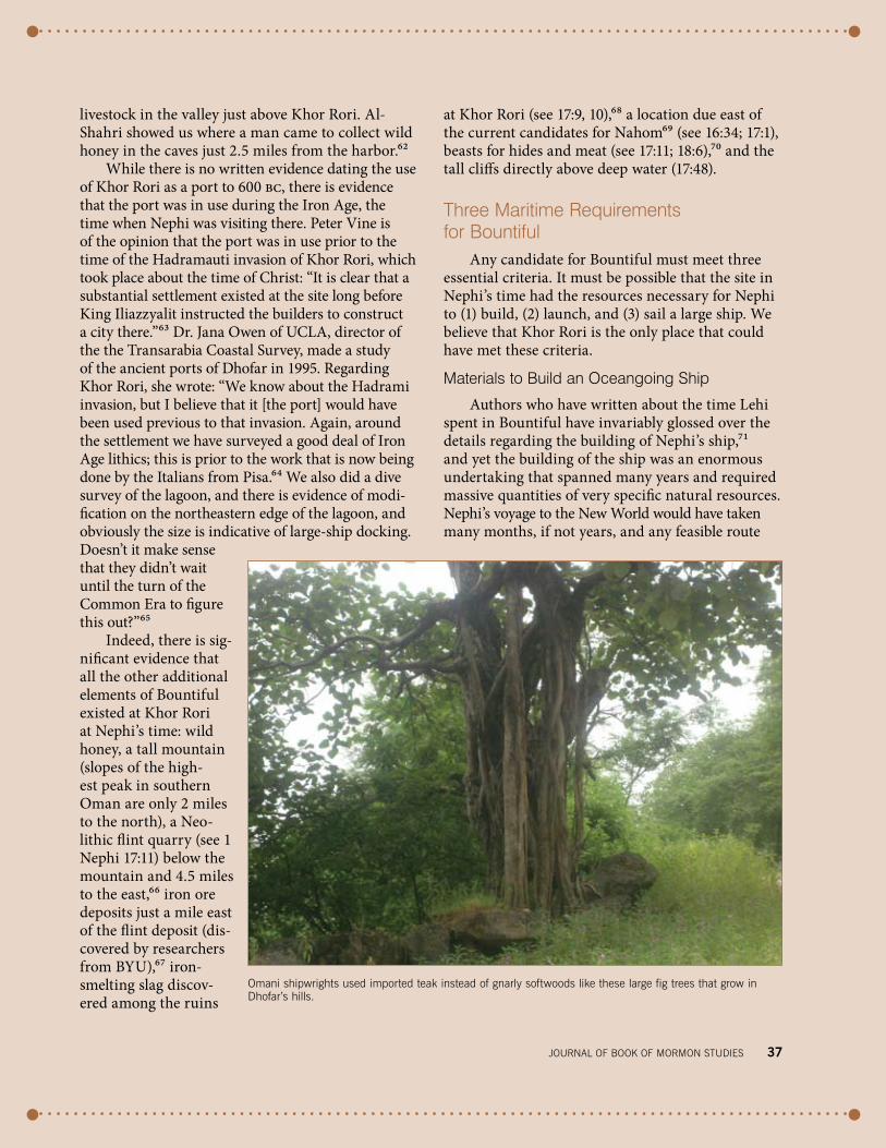
Timber. Nephi needed hardwood to build a ship strong enough to survive an ocean crossing. The usual assumption is that he used the trees that grew in Bountiful to build his ship. This overlooks one obvious problem: nearly all of the woods native to Dhofar in southern Oman are permeable softwoods and could not be used for shipbuilding.77 The hard-
woods that are found in Oman are short, gnarly, and unsuitable for the fabrication of the massive structural components of a large sailing vessel. His-torically, hardwoods had to be imported into Arabia for shipbuilding. The first records of timber being imported into the Persian Gulf region from foreign lands date to an inscription of Urnanshe, king of Lagash in Sumer in about 2500 bc.78 Hardwood, or an impermeable softwood, was an absolute require-ment for the building of a seaworthy ship. Indian archaeologist Shereen Ratnagar points out that “in the historic period most Indian boats were made of teak. Even Arab craft were made on the west coast of India, due to the availability of wood.”79 Regard-ing the source of wood for ships built in Oman, Tom Vosmer, director of the Traditional Boats of Oman Project, noted, “Most, if not all, planking timber had to be imported: teak (Tectona grandis), venteak (Lythracea lanceolata), mango (Mangifera indica), as did spar timber.”80
The softwoods that grow in Dhofar would never have been strong enough to survive long at sea. Hard woods are used not only for their strength but also for their longevity. The wood used for a boat is subject to many dangers, particularly marine borers that cause it to decompose very rapidly. Some spe-cies of tropical shipworms grow to six feet in length and attain the thickness of a man’s arm.81
In order to carry all of the provisions needed for a long transoceanic journey, Nephi would have needed a ship that was large by the standards of the day. The ship’s size would have been a direct function of the number of people on board and the provisions carried and would have determined the size of the port needed for construction. Maritime archaeologist Tim Severin built an 80-foot-long wooden replica of the medieval Omani ship and sailed it from Oman to China. Although the Sohar was a replica, Severin’s basic needs would have been similar to Nephi’s since wooden ships changed little in design until the 16th century ad.82 John L. Soren-son estimates that 43 people went aboard Nephi’s ship,83 more than twice as many people as were on Severin’s 80-foot vessel. Lynn and Hope Hilton esti-mated that there were 73 on board Nephi’s ship.84 John Tvedtnes estimates up to 68 persons.85 While Severin’s vessel was probably not identical in size to Nephi’s, the list of materials Severin needed to build his ship is useful because it gives us a general idea

journAl of booK of mormon STudIeS 39
of the order of magnitude of materials Nephi would have needed to construct his ship.
Severin had to find a tree suitable for the 81-foot main spar and a 65-foot log that was to be tapered into the mast.86 He wrote that a ship’s keel “is long, straight and massive; it is the very backbone of the vessel. . . . The keel piece to my replica needed to be 52 feet long, 12 inches by 15 inches in cross-section, and dead straight.”87 Severin imported the timber for his Arab ship from India because, “historically, nearly all materials for shipbuilding in Oman have been imported from the Indian subcontinent, Oman being lacking in suitable timber for large boatbuilding.”88
If good shipbuilding timber never grew in Oman, then Nephi must have used, like the Arab shipwrights, imported materials from India and the islands thereabout. The Omani Ministry of National Heritage and Culture notes of Omani shipbuilding: “Teak and coconut wood were used exclusively for building hulls. Teak had to be imported from India. . . . Indeed, the virtues of the wood would have been known in the Gulf from the earliest sea voy-ages to the Indus in the third millennium bc.” The Omani Ministry adds, “Coconut wood also had to be imported—mainly from the Maldive and Laccadive Islands from where it is possible that the coconut tree spread to Dhofar in the Middle Ages.”89 Recent dis-coveries in Egypt confirm that Indian teak wood was used for construction of the ancient ships that sailed the Indian Ocean.90
But would this timber imported from India have been available to Nephi at Dhofar’s port of Khor Rori in the sixth century bc? The Omani Ministry
of National Heritage and Culture states that Dhofar “grew from obscure beginnings before 1000 bc. . . . Its growth was the major stimulus to the re-open-ing and expansion of Indian Ocean maritime trade routes.”91 German maritime archaeologist Norbert Weismann, who specializes in Oman, writes of Dho-far, “Certainly it was involved in the traffic to India in Greco-Roman times, but there was trade with white India much earlier.”92 Nephi’s text alludes to the possibility that the timbers he and his brethren were working had already been cut somewhere else: “We did work timbers of curious workmanship” (1 Nephi 18:1). How could the timbers have been curious to Nephi and his workers if they had logged and cut the lumber themselves? Apparently, some of the timbers Nephi used to construct his ship were precut in an unfamiliar manner. We know that hardwoods were being imported into the Arabian Gulf since the third millennium bc and that a few centuries after the time of Christ their export from India in the form of precut beams and rafters was a common practice.93
Rope. Of course, Nephi needed much more than just timbers to build his ship. A quotation attributed to Rabbi ShimĻon ben Laqish, a second-century-ad Palestinian sage, noted: “A flesh and blood [i.e., mortal man], if he wants to build a ship, first he brings beams, then he brings ropes, then he brings anchors, then he places in it seamen.”94 The importance of ropes cannot be overemphasized. According to Arabist scholar Raphael Patai, the bib-lical name for a ship’s captain was rabh hahobhel, or “master roper” (Jonah 1:6).95 Historically, the planks of ships built in Oman were sewn together with rope. It took the husks of 50,000 coconuts to make the 400 miles of rope Severin needed to build his sewn ship, the Sohar.96 Even if Nephi used nails, rope would be required for riggings and anchor lines. Coconuts are not native to Dhofar, and so if Nephi made ropes from coconuts, they also had to be imported.
Fabric for sails. Oceangoing sailing ships require several sets of sails. Traditionally, the sails on Arab ships were woven from coconut or palm leaves or were made from cotton cloth.97 Cotton would have been available either as a locally grown98 product or as an import from India. According to the Periplus of the Erythraean Sea, cloth was one of the products that the inhabitants of Dhofar imported in return for their frankincense.99
The Sohar, a replica of the typical medieval omani “sewn” ship, sailed from oman to China. Photo by richard Greenhill/Severin Archive.

In order to obtain large timbers and build his ship, Nephi would have needed to be somewhere with (1) established trading links with the subcon-tinent and (2) an established port. Though desolate today, in antiquity Khor Rori was a principal mar-ketplace. In the year 2000 the World Heritage Com-mittee of the United Nations’ Educational, Scientific and Cultural Organization (UNESCO) designated Khor Rori as a World Heritage site, noting the trade in frankincense as “one of the most important trad-ing activities of the ancient and medieval world.”100 Dhofar would also appear to have its own tradi-tion of shipbuilding. Several kinds of ancient ships are depicted in rock art drawings found in caves in sight of Khor Rori (just 2.5 miles from the har-bor).101 The Omani Ministry of National Heritage and Culture states that shipbuilding at Dhofar may go back into great antiquity.102
While we suggest that the things Nephi needed to build his ship were available at the time at Khor Rori, could Nephi have afforded the imported goods? There would have been a number of funding options for Lehi: selling his camels, exchanging his services as a scribe and merchant, or perhaps even arranging to have his property sold in Jerusalem.
a Protected harbor
As noted earlier, it is likely that Nephi’s ship would have been large by the standards of the day.
When completed and fully laden with supplies, rig-ging, tons of ballast, water, and at least one anchor (often of considerable size even on a small ship), the ship could have weighed as much as 100 tons.103 As such, it could only have been built on “ways” (wooden rollers) above the tide line and then rolled down into the water. Saeed al-Mashori, the Omani Supervisor of Excavations at Khor Rori, showed us eight clearly defined “way-ramps” of unknown date, from which large ships were launched into and retrieved from Khor Rori. The ramps are located just south of the Sumhuram fortress built by the Hadramutis and included moorings where large ships were finished and loaded.104 Once the ship was moored in sheltered waters, construction could continue, adding the weight of the deck, outfitting, rigging, and tons of ballast and provision.
From time immemorial, large hulls have been launched from harbors, and Nephi’s narrative implies that his ship was no exception. The coastline of Dho-far is known for its heavy surf and consists of rocky cliffs alternating with sandy beaches. Launching a ship weighing as much as 100 tons (and having no means of power or control) from a shallow beach into breaking surf with strong currents is physically impossible and would only result in a shipwreck. Yet Nephi’s text implies a calm, orderly, and seem-ingly routine embarkation in which party members all boarded the ship before they “did put forth into
freshwater stream at Khor rori.
40 Volume 15, number 2, 2006

the sea” (1 Nephi 18:8). There is only one way that everyone could be on board the ship and then “put forth into the sea”—the ship had to be moored in a deep, calm harbor. Nephi does not describe the family pushing the ship into the sea; they are already on board.
Furthermore, when Nephi’s wooden ship set forth into the sea, it could not have been the first time the ship was in the water. The reason for this is that a ship must be placed in water in order for the hull to be tightened. Raphael Patai noted that both the Hebrew and Egyptian shipbuilders used this technique: “Under the influence of the water the planks of the ship’s hull swelled at the seams, and every seam, split, or crack became tightly closed.”105 After Nephi was sure the hull was watertight, he could then load the tons of ballast into the ship and perform sea trials to make sure the ballast was of the correct weight and position for the sails. Only when all these things were done could he load the provi-sions on board and set forth into the ocean. Nephi not only needed a harbor, but he needed a large one where the preliminary trials could take place. Khor Rori is essentially the only harbor in Dhofar large enough and deep enough to allow this.106
Are there any other inlets that Nephi could have used to build his ship? There are a number of other
inlets in Dhofar, all of which are much smaller than Khor Rori. We studied each of these inlets to deter-mine if they were year-round protected harbors in Nephi’s day, if they were large enough to accommo-date oceangoing ships, and if these inlets would have had the resources Nephi needed to build a ship in the beginning of the sixth century bc. In all, we visited nine inlets besides Khor Rori.107 Most of the inlets were too small for large ships to enter. There is evi-dence that only three were used in the past. The most westerly of these is Raysut, situated some six miles west of the modern town of Salalah. While Raysut provides anchorage, it would not have provided year-round protection for the vessel that Nephi was build-ing.108 The second possibility is Khor al-Balīd, in the modern town of Salalah, which the Hiltons suggested may have been the place Nephi called Bountiful.109 A sandbar now closes off the inlet. It was the only other inlet that would have provided year-round protec-tion (necessary for building a ship that would have taken longer than the period between the monsoon seasons) and would have been wide and deep enough to build and launch a large vessel. But there is no evidence that this harbor was used in Nephi’s time.110 The third candidate is Khor Suli, but it is very nar-row and is barely wide enough to allow a ship to turn around on its axis, let alone allow any sea trials.
journAl of booK of mormon STudIeS 41
breaking surf at Salalah. building and launching a relatively large vessel like nephi’s likely required a protected harbor to avoid the perils of beach launching into the typically rough surf and strong currents of the dhofar coast.

42 Volume 15, number 2, 2006
Because Khor Kharfot (Wadi Sayq) has been suggested as the location of Nephi’s harbor,111 we discuss it briefly here. It is an isolated inlet 66 miles west of Salalah, a 70-mile journey over mountains from the ancient port where Nephi could have found shipbuilding timber, cotton, rope fiber, and other necessary resources. Nephi would have needed to haul all of these heavy imported goods to Khor Kharfot in order to build his ship. Khor Kharfot is presently closed off by a sandbar. There is no documented evidence that the inlet was open to the sea in Nephi’s time, but if it were, the inlet is very narrow and the floor is strewn with huge boulders that would have posed considerable risk to anything other than small, shallow-draft vessels attempting to use it. For these reasons, and others, we do not consider it a candidate for Bountiful.
seamanship skills
Nephi needed a crew, and he needed to acquire the skills to train them. It takes years to learn and practice the skills needed to control a sailing ship at sea. United States Merchant Marine officer Frank Linehan, an experienced transoceanic sailboat skip-per, notes, “Even with the inspiration of the Lord, it was simply impossible for Nephi to have sailed to the New World without training.”112 Historian Maurizio Tosi writes of the ancient Arabian cap-
tains: “For the first navigators it was like venturing into outer space and only a body of accumulated experience, strengthened by tradition, would have ensured their survival at sea.”113 For Nephi the same learning experience must have taken place. Nephi could not have merely guessed how to sail the Pacific Ocean or have succeeded unless both he and his crew knew what they were doing.
The Periplus of the Erythraean Sea, written in the early Christian centuries, perhaps as late as the fourth century, mentions that Khor Rori was a safe haven for ships held up in the winter: “[T]he place goes by the name of Moscha—where ships from Cana (Yemen) are customarily sent; ships come from Dimyrike (southern India) and Barygaza (modern-day Broach in India) which cruise nearby, spend the winter there due to the lateness of the season.”114 Undoubtedly the later Greek captains learned from the early Arabian sailors before them the advantages of mooring in the protected waters of Khor Rori during the winter northeast monsoon. Here, then, over the winter at Khor Rori were cap-tains who knew how to sail a large ship across the open seas of the Indian Ocean, experienced seamen from whom Nephi could learn and who had idle time to spend instructing Nephi.
The specific essential items Nephi needed to build his ship would have been available to him
left: Sumhuram ruins at Khor rori. Sumhuram was a fortified port that controlled incense trade.
below: Ancient rock art in caves near Khor rori portrays ships.

journal of Book of MorMon StudieS 43
only if he was at an established port. The strength of Khor Rori over other locations proposed for Bountiful is that it is the only established large port in Dhofar in Nephi’s time. One does not need to rely on a long list of miracles in order to artificially make this location fit the necessary requirements essential for building, launching, and sailing a large ship. No location other than Khor Rori has yet been able to meet these criteria.
The Case for Khor Rori
Nephi’s recollections of his time in Bountiful center on the building of an oceangoing ship. Any location that purports to be Bountiful must fulfill the requirements needed to do this. We suggest that there now exists a strong candidate—one that can stand up to the scrutiny of thorough investiga-tion—for the place where Nephi could have built such a ship. Every resource Nephi needed to build, launch, and sail a ship to the promised land can be identified at Khor Rori. We also propose that a route existed in Nephi’s time that led from Jerusa-lem to that harbor and along whose course qualified
candidates exist for the Valley of Lemuel, the River of Laman, Shazer, “the most fertile parts,” “the more fertile parts,” Nahom, the trail east, the land Bountiful (Dhofar), and the place Bountiful, where much fruit grows at the seashore.
It is of more than passing interest that modern scholarship from non–Latter-day Saint researchers is helping to show that this element of the Book of Mormon narrative appears to be in perfect har-mony with the historical setting of Arabia in the mid-first millennium bc. It took these two authors six years; thousands of hours of research and ref-erence to many hundreds of books, articles, and maps; and 35,000 miles of personal travel to verify that what Nephi wrote in his account squares with modern scientific research as an accurate histori-cal portrayal of a voyage along the only known trails that led from Jerusalem to Dhofar in 600 bc. And yet the poorly educated 19th-century farmboy Joseph Smith, who had never left the east-ern United States nor had access to any of these resources, dictated the pages that cover this jour-ney in just over one day.115 !
lake at Wadi darbat, a large valley a few miles above khor rori, is exceptional for its large trees, abundant vegetation, and wildlife.

journal of Book of MorMon StudieS 113
Reports, no. 59, 1986). More general treatments such as Paul Lunde’s “The Middle East and the Age of Discovery,” Aramco World 43/3 (1992), and “The Indian Ocean and Global Trade,” Saudi Aramco World 56/4 (2005)—at www.saudiaramcoworld.com— also provide valuable context and insights into aspects of early Arabian seafaring that illumi-nate Nephi’s account.
47. See Reynolds, “By Objective Measures,” 128–29.
48. Capelotti, senior lecturer in anthropology and American studies at Penn State Univer-sity and author of Sea Drift: Rafting Adventures in the Wake of Kon-Tiki (Piscataway, NJ: Rutgers University Press, 2001), made this comment (emphasis added) about rafts, accessible at http://rutgerspress.rutgers.edu/acatalog/Capelotti_interview.html. Sincere appreciation is expressed to Steven L. Carr, MD, of Salt Lake City, for his pioneering efforts, based on two visits to Dhofar, to resolve the practical realities of how Nephi’s ship may have been constructed and how it func-tioned. From this has come a new look at the merits of a raft as a possible design for Nephi’s ship.
49. See Captain DeVere Baker, The Raft Lehi IV: 69 Days Adrift on the Pacific Ocean (Long Beach, CA: Whitehorn Publishing, 1959). For an overview of his life and the sailing from California to Hawaii in July 1958, see Sam-uel W. Taylor, “Twenty-Five Years on a Raft: The Odyssey of DeVere Baker,” Sunstone 21/3 (August 1998): 72–76.
50. See Tim Severin, The Sind-bad Voyage (London: Arrow Books, 1983).
51. Sycamore fig and tamarind are the major timber species found at Kharfot today.
52. See John L. Sorenson and Matthew Roper, “Before DNA,” JBMS 12/1 (2003): 13. An expanded and more focused examination is John L. Sorenson’s “Ancient Voy-ages Across the Ocean to America: From ‘Impossible’ to ‘Certain,’” JBMS 14/1 (2005): 4–17. The article’s endnotes provide a useful index of other material related to transoceanic voyaging.
As orthodox science accepts ancient intercontinental sea voyaging, we can expect fur-ther insights into this longest, yet least known, stage of Lehi’s odyssey to emerge.
53. Alessandra Avanzini, in Khor Rori Report 1 (Pisa: University of Pisa, Arabica Antica Series, 2002), gives a date of circa 300 bc for the earliest develop-ment at the Khor Rori site, reaching its peak hundreds of years later. See also Alessan-dra Avanzini and Alexander V. Sedov, “The stratigraphy of Sumhurum: new evidence,” in Proceedings of the Seminar for Arabian Studies 35 (2005): 11–17. These dates effectively rule out any notion that an established seaport existed in Dhofar in Nephi’s day or that he could have drawn upon local knowledge.
54. See Ben R. Finney, “Anoma-lous Westerlies, El Niño, and the Colonization of Polyne-sia,” American Anthropologist 87/1 (1985): 20. See also the discussion of the ENSO effect and its implications for the Lehite sea voyage in David L. Clark, “Lehi and El Niño: A Method of Migration,” BYU Studies 30/3 (Summer 1990): 57–65. The projected sail-ing date given in that article (August, in the midst of the monsoon storms) seems unlikely, however.
Lehi’s Trail: From the Valley of Lemuel to Nephi’s HarborRichard Wellington and George Potter
The authors lived for many years in Saudi Arabia. Richard Wel-lington left in 2003 after more than 18 years there, and George Potter is still living there after 14 years. This circumstance gave the authors a unique opportunity to travel freely in Saudi Arabia, where much of the early chapters of the Book of Mormon took place, something that could be done only by those few Western-ers who had visas to work and live there.1. See George Potter, “A New
Candidate in Arabia for the Valley of Lemuel,” JBMS 8/1 (1999): 54–63.
2. See George Potter and Rich-ard Wellington, Lehi in the Wilderness: 81 New, Docu-mented Evidences That the Book of Mormon Is a True His-
tory (Springville, UT: Cedar Fort, 2003), 25–28.
3. See Hugh W. Nibley, Lehi in the Desert; The World of the Jaredites; There Were Jaredites (Salt Lake City: Deseret Book and FARMS, 1988); Lynn M. Hilton and Hope A. Hilton, In Search of Lehi’s Trail (Salt Lake City: Deseret Book, 1976); and Warren P. Aston and Michaela Knoth Aston, In the Footsteps of Lehi: New Evi-dence for Lehi’s Journey across Arabia to Bountiful (Salt Lake City: Deseret Book, 1994).
4. See S. B. Miles, The Countries and Tribes of the Persian Gulf, 2nd ed. (London: Frank Cass, 1966), 2.
5. In medieval times a second route came into being that ran along the Arabian coast. This was built at great expense to provide protection from bedouin raiders who were attacking Muslim pilgrims traveling along the old Frank-incense Trail on their way to perform Haj and Umra in the Muslim holy cities of Mecca and Medina. This route came into being approximately 1,400 years after Lehi traveled through Arabia. See Abdul-lah al-Wohaibi, The Northern Hijaz: In the Writings of the Arab Geographers [ad] 800–1500 (Beirut: Al-Risalah, 1973), 324, 325, and map in back of book.
6. Thus we agree with Hugh Nibley’s proposal that the route Lehi took was inland, east of the Hijaz mountains. See Nibley, Lehi in the Desert, 112; and Lynn M. Hilton and Hope A. Hilton, Discovering Lehi (Springville, UT: Cedar Fort: 1996), 34 (map). The Hiltons drove down the west coast of Arabia and suggested that this was the route Lehi took, and a map of this route was placed on the FARMS Web site for many years. This map was removed a few years ago, and S. Kent Brown pro-duced a map that essentially mirrors the route we proposed to FARMS in 1998 (see Don-ald W. Parry, Daniel C. Peter-son, and John W. Welch, eds., Echoes and Evidences of the Book of Mormon (Provo, UT: FARMS, 2002), 58.
7. See Al-Wohaibi, The Northern Hijaz, 325.
8. Alan Keohane, Bedouin: Nomads of the Desert (Lon-
don: Stacey International, 1994), 10, 11.
9. Pliny, Natural History, trans. H. Rackham (London: Wil-liam Heinemann, 1952), 30.53.
10. Hilton and Hilton, In Search of Lehi’s Trail, 36.
11. Andrew Taylor, Travelling the Sands (Dubai: Motivate, 1995), 18.
12. Hilton and Hilton, In Search of Lehi’s Trail, 33.
13. Hilton and Hilton, In Search of Lehi’s Trail, 27.
14. See Taylor, Traveling the Sands, 12.
15. See Isaiah 21:13; Jeremiah 25:23; 49:7; Ezekiel 25:13; 38:13; and Genesis 10:7; 25:3.
16. See Al-Wohaibi, The Northern Hijaz, 204–12 and map in back of book.
17. For a more complete discus-sion of this subject see Potter and Wellington, “Jerusalem and the Way of the Wilder-ness,” in Lehi in the Wilder-ness, 15–29.
18. The “Judæans fled to east of the Jordan River when Nebu-chadnezzar captured Jerusa-lem in 587 B.C.” and scattered themselves among the lands of Ammon, Moab, and Edom (Burton MacDonald, Ammon, Moab and Edom: Early States/Nations of Jordan in the Bibli-cal Period [Amman: Al-Kutba Publishers, 1994], 46; see G. Lankester Harding, The Antiquities of Jordan [New York: Frederick A. Praeger, 1967], 46). According to the book of Obadiah, which is generally believed to have been written shortly after the Babylonian destruction of Jerusalem, the Edomites, through whose lands the road to Aqabah ran, participated in the capture of escaping Judeans and the finding and handing over to the Babylo-nians of those who remained in Edom. “Neither shouldest thou have stood in the cross-way, to cut off those of his that did escape; neither shouldest thou have delivered up those of his that did remain in the day of distress” (Obadiah 1:14).
19. As the walls were being breached, King Zedekiah and his sons made their escape through the king’s garden by the gate between the two walls near Siloam pool (see 2 Kings 25:4). But Zedekiah’s party was captured when they

114 voluMe 15, nuMBer 2, 2006
reached the plains of Jericho (see Jeremiah 52:8). In other words, Zedekiah was heading east to cross the river Jordan as he tried to escape.
20. For a more complete descrip-tion of Nephi’s directions of the journey from the Gulf of Aqaba to the Valley of Lemuel, see Potter, “New Candidate in Arabia for the Valley of Lem-uel,” 54–63.
21. Jeffrey R. Chadwick, “The Wrong Place for Lehi’s Trail and the Valley of Lemuel,” FARMS Review 17/2 (2005): 214.
22. Nibley, Lehi in the Desert, 78–79.
23. Nigel Groom, A Dictionary of Arabic Topography and Place-names (London: Longman, 1983), 265.
24. Quoted in Al-Wohaibi, The Northern Hijaz, 315.
25. Al-Wohaibi, The Northern Hijaz, 41, 42, 327.
26. Quoted in Taylor, Travelling the Sands, 17.
27. See Nigel Groom, Frankincense and Myrrh: A Study of the Ara-bian Incense Trade (London: Longman, 1981), 213.
28. Groom, A Dictionary of Ara-bic Topography.
29. Tactical Pilotage Charts, edi-tion 5-GSGS; produced under the direction of the Director General of Military Survey, Ministry of Defence, United Kingdom, 1989.
30. In Arabic, vowels are not written down, so a written word is made up of the con-sonants and the reader fills in the vowels through his knowledge of the pronuncia-tion of the word. Thus the fact that NHM does not have the same emphasis on the second syllable that Nahom does may not be significant. At a conference held at Brigham Young University on 23 May 1903, President Joseph F. Smith approved appoint-ments to a committee charged with the task of producing a guide to pronunciation of Book of Mormon names. The following day Charles W. Penrose, one of the com-mittee members, presented the rules of pronunciation recommended by the commit-tee. In these rules, words of two syllables are accented on the first syllable (see Deseret Evening News, 25 May 1903, 7; 26 May 1903, 4). These rules, while providing uniformity of
pronunciation and euphony in English, do not necessarily guarantee that this was the original pronunciation (see Mary Jane Woodger, “How the Guide to English Pronun-ciation of Book of Mormon Names Came About,” JBMS, 9/1 [2000]: 52–57).
31. This area was first suggested as a location for the Book of Mormon Nahom by Ross T. Christensen. See his article “The Place Called Nahom,” Ensign, August 1978, 73.
32. See Aston and Aston, In the Footsteps of Lehi, 13. Accord-ing to the legend, this map was “reproduced from ‘A Sketch Map of South West Arabia’ compiled by Nigel Groom and published by the Royal Geographical Society, London, in 1976”; however, the copy of Groom’s original map that we obtained does not contain the cemetery “Nehem” marked on it. We can only assume that either there is more than one ver-sion of this map available or this was an addition made by the Astons. If the latter is the case, one would have to question the antiquity of this name in this location. S. Kent Brown places Nahom “in the highlands that rise to the north of Wadi Jawf.” There is no specific reason given for this location, but we assume it is based on the Astons’ map. See S. Kent Brown, “‘The Place That Was Called Nahom’: New Light from Ancient Yemen,” JBMS 8/1 (1999): 66–68.
33. Located at 15º37´ N, 44º36´ E.34. Groom, A Dictionary of Ara-
bic Topography, 89. Furdat Naham is marked on the U.S. CIA map of Yemen of 1970 at 15º49´ N, 44º42´ E.
35. Yemen Arab Republic Official Standard Names Gazetteer, approved by the United States Board on Geographic Names. Prepared by the Defense Map-ping Agency Topographic Center, Washington DC 20315, November 1976. Wadi Naham is situated at 15º42´ N, 44º52´ E.
36. See Richard Le Baron Bowen Jr., Archaeological Discoveries in South Arabia (John Hopkins University Press, 1958), 76.
37. Rémy Audouin, Jean-Francois Berton, and Christian Robin, “Towns and temples—the
emergence of south Arabian civilization,” 1997 (www.yemenweb.com/info/_disc/ 0000002d.htm).
38. Strabo, as quoted in Brian Doe, Southern Arabia (Lon-don: Thames and Hudson, 1971), 69.
39. “Limestone altar dedicated to ļAlmaqah,” in Queen of Sheba: Treasure from Ancient Yemen, 166.
40. See Brown, “‘The Place That Was Called Nahom,’” 66–68.
41. Dr. Lynn Hilton, personal communication to the authors. The date of the temple was given by Professor Yusuf M. Abdullah, president of the Ministry of Culture and Tour-ism, General Organization of Antiquities, Museums and Manuscripts, SanaĻa, Yemen.
42. Richard Covington, “New Light on Old Yemen,” Aramco World 49/2 (1998): 4.
43. The modern road that runs into Marib follows the same route as the caravan route known as Darb El Ashraf. See Ahmed Fakhry, An Archaeological Journey to Yemen (March–May 1947) (Cairo: Government Press, 1952), 1:140. This route is the same as the old Incense Trail, according to the map in Michael Jenner, Yemen Redis-covered (London: Longman Group, 1983), 16.
44. See R. H. Kiernan, The Unveiling of Arabia: The Story of Arabian Travel and Discovery (London: George G. Harrap, 1937), 31.
45. See Nibley, Lehi in the Desert, 109–13; and Hilton and Hil-ton, Discovering Lehi, 150.
46. Freya Stark, The Southern Gates of Arabia: A Journey in the Hadramaut (London: John Murray, 1936), 302–3.
47. See John Noble Wilford, “Ruins in Yemeni Desert Mark Route of Frankincense Trade,” New York Times, 28 January 1997.
48. See Hilton and Hilton, In Search of Lehi’s Trail, 105–7.
49. See Warren P. Aston, “The Arabian Bountiful Discov-ered? Evidence for Nephi’s Bountiful,” JBMS 7/1 (1998): 4–11.
50. These resources include an abundant and wide variety of fruits (1 Nephi 17:5; 18:6), fruit orchards on a beach, wild honey (1 Nephi 17:5), a mountain nearby (1 Nephi
17:7), ore available locally (1 Nephi 17:9; see Wm. Revell Phillips, “Metals of the Book of Mormon,” JBMS 9/2 [2000]: 38), f lint, evidence of smelt-ing, a location due east from the current candidates for Nahom (Khor Rori is seven degrees east of Wadi Harib Nahom), beasts for hides and meat, and tall cliffs directly above deep water (see Potter and Wellington, Lehi in the Wilderness, 121–36).
51. Dr. Eduard G. Rheinhardt (assistant professor, School of Geography and Geology, McMaster University, Hamil-ton, Ontario), personal com-munication to the authors, 12 April 2001.
52. Measured by Doug Esplin using Google Earth software tools.
53. Juris Zarins, The Land of Incense (Sultanate of Oman: Sultan Qaboos University Publications, Al Nahda Print-ing Press, 2001), 64, 76, 154.
54. Zarins, The Land of Incense, 74, 88.
55. Ceramic typology suggests that Taqah’s occupation dates to the late phase of the Bronze Age, and this is sup-ported by carbon 14 dates averaging 1800 bc. Zarins concludes: “All the evidence placed together then suggests Moscha [a port known to the Greeks] was Sumhuram/Khor Rori. The last suggestion is that Khor Rori/Sumhuram was Ptolemy’s Abissa town (Van Wissmann 1977: 32–33, Groom 1994: 207) based on the natural falls at Wadi Dar-bat upstream” (Zarins, The Land of Incense, 72, 88, 139).
56. See Mauro Cremaschi and Alessandro Perego, “Land Use and Settlement Pattern in the Archaeological Sumhuram: An intensive survey at Khor Rori,” Sumhuram Prelimi-nary Report (Pisa: University of Pisa, 2006), 28. See also Lippi M. Mariotti, “Indagini palinologiche nel sito archeo-logico di Sumhuram (Khor Rori) in Dhophar (Oman),” Egitto e Vicino Oriente (2002): 25, 145, 149; and Lippi M. Mariotti, R. Becattini, and T. Gonnelli, “Archeopalinol-ogy at Sumhuram (Dhofar, Sultanate of Oman),” in Avan-zini, Khor Rori Report 1.
57. See Cremaschi and Perego, “Land Use and Settlement Pattern,” 23.

journal of Book of MorMon StudieS 115
58. Noah Webster’s 1828 Ameri-can dictionary defines fruit as “[1] In a general sense, what-ever the earth produces for the nourishment of animals or for clothing or profit. Among the fruits of the earth are included not only corn of all kinds, but grass, cotton, flax, grapes and all cultivated plants. In this comprehensive sense, the word is generally used in the plural. [2] In a more limited sense, the produce of a tree or other plant; the last production for the propagation or multiplica-tion of its kind; the seed of plants, or the part that contains the seeds; as wheat, rye, oats, apples, quinces, pears, cher-ries, acorns, melons, etc.” Noah Webster, An American Dictionary of the English Lan-guage, facsimile edition (San Francisco: Foundation for American Christian Educa-tion, 1993), s.v. “fruit”; empha-sis added.
59. Zarins, Land of Incense, 60.60. See Periplus of the Ery-
thraean Sea by an Unknown Author with Some Extracts from Agatharkhides “On The Erythraean Sea,” trans. and ed. G. W. B. Hunting-ford (London: The Hakluyt Socety, 1980), chap. 32. The Greek word periplus literally means “round-trip,” and the Periplus of the Erythraean Sea is an account of a trading journey between Egypt and India made by an unknown merchant or ship’s master. The date of authorship is not known and may be some-where between ad 40 and the early third century.
61. Ali Ahmad al-Shahri, The Lan-guage of Aad (Dhofar Salalah: self-published, 2000), 21.
62. On 22 September 2006, Ali al-Shahri showed George Potter and 14 other Latter-day Saints the cave where wild honey was collected.
63. Peter Vine, The Heritage of Oman (London: Immel Pub-lishing, 1995), 50.
64. The Italian Mission to Oman (IMTO), headed by Professor Alessandra Avanzini, Dipar-timento del Scienze Storiche di Mondo Antico, Università degli studi di Pisa, Italy.
65. Dr. Jana Owen, UCLA. Per-sonal communication with the authors, 14 August 2000.
66. See Zarins, Land of Incense, 37. Site TA 95:227 is on the
west side of Wadi Sinur (see fig. 28, “Archeological sites located on the Salalah Plain (1992–1995).” The distance to Khor Rori is 4.5 miles.
67. See Phillips, “Metals of the Book of Mormon,” 38.
68. Jeffrey M. Bradshaw (senior research scientist, Institute for Human and Machine Cogni-tion, Pensacola, Florida), per-sonal communication to the authors. Dr. Bradshaw showed us photographs of copper- and iron-smelting slag found in the ruins of Sumhuram as well as the remains of a smelt-ing furnace inside the city dating to the Sumhuram 1 period (ca. 300–150 bc). Saeed al-Mashori, supervisor of the Khor Rori excavation for the Al-Balīd Archaeological Park, Salalah, Oman, showed the aforementioned slag and furnace to Dr. Bradshaw on 30 May 2006. Regarding the Sumhuram 1 period, “the dat-ing of phases is based on the preliminary analyses of the pottery assemblages and on the number of radiocarbon dates of charcoal samples revealed in different strata. The 1st phase could be placed between the late fourth/early third and the mid-2nd cen-tury bc” (Alessandra Avan-zini and Alexander V. Sedov, Stratigraphy of Sumhuram: New Evidence (London: Brit-ish Museum, 2004), 1.
69. Wadi Nahom is 16 degrees north; Khor Rori is 17 degrees north (to the nearest degree).
70. Both wild and domesticated animals were present in Dho-far. “The fauna collected in the excavation of Sumhuram (Wilkins 2002) indicate that the subsistence of the town was based mainly on sea resources. However, the 17.8% of the faunal composition is constituted of land mam-mals. They consist mainly of domestic animals: bovines (Bos taurus, 27.02%), cap-rovides (71.47%: ovis aries 5.09%, capra hircus 7.2%, ovis vel capra 59.18%), an episodic occurrence of pig (0.05%), dromedary (0.66%) and a very little wild animal by a gazelle (gazela sp. 0.51%).” Cremaschi and Perego, “Land Use and Settlement Pattern,” 23.
71. See Nibley, Lehi in the Desert; Hilton and Hilton, In Search of Lehi’s Trail and Discover-
ing Lehi; Aston and Aston, “The Place Which Was Called Nahom” (FARMS paper 1991) and In the Footsteps of Lehi; and Warren P. Aston, “The Arabian Bountiful Discovered.”
72. Raphael Patai, The Children of Noah: Jewish Seafaring in Ancient Times (Princeton: Princeton University Press, 1998), 13.
73. See Phillips, “Metals of the Book of Mormon,” 38.
74. See al-Shahri, The Language of Aad, 31–34.
75. Phillips, “Metals of the Book of Mormon,” 36–43.
76. “Excavations and Restoration of the Complex of Khor Rori, Interim Report,” October 2000–April 2001 (Pisa: Uni-versitá di Pisa, 2001), 12–15, 45. In a conversation with George Potter on 23 September 2006, local Dhofar historian Ali al-Shahri said that during the first excavation of Sum-huram in the early 1950s, the American archaeologist Wen-dell Phillips discovered seven bronze plates engraved with text. Four of the metal plates had Thamudic script etched on them, while the three remain-ing plates were written in the yet-to-be-deciphered South Arabian language, generally referred to as the Dhofar dip-inti, which may possibly be part of the group known as the non-Sayhadic languages (see M. C. A. MacDonald, “Reflec-tions on the Linguistic Map of Pre-Islamic Arabia,” Arabian Archaeology and Epigraphy 11 [2000]: 30, 32).
77. Softwoods and hardwoods can be differentiated by the mate-rial that fills the cells of each. The cellular structure of soft-woods, with a few exceptions, is filled with water. Hard-woods, on the other hand, have solid material inside the cells. Softwoods make poor build-ing materials when exposed to the weather because water passes easily through the cell wall. On the other hand, the solid material in the cells of hardwoods resists the transfer of water through the material. The exceptions to this rule are the softwoods cedar, cypress, and California redwood, which have cells filled with a resin-ous material that provides the same type of resistance to water transfer as do the hardwoods. For reference, see
R. Bruce Hoadley, Understand-ing Wood: A Craftsman’s Guide to Wood Technology, (Newton, CT: Taunton Press, 2000), 17–23.
78. See Gerd Weisgerber, “Dil-mun—A Trading Entrepot: Evidence from Historical and Archaeological Sources,” in Bahrain through the Ages: The Archeology, ed. Shaikha Haya Ali al Khalifa and Michael Rice (London: KPI, 1986), 137.
79. Shereen Ratnagar, Encounters: The Westerly Trade of the Harappa Civilization (New York: Oxford University Press, 1981), 165n6.
80. Tom Vosmer, personal com-munication, 25 May 2000.
81. See Harry Morton, The Wind Commands: Sailors and Sailing Ships in the Pacific (Middletown, CT: Wesleyan University Press, 1975), 207.
82. See John Illsley, “History and Archaeology of the Ship,” lecture notes on nautical archaeology (Bangor Univer-sity, 5 May 2000), lecture 2, p. 1. Accessible at http://www.cma.soton.ac.uk/HistShip/shlect02.htm.
83. See John L. Sorenson, “The Composition of Lehi’s Fam-ily,” in By Study and Also by Faith: Essays in Honor of Hugh W. Nibley, ed. John M. Lun-dquist and Stephen D. Ricks (Salt Lake City: FARMS and Deseret Book, 1990), 174–96.
84. See Hilton and Hilton, Discov-ering Lehi, 143.
85. See John A. Tvedtnes, “Mul-tiply Exceedingly: Book of Mormon Population Sizes,” Review of Books on the Book of Mormon 6/1 (1994): 24–29 (a review of critic John C. Kunich).
86. See Tim Severin, The Sind-bad Voyage (New York: G. P. Putnam’s Sons, 1983), 43.
87. Severin, The Sindbad Voyage, 37, 38.
88. Tim Severin “Construction of the Omani Boom Sohar,” in Sewn Plank Boats: Archaeolog-ical and Ethnographic Papers Based on Those Presented to a Conference at Greenwich in November, 1984, ed. Sean McGrail and Eric Kently (Oxford: B.A.R., 1985), 279.
89. Omani Ministry of National Heritage and Culture (hereaf-ter MNHC), Oman, a Seafar-ing Nation, 2nd ed. (Sultanate of Oman: Oriental Printing Press, 1991), 107.

116 voluMe 15, nuMBer 2, 2006
90. See John Noble Wilford, “Under Centuries of Sand, a Trading Hub,” New York Times, 9 July 2002.
91. MNHC, Oman, a Seafaring Nation, 20, 22.
92. Norbert Weismann, personal communications to authors, 17 May 2000.
93. See MNHC, Oman, a Seafar-ing Nation, 107–8. Solomon had a f leet of ships built to sail to Ophir. When they returned from their three-year round-trip journey, they brought peacocks, which are found in India, not Africa (The New Shorter Oxford English Dic-tionary [1993], s.v. “peafowl”). The ships must have either been to India or traded with merchants from India. The ships also returned carrying almug wood, a hardwood that was used in the construction of the temple and was pre-sumably not native to Dhofar but imported from India. It should be noted that almug (1 Kings 10:11, 12; spelled algum in 2 Chronicles 2:8; 9:10, 11) appears only in the plural form almuggim in the Hebrew, which biblical scholars have taken to mean that the wood was delivered in planks (see M. G. Easton, Easton’s Bible Dictionary [1897], s.v. “almug”; accessible online at www.ccel.org/e/easton/ebd/ebd/T0000100.html#T0000182).
94. As cited in Patai, Jewish Sea-faring in Ancient Times, 37.
95. Patai, Jewish Seafaring in Ancient Times, 47.
96. See Severin, The Sindbad Voy-age, 41.
97. See MNHC, Oman, a Seafar-ing Nation, 113.
98. Cotton was introduced in southern Arabia in antiquity, possibly as early as 4000 bc (see Zarins, The Land of Incense, 60).
99. See Huntingford, Periplus of the Erythraean Sea, chap. 32.
100. “World Heritage Committee Inscribes 61 New Sites on World Heritage List” (report by UNESCO’s World Heritage Committee, 30 November 2000), http://whc.unesco.org/en/news/184.
101. Ali al-Shahri took George Potter and 14 other Latter-day Saint members to the caves on 22 September 2006.
102. See MNHC, Oman, a Seafar-ing Nation, 146.
103. Frank Linehan, the Western Region Marine Surveyor for United States Maritime Administration, an authority on the performance and con-struction of deepwater sailing vessels, estimated that Nephi’s ship would have been of a “light tonnage of no less than l00 tons” (personal communi-cations with the authors, June 1999). These dimensions are similar to the larger wooden sailing vessels still found in Oman, called bughlas. These ships traded with Bombay, the Gulf of Bengal, and the Red Sea. The largest of this class of ships, called the bateel, has an average weight of 100–200 tons, with the largest bateels weighing 300 tons. The bateels used for trading with China carried a crew of over 100 and were at least 100 feet in length. By way of comparison, Colum-bus’s Niña weighed between 50 and 60 tons and was approxi-mately 60–70 feet long (José María Martínez-Hidalgo, Columbus’ Ships, ed. Howard I. Chapelle [Barre, MA: Barre Publishers, 1966], 93).
104. See MNHC, Oman, a Seafar-ing Nation, 146.
105. Patai, Jewish Seafaring in Ancient Times, 37–38.
106. There are a number of khors (inlets) in Dhofar. Khor Salalah is the third largest after Khor Rori and Khor al-Balīd. Khor Salalah is a mod-ern bird sanctuary. It is a large khor and appears quite deep, but it has, in common with all of the khors that open directly onto the beach, a relatively narrow opening, which would have made it difficult to guide a large ship through, not to mention the breakers. Dr. Jana Owen of UCLA was not able to dive in Khor Salalah because it is a protected area. Regarding its suitability as a port in Lehi’s time, she noted in a personal communication to the authors, “Possible but is very small and we cannot be sure about the depth in antiquity” (personal cor-respondence to the authors, 14 August 2000).
107. The khors, or inlet bays, include Kharfot, Raysut, Quran al-Kabeer, Awqad, al-Balīd, Dhahariz, Suli, Taqah, Rori, and Mirbat.
108. Jana Owen wrote of Raysut, “We believe from surface col-
lection and the obvious suit-ability of the area that there would have been an ancient docking area there” (personal communication to the authors, 14 August 2000). The harbor at Raysut faces east and so provided protection from the southwest monsoon, which blows in summer but provides no protection from the winter northeast monsoon.
109. See Hilton and Hilton, Discov-ering Lehi, 166.
110. The khor was associated with a city of the same name, which was built around the 10th century ad by Persian conquerors who moved the capital to al-Balīd from Khor Rori, some 15 miles to the east. It would appear that the harbor was in use only much later than Lehi’s time. Owen states: “We believe that this harbor functioned around the turn of the Common Era. This is based on lithics and a small amount of ceramics” (Jana Owen, personal communica-tion to the authors, 14 August 2000).
111. See Aston, “The Arabian Bountiful Discovered?” 5–11.
112. Frank Linehan, personal com-munications with the authors, June 1999.
113. Maurizio Tosi, “Early Mari-time Cultures of the Arabian Gulf and the Indian Ocean,” in Bahrain through the Ages, ed. Khalifa and Rice, 94.
114. Periplus of the Erythraean Sea, as quoted in MNHC, Oman, a Seafaring Nation, 26.
115. It is generally accepted that Joseph Smith translated the Book of Mormon in 63 days, or about 8.5 pages per day. 1 Nephi, chapters 2 and 16–19, which cover the information about the journey, comprise fewer than 11 pages in total (see Richard L. Bushman, “The Recovery of the Book of Mormon,” in Book of Mormon Authorship Revisited, ed. Noel B. Reynolds [Provo, UT: FARMS, 1997], 23).
Refining the Spotlight on Lehi and SariahS. Kent Brown
1. On Lehi, see Noel B. Reyn-olds, “Lehi as Moses,” JBMS 9/2 (2000): 26–35; on Sariah, see Camille Fronk, “Desert Epiphany: Sariah and the Women in 1 Nephi,” JBMS 9/2
(2000): 4–15.2. My own publications include
“The Exodus Pattern in the Book of Mormon,” BYU Studies 30/3 (Summer 1990): 111–26; “A Case for Lehi’s Bondage in Arabia,” JBMS 6/2 (1997): 205–17; From Jerusa-lem to Zarahemla: Literary and Historical Studies of the Book of Mormon (Provo, UT: BYU Religious Studies Center, 1998), 1–98; “The Place That Was Called Nahom,” JBMS 8/1 (1999): 66–68; “New Light from Arabia on Lehi’s Trail,” in Echoes and Evidences of the Book of Mormon, ed. Donald W. Parry, Daniel C. Peterson, and John W. Welch (Provo, UT: FARMS, 2002), 55–126; “Lehi1, journey of, to the promised land,” in The Book of Mormon Reference Com-panion, ed. Dennis L. Largey et al. (Salt Lake City: Deseret Book, 2003), 511–16; and Voices from the Dust: Book of Mormon Insights (American Fork, UT: Covenant Commu-nications, 2004), 1–63.
3. On Nephi’s narrative pur-poses, see Noel B. Reynolds, “Nephi’s Outline,” BYU Stud-ies 20/2 (1980): 131–49; and “The Political Dimension in Nephi’s Small Plates,” BYU Studies 27/4 (1987): 15–37.
4. It is hard, for instance, to understand a map that shows an ancient route running along the impassable west shore of the Dead Sea; see The Anchor Bible Dictionary, ed. David Noel Freedman et al. (New York: Doubleday, 1992), 5:780 (map), but a more cor-rect rendition on p. 784.
5. The family must have taken pack animals—very probably camels—to carry tents and other essentials (see 1 Nephi 2:4). The sections of the tents would have weighed more than 100 pounds each. But even camels cannot carry such burdens if they are under-fed and tired (see Bertram Thomas, Arabia Felix [New York: Charles Scribner’s Sons, 1932], 164–65). That camels were more suited to desert travel than other animals can be seen in the offhanded remark of Ahmed Fakhry, who on a trip to Yemen from March to May 1947 traveled through southwestern Arabia with camels and mules: “It is impossible for laden mules