lecturer of surveying the islamic university of...
TRANSCRIPT
Some Presentation Slides
Dr. Maher A. El-HallaqLecturer of Surveying
The Islamic University of Gaza
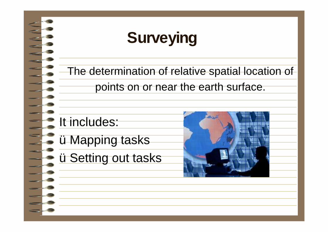
The determination of relative spatial location of points on or near the earth surface.
It includes:üMapping tasks üSetting out tasks
Surveying
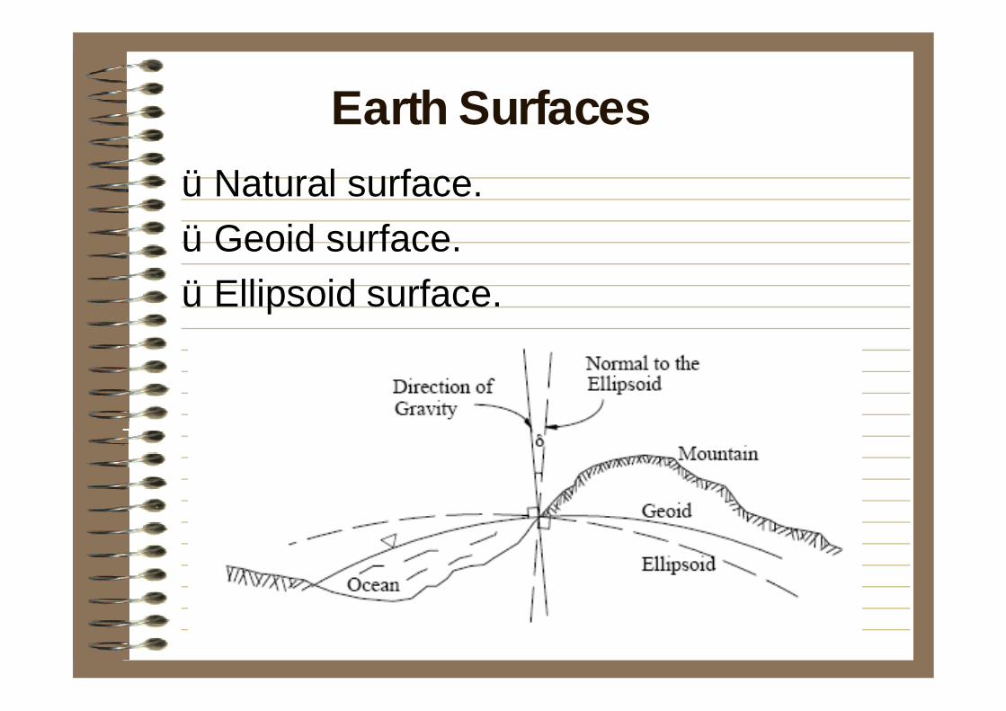
üNatural surface.üGeoid surface.üEllipsoid surface.
Earth Surfaces
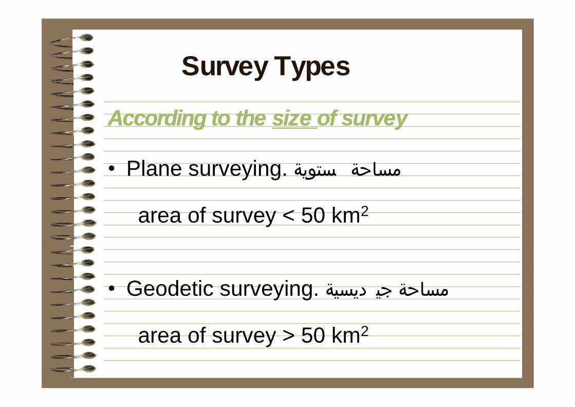
According to the According to the size size of surveyof survey
• Plane surveying. مساحة ستوية
area of survey < 50 km2
• Geodetic surveying. مساحة جي ديسية
area of survey > 50 km2
Survey Types
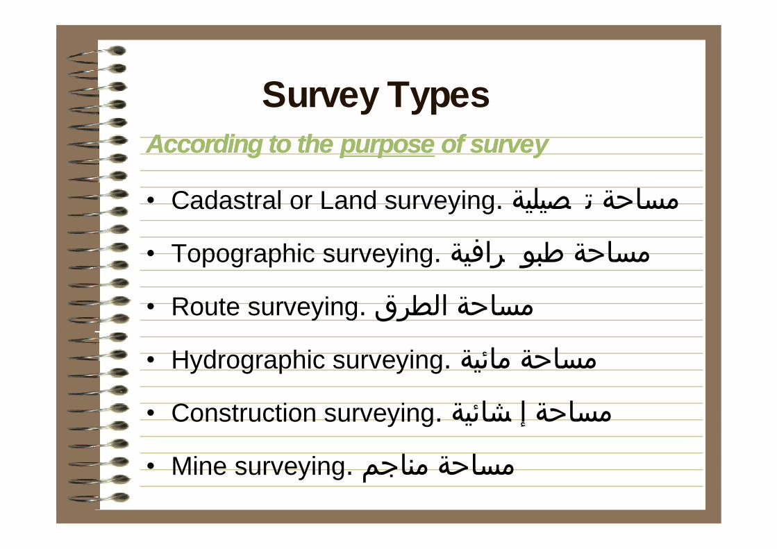
According to the According to the purposepurpose of surveyof survey
• Cadastral or Land surveying. مساحة ت صيلية
• Topographic surveying. مساحة طبو رافية
• Route surveying. مساحة الطرق
• Hydrographic surveying. مساحة مائية
• Construction surveying. مساحة إ شائية
• Mine surveying. مساحة مناجم
Survey Types

According to the According to the method method of surveyof survey
• Ground or Field surveying. مساحة أرضية
Ex: Leveling, total station surveys
• Remote surveying. مساحة ت ويرية
Arial photographs and satellite images
Survey Types
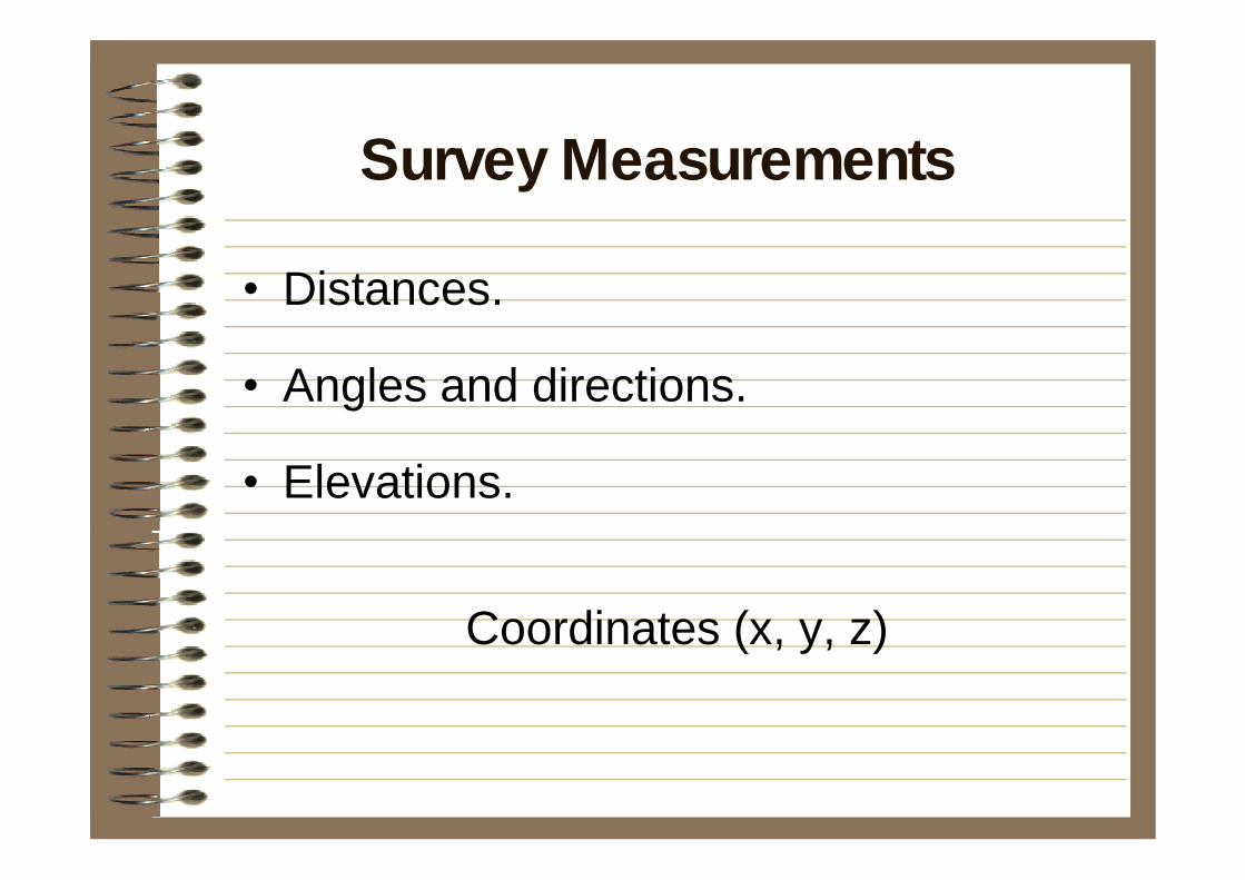
• Distances.
• Angles and directions.
• Elevations.
Coordinates (x, y, z)
Survey Measurements
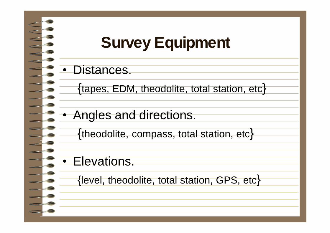
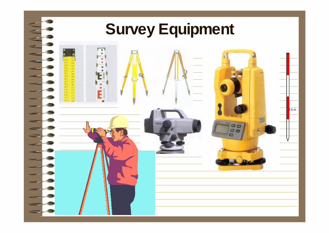
• Distances.{tapes, EDM, theodolite, total station, etc}
• Angles and directions.{theodolite, compass, total station, etc}
• Elevations.{level, theodolite, total station, GPS, etc}
Survey Equipment
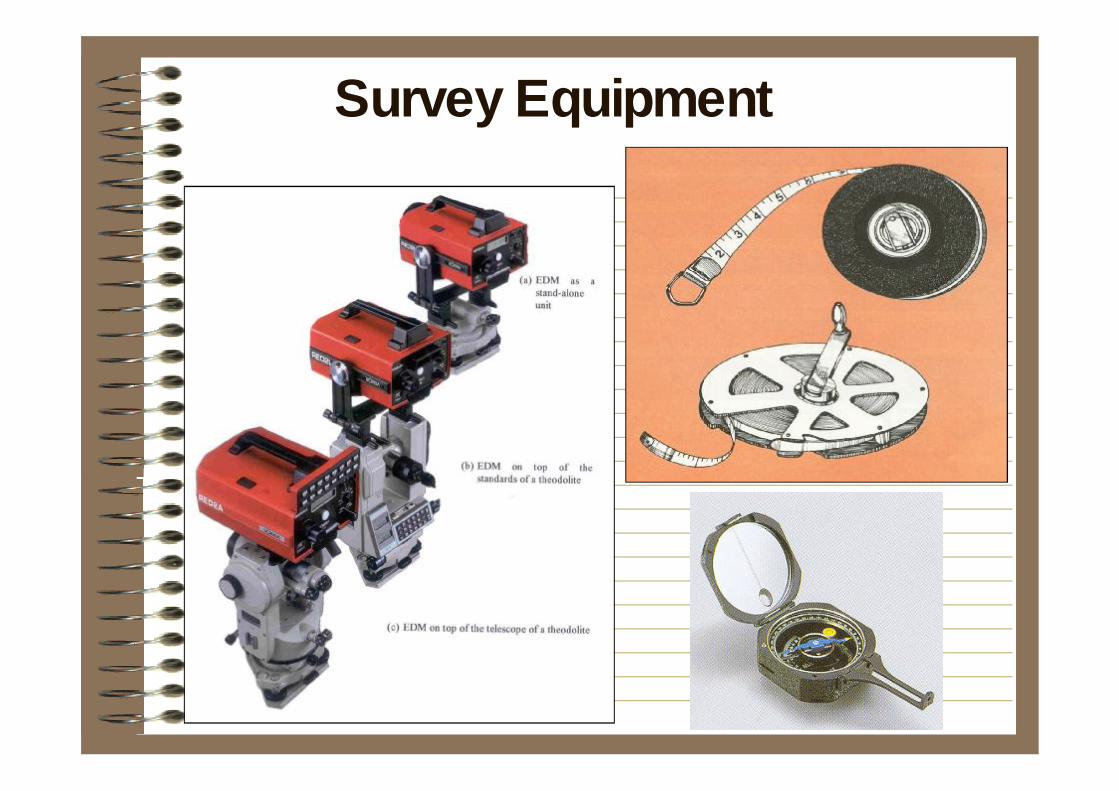
Survey Equipment
Survey Equipment
0.5 m
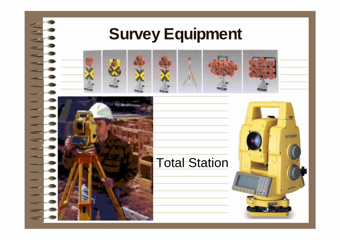
Total Station
Survey Equipment
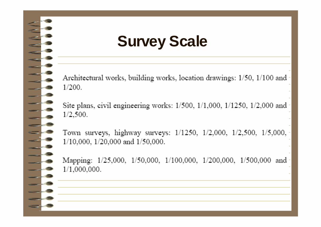
Survey Scale
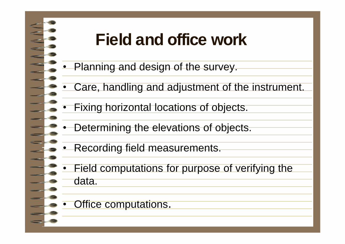
• Planning and design of the survey.
• Care, handling and adjustment of the instrument.
• Fixing horizontal locations of objects.
• Determining the elevations of objects.
• Recording field measurements.
• Field computations for purpose of verifying the data.
• Office computations.
Field and office work
• Establishing specifications for accuracies.
• Locations and analysis of all existing maps, photographs, etc.
• Preliminary examination of the site.
• Selection of equipment and surveying procedures appropriate for the task.
• Selection of computational procedures and methods for presenting the data.
Planning and Design of the Survey
• Maps. (planimetric and topographic)- geographic maps: large areas.- hydrographic maps: shorelines, bottom conditions, depths.- thematic maps: concentration of a specified subject.- photogrammetric maps and orthophotos
• Profiles.
• Cross sections.
• Geographic calculations.
• others.
Methods of presenting data
• Ground – field techniques.
• Aerial – photogrammetric techniques.
• Combination.
Mapping Survey Techniques
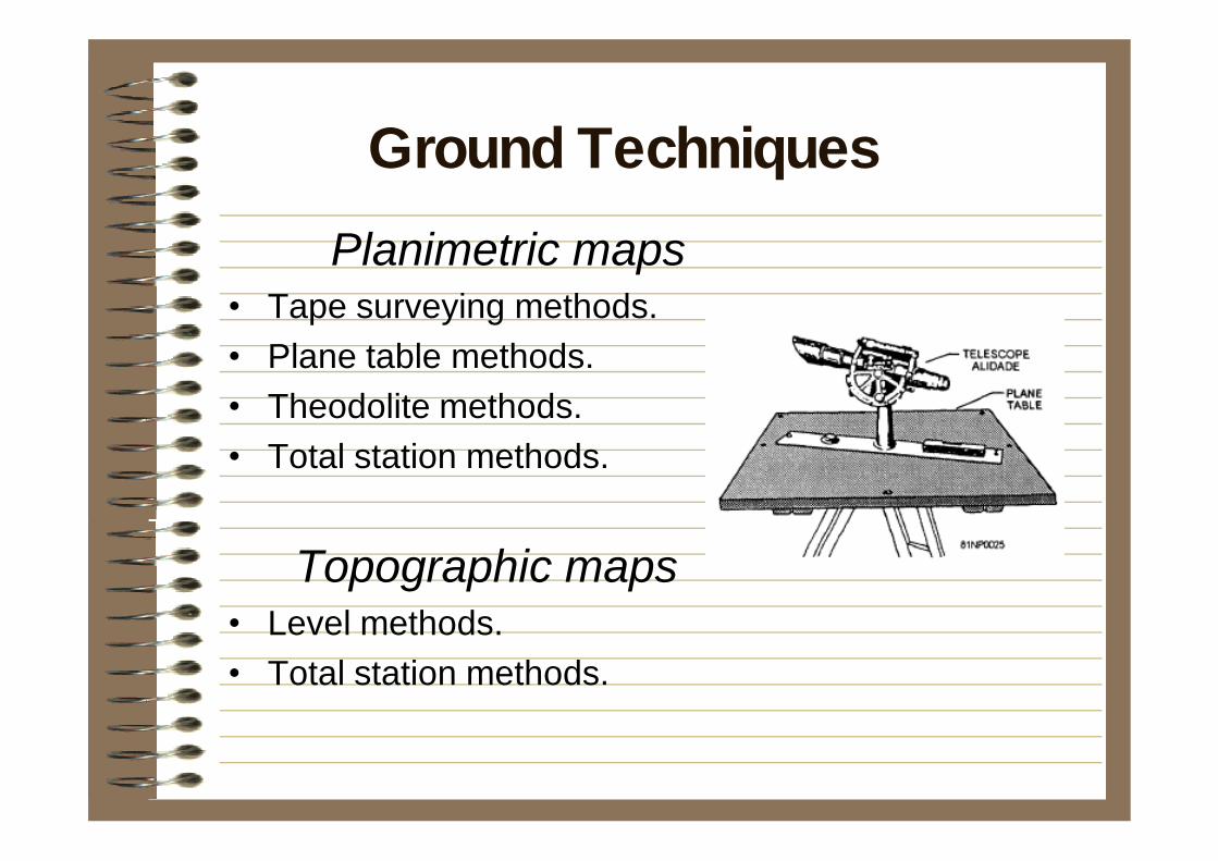
Planimetric maps• Tape surveying methods.• Plane table methods.• Theodolite methods.• Total station methods.
Topographic maps• Level methods.• Total station methods.
Ground Techniques
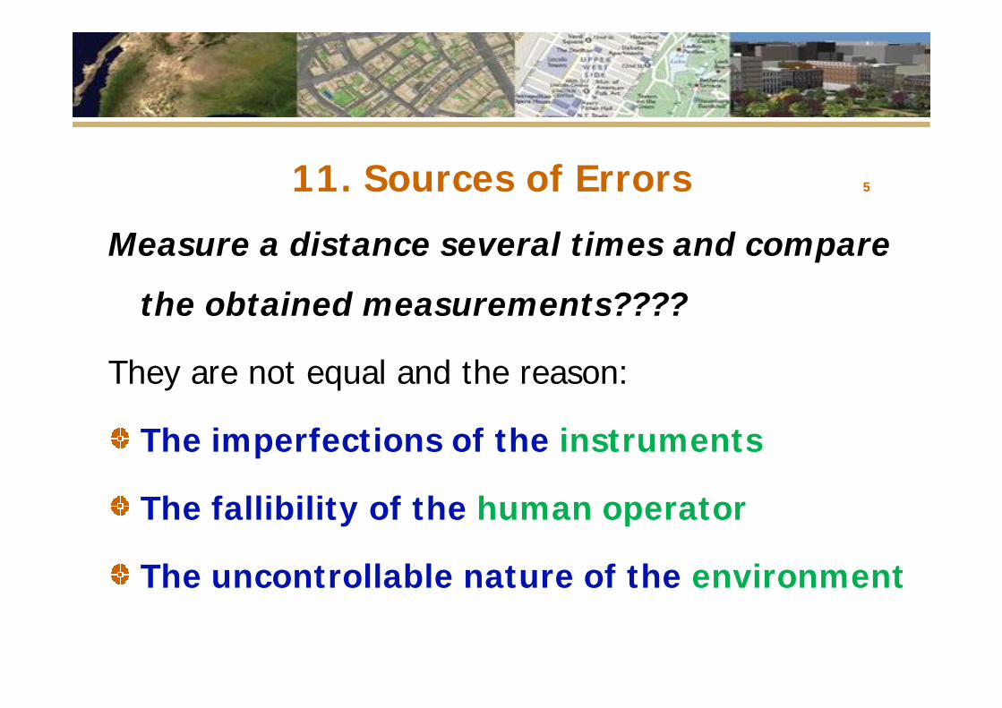
11. Sources of Errors 5
Measure a distance several times and compare
the obtained measurements????
They are not equal and the reason:
The imperfections of the instruments
The fallibility of the human operator
The uncontrollable nature of the environment
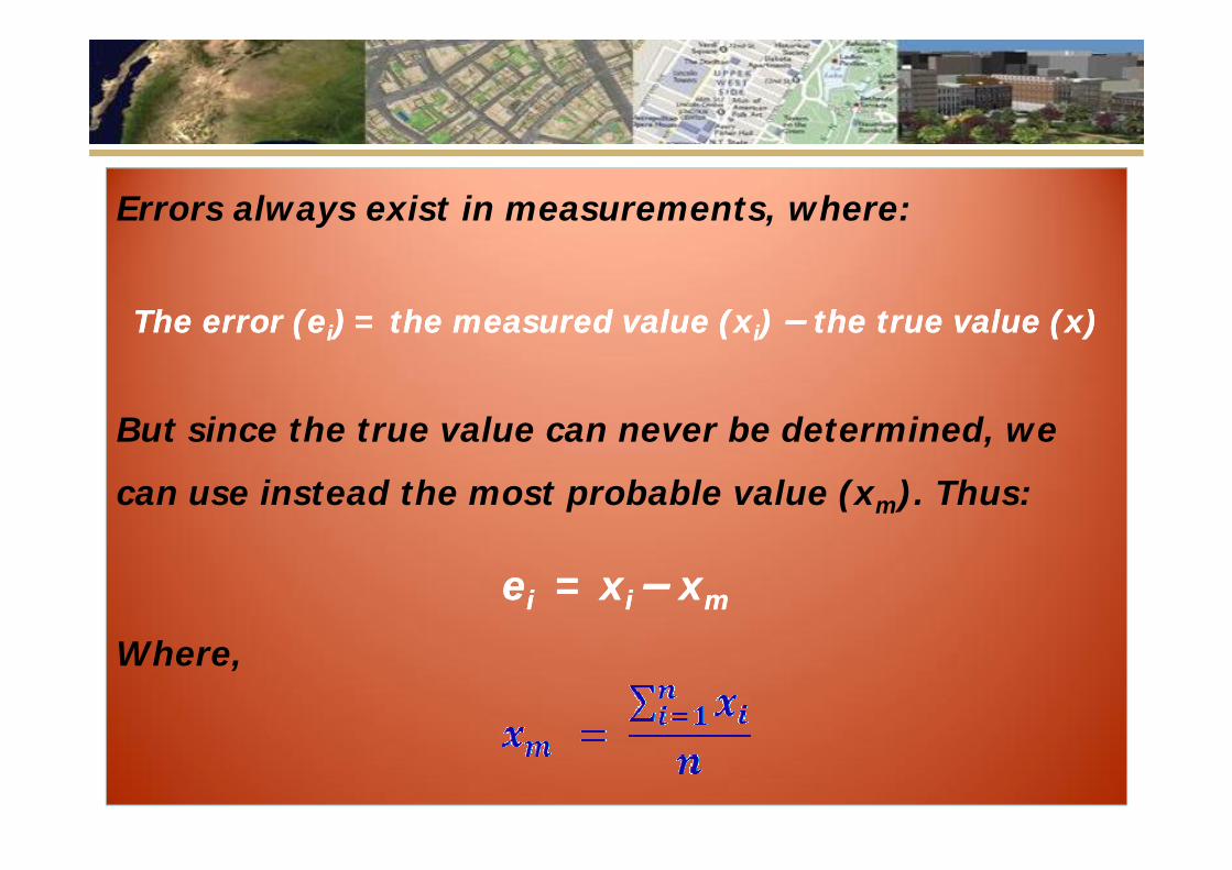
Errors always exist in measurements, where:
The error (The error (eeii)) = = the measured value (xthe measured value (xii) ) –– the true value (x)the true value (x)
But since the true value can never be determined, we
can use instead the most probable value (xm). Thus:
eeii = x= xi i –– xxmm
Where,
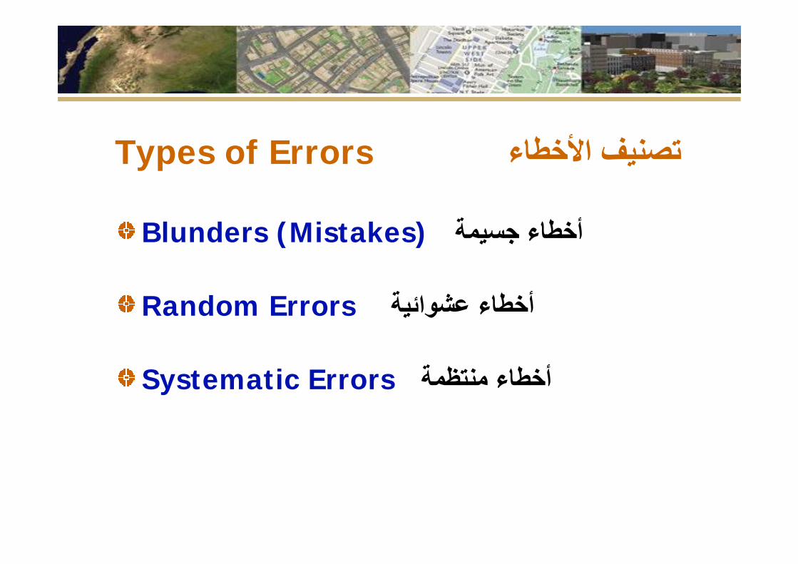
Types of Errors تصنیف األخطاء
Blunders (Mistakes) أخطاء جسیمة
Random Errors عشوائیة أخطاء
Systematic Errors منتظمة أخطاء
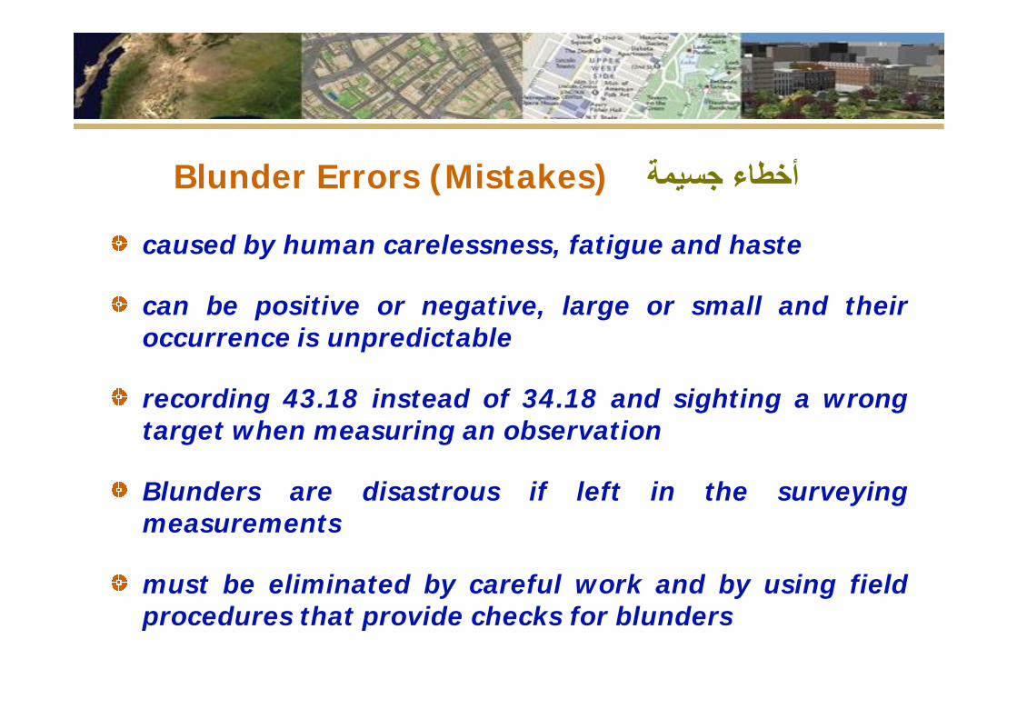
Blunder Errors (Mistakes) أخطاء جسیمة
caused by human carelessness, fatigue and haste
can be positive or negative, large or small and theiroccurrence is unpredictable
recording 43.18 instead of 34.18 and sighting a wrongtarget when measuring an observation
Blunders are disastrous if left in the surveyingmeasurements
must be eliminated by careful work and by using fieldprocedures that provide checks for blunders
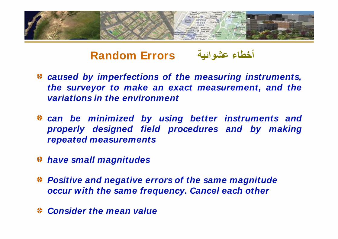
Random Errors أخطاء عشوائیة caused by imperfections of the measuring instruments,the surveyor to make an exact measurement, and thevariations in the environment
can be minimized by using better instruments andproperly designed field procedures and by makingrepeated measurements
have small magnitudes
Positive and negative errors of the same magnitude occur with the same frequency. Cancel each other
Consider the mean value
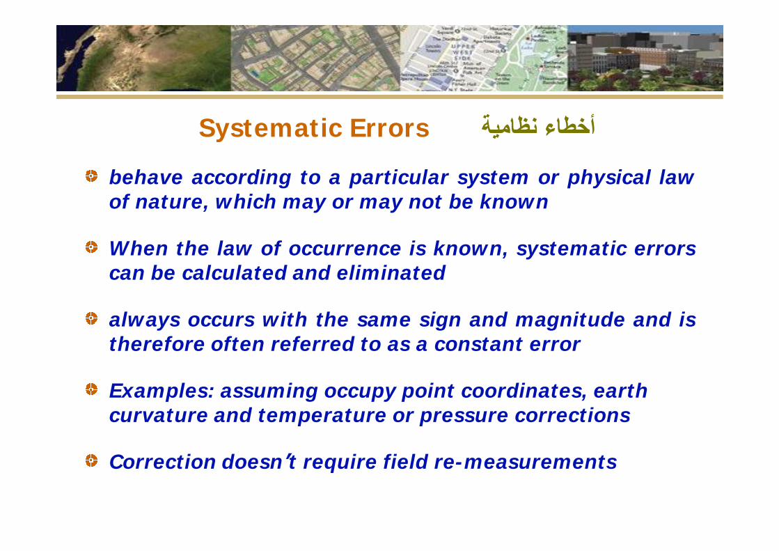
Systematic Errors نظامیة أخطاء behave according to a particular system or physical lawof nature, which may or may not be known
When the law of occurrence is known, systematic errorscan be calculated and eliminated
always occurs with the same sign and magnitude and istherefore often referred to as a constant error
Examples: assuming occupy point coordinates, earth curvature and temperature or pressure corrections
Correction doesn’t require field re-measurements
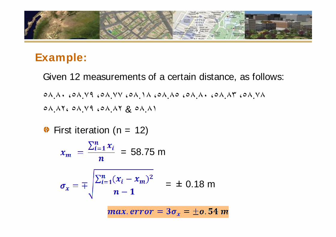
Example:
Given 12 measurements of a certain distance, as follows:
٥٨.٨٠ ،٥٨.٧٩ ،٥٨.٧٧ ،٥٨.١٨ ،٥٨.٨٥ ،٥٨.٨٠ ،٥٨.٨٣ ،٥٨.٧٨ ٥٨.٨٢، ٥٨.٧٩ ،٥٨.٨٢ & ٥٨.٨١
First iteration (n = 12)
= 58.75 m
= ± 0.18 m
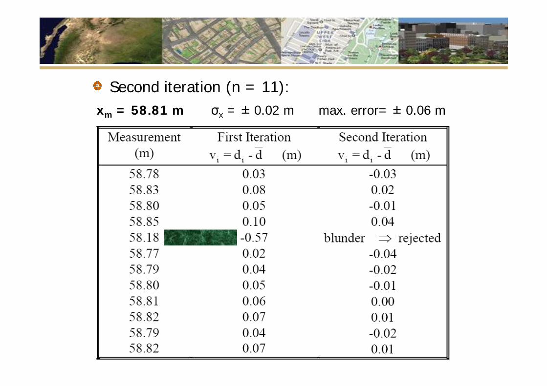
Second iteration (n = 11):xm = 58.81 m σx = ± 0.02 m max. error= ± 0.06 m
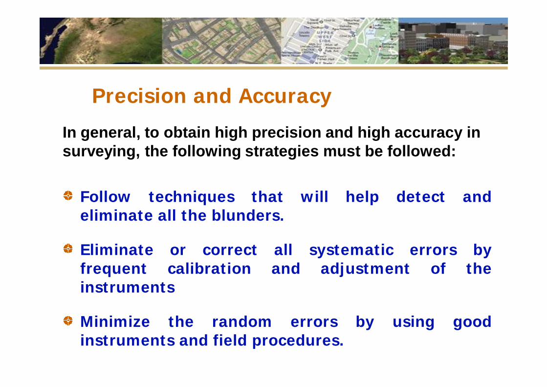
Precision and Accuracy
In general, to obtain high precision and high accuracy in surveying, the following strategies must be followed:
Follow techniques that will help detect andeliminate all the blunders.
Eliminate or correct all systematic errors byfrequent calibration and adjustment of theinstruments
Minimize the random errors by using goodinstruments and field procedures.
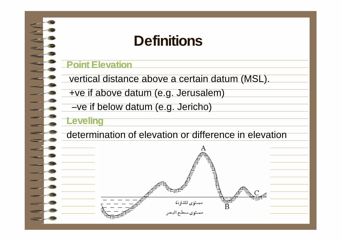
Point ElevationPoint Elevationvertical distance above a certain datum (MSL).+ve if above datum (e.g. Jerusalem)–ve if below datum (e.g. Jericho)
LevelingLevelingdetermination of elevation or difference in elevation
Definitions
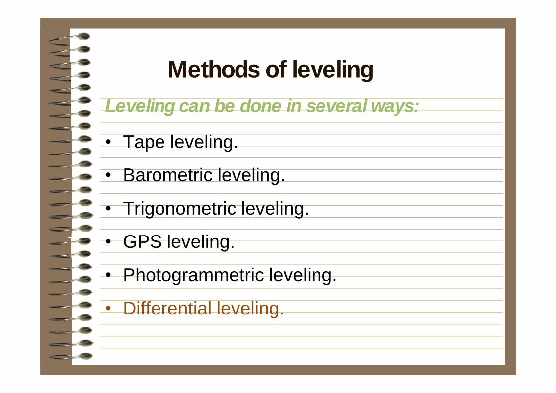
Leveling can be done in several ways:
• Tape leveling.
• Barometric leveling.
• Trigonometric leveling.
• GPS leveling.
• Photogrammetric leveling.
• Differential leveling.
Methods of leveling
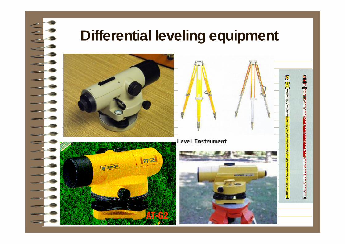
Differential leveling equipment
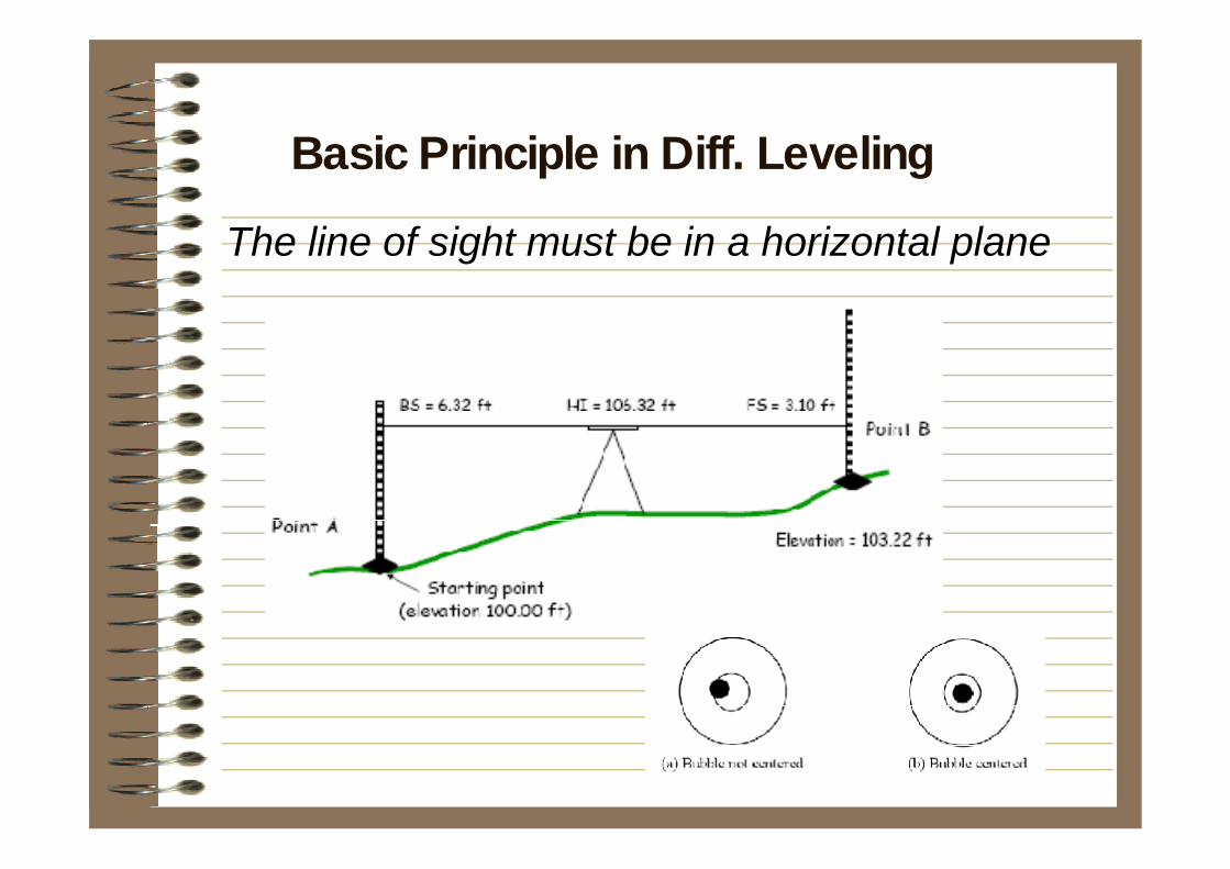
The line of sight must be in a horizontal plane
Basic Principle in Diff. Leveling
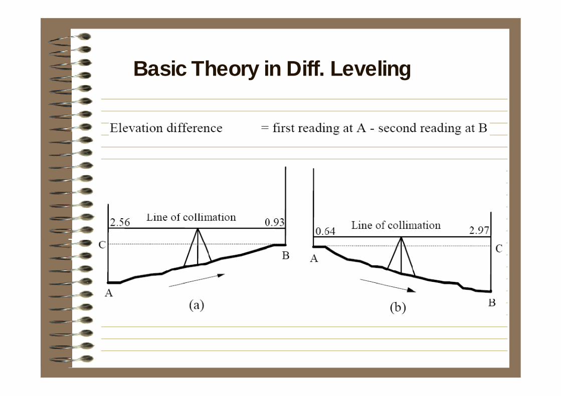
Rise Fall
Basic Theory in Diff. Leveling
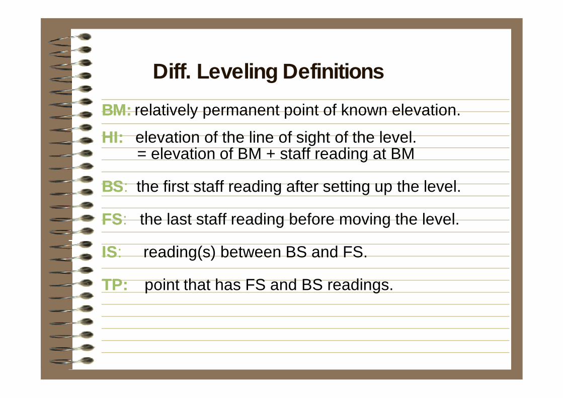
BM:BM: relatively permanent point of known elevation.HI:HI: elevation of the line of sight of the level.
= elevation of BM + staff reading at BM
BSBS: the first staff reading after setting up the level.
FSFS: the last staff reading before moving the level.
ISIS: reading(s) between BS and FS.
TP: TP: point that has FS and BS readings.
Diff. Leveling Definitions
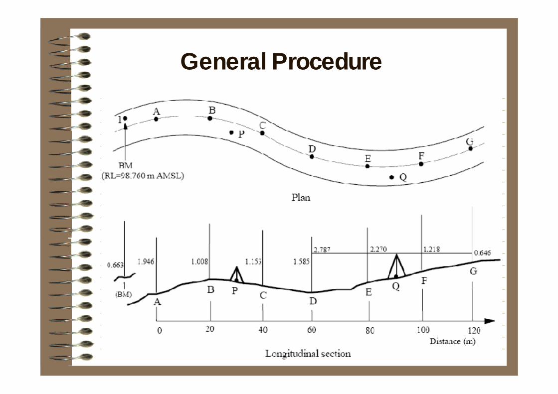
General Procedure
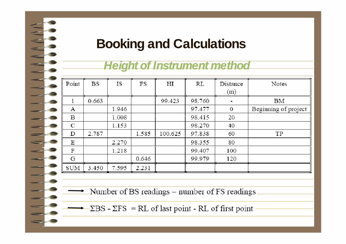
Height of Instrument methodHeight of Instrument method
Booking and Calculations
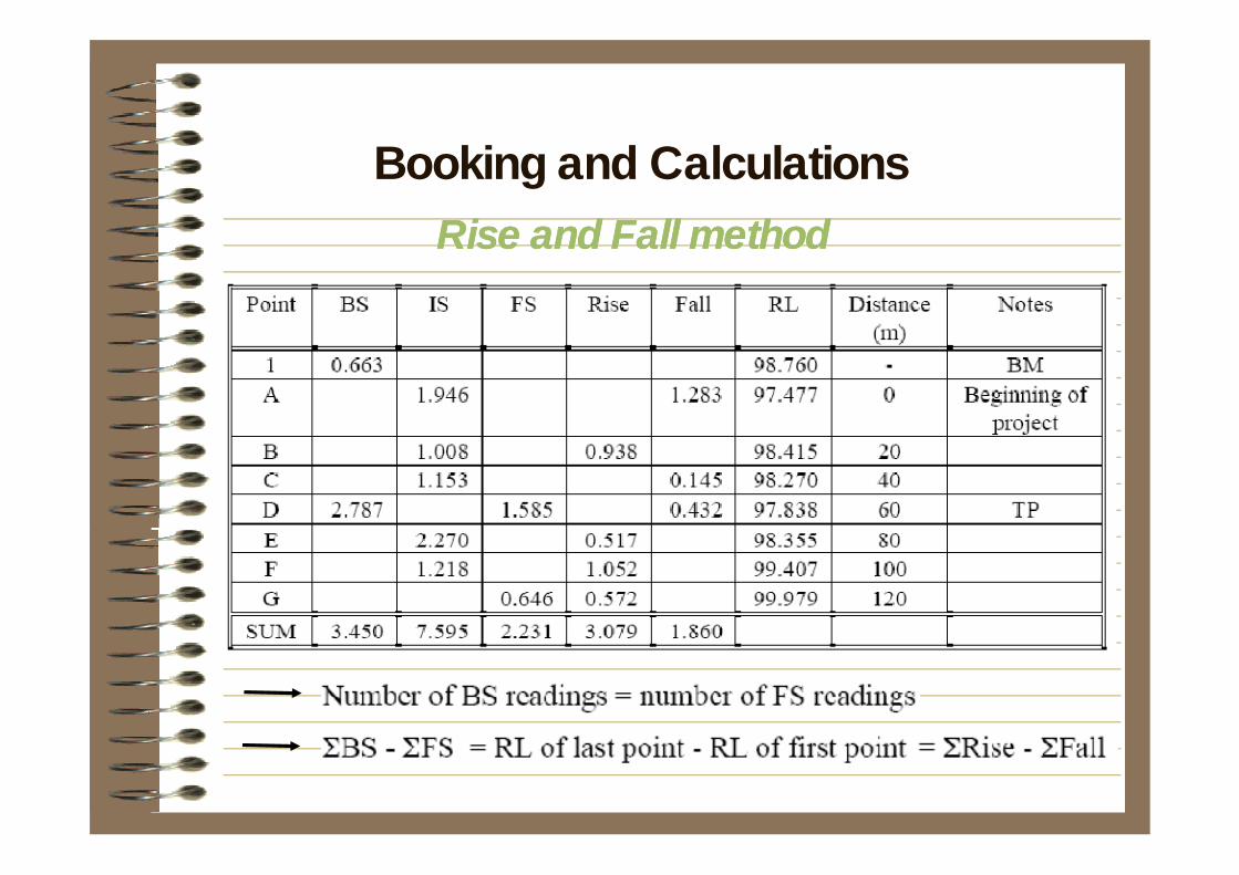
Rise and Fall methodRise and Fall methodBooking and Calculations
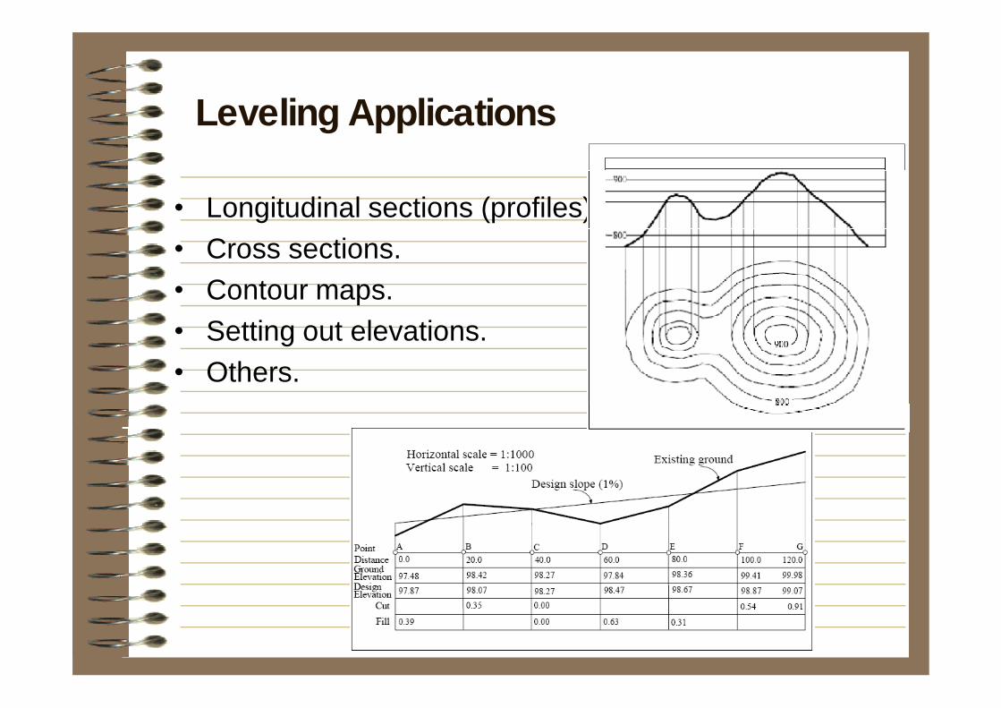
• Longitudinal sections (profiles).• Cross sections.• Contour maps.• Setting out elevations.• Others.
Leveling Applications
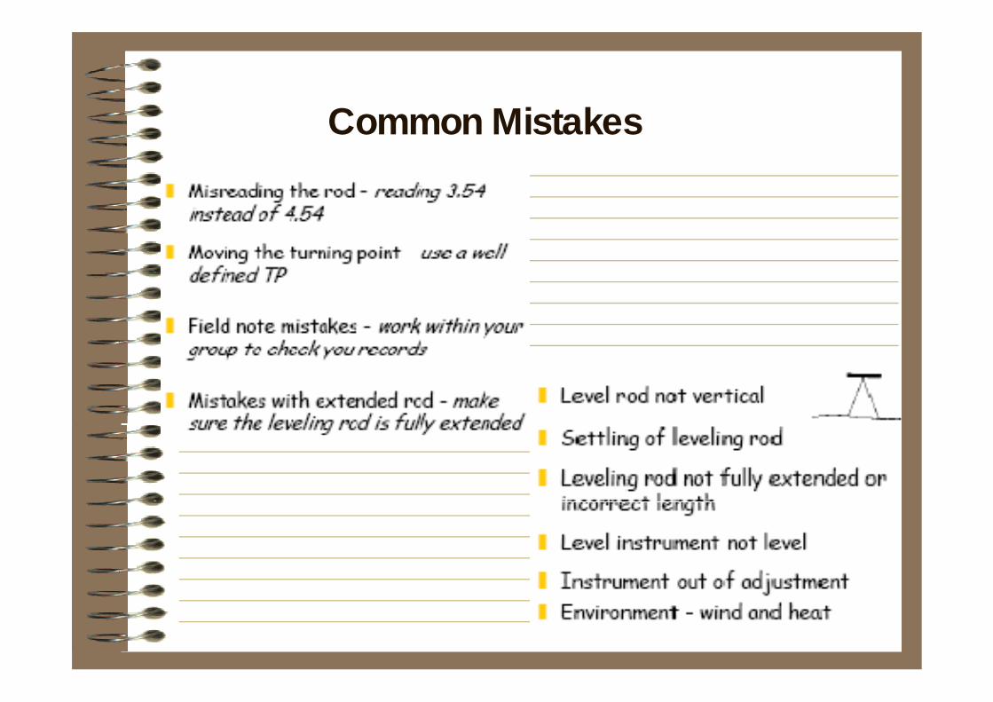
Common Mistakes
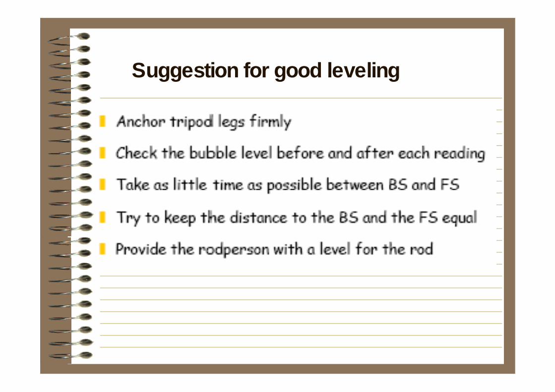
Suggestion for good leveling

Thank You !!!