lecture#2 p2 interpretation
TRANSCRIPT

8/6/2019 LECTURE#2 P2 Interpretation
http://slidepdf.com/reader/full/lecture2-p2-interpretation 1/42
1. INFORMATION EXTRACTION IN REMOTE SENSING
2. IMAGE INTERPRETATION
3. INTERPRETATION ELEMENTS/KEYS
Database Management Information System
& Applications of Remote sensing and GIS
Subject:
Dated:14/10/10Lecture#2-P2
Topics:
Presented
by
Rehana Jamal

8/6/2019 LECTURE#2 P2 Interpretation
http://slidepdf.com/reader/full/lecture2-p2-interpretation 2/42
1. INFORMATION EXTRACTION IN REMOTE SENSING
Remote sensing is the technology allowing to obtain information
of an object, area or phenomenon by means of data coming
from an apparatus, which is not in physical contact with this
object, area or phenomenon.
In practice, this means that the information of the Earth's surface
is obtained by sensors mounted on an airplane or a satellite.
Remote sensors record electromagnetic radiation emitted or
reflected from the Earth¶s surface. Different types of vegetation,
soils and other features emit and reflect energy differently.

8/6/2019 LECTURE#2 P2 Interpretation
http://slidepdf.com/reader/full/lecture2-p2-interpretation 3/42
*Energy Source or Illumination (A)
*Radiation and the Atmosphere (B
*Interaction with the Target (C)
*Recording of Energy by the Sensor (D)
*Transmission,Reception, and Processing (E)
*Interpretation and Analysis (F)
* Application (G
Process of
information
extractionfrom
remote
sensing

8/6/2019 LECTURE#2 P2 Interpretation
http://slidepdf.com/reader/full/lecture2-p2-interpretation 4/42
DIFFERENT TECHNIQUES OF INFORM ATION EXTR ACTION
Remote sensing:is a technique of
collecting
information from
a distance
Remotely sensed
data :
The data
collected from a
distance

8/6/2019 LECTURE#2 P2 Interpretation
http://slidepdf.com/reader/full/lecture2-p2-interpretation 5/42
³Remote Sensing (RS) is the science and
art of acquiring information (spectral,spatial, temporal) about material objects,
area, or phenomenon, without coming into
physical contact with the objects, or area,
or phenomenon under investigation³
Definitions of Remote Sensing
³Remote sensing is the science and art of
obtaining information about an object
,area or phenomenon through the
analysis of data acquired by a device that
is not in contact with the object, area or
phenomenon under investigation´
OR

8/6/2019 LECTURE#2 P2 Interpretation
http://slidepdf.com/reader/full/lecture2-p2-interpretation 6/42
Two main categories of Spatial data acquisition
Ground based methods
Remote sensing methods
Real world
Real world
Observation &
measurements
Spatial
database
Spatial
databaseObservation &
measurementsSensorsImage
data

8/6/2019 LECTURE#2 P2 Interpretation
http://slidepdf.com/reader/full/lecture2-p2-interpretation 7/42
Topic:2 Characteristics of Electromagnetic radiation
Electromagnetic Energy can be modelled in two ways
i. By waves ii. By Photons(Energy bearing particles)
Electromagnetic waves consist of a combination of oscillatingelectrical and magnetic fields, perpendicular to each other.

8/6/2019 LECTURE#2 P2 Interpretation
http://slidepdf.com/reader/full/lecture2-p2-interpretation 8/42
8
In respect to the type of Energy Resources:
Passive & Active remote Sensing

8/6/2019 LECTURE#2 P2 Interpretation
http://slidepdf.com/reader/full/lecture2-p2-interpretation 9/42
Stages in Remote Sensing
Source of energy
Interaction of EMR with the atmosphere
EMR interaction with Earth features
Detection of EMR by the remote sensing sensors
Data transmission and Processing
Image processing and analysis

8/6/2019 LECTURE#2 P2 Interpretation
http://slidepdf.com/reader/full/lecture2-p2-interpretation 10/42
ELECTRO
MAGNETIC
SPECTRUM
8/6/2019 LECTURE#2 P2 Interpretation
http://slidepdf.com/reader/full/lecture2-p2-interpretation 11/42
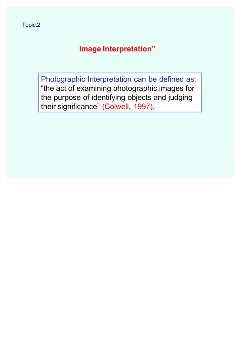
Image Interpretation´
Photographic Interpretation can be defined as:
³the act of examining photographic images for
the purpose of identifying objects and judging
their significance´ (Colwell, 1997).
Topic:2

8/6/2019 LECTURE#2 P2 Interpretation
http://slidepdf.com/reader/full/lecture2-p2-interpretation 12/42
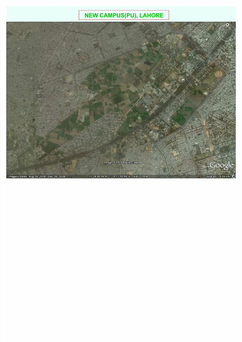
Image Interpretation (visual analysis)
KALMA CHOWK,LAHORE
8/6/2019 LECTURE#2 P2 Interpretation
http://slidepdf.com/reader/full/lecture2-p2-interpretation 13/42
NEW CAMPUS(PU), LAHORE

8/6/2019 LECTURE#2 P2 Interpretation
http://slidepdf.com/reader/full/lecture2-p2-interpretation 14/42
Can you interpret CIMR in PU, Lahore?
8/6/2019 LECTURE#2 P2 Interpretation
http://slidepdf.com/reader/full/lecture2-p2-interpretation 15/42
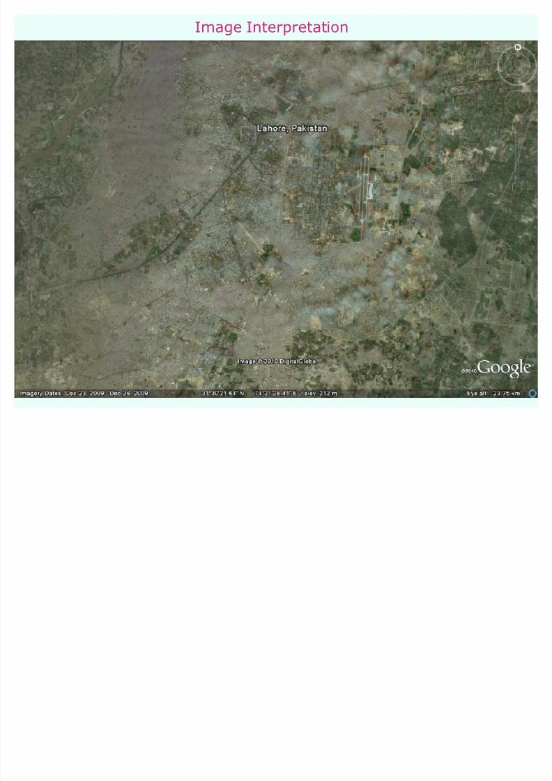
Image Interpretation

8/6/2019 LECTURE#2 P2 Interpretation
http://slidepdf.com/reader/full/lecture2-p2-interpretation 16/42
Two methods of information extraction from
remote sensing imagery
Information extraction based on visual analysis or
interpretation of data e.g. land use, soil map,updating of topographic maps from aerial photographs
Information extraction based on semi-automatic
processing by computer e.g. automatic generation of
DTM, image classification and calculation of
surface parameters

8/6/2019 LECTURE#2 P2 Interpretation
http://slidepdf.com/reader/full/lecture2-p2-interpretation 17/42
Image understanding and Interpretation
1st Method
Human Vision
Interpretation elements
Stereoscopic vision

8/6/2019 LECTURE#2 P2 Interpretation
http://slidepdf.com/reader/full/lecture2-p2-interpretation 18/42
Direct and spontaneous recognition----refers to the
ability of an interpreter to identify objects or
phenomena at a first glance.
By a reasoning process (logical inference) ---In thereasoning interpreter will use his professional
knowledge & experience. If reasoning cannot help
then field observation is required
Two situations of human vision:
i. Direct and spontaneous recognition
ii By a reasoning process(logical inference)
1- Human Vision

8/6/2019 LECTURE#2 P2 Interpretation
http://slidepdf.com/reader/full/lecture2-p2-interpretation 19/42
refers to the ability of an interpreter to identify
objects or phenomena at a first glance.
i- Direct and spontaneous recognition---

8/6/2019 LECTURE#2 P2 Interpretation
http://slidepdf.com/reader/full/lecture2-p2-interpretation 20/42
LAHORE

8/6/2019 LECTURE#2 P2 Interpretation
http://slidepdf.com/reader/full/lecture2-p2-interpretation 21/42
� In the reasoning, interpreter will use hisprofessional knowledge & experience.
� If reasoning cannot help then field observation is
required
ii- By a reasoning process (logical inference) ---

8/6/2019 LECTURE#2 P2 Interpretation
http://slidepdf.com/reader/full/lecture2-p2-interpretation 22/42
LAHORE

8/6/2019 LECTURE#2 P2 Interpretation
http://slidepdf.com/reader/full/lecture2-p2-interpretation 23/42
³A set of terms required to express and define characteristics
present in pictures (that are visualized in image data) are called
Interpretation elements.´ e.g.
Tone/Hue Texture
Shape
Size
Pattern
Site Association
2- Interpretation elements

8/6/2019 LECTURE#2 P2 Interpretation
http://slidepdf.com/reader/full/lecture2-p2-interpretation 24/42
Tone/Hue--- relative brightness of black and white image
Texture--- refers to the colour on the image as defined in the Intensity, Hue
,Saturation(HIS)system
Shape--- form characteristics many terrain objects visible in the image
Size--- relative or absolute
Pattern--- refers to the spatial arrangement objects e.g. concentric, radial---
irrigation and housing have different pattern
Site--- relates to the topographic or geographic location
Association--- refers to the fact that a combination of objects makes it
possible to infer about its meaning or functioning
2- Interpretation elements

8/6/2019 LECTURE#2 P2 Interpretation
http://slidepdf.com/reader/full/lecture2-p2-interpretation 25/42
Radar image interpretation

8/6/2019 LECTURE#2 P2 Interpretation
http://slidepdf.com/reader/full/lecture2-p2-interpretation 26/42
The impression of depth in real world can be realized by the pair
of images of the same object taken from different positions. Such a
pair of images, photographs or digital images that are separated and
observed at the same time by the two eyes give images on the
retinas in which objects at different positions in space are projectedon relative different positions. This is called Stereoscopic Vision
Stereo grams---Pairs of images that can be viewed
stereoscopically are called Stereo grams.
Convergence---Focusing both eyes to the object(point) of interest
is called convergence.
3- Stereoscopic Vision

8/6/2019 LECTURE#2 P2 Interpretation
http://slidepdf.com/reader/full/lecture2-p2-interpretation 27/42
Pocket and Mirror stereoscopes--- use a system of
lenses &mirrors to feed one image into one eye
uses: in vegetation, forest, soil, and geomorphology
Photogrammetric plotters---uses: in topographic &large
scale mapping activities
Anaglyph system---
Corresponding spectacles comprising one Red
one Green glass suited to view overlappingimages on a computer screen.
In digital photogrammetric system polarization is
also applied.
Different Methods of Stereoscopic Vision

8/6/2019 LECTURE#2 P2 Interpretation
http://slidepdf.com/reader/full/lecture2-p2-interpretation 28/42
Pocket stereoscope with original test image.Used by military to
examine stereoscopic pairs of vertical aerial photographs.
Pocket and Mirror stereoscope

8/6/2019 LECTURE#2 P2 Interpretation
http://slidepdf.com/reader/full/lecture2-p2-interpretation 29/42
Photogrammetric plotters

8/6/2019 LECTURE#2 P2 Interpretation
http://slidepdf.com/reader/full/lecture2-p2-interpretation 30/42
Anachrome optical diopter glasses.
Anachrome "compatible" color anaglyph method

8/6/2019 LECTURE#2 P2 Interpretation
http://slidepdf.com/reader/full/lecture2-p2-interpretation 31/42
Anaglyphs

8/6/2019 LECTURE#2 P2 Interpretation
http://slidepdf.com/reader/full/lecture2-p2-interpretation 32/42
Stereoscopic Vision and 3D Technology

8/6/2019 LECTURE#2 P2 Interpretation
http://slidepdf.com/reader/full/lecture2-p2-interpretation 33/42
Process of visual image interpretation
Selection of image data and its hard copy prints
Use of transparencies to overlay on hard copy print of
image for interpretation
Digitization of line patterns on transparencies having class
codes & land cover codes.
Validation: independent assessment of accuracy

8/6/2019 LECTURE#2 P2 Interpretation
http://slidepdf.com/reader/full/lecture2-p2-interpretation 34/42
Applications of visual image interpretation
Soil mapping with aerial photographs
Land cover mapping from multispectral data
Some general aspects i.e. Geometric aspects (size & width)
of objects)and Classes or categories of objects by using
hierarchical system

8/6/2019 LECTURE#2 P2 Interpretation
http://slidepdf.com/reader/full/lecture2-p2-interpretation 35/42
Land cover & Land use
Land cover ---refers to the type of features present
on the surface of the land,e.g., water, sand, potato
crop & asphalt.
Land use ---refers to the human activity or economic
function for a specific piece of land, e.g., urban use ,
industrial use, agricultural use or nature reserve.

8/6/2019 LECTURE#2 P2 Interpretation
http://slidepdf.com/reader/full/lecture2-p2-interpretation 36/42

8/6/2019 LECTURE#2 P2 Interpretation
http://slidepdf.com/reader/full/lecture2-p2-interpretation 37/42
The aim of the European Union¶s CORINE Land Cover project is to
provide up to date information on land cover at scale 1:100,000 for the
whole Europe.
The database includes 44 categories in accordance with a standard
European nomenclature, organised into five large groups:artificial surfaces, agricultural areas, forest and semi-natural areas,
wetlands, water bodies.
Classification was done by visual interpretation using Landsat
ThematicMapper satellite image maps with the help of topographicmaps as main ancillary material and field work. Following digitization the
land cover information is stored in topological structure as ARC/INFO
database.
Objective of CORINE

8/6/2019 LECTURE#2 P2 Interpretation
http://slidepdf.com/reader/full/lecture2-p2-interpretation 38/42
CORINE LAND COVER map sheet no.54.

8/6/2019 LECTURE#2 P2 Interpretation
http://slidepdf.com/reader/full/lecture2-p2-interpretation 39/42
Requirement of image based mapping process
Field observations can be used:
to gather local knowledge
to gather data about areas or features that are
hidden due to DEAD GROUND effect
validation(evaluation of final evaluation result) or accuracy is determined

8/6/2019 LECTURE#2 P2 Interpretation
http://slidepdf.com/reader/full/lecture2-p2-interpretation 40/42
DEAD GROUND EFFECT

8/6/2019 LECTURE#2 P2 Interpretation
http://slidepdf.com/reader/full/lecture2-p2-interpretation 41/42
Quality aspects
Professional experience and image interpretation
experience
Image data applied limit the phenomena
Quality of the interpretation guidelines

8/6/2019 LECTURE#2 P2 Interpretation
http://slidepdf.com/reader/full/lecture2-p2-interpretation 42/42
References:
�www.google.com
�³Principles of Remote sensing´
by Lucas L.E. Janssen
�http://fish.fomi.hu/angolfish/adathaz/
termekek/CORINE/corine.htm