lecture 03 introduction to global positioning systems · introduction to global positioning...
TRANSCRIPT

Introduction to Global Positioning Systems. Fall Semester 2015. Raj Khosla Page 1 9/1/2015
Lecture 03
Introduction to Global Positioning Systems Introduction to Global Positioning Systems:
From time immemorial humans have been trying to locate their position and find their ways on the planet earth. Some used drawings, some used landmarks. However such positioning system was good only under normal weather conditions. During snow or heavy rainfall, markings on ground would be buried and invisible. Moreover, when humans started exploring oceans and attempting to fly, such methods were of little use for navigation on water and air-surfaces.
Humans started using astronomical aspects such as stars to locate where they are. Although celestial navigation can tell you where you are within more or less 1-mile radius, such navigation system was useful only during nights and only on clear nights.
Modern humans with the invention of electronic gadgets have been trying several new mechanisms of navigation on planet earth. The most recent and the most advanced positioning system available today is the global positioning system.
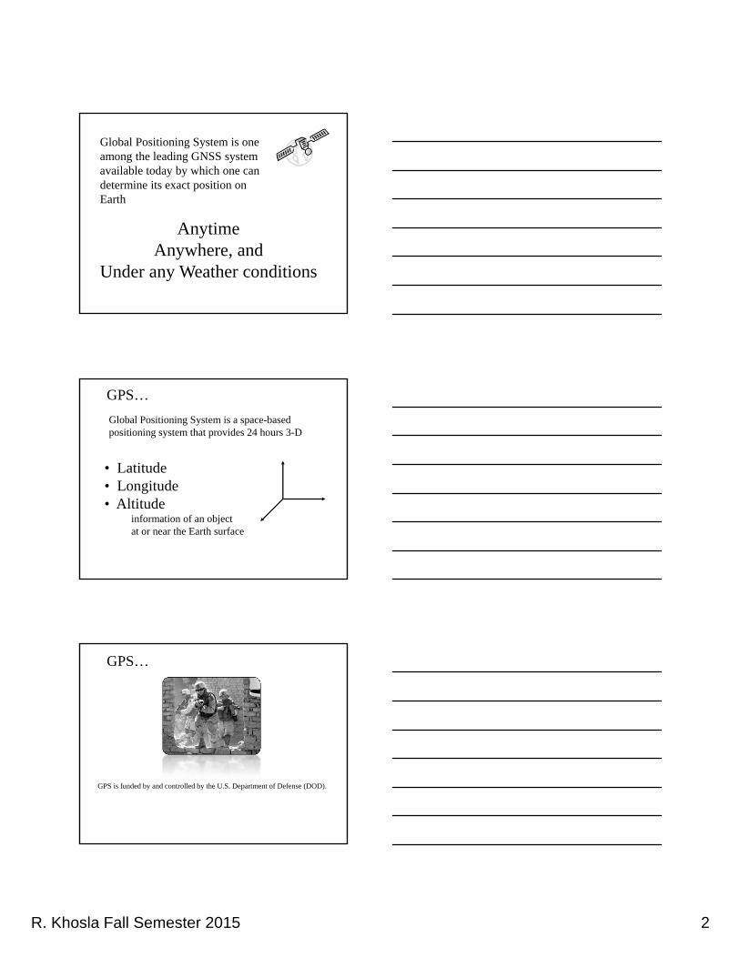
Global Positioning System is one among many GNSS systems (Global Navigation Satellite System) available today by which one can determine its exact position on earth, anytime, anywhere and under any weather conditions. It is a space-based radio positioning system that provides 24 hours 3-D (three Dimensional: Latitude, Longitude, Altitude) information of an object on or near the surface of the Earth.
GPS is funded by and controlled by the U.S. Department of Defense (DOD).
Although there are thousands of civil users of GPS world-wide, the system was designed for and is operated by the U.S. Military.
It all started back in October of 1940. National Defense Research Council, Washington D.C. suggested to develop a navigation system that combines radio signals with the new technology of accurate time interval measurements. Soon after, MIT’s Radiation Lab. develops LORAN ~ LOng RAnge Navigation system the first ever land-based all-weather navigation system. It was deployed along the N. Atlantic, used during the WW II to guide allied convoys. The system had a 600 miles range.
Beside LORAN other ground based radio-navigation systems are: Omega,
VOR/DME, (Very High Frequency Omni-directional Ranging/Distance Measuring Equipment) and ILS (Instrument Landing System).
In 1957: Soviet Union launched world’s first satellite Sputnik-I and demonstrated
that ground position can be determined if the orbital parameters of the satellite are known.

Introduction to Global Positioning Systems. Fall Semester 2015. Raj Khosla Page 2 9/1/2015
Soon after the launch of Russian satellite, in 1958, U.S. puts first American
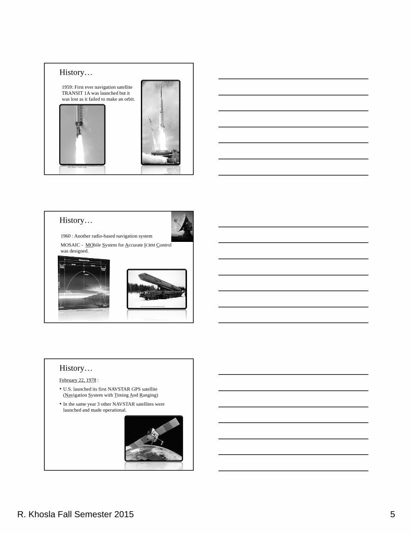
satellite, Explorer-I, into space. In 1959, first ever navigation satellite TRANSIT 1A was launched but it was lost as it failed to make an orbit. In 1960, another radio-based navigation system MOSAIC ~ MObile System for Accurate Icbm Control was designed. Since then a large number of satellites have been launched by U.S., erstwhile U.S.S.R., and several other countries to improve their navigational capabilities.
Some of the landmark launch/progress/events in the history of GPS are: February 22, 1978: U.S. launched its first NAVSTAR (Navigation System with Timing And Ranging) GPS satellite. In the same year 3 other NAVSTAR satellites were launched and made operational. Four years later on Oct. 12, 1982: U.S.S.R launched their first GPS satellite GLONASS 1. (Global’naya Navigatsionaya Sputnikovaya Sistema). GLONASS can be considered as Russian equivalent of GPS. By March 28, 1996: U.S. launched 38 NAVSTAR GPS satellites. Except a few that were lost, all others were operational. They have a life span of seven years, currently 24 GPS satellites are in the orbit. TRANSIT, NAVSTAR, and GLONASS are the space based navigation systems. Global navigation Satellite System (GNSS): Applications: There are innumerable applications of GPS. Three broad categories are: Agricultural Uses, Military uses, and the Civil/Recreational uses. There are several uses of GPS in agriculture. Mapping of new areas or improving the existing soil survey maps. Soil fertility maps, Yield monitor maps, and Identifying hazardous waste disposal sites. The application of GPS in agriculture that has received most attention is the site-specific management or precision farming. Military Uses: GPS provides the exact location of objects carrying the receiver. It could be soldiers, tanks, vehicles, helicopters, aircrafts, etc. In Gulf war, soldiers were able to go to places at night and during sandstorms, when even the troops who lived there couldn’t. Use of GPS in everyday life is limited only by our imagination, new ways to use its capabilities are continually being found. Construction of English channel: British and French crews started digging at opposite ends. They relied on GPS receivers to check their positions along the way to make sure they meet exactly in the middle.
Introduction to Global Positioning Systems. Fall Semester 2015. Raj Khosla Page 3 9/1/2015
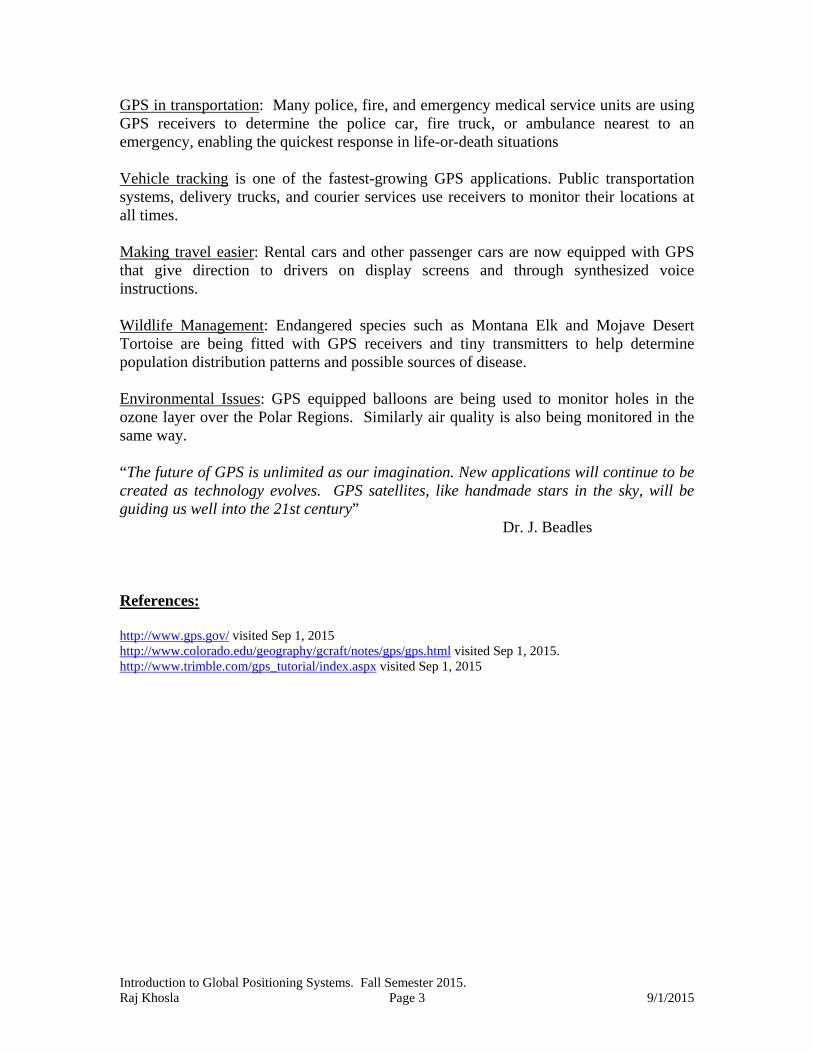
GPS in transportation: Many police, fire, and emergency medical service units are using GPS receivers to determine the police car, fire truck, or ambulance nearest to an emergency, enabling the quickest response in life-or-death situations Vehicle tracking is one of the fastest-growing GPS applications. Public transportation systems, delivery trucks, and courier services use receivers to monitor their locations at all times. Making travel easier: Rental cars and other passenger cars are now equipped with GPS that give direction to drivers on display screens and through synthesized voice instructions. Wildlife Management: Endangered species such as Montana Elk and Mojave Desert Tortoise are being fitted with GPS receivers and tiny transmitters to help determine population distribution patterns and possible sources of disease. Environmental Issues: GPS equipped balloons are being used to monitor holes in the ozone layer over the Polar Regions. Similarly air quality is also being monitored in the same way. “The future of GPS is unlimited as our imagination. New applications will continue to be created as technology evolves. GPS satellites, like handmade stars in the sky, will be guiding us well into the 21st century”
Dr. J. Beadles References: http://www.gps.gov/ visited Sep 1, 2015 http://www.colorado.edu/geography/gcraft/notes/gps/gps.html visited Sep 1, 2015. http://www.trimble.com/gps_tutorial/index.aspx visited Sep 1, 2015

R. Khosla Fall Semester 2015 1
Intro to GPS&
Applications of GPS
http://www.pocketgpsworld.com/reviews/howgpsworks/gps1.jpg
Picture courtesy of US Department of Defense.
Since earliest times we’ve been trying to figure out where we are and where we’re going.
Using stars for Navigation
http://www.stardome.org.nz/uploads///Celestial-Navigation.jpg
Source: http://nmp.nasa.gov/st6/TECHNOLOGY/star_camera.html
R. Khosla Fall Semester 2015 2
Global Positioning System is one among the leading GNSS system available today by which one can determine its exact position on Earth
AnytimeAnywhere, and
Under any Weather conditions
GPS…
Global Positioning System is a space-based positioning system that provides 24 hours 3-D
• Latitude• Longitude• Altitude
information of an object at or near the Earth surface
GPS is funded by and controlled by the U.S. Department of Defense (DOD).
GPS…

R. Khosla Fall Semester 2015 3
• Although there are thousands of civil users of GPS world-wide, the system was designed for and is operated by the U.S. Military.
http://en.wikipedia.org/wiki/File:KyotoTaxiRide.jpg
Source: http://www.autosavant.com/2008/07/08/2008-suzuki-xl7-limited-navigation-review/
GPS…
What Is GPS…GPS is a Space-Based Navigation System designed by the U.S. Military to provide:
• Autonomous Geo-Positioning
• 10-20 Meter Accuracy (without any correctional service)
• Worldwide Coverage
• Availability 24 hours per day
• Military Security
• Low End-User Cost
• Receivers to each soldier
• Installation on every vehicle
History of GPS
It started in Oct 1940.
National Defense Research Council, Washington D.C. suggested to develop a navigation system that combines radio signals with the new technology of accurate time interval measurements
Author: NoClip

R. Khosla Fall Semester 2015 4
• MIT’s Radiation Lab. develops LORAN LOng RAnge Navigation system
• The first ever land-based all-weather navigation system.
• It was deployed along the North Atlantic, used during the WW II to guide allied convoys.
• The system had 600 miles range.
History of GPS…
1957 : Soviet Union launched the first satellite, Sputnik-I and demonstrated that ground position can be determined if the orbital parameters are known.
Source: www.mctdirect.com/sitetour/krtgraphics.htm
Source: www.gizmag.com
Oct 4, 2007, celebrated the 50th anniversary
History…
1958: U.S. puts first American satellite, Explorer-I, into space
Source: http://claudelafleur.qc.ca/images/explorer_1.gif
History…
R. Khosla Fall Semester 2015 5
1959: First ever navigation satellite TRANSIT 1A was launched but it was lost as it failed to make an orbit.
Source: http://commons.wikimedia.org/wiki/Image:Thor-Able_II_Transit_1A.jpgSource: http://media.defenseindustrydaily.com/images/SPAC_2006-03-24_Falcon-1_Closeup_lg.jpg
History…
1960 : Another radio-based navigation system
MOSAIC - MObile System for Accurate ICBM Control was designed.
Source: http://1.bp.blogspot.com/_JGRd43QLug8/RkER-A4pB5I/AAAAAAAAA9E/4shLown0884/s1600/ballistic%2Bmissile%2Btrajectory.jpg
http://www.new-factoria.ru/missile/wobb/topol_m/pu.jpg
Source: http://www.met.rdg.ac.uk/radar/camra.html
History…
February 22, 1978 :
• U.S. launched its first NAVSTAR GPS satellite (Navigation System with Timing And Ranging)
• In the same year 3 other NAVSTAR satellites were launched and made operational.
http://commons.wikimedia.org/wiki/Image:Navstar-2F.jpg
History…

R. Khosla Fall Semester 2015 6
NAVSTAR GPS Satellites
• Rockwell International (GE Astro Space)
• Total 24 satellites
• 10,900 Nautical Mile orbit
• 55o Orbital Plane
• 12 Hour Orbital Period
• Life-span – 7.5 years
• Weight: 1900 lbs
• 31 in operation, 3 spares
http://space.skyrocket.de/doc_sdat/navstar-2rm.htm
Nautical ~ related to sea, ships, and sailingNautical miles is an international unit for sea and
air-navigation equal to 1 minute of arc of the great circle of earth
1 NM = 6076.12 feet= 1.1508 miles= 1852 meter
10,900 NM = 12,543 miles.
Nautical Miles…
History…
Four years later on OCT.12, 1982: U.S.S.Rlaunched their first GPS satelliteGLONASS I (GLONASS is Russianequivalent of GPS system)
It is very similar to GPS: there are 27 satellites in the full constellation
Each satellite transmits various data on two L-band carriers
There is one navigation signal that has been authorized for civilian use, and further navigation signals that have been reserved solely for Russian military use
There is a ground segment that monitors and control the satellites
Users passively receive its signals and are able to navigate with accuracy's of few tens of meters or better.
http://www.glonass-ianc.rsa.ru/pls/htmldb/f?p=202:20:14637162736231801312::NO:::
Source:http://www.gpsdaily.com/reports/Russian_Glonass_GPS_Satellite_System_To_Be_Fully_Operational_In_2010_999.html

R. Khosla Fall Semester 2015 7
History…
The current status of GLONASS system, as of Sep 2, 2014
http://glonass-iac.ru/en/GLONASS/
Sep 2, 2014
History…
What is Galileo?
Galileo will be Europe’s own global navigation satellite system, a highly accurate, guaranteed global positioning service under civilian control.
It will be inter-operable with GPS and GLONASS, the two other global satellite navigation systems.
A user will be able to take a position with the same receiver from any of the satellites in any combination.
By offering dual frequencies as standard, however, Galileo will deliver real-time positioning accuracy down to the metre range, which is unprecedented for a publicly available system.
The project architects plan deployment in 2006-7, becoming operational in 2008 at a yearly cost of €220m (provided positioning in 2013. Satellite #7 and #8 were launched in March 2015 Source: Wikipedia)
http://www.esa.int/esaNA/GGGMX650NDC_galileo_0.html
European Space Agency
Other GPS systems
http://en.wikipedia.org/wiki/Global_Positioning_System
+ GAGAN: Satellite positioning system

R. Khosla Fall Semester 2015 8
History…
• By March 28, 1996: U.S. launched 38NAVSTAR GPS satellites.
• Except a few that were lost, all others were operational.
• They have a lifespan of seven years.
• Currently 31 GPS satellites are in orbit.
Radio Navigation system
I. Ground based:
Omega: 6 nations, total 8 stations (Norway, USA, Japan, Australia, Argentina, and France
Loran: Long Range Navigation System (LORAN-C) ~ Coast Guard Beacon
VOR/DME: Very High Frequency Omni-directional Ranging/Distance Measuring Equipment (Air navigation)
ILS: Instrument Landing System ~ Airports (Expensive$$)
Radio Navigation system
II. Space based:
Transit, Timation, 621b: All merged to GPS Phase I
GPS: Global Positioning System
Source: http://code8100.nrl.navy.mil/about/NCST/index.htm

R. Khosla Fall Semester 2015 9
Space-Based
System Freq. W/L Error 2D Coverage
Transit 150-400 MHz 2M-73Cm 460 M Global
GPS 1575.42 MHz 19 Cm <100 M Global
Radio Navigation system
Ground-Based
System Freq. W/L Error 2D Coverage
Omega 10-13 KHz 26 Km 3-6 Km Global
Loran 100 KHz 2.5 Km 460 M ~ 10%
VOR/DME 108-118 MHz ~2.5M 60-180M N.A.Tot
ILS 330 MHz ~1M 5-10M Limited
Radio Navigation system
1000km
100km
10km
1km
100m
10m
1m
100mm
10mm
300Hz
3Hz
30Hz
300KHz
3MHz
30MHz
300MHz
3GHz
30GHz
Low-Freq High-Freq VHF UHF MWELF VLF
OMEGA10 – 13 Hz
Loran100 HHz
VOR108 - 118 MHz Transit
150 - 400 MHz
ILS330 MHz
GPS
L2 L11.2 1.5 GHz
Thumb Rule:
Smaller the wave-length, higher the frequency, higher the precision of the radio navigation system.
Radio Navigation system

R. Khosla Fall Semester 2015 10
Applications of GPS
• Agricultural uses
• Military uses
• Civil Daily uses
Mapping of new areas, or improving the existing soil survey maps.• Soil fertility maps
• Yield monitor maps
• Identifying hazardous waste disposal sites
However, the one use of GPS that has received most attention in agriculture is Site – specific management or Precision Farming.
http://www.ipm.iastate.edu/ipm/icm/1999/5-5-1999/popcropyield.gif
Applications…
Military Uses:
• GPS provides the exact location of objects carrying the receiver.
• It could be soldiers, tanks, vehicles, helicopters, aircrafts, etc.
Applications…

R. Khosla Fall Semester 2015 11
Daily use of GPS :
Use of GPS in everyday life is limited only by our imagination, new ways to use its capabilities are continually being found.
Applications…
Construction of English channel:
• British and French crews started digging at opposite ends.
• They relied on GPS receivers to check their positions along the way to make sure they meet exactly in the middle.
www.nealrayner.com/maps/
http://jamesfrey.com/pix_trips/europe98/chunnelmap.jpg
Applications…
GPS for saving lives :
Many police, fire, and emergency medical service units areusing GPS receivers to determine the police car, fire truck,or ambulance nearest to an emergency, enabling the quickestresponse in a life-or-death situations.
Applications…
http://www.fdnyems.com/gps/

R. Khosla Fall Semester 2015 12
GPS in transportation :
• Vehicle tracking is one of the fastest growing GPS application.
• Public transportation systems, delivery trucks and courier services use receivers to monitor their location at all times.
Applications…
Making travel easier :
Car rental companies are using GPS equipped vehicles that give direction to drivers on display screens and through synthesized voice instructions.
http://www.avis.com/AvisWeb/images/AU/en/deals/juxtaposedGPSandCAR.jpg
Applications…
Applications…Chances of getting lost on the way to Disney World would become minimal
http://bp1.blogger.com/_WfjE3NSh440/RvnkH_5PmHI/AAAAAAAABZs/kUlM6nu33Ek/s1600-h/Lost+Couple.jpg

R. Khosla Fall Semester 2015 13
Wildlife Management :
Endangered species such as Montana Elk and Mojave DesertTortoise are being fitted with GPS receivers and tinytransmitters to help determine population distribution patternsand possible sources of disease.
http://www.telonics.com/literature/gpscollars/gpscollarsintro.html
Applications…
http://jandj-b-wildlifephotography.blogspot.com/2011/03/spring-time-of-transition.html
Environmental Issues :
• GPS equipped balloons are being used to monitor holes in the ozone layer over the polar regions.
• Similarly air quality is also being monitored in that way.
http://i.i.com.com/cnwk.1d/i/ne/p/2006/ozone_550x550.jpg
Applications…