late wisconsinan glacial history of northeastern … · late wisconsinan glacial history of...
TRANSCRIPT
Late Wisconsinan Glacial History of Northeastern Wisconsin and Western Upper Michigan
U.S. GEOLOGICAL SURVEY BULLETIN 1652 I

•
'•
'I
Late Wisconsinan Glacial History of Northeastern Wisconsin and Western Upper Michigan
By WARREN l. PETERSON
A history of four advances of late Wisconsinan glacial ice and of the proglacial Jakes ponded south of the ice fronts during the last two advances
U.S. GEOLOGICAL SURVEY BULLETIN 1652

DEPARTMENT OF THE INTERIOR
DONALD PAUL HODEL, Secretary
U.S. GEOLOGICAL SURVEY
Dallas L. Peck, Director
UNITED STATES GOVERNMENT PRINTING OFFICE: 1986
For sale by the Distribution Branch, U.S. Geological Survey, 604 South Pickett Street, Alexandria, VA 22304
Library of Congress Cataloging-in-Publication Data
Peterson, Warren lee, 1925-late Wisconsinan glacial history of northeastern Wisconsin
and western Upper Michigan. (U.S. Geological Survey bulletin ; 1652) Bibliography : p. 13 Supt. of Docs. no.: I 19.3:1568 1. Geology, Stratigraphic-Pleistocene. 2. Glacial epoch
Wisconsin. 3. Glacial epoch-Michigan-Upper Peninsula. I. Title. II. Series: Geological Survey bulletin ; 1652.
QE75.B9 no. 1568 557.3 s 85-600010 [QE697] [551.7'92'09775]
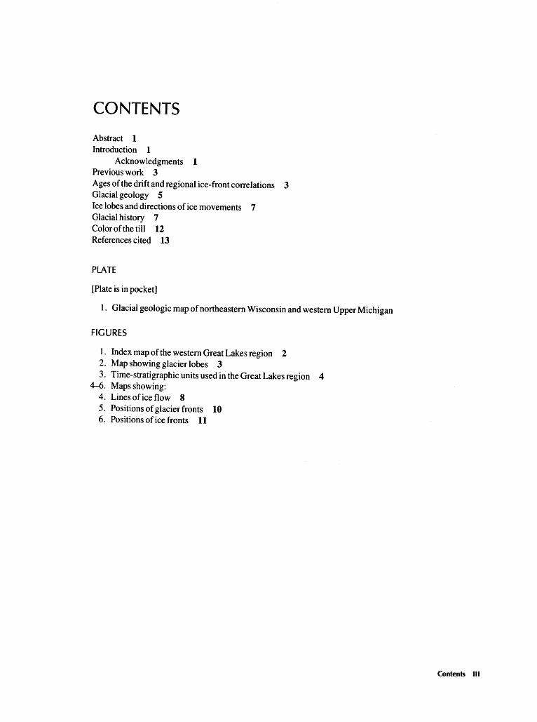
CONTENTS
Abstract 1 Introduction 1
Acknowledgments 1 Previous work 3 Ages ofthe drift and regional ice-front correlations 3 Glacial geology 5 Ice lobes and directions of ice movements 7 Glacial history 7 Color of the till 12 References cited 13
PLATE
[Plate is in pocket]
1. Glacial geologic map of northeastern Wisconsin and western Upper Michigan
FIGURES
1. Index map of the western Great Lakes region 2 2. Map showing glacier lobes 3 3. Time-stratigraphic units used in the Great Lakes region 4
4-6. Maps showing: 4. Lines of ice flow 8 5. Positions of glacier fronts 10 6. Positions of ice fronts 11
Contents Ill


late Wisconsinan Glacial History of Northeastern Wisconsin and Western Upper Michigan
ByWarren L. Peterson
Abstract
Four distinct late Wisconsinan advances of glacial ice are recognized in north-central Wisconsin and the Upper Peninsula of Michigan. During the first advance, ice lobes pushed southward and westward into north-central Wisconsin and built the massive Woodfordian terminal moraines. A later advance of ice lobes built east-trending end moraines across the western part of the Upper Peninsula and south-trending end moraines in northeastern Wisconsin. These moraines are probably of Port Huron age; in the Upper Peninsula, they contain conspicuous amounts of red (10R4/4) till. The last two advances built less conspicuous end moraines in the Upper Peninsula. large glacial lakes were ponded south of the ice fronts during these two advances in the northernmost part of the western Upper Peninsula. The youngest advance is dated at about 10,200 years B.P. in the western part ofthe Upper Peninsula and about 10,000 years B.P. in the central part.
INTRODUCTION
The late Wisconsinan glacial history of northem Wisconsin and the Upper Peninsula of Michigan has been known in a general way since the work of Chamberlin (1877, 1883), Weidman (1907), Leverett (1929), and Thwaites (1943). Regional summary maps by Thwaites (1956), Martin (1957), National Research Council (1959), and Hadley and Pelham (1976) show the areal distribution of the moraines and the glaciofluvial and glaciolacustrine sediments and the orientations of ice-flow indicators.
·New fieldwork during the summers of 1978, 1979, and 1980 resulted in a more detailed map of the glacial deposits of the Iron River 1 o x 2 o
quadrangle (fig. 1) and a more detailed history of the movements of the ice lobes, deposition of drift, and impoundment of glacial lakes in that quadrangle (Peterson, 1985 ).
The areas contiguous to the Iron River quadrangle are almost all covered by recent 7 112-
minute topographic quadrangle maps, most maps having a contour interval of 10 feet. By interpreting the glacial features expressed in the topography shown on these topographic maps and by making a glacial geologic map based on these interpretations, the writer can integrate his work in the Iron River quadrangle with work done farther south in northcentral Wisconsin, particularly that by Weidman (1907), Thwaites (1943, 1956), Mickleson and others (1974), McCartney (1979), Mickelson and McCartney ( 1980), and McCartney and Mickelson ( 1982). Toward this end, a glacial geologic map (pl. 1) has been made that covers the Iron River 1 o x 2 o
quadrangle and some contiguous areas (study area is shown on fig. 1 ). A history of the movements of the ice lobes and the deposition of the glacial drift in this area between about 14,500 and 10,000 years B.P. is herein proposed.
ACKNOWLEDGMENTS
The writer thanks David Mickelson and Carol McCartney, University of Wisconsin-Madison, and John Hughes, Northern Michigan University, Marquette, for helpful discussions about the glacial deposits of northern Wisconsin and the Upper Peninsula of Michigan; Jack Van Alstine, Michigan Geological Survey, Marquette, for spending a day in the field with him; and Lee Clayton, Wisconsin Geological and Natural History Survey, Madison, for spending 2 days. The writer is particularly grateful to J. P. Schafer, U.S. Geological Survey, Reston, Va., for 4 days spent with him in the Iron River quadrangle; any value in the work reported here is at least partly due to Schafer's discerning comments on the glacial deposits. Norman Lasca, University of Wisconsin-Milwaukee, and David Mickelson have provided many very useful comments on an earlier version of this paper.
Introduction 1

46°
440
43°
42°
WISCONSIN
EXPLANATION
Terminus of glacial advance; dashed where taken from Saarnisto ( 197 4)
I II III IV Terminus identifiers
referred to in text
c=:> Mountainous Areas referred to in text
0
I I
0
I
I I I
I ' 50
50 I
I 100
100 I
I 150
I
150 MILES I
200 KILOMETERS
Figure 1. Index map of the western Great lakes region, showing the study area (solid lines), the Iron River and Iron Mountain 1 o x 2 o quadrangles (dashed lines), and the termini of four glacial ice advances (hachured lines).
2 Late Wisconsinan Glacial History of Northeastern Wisconsin and Western Upper Michigan

PREVIOUS WORK
The earliest work on the glacial geology of northern Wisconsin was by Chamberlin (1877, 1883), who recognized the massive Wisconsinan terminal moraine. Weidman ( 1907) identified several lobate segments within this moraine, which he named the Chippewa, Wisconsin Valley, Langlade, and Green Bay moraines. Weidman recognized that these moraines had been built by independently acting ice lobes and gave these lobes names that correspond to the moraine names. The Chippewa, Wisconsin Valley, and Langlade lobes advanced south out of the Lake Superior basin, and the Green Bay lobe advanced west out of the Green Bay trough (fig. 2). Leverett ( 1929) later described the glacial geology
47" r-----'9:.,::-0° ____________ ---=.88r---o-----,
ONTONAGON LOBE
. : ... MICHIGAMME \KEWEENAW\ LOBE ··.BAY LOBE :
GREEN BAY
GREEN BAY LOBE
45o '--------'-------.6.__ ___ LO_B_E ___ ___JL-_ __.J
0 25 I I I I I 50 I
I 75
I
75 MILES I
100 KILOMETERS
Figure 2. Map showing glacier lobes and areas occupied by the lobes within the study area at two different times. When the ice fronts stood within the Woodfordian terminal moraines in north-central Wisconsin, the four active lobes were Chippewa, Wisconsin Valley, Langlade, and Green Bay. When the ice fronts stood farther north and east at the Winegar, Saint johns, and Sagola moraines, the four active lobes were Ontonagon, Keweenaw Bay, Michigamme, and Green Bay. Hachured lines mark ice fronts; dotted lines locate sutures between lobes. I and II same as shown on figure 1. Map shows the same area as that shown on plate 1.
of the Upper Peninsula of Michigan and worked out a glacial history. Thwaites (1943) mapped a part of northeast Wisconsin and proposed a glacial history for the area. He did not use the name Langlade moraine, but recognized the Parrish, Summit Lake, and Elcho moraines within its extent (pl. 1 ). He also did not use the name Green Bay moraine; instead, he recognized the Outer moraine and other moraines within its extent. Thwaites (1956) later made a reconnaissance glacial geologic map of all of Wisconsin.
These early workers mapped the gross aspects of the glacial deposits and deduced the essentials of the glacial history of the area, which, in summary, are as follows: ( 1) advance of the glacier lobes south out of the Lake Superior basin and west out of the Green Bay trough into north-central Wisconsin in late Wisconsinan time; (2) construction of the late Wisconsinan (Woodfordian) terminal moraines; (3) retreat of the ice lobes northward and eastward and the associated construction of many major and minor end moraines during stillstands or during minor readvances, and deposition of abundant melt-water deposits; ( 4) continued retreat of the ice front northward into the Lake Superior basin, the ponding of a proglacial lake at the northern end of the area between the glacier on the north and the high ground to the south, a lake that drained west and then south through the Bois Brule and St. Croix River valleys (fig. 1); and (5) final retreat of the ice front to where drainageways to the east were opened, causing the proglaciallake level to drop, with some fluctuations, to that of the present Lake Superior.
Later work by Hack ( 1965), Black ( 1969), Mickelson and others (1974), McCartney (1979), McCartney and Mickelson ( 1982), Richmond and Fullerton (1984), and several others has added many details and has established the radiometric ages of some deposits but has not greatly altered the understanding of the regional glacial geology.
AGES OF THE DRIFT AND REGIONAL ICE-FRONT CORRELATIONS
The glacial deposits discussed here are all of late Wisconsinan age (fig. 3). The oldest features, the Chippewa, Wisconsin Valley, Harrison, Parrish, Summit Lake, and Outer moraines (pl. 1 ), are of Woodfordian age (Mickelson and others, 1974) and are herein called the Woodfordian terminal moraines (fig. 1 ). The drift for some distance north and east of these moraines is also of Woodfordian age. Some of the drift in the northern and easternmost parts of the
Ages of the Drift and Regional lee-Front Correlations 3

Lake Michigan Basin Eastern Radio- Great Lakes carbon Dreimanis and years Evenson and Frye and Karrow, 1972; B.P. others, 1976 others, 1968 Evenson and
Dreimanis, 1976 Q) c: Q)
7,000 - Q) u c.~ ctl ~..c: c: 0
'-(/) -ro .... -s ctiC) Q) 0 Q)c: .... Q) (/) c:::::l u ::I: .co ..... a. c: Q)O 0 Q) "t:u c: a.·- Q);. 0 C)
0.~ c3=>~ ~> ::I: ctl
8,000 -.,- z~ a.. Q)ctl ci5 ~co Driftwood Q)
I I I -- ------------- c: Stadia I Q) u 0 0
9,000 - ::I: Valderan
1----Sixmile Substage
10,000 -moraine:=
Greatlakean Watton Substage Q)
moraine/? ___ C) North Bay ctl I
ci5 Interstadial .~ 1:
I Q)
11,000 -I C)
(/) 0 \. -?-- ctl --------------
oa. (i) Q)
Cl.Q) C)
Q) .... c: ~ Valders "O(f) ---?--- ctl (/) Stadia I -:c ~ c: Twocreekean .0 o ..... / c: 'iii ::I
I ------------- -12,000 - ctl Twocreekean c: Substage (/)
- c: I c: 0 ctl._ I Two Creeks ~"0 Winegar 'iii Substage u Q) Q)
f'-· moraine c:
(/) Interstadial ..... (/) I 0 3: c c: (/) I u Port ---Poit-H~ro~---·-::I \ (/) Q) ctl
Q) u 3: C) Huron c ---- -~t~<.!i.~L----13,000 - E.~ ctl 'iii
i="C ~ ----c-arv------ c: Mackinaw 0
::::1 Port Huron u Interstadial - (/) ------------ (/) --------------
l c: Cary 3:
14,000 -ctl Woodfordian ~ Port Bruce :0 Parrish and Summit 0 Substage ctl Stadia I
Lake moraines ...1
1---- ~ --------------0 0
15,000 - ~
~'-/"'J ~ ~~~~v-v ~ '-''"'
Figure 3. Time-stratigraphic units used in the Great Lakes region and time-distance diagram along a line of ice flow south out of the Keweenaw Bay trough, then southwest to the northwest end of the Summit Lake moraine.
area shown on plate 1 is unquestionably of Valderan (or Greatlakean) age, but the stratigraphic position of the top of the Woodfordian is uncertain in all but the southeasternmost parts of the area shown on plate 1; therefore, no attempt was made to locate it.
Figure 1 shows the extent of four regionally correlated ice-front positions. The southernmost position (terminus I on fig. 1) is at the southern margins of the Chippewa, Wisconsin Valley, Harrison, and Parrish moraines and at the western margin of the Outer moraine (pl. 1 ). This ice-front position extends south to the western margin of the Johnstown moraine in southern Wisconsin and the western and southern margins ofthe Valparaiso moraine (morainic system) in northern Illinois and Indiana (adapted
from Frye and others, 1965, fig. 4). This pos1t1on marks the terminus of a major ice advance and apparently correlates with the early part of the Port Bruce Stadial (fig. 3). The age is judged to be about 14,500 years B.P. Fullerton (1980, pl. 1) has indicated an age of 15,500 years B.P. for the outermost ridge of the Valparaiso morainic system in Illinois and about 14,500 years B.P. for the outer Valparaiso moraine in Indiana.
The second ice-front position (terminus II on fig. 1 ), was the terminus of a major advance of all lobes in late Woodfordian time; it is shown at the southern edge of the Winegar and Saint Johns moraines and at the western edge of the Sagola moraine in the Iron River quadrangle (pl. 1 ). For the most
4 late Wisconsinan Glacial History of Northeastern Wisconsin and Western Upper Michigan

part, these moraine margins coincide with the southern and western edges of areas containing conspicuous amounts of red (l0R4/4) 1 till in the Upper Peninsula of Michigan and northeasternmost Wisconsin. South of the Iron River quadrangle, the ice-front position extends south through Wisconsin at the western edge of the red drift. It crosses Lake Michigan at the southern boundary of the Shorewood till (Lineback and others, 1974), extends north along the Whitehall moraine in Michigan, and thence across lower Michigan at the outer margin of the Port Huron moraines (Evenson and Dreimanis, 1976). The age is about 13,000 years B.P. The correlation of the ice front in Wisconsin, from the Iron River quadrangle south, is based on the conclusion by Mickelson and McCartney ( 1980) and McCartney and Mickelson (1982) that the edge of the red drift in northern Wisconsin is of Port Huron age (fig. 3), although it is not precisely the same age everywhere.
Two younger ice-front positions that mark the termini of minor glacial advances are located in the northern part of the area shown on plate 1. The oldest of these positions (terminus III on fig. 1) is placed at the outer edge of the Watton moraine, which was built at the maximum extent of this advance. The line is extended west along several minor morainic ridge remnants and is inferred to extend east across the area south of the Huron Mountains and then southeast towards Green Bay. It may have an age of about 11,000 years B.P., as discussed below. The northernmost and youngest line (terminus IV on fig. 1) is dated at about 10,200 years B.P. in the Iron River quadrangle (Peterson, 1985) by several pieces of wood that have been found in red till there by several workers. Topographic relationships indicate that the Sixmile moraine and the adjacent Rousseau delta (pl. 1) were constructed at this time. The line is inferred to extend from the Sixmile moraine eastward across the northern edge of the Yell ow Dog Plains (Segerstrom, 1964), which are about 5 km south of the Huron Mountains. From there, this line extends southeast to near Marquette, Mich., where it coincides with the terminus of an advance that has been dated at about 10,000 years B.P. (Hughes and Merry, 1978; Drexler, 1981). Hughes and Merry (1978) have named this advance the Marquette stadia!.
The two dashed ice-front positions shown on figure 1 that extend south from near Marquette, Mich., and then east across the Upper Peninsula of Michigan into Canada have been taken from Saarnis-
•color designations are based on the "Rock-Color Chart" of the National Research Council (Goddard and others, 1948).
to ( 197 4 ). He concluded that two ice-front stillstands, which together he called the Algonquin Stadia!, took place at 10,000 and 11,000 years B.P., respectively. These ice-front locations are based mainly on mapping by Leverett ( 1929) and, if valid, could record the same stillstands as the Watton and Sixmile moraines; they are shown as such on figure 1. Saarnisto ( 197 4, fig. 2), however, did not extend the two fronts west of the Huron Mountains, as shown by the writer on figure 1, but rather extended them north across the Keweenaw Peninsula and then northwest across Lake Superior.
GLACIAL GEOLOGY
Plate 1 shows the glacial geology of part of northeastern Wisconsin and the western part of the Upper Peninsula of Michigan. The geology in the areas outside the Iron River 1 o x 2 o quadrangle has been interpreted from topographic maps. The glacial materials are designated by nine map units (pl. 1, and below). No information except for that on glacial striae has been transferred directly from previously published maps to plate 1.
The types and aerial distributions of glacial deposits shown on plate 1 are similar to those shown on previously published maps, but are different in det~il. New contributions are: refinements and some maJor changes in the distribution of end-moraine deposits in the Iron River quadrangle; recognition of two large glacial deltas deposited in lakes that had dit:fe~ent surface altitudes; delineation of areas of drumhn1zed and fluted glacial deposits; and addition of many features that indicate directions of ice movement or trends of ice fronts.
Thin drift over bedrock.-Thin drift over bedrock is mapped where glacial drift is commonly less than 3 m thick and where the topography is essentially that of the bedrock surface slightly modified by the veneer of drift. The drift is chiefly till in the Iron River 1 o x 2 o quadrangle. Many areas contain abundant bedrock outcrops.
Drumlinized and fluted glacial deposits.-Subglacially formed streamlined features include drumlins, flutes, irregular drumlinized ridges, and rock drumlins. Areas containing these features within the Iron River 1 o x 2 o quadrangle have been discussed by Peterson ( 1985 ). A large drumlin field formed by the Langlade lobe is found northeast of the Summit Lake and Elcho moraines (pl. 1 ). The drumlins are commonly 0.5 to 1.5 km long, 0.5 to 1 km wide, and 5 to 15 m high. Their composition is not well known, although most are probably composed of
Glacial Geology 5

subglacially deposited till. Some drumlins, however, contain a core of glaciofluvial sand and gravel and a thin surface veneer of till, indicating that they were formed by glacial erosion of preexisting sand and gravel. Exposures showing internal stratigraphy of this type occur at and near Iron River, Mich. (Peterson, 1985 ), and near Crandon, Wis. (Mickelson and others, 1974). The drumlins in other drumlin fields (pl. 1) have dimensions similar to those northeast of the Summit Lake and Elcho moraines. The irregular drumlinoid ridges mapped southeast of the Watton moraine do not have the smoothed surfaces of typical drumlins. These ridges, which are composed of till and gravel, have widely differing dimensions but are commonly 0.25 to 1 km wide, 1 to 3 km long, and mostly less than 5 m high. Bedrock is at or near the surface in areas containing these irregular ridges and must be related to the irregularity. A few ridges are known to trail behind bedrock knobs; probably many do. The veneered drumlins (pl. 1) have overall dimensions similar to those of smooth drumlins but have irregular topographic surfaces and are probably overlain by an irregular veneer of collapsed glaciofluvial drift. The flutes found in several areas near Lake Superior were first described by Hack (1965). They are straight narrow U-shaped grooves separated by straight round-topped evencrested ridges. In the vicinity of White Pine, Mich., according to Hack ( 1965), the distance from ridge crest to adjacent ridge crest averages 116 m, the height of the ridges averages 3 m, and the lengths of the ridges are as much as 4.8 km. These dimensions are representative for all the fluted areas. Several large rock drumlins are eroded in the Jacobsville Sandstone near Keweenaw Bay.
Unclassified weakly lineated glacial deposits.-Deposits in areas where the surface appears rather smooth on the topographic maps and the topography is weakly lineated parallel to drumlins in nearby areas are mapped as unclassified weakly lineated glacial deposits. In these areas, drumlins may be poorly formed or may be obscured by an overlying veneer of ablation drift or outwash.
End-moraine deposits.-The end moraines are mappable hummocky elongate areas of drift deposited at the glacier front when the front remained in a narrow zone for a considerable length of time. They are ridgelike in places but more commonly are rather broad hummocky areas somewhat higher than the surrounding areas. Many moraines include smaller linear ridges of drift. The end moraines are composed of till and collapsed glaciofluvial sand and gravel. Till is probably dominant but in some areas is mostly absent.
The morainic areas of north-central Wisconsin shown on plate 1, which consist of the Chippewa, Wisconsin Valley, Harrison, Parrish, Summit Lake, Elcho, and Outer moraines, are similar in outline to those shown by Thwaites (1943, 1956) and by Hadley and Pelham ( 1976). The feature here called the Rhinelander moraine (pl. 1 ), however, has not been recognized previously as an end moraine, though some areas of end moraine were shown in that general area by Hadley and Pelham (1976). On the modem topographic maps, the Rhinelander moraine is an elongate hummocky area that has an abrupt northeast margin similar to the northern side of the Winegar moraine. The southeast boundary is less clearly identified because it butts against other hummocky topography, particularly near the southern end. Several northwest-trending ridges occur in the southern part of the Rhinelander moraine. This moraine was deposited by the Langlade lobe, probably by the part of the lobe that originated in the Keweenaw Bay trough.
High-relief collapsed stratified drift.-The highrelief collapsed stratified drift shown in one area on plate 1 forms hummocky topography that has a maximum relief of about 30 m and that contains many enclosed kettle-hole basins and a few flat areas such as small outwash plains. The unit consists mostly of stratified pebbly medium-grained sand. It probably was deposited in a zone of dead ice between the retreating Wisconsin Valley and Langlade lobes and can be classified as an interlobate deposit.
Unclassified high-relief glacial deposits.-Areas underlain by unclassified high-relief glacial deposits have a topographic expression similar to the highrelief collapsed stratified drift unit mapped in the Iron River quadrangle.
lnterlobate ridge deposit.-The interlobate ridge deposit is a northwest-trending ridge within an area of unclassified high-relief glacial deposits about 12 km southwest of Rhinelander, Wis. (pl. 1 ). The ridge has ice-contact slopes on both the northeast and southwest sides. It probably consists of glaciofluvial sediment. The ridge extends southeast into the prominent frontal ridge of the Summit Lake moraine. The writer concludes that the interlobate ridge was deposited between the front of the southwest-flowing Langlade lobe and the side of the southeast-flowing Wisconsin Valley lobe at a time when ice on both sides of the ridge had become stagnant.
Low-relief collapsed stratified drift and outwashplain deposits.-Most low-relief collapsed stratified drift and outwash-plain deposits form hummocky topography that has a maximum relief of about 15 m. Pitted and unpitted outwash plains and enclosed ket-
6 late Wisconsinan Glacial History of Northeastern Wisconsin and Western Upper Michigan
tie-hole basins are numerous. The hummocky ground consists of stratified pebbly medium-grained sand and much smaller amounts of gravel and sandy gravel. The hummocky ground includes many short straight ice-channel fillings that are both parallel and transverse to the ice-flow directions, and many eskers. The outwash plains are composed mostly of medium-grained sand; many are elongate parallel to the ice fronts. The areas covered by this unit contain a few distinct small ice-contact fans and ice-walled lake deposits.
Lake-bottom deposits.-The lake-bottom deposits in the Iron River quadrangle (pl. 1) are composed of red (1 OR4/4) clayey silt and silty clay and yellowish-gray medium-grained sand. They accumulated in large lakes dammed by glacial ice in the north-draining part of the study area. Lake deposits apparently also occur elsewhere in northern Wisconsin, as indicated by Mickelson and others ( 197 4, fig. 1 ), but they could not be recognized in this study.
Glacial delta deposits.-Two large glacial deltas mapped in the Iron River 1 o x 2 o quadrangle contain only the topset and foreset beds and are composed of medium-grained sand and minor amounts of pebble gravel. The plain of the Sidnaw delta is at an altitude of about 425 m; that of the Rousseau delta is at about 365m.
Other unclassified glacial deposits.-Areas underlain by other unclassified glacial deposits have a topographic map expression similar to that of areas of thin drift over bedrock, as mapped in the Iron River quadrangle.
ICE LOBES AND DIRECTIONS OF ICE MOVEMENTS
The Woodfordian terminal moraines in northcentral Wisconsin were built by the Green Bay, Langlade, Wisconsin Valley, and Chippewa lobes. Figure 2 shows the areas occupied by these lobes near the terminal moraines. Later, when the Winegar moraine was built, four recognizable lobes were also active-Green Bay, Michigamme, Keweenaw Bay, and Ontonagon (fig. 2).
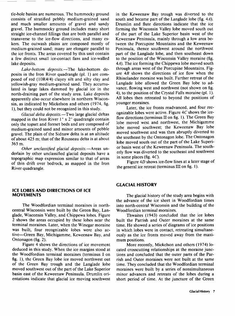
Figure 4 shows the directions of ice movement deduced in this study. When the ice margins stood at the Woodfordian terminal moraines (terminus I on fig. 1 ), the Green Bay lobe ice moved northwest out of the Green Bay trough and the Langlade lobe moved southwest out of the part of the Lake Superior basin east of the Keweenaw Peninsula. Drumlin orientations indicate that glacial ice moving southwest
in the Keweenaw Bay trough was diverted to the south and became part of the Langlade lobe (fig. 4A). Drumlin and flute directions indicate that the ice forming the Wisconsin Valley lobe moved south out of the part of the Lake Superior basin west of the Keweenaw Peninsula, mainly through a low area between the Porcupine Mountains and the Keweenaw Peninsula, thence southwest around the northwest part of the Langlade lobe, and then southeast down to the position of the Wisconsin Valley moraine (fig. 4A). The ice forming the Chippewa lobe moved south through areas west of the Porcupine Mountains. Figure 4B shows the directions of ice flow when the Rhinelander moraine was built. Further retreat of the Langlade lobe allowed the Green Bay lobe to advance, flowing west and northwest (not shown on fig. 4), to the position of the Crystal Falls moraine (pl. 1). All lobes then retreated to beyond the positions of younger moraines.
Later, the ice fronts readvanced, and four recognizable lobes were active. Figure 4C shows the iceflow directions (terminus II on fig. 1 ). The Green Bay lobe moved west and northwest, the Michigamme lobe moved southwest; the Keweenaw Bay lobe moved southwest and was then abruptly diverted to the southeast by the Ontonagon lobe. The Ontonagon lobe moved south out of the part of the Lake Superior basin west of the Keweenaw Peninsula. The southerly flow was diverted to the southeast and southwest in some places (fig. 4C).
Figure 4D shows ice-flow lines at a later stage of the general ice retreat (terminus III on fig. 1 ).
GLACIAL HISTORY
The glacial history of the study area begins with the advance of the ice sheet in Woodfordian times into north-central Wisconsin and the building of the Woodfordian terminal moraines.
Thwaites ( 1943) concluded that the ice lobes built the Parrish and Outer moraines at the same time. He showed a series of diagrams of ice positions in which lobes were in contact, retreating simultaneously as the ice fronts moved away from the maximum positions.
More recently, Mickelson and others (1974) located crosscutting relationships at the moraine junctions and concluded that the outer parts of the Parrish and Outer moraines were not built at the same time. They concluded that the Woodfordian terminal moraines were built by a series of nonsimultaneous minor advances and retreats of the lobes during a short period of time. At the juncture of the Green
Glacial History 7
A
45°
8 0 I I I I I I I 'I 0 25
Figure 4. Maps showing lines of ice flow at four different times, progressively younger from A to 0: A, when glaciers built the Woodfordian terminal moraines in northcentral Wisconsin (terminus I on fig. 1 ); 8, when the Rhinelander moraine was built; C, when the Winegar, Saint Johns, and Sagola moraines were constructed (ter-
25
I 50
45°'-----.l... ____ ___L:...___ ________ .....L--_----'
c
goo 88°
46° 1------+--
45°
50 75 MILES D I I
I I 75 100 KILOMETERS
minus II on fig. 1); 0, when the Watton moraine was built (terminus III on fig. 1). Outlines of end moraines are shown on each map; shaded areas show end moraine deposited during time depicted. Area of each map is the same as that shown on plate 1.
8 Late Wisconsinan Glacial History of Northeastern Wisconsin and Western Upper Michigan

Bay and Langlade lobes, the Green Bay lobe first built the Outer moraine and then retreated. The Laoglade lobe advanced, overrode the north end of the Outer moraine, and built the Parrish moraine before retreating. This sequence is clearly recorded in the topography. According to Mickelson and others (1974), the subsequent history at this juncture is quite complex and includes more minor advances and retreats of the Langlade and Green Bay lobes. At the juncture of the Langlade and Wisconsin Valley lobes, Mickelson and others (1974) concluded that the Langlade lobe first advanced and built the Parrish moraine and then retreated before the Wisconsin Valley lobe advanced to its maximum position and built the Harrison moraine (named by Nelson, 1973) and retreated. The Langlade lobe then overrode the northern end of the Harrison moraine and built the Summit Lake moraine. This sequence of events seems somewhat tenuous because the morainic ridging as expressed on the topographic maps indicates to the writer that the Harrison moraine was probably deposited first and its northern end later overridden by the Langlade lobe at the time the Parrish moraine was deposited.
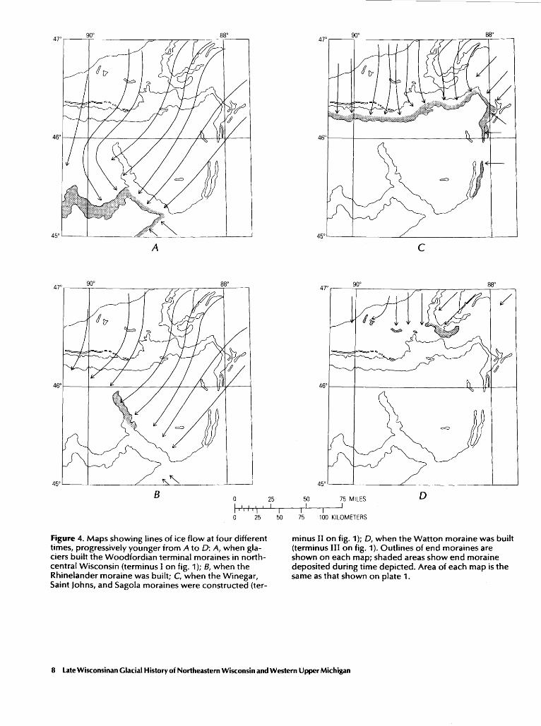
Figures 5 and 6 show the sequence of glacial events the writer wishes to propose. These events begin with advance of all lobes to the outer margins of the terminal moraines (fig. 5A). The outer moraines, however, as has been described by Mickelson and others (1974), were not constructed at the same time. At a somewhat later stage, an interlobate ridge (pl. 1) was built between the Wisconsin Valley and Langlade lobes about 12 km southwest of Rhinelander, Wis. (fig. 5B).
Nelson (1973) and Mickelson and others (1974) have discussed the interlobate ridge and have concluded that it accumulated where the active ice of the Langlade lobe on the north impinged on the dead ice of the Wisconsin Valley lobe after the active front of the Wisconsin Valley lobe had retreated towards the northwest. The writer concludes that the straightness of the combined frontal ridge of the Summit Lake moraine and the interlobate ridge (pl. 1) precludes this origin. Instead, he suggests that both lobes must have been active before the ridge formed, the Wisconsin Valley ice sliding southeastward along the front of the Langlade ice. The ridge was deposited by melt-water streams after ice from both lobes became inactive in the vicinity of the ridge. The active front of the Wisconsin Valley lobe must have stood near the present position of the southeast end of the interlobate ridge immediately prior to the deposition of the ridge.
When the lobes retreated from the Woodfordian terminal moraines, the Wisconsin Valley lobe re-
treated much faster than the Langlade lobe. Figure 5C shows the position of the ice fronts when the Elcho moraine was built. When the Langlade lobe had retreated northeast, slightly beyond Rhinelander, Wis., it ·built the Rhinelander moraine, which extends from 5 km southeast of Rhinelander northwest to near Woodruff, Wis. At this time, the Wisconsin Valley lobe had retreated to the position shown on figure 5D, a position based on trends of morainic ridges within the Rhinelander moraine and trends of outwash plains and fans deposited in front of the Wisconsin Valley lobe. Projection of the southeast trend of ridges within the southern part of the Rhinelander moraine indicates that the front of the Laoglade lobe would have stood at the position of the dashed line shown northeast of the Summit Lake and Elcho moraines (fig. 5D). However, no moraine occurs there. The reason is not apparent.
After the construction of the Rhinelander moraine, the lobes retreated rapidly. A minor halt in the retreat of the Langlade lobe (fig. 5E) is defined by the alignment of the Laona moraine (Thwaites, 1943) and an array of small outwash plains and fans near Three Lakes, Wis. (pl. 1 ). The area of high-relief collapsed stratified drift was deposited about this time, or slightly later, at the juncture of the Wisconsin Valley and Langlade lobes. The Langlade lobe subsequently continued to retreat to beyond the outer margins of the Winegar and Saint Johns moraines.
The position of the Green Bay lobe during the retreat of the Langlade lobe is not known. However, some time after the Langlade lobe retreated from the Woodfordian terminal moraines, the Green Bay lobe advanced westward onto ground that had been vacated by the Langlade lobe. A distinct morainic ridge about 5 km west of Dunbar, Wis., was built at the maximum extent of this advance (pl. 1 ). This ridge extends south to its junction with the western ridge of the Mountain moraine (as used by Mickelson and others, 1974, fig. 1 ), and is probably correlative northward with the Crystal Falls moraine (pl. 1 ). The morainic ridge and the Crystal Falls moraine were formed at the free front of the Green Bay lobe (fig. 5F) and are not interlobated deposits. Later, all lobes retreated to positions north of the Winegar moraine and east of the Sagola moraine. This interval of icefront retreat appears to correspond to the Mackinaw (Cary-Port Huron) interstadial (fig. 3).
The drift deposited after this ice retreat tends to contain much red till and red lacustrine silt and clay. The color is close to moderate reddish brown (10R4/4) in the Iron River quadrangle but seems less red elsewhere, as discussed later in this report. The red drift has been discussed extensively by Chamberlin (1877), Alden (1918), Leverett (1929), Thwaites
Glacial History 9
A
c 0 25
I•'• •'•\ I I I 0 25 50
Figure 5. Maps showing the positions of the glacier fronts during the building of the Woodfordian terminal moraines in north-central Wisconsin and during part of the subsequent deglaciation (progressively younger from A to F). A, Generalized positions of glacier fronts when outer parts of the terminal moraines were built (not strictly simultaneously) (terminus I on fig. 1); 8, positions when southern ridge of the Summit Lake moraine and the interlobate ridge were deposited; C, positions when Elcho moraine was deposited; D, positions when the Rhinelander moraine was built; f, positions when the Laona
D
E
50 75 MILES F II I I
75 100 KILOMETERS
moraine was constructed; F, position of the front of the Green Bay lobe after it had advanced onto ground vacated by the Langlade lobe (the Wisconsin Valley and Langlade lobes probably had retreated to beyond the positions of the Winegar and Saint Johns moraines). Heavy lines, positions of the glacier fronts; dashed heavy lines, inferred positions of glacier fronts; dotted heavy lines, inferred positions of sutures between ice lobes. W, Wisconsin Valley lobe; L, Langlade lobe; G, Green Bay lobe. Each map shows outlines of end moraines shown on plate 1 and covers the same area as that on plate 1.
10 late Wisconsinan Glacial History of Northeastern Wisconsin and Western Upper Michigan

A
8
=) c 0
I·····\ 0 25
25 I
I 50
Figure 6. Maps showing positions of ice fronts at the culmination of the advance to the Winegar, Saint johns, and Sagola moraines and during the subsequent deglaciation (progressively younger from A to F). A, Positions of ice fronts when the Winegar, Saint Johns, and Sagola moraines were built (terminus II on fig. 1); 8, positions when the first morainic ridge east of the Sagola moraine and the morainic ridge north of the Saint Johns moraine were built; C, positions when the MacDonald moraine and possibly the second morainic ridge east of the Sagola moraine were deposited; D, positions of the Ontonagon and Keweenaw Bay lobes when the Watton moraine was deposited (terminus III on fig. 1 ); f, positions of the fronts of
50 I
I 75
I
75 MILES I
100 KILOMETERS
D
E
F
the Ontonagon and Keweenaw Bay lobes when the Sixmile moraine was built (terminus IV on fig. 1); f, position of the front of the Keweenaw Bay lobe after it had retreated into the Keweenaw Bay trough and the Ontonagon lobe had retreated into the Lake Superior basin. Areas of several glacial lakes are shown. Heavy lines, positions of glacier fronts; dashed heavy lines, inferred positions of glacier fronts; dotted heavy lines, inferred positions of sutures between Jobes. Shading shows extent of glacial lakes. 0, Ontonagon lobe; K, Keweenaw Bay lobe; M, Michigamme lobe; G, Green Bay lobe. Each map shows the outlines of the end moraines shown on plate 1 and covers the same area as that on plate 1.
Glacial History 11

(1943), and many others. In the study area, the red drift is mostly but not exclusively found in the drift north and east of the outer margins of the Winegar and Sagola moraines. The red glacial sediments were derived from the red Precambrian (and/or Cambrian?) sandstone and shale beneath the waters of Lake Superior and on land in the northern part of the area shown in plate 1 (see Cannon, in press). The glacial sediments are the ice-pulverized counterparts of the sandstone and shale. Probably most of the red till found in the northern part of the Iron River 1 ° x 2 o
quadrangle was deposited directly from the ice, having been ground up and deposited in one episode.
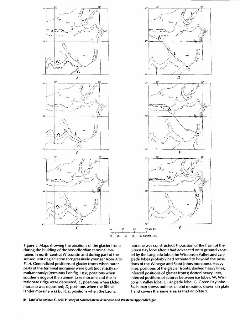
All lobes readvanced to the position shown on figure 6A, after an unknown length of time and an unknown distance of ice retreat. This readvance probably corresponds to the Port Huron advance (fig. 3). The ice mass that had previously been the Langlade lobe and that had had essentially a single integrated front was now separated into two lobes, the Keweenaw Bay and Michigamme. The Winegar moraine was built by the Ontonagon and Keweenaw Bay lobes, the Saint Johns moraine, by the Michigamme lobe, and the Sagola moraine, by the Green Bay lobe. These moraines are believed to be about contemporaneous. The shapes of the junctures between the moraines (pl. 1) indicate that when these moraines were built, the various ice lobes were present at essentially the same time. The ice front that built the Sagola moraine probably also built the morainic ridge in the Iron Mountain 1 o x 2 o quadrangle (pl. 1) about 2 km east of Dunbar, Wis. (fig. 6A). The ridge is topographically distinct and marks the edge of the red drift as determined by McCartney ( 1979).
Figures 6B and C show some possible ice-front positions during the retreat of the ice lobes. Two distinct lines of morainic ridges, which mark halts or minor readvances of the Green Bay lobe, are found east of the Sagola moraine. Possibly the younger of these lines of ridges correlates with the McDonald moraine (fig. 6C). The lobes then retreated. Later, the Keweenaw Bay lobe readvanced to the position of the Watton moraine. At the same time, the Ontonagon lobe probably readvanced to the line shown in figure 6D, which is marked by several segments of rather indistinct morainic ridges. A glacial lake, which had a surface altitude of about 425 m and which corresponds approximately to Lake Ontonagon of Leverett ( 1929), was ponded south of the Ontonagon lobe and west of the Keweenaw Bay lobe. The Sidnaw delta (pl. 1 ), composed of sand derived from the Keweenaw Bay lobe, was built into the lake from the east. Red lake-bottom sediments of silt and clay were deposited farther west. The lake drained west and
then south through the Bois Brule and St. Croix River valleys (Leverett, 1929).
The ice lobes then retreated far enough so that the glacial lake abandoned the drainageway through the Bois Brule and St. Croix River valleys to the west and was able to use lower outlets to the east. Evidence for this change of outlets is ancient wood found buried beneath latest red till just west of the Porcupine Mountains (pl. 1 ), in what must have been near its growth position (Meyer Rubin, oral commun., 1981 ), at an altitude at least 50 m below the surfaces of the glacial lakes that drained to the west. Radiocarbon dates from the ancient wood indicate that the Ontonagon lobe readvanced about 10,200 years B.P. to about the position shown on figure 6£ without building a distinct terminal moraine (Peterson, 1985 ). Topographic relations indicate that the Keweenaw Bay lobe also advanced at this time to the position shown (fig. 6£) and built the Sixmile moraine; it also built the Rousseau delta (pl. 1 ), which is composed of sand, westward into the glacial lake ponded south of the Ontonagon lobe and west of the Keweenaw Bay lobe. Red lake-bottom silt and clay were deposited west of the delta. The lake, which drained west, was a local precursor to glacial Lake Duluth. A smaller glacial lake was ponded south of the Keweenaw Bay lobe at this time. The front of the Ontonagon lobe then retreated, and glacial Lake Duluth, which had a surface altitude of 365 m and also drained west and then south through the Bois Brule and St. Croix River valleys (Leverett, 1929), expanded to occupy the area previously filled with glacial ice (fig. 6F). The Keweenaw Bay lobe retreated, ponding a small lake between it and the Sixmile moraine. This lake was connected by a neck of water with the main part of Lake Duluth. Subsequently, the ice lobes retreated into the Lake Superior basin to a position where the glacial waters could escape eastward through and around the Keweenaw Peninsula. The level of the glacial waters dropped, and the drainageway to the west was abandoned. This final retreat of the Keweenaw Bay lobe effectively ended the glacial history of the area.
COLOR OF THE TILL
The writer has previously discussed the color of the till in the Iron River 1 o x 2 o quadrangle (Peterson, 1985 ). The till there was color classified as red (10R4/4), brown (5YR4/4), and gray (5Y5/2). The red and brown colors are quite arbitrary because the brown till also has a distinct reddish cast. The red till
12 Late Wisconsinan Glacial History of Northeastern Wisconsin and Western Upper Michigan

is commonly but not everywhere confined to deposits that are here considered Port Huron age and younger. These deposits are herein correlated southward with red till described by McCartney ( 1979) and McCartney and Mickelson ( 1982). Colors reported by McCartney and Mickelson for red till, however, are 5YR5/3 and 5YRS5/4 and are closer to those of the brown till described by the writer in the Iron River quadrangle. The writer believes that the correlations made here are correct but does not know the reason for the color discrepancy, because he has only cursorily examined a few exposures of the till described by McCartney and Mickelson.
REFERENCES CITED
Alden, W. C., 1918, The Quaternary geology of southeastern Wisconsin: U.S. Geological Survey Professional Paper 106, 356 p.
Black, R. F., 1969, Valderan glaciation in western Upper Michigan, in Conference on Great Lakes Research, 12th, Ann Arbor, Michigan, 1969, Proceedings: Ann Arbor, Mich. , International Association for Great
\ Lakes Research, p. 116-123.
Cannon, W. F., in press, Geologic map of the Iron River 1 o
x 2° quadrangle, Michigan and Wisconsin: U.S. Geological Survey Miscellaneous Investigations Series Map 1-1360-B, scale 1:250,000.
Chamberlain, T. C., 1877, Geology of eastern Wisconsin: [Wisconsin Geological Survey], Geology of Wisconsin, V. 2, p. 91-405.
--1883, General geology; I, Chemical geology; II, Lithological geology; III, Historical geology: [Wisconsin Geological Survey], Geology of Wisconsin, v. 1, p. 1-300.
Dreimanis, Aleksis, and Karrow, P. F., 1972, Glacial history of the Great Lakes-St. Lawrence region, the classification of the Wisconsinan stage and its correlatives: International Geological Congress, 24th, Montreal, 1972, Proceedings, Section 12, Quaternary geology. p. 5-15.
Drexler, C. W., 1981, Outlet channels for the post-Duluth lakes in the Upper Peninsula of Michigan: Ann Arbor, University of Michigan, Ph.D. dissertation, 295 p.
Evenson, E. B., and Dreimanis, Aleksis, 1976, Late glacial (14,000-10,000 years B.P.) history of the Great Lakes region and possible correlations, in Easterbrook, D. J., and Sibrava, V., eds., Quaternary glaciations in the Northern Hemisphere: UNESCO International Geological Correlation Programme, Report 3 on the session in Bellingham, Wash., p. 217-239.
Evenson, E. B., Farrand, W. R., Mickelson, D. M., Eschman, D. F., and Maher, L. J., 1976, Greatlakean
substage-A replacement for Valderan substage in the Lake Michigan basin: Quaternary Research, v. 6, p. 411-424.
Frye, J. C., Willman, H. B., and Black, R. F., 1965, Outline of glacial geology of Illinois and Wisconsin, in Wright, H. E., Jr., and Frey, D. G., eds., The Quaternary of the United States: Princeton, N.J., Princeton University Press, p. 43-61.
Frye, J. C., Willman, H. B., Rubin, Meyer, and Black~ R. F., 1968, Definition of Wisconsinan Stage: U.S. Geological Survey Bulletin 1274-E, 22 p.
Fullerton, D. S., 1980, Preliminary correlation of post-Erie interstadial events ( 16,000-10,000 radiocarbon years before present), central and eastern Great Lakes region, and Hudson, Champlain, and St. Lawrence lowlands, United States and Canada: U.S. Geological Survey Professional Paper 1089, 52 p.
Goddard, E. N., and others, 1948, Rock-color chart: Washington, D.C., National Research Council, 6 p. (Republished by Geological Society of America, 1951.)
Hack, J. T., 1965, Postglacial drainage evolution and stream geometry in the Ontonagon area, Michigan: U.S. Geological Survey Professional Paper 504-B, 40 p.
Hadley, D. W., and Pelham, J. H., comps., 1976, Glacial deposits of Wisconsin: Wisconsin Geological and Natural History Survey, Map 10, scale 1:500,000.
Hughes, J. D., and Merry, W. J., 1978, Marquette buried forest 9,850 years old [abs.]: American Association for the Advancement of Science, National Meeting, I 44th, Washington, D.C., Feb. 12-17, 1978, Abstracts, p. 115.
Leverett, Frank, 1929, Moraines and shore lines of the Lake Superior basin: U.S. Geological Survey Professional Paper 154-A, p. 1-72.
Lineback, J. A., Gross, D. L., and Meyers, R. P., 1974, Glacial tills under Lake Michigan: Illinois State Geological Survey Environmental Geology Notes 69, 48 p.
Martin, H. M. M., comp., 19 57, Map of the surface formations of the Northern Peninsula of Michigan: Michigan Geological Survey Publication 49 [pt. 2], scale 1:500,000.
McCartney, M. C., 1979, Stratigraphy and composition of till sheets in part of northeastern Wisconsin: Madison, University of Wisconsin, Ph.D., dissertation, 147 p.
McCartney, M. C., and Mickelson, D. M., 1982, Late Woodfordian and Greatlakean history of the Green Bay Lobe, Wisconsin: Geological Society of America Bulletin, v. 93, no. 4, p. 297-302.
Mickelson, D. M., and McCartney, M. C., 1980, History of the Green Bay lobe, eastern Wisconsin, between 13,000 and 11,000 years B.P. [abs.]: Geological Society of America, Abstracts with Programs, v. 12, no. 5, p. 251.
Mickelson, D. M., Nelson, A. R., and Stewart, Mark, 1974, Glacial events in north-central Wisconsin, in Knox, J. C., and Mickelson, D. M., eds., Late Quaternary envi-
References Cited 13
ronments of Wisconsin: American Quaternary Association, Third Biennial Meeting, Field Trip Guidebook, p. 163-195.
National Research Council, Division of Earth Sciences, 1959, Glacial map of the United States east of the Rocky Mountains: New York, Geological Society of America, 2 sheets, scale 1:1,750,000.
Nelson, A. R., 1973, Age relationships of the deposits of the Wisconsin Valley and Langlade glacial lobes of north-central Wisconsin: Madison, University of Wisconsin, Master's thesis, 130 p.
Peterson, W. L., 1985, Surficial geologic map of the Iron River 1 o x 2 o quadrangle, Michigan and Wisconsin: U.S. Geological Survey Miscellaneous Investigations Series Map I-1360-C, scale 1:250,000.
Richmond, G. M., and Fullerton, D. S., eds., 1984, Quaternary geologic map of the Lake Superior 4 o x 6 o
quadrangle, United States and Canada: U.S. Geologi-
cal Survey Miscellaneous Investigations Series Map I-1420, scale 1:1,000,000.
Saarnisto, Matti, 1974, The deglaciation history of the Lake Superior region and its climatic implications: Quaternary Research, v. 4, no. 3, p. 316-339.
Segerstrom, Kenneth, 1964, Negaunee moraine and the capture of the Yellow Dog River, Marquette County, Michigan: U.S. Geological Survey Professional Paper 501-C, p. C126-C129.
Thwaites, F. T., 1943, Pleistocene of part of northeastern Wisconsin: Geological Society of America Bulletin, v. 54, no. 1, p. 87-144.
---1956, Glacial features of Wisconsin: Wisconsin Geological and Natural History Survey open-file map, scale 1:1,000,000.
Weidman, Samuel, 1907, The geology of north-central Wisconsin: Wisconsin Geological Survey Bulletin 16, 697 p.
14 Late Wisconsinan Glacial History of Northeastern Wisconsin and Western Upper Michigan
t< U.S. GOVERNMENT PRINTING OFFICE: 1986 - 491 -40 5 - 226/20123