landscapes without livestock - ahdb beef &...
TRANSCRIPT

Final project report to EBLEX
Landscapes without
Livestock Visualising the impacts of a reduction in beef and sheep farming
on some of England’s most cherished landscapes

Landscapes without Livestock LUC
Landscapes without
Livestock
Visualising the impacts of a potential decline in beef and sheep farming
on some of England’s most cherished landscapes
Document Control
Version Date Version Details Prepared by Checked by Approved by
V4-0 12/12/11 Final report Robert Deane Sally Parker Robert Deane
Planning & EIA
Design
Landscape Planning
Landscape Management
Ecology
Mapping & Visualisation
LUC BRISTOL
14 Great George Street
Bristol BS1 5RH
Tel:0117 929 1997
Fax:0117 929 1998
Offices also in
London
Glasgow
Edinburgh

Landscapes without Livestock LUC
Contents
1 Introduction 1
Overview of the project 1
Intended outcomes of the project 1
Scope and methodology 1
Acknowledgements 2
2 The narratives of change 3
3 Upland pastures in the North York Moors 4
Description of current predominant land use type 4
The current landscape 4
Visualisations of change 5
Overview of visual changes 9
4 Rolling farmland in the Vale of Pickering 10
Description of current predominant land use type 10
The current landscape 10
Visualisations of change 11
Overview of visual changes 14
5 Lowland farming on Romney Marsh 15
Description of current predominant land use type 15
The current landscape 15
Visualisations of change 16
Overview of visual changes 20
6 Upland hillsides on Exmoor 21
Description of current predominant land use type 21
The current landscape 21
Visualisations of change 22
Overview of visual changes 26
7 Moorland commons on Dartmoor 27
Description of current predominant land use type 27
The current landscape 27
Visualisations of change 29
Overview of visual changes 32
8 Conclusions 33
Appendix 1: Location of sites 37

Landscapes without Livestock 1 LUC
1 Introduction
Overview of the project
1.1 EBLEX is the organisation for beef and lamb levy payers in England and exists to enhance the
profitability and sustainability of the English beef and lamb sector. Its aims are:
To help the beef and sheep meat supply chain become more efficient
To add value to the beef and sheep meat industry
1.2 EBLEX commissioned LUC to conduct independent consultancy work to illustrate the likely visual
impact over time on a number of English landscapes arising from a reduction in livestock
numbers.
1.3 The results of the project will be used in the public arena, stimulating debate on livestock
farming’s wider contribution to England’s natural environment. Arguments from some quarters
have called for livestock numbers to be reduced as an effective way to cut environmental
emissions. The results of this project will add to the debate on the environmental impact of the
sector, an area also covered extensively in EBLEX’s environmental roadmaps ‘Change in the Air’
and ‘Testing the Water’. Effectively, simply cutting livestock numbers will have knock-on effects
which will themselves have a negative environmental impact.
1.4 The audience for the work includes EBLEX levy payers, industry stakeholders, wider stakeholders,
politicians, NGOs and the general public.
Intended outcomes of the project
1.5 The initial aim was to present the findings of the project on screen in the reception of EBLEX’s
annual conference in Kenilworth on November 2nd. The event was attended by levy payers, other
stakeholders and the EBLEX Board and senior members of the EBLEX operations team. The
conference provided a good platform for the ‘soft’ launch of the project and an opportunity to gain
feedback ahead of the final report.
1.6 Subsequently, EBLEX plans to make the report available to stimulate further debate on the
subject. A press release on the findings of the report will also be circulated to the media at this
stage.
1.7 The overall objective will be to use the project to raise greater awareness among stakeholders
and the wider public of the potential issues involved in reducing or removing livestock from the
environments identified and to counter the arguments of advocates of such activity.
Scope and methodology
1.8 EBLEX required an independent project which adds expert evidence to add to the debate with
lobby groups opposed to the beef and lamb sector who claim the industry operates to the
detriment of the natural environment. The project has sought to be authoritative and to stand up
to scrutiny from statutory and third sector organisations with an interest in the natural
environment.
1.9 For this project, EBLEX identified five different environments in England typically grazed by beef
cattle and sheep and in which these livestock play a major role in maintaining the distinctive
environmental character. At the start of this project, these landscapes were defined as:
Less Favoured Area (LFA) Upland
Less Favoured Area (LFA) Hillsides
Landscapes without Livestock 2 LUC
Rotational Pasture
Permanent Pasture
Moorland
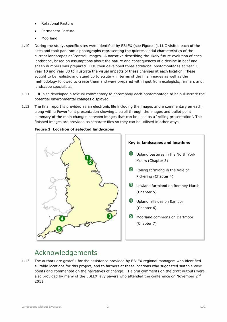
1.10 During the study, specific sites were identified by EBLEX (see Figure 1). LUC visited each of the
sites and took panoramic photographs representing the quintessential characteristics of the
current landscapes as ‘control’ images. A narrative describing the likely future evolution of each
landscape, based on assumptions about the nature and consequences of a decline in beef and
sheep numbers was prepared. LUC then developed three additional photomontages at Year 3,
Year 10 and Year 30 to illustrate the visual impacts of these changes at each location. These
sought to be realistic and stand up to scrutiny in terms of the final images as well as the
methodology followed to create them and were prepared with input from ecologists, farmers and,
landscape specialists.
1.11 LUC also developed a textual commentary to accompany each photomontage to help illustrate the
potential environmental changes displayed.
1.12 The final report is provided as an electronic file including the images and a commentary on each,
along with a PowerPoint presentation showing a scroll through the images and bullet point
summary of the main changes between images that can be used as a “rolling presentation”. The
finished images are provided as separate files so they can be utilised in other ways.
Figure 1. Location of selected landscapes
Acknowledgements 1.13 The authors are grateful for the assistance provided by EBLEX regional managers who identified
suitable locations for this project, and to farmers at these locations who suggested suitable view
points and commented on the narratives of change. Helpful comments on the draft outputs were
also provided by many of the EBLEX levy payers who attended the conference on November 2nd
2011.
Key to landscapes and locations
Upland pastures in the North York
Moors (Chapter 3)
Rolling farmland in the Vale of
Pickering (Chapter 4)
Lowland farmland on Romney Marsh
(Chapter 5)
Upland hillsides on Exmoor
(Chapter 6)
Moorland commons on Dartmoor
(Chapter 7)
Landscapes without Livestock 3 LUC
2 The narratives of change
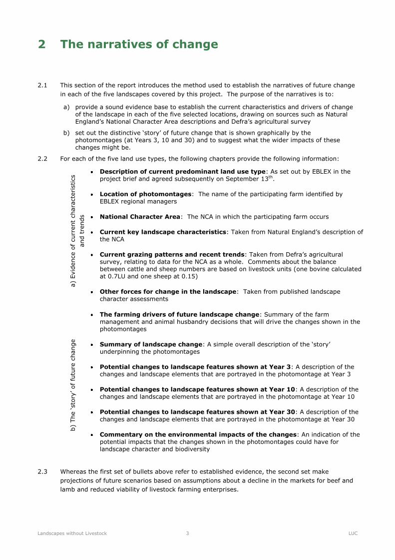
2.1 This section of the report introduces the method used to establish the narratives of future change
in each of the five landscapes covered by this project. The purpose of the narratives is to:
a) provide a sound evidence base to establish the current characteristics and drivers of change of the landscape in each of the five selected locations, drawing on sources such as Natural England’s National Character Area descriptions and Defra’s agricultural survey
b) set out the distinctive ‘story’ of future change that is shown graphically by the photomontages (at Years 3, 10 and 30) and to suggest what the wider impacts of these
changes might be.
2.2 For each of the five land use types, the following chapters provide the following information:
a)
Evid
ence o
f curr
ent
chara
cte
ristics
and t
rends
Description of current predominant land use type: As set out by EBLEX in the project brief and agreed subsequently on September 13th.
Location of photomontages: The name of the participating farm identified by EBLEX regional managers
National Character Area: The NCA in which the participating farm occurs
Current key landscape characteristics: Taken from Natural England’s description of the NCA
Current grazing patterns and recent trends: Taken from Defra’s agricultural survey, relating to data for the NCA as a whole. Comments about the balance between cattle and sheep numbers are based on livestock units (one bovine calculated at 0.7LU and one sheep at 0.15)
Other forces for change in the landscape: Taken from published landscape character assessments
b)
The ‘sto
ry’ of
futu
re c
hange
The farming drivers of future landscape change: Summary of the farm management and animal husbandry decisions that will drive the changes shown in the photomontages
Summary of landscape change: A simple overall description of the ‘story’ underpinning the photomontages
Potential changes to landscape features shown at Year 3: A description of the changes and landscape elements that are portrayed in the photomontage at Year 3
Potential changes to landscape features shown at Year 10: A description of the changes and landscape elements that are portrayed in the photomontage at Year 10
Potential changes to landscape features shown at Year 30: A description of the
changes and landscape elements that are portrayed in the photomontage at Year 30
Commentary on the environmental impacts of the changes: An indication of the
potential impacts that the changes shown in the photomontages could have for landscape character and biodiversity
2.3 Whereas the first set of bullets above refer to established evidence, the second set make
projections of future scenarios based on assumptions about a decline in the markets for beef and
lamb and reduced viability of livestock farming enterprises.

Landscapes without Livestock 4 LUC
3 Upland pastures in the North York Moors
Figure 3.1. The landscape as it now appears
Description of current predominant land use type
3.1 Large-scale fields of improved and semi-improved permanent pasture with frequent
areas of rough grazing occurring on the ridges and plateaux of the Less Favoured Areas
(LFA). Sheep tend to dominate over beef cattle. Hardy hill breeds predominate such as Scotch
blackface and Cheviot sheep and Limousin cattle. Parcels of land may be divided by stone walls,
but where grazing has been created from ‘new takes’ of moorland, wire fences are more common.
Farmland may be interspersed with large blocks of conifer forestry. Farmsteads are generally few
and far between.
3.2 This land use is also found in close association with LFA hillsides, moorland and permanent
pasture.
The current landscape
Current key landscape characteristics
3.3 The selected site lies within the North York Moors and Cleveland Hills National Character Area
(NCA). Key characteristics of this landscape include:
Plateaux dissected by a series of dales, often broad and sweeping, but with steep-sided river
valleys in places
Extensive areas of heather moorland on plateaux and hills, creating a sense of space,
expansiveness and openness. Many of these areas have been internationally designated as
Special Areas of Conservation
Valley landscapes characterised by predominantly pastoral farming with clear demarcation
between the enclosed fields and the moorland ridges above. Transition often marked by
bracken fringes
Extensive areas of coniferous plantations. Remnant areas of predominantly ancient semi-
natural woodland occurring mainly on valley side slopes, on escarpments and fringing hills
Traditional stone walls and hedgerows enclosing fields in the dales and lower fringing
farmland - now often replaced by fences
Landscapes without Livestock 5 LUC
Farms and villages built of predominantly rubble limestone or dressed sandstone, with red
pantile or slate roofs
Current grazing patterns and recent trends
3.4 Across the NCA as a whole, there is a relatively even balance of cattle and sheep. A significant
proportion of cattle and sheep are sold for breeding or as store animals (few being finished on
farms in the area). Since 2000 there has been a significant fall in livestock numbers, particularly
sheep (overall decline of 20%, sheep by 27% and cattle by 13%, these falls being greater than
for England as a whole). There is likely to have been an increase in the winter housing of cattle,
particularly on moorland and upland farms, and a small increase in the proportion of livestock
finished in the area.
Other forces for change in the landscape
3.5 Forces identified in the North York Moors National Park Landscape Character Assessment (2003)
for the 2: Narrow Moorland Dale Landscape Type are as follows:
Decline in rough pasture/species rich and wet grasslands in favour of improved pasture
Disrepair/loss of dry stone walls
Replacement of walls and hedges with fencing
Growth in visitor numbers: increased traffic, bridge and verge damage, footpath and
bridleway erosion, off road vehicle/motorcycle/mountain bike damage, disturbance to wildlife
Increasing commercialism within villages, tourist related development, holiday homes,
conversion of redundant buildings, pressures to increase extent/number of
camping/caravanning sites
Highway related changes, including road and bridge improvement, kerbing, parking controls,
signage and lighting
Telecom and mobile phone masts
Visualisations of change
The farming drivers of future landscape change
3.6 A decline in market prices for cattle and sheep relative to production costs would result in
significant reductions in grazing densities across most of the upland fields. The most marginally
productive and inaccessible land (such as steep ground on poor soils, currently providing rough
grazing) would cease to be grazed at all, with resulting invasion of gorse and other scrub. Fields
around farmsteads would probably continue to be grazed for amenity (lifestyle) purposes, but
with lower inputs (fertiliser and weed control). There would be a decline in the maintenance of
stone walls and many stone barns, except where environmental payments were received or where
new uses were found for buildings. Conservation grazing, funded by receipts from agri-
environment schemes, would continue on sites with high environmental value, such as
unimproved pasture, hay meadows and areas of enclosed (and unenclosed) heather moorland.
3.7 Many upland farm businesses would sell or rent their land and others would diversify, with
tourism being the most popular and visible enterprise (though already common and possibly
oversupplied in many areas). Provision of camping or, in sheltered spots, small caravan sites,
and conversion of traditional farm buildings to holiday cottages or camping barns would increase.
Planning policies in National Parks would be a constraint. While these would probably not prevent
environmentally sympathetic development of buildings, they are likely to prevent large scale
developments such as wind farms (but small turbines are possible). Planting of woodland for
energy production (using fast growing species such as eucalyptus or willow) or timber (most
probably conifers in the uplands) would take place on significant areas of land.
Landscapes without Livestock 6 LUC
Summary of landscape change
3.8 Livestock grazing will disappear from large areas of the uplands, being retained in a
few areas only for conservation purposes, to be replaced by naturally colonising scrub
and planted woodland. Remaining farms will get larger, with many relying on tourism
to maintain incomes.
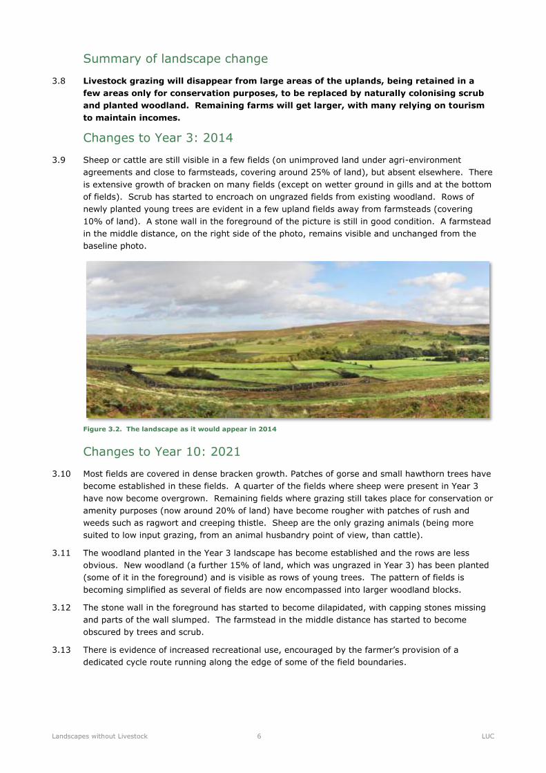
Changes to Year 3: 2014
3.9 Sheep or cattle are still visible in a few fields (on unimproved land under agri-environment
agreements and close to farmsteads, covering around 25% of land), but absent elsewhere. There
is extensive growth of bracken on many fields (except on wetter ground in gills and at the bottom
of fields). Scrub has started to encroach on ungrazed fields from existing woodland. Rows of
newly planted young trees are evident in a few upland fields away from farmsteads (covering
10% of land). A stone wall in the foreground of the picture is still in good condition. A farmstead
in the middle distance, on the right side of the photo, remains visible and unchanged from the
baseline photo.
Figure 3.2. The landscape as it would appear in 2014
Changes to Year 10: 2021
3.10 Most fields are covered in dense bracken growth. Patches of gorse and small hawthorn trees have
become established in these fields. A quarter of the fields where sheep were present in Year 3
have now become overgrown. Remaining fields where grazing still takes place for conservation or
amenity purposes (now around 20% of land) have become rougher with patches of rush and
weeds such as ragwort and creeping thistle. Sheep are the only grazing animals (being more
suited to low input grazing, from an animal husbandry point of view, than cattle).
3.11 The woodland planted in the Year 3 landscape has become established and the rows are less
obvious. New woodland (a further 15% of land, which was ungrazed in Year 3) has been planted
(some of it in the foreground) and is visible as rows of young trees. The pattern of fields is
becoming simplified as several of fields are now encompassed into larger woodland blocks.
3.12 The stone wall in the foreground has started to become dilapidated, with capping stones missing
and parts of the wall slumped. The farmstead in the middle distance has started to become
obscured by trees and scrub.
3.13 There is evidence of increased recreational use, encouraged by the farmer’s provision of a
dedicated cycle route running along the edge of some of the field boundaries.

Landscapes without Livestock 7 LUC
Figure 3.3. The landscape as it would appear in 2021
Changes to Year 30: 2041
3.14 The pattern of fields has become very largely obscured by the extensive growth of mature gorse
scrub and young self-sown oak and willow woodland.
3.15 The woodland planted in Years 3 and 10 is now well established. Rows have disappeared and the
character of the different types of woodland has become obvious, with large blocks of single
species dominating parts of the landscape. On the higher ground there is plantation conifer
forestry while on the lower ground, the distinctive moss green colour of eucalyptus (grown as an
energy crop) stands out. Eucalyptus is very fast growing and trees 40ft high in the foreground
have started to obscure more distant views.
3.16 The proportion of land that receives some livestock grazing for conservation or amenity purposes
has fallen to 15%. Only sheep are visible on this land – cattle are now completely absent. This
land is also being encroached at its edges by scrub and has a rougher weedy look (with extensive
patches of rush and ragwort).
3.17 The stone wall in the foreground is much less visible, having been robbed of stone (for building)
and colonised by shrubs such as hawthorn and elder.
3.18 The original farm buildings on the right hand side of the photo are now hidden by trees but a new
stone building has been erected in the field in front of the farm to provide a camping barn and
source of tourism income (although this use cannot be seen at this distance).
3.19 The network of recreational (cycling and riding) tracks has been extended and all are well
established, standing out in the otherwise unmanaged landscape. Again, people using the tracks
are visible.
Figure 3.4. The landscape as it would appear in 2041
Landscapes without Livestock 8 LUC
Commentary on the changes to landscape character and quality
3.20 This upland landscape is transformed from one where the transition between in-bye farmland and
upland moorland is key to landscape character to one where the boundaries between the two are
blurred. The 2011 landscape – with its smooth pastoral fields of varying shades of green standing
out against a backdrop of textured bronze and golden bracken and heather moorland habitats –
combines to create a varied upland mosaic reflecting patterns of land management activity. In 30
years the spread of bracken, scrub and rough grassland along with new woodland planting results
in a more roughly textured landscape. Historic field patterns are hidden from view, with
prominent conifer blocks forming detracting features both in terms of scale and colour within the
moorland scene. The future landscape evokes a sense of agricultural abandonment and increased
feelings of ‘wildness’, with untamed nature taking over large areas. Movement within the
previously calm landscape has increased, with recreational users appearing as frequent features
whilst sheep and cattle have all but disappeared.
Commentary on the changes to biodiversity
3.21 By 2041, bracken and scrub replaces the open habitat mosaic favoured by characteristic moorland
birds such as merlin, red grouse, meadow pipit and upland waders. Together with high levels of
disturbance from increased recreation, this has resulted in localised population declines. Species-
rich grasslands, which depend upon low levels of grazing, have been replaced by taller, rank
grasslands with lower species diversity. Subsequently, several rare butterflies and moths have
been adversely affected. Species associated with bracken, such as the pearl bordered fritillary
may benefit from its increase.
Landscapes without Livestock 9 LUC
Overview of visual changes
2014
2041
2021
Now
Landscapes without Livestock 10 LUC
4 Rolling farmland in the Vale of Pickering
Figure 4.1. The landscape as it appears today
Description of current predominant land use type
4.1 Improved (ley) pasture and meadows which are rotated with arable and root crops in
lowland mixed farmland landscapes. Other crops include forage maize (associated with dairy
cattle), cereals, oilseed rape (and other arable break crops) and forage root crops such as stubble
turnips. Fields are divided by hedges, often tightly trimmed, barbed wire fences or ditches.
Grazing is provided by lowland breeds of sheep and beef cattle (including cross-bred mule flocks
of sheep and dairy-bred steers and heifers), as well as dairy cattle. Small blocks of broadleaved
woodland and shelter belts are often common. Farmsteads often occur on the edges of villages
and hamlets, but may be out-lying in their own ‘ring fence’ of farmland.
4.2 This land use is also found in close association with permanent pasture and arable cropping.
The current landscape
Current key landscape characteristics
4.3 The selected site lies on the northern edge of the Vale of Pickering National Character Area (NCA).
Key characteristics of this landscape include:
Low lying flat or gently undulating vale with land rising gently in the north to the foothills of
the North York Moors and Cleveland Hills
Pastoral floodplains of the rivers Rye and Derwent and their predominantly northern
tributaries
An important visual characteristic is the transition from a relatively large-scale pattern of
arable fields and shallow dry valleys to a smaller-scale, pre-parliamentary pattern of long
linear, often pastoral fields near settlement edges
Relatively sparse tree cover and few woodlands overall, with those which do occur being
mainly mixed or coniferous in character and located more to the north and west of the Vale
Varied building materials, including hard sandstone, brought in from surrounding uplands, and
brick

Landscapes without Livestock 11 LUC
Current grazing patterns and recent trends
4.4 This is a strong beef farming area, with finishing taking place in sheds (on cereal-based rations)
as well as on improved ley grassland. In contrast, there are relatively few sheep. Cattle numbers
have increase by 13% since 2000 while sheep numbers have declined by 14%. Most livestock
farms also grow arable crops (overall 60% of the farmed area grows arable crops), although since
2000 the area of grass has increased at the expense of arable.
Other forces for change in the landscape
4.5 Forces identified in the The Landscapes of Northern Ryedale (1999) for the F: Linear Scarp
Farmland Character Area are as follows:
Modern farm buildings, pylons and poorly sited fence lines
Field enlargement and hedge removal
4.6 Forces identified in the The NCA Description for 26: Vale of Pickering are as follows:
Trees and wildlife habitats have been lost along river banks as a result of over-engineering
and river management
Development pressures for road building and housing
Visualisations of change
The farming drivers of future landscape change
4.7 Much of the grassland in this landscape is readily suited to conversion to continuous arable
cropping with cereals and break crops such as oilseed rape. If livestock farming became less
profitable, farms would adapt and businesses would continue with the almost complete absence of
farm livestock. Where cattle and sheep were retained it would be for amenity and lifestyle
purposes. Where feasible by the removal of wire fences and some hedges, fields would become
larger. Hedges and shelter belts would be cut back. Traditional livestock buildings would be
converted to other uses such as light industry. New large barns would be required for arable
machinery and grain storage. Land that was less suited to arable cropping would be planted with
woodland, particularly short rotation coppice for biomass energy production.
Summary of landscape change
4.8 This area changes from a mixed farm landscape to one dominated by continuous arable
cropping, with the planting of energy crops on less productive land. Farms grow larger
and land use is more intensive.
Changes to Year 3: 2014
4.9 The change from a mixed landscape of arable and grassland to one dominated by arable takes
place quickly. The patchwork pattern of fields is still evident (and if anything accentuated) by the
variation in cereal stubble and cultivated soil that has replace the grassland.
4.10 A field boundary in the middle ground (the gappy hedgerow at the far side of the second field
from the viewer) has been removed to allow two fields to be enlarged.
4.11 The only grassland visible is in small narrow fields not suitable for cultivation which are retained
as permanent pasture grazed by ponies, with wooden pony shelters in the corner of each field.

Landscapes without Livestock 12 LUC
Figure 4.2. The landscape as it would appear in 2014
Changes to Year 10: 2021
4.12 A contract farming arrangement by the farmer has allowed for large-scale block cropping, where
groups of fields are treated as one, with the same crop each year. Some further field boundaries
have been removed (small hedges), but even where boundaries remain, the effect is of a
simplified and more intensively farmed landscape. Remaining hedgerows have become more
tightly trimmed and are less prominent. One or two hedgerow trees have gone and others are
showing signs of die-back in the crown (due to repeated ploughing of the roots).
4.13 A substantial block of land has been planted on land in the middle ground with short rotation
coppice willow for biomass energy.
4.14 The pony paddocks in the narrow fields of permanent pasture have been replaced by a caravan
and camp site. There are a dozen tents, five camper vans and two caravans dotted about
amongst mown grassland. A large new barn has been created to store and dry grain.
4.15 A steep field on thinner soil has been planted with young woodland, with the rows of young trees
highly visible.
Figure 4.3. The landscape as it would appear in 2021
Changes to Year 30: 2041
4.16 Large-scale block cropping continues, with further field boundary removal increasing some field
sizes.
4.17 The area planted with short rotation coppice has increased. Growing to a height of 4m before it is
harvested (on a three-year cycle), it obscures views in some places.
Landscapes without Livestock 13 LUC
4.18 The process of tighter hedgerow management has continued, again reducing their prominence.
Many of the hedgerow and field trees have gone, not to be replaced. Others have become
prominent as isolated stag-headed trees as a result of regular ploughing and damage to roots
under their canopies.
4.19 The woodland planted in Year 10 has grown, with the rows of trees no longer being visible.
Another field has been planted with young trees.
4.20 The caravan site has grown further and become more regimented, with a network of concrete
tracks dividing up the mown grass field. Some 20 static caravans, as well as camper vans with
hook-ups are visible.
4.21 The large grain store has weathered and another one added by its side.
Figure 4.4. The landscape as it would appear in 2041
Commentary on the changes to landscape character and quality
4.22 This classic mixed vale landscape, comprising a rotating balance of vivid green grass leys and
arable fields bounded by a strong network of hedges and frequent hedgerow trees, is transformed
into a simple, monotone landscape of enlarged arable fields. During the 30-year timeframe, the
strong field patterns of different shapes and sizes are diluted through field enlargement – leaving
behind a simple, consistent landscape with few defining landscape features and very little
diversity in landscape patterns or colours. It is an ‘industrial’ landscape, strongly focused on
maximising agricultural production whilst providing opportunities for tourism. New roads and
caravan site infrastructure further emphasise the modern feel of this working landscape.
Commentary on the changes to biodiversity
4.23 By 2041, the loss of hedgerows and tree lines has resulted in a significant decline in farmland
birds, including grey partridge, linnet, corn bunting, reed bunting, and tree sparrow. However,
good populations of farmland birds persist in arable landscapes where specific management has
been undertaken in line with government incentives. Populations of barn owls and bat species
have declined, probably due to the loss of mature trees which provide suitable nest/roost sites
and hedgerows and rough pasture which provide suitable foraging habitat and movement
corridors.
4.24 The extent of neutral grassland, including species-rich examples traditionally maintained by long-
term grazing practices, is much reduced having been converted to intensive arable fields.
Livestock poaching along river banks is greatly reduced and the resulting margin of scrub and
aquatic vegetation has enhanced the riparian environment for otters.

Landscapes without Livestock 14 LUC
Overview of visual changes
2014
2041
2021
Now

Landscapes without Livestock 15 LUC
5 Lowland farming on Romney Marsh
Figure 5.1. The landscape as it appears today
Description of current predominant land use type
5.1 Generally small fields of improved or semi-improved permanent pasture occurring in
lowland landscapes. Grassland includes some grass cut for silage, hay or haylage. Fields are
divided by mixed species hedges, often allowed to grow tall to provide shelter, or by ditches.
Grazing is provided by lowland breeds of sheep and beef cattle (including cross-bred mule flocks
of sheep and dairy-bred steers and heifers), as well as dairy cattle. This land use type occurs
alongside rotational (ley) pasture and arable (often in an intimate mix of fields). Small blocks of
broadleaved woodland and shelter belts are often common. Farmsteads often occur on the edges
of villages and hamlets, but may be out-lying in their own ‘ring fence’ of farmland.
5.2 This land use is also found in close association with rotational pasture and arable cropping.
The current landscape
Current key landscape characteristics
5.3 The selected site lies within the Romney Marsh National Character Area (NCA). Key
characteristics of this landscape include:
A flat, open agricultural landscape, with distinctive drainage dykes, marshes and open skies.
The treeless, low-lying, reclaimed marshland is now maintained by manmade drainage and
river floodplain improvements
A high-quality agricultural land of extensive arable fields and some traditional open wet
pasture land grazed by cattle and sheep. Narrow, straight roads and widely dispersed
settlements with distinctive churches combine with the overall open character to provide a
sense of remoteness
Clumps of trees on pockets of higher ground around farmsteads, reed fringed ditches, patches
of standing water and rushy pasture, all contribute to local diversity in a relatively uniform
landscape
The landscape displays a sharp contrast between the shingle coastal promontories, the
extensive open, low-lying agricultural land behind and the inland backdrop of well-wooded
rising ground
Landscapes without Livestock 16 LUC
Current grazing patterns and recent trends
5.4 This is a strong sheep rearing and fattening area (with its own breed, the Romney or Kent breed,
which account for a minority of sheep produced in the area). Traditionally, sheep were wintered
out of the area on drier ground such as the South Downs, a practice that continues. The period
since 2000 has seen a shift in land use towards arable cropping (with an 11% rise in the area of
cereals and arable break crops), matched by a sharp fall in sheep numbers (down a third). Over
this period there has been a small rise in cattle numbers (up 8%). Most of the area is potentially
highly productive land (Grades 1 or 2). Drainage schemes in the last 50 years have converted
low-lying wet grassland to arable land cropped for wheat and high value crops such as potatoes
and field vegetables. Much of the remaining areas of unimproved permanent pasture is nationally
designated as Sites of Special Scientific Interest.
Other forces for change in the landscape
5.5 Forces identified in the Kent Landscape Assessment (2004) for the Brookland Farms Landscape
Character Area are as follows:
Hedgerows are often unmanaged and in decline
Some dykes are scoured of vegetation
The land is intensively farmed and mature trees and well vegetated ditches are fragmented
Pollarded willows and poplars are vulnerable because there are few young trees in the
structure
5.6 Forces identified in the NCA Description for 123: Romney Marsh are as follows:
Drainage and improvement works resulting in the loss of characteristic dyke, marshland and
wet meadow vegetation cover
Golf course development
The open landscapes are particularly vulnerable to landscape change arising from the
development of large new agricultural buildings and from military land uses
New roads and improvement schemes
Suburban influences
Visualisations of change
The farming drivers of future landscape change
5.7 In the absence of commercial sheep farming, land use would develop in two ways. Grassland that
was capable of being ploughed and drained (the majority) would be converted to intensive arable
cropping or field-scale horticulture, with dykes deepened, straightened and narrowed, or piped.
Land that was not suitable for this change, such as small parcels of land close to villages or beside
rivers, would be used for amenity and recreational purposes such as pony paddocks and golf
courses.
Summary of landscape change
5.8 The decline of commercial sheep farming increases the area already cropped intensively for
cereals, potatoes and field vegetables. The small parcels of land not suitable for draining and
cultivation are used for amenity and recreational purposes.
Landscapes without Livestock 17 LUC
Changes to Year 3: 2014
5.9 The transformation of this landscape starts swiftly with the replacement of the shallow reed-filled
dykes by deeper geometric drainage ditches which appear 'raw' and relatively unvegetated.
5.10 Most of the land in the foreground has been ploughed and cropped (potatoes, cereals or oilseed
rape).
5.11 A buffer of grassland has been retained around the old church which provides a focal point in the
middle ground of the photograph.
5.12 An area of grassland to one side of the fore/middle ground has been retained (possibly the parcel
in front of the church but is now grazed by ponies (horse tape is visible, keeping the ponies from
getting into the deep drainage ditch).
Figure 5.2. The landscape as it would appear in 2014
Changes to Year 10: 2021
5.13 The steep-sided drainage ditches appear less raw, having become more vegetated.
5.14 The buffer of grassland around the church has now scrubbed up, with hawthorn and bramble
growing in patches up to the foot of the church walls. The area of pony-grazed grassland remains
but has become overrun with creeping thistle and ragwort.
5.15 Field boundaries beside the arable have started to change, with straightened or piped dykes and
features such as pollarded willows removed.
5.16 In the far distance an industrial looking barn, used as a vegetable pack house, has been erected.
Figure 5.3. The landscape as it would appear in 2021
Landscapes without Livestock 18 LUC
Changes to Year 30: 2041
5.17 The area of arable has increased to occupy the whole of the fore/middle ground. The pony grazed
field has been ploughed and the buffer of grassland around the church has shrunk.
5.18 While there is evidence that some of the scrub in the remaining buffer area around the church has
been controlled (cut back), some of the trees have grown large.
5.19 The track carrying farm machinery has been surfaced and the vegetable packhouse in the
distance has been added to, giving a more industrial appearance to the photograph.
Figure 5.4. The landscape as it would appear in 2041
Commentary on the changes to landscape character and quality
5.20 The reclaimed landscape of Romney Marsh, with its long history of extensive sheep grazing on
open wet pastures sees a dramatic transformation in 30 years. The open, remote landscape with
strong, distinctive sense of place is replaced by a busy, working landscape characterised by arable
and industrial-scale vegetable cultivation. Grazing cattle and sheep, including the traditional
Romney breed, have disappeared, with uncultivated areas abandoned with scrub encroachment
emphasising the ‘forgotten’ function of these parts of the marshland landscape. Major engineered
drainage ditches cut deeply through the landscape – further demonstrating the strong modern
human influence that has become the dominating feature of the future Romney Marsh.
Commentary on the changes to biodiversity
5.21 By 2041, wet pasture has been replaced by intensive arable farming and industrial-scale
vegetable cultivation. Waders and wintering birds have disappeared and are now restricted to the
coastal fringe and sites of nature conservation importance such as Dungeness, Romney Marsh and
Rye Bay SSSI and Dungeness National Nature Reserve. At these sites, wetland bird numbers
have declined. The loss of suitable feeding habitat in the wider landscape is probably a significant
contributory factor.
5.22 Aquatic plant diversity in ditches is low, primarily as a result of nutrient enrichment and pollution
from run-off of agricultural pesticides, herbicides and fertiliser. A large quantity of water is
abstracted from ditches to irrigate crops, and consequently water levels are often sub-optimal.
Populations of rare aquatic species such as marsh mallow, sharp-leaved pondweed, greater water
parsnip, divided sedge and rootless duckweed are restricted to a few sites managed specifically
for their conservation. These populations continue to decline as abstraction, nutrient enrichment
and pollution increases.
5.23 Reduced water quality and a reduction in aquatic plant diversity have resulted in population
declines for several rare and notable invertebrates, including various water beetles and the
medicinal leech, which rely on the network of ditches within the Romney Marsh.

Landscapes without Livestock 19 LUC
5.24 Water voles are now uncommon throughout much of the Romney Marsh, largely as a result of
intensive management of ditches with inappropriate cutting regimes and insufficient terrestrial
margins. This Biodiversity Action Plan (BAP) priority species now survives only within areas
managed for nature conservation and a few isolated ditches managed sympathetically by land
owners.

Landscapes without Livestock 20 LUC
Overview of visual changes
2014
2041
2021
Now

Landscapes without Livestock 21 LUC
6 Upland hillsides on Exmoor
Figure 6.1. The landscape as it appears today
Description of current predominant land use type
6.1 Predominantly enclosed improved permanent pasture occurring in the valleys and
valley sides of the Less Favoured Areas. This land use may also include patches of rough
grazing and unimproved rush pasture on steeper slopes or poorer soils, and fields of rotational
pasture and arable on the most productive land. At a landscape scale, grazing is often from a mix
of sheep, beef and dairy cattle, but on individual farms one type of animal tends to dominate. A
wide range of hill breeds (not necessarily hardy) may be found. Fields are often divided by stone
walls or hedge banks. Belts of broadleaved woodland may occur beside streams. Farms are often
small. Farmsteads are either clustered around small villages or lie at the end of lanes up the
valleys or valley sides.
6.2 This land use is also found in close association with LFA upland, moorland and permanent pasture.
The current landscape
Current key landscape characteristics
6.3 The selected site lies within the Exmoor National Character Area (NCA). Key characteristics of
this landscape include:
A diverse upland landscape, rising abruptly out of the surrounding lowlands
Extensive 19th century moorland-edge enclosures and farms with beech-topped hedgebanks
and beech windbreaks
Steep, wooded inland valleys and steep, coastal combes
Regular, straight-sided fields usually enclosed by earth banks and stone walls
Villages and farmsteads nestle in sheltered valley bottoms. Slates and sandstones used in
older buildings
High archaeological interest of Bronze Age monuments such as hill-forts
6.4 Exmoor National Park Landscape Character Assessment (2007) for the Wooded & Farmed Hills
with Combes Landscape Type describes the following characteristics:

Landscapes without Livestock 22 LUC
Elevation ranging from 100m AOD to almost 400m AOD with a strongly articulated rounded
landform
Low-lying narrow combe valley floors meet steep valley sides that give rise to a series of
interconnected rounded hills
Open hilltops offer extensive coastal and inland panoramas
The landscape has significant woodland cover - deciduous, coniferous and mixed - ranging
from geometric plantations to sinuous swathes
Geological strata of slate, siltstones and sandstones predominantly underlie this landscape but
there are localised areas of limestone in the river valleys
The rolling hillsides reveal a clear pattern of field enclosure
Fields are medium-sized and delineated by banked, mixed hedges
The secondary roads and rural lanes connect the linear hamlets and small villages dispersed
throughout the area that nestle in the valley bottoms
Current grazing patterns and recent trends
6.5 Across Exmoor as a whole, sheep are the main grazing animal (accounting for 60% of grazing
livestock units). Traditionally most sheep were of hardy breeds such as the cheviot and Exmoor
horn, but in recent years, ‘softer’ and more productive breeds have become more common,
particularly on the LFA hillside land. Cattle breeds such as the Limousin, North Devon and
Aberdeen Angus breeds are reared for sale as calves and stores or are finished in the area, with
much of the finishing taking place in sheds and yards. Since 2000, livestock numbers have fallen
by a quarter, with the sheep flock declining by a third (cattle by 16%). Much of this reduction has
taken place on moorland farms, with farms on the more productive land off the moor seeing
smaller reductions. Land use is predominantly permanent pasture, or long term leys, and there is
little arable cropping. The overall balance of land use has changed little since 2000.
Other forces for change in the landscape
6.6 Forces identified in the Exmoor National Park Landscape Character Assessment (2007) for the
Wooded & Farmed Hills with Combes Landscape Type are as follows:
Hedgerow boundaries are in decline in places
Straight, blunt lines of game crops threaten the rounded, sinuous, organic form of the
landscape
Infrastructure associated with the game shoots is also having a cumulative impact – pens and
feeders are frequently seen elements
Conversion of redundant farm buildings to residential use
Visualisations of change
The farming drivers of future landscape change
6.7 Small farms with traditional farm houses and areas of broadleaved woodland (which are common
in this area) are in high demand as residential lifestyle (or hobby) farms. If commercial livestock
farming were to become less viable, many of the farms would be sold as smallholdings, often to
people with little previous experience of farming, but who have an interest in rare breeds and
producing their own food. Amenity uses of the land such as game shooting (already significant)
would increase, including through large syndicated shoots. Equestrian sports and riding are
popular and land would be converted to horse grazing, jumping and more specialist uses such as
dressage.
Landscapes without Livestock 23 LUC
6.8 Generating renewable energy from the land would be of interest to these lifestyle farmers,
particularly those with capital to invest. This would take the form of energy crops such as
miscanthus grass, wind turbines on high ground and solar farms on unshaded south facing slopes.
The scale and impact of the latter two would be limited by the planning policies of the National
Park Authority.
6.9 It is likely that small-scale commercial beef and lamb production, for specialist local and national
value-added (including organic) markets would continue on some farms, supported by agri-
environment payments. These farms are not the main focus of the scenario described below.
Summary of landscape change
6.10 Most small farms become non-commercial smallholdings in which extensive livestock
farming continues, using rare breeds and with lower inputs. Equestrian uses of land
increase and the land is used to generate renewable energy from wind, solar panels and
energy crops.
Changes to Year 3: 2014
6.11 There is relatively little outright change in land use. Small numbers of sheep graze the fields and
there are larger patches of bracken on the steeper slopes and rushes and creeping thistle on the
lower wetter land.
6.12 A game crop has been established in a strip 20m wide along the side of one of the higher fields,
catering for the growing demand for recreational (sporting) pursuits in the countryside.
6.13 Hedgerows and woodland belts have grown thicker and taller.
6.14 A wind turbine has been erected on the high ground on the far horizon.
Figure 6.2. The landscape as it would appear in 2014
Changes to Year 10: 2021
6.15 Sheep are still present in the fields in small numbers, but a wider diversity of farm animals
(particularly outdoor pigs and poultry) are now present on the ‘hobby’ farms. The ground on this
land has a rough look as a result of the ‘rooting’ activity of the pigs which are kept from adjoining
land by electric fencing.
6.16 Bracken has encroached further on other fields and the land has a generally rougher look, with
the colour of the grassland toned down (more olive greens, showing lower inputs).
6.17 Hedgerows have become thicker again. Equestrian uses have started to become more significant,
with cross-country hacking and jumping being popular pursuits as well as a source of income for
some landowners.

Landscapes without Livestock 24 LUC
6.18 One of the flatter fields in the distance has been planted with the energy crop Miscanthus
(‘Elephant grass’) creating a block of thick tall (2-3m) straw-coloured vegetation.
Figure 6.3. The landscape as it would appear in 2021
Changes to Year 30: 2041
6.19 The trends identified in Years 3 and 10 continue. The disturbance of the soil by outdoor pigs in
the foreground dominates the view but elsewhere the grassland has become progressively
rougher and hedgerows larger. Sheep and some North Devon cattle are still present in some
fields but bracken, rush and thistles have increased.
6.20 Equestrian uses are still taking place – the field in the foreground has been divided by a smart
fence separating horse grazing from the pigs. Long distance riding routes have been established,
attracting visitors on holiday to the area.
6.21 In one of the fields on steeper slopes next to woodland, drifts of bramble and thorn scrub have
encroached, covering about a fifth of the field, showing that, although it still receives some
grazing, this has not been enough to prevent scrub growth.
6.22 Rows of solar panels (raised at an angle on frames) have been erected in one of the south facing
fields in the distance. In this field, the hedges have been cut back and the grass is more tightly
grazed.
Figure 6.4. The landscape as it would appear in 2041
Commentary on the changes to landscape character and quality
6.23 Exmoor’s moorland fringe landscape, with its intricate patterns of medieval and post-medieval
pasture fields bounded by distinctive beech hedges, demonstrates a number of changes in the 30-
year time period. The intimate pastoral landscape of lush green fields grazed by distinctive Ruby
Landscapes without Livestock 25 LUC
Red Devon cattle is encroached by a variety of new land uses, diluting the traditional feel of the
area. Farm diversification includes outdoor pig rearing, game cropping, the installation of solar
farms and wind turbines introducing a sense of ‘busy-ness’ to the landscape. Strong field
patterns are obscured by scrub and new tree/woodland planting or sub-divided by fencing – with
the smooth, curving contours of the hills masked by geometric conifer blocks. In all, this part of
Exmoor is a ‘hotchpotch’ of activity, diluting the strong traditional identity associated with the
National Park.
Commentary on the changes to biodiversity
6.24 By 2041, the extent of the Biodiversity Action Plan (BAP) priority habitat ‘neutral grassland’ is
much reduced, having been replaced by woodland, hobby farming, game rearing and solar farms.
Loss of neutral grassland and encroachment of scrub has reduced populations of the BAP priority
species, ballerina waxcap, heath fritillary, and high brown fritillary. These species are now largely
restricted to sites managed specifically for nature conservation. Increased bracken, scrub and
woodland is providing additional habitat for dormouse and the local population of this species
remains stable.

Landscapes without Livestock 26 LUC
Overview of visual changes
2014
2041
2021
Now

Landscapes without Livestock 27 LUC
7 Moorland commons on Dartmoor
Figure 7.1. The landscape as it appears today
Description of current predominant land use type
7.1 Unenclosed moorland (consisting of upland heath vegetation such as heather or purple
moorgrass), often managed as common land and designated for its environmental
value. This land often occurs over deep peat soils and may include blanket bog vegetation and
valley mires. There are few field boundaries but stone walls and fences occur against enclosed
farmland (LFA upland or LFS hillsides types). Land is predominantly sheep grazed, but beef
cattle and sometimes hill ponies may also be found. Hardy breeds predominate. Farmland may
be interspersed with large blocks of conifer forestry. Any farmsteads that occur on the edge of
moorland are likely to be Victorian or more recent farms created around ‘new takes’.
7.2 This land use is also found in close association with LFA upland.
The current landscape
Current key landscape characteristics
7.3 The selected site lies within the Dartmoor National Character Area (NCA). Key characteristics of
this landscape include:
Strong contrasts between open, windswept moors with wide views and sheltered landscapes
of valleys and fringes
Central high moorland with a wild landscape of tors, clitters, bogs, grassland, heather and
bracken
Around the moorland core is a gentler landscape of small, irregular pasture fields with dry
stone walls and banks, cut by large, terraced, wooded valleys which shelter farmsteads and
hamlets
Granite and slate in cottages, farmhouses, villages, abandoned mine buildings and walls,
unifies the landscape
Very high historic interest from Bronze Age onwards: particular features include highly visible
features such as hut circles, standing stones, reaves, field systems, hillforts
7.4 Key characteristics described in the Dartmoor Landscape Character Assessment (2010) for the 1L:
Upland Moorland with Tors Landscape Character Type include:
Landscapes without Livestock 28 LUC
A gently rolling, large scale moorland landscape with a strong sense of exposure, tranquillity
and far reaching, often panoramic views
Tors punctuate the smooth moorland slopes, fringed by scatterings of granite boulders and
clitter slopes
Large conifer plantations create dark blocks with hard edges, contrasting with the smooth,
muted landscape backdrop
Patches of deciduous woodland are dominated by oak, ash and beech; generally limited to
valley sides and around settlements
Vegetation cover on more elevated areas is of a heathland character with a patchwork of
heather and grass moor, Western heath, gorse scrub, tufts of Molinia grass, bracken and
scattered, windswept trees
Free-roaming sheep, cattle and ponies are strongly associated with the moorland scene
Valley mires and blanket bogs thread through the rolling landscape before feeding into fast
flowing tributary streams, which grow in size and occupy steep sided valleys off the moor
Strong pattern of late 18th and 19th century ‘newtakes’ surround the moorland core, defined
by a regular pattern of granite drystone walls and low hedgebanks enclosing rough grazing
land
Local vernacular is characterised predominantly by granite and slate. Settlements are small
and clustered around bridging points or crossroads nestled into the folds of the landscape.
Isolated farmsteads, often with colourwashed walls, are dotted across the moorland;
commonly framed by trees providing shelter from the elements
Current grazing patterns and recent trends
7.5 There is a balance of cattle and sheep grazing (with cattle accounting for 55% of livestock units).
Hardy breeds such as the Scotch blackface sheep and Galloway and South Devon cattle. Ponies
are also grazed on the moorlands. Since 2000, livestock numbers have fallen by a quarter, with
the sheep flock declining by 31% and cattle by 17%. Most of the grazing on the unenclosed
moorland is held as shared common grazing. The last decade has seen most of the Dartmoor
Commons come within agri-environment schemes agreements and stocking of the moorlands has
fallen as a result, particularly during the winter.
Other forces for change in the landscape
7.6 Forces identified in the Dartmoor Landscape Character Assessment (2010) for the 1L: Upland
Moorland with Tors Landscape Character Type are as follows:
Bracken and gorse no longer used for livestock bedding or fuel – with this trend contributing
towards their spread within the open moorland
Ongoing decline in traditional skills including commoning, dry stone walling and hedge laying,
with associated impacts on landscape character
Variable management of stone walls and Devon hedgebanks associated with the newtakes on
the edge of the moorland
Pressure from tourism and people moving to the area leading to farm conversions and an
increase in traffic levels on roads crossing the moor
Recreational pressure particularly in honeypot locations close to the road network

Landscapes without Livestock 29 LUC
Visualisations of change
The farming drivers of future landscape change
7.7 Of all of the five land use types and landscapes covered by this project, this one is likely to be
subject to least out-right transformation of land use as a result of declining markets for livestock
production. This is because moorland is already subject to low levels of grazing (reliant on farm
support and agri-environment payments more than market returns) and there is little likelihood of
agricultural improvement (due to environmental protection and the low productivity of the soils).
7.8 The high importance of the moorland’s biodiversity, landscape character, archaeology and stored
organic carbon in the peat soils is likely to mean that agri-environment payments for conservation
grazing will continue. However, the long term outcome of this policy is not clear. Over the last
20 years, conservation grazing over most of Dartmoor’s moorland has failed to deliver the
anticipated rejuvenation of dwarf shrub heathland and blanket bog. Instead, purple moorgrass
has become more dominant, with a thick ‘thatch’ of grass that is unpalatable to livestock
suppressing heather growth. The reasons for this are not fully understood but the lower levels
and altered timing of grazing, and also climatic factors, are likely to be involved. This suggests
that agri-environment schemes have either failed to counter, or have possibly exacerbated,
fundamental changes in moorland farming systems resulting in declines in early summer grazing
(particularly by cattle) and lower numbers of hardy breeds.
7.9 In this future scenario it is assumed that public funding ensures the continuation of a level of
conservation grazing but that this is unable to reverse the trend towards dominance of purple
moorgrass and encroachment of scrub onto the high moor. Moorland burning (swaling) would
continue in a planned fashion but the risk of uncontrolled fires of the dry grass in hot summers
would increase. Overall, the wild and untamed character of the moorland would be accentuated,
with agricultural management having less influence on the landscape than it currently does.
7.10 Importantly, it is assumed that farm support payments (from the Single Payment Scheme and
agri-environment schemes) will continue, ensuring that the moorland continues to receive some
grazing. Were these sources of income to decline significantly, it is likely all forms of agricultural
management on the moorland would cease.
Summary of landscape change
7.11 Low levels of conservation grazing and other environmental management continue but these
struggle to deliver the conservation objectives of increasing the area of heather and the condition
of blanket bog. Increased growth of purple moorgrass, gorse and isolated trees gives the
moorland a wilder and untamed look.
Changes to Year 3: 2014
7.12 Belted Galloway cattle can be seen on the moor in small numbers. The rushy vegetation in the
fore/middle ground has grown taller and there is no close cropped grass. Throughout the
landscape, there are increased areas of bracken on the ‘grey’ moor (purple moorgrass
dominated). The stone wall in the foreground is unchanged.

Landscapes without Livestock 30 LUC
Figure 7.2. The landscape as it would appear in 2014
Changes to Year 10: 2021
7.13 The patches of brown in the middle and far distance (clumps of heather) have gone, replaced by a
‘sea’ of yellow molinia (purple moor grass).
7.14 The vegetation in the foreground (rush and molinia dominated) has become noticeably taller,
obscuring the base of the stone wall in places
7.15 No livestock are visible.
7.16 The area of grazed grassland on the right hand side of the photo has become dominated by
isolated bushes of gorse, flowering yellow, surrounded by rush pasture and bracken.
7.17 Self-sown conifers (Norway spruce) have started to encroach as isolated trees from the plantation
on the left hand side and on the horizon
7.18 The gaps in the stone wall in the foreground have been filled (showing on-going conservation of
this important archaeological/landscape feature), but the metal gate has gone, showing it no
longer provides an agricultural function.
Figure 7.3. The landscape as it would appear in 2021
Changes to Year 30: 2041
7.19 The main feature of the landscape is a large uncontrolled fire that has consumed the thick molinia
in most of the middle ground (seen as a large expanse of black soil and vegetation, with drifting
smoke in place). Evidence of an earlier fire is evident in the scorched ground on the right hand
side of the horizon.
7.20 Again, the vegetation in the foreground has ground taller and gorse bushes have grown in the
shelter of the wall.

Landscapes without Livestock 31 LUC
7.21 The gorse bushes present in Year 10 have grown to ‘pepper’ significant areas across the
moorland, and now include a few mountain ash (rowan) trees.
7.22 The stone wall has declined from its improved state in Year 10, with gaps and slumping having
occurred, and it is now strongly obscured by the height of molinia and gorse.
Figure 7.4. The landscape as it would appear in 2041
Commentary on the changes to landscape character and quality
7.23 The open moorland of Dartmoor, with its internationally important mosaic of upland habitats,
undergoes major changes as a result of a severe decline in grazing livestock over 30 years. The
2011 landscape, with its open heather and grass moorland marked by distinctive dry stone walls,
becomes swamped by extensive swathes of purple moor grass and stands of self-sown conifers.
Views no longer sweep across the open moorland horizons; instead the eye is drawn to new
landscape features scattered across the scene associated with a lack of management. The
vastness of scale so strongly associated with Dartmoor is fragmented by human-scale features
such as trees and scrub. Conversely, traditional stone walls associated with agricultural
management disappear, left only as relics of the landscape’s working past. The barren future
landscape provides no indication of any management by livestock or other traditional means. It is
left vulnerable to wild fires that sweep uncontrolled through the moor in times of drought –
further emphasising a feeling of abandonment and neglect.
Commentary on the changes to biodiversity
7.24 By 2041, regular fires and encroachment from trees and scrub has degraded Dartmoor’s open
moorland mosaic. Biodiversity Action Plan (BAP) priority bird species, dependent on the habitat
mosaic and openness of Dartmoor’s moorland, including curlew, golden plover, and dunlin, ring
ouzel, red grouse, skylark and woodlark, are now largely restricted to sites managed specifically
for nature conservation. Outside these areas, populations of BAP priority plant species including
heather, flax-leaved St John’s wort and Vigur’s eyebright, and mosses, ferns and lichens
associated with ‘waxcap’ grasslands are reduced as a result of a taller grassland sward and scrub
encroachment.
7.25 Populations of BAP priority invertebrate species, including high brown and pearl-bordered fritillary,
marsh fritillary and narrow-bordered bee hawk-moth are now also largely confined to areas
managed specifically for their conservation. An increase in purple-moor grass, scrub habitats and
trees provides additional foraging habitat, movement corridors and shelter opportunities for bats,
otter and dormouse.

Landscapes without Livestock 32 LUC
Overview of visual changes
2014
2041
2021
Now
Landscapes without Livestock 33 LUC
8 Conclusions
8.1 This project has focussed on the impacts of declining livestock numbers on the character and
quality of the landscape, also commenting on the potential impacts on key habitats and species.
The five locations represent different landscapes whose character is strongly defined by the
grazing activity of beef cattle and sheep, covering both the uplands and lowlands in different parts
of England.
8.2 For the purpose of the visualisations portrayed by this project, it is assumed that the common
driver of change in all landscapes is a long term fall in the profitability of beef and sheep farming,
leading to a replacement of grassland farming with other land uses. As Figure 8.2 shows, all
landscapes look strikingly different 30 years from now. In all cases, distinctive features of the
current landscape have disappeared or changed significantly. As the short commentary on
biodiversity impacts at the end of the previous chapters shows, there are also likely to be
significant changes to the wildlife living in these areas.
8.3 However, there are also major differences between the landscapes, both in the types of land use
that replace grazed habitats and in the speed with which the changes take place. These
differences are briefly explored in the following section.
Different trajectories of change
8.4 The different agricultural capabilities of the landscapes, and the potential of the land to be used
for things other than beef and sheep farming, means that the ‘trajectories’ of change are different
for each of the five locations. These differences are illustrated in Figure 8.1. This figure plots
the starting point for each location in terms of the diversity of the landscape (along the X axis)
and the intensity of land use (the Y axis). The arrow shows the effect on both diversity and
intensity of the changes anticipated by this project.
Figure 8.1. Schematic diagram contrasting the changes to intensity of land management
and diversity of the landscape between landscape types
For the key to the numbered landscapes, see Figure 8.2.
2
1
Landscape diversity
Inte
nsi
ty o
f la
nd
use
Low diversity High diversity
Low
inte
nsi
tyH
igh
inte
nsi
ty
5
43

Landscapes without Livestock 34 LUC
Figure 8.2. Overall summary of changes from the present to 2041
Upland pastures
in the North York
Moors
Rolling farmland
in the Vale of
Pickering
Lowland farming
on Romney Marsh
Upland hillsides
on Exmoor
Moorland
commons on
Dartmoor
Landscapes without Livestock 35 LUC
8.5 The contrast of different circumstances is shown by the Dartmoor common landscape (No. 5) and
the Vale of Pickering (No. 2).
8.6 The Dartmoor common currently has low landscape diversity (the dominance of molinia grassland
covering the moorland with few distinguishing features) and low land use intensity (low levels of
management and dominance of semi-natural vegetation1). By 2041, the intensity of use has
fallen further with the virtual absence of any livestock grazing and the unsuitability of the land
(together with environmental designations) preventing any alternative uses. However, the
gradual colonisation of the moorland by gorse and trees (including dark conifers which contrast
with the light coloured grasses), together with the impact of wildfires, have resulted in a more
diverse or visually intricate landscape. The Exmoor landscape, despite starting at different place
on the chart, shows a similar trajectory towards reduced intensity of management on much of the
land (for instance large hedgerows and many fields with lower levels of grazing) but increased
diversity of uses (for instance horse grazing, outdoor keeping of pigs and poultry, forestry, energy
crops and wind turbines). Both these landscapes have become ‘busier’ and more complex.
8.7 In contrast, the Vale of Pickering’s mixed farmland is already much more diverse, with a range of
different land use, field boundaries, roads and settlement. It is also more intensively used, with
inputs such as fertiliser, and relatively high stocking densities, together with cultivation for arable
cropping, creating a more agriculturally productive landscape. By 2041, the replacement of
grassland with larger blocks of arable crops, and the removal of many of the field boundaries and
loss of hedgerow trees has created a simpler, less diverse and ‘starker’ landscape. However, the
high agricultural capability of the land has enabled more intensive management, reducing the
area of semi-natural habitats, giving the landscape a more heavily used look. The Romney Marsh
landscape shows a similar trend, although it is both less diverse and less intensively used to start
with. Again, it is the high agricultural capability of the land that allows the replacement of a
relatively complex pastoral landscape containing significant areas of extensively used semi-
natural vegetation with a simpler landscape dominated, to the exclusion of most other vegetation,
by arable cropping.
8.8 A third trajectory is shown by the North York Moors landscape. Here, the replacement of the
patchwork of pasture and meadows with large relatively amorphous blocks of woodland and
bracken have obscured the patterns of hedgerows and stonewalls, creating a less diverse
landscape, but also one that has lower levels of active management and a high degree of natural
colonisation.
The pace of change
8.9 There are also significant differences in the speed with which the changes become evident. In the
landscapes with relatively high agricultural capability (The Vale of Pickering, Romney Marsh and
Exmoor), the replacement of beef and sheep farming with other uses takes place relatively
quickly, measured in years or even months. In contrast, the withdrawal of grazing on the North
York Moors and Dartmoor commons is followed by a more gradual ‘re-wilding’ of the landscape,
with habitats developing over a period of decades.
Public perceptions of change and quality
8.10 Finally, it should be noted that this project makes no conclusions about the merits of the changes
to the landscape that are shown. People’s perceptions of landscape quality are complex,
depending on their connection to the place and their understanding of its history and function.
For instance, a farmer may perceive the landscape where he has his livelihood in a very different
way to a visitor who comes there on holiday. People also tend to oppose change for its own sake,
although they may be unaware of how the characteristics that they now value have arisen as a
result of past change.
1 The term ‘semi-natural’ refers to vegetation that has a high value for nature but is altered by human management.
Landscapes without Livestock 36 LUC
8.11 Nevertheless, recent research2 has shown that there are five factors which most people associate
with high quality rural landscapes. These are:
A strong sense of place (somewhere that is recognisable for its distinctive features)
Diversity (containing a ‘many layered’ character which is both visual and cultural)
Tranquillity (providing a sense of peace and calm and lacking intrusion such as new built
development)
Accessibility (the ability to experience the landscape either physically or visually)
Wildlife rich (containing nature in the form of wild species and habitats)
8.12 The different starting points and trajectories of change for the five landscapes are likely to
produce different responses in relation to these factors of landscape appreciation. As noted
above, some of the landscapes see an increase in the diversity of land use while others see a
decrease. The same is likely to be true for other factors. Overall, it is likely that many people will
regret change for its own sake. It is also likely that the loss of sense of place and distinctiveness,
which is evident to a greater or lesser extent in all the landscapes, will be perceived as
regrettable.
8.13 Perhaps least easy to anticipate is the way that the public would judge the changing agricultural
function of the landscape, and the cultural associations that go with this. There are many aspects
to this including a loss of the knowledge and traditions associated with family-based beef and
sheep farming, the disappearance of traditional breeds of livestock, decline of historic practices
such as hefting of animals on upland commons and cutting of hay for winter feed, and finally a
reduction in the environmental management of fields and their boundaries. These are difficult
things to portray in visual representations of landscape change, but they are likely to be
important aspects of the public’s perception of change that should not be neglected when
considering the impacts of changes in beef and sheep farming.
2 Research Box et al. (2010) Experiencing Landscapes: capturing the cultural services and experiential qualities of Landscape. Report to Natural England. Contract: NECR024. http://naturalengland.etraderstores.com/NaturalEnglandShop/NECR024

Landscapes without Livestock 37 LUC
Appendix 1: Location of sites
1. North York Moors
Reproduced using OS information with permission of The Controller of Her Majesty’s Stationery Office, Crown Copyright. LUC licence no 100019265
2. Vale of Pickering
Reproduced using OS information with permission of The Controller of Her Majesty’s Stationery Office, Crown Copyright. LUC licence no 100019265
Landscapes without Livestock 38 LUC
3. Romney Marsh
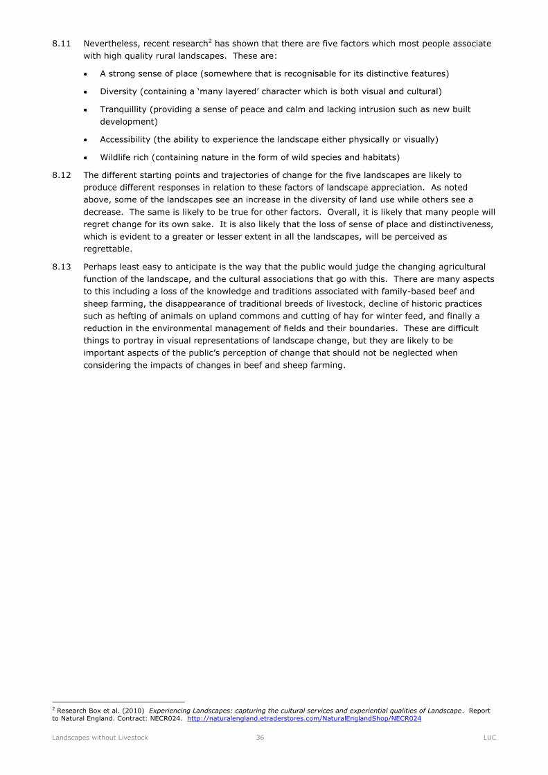
Reproduced using OS information with permission of The Controller of Her Majesty’s Stationery Office, Crown Copyright. LUC licence no 100019265
4. Exmoor
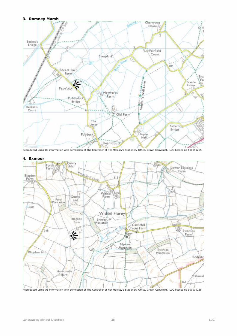
Reproduced using OS information with permission of The Controller of Her Majesty’s Stationery Office, Crown Copyright. LUC licence no 100019265
Landscapes without Livestock 39 LUC
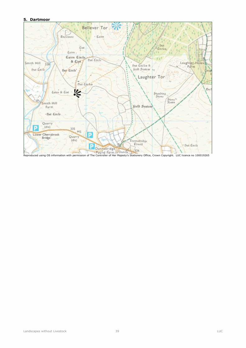
5. Dartmoor
Reproduced using OS information with permission of The Controller of Her Majesty’s Stationery Office, Crown Copyright. LUC licence no 100019265