landscape architecture portfolio
DESCRIPTION
This is a collection of the work I am most proud of from my time as a graduate student at University of Florida as well as some post graduate work as a design consultant. I chose to keep the composition and background simple and clean. i hope you enjoy!TRANSCRIPT

ME EDITPORTFOLIO
LEIG
H

3
DOCTORAL RESEARCH
WORK SAMPLES COTTON CLUB RE-VISIONING RENDERINGS SIXTH STREET RAILS TO TRAILS LANDSCAPE DESIGN MLA PROJECT SAMPLES THESIS PROJECT COFRIN NATURE PARK MEMORIAL CASTILLO DE SAN MARCO/AIA COCONUT CREEK MASTER PLAN EAST LUCAYA MASTER PLAN TURLINGTON PLAZA AND HALL HAMILTON COUNTY HERITAGE TRAIL BIOMEDICAL RESEARCH BUILDING PLANTING PLAN SGT. COREY DAHLEM MEMORIAL TURLINGTON HALL LOADING DOCK
BACK PAGES CREATIVE WORKS PHOTOGRAPHY
CONTENTS
4
5
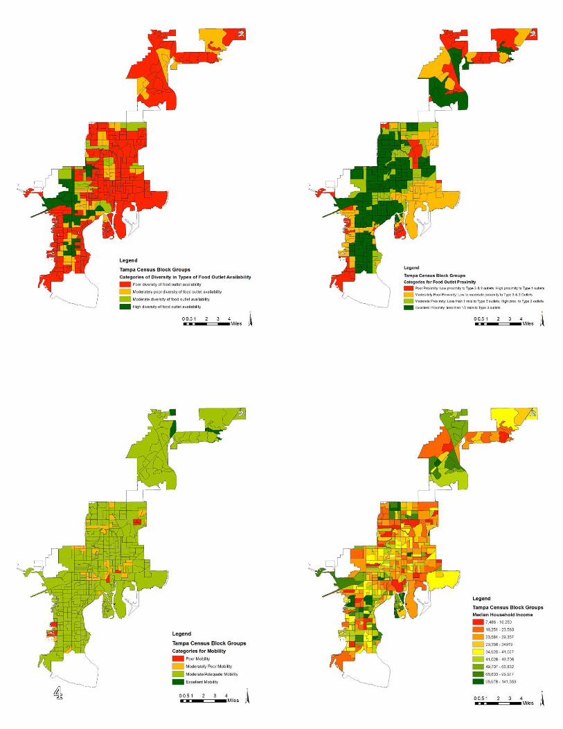
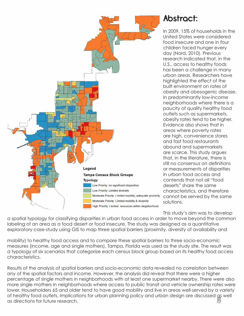
In 2009, 15% of households in the United States were considered food insecure and one in four children faced hunger every day (Nord, 2010). Previous research indicated that, in the U.S., access to healthy foods has been a challenge in many urban areas. Researchers have highlighted the effect of the built environment on rates of obesity and obesogenic disease. In predominantly low-income neighborhoods where there is a paucity of quality healthy food outlets such as supermarkets, obesity rates tend to be higher. Evidence also shows that in areas where poverty rates are high, convenience stores and fast food restaurants abound and supermarkets are scarce. This study argues that, in the literature, there is still no consensus on definitions or measurements of disparities in urban food access and contends that not all “food deserts” share the same characteristics, and therefore cannot be served by the same solutions.
This study’s aim was to develop a spatial typology for classifying disparities in urban food access in order to move beyond the common labeling of an area as a food desert or food insecure. The study was designed as a quantitative exploratory case-study using GIS to map three spatial barriers (proximity, diversity of availability and
mobility) to healthy food access and to compare these spatial barriers to three socio-economic measures (income, age and single mothers). Tampa, Florida was used as the study site. The result was a typology of six scenarios that categorize each census block group based on its healthy food access characteristics.
Results of the analysis of spatial barriers and socio-economic data revealed no correlation between any of the spatial factors and income. However, the analysis did reveal that there were a higher percentage of single mothers in neighborhoods with at least one supermarket nearby. There were also more single mothers in neighborhoods where access to public transit and vehicle ownership rates were lower. Householders 65 and older tend to have good mobility and live in areas well-served by a variety of healthy food outlets. Implications for urban planning policy and urban design are discussed as well as directions for future research.
Abstract:
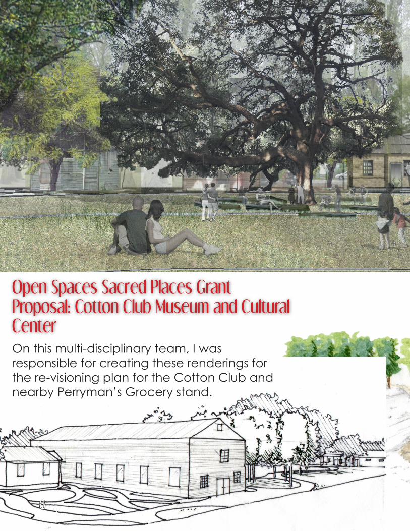
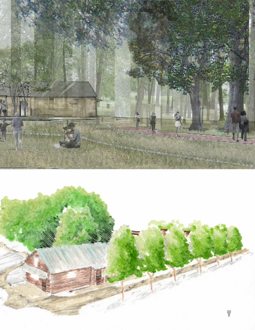
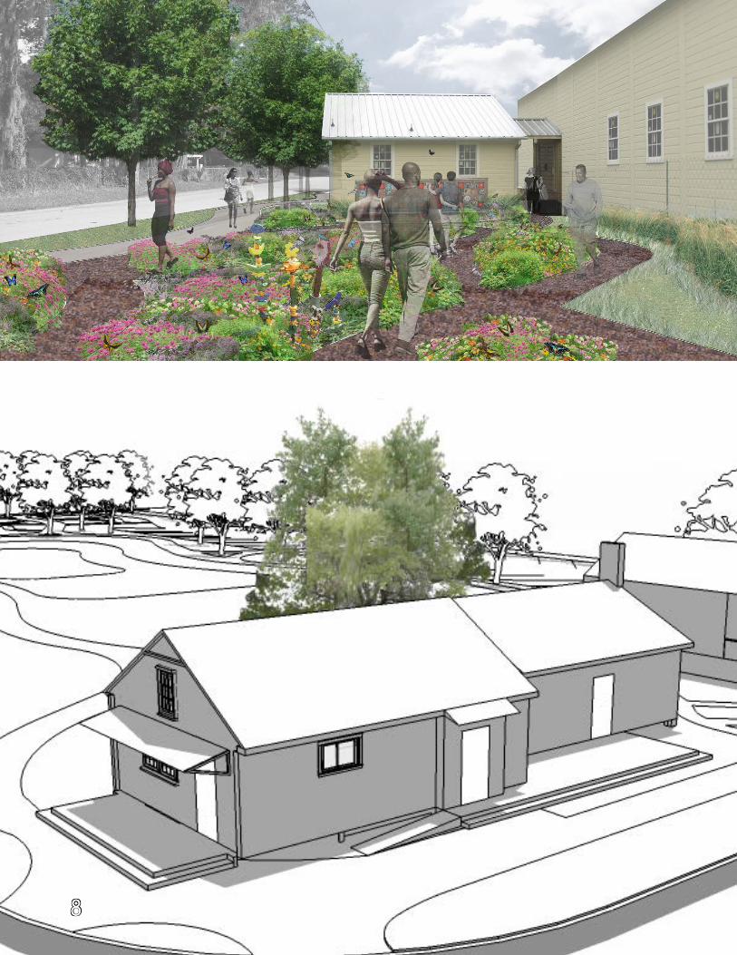
Open Spaces Sacred Places Grant Proposal: Cotton Club Museum and Cultural CenterOn this multi-disciplinary team, I was responsible for creating these renderings for the re-visioning plan for the Cotton Club and nearby Perryman’s Grocery stand.
6
7
8
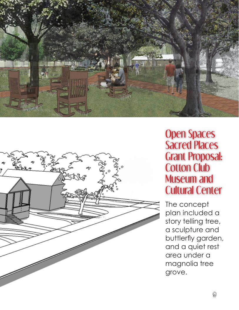
Open Spaces Sacred Places Grant Proposal: Cotton Club Museum and Cultural CenterThe concept plan included a story telling tree, a sculpture and buttlerfly garden, and a quiet rest area under a magnolia tree grove.
9
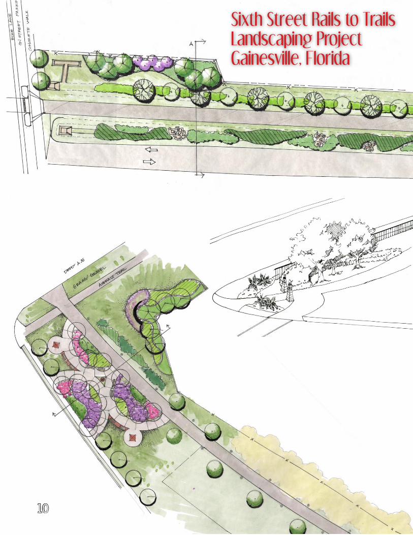
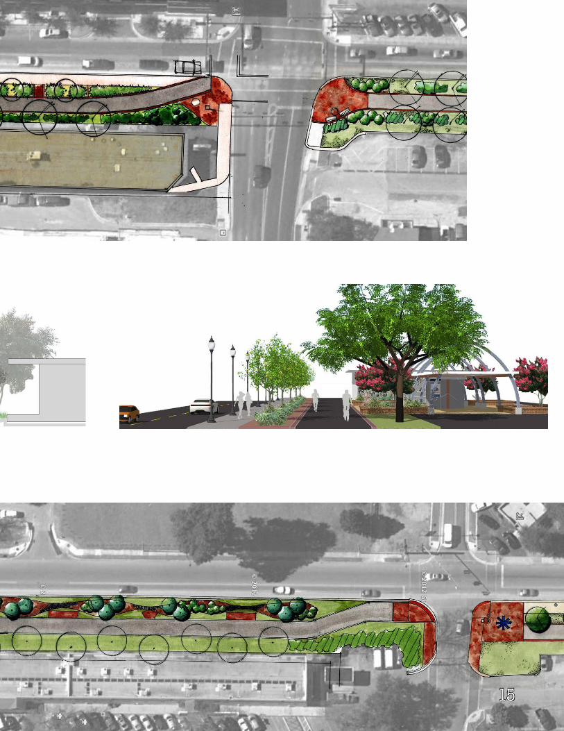
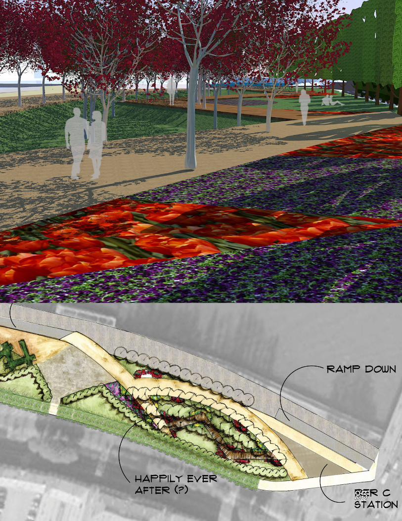
Sixth Street Rails to Trails Landscaping ProjectGainesville, Florida
10
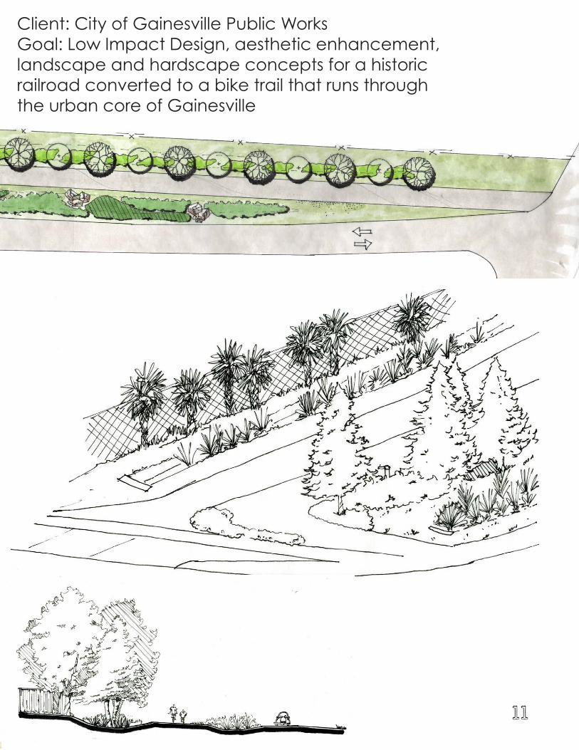
Client: City of Gainesville Public WorksGoal: Low Impact Design, aesthetic enhancement, landscape and hardscape concepts for a historic railroad converted to a bike trail that runs through the urban core of Gainesville
11
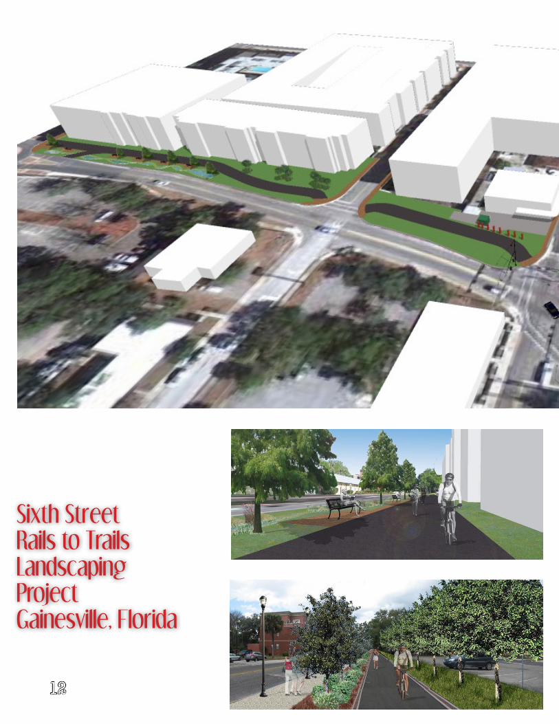
Sixth Street Rails to Trails Landscaping ProjectGainesville, Florida
12
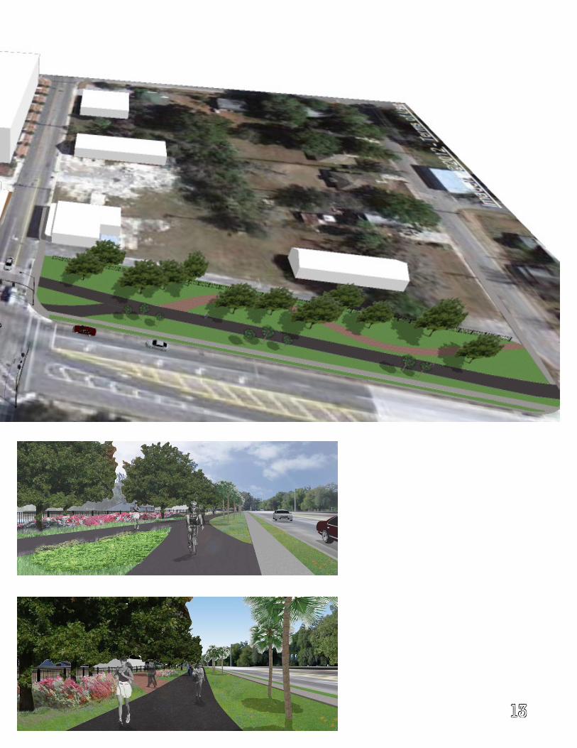
13
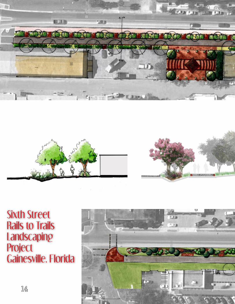
Sixth Street Rails to Trails Landscaping ProjectGainesville, Florida
14
15
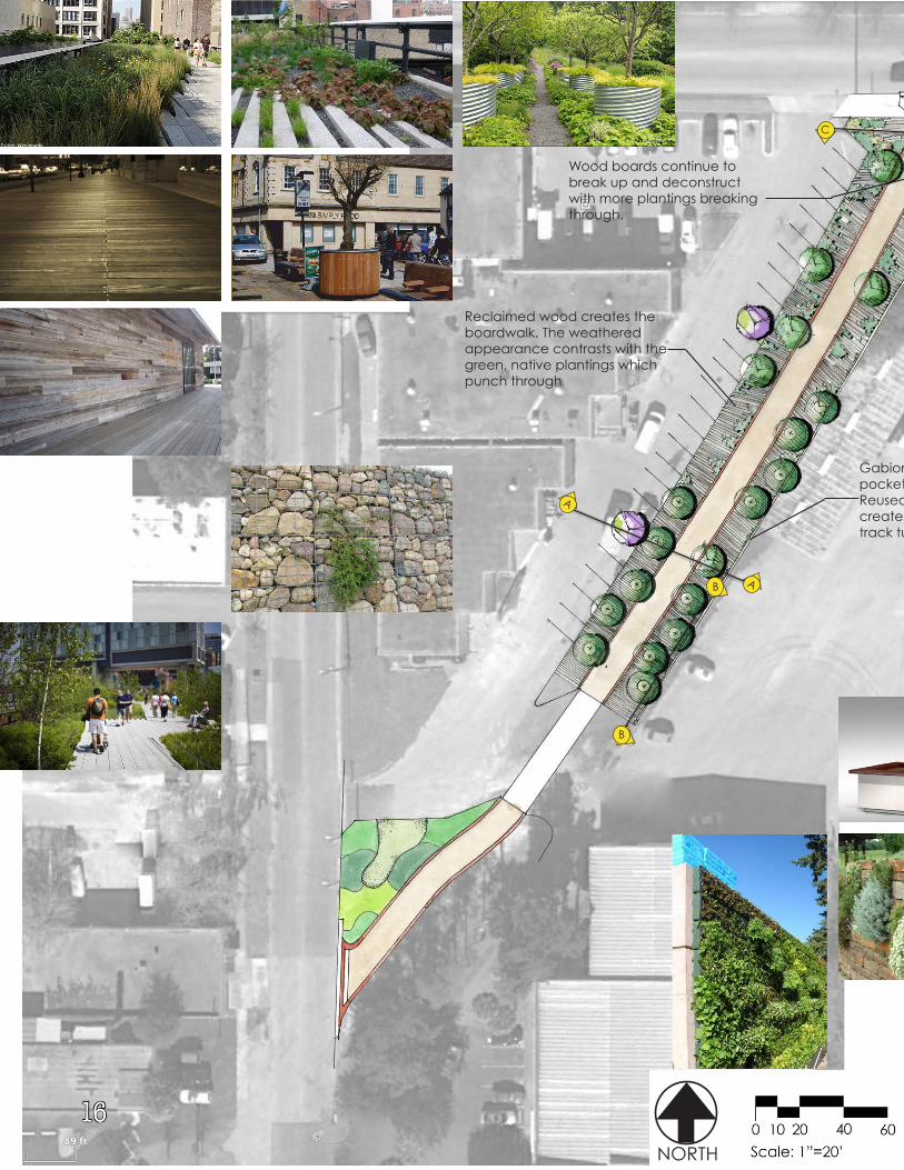
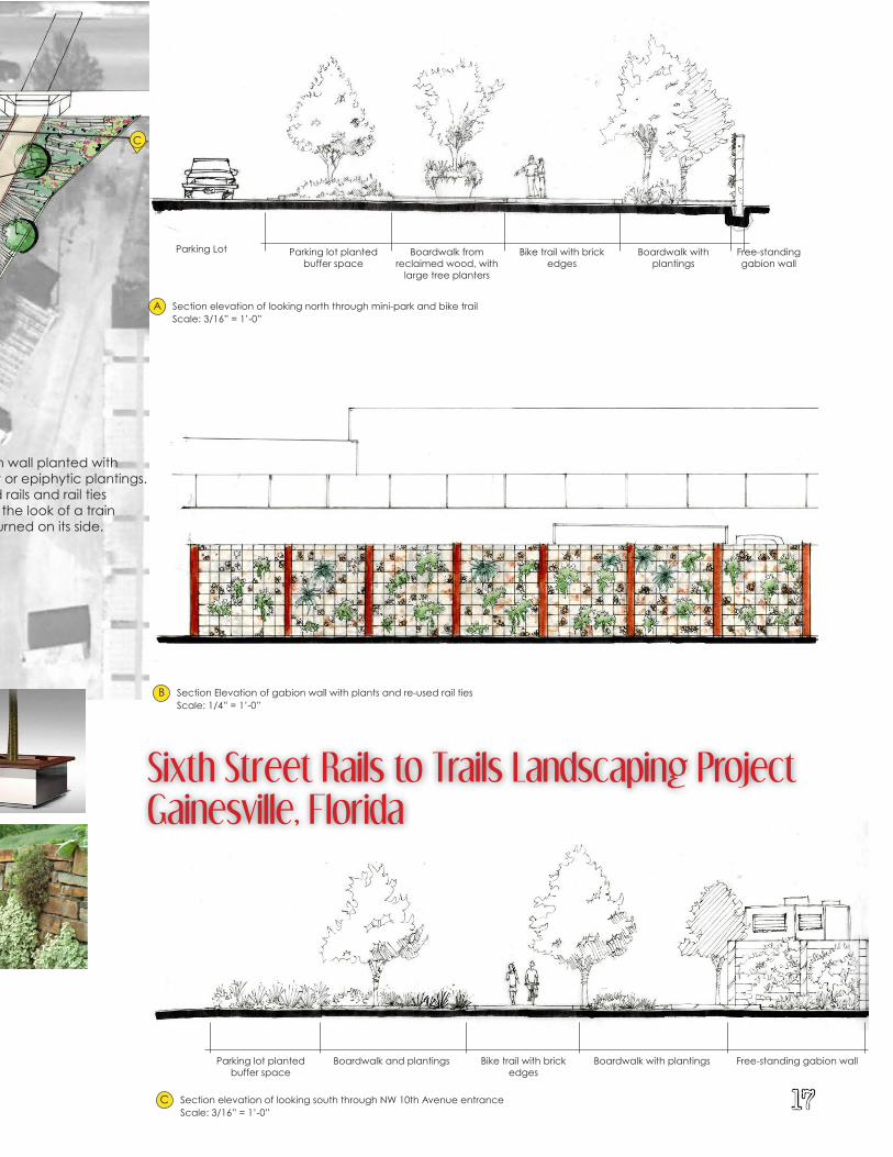
Sixth Street Rails to TrailS CONCEPTUAL LANDSCAPE DESIGN
Section TwoSheet 1
NORTH
B
A
C
A
C
B
Section Elevation of gabion wall with plants and re-used rail tiesScale: 1/4” = 1’-0”
Scale: 3/16” = 1’-0”Section elevation of looking north through mini-park and bike trail A
B
C Section elevation of looking south through NW 10th Avenue entrance
Gabion wall planted with pocket or epiphytic plantings. Reused rails and rail ties create the look of a train track turned on its side.
Wood boards continue to break up and deconstruct with more plantings breaking through.
Reclaimed wood creates the boardwalk. The weathered appearance contrasts with the green, native plantings which punch through
Scale: 3/16” = 1’-0”
Parking Lot Parking lot planted buffer space
Parking lot planted buffer space
Boardwalk from reclaimed wood, with
large tree planters
Boardwalk and plantings
Bike trail with brick edges
Bike trail with brick edges
Boardwalk with plantings
Boardwalk with plantings
Free-standing gabion wall
Free-standing gabion wall
16
Sixth Street Rails to TrailS CONCEPTUAL LANDSCAPE DESIGN
Section TwoSheet 1
NORTH
B
A
C
A
C
B
Section Elevation of gabion wall with plants and re-used rail tiesScale: 1/4” = 1’-0”
Scale: 3/16” = 1’-0”Section elevation of looking north through mini-park and bike trail A
B
C Section elevation of looking south through NW 10th Avenue entrance
Gabion wall planted with pocket or epiphytic plantings. Reused rails and rail ties create the look of a train track turned on its side.
Wood boards continue to break up and deconstruct with more plantings breaking through.
Reclaimed wood creates the boardwalk. The weathered appearance contrasts with the green, native plantings which punch through
Scale: 3/16” = 1’-0”
Parking Lot Parking lot planted buffer space
Parking lot planted buffer space
Boardwalk from reclaimed wood, with
large tree planters
Boardwalk and plantings
Bike trail with brick edges
Bike trail with brick edges
Boardwalk with plantings
Boardwalk with plantings
Free-standing gabion wall
Free-standing gabion wall
Sixth Street Rails to Trails Landscaping ProjectGainesville, Florida
17
18
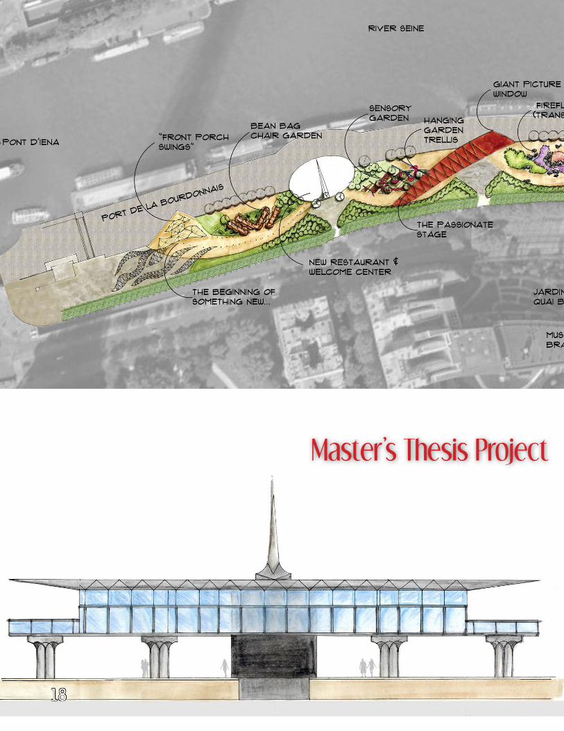
Master’s Thesis Project
19
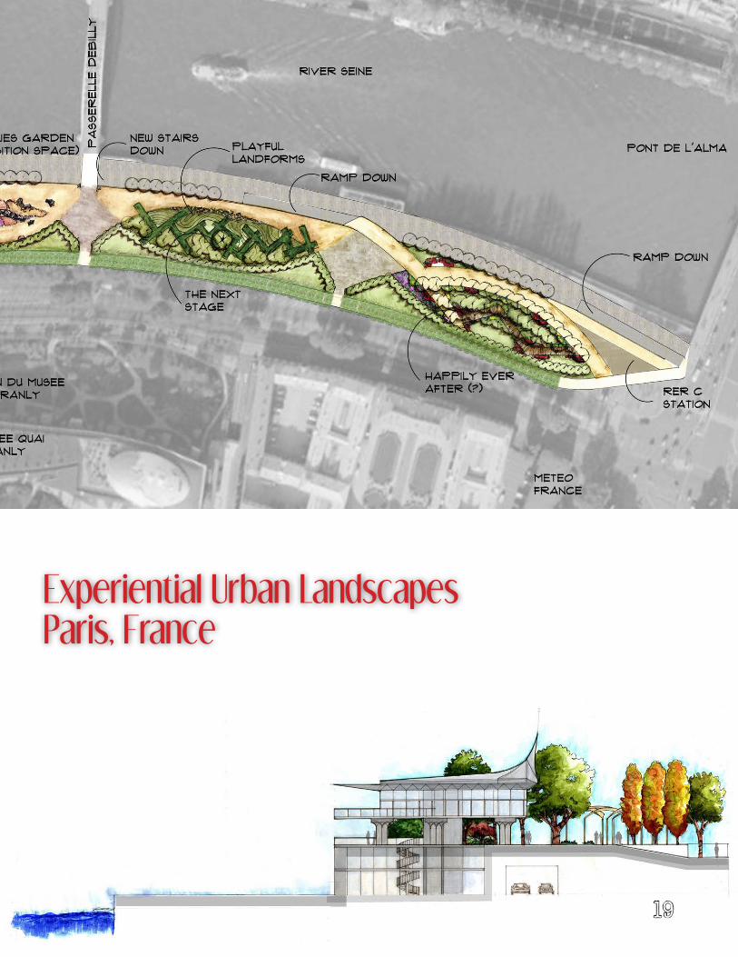
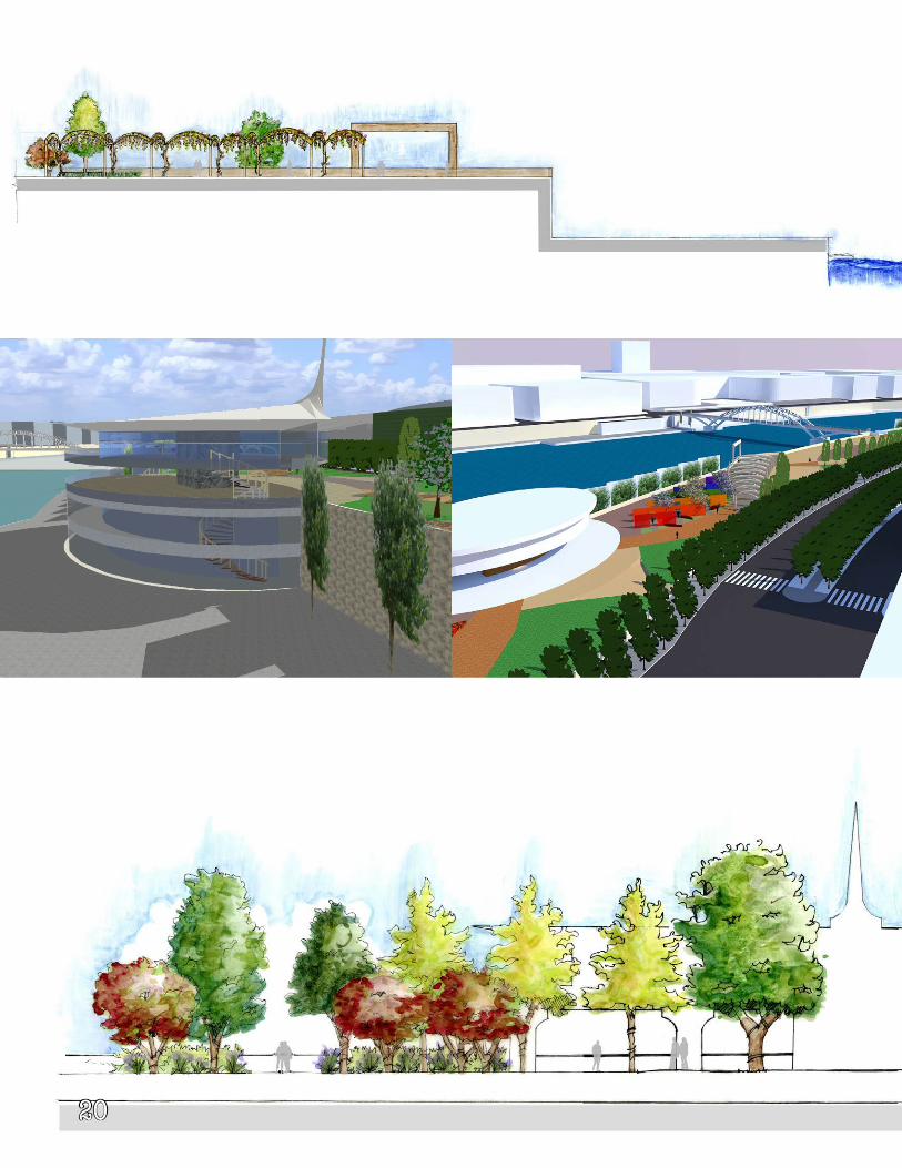
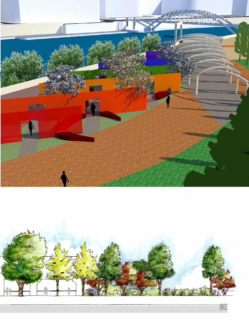
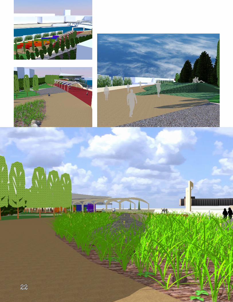
Experiential Urban LandscapesParis, France
20
21
22
23
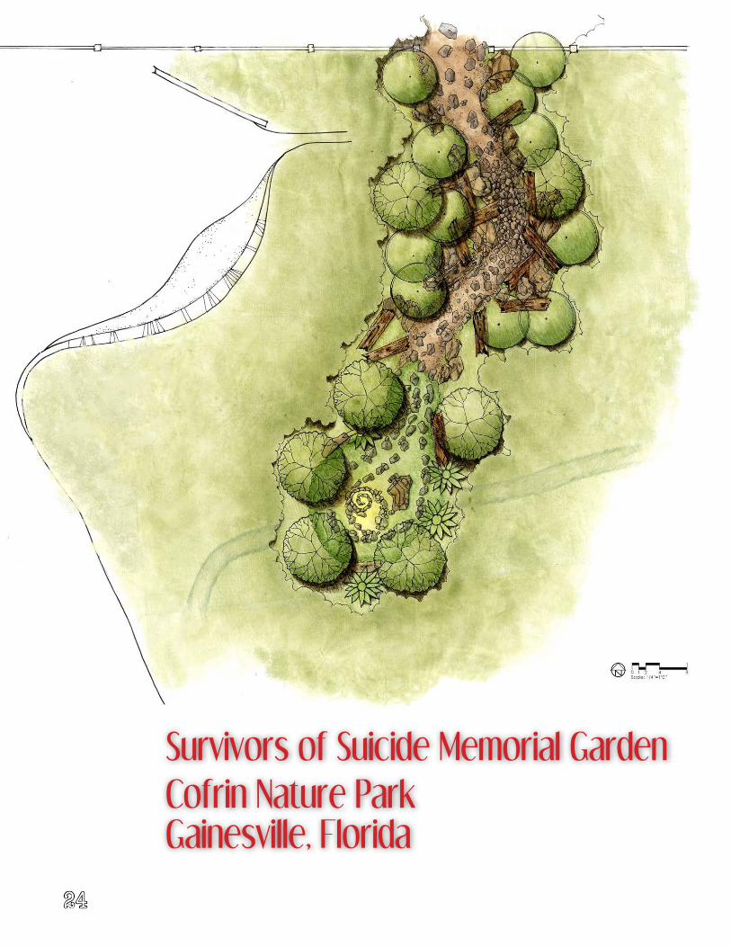
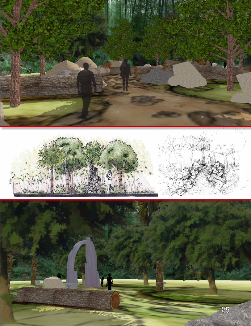
24
Cofrin Nature ParkGainesville, Florida
Survivors of Suicide Memorial Garden
25
26
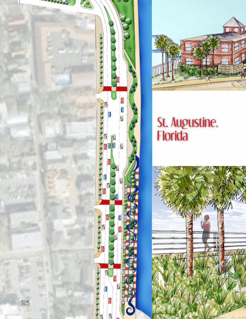
St. Augustine, Florida
27
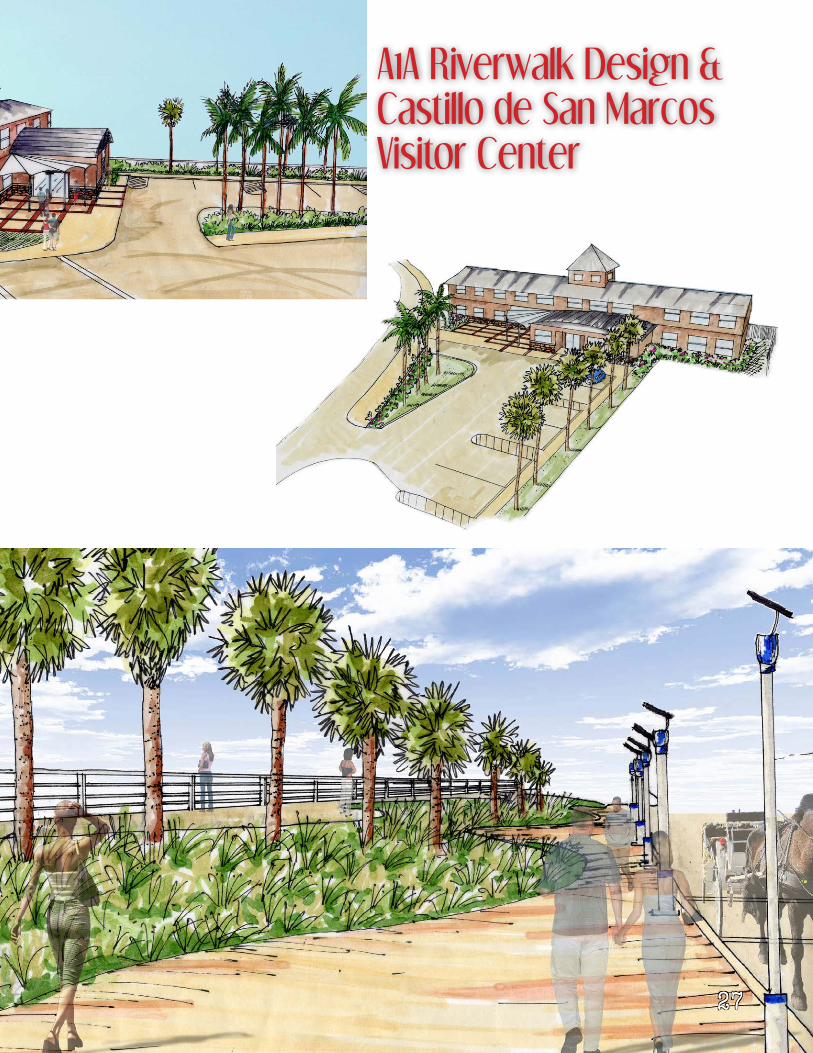
A1A Riverwalk Design & Castillo de San Marcos Visitor Center
28
29
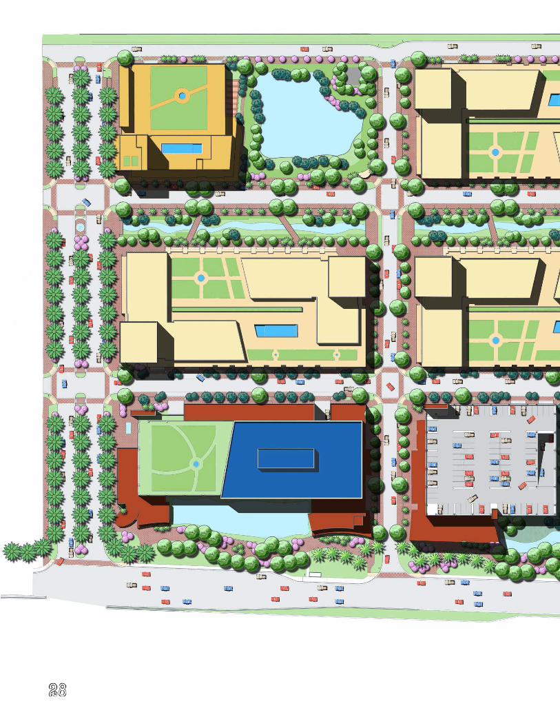
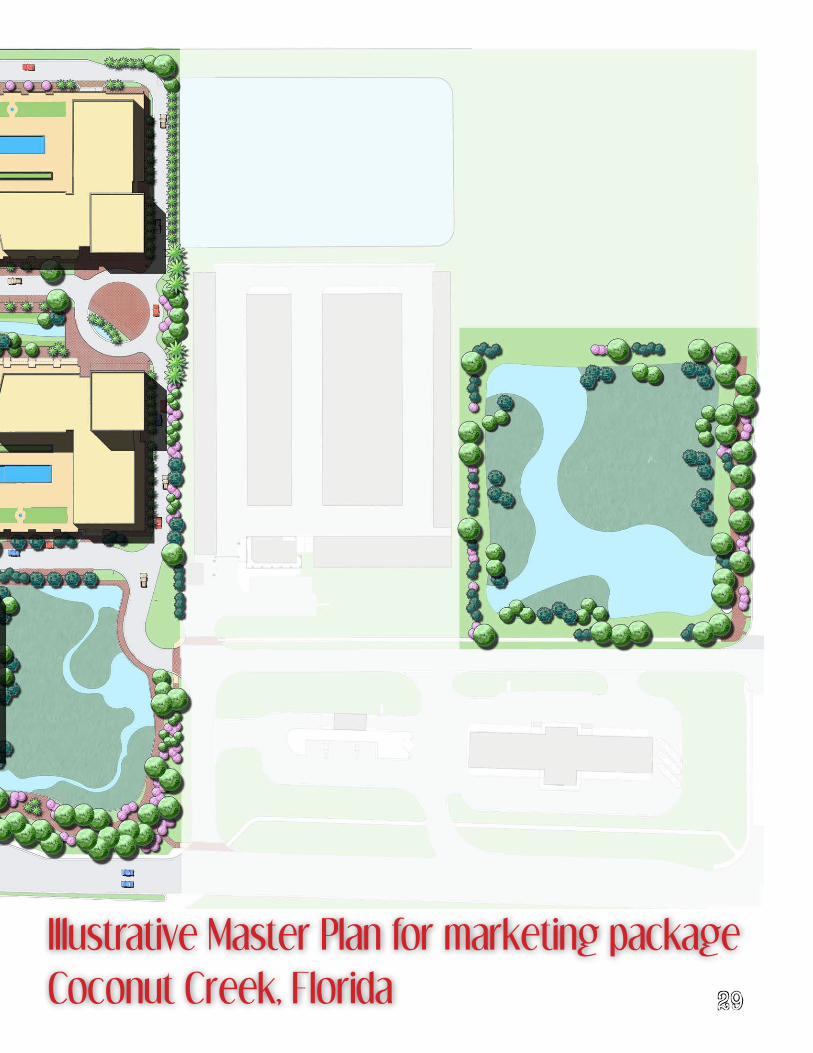
Illustrative Master Plan for marketing packageCoconut Creek, Florida
30
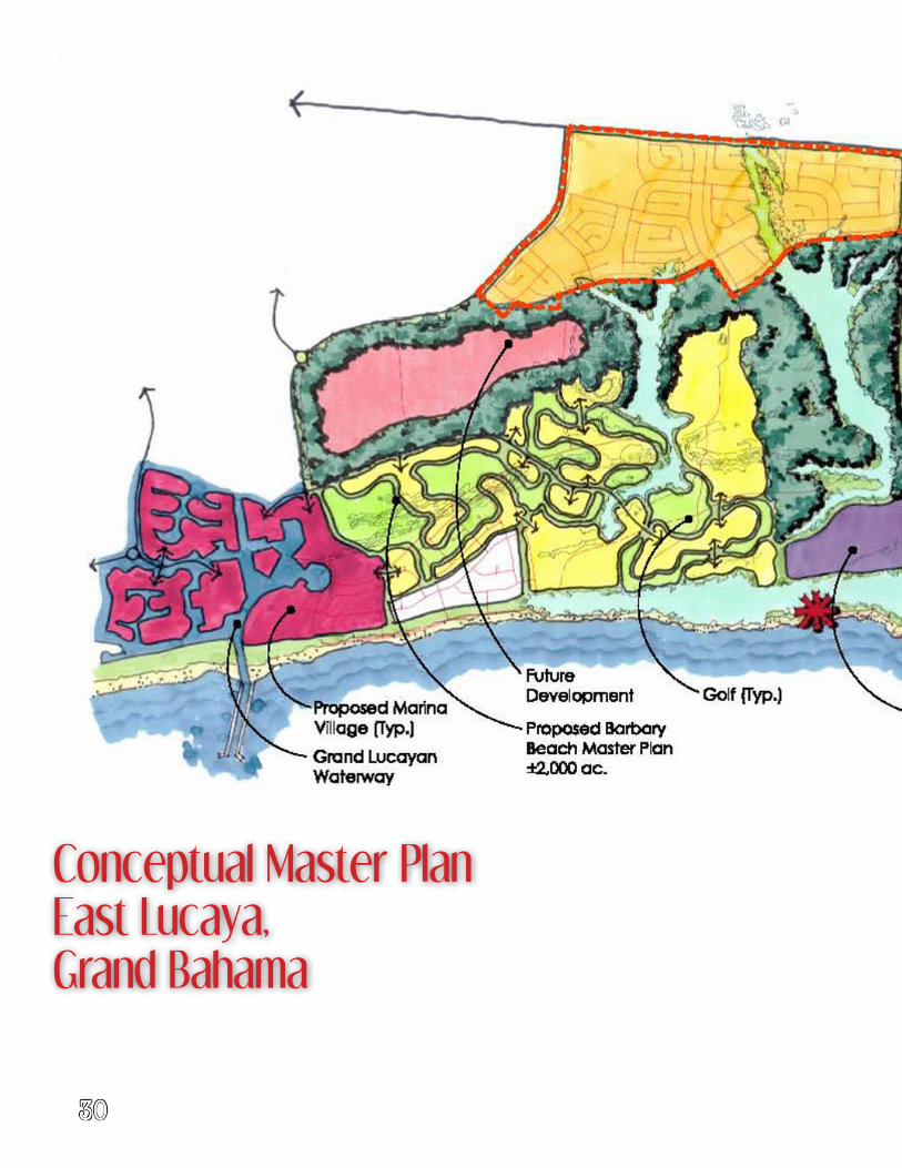
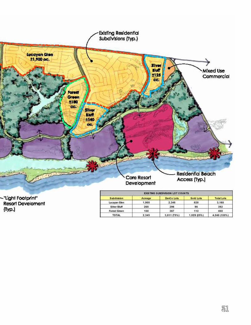
Conceptual Master PlanEast Lucaya, Grand Bahama
31
32
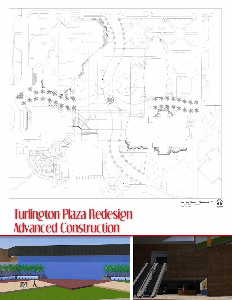
Turlington Plaza RedesignAdvanced Construction
33
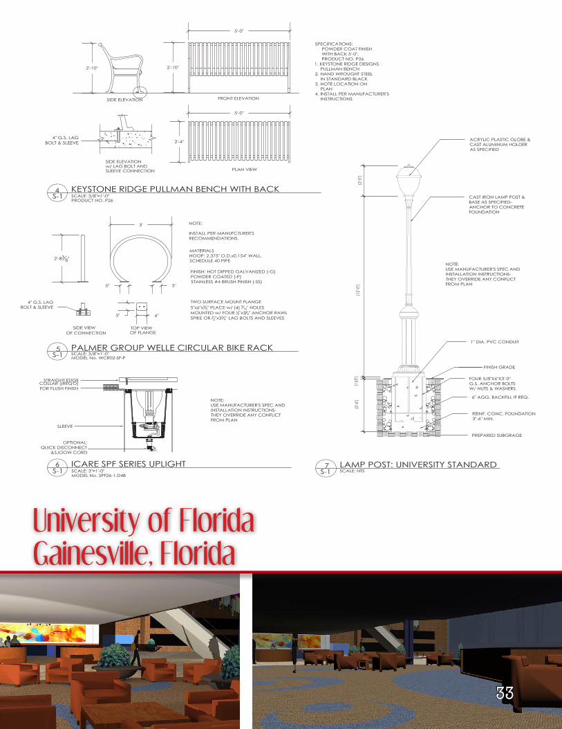
University of FloridaGainesville, Florida
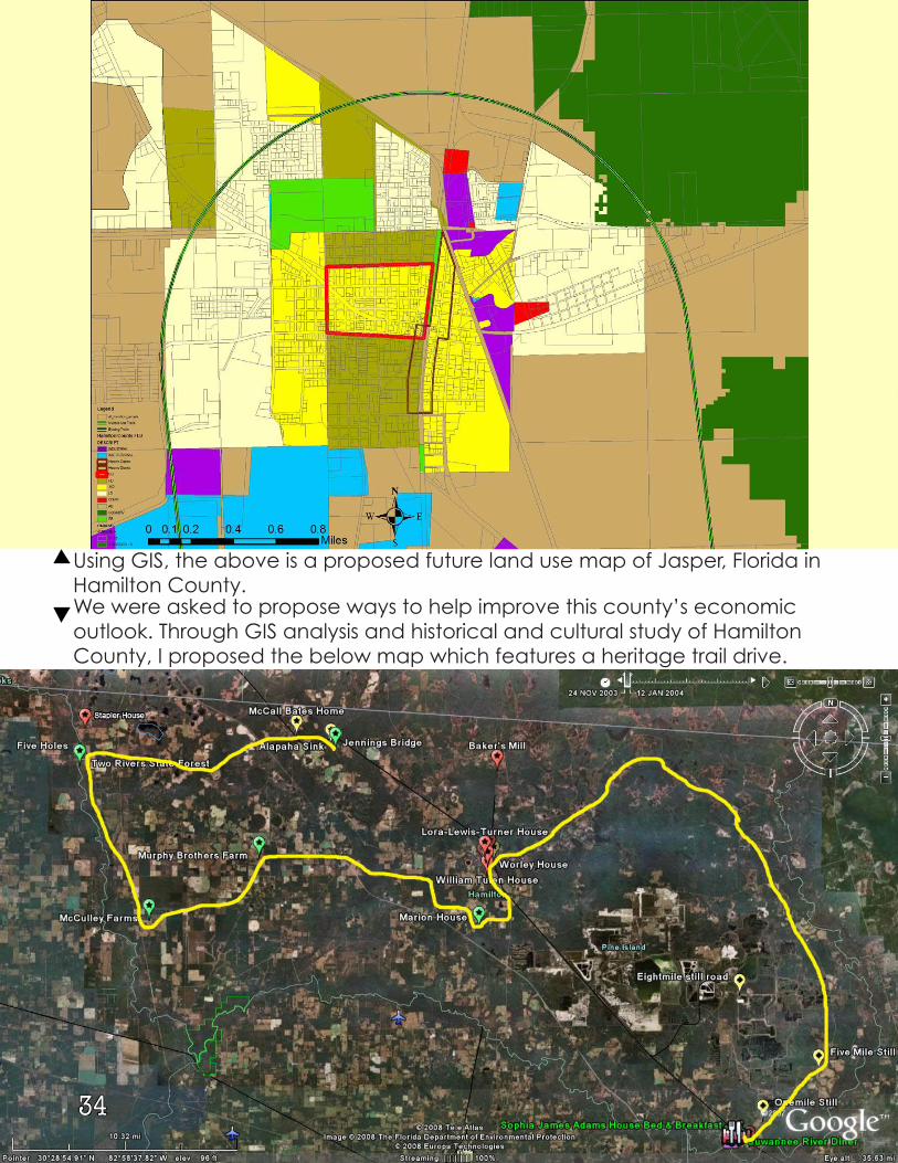
We were asked to propose ways to help improve this county’s economic outlook. Through GIS analysis and historical and cultural study of Hamilton County, I proposed the below map which features a heritage trail drive.
Using GIS, the above is a proposed future land use map of Jasper, Florida in Hamilton County.
34
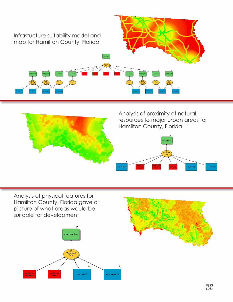
Infrastucture suitability model and map for Hamilton County, Florida
Analysis of proximity of natural resources to major urban areas for Hamilton County, Florida
Analysis of physical features for Hamilton County, Florida gave a picture of what areas would be suitable for development
35
36 Built Projects
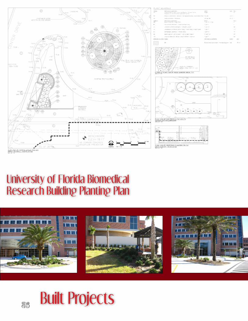
University of Florida Biomedical Research Building Planting Plan
37
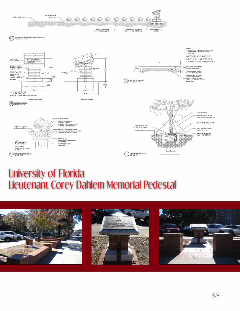
University of FloridaLieutenant Corey Dahlem Memorial Pedestal
38
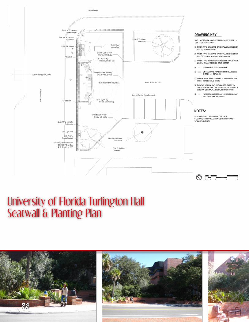
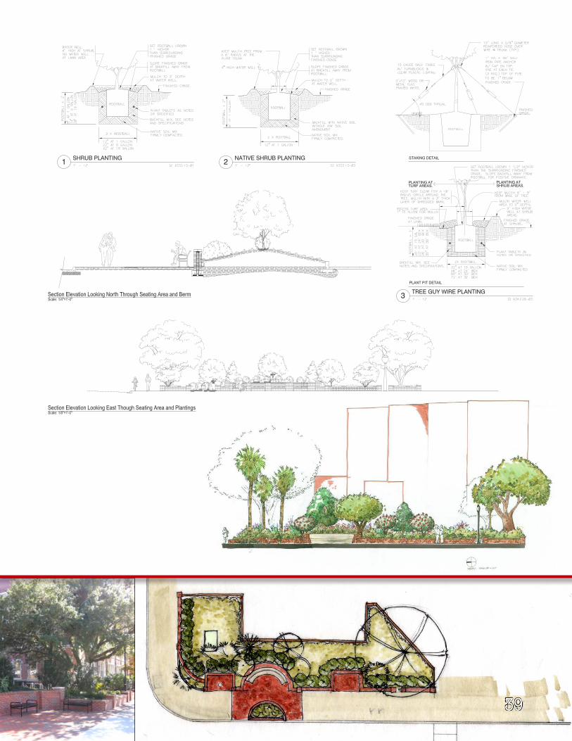
University of Florida Turlington Hall Seatwall & Planting Plan
39
40
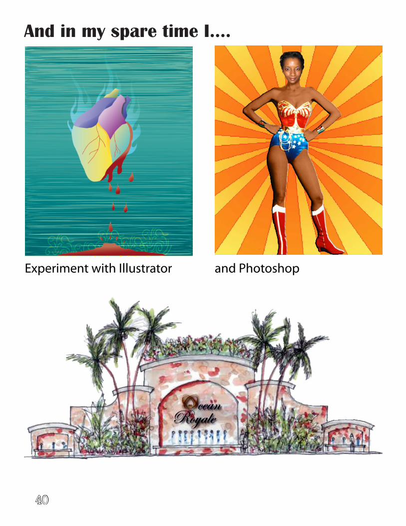
And in my spare time I....
Experiment with Illustrator and Photoshop
41
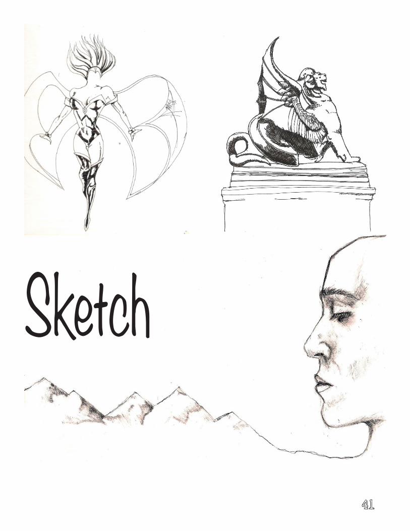
Sketch
42
Re
nd
ere
d w
ith
Pri
sma
co
lor
Pe
nc
il &
ch
arc
oa
l d
raw
ing
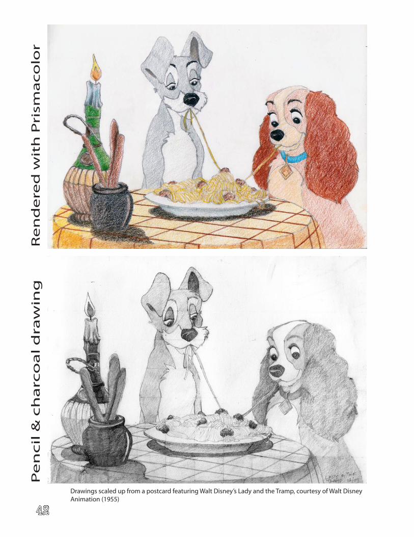
Drawings scaled up from a postcard featuring Walt Disney’s Lady and the Tramp, courtesy of Walt Disney Animation (1955)
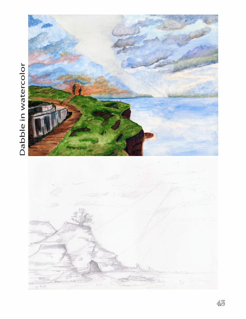
43
Da
bb
le i
n w
ate
rco
lor
44
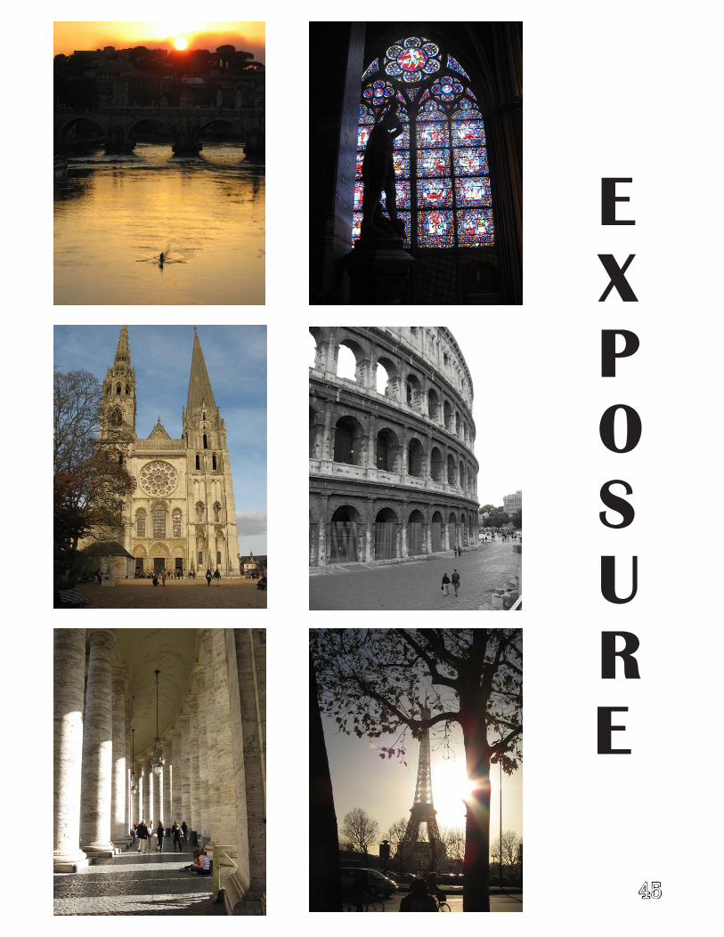
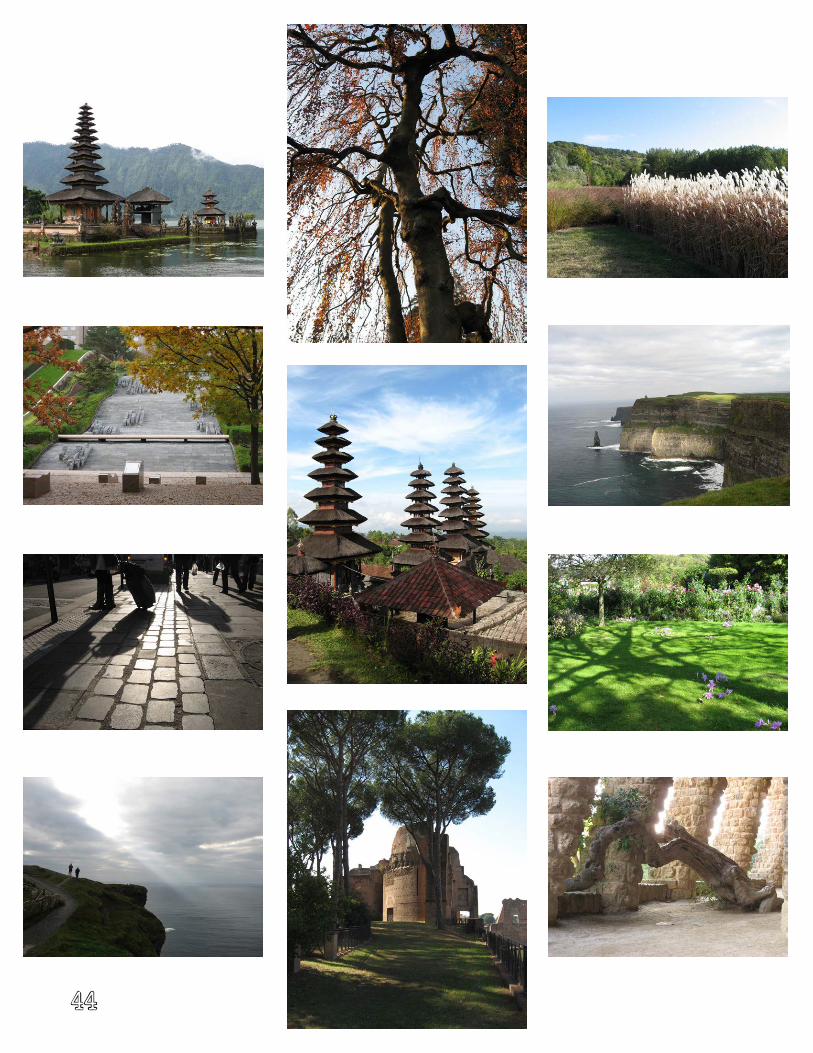
EXPOSURE
45