lab 3 hydrological application using gis. deriving runoff characteristics arcgis flow diagram load...
Post on 21-Dec-2015
218 views
TRANSCRIPT

Lab 3 hydrological application using GIS
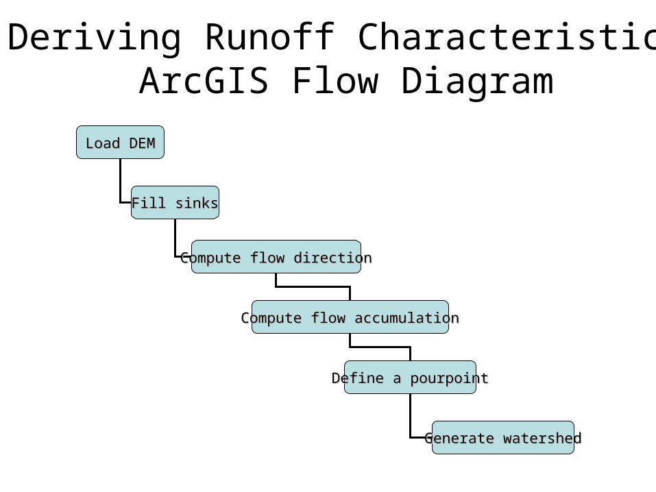
Deriving Runoff CharacteristicsArcGIS Flow Diagram
Load DEMLoad DEM
Fill sinksFill sinks
Compute flow directionCompute flow direction
Compute flow accumulationCompute flow accumulation
Define a pourpointDefine a pourpoint
Generate watershedGenerate watershed

Filling Sinks
• DEM creation results in
artificial sinks in the
landscape• A sink is a set of one or more cells which has no
downstream cells around it• Unless these sinks are filled they will isolate portions
of the watershed• Filling sinks is the first step for processing a DEM for
surface water systems
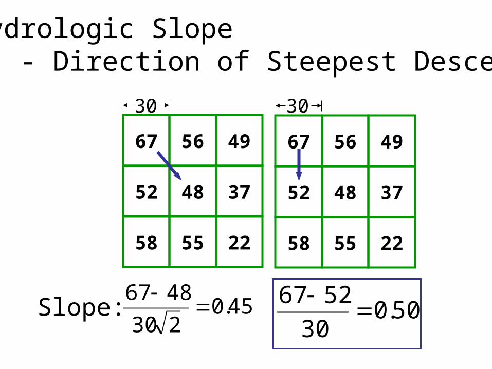
67 56 49
52 48 37
58 55 22
30
67 56 49
52 48 37
58 55 22
30
45.0230
4867
50.0
30
5267
Slope:
Hydrologic Slope - Direction of Steepest Descent
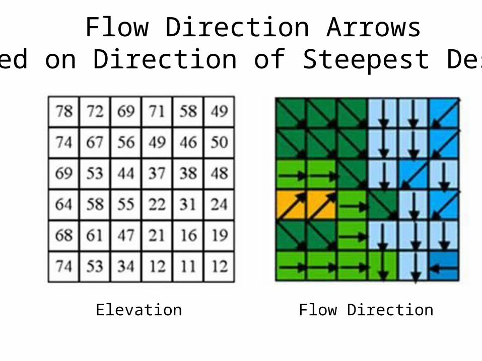
Flow Direction ArrowsBased on Direction of Steepest Descent
Elevation Flow Direction

32
16
8
64
4
128
1
2
Eight Direction Pour Point Model
ArcGIS Flow Direction Encoding

ArcGIS Flow Direction Raster Encoding
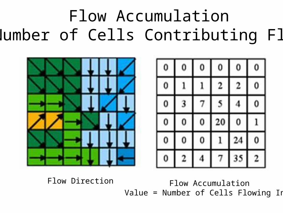
Flow AccumulationNumber of Cells Contributing Flow
Flow AccumulationValue = Number of Cells Flowing Into
Flow Direction
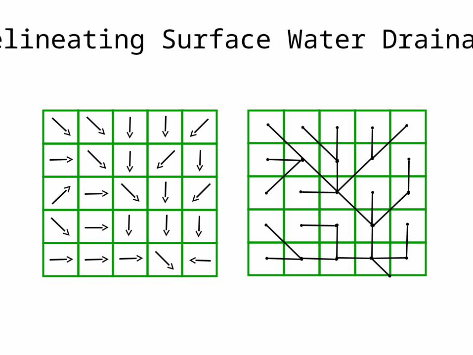
Delineating Surface Water Drainage
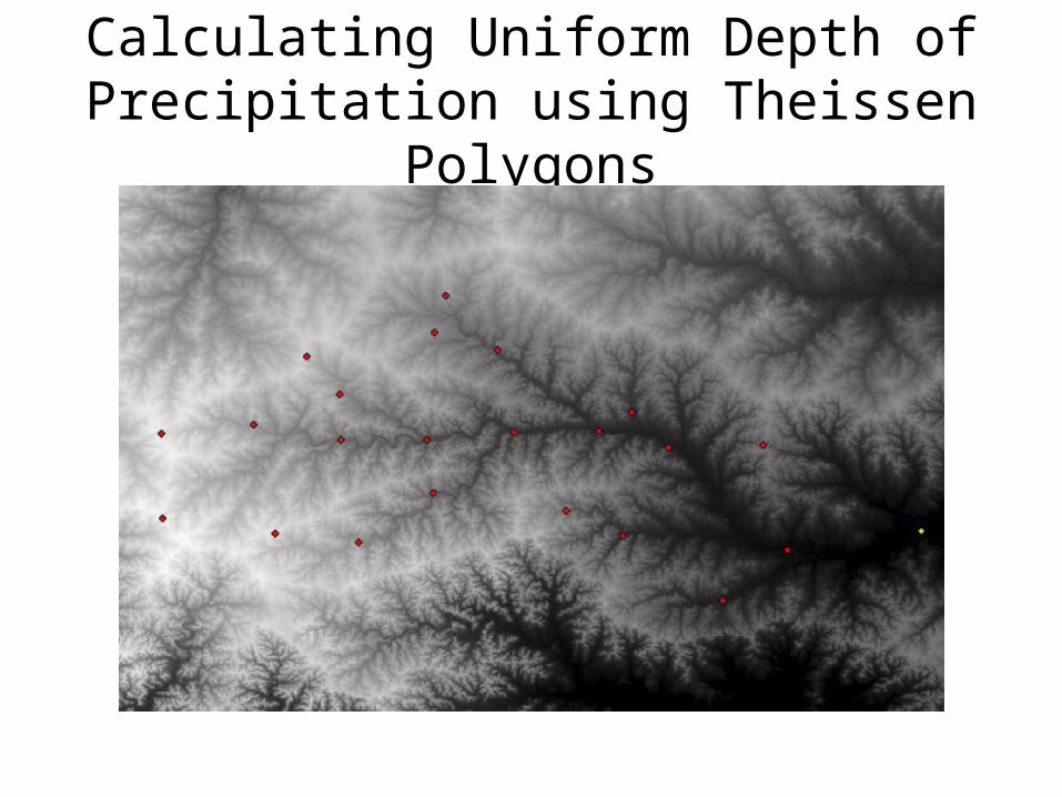
Calculating Uniform Depth of Precipitation using Theissen Polygons

Areal Estimation
• The Thiessen polygon approach is a geometric method for assigning areal weights to each gauge based on a nearest neighbor approach.
• Thiessen polygons are constructed by:
(1) Connecting each gauge in a triangulated network
(2) Intersecting each triangle edge by a perpendicular bisector
(3) Deriving polygons from the bisector edges and watershed boundary

Areal Estimation
• Thiessen Polygons