ken scheffe nssc – standards branch. ◦ describe the different kinds of data reports ◦ locate...
TRANSCRIPT

Navigating the NSSC Soil Characterization Data
website and Lab Data Sheets
Ken Scheffe
NSSC – Standards Branch

◦ Describe the different kinds of data reports◦ Locate data on the data report◦ Obtain reports from web application◦ Download characterization data for SDJR
analysis
Objectives

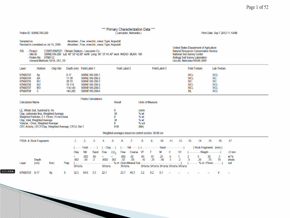
The printed data report contains the following:
Heading Soil Survey Number County, State Print Date Series, classification
◦ Sampled As & Correlated to Project ID, Pedon ID, Sample numbers Horizon Data and row identifier
Contents of Data Report
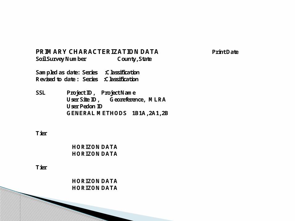
PRIMARY CHARACTERIZATION DATA Print Date Soil Survey Number County, State Sampled as date: Series :Classification Revised to date : Series :Classification SSL Project ID, Project Name User Site ID, Georeference, MLRA User Pedon ID GENERAL METHODS 1B1A, 2A1, 2B Tier HORIZON DATA HORIZON DATA Tier HORIZON DATA HORIZON DATA
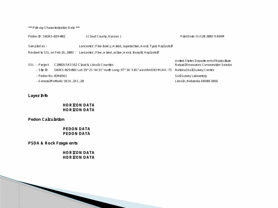
*** Primary Characterization Data ***
Pedon ID: S02KS-029-002 ( Cloud County, Kansas ) Print Date: Oct 20 2003 9:49AM
Sampled as : Lancaster ; Fine-loamy, mixed, superactive, mesic Typic Haplustalf
Revised to SSL on Feb 26, 2003 : Lancaster ; Fine, mixed, active, mesic Inceptic Haplustalf
United States Department of Agriculture SSL - Project C2002USKS162 Cloud & Lincoln Counties Natural Resources Conservation Service
- Site ID S02KS-029-002 Lat: 39° 21' 44.31" north Long: 97° 36' 3.01" west NAD83 MLRA: 75 National Soil Survey Center
- Pedon No. 02N0361 Soil Survey Laboratory
- General Methods 1B1A, 2A1, 2B Lincoln, Nebraska 68508-3866
Layer Info HORIZON DATA HORIZON DATA Pedon Calculation PEDON DATA PEDON DATA PSDA & Rock Fragments HORIZON DATA HORIZON DATA

Layer Horizon Orig HznDepth (cm)
Field Label 1 Field Label 2 Field Texture Lab Texture
02N01886 Ap1 0-10 S02KS-029-002-1 L SICL
02N01887 Ap2 10-20 S02KS-029-002-2 L SICL
02N01888 Bt1 20-29 S02KS-029-002-3 CL SICL
02N01889 Bt2 29-48 S02KS-029-002-4 GR-CL CL
02N01890 C1 48-61 S02KS-029-002-5 PCNV-CL SICL
02N01891 C2 61-84 S02KS-029-002-6 CBX-CL SIL
02N01892 2C3 84-129 S02KS-029-002-7 PCBX-SIL SIL
02N01893 2C4 129-198 S02KS-029-002-8 SIC SICL
Layer or Horizon Information
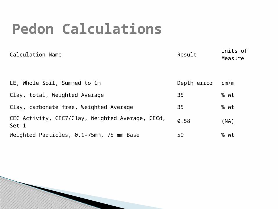
Pedon Calculations
Calculation Name ResultUnits of Measure
LE, Whole Soil, Summed to 1m Depth error cm/m
Clay, total, Weighted Average 35 % wt
Clay, carbonate free, Weighted Average 35 % wt
CEC Activity, CEC7/Clay, Weighted Average, CECd, Set 1 0.58 (NA)
Weighted Particles, 0.1-75mm, 75 mm Base 59 % wt
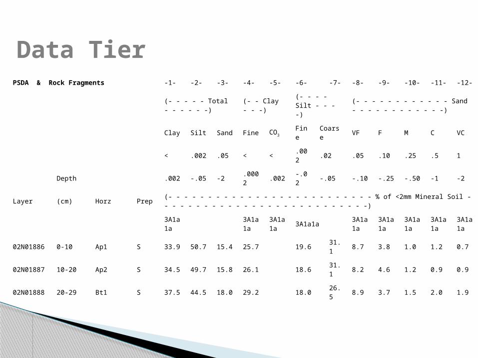
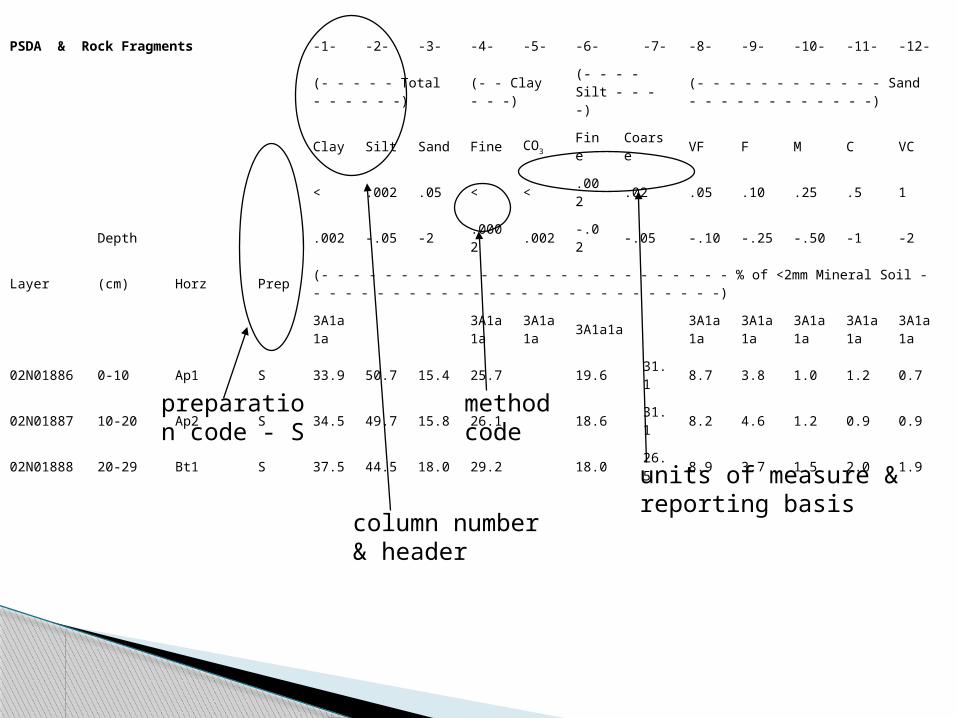
PSDA & Rock Fragments -1- -2- -3- -4- -5- -6- -7- -8- -9- -10- -11- -12-
(- - - - - Total - - - - - -) (- - Clay - - -) (- - - - Silt - - - -) (- - - - - - - - - - - - Sand - - - - - - - - - - - -)
Clay Silt Sand Fine CO3 Fine Coarse VF F M C VC
< .002 .05 < < .002 .02 .05 .10 .25 .5 1
Depth .002 -.05 -2 .0002 .002 -.02 -.05 -.10 -.25 -.50 -1 -2
Layer (cm) Horz Prep (- - - - - - - - - - - - - - - - - - - - - - - - - - % of <2mm Mineral Soil - - - - - - - - - - - - - - - - - - - - - - - - - - -)
3A1a1a
3A1a1a
3A1a1a
3A1a1a3A1a1a
3A1a1a
3A1a1a
3A1a1a
3A1a1a
02N01886 0-10 Ap1 S 33.9 50.7 15.4 25.7 19.6 31.1 8.7 3.8 1.0 1.2 0.7
02N01887 10-20 Ap2 S 34.5 49.7 15.8 26.1 18.6 31.1 8.2 4.6 1.2 0.9 0.9
02N01888 20-29 Bt1 S 37.5 44.5 18.0 29.2 18.0 26.5 8.9 3.7 1.5 2.0 1.9
Data Tier

Column heading Reporting basis Sample weight basis Significant figures Data report symbols
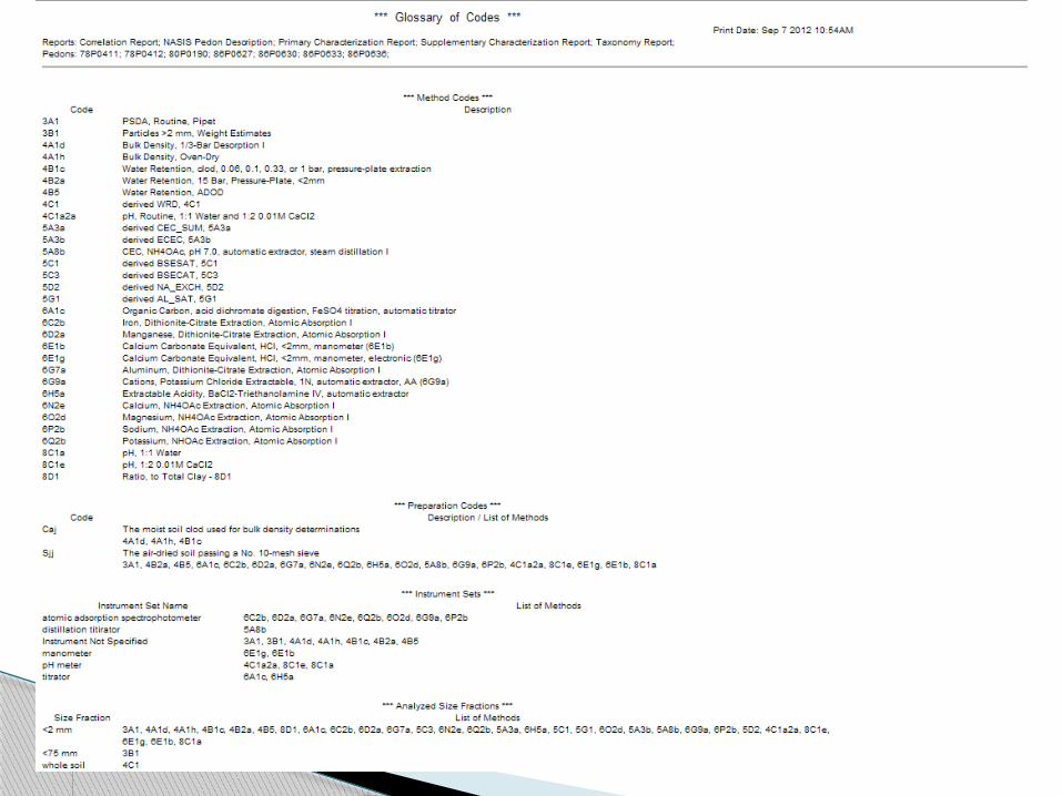
◦ tr, --, blank Method Codes Preparation
Conventions
PSDA & Rock Fragments -1- -2- -3- -4- -5- -6- -7- -8- -9- -10- -11- -12-
(- - - - - Total - - - - - -) (- - Clay - - -) (- - - - Silt - - - -) (- - - - - - - - - - - - Sand - - - - - - - - - - - -)
Clay Silt Sand Fine CO3 Fine Coarse VF F M C VC
< .002 .05 < < .002 .02 .05 .10 .25 .5 1
Depth .002 -.05 -2 .0002 .002 -.02 -.05 -.10 -.25 -.50 -1 -2
Layer (cm) Horz Prep (- - - - - - - - - - - - - - - - - - - - - - - - - - % of <2mm Mineral Soil - - - - - - - - - - - - - - - - - - - - - - - - - - -)
3A1a1a
3A1a1a
3A1a1a
3A1a1a3A1a1a
3A1a1a
3A1a1a
3A1a1a
3A1a1a
02N01886 0-10 Ap1 S 33.9 50.7 15.4 25.7 19.6 31.1 8.7 3.8 1.0 1.2 0.7
02N01887 10-20 Ap2 S 34.5 49.7 15.8 26.1 18.6 31.1 8.2 4.6 1.2 0.9 0.9
02N01888 20-29 Bt1 S 37.5 44.5 18.0 29.2 18.0 26.5 8.9 3.7 1.5 2.0 1.9
column number & header
method code
units of measure & reporting basis
preparation code - S

Preparation Master CodesCLODDB Moist soil clod for bulk density
GP Ground and pulverized whole soil including all coarse fragments
HM Heavy metal no metallic contact
M Moist prep
MW Moist whole soil prep
N No information about the coarse fragment content is known or recorded
P Plant material
PRE_PREPThe whole soil prior to any preparation actions (assumed to be the field
state)
R Roots
S Standard prep, whole soil collect data on coarse fragments
S_SK Standard prep, 2-20 mm fraction, ground to <2mm
SAND Sand fraction
SILT Silt fraction
SLIDE Sand or silt fraction slide
THSLIDE Thin section slide
W Water

Primary Characterization Data Report◦ Layer Information◦ Pedon Calculations◦ PSDA and Rock Fragments◦ Water Dispersible PSDA◦ Bulk Density and Moisture◦ Water Content
Types of Data Reports and Tiers - Warehouse

Primary Characterization Data Report◦ Carbon and Extractions◦ CEC and Bases◦ Salt◦ pH and Carbonates◦ Organic◦ Phosphorous
Types of Data Reports and Tiers (cont)

Primary Characterization Data Report◦ Mineralogy glass and petro◦ Mineralogy x-ray◦ Mineralogy thermal - dsc,tga,dta◦ Mineralogy total oxides◦ Mineralogy mica adjustment◦ Miscellaneous Data◦ Trace Elements Tier 1◦ Trace Elements Tier 2
Types of Data Reports and Tiers (cont)

Taxonomy Report◦ Taxonomy Tier 1◦ Taxonomy Tier 2◦ Pedon Calculations
Supplementary Data Report
NASIS Pedon Description
Types of Data Reports and Tiers (cont)
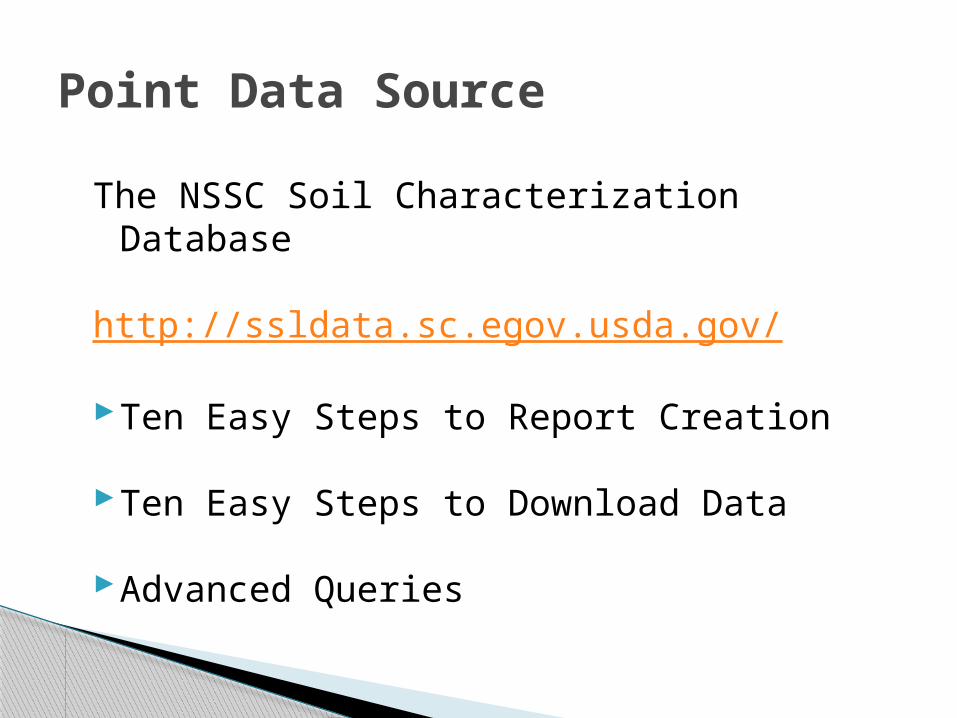
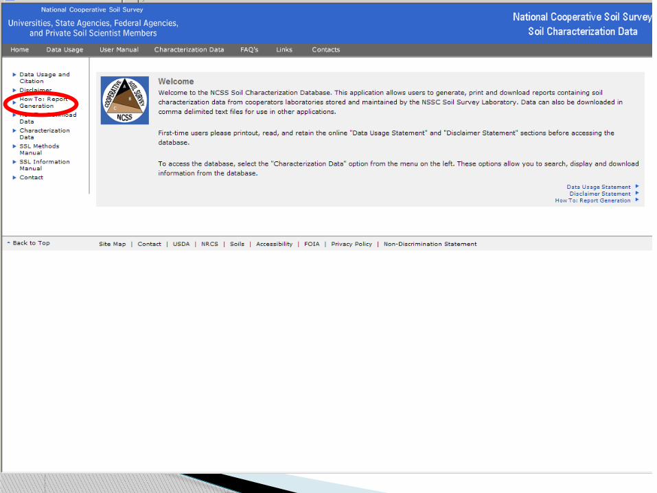
The NSSC Soil Characterization Database
http://ssldata.sc.egov.usda.gov/
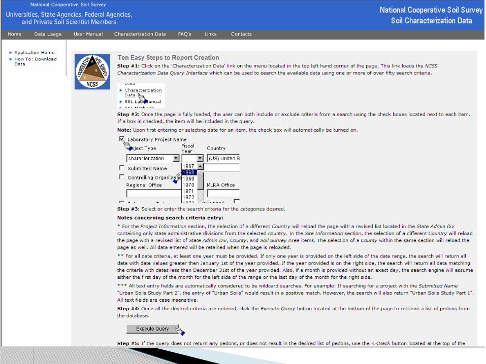
Ten Easy Steps to Report Creation
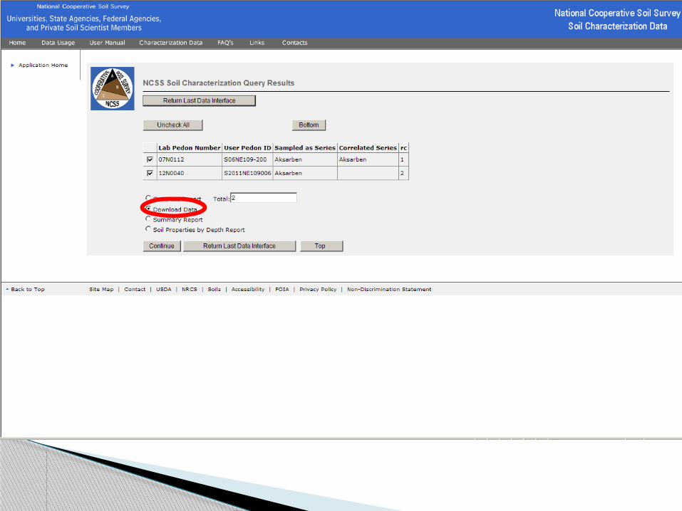
Ten Easy Steps to Download Data
Advanced Queries
Point Data Source

Generating Reports


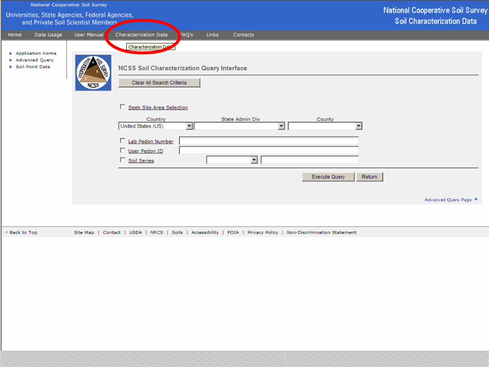
NCSS Query Pagehttp://ncsslabdatamart.sc.egov.usda.gov/querypage.aspxScreen clipping taken: 9/7/2012, 11:25 AM
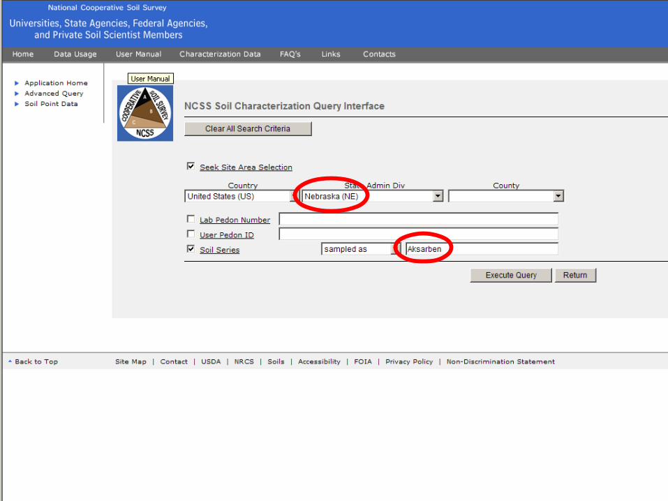
NCSS Pedon Selectionhttp://ncsslabdatamart.sc.egov.usda.gov/query.aspxScreen clipping taken: 9/7/2012, 11:26 AM

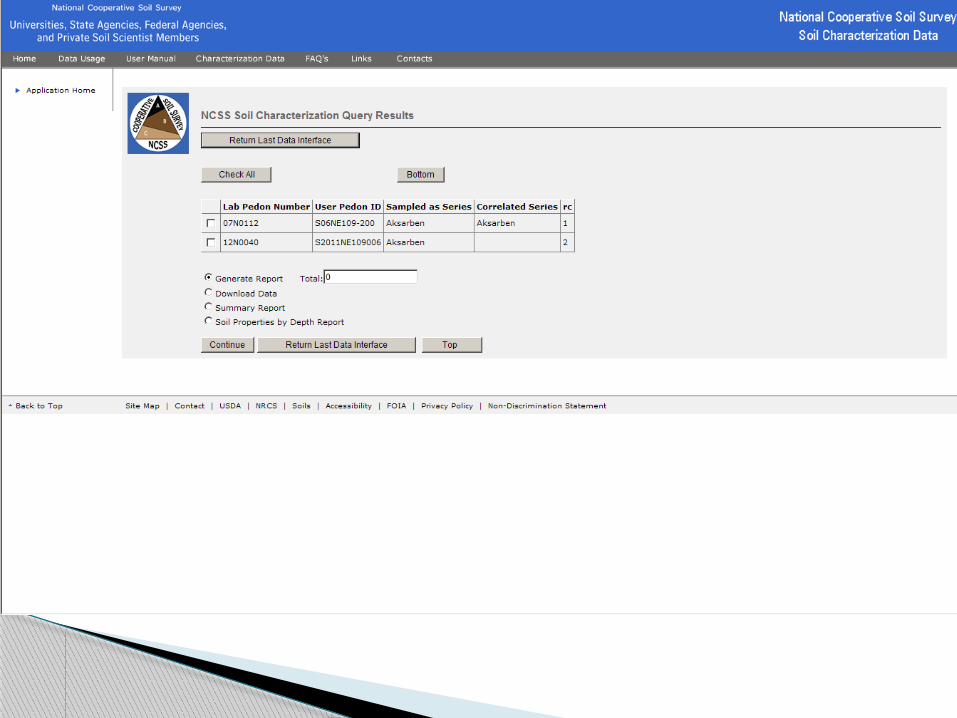
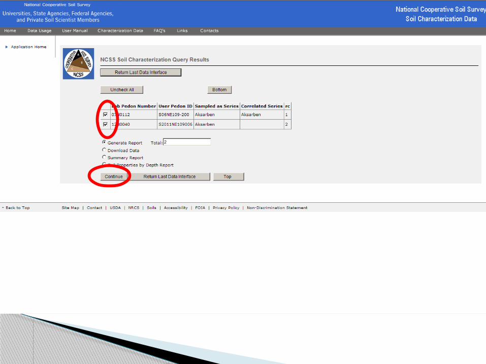
NCSS Report Selectionhttp://ncsslabdatamart.sc.egov.usda.gov/rptSelect.aspxScreen clipping taken: 9/7/2012, 11:27 AM

NSSC SSL Data Usage and Citation Informationhttp://ncsslabdatamart.sc.egov.usda.gov/popup_use.aspxScreen clipping taken: 9/7/2012, 10:52 AM
http://ncsslabdatamart.sc.egov.usda.gov/rptExecute.aspxScreen clipping taken: 9/7/2012, 11:12 AM
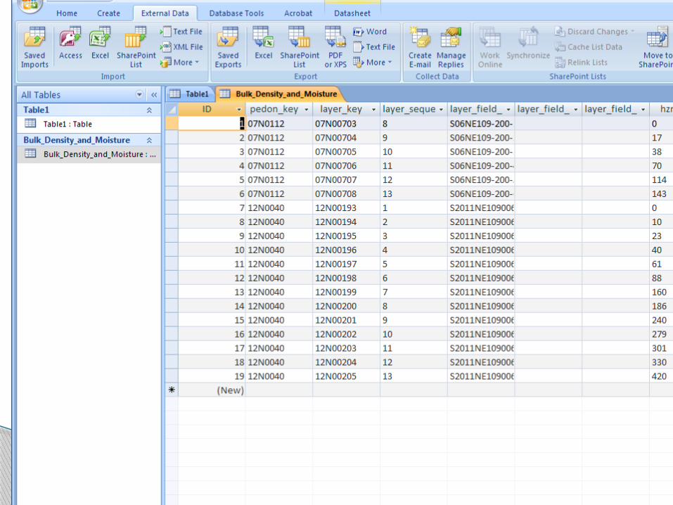
Downloading Analytical Data
NCSS Pedon Selectionhttp://ncsslabdatamart.sc.egov.usda.gov/query.aspxScreen clipping taken: 9/7/2012, 11:30 AM

NCSS Download Selectionhttp://ncsslabdatamart.sc.egov.usda.gov/dwnSelect.aspxScreen clipping taken: 9/7/2012, 11:31 AM
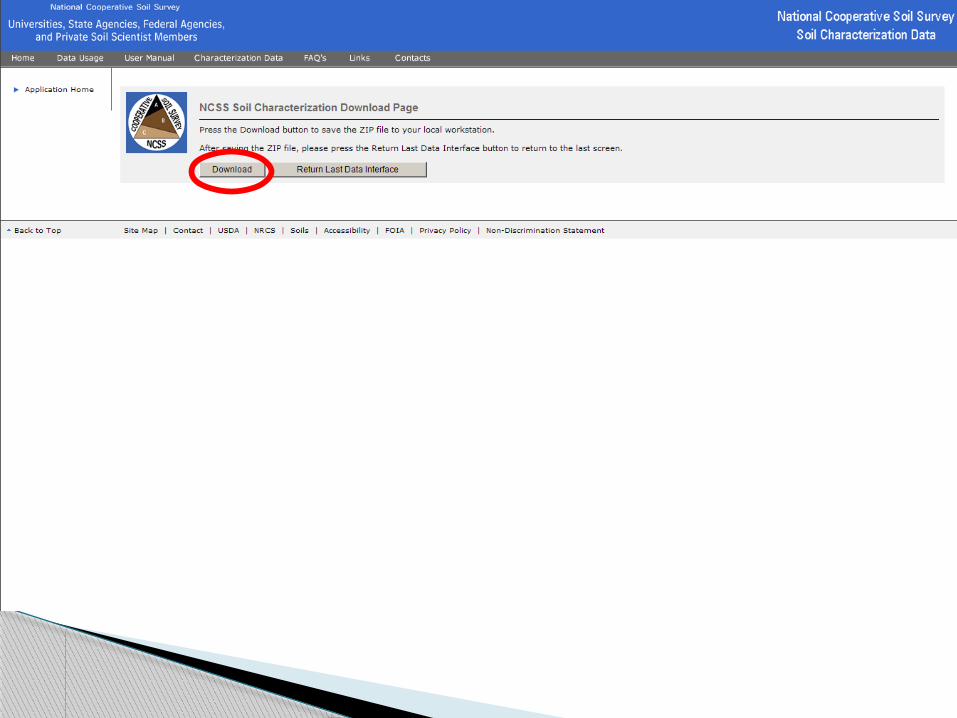
NSSC SSL Report Selectionhttp://ncsslabdatamart.sc.egov.usda.gov/dlExec.aspxScreen clipping taken: 9/7/2012, 11:32 AM

NSSC SSL Report Selectionhttp://ncsslabdatamart.sc.egov.usda.gov/dlExec.aspxScreen clipping taken: 9/7/2012, 11:32 AM

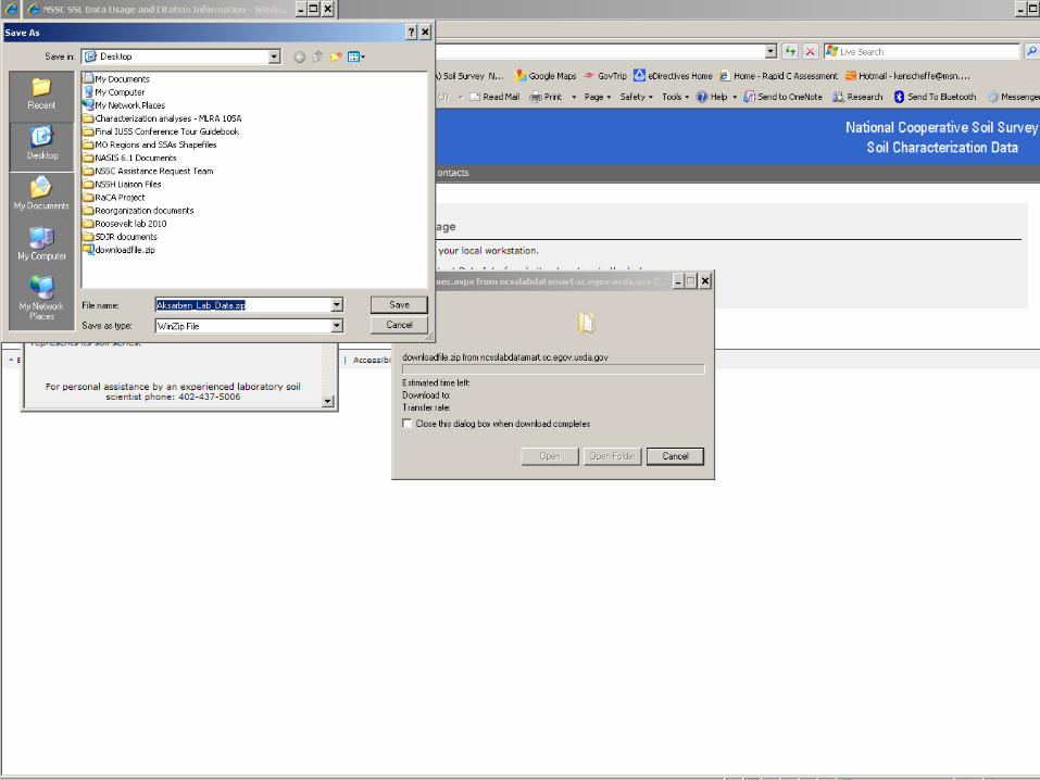
Screen clipping taken: 9/7/2012, 11:33 AM
Screen clipping taken: 9/7/2012, 11:36 AM

Screen clipping taken: 9/7/2012, 11:36 AM

Screen clipping taken: 9/7/2012, 11:34 AM

Screen clipping taken: 9/7/2012, 11:37 AM
Screen clipping taken: 9/7/2012, 12:52 PM