july 2018 east sabine lake hydrologic restoration (cs-32) · local sponsor: coastal protection and...
TRANSCRIPT
www.LaCoast.gov
Local Sponsor:Coastal Protection and Restoration AuthorityBaton Rouge, LA(225) 342-4736
Federal Sponsor:U.S. Fish and Wildlife ServiceLafayette, LA(337) 291-3100
For more information, please contact:
Approved Date: 2001 Project Area: 6,589 acres Approved Funds: $5.00 M Total Est. Cost: $6.04 MNet Benefit After 20 Years: 225 acresStatus: Completed October 2010Project Type: Hydrologic Restoration, TerracesPPL #: 10
Project Status
Location
Problems
Restoration Strategy
Progress to Date
East Sabine LakeHydrologic Restoration (CS-32)
rev. September 2010Louisiana Coastal Wetlands Conservation and Restoration Task Force
The project is located in the western portion of the Sabine National Wildlife Refuge from Pool 3 to the eastern shoreline of Sabine Lake in Cameron Parish, Louisiana.
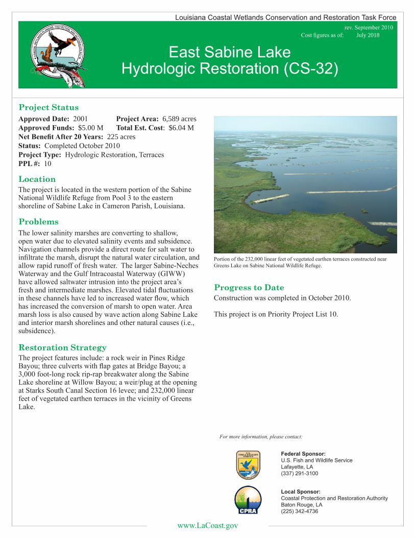
Portion of the 232,000 linear feet of vegetated earthen terraces constructed near Greens Lake on Sabine National Wildlife Refuge.
Construction was completed in October 2010.
This project is on Priority Project List 10.
The lower salinity marshes are converting to shallow, open water due to elevated salinity events and subsidence. Navigation channels provide a direct route for salt water to infiltrate the marsh, disrupt the natural water circulation, and allow rapid runoff of fresh water. The larger Sabine-Neches Waterway and the Gulf Intracoastal Waterway (GIWW) have allowed saltwater intrusion into the project area’s fresh and intermediate marshes. Elevated tidal fluctuations in these channels have led to increased water flow, which has increased the conversion of marsh to open water. Area marsh loss is also caused by wave action along Sabine Lake and interior marsh shorelines and other natural causes (i.e., subsidence).
The project features include: a rock weir in Pines Ridge Bayou; three culverts with flap gates at Bridge Bayou; a 3,000 foot-long rock rip-rap breakwater along the Sabine Lake shoreline at Willow Bayou; a weir/plug at the opening at Starks South Canal Section 16 levee; and 232,000 linear feet of vegetated earthen terraces in the vicinity of Greens Lake.
Cost figures as of: July 2018
