joint research centre fernando tempera, ec-jrc harmonized ecosystem service maps for the north...
TRANSCRIPT
Joint Research Centrewww.jrc.ec.europa.eu
FERNANDO TEMPERA, EC-JRC
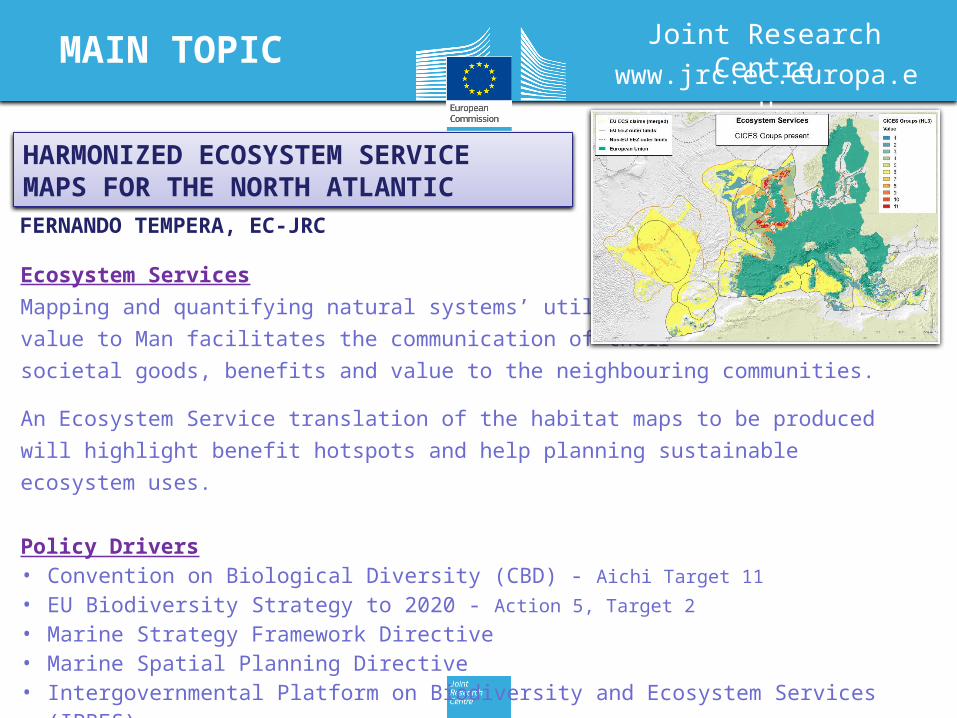
HARMONIZED ECOSYSTEM SERVICEMAPS FOR THE NORTH ATLANTIC
Ecosystem Services
Mapping and quantifying natural systems’ utilitarian
value to Man facilitates the communication of their
societal goods, benefits and value to the neighbouring communities.
An Ecosystem Service translation of the habitat maps to be produced will
highlight benefit hotspots and help planning sustainable ecosystem uses.
Policy Drivers• Convention on Biological Diversity (CBD) - Aichi Target 11
• EU Biodiversity Strategy to 2020 - Action 5, Target 2
• Marine Strategy Framework Directive• Marine Spatial Planning Directive• Intergovernmental Platform on Biodiversity and Ecosystem Services (IPBES)
MAIN TOPIC

DISTRIBUTION AND QUANTIFICATIONOF MARINE ECOSYSTEM SERVICES
PRIORITIES
Classification systems for habitats and ecosystem servicesEUNIS development (Galparsoro et al., 2012)Trans-Atlantic habitat translation/harmonisationHierarchical or non-hierarchical approach? CMECS?Marine Ecosystem Services review (Liquete et al., 2013)
Data collationSeabed broad-scale data available from:UNEP Global Seafloor Geomorphic Features MapEUSeaMap, EUSeaMap 2, MeshAtlantic Need to complete deep-sea and offshore areas
Marine Ecosystem Service inventory per habitatCompilations available from e.g., Galparsoro et al. (2014),Potts et al. (2013), Armstrong et al. (2012), Salomidi et al. (2012),Millennium Ecosystem Assessment (2005)Need to continue completing the inventory and updating
Marine Ecosystem Services
Habitat classification• Harmonize approaches: EUNIS, CMECSAlso important: establish North Atlantic Biogeographic boundaries (seabed and pelagic domains)
Data collation• Merge and compile further harmonised seabed and pelagic habitat occurrencesAlso important: define spatial scale, minimum mapping unit, data aggregation rules
Habitat mapping• Segment the seafloor and the water-column in habitat classesAlso important: analysis of satellite imagery and oceanographic models to localize consistent regimes; spatially-explicit predictive models)
Marine Ecosystem Services inventory• Inventory CICES Ecosystem Services associated to each habitat (relationship likely
specific to biogeographic region)Also important: Review CICES (strengthen marine perspective)
Ecosystem Service mapping• Link habitat maps and information on ecosystem services provided by each habitat to
map distribution of ecosystem servicesAlso important: Quantify and model natural provision rates and anthropogenic demand scenarios to assess sustainability and define management (service-specific models)
IMPLEMENTATION MEASURES
Marine Ecosystem Services