jakarta waterscape: from structuring water to 21st century hybrid nature?
DESCRIPTION
ÂTRANSCRIPT
Jakarta Waterscape: From Structuring Water
to 21st Century Hybrid Nature?
Prathiwi W. Putri Departement Architectuur Stedenbouw en Ruimtelijke
Ordening (ASRO), KU Leuven [email protected]
Aryani Sari Rahmanti Departement Architectuur Stedenbouw en Ruimtelijke
Ordening (ASRO), KU Leuven [email protected]
Abstract
This paper explores how changing conceptions of human-environment relationship have been materialized within Jakarta’s planning and development practices and how these practices have contributed in shaping today’s problematic waterscape. By refusing the modern binary opposition of nature-culture and arguing that our city is a hybrid nature of human-nonhuman, this paper shows that there have to be socio-technological hybrid solutions for current water sector’s problems. We centre our chain of explanations on flooding without neglecting the fact that flooding is related to other water issues and broader issues of uneven spatial development. Hence, tackling the calamities of flooding has to be situated within the whole water sector framework and spatial planning processes. Keywords: urban metabolism, Southeast Asia urbanism, water resource management, socio-technological innovation
2
Jakarta Waterscape: From Structuring Water
to 21st Century Hybrid Nature?
Abstract
This paper explores how changing conceptions of human-environment relationship have been materialized within Jakarta’s planning and development practices and how these practices have contributed in shaping today’s problematic waterscape. By refusing the modern binary opposition of nature-culture and arguing that our city is a hybrid nature of human-nonhuman, this paper shows that there have to be socio-technological hybrid solutions for current water sector’s problems. We centre our chain of explanations on flooding without neglecting the fact that flooding is related to other water issues and broader issues of uneven spatial development. Hence, tackling the calamities of flooding has to be situated within the whole water sector framework and spatial planning processes. Keywords: urban metabolism, Southeast Asia urbanism, water resource management, socio-technological innovation
3
1. Introduction In schools, children of Jakarta learn about the story of hydrological cycle. In reality, Jakarta’s water provision does not simply follow the logic of the material cycle through biological-chemical-physical processes. Jakarta’s source of water for more than eight million inhabitants (DKI Jakarta Government, 2010)1, in fact, is not only from the precipitation that goes to the stream or our aquifers. Engineers have been manipulating water ways since hundreds of year ago. Rivers were diverted and canals were built to nurture Batavia, the colonial Jakarta, with water for both economical and ecological functions. Since Jakarta does not grow its own rice and vegetables, there is plenty of water beyond our consciousness that is used for the populations. Today, transported by huge trucks, different brands of drinking waters in gallons are entering the city of at least 650 squares kilometres (Ibid.). Delivering water through gallons and plastic bottles is just one of several modes of water provision in Jakarta2, i.e. the municipal piped water system that serves not more than 20 % of the population, community standpipes, shallow wells, artesian wells, open streams and water bought from petty traders. The rich, industrial and manufacturing enterprises have their own artesian wells while poor people in the kampung rely on shallow wells that were often found to be dangerously contaminated by E. coli bacteria, or buy water from vendors whose price is often more expensive than the municipality water. In the slums, people fetch polluted water from rivers, streams and canals. In 1997, one of the largest water and sewerage privatization schemes in the world were launched in Jakarta. Thames Water Overseas Ltd. and Suez Lyonnaise des Eaux allied themselves with two local Indonesian companies to run Jakarta water and sewerage system (Argo and Laquian 2004). The socio-technological water management system brought by the Dutch for Batavia had not incorporated centralized underground sewerage systems. Open ditches were built for both domestic wastewater and storm water (Ravesteijn and Kop 2008). While centralized water provision has been organized before 1918 (Ibid.), it was only in the beginning of the 1980s, Jakarta started to have centralised waste-water management through Jakarta Sewerage System Project, financed by the World Bank, that is functioning only for less than 3 % of the population. The sewerage line is passing an area with mainly tall buildings with office and commercial functions. It was argued that commercial functions should be served first in order to give the operator company benefits in order to provide subsidy to residential areas and later on be able to expand the system. Until today, the coverage area of the sewerage system has not been expanded. Most of the buildings and houses in Jakarta have been relying on on-site sanitation system such as septic tanks that should be emptied regularly by municipal trucks. Unfortunately, most of the domestic septic tanks are leaking and polluting the soil and ground water. It is often the case that houses in crowded areas channel the wastewater into the nearest streams since there is no space for the septic tanks.
1 This is an official estimation the population of Jakarta Special Region, the provincial administration area. The
population of urban agglomeration of Jakarta Metropolitan Area may double to 17 million people (DKI Jakarta Government, 2010). We assumed that official population data is excluding non-registered inhabitants such as those migrated from rural areas without proper administration procedures. Moreover, during the day, the population is increasing due to the commuters earning a living in the city.
2 For studies of the water provision dynamic in Jakarta within the framework of governance, consult for example Argo (1999), Argo and Laquian (2004), Kooy and Bakker (2008a, 2008b)
4
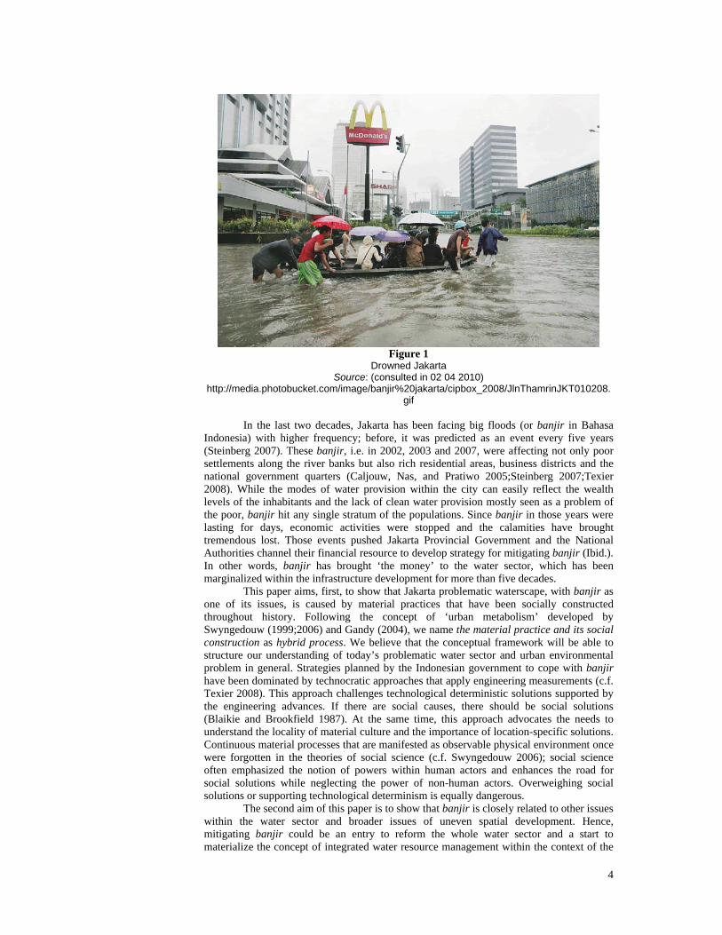
Figure 1
Drowned Jakarta Source: (consulted in 02 04 2010)
http://media.photobucket.com/image/banjir%20jakarta/cipbox_2008/JlnThamrinJKT010208.gif
In the last two decades, Jakarta has been facing big floods (or banjir in Bahasa Indonesia) with higher frequency; before, it was predicted as an event every five years (Steinberg 2007). These banjir, i.e. in 2002, 2003 and 2007, were affecting not only poor settlements along the river banks but also rich residential areas, business districts and the national government quarters (Caljouw, Nas, and Pratiwo 2005;Steinberg 2007;Texier 2008). While the modes of water provision within the city can easily reflect the wealth levels of the inhabitants and the lack of clean water provision mostly seen as a problem of the poor, banjir hit any single stratum of the populations. Since banjir in those years were lasting for days, economic activities were stopped and the calamities have brought tremendous lost. Those events pushed Jakarta Provincial Government and the National Authorities channel their financial resource to develop strategy for mitigating banjir (Ibid.). In other words, banjir has brought ‘the money’ to the water sector, which has been marginalized within the infrastructure development for more than five decades. This paper aims, first, to show that Jakarta problematic waterscape, with banjir as one of its issues, is caused by material practices that have been socially constructed throughout history. Following the concept of ‘urban metabolism’ developed by Swyngedouw (1999;2006) and Gandy (2004), we name the material practice and its social construction as hybrid process. We believe that the conceptual framework will be able to structure our understanding of today’s problematic water sector and urban environmental problem in general. Strategies planned by the Indonesian government to cope with banjir have been dominated by technocratic approaches that apply engineering measurements (c.f. Texier 2008). This approach challenges technological deterministic solutions supported by the engineering advances. If there are social causes, there should be social solutions (Blaikie and Brookfield 1987). At the same time, this approach advocates the needs to understand the locality of material culture and the importance of location-specific solutions. Continuous material processes that are manifested as observable physical environment once were forgotten in the theories of social science (c.f. Swyngedouw 2006); social science often emphasized the notion of powers within human actors and enhances the road for social solutions while neglecting the power of non-human actors. Overweighing social solutions or supporting technological determinism is equally dangerous.
The second aim of this paper is to show that banjir is closely related to other issues within the water sector and broader issues of uneven spatial development. Hence, mitigating banjir could be an entry to reform the whole water sector and a start to materialize the concept of integrated water resource management within the context of the

5
coastal city. At the end, this paper aims to advocate the issues of water sectors as structuring points in spatial planning processes and the role of urban designers as the mediator between social and technological determinism. The importance of finding socio-technological hybrid solutions should bring creativity in urban design processes. This paper benefits from numerous previous scholarly works related to Jakarta’s water sector. Among them are those unfolding historical development of the sector within the disciplines of sociology, anthropology and hydrology; the ones on governance and the socio-political processes of securing water supply from the city managers point of view referring to the processes of privatization and supply expansion; and the works that are focusing in seeking the pattern of Southeast Asian urbanism. However, research on integrated water infrastructure, its relation to the bigger infrastructure sector and its connection to urban life is still lacking. Adding to the existing literature, we would like to contribute in fulfilling what is lacking and answer the calls of ‘de-centered theory’ of urbanization (Kooy and Bakker 2008) in the context of global South. In the following parts, we open the discussion by theorizing human-environmental relationship and afterwards move to the application of the conceptual framework into the phenomena of Jakarta spatial development in respect to water sector. 2. Unfolding Urban Metabolism: contesting nature and culture It was the Dutch colonialism that has transplanted the model of Western modern city into the land of Java, mostly in coastal areas. The inheritance of Dutch colonial cities can still be found today in the form of, for example, canals, cathedrals and art-deco buildings. Later on, far from the coastal cities in which the Dutch inhabited, hectares of tropical rainforest were transformed into plantation producing various types of export-based crops. For both types of environment, the Dutch administrator had to mobilize thousands of unpaid workers transforming the soil, stones, and bricks into the buildings or the irrigation canals. Without importing bricks, before it was produced in Java, and bringing the seeds in from thousands of miles away for cultivating the colony, the landscape of Java would not be the same as it was. It is interesting to see that within Indonesian society today, there are discursive ideas that the city is ‘culture’ while the plantation is ‘nature’. Accompanied by the following explanation, we argue that both ‘the city’ and ‘the plantation’ are in the same time nature and culture. The term of ‘metabolism’ became familiar in the early nineteenth century that refers to material exchanges within human body through the respiration system, between organisms and the environments, and between living creatures, involving biological, chemical and physical processes (Swyngedouw 2006). Either metabolism happen within a living thing or between the living thing and its environments, each has its totality of biochemical reactions with possibility of affecting each other (c.f. Ibid.). The use of ‘metabolism’ became broader with its application within the dynamics of socio-environmental transformations. Swyngedouw points Marx as one among the first used the term of ‘metabolism’ in this respect, influenced by the work of chemist agriculturalist Justus von Liebig. Marx (1970 in Ibid.) applies ‘metabolism’ in defining labouring. To summarize, labouring is a process of controlling the material processes of the objects which human tries to transform while having own metabolism within the body. It is not only a matter of technical experiences between human and the non-human object, but labouring is also affected by social relations, or experiences between human-human, since the activity has been always happening within social relations. On the other hand, by transforming the nature, one has contributed to social-relation transformations. From both human- nonhuman and human-human interactions, and the process of confirming one toward another, one develop conception towards his or her environment (c.f. Sayer 1992). Certainly in the contemporary urban life, human’s work is not simply ‘labouring’ with the meaning of transforming material objects to other forms, for example, cultivating rice or fabricating clothes3. Activities of service sector have been painting our urban landscape today. In the case of Jakarta Metropolitan Area, activities contributing to the growth are
3 See Mollenkopf (1983) for the first and second urban transformation and the social characteristics
accompanying them. What Mollenkopf refers as ‘first’ urban transformation is changes during the industrial era while ‘second’ transformation is changes during the growth of service sector.
6
including manufacturing, finance, trade, transportation, and building sector (Firman 1998). However, there are material processes in the activities of clerks, bus drivers, architects, developers and bank managers within certain social relations and physical environments (c.f. Latour 1999).
Following above explanation, then we can define urban metabolism as socially mediated process of mass-collective environmental-transformation and trans-configuration by interconnected acts of all ‘agents’ (c.f. Swyngedouw 2006; Mollenkopf 1983; Harvey 1985). Urban metabolism is an uninterrupted assembling process of humans and non humans whose own metabolism for being is an integral element. City, hence, is spatial manifestation of the ‘heterogeneous assemblages’ from continuous dynamic ecological relationships between humans and nature that are not neutral from the dialectics of human’s perception, conception and sets of meaning (see Gandy 1999;2004;Kaika and Swyngedouw 2000;Swyngedouw 1999;2006).
It is important to understand that above concept of ‘metabolism’ within the dynamic of urban socio-environmental transformation as advocated by, for example, Swyngedouw and Gandy is different with the one that is used as purely social metaphor, i.e. using the nature’s processes of metabolism explained by biological and physical sciences as explanatory structures of social phenomena without incorporating that natural material processes are actually happening in the same moment (c.f. Gandy 2004;Swyngedouw 2006). The same importance is to differentiate above concept with the one that is utilized within urban and architectural discourse referring to the bio-physical processes of urban metabolism as static functionalities that do not explain urban space as historically produced environment (Gandy 2004).
The model of the modern city transplanted into the global South through the colonialism has not been without continuous conflicts and reformulations within the original setting of industrialised Europe. From the stories of hydrological transformations in 19th Century European cities, we can argue that the process of reformulating and redevelopment of the modern city, in this case the water system model, involved: the environmental degradation due to industrialisation that had changed the pattern of labouring; significance development in science and engineering (see Melosi 2000;Porter (ed.) 1994); the role of welfare state with some leading reformists, especially in public health sector e.g. Edwin Chadwick for Britain (see Porter (ed.) 1994); planners and engineers that materialized the discursive ideas at the time (Melosi 2000), like Joseph Bazalgette for London and Baron Haussmann for Paris (Gandy 1999). The development of Batavia, colonial Jakarta, was influenced by the dynamic of hybrid-process in the home country. Batavia water management was an evolution happening longer before the first anchor was sailed by the Dutch who arrived with a big ship containing of water management experiences after ‘centuries-long battle’ in the low land attached to the North Sea (Kop 2008). On the other hand, it has been acknowledged that the socio-technological dialectics of water management in the colony influenced the development of knowledge and practice of water management in the mother land (Ravesteijn and Kop 2008). Below explanation shows how the Dutch engineers transplant the modernist concept of urban living in Batavia, the colonial Jakarta, from 17th to 20th Century. Perhaps we could point the highly technological approach towards the existing environment as the legacy of living with banjir. 3. Watering the City and Modernizing the Colony The number and intensity of urban agglomeration in Indonesia were augmented by the emergence of coastal cities that has also been arising widely in Southeast Asia during the maritime trading between China and India since the second century AD. However, until the eighth century AD (Ford 1993), major civilizations such as Java and Sumatera kingdoms were concentrated in inland areas with the Hindu-Buddhist palaces as the generator for the agglomeration. Connected through the rivers, the kingdoms’ territories ended in coastal areas that were supporting inland activities (Widodo 2009). The emerging coastal cities differed from the conurbations constructed based on the Indian tradition in inland areas (Widodo 2004). As the connecting points between interior cities and the international worlds (Widodo 2009), the coastal cities underwent more dynamic experiences which gradually became more important and bigger with their own morphology characteristics.

7
One of these coastal cities was Jayakarta (1527–1619) that originally situated close
to the mouth of Ciliwung River, the main river of Jakarta today. Emerged as a river settlement with immense amount of water courses on a flat and low plain, Jayakarta flourished with the risk of being wiped by greater volume of upstream water and sea level rise. The settlement was morphologically simple. The harbour, traditional market area, mosque, alun-alun (open public space), the prince’s house, warehouses were located in the left bank of Ciliwung River while the opposite side of the river was given to native and foreign settlements (Widodo, 2004). Albeit the port town was one of the main harbour settlements in Java for international traders (Sugiantoro, 2005), Jayakarta was less recognized compare to its rival Banten Port that was ruled by another kingdom located just next to the east side of Jayakarta (Widodo, 2004). It was only in early 17th Century when the Dutch took over the area did Jayakarta start to be entirely redeveloped as a major port city in Java with the new name of Batavia.
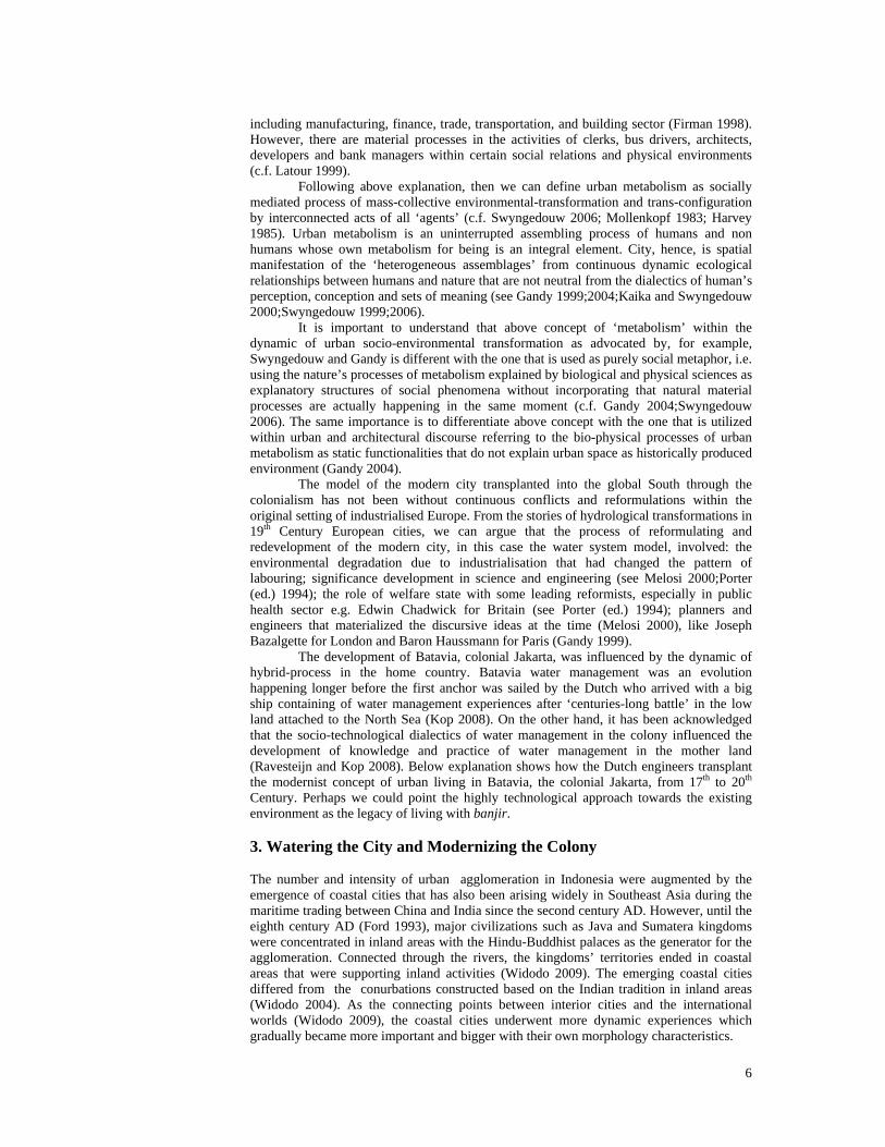
During the colonial era in Batavia, public perception towards water was de-constructed and new conception on water was built. Before unfolding urban metabolism of colonial Batavia through the history of its water management system, we would like to start the discussion by briefly unravelling the history of water management in the Netherlands to give us a foreground for analysing the contemporary waterscape of Jakarta. We point ‘foreground’ due to the following rationalisation. When the Dutch colonialists arrived in Java, they did not bring the last model or the absolute form of water management system. In the Netherlands, the modern approach towards nature has been reformulated and the on-going process has been producing ‘better’ ways of dealing with water. It is relevant to show that the dialectics in Dutch water sector, and generally in the global north, did not stop when the socio-technological system was imported into the Archipelago through the modern colonialism. By doing this, we counter the practices in the global South that often take the modern way of dealing with water as an absolute model and this has closed spaces for innovation, even when the transplanted model has been proved as not always been performing. 3.1. Watering the Origin Hooimeijer’s work (2009) offers an outline of historical, current and future relationship between urbanisation and water management in Dutch polder cities that is drawn on relationship between water management and urban design. Hooimeijer shows that conceptual thinking behind polder cities has been changing and hence, creating transforming polder cities. We simplify the author’s explanation by summarising the narration within our conceptual framework into Table 1.
Table 1
Six Phases of Dutch Water Management
Phase (Hooimejer
2009)
Period (AD)
Influential Events Responses Characteristics
Acceptation -1000 Natural metabolism: forces of water and wind
Living in higher grounds
Surrender to the forces of nature – this has been seen as flexible character towards water
Defensive 1000-1500 The ‘great reclamation’ of agricultural grounds
Combination of dikes, natural watercourses and dams mostly the dams turned into trading markets estuary outside the dikes became a sheltered harbour
Combination of hydraulic and economical considerations; this era has been considered as flexible character towards water too
8
Offensive 1500-1800 Population growth; the formation of the ‘Republic of Seven United Netherlands’, organized army was formed; progress in science, technology and arts
Living on levelled ‘dry’ cores
Growing needs of group consensus to fight against the water; negotiation and co-operation between landowners and farmers
Early Manipulative
1800-1890 Growing industrialisation; explosion of population; technological inventions; improvements in the fields of hydraulics, soil mechanics and engine power; French colonisation
Spatial separation of conflicting functions and grouping of similar ones; better settlements for better-off populations; combining hydraulic engineering and city design
Centrally organised governmental structures; national concern of water management and education of related professions; water should bring quality and conditions for better living environments
Manipulative 1890-1990 The invention of steam power; Maturation of soil mechanic field
Much greater scale of land reclamation: reclaim water, not only wetlands; segregation of spatial functions; underground piping started to be in place; reintroducing of public space
Not only control but manipulate; maturation of and specialisation within fields lead to disintegration of professions, e.g. designers ignored the logic of natural metabolism
Adaptive Manipulative
1990-
Calls not only to integrate water management but also between water management and spatial planning*; improvement in the fields of foundation engineering and building materials; the impacts of economic recession: no funding for public space; climate change
Water should be stored instead of drained as quick as possible; ‘nature’ as element of urban design: the concept of ‘blue’ and ‘green’ in spatial planning; increasing use of soft-surface (water, grass and soil) instead of hard one (concrete, etc.); easy and cheap maintenance of public space
Concerns on ecological systems; nature and city are one system; leaving rigid and purely technological approaches to water management; ‘watering’ urban design;
Source: Authors based on Hooimejer (2009) * see also Meyer (2007) and Voogd (2006)
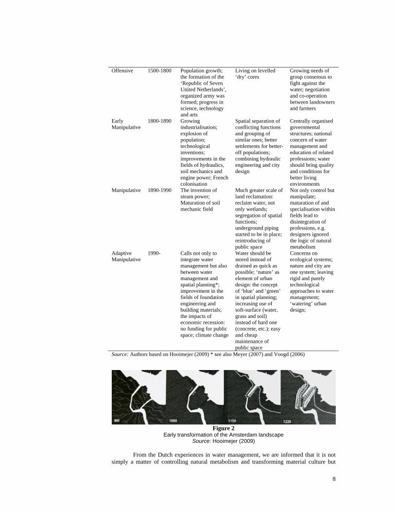
Figure 2
Early transformation of the Amsterdam landscape Source: Hooimejer (2009)
From the Dutch experiences in water management, we are informed that it is not
simply a matter of controlling natural metabolism and transforming material culture but

9
also maintaining the institutional dynamics. Since water was a common enemy, in respect to the period before 19th Century, a group consensus was required. Further, since reclaiming land necessitates resources, i.e. planning and labour, development has to be regulated (Ibid.). Hooimeijer raises another crucial point that not only we confirm the existence of flourishing knowledge of water-related engineering is affected by and affecting the practices of water management, but we also need to understand who owns the knowledge. It is explained by Hooimeijer (Ibid.) that military and civil engineers were those mastering the field since they were the first having interest on water management.
Dutch water management system has been evolving for centuries and today, purely technological approach has been perceived as not sufficient for responding the complexity of contemporary urban water issues (Hooimeijer 2009;Voogd 2006). Domination of ‘technological innovation and historical transmission of water management techniques’ has led to less appreciation of spatial quality (Voogd 2006) and put water experts in an exclusive box of professional privileges (c.f. Hooimejer 2009). However, there have been attempts to transform the relation of, for example, urban design and engineering in the recent years. Although once, it was torn apart, today’s complexity of urban life and the rising of sea level are demanding trans-disciplinary approaches (c.f. Meyer, 2007). 3.2. Banjir in Batavia: Natural and Normal For the Dutch, settling in Batavia was not without difficulties. The material condition alone, leave behind the whole existing cultural process, is one of the localities that give important difference to the Western setting. Ravesteijn (2008) shows that the Dutch technology in East Indies generally faced two big things: nature challenges and geographical features.
Without anthropogenic factors, Jakarta is already subject to flooding (Caljouw, Nas, and Pratiwo 2005) due to natural metabolism as it is explained in the following. Jakarta today is a more-than 5,000 year-old delta that was formed by sedimentation of debris from the volcanoes in the southern areas. The alluvial plain that is just above sea level has around 13 waterways cutting through the city; three of them are bigger ones with their springs in the steep mountainous highland. Water flows slower towards the sea due to significant decrease of inclination. Most of the river outlets are heavily silted up due to the lower speed of water. High tide also reduces the proximity of the stream. During wet season, these rivers carry enormous amount of water containing heavy silt brought by fast stream in the higher lands. Combinations of mentioned factors cause inundation of the delta regularly.
Figure 3
Hydrological Situation of Jakarta Today within the River Basins Source: Authors based on Nedeco 2002 in Caljouw et al 2005
10
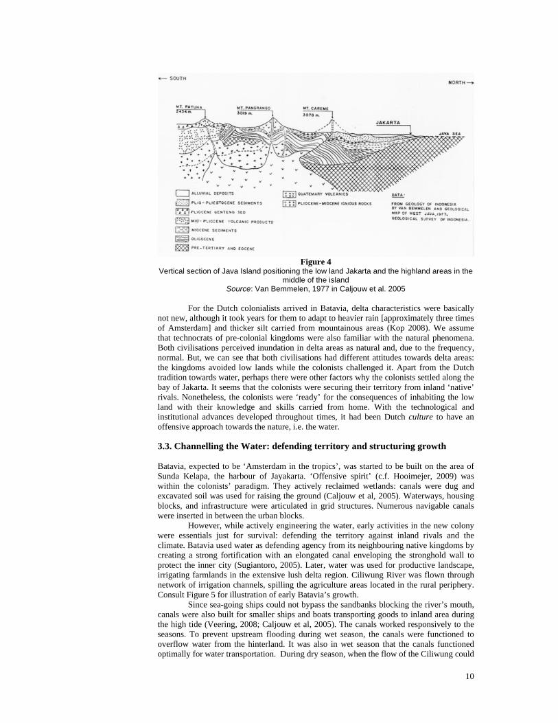
Figure 4
Vertical section of Java Island positioning the low land Jakarta and the highland areas in the middle of the island
Source: Van Bemmelen, 1977 in Caljouw et al. 2005 For the Dutch colonialists arrived in Batavia, delta characteristics were basically not new, although it took years for them to adapt to heavier rain [approximately three times of Amsterdam] and thicker silt carried from mountainous areas (Kop 2008). We assume that technocrats of pre-colonial kingdoms were also familiar with the natural phenomena. Both civilisations perceived inundation in delta areas as natural and, due to the frequency, normal. But, we can see that both civilisations had different attitudes towards delta areas: the kingdoms avoided low lands while the colonists challenged it. Apart from the Dutch tradition towards water, perhaps there were other factors why the colonists settled along the bay of Jakarta. It seems that the colonists were securing their territory from inland ‘native’ rivals. Nonetheless, the colonists were ‘ready’ for the consequences of inhabiting the low land with their knowledge and skills carried from home. With the technological and institutional advances developed throughout times, it had been Dutch culture to have an offensive approach towards the nature, i.e. the water. 3.3. Channelling the Water: defending territory and structuring growth Batavia, expected to be ‘Amsterdam in the tropics’, was started to be built on the area of Sunda Kelapa, the harbour of Jayakarta. ‘Offensive spirit’ (c.f. Hooimejer, 2009) was within the colonists’ paradigm. They actively reclaimed wetlands: canals were dug and excavated soil was used for raising the ground (Caljouw et al, 2005). Waterways, housing blocks, and infrastructure were articulated in grid structures. Numerous navigable canals were inserted in between the urban blocks. However, while actively engineering the water, early activities in the new colony were essentials just for survival: defending the territory against inland rivals and the climate. Batavia used water as defending agency from its neighbouring native kingdoms by creating a strong fortification with an elongated canal enveloping the stronghold wall to protect the inner city (Sugiantoro, 2005). Later, water was used for productive landscape, irrigating farmlands in the extensive lush delta region. Ciliwung River was flown through network of irrigation channels, spilling the agriculture areas located in the rural periphery. Consult Figure 5 for illustration of early Batavia’s growth.
Since sea-going ships could not bypass the sandbanks blocking the river’s mouth, canals were also built for smaller ships and boats transporting goods to inland area during the high tide (Veering, 2008; Caljouw et al, 2005). The canals worked responsively to the seasons. To prevent upstream flooding during wet season, the canals were functioned to overflow water from the hinterland. It was also in wet season that the canals functioned optimally for water transportation. During dry season, when the flow of the Ciliwung could

11
fall to 2m³/s, the canals provided the city with water. In the city, there was space for water to be diverted or distributed.
Figure 5 From Jayakarta to Batavia within three decades of colonialism - attached map
is Batavia 1740 Source: Authors based on Sugiantoro, 2008 – maps are collections of
Royal Tropical Institute The modification of Batavia continued for decades, positioning the essence of water as the main regulator in constructing the city. Within thirty years after the occupation, in 1650, the vicinity of Batavia expanded three times larger than before (consult Figure 5). However, from small defensive city to its bigger expansion, Batavia was hit several times by major banjir due to anthropogenic and natural factors. Upstream deforestation and irrigation for over-extended agriculture area worsened the situation. Forest clearance in the far south mountainous area for tea plantations caused floods in 1654 and 1714. Numerous waterworks were constructed such as sluices, dams, and canals since the beginning of the 18th Century (Kop, 2008a) to cope with flooding problems inside the city. Irrigation channels watering the agriculture area were unmanageable and likewise contributed the amount of rising water. Special events generated other floods: excessive water quantity during the wet seasons and mud inundation caused by Mount Salak eruption. In the early 19th Century, urbanization in Batavia took place in further south of the old town as there were needs for larger area accommodating greater civic functions. The deteriorating environment condition in the old town was another push-factor for this expansion. Leaving the coastal area of Batavia, the colonists were reaching higher grounds. This decision was without any consequence. Extended waterworks were still following the expansion.
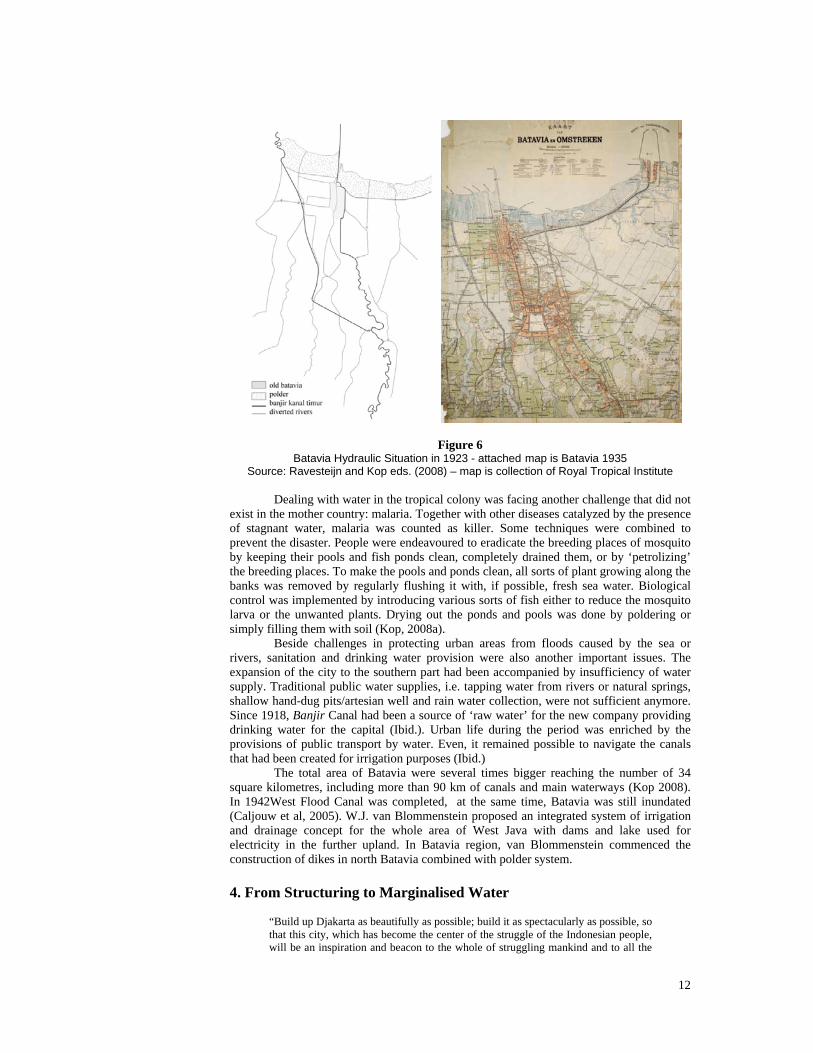
As the flooding encroached the city more often, Herman van Breen, an engineer for water management in Jakarta, developed a design for West Flood Canals in 1917 (Figure 6). The idea was to control the volume of the abundant water by discharging the water from Ciliwung River to be redirected to the western part of Batavia before it was released to the sea. Van Breen as well designed some polders in some parts of North Jakarta (consult the map of Figure 6) which height used the dredged mud sediment in the mouth of the river (Caljouw et al, 2005). During the construction of West Canal Flood in 1920, Batavia covered an area for approximately 25 square kilometres only.
12
Figure 6 Batavia Hydraulic Situation in 1923 - attached map is Batavia 1935
Source: Ravesteijn and Kop eds. (2008) – map is collection of Royal Tropical Institute
Dealing with water in the tropical colony was facing another challenge that did not exist in the mother country: malaria. Together with other diseases catalyzed by the presence of stagnant water, malaria was counted as killer. Some techniques were combined to prevent the disaster. People were endeavoured to eradicate the breeding places of mosquito by keeping their pools and fish ponds clean, completely drained them, or by ‘petrolizing’ the breeding places. To make the pools and ponds clean, all sorts of plant growing along the banks was removed by regularly flushing it with, if possible, fresh sea water. Biological control was implemented by introducing various sorts of fish either to reduce the mosquito larva or the unwanted plants. Drying out the ponds and pools was done by poldering or simply filling them with soil (Kop, 2008a). Beside challenges in protecting urban areas from floods caused by the sea or rivers, sanitation and drinking water provision were also another important issues. The expansion of the city to the southern part had been accompanied by insufficiency of water supply. Traditional public water supplies, i.e. tapping water from rivers or natural springs, shallow hand-dug pits/artesian well and rain water collection, were not sufficient anymore. Since 1918, Banjir Canal had been a source of ‘raw water’ for the new company providing drinking water for the capital (Ibid.). Urban life during the period was enriched by the provisions of public transport by water. Even, it remained possible to navigate the canals that had been created for irrigation purposes (Ibid.)
The total area of Batavia were several times bigger reaching the number of 34 square kilometres, including more than 90 km of canals and main waterways (Kop 2008). In 1942West Flood Canal was completed, at the same time, Batavia was still inundated (Caljouw et al, 2005). W.J. van Blommenstein proposed an integrated system of irrigation and drainage concept for the whole area of West Java with dams and lake used for electricity in the further upland. In Batavia region, van Blommenstein commenced the construction of dikes in north Batavia combined with polder system. 4. From Structuring to Marginalised Water
“Build up Djakarta as beautifully as possible; build it as spectacularly as possible, so that this city, which has become the center of the struggle of the Indonesian people, will be an inspiration and beacon to the whole of struggling mankind and to all the

13
emerging forces. If Egypt was able to construct Cairo as its capital, Italy its Rome, France its Paris and Brazil its Brasilia, then Indonesia must also proudly present Jakarta as the portal of the country”. (Soekarno, 1962)4
The Dutch surrender in 1945 opened a new phase in governing the country, including in visioning the capital city. Inspired by other big cities in the world, Soekarno, the first president of Indonesia, evoked his vision to make Jakarta to be recognised as one of the world cities. According to his nationalist view, an urban revolution was needed to re-establish a new international image of Jakarta, opposing its former representation as an old colonial town. He believed that powerful tools to realize his aspirations laid on the performance of several major urban projects. Agendas for fashioning Jakarta were inaugurated by mounting monumental buildings attached to grandiose boulevards (Silver, 2008). Unfortunately, Soekarno’s priorities for urban development were without touching the deteriorating parts, including the problem of flooding. Moreover, his priority to develop more infrastructural projects without public transport improvement was the embryo for road based and private urban developments in the following years (c.f. Danisworo, 2002). The ‘New Order’ of Soeharto, from 1965 to 1998 simply continued Soekarno’s scheme for a road based development, followed by big infrastructure projects. More boulevards, toll roads, highways, and flyovers were built in Jakarta while only within three decades, from the 70’s to the late 90’s, approximately 45 high rise buildings and numerous shopping malls were built (Danisworo, 2002), representing consumptive development. One of the controversial projects was the plan of a new waterfront development, North Jakarta Revitalization and Waterfront Reclamation Project, that would facilitate commercial, residential, and industrial purposes. Formerly initiated in 1995 by the Jakarta Regional Planning Board, the project officially obtained its endorsement from the government after several long disputes and delays. The reclamation project stretches 32 km long from Tanjung Priok Harbour to the Jakarta’s International Airport. This energy-intensive development requires enormous amount of soil for the reclamation. It is predicted that the realisation of the project would worsen current occupations over natural features in Jakarta Bay. 4.1. Majoring the Asphalt, Marginalizing the Water Rapid urbanization has been worsening hydrological situation of Jakarta. More impermeable land makes water flows into the waterways with a higher speed. Hence, the volume of rivers and canals increases quickly, especially during the rainy season. Upstream, less forest and green coverage cause greater erosion and the river carries more sediment. Garbage dumping into waterways adds the problem. At the same time, rivers are suppressed by the urbanisation and this has decreased their width significantly. Gigantic constructions with excavations of the earth surface for foundation and basement parking, and the uncontrolled extraction of ground water have led to land subsidence and allowed saline water to intrude the North part of Jakarta.
Jakarta has been transforming for over 60 years after the Independence. Water slowly evaporates from the mental map of the inhabitants. In Jakarta, people experience their daily life in vehicles – often trapped in traffic jams – through the networks of asphalt and concrete. Roads have been built covering the area of 650 square kilometres and reached any corner of Jakarta. Surface areas of the roads have multiplied the width of Jakarta’s main rivers. Since physical development is facing the roads and the coastal lines are blocked with the private functions, there is no more contact between the inhabitants and the water. Jakarta citizens do not aware that they live near the sea on a low level land. There is no open space along the river as city-scale public amenities. For majority of the people, it would be very difficult to point the location of Ciliwung River, while it would be much easier to recognise the tallest landmark of Jakarta, or to map the major asphalt lanes of Jakarta surrounding the monumental commercial and business centres. Ironically, it was only when banjir hit the city, people were reminded of their vulnerable habitat. That is how water culture has altered drastically to be perceived as a frustrating issue. 4 Speech from Soekarno, first president of Indonesia, for his vision: The Transformation of Djakarta Raya, 1962,
in (Silver 2008)
14
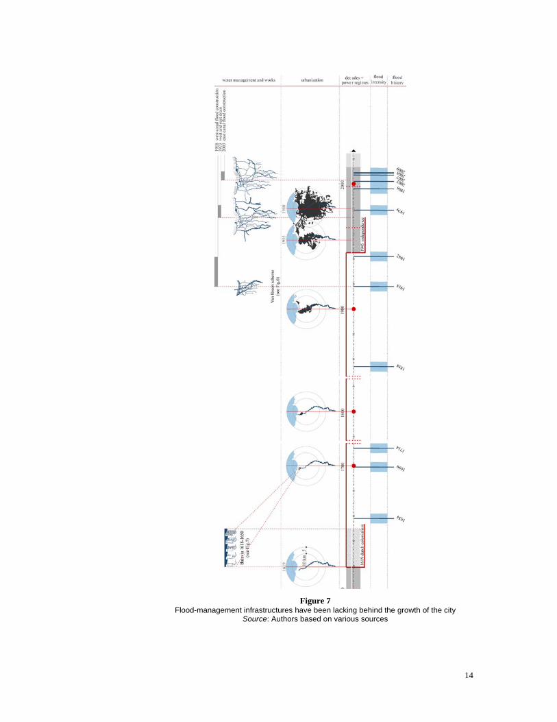
Figure 7 Flood-management infrastructures have been lacking behind the growth of the city
Source: Authors based on various sources

15
4.2. Marginalised Water and Forgotten Communities Although banjir has become a common problem and has driven attentions from provincial and national government, it has been experienced differently by each sector and income level. Low income population has to accept the reality that there is no place in the city to live apart from the places with limited or even without access to public facilities, such as the river banks. Since the riverbanks are subject to flooding, these inhabitants have become the most vulnerable victims (Textier, 2008).
It is often that the residing society along the riverbanks is accused as being responsible to the calamity due to their insanitary behaviour. Solid waste dumping and waste water channelling into the river have been seen as merely the poor’s misbehaviour. It is not that there is no flood awareness and environmental appreciation among the poor. In fact, their ways of life is the way to cope against poverty and uneven spatial developments (c.f. Textier, 2008). Their dwelling pattern is congested and they occupy the space without adequate fresh air and sunshine. They use dirty water from the rivers for domestic use as most of the households are not served by piped water supply. During wet season, the waterways are blocked and the water spills over the city. In dry season, stench appears. Meanwhile, rich people simply heightened their ground floor residential platforms. These individual actions actually have caused higher level of water to the surrounding poor neighbourhoods when the flood comes.
Figure 8
Socio-hydrological Situation of Jakarta Today: flooded areas and slum distributions Source: Left - based on Rijkswaterstaat et al. 2003 in Caljouw 2005 and RTRW DKI Jakarta
2010; Right - based on (Bakker et al. 2008) Jakarta authority claimed that there have been comprehensive efforts to manage banjir including incorporation of non technical aspects such as economy, socio-culture and governance in the forms of new approaches in urban development policy-making and practices and strengthening public awareness and concern related to banjir (see [sources please! Insert semua sumber artikel2 itu ya.]). In fact, technical progress and engineering work are still used by the government as the parameter to measure how far we have moved forward for the problems of banjir. Moreover, most of the infrastructural projects, like the East Flood Canal project, are accompanied by relocations of the settlements along the waterways. Leave alone the debates whether flood-canal can help Jakarta water system, the relocations have destroyed urban socio-physical fabrics and do not solve the problems of slum. The authority argued that since the inhabitants along the waterways are vulnerable to banjir, relocating the settlements are needed in order to protect them.
Jakarta government views that banjir is not only the responsibility of the government, but also the communities. The principle to share the responsibility with public is, unfortunately, not a gate for democratic space in managing the city. Instead, it has been seen as efforts to throw the responsibility to others. The government justify banjir as natural, as the city is built on the alluvial low land, and argued that it has been worsened by the practice of solid waste dumping into the river (see [the source]). This justification has
16
been seen as incapability of the state in handling the problems of flooding (see [the source]). Instead of, for example, regulating the physical development, the government built discourses to divert the criticism addressed to them. The understanding that banjir is part of Jakarta natural behaviours is not used as the foundation to create water-friendly urban development and promote living with water. Instead, it has been used as a political legitimation of a regime doing nothing for the communities.
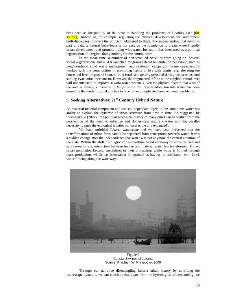
In the mean time, a number of non-state led activities were going on. Several social organizations and NGOs launched programs related to sanitation behaviour, such as neighbourhood solid waste management and sanitation campaigns. Some organisations worked with the communities in promoting habits to live with banjir: e.g. elevating the house and free the ground floor, storing foods and getting prepared during wet seasons, and settling evacuation mechanism. However, the fragmented efforts at the neighbourhood level will not sufficient to improve Jakarta water system. Given the physical feature that 40% of the area is already vulnerable to banjir while the local wisdom towards water has been erased by the modernity, Jakarta has to face rather complicated environmental problems. 5. Seeking Alternatives: 21st Century Hybrid Nature As essential material component and concept-dependant object in the same time, water has ability to explain the dynamic of urban structure from time to time. As suggested by Swyngedouw (2004), ‘the political ecological history of many cities can be written from the perspective of the need to urbanize and domesticate nature’s water and the parallel necessity to push the ecological frontier outward as the city expanded’. We have unfolded Jakarta waterscape and we have been informed that the transformations of urban form cannot be separated from conceptions towards water. It was a sudden change after the independence that water was not anymore the central attention of the state. Within the shift from agricultural-maritime based economy to industrialised and service-sector era, interaction between human and material water has transformed. Today, urban population became specialised in their professions while water is bottled through mass production, which has been taken for granted as having no correlation with black water flowing along the waterways.
Figure 9
Coastal Skylines of Jakarta Source: Prabham W. Pratipodyo, 2008
Through our narrative disentangling Jakarta urban history by unfolding the waterscape dynamic, we can conclude that apart from the hydrological understanding, we

17
need to know how actors perceive water-related problems to form the consensus in creating urban environment we wish to inhabit. It seems that it is still a very long journey towards the 21st Century hybrid nature that is able to bring so-called sustainability. However, although it is scattered and fragmented, there have been attempts from the communities. Individual architectural efforts, sanitary behaviour improvements and social capital in the form of social organisations are waiting to be organised collectively. Jakarta’s size, referring to the number of population and the area, is too big for a centralistic management. The 13 river basins need to be considered as individual clusters. Hence, there is grand agenda for urban design practices: integrating location-specific solutions within a framework of city-wide spatial planning or provoke a city-wide strategy to be in place by proposing location-specific solutions. 6. Bibliography
Argo, Teti, and Aprodicio A. Laquian (2004) Privatization of Water Utilities and Its Effects on the Urban Poor In Jakarta Raya and Metro Manila. Paper presented at Forum on Urban Infrastructure and Public Service Delivery for the Urban Poor, Regional Focus: Asia, sponsored by the Woodrow Wilson International Center for Scholars and the National Institute of Urban Affairs, India Habitat Centre, New Delhi, 24-25 June 2004.
Bakker, Michel et al. (2008) Free extending over the bandjir: Building bridges for roads and railways. In Ravesteijn, Wim and Jan Kop (eds). For Profit and Prosperity: The Contribution made by Dutch Engineers to Public Works in Indonesia 1800-2000. Zaltbommel: Aprilis and Leiden: KITLV Bakker, Karen, Michelle Kooy, Nur E. Shofiani, and Ernst J. Martijn (2008) Governance Failure: Rethinking the Institutional Dimensions of Urban Water Supply to Poor Households. World Development 36 (10): 1891-1915, http://www.sciencedirect.com/science/article/B6VC6-4T4HJKW-2/2/1ef331f32a1e3be6e50df495c39da2f0
Blaikie, Piers and Harold Brookfield (1987) Land Degradation and Society. London: Methuen & Co. Ltd
Caljouw, Mark, Peter J. M. Nas, and Pratiwo (2005) Flooding in Jakarta. Towards a blue city with improved water management. Bijdragen tot de Taal-, Land-, en Volkenkunde (BKI) 161 (4), pp. 454-484
Danisworo, Mohammad (2002) Jakarta: a Car Oriented City Marked with Contrast, paper presented for AIUS Seminar on Current Thinking on Regional Planning at NSW, Sidney. DKI Jakarta Government (2010) Jakarta Demographic Data. http://www.kependudukancapil.go.id/, last consulted on 22 February 2010. Firman, Tommy (1998) The restructuring of Jakarta Metropolitan Area: A "global city"in Asia. Cities 15 (4), pp. 229-243
Ford, Larry (1993) A Model of Indonesian City Structure. Geographical Review 83 (4), pp. 374-396
Gandy, Matthew (1999) The Paris Sewers and the Rationalization of Urban Space. Transactions of the Institute of British Geographers 24 (1), pp. 23-44
----- (2004) Rethinking urban metabolism: Water, space and the modern city. City 8 (3), pp. 363-379
Harvey, David (1985) The Urbanization of Capital. Oxford: The John Hopkins University Press

18
Hooimeijer, F. L. (2009) Exploring the relationship between water management technology and urban design in the Dutch polder cities. In Water and Urban Development Paradigms: Toward an Integration of Engineering, Design, and Management Approaches, eds J Feyen, K Shannon and M Neville, 137-142. London: Taylor and Francis Group
Kaika, Maria, and Erik Swyngedouw (2000) Fetishizing the modern city: the phantasmagoria of urban technological. International Journal of Urban and Regional Research 24 (1), pp. 120-138
Kop, Jan. (2008a) Water in the city: Drinking water, sanitation and flood control in urban areas. In Ravesteijn, Wim and Jan Kop (eds). For Profit and Prosperity: The Contribution made by Dutch Engineers to Public Works in Indonesia 1800-2000. Zaltbommel: Aprilis and Leiden: KITLV Kop, Jan. (2008b) From technical assistance to gotong royong: hydraulic engineering, sanitary engineering and bridge building in new Indonesia. In Ravesteijn, Wim and Jan Kop (eds). For Profit and Prosperity: The Contribution made by Dutch Engineers to Public Works in Indonesia 1800-2000. Zaltbommel: Aprilis and Leiden: KITLV Latour, Bruno (1999) We Have Never Been Modern. New York: Harvester Wheatsheaf
Melosi, Martin V. (2000) The sanitary city : urban infrastructure in America from colonial times to the present. Baltimore: Johns Hopkins press
Meyer, Han (2007) The Search for New Structure and the Regional Context of Dutch Cities. In La Greca, Paolo et al (eds.) Urban Trialogues: Co-productive ways to relate visioning and strategic urban projects. International Society of City and Regional Planners (ISOCARP) Mollenkopf, John. H. (1983) The Contested City. New Jersey: Princeton University Press
Porter, Dorothy (ed.). 1994. The History of Public Health and the Modern State. Amsterdam- Atlanta: Rodopi B.V.
Ravesteijn, Wim (2008) Where the high mountains rise and the kali rumbles from afar: The unique character of technology in Dutch East Indies. In Ravesteijn, Wim and Jan Kop (eds). For Profit and Prosperity: The Contribution made by Dutch Engineers to Public Works in Indonesia 1800-2000. Zaltbommel: Aprilis and Leiden: KITLV Ravesteijn, Wim and Jan Kop (2008) For Profit and Prosperity: The Contribution made by Dutch Engineers to Public Works in Indonesia 1800-2000. Zaltbommel: Aprilis and Leiden: KITLV. Former Dutch version, Bouwen in de Archipel: Burgerlijke Openbare Werken in Nederlands-Indie en Indonesie 1800-2000. Zutphen: Walburg Press
Sayer, Andrew (1992) Method in Social Science, A Realist Approach. London and Newyork: Routledge
Silver, Christopher (2008) Planning the Megacity: Jakarta in the Twentieth Century. London, New York: Routledge
Steinberg, Florian (2007) Jakarta: Environmental problems and susainability. Habitat International 31, pp. 354-365
Sugiantoro (2006) Jakarta Case Study: Revitalization of Historic Inner city areas in Asia. Publication on research. Jakarta: URDI. Swyngedouw, Erik (1999) Modernity and Hybridity: Nature, Regeneracionismo, and the Production of the Spanish Waterscape, 1890-1930. Annals of the Association of American Geographers 89 (3), pp. 443-465
19
----- (2004) Social power and the urbanization of water: flows of power. Oxford: Oxford University Press
----- (2006) Circulations and Metabolism: (Hybrid) Natures and (Cyborg) Cities. Science as Culture 15 (2), pp. 105-121
Texier, Pauline (2008) Floods in Jakarta: when the extreme reveals daily structural constraints and mismanagement. Disaster Prevention and Management 17 (3), pp. 358-372
Veering, Arjan (2008) Nodes in the maritime network: The formation of the port system. In Ravesteijn, Wim and Jan Kop (eds). For Profit and Prosperity: The Contribution made by Dutch Engineers to Public Works in Indonesia 1800-2000. Zaltbommel: Aprilis and Leiden: KITLV Voogd, Henk (2006) Combating flooding by planning: some Dutch experiences. disP 164 (1), pp. 50-58
Widodo, Johannes (2004) The boat and the city: Chinese diaspora and the architecture of Southeast Asian coastal cities. Singapore: Marshall Cavendish
----- (2009) Morphogenesis and hybridity of Southeast Asian coastal cities. In Southeast Asian culture and heritage in a globalising world: diverging identities in a dynamic region, eds R Ismail, B Shaw and OG Ling, 79-92. Farnham: Ashgate