introduction to environmental challenges in the baltic sea ... · introduction to environmental...
TRANSCRIPT

15.5.2014
1
Introduction to Environmental Challengesin the Baltic Sea
… and responses to them
Director Mari WallsMarine Research Centre
Finnish Environment Institute SYKE
HENVI Science Days, University of Helsinki13.5.2014

15.5.2014
2
Key challenges of taking care of theBaltic
• How to get a comprehensive picture of the state of the marineenvironment across the Baltic for research & management?• MSFD: Integrated marine monitoring in an international framework• MONITOR2020: Cost-efficient & smart monitoring scheme• GOF 2014 thematic year: Focus on Gulf of Finland• FINMARI: Finnish Marine Research Infrastructure – a joint effort
between universities and research institutions
• How to protect the vulnerable species and habitats?• MSP: Velmu Underwater habitat and biodiversity inventory
• How to solve the eutrophication problem?• HELCOM BSAP: International collaboration and national
commitments• Measures in the catchments: Target areas for nutrient reductions
• How to divide the costs of protection fairly between thecoastal nations?
• HELSCOM BSAP: National reduction targets• Baltic Stern: Assessing economic value on costs and benefits
15.5.2014
3
Features that make the Baltic Seasensitive to external perturbations
● Large catchment, shallow watersà Large “load to volume” -ratio
● Slow water exchange, thermohaline stratificationà Sensitivity to eutrophication and its negative consequences onmarine ecosystems
● Long ice cover seasonà Short growing season
● Low number of speciesà Food webs sensitive to disturbances

15.5.2014
4
‘Good EnvironmentalStatus - GES’ meansthe environmentalstatus of marine waterswhere these provideecologically diverseand dynamic oceansand seas which areclean, healthy andproductive within theirintrinsic conditions,and the use of themarine environmentis at a level that issustainable, thussafeguarding thepotential for uses andactivities by currentand future generations.(EU MSFD, Article 3)
15.5.2014
5
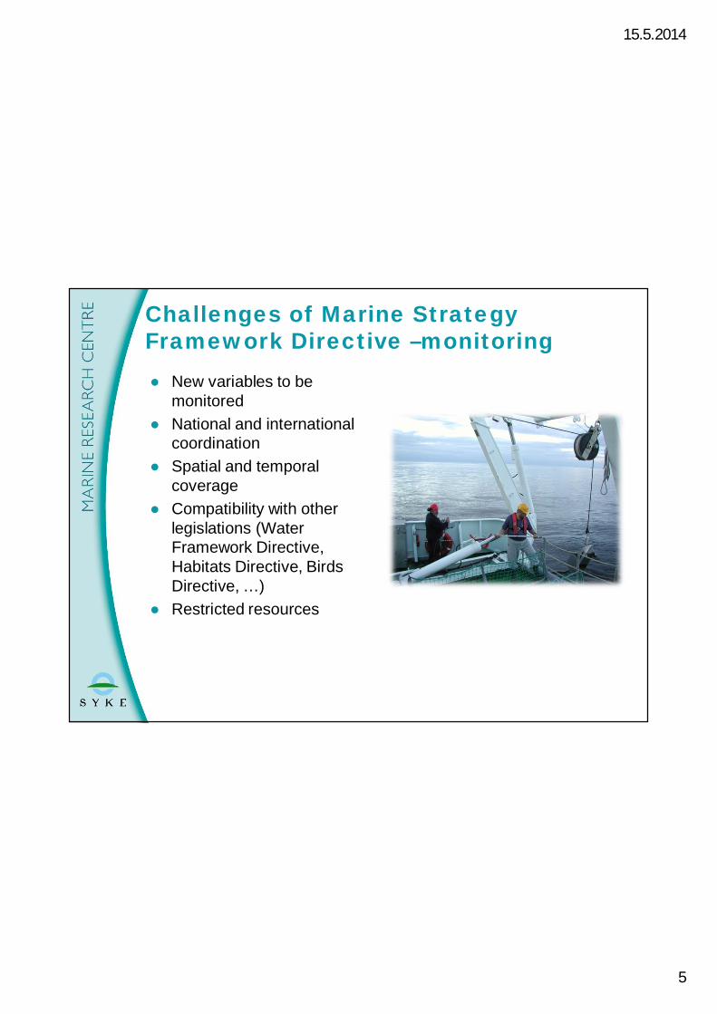
● New variables to bemonitored
● National and internationalcoordination
● Spatial and temporalcoverage
● Compatibility with otherlegislations (WaterFramework Directive,Habitats Directive, BirdsDirective, …)
● Restricted resources
Challenges of Marine StrategyFramework Directive –monitoring
15.5.2014
6
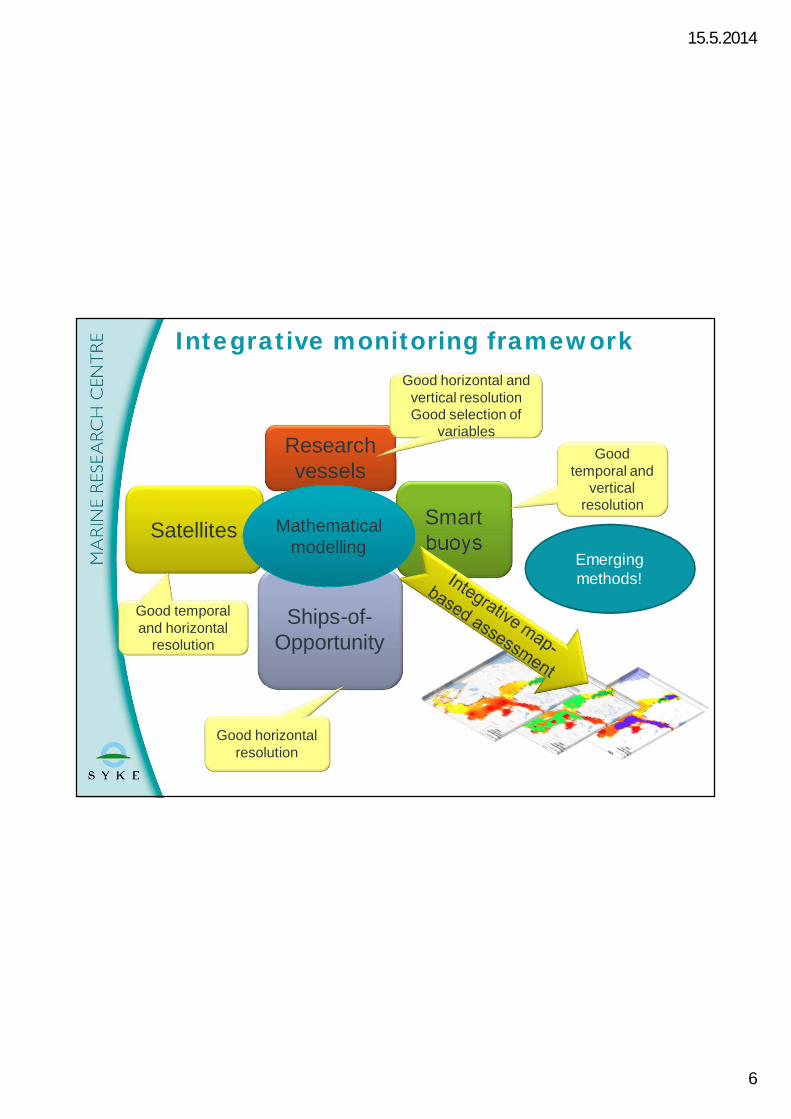
Integrative monitoring framework
Satellites Smartbuoys
Researchvessels
Ships-of-Opportunity
Goodtemporal and
verticalresolution
Good horizontal andvertical resolutionGood selection of
variables
Good horizontalresolution
Good temporaland horizontal
resolution
Mathematicalmodelling
Emergingmethods!
15.5.2014
7
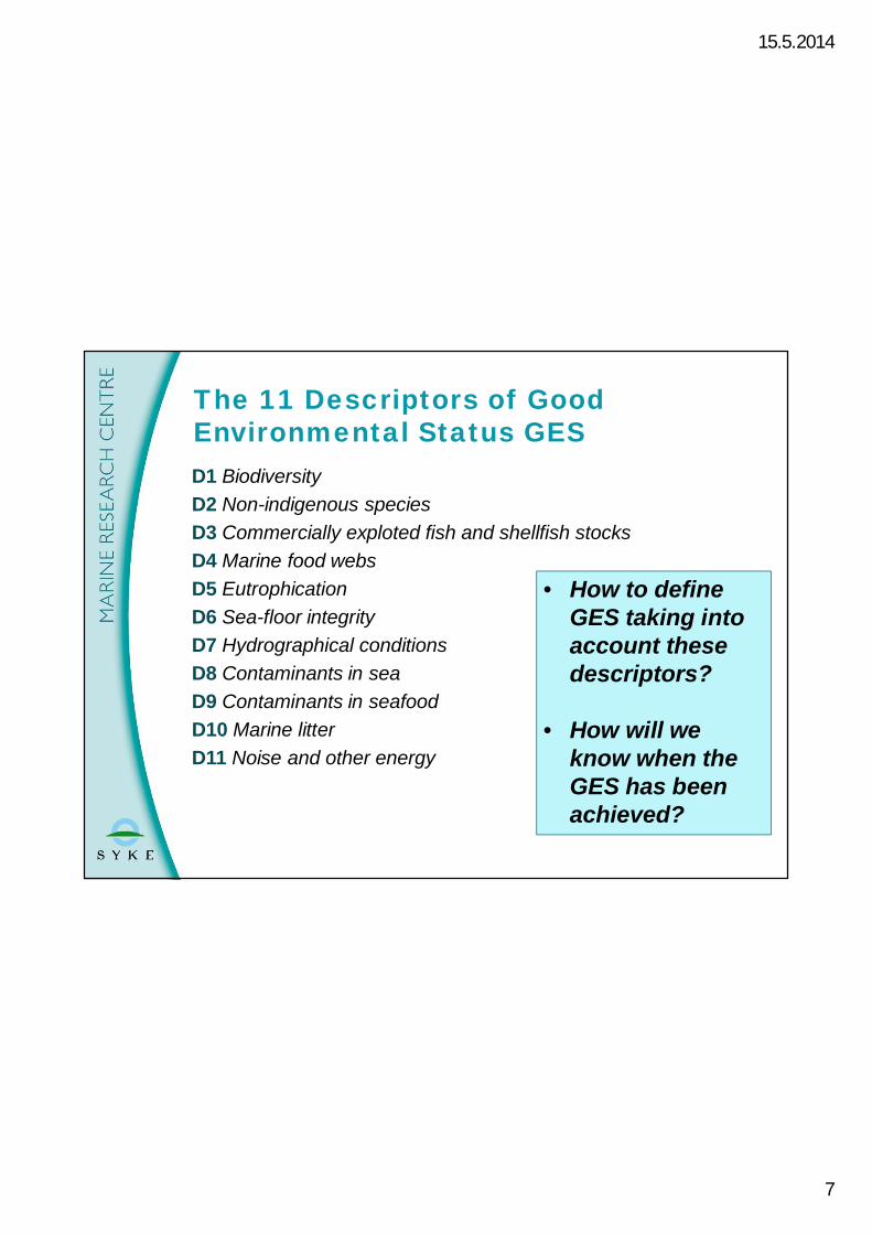
D1 BiodiversityD2 Non-indigenous speciesD3 Commercially exploted fish and shellfish stocksD4 Marine food websD5 EutrophicationD6 Sea-floor integrityD7 Hydrographical conditionsD8 Contaminants in seaD9 Contaminants in seafoodD10 Marine litterD11 Noise and other energy
The 11 Descriptors of GoodEnvironmental Status GES
• How to defineGES taking intoaccount thesedescriptors?
• How will weknow when theGES has beenachieved?

15.5.2014
8
BIAS-project: underwater noise (D 11)
Data: Jukka Pajala/SYKE
15.5.2014
9
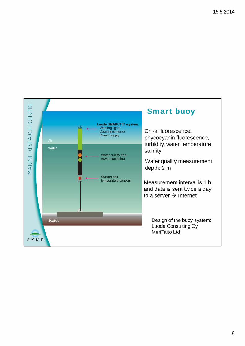
Smart buoy
Design of the buoy system:Luode Consulting OyMeriTaito Ltd
Measurement interval is 1 hand data is sent twice a dayto a serverà Internet
Chl-a fluorescence,phycocyanin fluorescence,turbidity, water temperature,salinity
Water quality measurementdepth: 2 m

15.5.2014
10
The pilot use of smart navigational buoyshave shown good results in the automaticmonitoring of a-chlorophyll
1.7. 1.8. 1.9. 1.10.0
5
10
15
20
25
2012
Chl
-aug
/l
Helsinki buoy 2012
Raw dataControl samples
1.7. 1.8. 1.9. 1.10.0
5
10
15
20
25
2012
Chl
-aµg
/l
Helsinki buoy
ControlBuoy
Buoy data: SYKEControl: Helsinki Cityand r/v Muikku
Photo: Kari Kallio/SYKEData: SYKE and City of Helsinki

15.5.2014
11
11
• SYKE provides operationalEarth Observation products forthe Baltic Sea
• Satellite instruments: MERIS2006-2011 (Beam/FUBprocessor) and MODIS 2012(SeaDas)
• Weekly Chl-a composites
Monitoring byEarth Observation
Helsinki sea area (2.-8.5.2011)

15.5.2014
12
Gulf of FinlandYear 2014
Joint winter cruise ofR/V Aranda in Jan.2014 producedcomprehensive data(Phosphate) coveringalso the eastern part ofthe Gulf of Finland.
12

15.5.2014
13
● Defines a joint framework forFinnish marine research andrelated infrastructure
● Connects Finnish marineresearch to international RInetworks, especially to theESFRI process (EuropeanStrategy Forum on ResearchInfrastructures), and marine RTDIcommunities (Research,Technological Development andInnovation)
13
FINMARI – Finnish Marine ResearchInfrastructure
R/V Aranda
15.5.2014
14
● SYKE Marine Research Centre (coordination)○ Research vessels, Alg@line, experimental laboratory, modelling,
national data banks● Tvärminne Zoological Station, University of Helsinki
○ Field & lab experimentation in biodiversity and function● Archipelago Research Institute, University of Turku
○ Field & lab experimentation in ecology and evolution● Husö Biological Station, Åbo Akademi University
○ Experimentation, spatial modelling and management● Finnish Meteorological Institute/ Marine Research Programme
○ Modelling, physical oceanography, FMI/Utö station● Geological Survey of Finland
○ Seafloor surveys● Arctia Shipping Ltd
○ Multipurpose icebreaker platforms
FINMARI partner RI profiles

15.5.2014
15
Source: Lauri Laakso/ FMI

15.5.2014
16
Ships of opportunity: Alg@lineFinnmaid 29 - 30 April 2014
Source: http://www.itameriportaali.fi/en/tietoa/algaline_seuranta/en_GB/mittaustulokset/

15.5.2014
17
● Baltic Sea Action plan agreed inHELCOM ministerial meeting inKrakov 2007
● First regional sea action planpresenting a scheme of quantitativenutrient loading reduction fromcountries
● Provides a model example for theAction Plans under the of the UNEnvironmental and Regional SeasProgramme
● Nutrient load reduction scheme wasrevised in the CopenhagenMinisterial meeting on 2013
● Provides a framework and ambitioustargets for preparation of the MSFD’sprogramme of measures (due to2016)
HELCOM Baltic Sea Action Plan
15.5.2014
18
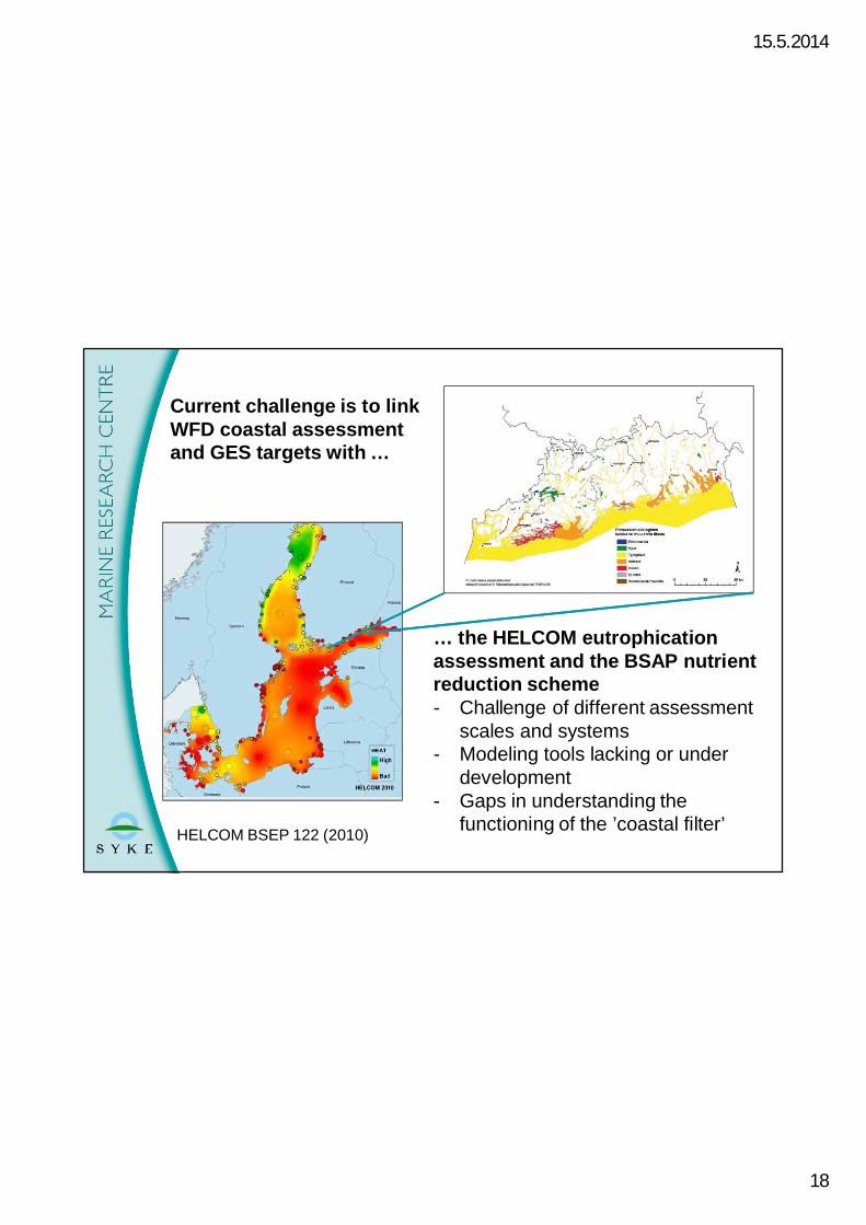
… the HELCOM eutrophicationassessment and the BSAP nutrientreduction scheme- Challenge of different assessment
scales and systems- Modeling tools lacking or under
development- Gaps in understanding the
functioning of the ’coastal filter’
Current challenge is to linkWFD coastal assessmentand GES targets with …
HELCOM BSEP 122 (2010)

15.5.2014
19
HELCOM Baltic Sea Action Plannutrient reductions requirements
● Revised BSAP requires overall reductions of○ 118 000 tN and○ 15 000 tPuntil year 2021.
● Largest reductions are required from Poland,Russia, and Sweden.
● The Finnish nutrient annual loads are requiredto decrease by○ 2901 tN and○ 338 tP

15.5.2014
20
Nutrient loads from the Finnish Rivers in1997-2012
0
1000
2000
3000
4000
5000
6000
0
1000
2000
3000
4000
5000
6000
1997
1999
2001
2003
2005
2007
2009
2011
Normalisoitu P (t) Normalisoimaton P (t)Trendiviiva
0
25000
50000
75000
100000
125000
0
25000
50000
75000
100000
125000
1997
1999
2001
2003
2005
2007
2009
2011
Normalisoitu N (t) Normalisoimaton N (t)Trendiviiva
• Finland aims to reduce nutrient loads in all marine areas,particularly in the Gulf of Finland, Archipelago Sea and theBothnian Sea.
• Reduction in other regions (besides that GoF) are also justified tohelp overall the state of the Baltic Sea
Data: Antti Räike/ SYKE
15.5.2014
21
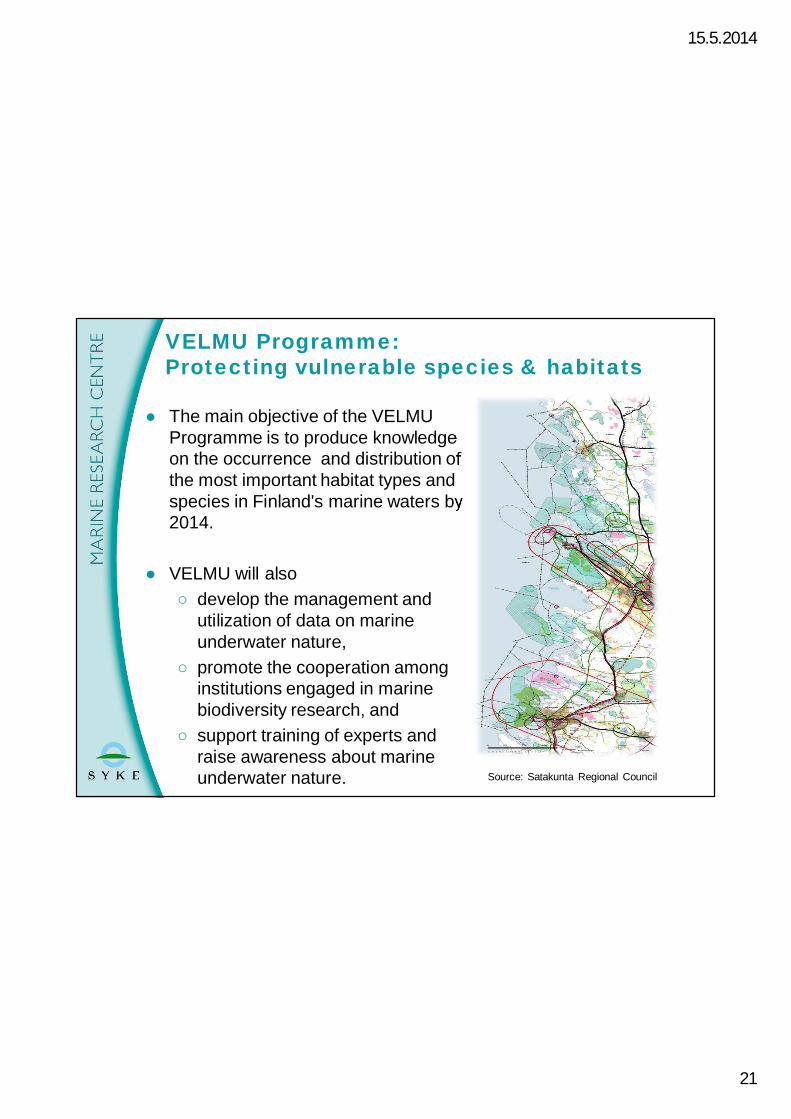
● The main objective of the VELMUProgramme is to produce knowledgeon the occurrence and distribution ofthe most important habitat types andspecies in Finland's marine waters by2014.
● VELMU will also○ develop the management and
utilization of data on marineunderwater nature,
○ promote the cooperation amonginstitutions engaged in marinebiodiversity research, and
○ support training of experts andraise awareness about marineunderwater nature.
VELMU Programme:Protecting vulnerable species & habitats
Source: Satakunta Regional Council

15.5.2014
22
Primary Survey Areas of the EU/ FinmarinetProject)
VELMU brings together differentministries and research institutes:● Ministry of the Environment
and five other ministries asstakeholders and financiers
● Finnish Environment InstituteSYKE
● Finnish Game and FisheriesResearch Institute RKTL
● Geological Survey GTK● National Heritage Survey -
Metsähallitus● Åbo Akademi University ÅA● Coastal Regional Centres for
Economic Development,Transport and the Environment
22
15.5.2014
23
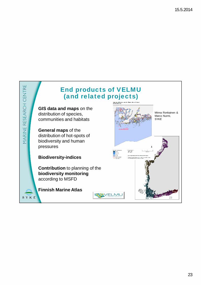
GIS data and maps on thedistribution of species,communities and habitats
General maps of thedistribution of hot-spots ofbiodiversity and humanpressures
Biodiversity-indices
Contribution to planning of thebiodiversity monitoringaccording to MSFD
Finnish Marine Atlas
End products of VELMU(and related projects)
17407observationpoints
Minna Ronkainen &Marco Nurmi,SYKE
23

15.5.2014
24
It pays off to protect theBaltic Sea!● Finnish researchers of the PROBAPS project
and the Baltic Stern network estimated thebenefits (2330 Mill.Eur/ yr) are at least 1,7 xhigher than the costs of the protection of theBaltic Sea (Baltic Stern report, 2013)
● The Finnish citizen are willing to pay ca. 200Mill.Eur/ yr for mitigation of the eutrophication,and recreational value of ca. 400 Mill. Eur/ yr(i.e. 74 Eur/ person/year)
● Recent work* shows the cost of the BSAPrevision lower and efficient trans-boundarycollaboration even more beneficial.
● Benefits of the marine ecosystem services mightbe even higher, if evaluated, suggesting thatdegradation of the ecosystems reduce societalwelfare provided by the Baltic Sea.
* Hyytiäinen & Alhvik, 2014: Prospects for cost-efficientwater protection in the Baltic Sea.

15.5.2014
25
● Better state of the Baltíc Sea will be reached in case the targets arisingfrom best scientific knowledge, EU Directives and BSAP can be fulfilled.
● However, good environmental status of the Baltic Sea by 2020 isextremely challenging due to○ the time lag between protection measures in the catchments and
decreases in loading (especially from diffuse sources) into the sea○ the time lag between decreases in loads into the sea and response
of the ecosystem to these decreases (recovery is slow).● The integrated use of data from traditional monitoring and new methods
(satellites, ships-of-opportunity, smart buoys, modelling) will improve ourknowledge about the effects of changes in human induced pressuresand in natural conditions. This knowledge is needed to providebackstopping for policies, guidelines and management measures.
● Maritime Spatial Planning and new underwater habitat and biodiversityinformation will allow us to better plan the use and protection ofvulnerable species and habitats in the coastal and open sea areas. Thiscalls for multidisciplinary, problem-solving research approaches.
● Baltic Sea is a regional sea well suited for new types of internationalcollaborative approaches and pilot actions.
Conclusions and future perspectives
15.5.2014
26
Thank you!